
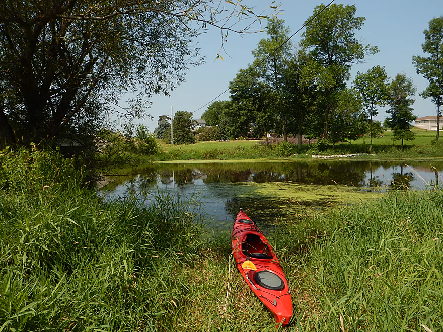
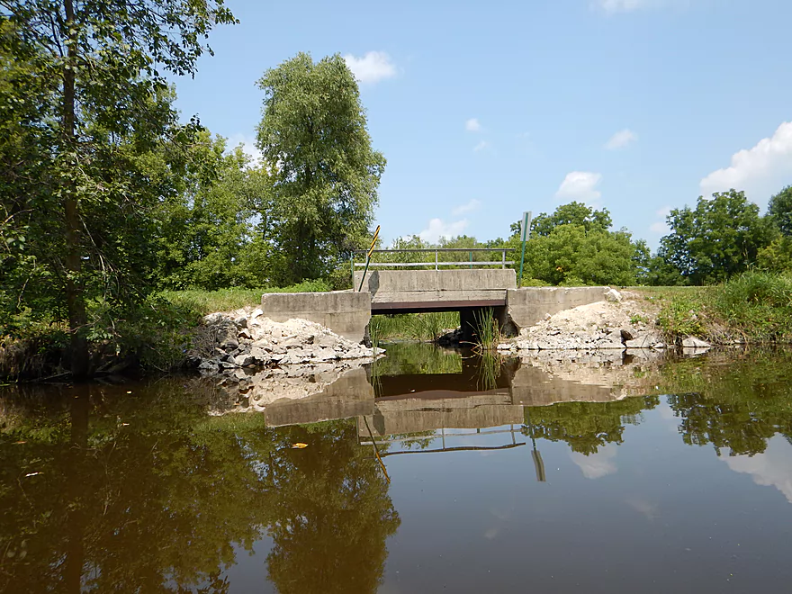
Gill Road bridge…ok access but poor parking
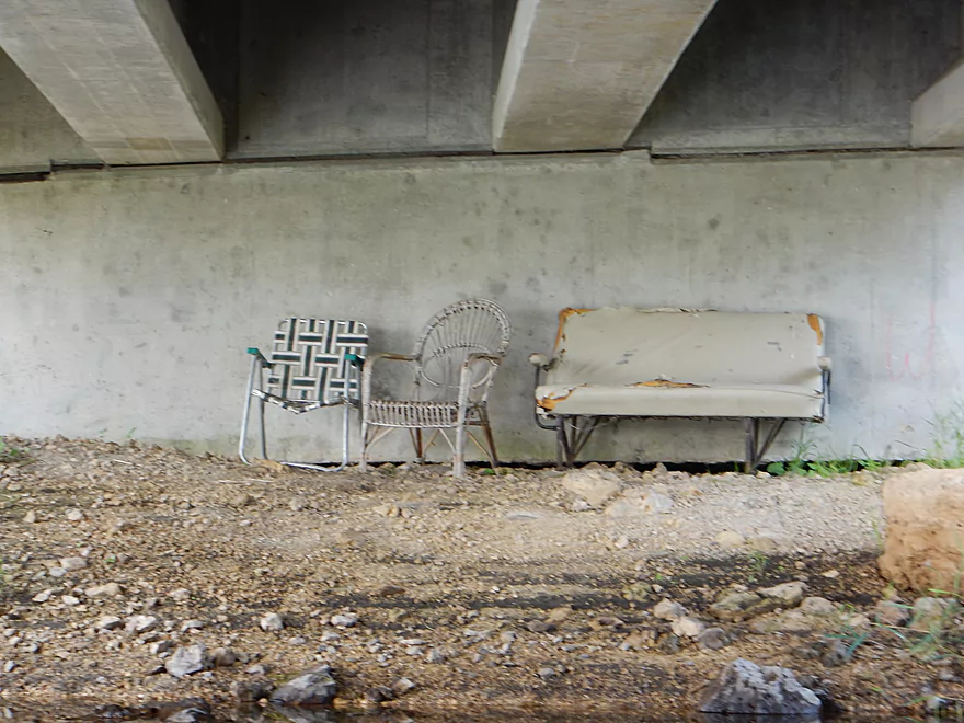
Riverside seats under the bridge
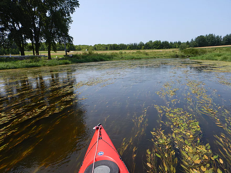
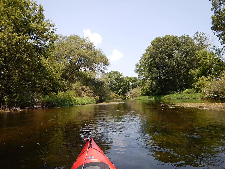
Kind of open and boring to start
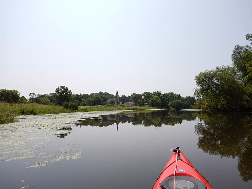
Possible public access by Immanuel Lutheran Church
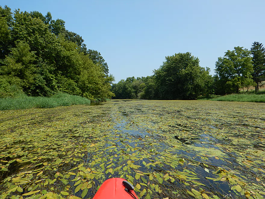
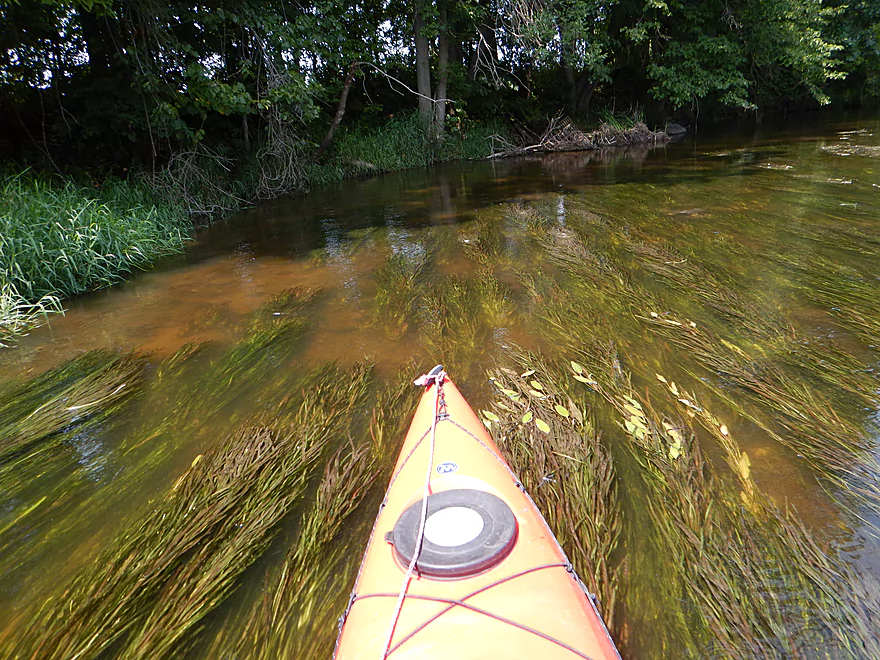
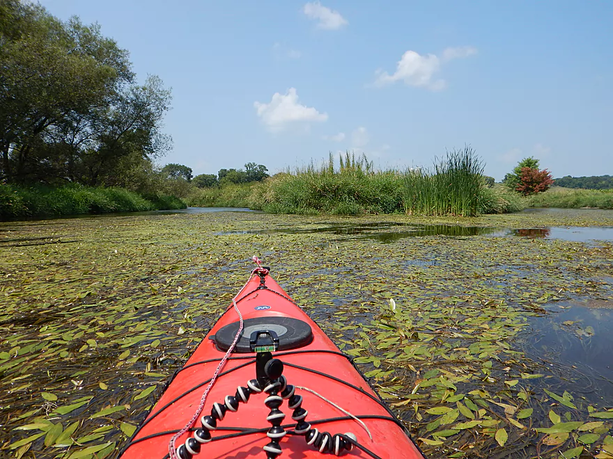
Big weed jam, but easy to cut through
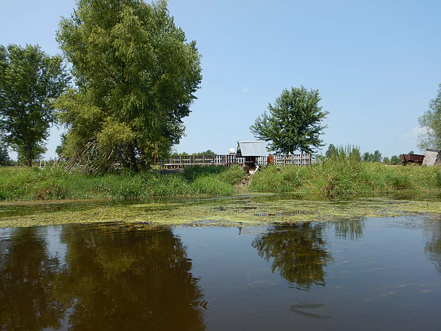
Farmer slurping up the Rock River
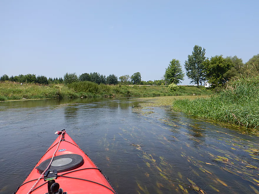
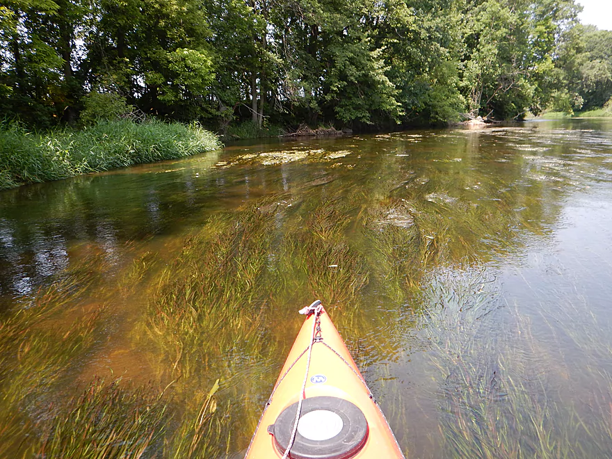
Cool flowing potamogeton
A very noisy water intake
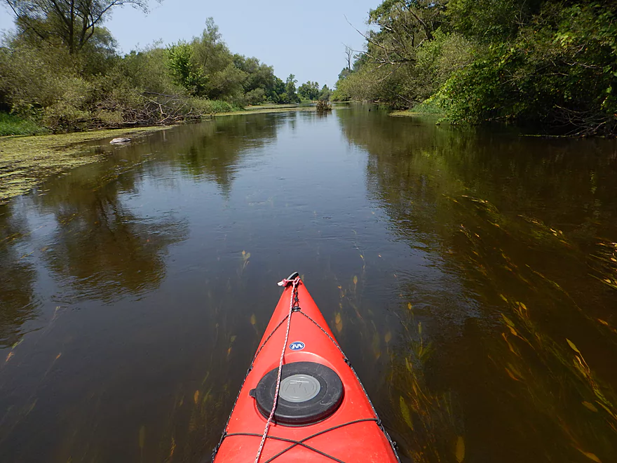
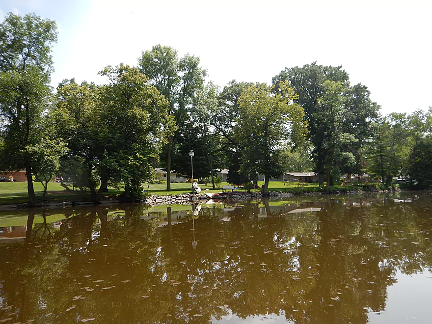
The river is much nicer here
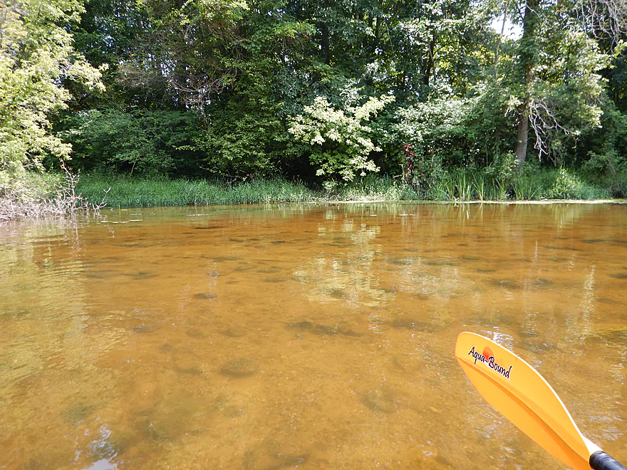
A ton of Giant Floaters (type of clam) by the bridge
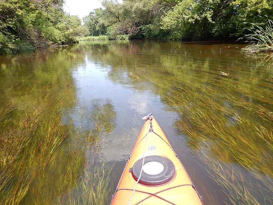
Shallow clean water…a surprise for the Rock.
Current picks up, which cleans the water
Swaying potamogeton in the current
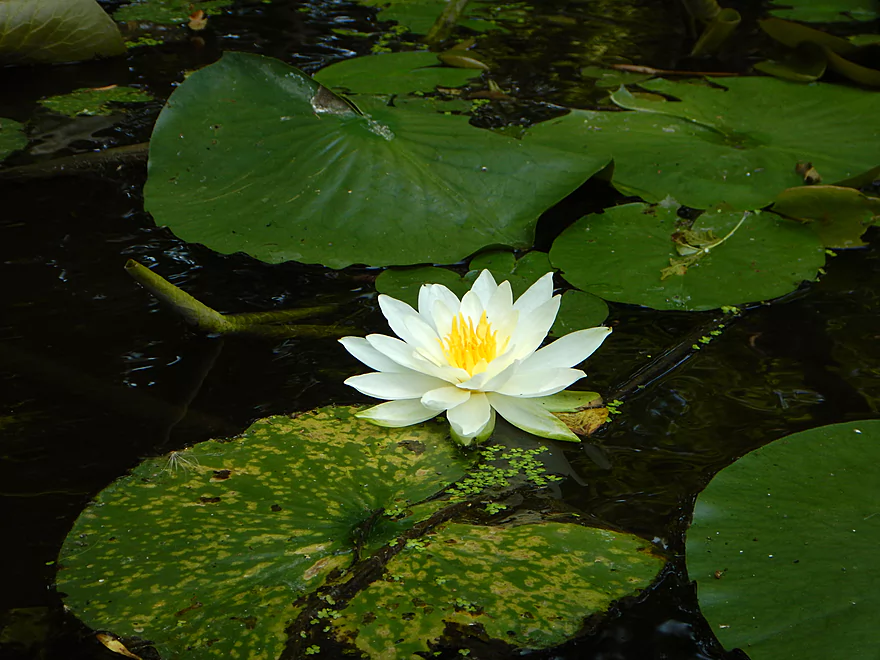
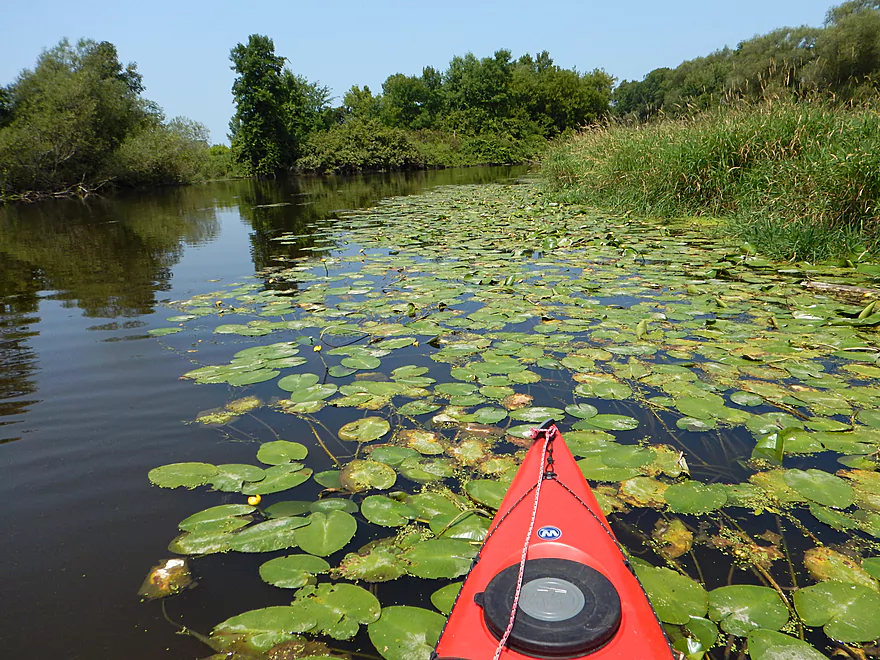
White waterlily
Only island on the trip
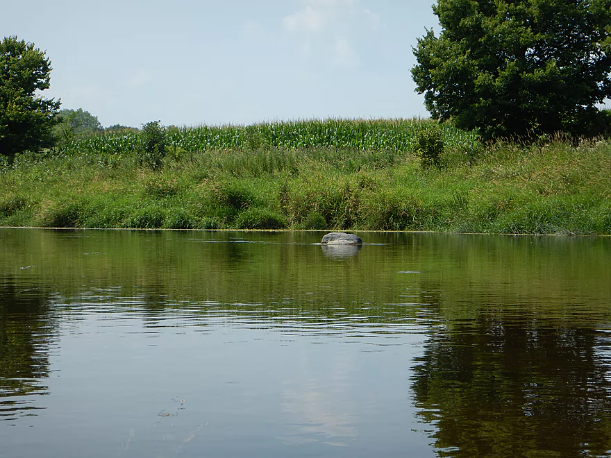
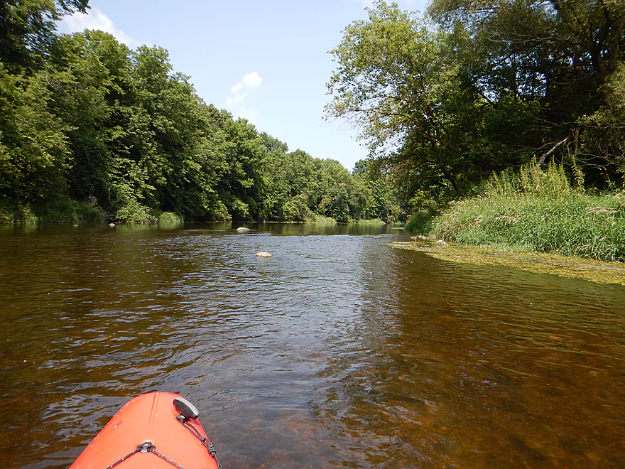
Rock and corn…kind of sums up the river
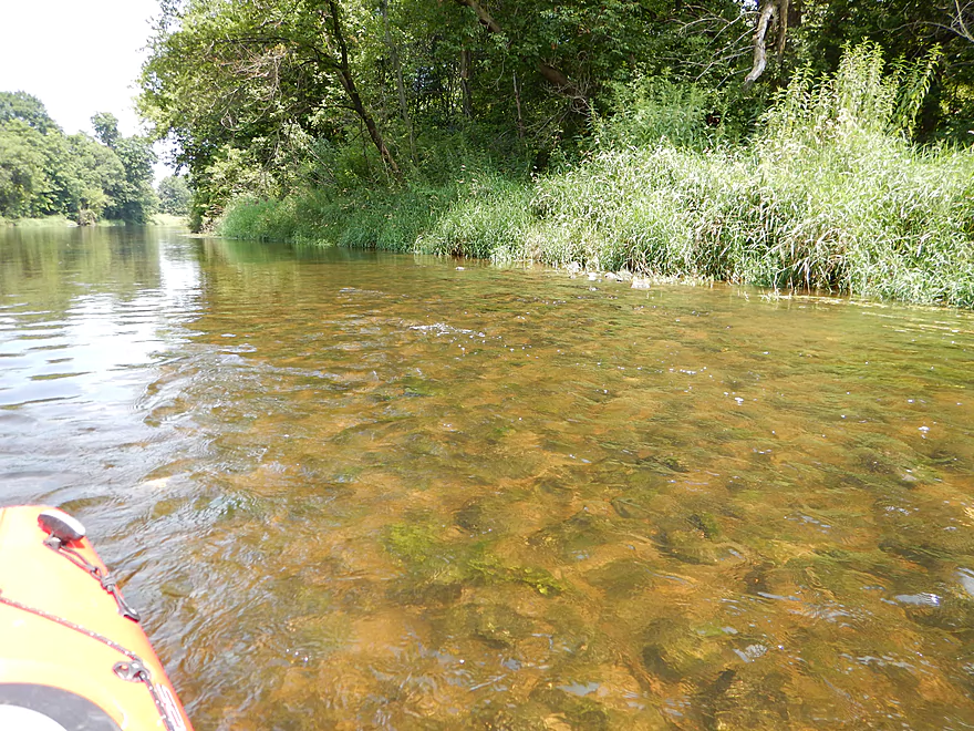
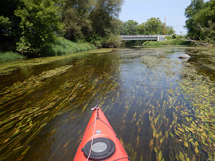
Another nice clean rocky section
Rock River living up to its namesake
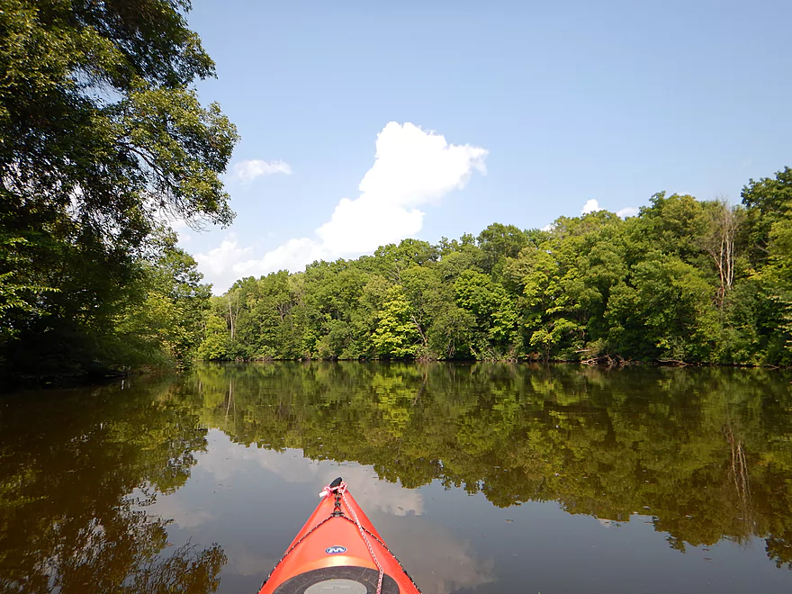
About at Fink Creek (good alt access), the river starts to get really boring
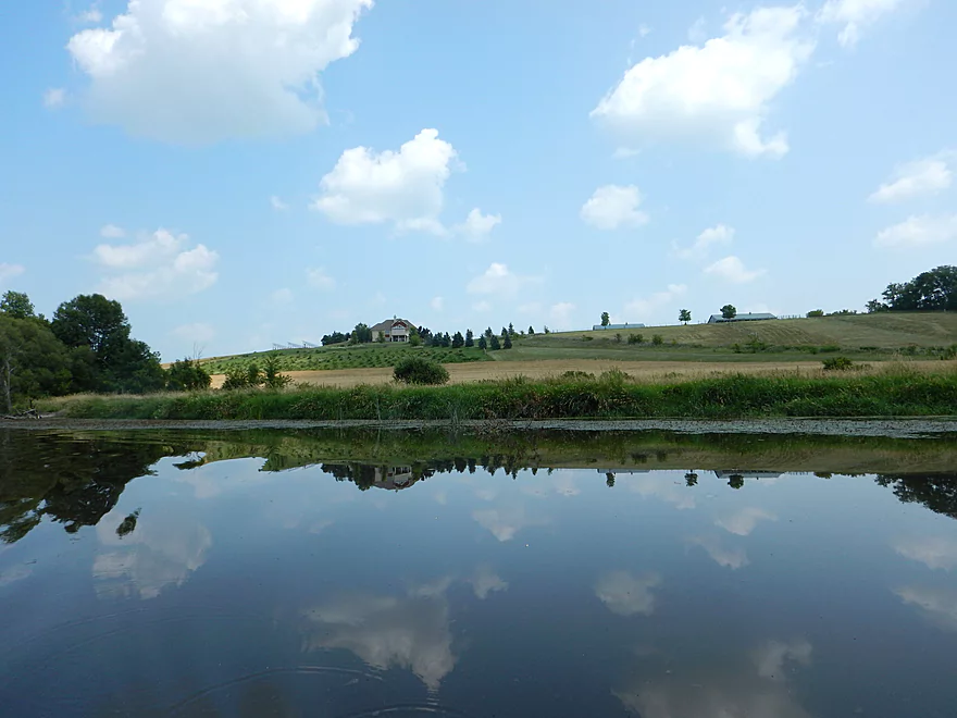
Not too many homes on the water (outside of Mayville)
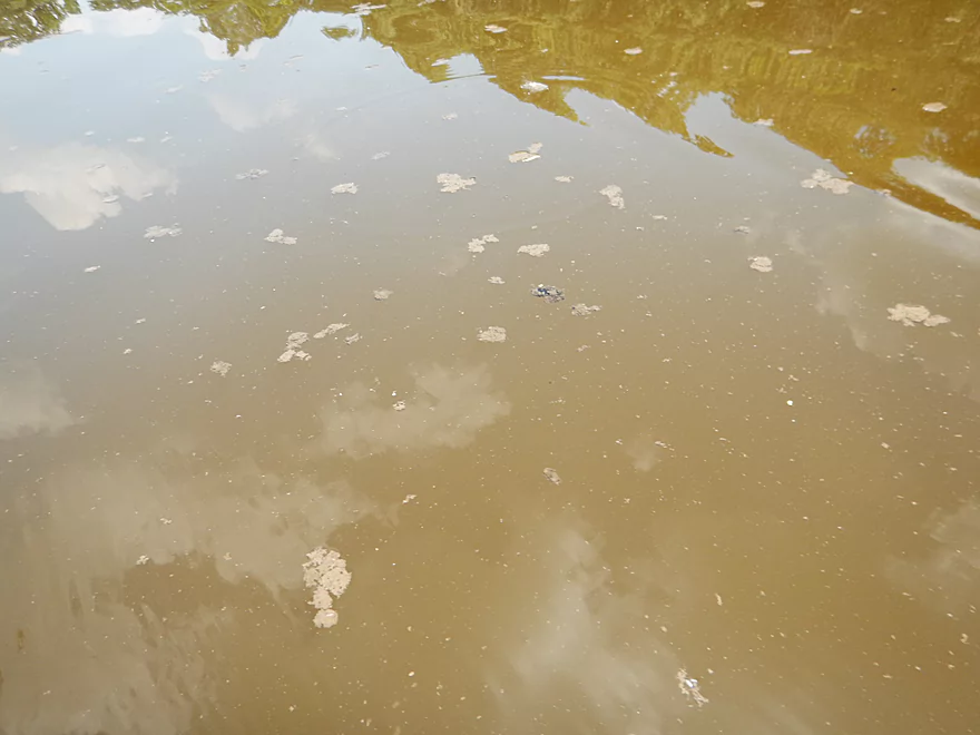
Dam flowage starts to kick in and the water gets filthy
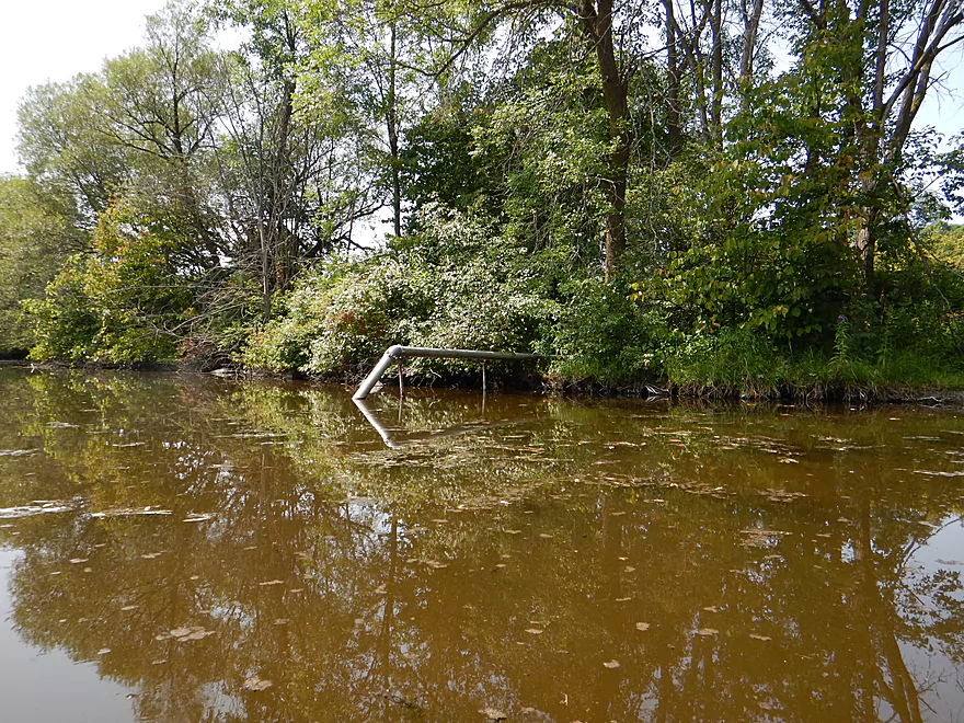
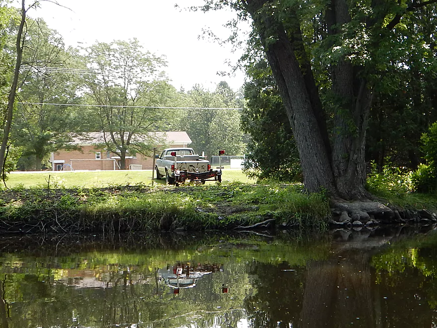
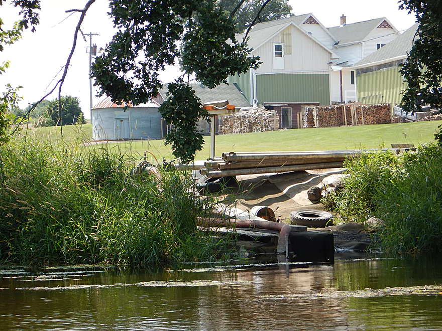
Another slurping pipe…this time for a golf course
Entering Mayville
Believe this is an alt access point south of the golf course
Firemans Park would be good for launching a kayak
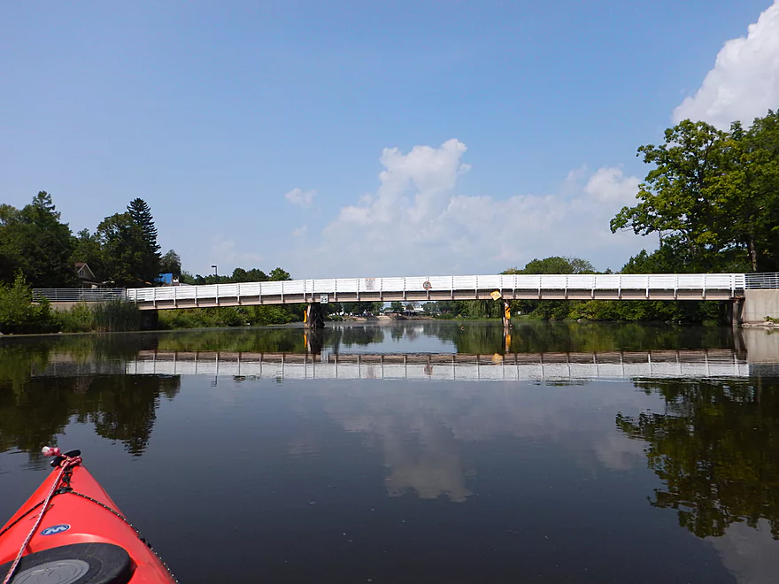
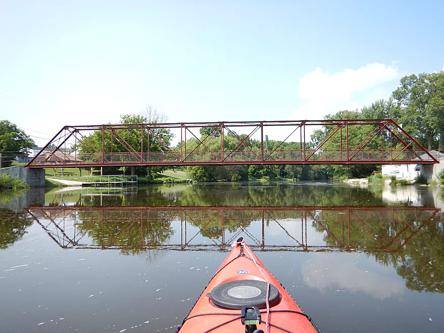
Pedestrian bridge
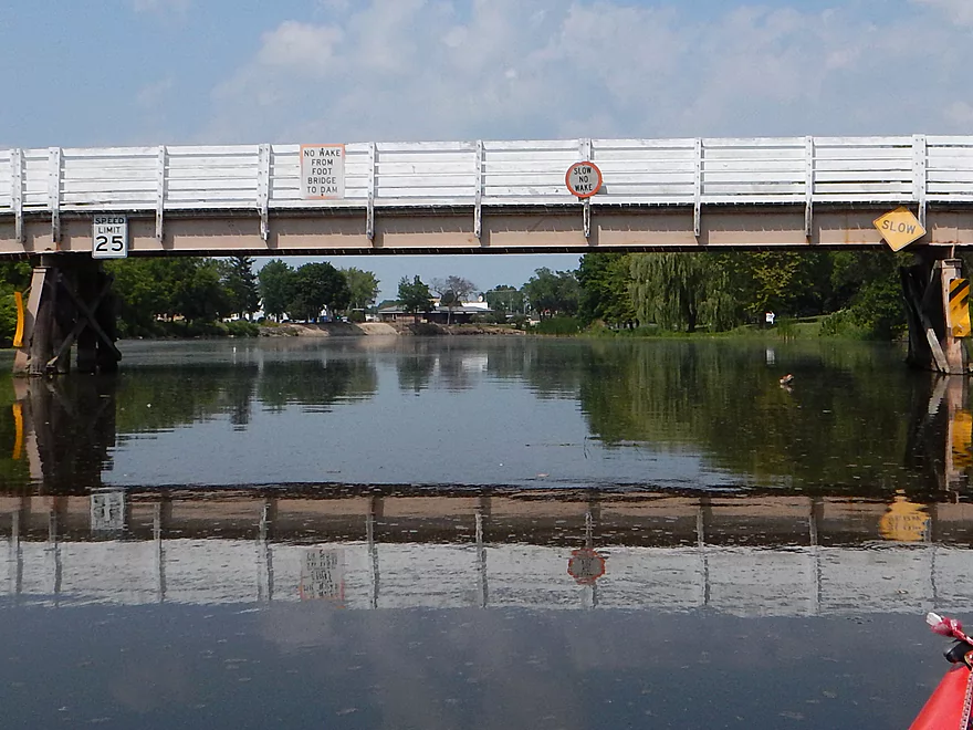
25 mph limit means powerboats could be an issue, but I saw none here
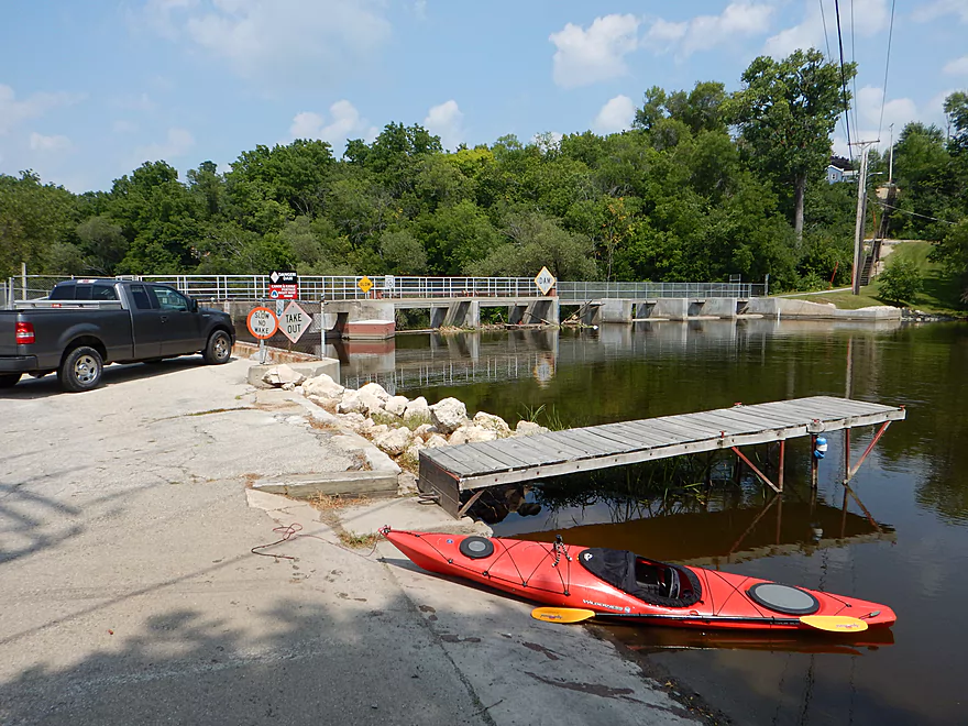
Boat landing by the first dam
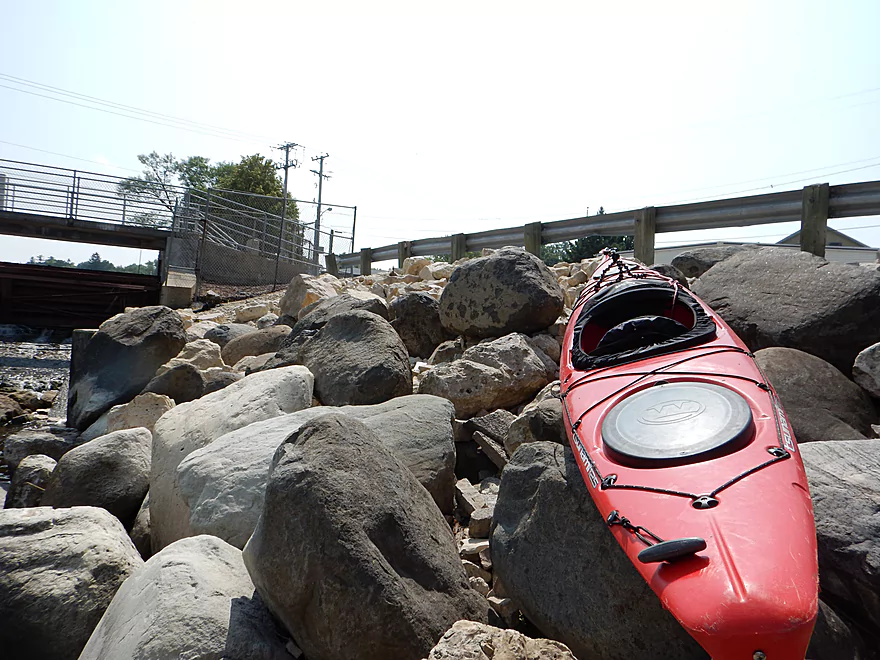
Is actually a horrible portage path
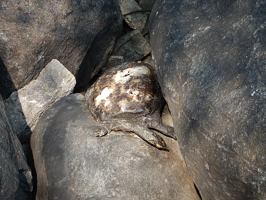
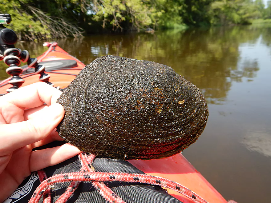
A spiny softshell turtle (who is not too peppy)
The other side of the dam has a much better portage path…oh well
Stealing gradient from the previous two miles
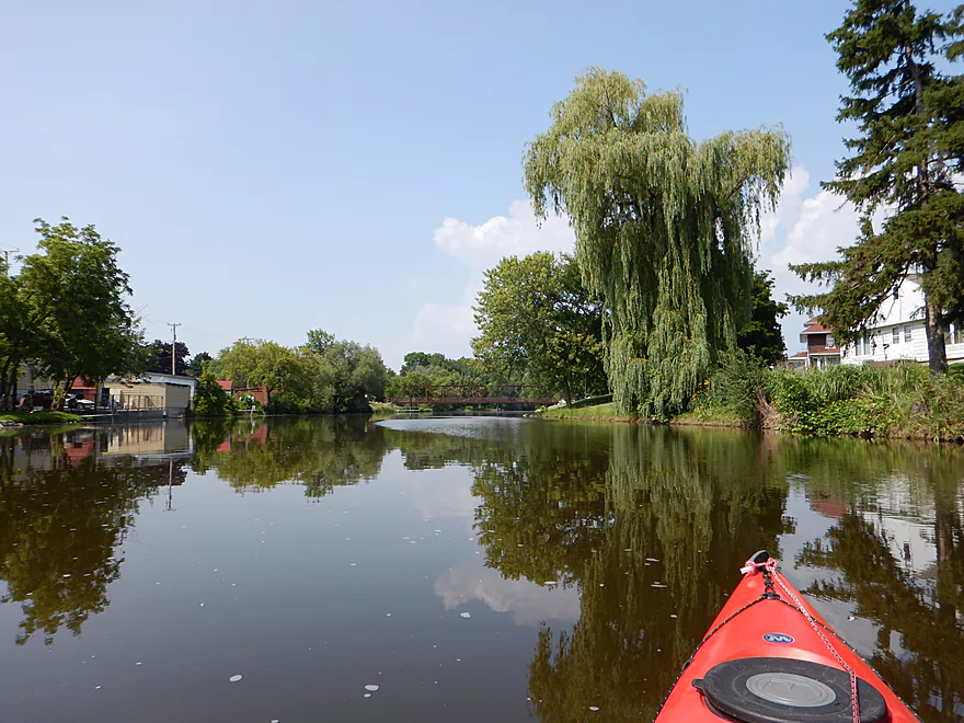
Lot of weeping willows around Mayville
Pretty sure there is public access on Dayton Street to the left
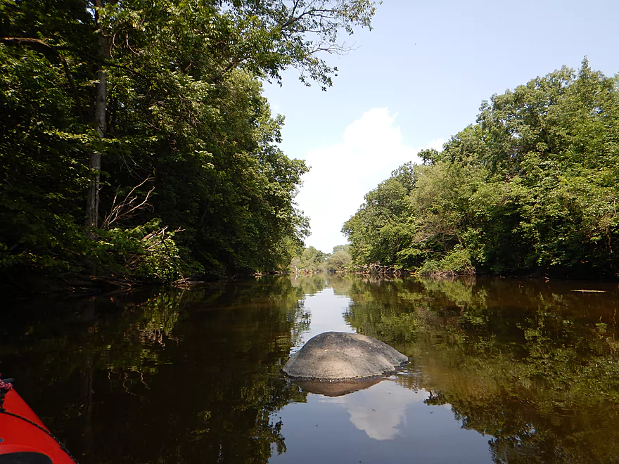
Cool reflection
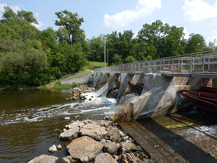
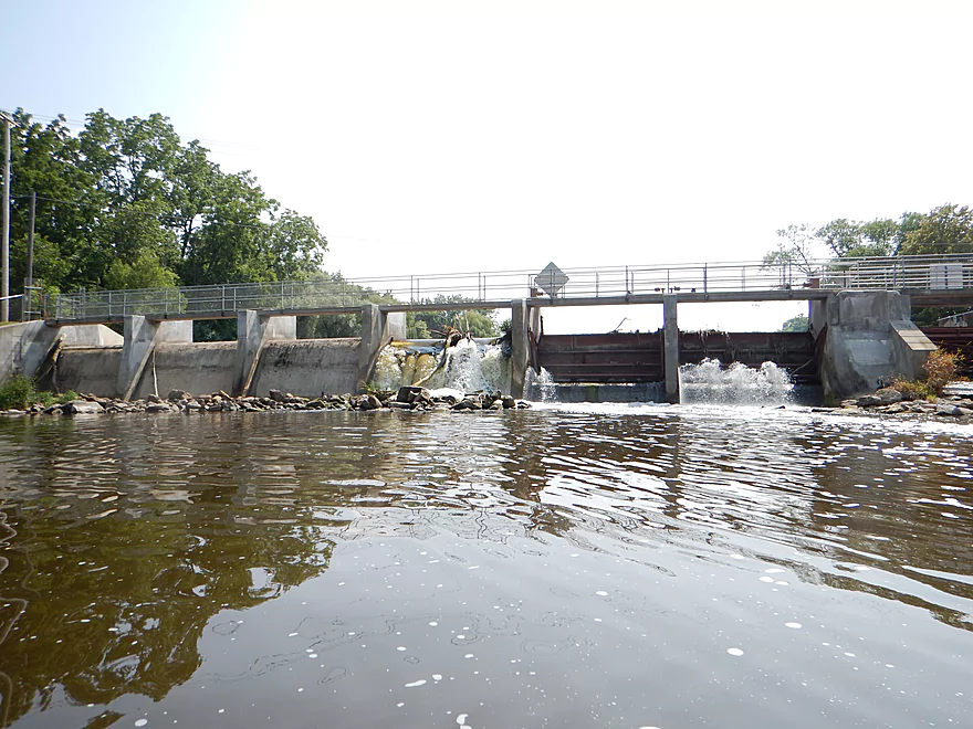
Another evil dam…take-out on the right
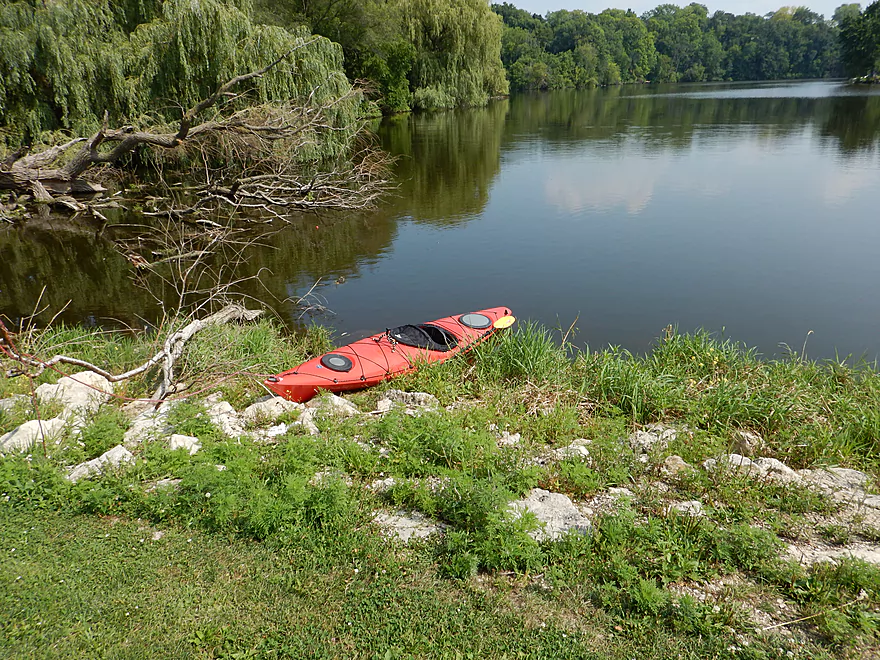
End of trip — nice take-out area, just no facilities
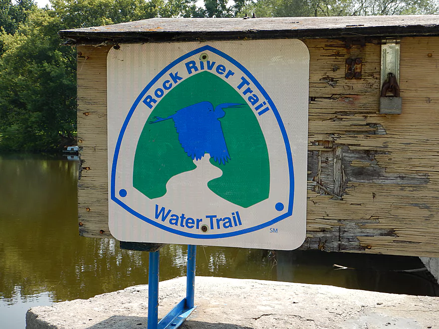
The river is promoted as a water trail for paddlers
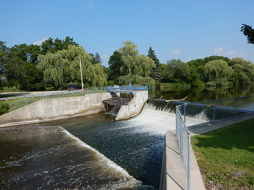
A meaner dam than the first
Good portage/access area between dam & bridge
Scouting time…river looks great below the dam
Rock River – East Branch

For the most part, a weak paddling prospect, with slow, dirty current and open, scraggly banks. But…the river does have redeeming attributes and nearby sections of the river have potential, so keep reading…
When you think of Wisconsin’s mighty watersheds…the Fox, Wisconsin and Chippewa all come to mind, but ultimately the Rock is larger than all of them (well, at least according to USGS). This river gets its share of paddlers, but is generally not super popular with paddlers despite being in the triangle of Madison, Milwaukee and Green Bay. The reasons are pretty simple…the river is dirty, slow and heavily dammed. There are nice sections on the lower Rock (which I’ll probably paddle in the future), but for the most part this isn’t a topnotch destination.
What got me interested in the East Branch of the Rock River was when I did a section of it during my Horicon Marsh paddle. I actually liked the upper part of the trip and, being curious, contacted the local government (city park offices, chamber of commerces, and visitor and convention bureaus are a great source of paddling info!), and learned that the East Branch was navigable and that it was paddled around Mayville (thanks to Mike Kurutz for the tips). However, little was known about the river itself. Basically, the section above Mayville would be slower but safe from log jams. The section below the second dam would be swifter, but could have log jams. I opted for no log jams and planned a route from Gill Road to the Furnace Bridge Dam.
For this trip I did a bike shuttle. Pretty easy bike shuttle at only 2.7 miles! Some town biking and surprise hills, but being this short, these are not a problem. No gravel roads that I could see, which was nice.
My “guess in the dark” put-in at Gill Road and Cty AY wasn’t too bad. Bit of a slope by the bridge where it seemed others had put in (northeast of the bridge). Parking is really bad by this bridge (and the other nearby bridges). Very steep ditches and you may have to drive a bit up and down the road to find a safe parking area to walk from.
Right off the bat, the Rock River starts with…honestly, a bad impression. It was slow, dirty and deep. It felt like a big drainage ditch and I wouldn’t have been surprised if it had been artificially straightened (which farmers sometimes do to rivers). Hate to say it, but my first thoughts were if I could justify giving a river a one star rating with no log jams! Was also rethinking my entire star scale, as rivers like the White (which I ranked at two stars) were, in hindsight, underrated. Eventually my mind wandered back to the Rock River though. Found some fisherman on a motorboat (yes, even the far upper reaches of the Rock are large enough to support powerboats) and asked them about log jams by the town of Theresa, which they didn’t know of. This was the only powerboat I saw though, and they aren’t really an issue that I could see.
Things improved as the tree cover got closer to the river and I saw a red-tail fly over and land by the bank. Slow river + late in summer = weed issues, and this was no exception. There are numerous super patches of weeds which you’ll have to “snowplow” through. At this depth, and with my 12.5′ boat (and v-bottom front), I was able to knife a path through with no problems, but shorter/flatter boats could be in for an adventure. During dry spells, these weed patches could become serious impediments.
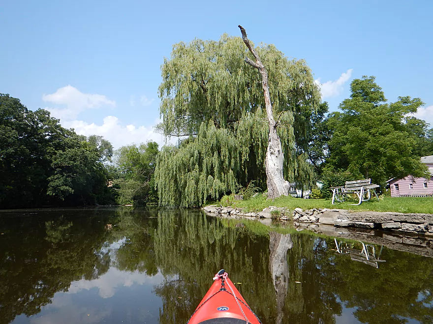
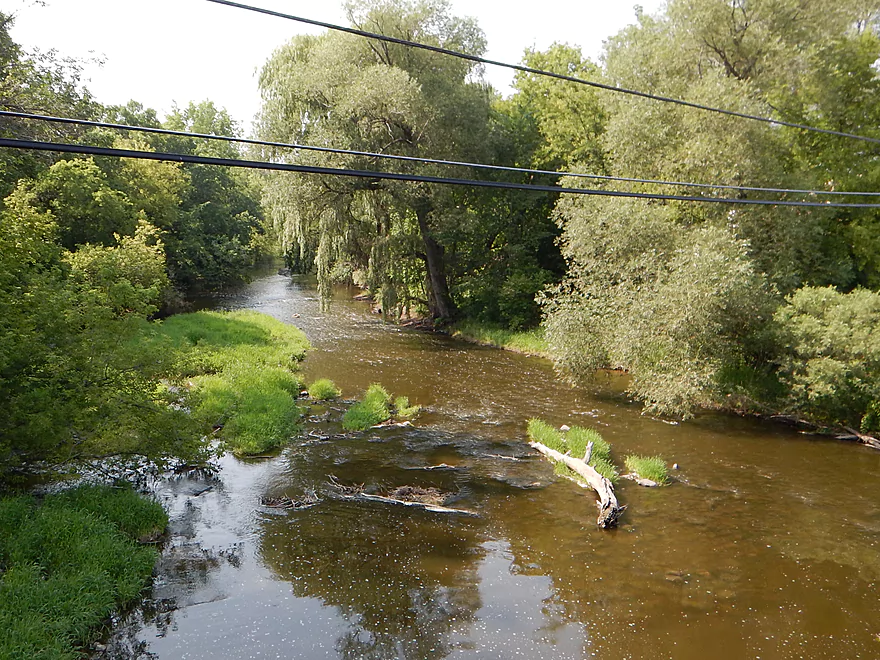
The river then makes a dramatic v-turn from going south to going north…and actually improves considerably for the next few miles. The current picks up, the depth decreases and the water actually becomes clear (big shock for the Rock River)! There are still aquatic plants in the water, but these are the graceful type (potamogetons) that gently sway in the water and are quite attractive. As you travel north under the Gill Road bridge, the river will be at its finest. Here you’ll see massive clam piles, as apparently they love this section of the river (large specimens, too). Swift current will clean up a river…but so will clams and they deserve some credit.
Also of positive note…the substrate loses its mucky/mud bottom and becomes quite rocky. Normally you don’t think of the Rock River as having that many rocks (ironically enough), so this was quite the surprise and striking in the clear reddish water. No doubt the river was named before all the dams covered and silted over much of the watershed’s nice native substrate.
There wasn’t too much in the way of wildlife. A painted turtle and a dead softshell turtle were perhaps the highlights, as were the red-tail and the clams. Some wildflowers, with the flowing potamogeton being the best in the way of plantlife. Lot of fish, but I think all were carp. Quite large, these were fun to spot in the clear water and chase. Just like in Horicon Marsh, the carp were quite boisterous and would really thump the bottom of your kayak when you bumped into them. For human wildlife, there weren’t actually too many people by the river (outside of Mayville, of course). Just one fisherman, two kayakers and some houses on the river. Multiple farms that were way too close to the rivers edge though. Buffer zones between rivers and fields/development are very important ecologically for a river, but few realize this or don’t care. I counted three intake pipes from which people were sucking up the Rock for personal or business use.
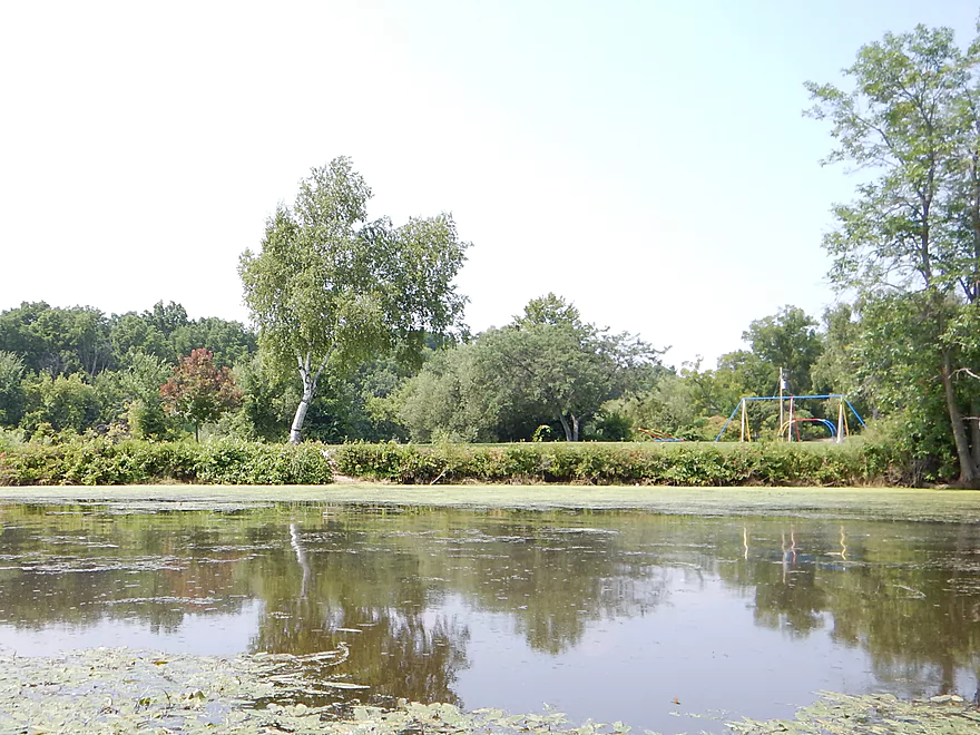
Roughly by Fink Creek/McArthur Road, the river becomes boring again. In hindsight, this is actually a good take-out area and I would have been better served by starting the trip closer to or in the city of Theresa (more on this later). There is a dam (well, two) in Mayville and I suspect the reason the river becomes so big/slow/boring/dirty after Fink Creek is because of this flowage. The nice clean water becomes dirty again and by the golf course, the water is at its filthiest.
It’s too bad that so many local governments support these town dams. They generate no electricity and really serve no purpose. The slow water allows bad things to grow and is uninviting for boaters, swimmers and paddlers. I remember how popular the undammed sections of the Waupaca and Crystal Rivers were with the locals who would wade and even sit in the river, and whose waterfront property values probably vastly exceed those of Mayville and think of what a shame this is.
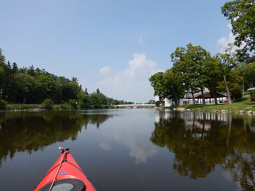
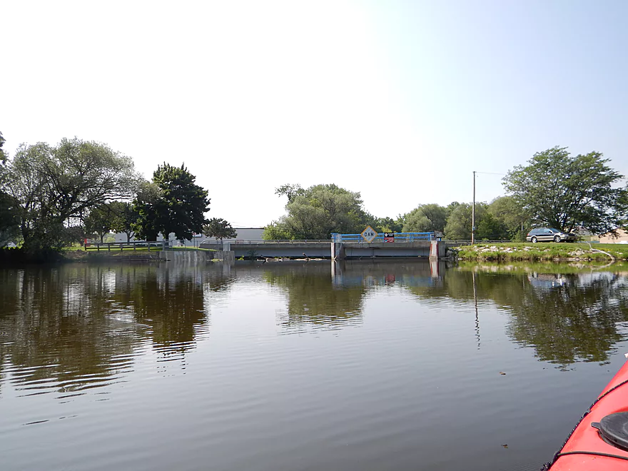
Mayville is kind of boring as far as small city paddles go. Some nice pedestrian bridges though. You’ll soon come across your first dam. There is an easy boat ramp to your left which could be a take-out (parking behind the American Legion building, I believe, is free). I saw a portage sign pointing to the right and thought that was a mistake…and took out by the boat ramp. Turns out the portage on the left/west side of the dam is awful, with huge boulders. I survived and had a nice view of the portage path on the opposite side when I got back in…oh well. The dam is maybe 7′? That is actually a significant amount of gradient/current that is being stolen from the upper sections and it would be fascinating to see the river without these dams. I suspect it would be clean/swift/riffly and rocky. There are several alternate access points I spotted from the river and I went crazy marking these on the map below.
Almost immediately after the first dam, the river slows into another flowage by a second dam in Mayville. This is a short flowage and the dam itself marked my take-out. Just paddle to the right of the dam and there is a nice take-out area with parking (no facilities, but an otherwise fine launch area). If you continue on, there is a nice grassy re-entry where you can portage past the dam (between the bridge and dam). There is actually a “Rock River Watertrail” sign by the dam and this (plus the portage signs) means somebody is interested in promoting the river for paddlers, which is nice.
So, all in all, too many weak sections on this river to justify a good rating. But from the southernmost “toe” to Fink Creek was a very pleasant 3-mile section I enjoyed (I marked this as a green route on the map). In hindsight…I would have avoided the twin flowages by Mayville and specifically the section between Fink Creek and the Furnace Bridge Dam (second one). If you paddle the Rock (well, the East Branch) try to do so at low water as this will clean up the water dramatically. There was plenty of “padding” on the river, so this could have been run much lower. I did this at 220 CFS and for reference did the Horicon Marsh at 40 CFS, which had mostly plenty of room and just one muck-jam.
BTW…if you are in the area, consider checking out Ledge Park. Super county park that rivals many state parks, offers nice camping options and a terrific view overlooking Horicon Marsh.
Detailed Overview
East Branch:
- Upstream of Hillcrest Drive: I believe these portions are too congested to paddle.
- Hillcrest Drive to Hwy DW: 4.1 miles.
- Hillcrest Drive to Riveredge Park: 0.9 miles. Scenic stretch through the outskirts of Allenton with good clarity. However there are two major logjams to portage, and several minor logjams to squeak past.
- Riveredge Park to Hwy DW: 2.7 miles. An open stretch through wetgrass and a state natural area. One logjam needs to be portaged.
- Hwy DW to Hwy D: 5.5 miles. Outside of one nasty logjam cluster this is a pretty open creek paddle through a protected wildlife area that might be decent.
- Hwy D Wayside to N. Pole Rd. Launch: 7.3 miles. A good wetland paddle prospect through Theresa Marsh. Maybe 1-2 downed trees on the upper part.
- Kohlsville River: Note, the Kohlsville River joins the East Branch here, but it seems too congested with downed trees to be feasible.
- N. Pole Rd to Gill Rd(East): 6.0 miles.
- N. Pole Rd Landing to River Edge Park: 1.3 miles. Slow, open, and marshy channel. Nice though.
- River Edge Park to Rock River Street/Dam: 0.5 miles. A nice town paddle through the community of Theresa. One dam to portage.
- Rock River Street/Dam to Hwy AY: 3.5 miles. One of my favorite stretches on the entire Rock River. While shallow in spots, it is scenic with nice woods, small boulder gardens and multiple light rapids.
- Hwy AY to Gill Road(East): 0.7 miles. A brief wooded stretch that is a nice paddle.
- Gill Road(East) to Hwy 67/Dam: 8.3 miles.
- Gill Road(East) to McArthur Road/Fink Creek: 4.7 miles. Starts boring, weedy, and slow, but gets nice with clear water and rocks later on. Gill Road(West) may be a viable halfway access.
- McArthur Road to Hwy 67/Dam: 3.6 miles. A less interesting paddle through a flowage and downtown Mayville with numerous alt take-outs.
- Hwy 67 to Green Head Road Ramp: 6.4 miles.
- Hwy 67 to Hwy Y/Ziegler Park: 1.9 miles. One of the best paddling stretches on the entire Rock River with good current and small boulder gardens.
- Hwy Y to Hwy TW/Kekoskee Pond Ramp: 1.9 miles. A good stretch that includes a little bit of flowage paddling.
- Hwy TW to Green Head Road Ramp: 2.6 miles. An ok stretch as the river really slows and starts to turn into marsh.
- Green Head Road to N. Nebraska St. Ramp: 10.0 miles. The most popular route through Horicon Marsh known for its waterfowl.
South Branch:
- Upstream of E. Rock River Rd.: I suspect downed trees are too much of an issue for this to be navigable.
- E. Rock River Road to Hwy 49: 1.6 miles. Perhaps a cluster of downed trees in the middle and an electric fence upstream of Hwy 49.
- Hwy 49 to Waupun Park: 1.7 miles. Hwy 49 is not ideal for launching, but should be doable. A good prospect mostly through a golf course. Maybe 2 logjams?
- Waupun Park to E. Waupun Road: 7.2 miles. A good section.
- Waupun Park to Tanner Park: 3.1 miles. Great section though downtown Waupun. Alt access at Pine Street Park, Meadow View Park and Harris Mill Park.
- Tanner Park to Roadside Park: 3.2 miles. A pleasant paddle through a mixture of woods and open areas. A couple of logjam squeakers and one major portage.
- Roadside Park to E. Waupun Road: 0.9 miles. River widens, slows, and gets less interesting.
- E. Waupun Road to Dike Road: 10.0 miles. This is the northern unit of Horicon Marsh and is off limits to paddlers per National Wildlife Refuge rules.
- Dike Road to N. Nebraska St. Ramp: 5.6 miles. Am 80% sure you can drive on Dike Road from the east to launch in the ditch. Mostly a long straight canal paddle through Horicon Marsh with perhaps interesting side canals to explore. You can also launch in a west canal by Burnett Ditch Road. The city of Horicon marks the confluence of the South and East Branches of the Rock River.
West Branch:
It’s a neat prospect, but I suspect the logjam situation is too much (I could be wrong).
Main Branch:
- N. Nebraska St. to Legion Park/Dam: 0.9 miles. An ok section through downtown Horicon.
- Legion Park to River Bend Park: 1.1 miles. Simple river segment…probably nothing too special.
- River Bend Park to Lions Park: 8.8 miles. A large and probably uninteresting flowage. If you get permission to take out at Ox-Bo Marine, you can avoid much of the flowage paddling.
- Lions Park to Elmwood Park: 7.2 miles. Trip starts nice with a great boulder garden, but becomes less interesting as the current dies.
- Elmwood Park to Hwy MM: 4.4 miles. An interesting prospect recommended by Frank Piraino.
- Hwy MM to Harnischfeger Park: 6.9 miles.
- Harnischfeger Park to Kaul Park/Hwy CW: 5.1 miles. Nice section with more wooded banks.
- Kaul Park to Kanow Park: 5.7 miles. Nice prospect.
- Kanow Park to Hwy F: 5.0 miles. Mediocre prospect.
- Hwy F to Hwy P: 6.0 miles. This isn't an elite trip with slow current and no exotic scenery. But it is pleasant and one of the nicer legs on the Lower Rock.
- Hwy P to Dam1st/Front St.: 5.6 miles. Probably an uninteresting flowage paddle.
- Dam1st/Front St. to Dam2nd/S. 1st Street: 2.6 miles. Possibly a unique paddle through downtown Watertown.
- 1st Street to Hwy 26 Launch: 3.5 miles. Mediocre prospect.
- Hwy 26 Launch to Hwy B: 10.9 miles. The put-in is SE of Hwy 26 via Jefferson Road. This segment is more undeveloped, but is still probably not interesting with the highlight being I94.
- Hwy B to Lubahn Park/N. Watertown Ave: 4.1 miles. Probably uninteresting.
- Lubahn Park to Tensfeldt Park: 2.3 miles. Paddling through downtown Jefferson might be unique, but there is a dam to portage. Many alt landings in Jefferson.
- Tensfeldt Park to Klement Park: 4.2 miles. Probably an interesting tweener section between Jefferson and Fort Atkinson.
- Klement Park to Lorman Bicentennial Park: 3.1 miles. A weak prospect through downtown Fort Atkinson.
- Lorman Park to Hwy 26 Ramp: 3.3 miles. A weak prospect.
- Hwy 26 to E. Knudsen Road Ramp: 11.8 miles. Mostly boring paddling on Lake Koshkonong. Many other launches on the lake.
- E. Knudsen Road Ramp to Hwy M/Dam: 3.4 miles. Boring flowage.
- Hwy M/Dam to Hwy 14: 8.2 miles. Probably uninteresting.
- Hwy 14 to Century Ave/Dam: 6.4 miles. A trip through downtown Janesville with several dangerous dams to portage (reviewed by AmericanWhitewater.org). There are also many other launch options in Janesville.
- Century Ave/Dam to Happy Hollow Park: 7.8 miles. A very industrial section.
- Happy Hollow Park to Preservation Park Boat launch: 3.2 miles.
- Preservation Park to Wooton Park Boat Ramp: 3.0 miles. Start of urban paddling in Beloit. Numerous other launch options in Beloit proper.
- Further Rock River Trips: From here on, you are in Illinois. For further information see “Paddling Illinois” or Rockrivertrail.com.
Trip Map
Overview Map
Video
Weed Jam: 0:15
Friendly Carp: 0:28
Filthy Water: 2:03
First Dam: 2:22
Second Dam: 2:49
Scouting Downstream of Hwy V: 2:58
Scouting by the Mayville Sanitation Plant: 3:03
Scouting by the Hwy Y Bridge (Zeigler Park): 3:05
Photos Size: