
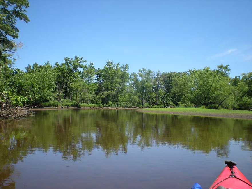
Starting by the HH bridge
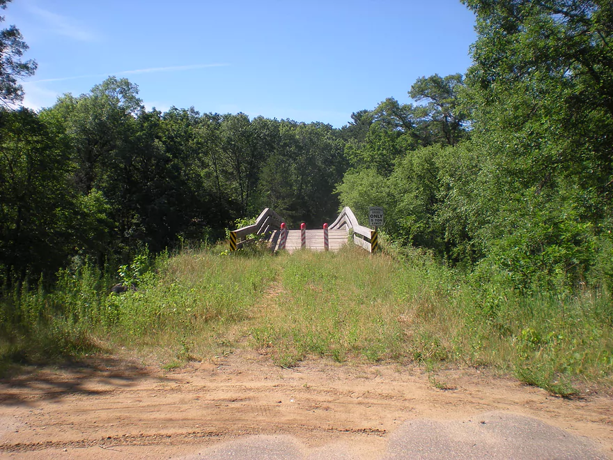
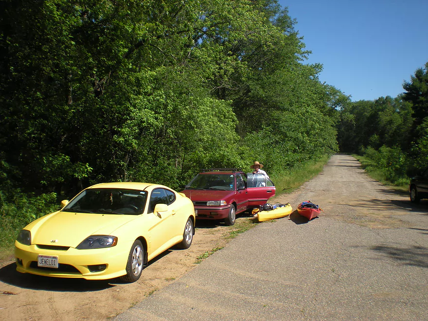
The landing is next to a snowmobile bridge
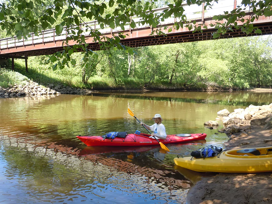
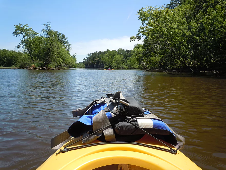
Nice put-in
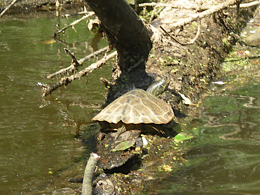
Painted turtle
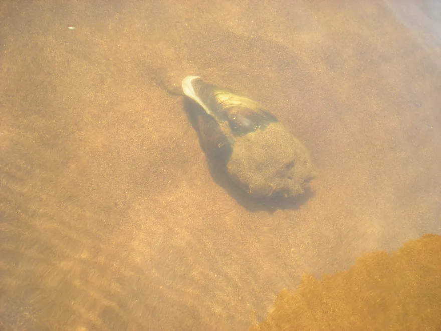
There were a lot of clams on the river
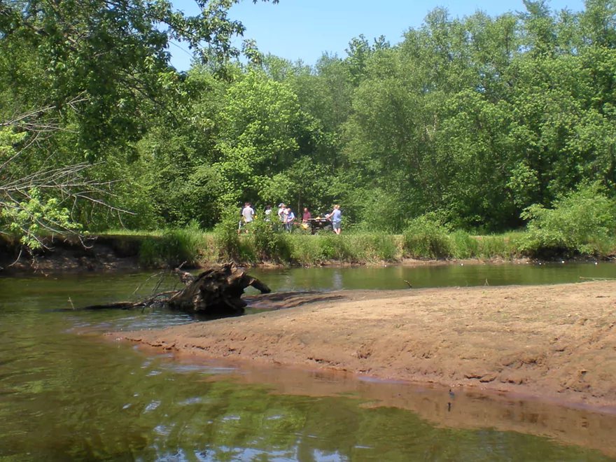
The locals were shooting styrofoam cups in the water
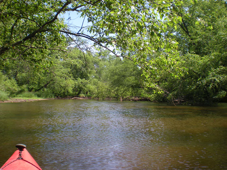
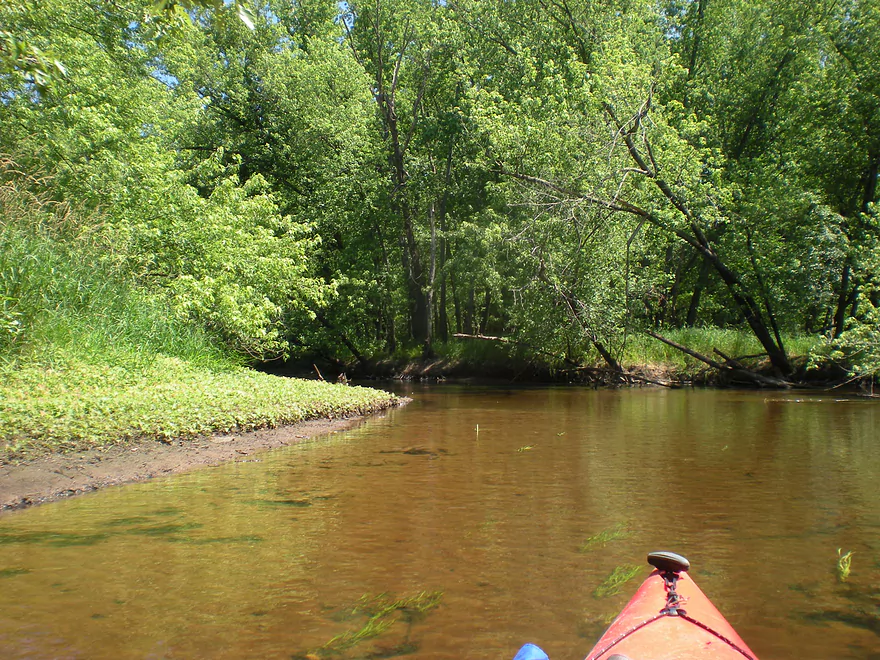
Some downed trees but no logjams
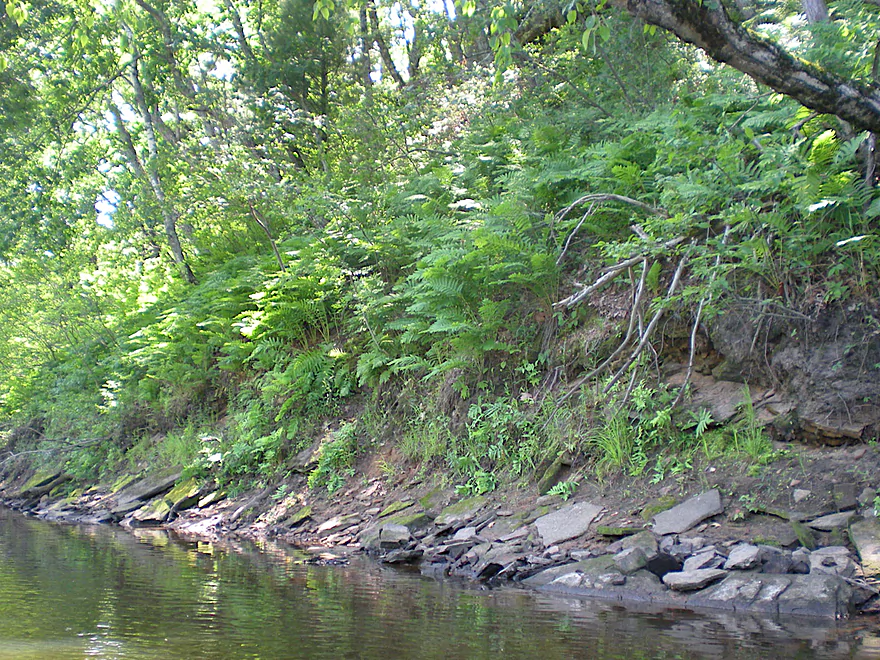
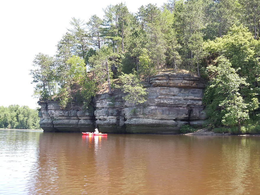
Interesting shoreline
One of the nicer outcrops
During low flow rates, the Lemonweir can be a clear river
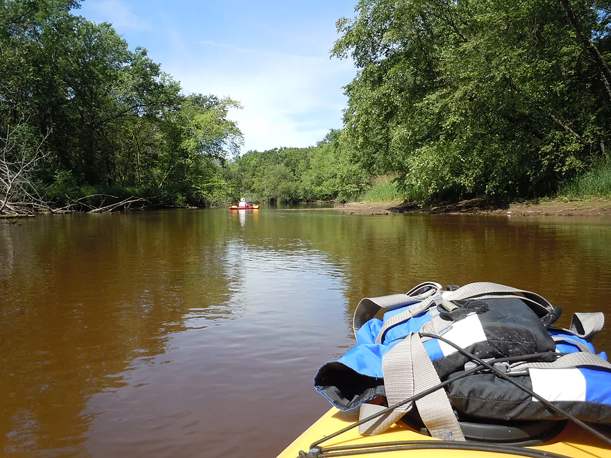
River widens as it nears the Wisconsin
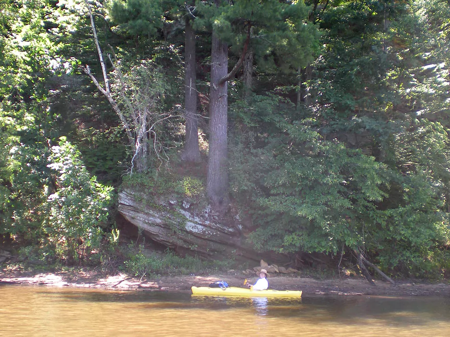
One of several minor outcrops
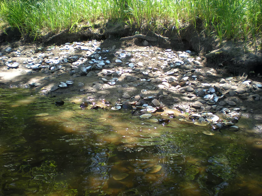
Clam massacre
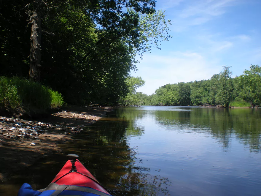
Approaching the mouth
To the right is the Lemonweir, to the left is the Wisconsin
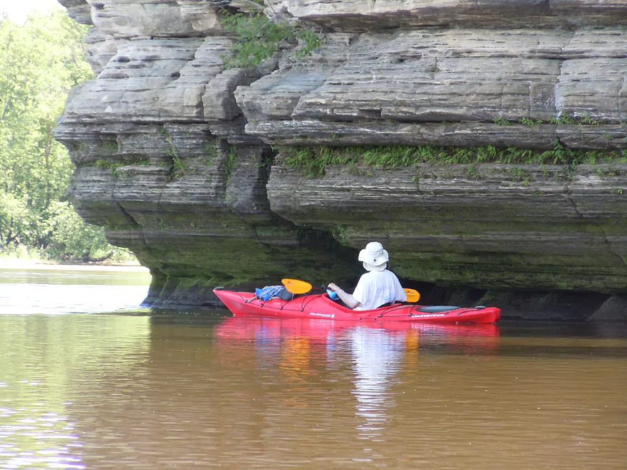
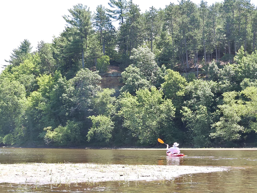
Great outcrops
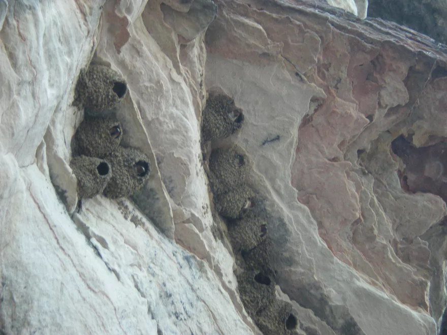
Home to many swallows
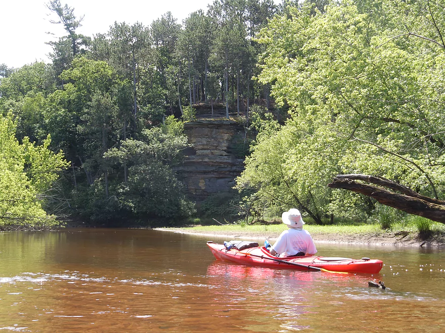
This is unofficially the start of the Dells
Time for a break
A nice sandbar is located right by the mouth
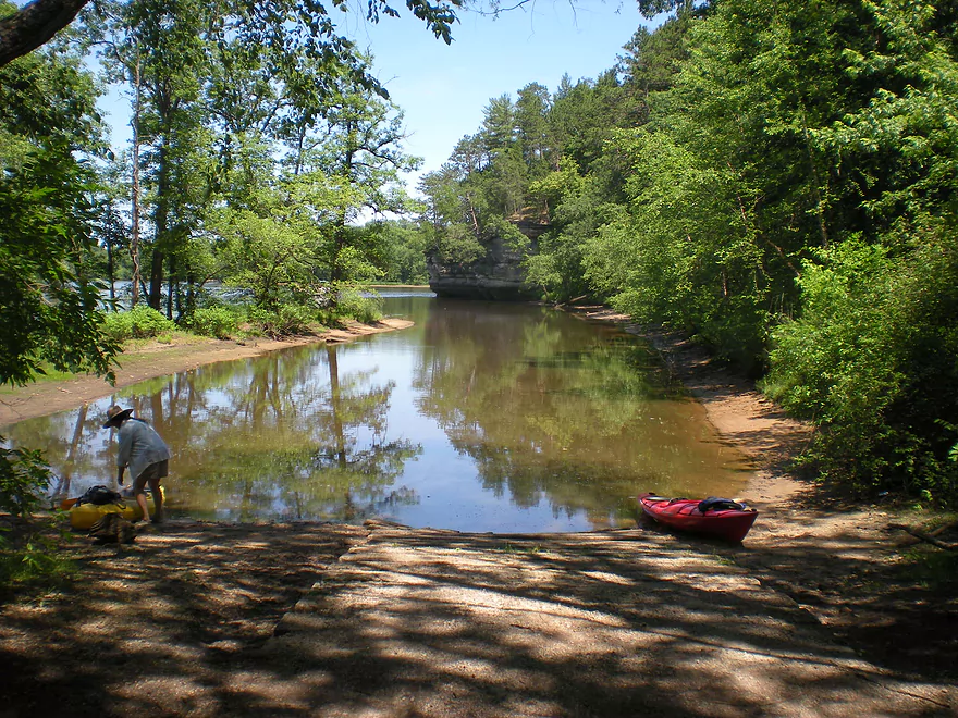
The nearby take-out (Two Rivers Landing) is very scenic
Lemonweir River – Mouth

Again, if you’ve read my previous review of the Lemonweir you know there are three segments below Mauston and to the Wisconsin River based on the landing options: a five mile section, a ~14 mile section, and then a remaining 5 mile section to the Wisconsin. This review will be of that last section. You can, of course, lengthen this trip by taking out at one of the landings on the Wisconsin River or by putting in close to Mauston (that’s a long trip though).
This is a very pleasant section that I liked. The ‘drop car location’ is the Two Rivers boat ramp near the conflux of the rivers. Very nice landing with bathrooms. Make sure you walk down to the landing and eyeball the surroundings as there is a minor chance you can miss the landing (more on this later). This final section of the Lemonweir is unique because it is the final section/delta and it has a lot of sloughs, side channels and islands. So, during high water, you do have some strategic choices to make as far as navigation goes. Generally speaking, you’ll probably want to follow the channel with the most volume and is going the fastest.
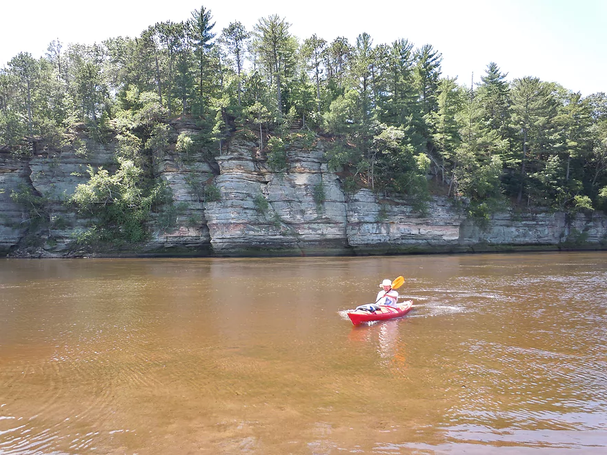
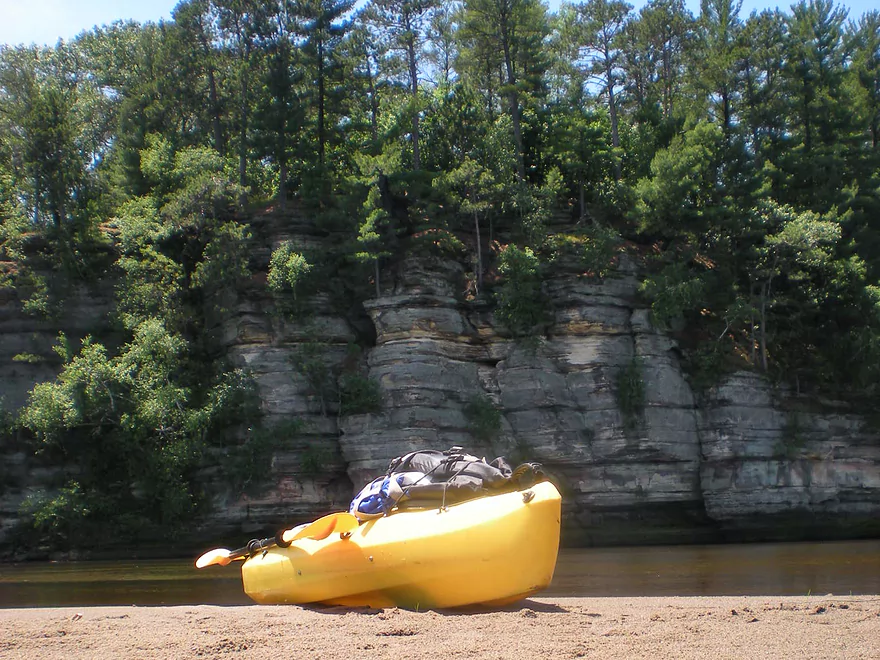
Put in by a snowmobile bridge that you can’t drive over (you’ll have to cross on a separate bridge and double back from the north side…see map). Decent put-in (no bathrooms). This is a pleasant section of the river and there was plenty of evidence of wildlife, especially birds and clams. The consistency of this segment is mostly sand, which is very nice (relative to muddy bottoms and banks of other rivers). We went at the height of the 2012 drought and there were some shallow areas that required ‘hopping’ and even getting out. Nothing too bad though…it’s not a big deal to get out when the water is not too dirty and you have sand to step on. Ironically, the upper sections of the river seem deeper…this is probably because this section loses a lot of volume due to the side-channels. Indeed, from Google maps, the channel breaks out in a tree-like format and it is somewhat possible to get lost. Just follow the biggest/fastest channel and you’ll be fine. While there are side-choices that may be fun to explore, if you deviate from the main channel you may miss one of the three river-side rock formations on this segment of the river.
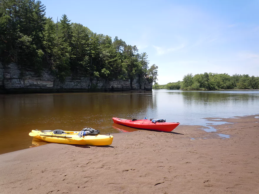
You’ll probably see other boaters on the river as this is a moderately popular paddling section. Unfortunately paddlers aren’t the only people on the river. About half way into out trip, we heard a large number of gunshots about a mile away. These kept continuing, and as we got close, we saw a large group of native rednecks shooting styrofoam cups in the river with their pistols. Not sure if this was legal…if for no other reason than they were polluting the river. That was unfortunate, but the rest of the trip was quite nice. As you progress through the river the main channel starts to open up and you’ll get more islands/paths that can make for fun exploring. As you wind through the main section, you’ll probably end up wondering where the boat landing is. It is somewhat hidden and tucked back to your right. What you need to do is follow the third and largest rock formation (see pictures). This formation is unofficially the start of the Dells and in fact was going to be the northern border of Wisconsin Dells National Park, which was a plan that got scrapped in the 30’s. As you get closer to the rock formation, you’ll see the landing on your right and slightly back. We intentionally over-shot the landing so we could go out on the Wisconsin River (nice sandbar right there). By the last rock formation on the Lemonweir and at the mouth, the current is VERY strong. While it is tempting to get close to check out the cliffs and all the cliff swallow nests…you’ll probably only want to do so with your life jacket on and to be careful that your boat doesn’t get pinned by the rocks.
Detailed Overview
Lemonweir River - Main Branch:
- East/South Fork Confluence to Cty PP: 1.0 miles. Likely around 3 logjams.
- Cty PP to Funnel Road: 2.0 miles. Very straight channel with roughly 6 logjams.
- Funnel Road to 2nd Ave: 1.2 miles. Highly channelized and straight with about 3 logjams.
- 2nd Ave to Cty H: 1.8 miles. Roughly 4 logjams. The channel can be poorly defined at times.
- Cty H to River Road: 2.3 miles. Expect 4-6 logjams and confusing side channels where navigation is a challenge.
- River Road to 6th Ave: 5.4 miles. Likely navigable, but expect a high volume of logjams.
- 6th Ave to 37th Street Landing: 4.4 miles. Occasionally paddled but contains several logjams.
- 37th Street Landing to New Lisbon: 6.6 miles. A long, slow stretch that feels more like a lake than a river. While somewhat monotonous, the rock outcroppings, white pines, and fall colors provide some redeeming beauty.
- New Lisbon Dam to Hwy 12/16 Shoulder: 7.9 miles. A promising prospect featuring a “Little Dells” rock outcrop, though hampered by about 6 logjams. The Hwy 12/16 shoulder is a speculative but potentially an access point.
- Hwy 12/16 Shoulder to Riverside Park in Mauston: 4.6 miles. Mostly slow, open paddling through river flowages.
- Mauston Dam to 19th Ave: 4.5 miles. One of the premier stretches on the river.
- 19th Ave to Cty HH: 13.1 miles. Less engaging with a noticeably slower current.
- Cty HH to the Mouth: 3.3 miles. An excellent section with beautiful rock outcrops that serve as a prelude to the Wisconsin Dells.
Lemonweir River - East Fork:
- Cty EW to Buckley Ave: 3.4 miles. Begins in cranberry bogs before transitioning into a sedge-lined creek and concluding with a spectacular corridor of towering white pines. Expect roughly five logjams, mostly near the end.
- Buckley Ave to Hwy 173: 4.7 miles. One of the most scenic and diverse stretches of the Lemonweir, featuring marshes, a lake, cranberry bogs, sandbars, and towering pines. A handful of easy-to-portage logjams are located near the end.
- Hwy 173 to Cooper Road/Dam:
- Hwy 173 to Dove Ave: 0.9 miles. A lovely, open leg with clear red water and numerous small sandbars. Includes one minor, easy portage.
- Dove Ave to Cooper Road: 2.4 miles. A mediocre stretch flanked by frac sand mines and cranberry bogs; much of the channel is ditched and straightened. The half mile below Dove Ave contains several logjams, some requiring difficult portages.
- Cooper Road to Backwater Bar Dam: 0.2 miles. A short but scenic flowage set against attractive pines. The dam is not a practical take-out due to trespassing restrictions and proximity to the spillway.
- Backwater Bar and Grill to Hwy 21: 0.5 miles. Likely congested with near-constant logjams.
- Hwy 21 to East/South Fork Confluence: 0.3 miles. Expect 2-3 logjams.
Lemonweir River - South Fork:
- Butts Park/Lake Tomah to Forbes Road: 4.5 miles.
- Butts Park to Lake Tomah Dam: 0.2 miles. A quick paddle across Lake Tomah to reach the spillway.
- Lake Tomah Dam to Memorial Park: 1.2 miles. A narrow, sandy stretch with a high number of downed trees.
- Memorial Park to Tomah Dog Park: 0.6 miles. Mostly pleasant and open, though one large logjam requires a very difficult portage.
- Tomah Dog Park to Forbes Road: 2.5 miles. The first half is heavily obstructed; the second half is more open but still requires two logjam portages.
- Forbes Road to County N: 6.9 miles.
- Forbes Road to Cty ET: 1.6 miles. A high-quality stretch with good clarity, a sandy bottom, and one manageable logjam portage.
- Cty ET to Cty N: 5.3 miles. Scenic and clear, passing through grasslands, frac sand mines, and a massive cranberry bog. Includes three logjam portages.
- County N to Excelsior Ave: 3.0 miles. Open through the golf course, but the wooded sections likely contain 6-8 logjams.
- Excelsior Ave to East/South Fork Confluence: 0.5 miles. Likely riddled with countless logjams.
Trip Map
Overview Map
Video
Photos Size:
This site is great! I have done many of the same trips as I live near Portage. A useful piece of information for each trip is actual paddling time. We did the Lemonweir Mouth trip expecting 5 hours per your review. We put in at the snowmobile bridge at 11:30a. We were quite casual, stopping several times and just floating quite a bit. We hit the Two Rivers landing at 1:30pm. We actually had our pick up vehicle at the camp grounds on the WI River a mile down or so. In all we had about 2.5 hrs paddling casually. A nice trip, but we would have gone further if we knew the actual paddling time beforehand.
Food for thought. Thanks for a great resource!
Thanks for the comment! I do agree that some of the paddling times are deceptive. In this case, the time is technically correct (for our trip), but we took breaks on the sandbar at the mouth, got a little lost, had some shallow water portages and got to out to explore some class piles. Not to mention my photo taking seriously slows down trips. When I get caught up with my reviews, I’ll probably issue qualifiers for my times.
The most accurate measure of time is distance. Fast paddlers in long boats do 3 miles an hour. Typical paddlers do 2 miles an hour and my paddles can take 1-2 miles an hour because of the sheer number of pictures I take.
Great to hear from a Portage resident! Might still do the Fox by Portage yet….but it looked pretty weedy last week when I drove over it.