
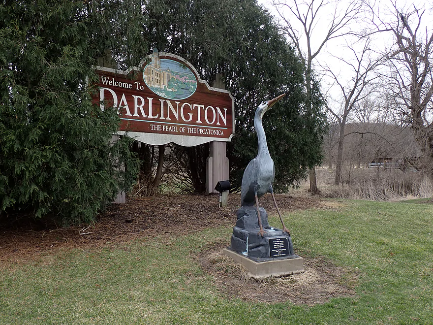
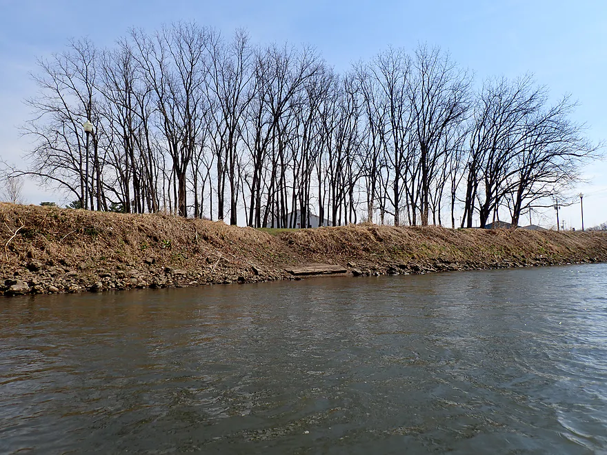
Welcome to Darlington
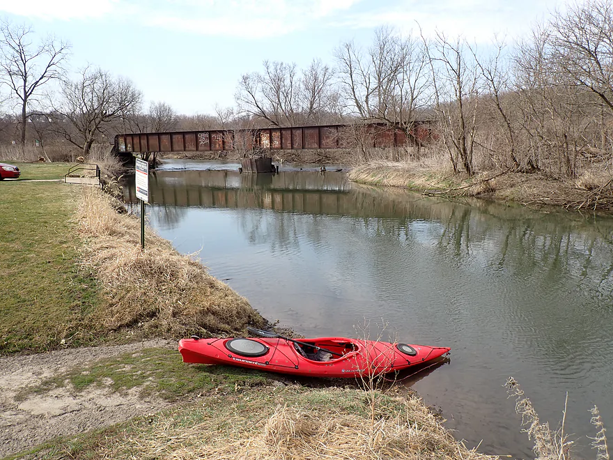
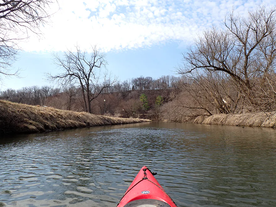
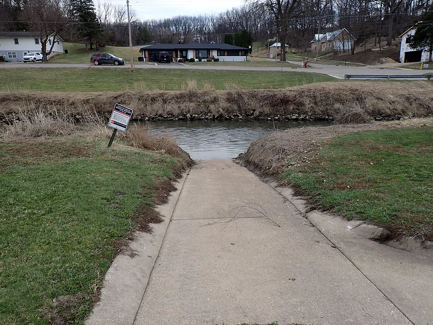
Starting the trip at the Padlock Boat Launch
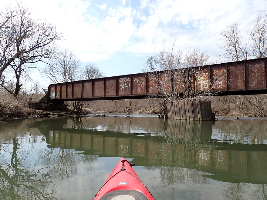
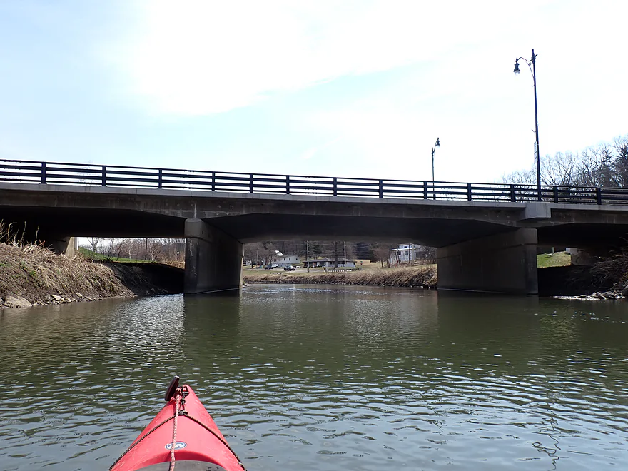
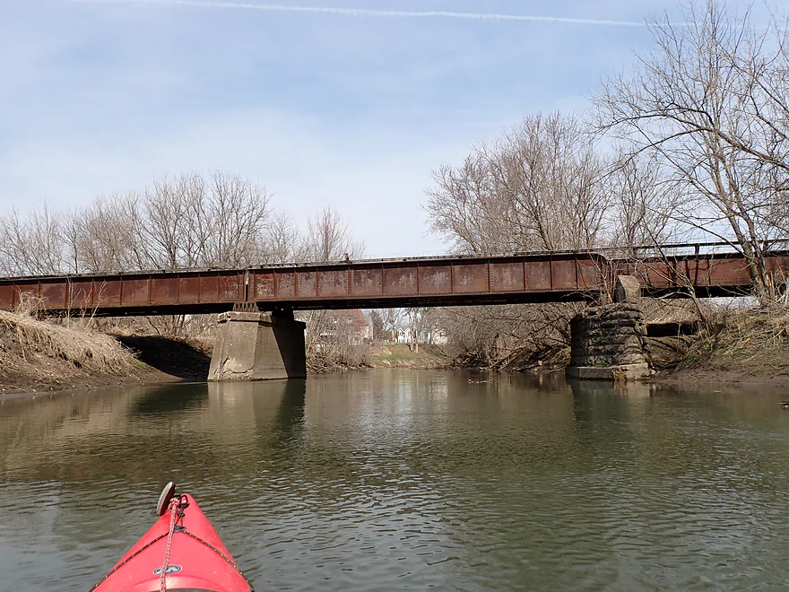
Cheese Country Trail bridge with awful graffiti
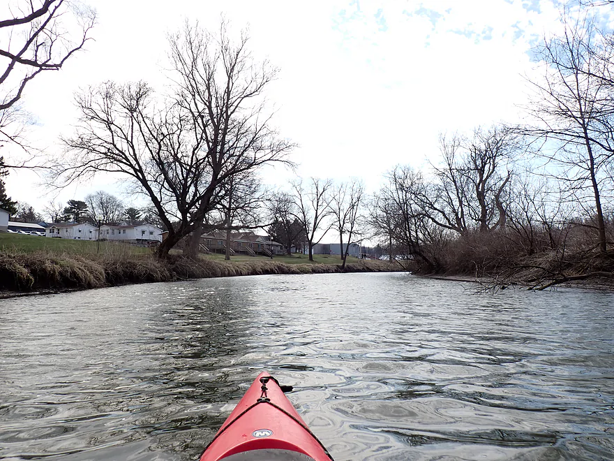
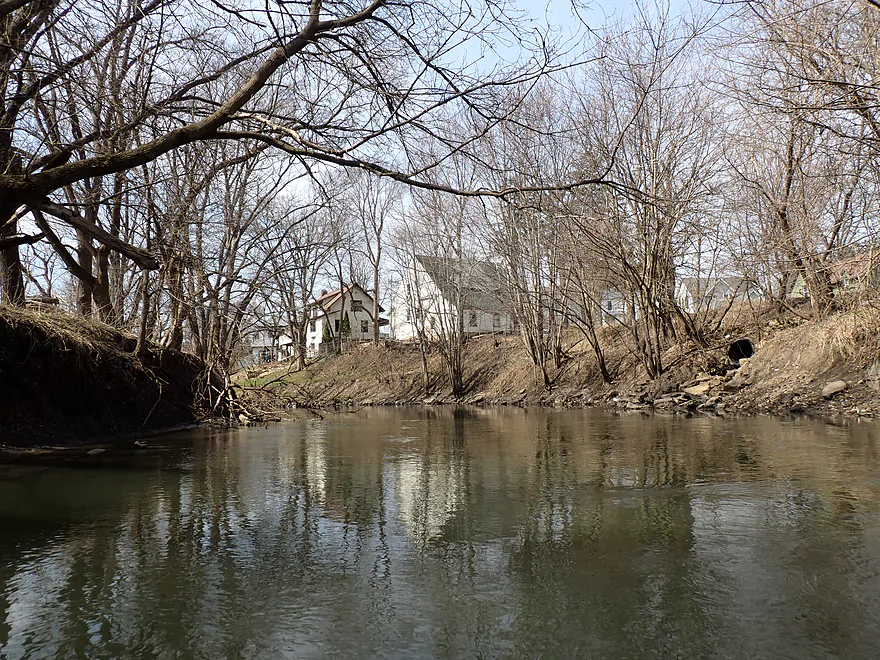
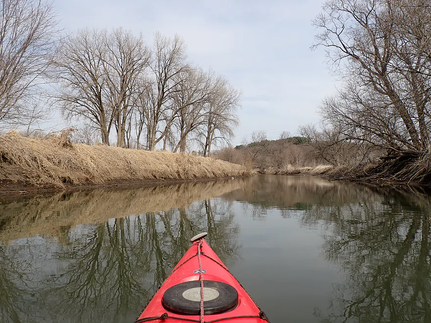
Paddling through Darlington
There used to be an old mill pond on this stretch
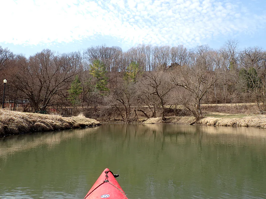
Peterson Park is an access option (old mill was here)
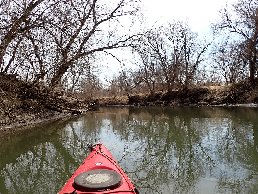
Approaching the remants of the old dam
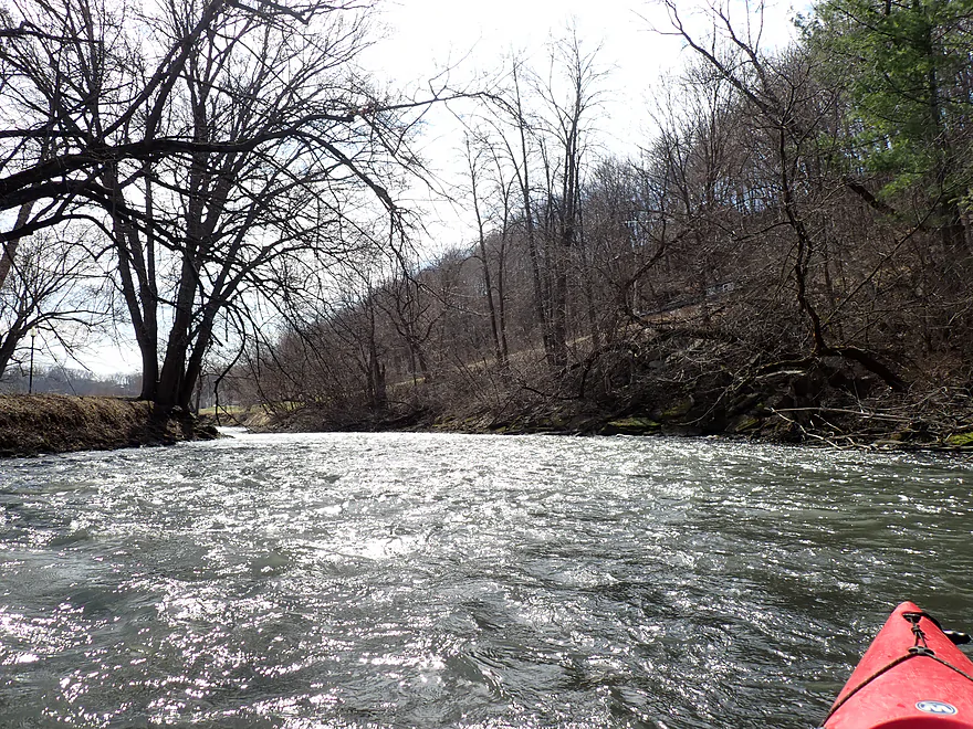
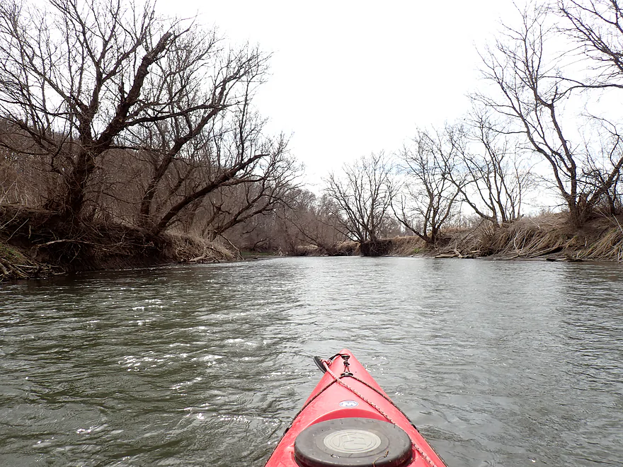
Great stretch of fun rapids
Getting out to run the rapids again
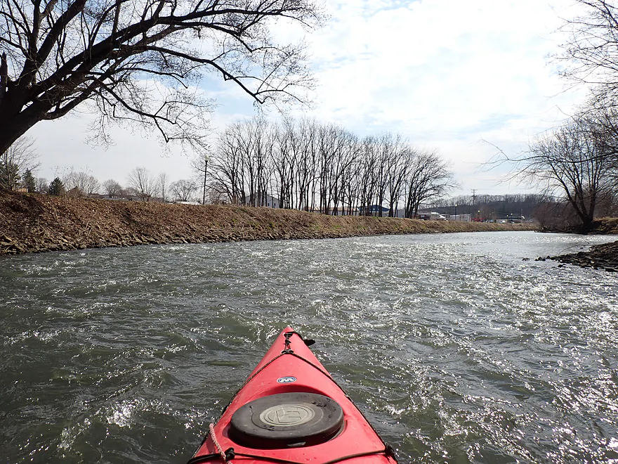
Reverse view
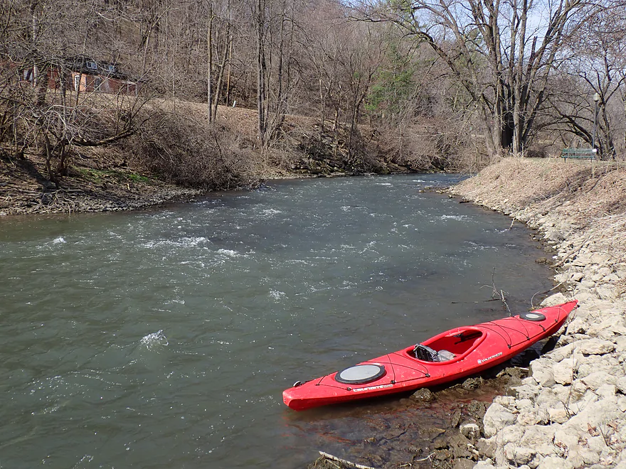
Trails Park Access is a nice park and play take-out
Not sure that’s a good spot to park your bike…
Hwy 23
Wells Street Access (by Piggly Wiggly)
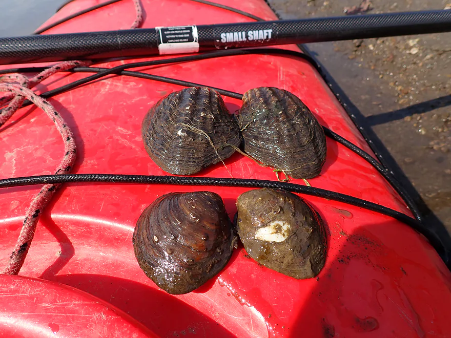
Surprising number of clam shells
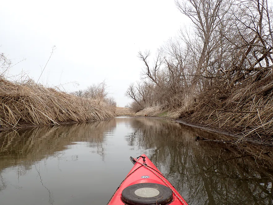
Cheese Country Trail again
Evidence of how high the river floods
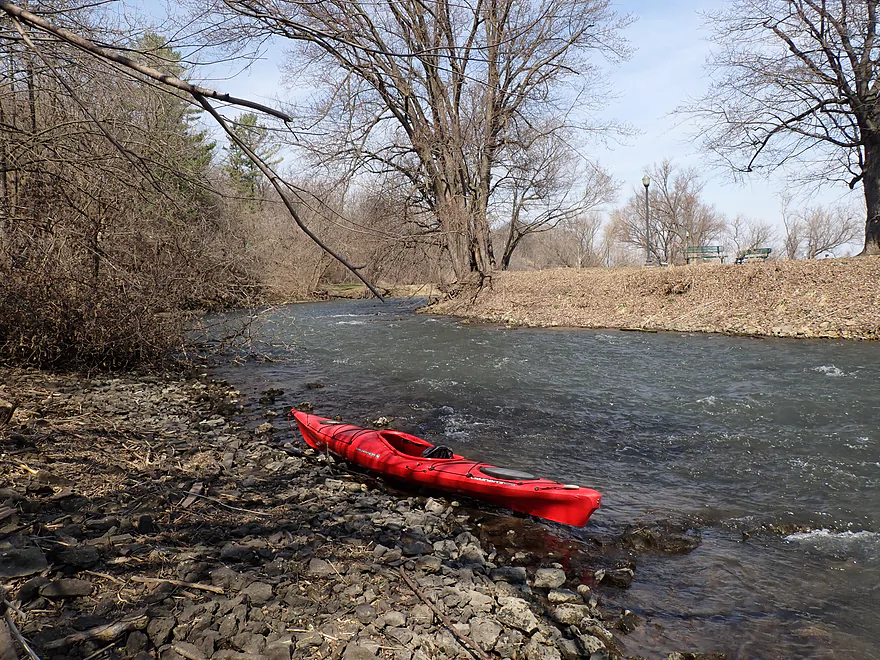
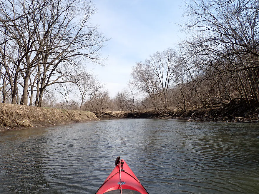
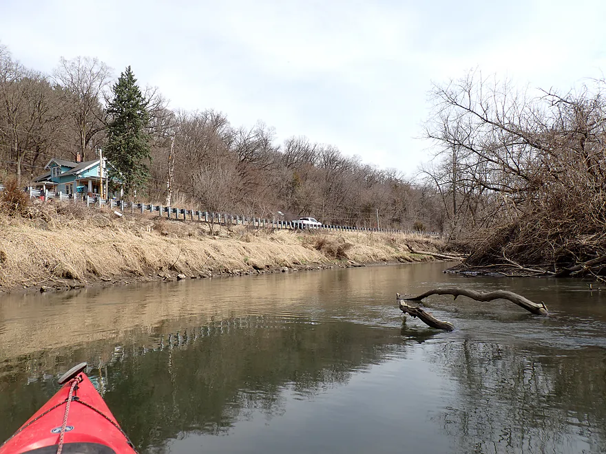
Scenic river bend
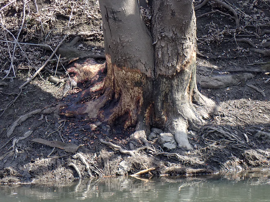
Skinned knees (ice damage)
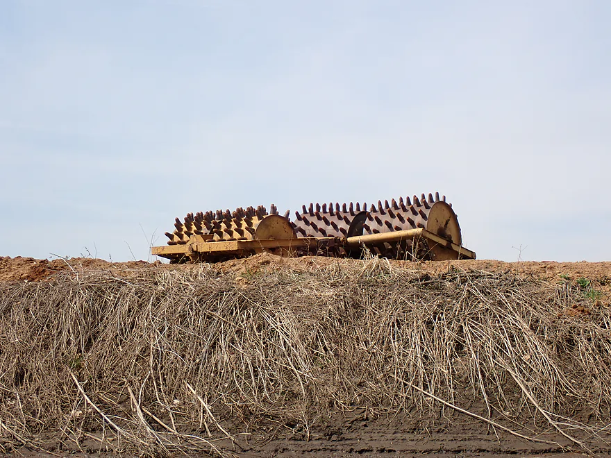
Weird contraption by the fair grounds
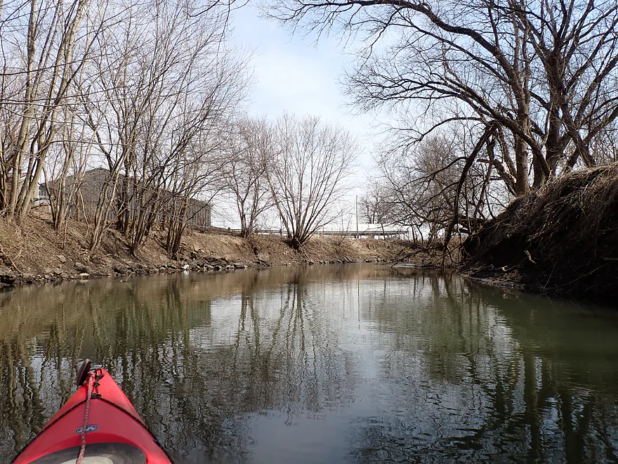
Leaving town behind
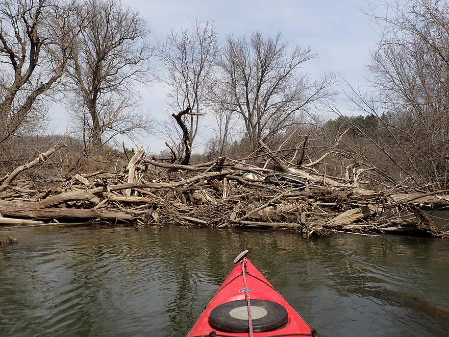
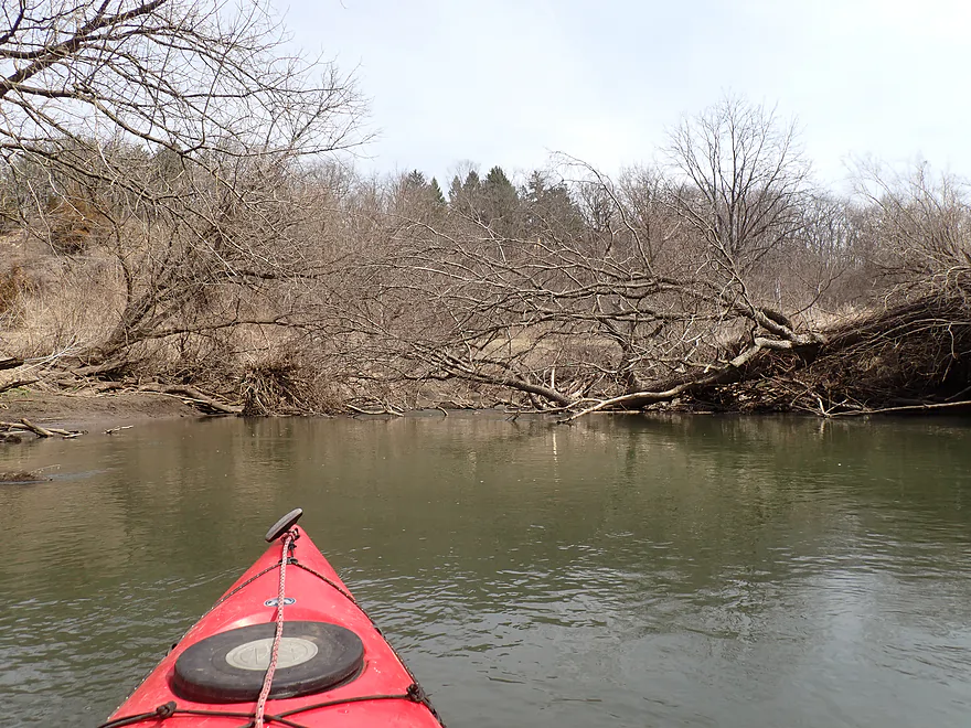
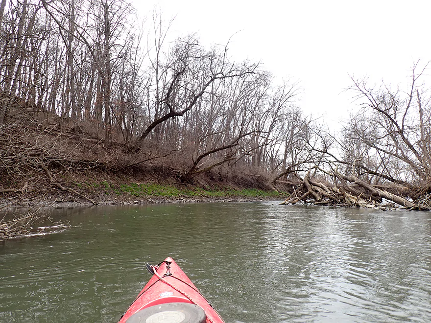
First major logjam
There is a small gap on the right I was able to sneak though
Immediately followed by logjam #2
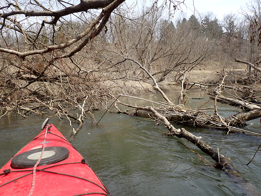
A mess, but I was able to punch through
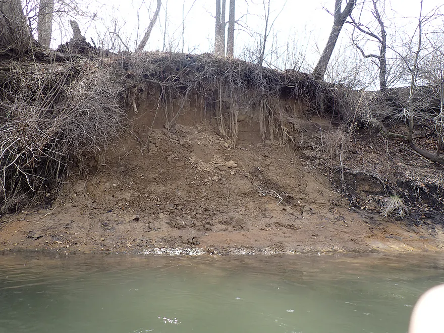
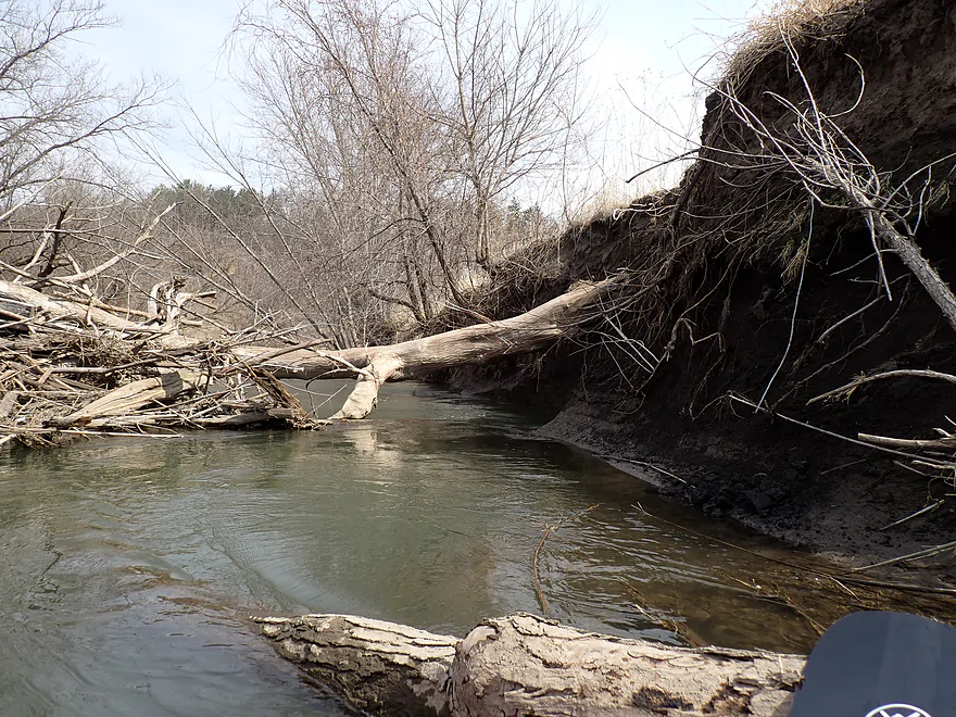
Huge clay banks
Checking out Otter Creek (a small tributary on my left)
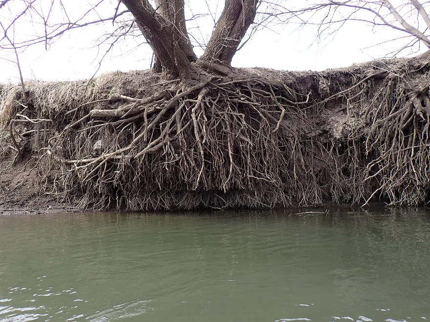
Cool how the ice “trimmed” the bottom of the roots
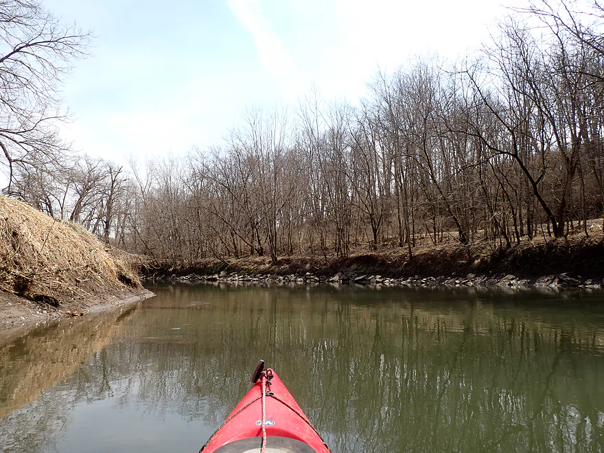
A rare bluff
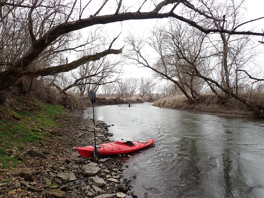
Getting out for a photo
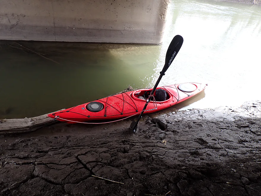
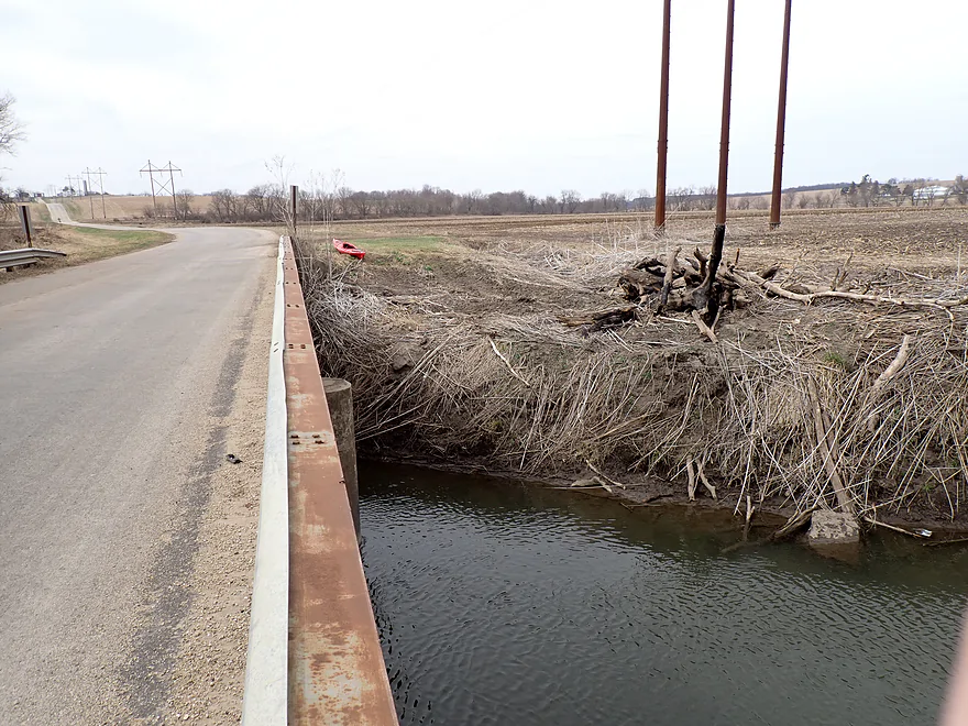
Ending the trip at muddy Roller Coaster Road
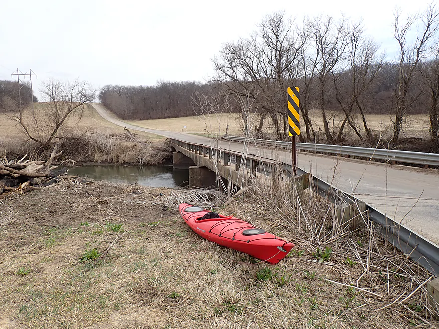
Not a great access
Reverse view shows how steep the banks are (a bit easier to get out UNDER the bridge)
Scenic bike shuttle back through Darlington
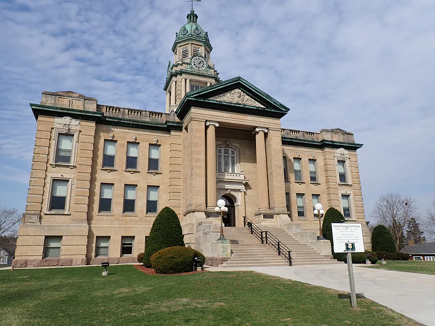
Historic courthouse
Pecatonica River – Darlington

The Lower Pecatonica River is kind of meh for paddling. Poor agricultural practices and topsoil erosion have left it in a messy and muddy state. Despite this there are a few legs worth paddling, including the stretch below Darlington.
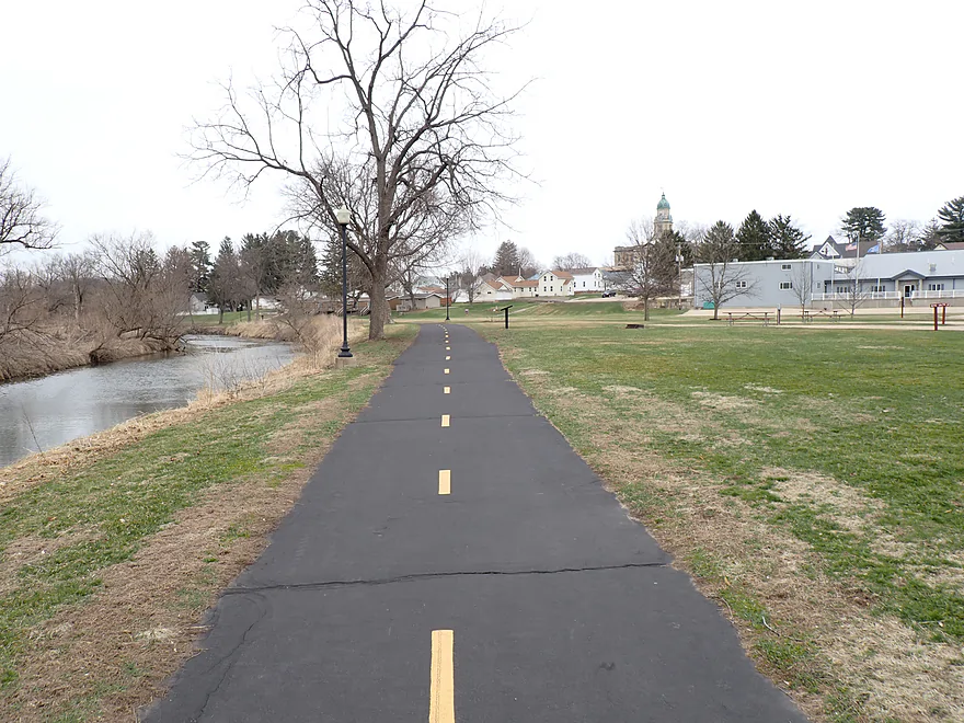
Within Darlington there are four separate launch options, but I chose Padlock Boat Launch as it was the furthest upstream. My early impression was how deep the river was (my paddle would not touch) and surprise as to the ugly graffiti on the local Cheese Country Trail bridge. Downstream from the bridge though was an attractive riverwalk which locals were enjoying in the good weather.
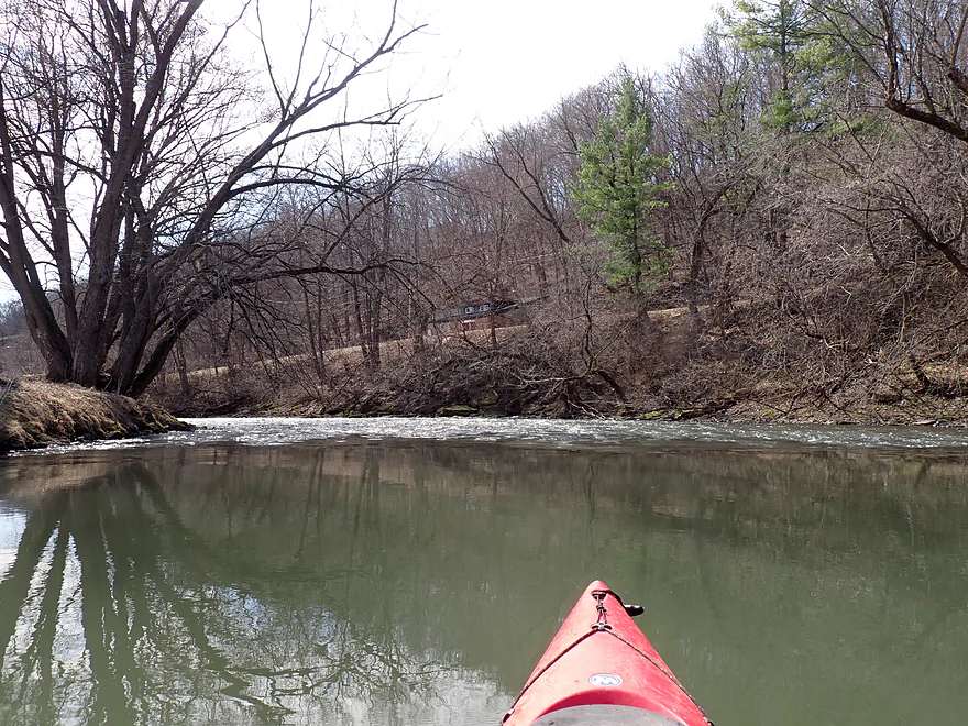
The current soon died as I entered the remnants of the old Darlington Mill Pond. The dam was roughly 98% removed in the 1920’s due to its deteriorating condition. All that remains is a 500′ stretch of rapids that were super fun and a trip highlight. Because the river wraps around a bend, it’s easy to get out and run them again (which I did and a local was nice enough to get a video of me).
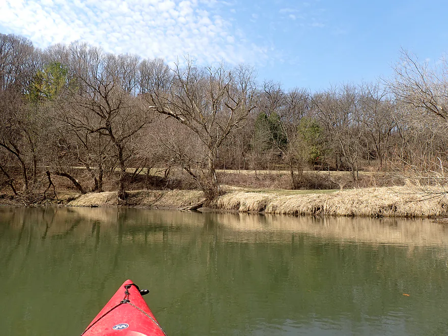
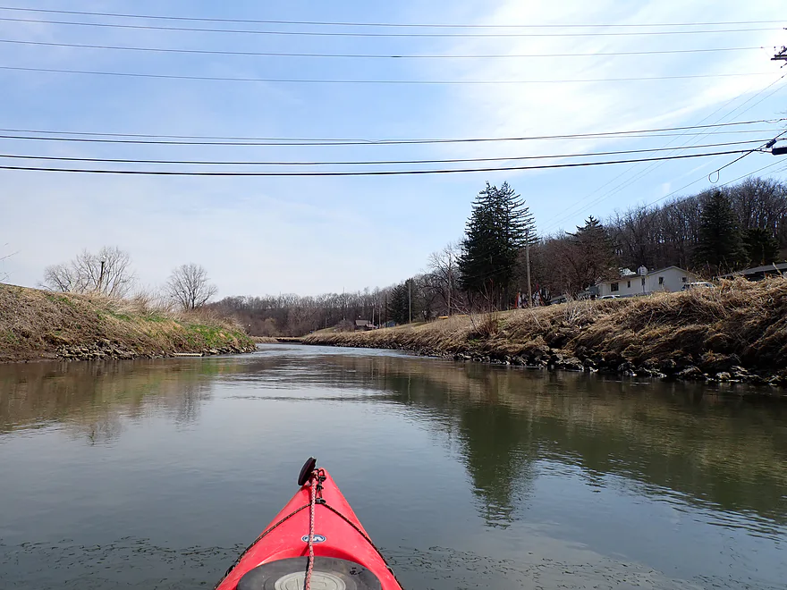
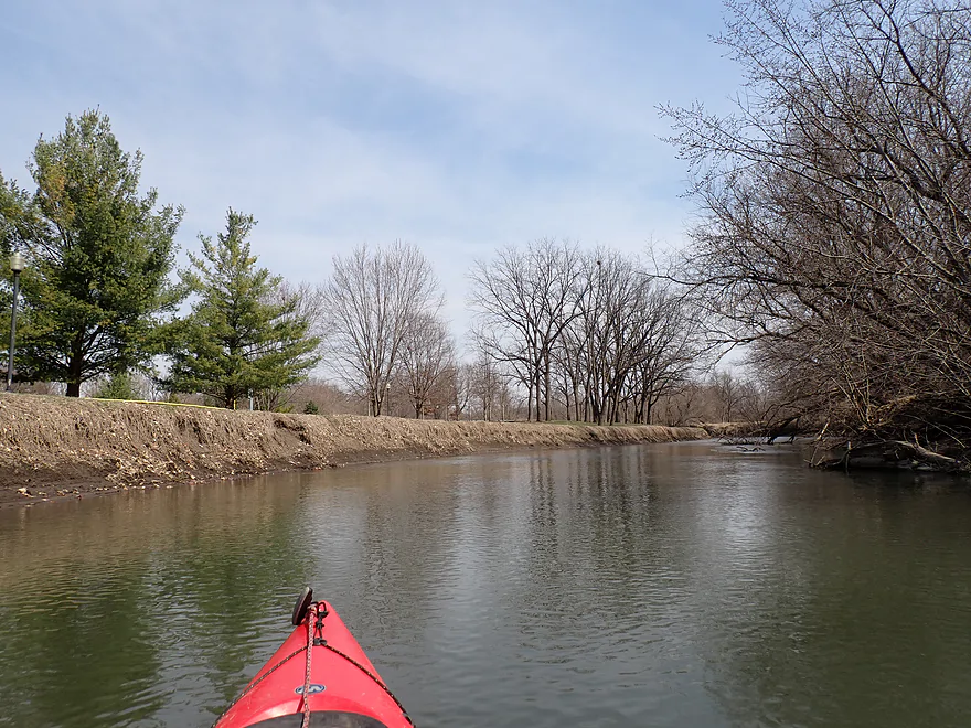
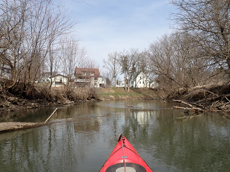
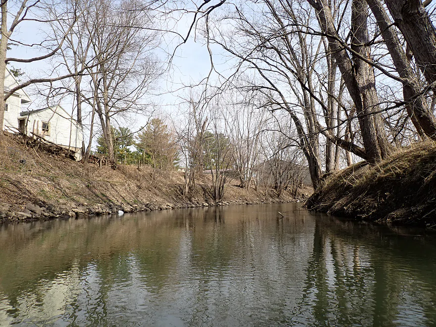
Following the rapids, the river continued though the outskirts of Darlington and stayed scenic and attractive despite rip-rapped banks. Darlington would turn out to be the best part of the trip.
After the second Cheese Country Trail bridge, the Pecatonica left town behind and started to meander. Here the river became less interesting with steep muddy banks and a thin layer of “weed trees” that struggled to cling to the poor quality mud banks. The river will meander in the future and topple these trees into the river like a dump truck.
It was a good thing I never had to portage on this trip, as 99% of the banks were steep mud walls and getting out would have been difficult. The Lower Pecatonica might even surpass the Baraboo for being the muddiest river in Wisconsin. I did encounter a pair of large logjams (here) but was able to figure out a way through them.
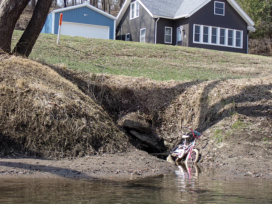
Following Otter Creek, there was a nice bluff with a rocky shoreline with natural springs (see featured image). Soon after this I came to Roller Coaster Road and ended the trip here (one of the muddiest access points I’ve ever used).
In summary, this trip was a mixed bag. The Darlington section was four stars and the rapids were super fun. But the river after Darlington was just too degraded, with no outcrops and unsightly deadfall in the water (more like two stars), so I’m averaging this for a three star review. It might be nicer in the summer when attractive leaf canopies form over the river. Note, paddlers who just want to do the rapids could do a “park and play” as a public river walk is next door. And for paddlers who don’t want to face the mud at Roller Coaster Road, they can continue 7.4 miles to the Walnut Road access, which has much less mud.
Darlington Canoe Festival: The canoe annual canoe race upstream from Darlington was suspended in recent years, but I think it will return in 2026. This is their big summer event and includes a crafts fair, carnival, concerts, and a parade.
Sights included a groundhog, painted turtles, a bank beaver den, and geese. There were a surprising number of clam shells and even one living clam.
Padlock Boat Launch: There are a number of launches to choose from in Darlington, but this is the furthest upstream and allows you to see most of town. It’s technically a small boat ramp, but it’s super easy to launch a kayak here.
Alternate Put-ins:
- Peterson Park: (0.5 miles upstream from Padlock Launch) The launch is located on the south shore at the site of the old mill and dam. If you want to run the rapids, it is conveniently located just upstream from them.
- Trails Park: (0.6 miles upstream from Padlock Launch) This is located on the north shore just downstream from the rapids. It’s a convenient park and play spot…you can get out and portage (east bank) upstream to run the rapids again.
- Wells Street Access: (0.9 miles upstream from Padlock Launch) This is an excellent launch and you should be able to use the adjacent Piggly Wiggle parking lot. Unfortunately it’s further downstream from the other access points, so you miss out on paddling past the court house, rapids and other town features.
Roller Coaster Road: This is a doable but not ideal bridge access. If you leave your car here, be careful not to block the farmer from accessing his field. The big problem is mud though…this is one of the muddiest take-outs I’ve ever used and you need to pick your spots carefully as the bank is steep. If you take out directly under the bridge it’s kind of doable, but expect you (and your boat) to get muddy.
Alternate Take-outs:
- Walnut Road Access: (7.4 miles downstream from Roller Coaster Landing) This is a small boat ramp and good public access (although a smidge muddy). This bonus leg features even more dilapidated banks, but is a bit nicer with larger bluffs and a few outcrops.
Bike Shuttle – Roller Coaster Road to Padlock Boat Launch: 3.4 miles with 52′ of ascent. Most of the shuttle route I took was on the Cheese Country Trail which was nice, but badly chewed up by heavy ATV and snowmobile use. While not as horrendous as other stretches of the trail I’ve done in years past, careful consideration was required to avoid nasty gravel islands. Not ideal, but it’s doable for bikers (unless you have skinny tires). It’s better than the alternative Roller Coaster Road which is aptly named and would give you more exposure to the wind. The final stretch of the Cheese Country Trail through Darlington parallels the river, was paved and really scenic. You will need a state trail pass to use the trail and this is one of the few trails that’s actually patrolled.
Rapids: There is one set of rapids in Darlington across from Peterson Park (site of the old mill/dam). It’s a Class 1 about 500′ long and pretty safe (video). It’s also pretty fun and you can “park and play” and run the rapids multiple times by taking out on the east bank (there is a hidden ramp). From here you can portage upstream along a public river trail and easily re-enter above the rapids.
Strainers: There are a few strainers to dodge. For experienced paddlers these shouldn’t be too difficult, but you should be careful as the strainers are often situated over deep and moving water.
Current: The current was a bit below average, but after Darlington it moved at a consistent pace.
Logjams: There were two logjams (I’ve marked their locations on the trip map).
- Logjam #1 – There is a massive cluster of logs just west of Hwy 81. Fortunately there is a gap on the right side with a log overhead that I was able to duck under, but it was low. Note, in high water you might not fit. And the banks are deteriorating so this gap could close. If you portage, you might have to back paddle a bit to find a good take-out spot as the banks are steep and muddy.
- Logjam #2 – This is coincidentally located just downstream from the first logjam. This is more open and would be easier to get through in high water. I broke some branches and was able to zigzag through, but some boats won’t fit. If you portage logjam #1, you could portage this one at the same time.
Closest Gauge: Pecatonica River @ Darlington
Trip Depth: 159 CFS or 2.69′
Navigability Estimates:
- < 100 CFS: The river infrequently gets this low, but even so, navigability shouldn’t be an issue aside from the rapids, which might be bump.
- 101-210 CFS: Very ideal conditions and a good target range for the Lower Pec. The water should be relatively clean at these levels.
- 211-250 CFS: An average depth, fine for paddling.
- 251-290 CFS: A bit above average, but plenty manageable. One of the logjams might be tricky to get past.
- 291-350 CFS: A high depth. Likely manageable, but the river may be very muddy and unattractive. Be mindful of shoreside strainers at these levels.
- 351-500 CFS: A very high depth. Perhaps only suitable for experienced paddlers.
- 501+ CFS: This might be too high and muddy for enjoyable paddling.
Detailed Overview
- Upstream of Hwy X: I think the river up here is too shallow to run.
- Hwy X to Hwy G1st: 4.2 miles. This section is a small creek and may need high water. Some logjams and probably small outcrops. Hwy X is not a great access and lacks privacy.
- Hwy G1st to Hwy E: 3.4 miles.
- Hwy G1st to Hwy G2nd/Mifflin: 2.9 miles. Great section with many rock outcrops and light rapids. Shallow, but becomes much deeper after the Livingston Branch joins up. Two fences, but easy to get past.
- Hwy G2nd/Mifflin to Hwy E: 0.5 miles. Short, open section heavily grazed by nearby beef cattle. Some fun rapids and outcrops are on this segment. One fence to duck under (quite manageable).
- Hwy G2nd/Mifflin to Hwy A: 4.4 miles. An excellent prospect with good current, outcrops, a state natural area, and few logjams. Martin (reader comment) kayaked this section and wrote a nice summary here that you can read.
- Hwy A to Peniel Road/Hwy J: 1.7 miles. Maybe two outcrops and two major logjams.
- Peniel Road/Hwy J to Jones Branch Road: 2.5 miles. Some congested woods with maybe 3 logjams and 2-3 outcrops.
- Jones Branch Road to Powell Road: 3.1 miles. A nice peaceful stretch with a few outcrops, 2 sets of light rapids, and one serious logjam.
- Powell Road to Oak Park Road: 8.0 miles. A very open section with no logjams. Highlights include green rolling hills, oak savannas, a few rapids, and one outcrop. Lowlights include four low fences.
- Powell Road to Hwy 151/Blackstone Cattle: 4.4 miles. The more scenic of the two sections with scenic hills and one outcrop. There are two low electric fences to duck under.
- Hwy 151 to Oak Park Road: 3.6 miles. This section had more corn and trees and wasn’t as interesting, but still was decent. There is one low electric fence and one super low barbed wire fence.
- Oak Park Road to Hwy O: 3.7 miles. Likely some logjams but also some outcrops at the end. Oak Park Road is a muddy but doable put-in.
- Hwy O to Hwy G: 6.0 miles. Some scenic moments, but mud and logjams are detractions. Put-in and take-out are muddy.
- Hwy G to Darlington/Black Bridge Park: 8.5 miles. A decent prospect. As of 2020, there is a large logjam on this leg that requires a difficult portage up steep and muddy banks. This might be cleared out for the 2021 Darlington Canoe Festival.
- Darlington/Black Bridge Park to Roller Coaster Road: 4.9 miles.
- Black Bridge Park to Wells Street Access: 0.7 miles. A great stretch though the town of Darlington. The highlight is a section of Class 1 rapids where the old mill dam used to be.
- Wells Street Access to Roller Coast Road: 4.2 miles. A decent stretch, but no outcrops, the banks are steep/muddy and there are two partial logjams to circumnavigate around. Not bad...not great.
- Roller Coaster Road to Walnut Road: 7.3 miles. While one of the nicer legs on the lower Pecatonica, the river has been too badly damaged by erosion to be an elite paddle. The highlight is a sandstone outcrop.
- Walnut Road to Riverside Road: 5.5 miles. Mediocre prospect flanked by a lot of farmland. Excellent put-in and take-out.
- Riverside Road to Hwy 78 Canoe Landing: 3.2 miles. Likely an uninteresting leg with lots of farmland and large mud banks. I doubt there are many bluffs. There may be one major logjam.
- Hwy 78 Landing to Gratiot Conservation Club Landing: 5.8 miles. A mediocre stretch. Much of this is wide, slow, and straight...but there are a few nice wooded bluffs.
- Gratiot Conservation Club Landing to Sargent Road: 4.7 miles. Maybe a weaker section.
- Sargent Road to Hwy D/N: 4.6 miles. Flows partly through a SNA and by a valley ridge so might be interesting.
- Hwy D/N to Hwy 11 Boat Ramp/Browntown: 8.8 miles. The East Branch comes in and doubles the river (now pretty big).
- Browntown to Brewster's Landing: 12.2 miles.
- Hwy 11 Boat Ramp/Browntown to Hwy B: 4.8 miles. Generic stretch with farm fields and a thin layer of trees. Take-out might be tricky because of a guardrail but I think it’s doable.
- Hwy B to Hwy M: 4.6 miles. A good leg with scenic bluffs and outcrops. Put-in is meh…take-out might be bad.
- Hwy M to Brewster's Landing: 2.9 miles. Mediocre stretch that crosses into Illinois.
- Brewsters Landing to McConnell Bobtown Landing: 7.2 miles. Mostly straight and boring. But there is a wooded section with bluffs that might be nice. Could be an outcrop or two.
- McConnell Bobtown Landing to McNeil's Damascus Landing: 8.5 miles. River flows through a more rugged and varied part of Stephenson County. Still some boring parts, but also some nice bluffs and limestone outcrops.
- McNeil's Damascus Landing to Wes Block Trailhead: 8.3 miles. Mostly a straight and muddy paddle. But there should be a few nice bluffs on the west bank.
- Wes Block Trailhead to Tutty's Crossing: 6.4 miles. River enters Freeport (IL). This should be a pleasant stretch with fewer farm fields, nicer woods, and a few attractive trail bridges.
- Tutty's Crossing to Hancock Ave Boat Ramp: 0.7 miles. Wooded urban stretch.
- Hancock Ave Boat Ramp to Junior's Place/VFW: 2.3 miles. River leaves Freeport. This is likely a mediocre stretch.
- Junior's Place/VFW to Ridott Fishing Park: 14.8 miles. A very long stretch that I'm not sure would be that interesting. There are rapids by the Brown's Mill Dam that may have to be portaged.
- Ridott Fishing Park to Attens Landing: 6.7 miles. I don't know much about this stretch. It meanders more and has thicker woods so may be nicer.
- Attens Landing to Winnebago County Fairgrounds Ramp: 7.5 miles. Much of this flows through the Pecatonica Wetlands Forest Preserve.
- Winnebago County Fairgrounds Ramp to Sumner Park: 0.4 miles. There are tricky rapids where a dam was mostly removed. Depending on water levels, you may have to portage this.
- Sumner Park to Pecatonica River Forest Preserve Ramp: 6.0 miles. A north flowing leg of the river that is mostly undeveloped and contains some floodplain forests.
- Pecatonica River Forest Preserve Ramp to Trask Bridge Ramp: 7.0 miles. This is a relatively good prospect with large clay banks and a few nice woods.
- Trask Bridge Ramp to Two Rivers Ramp: 12.6 miles. Paddling author Mike Svob seemed to like this leg. Here the river meanders and twists more. The woods are also more impressive. Much of this is still likely wide, slow, and boring though. The take-out is close to the mouth of the Sugar River.
- Two Rivers Ramp to Boat Launch Mactown: 9.8 miles. The last leg of the Pecatonica before it empties into the Rock River. Significantly enlarged by the Sugar River, I suspect this is a big and boring leg.
Trip Map
Overview Map
Video
Photos Size: