
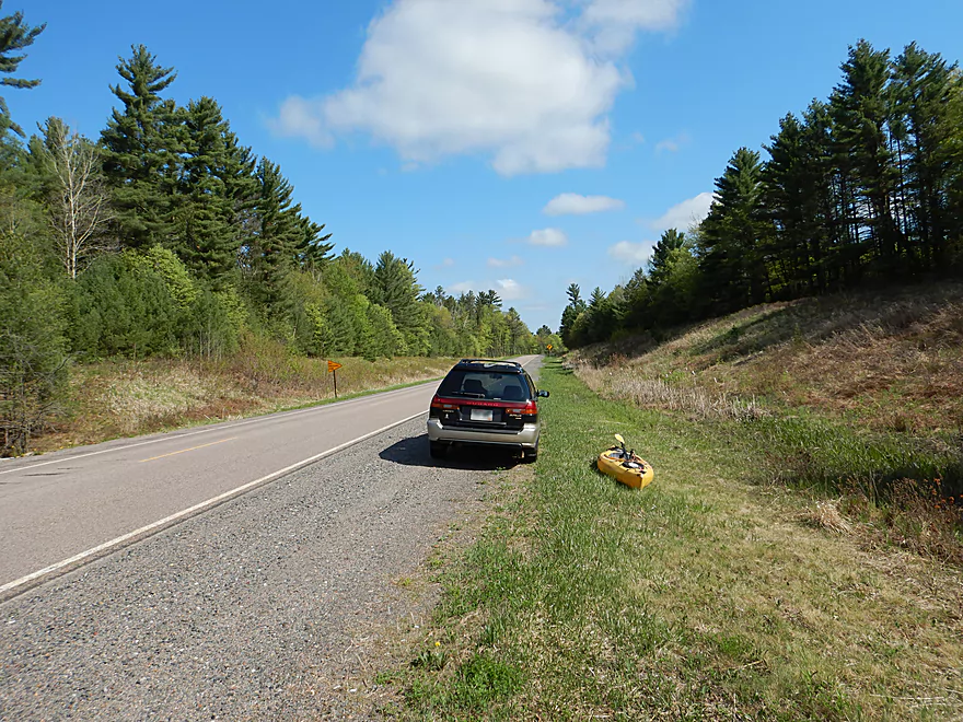
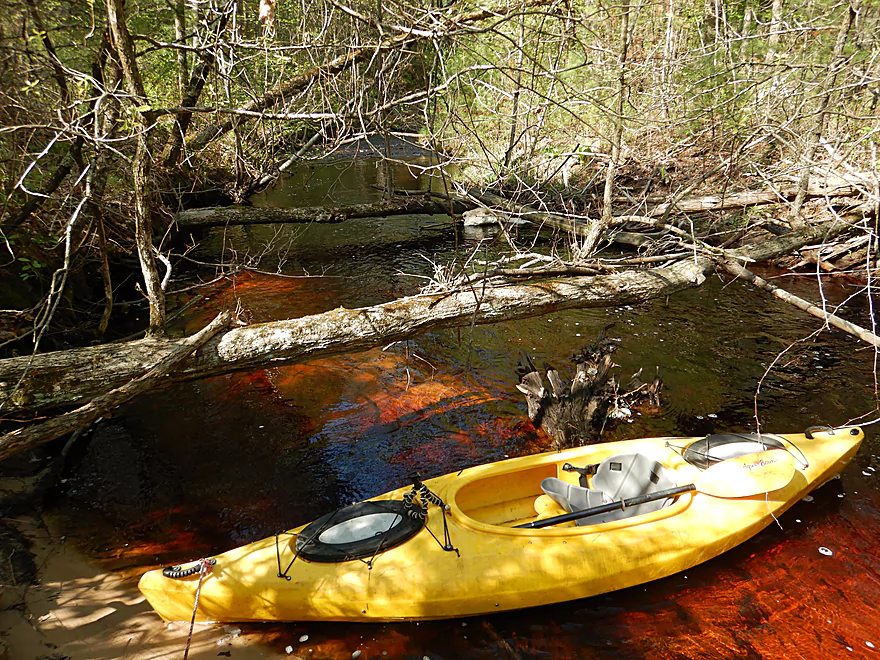
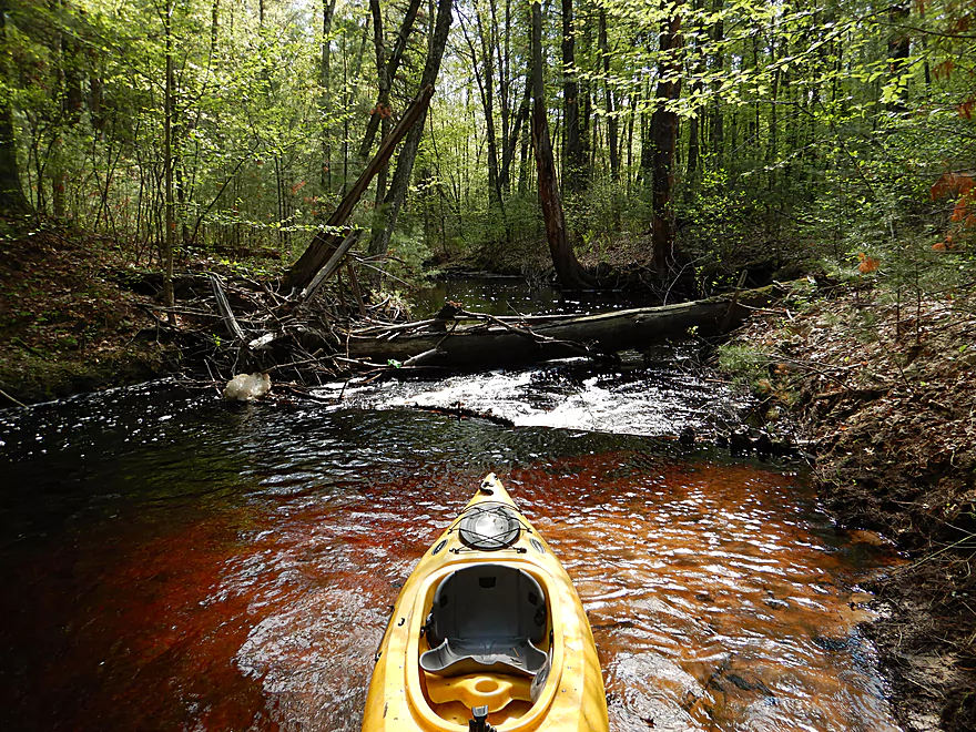
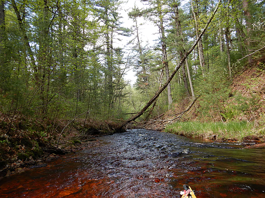
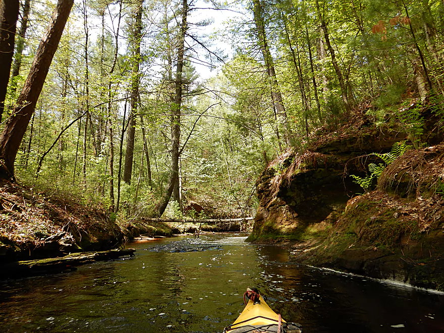
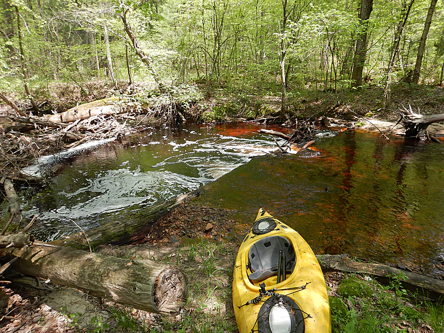
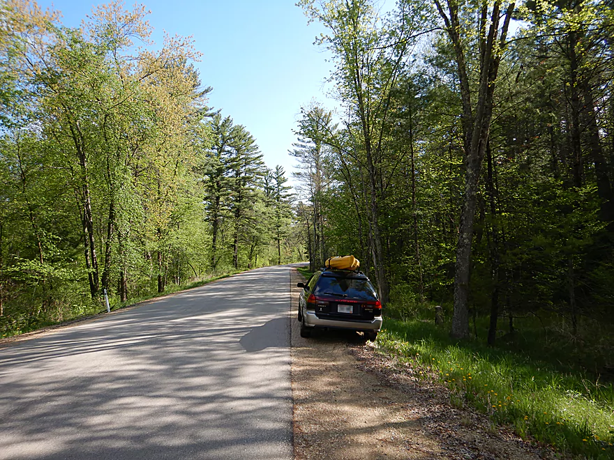
Starting the trip in the Black River State Forest (Hwy K)
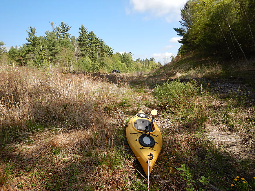
Some dragging required to reach water…but not bad
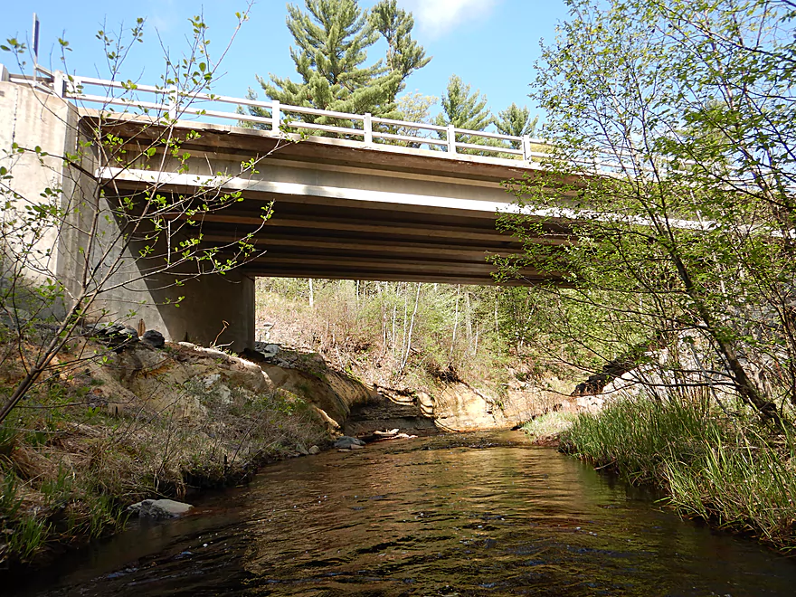
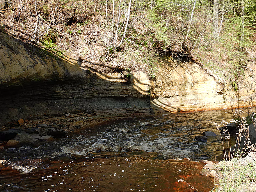
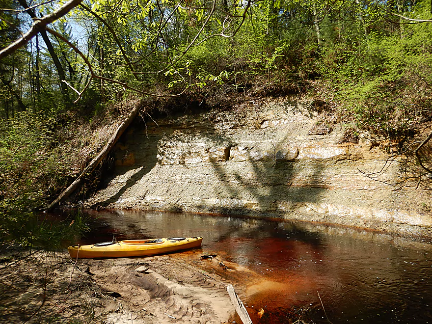
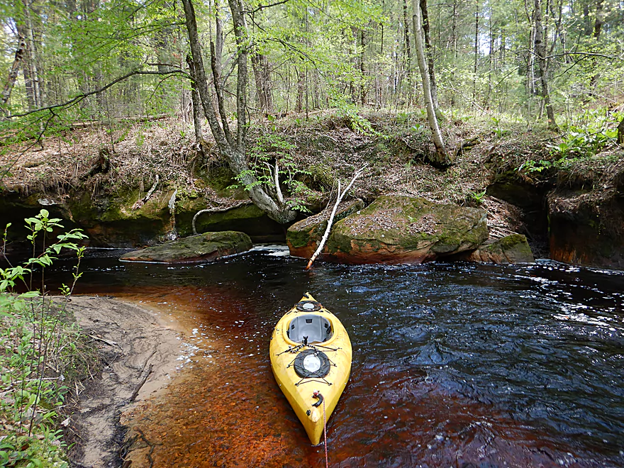
Hwy K bridge
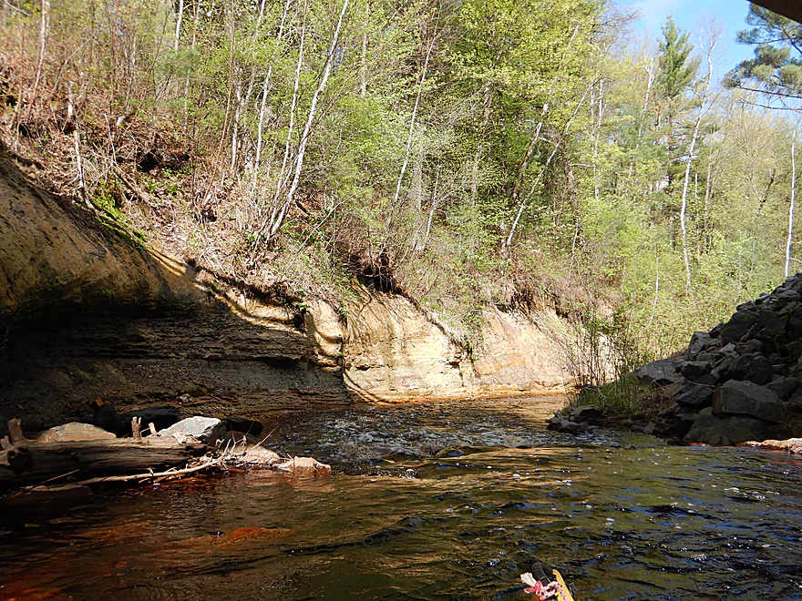
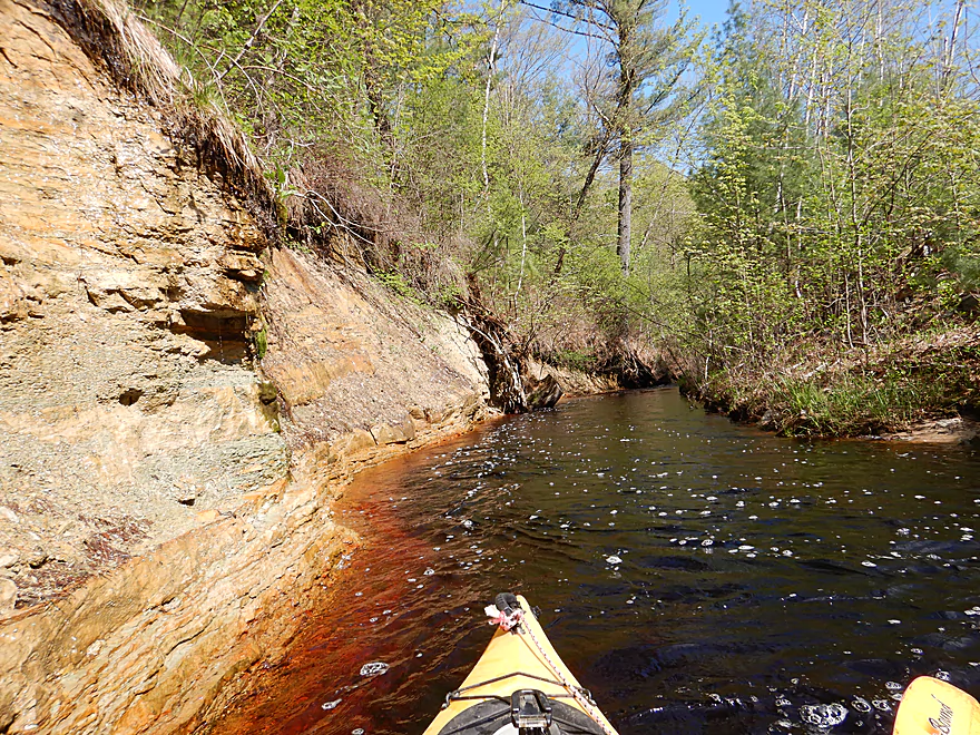
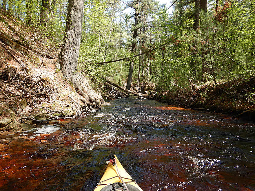
Approaching a cool sandstone bend
With some fun rapids
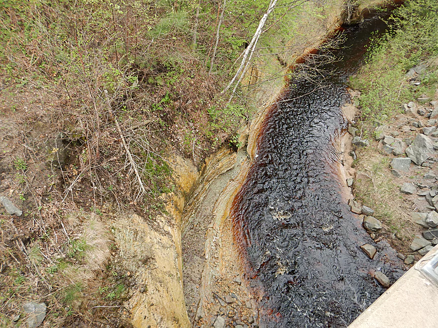
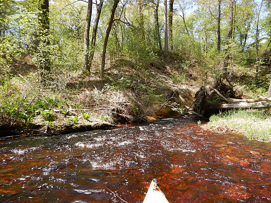
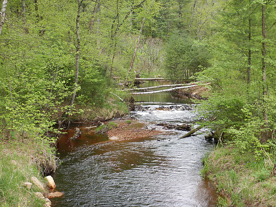
View from the bridge
The wall just keeps wrapping around the corner
This was tricky to get through
One of the easier portages
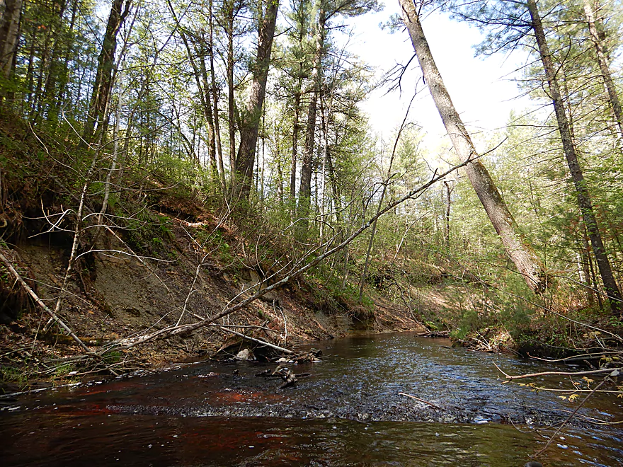
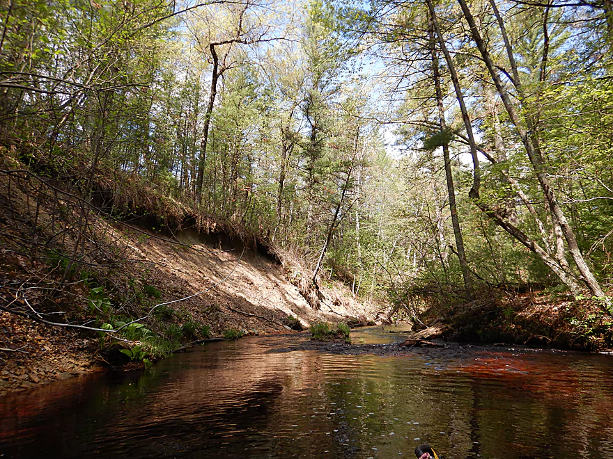
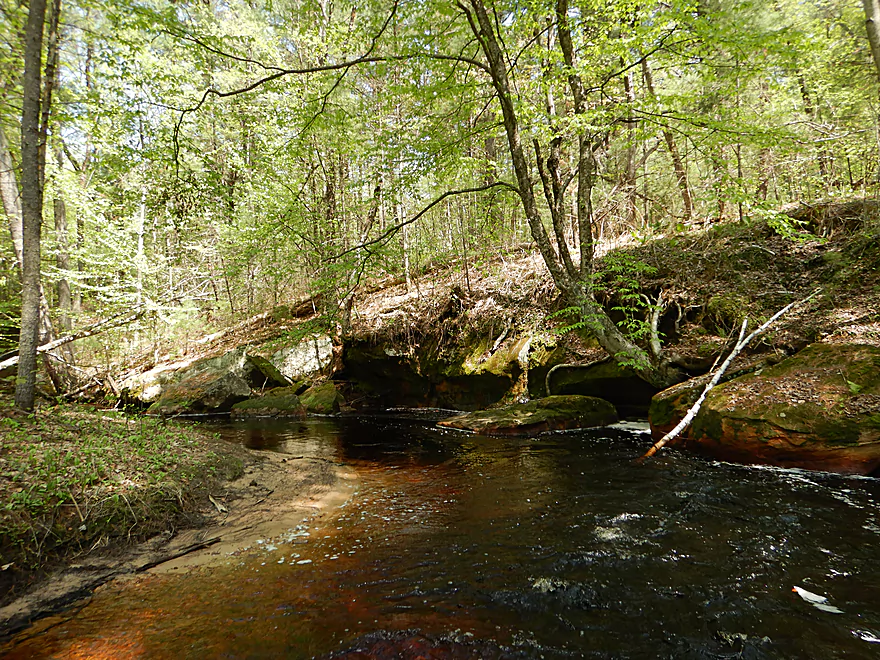
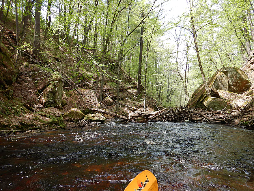
Steep rocky banks
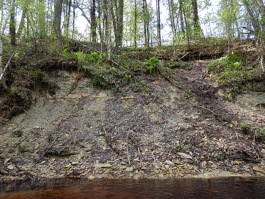
Some small seeps (hard to see)
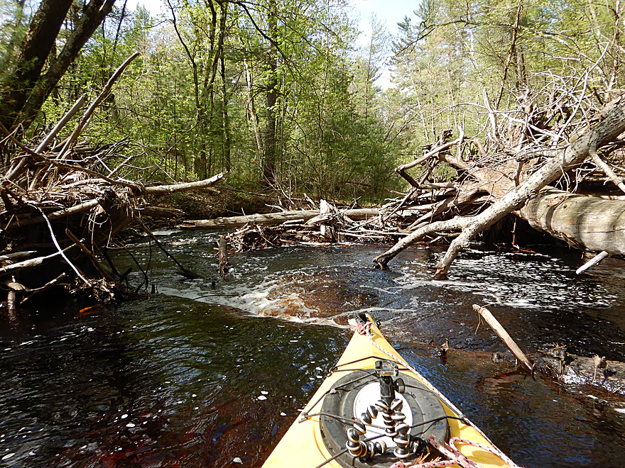
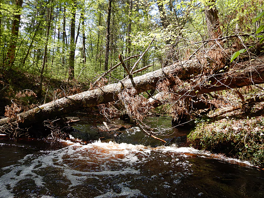
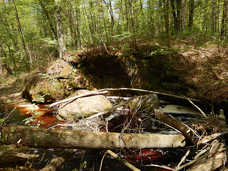
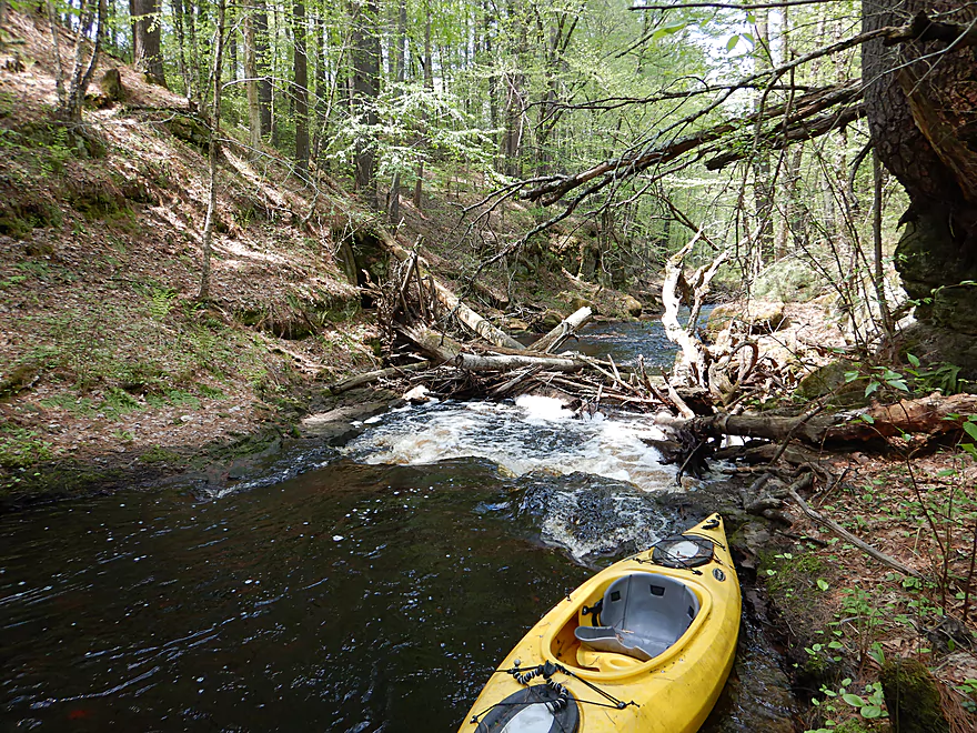
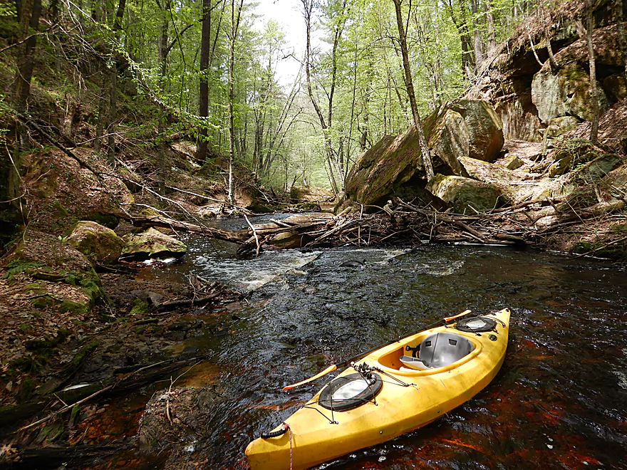
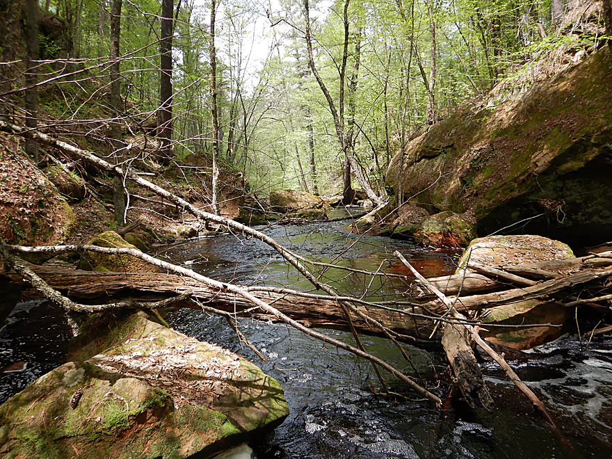
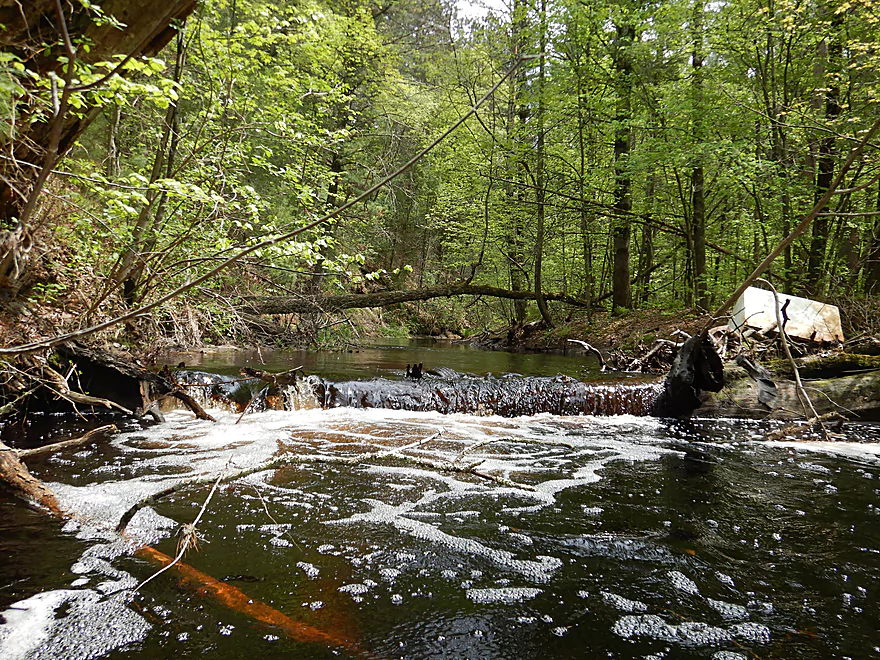
Many little dams created by downed trees
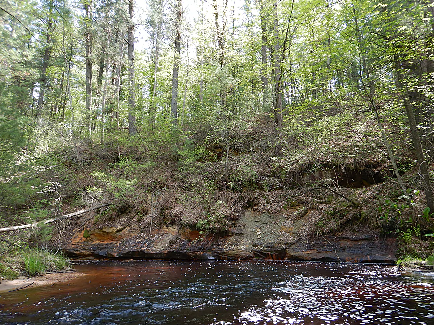
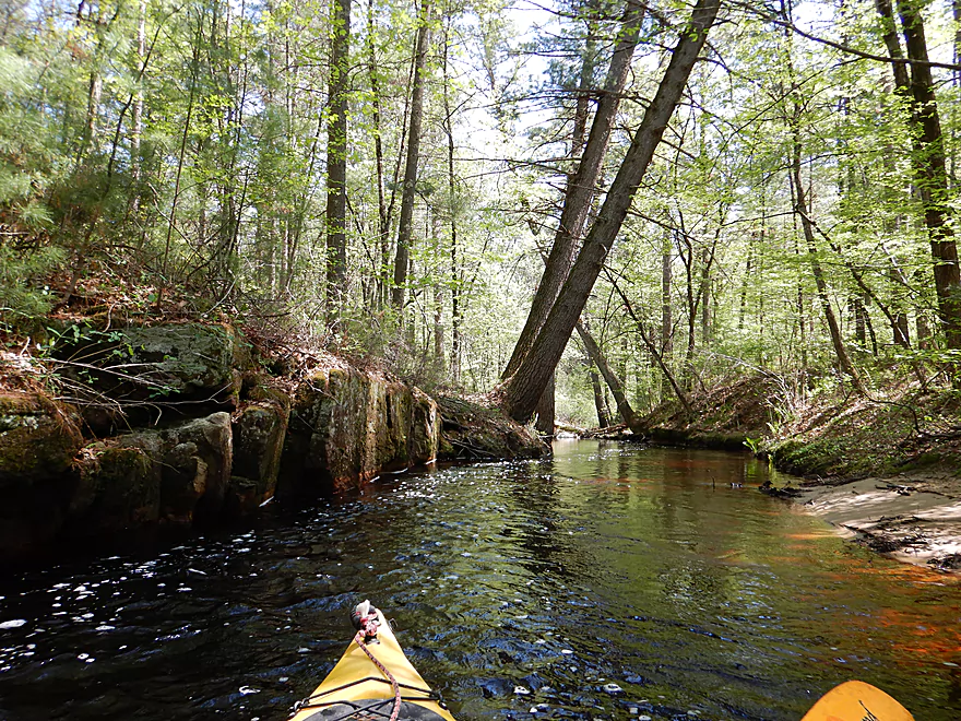
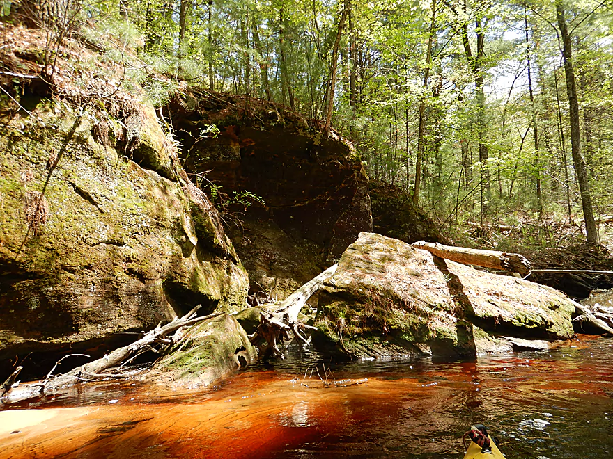
One of many sandstone walls
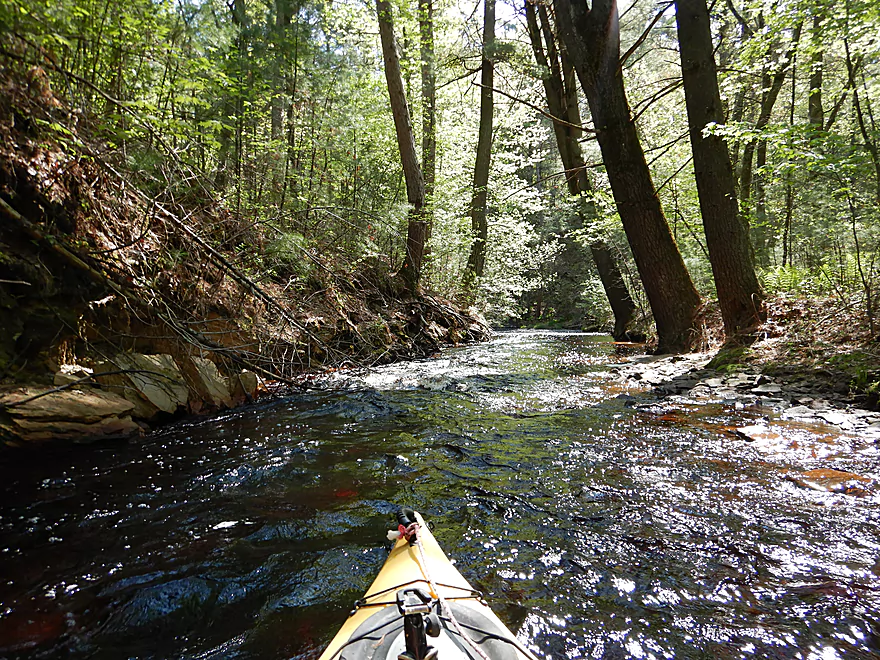
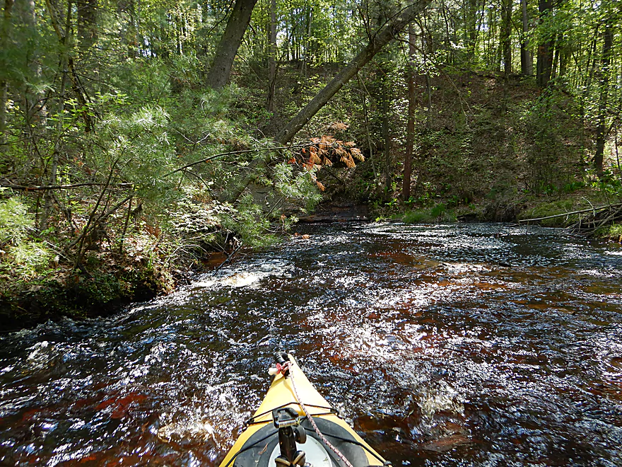
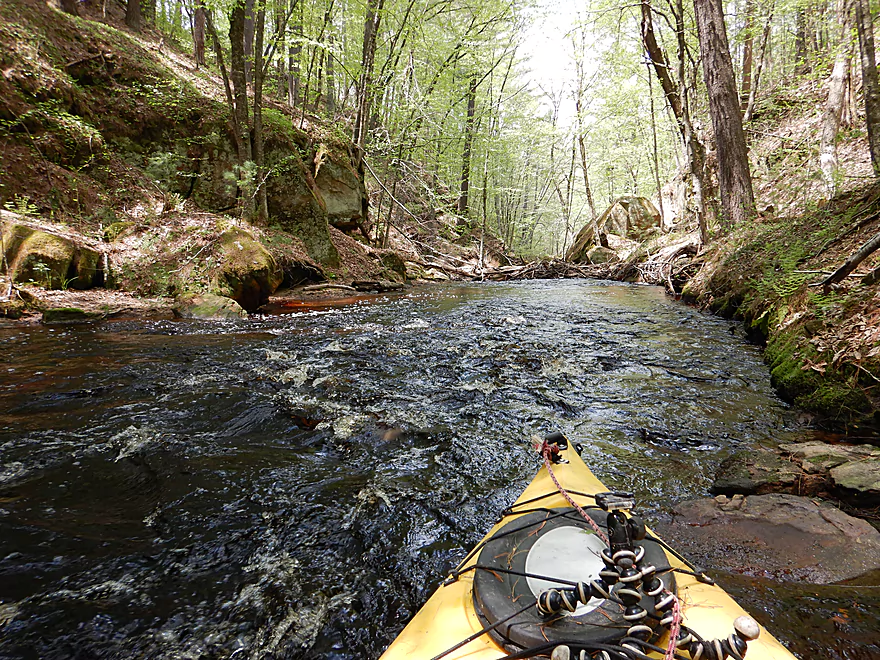
One of many light rapids
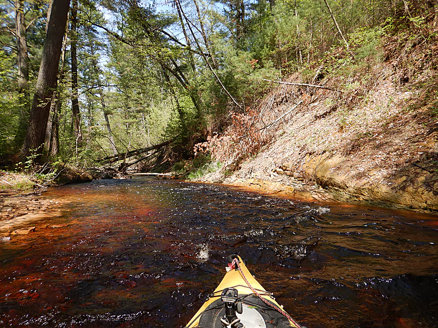
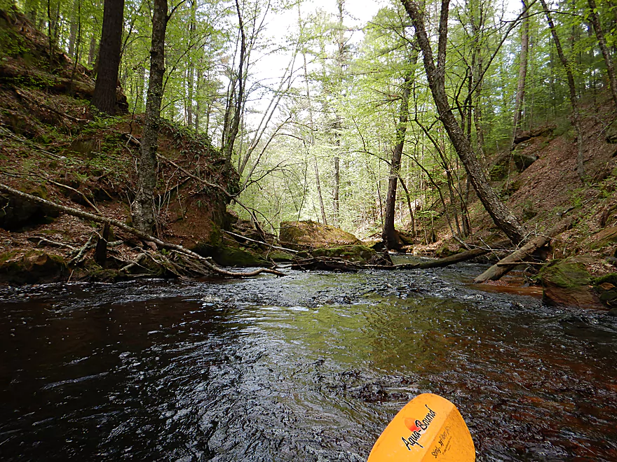
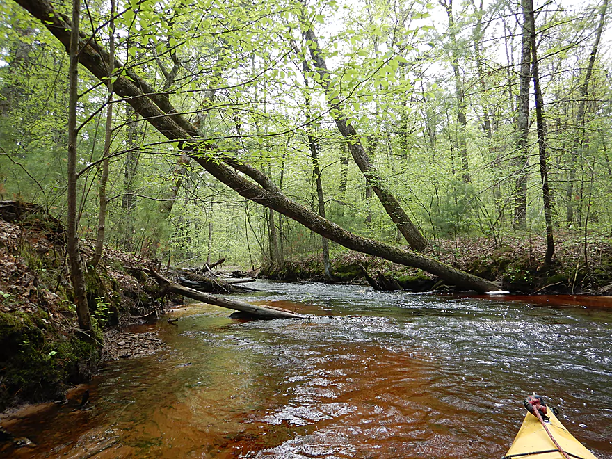
Very narrow creek
The rapids next to the sandstone reminded me of Robinson Creek
The creek drops at 30 feet per mile
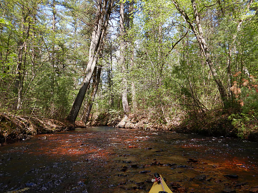
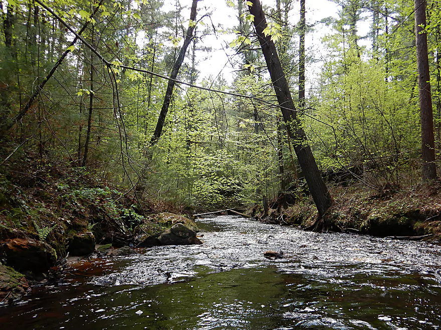
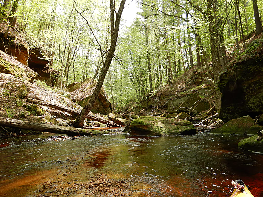
White pines towering over the creek (in places?) were fantastic
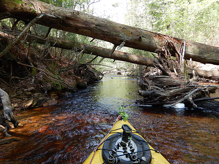
Sometimes you could go under the logjams
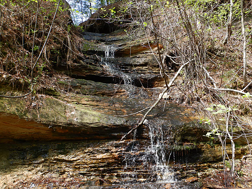
A neat little waterfall
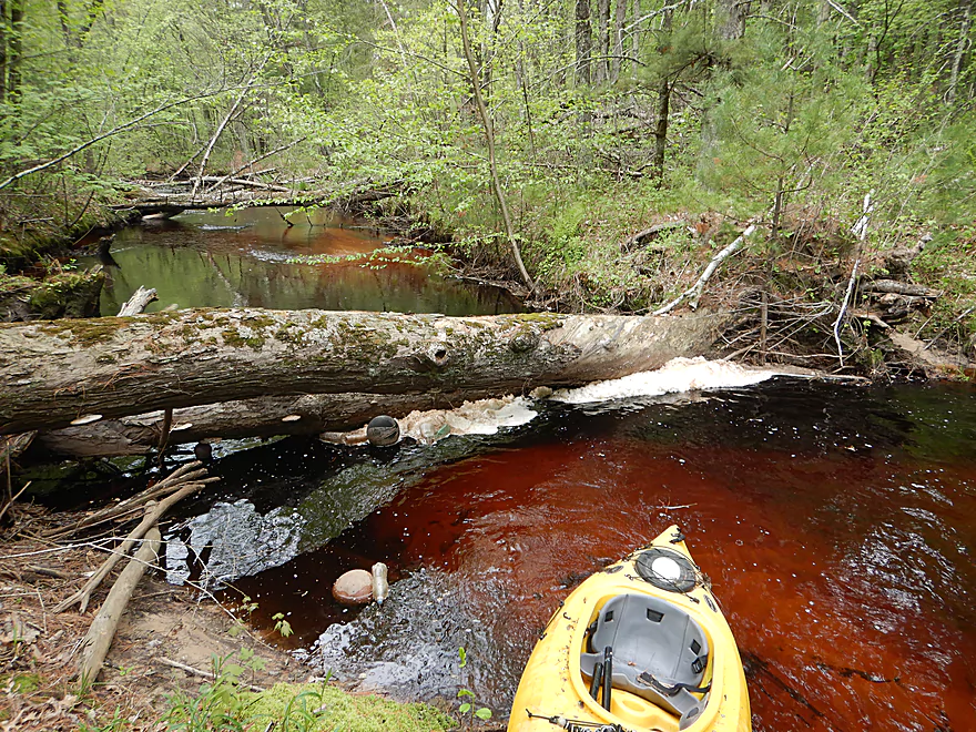
One of the steeper log dams
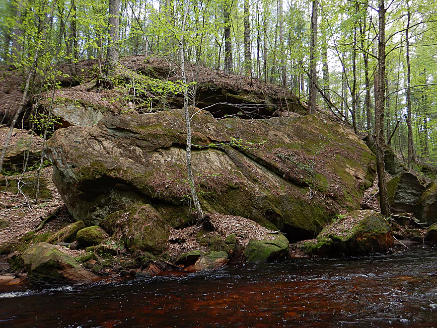
The largest sandstone wall on the trip
Which has a nasty logjam
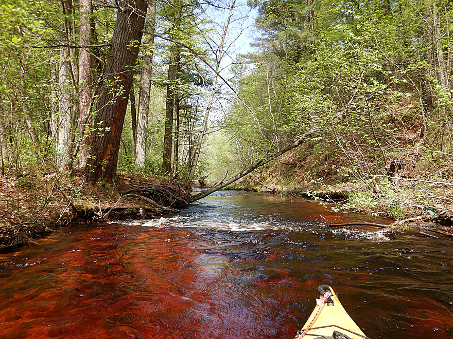
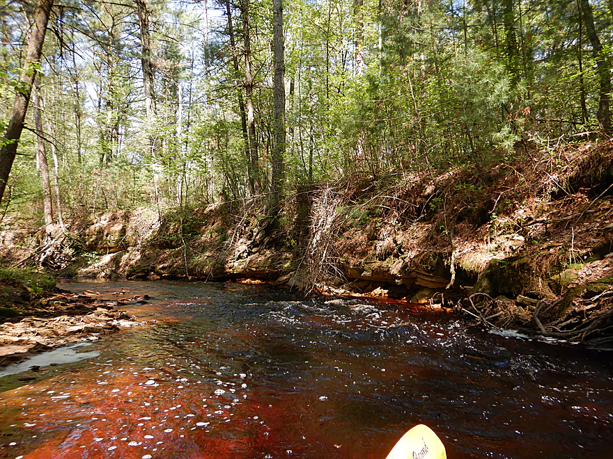
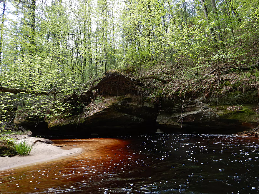
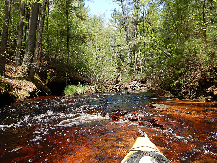
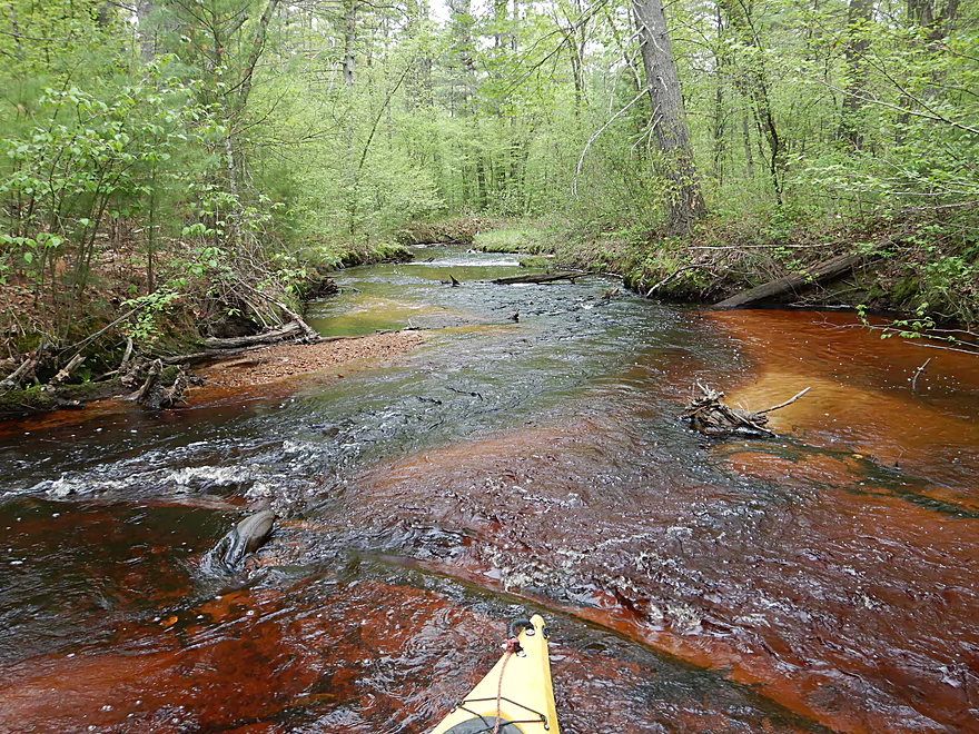
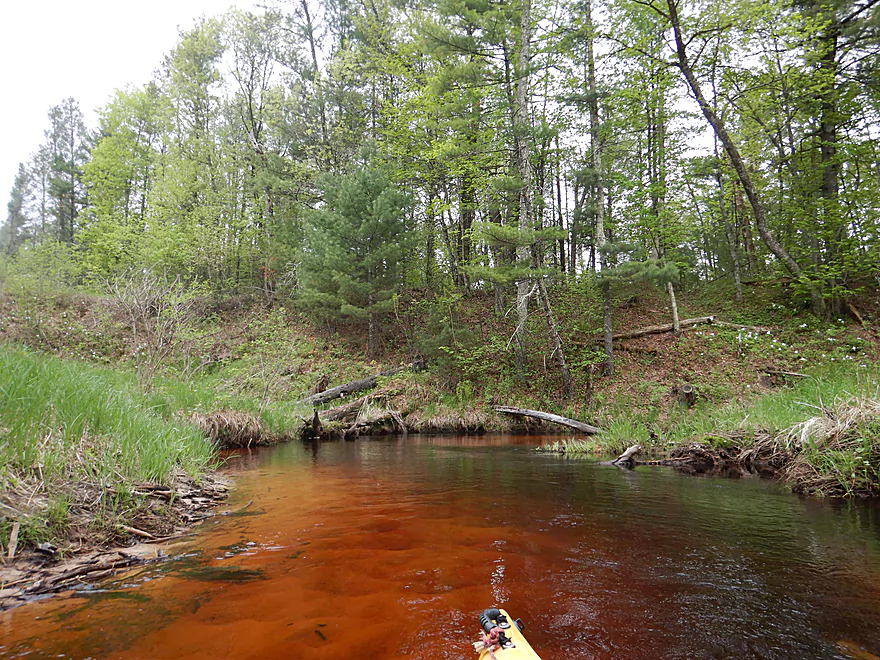
The water had an attractive red hue to it
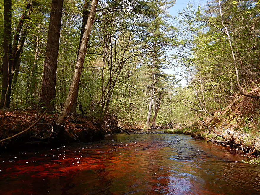
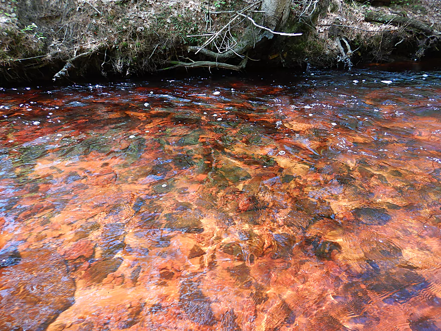
Very good clarity
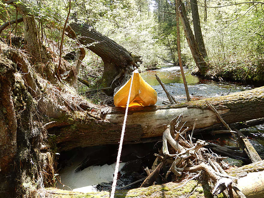
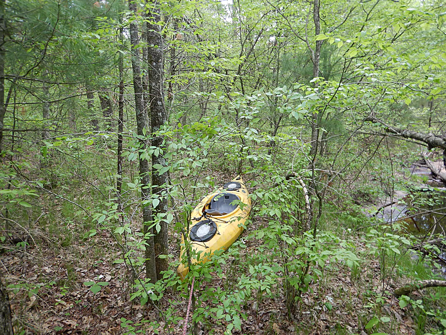
Not a fun portage
Rapids and sandstone ruined by a logjam
At times it was like paddling in a tunnel
I actually fit through that (not fun)
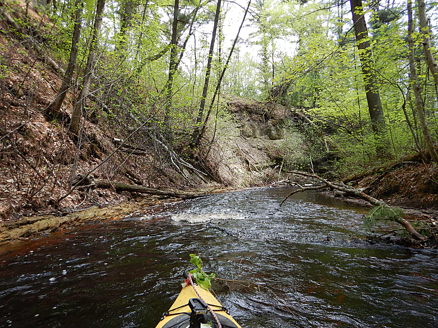
Maybe a third into the trip the geology gets much better
Sandstone equivalent to iceberg calving
A horrible logjam and a difficult portage
Being rewarded occasionally for all those bad portages
Poorly picutred, but there is a small cave under that overhang
Entering what I refer to as the dells
Nasty logjam and nasty portage
Wonderful scenery
Coming up on another mess
My favorite photo
I portaged far far left…super hard
Reverse view
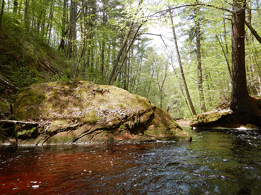
Huge boulder…reminded me of Morrison Creek
And that is about it for the dells
Logjams get very frequent from here forward
Still scenic, but a different character
Yes, that is a refrigerator
One logjam followed another…now typical
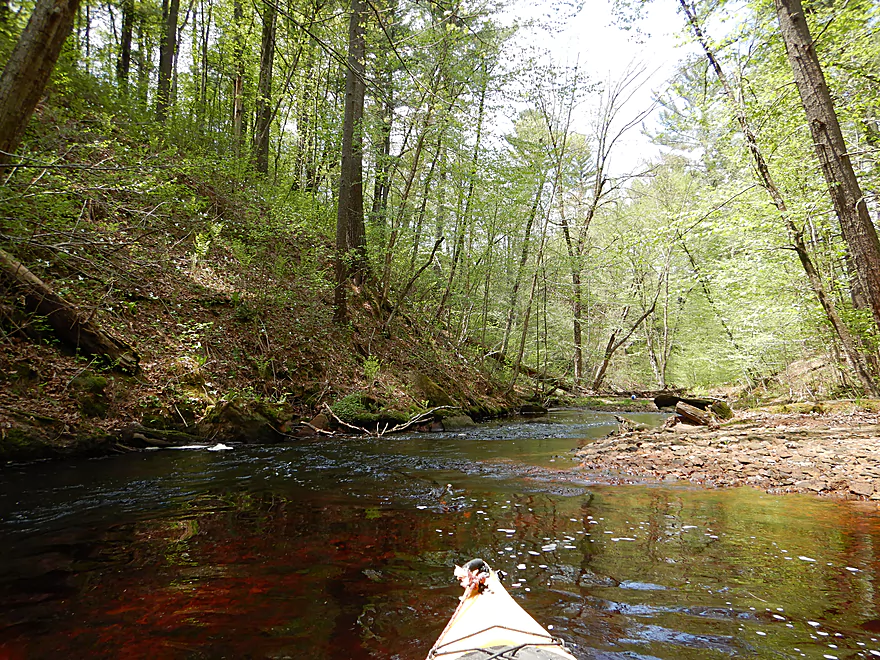
Still a nice creek
Where my paddle turned into a hike
The super portage was scenic at times
Trying to navigate on the creek without my paddle
The final mess which I portaged
Taking out at Pettibone Pass
Dickey Creek

The bridge put-in off Hwy K in the Black River State Forest was decent. Here was actually one of the highlights of the trip. After paddling directly under the bridge and over some rapids I encountered a 20′ wall of sandstone that made a sharp turn to the right. What made this special was its consistent curvature and arc which spanned for roughly 300′ over solid bedrock. If you’re in the area, consider checking it out which is easy to do from atop the bridge.
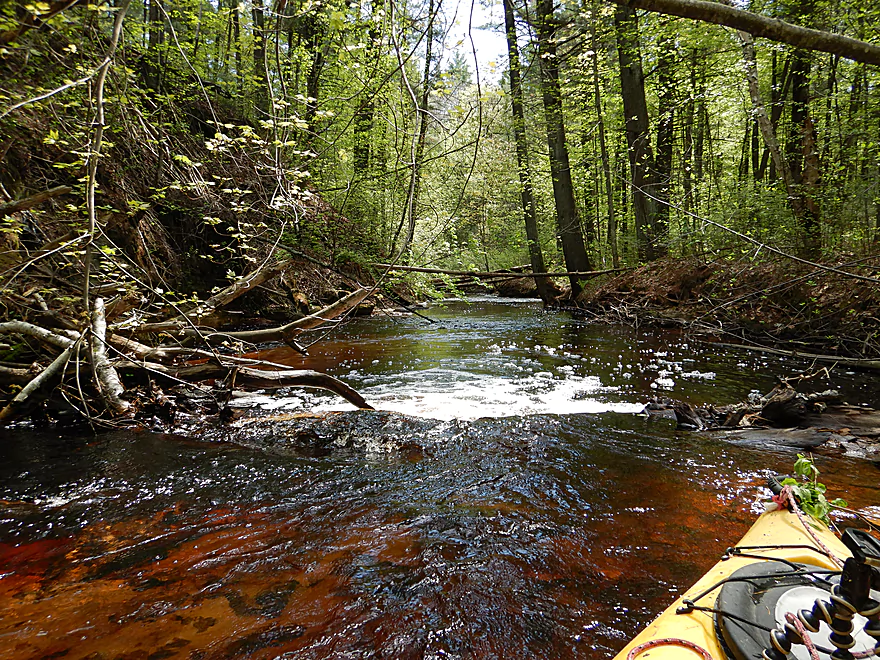
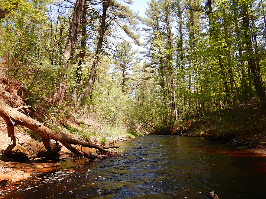
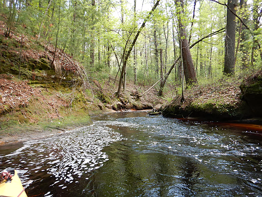
This was a small creek that was very narrow and fast. Dead and leaning trees were a frequent sight, which in the fast current, required sudden and difficult maneuvers to avoid. In the first mile I portaged maybe 8 times…some of which were tricky because the banks, while not muddy, could be steep and somewhat overgrown. I would often dread the sound of falling water, as I knew this meant a log dam with associated strainers. Take away the stupid logjams though and this was a fantastically scenic creek. The water was clear with a red tint and flowed over a mix of gravel, sand and even smooth bedrock. In contrast, massive white pines atop small sandstone outcrops towered overhead.
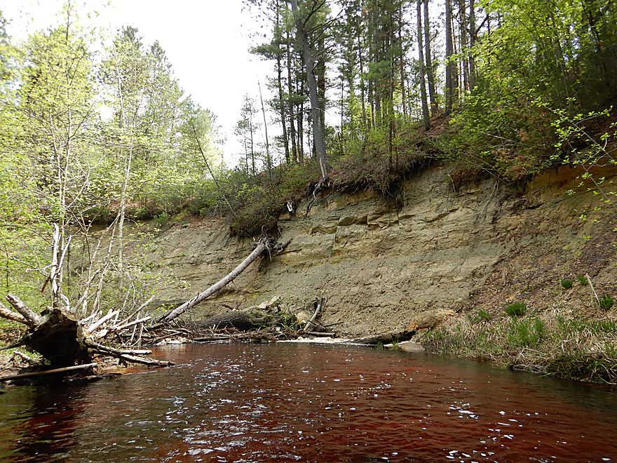
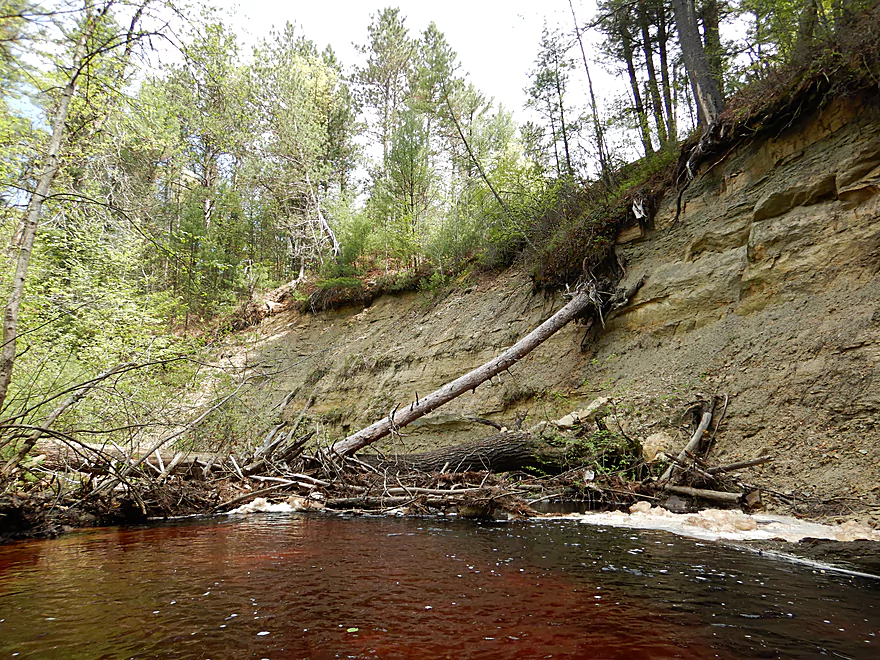
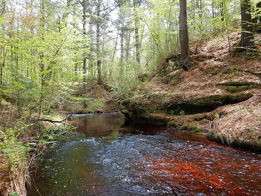
The middle portion of the trip was the best. After coming up on what I believe to be the sound of yet another logjam, I instead encountered a cool waterfall trickling down an exposed sandstone face. Not much more than a bathroom shower, but still a neat experience. On occasion the river would be redirected by flat, smooth banks of sandstone, with one larger one being maybe 40′ high. The sandstone outcrops started getting bigger and more vertical which coupled with the fast narrow channel and smooth bedrock, was very scenic. At times, the current would undercut the sandstone creating an overhang and a future caves in the making.
The highlight of the trip was what I dubbed ‘the Dells’. Here the sandstone outcrops were the largest and flanked both sides of the channel to form a ravine. While wonderfully scenic and filled with inviting rapids…there were logjams here that were problematic. The first required that I get out on the right bank and scale a steep hill to get around one nasty mess. The second was more difficult. A downed tree blocked the main channel and the banks were too steep to practically scale. Instead I hoisted my boat over two narrow boulders and made a difficult re-entry in somewhat deep water and fast current.
Following the dells, the creek stays scenic with a few outcrops, but really it lost most of its geology at that point. This was the low point of the trip as the logjams here because too numerous to deal with and I had to walk much of the final half mile on foot. I was in a pretty grumpy mood at that point…as it is not an easy task to drag a boat a long distance through a woods. I was also being hounded by mosquitoes, scratched by nettles, had open blisters from my towing rope, my clothes were wet and significantly ripped, and somewhere along my mega-portage my 100 dollar paddle popped out of the cockpit and I lost it. I backtracked and looked for it a bit…but my portage area was so large, this proved futile.
Judging the creek in hindsight is somewhat tricky. This is in essence the south branch of Morrison Creek, which is a famous paddling creek in its own right and among the best in the state. But Dickey Creek was actually more scenic. Take away the logjams and this is a five star trip and among the best I’ve ever done. But the logjams are a reality and there are just too many for me to recommend this for casual paddlers. Perhaps one day word will get out what a cool creek Dickey is and the two big local landowners (Ho-Chunk and the State of Wisconsin) will get together to create a scenic nature path along the creek. This path could also be used to clean out the unfortunate garbage and allow for cleanup teams to make the creek navigable.
Special thanks to two anonymous posters on AmericanWhitewater.org who warned about the logjams in their write-ups, but I unfortunately didn’t take them seriously.
Hwy K is on a steep embankment, but there is a doable path (well drainage ditch) northeast of the bridge which leads to the water. The adjacent land is part of the Black River State Forest.
An alternate upstream put-in might be Hwy 54, which would add 2.0 miles to the trip. This upstream section likely has fewer logjams and less geology…I just don’t know if it is practical to run.
The bridge take-out at Pettibone Pass was decent, although the shoulders were a tad narrow for parking.
An alternate downstream take-out would be to continue one more mile to the mouths of Morrison Creek and then the Black River, where there is a public canoe landing. I don’t advise this. That last little bit of Dickey Creek is likely clogged with jams and would offer no scenic value or geology. The canoe landing is also not the greatest…the access road is rough and rutted, and the Black river frequently submerges the landing and the access road.
The bike shuttle was super easy…only 1.5 miles and just one hill (98′) to climb. A hiking shuttle is certainly an option.
The shuttle route goes through Winnebago Mission which is one of the largest Ho-Chunk communities in the state. Many homes had dogs and quite a few ran after me on my bike. In one instance a boy came out to I assumed reign in his chasing dog…but in a perfect Nelson Muntz impression pointed at me and said “ha ha”. He even looked like Nelson…
I find the key in dealing with chasing dogs is to never give them eye contact which they see as a challenge. Also keep up a good pace (most domestic pooches are lazy and out of shape).
This is a consistently fast creek that falls at an incredible 32′ per mile. This results in many Class 1 rapids and some Class 2s. Any degree of whitewater difficulty comes not from the rocks, but from the deadfall. Often a fallen log would create a little dam, which was navigable at times, but at other times created a big problem as they were frequently combined with nearby stainers which were tough to avoid.
So how many logjams were there? I was going to count, but gave up partway into the trip. Roughly speaking for the first 1.5 miles, there was perhaps one significant jam every 800′. But in the last half mile and right after the dells it got much worse. Perhaps one every 100′.
Not all logjams are created equal. Some were easy…you could duck under them, hop over them, or lead your boat through in shallow water. But quite a few of the portages weren’t easy. While there wasn’t a lot of mud, the banks could be quite steep and congested with undergrowth. Most of the time it was easy to get out, but at times, I had to backpaddle in swift current to reach a suitable take-out location that wasn’t too deep and fast. Finding a reentry location proved tricky as well. The most difficult portages were in the dells. The first required I drag my boat up a 20′ embankment to get around (and on top of) the dells to avoid one nasty mess. The second portage in the dells had me trying to launch a boat between too narrow rocks in fast current and poor footing.
After the dells, the portages became too numerous and I ended up dragging my boat the final half mile to the take-out.
Dickey Creek is a whitewater creek and can be bumpy during low flow rates. But attempting the stretch and its many portages in high water could not only be tricky but actually dangerous. I advise to shoot for a low flow rate to make the portages easier. There isn’t a local gauge nor an approximate one I trust. The East Fork gauge will have to do but it is a much larger stream and only somewhat correlative.
- 891′ to 892′: A very shallow depth. Likely this will require a lot of wading, but will make the portages easier to deal with.
- 892′ to 892.5′: An average depth.
- 892.5 to 893: An above average depth in which can make navigating through the strainers trying.
- 893′ to 894′: This is a high depth and could make navigating the strainers and portages difficult. This trip was done at 893.6′.
- 894′ and up: I suspect this would be too high and might be dangerous.
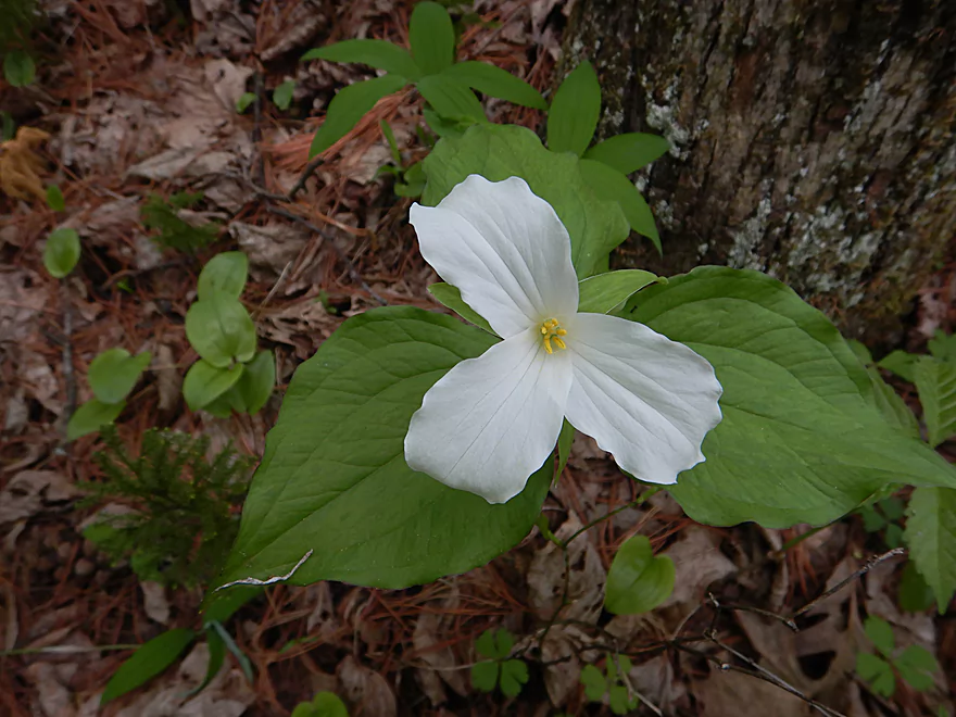
Surprisingly little…some frogs, one snake, and many mosquitoes. The plant life was more interesting with ferns, skunk cabbage, and wildflowers being common sights along the banks. All of which I had a great view of when I was doing my many portages.
- Hwy 54 to Hwy K: 2.0 miles. Likely less logjams but also less geology. This is an interesting prospect, but I’m worried about the creek’s small size and obstacles.
- Hwy K to Pettibone Pass: 2.2 miles. Stunning scenery but too many logjams to recommend. Reviewed here.
- Pettibone Pass to mouth on Morrison Creek: 0.25 miles. Likely a bad section clogged with logjams and no interesting geology.
- Morrison Creek to mouth on Black River: 0.7 miles. This short little section on Morrison Creek isn’t special, but shouldn’t have logjams. Just as you enter the Black River, you will see the landing on the left, which is doable, but requires driving on a rough road to reach. Reviewed May 2014.
For more information on Morrison Creek, click here.
For more information on the Black River below the Hatfield Powerhouse, click here.
Trip Map
Video
Photos Size:
I was wondering if this was paddle able just the other day when I was photographing Morrison Creek. Thanks for the review. Even tho it looks to be a tough time. I’d sure like to shoot what you refer to as the dells.
Photographing just the dells might be possible. There is a ravine just after the dells, which the locals (the Ho-Chunk) use to access the creek. You might contact the local Ho-chunk government and ask if you can use their land to access the creek.
Wow, this looks like a fantastic fishing stream, might have to look into this. Thanks for the photos!