
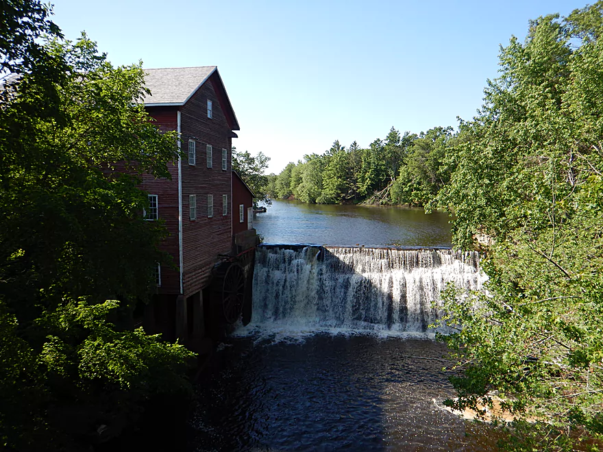
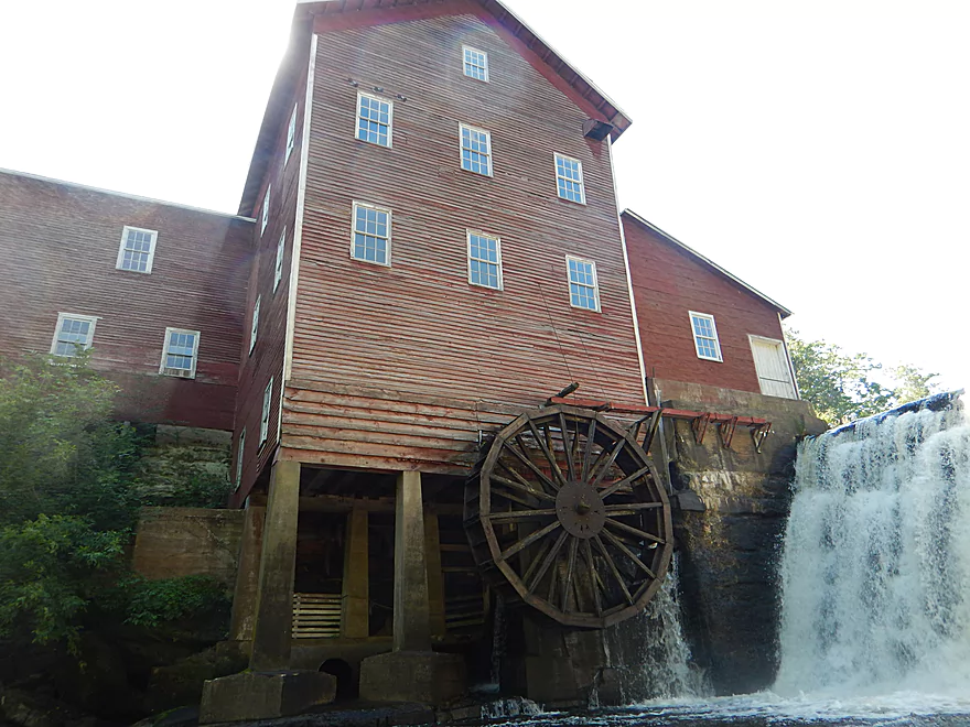
A scenic mill and dam overlook the creek
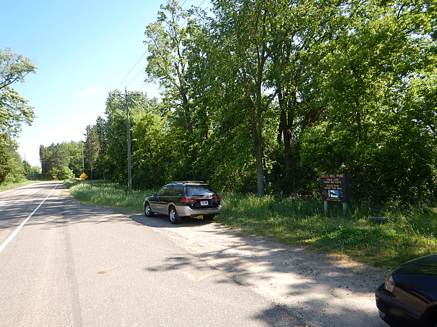
There is a public parking lot for the mill pond you can use
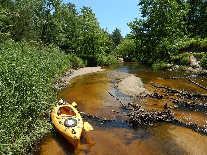
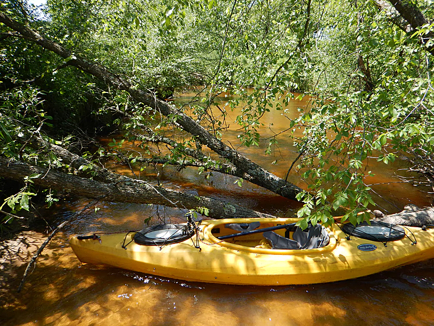
Locals were really nice and let me launch from their yard
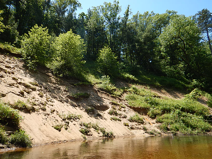
Steep incline leading to the water
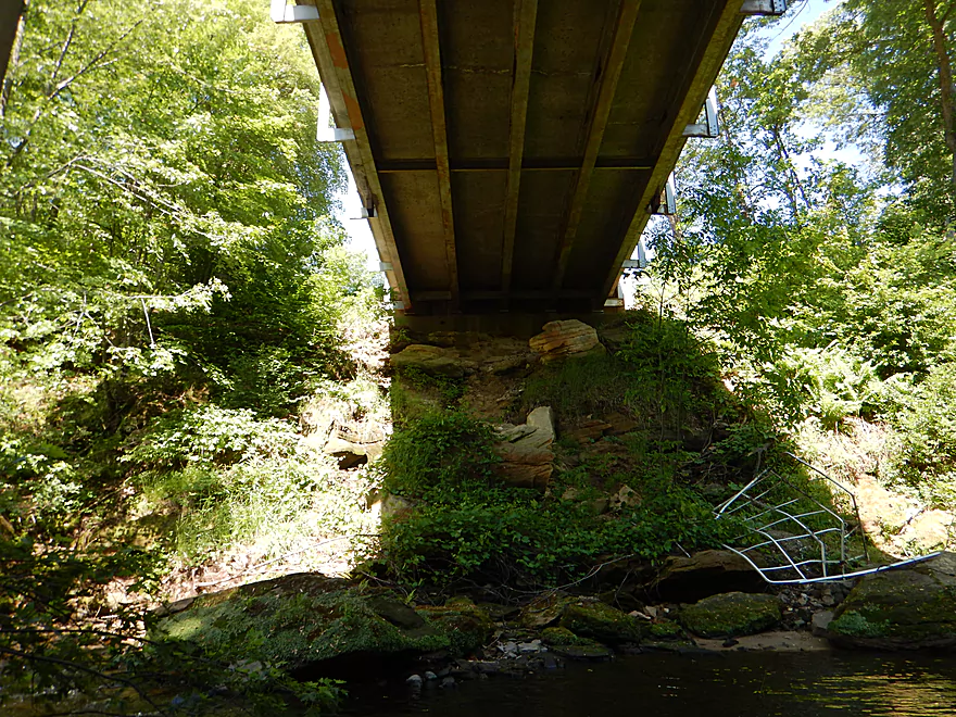
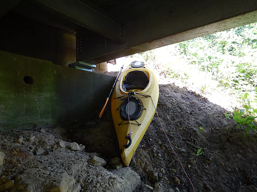
It helps to have rope
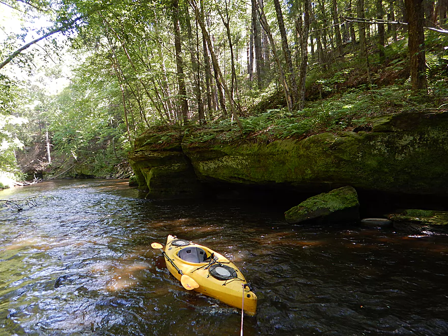
Finally on the water…checking out the old watermill
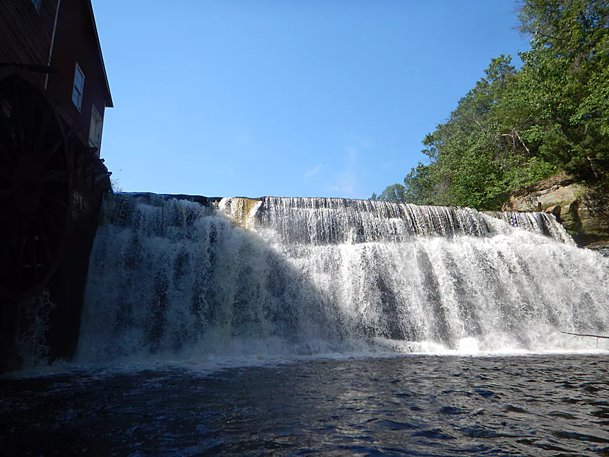
Dam kicked up so much spray it was like rain
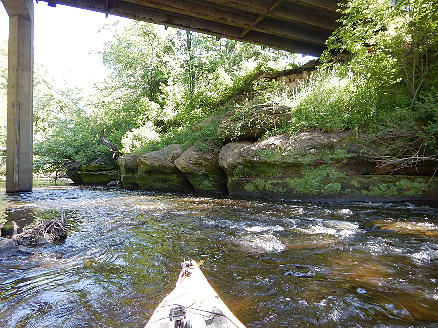
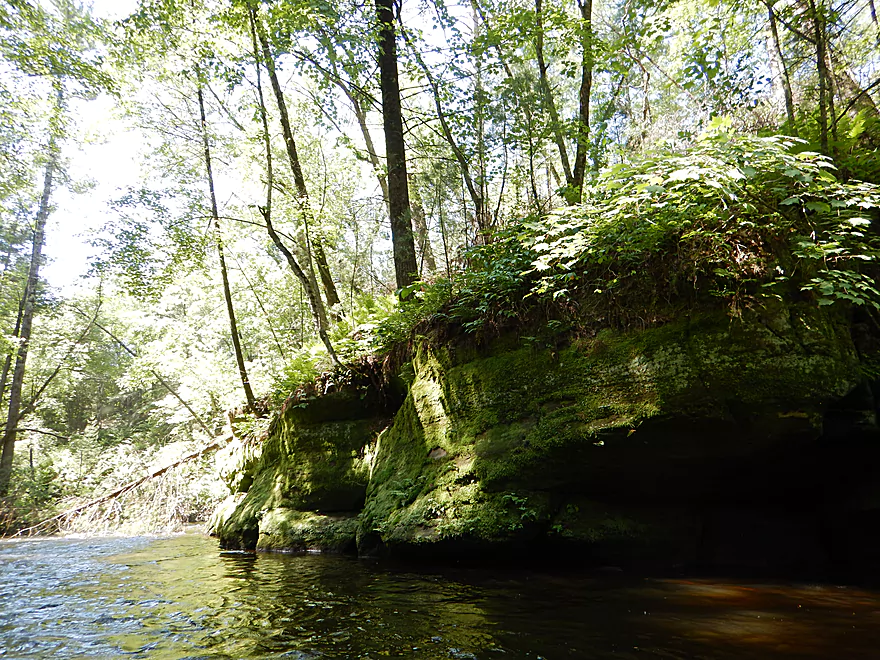
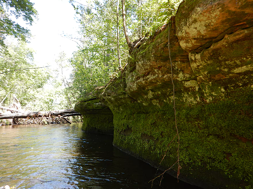
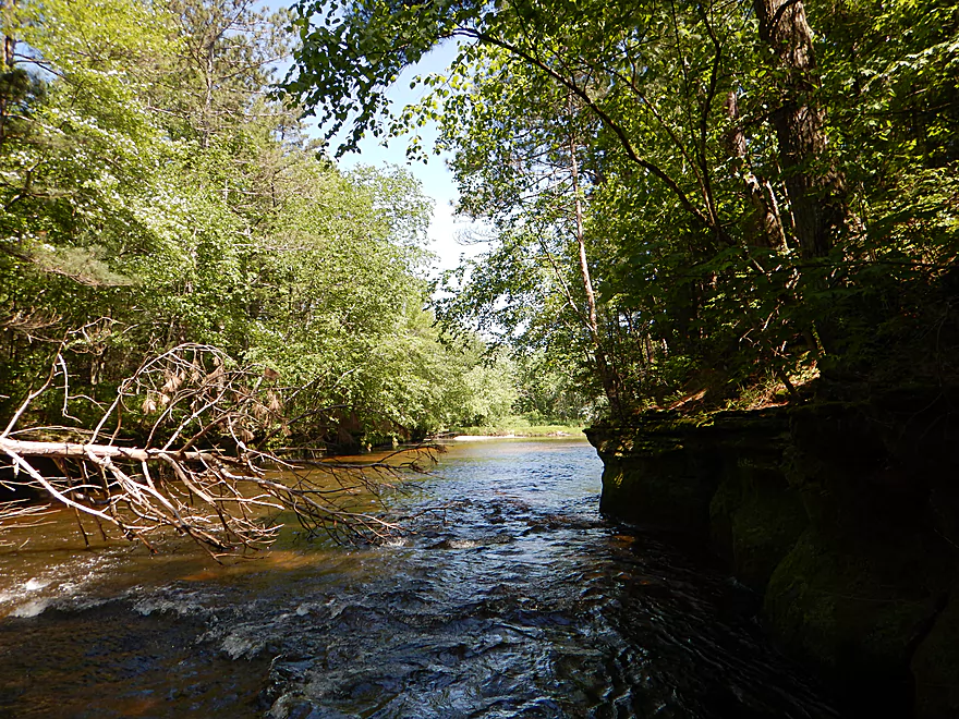
Some nice little outcrops under the bridge
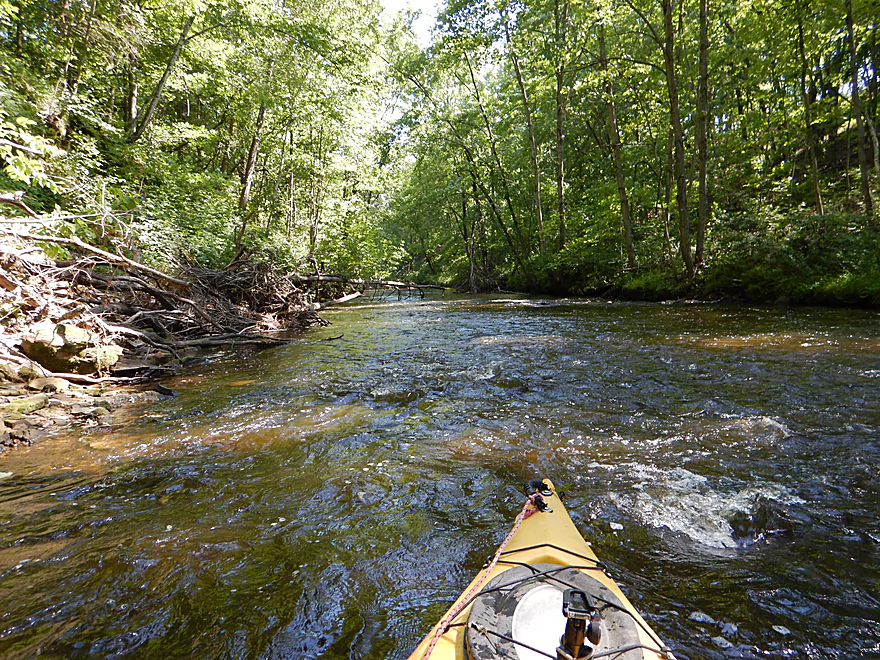
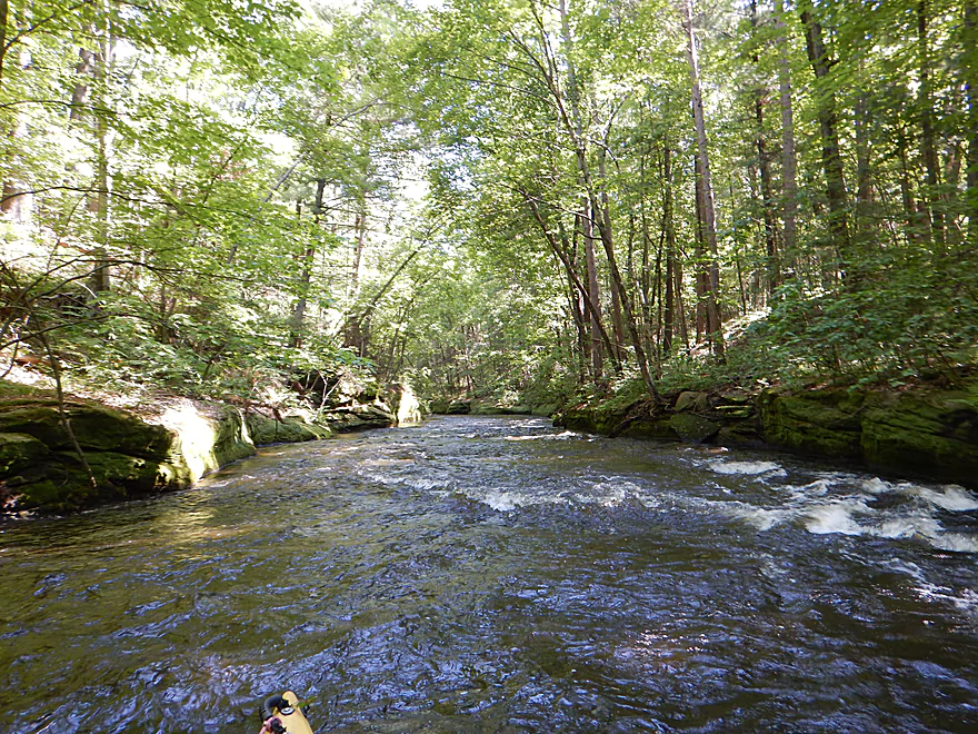
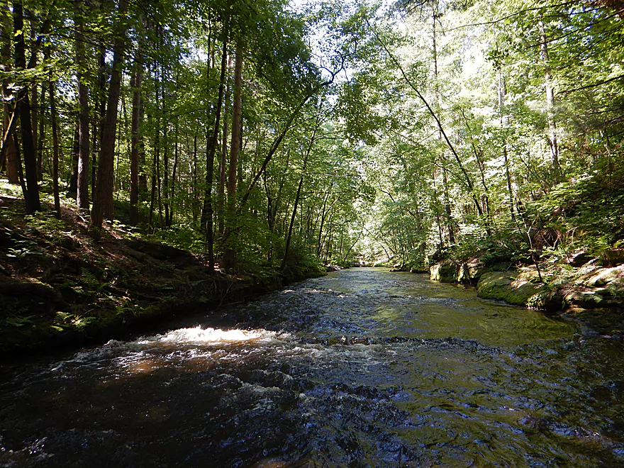
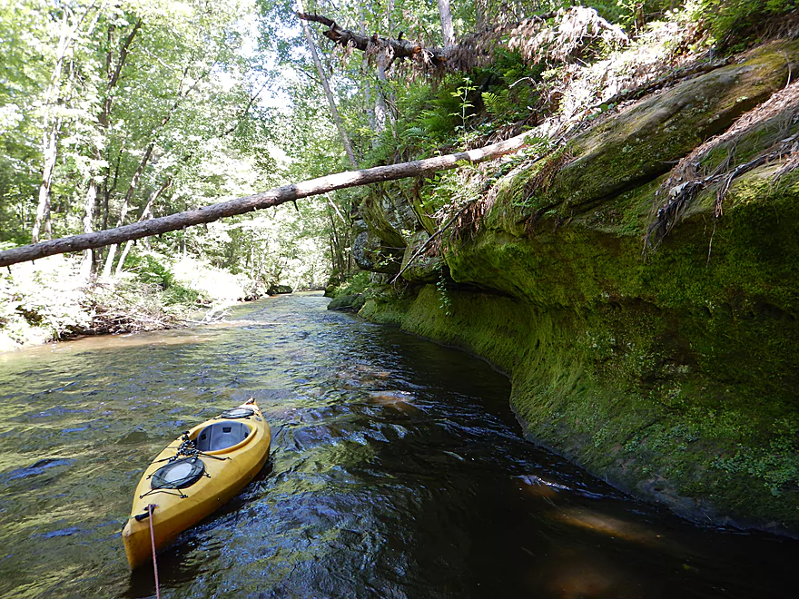
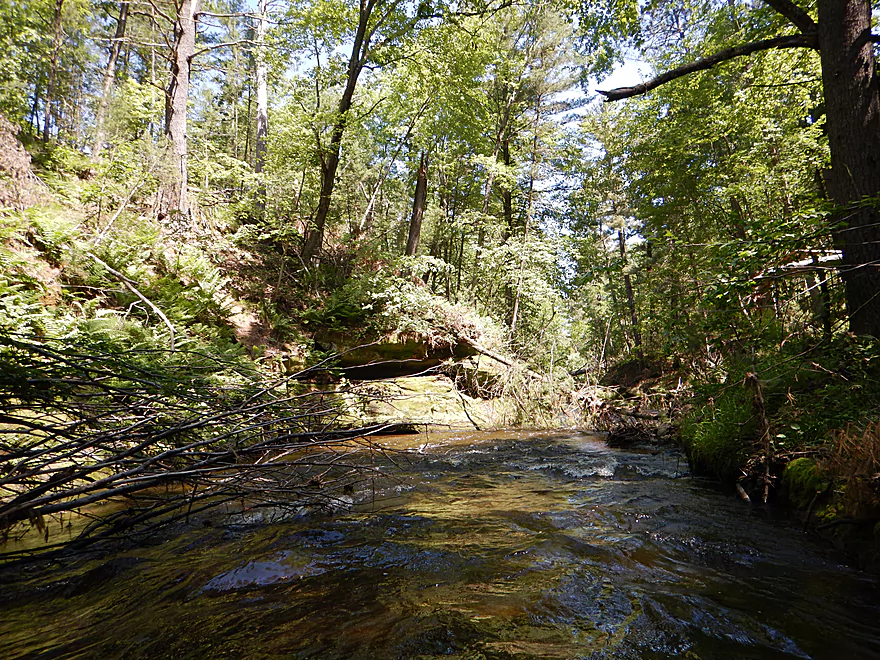
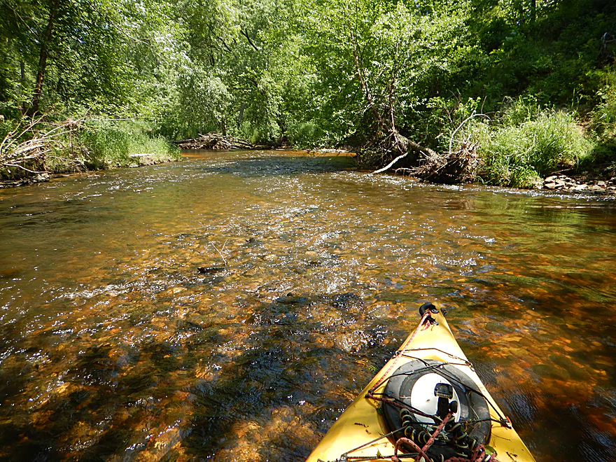
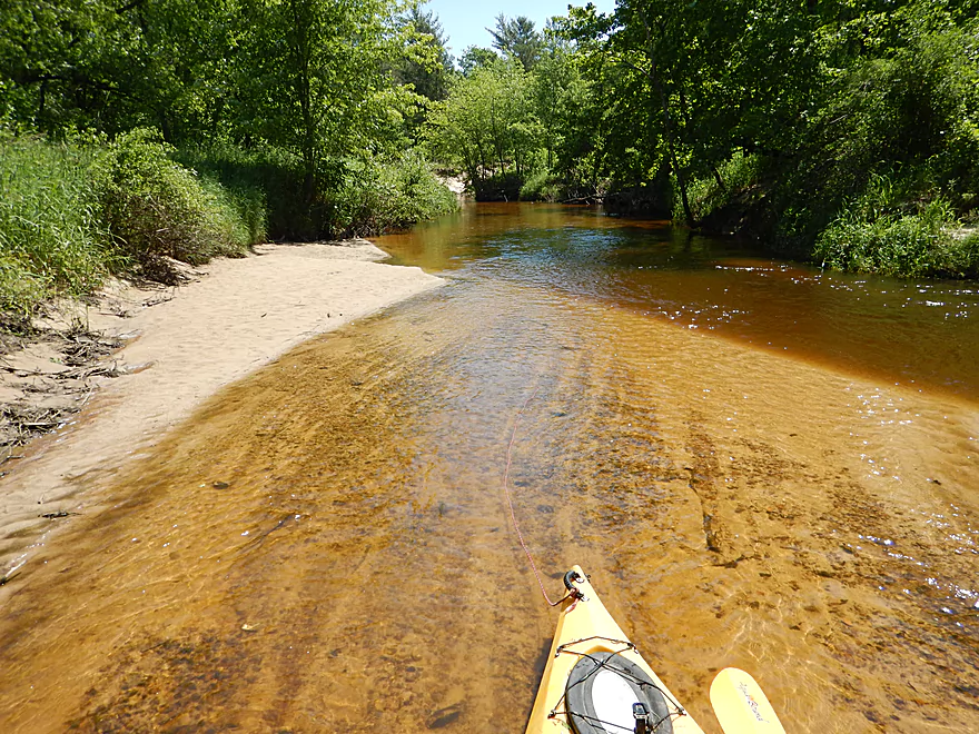
Finally starting the trip
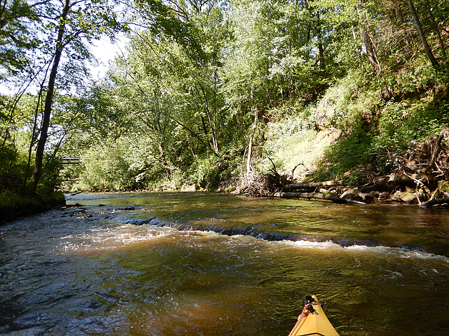
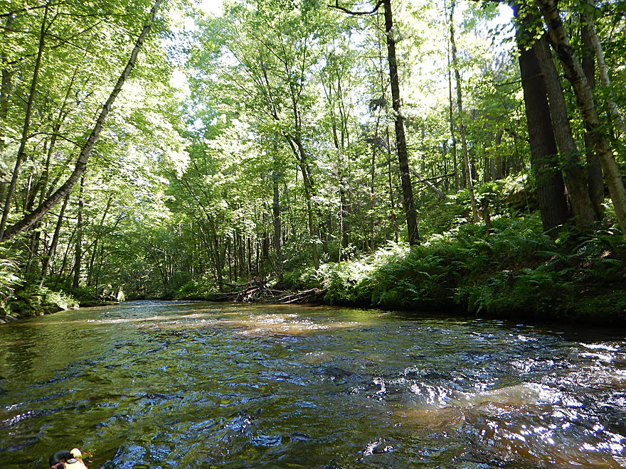
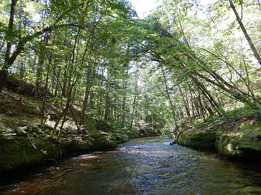
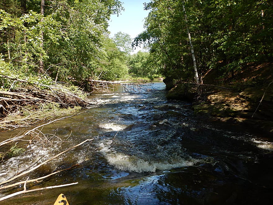
A fast creek…one of several small ledges
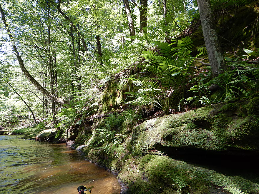
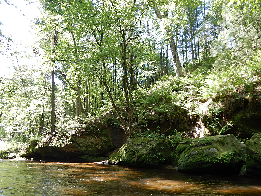
Lot of ferns
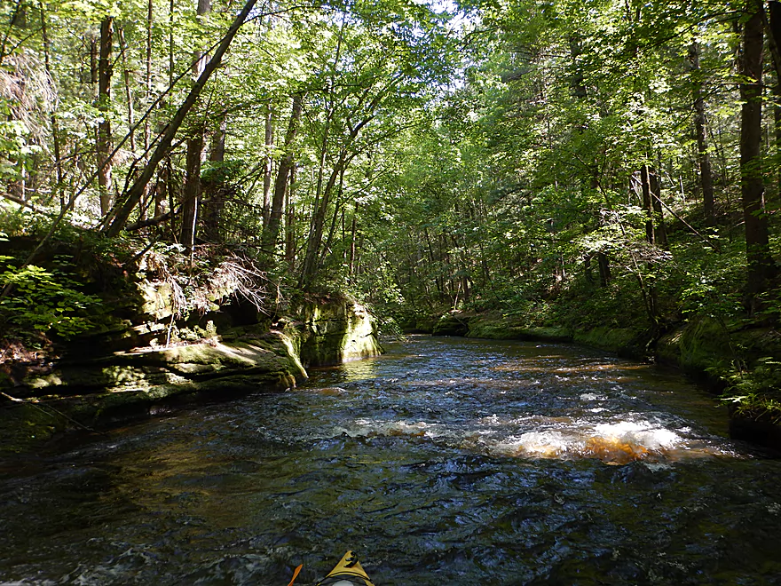
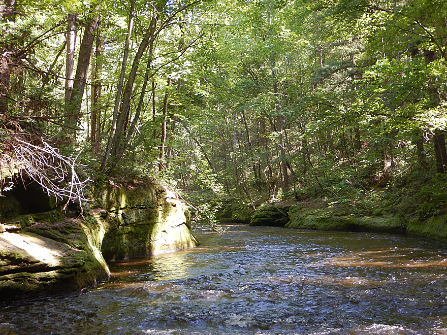
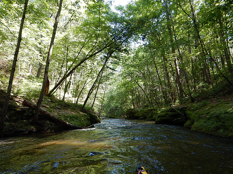
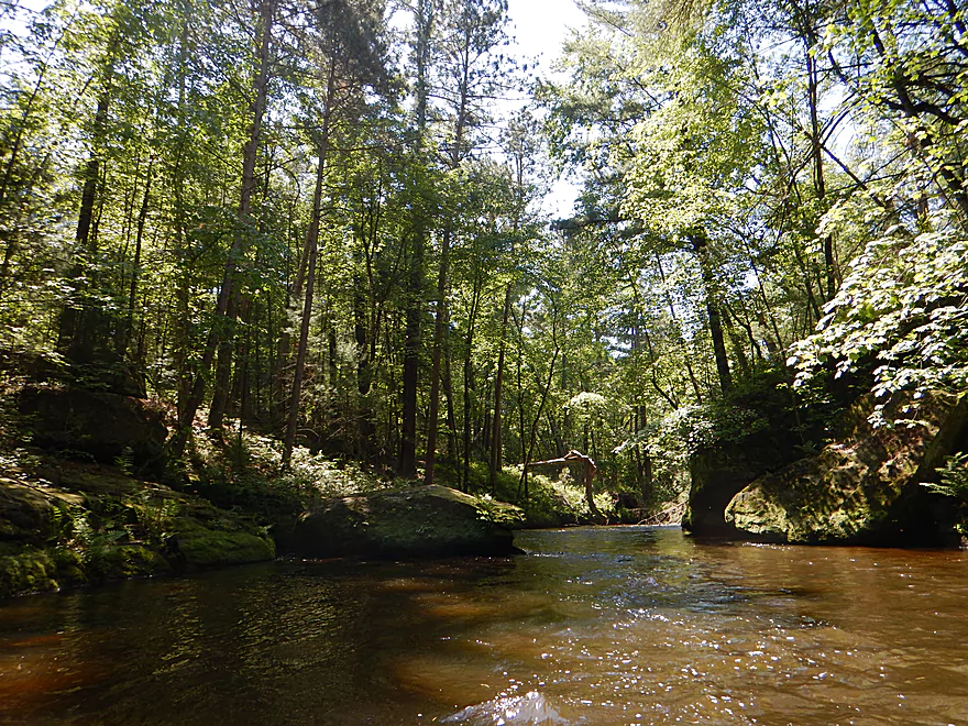
Entering the main dells
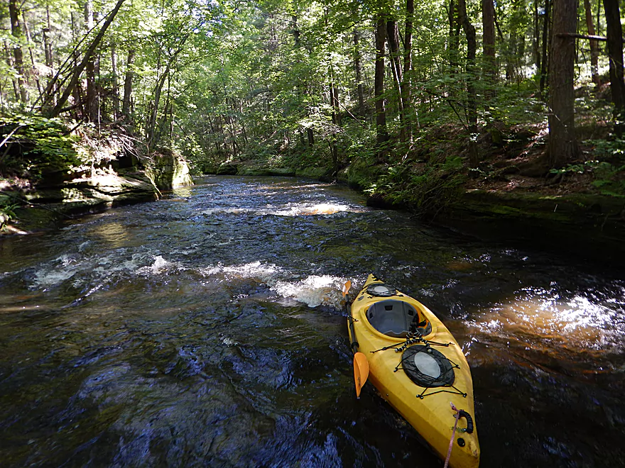
Getting out for photos
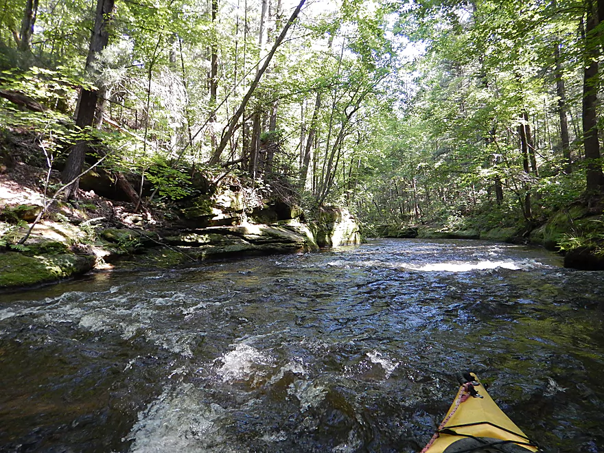
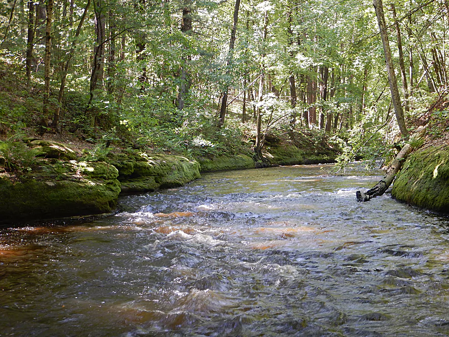
Fun safe rapids
Looking back
The dells keep wrapping around the bend
Looking back
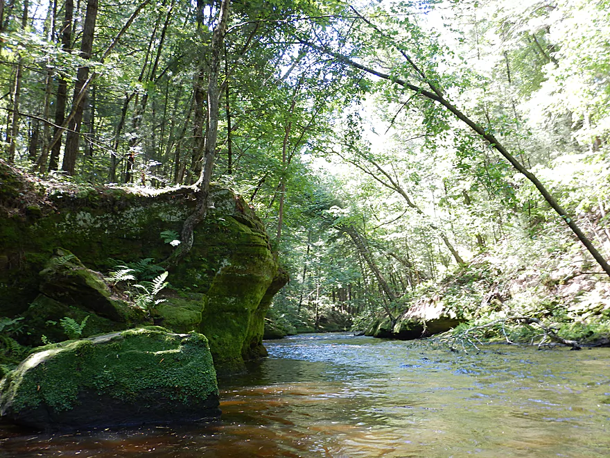
Very scenic and reminded me of Halls Creek
The trees are slowly destroying the dells
More nice ferns
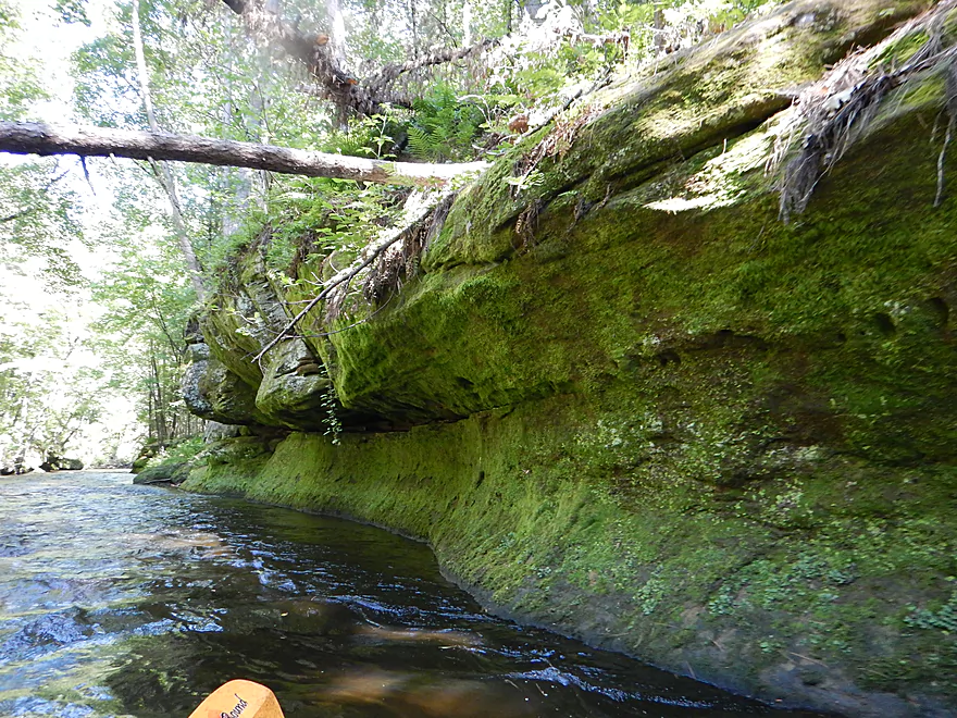
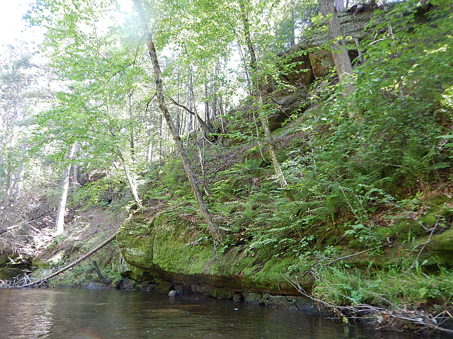
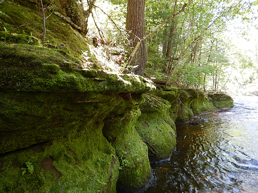
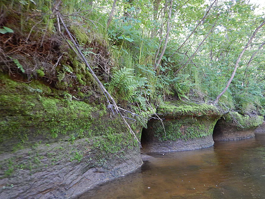
Some serious undercutting
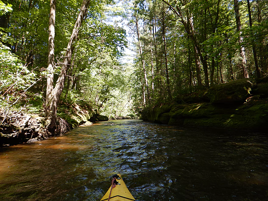
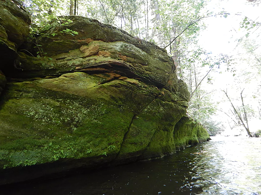
The dells were never super big but always nice
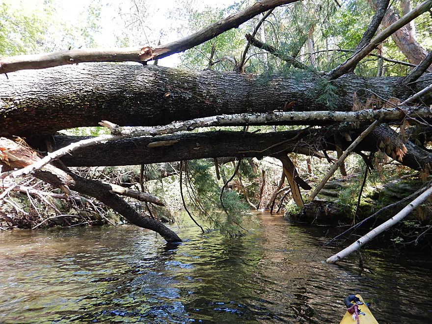
Fast current pushing me into a strainer
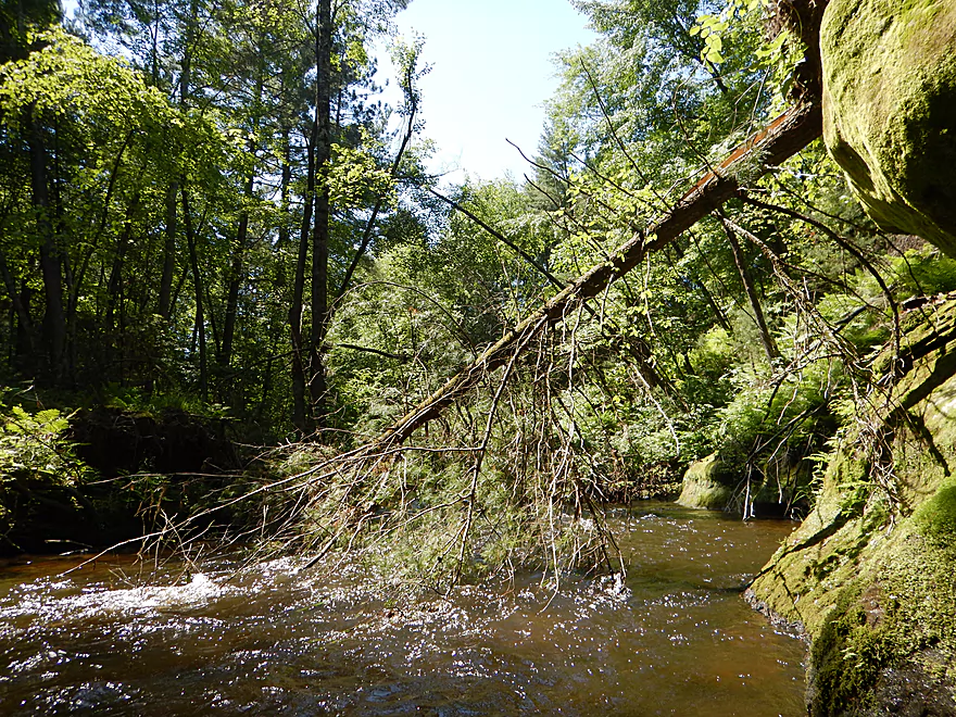
Doable, but stay on your toes
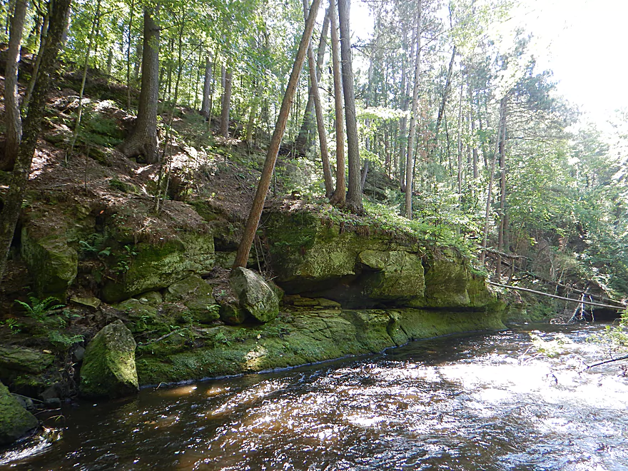
Some massive boulders
Frequently, the dells protected the channel from jams
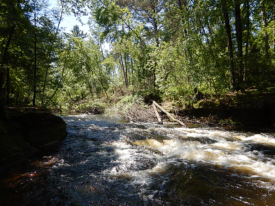
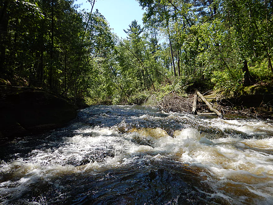
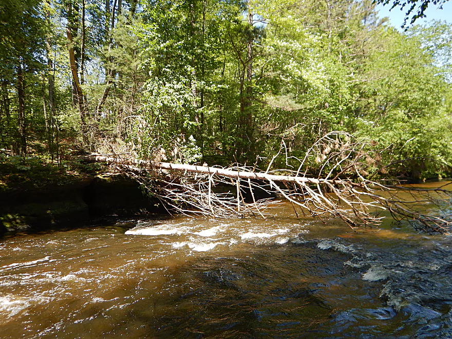
Strongest rapids on the trip
Portaging does not seem like an option
Reverse view
Different angle
Do not get pushed left
Instead, stay right
The last of the dells
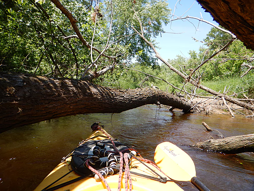
A deceptively tricky strainer
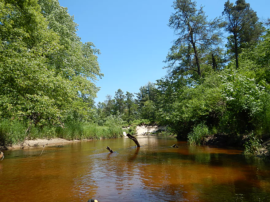
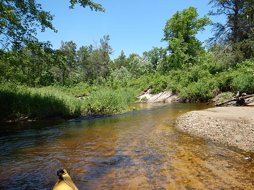
Creek starts to get shallow
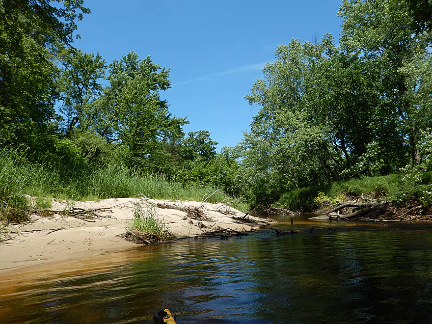
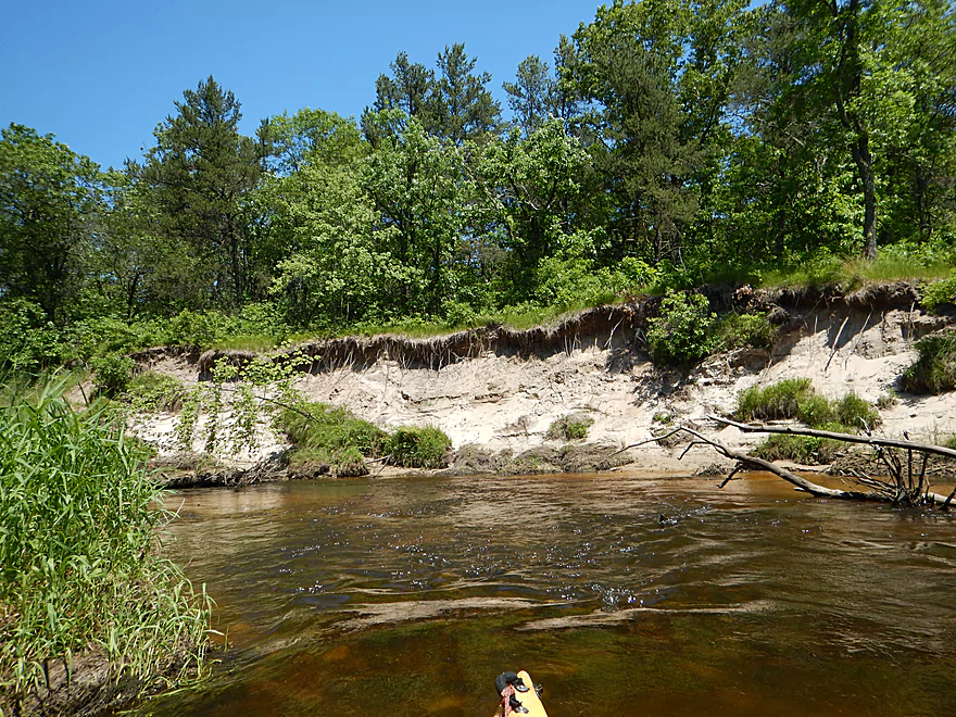
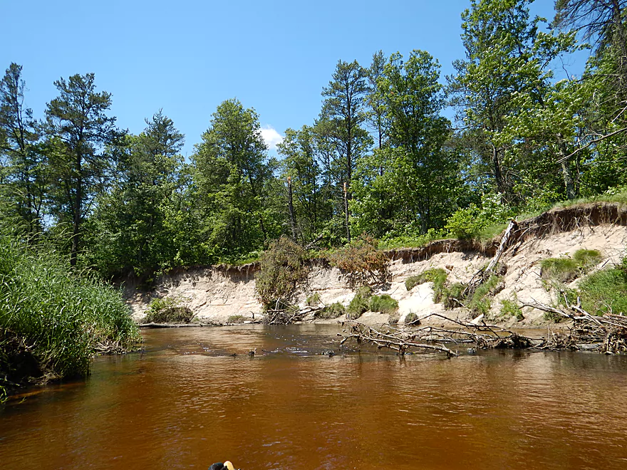
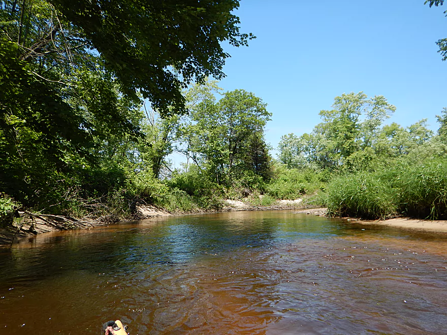
Lot of sandbars on the bottomlands
White pines going for a toboggan ride
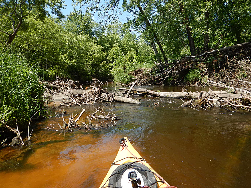
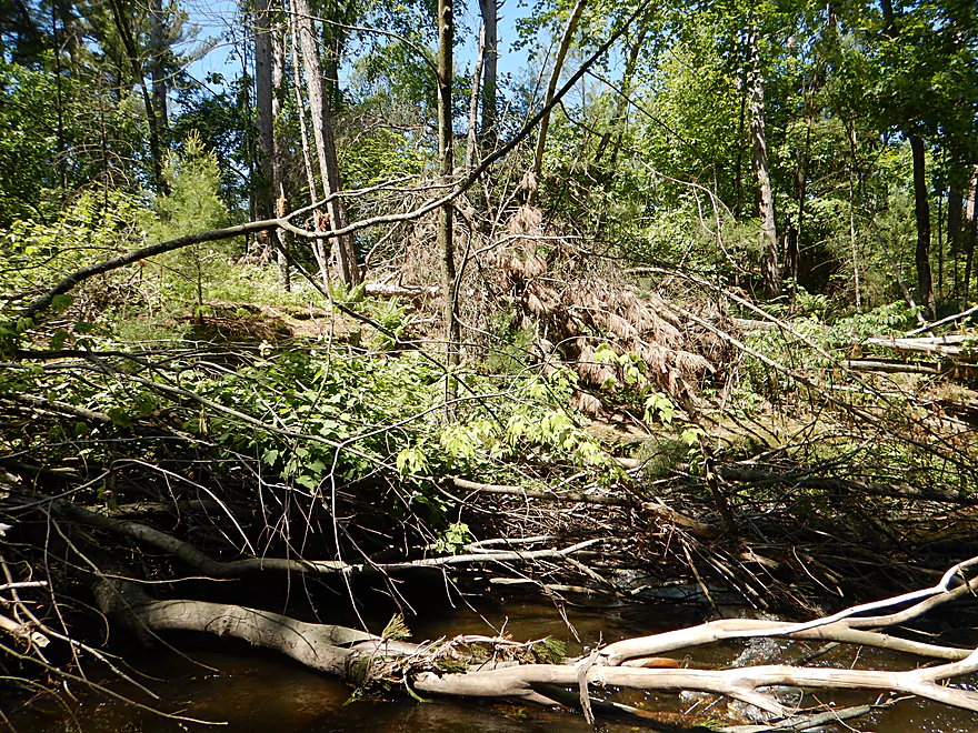
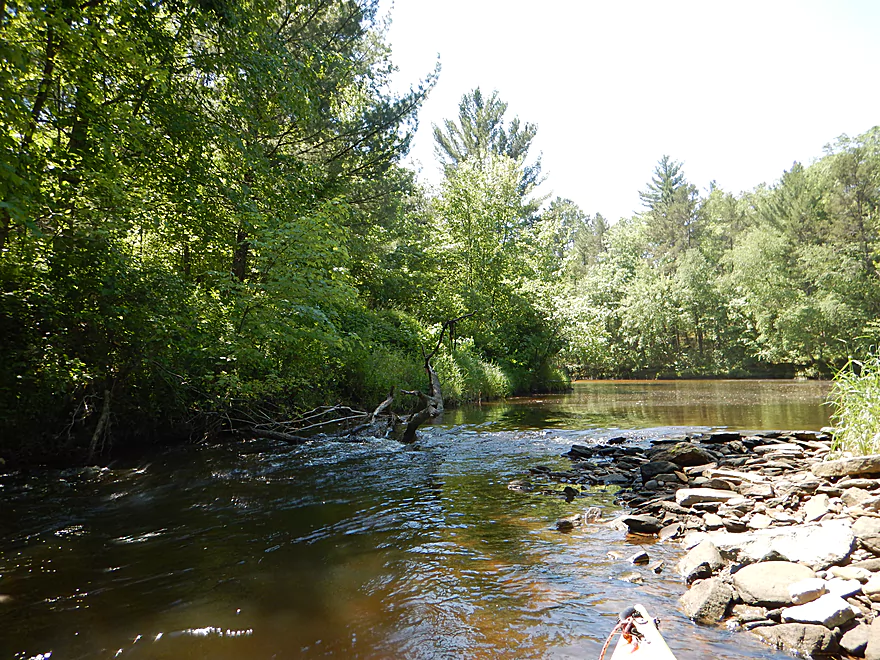
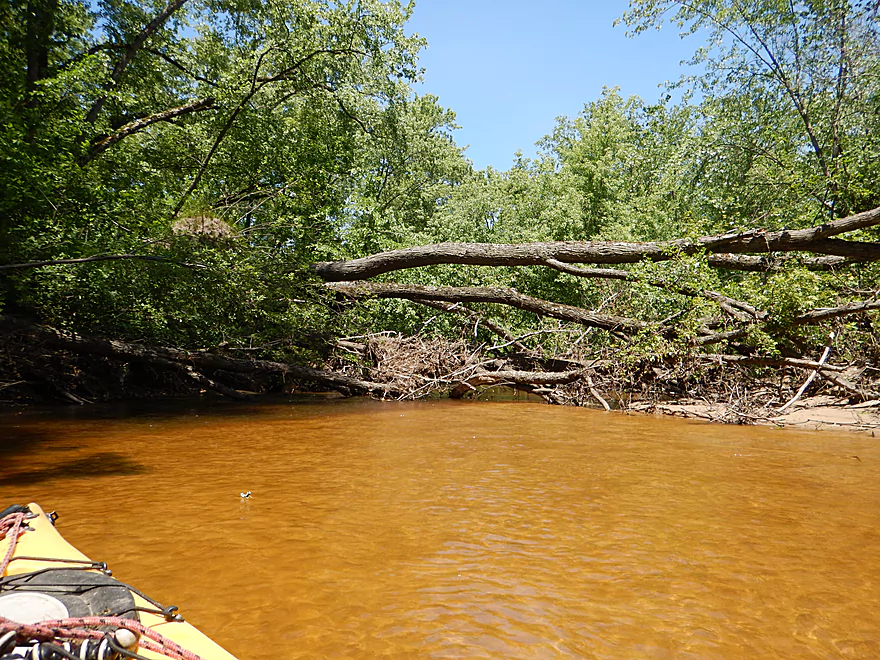
First jam that has to be portaged
Easy to do on the adjacent sandbar
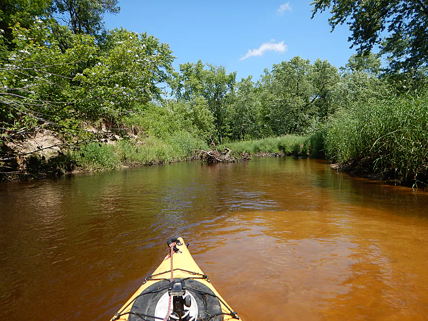
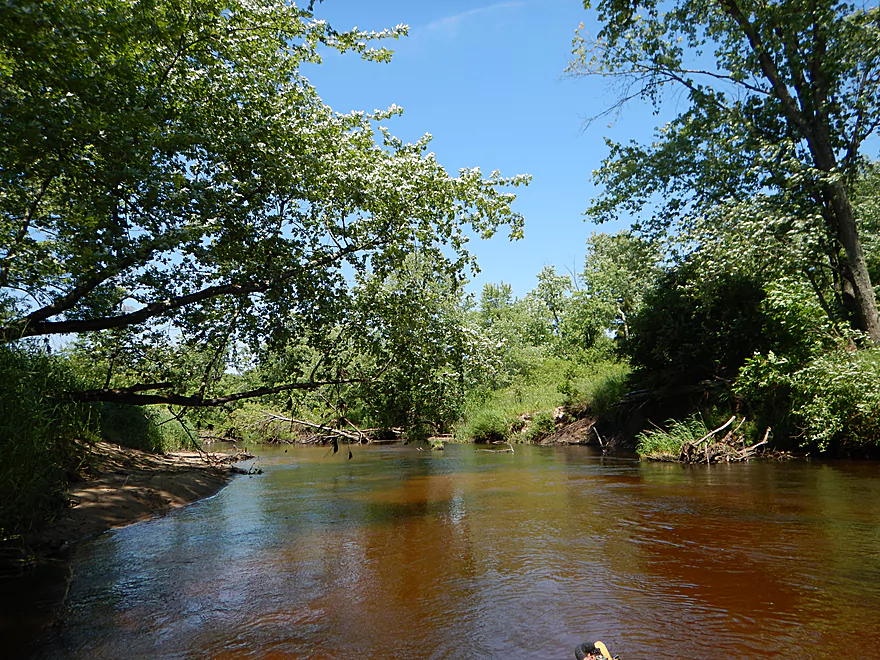
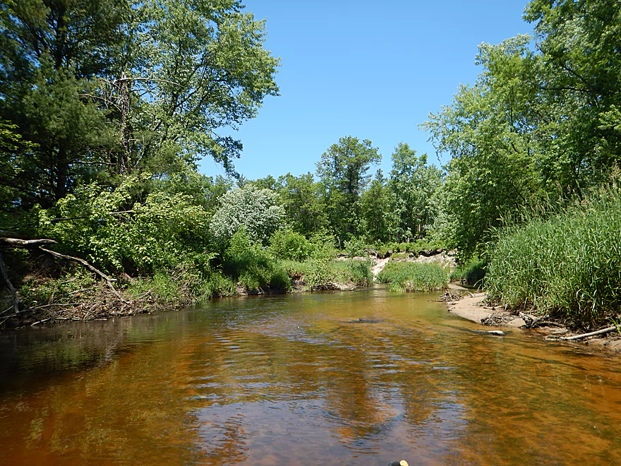
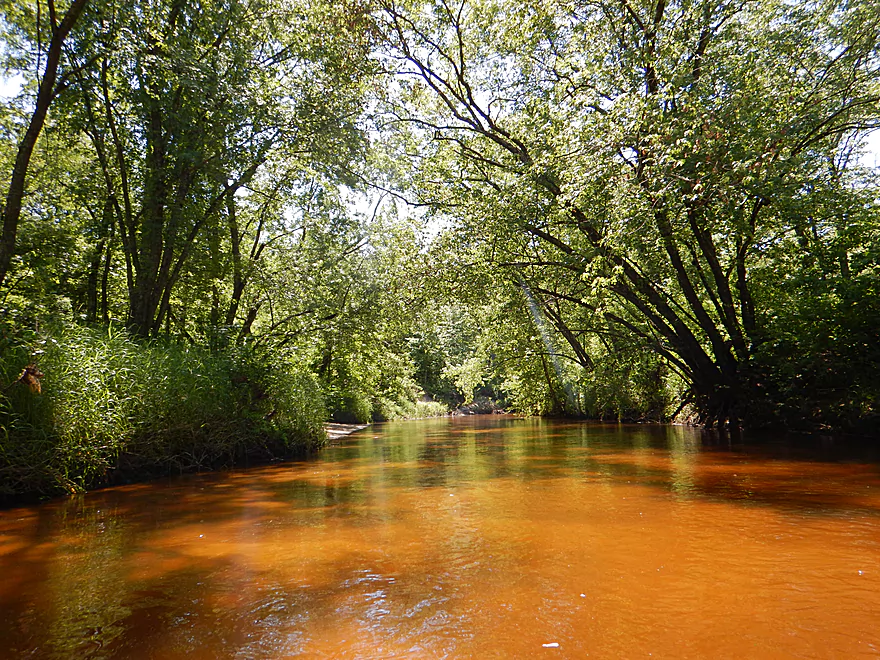
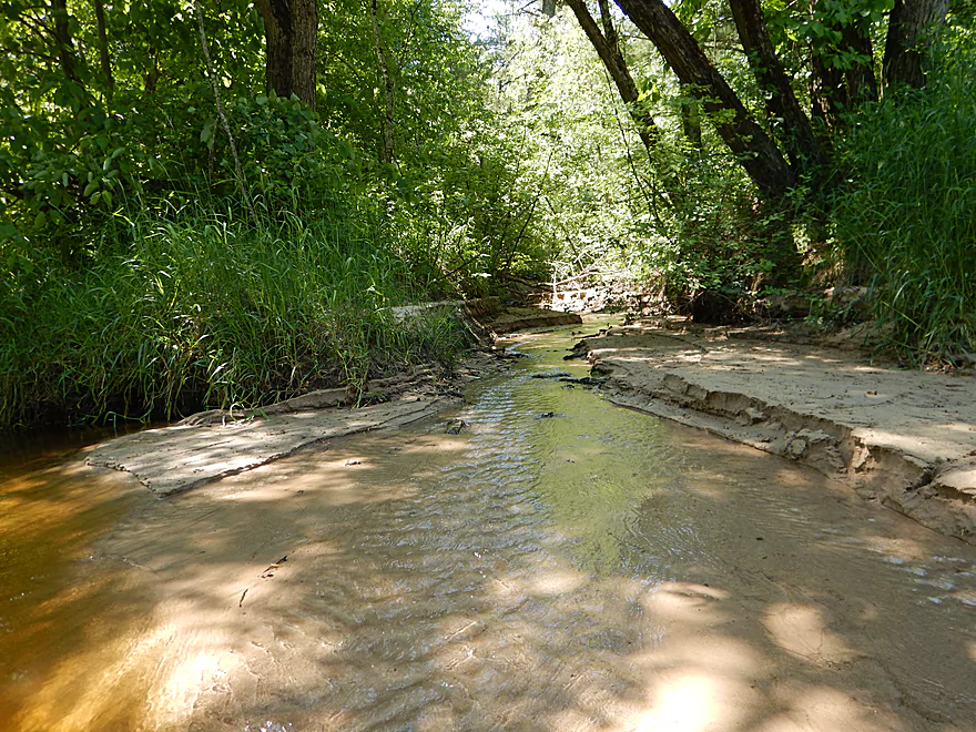
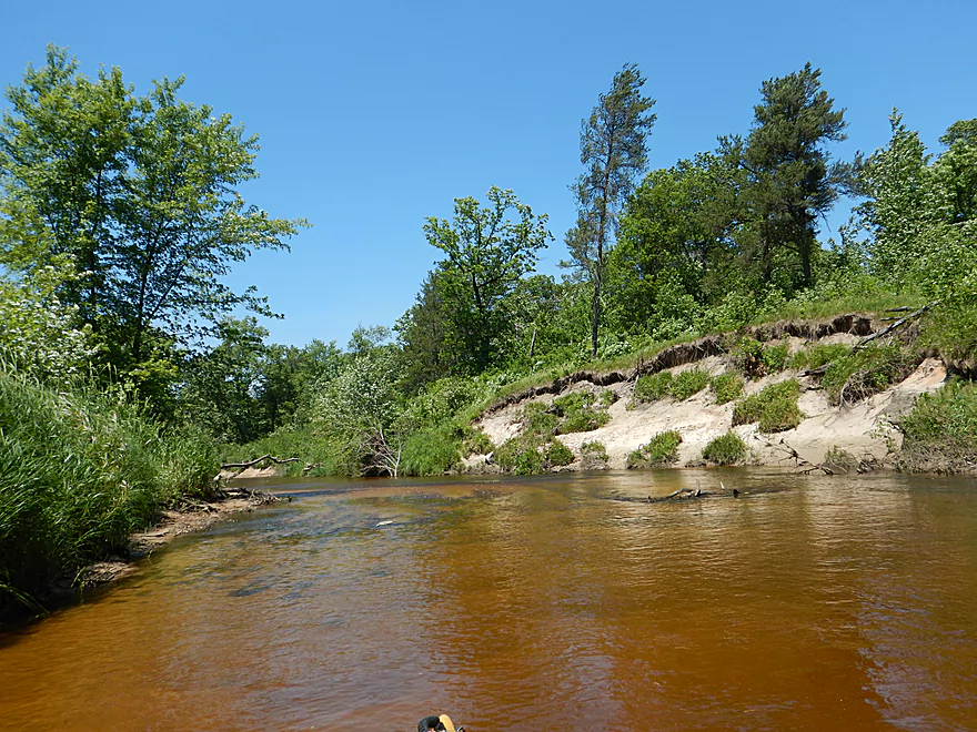
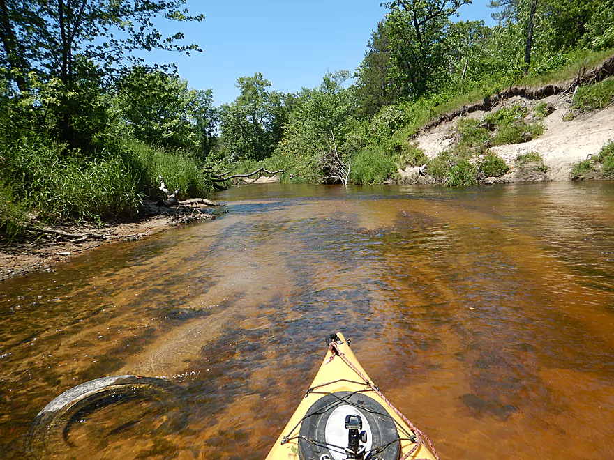
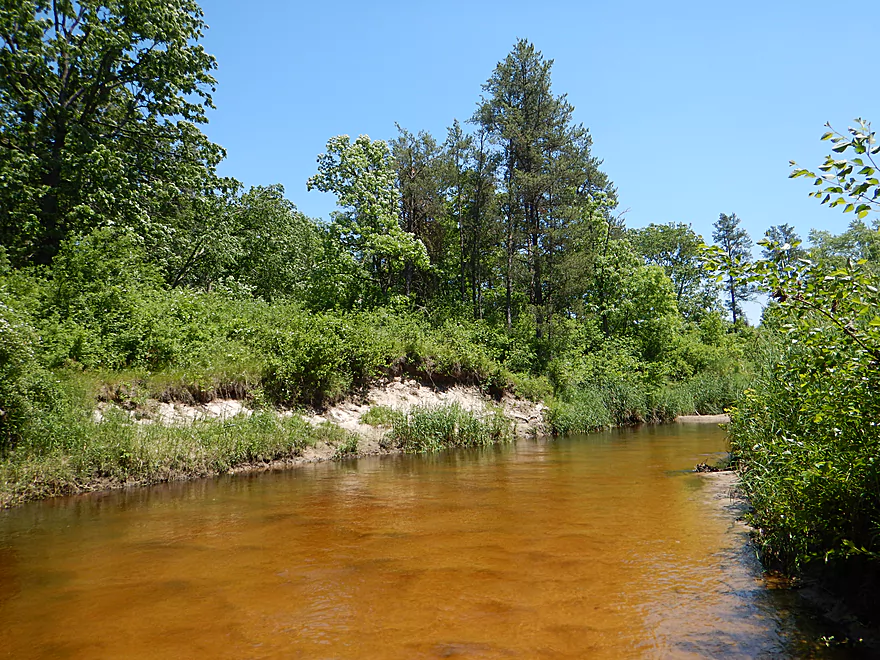
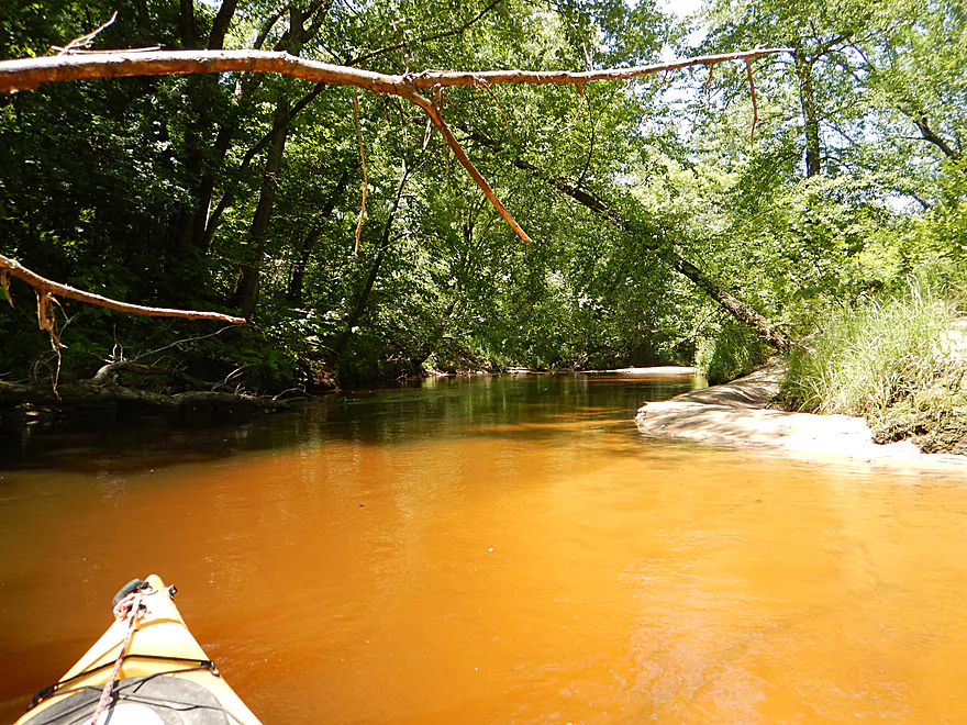
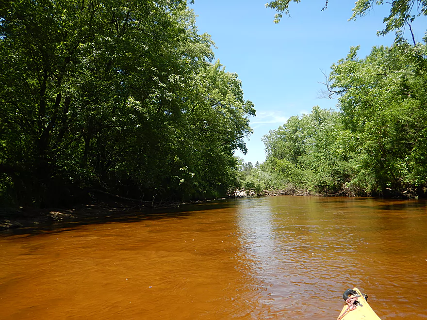
Water has a neat red hue to it
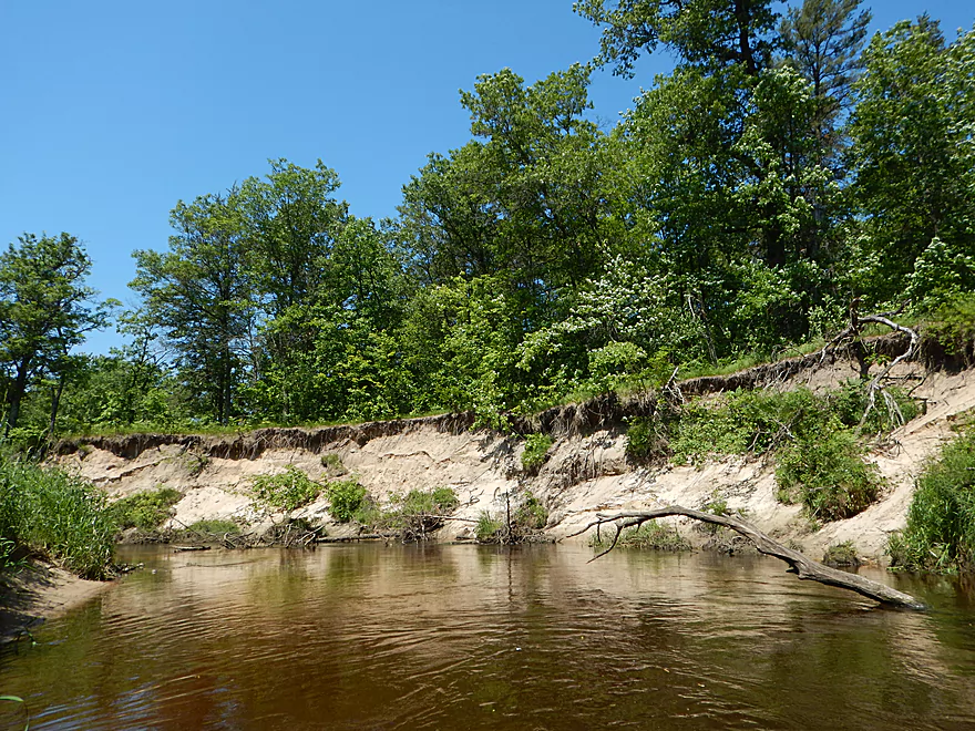
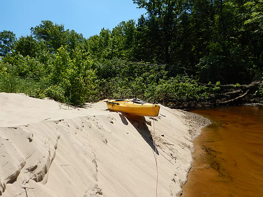
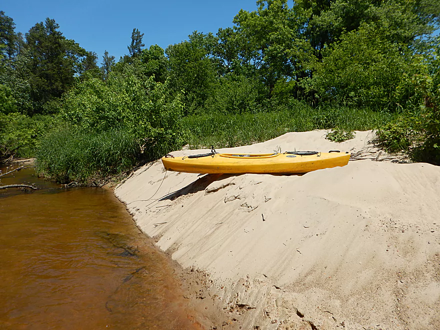
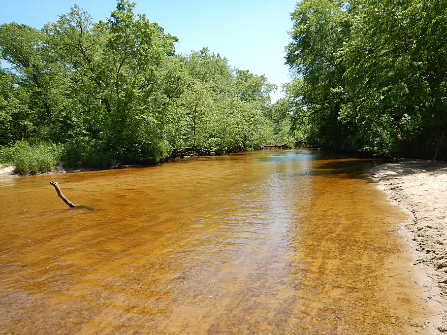
So many nice sandbanks
Current still stays zippy
Another set of nice sandbanks
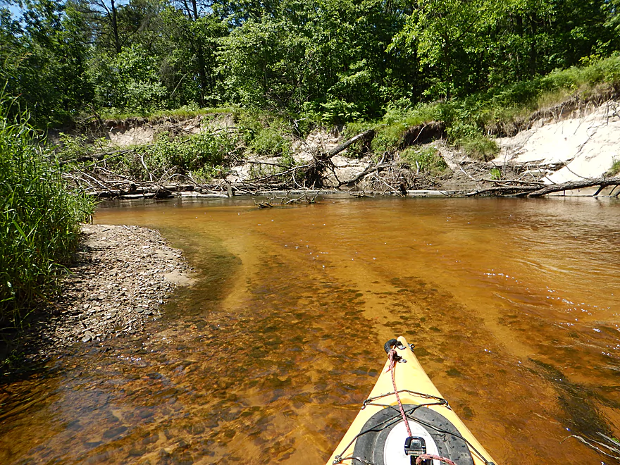
Water clarity was really nice
Another portage…super easy!
Guess all that remains of the dells here is pulverized sand
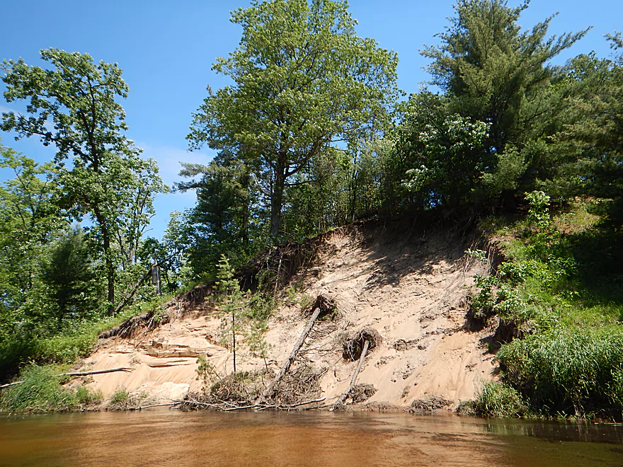
Maybe a 40 foot high sandbank
Crystal clear water carving through the sandbar
Not sure how the tire got here
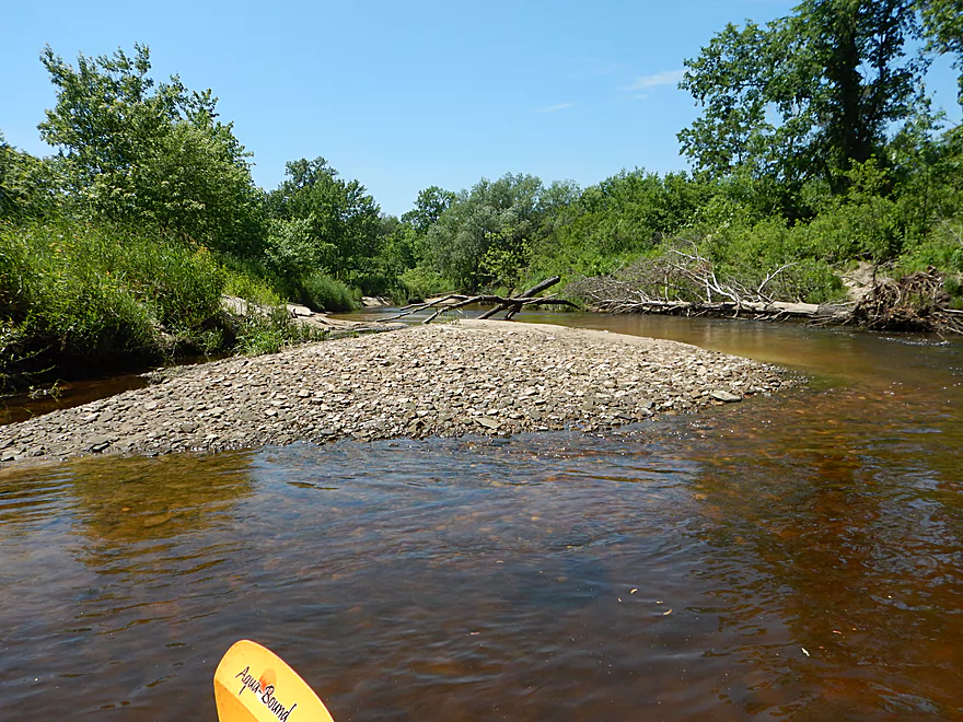
Several nice gravel bars on the creek
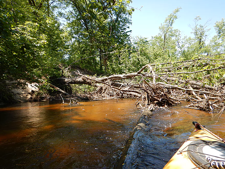
Another jam
Another easy portage
Cool sandbar
Another jam
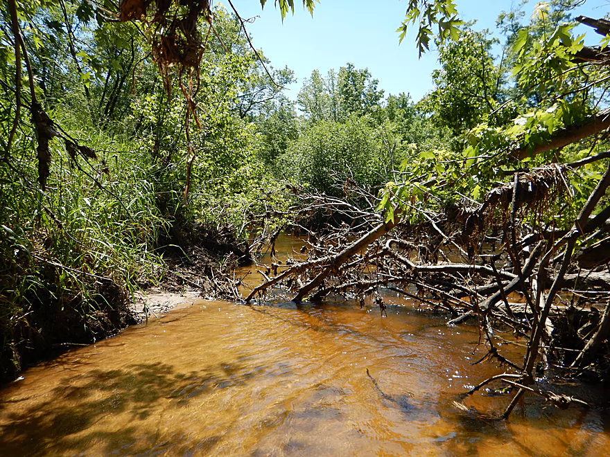
And another
And another…all reasonable to portage on the sand
The best sand bank on the trip
Maybe 50 feet
It is hidey…but there is a way through
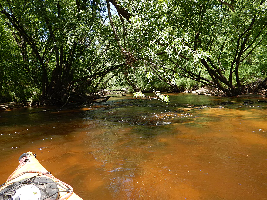
Zippy creek
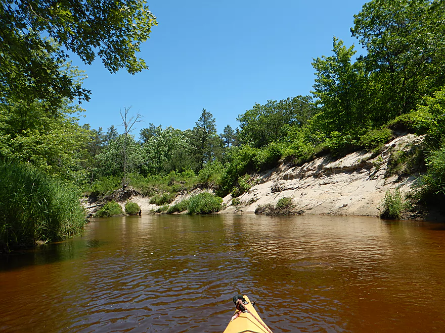
The sandstone makes a surprise return
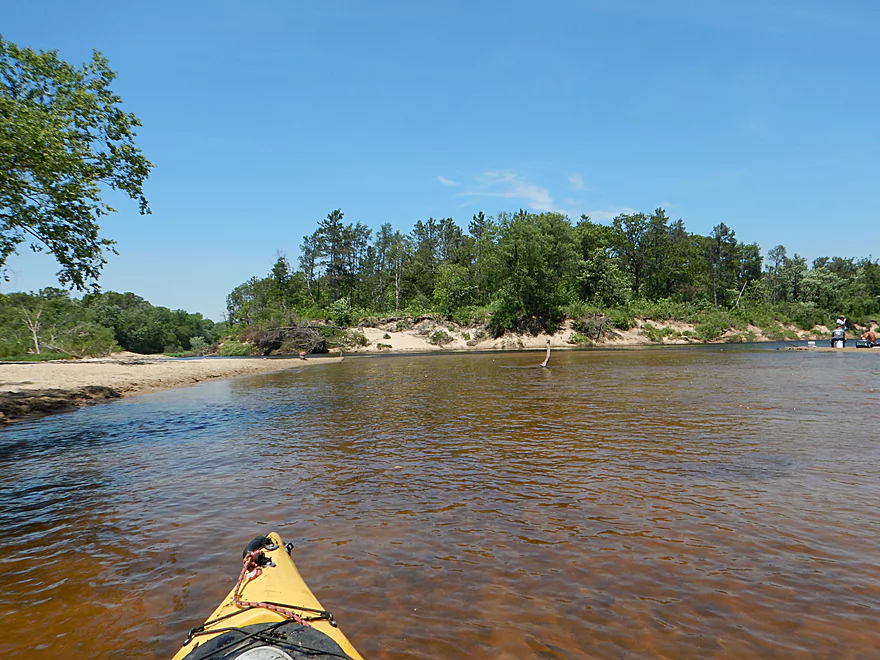
Finally on the mouth
Looking upstream at Bridge Creek
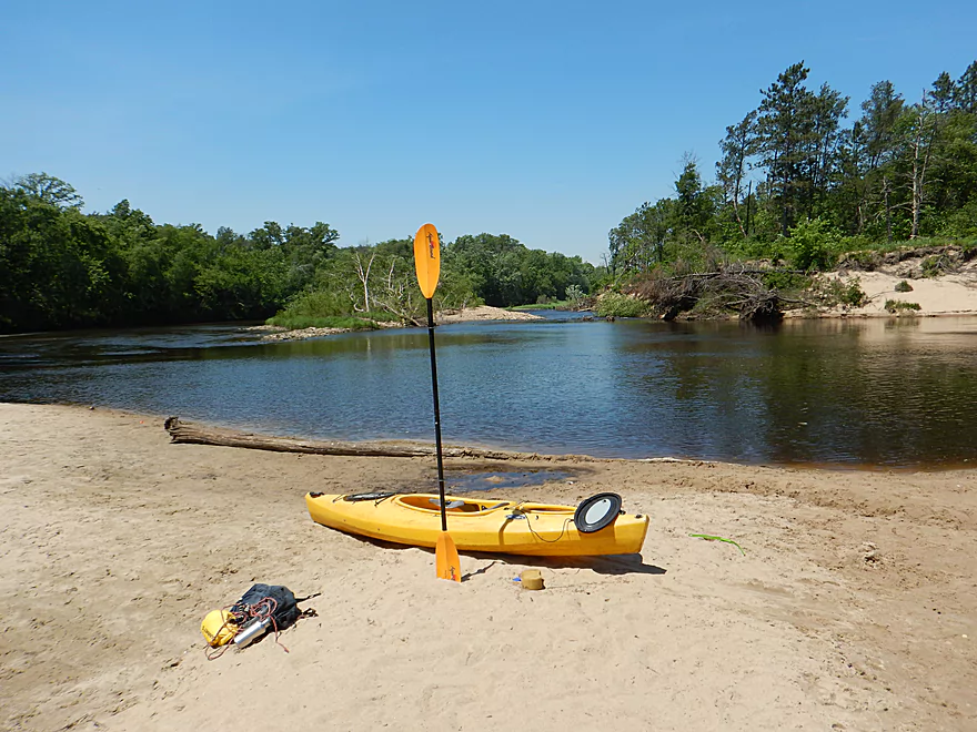
Looking downstream at the Eau Claire River
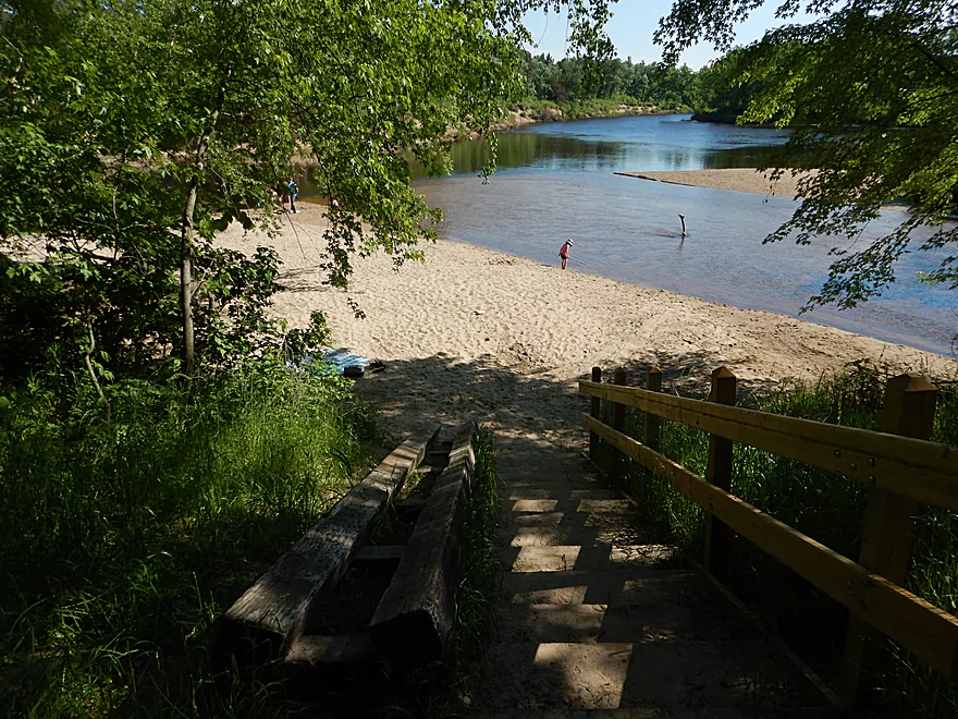
Walking back to the car
Bridge Creek


Bridge Creek is a decent-sized tributary to the Eau Claire River located just southeast of the city of Eau Claire. I read about it in Richard Kark’s paddling guide which referred to this as a short but scenic section with dells and light whitewater. Given that its neighbors were so good (Eau Claire River to the north, Coon Fork Creek to the east, and Halls Creek to the south), I was pretty optimistic that it would be a good prospect. So despite the ominous warnings about private property and my not having scouted it ahead of time, I impulsively decided to drive the 120 miles to check it out.
At the put-in is a scenic historic millhouse and waterwheel accompanied by a surprisingly tall dam for a creek. The mill is owned by an Amish family who run it as a museum and gift shop. My initial plan was to stop by the shop before the trip to get their permission…but they hadn’t opened yet. This was an issue, as they owned much of the key land south of the bridge and had erected fences and many “No Trespassing” signs. My other hope had been to get nice photographs of the mill, but the morning light was bad and the Amish had erected a sign stating they wanted two dollars if you took a picture of the mill. Given that Google didn’t pay this when they took their photo, I don’t think this was illegal, but certainly it felt unwelcoming.
On top of this, I spied all four corners of the bridge and all looked too steep for launching. At that point I was ready to give up and go to my backup plan (a nice trip on the Eau Claire…always have a backup plan when traveling 120 miles!).
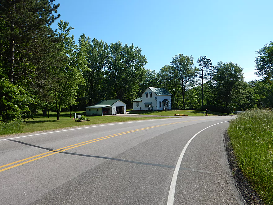
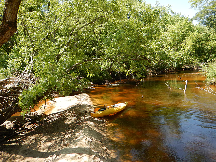
But as luck would have it, the northwest neighbors were outside fixing their mailbox and I was able to talk to them. It turned out their daughter had run the creek and they said you could reach the bottom if you descended directly under the bridge (which you couldn’t see from the road). They were nice enough to let me launch from their yard and even gave me a tip about a public parking lot just a little to the southwest. I offered to pay but they declined. As an ice-breaker when asking to access private property ALWAYS offer money…even if they don’t accept it is a sign of respect and increases the chances they’ll cooperate.
So, after a slow and steep descent below the bridge carefully leading my boat with rope, I was finally on my way. The dam which you see right away is built on what used to be some really cool dells and rapids (perhaps even a waterfall) and it is tragic that this is all buried underwater. But you are still initially padding in a mini-canyon with sandstone outcrops and light rapids which is scenic. My worry was that this was it for the dells, based on Richard’s reference to them being short, but this wasn’t the case and they would continue for an almost continuous 0.7 miles.
While perhaps not quite in the same league as Halls Creek, these dells captured some of its magic. You had steep sandstone walls on both sides of the creek and at times you paddled through small canyons. The substrate (like Halls) was flat, smooth bedrock. You could walk on it like a kitchen floor, and I did frequently to get out to take pictures and to run the rapids again. Most of the rapids were quite easy and not greater than Class 1. Atop the sandstone cliffs were attractive mosses and towering white pines that were quite striking.
At the end of the dells and rapids (again about 0.7 miles into the trip), you’ll first hear and then see a strong set of rapids. Either a very strong Class 2 or weak Class 3, and perhaps a 4′ drop over a series of ledges. The trick is you can’t practically portage this because of the sandstone walls. The main chute is problematic as current pushes you into boulders, not away. Like most rapids you never want to get pushed sideways and usually want to keep moving forward no matter what…I made it through ok.
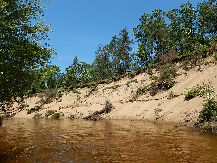
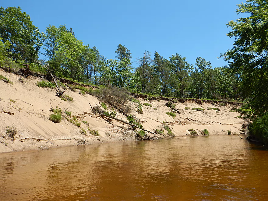
For the next two miles the creek changes dramatically. Hardwoods push out pines, sand replaces sandstone, meanders and oxbows replace the straight channel, the current slows (still up-tempo), and the dells are left behind. I suspect this dramatic transformation was due to a demarcation from the driftless zone. Likely the first south mile was spared the wrath of the glaciers, but the northern two miles had their nice outcrops ground to fine sand by the glaciers.
Despite the lack of outcrops, these final two miles in the bottomlands were really nice. You had clear shallow water over clean sand with occasional pebbles. There were many sandbars and exposed sandbanks, several of which were quite striking and were likely over 40′ high. Atop the banks were a thin layer of hardwoods that let in enough light for photography. This was a neat wilderness trip for its entirety and I never came across another human nor house. The bottomlands very much felt like a mini-version of the Eau Claire River, except nicer.
The take-out is directly on the mouth at the Eau Claire River where there is a county park and a popular beach, which is a great spot for taking out. While I had a great time on this trip, I can’t give a complete five stars as there were a few strainers and a handful of logjams that had to be portaged (almost all in the bottomlands, not the dells). Most of the logjams were super easy to portage because of adjacent sandbars and shallow, mudless substrate, so don’t be too discouraged.
The put-in is off the Hwy V bridge just downstream from the “Dells Mill”. The problem is that the banks here are extremely steep (cliff walls in some cases). Both eastern corners of the bridge don’t seem viable and both southern corners are marked are owned by the mill and marked as “No Trespasssing”. You will need to obtain permission from the NW home to launch from their yard (thankfully the couple who lived there was outside and I was able to get their permission). After you unload on their yard, you’ll need to drag your boat under a guardrail and VERY CAREFULLY lead your boat down a steep sandy slope (ideally with rope). You can’t see it from the road, but there is an acceptable incline directly under the west end of the bridge. Once you are at the water, you are home free.
For parking, there isn’t shoulder parking, but thankfully there is public parking area 700′ south on Hwy V that I’ve marked on the map (intended for lake access).
You might ask…why not launch on the lake and portage the dam to avoid the private property issues (portaging is legal on private property). The dam itself is not easy to portage. I guess it is possible…you would have to take out well southeast of the mill (where there are “No Tresspassing” signs), drag your boat onto the Hwy V bridge and across to the the opposite corner (a fast road with no shoulders). Then you could proceed to lead your boat down, but really it would be best to just get permission.
Note, if the owners of the little white house (northwest corner) aren’t home, you can try to ask the mill shop if you can launch from the SW corner (doable but you’ll need rope and will have to get under the bridge again). The mill is run by Amish and does not have conventional hours though.
The take-out is located at a beach in Harstad Park where Bridge Creek empties into the Eau Claire River. This is a very nice county park and popular launching area for other paddlers. There is even a set of wooden rails to let paddlers guide their boats safely down the stairs. Which doesn’t help if you are taking out… Thankfully a stranger offered to help me carry my boat from the beach to the parking lot (120’…doable by yourself though).
Note, there is a self-pay station where you must purchase a $3 day pass. If you don’t, you risk a ~$120+ fine.
Note, I didn’t ask but there are two local liveries nearby that service the Eau Claire River and it is likely they would shuttle you if you asked.
- Riverside Bike and Skate: (715) 835-0088 – 937 Water Street, Eau Claire, WI 54703
- Riverside Junction: (715) 456-2434 – Junction of Eau Claire River Bridge and Highway 27 Augusta, WI
The shuttle route is only 3 miles, so you could hike this if need be.
For bikers this is mostly flat and pretty easy. But not that day though as there were 40 mph headwind gusts. So strong I actually had to get off and walk some sections.
The creek can be divided into two sections. The dells and the bottomlands.
The dells had many light rapids (Class 1) that were not a problem. There were also no downed trees in the dells that I had to portage. However there were a few times I had to weave past pine tree strainers and through a few branches (pretty doable in small boats).
The big issue is the rapids at the end of the dells. Falling maybe 4′ over a series of ledges, this is significant and might be a weak Class 3. Portaging does not seem to be a practical option because of sandstone walls. What you’ll want do is find a safe place to get out and stand in the middle of the channel above the rapids to scout the best way through (this is important!…but might be tricky in high water). Looking downstream, the right chute gets shallow and will likely flip you sideways. The main channel flows sharply left but into boulders and then into a big strainer. Your best bet is mostly dead center, but to stay center you’ll need to fight the current. Watch my video to get a feel for this. Shallower water would likely make this more forgiving but you might hit a number of rocks. High water could be nasty and you’ll likely be pushed left into the boulders and then into the strainer.
Once in the bottomlands there are no dangerous rapids, although the current still clips along. I did have to portage logjams six times, but don’t let this scare you as practically every time there was a nearby sandbar which made doing the portage pretty easy. Very unlike the steep, muddy, overgrown portages you experience so often in Southern Wisconsin.
Generally speaking this is a shallow creek. In the dells, the depth maybe averaged 4-6 inches, which worked well for getting over the rapids and I only got hung up a few times. The bottomlands are a little more inconsistent, and the depth will vary from 2 inches to 2 feet. I did get hung up on the shallow sandbars maybe 3-4 times and had to get out, but this was easy to do (and the shallow, sandy water was scenic). You could run the creek at shallower depths but might have to walk a few sections (I think it would be worth it). At high levels, the main rapids could be dangerous and several strainers could be obnoxious. Below is a very, very rough guide based on a Black River gauge.
- 0-150 CFS: Might be too shallow.
- 151-200 CFS: Quite shallow but mostly doable and pretty scenic. You’ll have to get out and walk a handful of times which shouldn’t be a major issue.
- 201-250 CFS: My ideal and suggested depth. A few walking moments but mostly pretty good. I did the trip at 230 CFS.
- 251-300 CFS: Pretty doable but not as forgiving in the tight spots.
- 301-500 CFS: This would be a high level for the creek and most of this isn’t a problem. But because of a few strainers and the major rapids, my vote would be to avoid this depth.
- 501+ CFS: Creek is very high likely at these stages and maybe close to flood stage. If some of the debris were cleared out, this would be a good depth for pro whitewater paddlers.
One eagle, a number of dragonflies and a lot of clams. On one of the sandbars was a large beached muskie. I also spooked what appeared to be a large barred owl.
Roughly speaking, I don’t believe there are too many other navigable sections on the creek. The dam creates a large millpond which you could paddle on but it wouldn’t be special (access on the northwest side of the lake, marked on map).
Further upstream leading to the city of Augusta, there seem to be serious logjam issues and little chances of outcrops. The creek quickly splinters into 4 branches at Augusta and reduces dramatically in size.
Upstream of Kruger Road, the creek might be navigable as a small sandy brook winding through a marsh. Further upstream the creek flows through a cranberry marsh and is not viable.
The nearby creeks are interesting though. Coon Fork Creek to the east (from Coon Fork Park to the Eau Claire River) is VERY similar to Bridge Creek and if it wasn’t for its bike shuttle issues I would have done it already. Halls Creek to the south is a legend and one of the best water trails in the state. The Eau Claire River itself is of course a classic when it comes to paddling and I detail many trip options here. Note, if you are in the area consider checking out Big Falls County Park, a scenic park flanking the strongest rapids on the Eau Claire River.
Trip Map
Overview Map
Video
Photos Size:
I haven’t run that yet but have done below Harstad park. Was there once when the mill was open, the tour of the mill is definitely interesting.
If you do this trip, let me know how it turns out. The Mill is very cool and photogenic.