
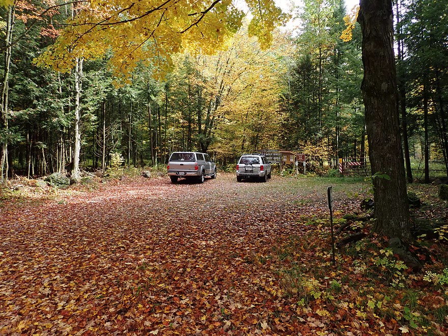
Starting the trip at the Little Wolf River Fishery Area
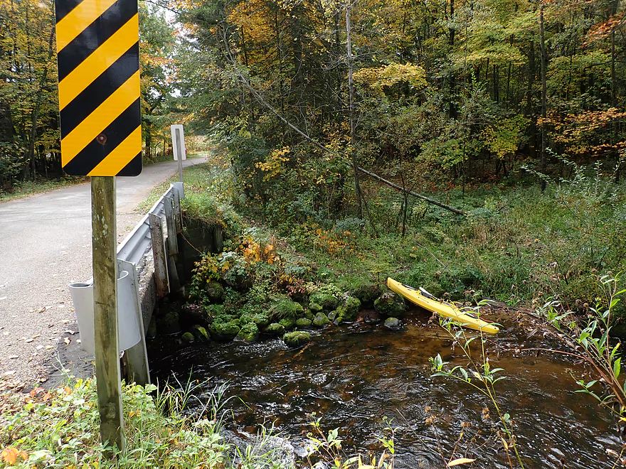
Putting in at Ness Rd
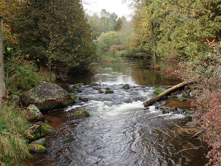
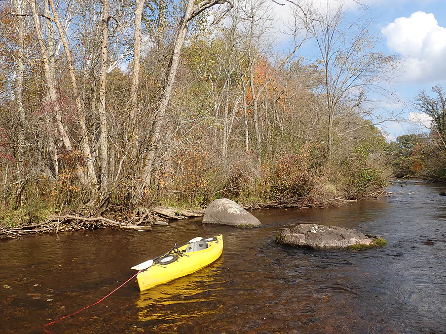
Nice launch area below the bridge
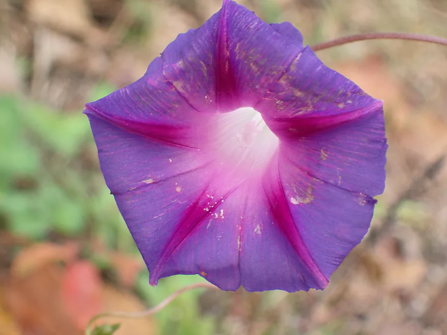
Purple bindweed
You can also launch by the rapids
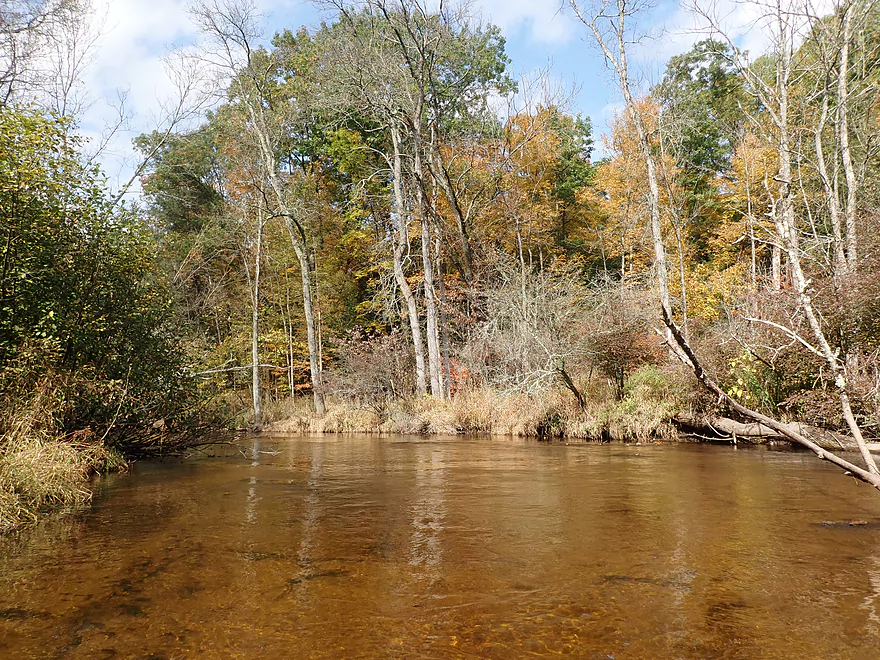
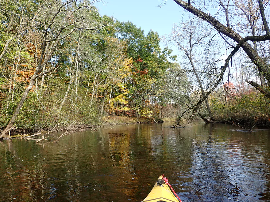
Scenic area
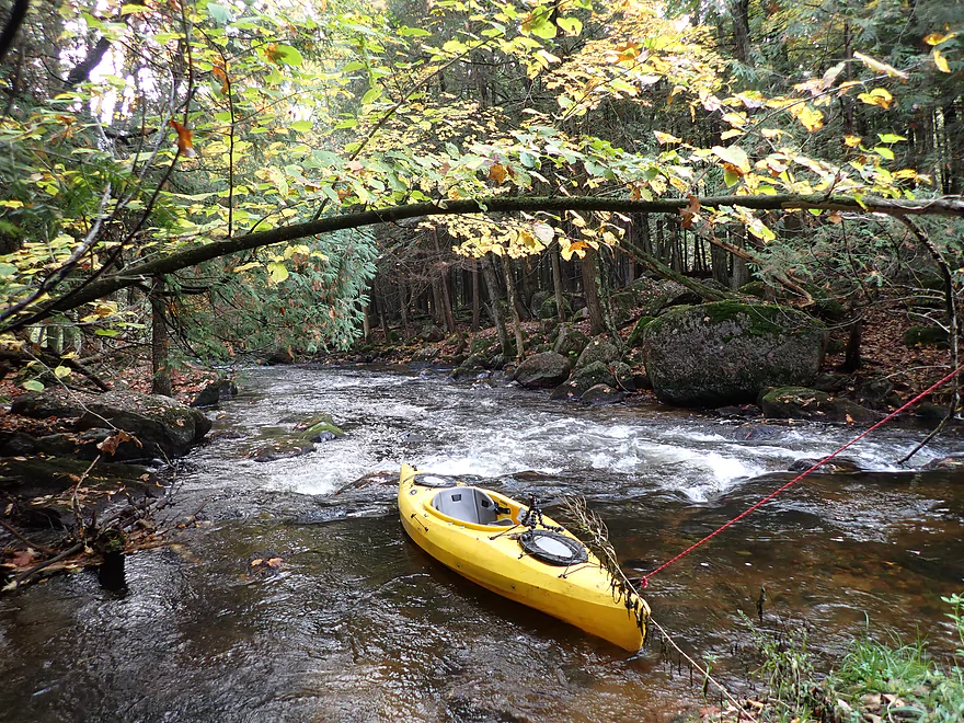
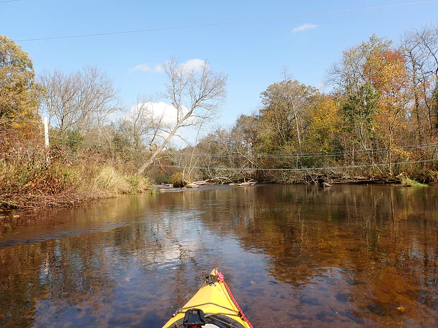
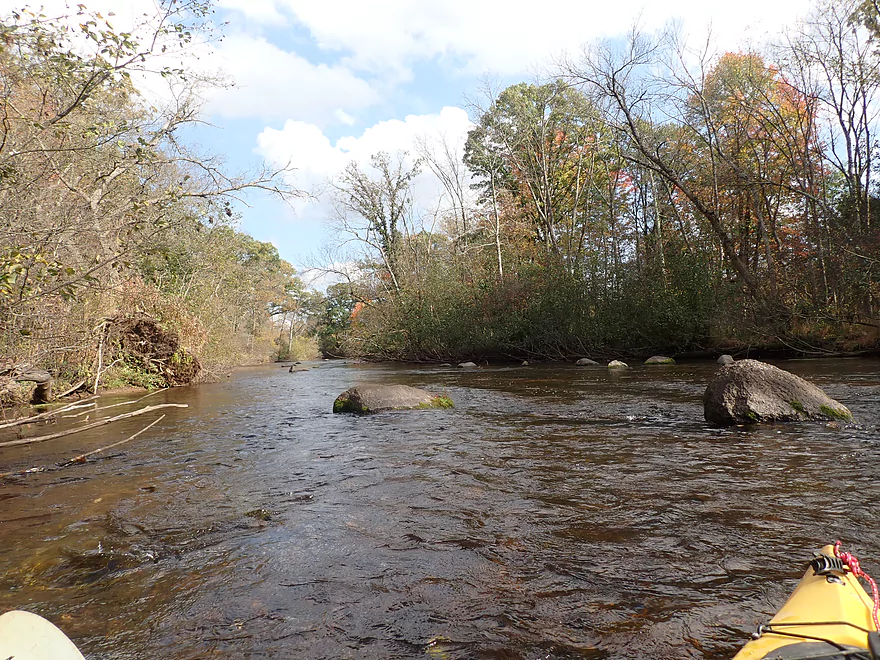
Fun rapids to start the trip
Reverse view
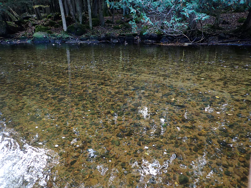
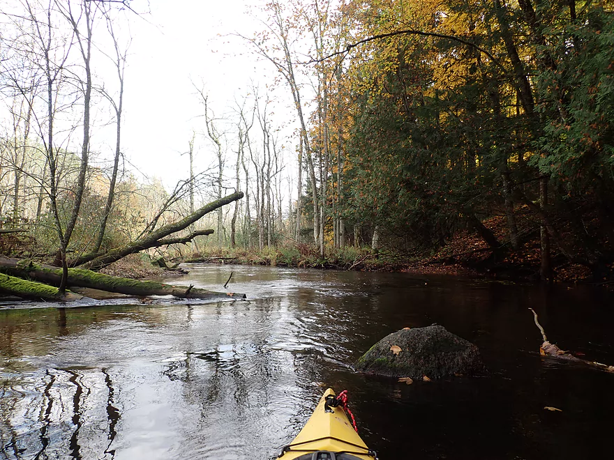
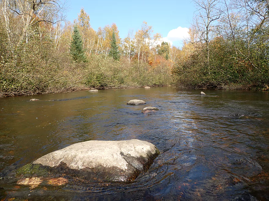
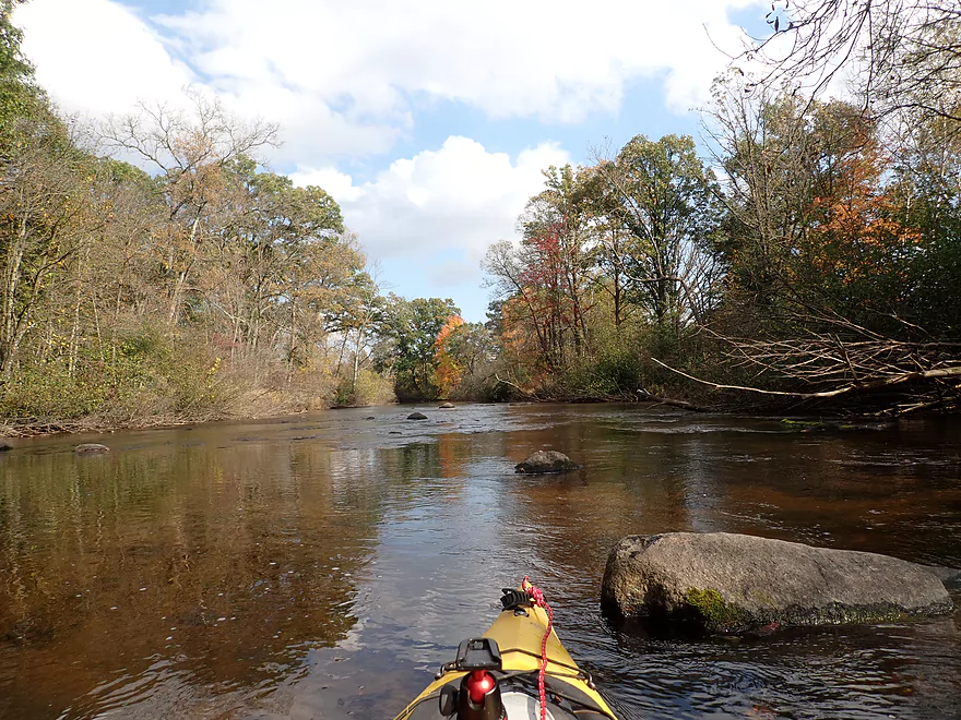
Great clarity
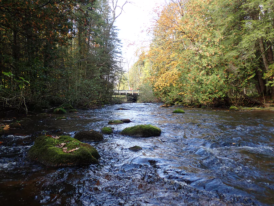
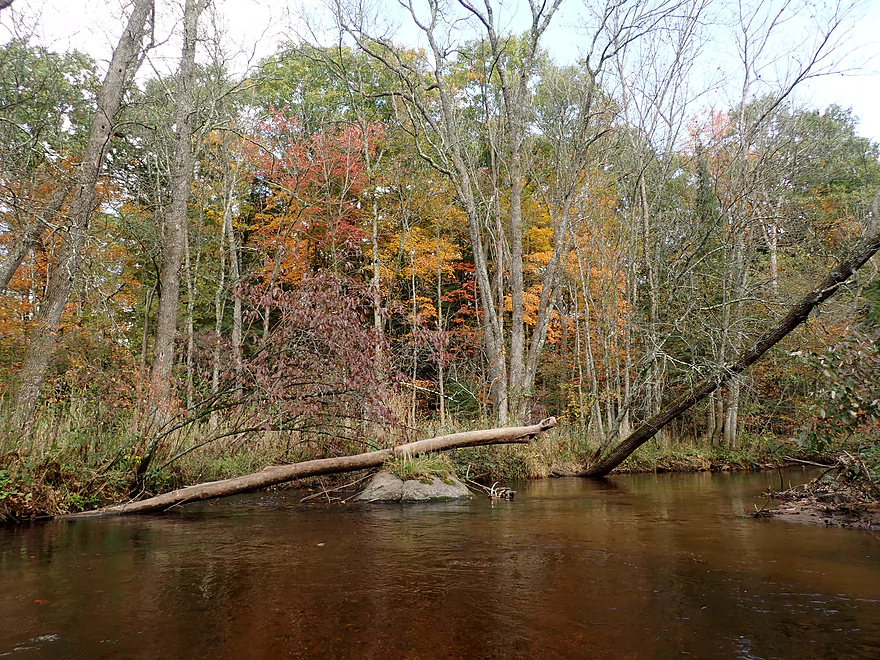
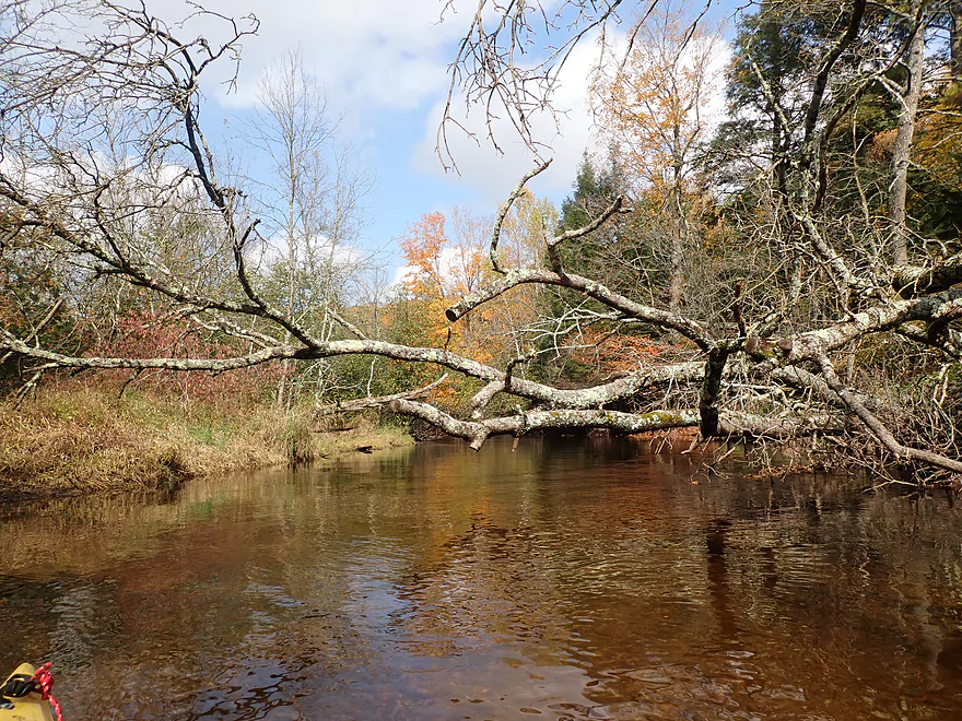
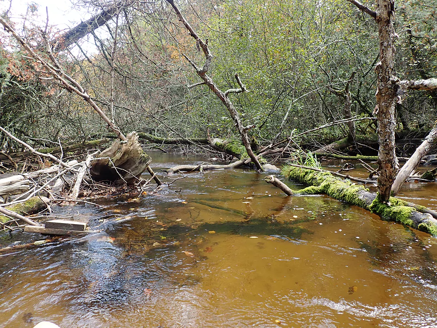
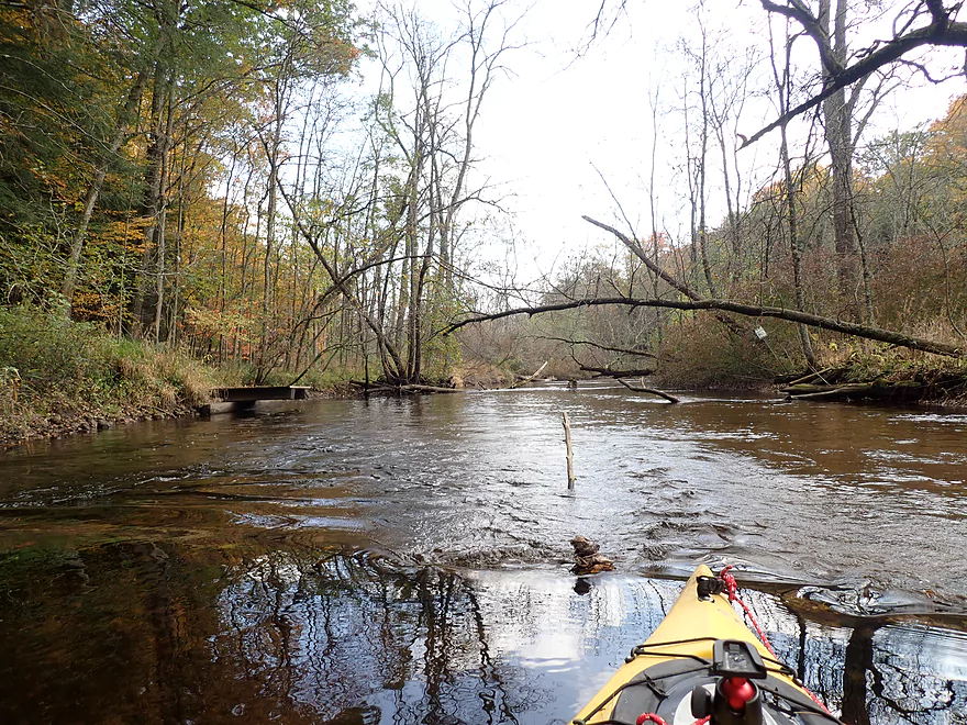
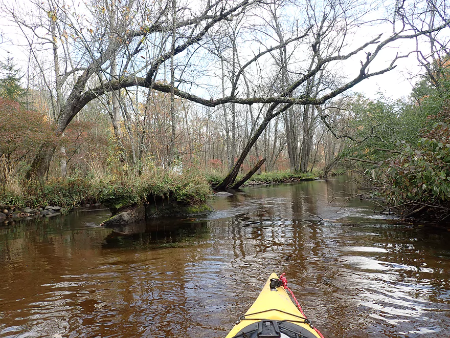
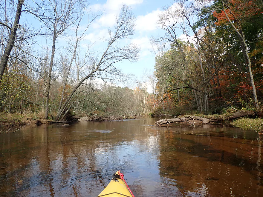
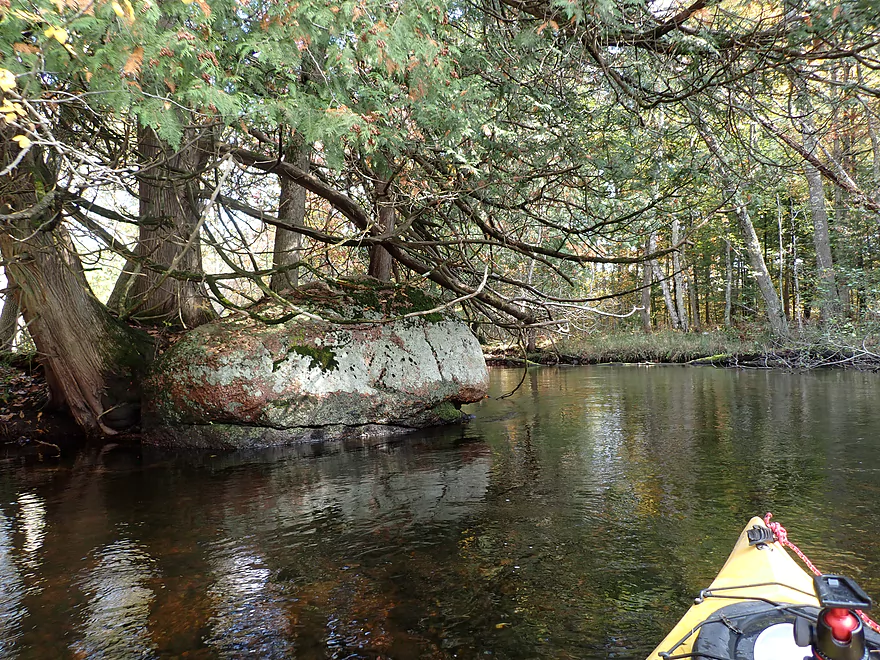
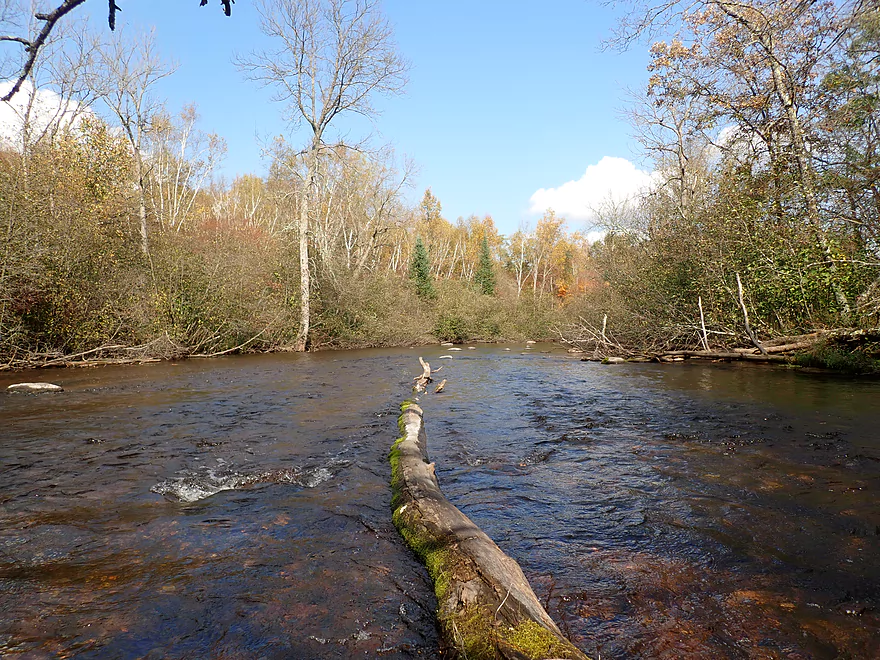
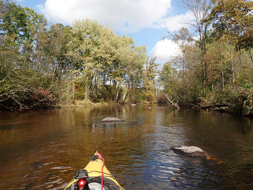
Entering the dells
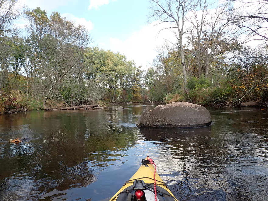
Best part of the trip
Reverse view after first pitch
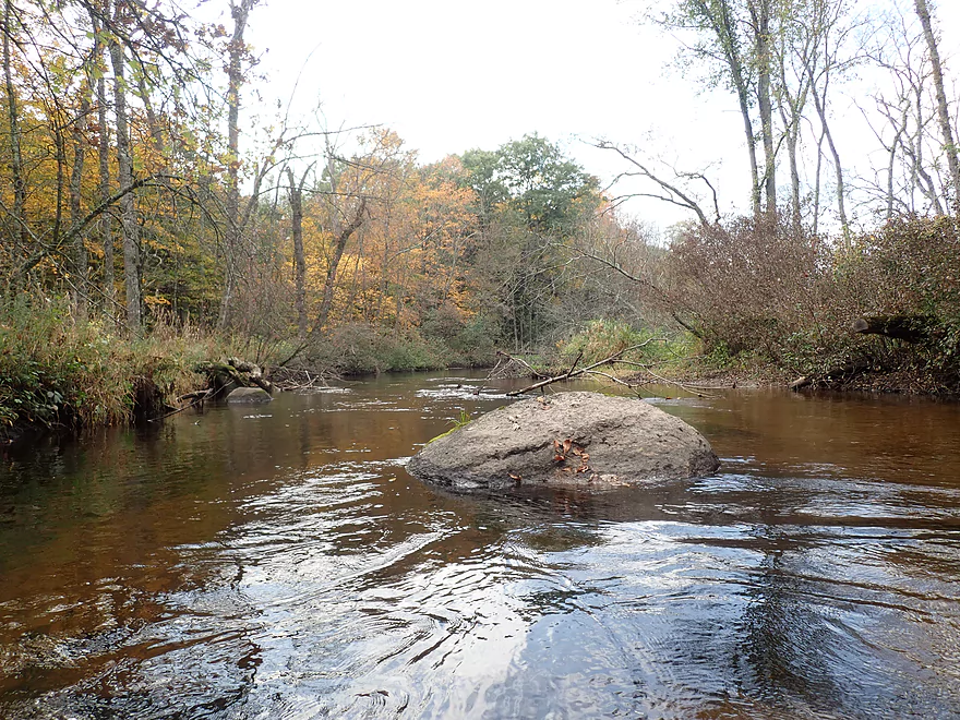
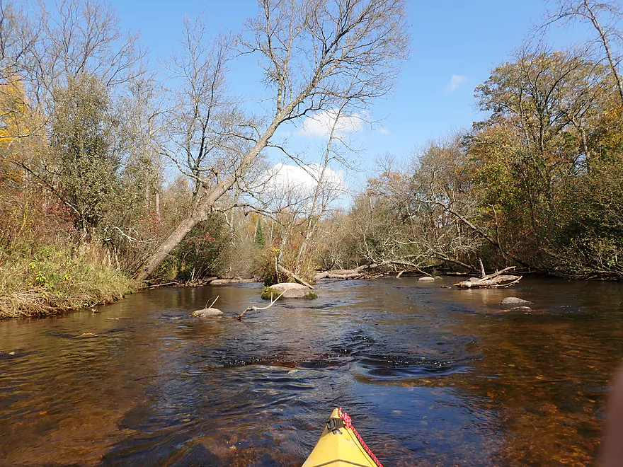
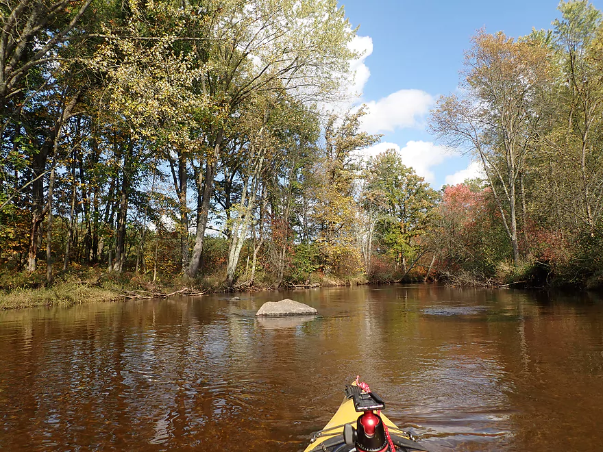
Boulders everywhere
Looking downstream at the second pitch
Reverse view from second pitch
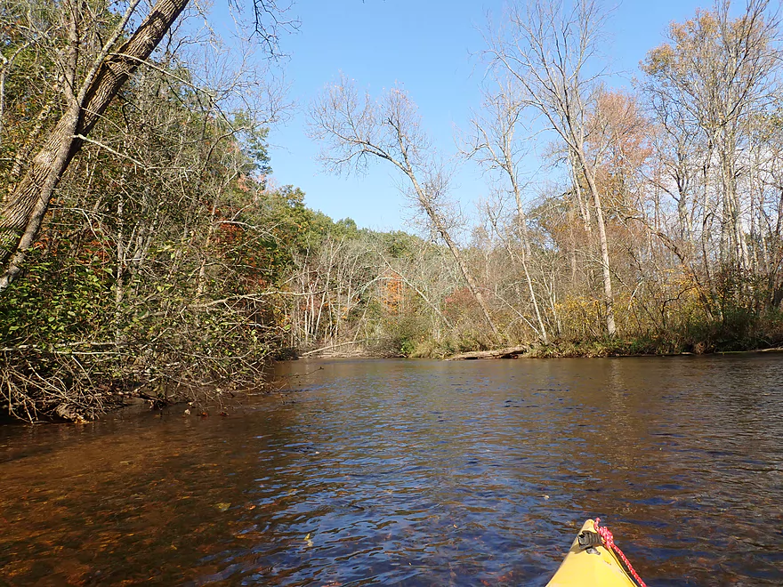
Early fall color
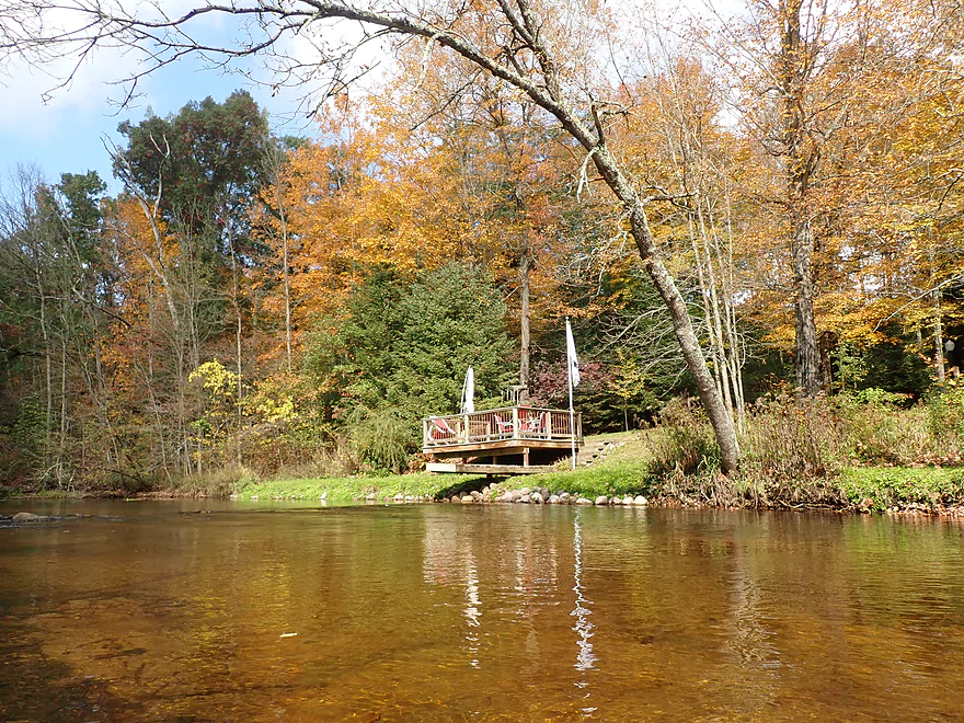
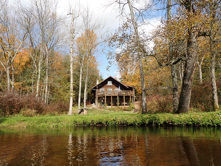
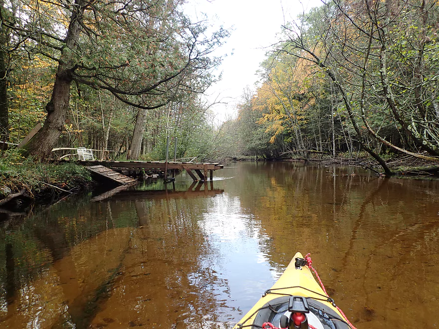
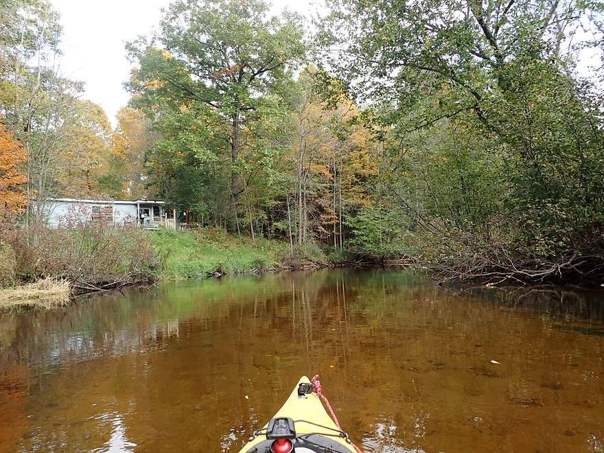
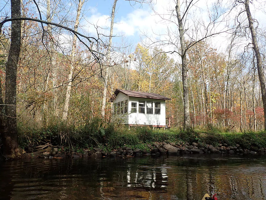
Some homes along the river
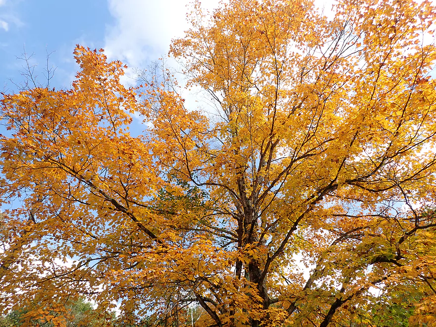
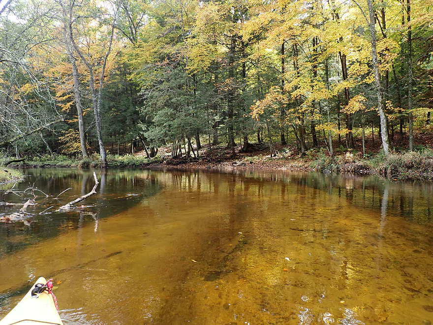
Not many sugar maple, but the ones on the river were at peak color
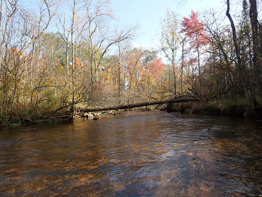
Lot of terrific cleanup work
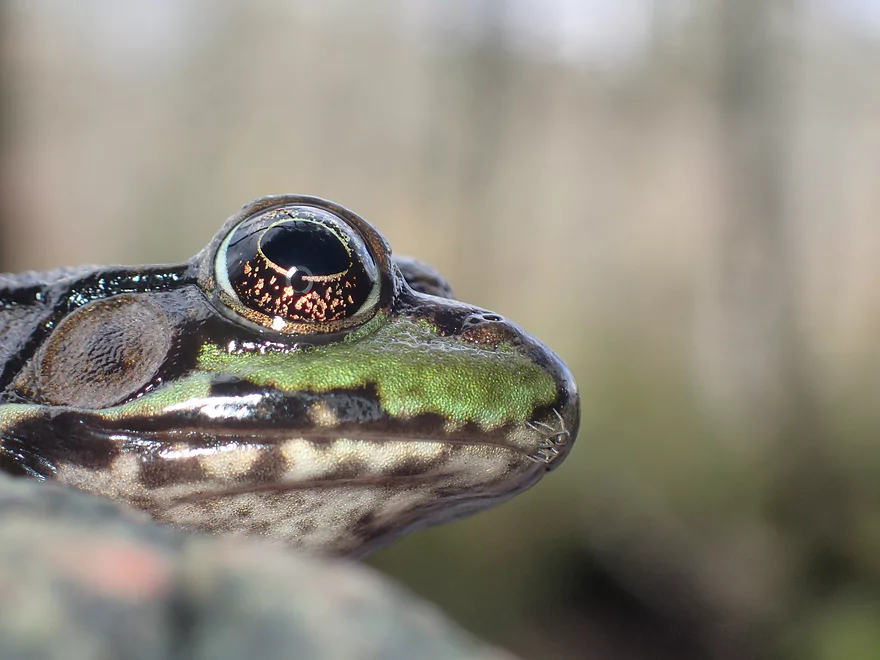
An eye-to-eye view of a green frog
This really reminded me of the Upper Mecan River
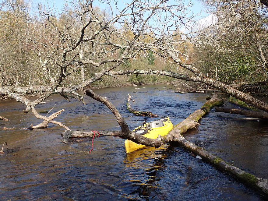
Only a few snags, but always away through
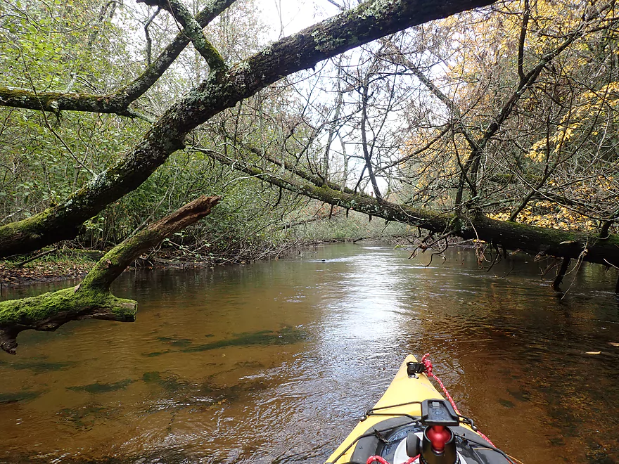
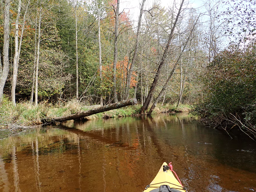
More great cleanup work
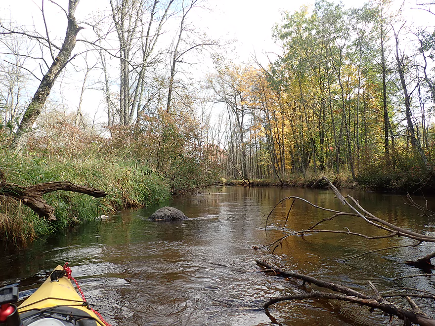
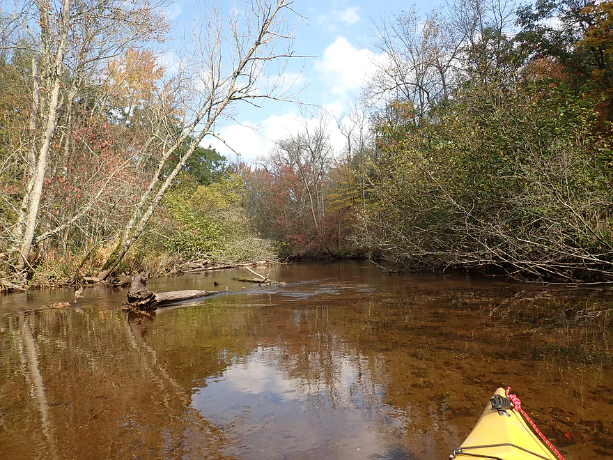
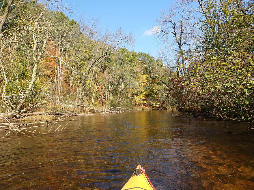
Not as many boulders after the dells
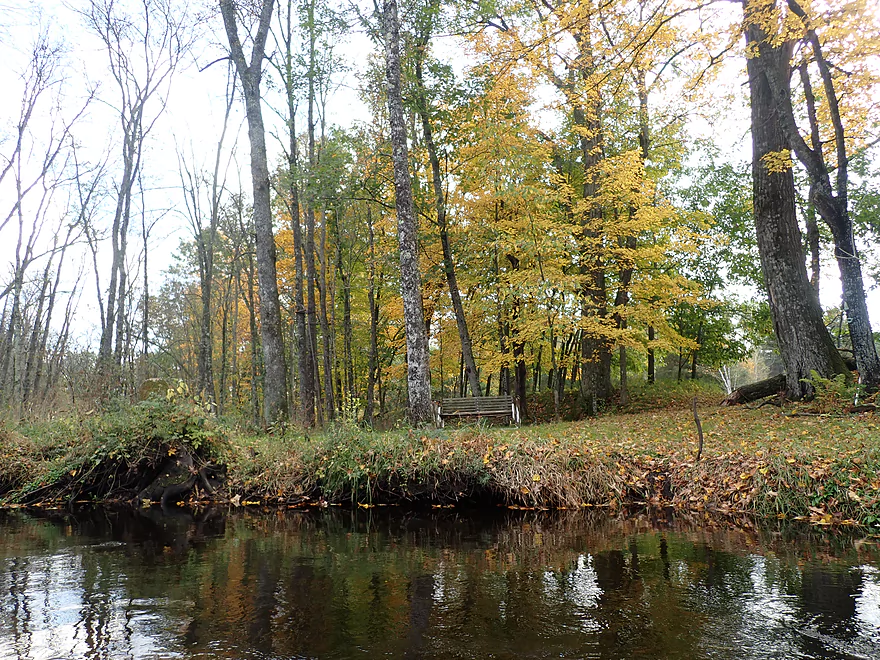
Nice little bench area
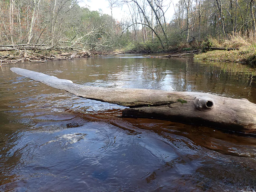
A wooden paddlefish
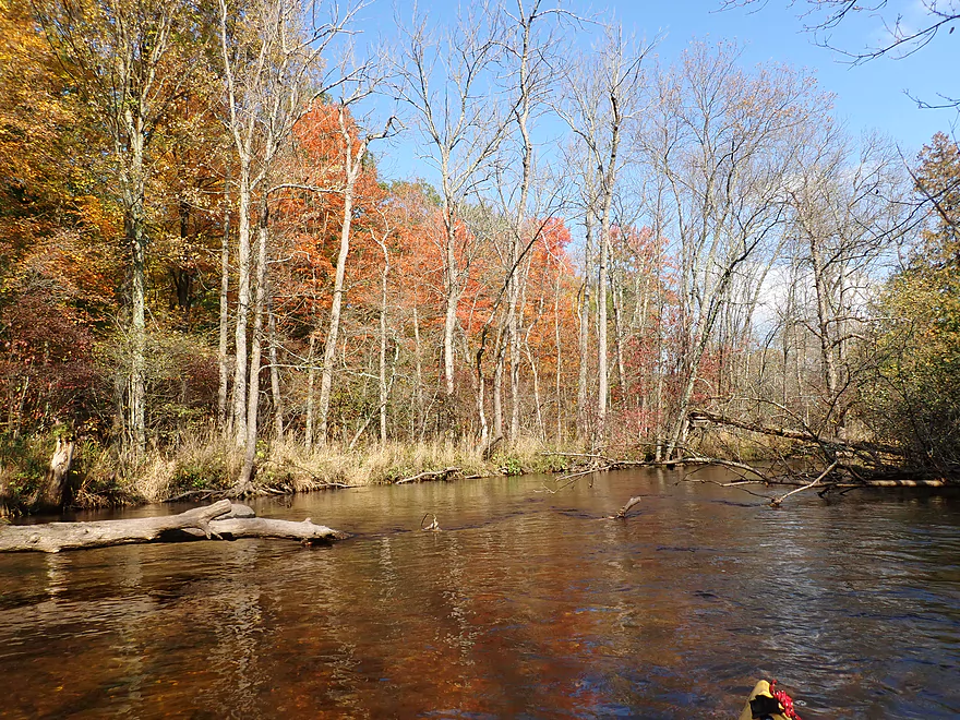
Some of the better color on the trip
Many of the granite boulders had moss and lichens growing on them
Flume Creek really widens the river
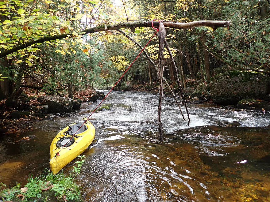
Some strange type of rope setup
Finally starting to see boulder gardens again
Getting out for pictures
Sun comes out for nice lighting
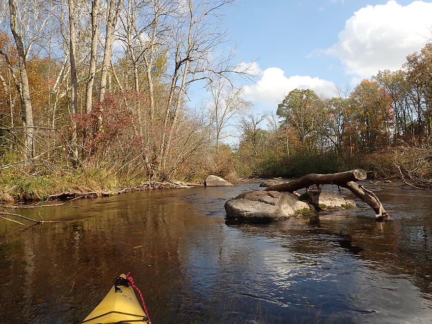
Coming up on another nice boulder field
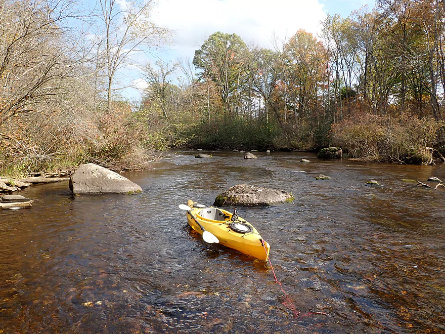
Another nice part of the river
Wolf River Road
Nice take-out after the bridge
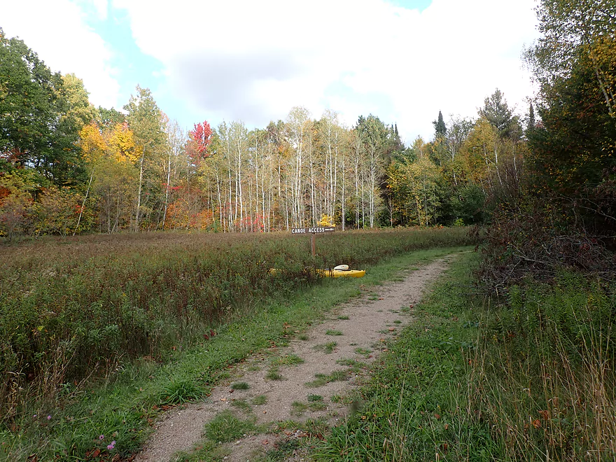
A sign marks the way to the river
This is typically a popular access, but for my trip I had it all to myself
Little Wolf River – Ness Rd

The Little Wolf River is a Central Wisconsin paddling classic with some of the best Class 2 rapids in the state. Most kayakers who do the upper Little Wolf, start from Wolf River Road and end at Big Falls, which features the best scenery and rapids. However, I had already done that leg and was looking for a new adventure. Instead I opted to start just upstream of that (Ness Rd) which is fairly obscure in kayaking circles.
Actually my initial plan was to launch from N. River Rd (0.25 miles upstream from Ness Rd). I had previously “map scouted” the area and it looked really promising with neat boulder gardens, rapids, and DNR public access. But when I drove down the actual road, there were many private property/keep out signs intermixed with many DNR public access signs. Very confusing with no clear indication where the public access was (perhaps intentional). I suspect the public access corridors still exist, but overzealous locals have obscured it with their signage (to discourage outsiders). The DNR pays a lot of money for public easements, and if locals are blocking access to them this would be unethical and possibly illegal.
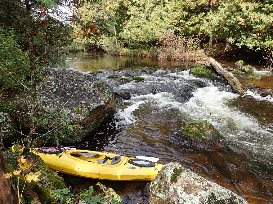
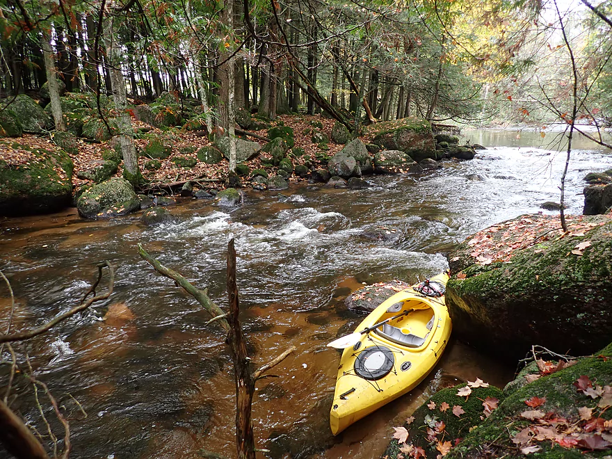
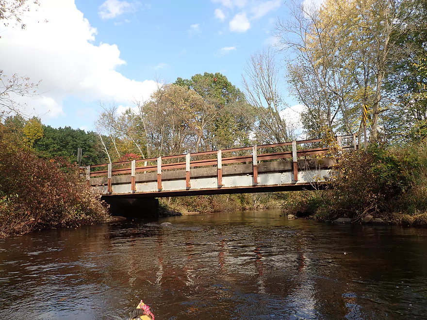
So I scrapped those plans and launched from Ness Rd instead which is a good bridge access with an adjacent DNR public parking lot. Paddlers shouldn’t be in a hurry to head downstream though, as the best scenery of the entire trip is located just upstream and downstream from Ness Rd. Just west of the bridge is a Class 2 ledge that looked a little rough for running, so I was glad I was launching downstream from it…but it was scenic.
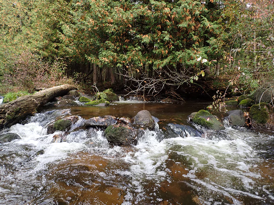
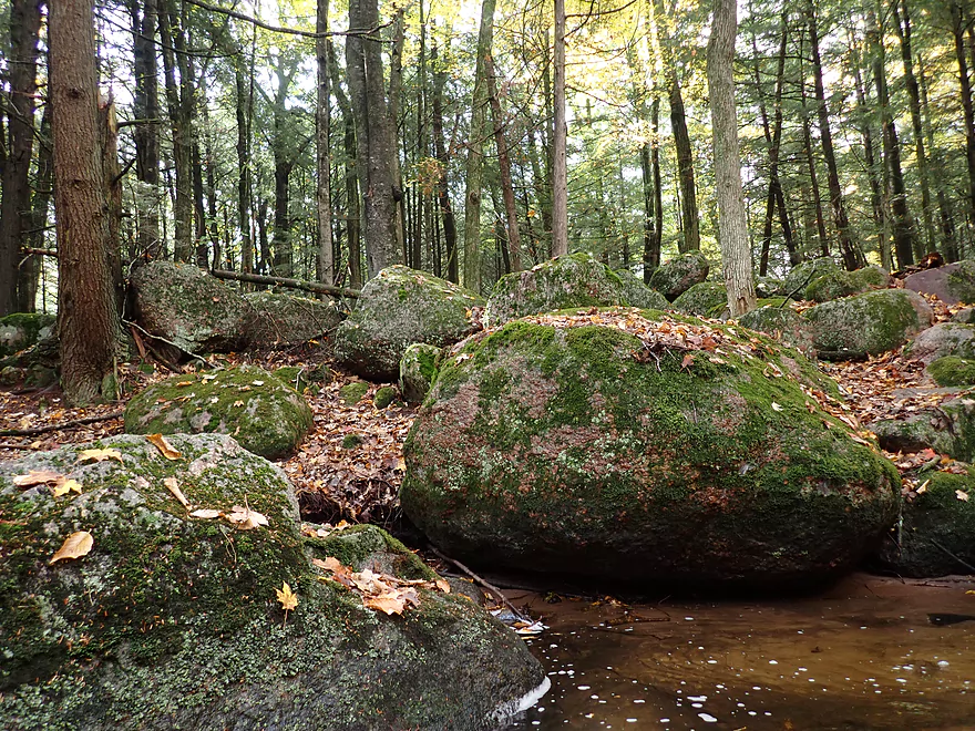
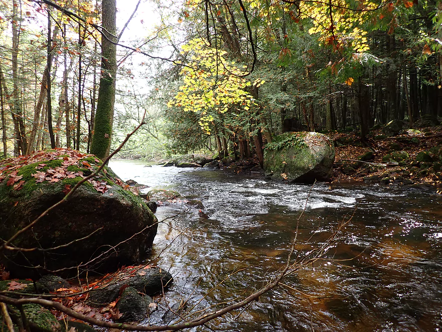
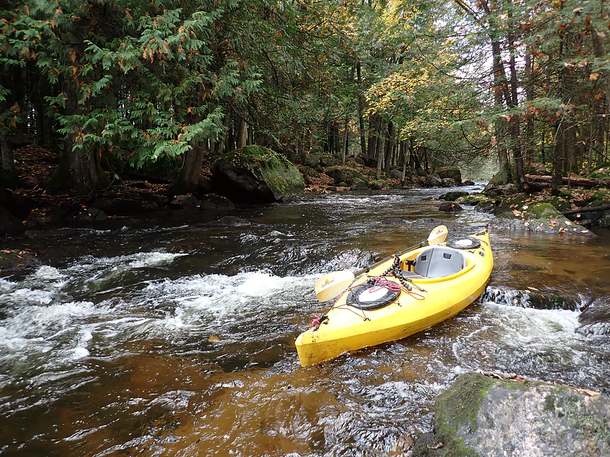
Downstream from Ness Rd was a series of Class 1 rapids and a small boulder garden. The river soon narrowed into a short stretch of dells with large boulders on both banks. Hemlocks arched overhead creating a “tunnel” visual that was incredibly scenic. A dense field of boulders covered with attractive mosses and mushrooms extended into the adjacent woods (debris from the last glacier). This was easily the highlight of the entire trip.
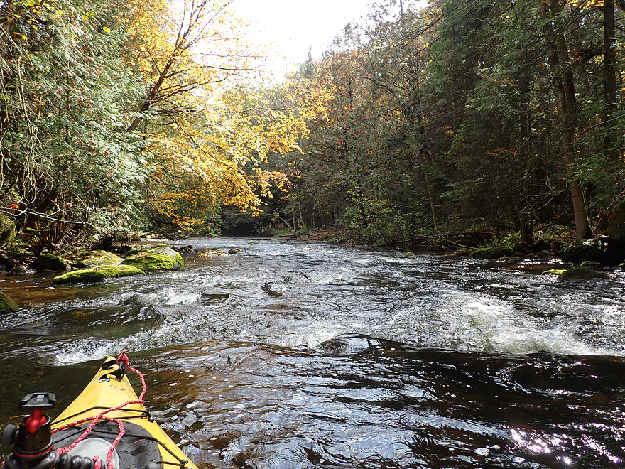
After that the river became much more mundane with far fewer boulders and rapids. The banks thinned out with scrubbier tree species. In many ways it REALLY reminded me of the Upper Mecan. Like the Mecan, clarity was fantastic and I could “clearly” see the usually sandy bottom. While there aren’t a huge number of sugar maple, there was a sufficient number to provide a decent show for an October paddle.
After Flume Creek, the river widened and boulders became a bit more common again. These were scenic, but not in the same class as those near Ness Rd.
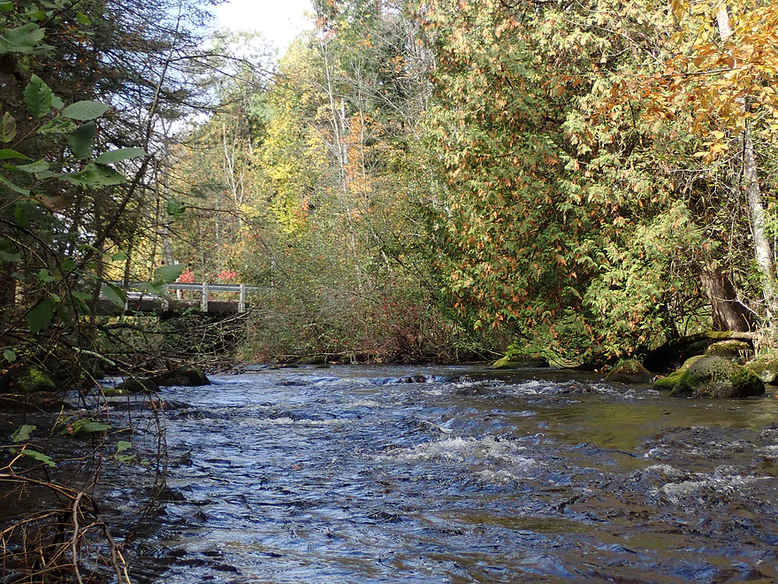
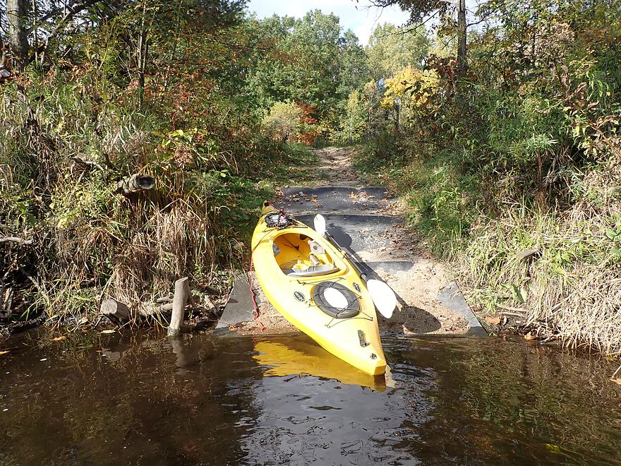
I ended the trip at Wolf River Rd where there is a good public take-out. As I pulled out of the drive to start my bike shuttle, I thought how odd it was that on a Saturday with good weather and fall color, that my car was the only one at the Wolf River Landing (which is usually popular). I suspect many were deterred by bad weather forecasts which incorrectly said it was going to rain. But as I was thinking it odd there were no other kayakers…I was passed by a car with a green kayak…it was none other than occasional WisconsinRiverTrips.com contributor Eric Guderyon! He had just paddled the Little Wolf by Little Falls which was a positive experience (his thoughts on this stretch in the comments below).
In summary this was a very nice trip. But I do want to be clear it’s not in the same league as downstream legs (Wolf River Road > J > Big Falls > Kretchner Rd)…those are uber-elite. The other note is that what I did (2.5 miles) would be considered too short for most paddlers. I personally do short trips to provide time for pictures/video…but most paddlers would prefer to extend this trip downstream to Cty J. It’s possible that extending this trip upstream to the next bridge may be viable as well. The locals did a great job of clearing out logjams below Ness Rd…perhaps they did the same upstream from there? That will be a future paddling project hopefully for 2022.
April 2026 Update – A reader has noted multiple downed trees caused by recent flooding. Until these are cleared out, this stretch might not be recommended.
Sights included a few deer and a frog. There were some small fish, but not many which is odd as this is considered a trout stream.
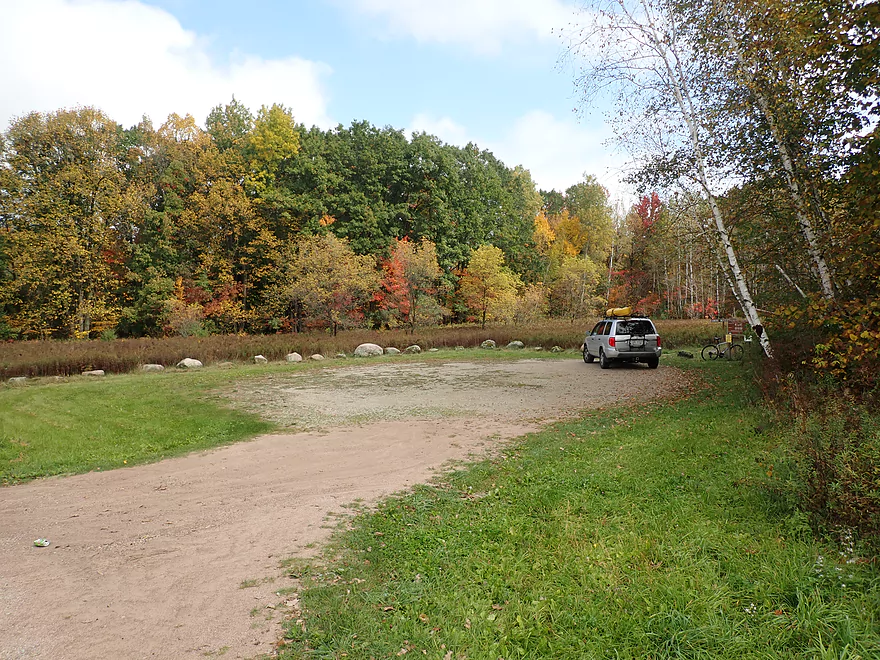
Ness Road: This is a good bridge access and scenic. But, you can’t park by the bridge. Instead leave your car 500′ to the north at a public DNR parking lot.
Alternate Put-ins:
- Wolf River Rd(north crossing) (3.0 miles upstream from Ness Rd) This seems like a doable bridge access. I don’t know if anybody has done this leg, but it seems intriguing. Figure dense woods, lots of boulders, maybe a few logjams, a few rapids, and shallow in spots.
Wolf River Rd(south crossing): This is a good public access with a ramp and public parking lot. This is typically the main put-in (not take-out) for Little Wolf paddlers.
Alternate Take-outs:
- Hwy J (3.6 miles downstream from Wolf River Rd) A scenic stretch with some of the best Class 2’s on the entire Little Wolf.
- Big Falls (7.7 miles downstream from Wolf River Rd) The above plus several Class 2’s and one Class 3. Includes the famous dells stretch.
Bike Shuttle Route – Stebbinsville Rd to Dunkirk: 3.9 miles with 174′ of ascent. This was an easy bike shuttle.
Logjams: None! Somebody cleared them all out…
April 2026 Update – A reader has noted multiple downed trees caused by recent flooding. Until these are cleared out, this stretch might not be recommended.
Current: Good current and is fastest near the put-in.
Rapids: Nothing major. There is a Class 2 by the put-in, but it is upstream of the put-in. After that there is a series of Class 1’s…then the river slows down for the next few miles. There are a few minor rapids near the end of the trip.
Strainers: There are a few low logs to dodge and duck under. I found these mostly easy to deal with. In high water however, the current could get pushy and force paddlers into some low branches.
Trip completed at 1.42′ per the Royalton Gauge. Unfortunately this is far downstream, so may not be super representative. The following are just rough guesstimates. Always scout a river before running and use your own good judgement.
- 0-1.21′: The river rarely gets this low, but when it does paddlers can enjoy great clarity. Some sections will have to be waded.
- 1.21′-1.5′: An average later summer depth good for paddling and having good clarity. Just a few minor shallow spots.
- 1.5′-1.8′: River is above normal. Clarity isn’t as good but is still ok in spots.
- 1.8′-2.4′: A high depth. Current could get pushy and strainers could develop along the shore. Likely a doable depth for experienced paddlers, but not as scenic.
- 2.4’+: Perhaps too high for enjoyable paddling.
Detailed Overview
- Wolf River Road to Ness Road: (3.0 miles) Very narrow, heavily wooded, shallow in spots, and very rocky. Maybe 2 logjams. This is an intriguing prospect on my todo list.
- Ness Road to Wolf River Road: (2.5 miles) A good trip with clear water, boulders, and a few easy rapids.
- Wolf River Road to Big Falls Dam: (7.7 miles)
- Wolf River Road to Hwy J: (3.6 miles) Scenic section with some strong Class 2 whitewater. Good put-in.
- Hwy J to Big Falls: (4.1 miles) Also scenic and with whitewater, with perhaps a Class 3 by the Dells. Good launch by Hwy J.
- Big Falls Dam to Big Falls Powerhouse: (700') This is a steep chute of exposed granite that can create Class 4 rapids when it has sufficient water. But typically the dam penstock robs Big Falls of 99% of its flow. Access to the top of the falls is available from either the east or west shore.
- Big Falls Powerhouse to Kretchner Road: (4.4 miles)
- Big Falls Powerhouse to Little Falls Park: (1.7 miles) This is a good stretch with the highlight being a 2000' stretch of rapids.
- Little Falls Park to Hwy C: (0.3 miles) Features a Class 2 under a bridge, and then a 1500' stretch of boulders and Class 1 rapids. Hwy C isn't a great bridge access.
- Hwy C to Kretchner Road: (2.7 miles) Just below Hwy C is a series of rapids including a Class 3 that runs through a scenic gorge. After that the river slows down and becomes less interesting
- Kretchner Road to Hwy 110: (4.3 miles) A great leg with many scenic boulder gardens. Rapids on this stretch are mild and suitable for beginners. While nice, this leg isn't as terrific as Little Falls or Big Falls legs located upstream.
- Hwy 110 to Hwy 22/Symco: (8.0 miles) Unimproved bridge put-in but should be ok. This section likely has some deadfall issues (not sure how much though).
- Hwy 22/Symco to Manawa Dam: (5.9 miles)
- Hwy 22/Symco to Bridge Road: (2.0 miles) Looks like a nice section with some rapids and boulder gardens near Symco. Good put-in at Symco.
- Bridge Road to Manawa Dam: (3.9 miles) Likely a mediocre section with some flowage paddling at the end. Some of the flowage paddling can be avoided by taking out at Waupaca Park. Bridge Road is a good put-in.
- Manawa Dam to Road Bb: (3.9 miles)
- Manawa Dam to Hwy B: (1.9 miles) Honestly an uninteresting section with slow current and bland flood-bottom woods. Aquatic weeds are an issue (thanks to the Manawa Septic plant). River does get a bit more interesting after the railroad tracks and features a small boulder garden.
- Hwy B to Hwy 110/B: (0.9 miles) A good stretch with some boulder gardens and good clarity. There are Class 2 rapids by the "Rapid View" island.
- Hwy 110/B to Road Bb: (2.1 miles). A great stretch with several impressive boulder gardens and a few minor rapids.
- Road Bb to Hwy X: (7.6 miles)
- Road Bb to Royalton: (3.5 miles) Very good put-in. Nice clarity and boulders until the South Branch joins (almost doubling the river). Very nice boulder garden and rapids 2/3rds in.
- Royalton to Ostrander: (2.7 miles) After the brief rapids under Hwy 54/O, the Little Wolf goes back to sleep, with pleasant but monotonous scenery (the highlight being sporadic boulders). Finally, maybe a half mile prior to Ostrander Road, there is another set of rapids (Class 1) and an attractive boulder garden. Paddlers will have to deal with many tubers.
- Ostrander Road to Hwy X: (1.4 miles) Busiest tubing section probably in the state. Very nice boulder gardens and rapids at end. Public landing NE of Ostrander Road.
- Hwy X to the Mouth (Junction at Wolf River): (2.0 miles) Part of the Mukwa Bottomland Forest SNA
- Mouth to Dey Road/Shaw Road Boat Ramp: (0.8 miles) A short stretch on a now large Wolf River.
Trip Map
Overview Map
Video
Photos Size:
I did a short section from Big Falls to Kretchner Rd to 10/4/21, and had a fantastic time. The water clarity as well as the scenery were outstanding. (Unfortunately my camera died just after this trip, and I have not been able to retrieve any of the photos) The highlights of the trip were the numerous boulder gardens, especially impressive were many car sized boulders in and along the river. There were many small riffles and rapids as wellas a couple of decent class l rapids, and one good drop (class 2?). The river was rarely 1-2 feet deep and the rapids were fairly boney so probably not a river to do if you worry about putting a couple of good scrapes on the bottom of your boat. The trip was about 4.7 miles and took me just under 2 hours, but I was taking a lot of pics and playing in some of the rapids, so I would think 1.5 hours would be more typical. I did a bike shuttle, it was about 3 miles, and took me about 15 mins. The google maps will direct you to go on Hwy C all the way, but be sure to take a little detour to stop in the “town” of Little Falls to scout the rapids under the second bridge. Debris tends to accumulate here and you will want to check to see which of the three routes under the bridge are runnable. The town is really little more than a bar that used to be a resort, but there are some kitschy things to check out, a kinda scary suspension, mini zoo with peacocks, rabbits, and a few cages with…..(nothing I could see) and no signs, as well as something that looked like a hairless deer or a newly shaved llama??? The bar was closed and there was no one around to ask. The forecast was for rain on the day I paddled so I did this short trip, if I did it again I would continue another 4 miles down to Hwy 110
Put-in/take-out
There is a small parking lot on Power House Lane, which is just south east of the Dam off hwy G. There is a small trail that leads to an easy put-in spot, there is also a porta-potty by the parking lot. The take-out is at Kretchner Rd, on river right just before the bridge. There is a small field with a partial driveway, I don’t know if it is OK to park there, but it appears to have been used to load boats in the past, and there is plenty of space to park along the road and by the bridge.
First thank u soooooooooooo much for the absolutely invaluable information on your site!! The links to google maps in particular snd the pictures!
My question is… how do you get your boat up and down fro
The car by yourself!
I bike shuttled! I’m a big fan of bike shuttles. Otherwise you would likely need to bring a second car and car shuttle.
I put down the seats in my minivan. The kayak fits diagonally inside the van with the nose riding shotgun. This saves me any overhead lifting.
Attempted Ness Road to Wolf River Rd on 26-Apr-26. The Little Wolf Gauge at Royalton was at 2.43 ft. This was following the heavy rains in the area that flooded New London, Shiocton, etc, and made for the wettest April on record.
We decided to carry our kayaks back on shore after no more than a half mile. There were numerous downed trees blocking the river. The shore (especially to the north), was a flooded / mucky swamp. The flow itself wasn’t a problem, but all the havoc that earlier flooding had wrought made this a mess.
Perhaps if we had started further downstream, where the river widens a bit, we would have had more luck. I love this whole stretch and have run it many times before.
Thanks for the update and warning (I’ll add a note about the downed trees in the write-up). If you hear any further updates, definitely let me know.