
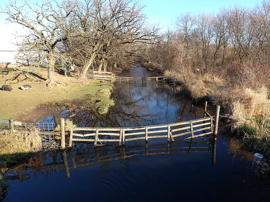
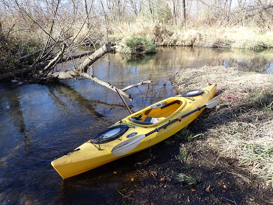
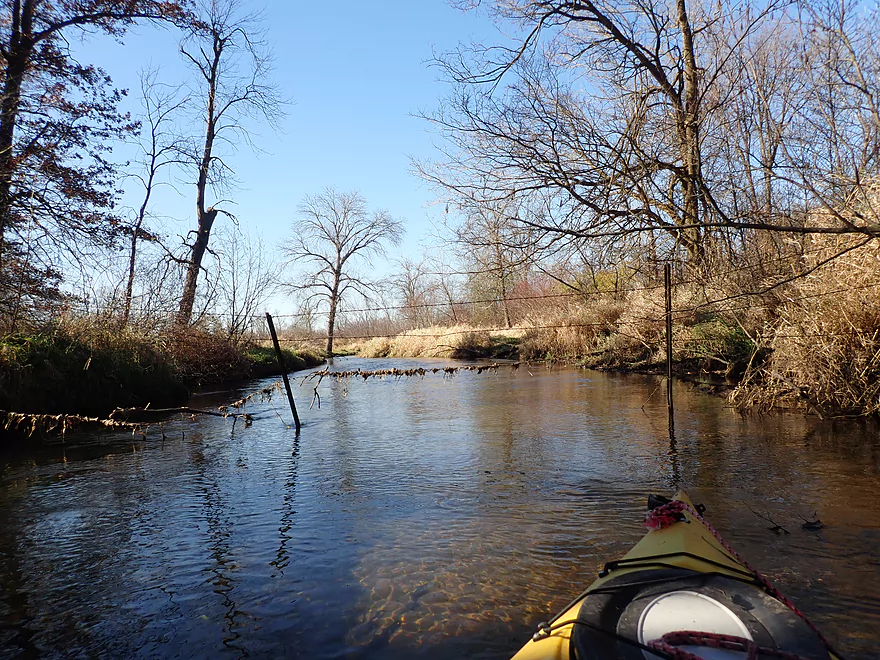
Starting the trip at Hwy 92 below some farm swing gates
Good launch area on the downstream side
The gates were on the upstream side, so didn’t need to be passed
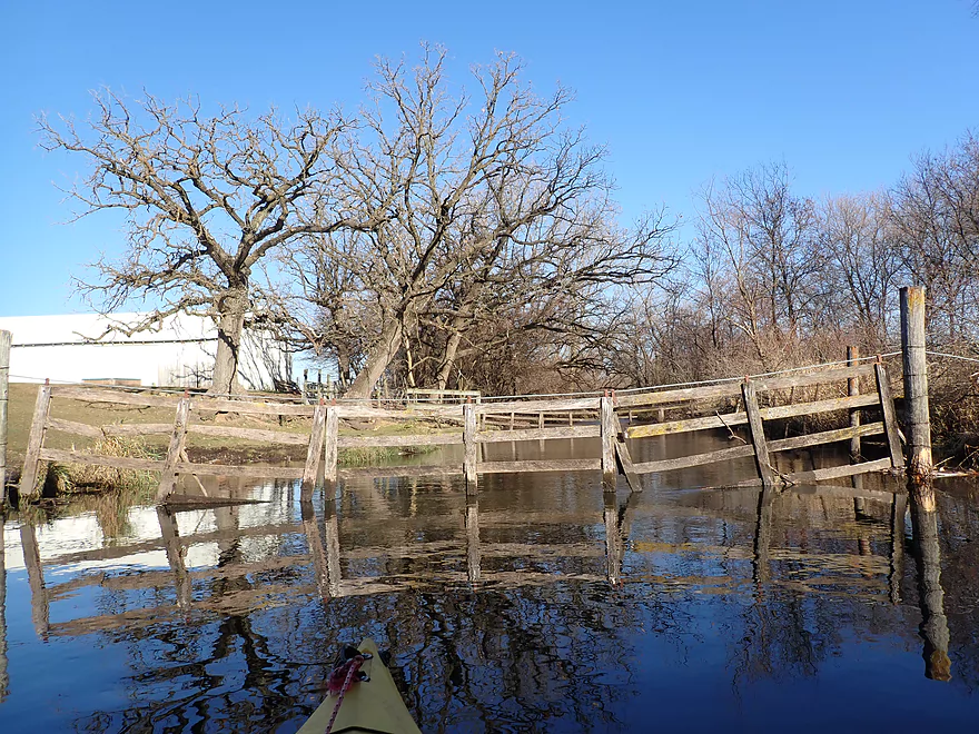
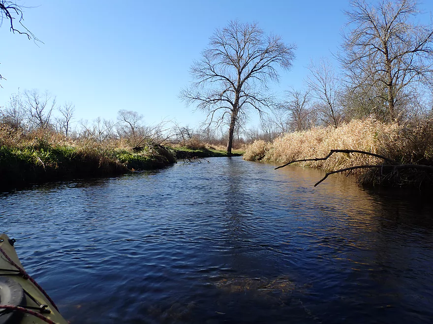
Reverse view of the bridge
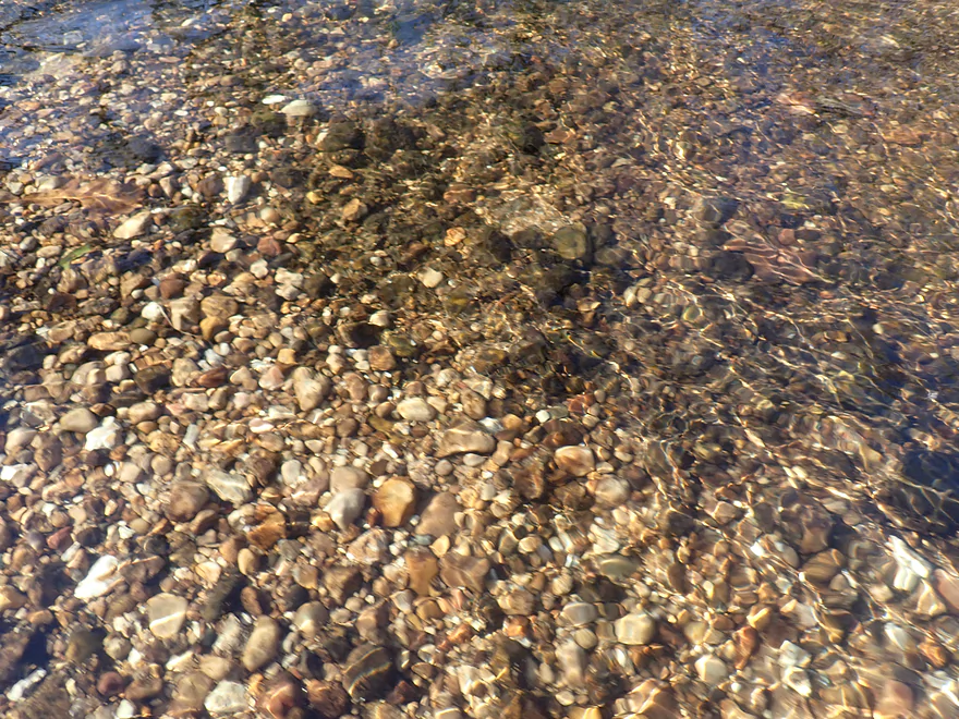
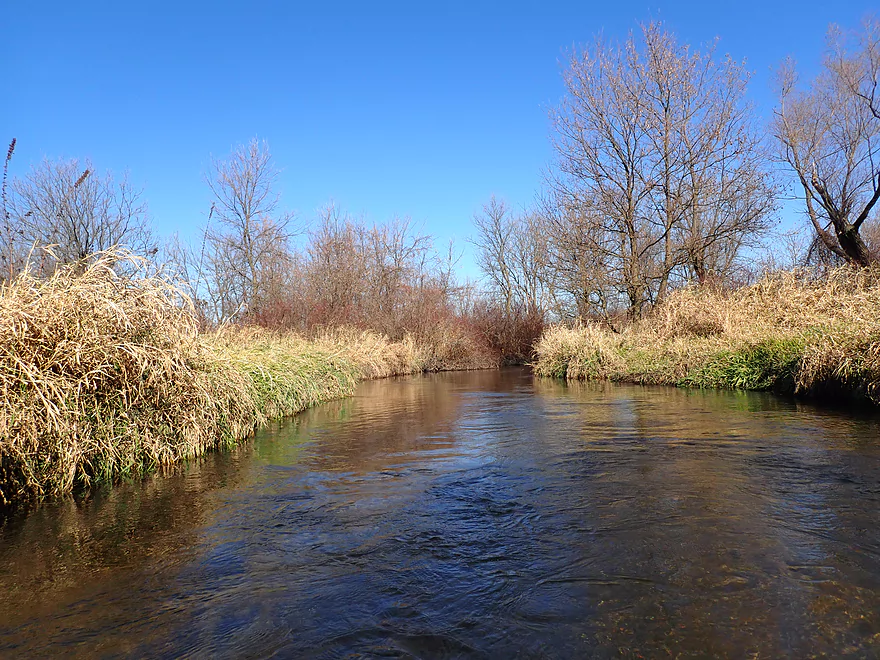
Nice gravel substrate
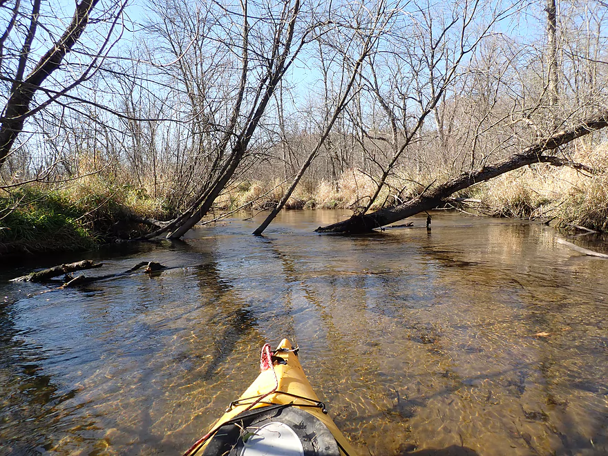
Very fast current to start
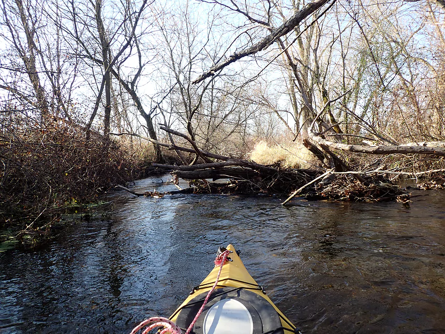
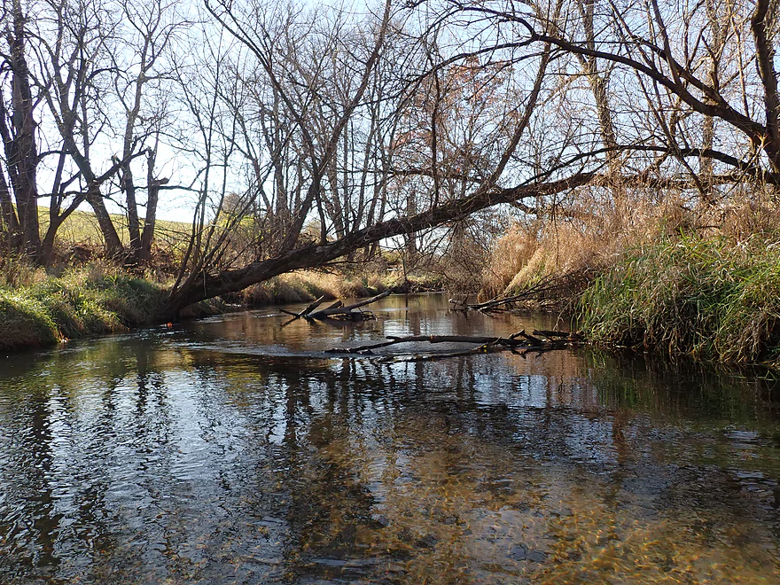
Some snags to deal with though
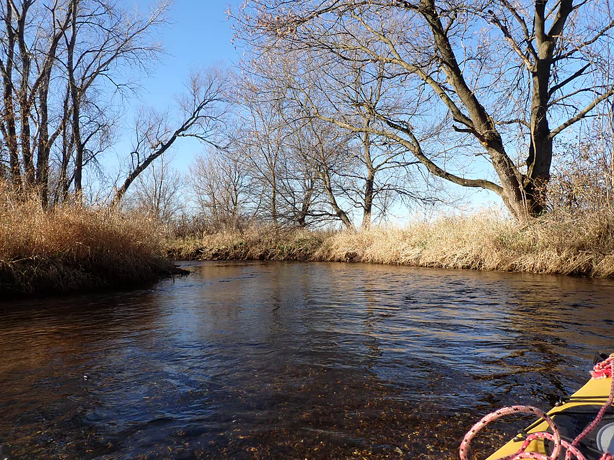
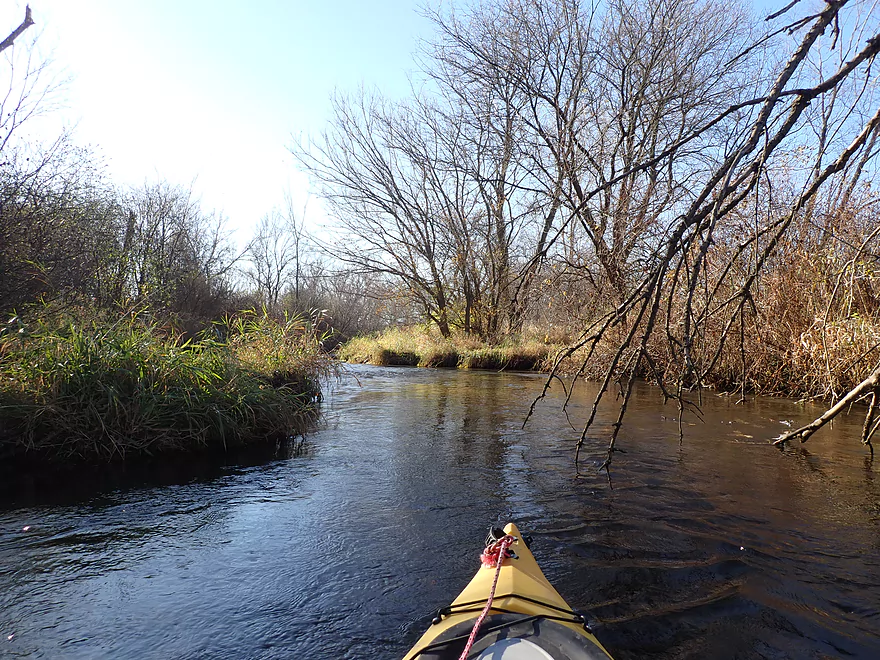
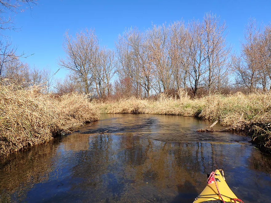
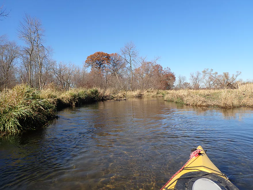
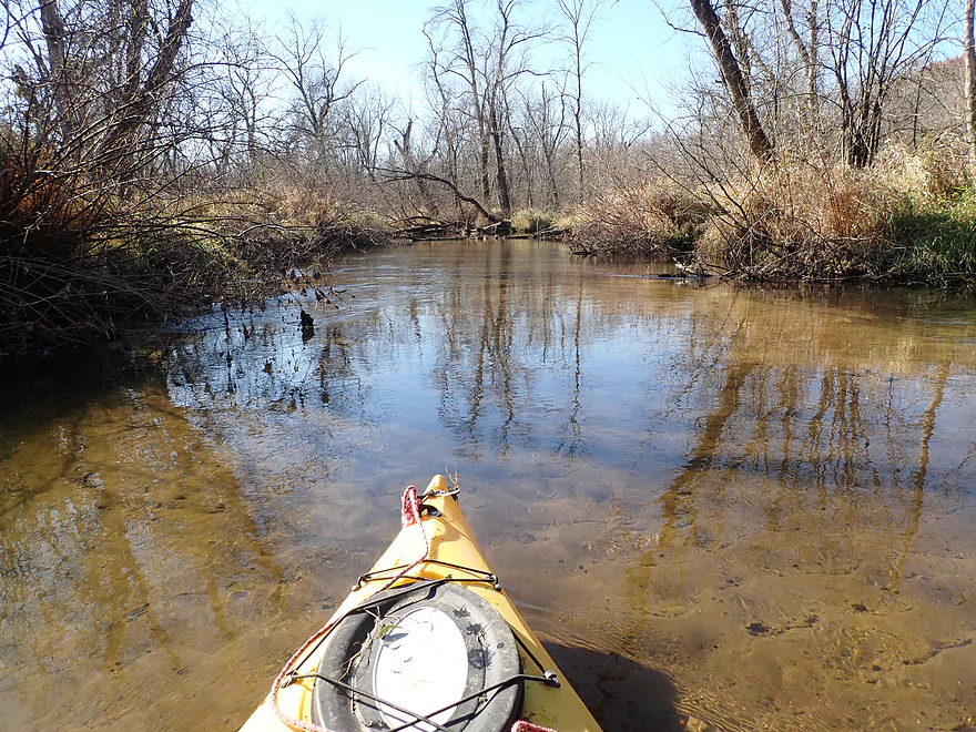
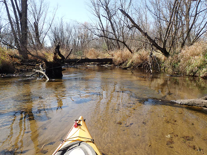
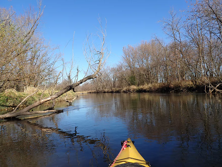
Out of the woods
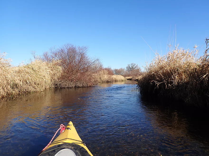
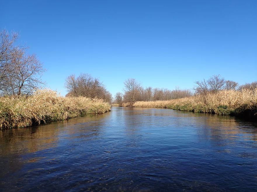
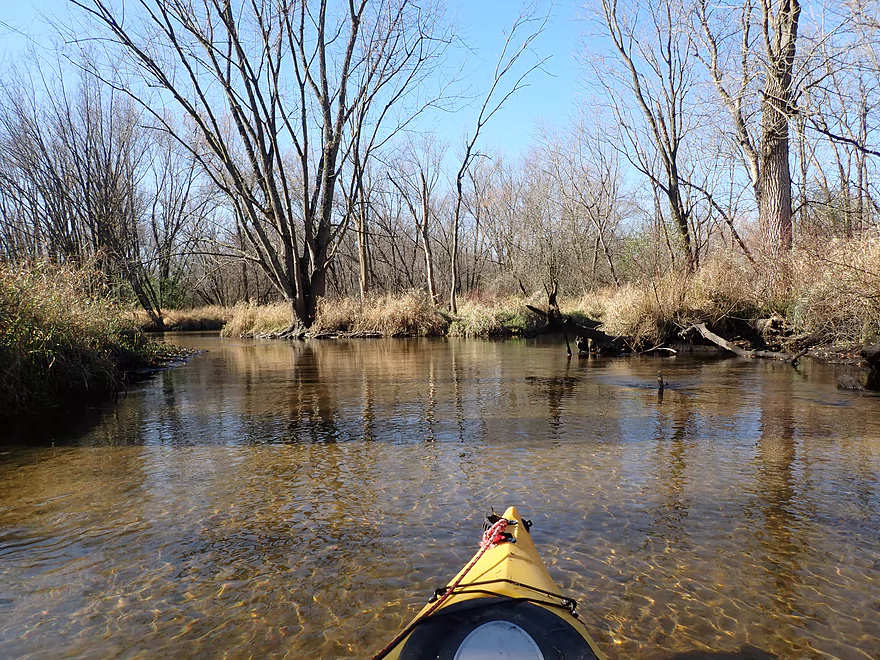
Creek starts to open up
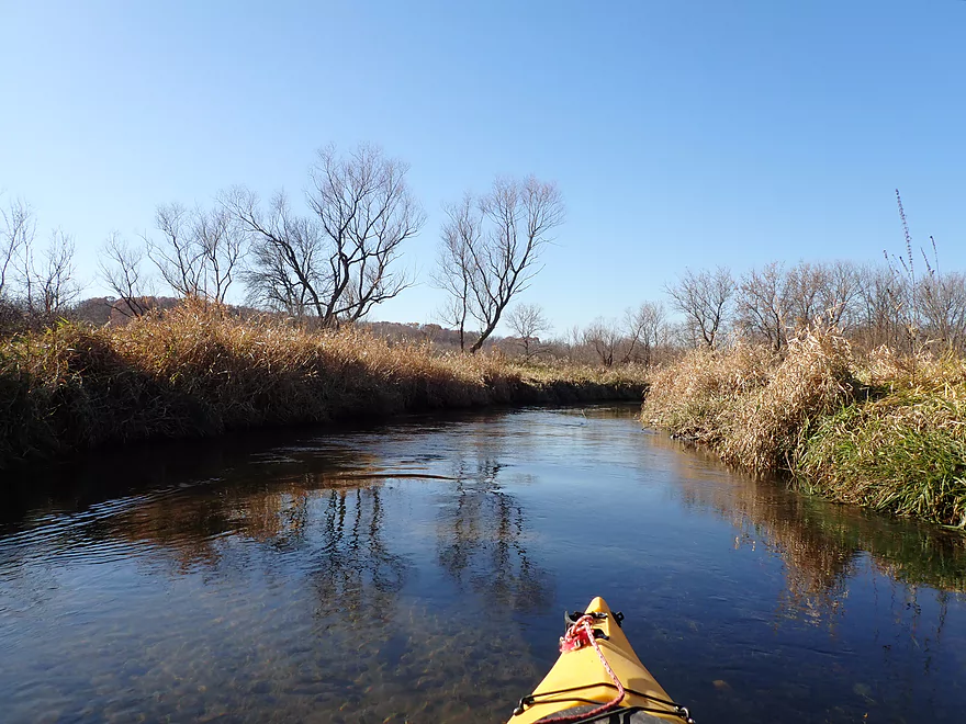
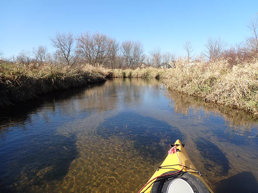
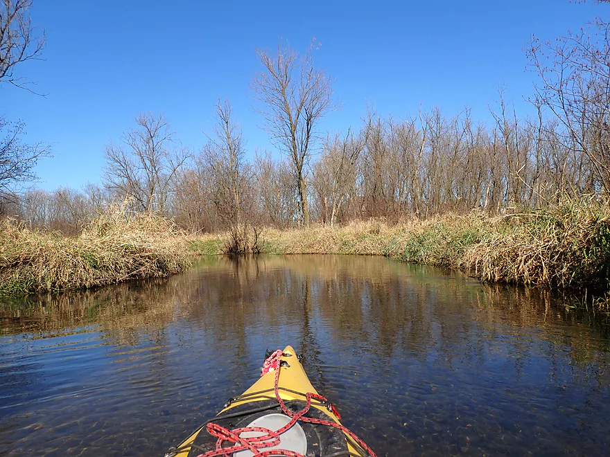
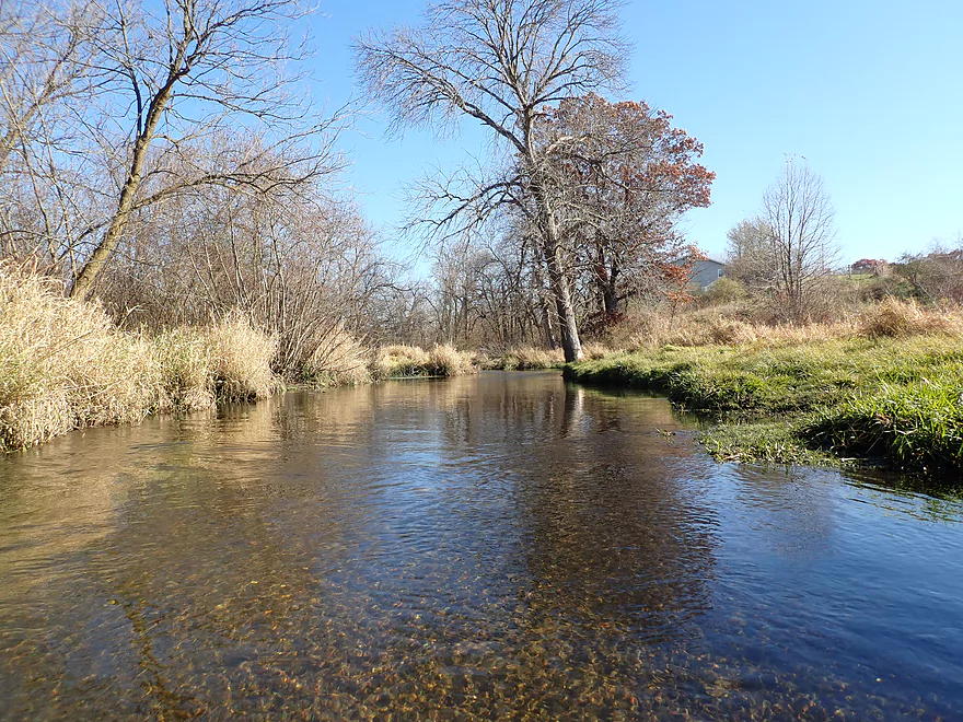
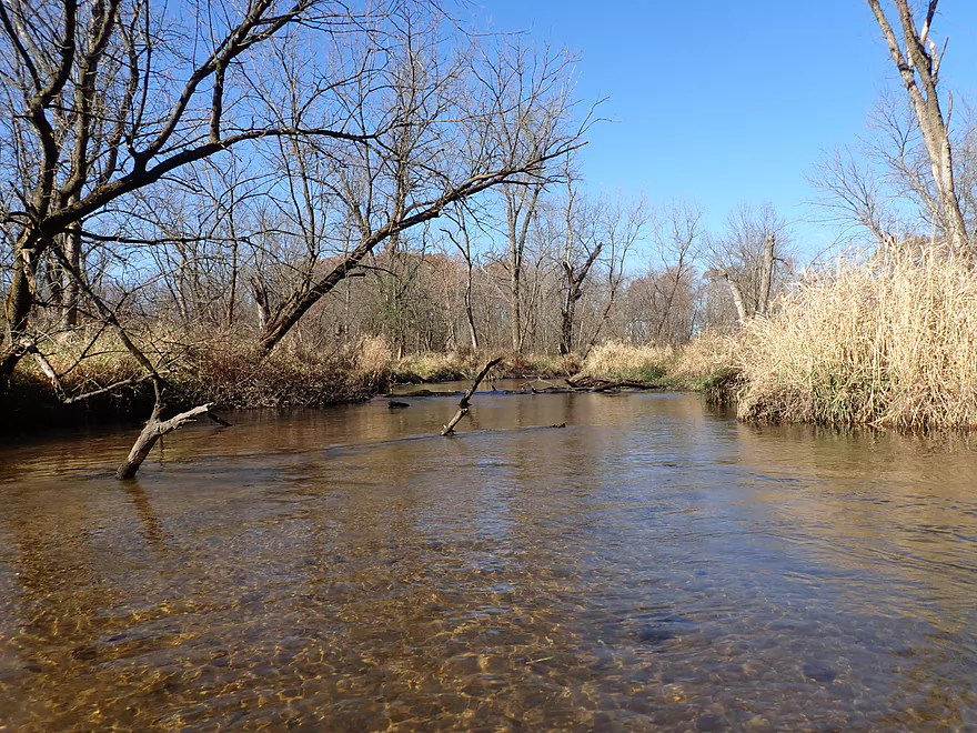
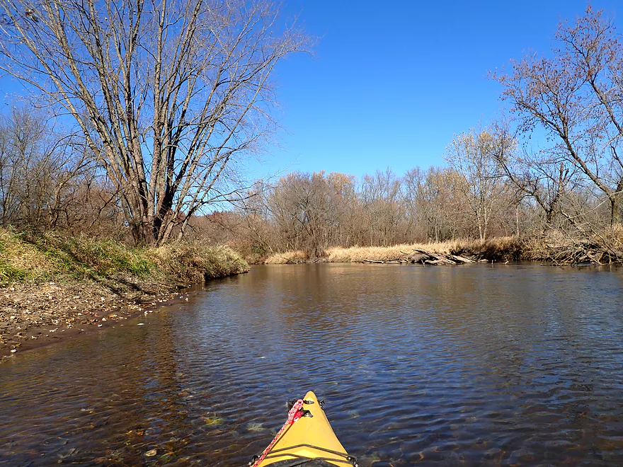
Terrific clarity
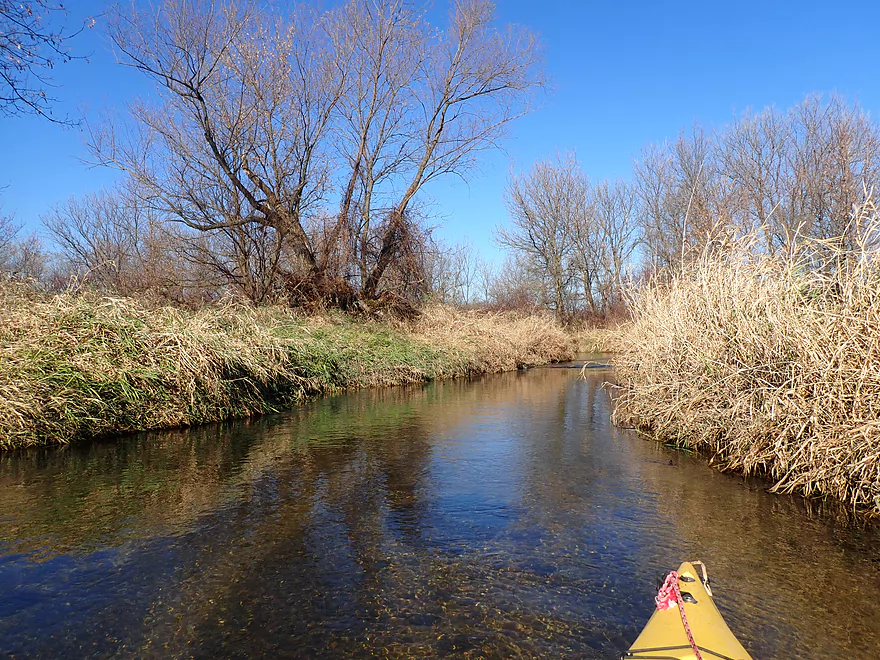
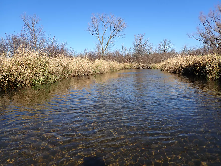
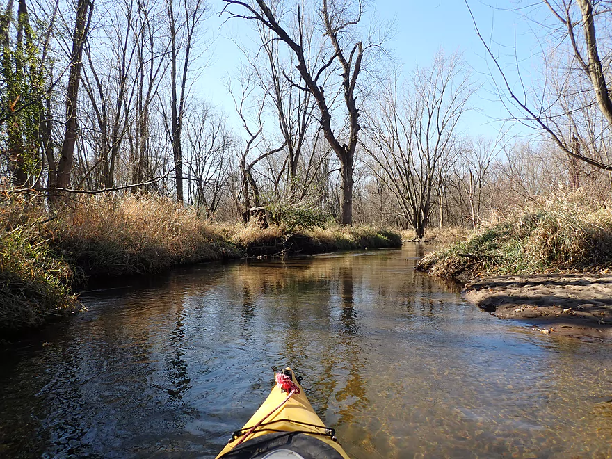
More clear water and gravel
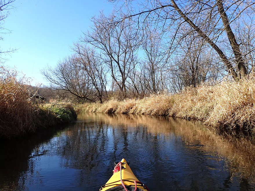
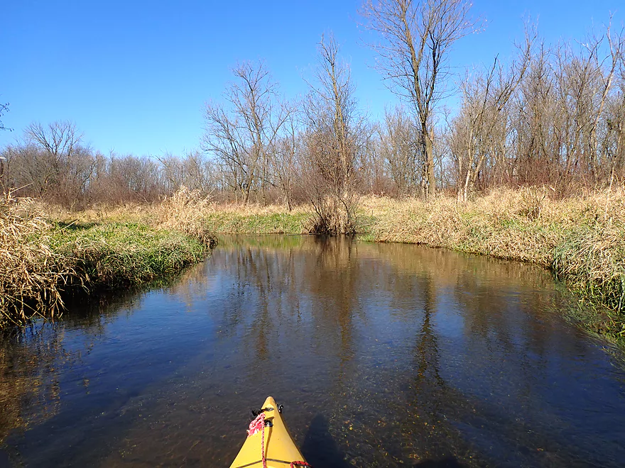
This really reminded me of the Upper Mecan River
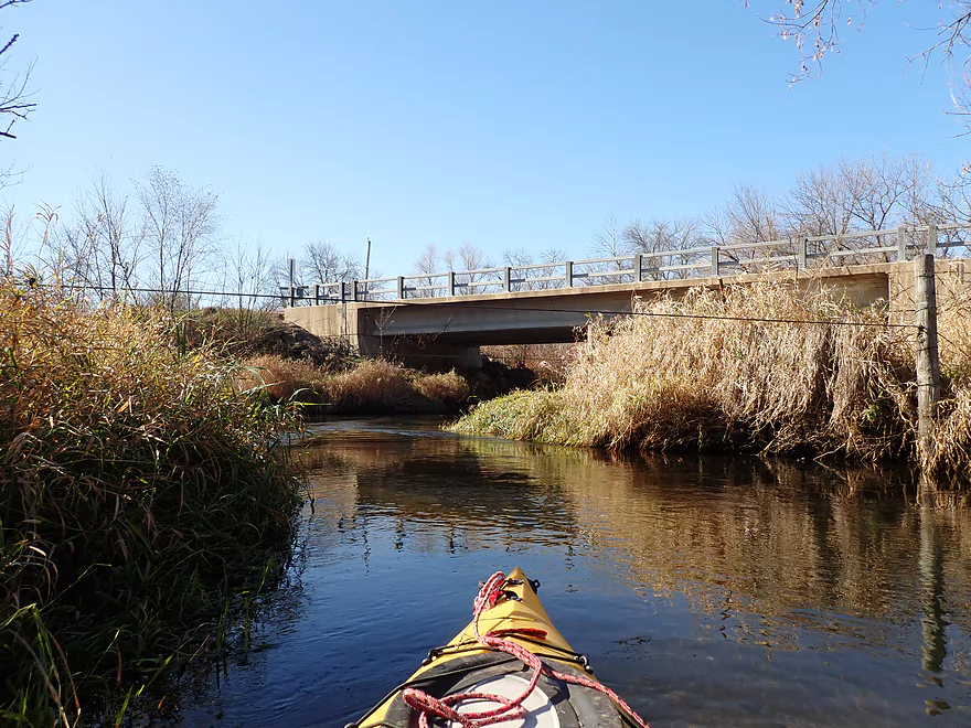
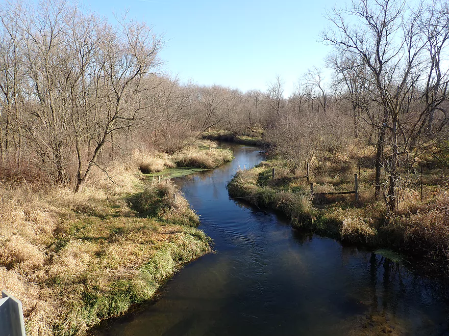
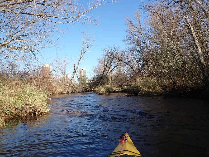
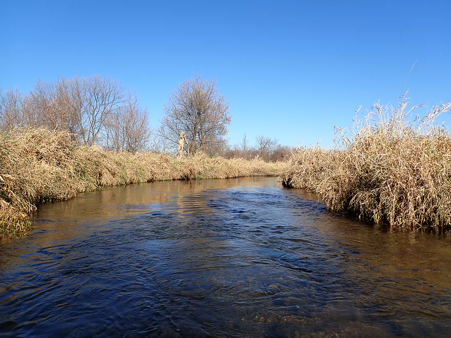
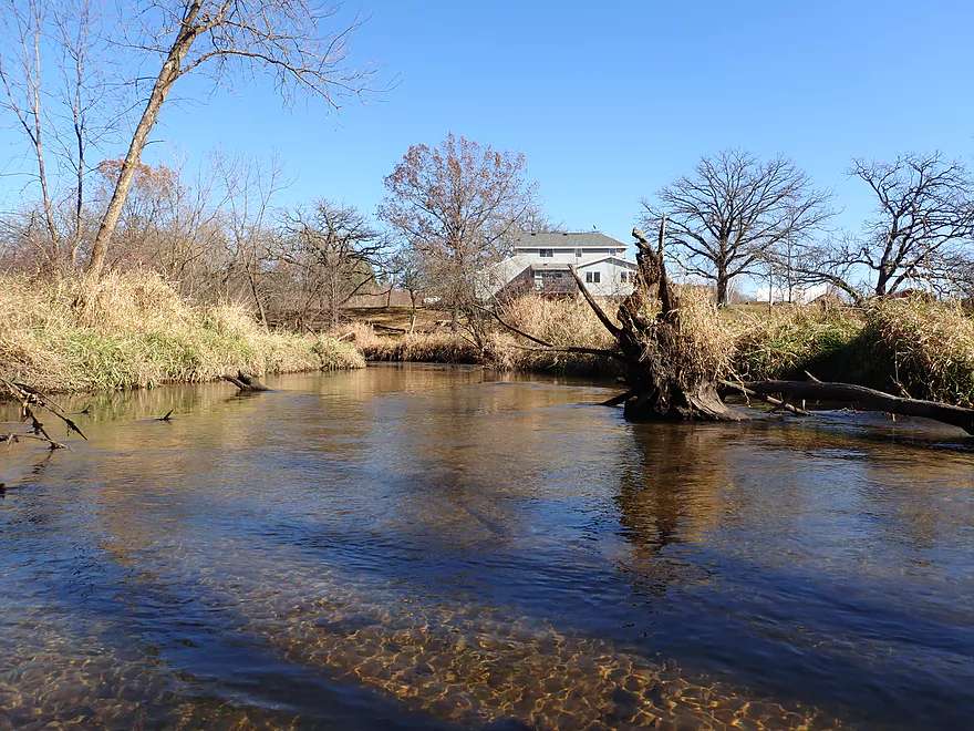
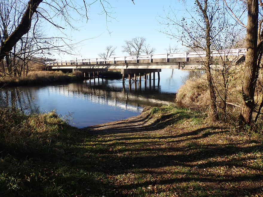
View from the Hwy X bridge (there is a nice access on the north bank)
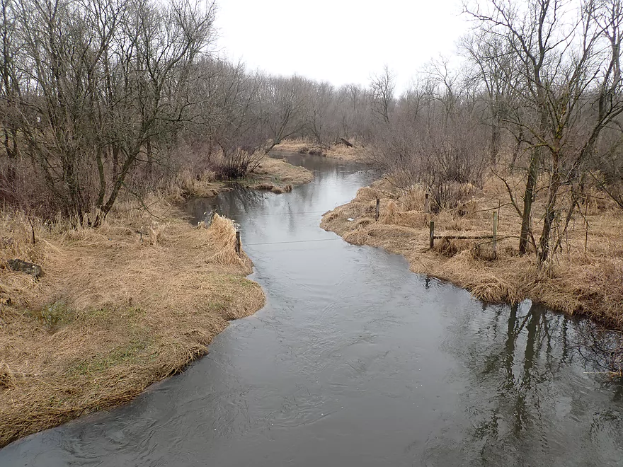
Same view but in spring with high water
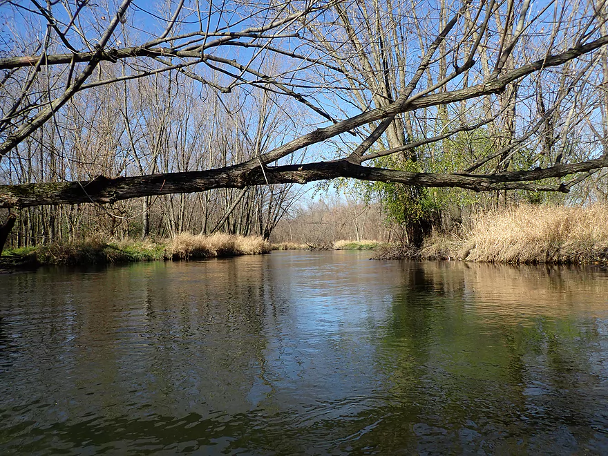
Some portages…mostly easy
A barbed wire fence that I was able to duck under
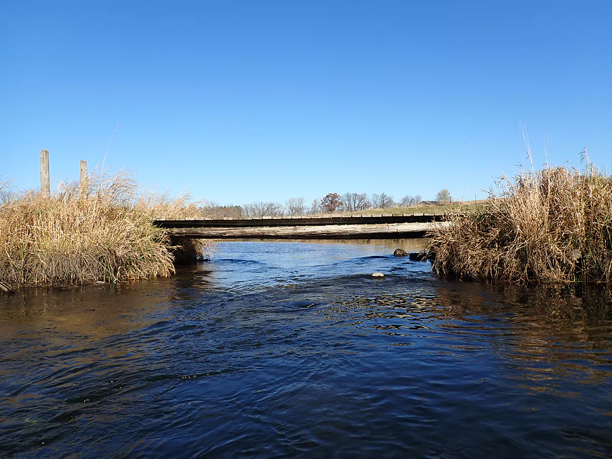
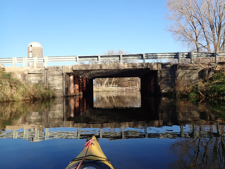
A VERY low farm bridge
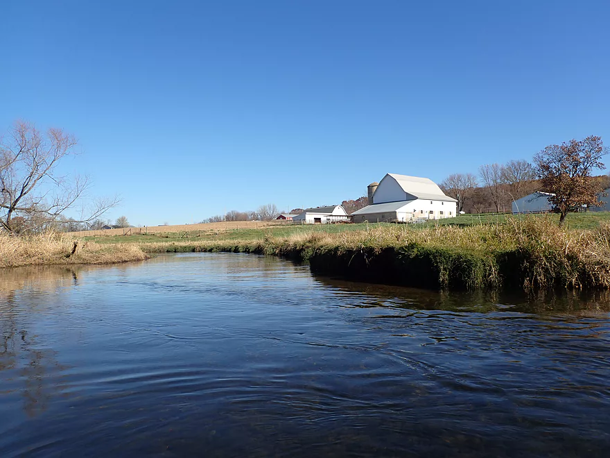
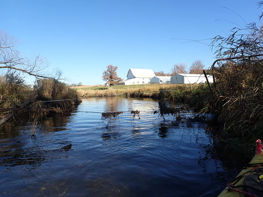
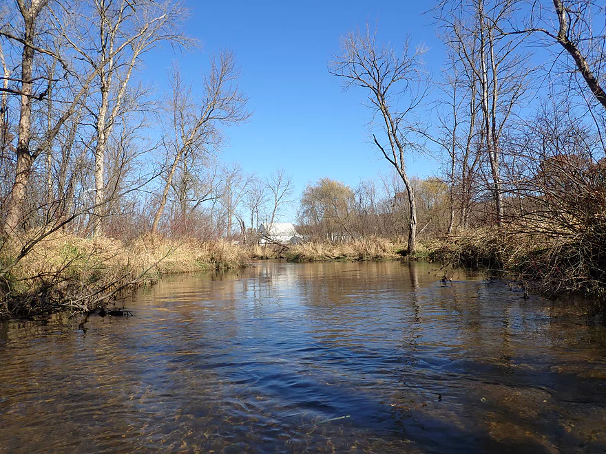
Passing by a large farm
Another farm fence…this was easy to get under
Very sandy stretch
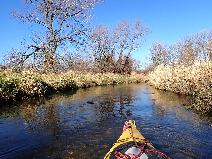
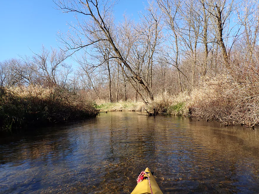
Becoming a bit more wooded
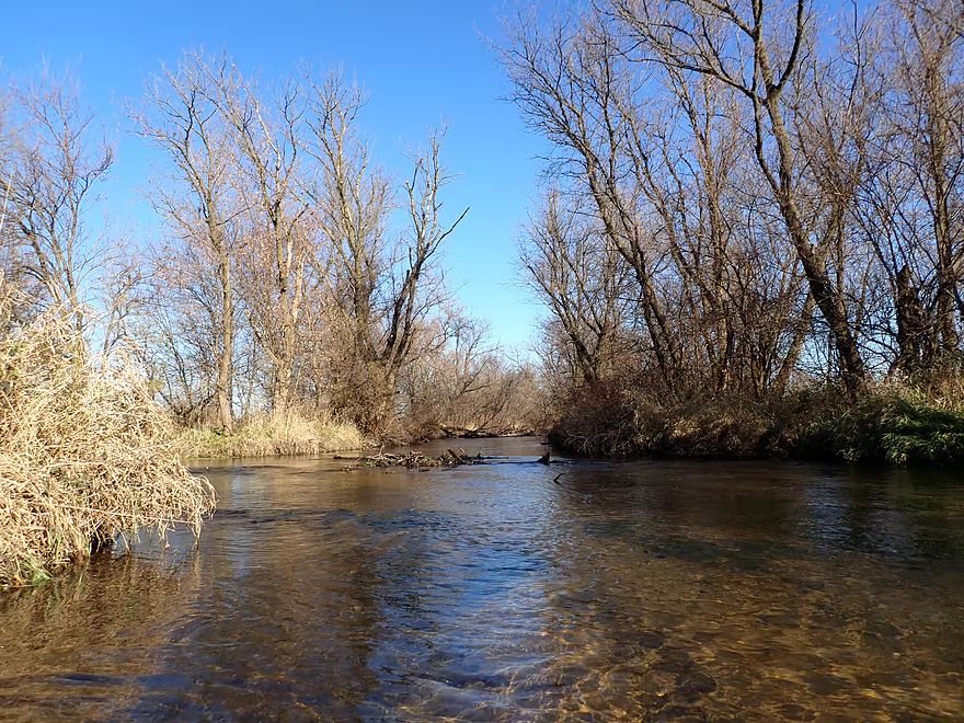
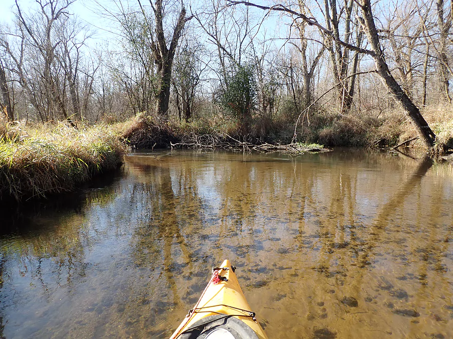
Some logjams to deal with
Easy portage
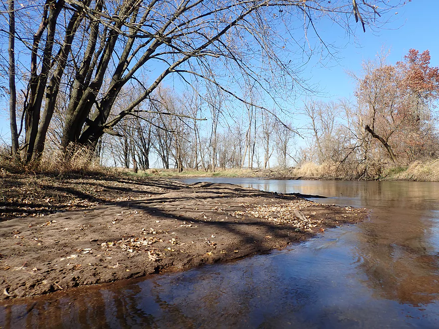
Going through a floodplain forest
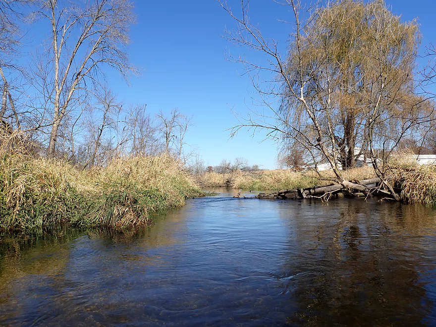
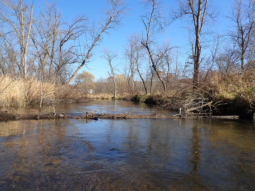
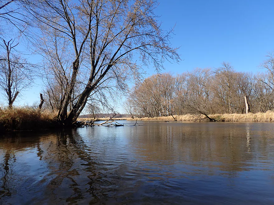
The mouth of Story Creek
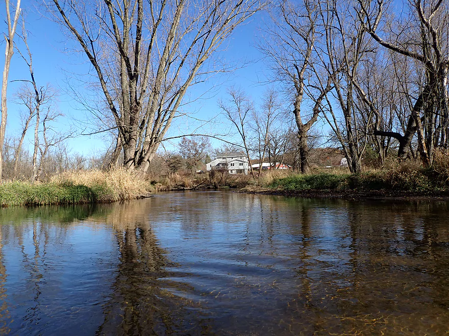
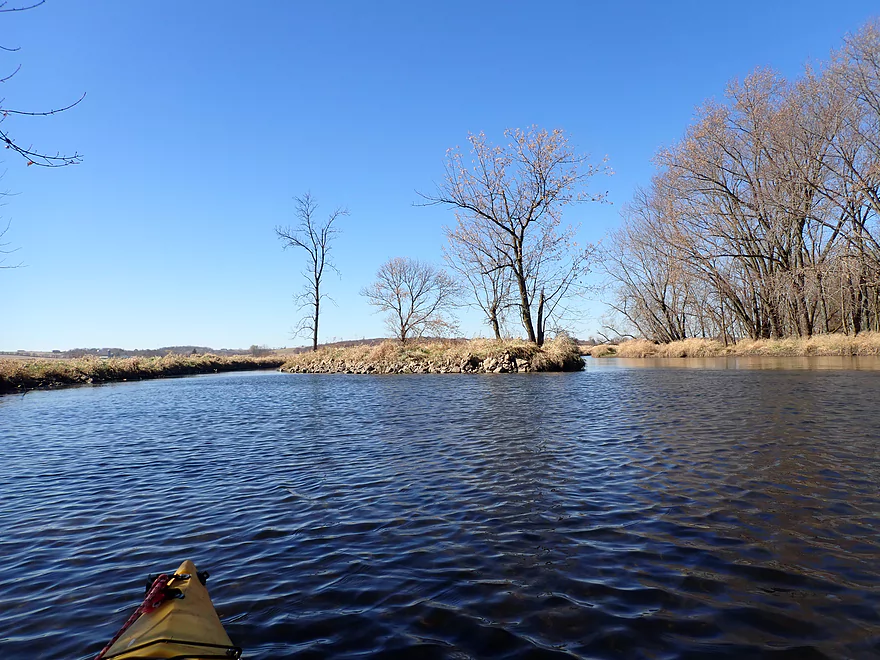
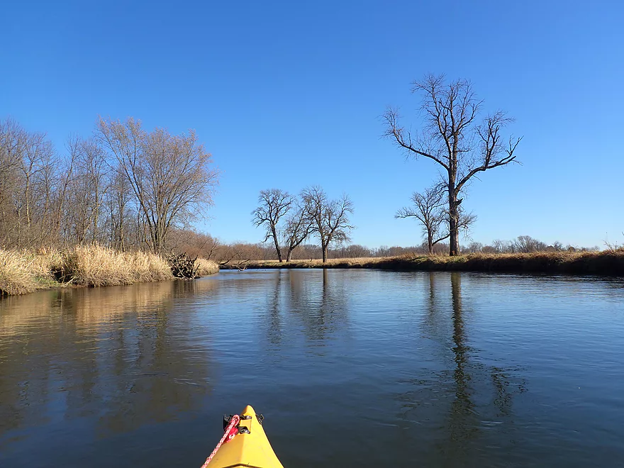
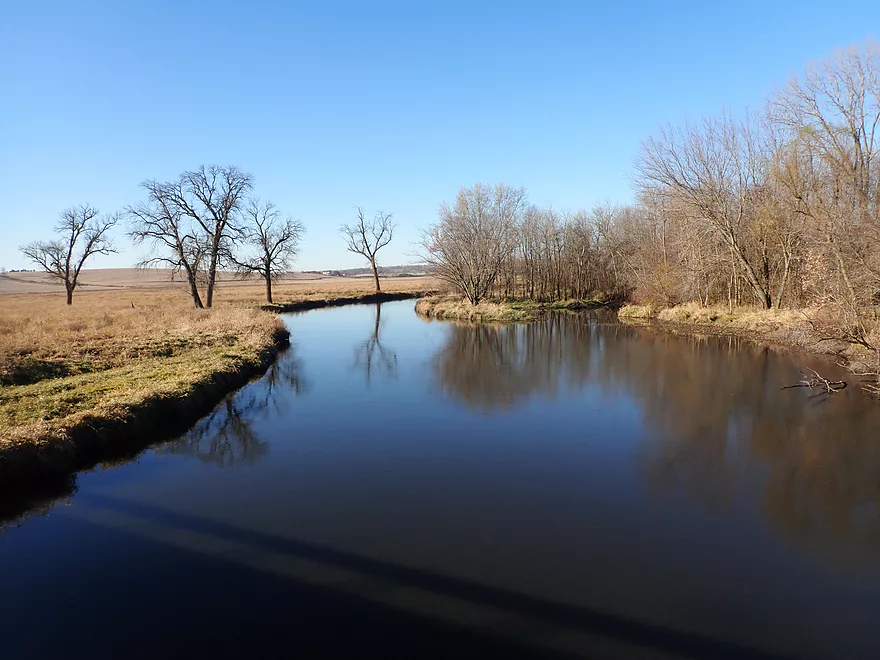
Now on the Sugar River
Which is much bigger
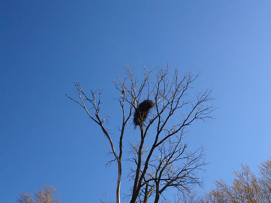
A large eagle nest
Many blackbirds staging for migration
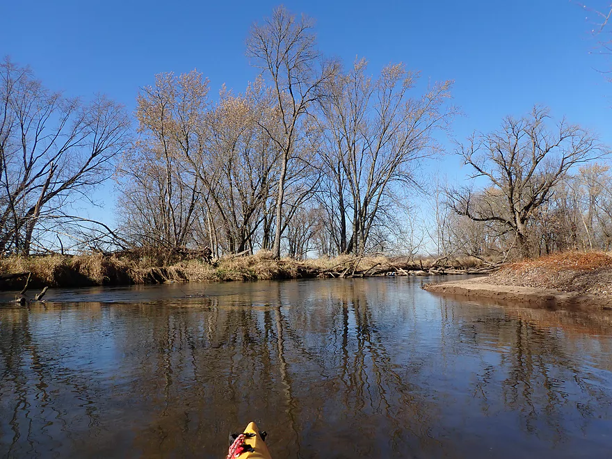
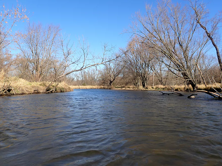
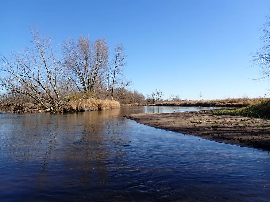
Some surprise sandbars
This is a nice part of the Sugar River
This would look very different in the summer
A riverside campground
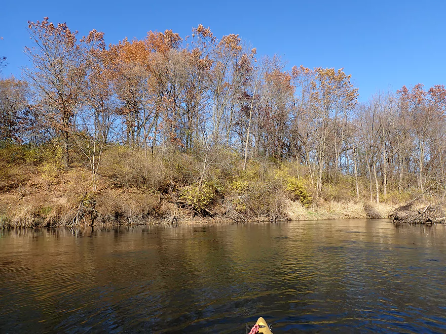
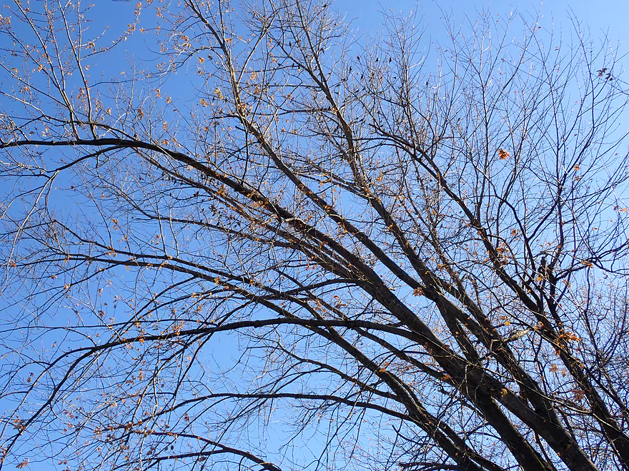
Some late-turning oaks
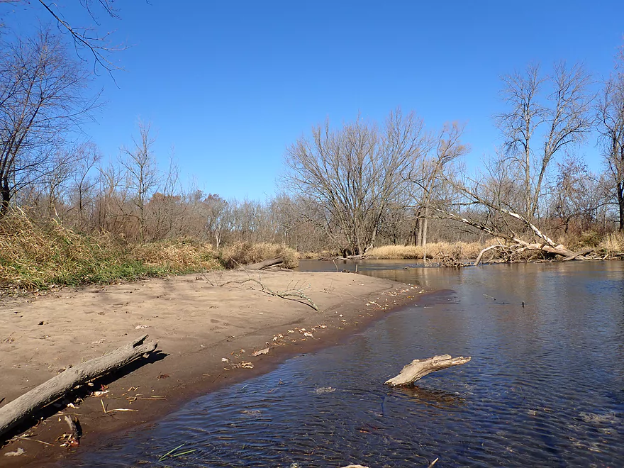
The Sugar was on the low side which revealed some small sandbars
Some stately trees
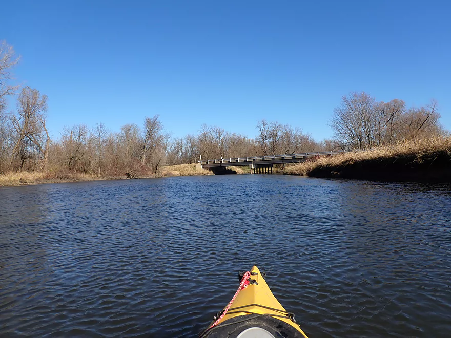
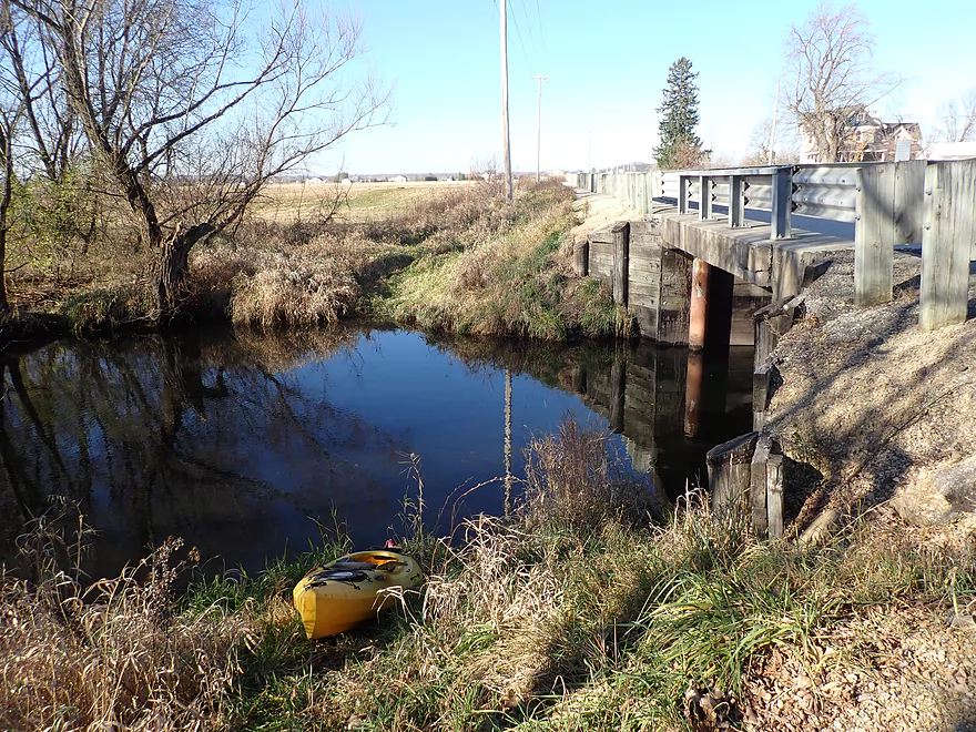
Hwy X (2nd bridge)
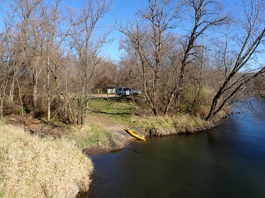
Taking out here
It’s a nice public boat ramp
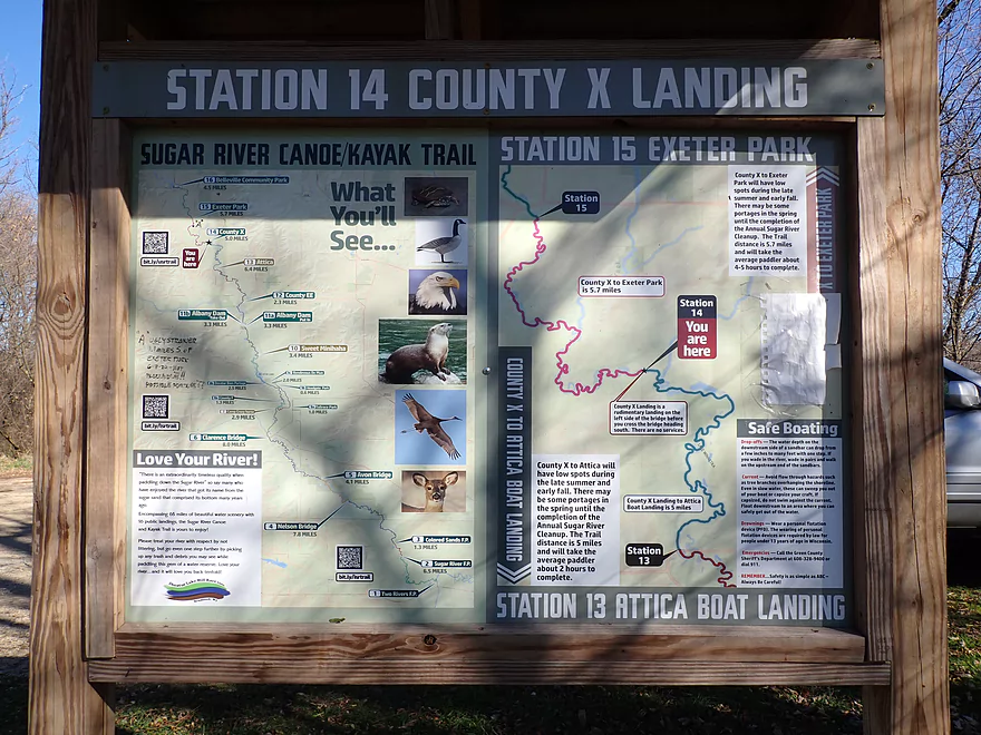
A handy Sugar River map
One last view looking upstream
Story Creek


Story Creek is an obscure tributary to the Sugar River located near Belleville. Before doing this trip I didn’t know much about it…only that it looked intriguing from satellite images and from a fishing video I found. It also flowed through a large natural area (the Brooklyn Wildlife Area) which is usually a good sign, so I decided to roll the dice.
The upper stretches of the creek are likely too congested to run, so I launched on the lower part at the Hwy 92 bridge. At first glance this didn’t seem like a great bridge access as it was by a busy road, it had a nearby farm, and there were imposing swing gates located on the upstream side of the bridge. But it actually worked out well with good shoulder parking and easy bank for launching. There’s even a boot cleaning station for trout fishermen.
The first half mile of the trip was relatively wooded, fast, and the most congested of the entire trip. Strictly speaking I didn’t have to portage on this stretch, but there were several tight fits in swift current that kept me on my toes. Most of these snags were small though and would have been easy portages. Locals could easily clear them out. On the plus side, the creek was incredibly clear and flowed over a gravel substrate…not something you typically associate with southern Wisconsin. Story Creek is actually an “Ice Age Paddle” which means it’s located at the edge of the terminal moraine. These tend to be atypically clear, have little mud, and have an unusual amount of gravel.
After this the creek opened up and changed dramatically. Grasses replaced trees and the channel slowed, widened and deepened. The clarity though was still top-notch. I was able to spot many large schools of fish through the clear water. It’s ironic that typically when I do trout streams, I rarely see fish…this (and the Big Green) are the only two trout streams where I’ve actually seen large numbers. I suspect the fish like the clean, cold water…perhaps a byproduct of upstream springs in the Brooklyn Wildlife Area.
At the two mile mark, I came to Hwy X. Here there was a nice parking lot and public access area for the creek. I didn’t see evidence that many people use this, which is kind of sad. It’s one of the nicer creeks located in Madison’s orbit. At many points, it REALLY reminded me of the Upper Mecan River which is high praise.
While I could have taken out at Hwy X, I continued on and soon came to a large farm. Here there was a low farm bridge that required serious ducking to get under (a portage wouldn’t have been difficult). There were also two barbed wire fences to deal with, but these were manageable and I was able to get under without much difficulty.
After a more open stretch, the creek entered a final wooded floodplain. This had some congestion but it was nothing too stressful. The substrate became much sandier, which reflected a lot of light and really showed off the creek’s incredible clarity.
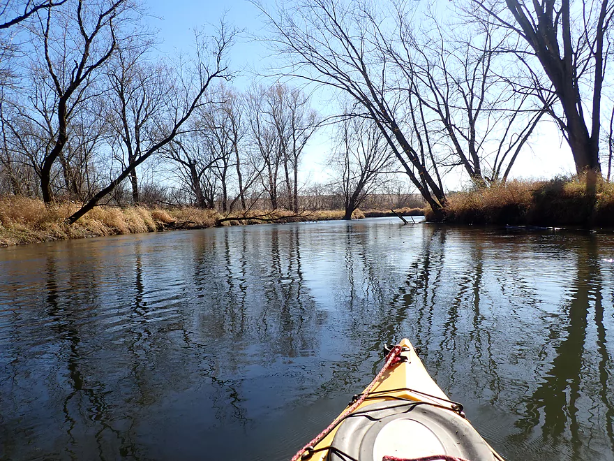
The floodplain forest was brief and I soon was on the Sugar River. My primary purpose of the trip wasn’t to do a Sugar paddle, but I knew I had to paddle a few miles on it to reach the next bridge. This wasn’t a big deal though as this is a nice stretch of the river.
It was, though, a serious downshift. The clarity mostly vanished, the scenery became less interesting, and the paddle lost some of its magic. The Sugar (while not a big river) certainty seemed like one next to small Story Creek. Gone were the never-ending turns and twists around tight bends. Instead it was one long stretch, a turn, another long stretch, etc…
Most Sugar River kayakers paddle it in the summer, but that’s a very different experience compared to now (late fall). With the grasses partly died back and the trees de-leafed, it let a lot of light onto the river and really provided a more open vibe to the river which I liked.
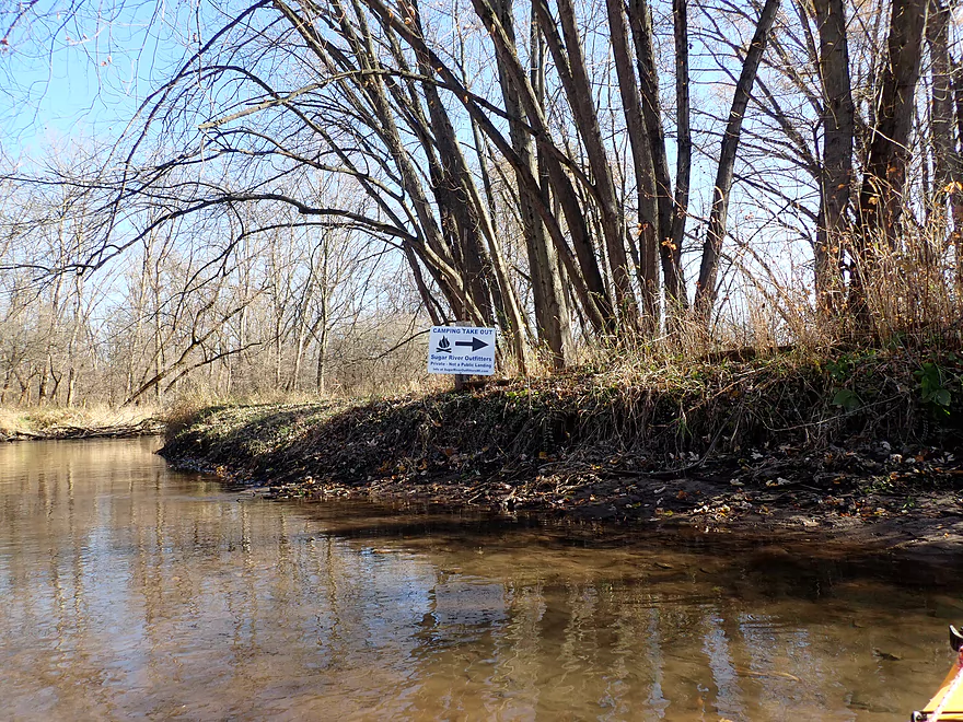
There was even a private campsite I passed (you can pay Sugar River Outfitters for access). This is quite novel as you usually don’t associate camping with these types of rivers. I ended the trip at the Hwy X Boat Ramp which was a terrific take-out.
In summary, this was a trip that I enjoyed. This might not be for casual paddlers as there were some logjams and snags to deal with, but the clarity was terrific and the trip really reminded me of the Mecan River. Hopefully in the future some of these snags will get cleared out. This is an overlooked creek by both fishermen and paddlers that deserves consideration.
At the put-in there was a family of muskrats that scrambled into the water when they heard me arrive. There was a nice eagle nest on the Sugar as well as a number of blackbirds staging for migration. The trip highlight was the many schools of fish I saw on Story Creek. Perhaps over 100 total…among the most I’ve ever seen on a paddle.
Ice Age Trail – Brooklyn Wildlife Segment: The Ice Age Trail goes by upper Story Creek and through the Brooklyn Wildlife Area. For more information check out this hiking review of the area.
Hwy 92: Despite being next to a busy road and a pig farm, this was a surprisingly good access. It’s actually at the border of the Brooklyn Wildlife Area and I suspect trout fishermen frequent this spot. Both here and the take-out have boot cleaning stations which is considerate. The purpose of these is to prevent the spread of invasive species, but it’s also a good way to clean off your boots before you get into your boat or car.
Alternate Put-ins:
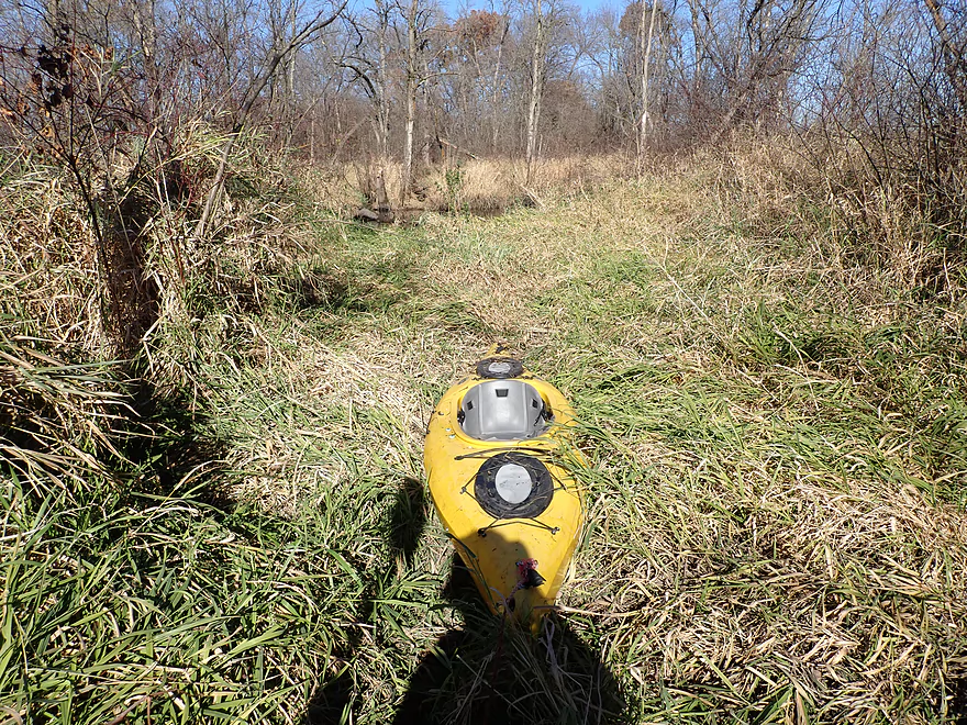
- Upstream of Hwy 92: The next bridge upstream is Bellbrook Road, but I don’t think it’s viable for paddlers, as the upper creek is likely too small and clogged with logjams. You could possibly launch further downstream by one of the trout access points, but most of these would require a decent hike. Here is an example location used by fishermen. While I will likely never paddle the upper portions of the creek, it does look scenic (based on this Youtube video).
- Hwy X Bridge (1.9 miles downstream from Hwy 92): There is a public parking lot northwest of the bridge, and a faint trail leads to the creek where it would be easy to launch. I’m not sure you want to launch here, as it would only mean paddling just a mere mile on Story Creek.
Hwy X Boat Ramp: This is an excellent public boat ramp.
Alternate Take-outs:
- Hwy X Bridge (3.6 miles upstream from Hwy X Boat Ramp): This is a good access…but taking out here omits a nice stretch of the creek.
Hwy X to Hwy 92: 2.9 miles with 59′ of ascent. This was a very easy bike shuttle.
Liveries/Rentals: Sugar River Outfitters services much of the Upper Sugar. Call ahead to ensure availability: (608) 692-7910.
Logjams: There were several low branches and downed trees. Most of this wasn’t too difficult to deal with or to portage. The worst congestion was in the first half mile of the trip. For exact locations of the logjams see my trip map. Most of the jams aren’t major and could easily be cleaned out by locals.
- Logjam #1: There is a low branch here that I was able to hop over.
- Logjam #2: Another low branch that I was able to hop over.
- Logjam #3: A downed tree blocks most of the creek. I was able to duck low and get past on the right side.
- Logjam #4: 100 yards downstream from the first Hwy X bridge is a small logjam that is an easy portage.
- Logjam #5: Just upstream from the mouth was a small logjam that required an easy portage.
Fences:
- Fence #1: Just upstream of the first Hwy X bridge is a pair of wire fences. These were super easy to duck under.
- Fence #2: About 200 yards downstream from the first Hwy X bridge was a barbed wire fence. I was able to duck and get under without too much difficulty.
- Fence #3: About 300 yards downstream from fence #2 is another farm fence. This was low, but sagged and was easy to lift over my head.
Low Bridges: About a half mile upstream from the mouth there was a farm bridge that required me to get pretty low to get under. This alternatively would have been an easy portage.
Water Temperature: This trip was done in November when water temperature can be cold. Story Creek is pretty safe because it is so small…but the Sugar River is bigger and should be treated seriously by cold water paddlers. Figure water temperatures in the range of 60-70°F as being pretty uncomfortable. Water temps however below 60 degrees can be quite dangerous. Now…you can certainly paddle in these conditions, but you need to know what you’re doing. First you should wear a life jacket, as falling into cold water can sap your body of energy even if you’re a good swimmer. Second, you need to wear protective clothing that will keep you warm even if wet (many outdoor shops sell boots/gloves/pants/shirts designed to keep wet paddlers warm). Lastly, it is very important to know the temperature of the river you are about to paddle. The USGS provides many such gauges. The Sugar River gauge for example was at 45°F (not exactly swimming conditions).
Wind: The Sugar is open and somewhat susceptible to wind, so be mindful of the forecasted wind speed and direction. Story creek has just enough cover and squiggles that wind shouldn’t be a factor.
Strainers: The Sugar River has a few minor strainers, but IMO mostly nothing to worry about. In high water though, almost any river with low branches and downed trees can be dangerous. In July a tuber drowned about 13 miles downstream from this trip when he became entangled in a strainer in high water. Paddlers can learn from this…doing the following three things will dramatically improve your odds when on the water.
- Stay off rivers that are high (water is heavy, so more of it means more force, energy, and pushy current which can pin paddlers against obstructions)
- Wear your life jacket
- Avoid drinking and paddling (you need your reaction time and good judgement)
Best Approximate Gauge: Sugar River @ Verona. Trip done at 65 CFS.
- 0-40 CFS: A low depth for Story Creek with maybe some bumpy spots in the first half mile. Otherwise this should be good with excellent clarity.
- 41-80 CFS: An average depth and a good target range.
- 81-120 CFS: Above average depth. It’s likely doable, but clarity won’t be as good.
- 121-150 CFS: A high depth with likely no clarity. Creek will be on the verge of bursting its banks. I scouted the area at 130 CFS and the creek looked pretty full.
- 151+ CFS: Perhaps too high for enjoyable paddling.
- Ice Age Trail Access to Hwy 92: 2.1 miles. A scenic stretch through the Brooklyn Wildlife Area…but likely too many logjams.
- Hwy 92 to Hwy X Boat Ramp: 5.5 miles.
- Hwy 92 to Hwy X: 1.9 miles. The first half mile is rocky, wooded and fast. After that it opens up into a nice paddle with good clarity. There are a few logjams to deal with.
- Hwy X to Mouth on Sugar River: 1.0 miles. Superb clarity on this stretch, but also some logjams to deal with as well as a low bridge.
- Mouth to Hwy X Boat Ramp: 2.6 miles. A mostly open and pleasant stretch on the Sugar River.
Trip Map
Overview Map
Video
Photos Size:
I paddled this section on 12/27/23, the creek was at about 55 CFS and 3.05 ft. While we had a great time and I will certainly do this creek again it is probably not everyone’s cup of tea. The Good: The water clarity was fantastic as was the gravel and sand bottom. The river is small, narrow and sinuous with a few small riffles, and while there were some shallow areas we never had to get out and walk our boats. Also, there is a small beaver dam that was a simple slide over, and once on the Sugar there are some nice big trees and a huge eagles eyrie. The Bad: this time of the year the scenery was just so so, perhaps it would be better in the spring/summer/fall. The creek flows past/through several farms with some signs of cattle in the creek. there are several small jams that may require short portages.The Ugly: there are several fences that may require ducking under, climbing over, or portaging around. With a bit of clearing blockages and removing fences this could be a really nice paddle, but for now it is probably best left to those of us who enjoy what I call adventure paddling. https://www.relive.cc/view/vXOnnME585O
It’s too bad it was overcast for your trip…pictures still looked nice. Hopefully this leg gets cleaned up in the future for other paddlers.
I have to ask if you do these runs how do you address the two locations. Is there two parties on these trips?
In this case I bike shuttled. I paddled downstream and biked upstream back to the put-in. You can pedal before paddling or vice-versa…up to you. This means leaving your boat and bike unattended for a bit…a cable lock is recommended.