
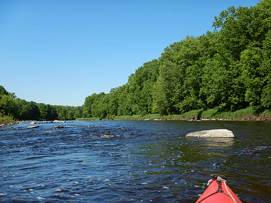
Great to return to Neillsville
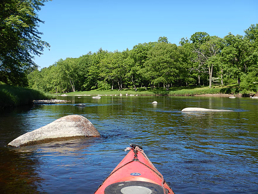
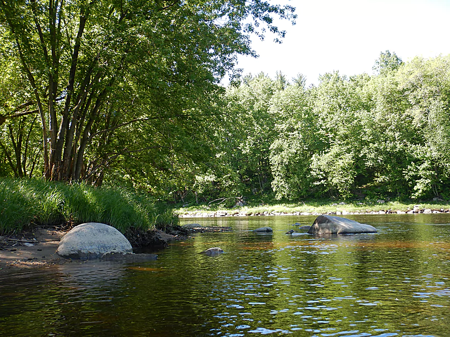
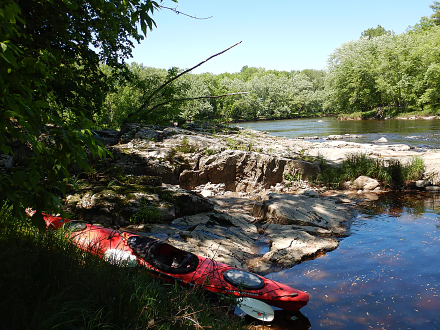
Launching at the corner of Grand Ave and Hill Road
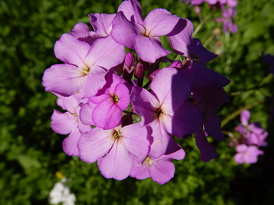
Lot of dames’ rocket along the banks
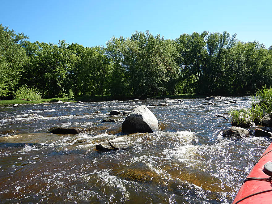
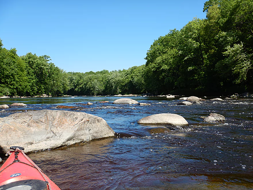
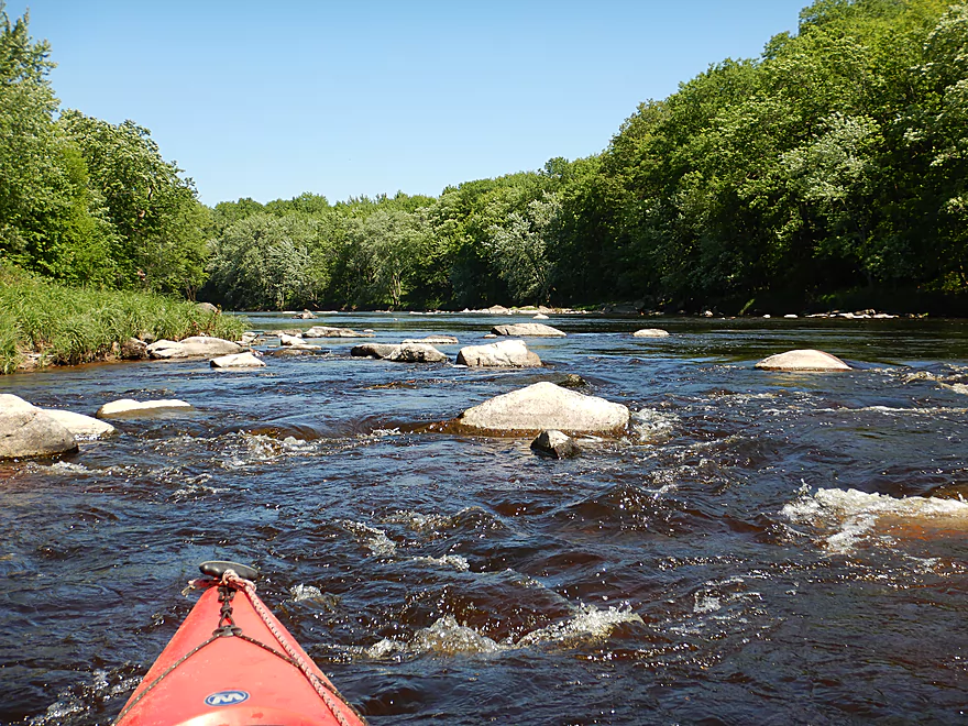
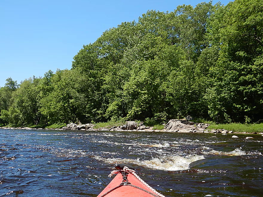
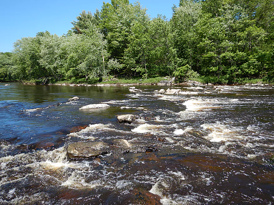
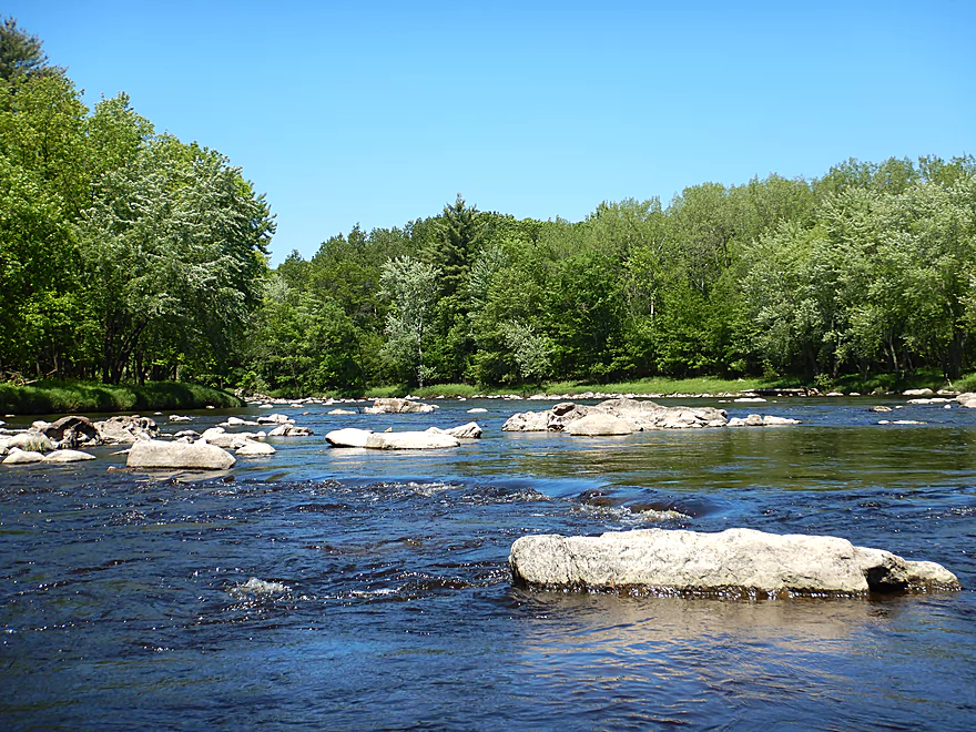
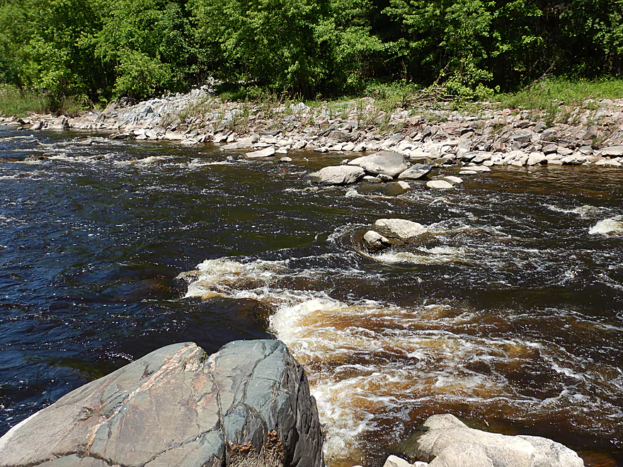
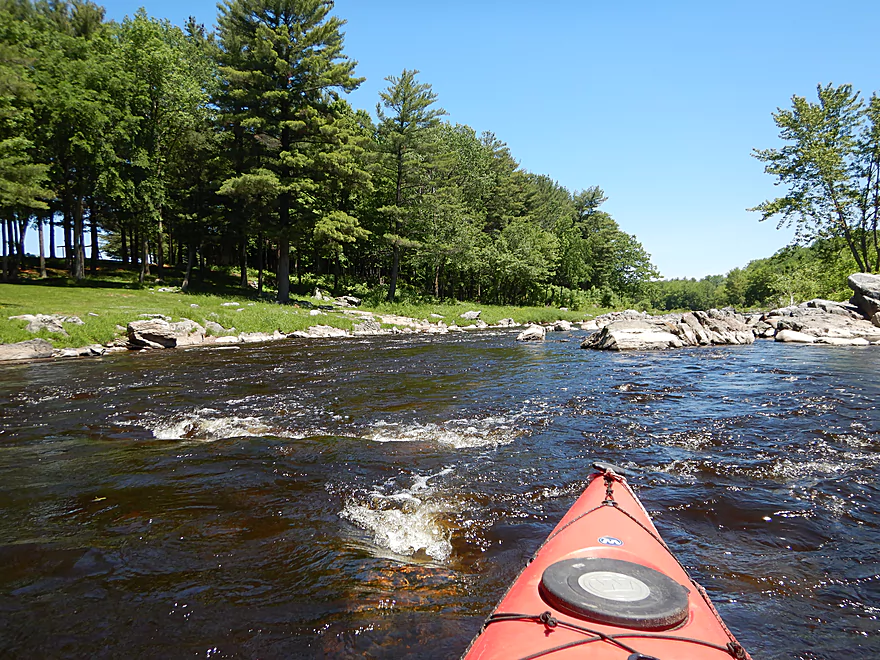
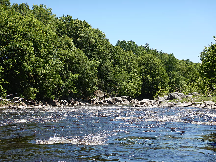
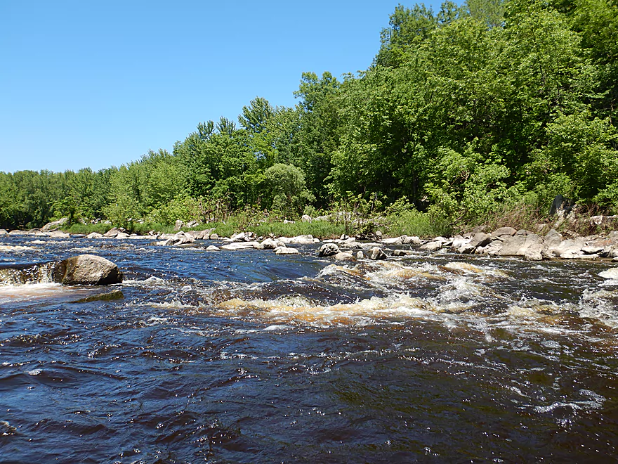
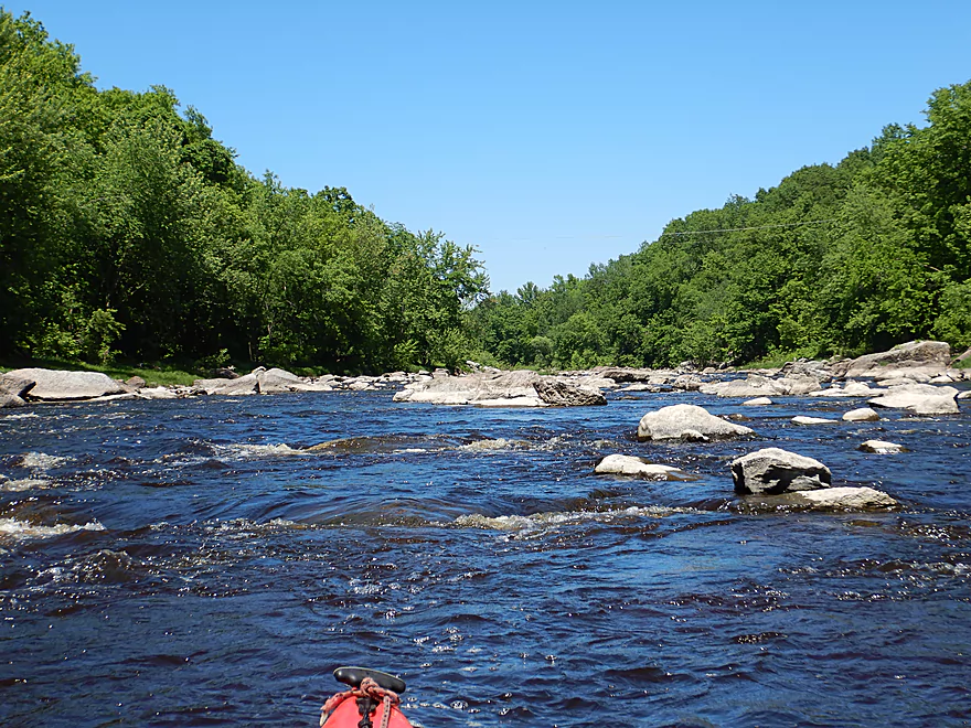
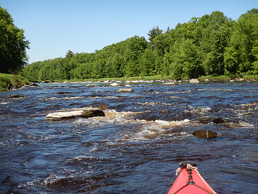
First of many rapids
Scrape marks perhaps from glaciers
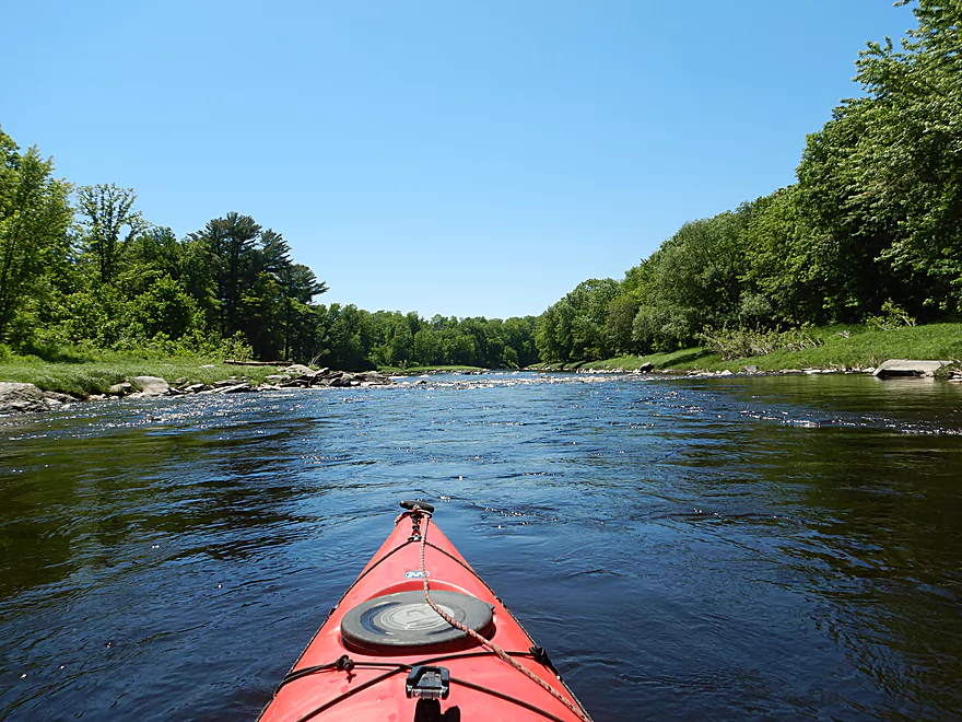
Some longer slow sections in the first mile
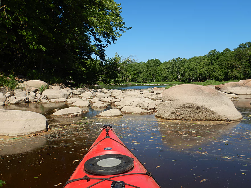
At lower levels, some island channels are blocked
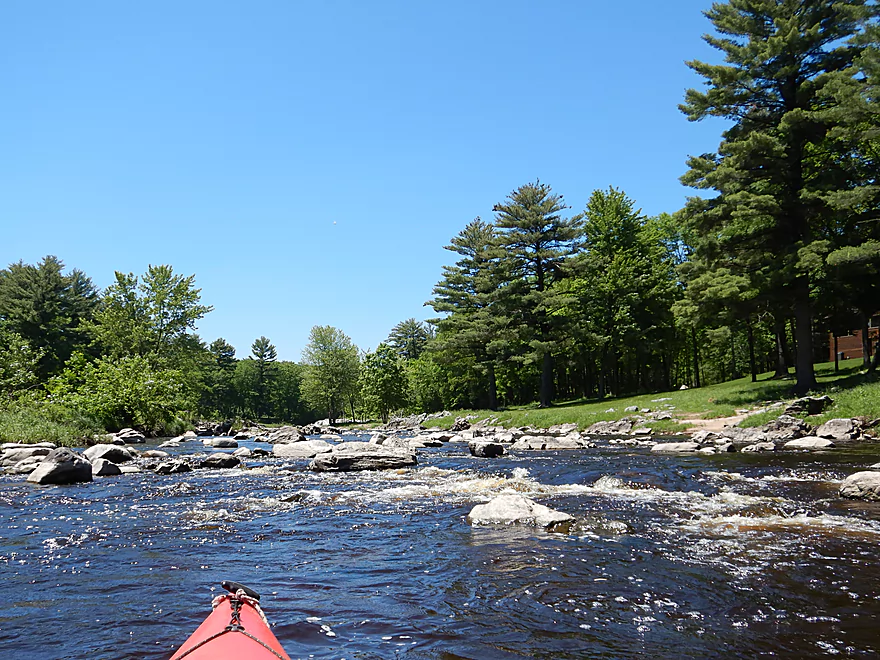
Another set of rapids
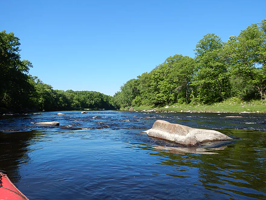
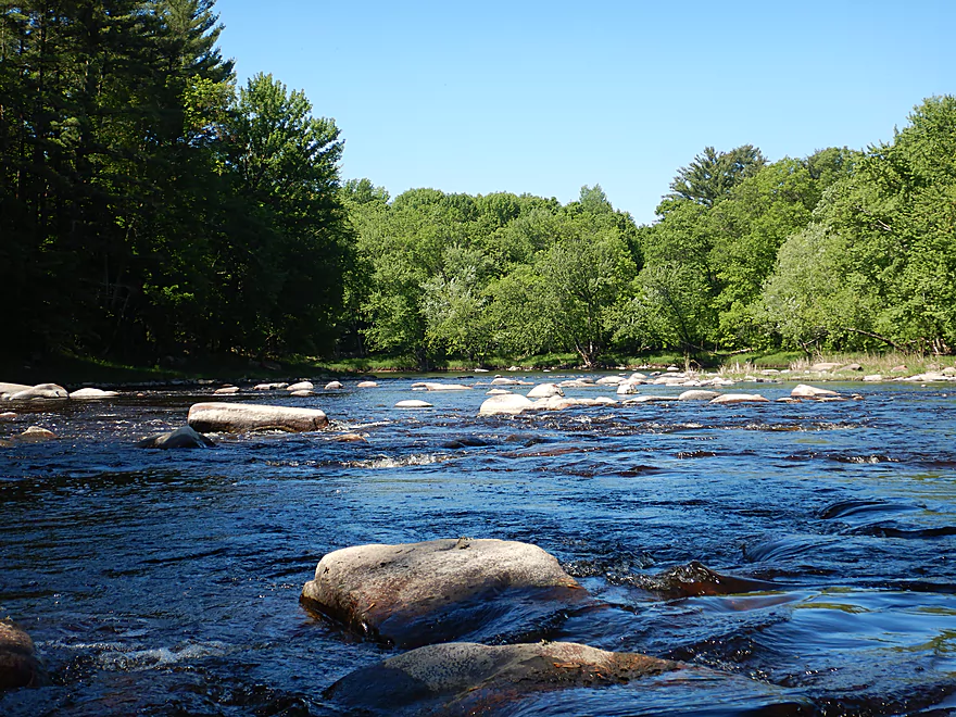
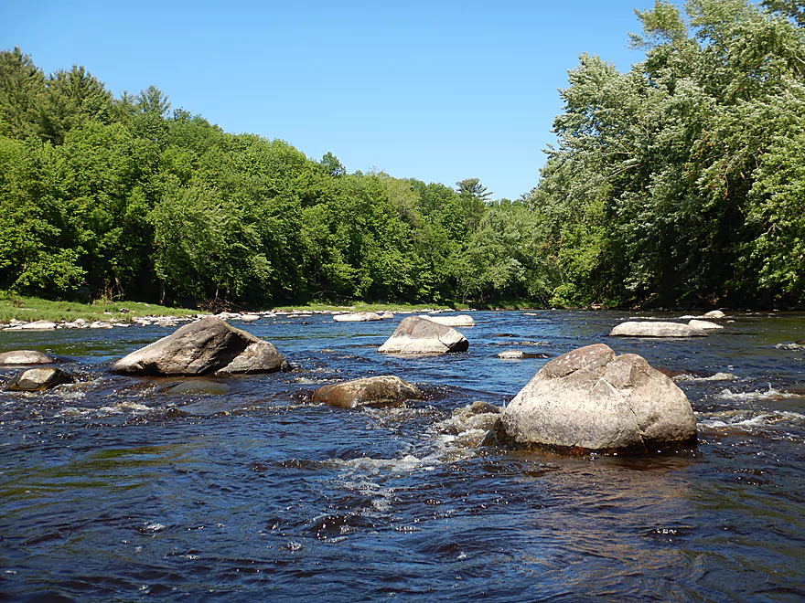
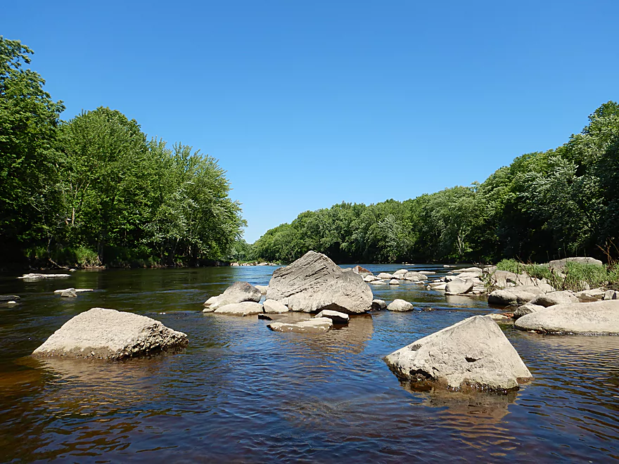
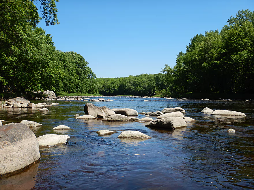
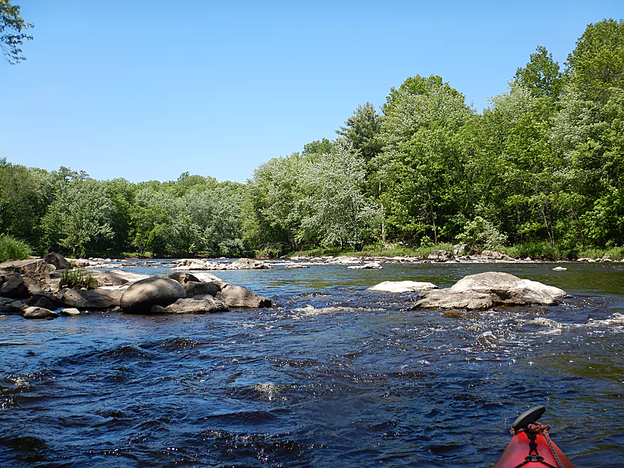
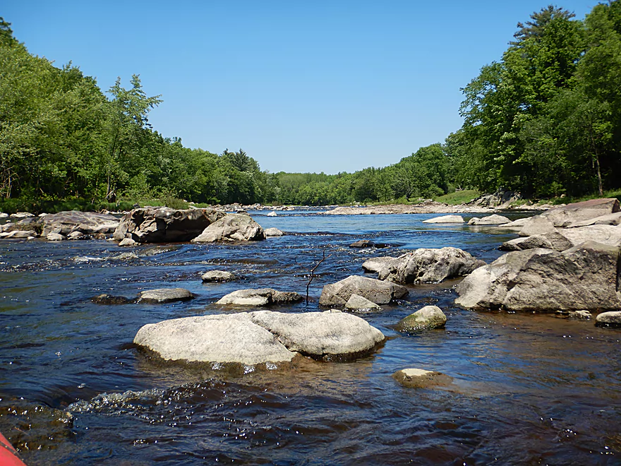
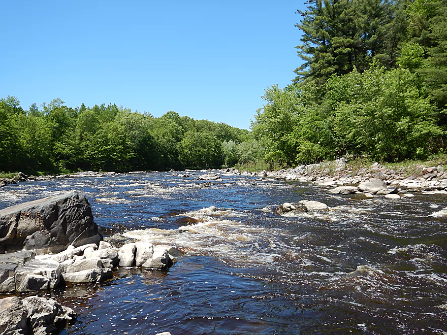
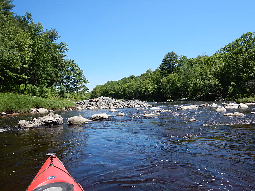
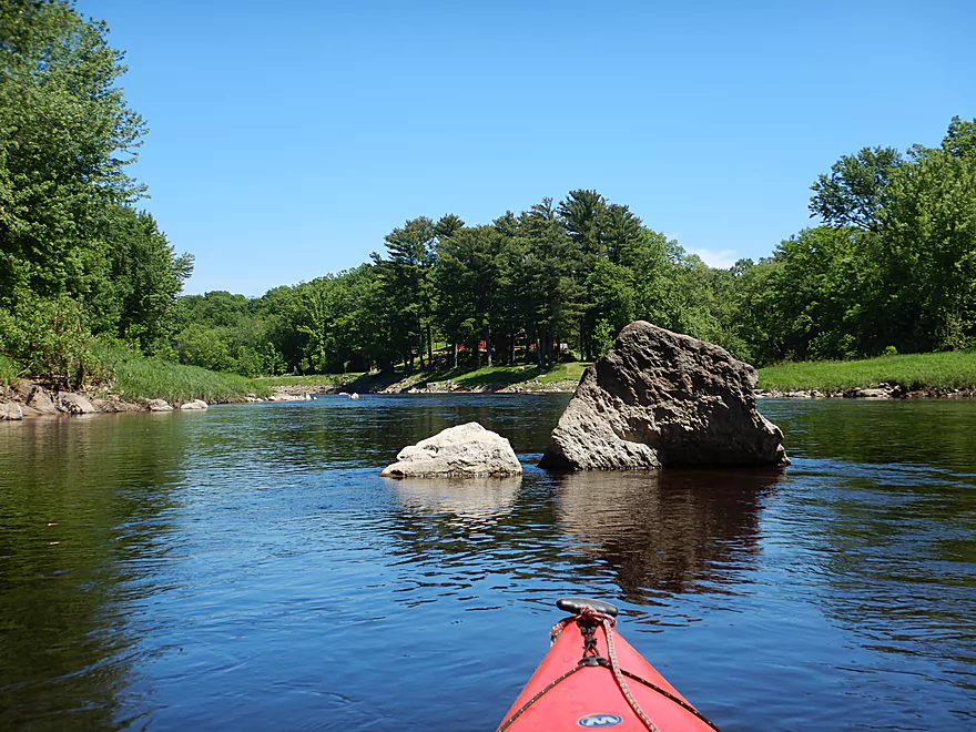
Very scenic river
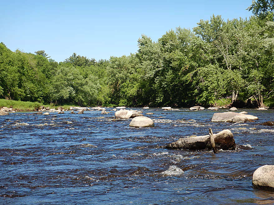
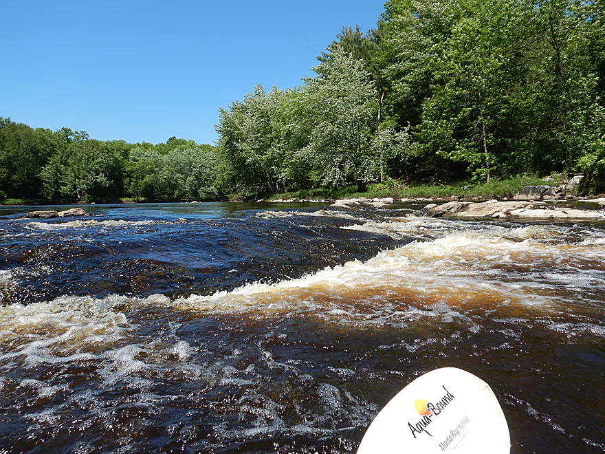
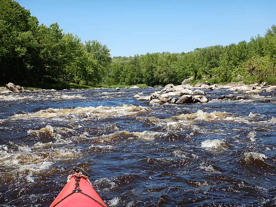
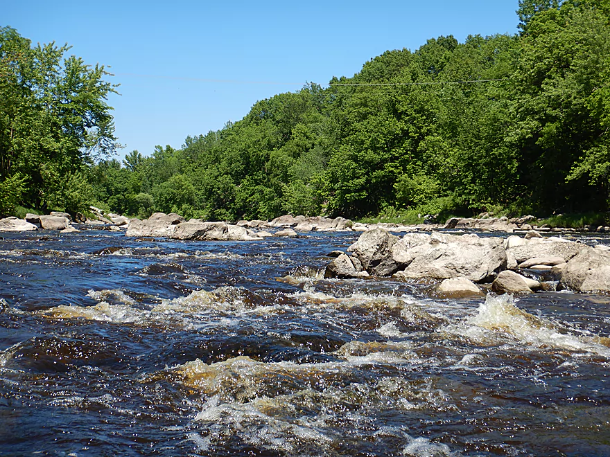
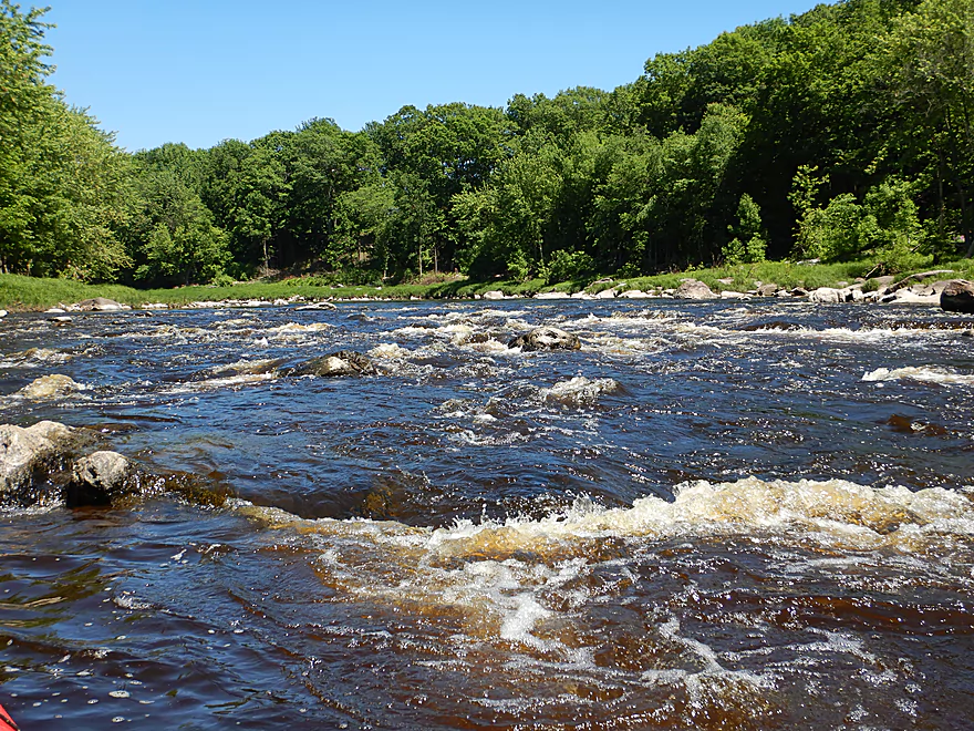
A longer stretch of rapids
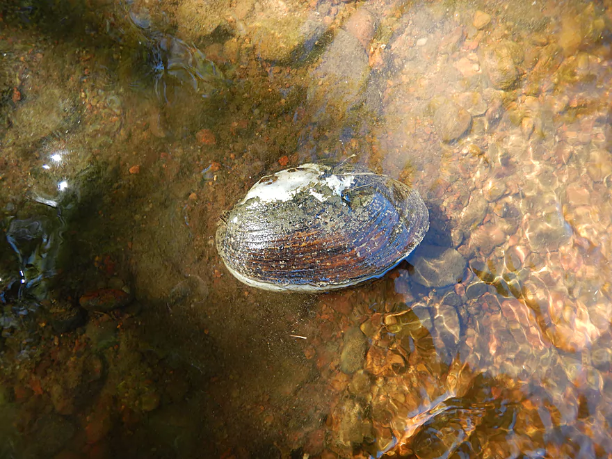
Quite a few clams in the area
Bit of a maze
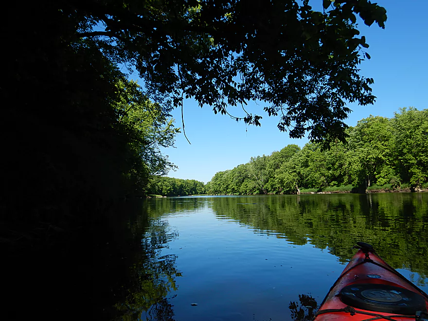
Back to flatwater
Start of a longer pitch
Typically Class 2, but Class 1 at 300 CFS
5th Street is not an access option
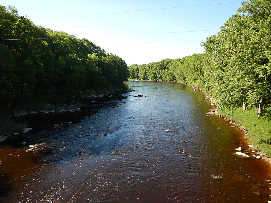
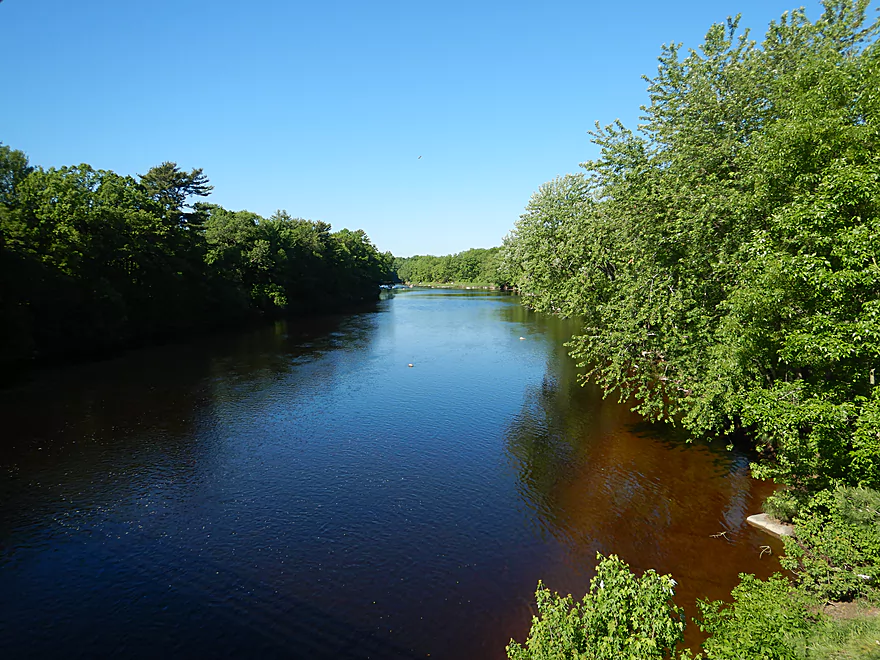
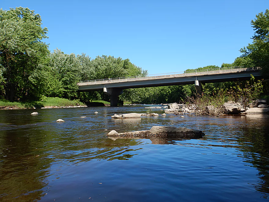
View from the bridge
Mostly undeveloped banks
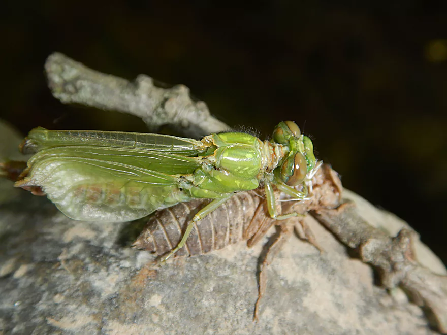
Dragonfly emerging
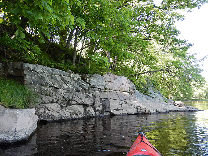
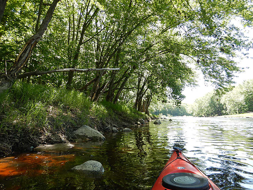
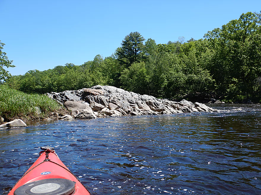
Very rugged river
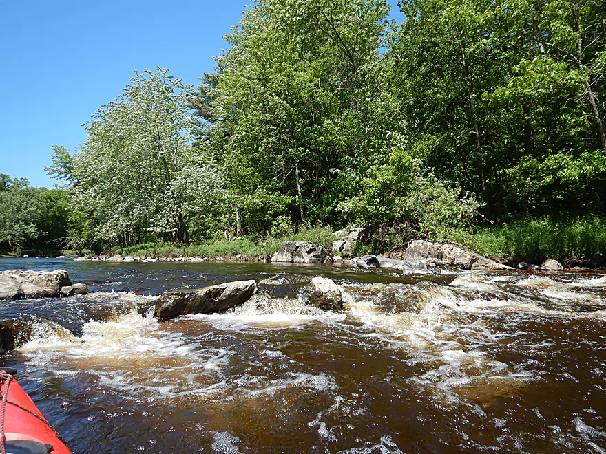
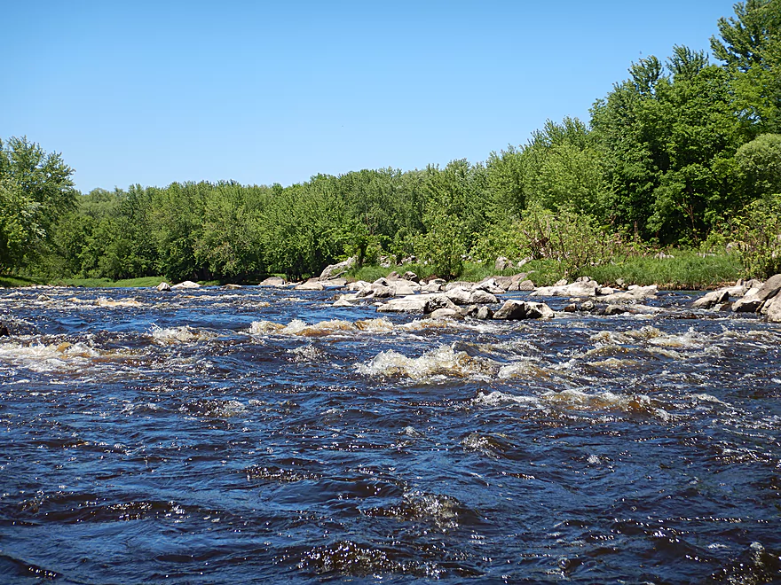
More easy rapids
Always a way through
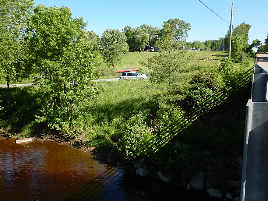
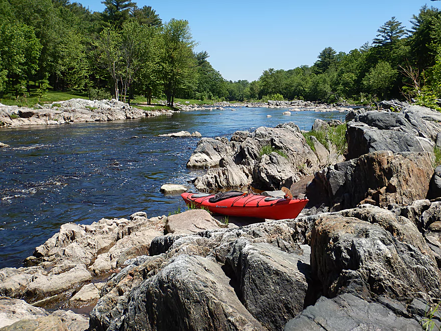
Listeman Arboretum is an access option
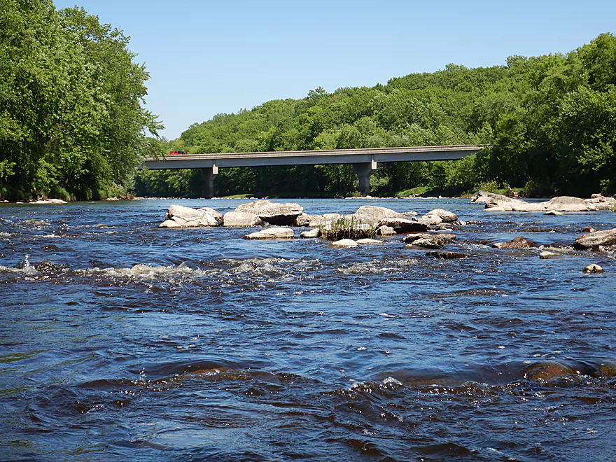
Busy Hwy 10
Thereafter the river becomes a bit more interesting
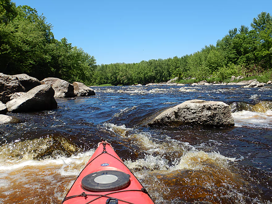
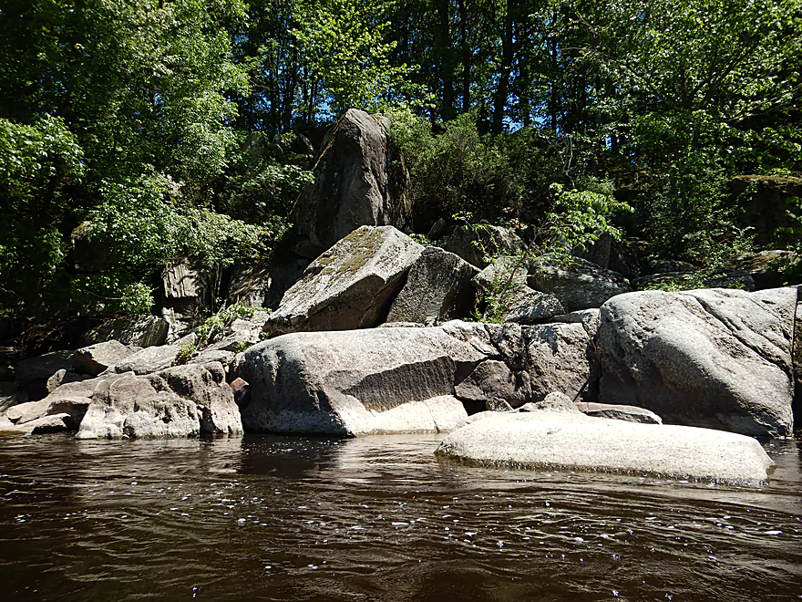
Boulders become more common
The most significant ledge of the trip
An alternate path by the north shore…looks boney
Getting out to scout (after I ran the ledge!)
Best path is almost dead center
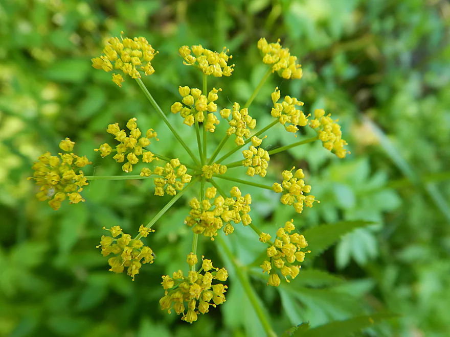
Golden Alexander
Start of a longer boulder field
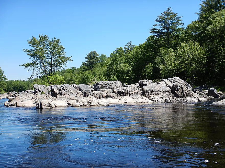
Great scenery
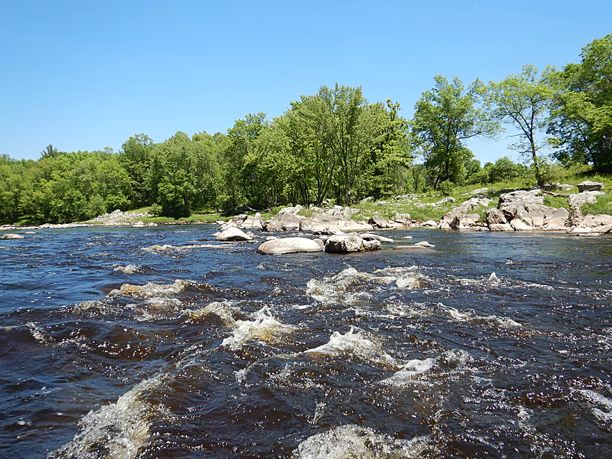
Rapids starting to get stronger
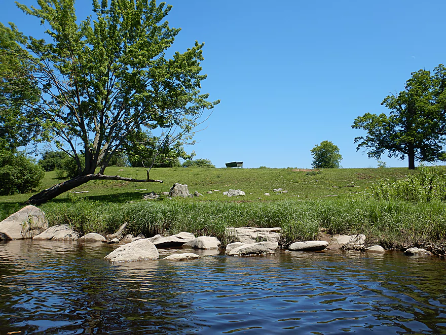
Only farm I saw on the trip
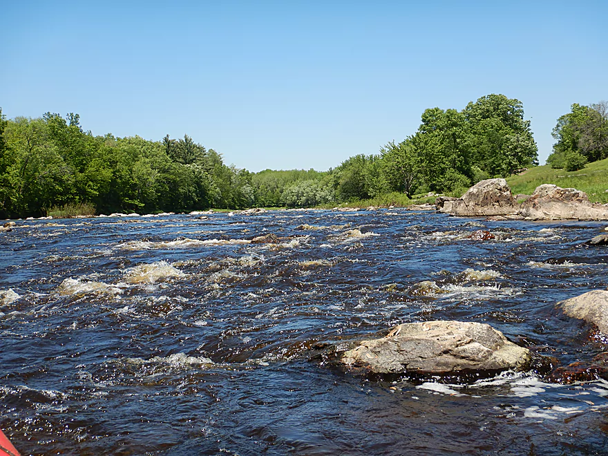
A longer section of whitewater
Always a way through
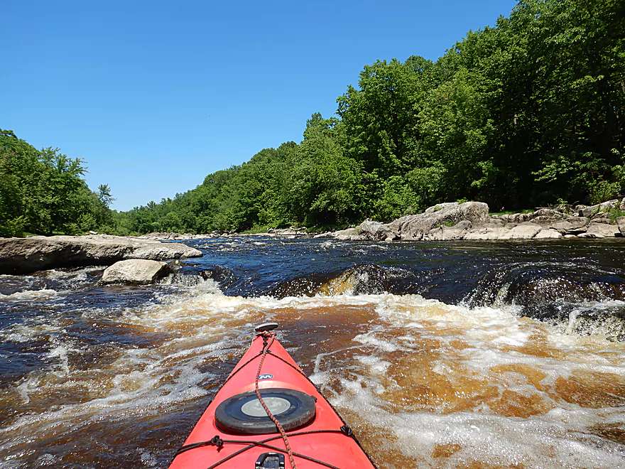
Approaching some serious rapids
Scouting from the shore
View upstream
Side view…not bad as long as you miss the rocks
Bottom view
Great scene
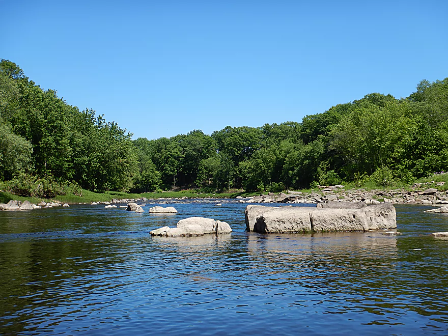
This massive granite mound marks the start of a large island
I chose the left path
Which worked pretty well
A natural granite wing dam
Reverse view of the north channel
Finally….approaching the famous Lower Neillsville Rapids
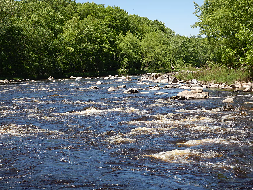
Strongest whitewater of the trip
Pick your path carefully
Photographing the rapids was tough
A larger ledge at the bottom with a hidden rock to avoid
Rugged shoreline
Running the second pitch
This also had a ledge at the bottom
Great fun
River becomes considerably tamer after that
But still some rapids
And boulder gardens
But mostly flatwater now
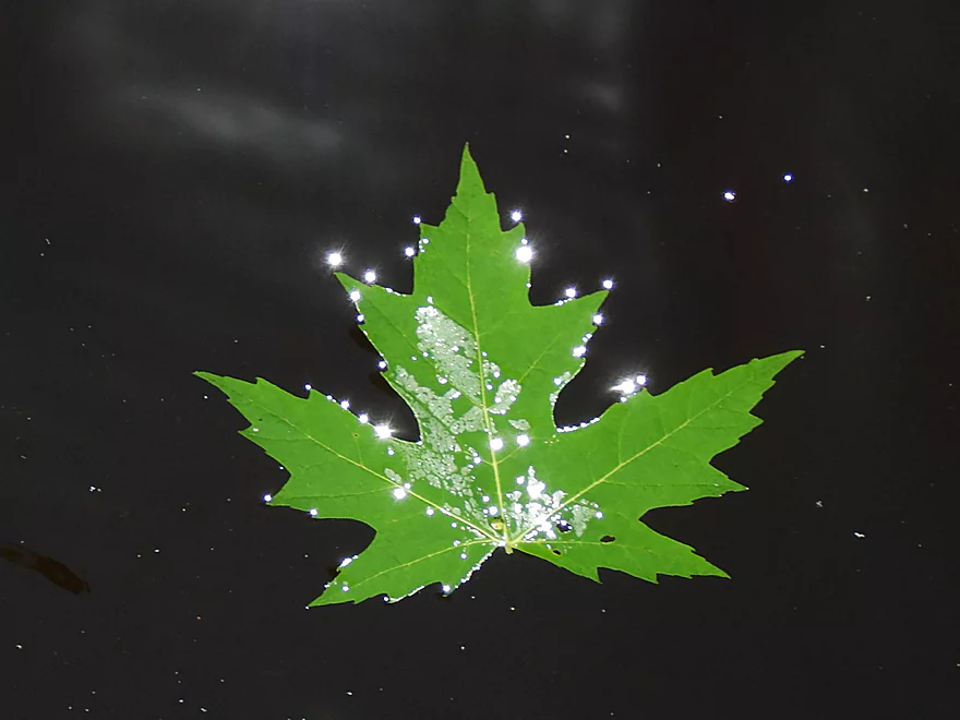
Beads of light
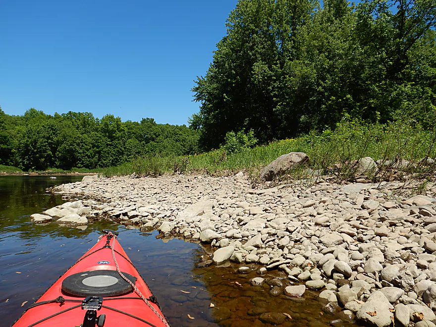
Some gravel bars
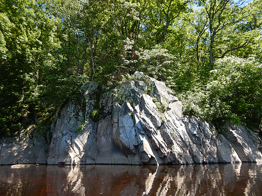
Nicest outcrop of the trip
Very wide river at this point
Last of the rapids
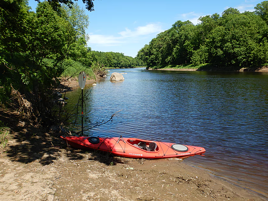
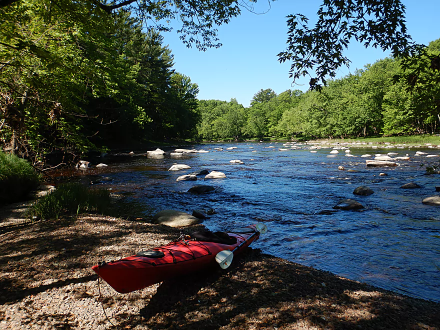
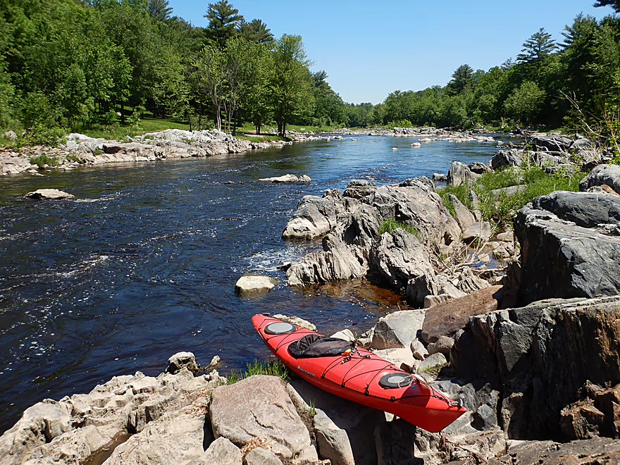
Taking out near Opelt Ave
Black River – Neillsville

The Black can be divided into two sections. The Lower section is famous for its scenic outcrops and sandbars. Despite its lackluster current, it’s the most popular with paddlers. More adventurous paddlers prefer the Upper Black north of Black River Falls, which is practically a different river. Here (outside of a few impoundments) the channel is very rocky and filled with countless rapids. The epicenter of Black River whitewater is located south of Hatfield and is on my to-do list…but this time around I wanted to explore an obscure whitewater leg just south of Neillsville to take advantage of what I felt were favorable flow rates.
I previously paddled a leg on the Upper Black north of Neillsville which was a great trip. For this trip I started where I last left off along Hill Road. The first few miles form a large halfcircle around the city of Neillsville, but you wouldn’t know this from the water as the banks were heavily wooded with little development. Up to Hwy 10 it was a mix of flatwater and whitewater. Michael E. Duncanson in his paddle guide described many of these pre-Hwy 10 rapids as Class 2, but at my relatively low level (300 CFS) I would rate them instead as strong Class 1’s. Accompanying most the rapids were scenic and photogenic boulder gardens, which are only visible at lower flow rates.
Hwy 10 marked an important divide in the trip and hereafter things become more interesting and with much stronger rapids. Following a sharp left turn I came upon a decent ledge which I mistakenly thought were the Upper Neillsville Rapids (not yet!). Here the river split into two chutes with both sides having a decent ledge to go over. I made it over ok but I did have to dodge a few rocks at the bottom.
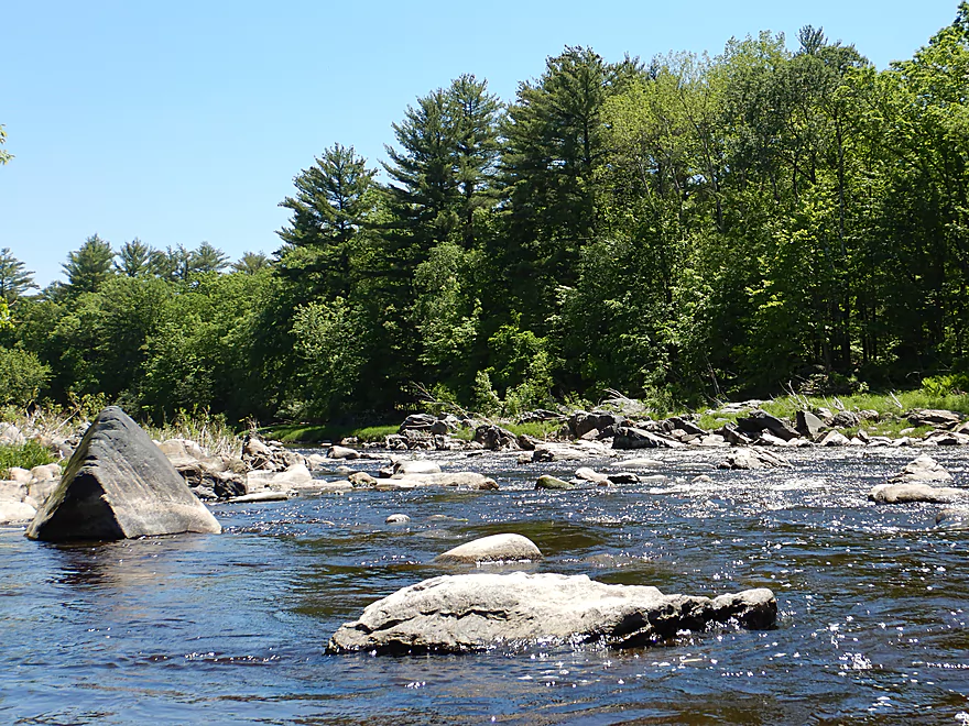
After the river made a sharp turn right, I came upon one of the nicest and longest boulder fields of the trip, which extended from the water up onto the shoreline. The next two miles enjoyed a large concentration of whitewater including many Class 2s. Not only was the river scenic, but the shoreline was as well which occasionally was dotted with large boulders and outcrops.
As I neared Hwy 73 and made a turn right, I finally encountered the Upper Neillsville Rapids. These are the strongest of the trip and rated Class 3….but weren’t too fierce at 300 CFS as long as you picked your lines correctly. If in doubt, get out and scout (or portage). I knew somebody who paddled these rapids at a significantly higher level and he said they were quite formidable then. The first pitch is followed by a second pitch then a short stretch of Class 2 rapids.
After that the river really settled down and was mostly a flatwater paddle with infrequent whitewater interruptions. Here the river is surprisingly wide for its size…sometimes over 250′. I ended the trip at an obscure landing off Opelt Ave which was convenient.
In summary, this was a fantastic paddle that I really enjoyed. The rapids were a lot of fun, and the granite boulder gardens were huge and fantastic. No, this should not be attempted by beginner paddlers, but intermediate paddlers should be able to handle it at lower levels. I’ve done a lot of trips on the Black (eight!) and this might rank as the best to date.
Sights included a few eagles, some clams, two dragonflies and some smaller fish.
I launched at the intersection of Hill Road and Grand Ave which was decent. Shoulder parking is available and it was easy dragging my boat down the grassy shoulder to the river below. There is some mud at the bottom, but this wasn’t bad.
An alternate put-in 2000′ upstream is near the end of Hill Road where there is an obscure public area for launching. This would be a bit more weedy, but launching here is more private and would allow you to run two more pitches of fun rapids. I would have launched here had I not done that section before.
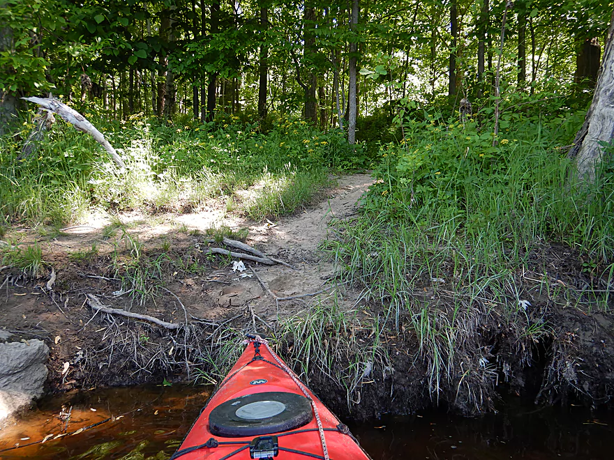
An alternate put-in two miles downstream would be the Listeman Arboretum located off the Hwy 10 bridge. This is a popular public area for hikers and fishermen, and could work as a launch option. But you would have to drag your boat 600′ from the parking lot down the trail to reach the water. Also, if you launch here you miss out on a nice part of the river.
I ended the trip at the Opelt Ave canoe launch, which is very hidey and obscure…but is a access option.
An alternate take-out 1.2 miles downstream would be at the Bryan Ave bridge (NW corner). I did see other paddlers parked here and it seemed like a feasible bridge access, but not nearly as nice as the Opelt Ave launch. The additional mile of paddling would be somewhat nondescript…mostly slow and lacking in rapids.
There is a kayak livery and rental in Hatfield, but the owner prefers to start his paddlers below Neillsville. You might be able to secure a shuttle if you arrange an appointment in advance. He can be reached at: (715) 333-5009.
The bike shuttle was mediocre…it’s all paved and a reasonable 4.8 miles, but there are a few big hills to walk (route will include 171′ of climbing). A portion of the shuttle goes through downtown Neillsville, but this isn’t so bad as traffic was pretty light. Bike shuttlers should be wary of poison ivy at Opelt Ave when looking for good locking trees.
Logjams: None nor any strainers.
Current: The rapids of course were very fast, but in between there were some longer and slower flatwater sections.
Rapids: This is a whitewater run that should only be attempted by capable paddlers. There are maybe fifteen sets of Class 1’s, six Class 2’s and two Class 3’s. For details see my map or watch my video. The most serious of which are called “Lower Neillsville Rapids” and are located close to Hwy 73 (video of these at 6:59).
2024 Update – I received this warning from Mike on Youtube: A couple friends and I did this stretch yesterday (5/18/24). 752 CFS (4.7 ft). It was pretty brutal. I would definitely plan this again at a much lower discharge.
There is a local gauge in Neillsville which is super convenient.
- 0-150 CFS: Likely too shallow.
- 151-250 CFS: Some of the rapids will be pretty shallow. I suspect this is still a viable trip for determined paddlers not afraid of a few bumps. Boulder gardens should be quite photogenic at this level.
- 251-350 CFS: A good depth. I did the trip at 300 CFS and most rapids had good padding and the current wasn’t too pushy. I still hit some bumps, but likely a great target range for less experienced whitewater paddlers.
- 351-500 CFS: Most of the rapids should be decently padded.
- 501-750 CFS: Rapids will be much stronger and less forgiving. The most scenic boulder gardens are likely submerged.
- 751-1200 CFS: Perhaps only suitable for serious whitewater paddlers.
- 1201+ CFS: Maybe too high for paddling. AmericanWhitewater had this to say… “1250 is mostly washout haystacks. I have never run it above 1250 nor beyond Hwy 95“.
Quick Overview
Black River:
- Upstream of Hwy 73: Obscure sections of the Black with little known about them. Some legs will have logjam issues.
- Hwy 73 to Lake Arbutus: 48 miles. Good legs with a mix of rapids, boulder gardens and undeveloped banks. Only reason these legs don't receive more paddling traffic is because they're located away from population centers.
- Lake Arbutus: 3 miles. A scenic but challenging lake because of the waves.
- Hatfield Dam to Halls Creek Landing: 7 miles. Some of the best and most fun whitewater on the Black River.
- Halls Creek Landing to Black River Falls Dam: 6 miles. An impounded part of the river, but nice with cool cliffs.
- Black River Falls Dam to North Bend: 37 miles. This is the heart of the Lower Black and sees the most paddling traffic. No major rapids, but there are many scenic cliffs and creek inlets.
- North Bend to Mouth: 30 miles. This is the second half of the Lower Black. While not as scenic, there are still cool sandbars and sandbanks. Few paddle these stretches.
Noteworthy Tributaries:
- Robinson Creek: One of the best paddles in all of Wisconsin.
- Halls Creek: Also one of the best and with amazing sandstone walls.
- Morrison Creek: Very scenic creek with some fun whitewater.
- Wedges Creek: Great paddle with amazing boulder gardens.
- East Fork of the Black River: Some fun riffles and unique granite geology.
- Perry Creek: Shallow but a super scenic creek.
- Dickey Creek: A wonderfully scenic creek with fantastic sandstone…but too many logjams.
- Beaver Creek: Some fun rapids and amazing sandstone in Galesville, but logjams on the downstream portions.
- Popple River: A shallow whitewater river that is very nice.
- Arnold Creek: A pleasant tributary to Lake Arbutus with really nice reflections.
- Rock Creek: Many scenic boulder gardens, but usually this creek is too shallow to run.
- Roaring Creek: Very scenic creek with a great waterfall at the mouth, but might be a challenge to paddle.
- Vismal Creek: Super scenic but has a lot of logjams and is shallow. Requires very high water conditions.
- Plus countless small creeks that are too small to paddle but quite fun to explore by foot. If you know of viable paddling options, let me know! Am very curious to know more about Douglas Creek, Levis Creek, O’Neal Creek, and Crawley Creek.
Detailed Overview
Headwaters to Neillsville:
- Upstream of Division Drive: Likely too many logjams to be navigable.
- Division Drive to Sawyer Ave: (6.5 miles) Rocky and a few light rapids. Maybe 4 logjams.
- Sawyer Ave to Hwy 64: (2.5 miles) Rocky and a few light rapids.
- Hwy 64 to Bridge Road: (14.4 miles) Solid prospect reviewed by Mike Svob. Some Class 1 rapids and nice gravel bars. Intermediate access points at Bahnkes Ave and Hwy AT.
- Bridge Road to Hwy X: (6.0 miles) Little is known of this section…likely pretty simple.
- Hwy X to Colby Factory Road: (6.0 miles) Little is known about this section…likely some rapids and outcrops. Intermediate alt access points at Hwy 29 and Hwy N.
- Colby Factory Road to Popple River Mouth: (7.9 miles) This stretch has far fewer rapids than downstream legs with only a few minor rapids. It should still be pleasant though.
- Popple River Mouth to Reese Ave: (5.3 miles)
- Popple River Mouth to Warner Drive: (1.0 miles) This is a slower and less interesting stretch, but does include 4 Class 1's and scenic Hemlock Rapids which are Class 3.
- Warner Drive to Greenwood Park: (3.4 miles) A good leg with many rapids (3 Class 2's and 17 Class 1's).
- Greenwood Park to Reese Ave: (0.9 miles) A slower stretch with just 2 Class 1's. Part of this passes through the community of Greenwood.
- Reese Ave to Twenty Six Rd: (5.1 miles)
- Reese Ave to Sladich Rd: (0.7 miles) A mostly nondescript wooded stretch. The exception is Greenwood Rapids where an island splits the river. The right side is scenic, but the left side has fun Class 3 rapids.
- Sladich Rd to Willard Rd: (1.6 miles) A somewhat slow and relatively uninteresting leg. Highlights include one nice outcrop, a few gravel bars and a 400' stretch of Class 1 rapids.
- Willard Rd to Twenty Six Rd: (2.8 miles) A great leg with 10 Class 1's and 2 Class 2's. Highlights also include scenic boulder gardens and a few outcrops.
- Twenty Six Road to Hwy H: (5.0 miles) Multiple Class 1 & 2 rapids.
- Hwy H to Grand Ave/Hill Road: (8.0 miles) A great trip with several Class 2 rapids and scenic granite outcrops.
Note, for more details on the Upper Black, I highly recommend “Indian Head Rivers” by Michael Duncanson.
Alternate Black River Trips – Neillsville to Black River Falls:
- Grand Ave/Hill Road to Opelt Road Landing: (6.7 miles)
- Grand Ave/Hill Road to Hwy 10: (2.2 miles) Nice section with a handful of rapids. These are mostly Class 1 at lower depths, but strengthen to Class 2 during high flow rates.
- Hwy 10 to River Road Landing: (4.3 miles) Fantastic whitewater section. Maybe six Class 2’s and two class 3’s. Scenic boulder gardens and a few outcrops.
- Opelt Road Landing to Bryan Ave Bridge: (1.1 miles) Not sure there is anything special about this stretch.
- Opelt Ave Bridge to Hwy 95: (4.4 miles) Ok…nothing special.
- Hwy 95 to West Arbutus County Ramp/Hatfield Dam: (4.8 miles)
- Hwy 95 to North Arbutus Boat Landing: (2.4 miles) Includes a scenic gorge, boulder gardens and rapids including the Class 3 Red Granite Rapids. River slows after rapids.
- North Arbutus Boat Ramp to West Arbutus County Ramp: (2.4 miles) A large open water paddle on Lake Arbutus that can feature challenging waves on summer afternoons.
- Hatfield Dam to West/East Channel Confluence: 0.2 or 0.3 miles.
- West Dam to West/East Channel Confluence: 0.3 miles. There is a large boulder field and Class 2 rapids below the west dam. At the outlet of the west channel is a Class 4 drop. This is easy to scout and portage.
- East Dam to West/East Channel Confluence: 0.2 miles. Perhaps the most extraordinary rapids in the state with Class 4/5+ rapids. The action starts below the dam where steep granite banks narrow the river significantly and force it down deep chutes. The gorge starts with Class 2-3 rapids but ends with two significant drops. American Whitewater warns “between the dam and this point lie some serious drops which contain near inescapable boiling cauldrons at moderate to high flows”.
- Hatfield Dam Confluence/West Clay School Road to Powerhouse Road Landing: (3.1 miles)
- Hatfield Dam Confluence to Hwy K: (0.3 miles) One of the most scenic paddling areas in the state with massive granite outcrops. There is one set of Class 2 rapids.
- Hwy K to Powerhouse Road Landing: (2.8 miles) The first half mile by Hwy K is very scenic and contains one Class 3. The second mile is mostly flatwater. The third mile is almost continuous rapids and features one Class 3.
- Powerhouse Road Landing to Halls Creek Landing: (4.0 miles) Scenic section with a few Class 2 rapids and a steep ledge.
- Halls Creek Landing to Black River Falls Dam: (6.2 miles) Wonderful sandstone cliffs.
Alternate Black River Trips – Black River Falls to Mouth:
- Black River Falls Dam to Mason’s Landing: (4.7 miles) A great little section.
- Mason’s Landing to Irving Landing: (9 miles) A good section.
- Irving Landing to Lost Falls Campground (2.3 miles) A popular stretch. Highlights include a few small outcrops, two tiny waterfalls, several impressive sandbars, and one large sandbank. A side hike to Roaring Falls can be arranged. Note Lost Falls Campground is private and you must purchase a pass from them to use their access.
- Lost Falls Campground to Grinde Landing: (6.4 miles) A popular section with some nice outcrops and a waterfall by Roaring Creek. Wolf Creek may also have a cool slot canyon. The river splinters into multiple channels, some of which may be quite shallow in later summer. As of 2023, Grinde Landing is closed because somebody stole the owner's deer stand.
- Grinde Landing to Melrose Landing: (3.9 miles) A shorter section but with a really nice rock outcrop before Melrose Landing. As of 2023, Grinde Landing is closed because somebody stole the owner's deer stand.
- Melrose to North Bend: (10.1 miles) Likely the most popular stretch with the best sandbars on the river, three sets of outcrops, and a few waterfalls.
- North Bend to Hwy 53: (13.3 miles) Likely a nice paddle with sandbars, large sandbanks and maybe a few outcrops. Unfortunately it is very long.
- Hwy 53 to Hwy 35: (8 miles) A nice section with epic sand banks.
- Hwy 35 to Lytle Road: (4.0 miles) Goes through the Van Loon Floodplain Forest. This can be a shallow trip but features many nice sandbars.
- Lytle Road to Fred Funk Boat Landing (Mississippi): (5.0 miles) Multiple options because of the river delta.
Trip Map
Overview Map
Video
Photos Size:
Definitely on my list. Beautiful area. There are quite a few Amish and Mennonite communities up there, I see signs on the cork-board in some of their stores for rides as some need rides to doc appointments etc.. This could be a good shuttle option.
Good idea! As for the Black, this is a great section and a great paddle.
Christie trip of black river – can u take out at HWY 10?
Yes…I see fishermen fishing from the bank there and there is a parking lot on the east shore. I’ve also heard of kayakers using this access. Only downside is it is a longer hike.
Yes, you take out north of Hwy 10 and east of the river, must carry Kayak about 50 yards on trail through the woods to a small parking lot.
A warning from Mike on Youtube: A couple friends and I did this stretch yesterday (5/18/24). 752 CFS (4.7 ft). It was pretty brutal. I would definitely plan this again at a much lower discharge.