
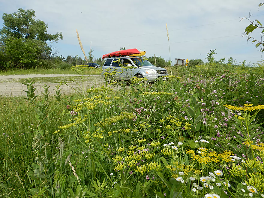
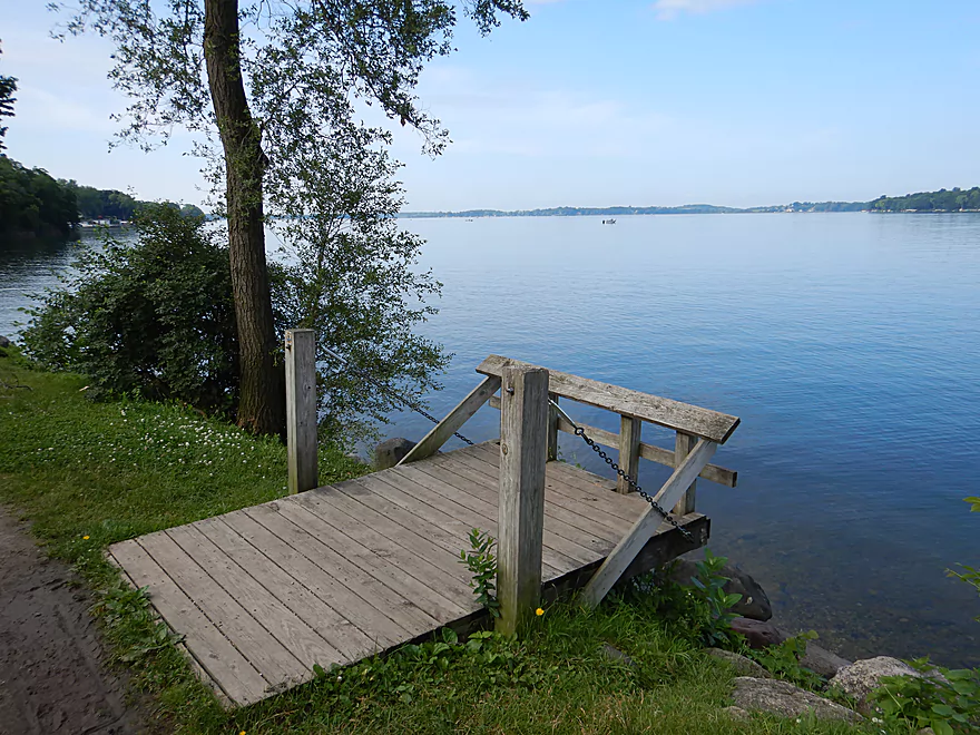
Starting the trip at Hwy A
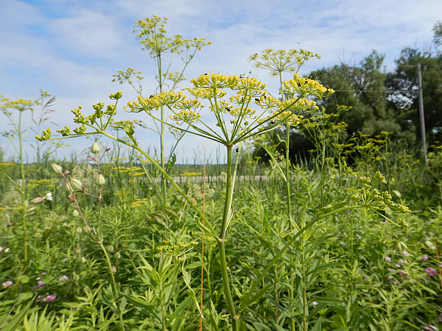
Very scenic public launch (although watch out for wild parsnip)
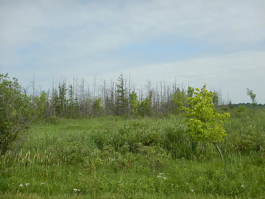
Tamaracks can been seen in the distance
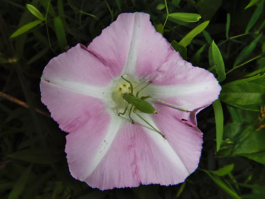
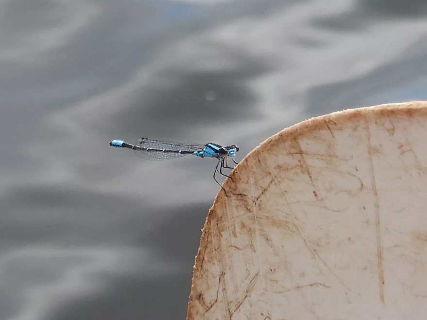
Tree cricket trying to hide in a bindweed
Launch is a bit muddy but doable
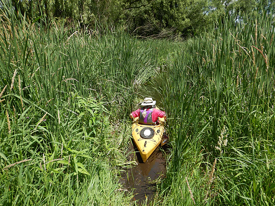
Rock Creek here is a bit of a cattail maze
Kind of cool
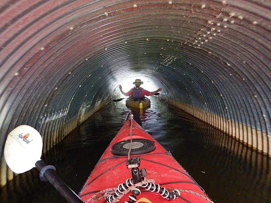
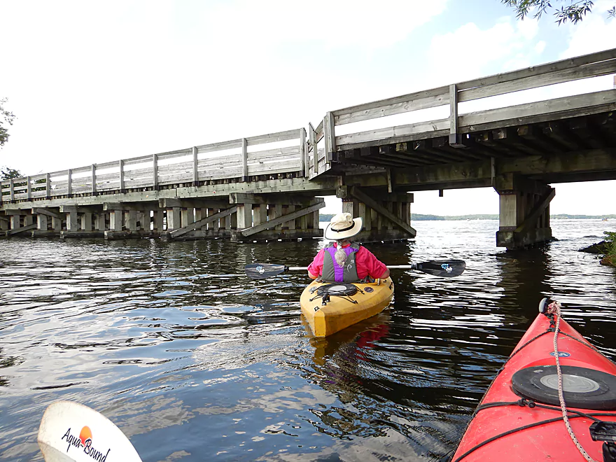
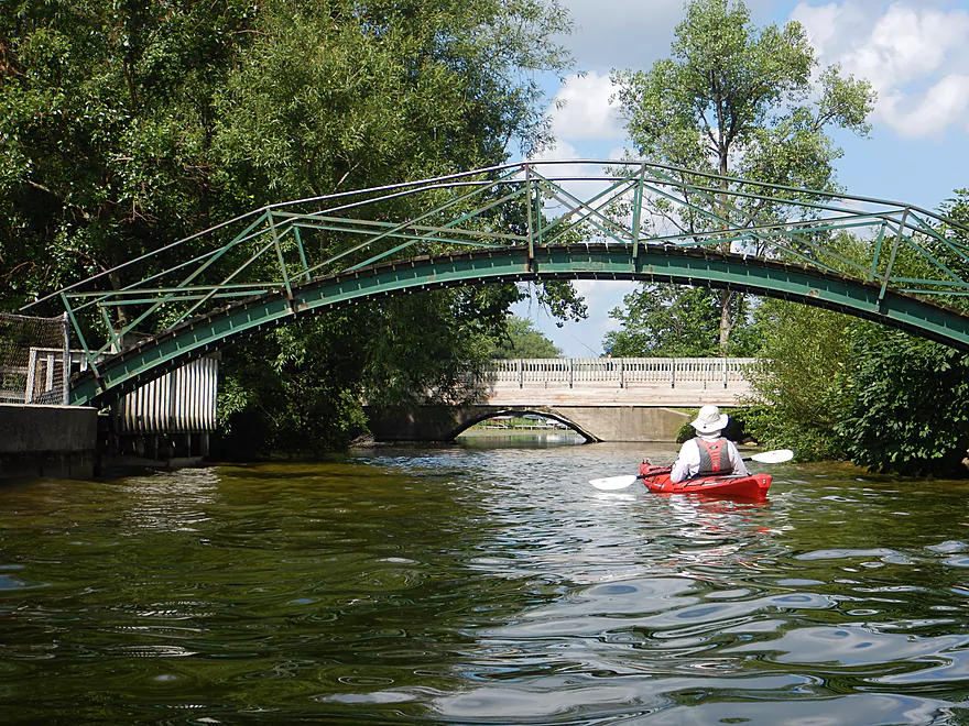
Paddling under Hwy A
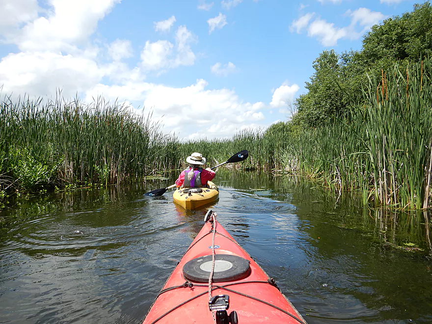
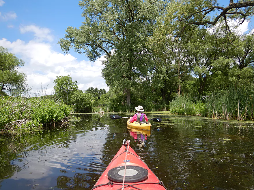
Very nice start to the trip
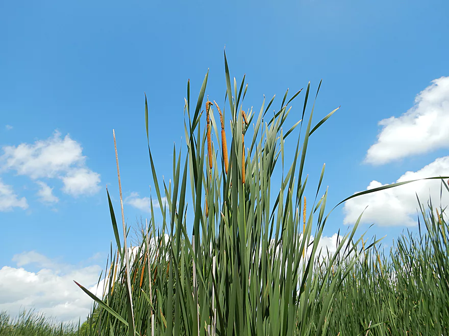
Cattails were quite tall
The blackbirds would nest not in trees but in the cattails
Nice marshy section
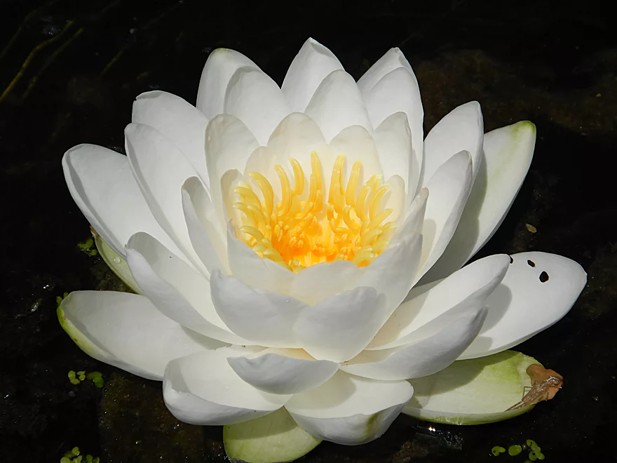
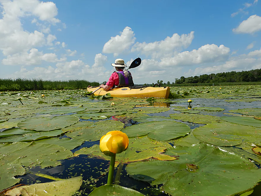
White water lily
Rock Creek starts to widen
Entering Marsh Lake
The eastern end is filled with muck
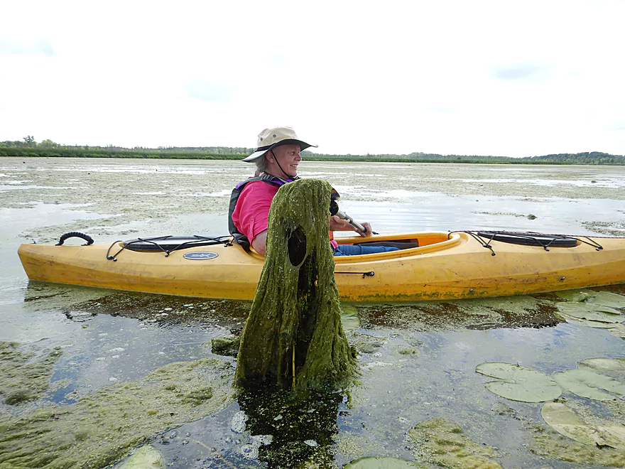
He’s hanging onto my paddle for dear life
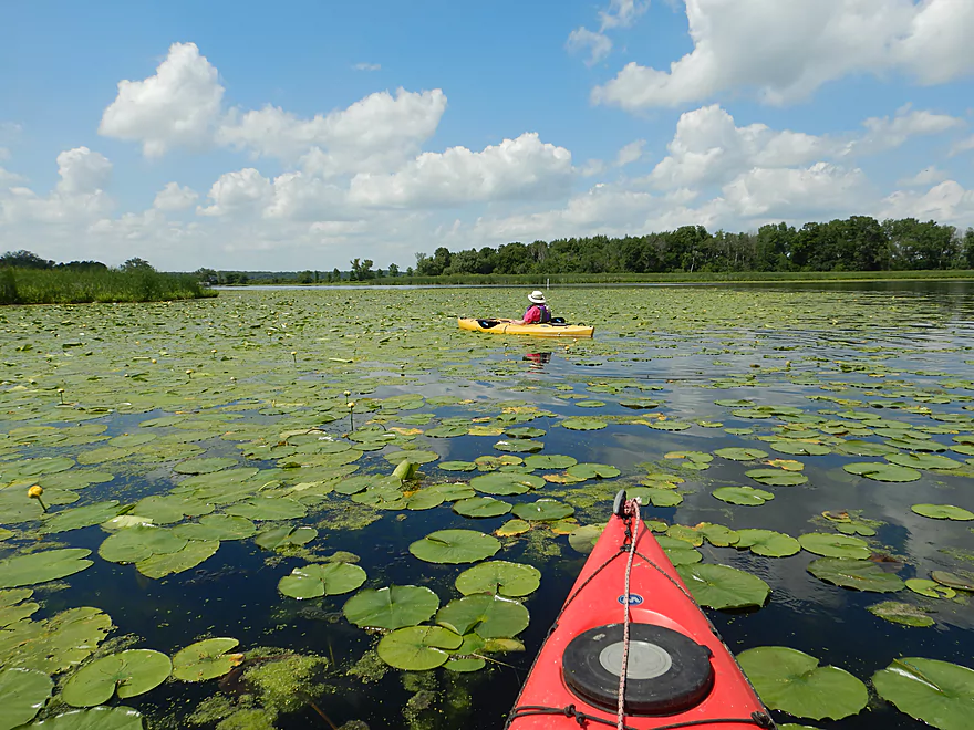
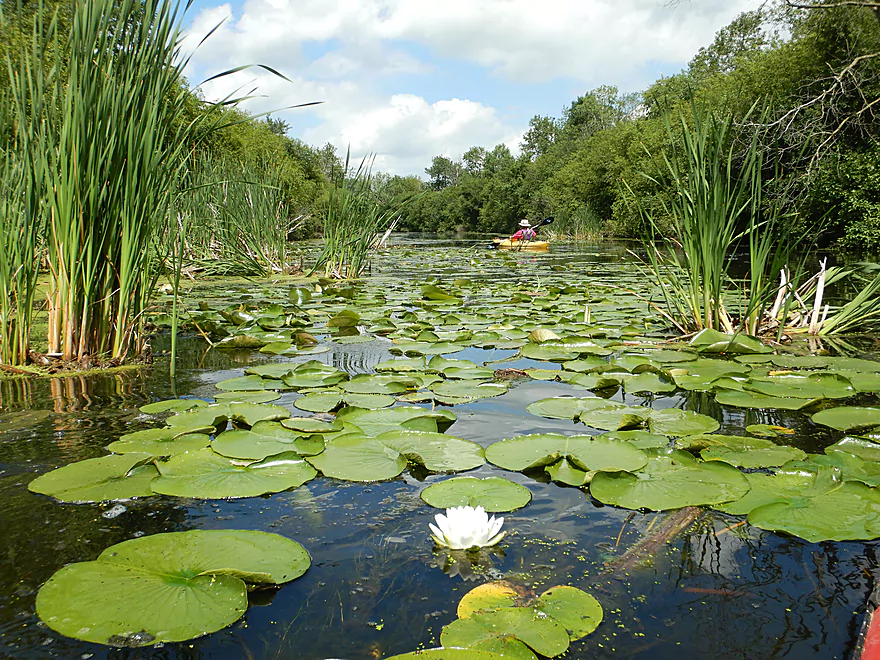
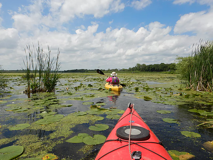
An absolutley massive lily bed
Really cool
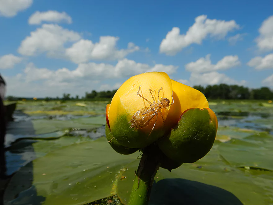
Dragonfly using a lily to emerge
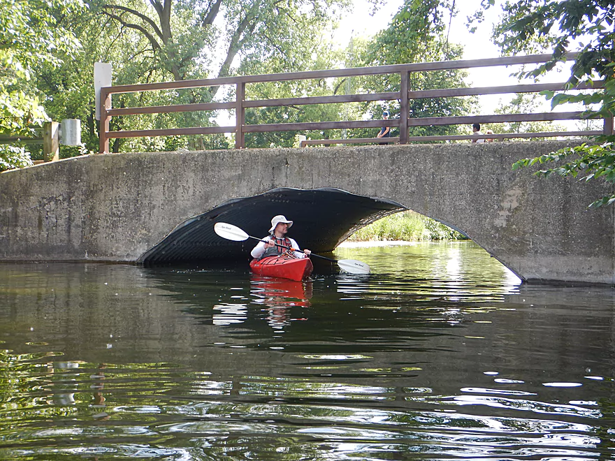
Paddling under the Glacial Drumlin State Trail
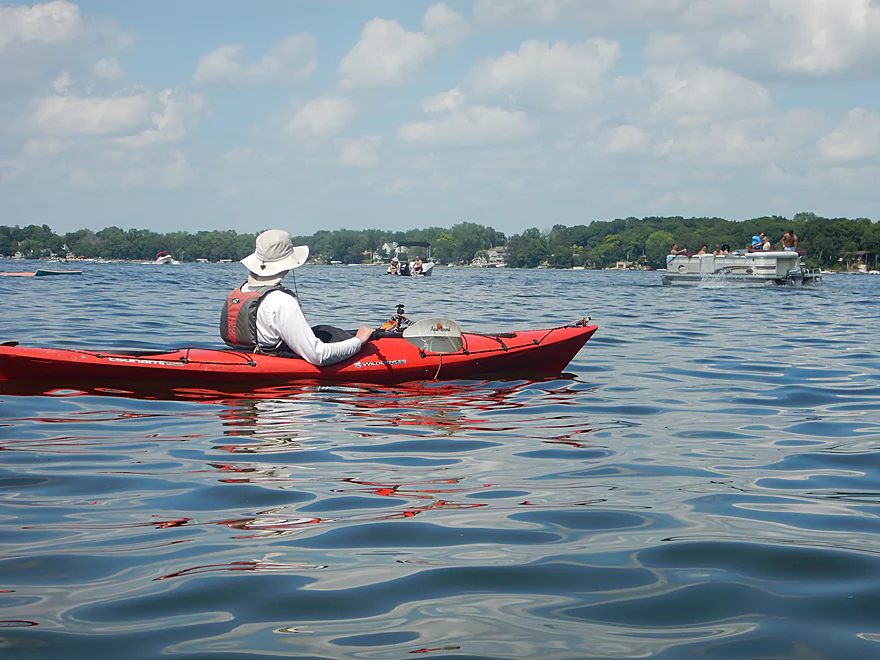
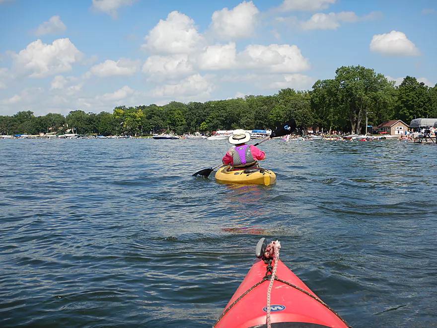
Entering Rock Lake…kind of a party lake
Waves were a bit choppy
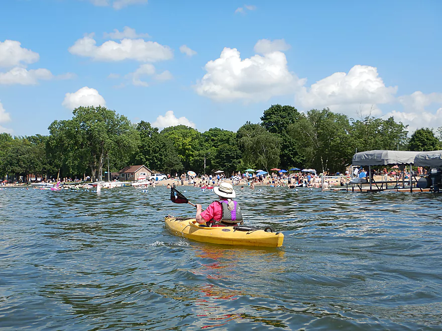
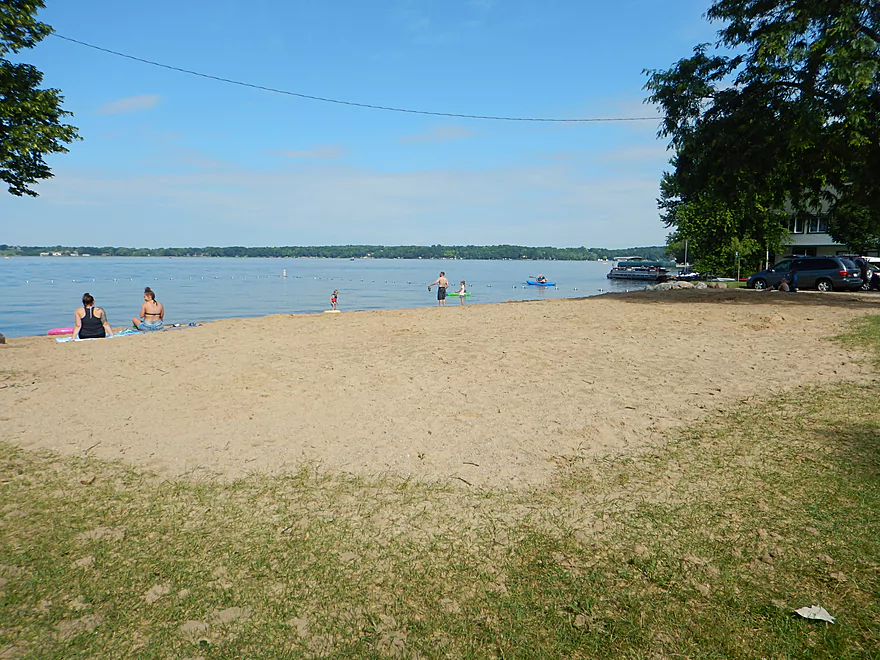
One of several packed beaches
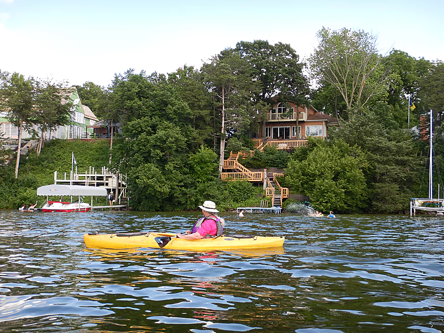
The eastern shore was heavily developed
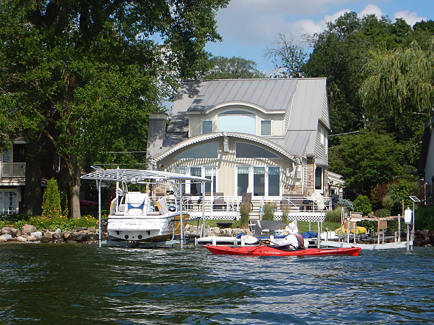
Some interesting homes
Deja-Maunesha
This is the outlet of Rock Lake
Cool pedestrian bridge
East of Ferry Drive is Mill Pond
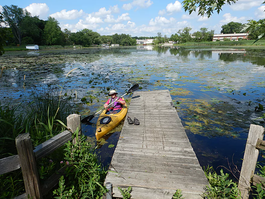
We took out at a public dock here
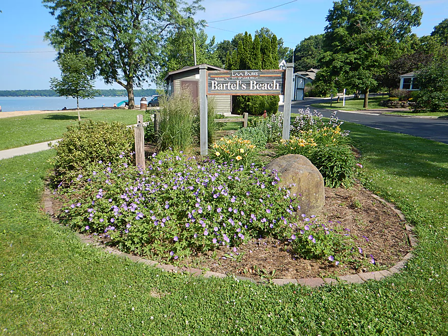
Part of Bartel’s Beach
Which has a nice swim area
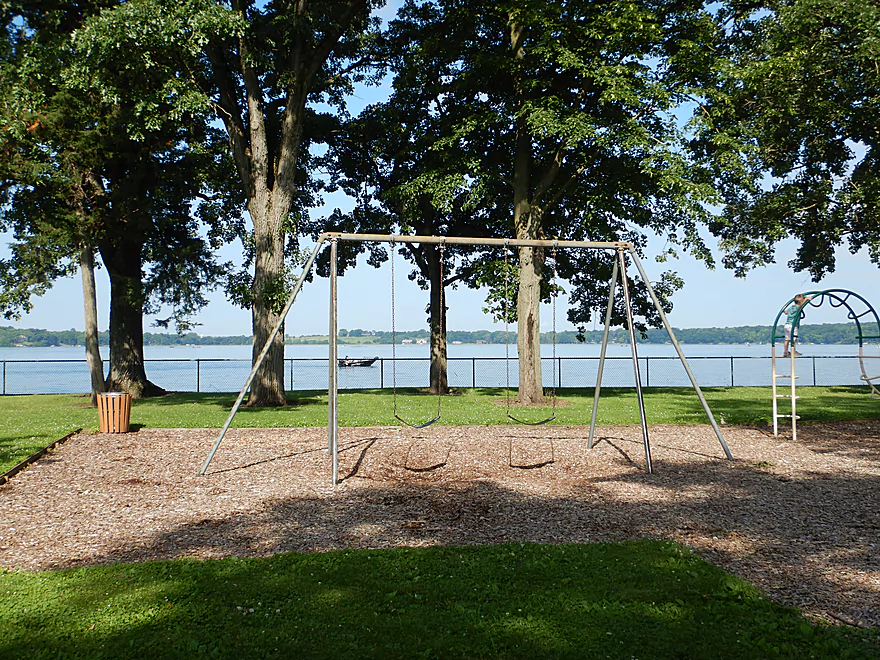
And park area
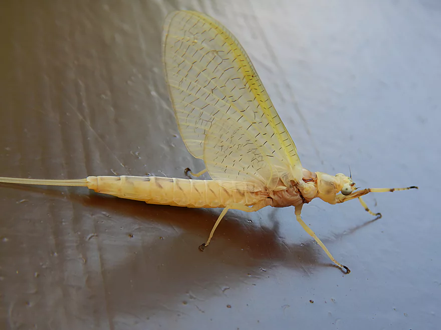
Newly emerged mayfly
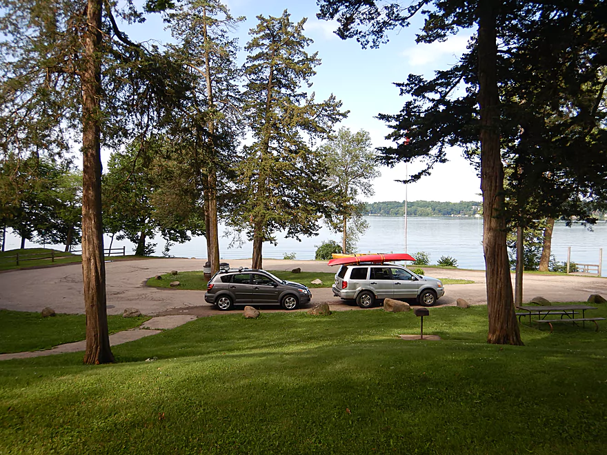
Another good take-out option is at Tyranena Park
There are far less people here
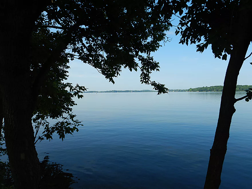
Rock Lake is very peaceful in the morning
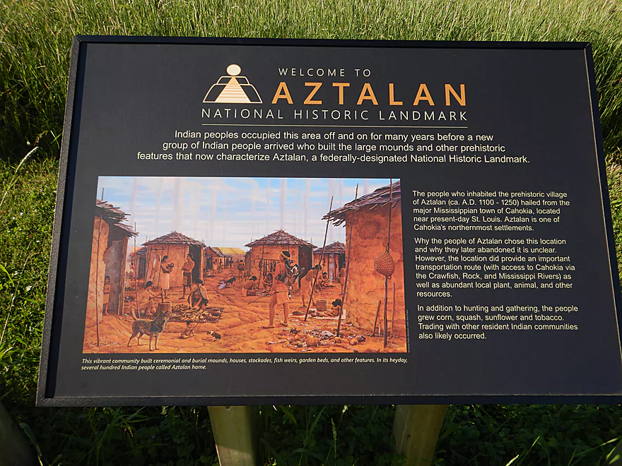
Aztalan State Park is nearby
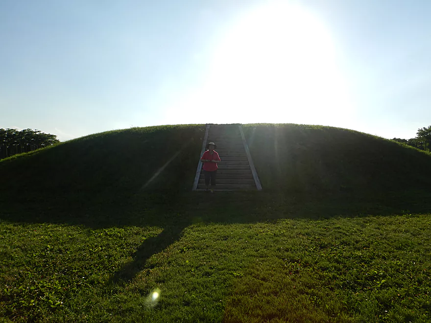
Featured are several Cahokian made mounds
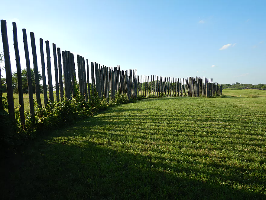
The park also includes some replica stockades
Rock Lake

Previously on this blog, I reviewed a trip on Upper Rock Creek and Mud Lake. The original plan was to start on Mud Lake, continue to Rock Creek, then Marsh Lake, and finally paddle out onto Rock Lake. But these elaborate plans had to be cancelled when we discovered the outlet to Mud Lake had been sealed shut by cattails. After our brief but aborted Mud Lake trip, we had time afterwords so decided to still do the Rock Lake portion, but instead to launch from Hwy A, which is just downstream from Mud Lake and has a nice canoe launch.
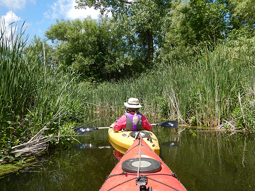
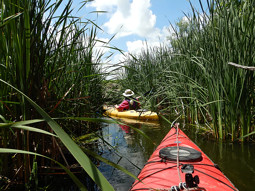
Rock Creek by Hwy A is narrow and walled in by tall cattails which created a cool corridor vibe. Paddlers could travel up this, but will eventually be blocked by cattails. After paddling through the Hwy A culvert, the creek soon widened and slowed. Here it entered an old canal, where the creek has been moved a quarter mile to the east. This subsequent section of creek was not as interesting but did have some nice lily beds including the one used as the featured image.
Rock Creek then took a sharp turn left and spilled out onto Marsh Lake. The southeast end of the lake was choked with weeds and algae and at times we had to snowplow a path through. Soon the lake cleared up though and this turned into a mediocre lake paddle. Unlike Rock Lake, Marsh Lake is pretty quiet with only a few fishermen. To the far west, large stands of tamaracks could be seen and in the middle of the lake there was a huge cattail island that splits the lake in two. Along the eastern end of this island was a HUGE bed of bullhead lilies…perhaps over a few acres in size. One of the largest I’ve ever seen and quite photogenic (especially when front-lit).
At the north end of Marsh Lake is an old railroad trestle that had been converted into the Glacial Drumlin State Bike Trail. Past that…Rock Lake. This is a decent-sized lake (two miles long, one mile wide) located along the western outskirts of Lake Mills. Most of the shoreline is developed with expensive homes and countless piers dotting the shoreline. This being a hot summer weekend, the lake was crawling with people. Powerboaters were everywhere and the beaches were packed. The heaviest concentration of traffic was located along the southern end of the lake by the inlet. Many boats were simply moored and parked as their occupants played in the water (a somewhat perilous activity as Rock Creek is known to be infested with a flatworm that causes swimmers itch).
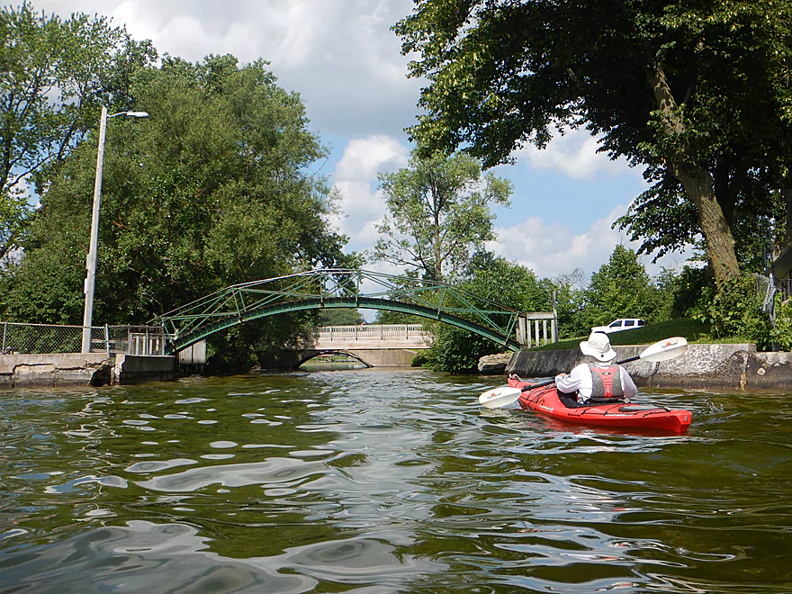
There are a large number of parks and take-out options along the lake to choose from. We had initially chosen Tryanena Park, which is a really nice and quiet area located at the north end of the lake. But given the crazy events that transpired earlier in the day we decided to cut things a bit shorter and take out at Bartel’s Beach, which is the outlet of Rock Lake. Here we paddled under a scenic arched walk bridge, onto Mill Pond, and then took out on a public pier just east of Ferry Drive. Continuing on past Mill Pond wouldn’t be very viable. At the east end is the dam and after that the creek flows about a block underground.
In summary this is a difficult trip to recommend for paddlers. The main portion on Rock Lake was crazy busy and overdeveloped. But…this can be a nice paddle if you time it right. Perhaps go on a weekday or very early in the morning. Mornings in general are great times for paddles as the water is usually pretty still which can create great color gradients and reflections. Kayakers may also prefer the north end of the lake by Tyranena Park which is slightly less developed and sees much less motorboat traffic. Marsh Lake will never have that much traffic, but the weeds at the east end can be annoying. You could avoid the Marsh Lake weeds by paddling in the spring, but then you would miss out on the lilies.
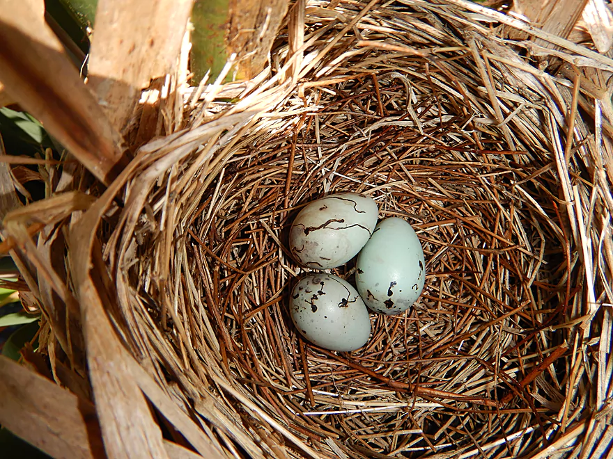
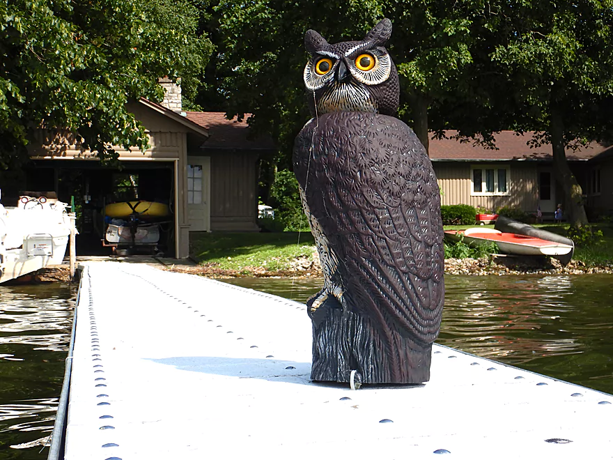
Some wood ducks, two owls (one real & one fake), and a suicidal map turtle trying to cross a busy street in Lake Mills. At Mill Pond we could hear bull frogs which make a very neat sound. The highlight was a massive eagle nest visible just south of the Hwy A put-in. This was among the largest I’ve seen.
Aztalan State Park: Located 3 miles east of Rock Lake is Aztalan State Park. Here you can see mounds created by the mysterious “moundbuilder” tribe (aka the Cahokians) that are believed to have originated from the St. Louis area. Honestly there isn’t too much to see at the park aside from grassy mounds and mowed paths. There is a replica stockade fence along part of the park which would have been similar to what the original inhabitants would have constructed.
Other more immersive ways to experience Aztalan:
- Offical DNR Video
- Wisconsin Natural Resources Article and Audio Tour
- Aztalan Museum (they were closed during our trip…their hours may be limited)
- HauntedPlaces.org (some claim it is haunted)
Rock Lake is one of the most fascinating archeological sites in the state of Wisconsin. Divers have discovered 10 artificial structures submerged underwater that somewhat resemble rock pyramids. With exceptional clarity, you can apparently see the outline of some of the larger structures from an airplane.
It’s believed that the pyramids were a necropolis for the Cahokians, of which several neighboring tribes tell fascinating stories about. Supposedly these moundbuilders were powerful sorcerers that would perform ritualistic ceremonies on Lake Tyranena (the old Cahokian word for Rock Lake). In these ceremonies priests would apparently “walk on water” holding torches (perhaps a sleight of hand). Other stories say the Cahokians had red hair and were heavily involved in the copper trade…in fact Aztalan was supposedly some sort of trading hub. Ultimately, the neighboring tribes drove the Cahokians out of Wisconsin for their cannibalism and practice of dark magic. Other sources suggest they left because of a six year drought and copper discoveries in Mexico which made this outpost less important.
Sadly, the Lake Mills dam has increased the height of Rock Lake and made the pyramids more inaccessible. The dammed water is also allowing excess algae to grow and sediments to settle on the bottom. Some of the pyramids are now covered in silt that didn’t exist 80 years ago. Hopefully one day the dam will be removed which would aid in a proper and full archeological excavation.
Resources:
- The Ancient Underwater Pyramids in Wisconsin (Video) – Very interesting! It does include a rough map of the main pyramids
- The Lost Pyramids of Rock Lake (book) – Likely the most in depth account of the pyramids. Includes some unique historical perspectives on the Cahokians and their relationships with nearby tribes. It is available in the South Central Library System.
- Native American Legends – A fascinating summary of old native legends concerning Rock Lake and the Cahokians.
- BurlingtonNews – This is more of an occult website but it has a lot of interesting tidbits about Rock Lake. This link is just the first of a multi-part series on Rock Lake.
Located off Hwy A is a Glacial Heritage canoe launch where you can start a trip on Rock Creek (just upstream of Marsh Lake and Rock Lake). This is a cool little launch area with dedicated parking lot. It is a tad mucky, but you should be able to slide in with little difficulty.
There are numerous alternate access options on Rock lake itself, if you’re not interested in paddling Rock Creek or Marsh Lake (see map).
We took out at Bartel’s Beach which in hindsight was a poor access. The beach and park area are nice and there are public outhouses, but it was packed and all the parking spots and then some were filled. We had to double park to load up our boats.
There are numerous other launch options for Rock Lake (see map). My suggested one would be Tryanena Park at the north end. This would be a great take-out with public outhouses (granted the lights don’t work). Unlike the other other nearby access options, few people use this park and I didn’t see any entrance fees.
We car shuttled, but a bike shuttle wouldn’t be super difficult at only 1.8 miles.
Logjams: None
Current: Practically none.
Wind: This can be a big problem. Mind the forecast.
Wake: The lake has been known to produce 3 feet swells. Mind the forecasted wind speed and be mindful of the countless powerboats (not all of which are looking where they are going).
Open Water Paddling: Like with most decent-sized lakes it is advisable to paddle close to shore in case of trouble. If you flip in the middle of the lake and don’t have a good re-entry strategy, you could be in trouble (especially if you don’t wear a life jacket and/or the water is cold).
Muck: Note the east end of Marsh Lake can be filled with muck and weeds that can make navigation difficult. This is most apt to be an issue in the later summer and/or when water levels are low.
Swimmer’s Itch: There was a warning sign at the beach that Rock Lake does suffer occasional outbreaks of swimmer’s itch in the summer. Basically this is caused by a flatworm that buries into your skin and causes intense itching. There were countless swimmers when we did our trip, so either it wasn’t an issue then or the general public was oblivious to the problem.
There is no gauge on Mud Lake. I’ll use the nearby Crawfish River gauge as a reference, but it is a poor representation.
- 0-200 CFS: Low depth and Marsh Lake could be pretty mucky. Clarity should be better and this provides the best chance to see the pyramids.
- 201-1800 CFS: Likely fine for paddling. Still some muck issues at the east end of Marsh Lake.
- 1800+ CFS: No matter the amount of rain, I suspect Rock Lake is always navigable. Some of the nice lily beds on Marsh Lake though might get submerged.
- Hope Lake Road to Mud Lake: 2.2 miles. Not viable because of significant cattail jams.
- Mud Lake Round Trip: 2.4 miles. A quiet lake paddle with highlights being the eastern inlet by the landing, and the western inlet which is very cool and can be explored upstream in depth.
- Mud Lake to Hwy A: 0.5 miles. A narrow creek paddle flanked by thick and tall clumps of cattails. An intriguing “maze-paddle” but not viable because of cattail jams. Adventurous paddlers could launch at Hwy A and try to head as far upstream as possible before turning back.
- Hwy A to Bartel’s Beach: 2.3 miles.
- Hwy A to Sandy Beach: 1.4 miles. A short but attractive creek segment that soon opens up into Marsh Lake. Marsh Lake suffers from muck on the far east end…but does have a fantastic lily bed east of the main island.
- Sandy Beach to Bartel’s Beach: 0.9 miles. A short paddle over just a small portion of Rock Lake. Rock Lake can be very busy with most of the traffic located along the southern end. Note there are many other viable routes on Rock Lake.
- Bartel’s Beach to Rock Lake Dam: 0.2 miles. Bit of a mucky area known as Mill Pond. Note the dam is not portageable.
- Rock Lake to Lake Mills Municipal Building: 0.1 miles. After the dam, the creek flows underground for a significant length before finally emerging behind the municipal building. I don’t think this section is navigable.
- Lake Mills Municipal to Hwy A: 6.2 miles. Likely a future trip.
- Lake Mills Municipal to Stony Road: 1.2 miles. An intriguing paddle past a huge fish farm and then parts of Lake Mills. There could be some logjams and other unknown hazards.
- Stony Road to Manske Road: 3.1 miles. Also an interesting prospect More open and and less developed, but likely still some logjams.
- Manske Road to Hwy A: 1.9 miles. A short trip to reach the mouth then a longer trip on the Crawfish to reach the Hwy A bridge.
Trip Map
Overview Map
Video
Photos Size: