
Scouting downstream from Hwy X…looks shallow
Decent put-in at Hwy G
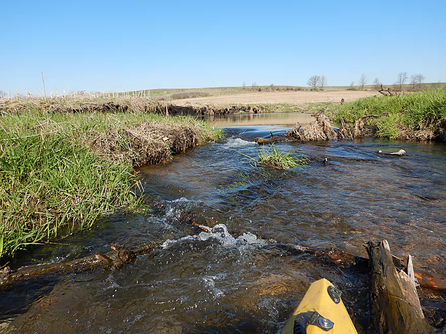
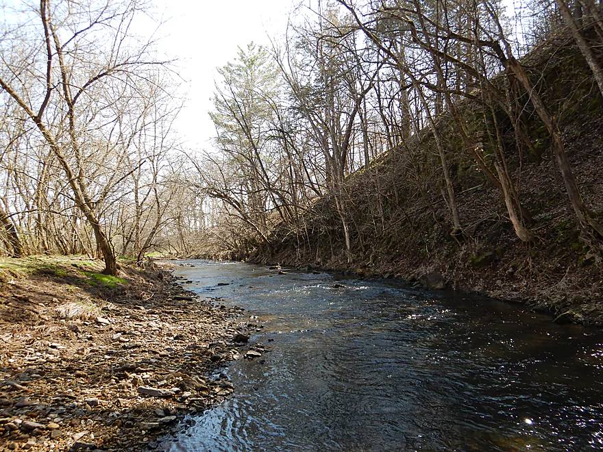
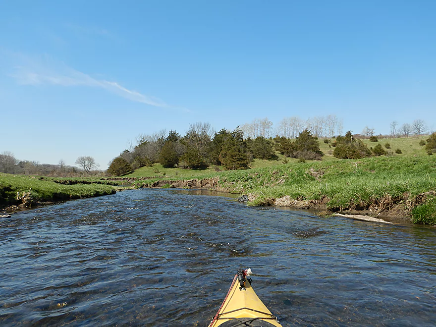
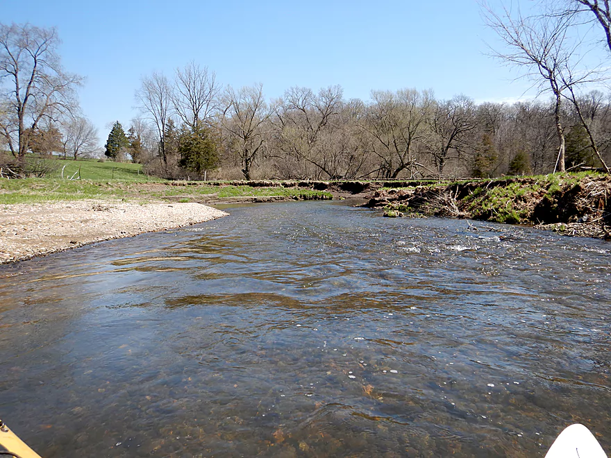
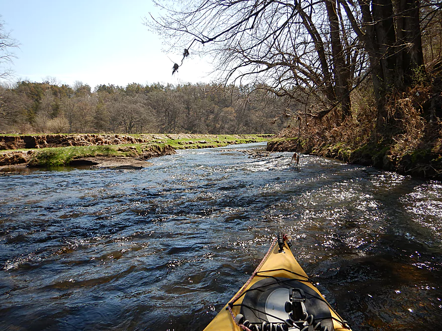
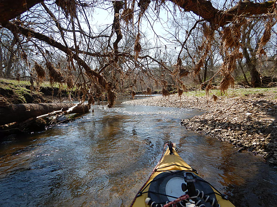
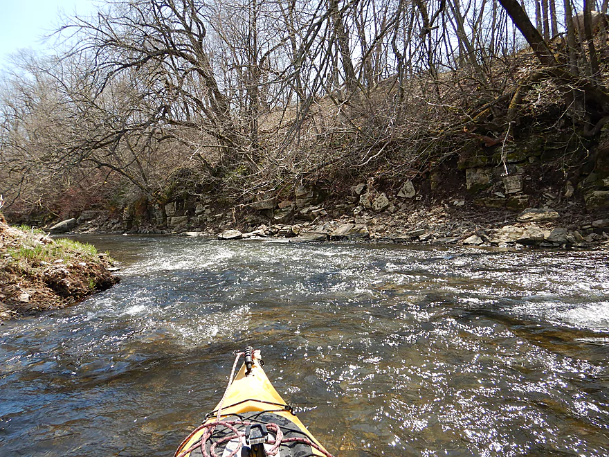
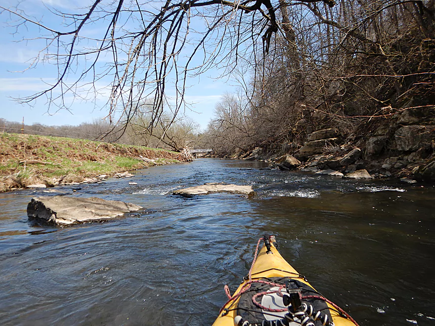
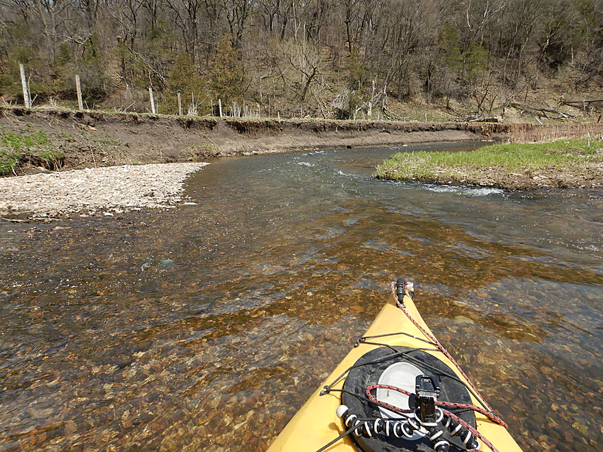
River starts fast
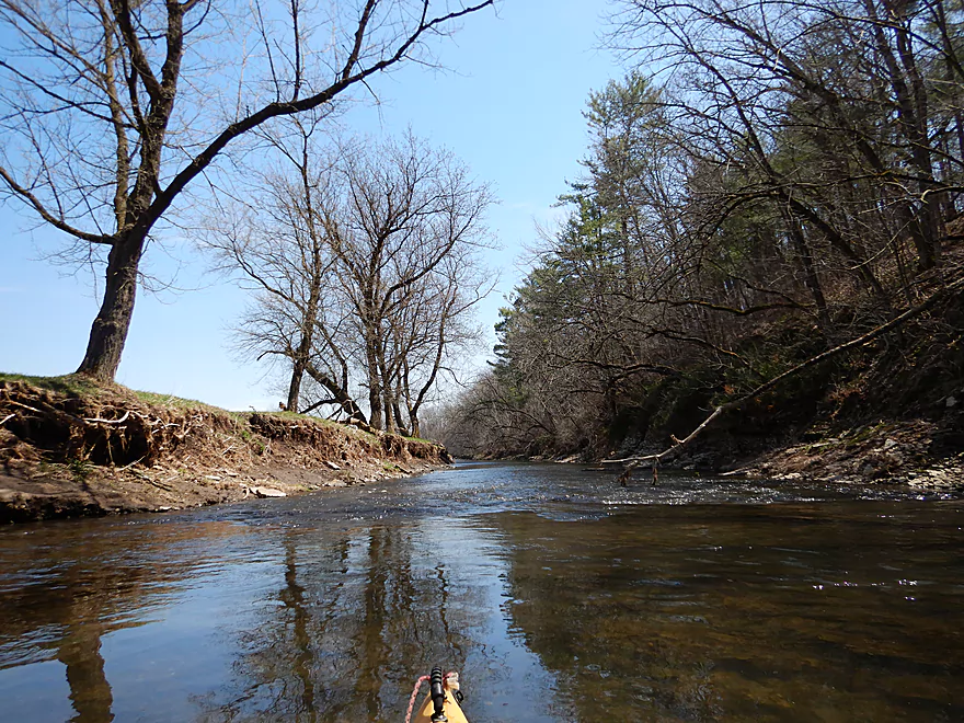
And has great clarity
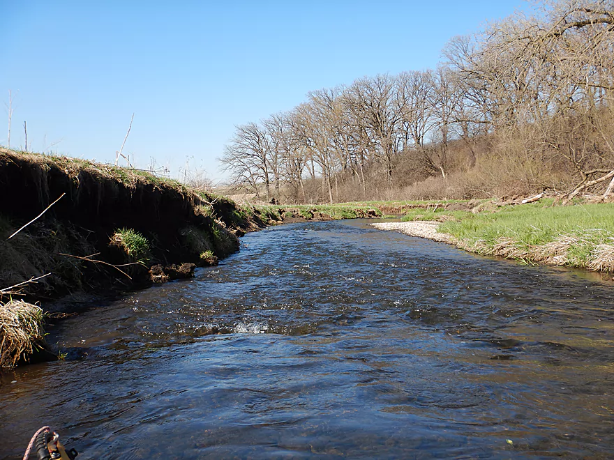
Kind of shallow though
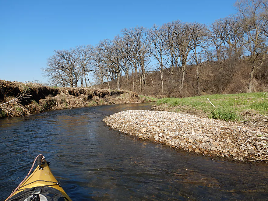
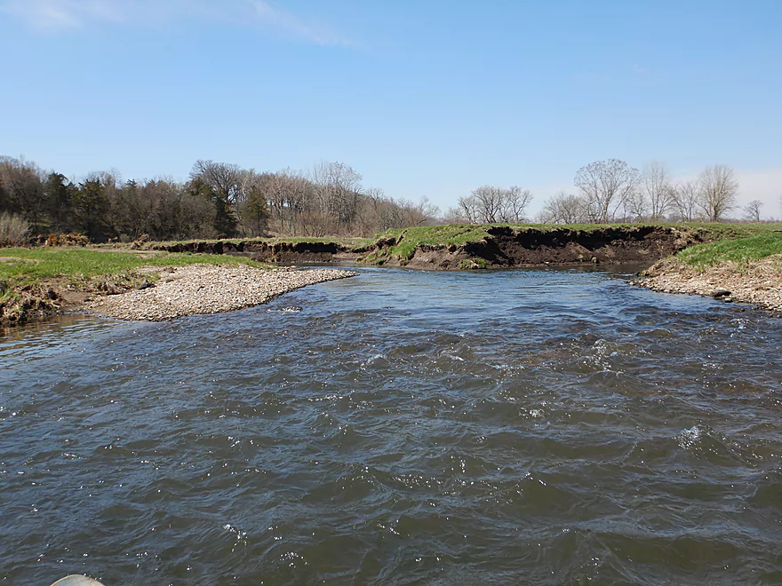
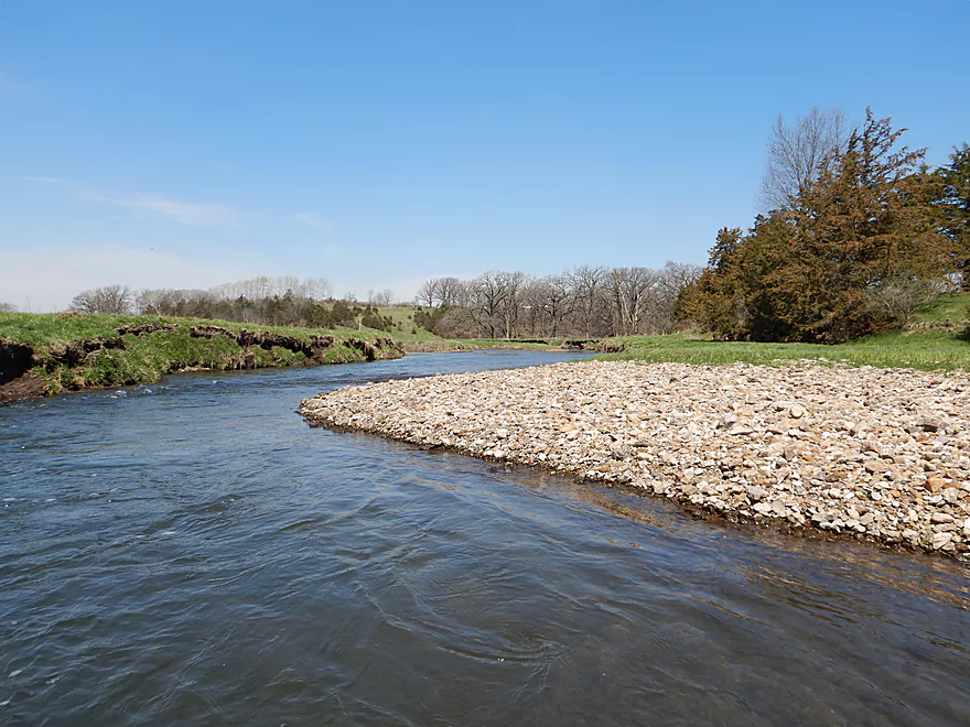
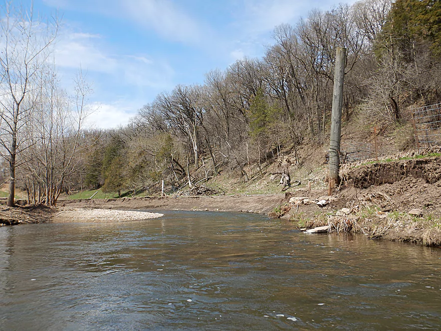
Some nice gravel bars
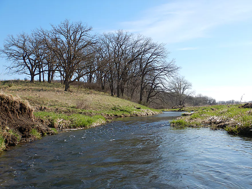
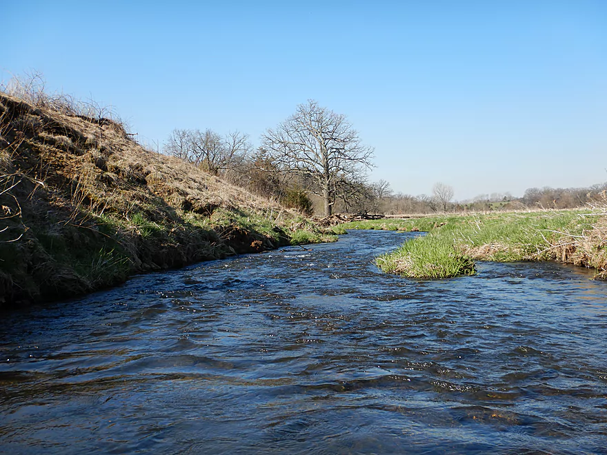
An oak savannah
A tight fit…but I made it
Reminded me of the Big Green River
Lot of fun rapids
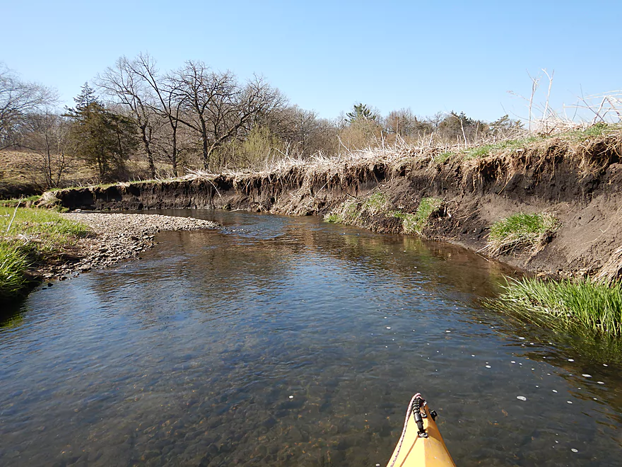
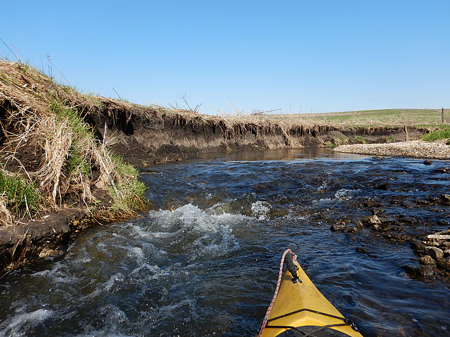
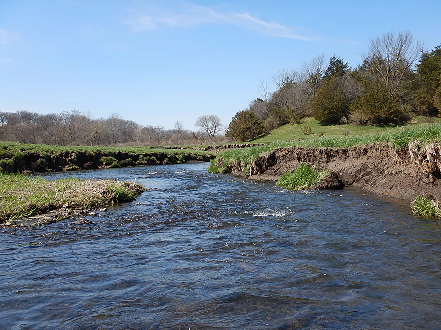
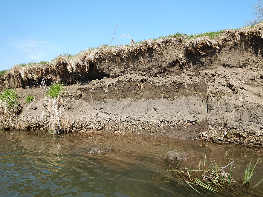
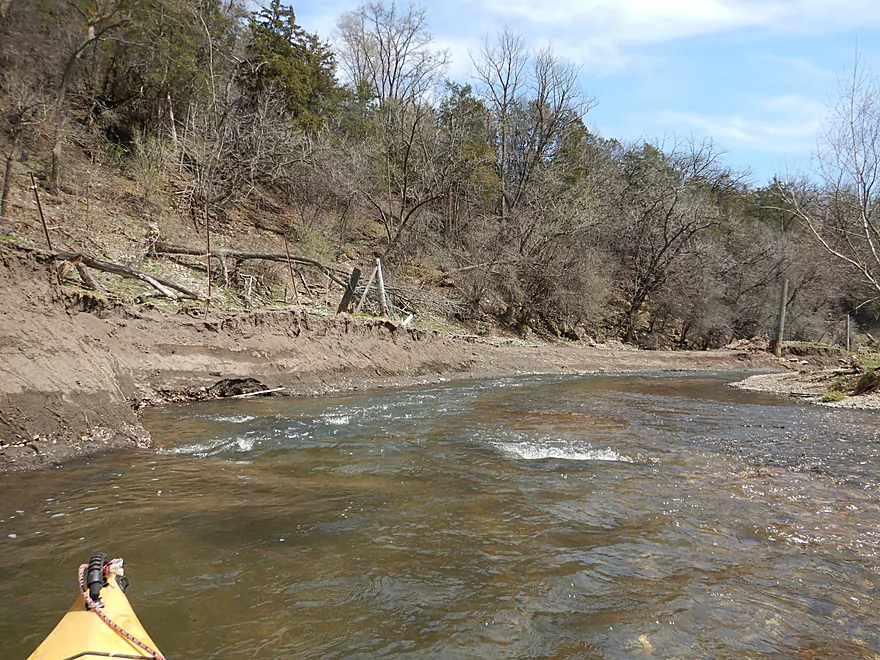
Eroded banks were common
A tight chute
Entering a patch of woods
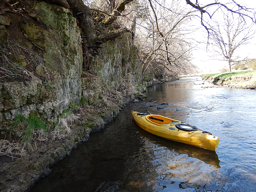
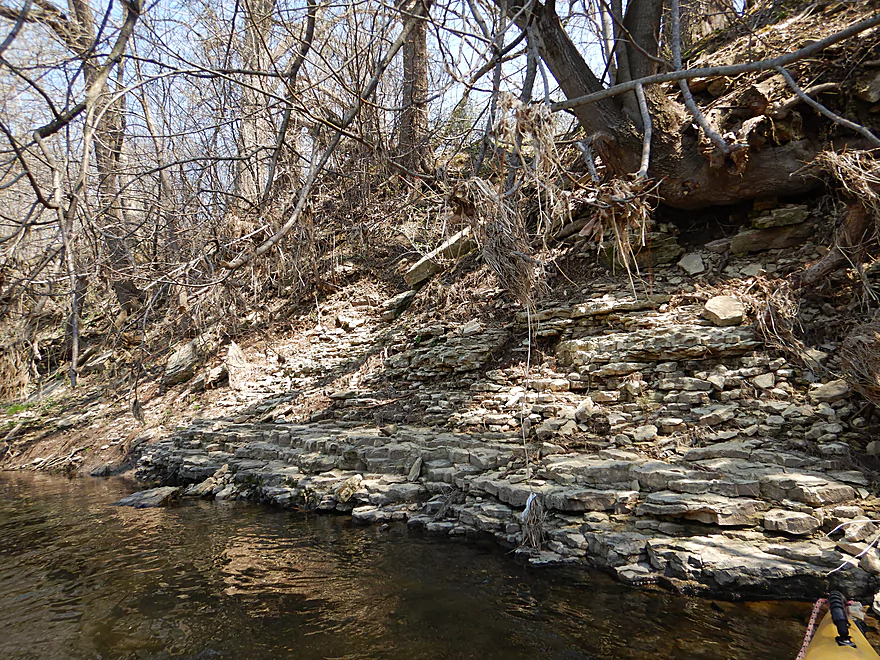
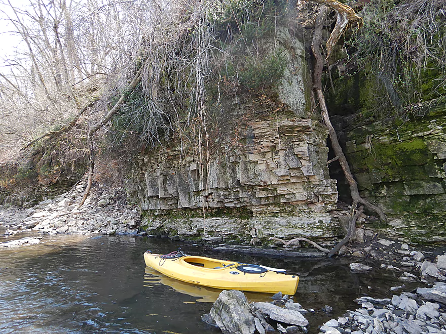
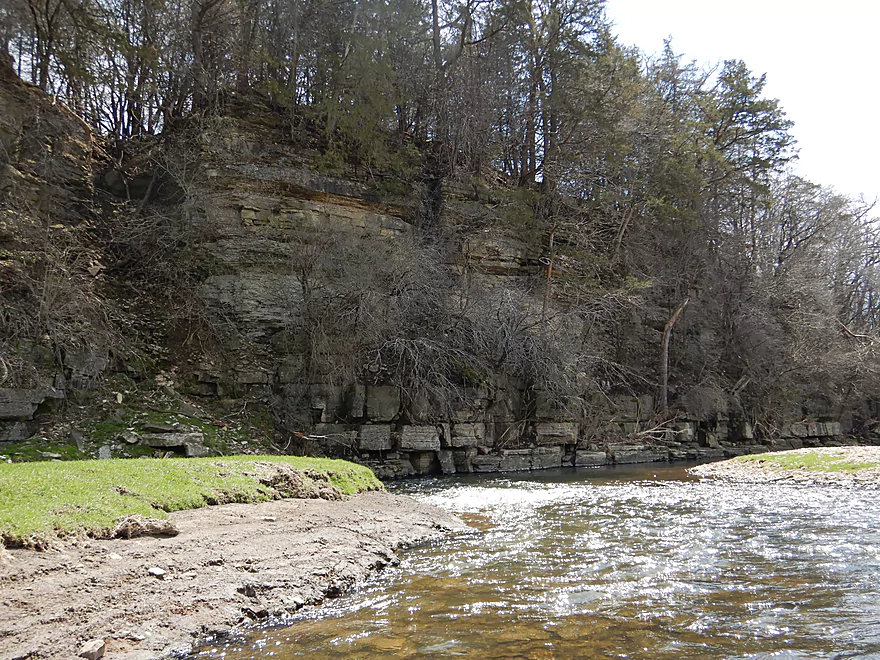
Neat area with outcrops
Getting out for better pictures
Looking back
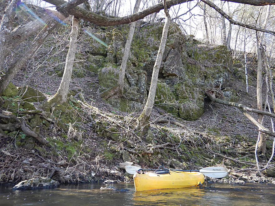
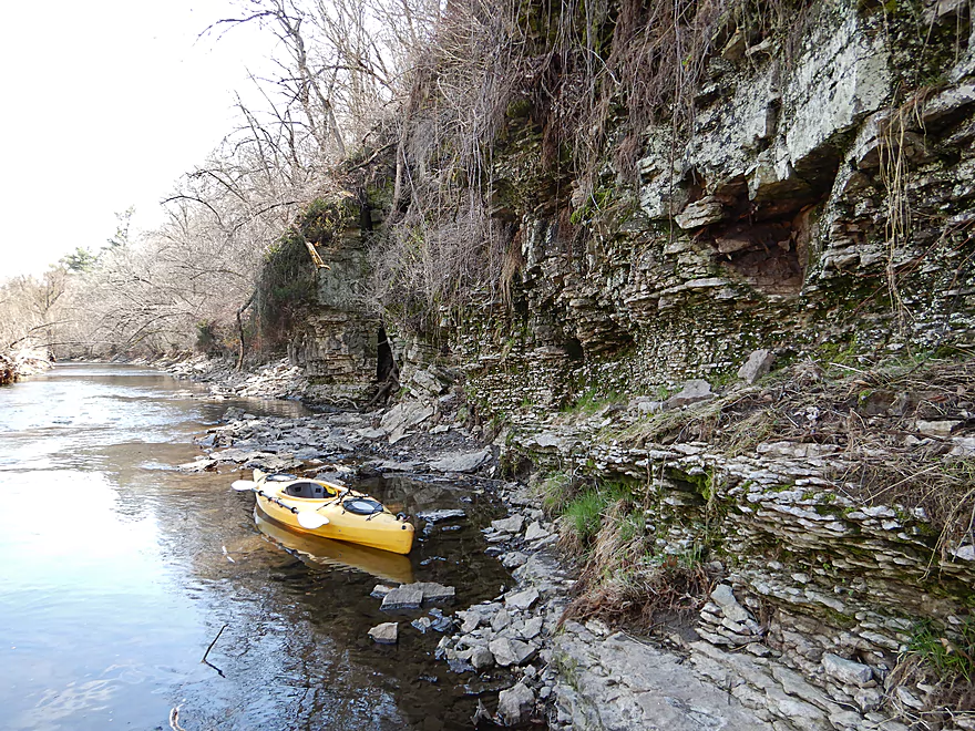
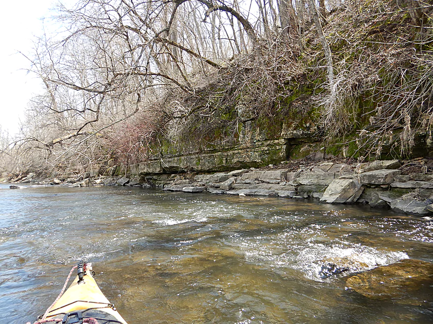
Another nice outcrop around the bend
Leaving the woods behind
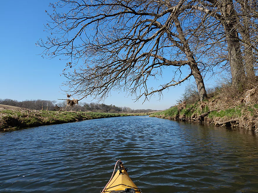
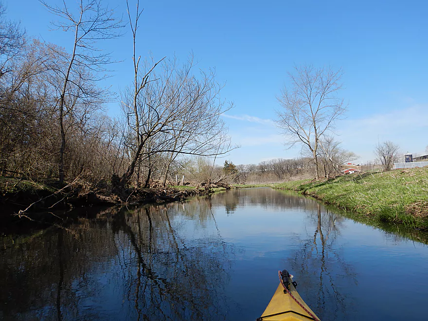
More great clarity
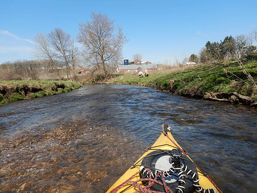
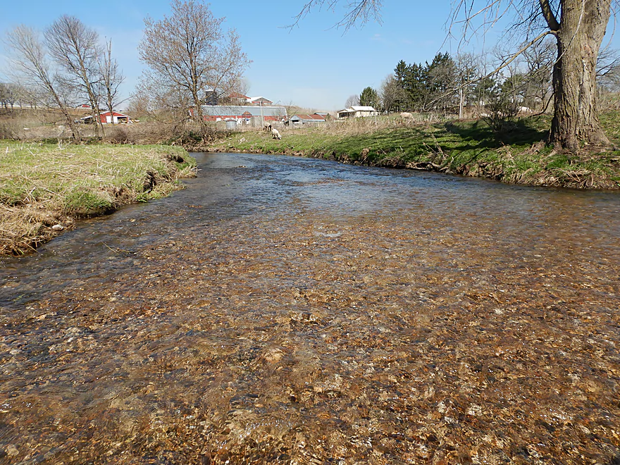
Coming up on a sheep farm
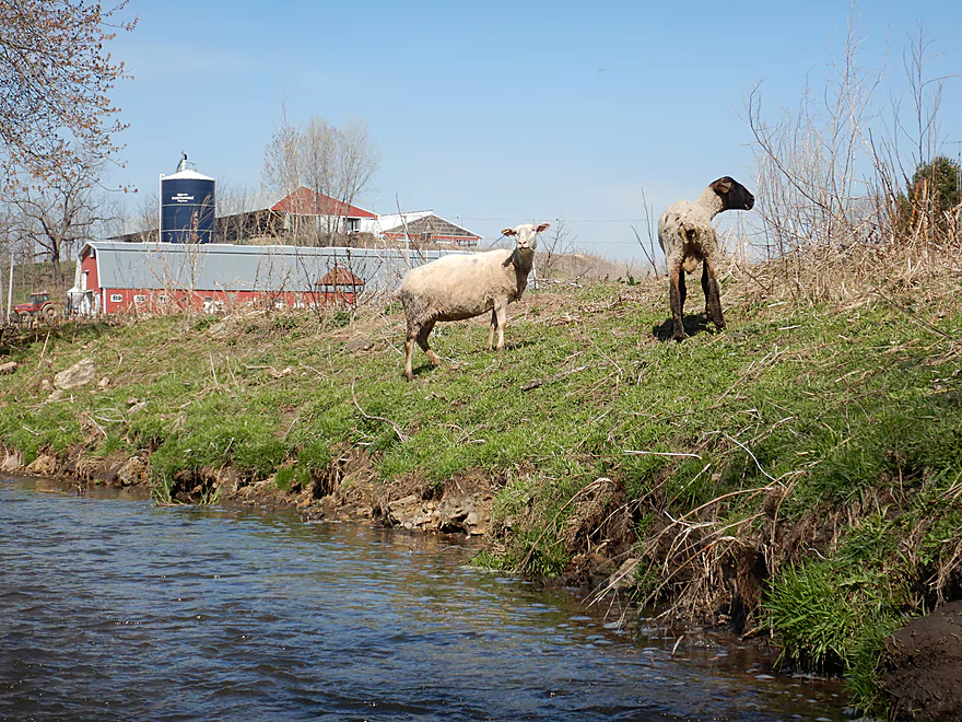
Curious onlookers
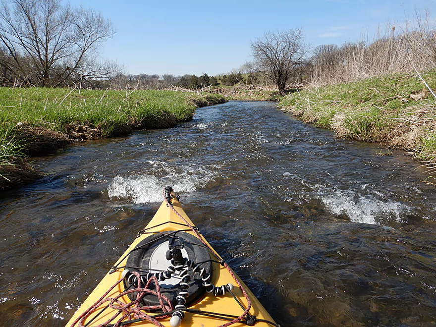
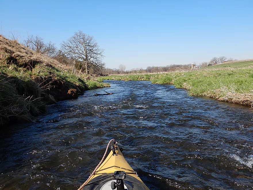
Speeding along
Another nice outcrop
Rolling green hills reminded me of Snow Bottom SNA
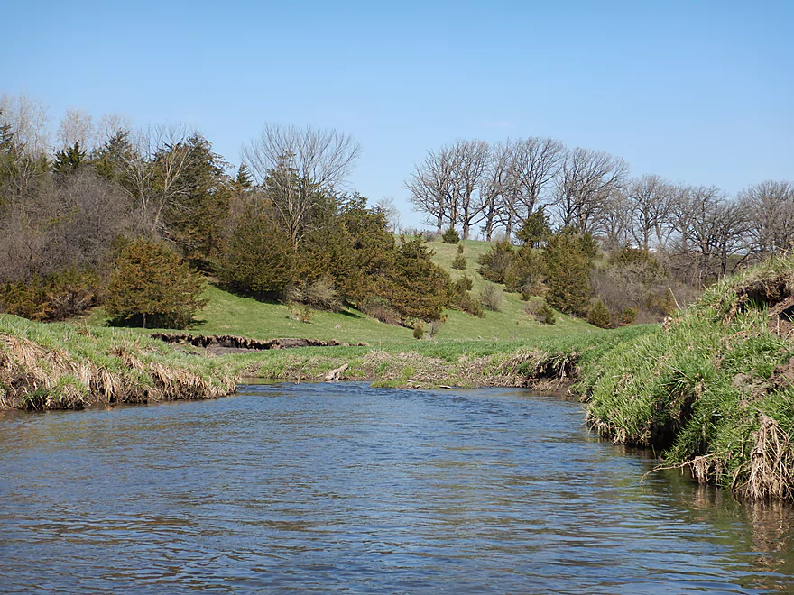
Hills grazed short by sheep…like a giant lawn
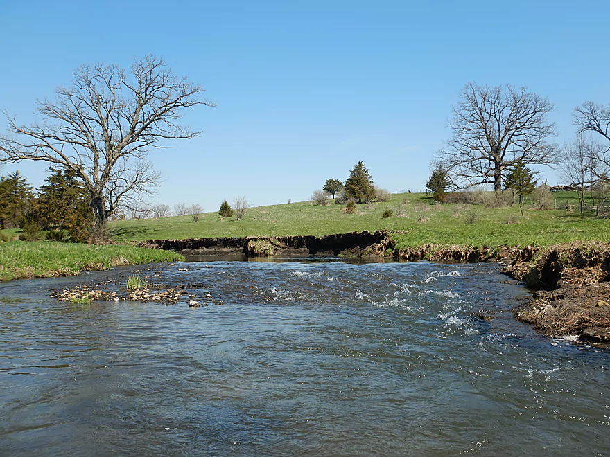
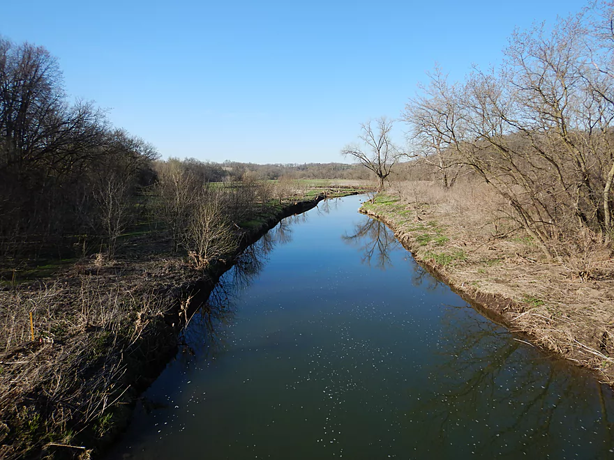
Livingston Branch joins the Main Branch
The band with gravel shows the original bank height
Taking a giant bite out of the hillside
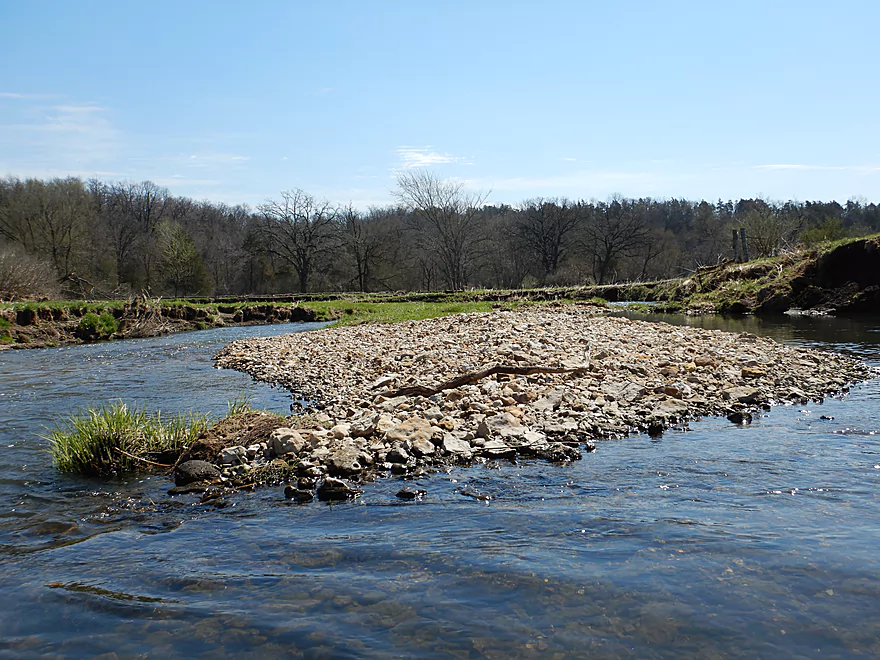
More great gravel bars
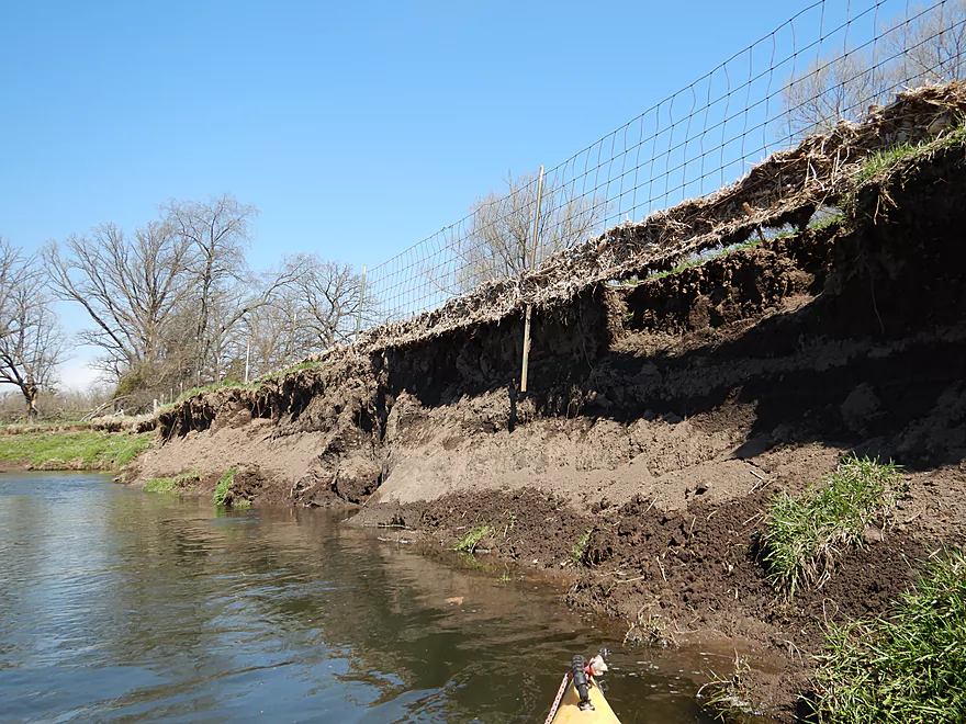
These banks move over time
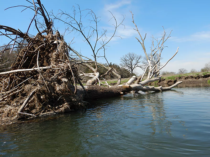
The few downed trees were swept to the side by strong current
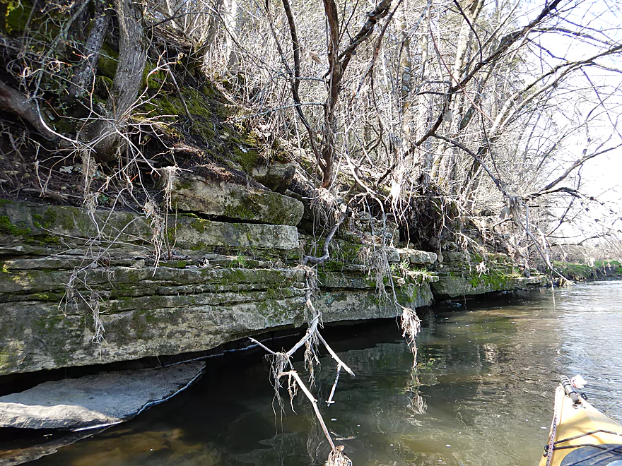
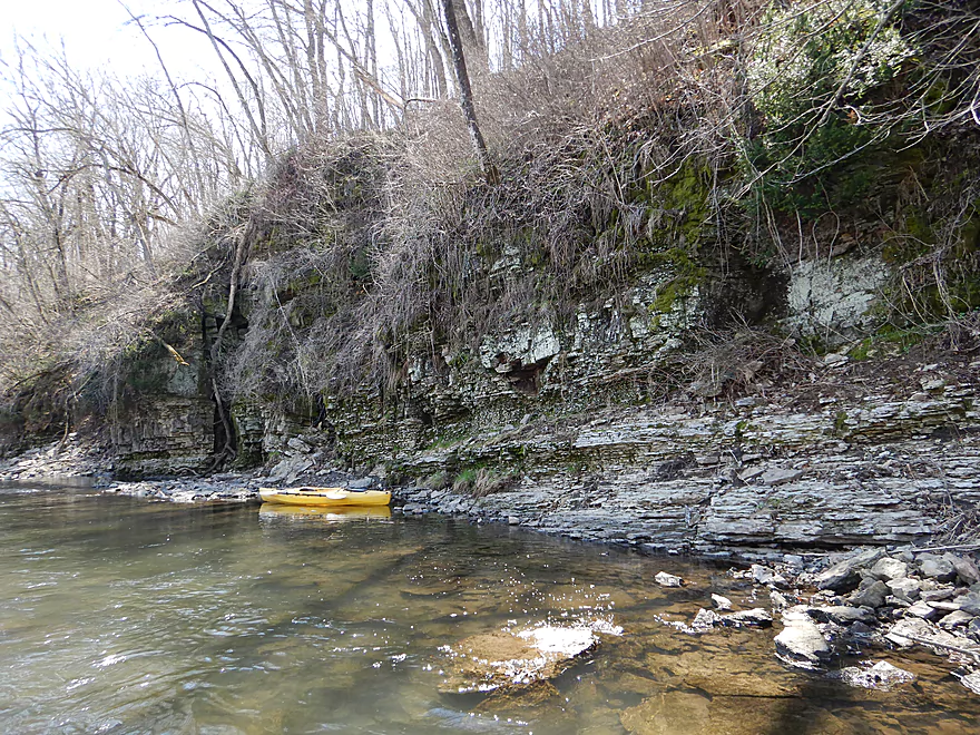
An undercut limestone wall
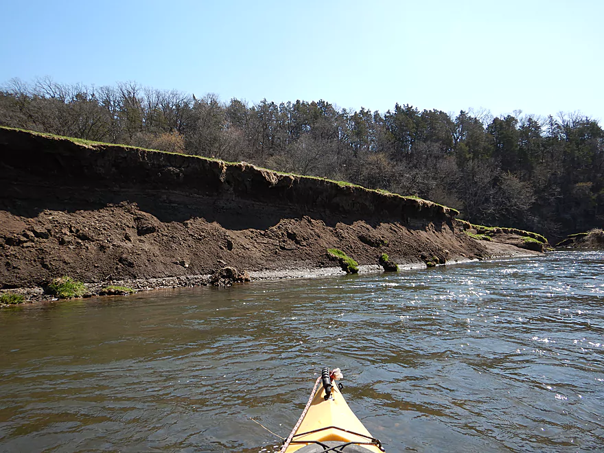
Some of the highest banks and worst erosion of the trip
Unusual fence…easy to get under
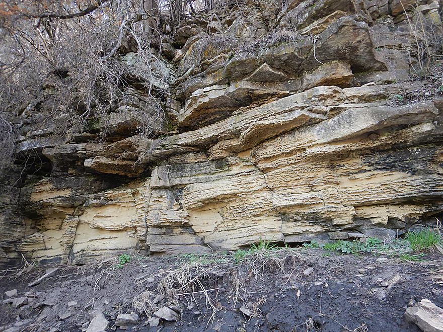
Trip had a mix of sandstone and limestone…this was sandstone
Some ducking required
Unique brick-like texture
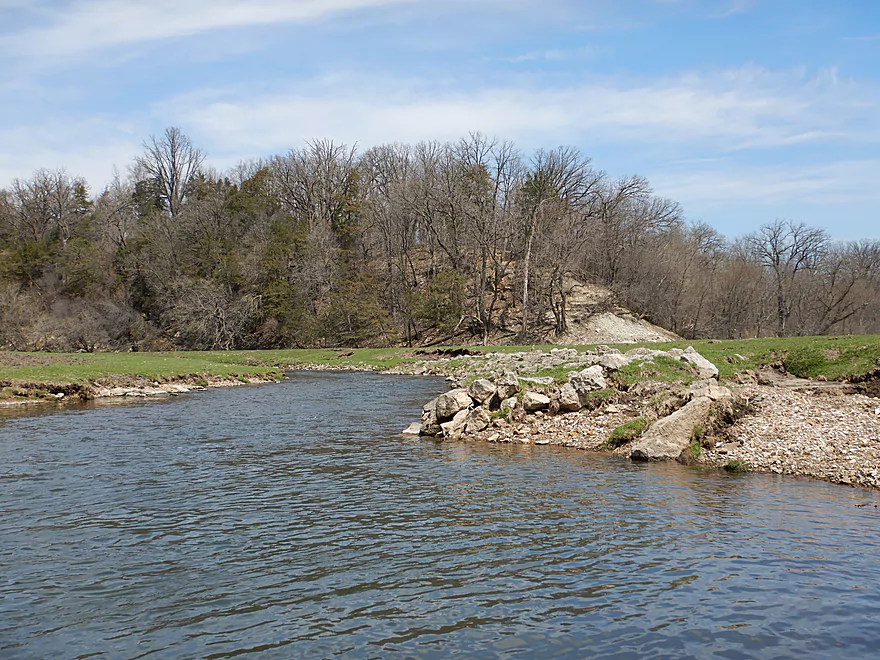
Limestone outcrops block the river and force it east
Very scenic
Evidence of a previous rock slide
White pines usually signify outcrops
Following the Livingstone Branch, the rapids had much more padding
Fun little slalom
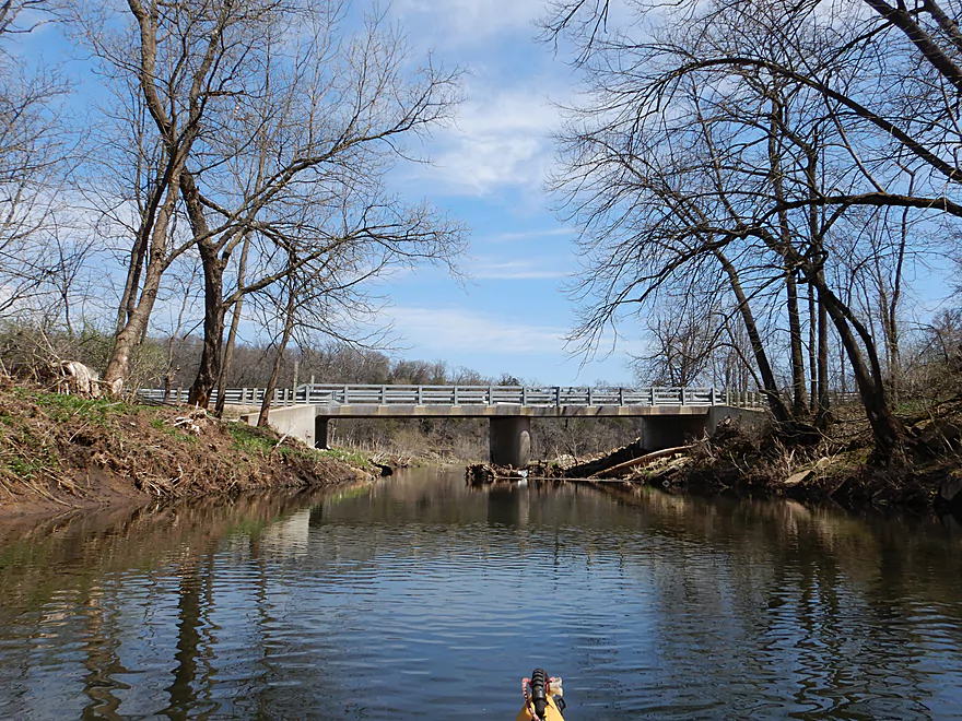
Hwy G (again)
This is a decent access option
But that would mean a short trip…so I kept paddling on
Paddling the first leg of a large half-mile horseshoe
Beef cattle graze on the nearby land
A turkey was hiding in the woods here
Very open section
The best outcrop and rapids all in one
Followed by a wire fence…easy to get under
Last of the rapids
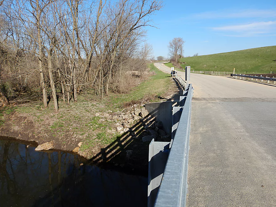
Taking out at E (not the easiest option but doable)
Looking downstream at a future trip
Pecatonica River – Mifflin

The Pecatonica is a classic located in southwestern Wisconsin. I’ve paddled it several times before and it’s a nice river, but the downstream sections can be quite high and muddy during the spring. My running hypothesis is that for most rivers the further upstream you go, the better…less mud, better current, smaller banks, and more character. For the Pec, I wanted to test this to the extreme by launching near the tip-top of its watershed tree just upstream of Mifflin to scope out a previously unexplored section.
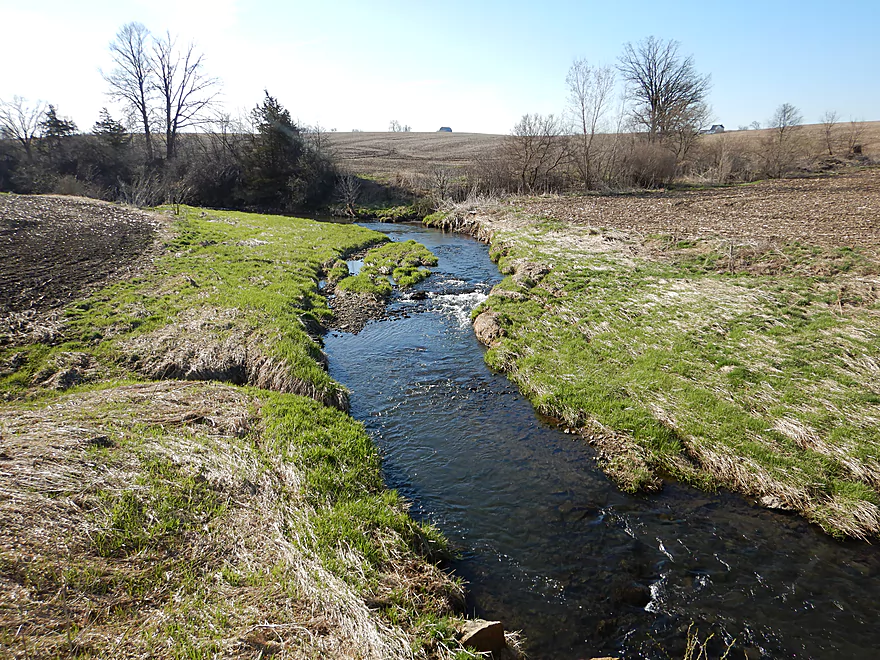
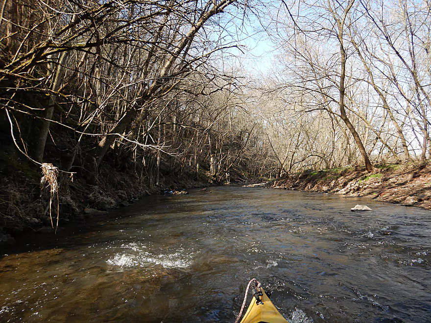
At the put-in off Hwy G, the Pecatonica was no more than a small creek. Navigable, but just. The first leg was sandwiched between large hills of corn to the south and a thin strip of woods to the north. This was a fast section with pool and riffle configuration…very reminiscent of the Big Green River.
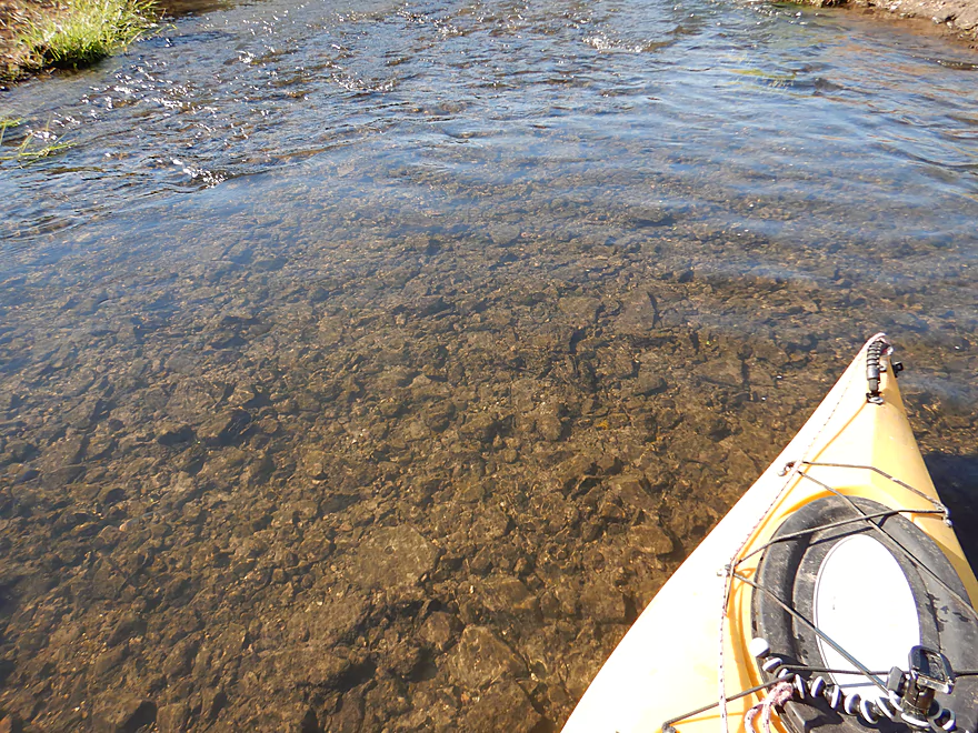
The clarity here was great and revealed a red pebble substrate. If you do this paddle, keep an eye out for meteorite fragments. Nine years ago a meteorite created international buzz when it fell just north of Mifflin. Here is a map of the strewnfield which was directly over this very water trail.
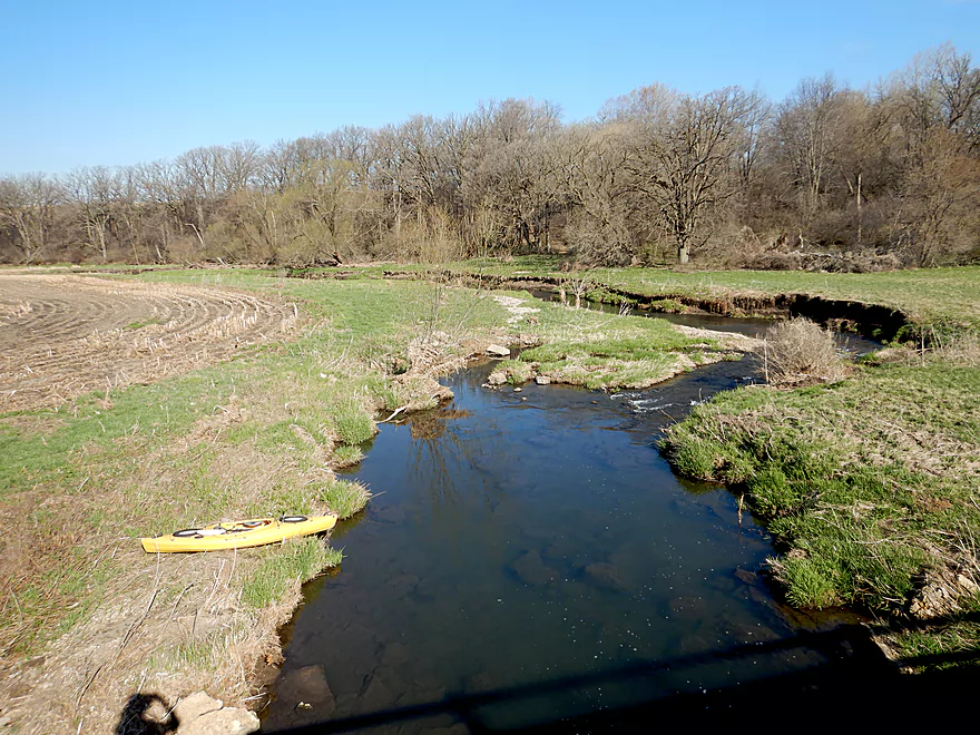
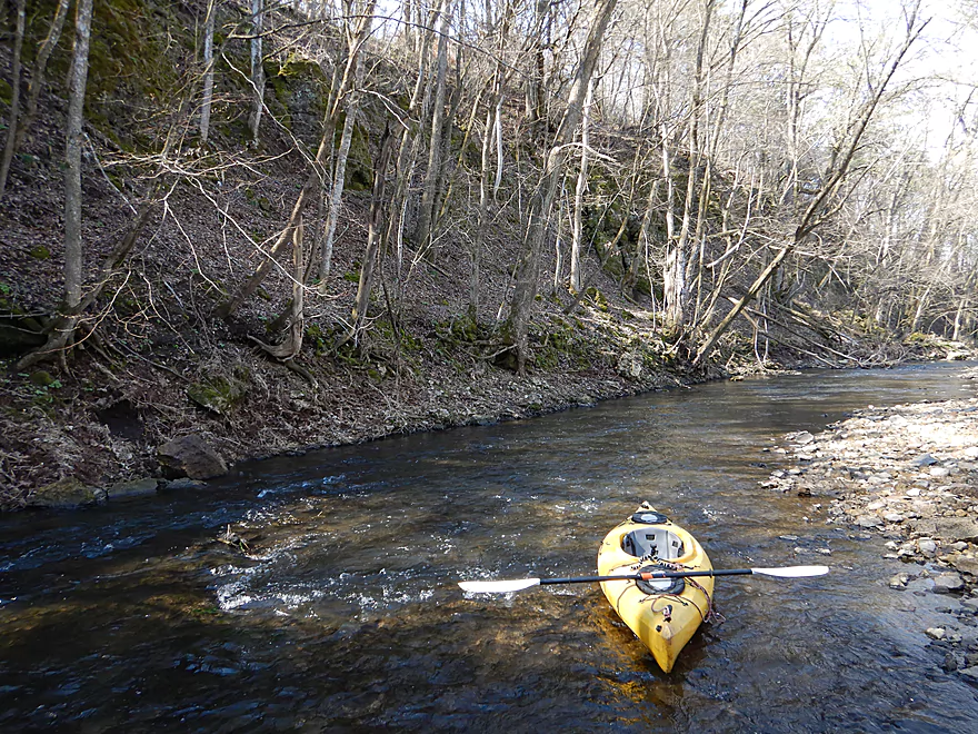
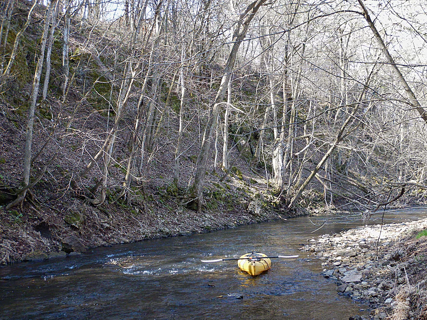
The hilly cornfields were followed by a wooded bluff which featured the first of the trip’s many outcrops. The sandstone, woods, and rapids combined to create a cool corridor I really liked.
This was followed by a large sheep farm, whose occupants curiously watched me paddle by. A fence separated them from the river, but the sheep were pretty clever and knew how to work their way through the gaps. Following another brief corridor of outcrops, the river opened up again into open pasture…an attractive section very reminiscent of the nearby Blue River and Snow Bottom SNA.
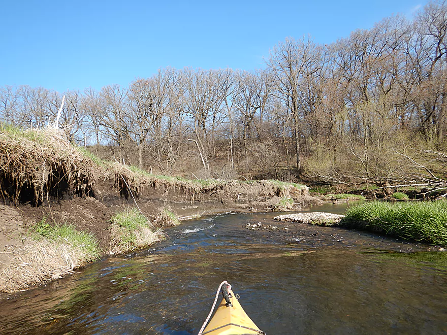
The Livingstone Branch soon joined with the Main Branch and nearly doubled the flow rate. From then on, most of the rapids had much more padding, which was much appreciated. A highlight on this segment were the large gravel bars, while a lowlight were the huge exposed mud banks from decades of topsoil erosion. A long series of bluffs then forced the river suddenly to the east. The outcrops at the base of this ridgeline were quite striking. There was a mixture of sandstone and limestone on this trip, but here most were limestone and had fantastic texture.
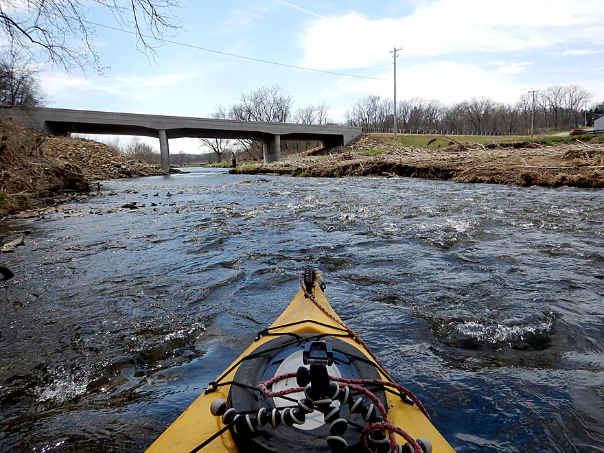
I debated on taking out at Hwy G, but that would have cut the trip pretty short…so I continued on to Hwy E. This additional half mile formed a giant horseshoe and flowed past a large beef cattle farm. Erosion was a serious issue, but there were still scenic rapids and outcrops, with the best being just upstream of Hwy E.
In summary, this was a trip I really liked and gave five stars. It had all my favorite components (rapids + no logjam portages + outcrops + clear water + narrow). But I could see many paddlers disagreeing with my five star assessment because of its shallow depth and requirement for high flow rates.
Some ducks, some gobbling turkeys, an eagle, a mink, clams, turkey vultures, a red-tailed hawk, sheep, and many singing songbirds. The highlight was the huge schools of fish I saw…some of which looked like trout. A surprise as this is not officially a trout stream. In fact, I’ve paddled many trout streams and only the Big Green River rivaled this for number of fish.
Hwy G (first bridge) was a pretty easy bridge access IMO.
An alternate upstream put-in would be at Hwy X, which would add 4.2 miles to a trip. Beware that this would be an unexplored section and could be very shallow with some possible logjams (although I think it is pretty open). There are also likely some small outcrops. Hwy X is not an ideal bridge access as it is open, close to a home, and lacking in privacy.
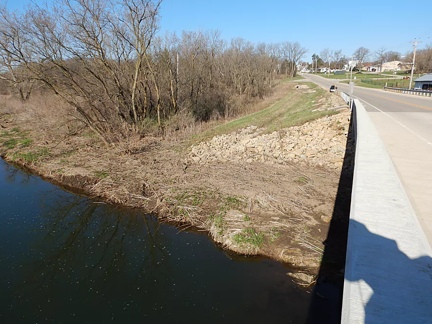
I took out at Hwy E, which was a mediocre bridge access. Because of the long guardrail and rocky embankment, it will take some effort to pull your boat to your car. Best parking is SW of the bridge.
An alternate take-out 0.5 miles upstream is at Hwy 2 (second bridge). This is a much better bridge access, but if you take out here, you miss out on a neat section.
An alternate take-out 4.4 miles downstream is at Hwy A. This is a very good prospect with quick current, outcrops, and a state natural area. There might be a few minor logjams on this leg.
The bike shuttle was very hilly (180′ of climbing) but is mercifully short at 1.7 miles. A hiking shuttle is certainly a viable option.
Fences:
- Fence #1: Located by the sheep farm, this is super easy to get under.
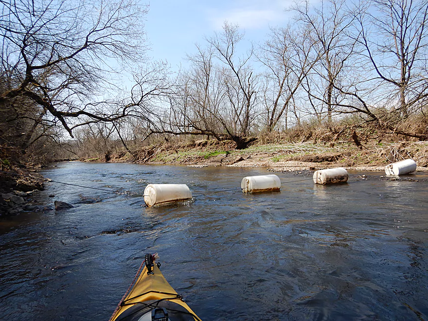
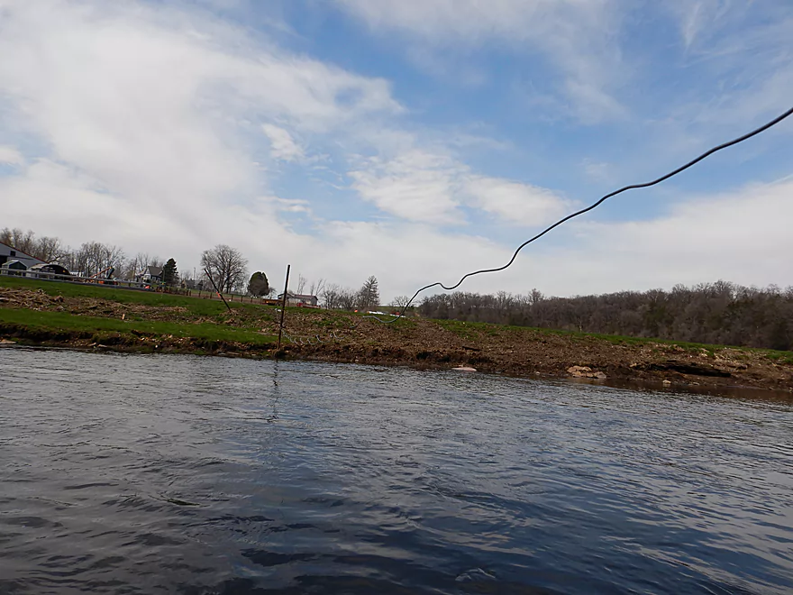
- Fence #2: Located halfway into the trip, this consisted of a unique cable and float system. I was able to duck under, but it would be easy to portage if need be (it’s not electric).
- Fence #3: Located just upstream of the E bridge, there is a sagging cable across the channel. Not sure if electric, but I was able to easily duck under the left edge. This can be scouted from the bridge.
Logjams: None. There were 2-3 instances in which downed trees narrowed the channel, but I always felt it was easy to get through.
Current: Like many SW Wisconsin rivers, this has a pool and riffle configuration. Overall this was a fast trip that drops at an impressive 13′ per mile.
Rapids: There were countless riffles. For rapids, I didn’t note any more difficult than Class 1. But in high water, I could see some rapids being promoted to Class 2. This could be a fun whitewater river at very high levels.
There is a gauge on the Pecatonica River, but is is about 35 miles downstream at Darlington. So…won’t be super accurate as the far upstream legs will rise and fall faster in reaction to rainfall. Note, parts upstream of the Livingston Branch are the most shallow. After that joins in, the rapids gain much more padding.
- < 300 CFS: I wouldn’t bother. Likely too shallow.
- 301-380 CFS: Pretty shallow…marginally doable, but many of the rapids will be extremely shallow. I did the trip at 340 CFS and really wished for more padding.
- 381-450 CFS: Likely a good depth…maybe some bumping, but not bad.
- 451-540 CFS: A high depth. This could be more of a whitewater trip and could be fun.
- 541-700 CFS: Very high depth…only suitable for experienced paddlers. Some banks may overflow at this depth.
- 701+ CFS: Maybe too high? I don’t know.
Detailed Overview
- Upstream of Hwy X: I think the river up here is too shallow to run.
- Hwy X to Hwy G1st: 4.2 miles. This section is a small creek and may need high water. Some logjams and probably small outcrops. Hwy X is not a great access and lacks privacy.
- Hwy G1st to Hwy E: 3.4 miles.
- Hwy G1st to Hwy G2nd/Mifflin: 2.9 miles. Great section with many rock outcrops and light rapids. Shallow, but becomes much deeper after the Livingston Branch joins up. Two fences, but easy to get past.
- Hwy G2nd/Mifflin to Hwy E: 0.5 miles. Short, open section heavily grazed by nearby beef cattle. Some fun rapids and outcrops are on this segment. One fence to duck under (quite manageable).
- Hwy G2nd/Mifflin to Hwy A: 4.4 miles. An excellent prospect with good current, outcrops, a state natural area, and few logjams. Martin (reader comment) kayaked this section and wrote a nice summary here that you can read.
- Hwy A to Peniel Road/Hwy J: 1.7 miles. Maybe two outcrops and two major logjams.
- Peniel Road/Hwy J to Jones Branch Road: 2.5 miles. Some congested woods with maybe 3 logjams and 2-3 outcrops.
- Jones Branch Road to Powell Road: 3.1 miles. A nice peaceful stretch with a few outcrops, 2 sets of light rapids, and one serious logjam.
- Powell Road to Oak Park Road: 8.0 miles. A very open section with no logjams. Highlights include green rolling hills, oak savannas, a few rapids, and one outcrop. Lowlights include four low fences.
- Powell Road to Hwy 151/Blackstone Cattle: 4.4 miles. The more scenic of the two sections with scenic hills and one outcrop. There are two low electric fences to duck under.
- Hwy 151 to Oak Park Road: 3.6 miles. This section had more corn and trees and wasn’t as interesting, but still was decent. There is one low electric fence and one super low barbed wire fence.
- Oak Park Road to Hwy O: 3.7 miles. Likely some logjams but also some outcrops at the end. Oak Park Road is a muddy but doable put-in.
- Hwy O to Hwy G: 6.0 miles. Some scenic moments, but mud and logjams are detractions. Put-in and take-out are muddy.
- Hwy G to Darlington/Black Bridge Park: 8.5 miles. A decent prospect. As of 2020, there is a large logjam on this leg that requires a difficult portage up steep and muddy banks. This might be cleared out for the 2021 Darlington Canoe Festival.
- Darlington/Black Bridge Park to Roller Coaster Road: 4.9 miles.
- Black Bridge Park to Wells Street Access: 0.7 miles. A great stretch though the town of Darlington. The highlight is a section of Class 1 rapids where the old mill dam used to be.
- Wells Street Access to Roller Coast Road: 4.2 miles. A decent stretch, but no outcrops, the banks are steep/muddy and there are two partial logjams to circumnavigate around. Not bad...not great.
- Roller Coaster Road to Walnut Road: 7.3 miles. While one of the nicer legs on the lower Pecatonica, the river has been too badly damaged by erosion to be an elite paddle. The highlight is a sandstone outcrop.
- Walnut Road to Riverside Road: 5.5 miles. Mediocre prospect flanked by a lot of farmland. Excellent put-in and take-out.
- Riverside Road to Hwy 78 Canoe Landing: 3.2 miles. Likely an uninteresting leg with lots of farmland and large mud banks. I doubt there are many bluffs. There may be one major logjam.
- Hwy 78 Landing to Gratiot Conservation Club Landing: 5.8 miles. A mediocre stretch. Much of this is wide, slow, and straight...but there are a few nice wooded bluffs.
- Gratiot Conservation Club Landing to Sargent Road: 4.7 miles. Maybe a weaker section.
- Sargent Road to Hwy D/N: 4.6 miles. Flows partly through a SNA and by a valley ridge so might be interesting.
- Hwy D/N to Hwy 11 Boat Ramp/Browntown: 8.8 miles. The East Branch comes in and doubles the river (now pretty big).
- Browntown to Brewster's Landing: 12.2 miles.
- Hwy 11 Boat Ramp/Browntown to Hwy B: 4.8 miles. Generic stretch with farm fields and a thin layer of trees. Take-out might be tricky because of a guardrail but I think it’s doable.
- Hwy B to Hwy M: 4.6 miles. A good leg with scenic bluffs and outcrops. Put-in is meh…take-out might be bad.
- Hwy M to Brewster's Landing: 2.9 miles. Mediocre stretch that crosses into Illinois.
- Brewsters Landing to McConnell Bobtown Landing: 7.2 miles. Mostly straight and boring. But there is a wooded section with bluffs that might be nice. Could be an outcrop or two.
- McConnell Bobtown Landing to McNeil's Damascus Landing: 8.5 miles. River flows through a more rugged and varied part of Stephenson County. Still some boring parts, but also some nice bluffs and limestone outcrops.
- McNeil's Damascus Landing to Wes Block Trailhead: 8.3 miles. Mostly a straight and muddy paddle. But there should be a few nice bluffs on the west bank.
- Wes Block Trailhead to Tutty's Crossing: 6.4 miles. River enters Freeport (IL). This should be a pleasant stretch with fewer farm fields, nicer woods, and a few attractive trail bridges.
- Tutty's Crossing to Hancock Ave Boat Ramp: 0.7 miles. Wooded urban stretch.
- Hancock Ave Boat Ramp to Junior's Place/VFW: 2.3 miles. River leaves Freeport. This is likely a mediocre stretch.
- Junior's Place/VFW to Ridott Fishing Park: 14.8 miles. A very long stretch that I'm not sure would be that interesting. There are rapids by the Brown's Mill Dam that may have to be portaged.
- Ridott Fishing Park to Attens Landing: 6.7 miles. I don't know much about this stretch. It meanders more and has thicker woods so may be nicer.
- Attens Landing to Winnebago County Fairgrounds Ramp: 7.5 miles. Much of this flows through the Pecatonica Wetlands Forest Preserve.
- Winnebago County Fairgrounds Ramp to Sumner Park: 0.4 miles. There are tricky rapids where a dam was mostly removed. Depending on water levels, you may have to portage this.
- Sumner Park to Pecatonica River Forest Preserve Ramp: 6.0 miles. A north flowing leg of the river that is mostly undeveloped and contains some floodplain forests.
- Pecatonica River Forest Preserve Ramp to Trask Bridge Ramp: 7.0 miles. This is a relatively good prospect with large clay banks and a few nice woods.
- Trask Bridge Ramp to Two Rivers Ramp: 12.6 miles. Paddling author Mike Svob seemed to like this leg. Here the river meanders and twists more. The woods are also more impressive. Much of this is still likely wide, slow, and boring though. The take-out is close to the mouth of the Sugar River.
- Two Rivers Ramp to Boat Launch Mactown: 9.8 miles. The last leg of the Pecatonica before it empties into the Rock River. Significantly enlarged by the Sugar River, I suspect this is a big and boring leg.
Trip Map
Overview Map
Video
Photos Size:
I paddled with a group of 27 on the Pecatonica River on June 22, 2019. The Darlington River gauge was at 360 CFS, which I agree is at a marginal water level. We looked at the Hwy G crossing, but because of all the Wild Parsnip and the width of the River elected to put in at CTH E in Mifflin. Our take out was at CTH A, river left, which was reasonable. Ample parking along the wide shoulders of the road. The actual distance is 5.2 mile. This trip took us 3.5 hours. Water clarity was murky for our trip. We encountered 1 barb wire fence which we held down, thus allowing the others to paddle over. 1 very shallow rocky bottom which we dredge via tossing a few rocks out of the way which allowed the rest of the group to pass thru a little easier. The last mile of the trip presented several challenges. 1 logjam at which 2 of us, on standing on top of the tree, hoisted kayak and paddlers over as there was not an option to portage. Another logjam that we cleared river left to allow portaging the shore line and river right to allow a limbo spot. We also made an opening in a couple other deadfalls to allow passage. We had one very low limbo spot along the way. We took out on river left right at the CTH A bridge. The road shoulders allowed for ample and unobstructed parking. I would imagine that this trip could easily be done in 2.5 to 3 hours. Otherwise a very enjoyable trip, with riffles, chutes, twisting corners and scenery.
Funny you should mention this stretch…I was going to paddle that very section on Saturday before I changed my mind last moment. IT’s nice to hear this was enjoyable but tough to hear about those logjams. I’ll update my overviews to reflect your update.
Thanks for the review/guide. Completed this on 9-13-20. It had rained the previous day but we still bottomed out in some of the rapids upriver of Livingston Branch. The PECATONICA RIVER AT DARLINGTON Gauge was over 600 CFS but it didn’t seem to correlate to the upstream portion being deeper. Very pretty river. The rapids at this level were fun and still in the class 1 range. Finally we ran into two down’ed trees/logjams that we had to portage over – not too bad.
Thanks Matthew for the update. It sounds like the Darlington gauge is just too far downstream :( Otherwhise, yeah it is a really cool river.