
Put-in at 28th Ct. Beware big snag just around the bend
Classic way to enjoy a river
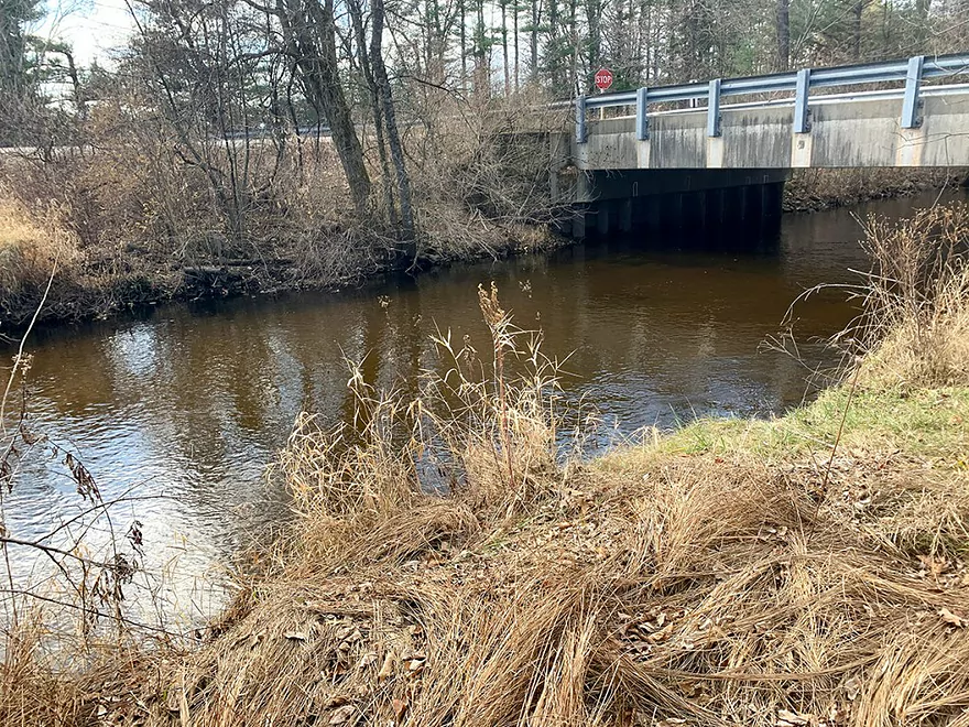
Bridge blocks the way. Portage left (this is upstream view)
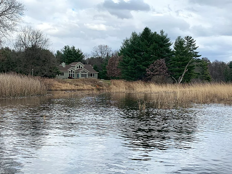
Look for this house to find your way through the flowage
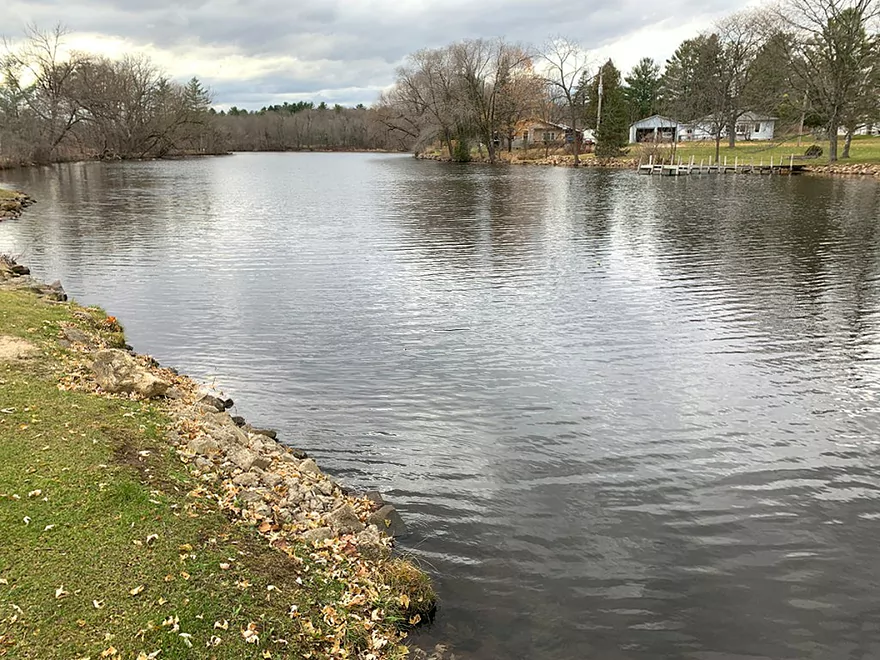
Upstream view of flowage from takeout at community park
Pine River – 28th Court


This Pine River has all the hallmarks of a central Wisconsin groundwater-fed stream: the water is clear and cold, the bottom mostly sandy. It is a sinewy river, winding in tight curves back and forth.
It’s hard to say where the Pine’s headwaters are. There are a number of small tributaries adding their flows to it between Wild Rose and Saxeville. Parts of those tributaries fall within the Wisconsin DNR’s Pine River Fishery Area. That these are high-quality trout fisheries tells you something about the water quality of the Pine itself.
Records of previous paddling excursions of the Pine of Waushara County exist. In his self-published “Small River Canoe Adventures of Wisconsin” (long out of print, written in the late 1990s), Frank Piraino found his way down the Pine from Apache Road to Waushara County Road A. A more recent trip (May 2020), from the same put-in Frank used but taking out a few hundred yards farther downstream at Covered Bridge Rd., is reviewed here.
The segment I’m about to describe was done in 1989 by Rick Kark, he of 309 Wisconsin rivers fame. What I have learned from Frank’s and Rick’s writings of these obscure Wisconsin streams applies to this segment of this Pine River: things are generally better on our rivers – water quality is better, obstacles are fewer, fences are going away, cows are almost totally gone – than when these two intrepid souls navigated them 20 and 30 years ago.
This river is very reminiscent of another central Wisconsin stream, the Montello, featured elsewhere on this site.
I put in on tiny 28th Court, just off County Highway H, east of the settlement of Pine River. Don’t try putting in below the dam at Pine River. I saw no way to easily launch there – no good access, too little water.
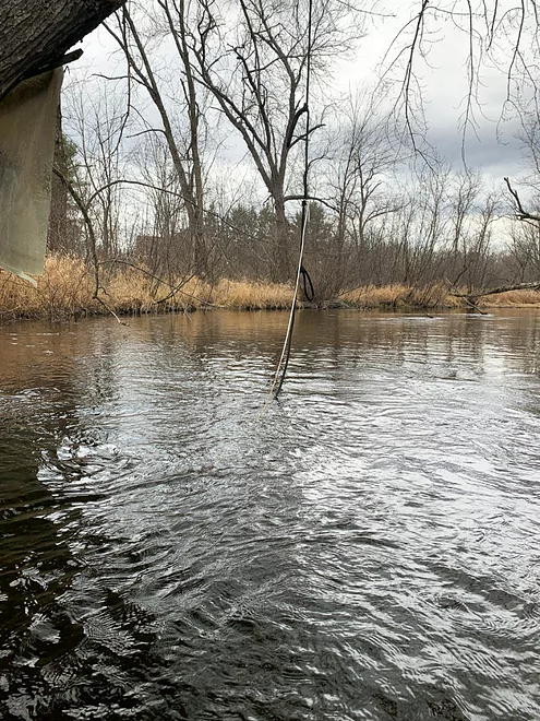
This put-in is acceptable. The grass has been trampled not by other paddlers but by anglers working the riverbank. You are confronted almost immediately by a serious logjam that I was able to cut myself through with a handsaw and some finagling.
That isn’t the last deadfall that you’ll encounter on this segment of the Pine, but it is by far the worst. There are plenty of downed trees and debris, but there always seems to be a passage. River angels have done some pruning, likely for themselves and other river property owners; there’s plenty of evidence that denizens of this segment of the Pine enjoy it for canoeing, fishing, tubing and stick-chasing for their dogs.
Characteristic of this segment of the river are the many dwellings, mostly humble seasonal cabins. Their owners seem like the kind of folks who wouldn’t want to live on a lake and appreciate the riverine environs. The buildings are more exposed (as is the traffic noise from County H) in the fall than they would be in summer.
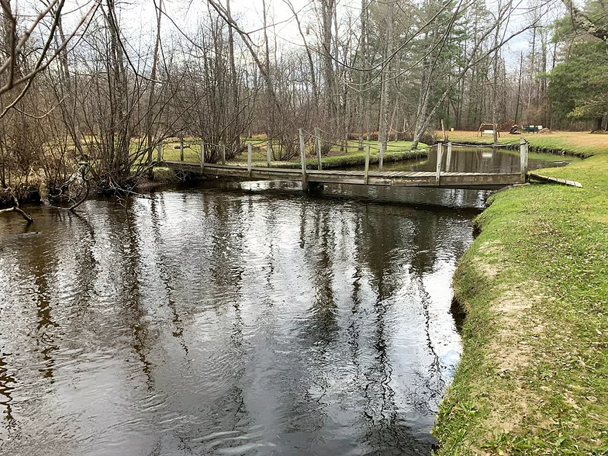
One owner clearly doesn’t understand the rules of navigable waters in Wisconsin – that you can’t prevent navigation, or if you do, you must provide a means to get around the blockage you created. There’s a footbridge that you can’t get under, but can easily get around. If they protest you are trespassing, remind them that their bridge is illegal. There are at least three other footbridges in this segment – all passable.
The river twists and turns but its current is gentle; you’ll never feel harried in your navigation. It eventually begins to widen and enter a large marshy area. Navigating this marsh could be tricky, especially if there’s been a long dry spell affecting the water level. Follow the current as best you can, then aim your boat toward the left bank of the marsh. In fact, head toward a cluster of white pine trees and a pale green colored house. This is where the main flow seems to be. It doesn’t mean you won’t scrape bottom or scoop some mud with your paddle, however.
Beyond the marsh, the river narrows briefly before widening considerably, due to the effect of the tiny hydroelectric dam at Poy Sippi. The current is pretty much dissipated at this point, as well. Paddling this flowage is not unpleasant. The shore is lined with houses, with some lovely legacy white pines interspersed throughout.
Takeout is on the right bank just above the dam at the community park. Don’t sweat this – you’re 100 yards from the dam and there is no current at that point.
Another – and better – trip on this river would be to continue downstream, below the dam at Poy Sippi and continuing on to Lake Poygan. That trip is described here.
Thanks for the review Denny! You went on this stretch when levels were relatively high. I might try to do this leg when water levels are lower and clarity is better.
WisconsinRiverTrips.com is always very appreciative of guest reviews, and if you the reader is ever interested in submitting one, you can use this online form.
Detailed Overview
- 19th Road to Hwy K: 1.7 miles. A neat prospect with clear water and no logjams.
- Hwy K to Aniwa Road Shoulder: 0.7 miles. Maybe 4 logjams.
- Aniwa Road Shoulder to Aniwa Road Bridge: 1.0 miles. Good prospect but likely 5 logjams.
- Aniwa Road to Apache Road: 0.7 miles. Likely a scenic and wooded section but 2-3 logjams are likely present.
- Apache Road to Covered Bridge Road: 5.8 miles.
- Apache Road to Hwy A: 5.7 miles. Good scenery and clear water. But there are multiple portages...8 for logjams, 1 for a low bridge and 1 for a Class 2+ set of rapids that has a strainer.
- Hwy A to Covered Bridge Park: 0.2 miles. A good stretch with some boulders and rapids. There is one minor logjam that requires limbo'ing. The scenic Saxeville Covered Bridge is by the park.
- Covered Bridge Road to 26th Road Wayside: 3.5 miles.
- Covered Bridge Road to Portage Street: 0.4 miles. An incredibly scenic stretch with dense boulder gardens and rapids. Some of the rapids are Class 3 and require difficult tight turns.
- Portage Street to Hwy W/Dam: 0.8 miles. The creek widens and slows into an impounded pond. This can get shallow and some wading may be required.
- Hwy W/Dam to 26th Road Wayside: 2.3 miles. This is a very nice stretch with boulders, tree canopies, pines, and quaint cottages. There is a low bridge to duck under and one logjam to portage.
- 26th Road Wayside to Hwy E/Dam: 2.7 miles. Maybe 6 logjam portages.
- Hwy E/Dam to 28th Court: 2.2 miles. An attractive stretch with many rapids...but likely many jams...perhaps 17.
- 28th Court to Poy Sippi Community Park: 5.3 miles. A mediocre stretch guest reviewed by Denny Caneff. This is a mostly open stretch, with maybe one noteworthy logjam. Some flowage paddling is required.
- Poy Sippi to Badger Drive Landing: 10.2 miles.
- Poy Sippi to Mouth on Lake Poygan: 8.5 miles. A good stretch guest reviewed by Denny Caneff.
- Mouth on Lake Poygan to Badger Drive Landing: 1.7 miles. This is a short stretch due north on Lake Poygan to reach a landing. Big lake paddling can be dangerous...do not do this when it is windy.
Trip Map
Overview Map
Photos Size: