
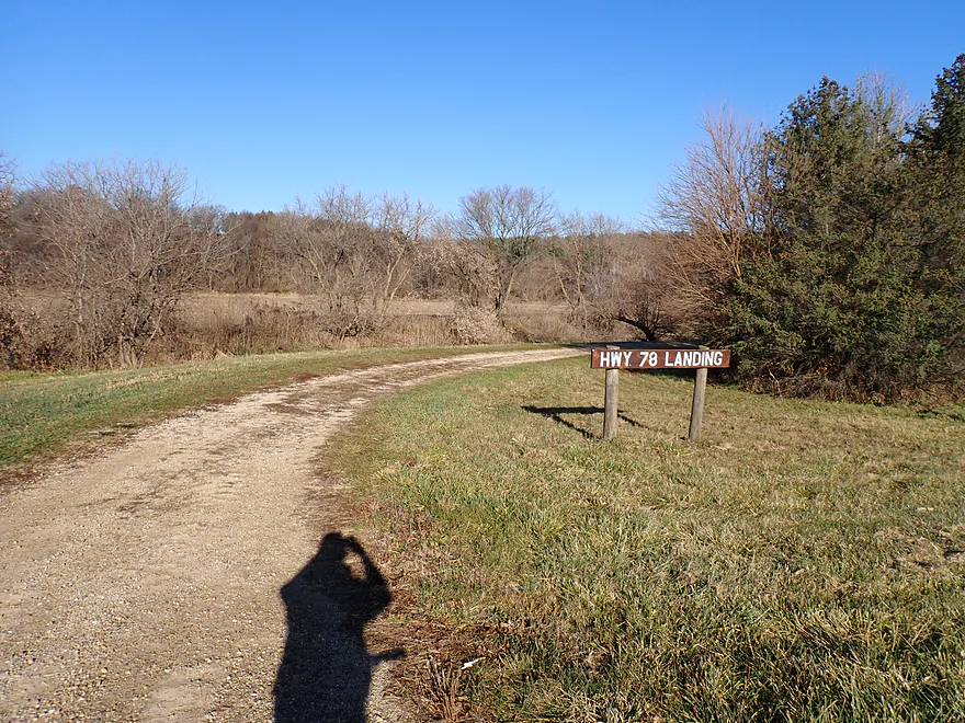
Starting at the Hwy 78 Landing
Nice public launch
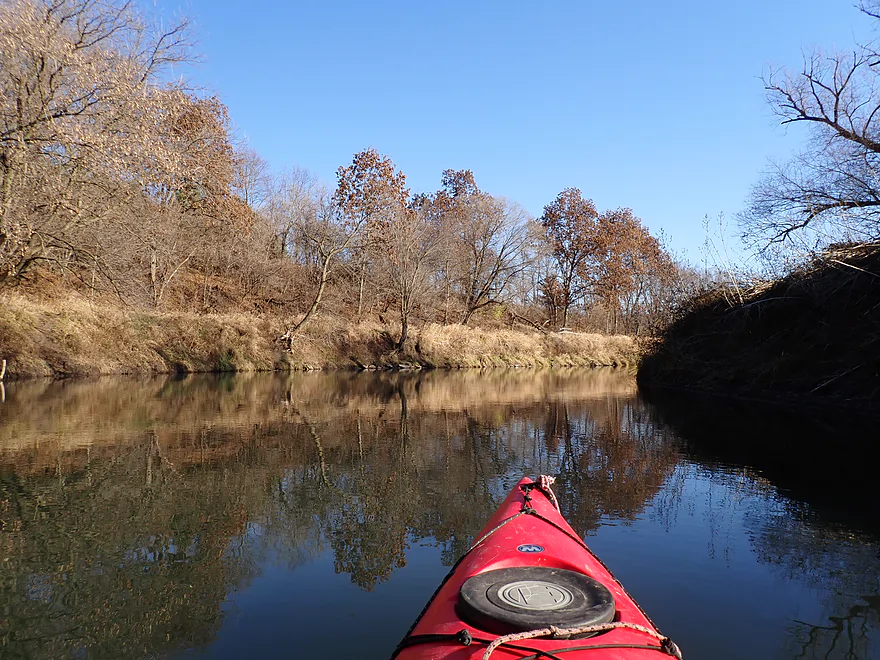
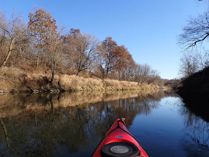
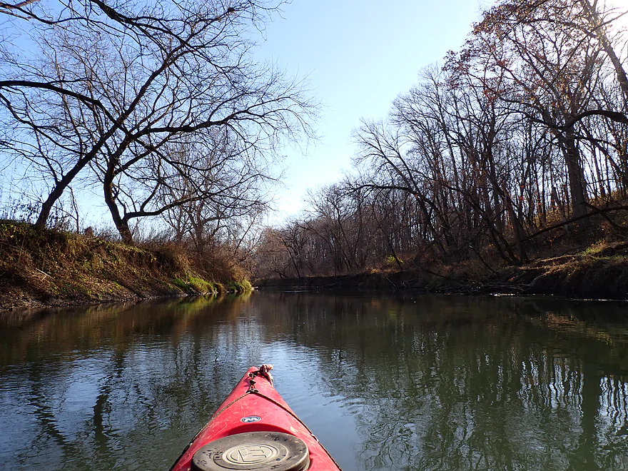
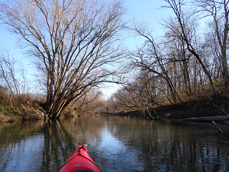
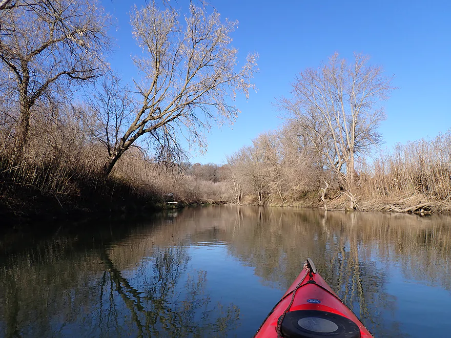
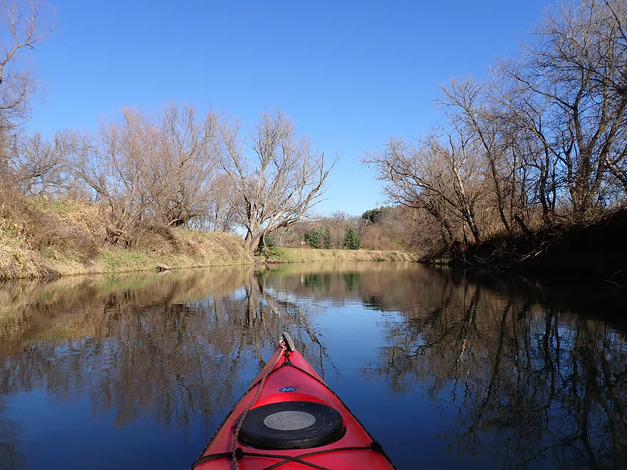
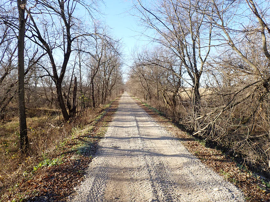
Scenic stretch to start the trip
Late turning oaks
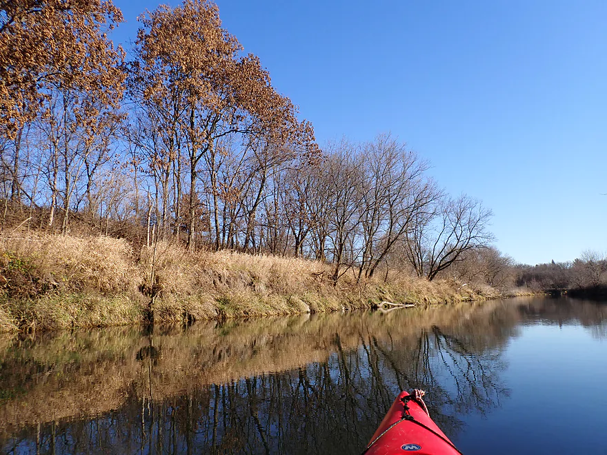
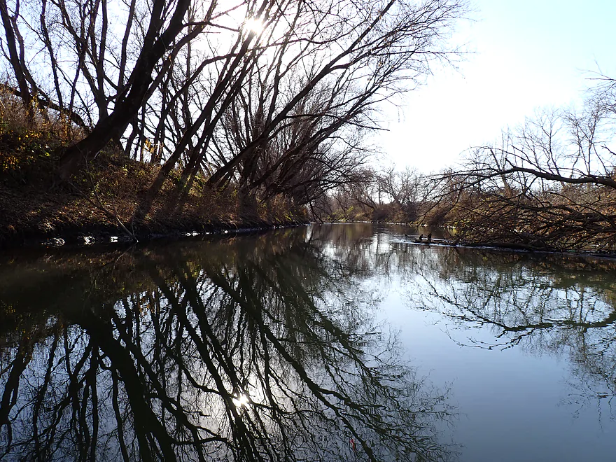
Coasting to let reflections form on the water
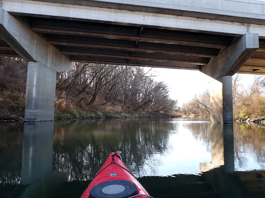
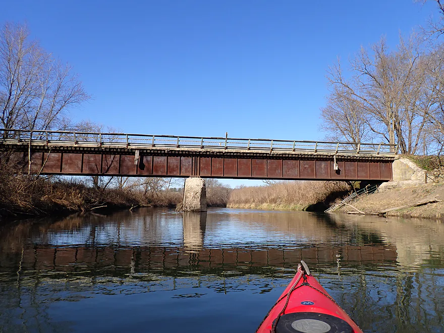
Hwy 78 bridge
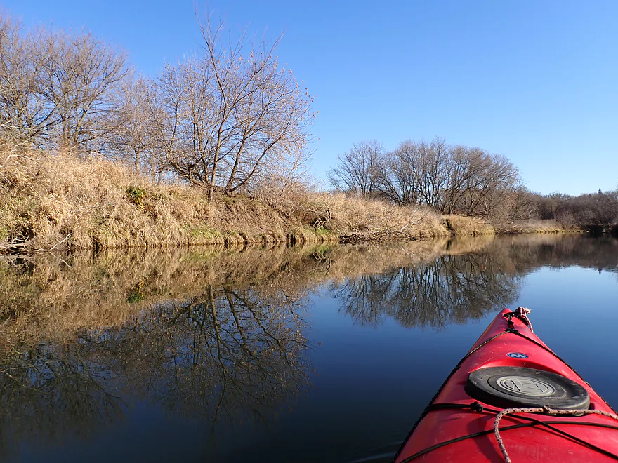
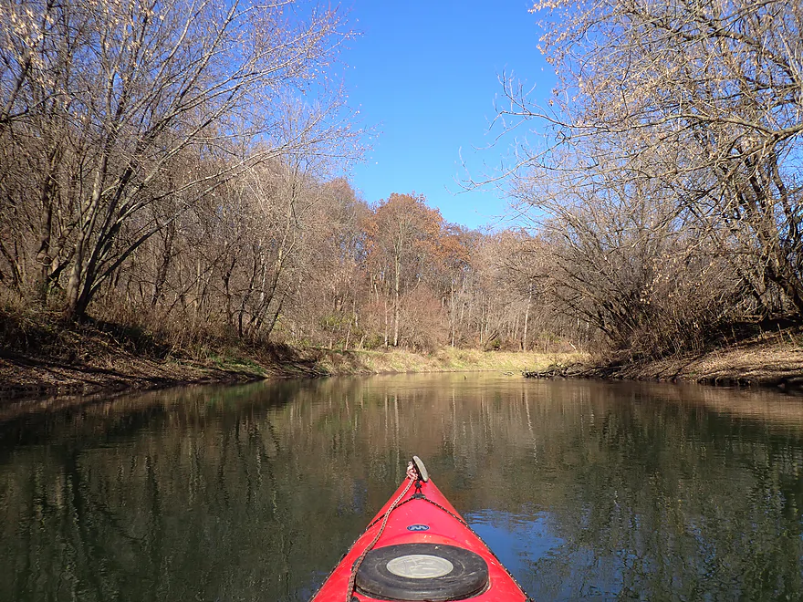
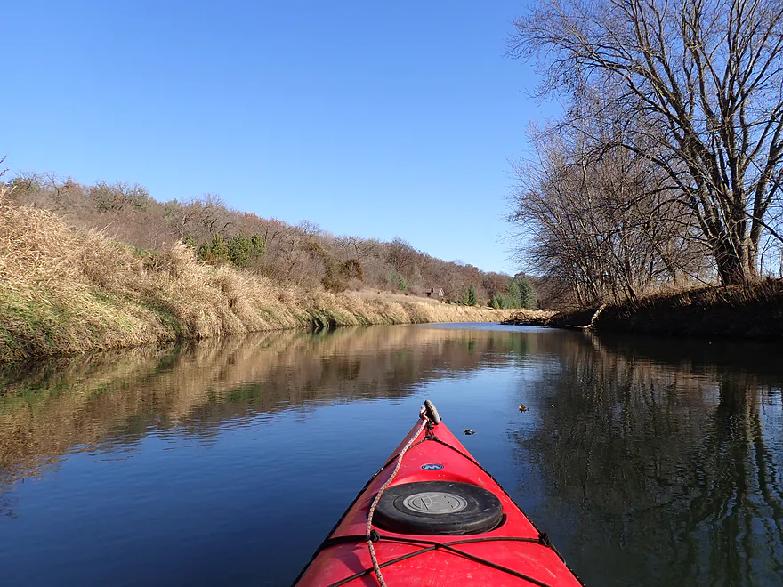
Approaching a ridge
I saw lots of orange shirts on this trip (first day of gun season)
Bank beaver or otter hole
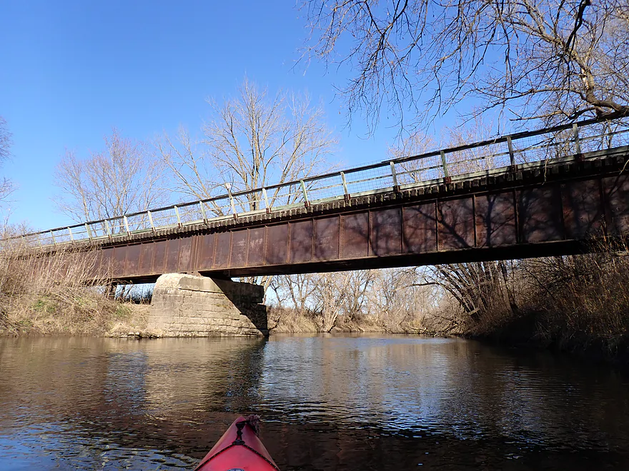
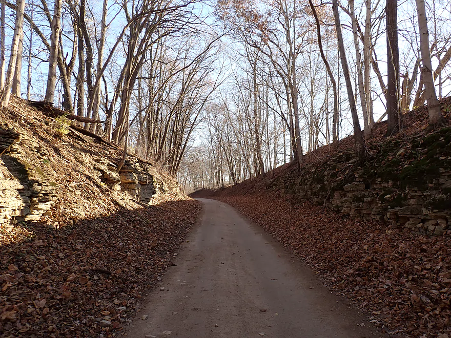
Cheese Country Trail bridge
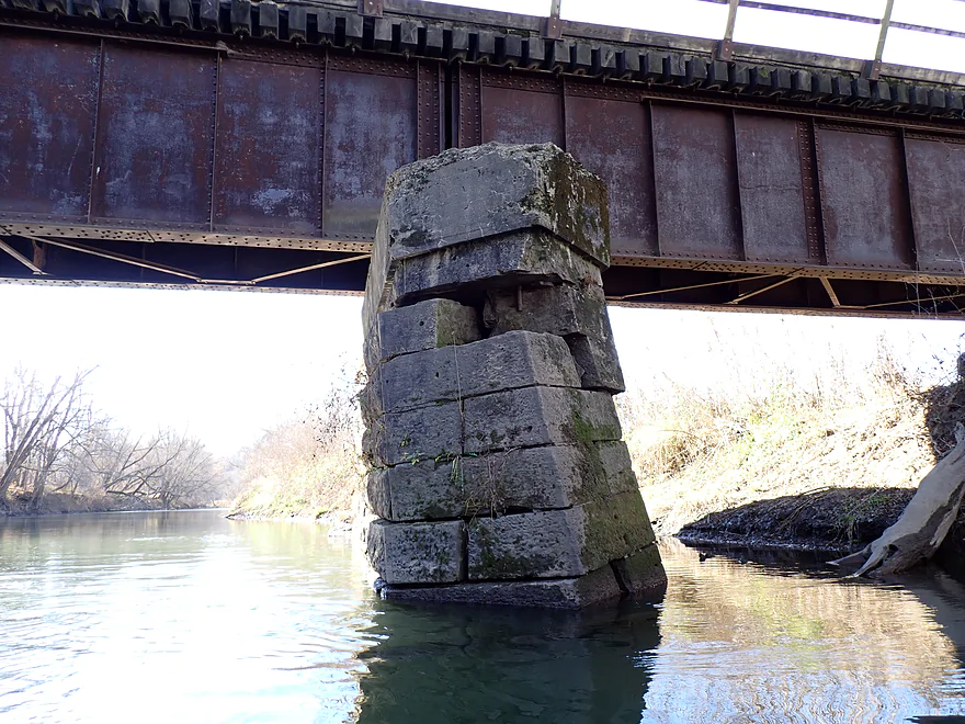
Over 100 years old…this pillar is starting to fail
Approaching another ridge line
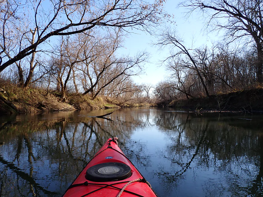
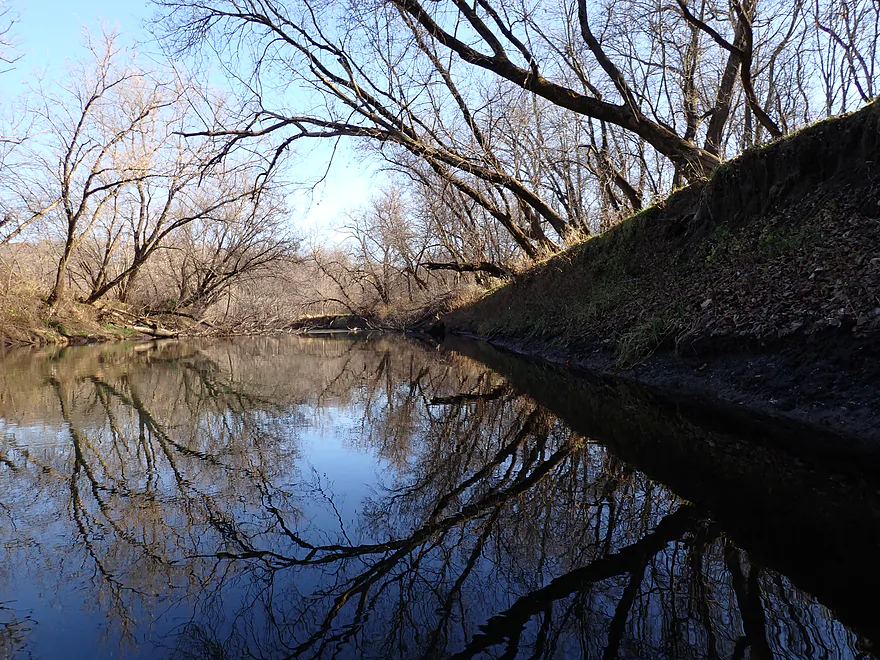
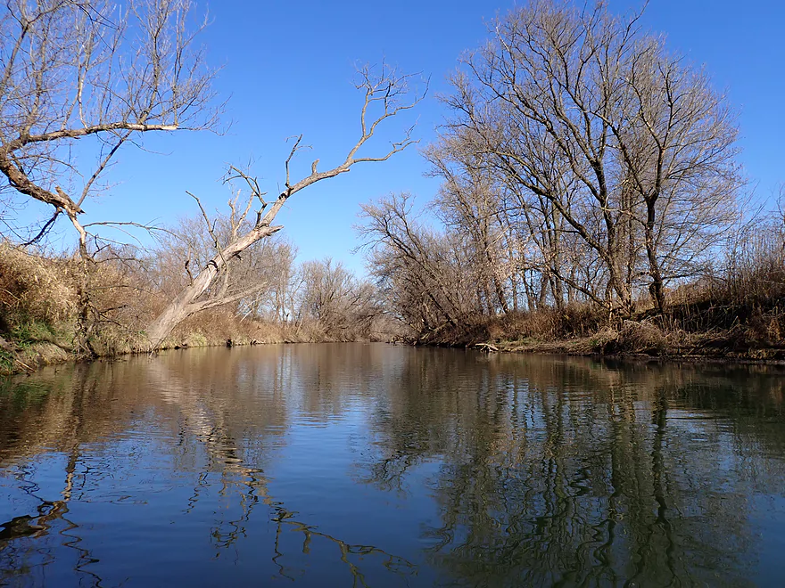
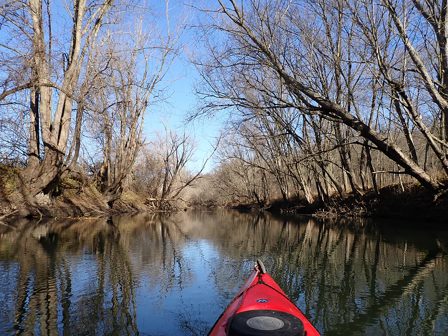
Great trip for reflections
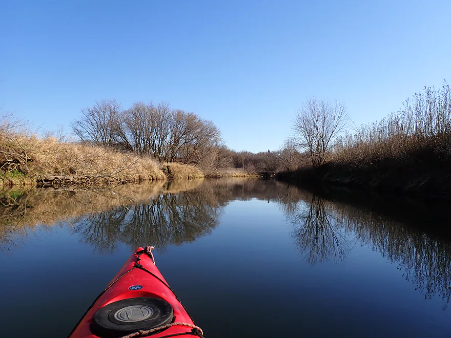
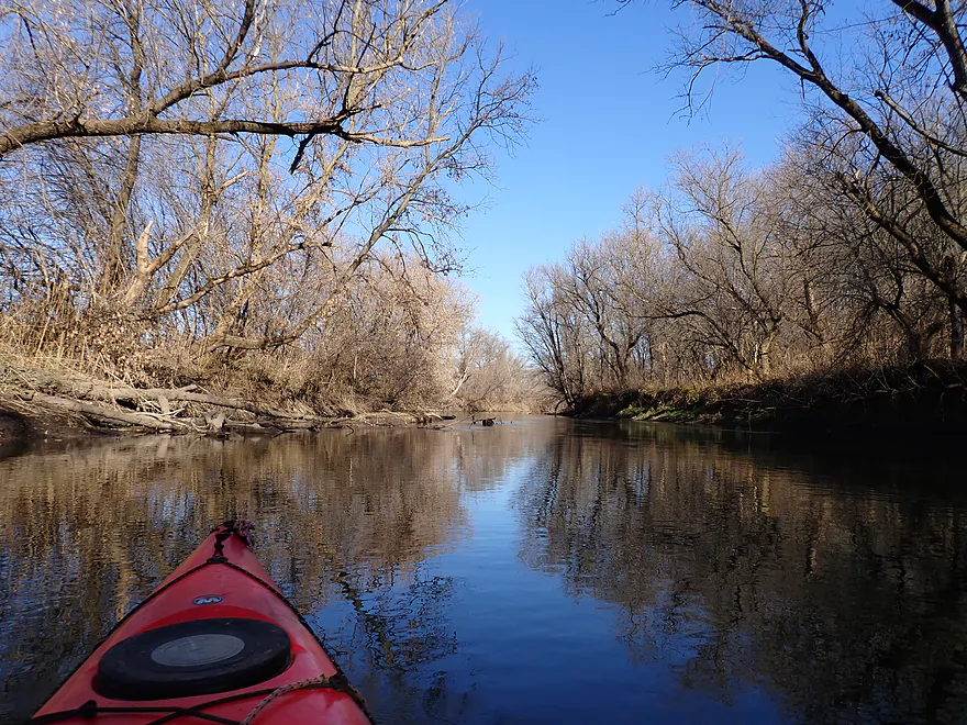
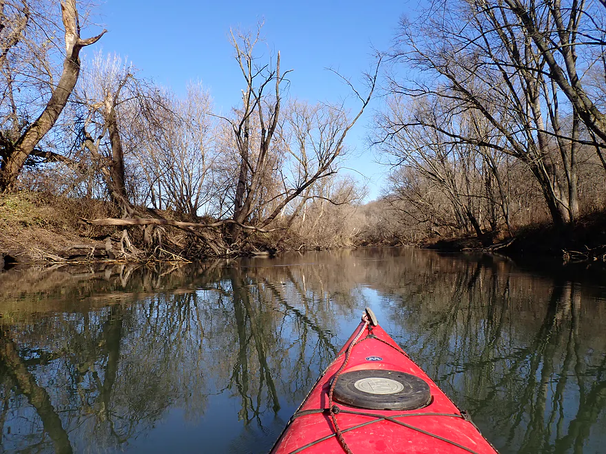
Coming up on the best part of the trip
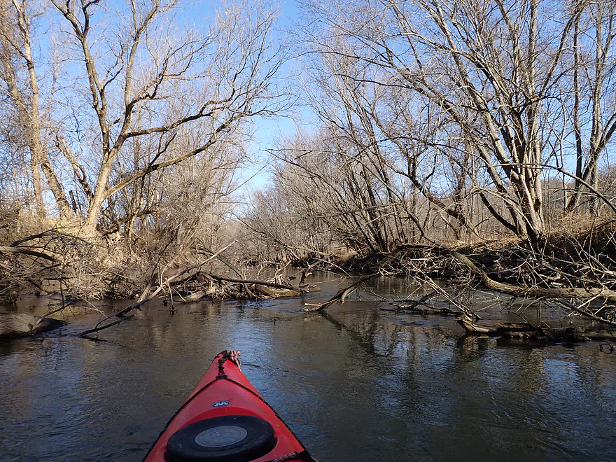
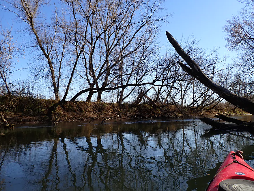
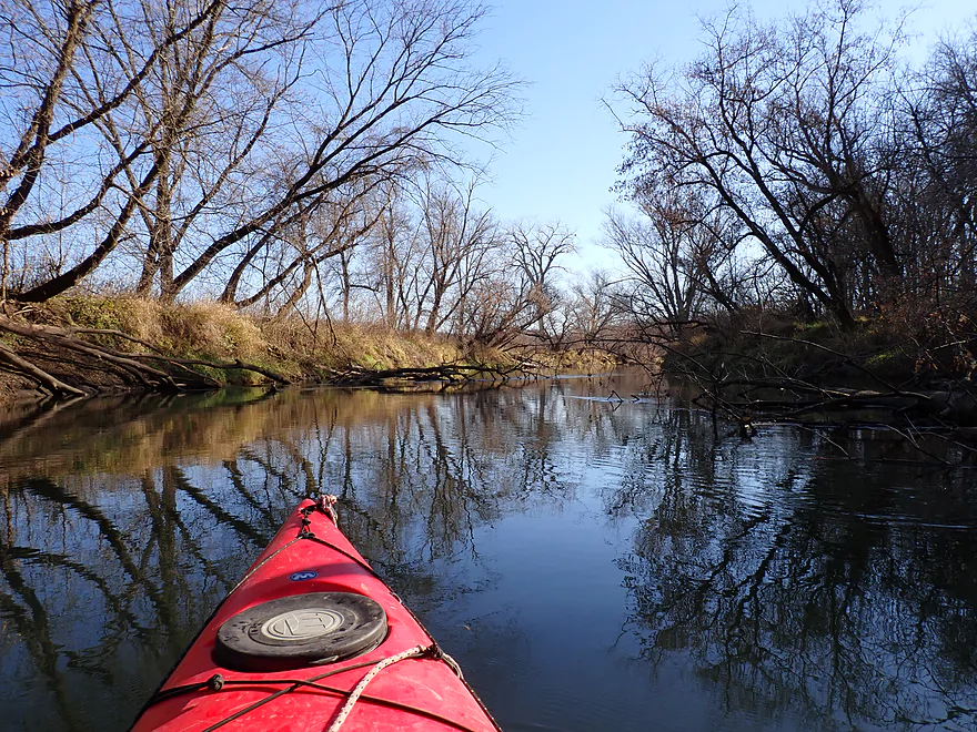
Some downed trees…but always a way around
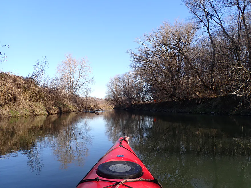
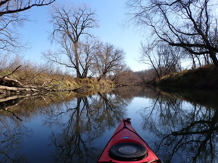
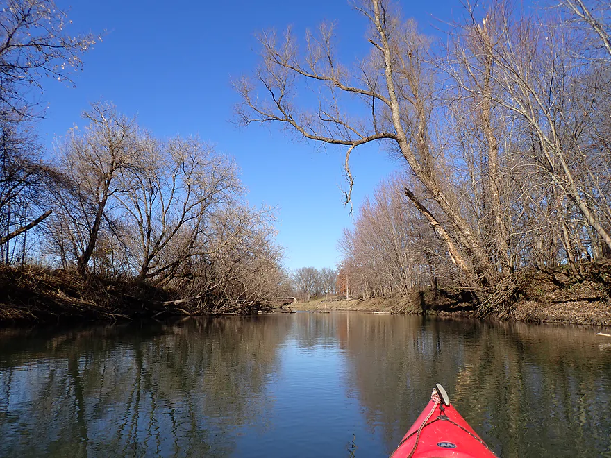
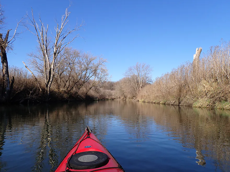
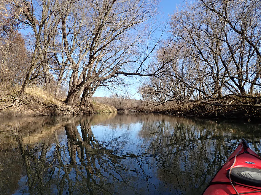
Great tree corridor
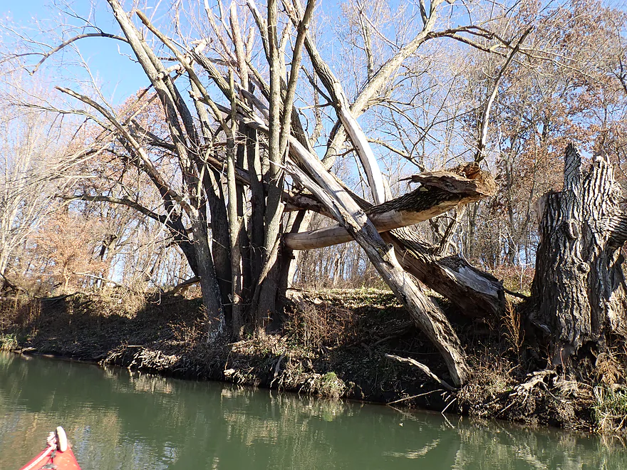
It’s going to take a big flood to get that untangled
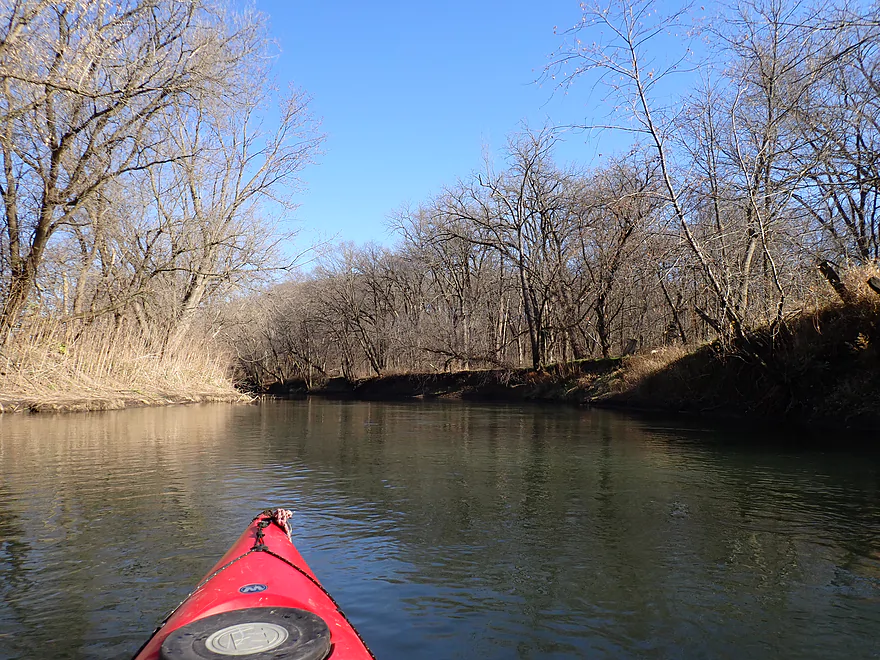
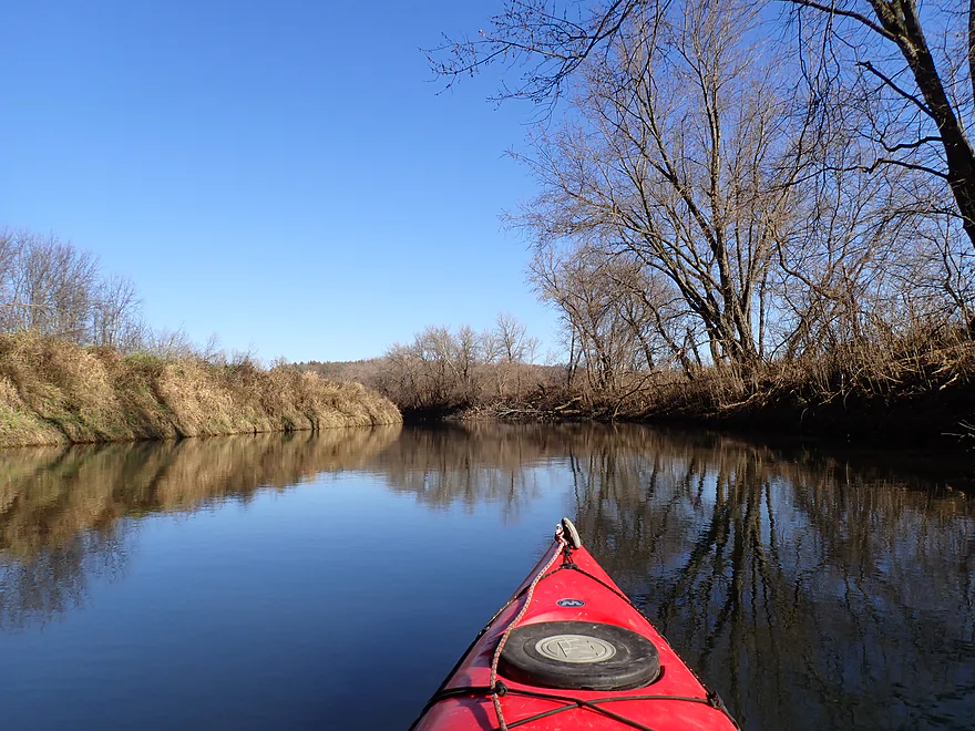
Leaving the woods behind for a more open stretch
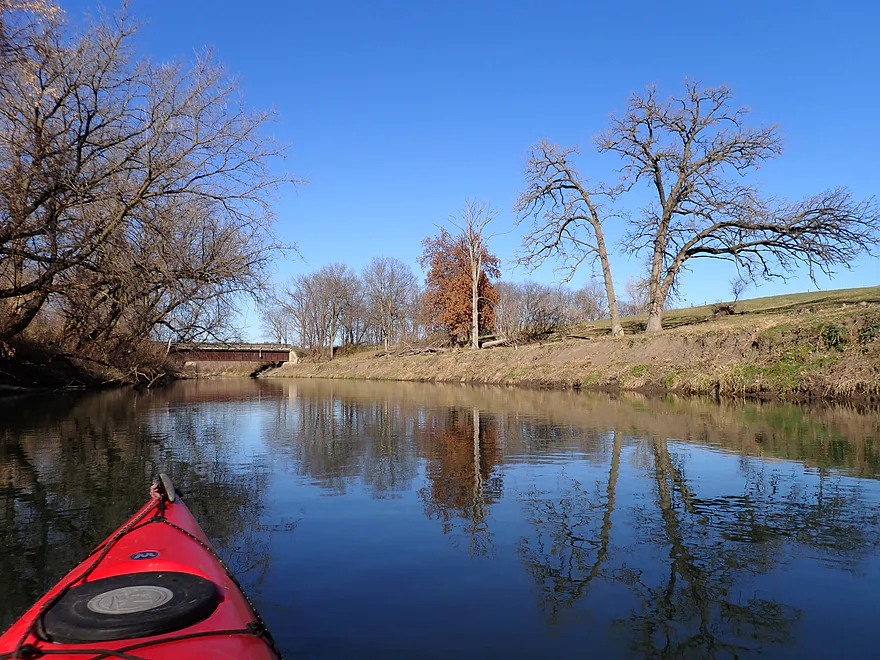
Second Cheese Country Trail bridge
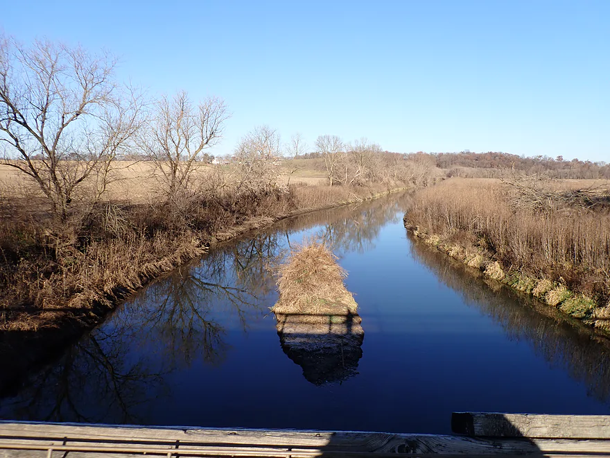
View from up top
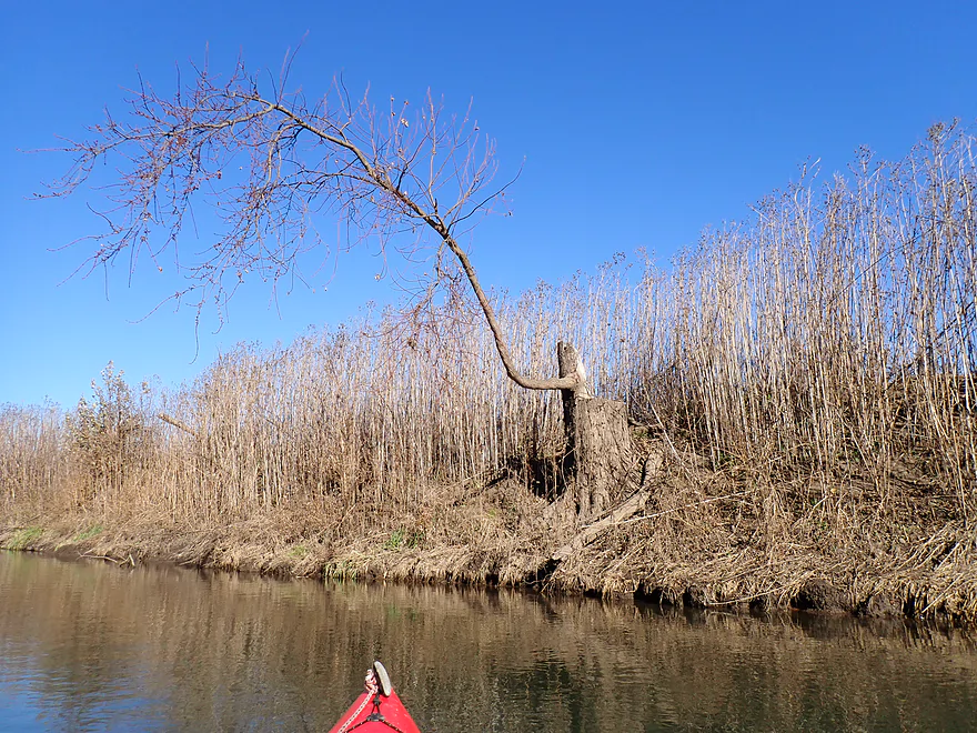
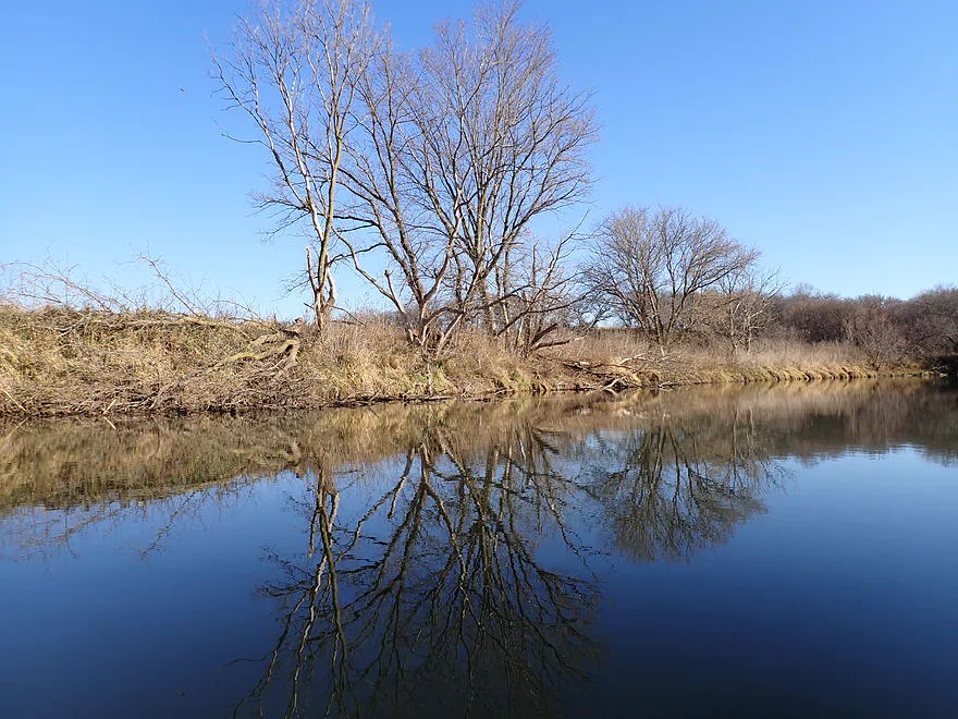
Life will find a way
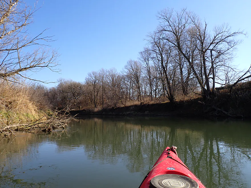
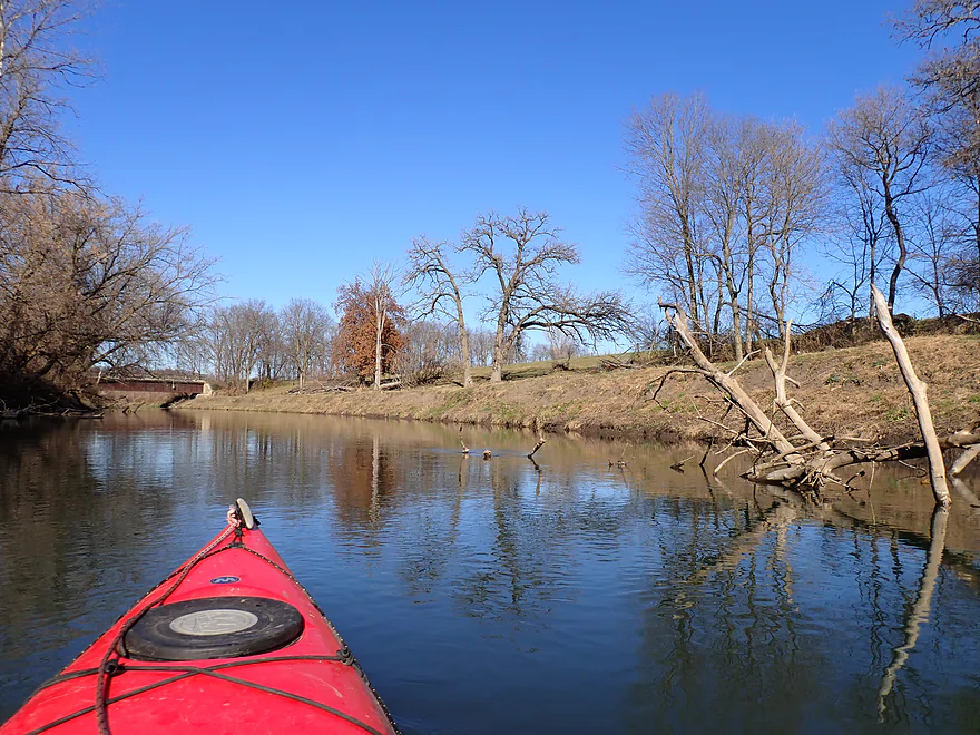
Nice ridge with oaks
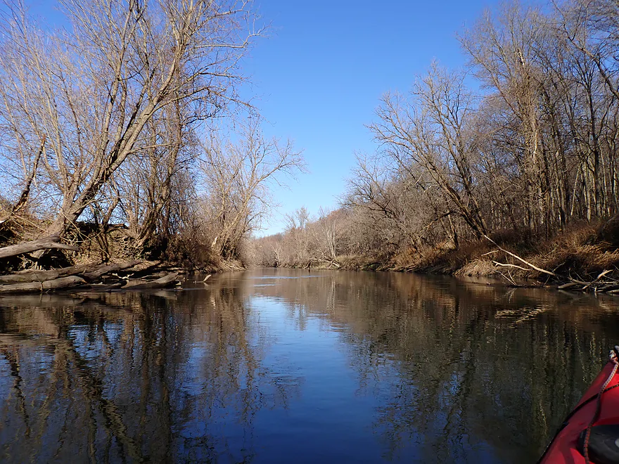
Final stretch
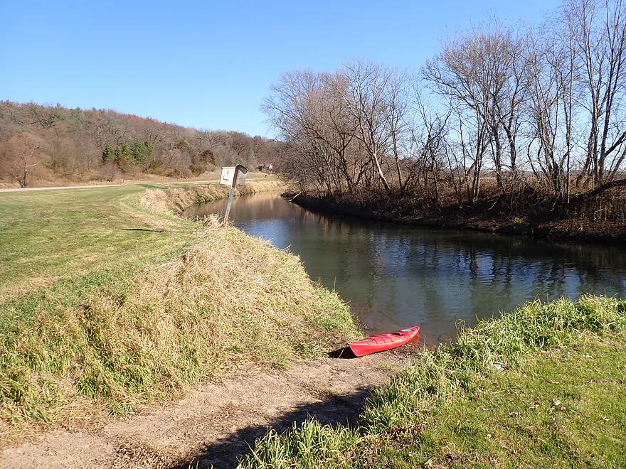
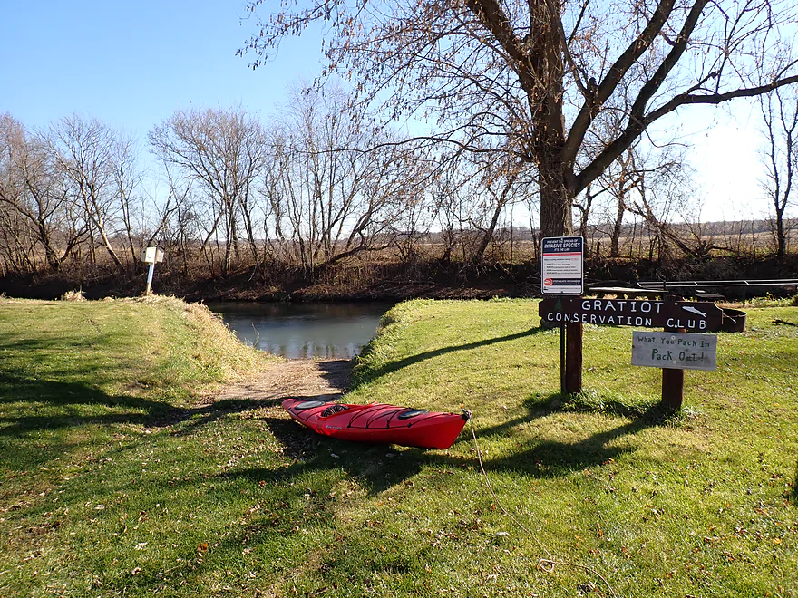
Taking out at the Gratiot Conservation Club landing
Good access
Shuttling to the put-in…much of the trail is in bad shape with very loose gravel
But it was a scenic bike shuttle
Pecatonica River – Hwy 78 Landing


The Pecatonica is a major watershed located in Southwest Wisconsin. I’m a big fan of its upper sections and branches, but in general find the lower legs somewhat boring. Given the state’s low water levels and ideal November temperatures close to the Illinois border, it was an optimal time to give the Lower Pec another chance. I decided on a stretch below Gratiot which seemed to have potential based on my analysis of topographic maps.
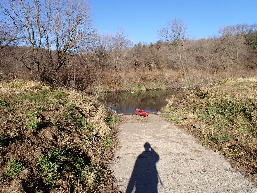
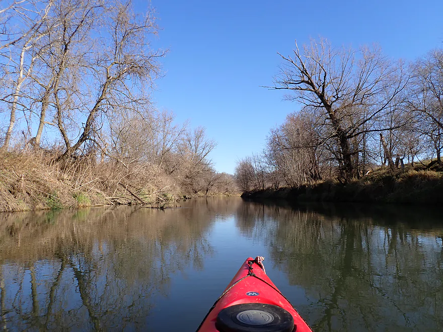
The trip started by Hwy 78, where I was pleasantly surprised to find an obscure public landing. The short quarter mile stretch from the landing to the Hwy 78 bridge was scenic with tidy grassy banks that weren’t too big or muddy. The trees were attractive and at times I would just coast and let their mirrored reflections form on the water.
Past Hwy 78, the river turned sharply south and was sandwiched by a large wooded bluff and cornfields. Unfortunately this south-facing leg of the river wasn’t as interesting. The channel was extremely straight (most likely artificially straightened), wide, deep, and extremely slow. I put my paddle down to test the depth and didn’t hit bottom. The mud banks became huge…and if the Baraboo River has a rival for the muddiest river in Wisconsin…the Pecatonica might be it.
The other issue with this south leg were the hunters. This was the first day of gun deer season and they were everywhere. I don’t think I was in danger…I had a bright red life jacket and a large red kayak. In fact I probably stood out more than the hunters who wore orange, and the people I met were friendly with their guns safely pointed in the air.
At the end of the south leg, the river is redirected north by a bluff with the Cheese Country Trail at its base. Along the trail were hunters who were using it as a staging point. They would communicate with walkie talkies and drive up and down the trail with their ATV’s as part of a larger operation. Despite all the hunters I saw, I actually came across two deer on the trip. Had I known this exact location would have been such an epicenter for hunting, I likely would have chosen a different water trail, but again I didn’t feel I was at risk.
After shortly veering north, the river turned sharply south again to form the second and larger hump of the trip. The south leg of the second hump wasn’t interesting…just a lot of cornfields, a thin layer of bank trees spared by farmers, and a few bluffs. I had hoped the bluffs on this trip would contain outcrops…but none did unfortunately.
The Cheese Country Trail crosses the river twice on this trip with historic 1910’s bridges. The first bridge is perhaps a little too historic, as its primary support has been undercut by the current and its stone blocks were slanted and falling into the water. It wouldn’t surprise me if in the future this bridge gets undermined when the next big flood hits.
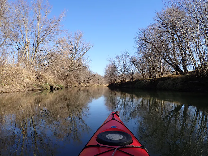
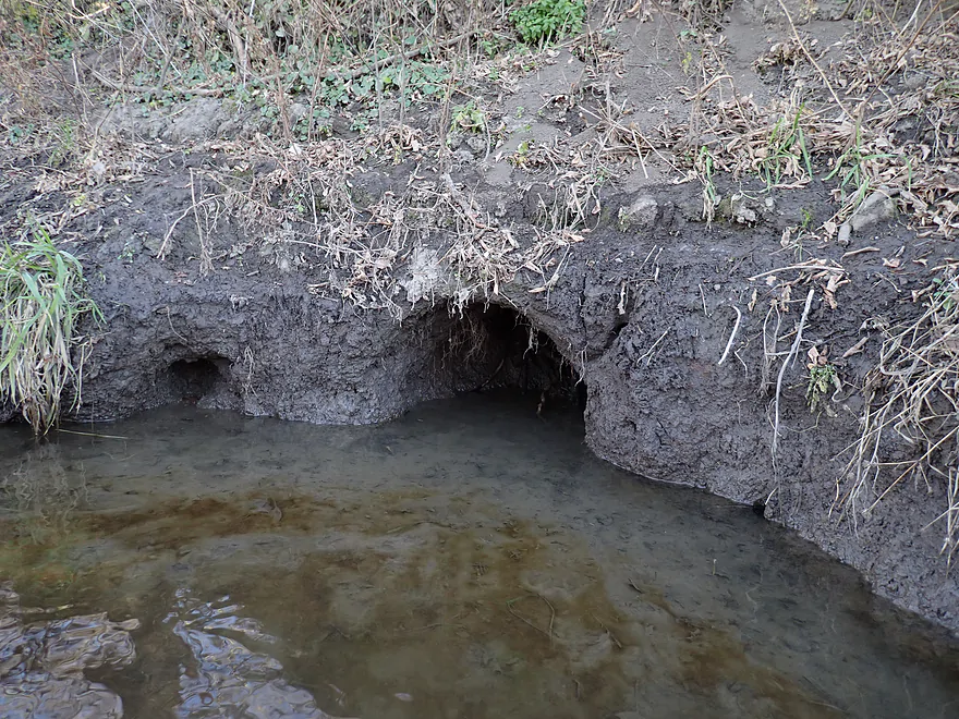
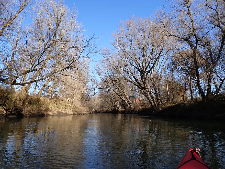
At the south end of the second hump, the river turns east and enters the most scenic part of the trip. Here there was a great ridge on the south bank and larger woods with healthier trees. This was also a great stretch for wildlife…I saw multiple redtails, eagles, beaver bank holes, and a family of chirping otters just in this area. A few spots had deadfall, but it was always easy to navigate around this (in a kayak). Despite the river having multiple boat landings, hunters were not using them. The reason was likely the few downed trees which would block motorboats but not kayaks.
The final north leg was scenic with decent bank quality (by Pec standards) and nicer vistas. Initially I had planned on taking out at Larse Road which would have been somewhat tricky…but I was pleasantly surprised to find a public landing just upstream of it which proved to be a far superior take-out.
In summary this was a mediocre trip. On the plus side, it’s easy…no portages for logjams, great put-in/take-out, no dams/rapids or other hazards, and the bike shuttle isn’t long. This leg of the river also never gets too low, so is great to do during droughts when other rivers are running shallow. The wooded ridges/bluffs were scenic even if they didn’t have outcrops. On the downside, parts of the river were just too slow, straight, and boring. If you’re new to the Pecatonica, I suggest starting with another more interesting leg. But if you’re local looking for a new adventure, this isn’t an bad trip.
Sights include several deer (surprising given how many hunters I saw), eagles, and a red-tail. The highlight was a family of three large otters who watched me pass and chirped very loudly at me.
Hwy 78 Landing: This is a great public landing. Few use it, but for kayakers that’s perfect as this means privacy and seclusion. Note the landing is not located at the bridge per say but rather a quarter mile to the west of it.
Alternate Put-ins:
- Riverside Road Landing: (3.2 miles upstream from Hwy 78) This is a good public access. However this leg likely wouldn’t be that interesting.
Gratiot Conservation Club Landing: This is an overlooked but good public landing.
Alternate Take-outs:
- Sargent Road Landing: (4.7 miles downstream from Gratiot Conservation Landing) This would be a decent public access. I’m not sure this bonus leg would be that interesting.
Gratiot Conservation Club Landing to Hwy 78 Landing: 4.1 miles with 49′ of ascent. Most of the shuttle route I took was along the Cheese Country Trail which was scenic, but badly chewed up by heavy ATV and snowmobile use. Roughly half of the trail I used was so bad (nasty loose gravel), that walking was sometimes more practical. While attractive with outcrops, and benefiting from wind protecting cover, I’m not sure I can recommend taking the Cheese Country Trail unless you have a fat tire bike. You will need a state trail pass to use the trail.
Alternatively you can also shuttle north of the river. This would be all paved and much shorter (2.4 miles), but would be hilly (154′ of climbing).
Rapids/Fences/Logjams: None. There are a few downed trees, but it was usually pretty easy to get around them.
Current: Generally speaking, the current is really slow.
Cold Water: This was a “cold water paddle”. While there isn’t a temperature gauge on the river, I suspect it was in the upper 40s (F). Paddlers should always assume they’ll tip over during a cold water paddle and should be wearing appropriate protective clothing for cold water immersion as well as a life jacket.
Deer Season: This was the first day of gun season and I saw a lot of hunters. IMO you’re ok to kayak during gun deer season, but you should wear bright clothing.
Closest Gauge: Pecatonica River @ Darlington
Trip Depth: 116 CFS or 2.4′
Navigability Estimates:
- < 100 CFS: The river infrequently gets this low, but even so, navigability shouldn’t be an issue.
- 101-210 CFS: Very ideal conditions and a good target range for the Lower Pec. The water should be relatively clean at these levels.
- 211-250 CFS: An average depth, fine for paddling.
- 251-290 CFS: A bit above average, but plenty manageable.
- 291-350 CFS: A high depth. Likely manageable, but the river may be very muddy and unattractive. Be mindful of shoreside strainers at these levels.
- 351-500 CFS: A very high depth. Perhaps only suitable for experienced paddlers.
- 501+ CFS: This might be too high and muddy for enjoyable paddling.
Detailed Overview
- Upstream of Hwy X: I think the river up here is too shallow to run.
- Hwy X to Hwy G1st: 4.2 miles. This section is a small creek and may need high water. Some logjams and probably small outcrops. Hwy X is not a great access and lacks privacy.
- Hwy G1st to Hwy E: 3.4 miles.
- Hwy G1st to Hwy G2nd/Mifflin: 2.9 miles. Great section with many rock outcrops and light rapids. Shallow, but becomes much deeper after the Livingston Branch joins up. Two fences, but easy to get past.
- Hwy G2nd/Mifflin to Hwy E: 0.5 miles. Short, open section heavily grazed by nearby beef cattle. Some fun rapids and outcrops are on this segment. One fence to duck under (quite manageable).
- Hwy G2nd/Mifflin to Hwy A: 4.4 miles. An excellent prospect with good current, outcrops, a state natural area, and few logjams. Martin (reader comment) kayaked this section and wrote a nice summary here that you can read.
- Hwy A to Peniel Road/Hwy J: 1.7 miles. Maybe two outcrops and two major logjams.
- Peniel Road/Hwy J to Jones Branch Road: 2.5 miles. Some congested woods with maybe 3 logjams and 2-3 outcrops.
- Jones Branch Road to Powell Road: 3.1 miles. A nice peaceful stretch with a few outcrops, 2 sets of light rapids, and one serious logjam.
- Powell Road to Oak Park Road: 8.0 miles. A very open section with no logjams. Highlights include green rolling hills, oak savannas, a few rapids, and one outcrop. Lowlights include four low fences.
- Powell Road to Hwy 151/Blackstone Cattle: 4.4 miles. The more scenic of the two sections with scenic hills and one outcrop. There are two low electric fences to duck under.
- Hwy 151 to Oak Park Road: 3.6 miles. This section had more corn and trees and wasn’t as interesting, but still was decent. There is one low electric fence and one super low barbed wire fence.
- Oak Park Road to Hwy O: 3.7 miles. Likely some logjams but also some outcrops at the end. Oak Park Road is a muddy but doable put-in.
- Hwy O to Hwy G: 6.0 miles. Some scenic moments, but mud and logjams are detractions. Put-in and take-out are muddy.
- Hwy G to Darlington/Black Bridge Park: 8.5 miles. A decent prospect. As of 2020, there is a large logjam on this leg that requires a difficult portage up steep and muddy banks. This might be cleared out for the 2021 Darlington Canoe Festival.
- Darlington/Black Bridge Park to Roller Coaster Road: 4.9 miles.
- Black Bridge Park to Wells Street Access: 0.7 miles. A great stretch though the town of Darlington. The highlight is a section of Class 1 rapids where the old mill dam used to be.
- Wells Street Access to Roller Coast Road: 4.2 miles. A decent stretch, but no outcrops, the banks are steep/muddy and there are two partial logjams to circumnavigate around. Not bad...not great.
- Roller Coaster Road to Walnut Road: 7.3 miles. While one of the nicer legs on the lower Pecatonica, the river has been too badly damaged by erosion to be an elite paddle. The highlight is a sandstone outcrop.
- Walnut Road to Riverside Road: 5.5 miles. Mediocre prospect flanked by a lot of farmland. Excellent put-in and take-out.
- Riverside Road to Hwy 78 Canoe Landing: 3.2 miles. Likely an uninteresting leg with lots of farmland and large mud banks. I doubt there are many bluffs. There may be one major logjam.
- Hwy 78 Landing to Gratiot Conservation Club Landing: 5.8 miles. A mediocre stretch. Much of this is wide, slow, and straight...but there are a few nice wooded bluffs.
- Gratiot Conservation Club Landing to Sargent Road: 4.7 miles. Maybe a weaker section.
- Sargent Road to Hwy D/N: 4.6 miles. Flows partly through a SNA and by a valley ridge so might be interesting.
- Hwy D/N to Hwy 11 Boat Ramp/Browntown: 8.8 miles. The East Branch comes in and doubles the river (now pretty big).
- Browntown to Brewster's Landing: 12.2 miles.
- Hwy 11 Boat Ramp/Browntown to Hwy B: 4.8 miles. Generic stretch with farm fields and a thin layer of trees. Take-out might be tricky because of a guardrail but I think it’s doable.
- Hwy B to Hwy M: 4.6 miles. A good leg with scenic bluffs and outcrops. Put-in is meh…take-out might be bad.
- Hwy M to Brewster's Landing: 2.9 miles. Mediocre stretch that crosses into Illinois.
- Brewsters Landing to McConnell Bobtown Landing: 7.2 miles. Mostly straight and boring. But there is a wooded section with bluffs that might be nice. Could be an outcrop or two.
- McConnell Bobtown Landing to McNeil's Damascus Landing: 8.5 miles. River flows through a more rugged and varied part of Stephenson County. Still some boring parts, but also some nice bluffs and limestone outcrops.
- McNeil's Damascus Landing to Wes Block Trailhead: 8.3 miles. Mostly a straight and muddy paddle. But there should be a few nice bluffs on the west bank.
- Wes Block Trailhead to Tutty's Crossing: 6.4 miles. River enters Freeport (IL). This should be a pleasant stretch with fewer farm fields, nicer woods, and a few attractive trail bridges.
- Tutty's Crossing to Hancock Ave Boat Ramp: 0.7 miles. Wooded urban stretch.
- Hancock Ave Boat Ramp to Junior's Place/VFW: 2.3 miles. River leaves Freeport. This is likely a mediocre stretch.
- Junior's Place/VFW to Ridott Fishing Park: 14.8 miles. A very long stretch that I'm not sure would be that interesting. There are rapids by the Brown's Mill Dam that may have to be portaged.
- Ridott Fishing Park to Attens Landing: 6.7 miles. I don't know much about this stretch. It meanders more and has thicker woods so may be nicer.
- Attens Landing to Winnebago County Fairgrounds Ramp: 7.5 miles. Much of this flows through the Pecatonica Wetlands Forest Preserve.
- Winnebago County Fairgrounds Ramp to Sumner Park: 0.4 miles. There are tricky rapids where a dam was mostly removed. Depending on water levels, you may have to portage this.
- Sumner Park to Pecatonica River Forest Preserve Ramp: 6.0 miles. A north flowing leg of the river that is mostly undeveloped and contains some floodplain forests.
- Pecatonica River Forest Preserve Ramp to Trask Bridge Ramp: 7.0 miles. This is a relatively good prospect with large clay banks and a few nice woods.
- Trask Bridge Ramp to Two Rivers Ramp: 12.6 miles. Paddling author Mike Svob seemed to like this leg. Here the river meanders and twists more. The woods are also more impressive. Much of this is still likely wide, slow, and boring though. The take-out is close to the mouth of the Sugar River.
- Two Rivers Ramp to Boat Launch Mactown: 9.8 miles. The last leg of the Pecatonica before it empties into the Rock River. Significantly enlarged by the Sugar River, I suspect this is a big and boring leg.
Trip Map
Overview Map
Video
Photos Size: