
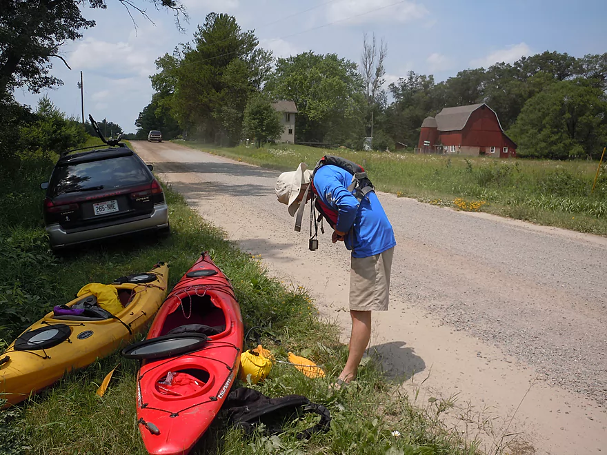
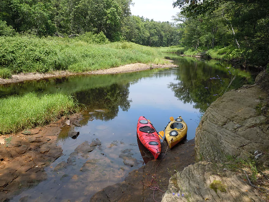
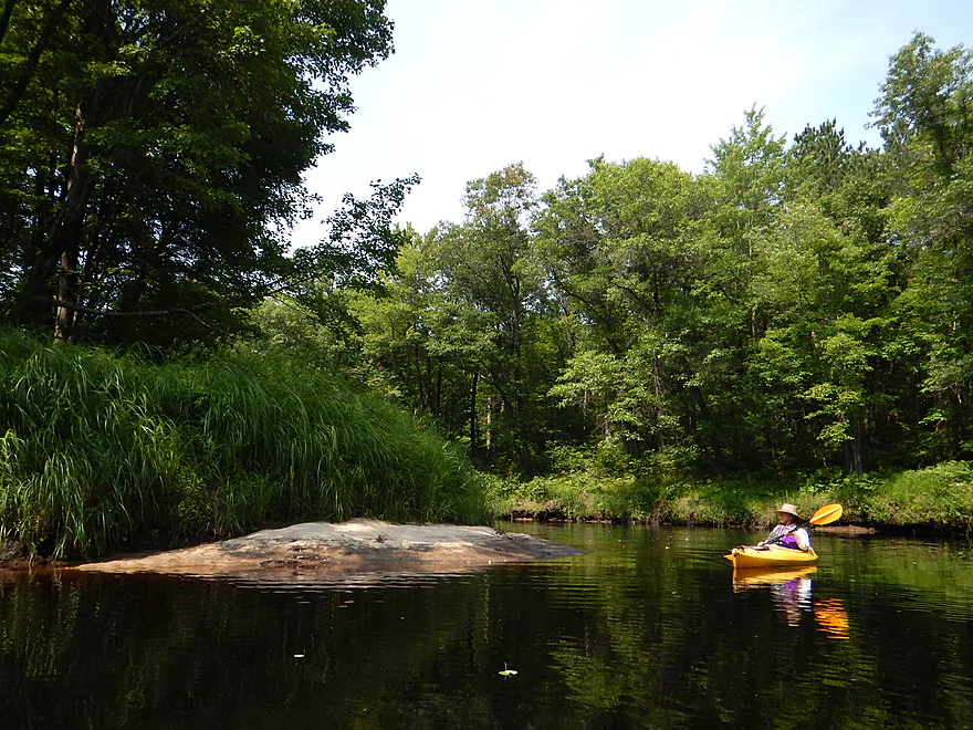
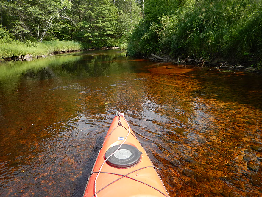
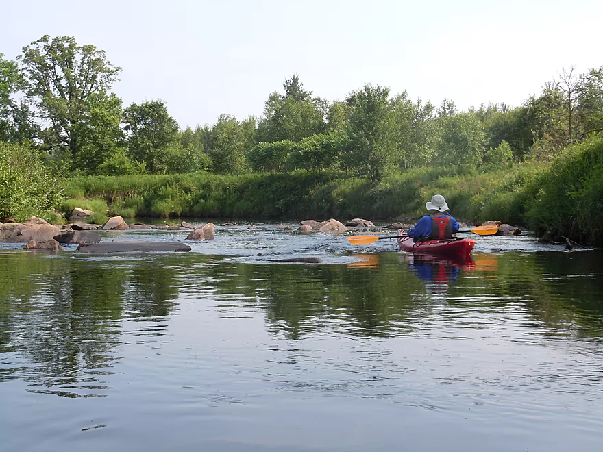
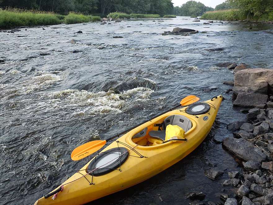
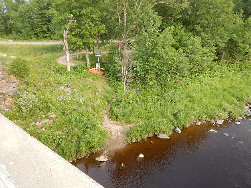
Put-in at Middle Road is very dusty
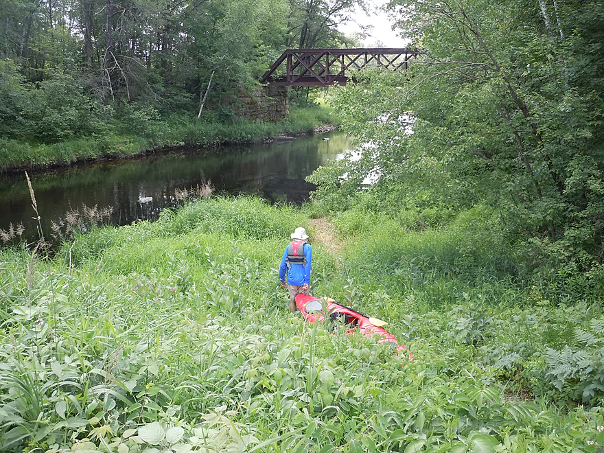
Trail means other people have put in here
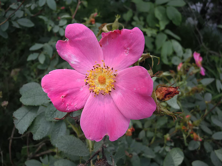
Bankside wild rose
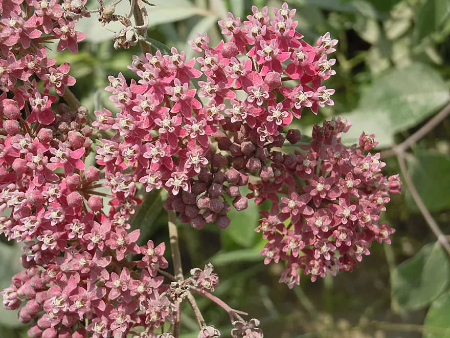
Swamp milkweed
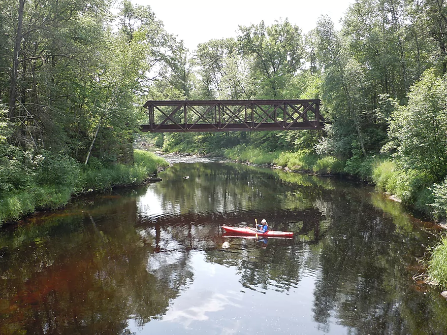
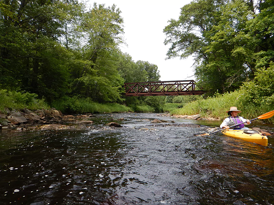
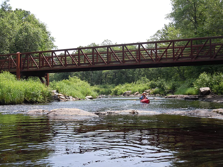
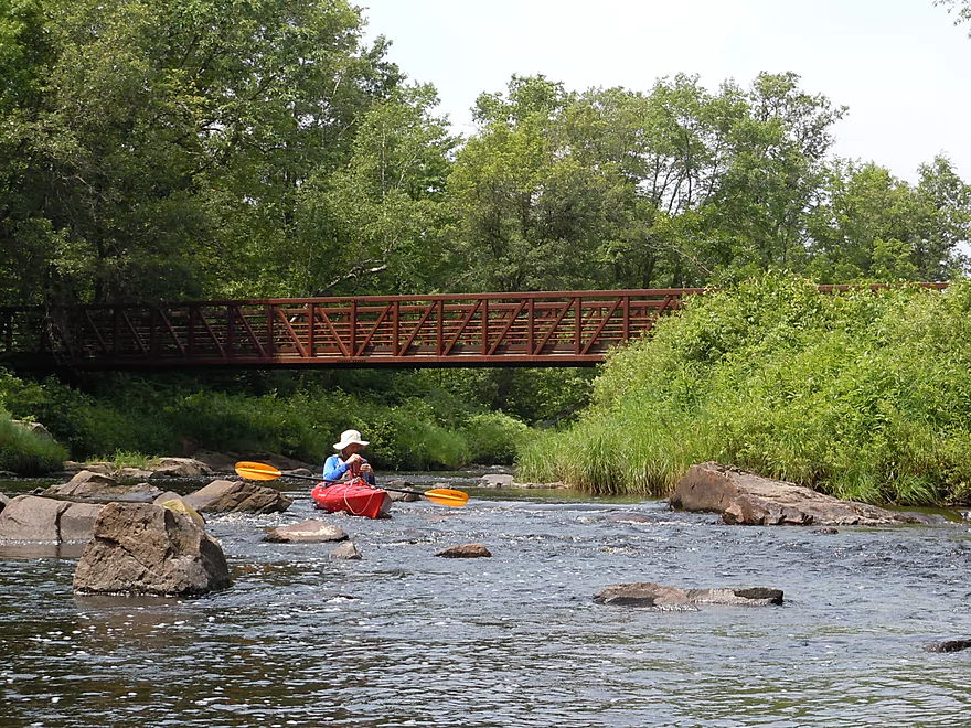
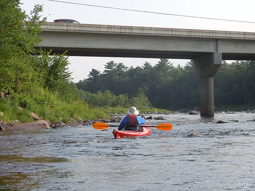
Scenic old bridge
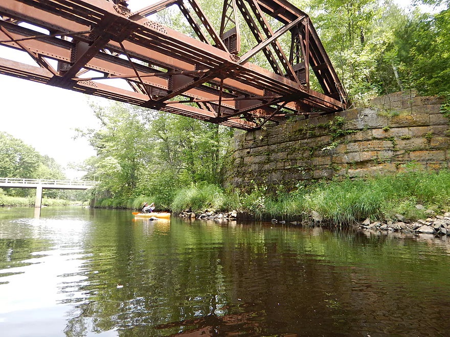
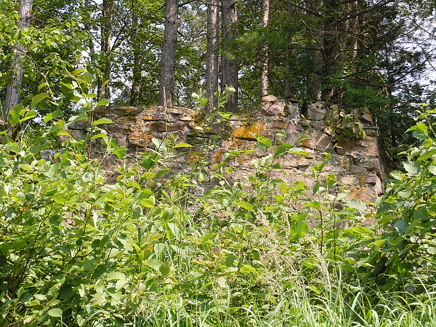
Nice stonework
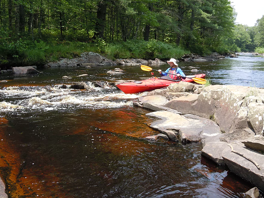
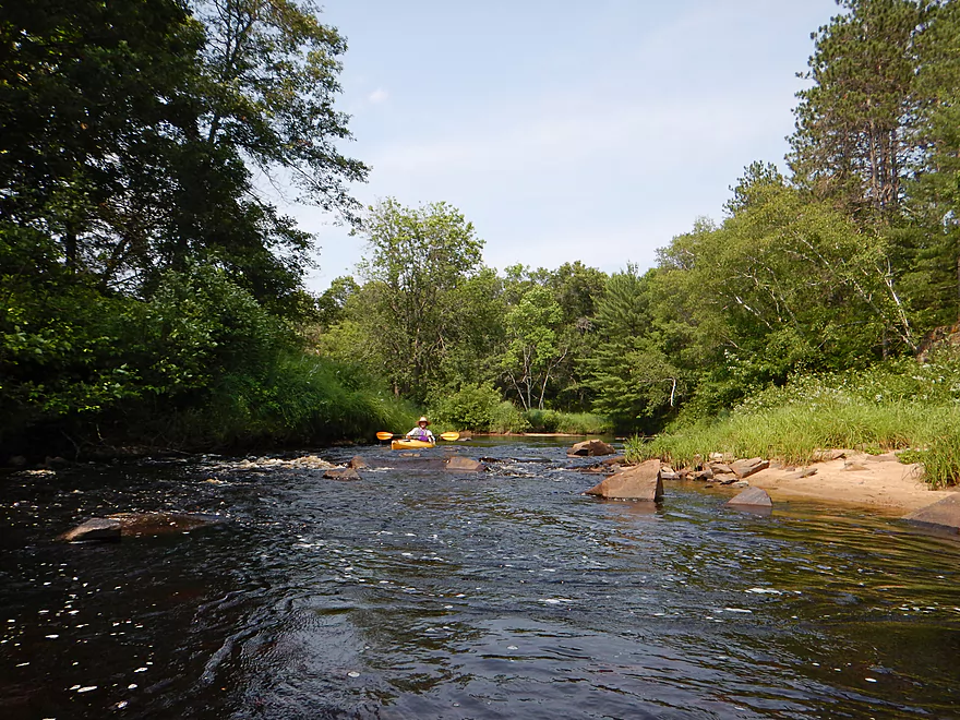
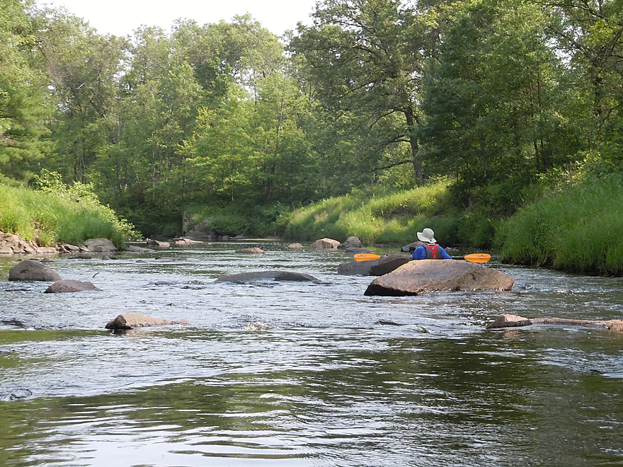
Must tread carefully to get through the rapids
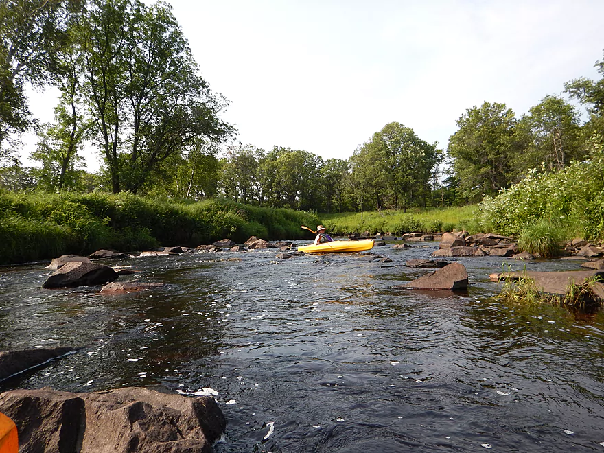
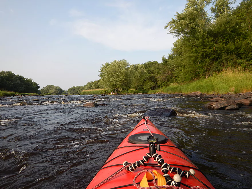
This is rockier than expected!
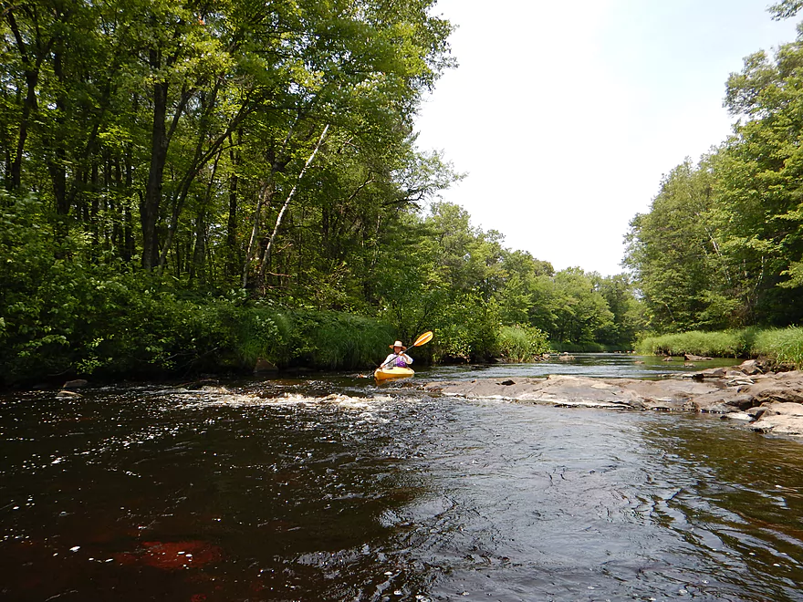
Many, many little rapids
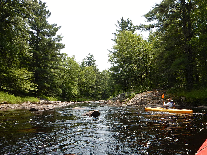
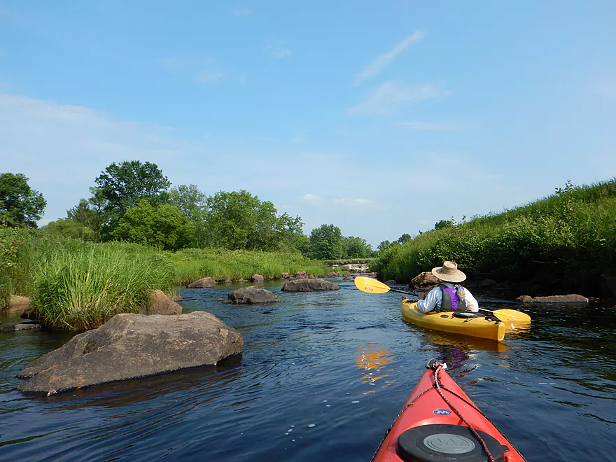
Granite banks constrict the channel here
The granite really made this creek unique
Waxed smooth by the river
A garden of granite
Bumpy but fun rapids

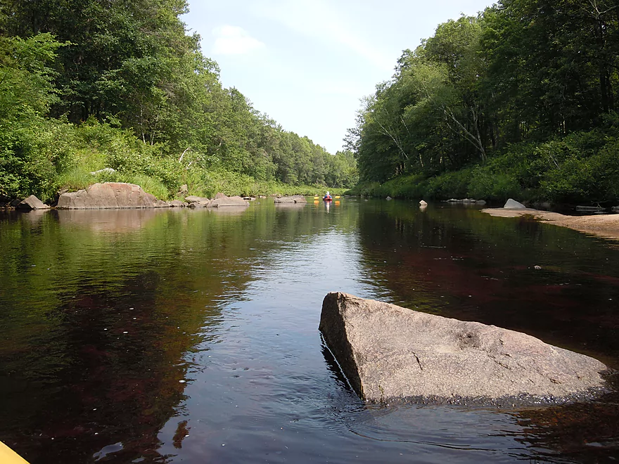
Massive granite boulder
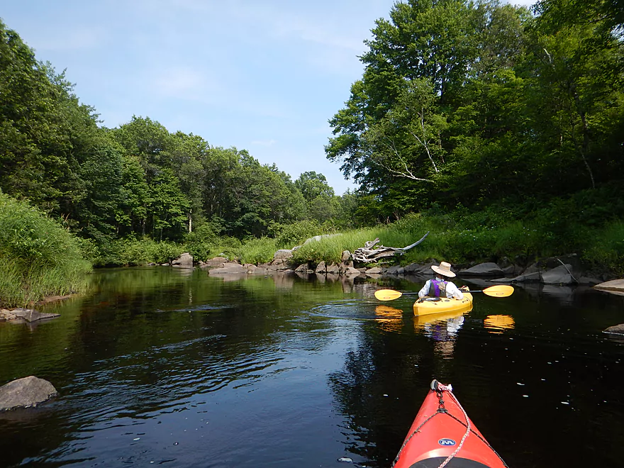
So scenic
But don’t be distracted by the scenery or this happens
Heard a possible bear by this snowmobile bridge
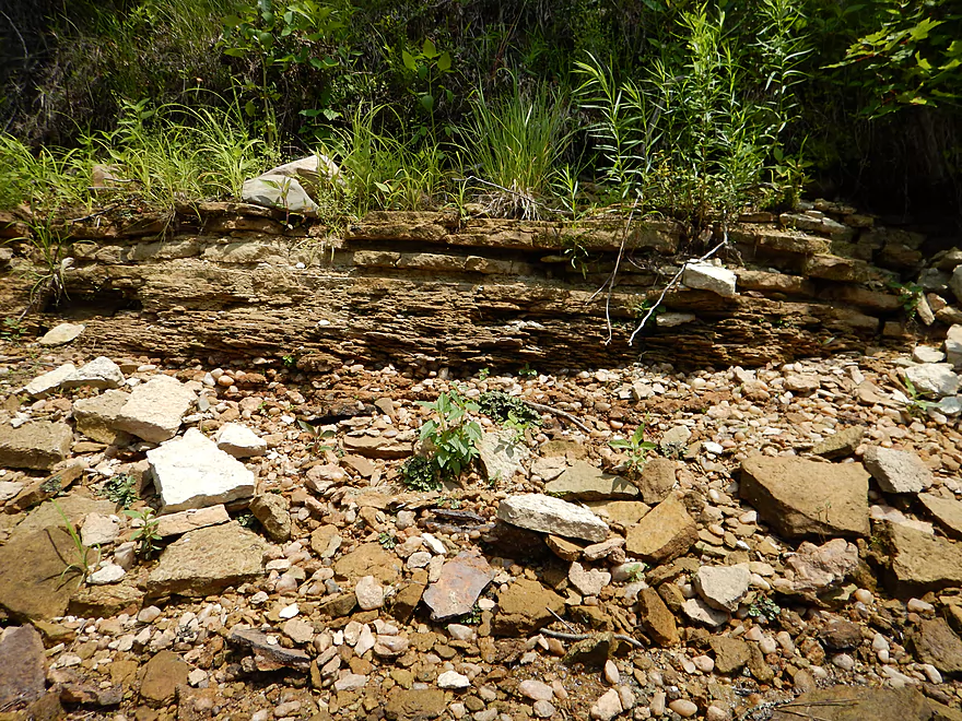
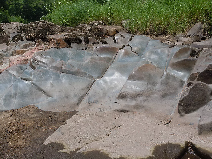
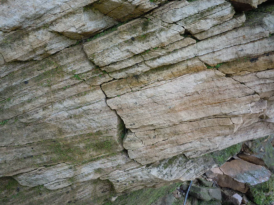
Cool sandstone stratification
All the rapids were safe at these low water levels
Only sandstone outcrop on the trip
Lot of history
Nice walking shelf
Time to explore
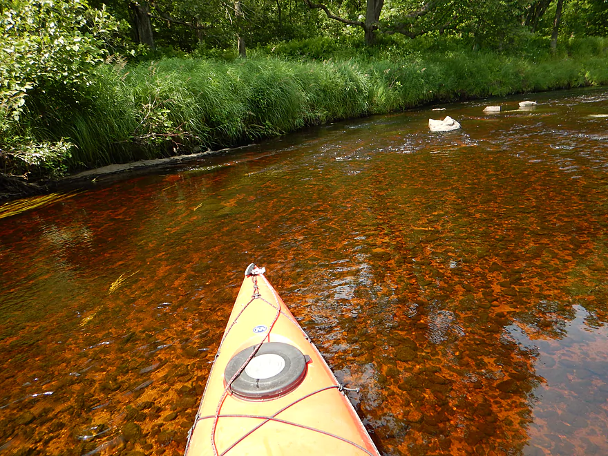
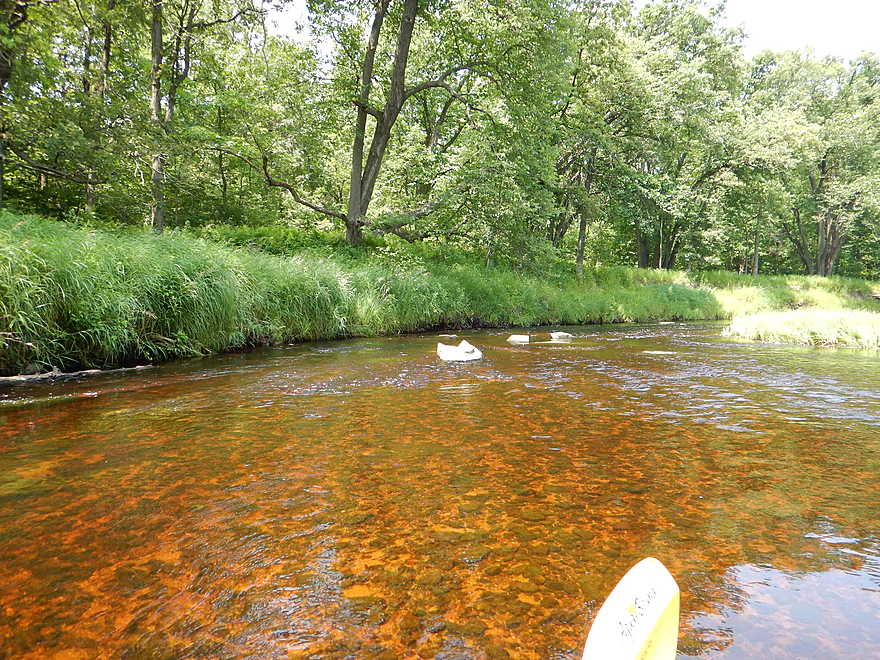
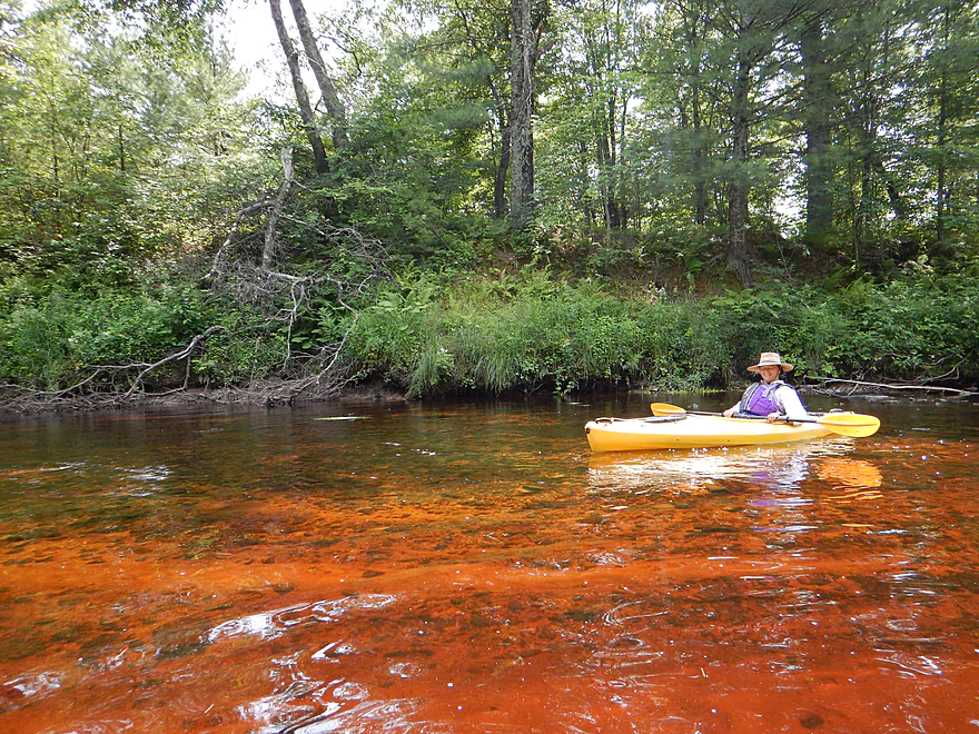
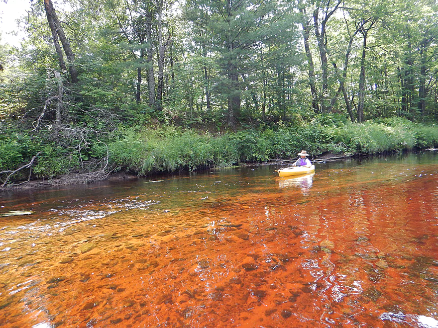
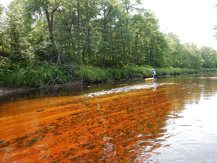
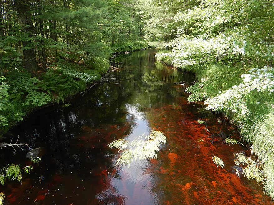
Wonderful clarity and red hue
So nice it gets two shots
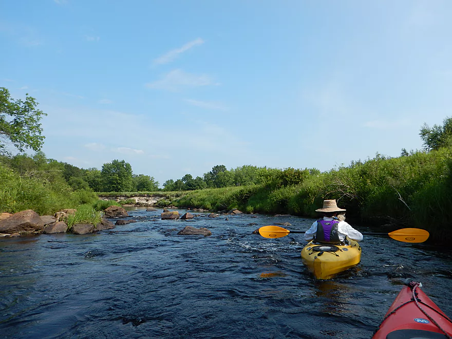
Lost count of the number of rapids
…as well as the boulder gardens
Paddling on Mars
Trick for these scenes is low water paddling
So nice, it gets three shots
Couple of fine sandbars on the creek
Some pines, but surprisingly not many
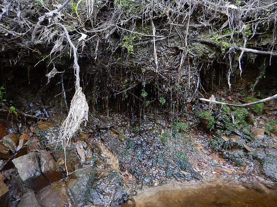
A weeping seep
Rouse Road bridge remnants (first of three washed out structures)
Wedges Creek starts to slow down and widen
To generalize, narrow channels = rapids
My new granite kayak
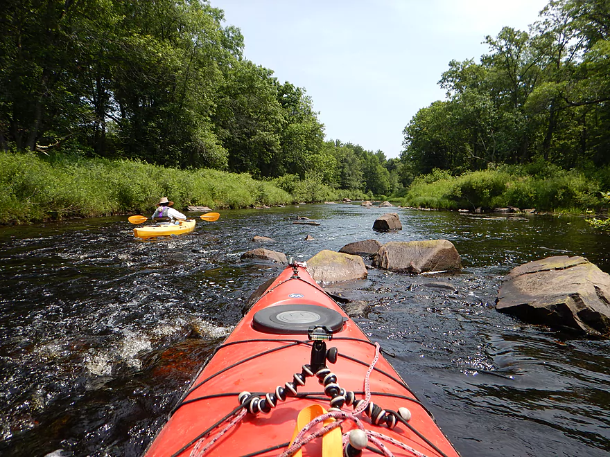
Always looking for the most open path
In the last mile, the rapids and rocks start to pick up
Most serious rapids on the trip
But at these levels, getting hung up is the biggest ‘danger’
Favorite boulder garden
Sand deposits from upstream outcrops
Hard turning to avoid the mines…I mean rocks
Friendly damselflies
Final stretch
Looking back on a very rocky Wedges Creek
Looking back on a very rocky Wedges Creek
You can take out at the mouth (Opelt Road)
Welcome to the Black River
Black River is so big and boring in comparison to Wedges
Some nice rocks here and there
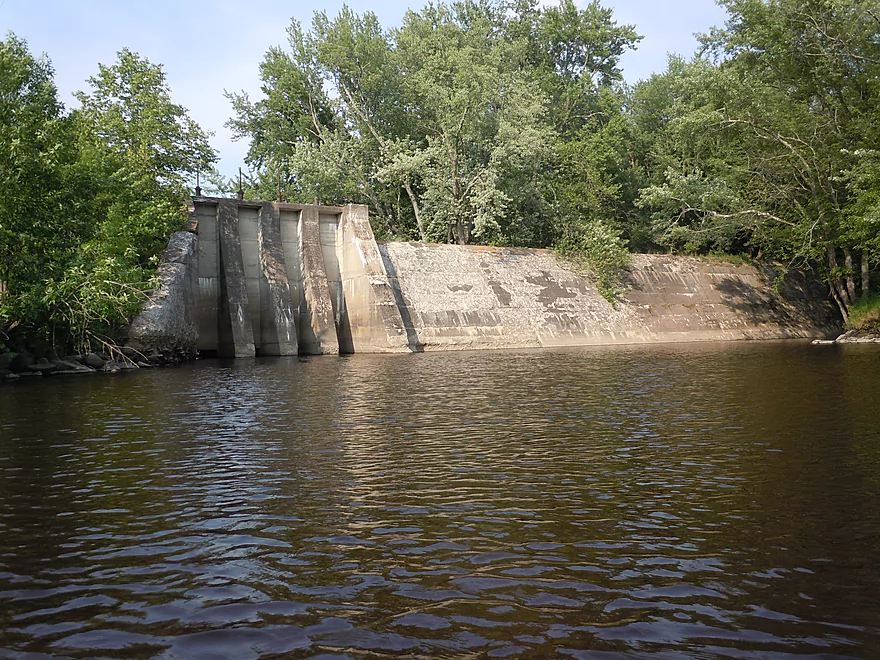
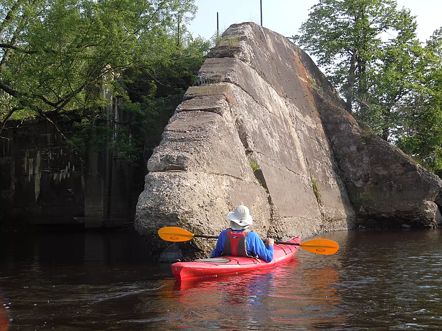
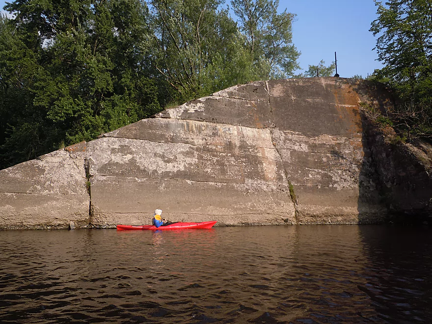
Remnants of the old Dells Dam
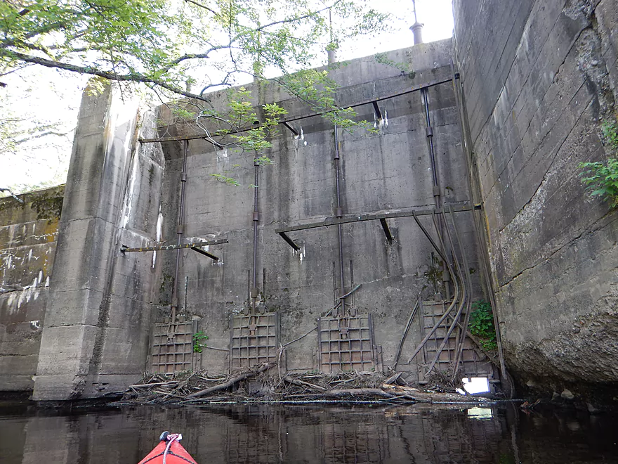
You can see the gates and screws that let water through
Reverse view…kind of looks like a fortress
Nose of the dam
Quite the beast
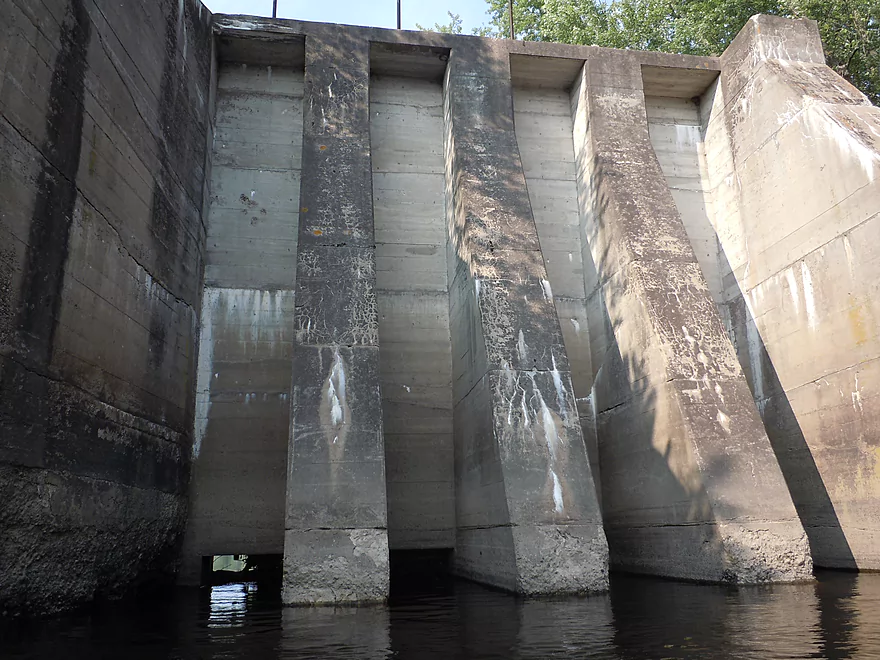
These puny gates were not enough and the main dam washed out
It was built on these nice dells (hence the name)
Some final rapids before the Hwy 95 take-out
These class 1 rapids were fun
…but shallow
You can actually see the Dells Dam (above bow) from Hwy 95 (it’s that big!)
Nice take-out by Hwy 10
Nice flowers
Good parking and launch area
Looking downstream at an impressive boulder garden
You can almost see the Red Granite Rapids
View from bridge shows the west channel is not deeper
Five Mile Creek is also a good prospect
Wedges Creek

The Black River is a classic water trail that is very popular. Savvy paddlers though know the secret to the Black is actually not the main river itself, but rather its tributaries which tend to outshine the main branch. One such tributary is Halls Creek which I consider one of the best paddling prospects in the state. Having paddled this stretch, I was curious about the next upstream “branch on the Black River tree” which would be Wedges Creek. So on June 13th, I set out to do this trip…but encountered unforecasted rain, a 3-mile gravel bike shuttle and a very flooded Wedges Creek. So that didn’t happen. Fast forward a month and I’m finally properly prepared to do the creek.
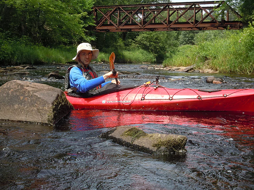
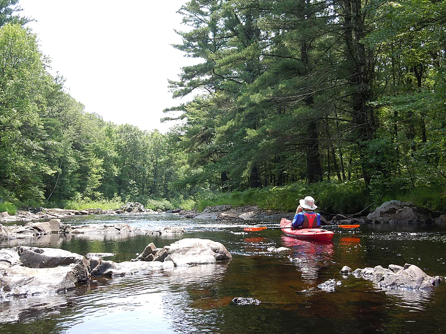
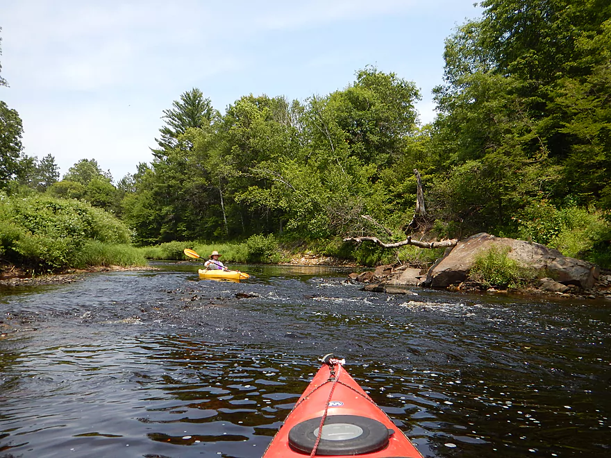
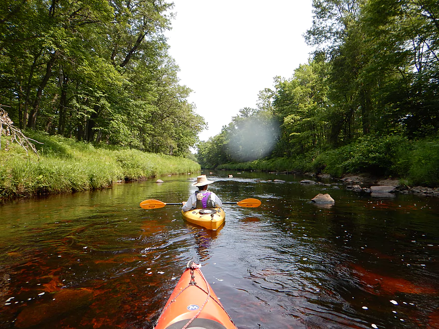
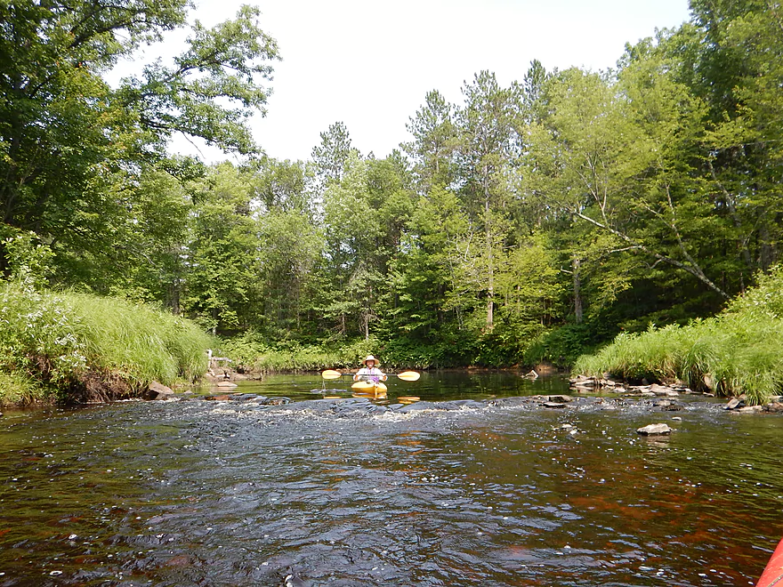
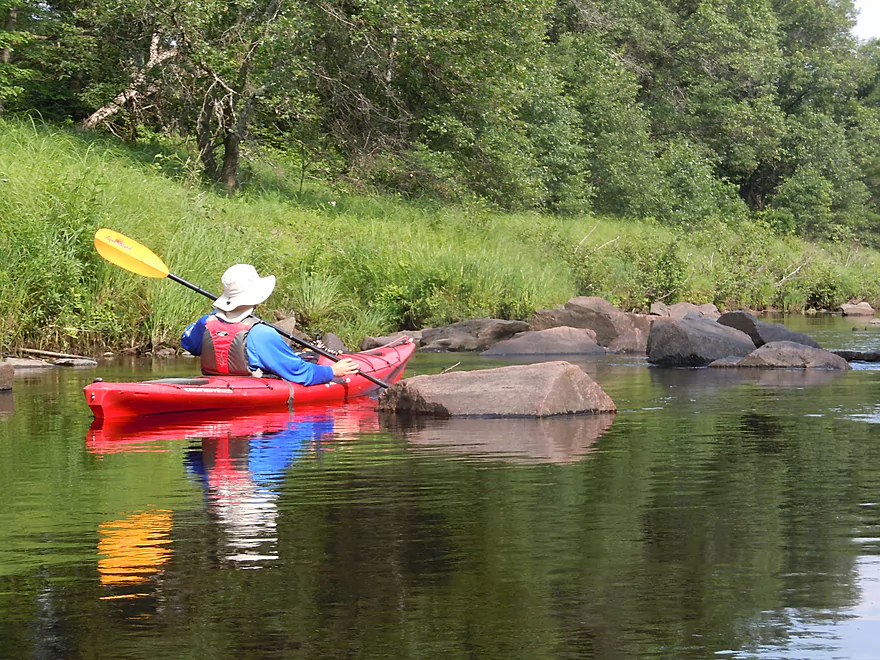
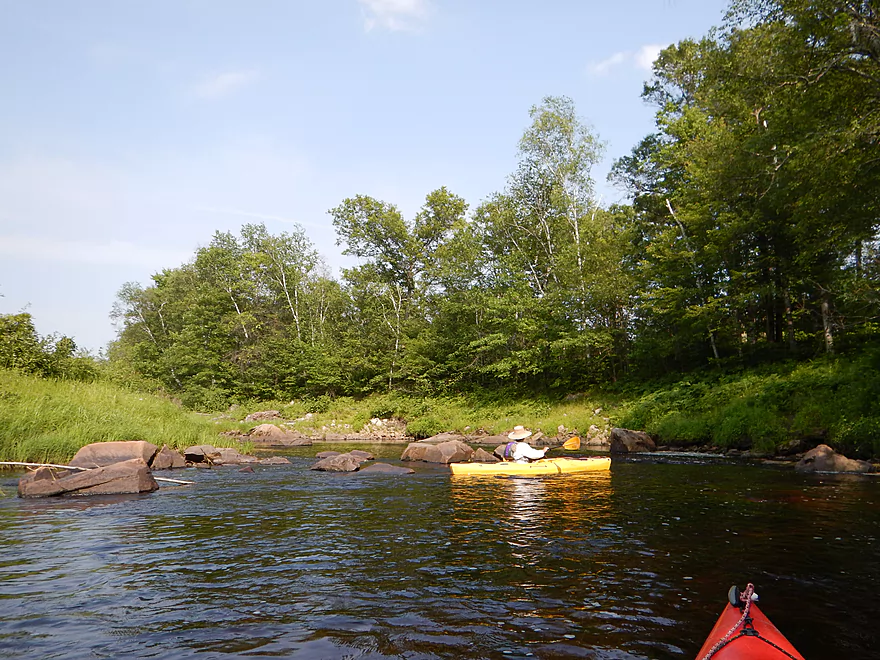
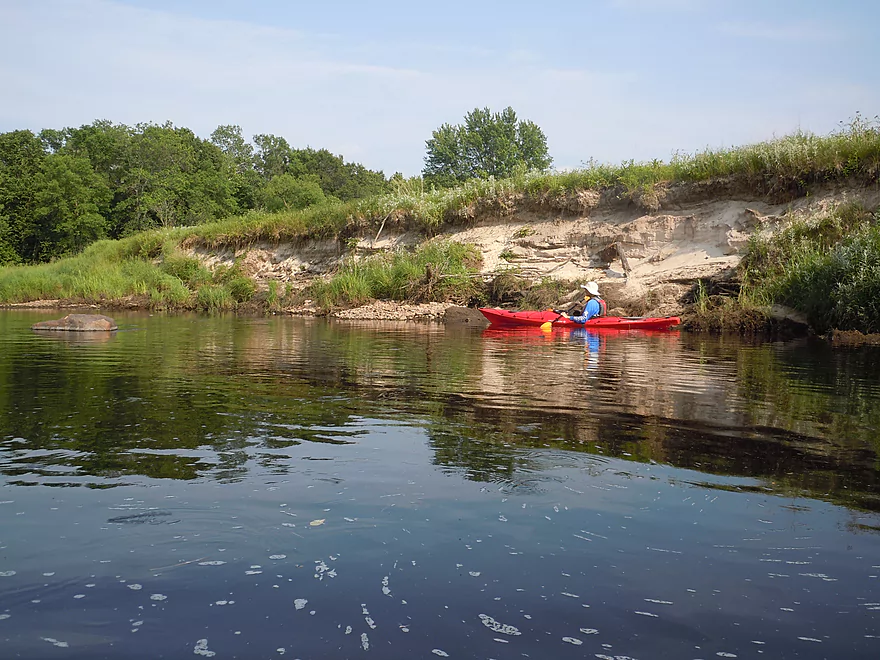
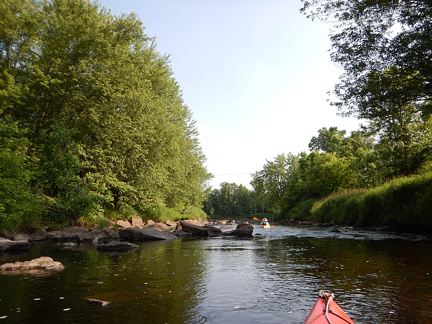
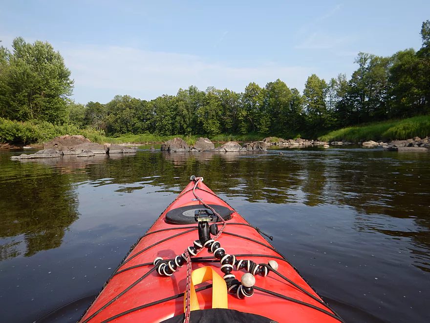
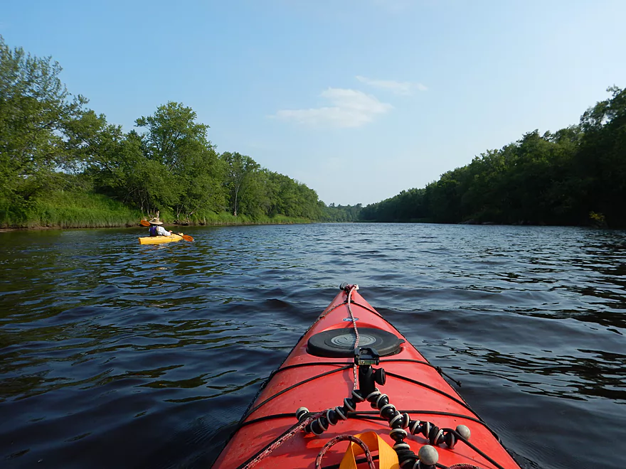
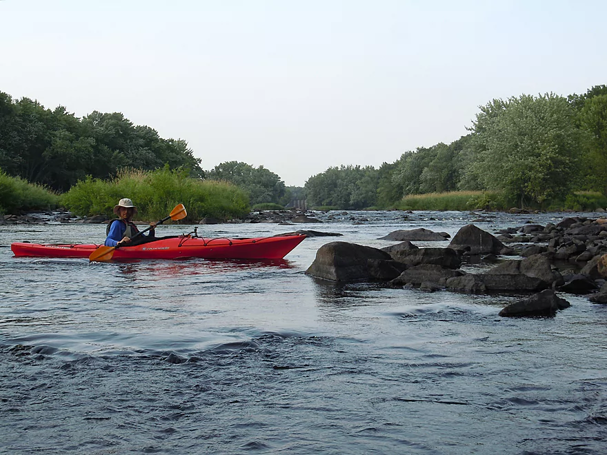
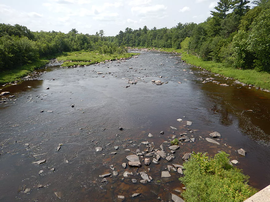
Putting in at Middle Road makes for a nice intro to the trip, with a scenic view of an old iron trestle bridge, rocks and slight riffles downstream of the put-in. What will strike you right away is how black the water is (much more so than the Black River) and how big Wedges is for a creek (it’s a small river). The other notable observation will be the number of rocks. This is the rockiest stream/river I’ve EVER done. That’s a good thing.
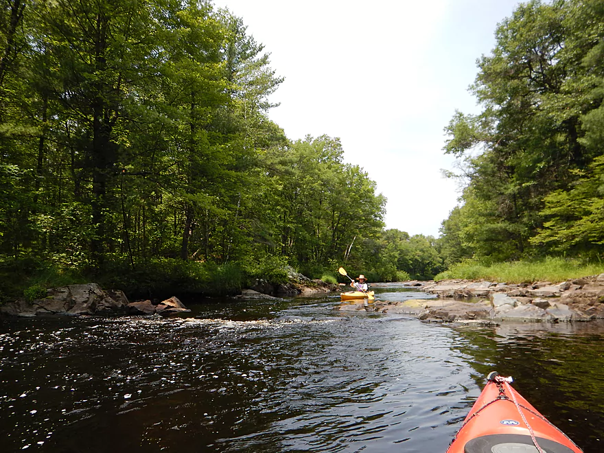
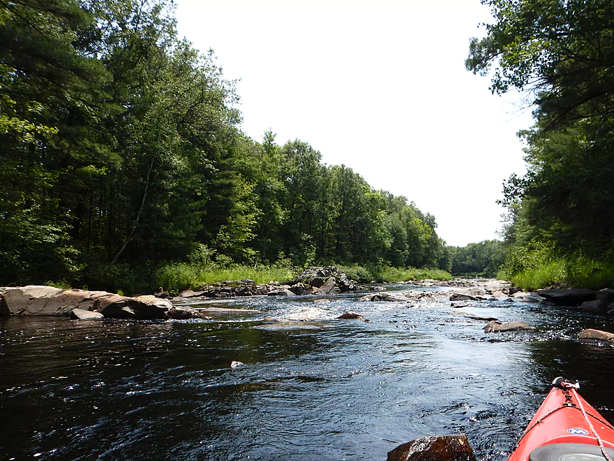
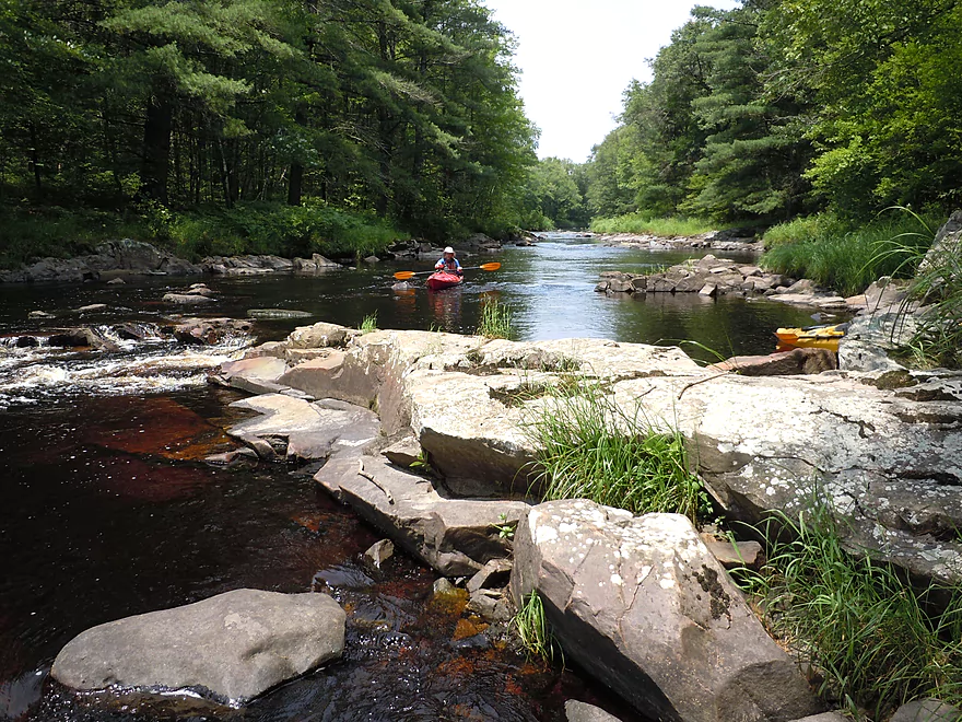
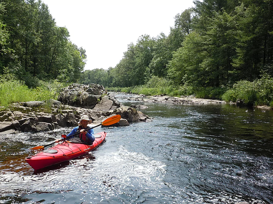
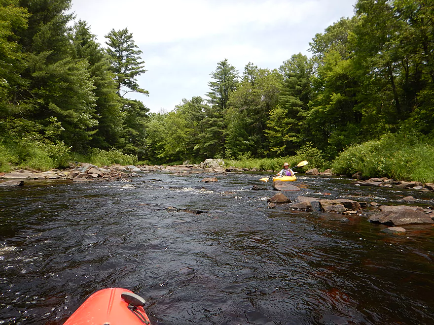
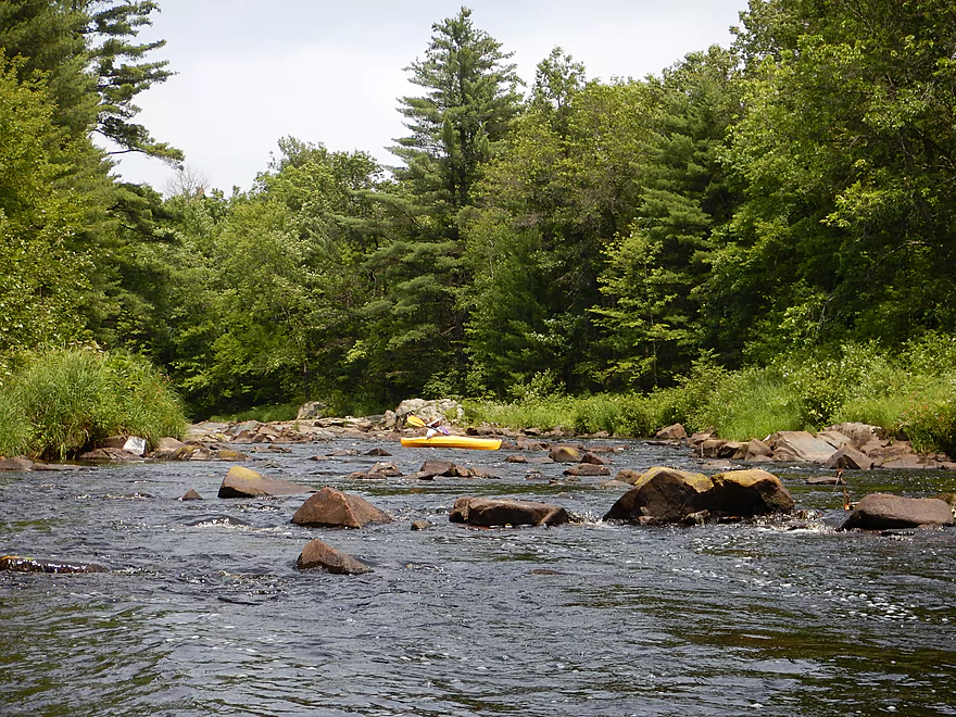
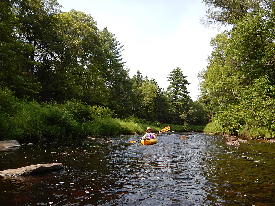
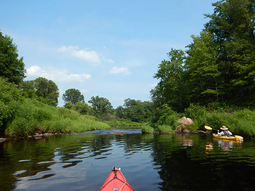
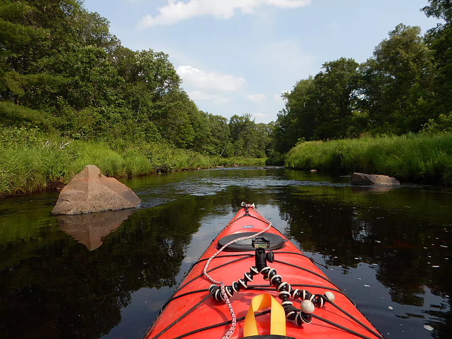
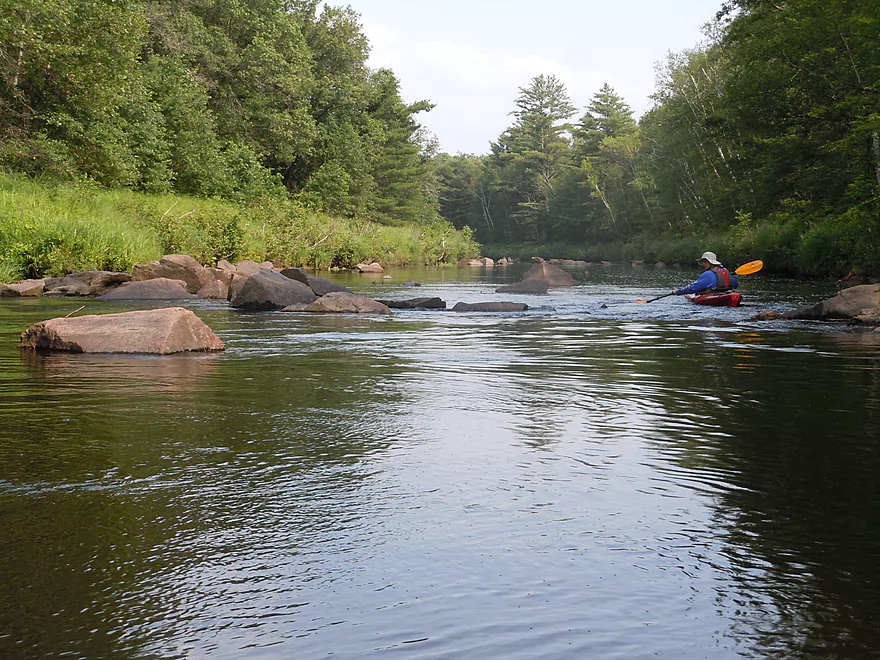
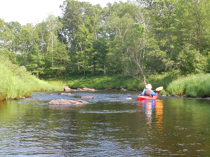
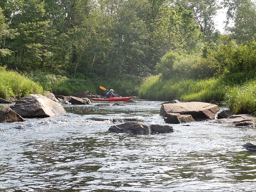
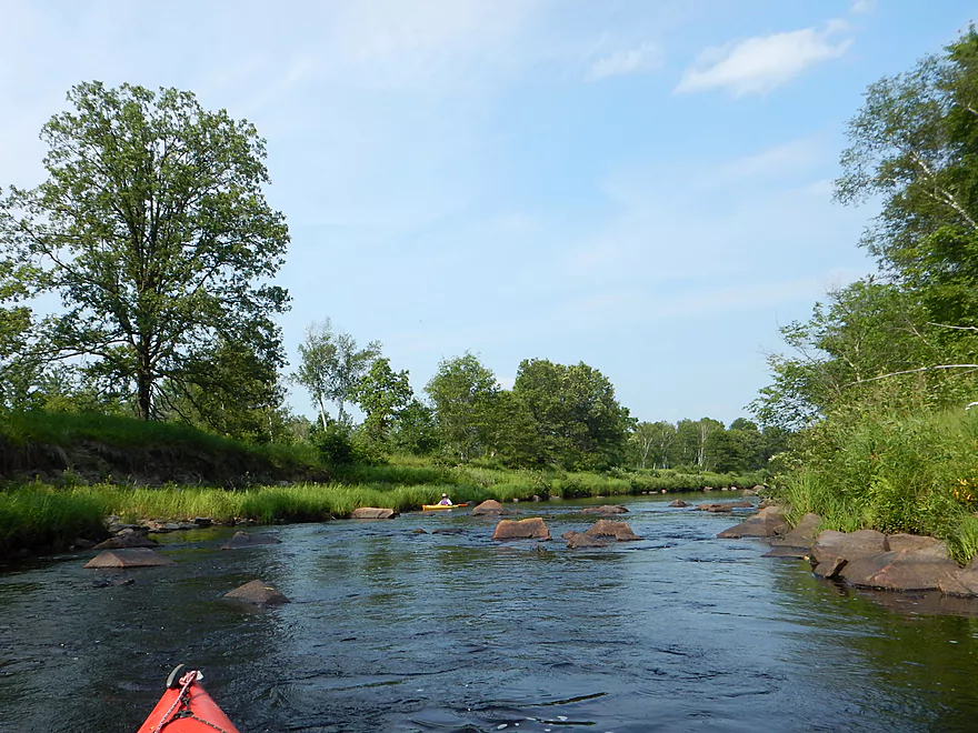
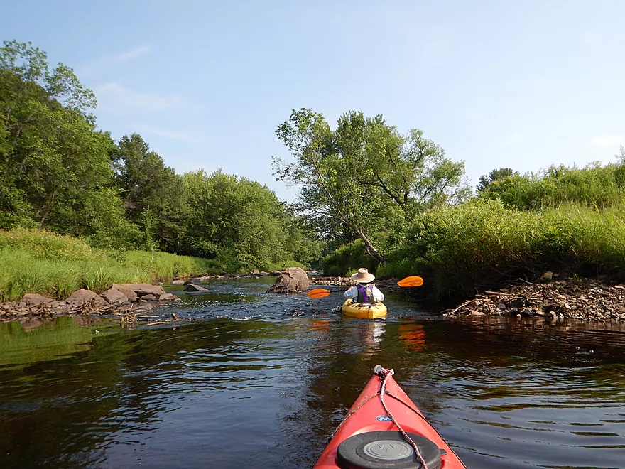
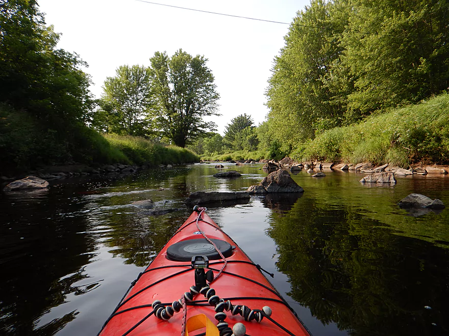
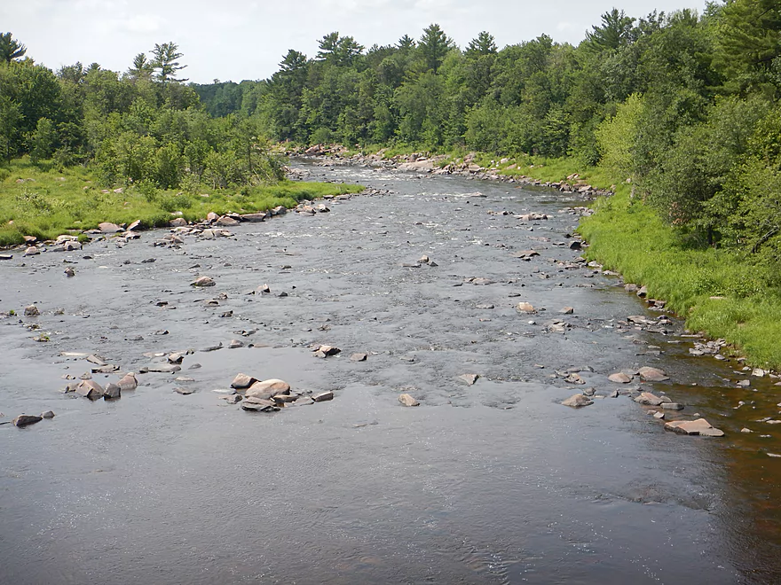
The first mile is very cool. Fantastic boulder gardens, many little rapids and some fun ledges to run over. At times the rocks so crowd the channel that you’ll have to choose carefully to find an open path. It would make a fun maze book for kids…have a picture of one of Wedge’s boulder gardens and they’d have to draw a path through for a kayak. The best parts were when massive granite banks came together to squeeze the channel into small entertaining chutes.
While this was quite cool, Wedges did not feel like Halls Creek nor Robinson Creek (lacked the sandstone, ferns and pines). But it REALLY felt like the East Fork of the Black River. Except smaller and nicer with more rapids and more granite gardens.
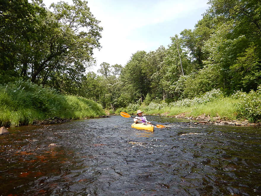
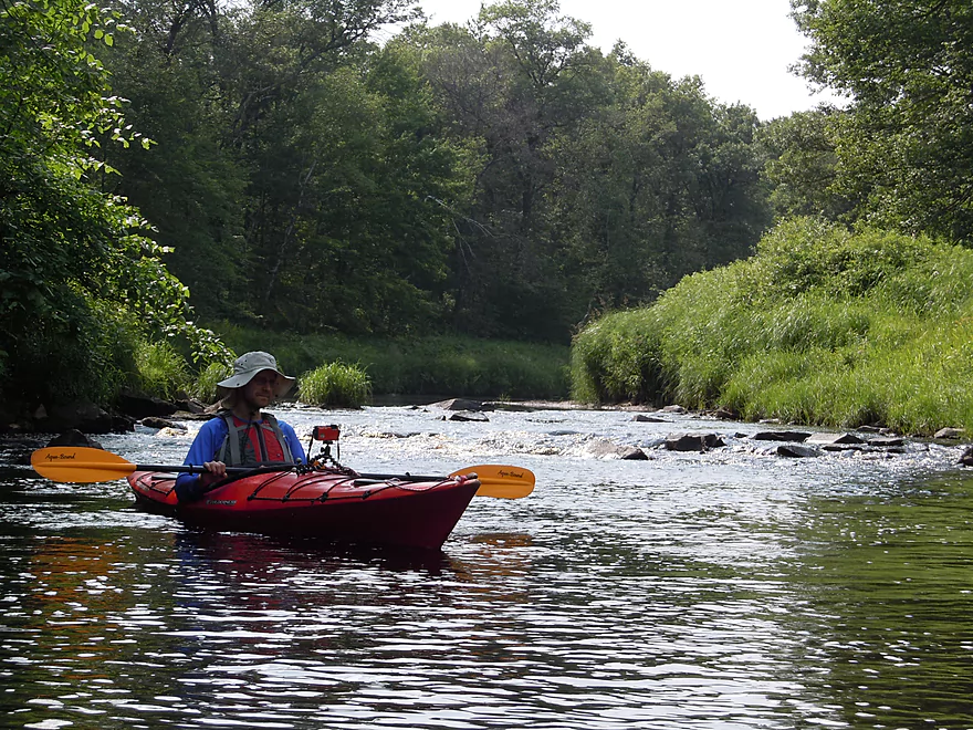
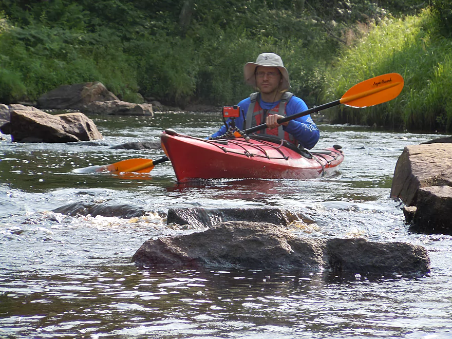
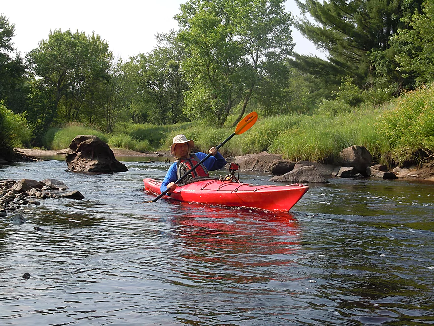
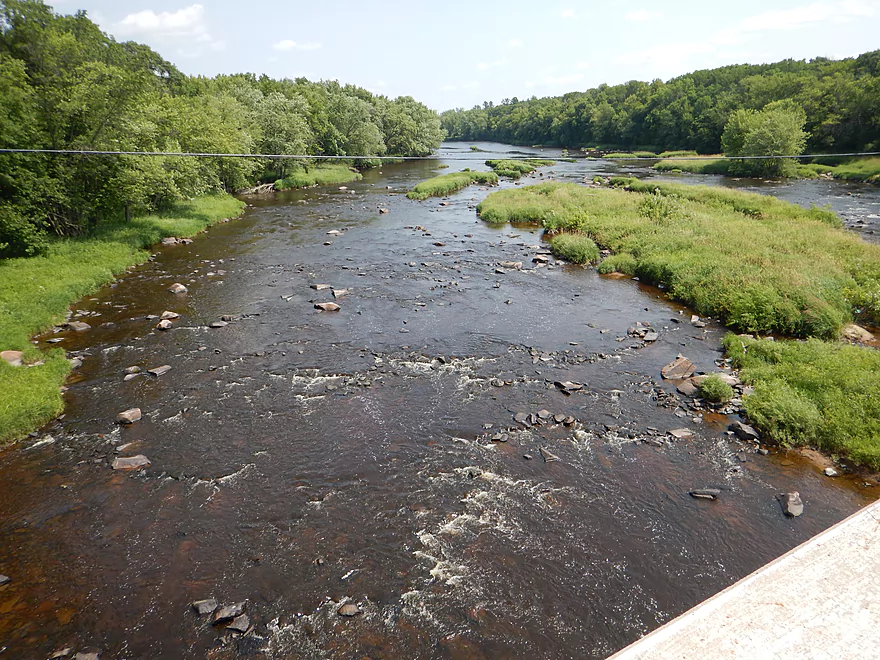
Most rapids I bumped down, which was still fun, but this didn’t give an idea of how pushy the rapids typically were. I would guess most were class 1, with 2-3 class 2’s. In higher water a couple sections might be promoted to class 3’s so be careful. Most of the serious rapids were videoed if you are curious.
After the snowmobile bridge, the stream widens, slows down and gets less rocky. The water isn’t really dirty but it isn’t super clear either because of the tannic acid. There were sections in which the light was able to cut through the water allowing for cool red-tinted views of the rocks and gravel below.
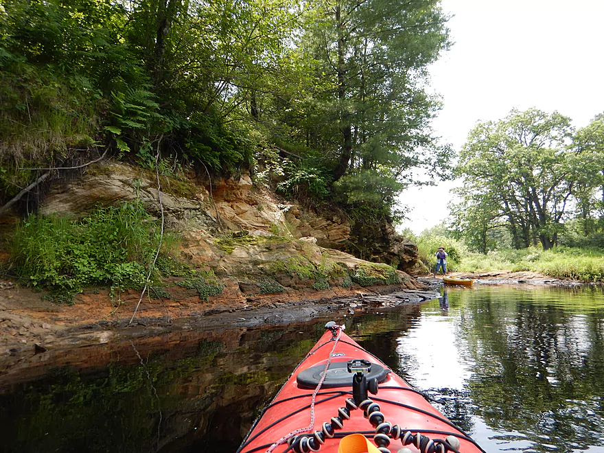
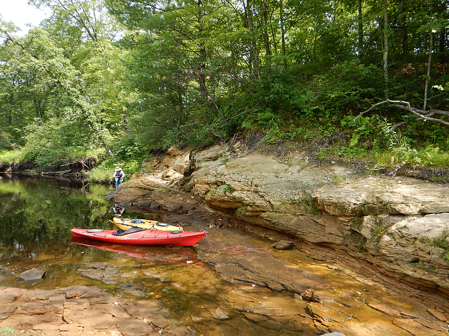
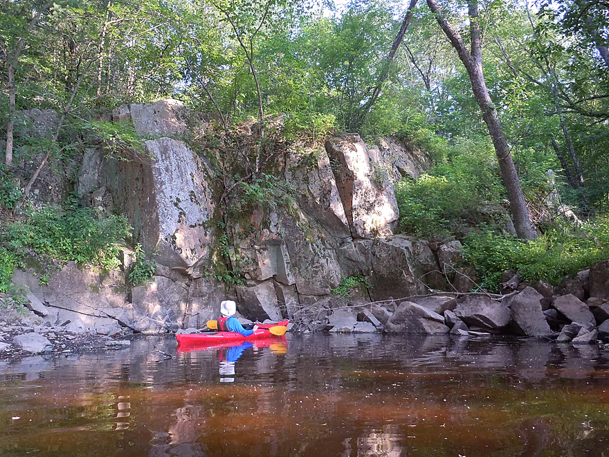
One of the highlights will be a sandstone rock outcropping on the west bank that you can get out and explore. The upstream sections of Wedges I suspect have a lot more of these bluffs, but this is the only one below Middle Road. Cool with seeps and ferns springing out of the rocks. No Halls…but Halls doesn’t have granite boulder gardens either.
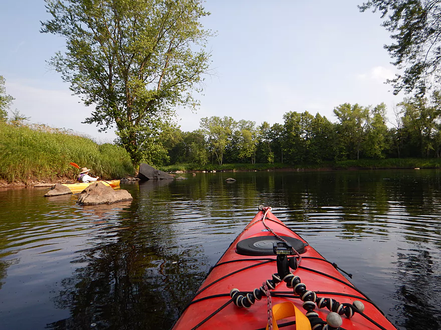
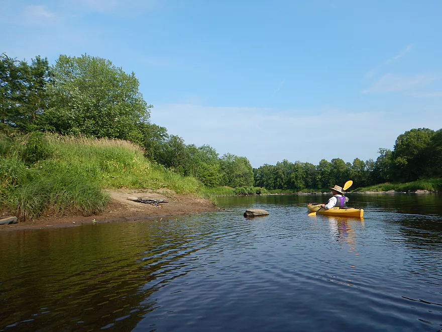
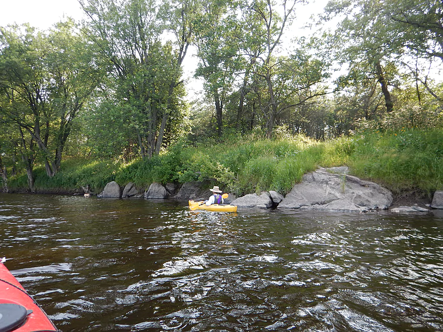
The middle section of Wedges is a bit slower and not as exotic. You’ll see a couple of small sandbars and gravel bars which are nice touches. This most reminded me of the East Fork with high banks of sedges and a number of oak openings.
The final mile on the creek is quite nice. The creek narrows dramatically and picks up its pace in preparation for meeting the Black. Here you’ll experience some of the larger and more serious boulder gardens and rapids on the trip. Very scenic.
You can take out at the public landing off of Opelt Road at the mouth of Wedges. But that would require some out-of-the way driving over rough gravel roads, so we opted instead to take out on the Black River for a bonus 1.4-mile section of “big river” paddling. While Wedges is big for a creek, the Black still dwarfs it and makes quite the impression upon entering it.
The stretch between Niellsville and Lake Arbutus has some impressive rapids and scenery, but this short little paddle on the Black was fairly tame and boring. Paddling such a big, monotonous river like this reminded me why I so prefer small rivers and creeks. Not to sell the Black short though as it is a cool river…this was just a non-exotic mile.
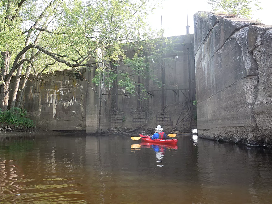
One of the curiosities on this section is a remnant of the old Dells Dam just upstream from Hwy 95. Constructed to regulate water level for log transport on the Black, it eventually washed out in 1911, leaving behind just the massive gates which are fun to explore. You’ll also see the old granite dells on which the dam was constructed. The detailed history of the dam (and its subsequent failure) is quite interesting:
- Old picture of the dam
- Construction photos
- Local news story on the great 1911 flood
- NY Times article on the 1911 flood and dam washout
Finally after 1.4 miles of boring, the Black decides to get interesting with a very large boulder garden and series of rapids both up and downstream of Hwy 95. These were quite fun to run and just class 1, but were quite bumpy at our depths. The take-out is just after the Hwy 95 bridge, which is a very scenic take-out (especially from the bridge). From “up top” you can see the start of the famous Red Granite Rapids which you can run if you stretch the trip out for another mile or two.
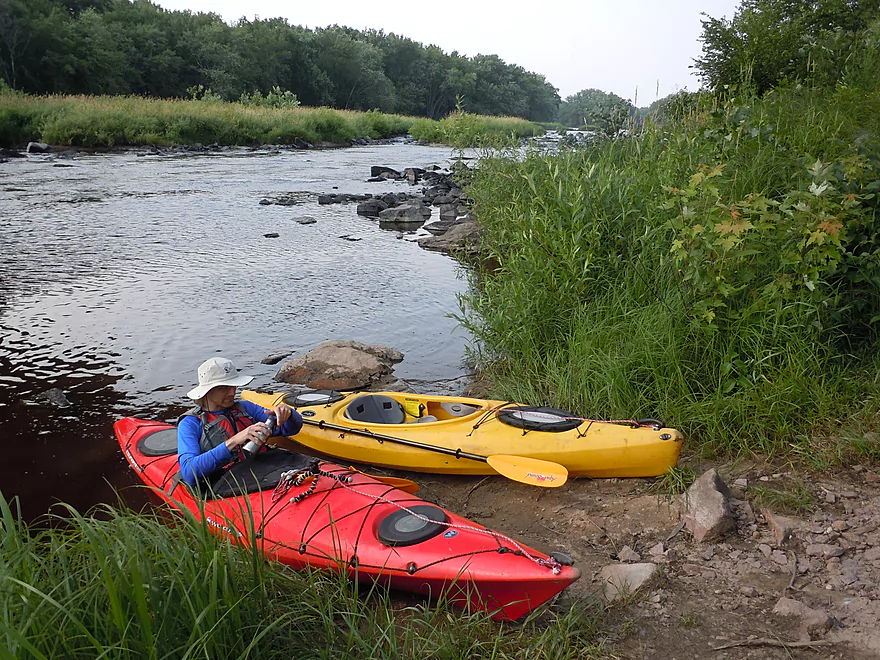
Good bridge access off Middle Road.
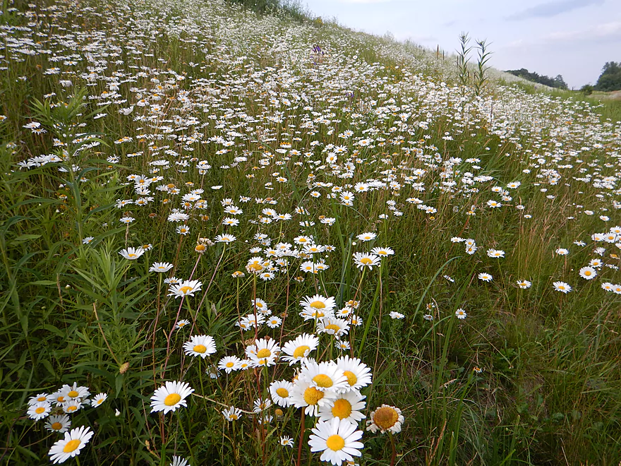
Very good take-out on the Black River by the Hwy 95 bridge. You will have to drive onto Reesewood Ave to access the landing despite it being almost under the Hwy 95 bridge. No outhouses at either landing, but the take-out has nice wildflowers.
For bike shuttlers this would be a tough 2.9-mile stretch over big gravel, then a 3.5-mile paved stretch. That’s why I cheated and car shuttled. As a rough rule of thumb, the numbered and lettered roads are paved (e.g., Hwy 95, Hwy 73, Hwy B, Hwy 10) while the spelled-out roads are gravel (e.g., Rouse Road, Middle Road, Columbia Road).
There actually is a local livery in Hatfield that I believe would service this area if you called in advance. They’re called the Hatfield Sports Shop and normally they do Black River trips but told me they would do the East Fork and that is further away than Wedges. They can be reached at (715)-333-5009.
Not one log jam. Only hazards are the rapids (see above).
Important part so pay attention. First, there is no local gauge (which is desperately needed), so you’ll have to make do with some nearby gauges. I presume the gauge on the East Fork of the Black River is the most accurate (similar size and both rivers empty into the Black near Lake Arbutus). At 345 CFS this was probably too low for most paddlers. I suggest 475 to 575 CFS (still bumpy but still scenic…I think). This creek does get very rough in high water and you want to be off it then. How high that would be…I’m not sure. Maybe 700 CFS and up?
You can also use the somewhat local Neillsville gauge. We paddled this at 3.16′ or 142 CFS which is considered low for the upper Black River. I suspect 4.9′ or 600 CFS will start to make the creek too rough (not to mention the river).
Most of our really shallow hang-ups were in the first mile and the remaining miles were much easier. As always, there is a trade-off between having enough water to pad the rocks, but not so much as to cover up its scenic character.
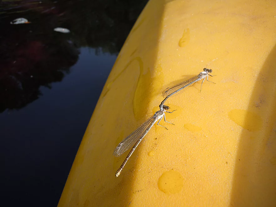
Surprisingly little. A number of damselflies, dragonflies, an osprey and two eagles (with one intently staring at some baby ducks we had been following). The highlight was what appeared to be evidence of a black bear. We spooked something by the river that was a lot heavier and clumsier than a deer….not sure what else it could have been.
Thanks to Clark County conservationist Matt Zoschke for his tips regarding Wedges. He has paddled Wedges both above and below Snyder County Park, but the stretch below Middle Road is his favorite because of the scenic rocks.
Detailed Overview
- Upstream of Chili Road: Not sure about these stretches.
- Chili Road to Snyder County Park: 5.8 miles. During spring run-offs you can run the section from Chili Road to Snyder County Park. Supposedly people have done this. Chili Road is a good put-in. When I scouted this on June 13th 2015, I actually thought it looked too high. Unfortunately this entails at least 4 miles of gravel biking. Likely some jams but should be scenic.
- Snyder Park to Middle Road: 6.4 miles. A neat section with boulder gardens and many rock outcrops. But low water can be an issue. Reviewed Aug 2017.
- Middle Road to Mouth: 4.4 miles. A nice section with only one sandstone outcrop, but some really neat boulder gardens and a few fun rapids. Reviewed Jul 2015.
- Black River Take-Out Options:
- Wedges Creek Mouth to Hwy 95: 1.4 miles. Kind of a wide, uninteresting section of the Black River but does include interesting dam remnants. Reviewed Jul 2015.
- Hwy 95 to Lake Arbutus Sports Grill: 1.1 miles. This section includes the Red Granite Rapids which are Class 3 and should be scouted beforehand. You can do this a bit from the Hwy 95 bridge, but you will get better views of the rapids from Reesewood Ave and/or Riviera Ave.
- Lake Arbutus Sports Grill to Lake Arbutus: 1.7 miles. An over developed flowage section that is still nice. Many take-out options on or just north of the lake.
- Further Upper Black River Options: See my Neillsville trip review which has a nice overview of the Black River.
Of note, Five Mile Creek is a significant tributary to Wedges that has also apparently been paddled and should be very scenic. This creek is very fast with a few boulder gardens but I doubt it has outcrops. It would be a 5.3-mile stretch from Hwy B to the mouth on Wedges (just above Middle Road, which would be a good take-out). I suspect this has more jams though. Bike shuttle would be mostly gravel outside of a short stretch on Hwy B, but only 4.2 miles.
Trip Map
Overview Map
Video
Photos Size:
Thanks for the great tour of Wedges creek. Been on Halls creek many times, mostly wading and fishing, and up and down the Black, but definitely going to check out Wedges with the kayak. Truly wonderful pictures.
Thanks for the comments. It is a cool creek! …but you do need to do it when it isn’t so shallow…now likely a bad time to paddle Wedges.