
Black Earth Creek
This is one of the great paddling streams of Dane County. Highlights include good water quality and swift current. Locals have done a terrific job of clearing out hazardous logjams.
Trip Reports
Cross Plains to Salmo Pond County Park
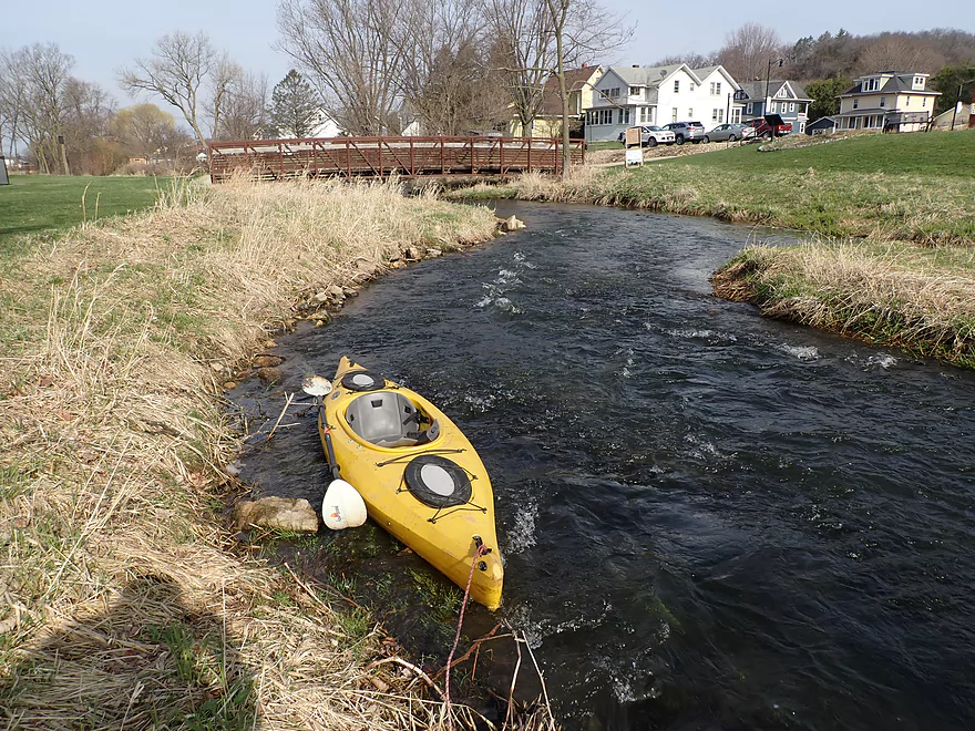
Date Paddled: April 23rd, 2022
Distance: 4.4 miles
Time: Expect 2 hours
Black Earth Creek is a popular water tail located just west of Madison. The Cross Plains segment, however, has been plagued in the past by fences and logjams. This exploratory trip proved that conditions have since changed and "Cross Plains" is now ready for paddling.
Read More...Scherbel Road to Black Earth Community Park
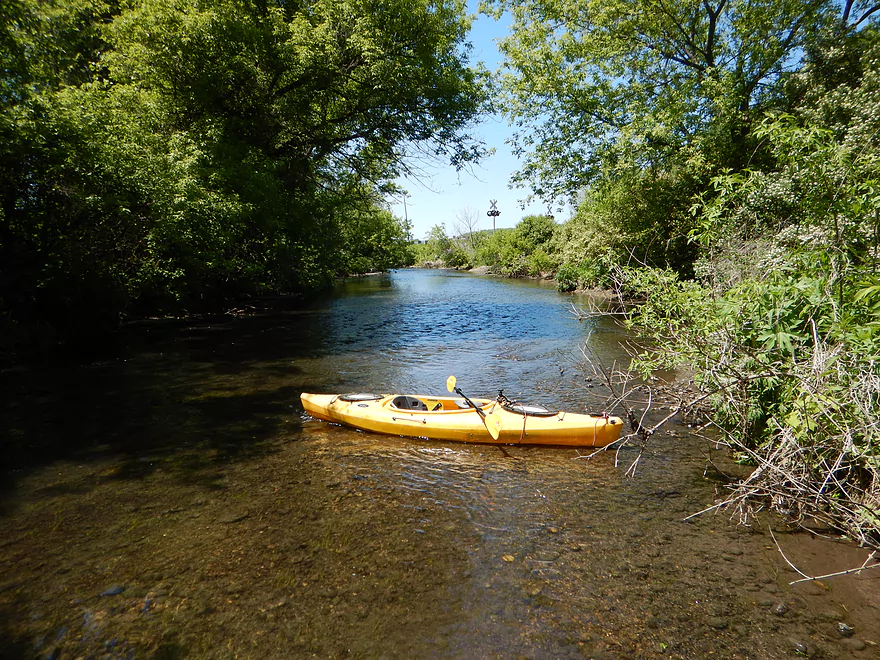
Date Paddled: May 22nd, 2015
Distance: 4.17 Miles
Time: 3 hours 13 minutes (2 hours would be more typical)
An obscure but pleasant paddle stretch from Salmo Pond County Park to Black Earth. A good combination of scenery, water quality and light rapids.
Read More...Black Earth Community Park to Olson Road Bridge
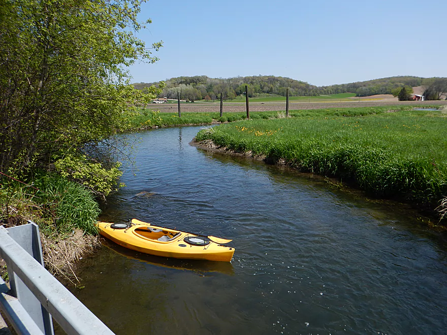
Date Paddled: May 18th, 2014
Distance: 4.1 Miles
Time: 3 hours
This is a very nice, clear, fast creek that runs from the Middleton Airport all the way to the Wisconsin River near Arena. On occasion, paddlers will run Blynn Road (the last bridge) to the mouth, and this is considered a good prospect that recently was cleaned up in 2011 of log jams by “Capitol […]
Read More...Olson Road Bridge to Walking Iron Park
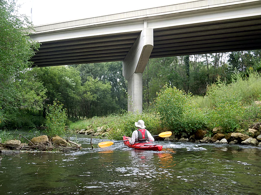
Date Paddled: August 24th, 2014
Distance: 3.7 Miles
Time: 4 hours 17 minutes (atypical....expect 2 hours)
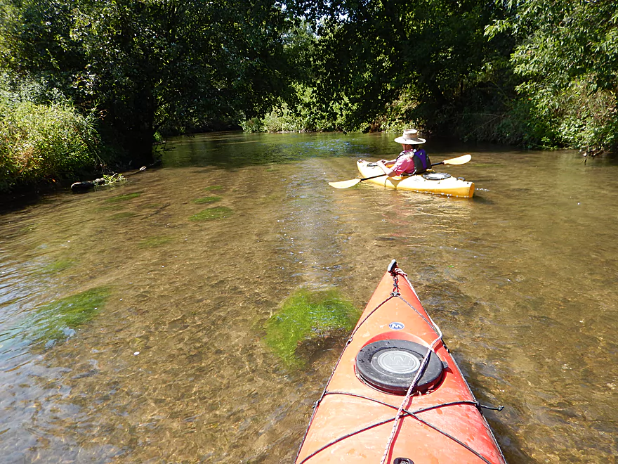
Connecting the city of Middleton to the Wisconsin River, Black Earth Creek is an obscure paddling prospect–more known for its nationally famous trout population. Nevertheless, this creek is a wonderful little gem with a great combination of prairie paddling and forest paddling that should not be overlooked by south-central Wisconsinites. Previously in May, I had […]
Read More...Olson Road to Wolf Run Trailhead Landing
Date Paddled: January 20th, 2018
Distance: 2.3 miles
Time: 1 hour 5 minutes
A guest winter review for a short segment on Black Earth Creek from Olson Road to the new Wolf Run Trail Landing.
Read More...Walking Iron Park in Mazomanie to Blynn Road Bridge
Date Paddled: August 22nd, 2015
Distance: 5.47 Miles
Time: 5 hours 3 minutes (2.5 hours would be more typical)
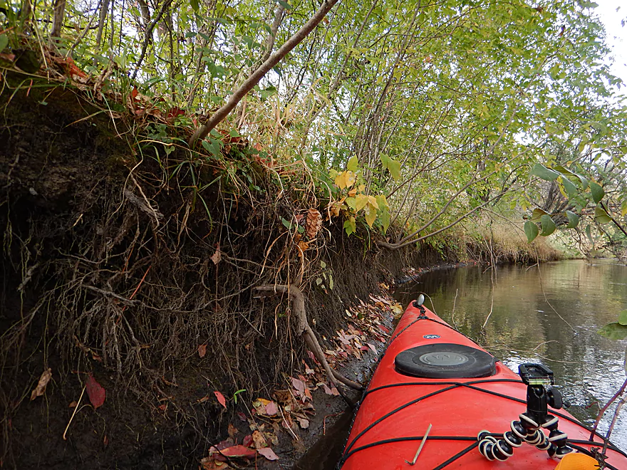
Back again at Black Earth Creek, this time starting at Mazomanie's Walking Iron Park. A really nice paddle with great water clarity, clean banks, attractive tree canopies and good current.
Read More...Blynn Road Bridge to Arena Public Boat Landing
Date Paddled: October 5th, 2014
Distance: 6.75 Miles
Time: 3 hours 21 minutes
A relatively new water-trail due to some fantastic clean-up work by the locals, but while the creek is worthy of consideration, this was a relatively disappointing paddle given how much I liked the upper sections of this watershed (namely, Black Earth Creek). Put-in: Pretty good put-in at Blynn Road. Access will be on the southeast […]
Read More...Overview Map
Detailed Overview
- Upstream from N. Birch Trail: The creek is small, but might be surprisingly navigable during high water.
- N. Birch Trail to Stagecoach Rd: 0.5 miles. Creek here is small and wooded with possible congestion and a few jams.
- Stagecoach Rd to Cross Plains: 2.0 miles. An intriguing prospect that may now be viable because Black Earth Creek has grown in size. Starts narrow, rocky and wooded then opens up. Maybe 2-3 logjams. Stagecoach Rd may not be a good access as a "No Tresspassing" sign is on one side of the bridge.
- Cross Plains to Salmo Pond: 4.3 miles. Nice stretch. Half of this leg flows by the community of Cross Plains. One fence and one logjam to deal with but not major.
- Salmo Pond to Black Earth Community Park: 4.2 miles. Several fences to deal with, but all in all, one of the more underrated legs on the creek.
- Black Earth Community Park to Olson Road: 4.5 miles.
- Black Earth Community Park to The Shoe Box Landing: 1.5 miles. Nice stretch that passes through the outskirts of Black Earth. Might be a few minor logjams to sneak past.
- The Shoe Box Landing to Olson Road: 2.9 miles. Pleasant open stretch. This is a common "add-on" leg for those wanting to do the popular Mazo trip, but as a longer trip.
- Olson Road to Walking Iron Park: 3.7 miles. The best and most popular leg on the creek. Much of it flows around the outskirts of Mazomanie and though a nice woods.
- Walking Iron Park to W. Hudson Road: 1.1 miles. A small but great section that is recommended as an add-on to an Olson Road trip. This doesn't receive as much upkeep so paddlers may encounter a logjam or two.
- W. Hudson Road to Blynn Road: 4.4 miles. An ok section but nothing special. This leg while once clear, may now have a few surprise logjams.
- Blynn Road to Mouth at Arena: 6.8 miles. Technically now Blue Mounds Creek, this is the weakest section.
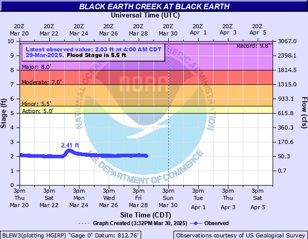
Nearby Guages

Videos
Comments