
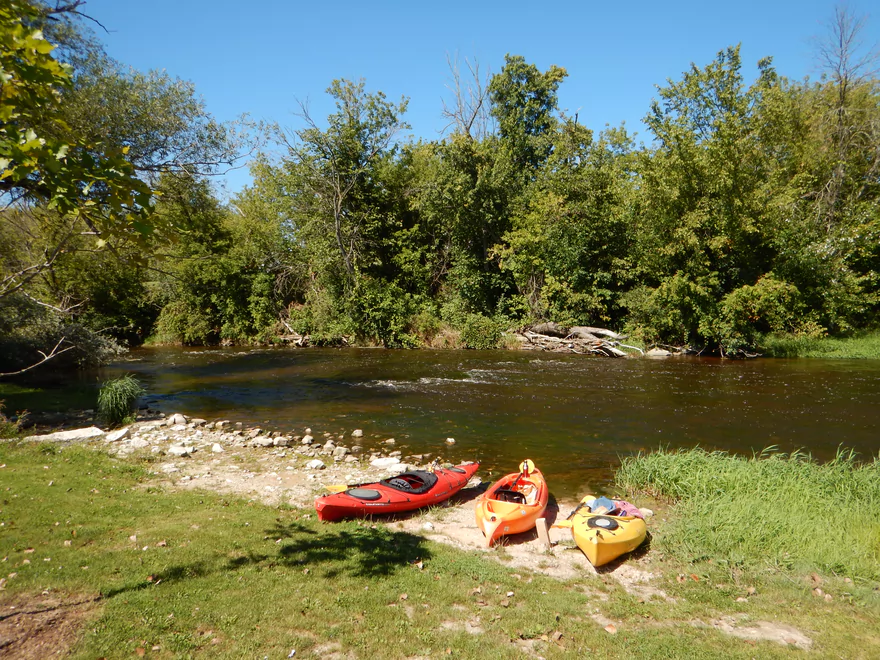
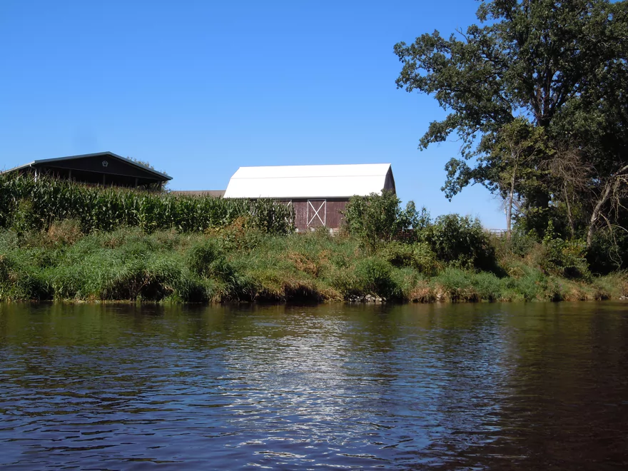
Putting in by the Main Street bridge in Newburg
Pretty good put-in
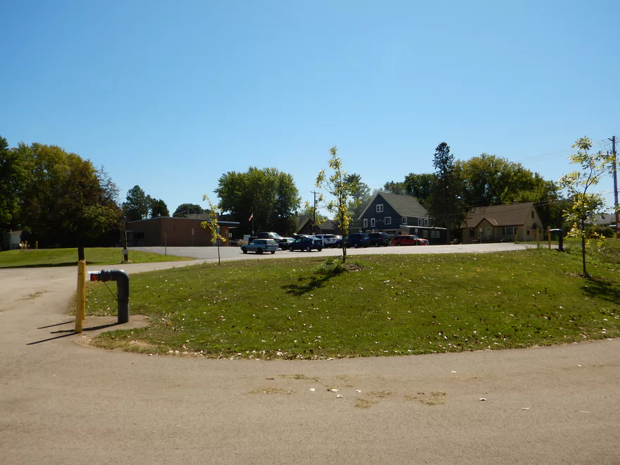
You can park in the nearby municipal lot
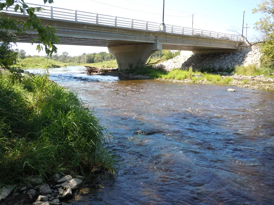
There used to be a dam here
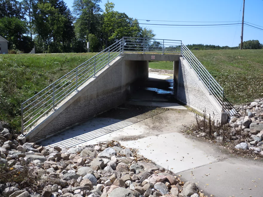
And this was the mill race
Looking upstream with alt-access on south (left) bank
Looking downstream
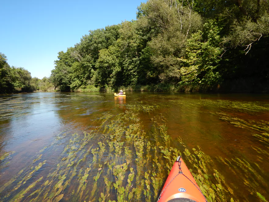
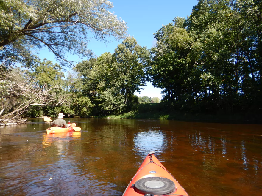
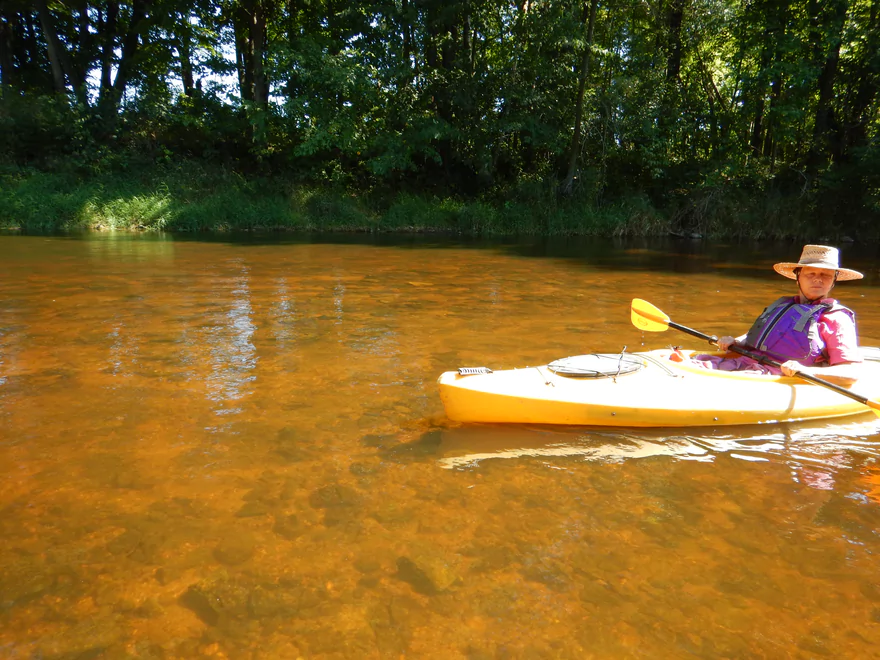
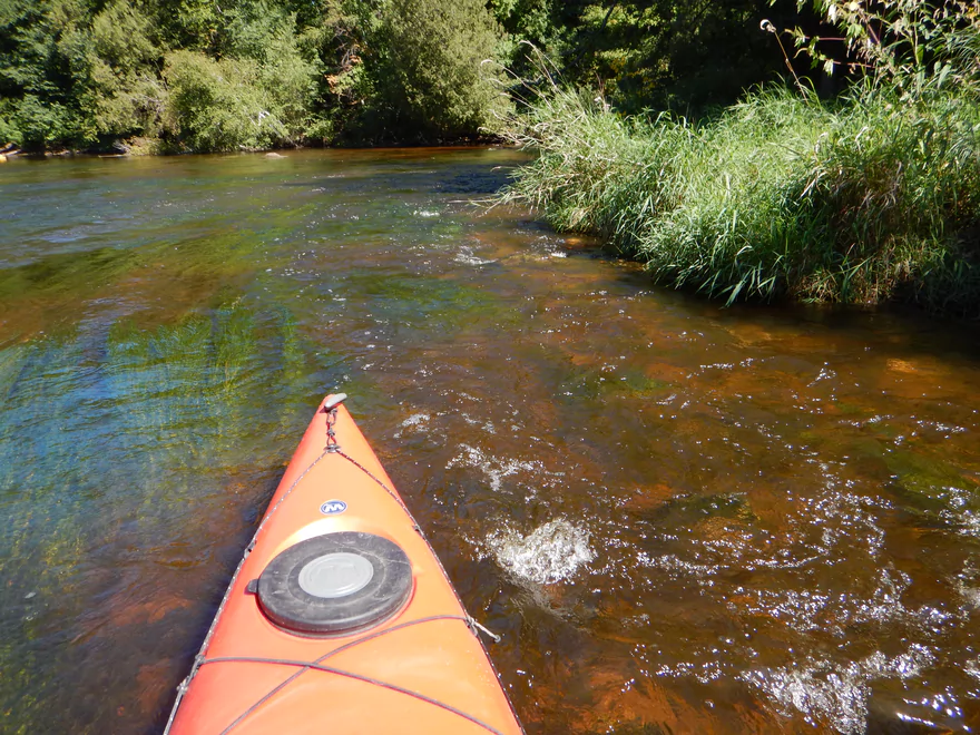
Great water clarity
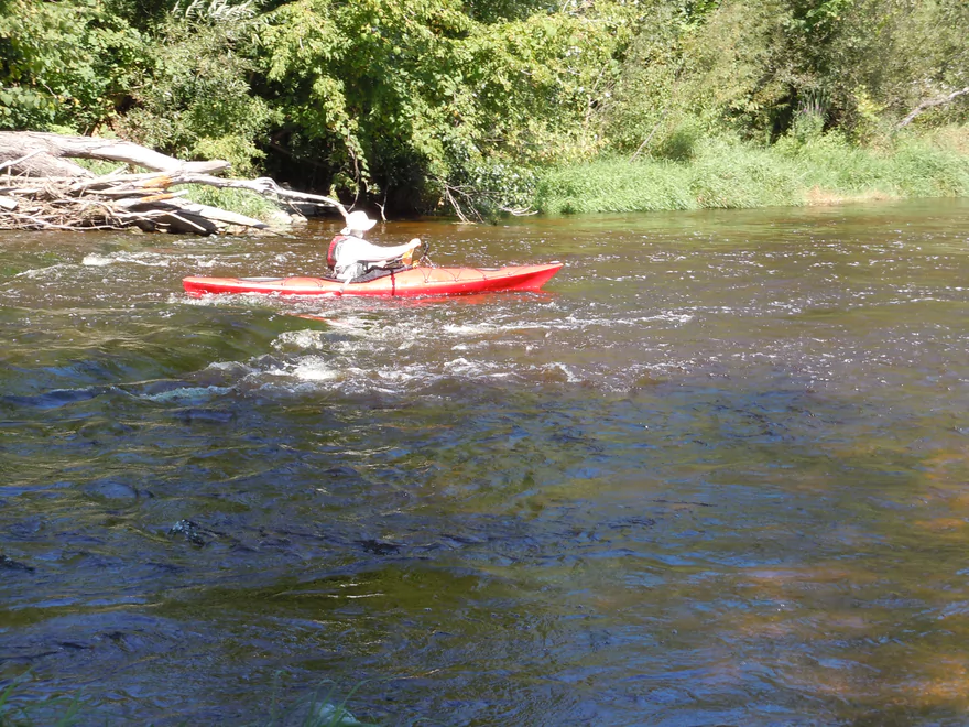
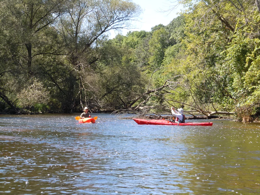
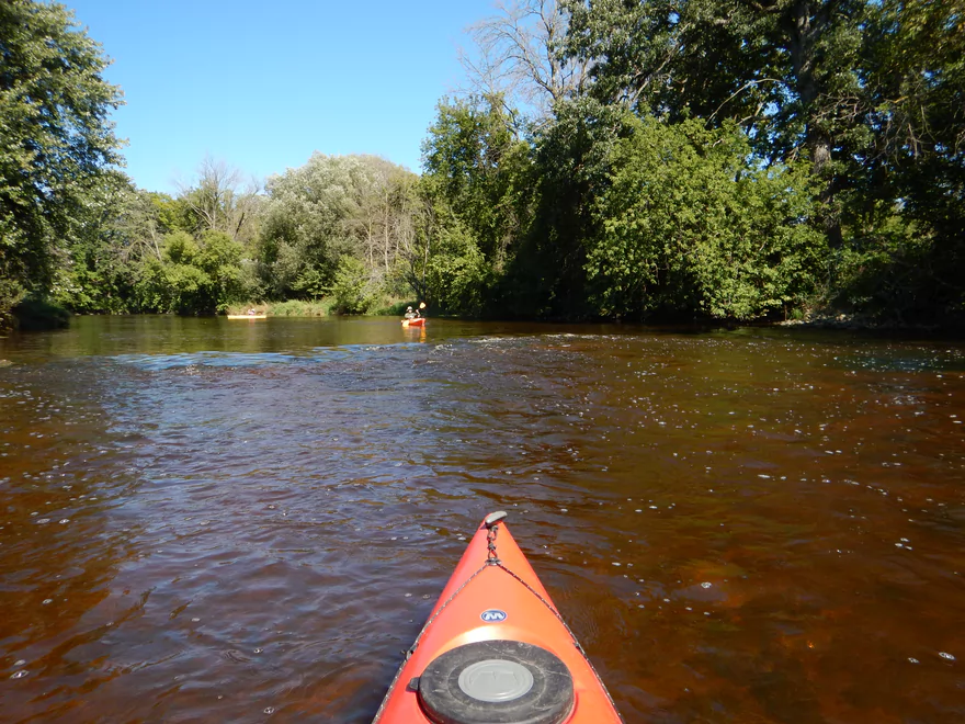
Fun rapids by the put-in
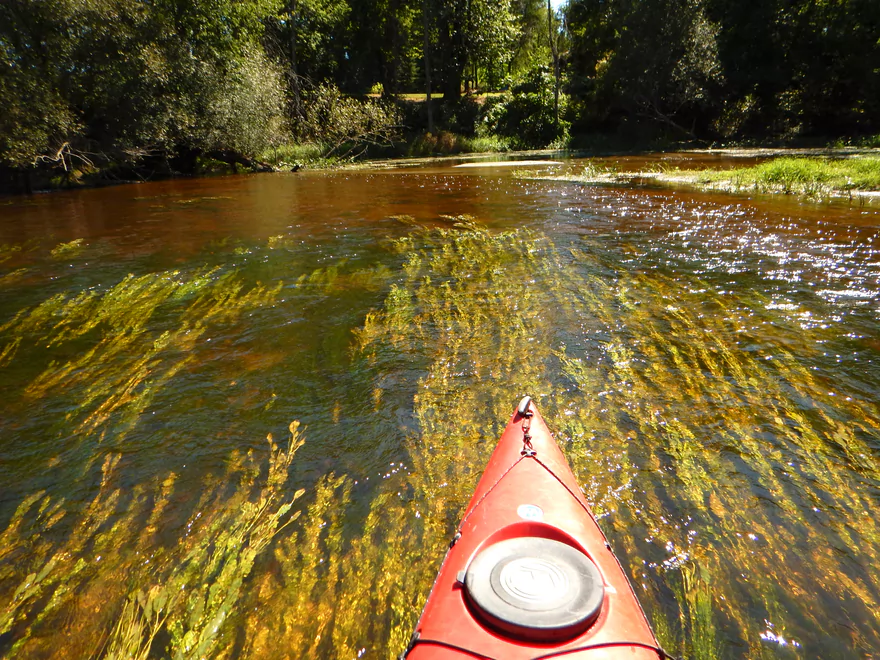
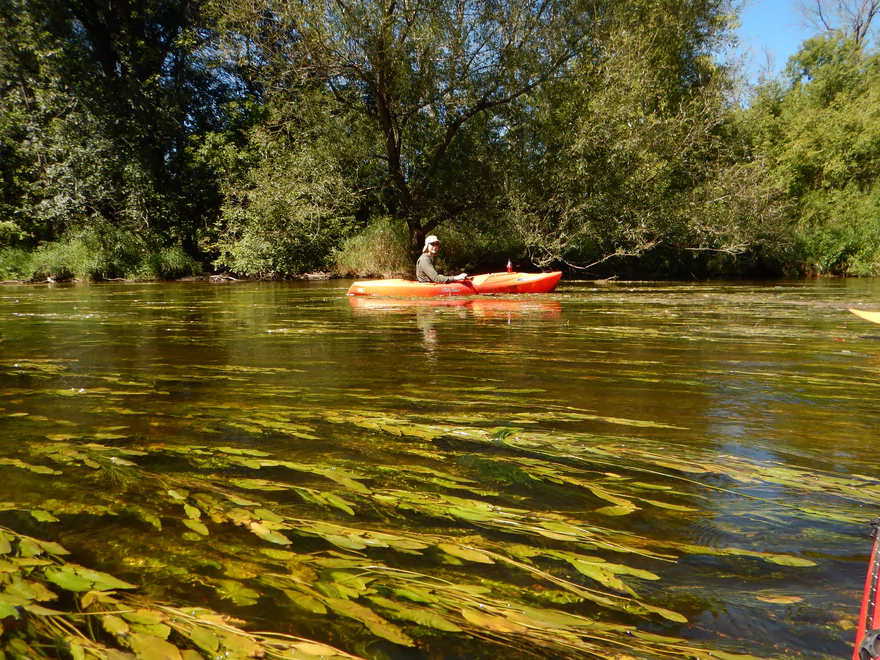
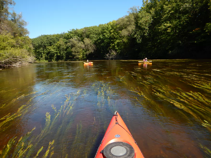
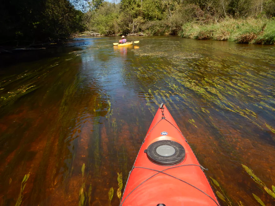
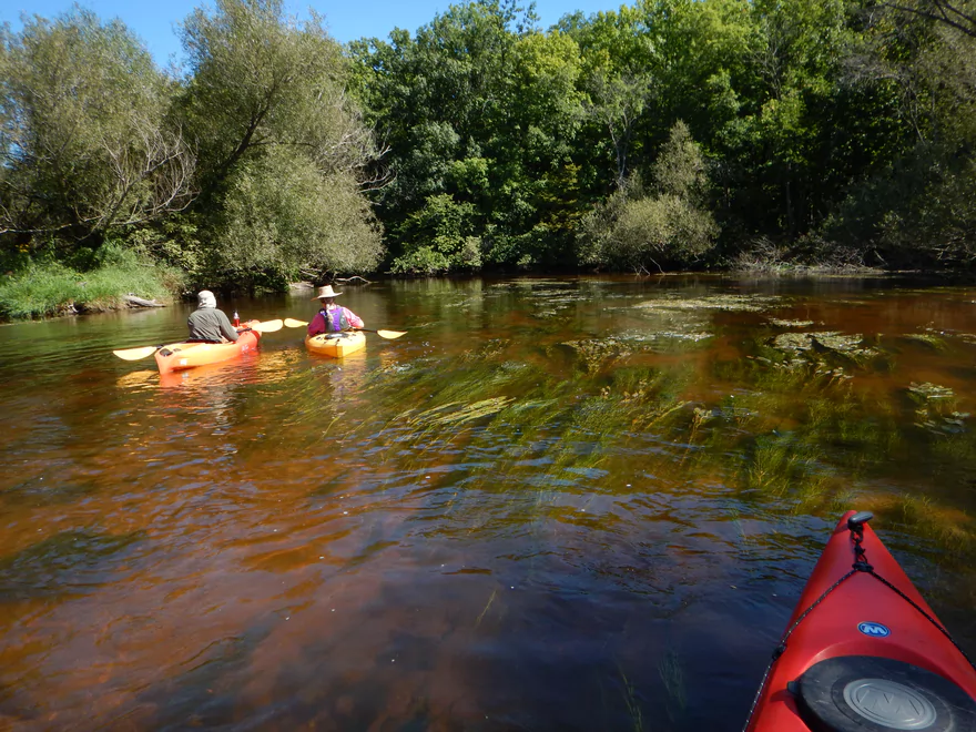
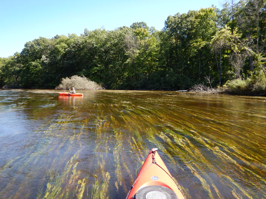
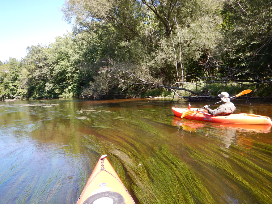
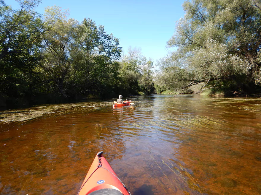
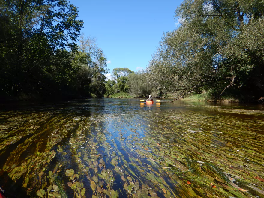
Terrific flowing Potamogeton
Intake pump for the sturgeon nursery at Riveredge Nature Center…normally not this covered with water
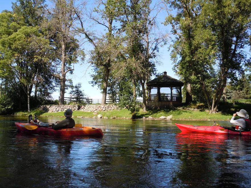
One of several public access spots
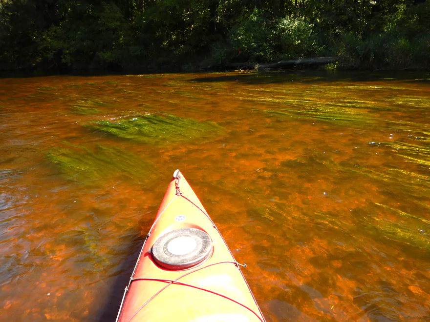
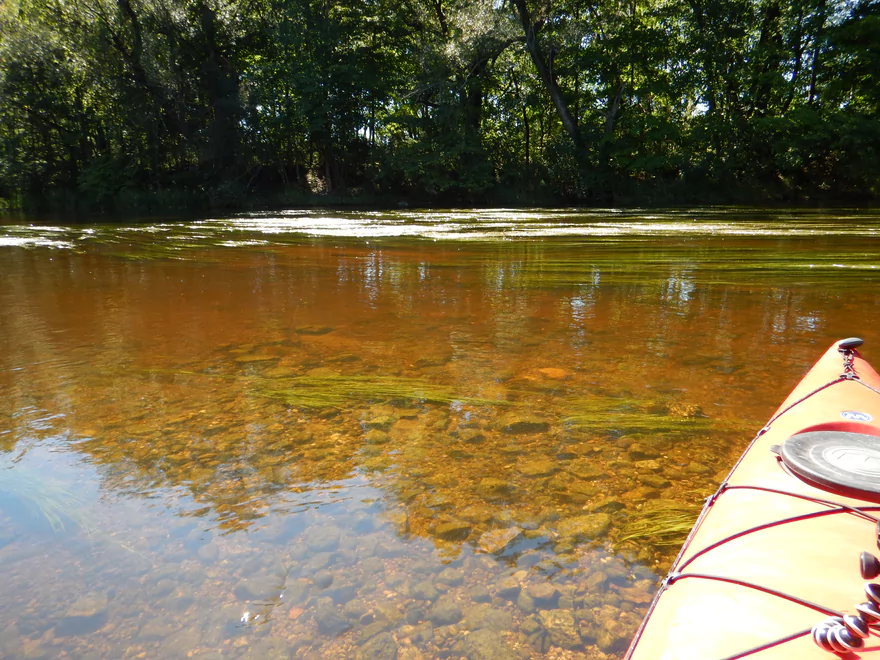
Water had a cool red hue to it
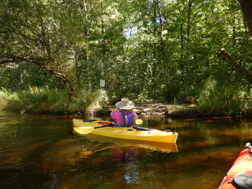
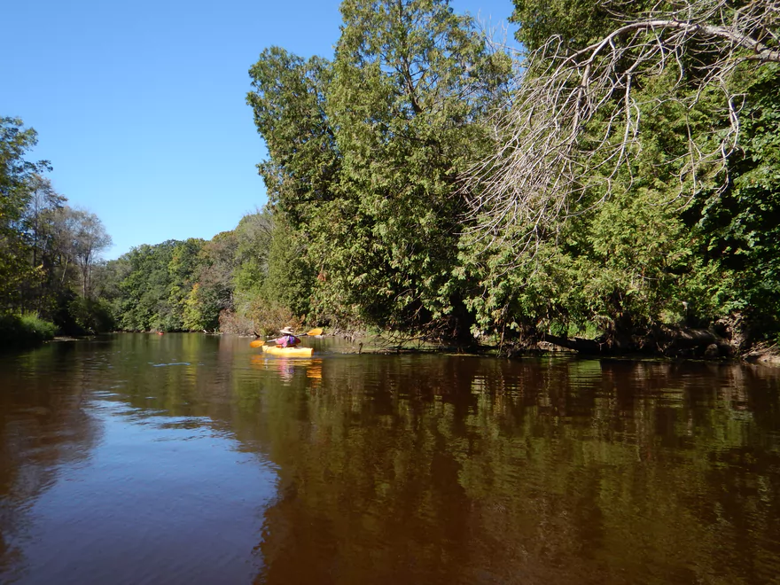
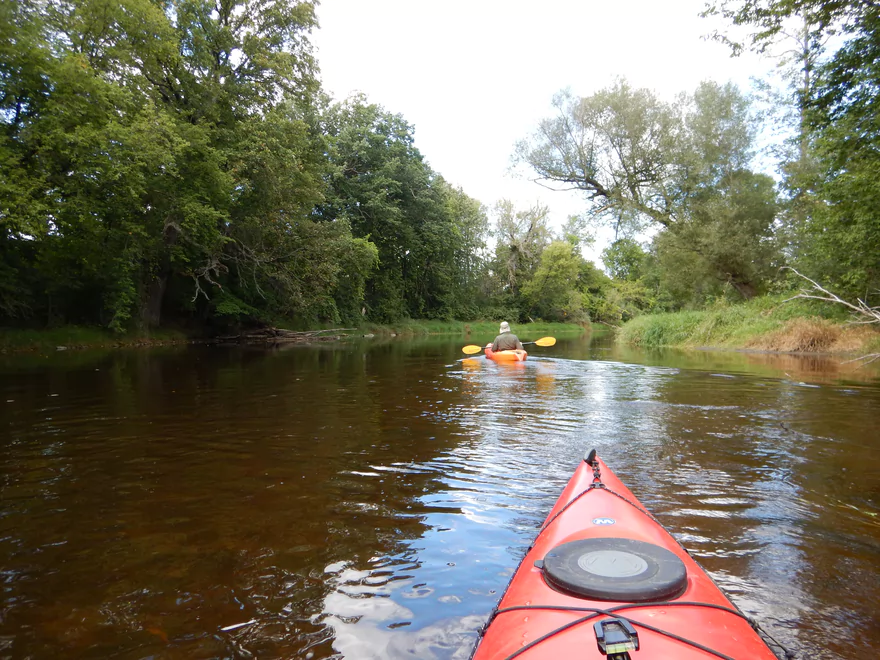
Surprising wilderness feel
Local nature center does a good job of protecting this part of the river
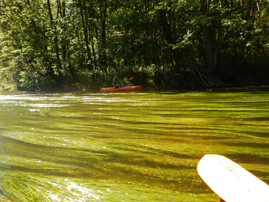
The aquatic plants were very striking
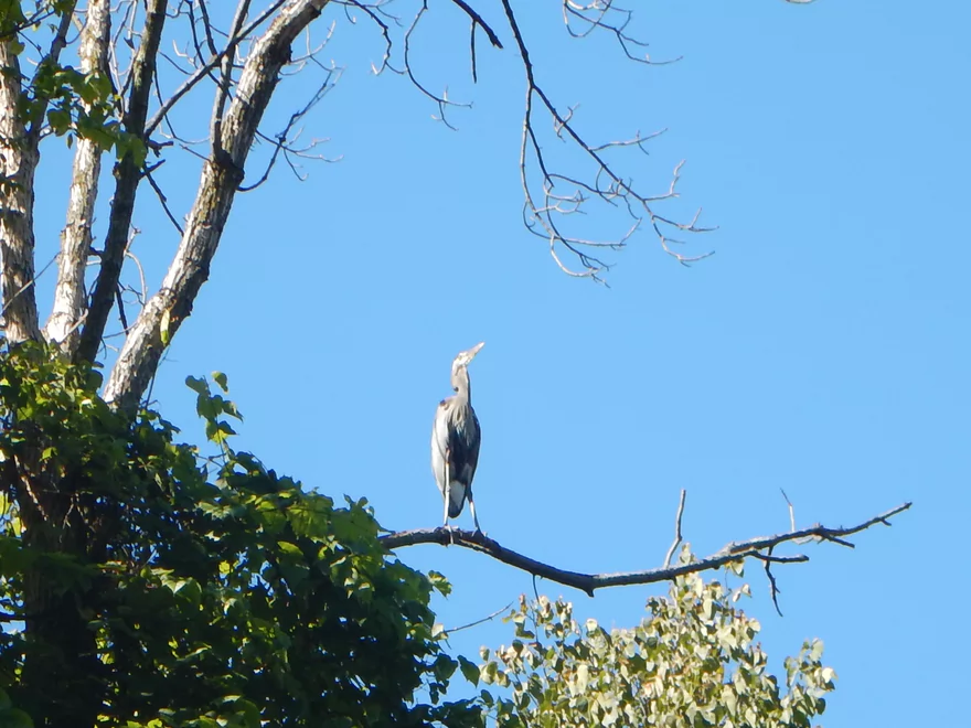
Great blue heron
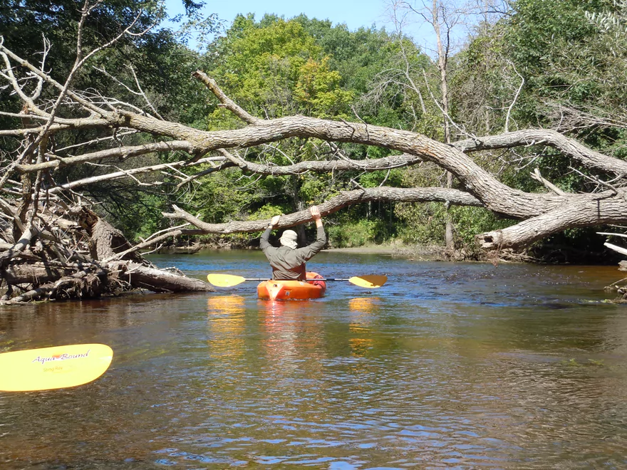
Might be tough to duck under in really high water
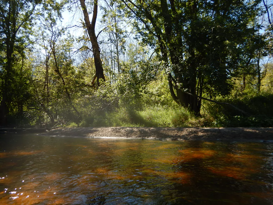
One of several small sandbars
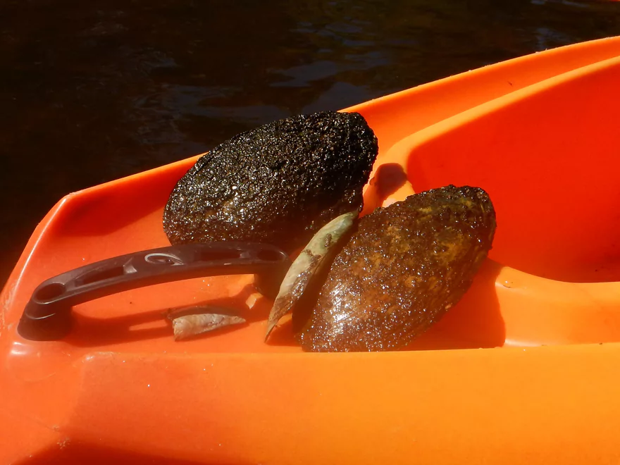
Lot of clams in the river
There are riffles here, but are obscured by the higher water
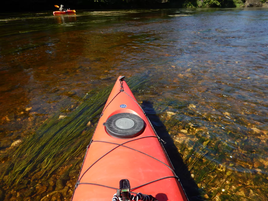
Gorgeous water clarity
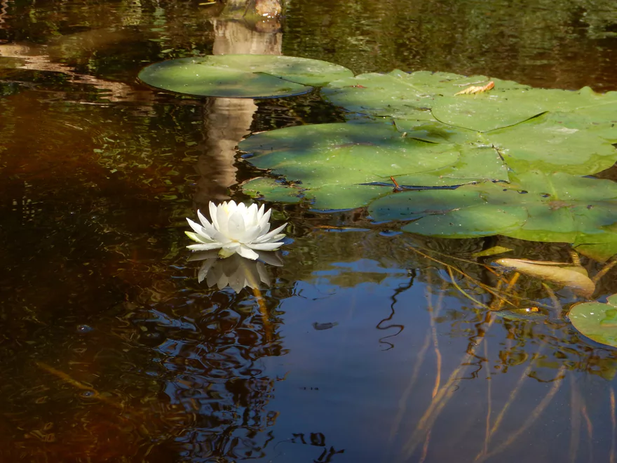
White water lily
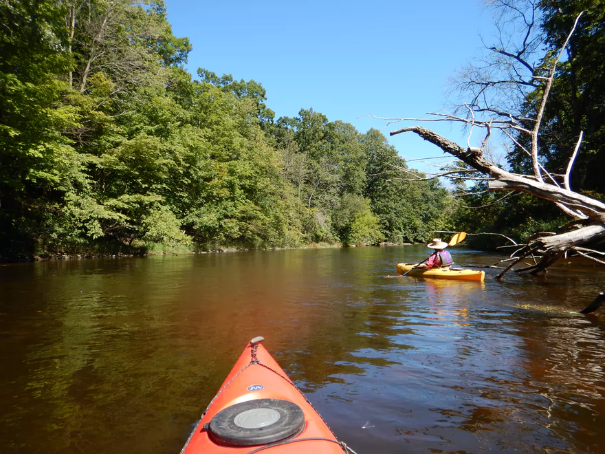
River is quite wide, but never deep
Homeowner carved a viewing hole into the tree line (kid you not)
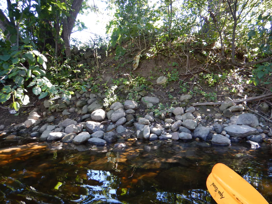
Rocky substrate
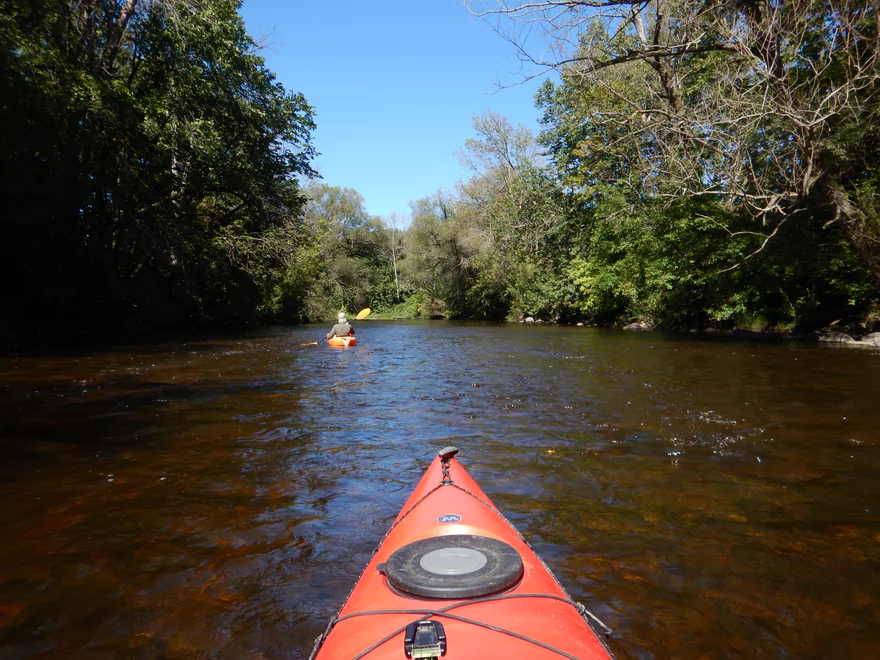
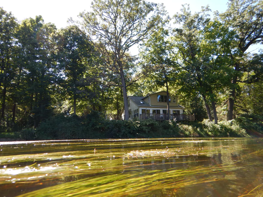
Were not many homes on the water
Clean gravel substrate
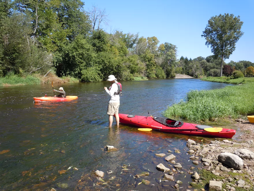
Current is mostly fast on this segment
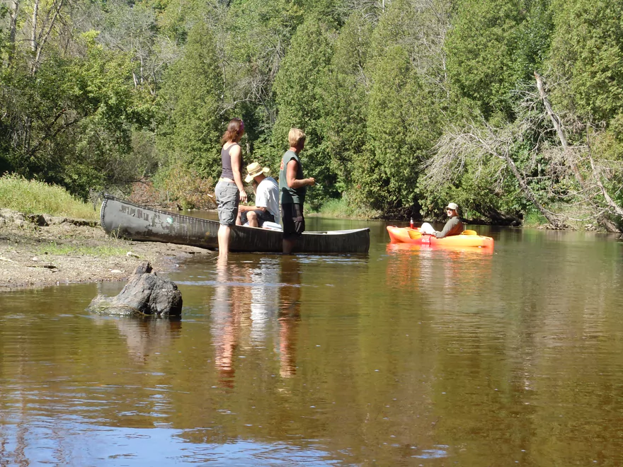
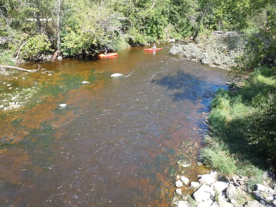
Canoers taking a break on a gravel bar
Think there are limestone bluffs hiding behind those white cedars
More light rapids (note dead ash trees)
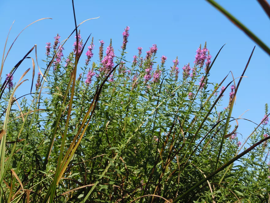
Purple loosestrife
Relatively clean banks
Shoreline no longer protected by the nature center
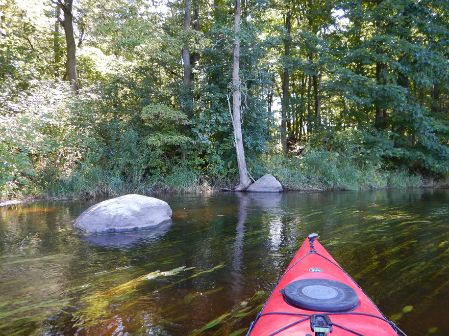
Some medium-sized boulders
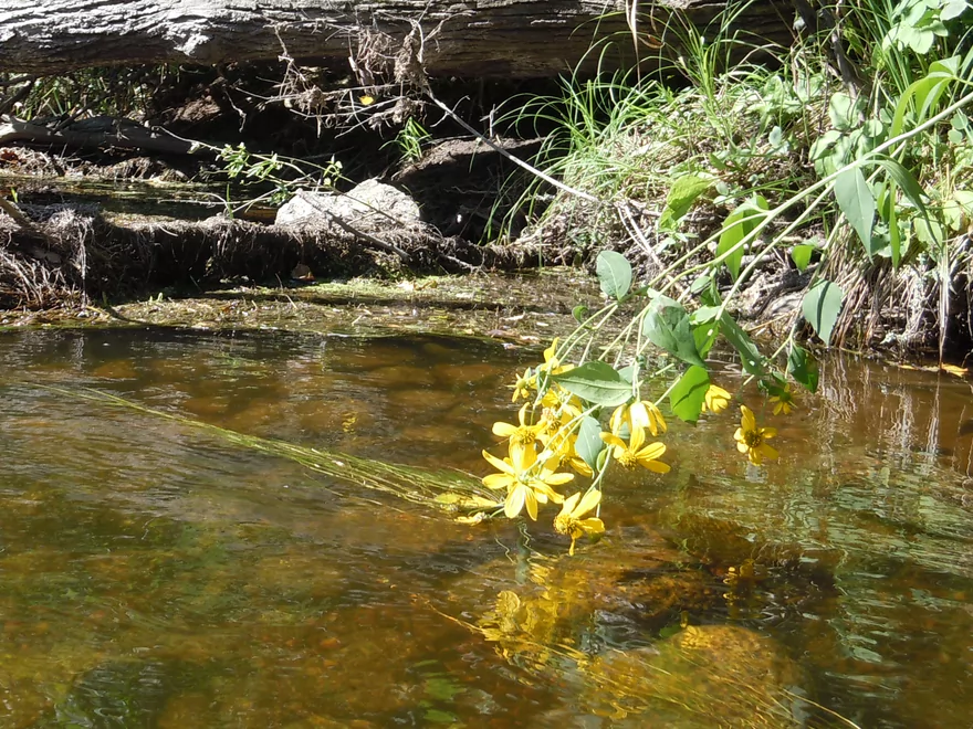
Drooping coneflower
Floating on root beer
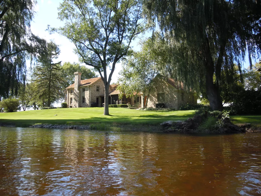
Unique stone house
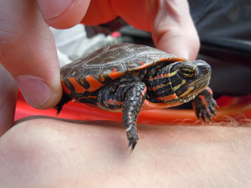
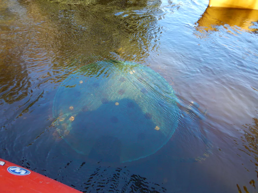
Captured a baby painted turtle
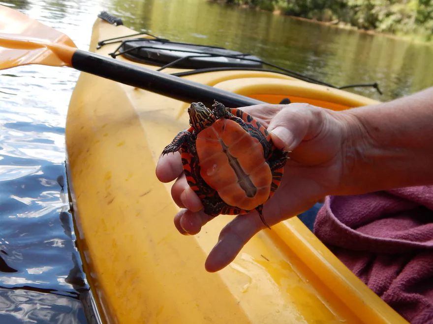
Fantastic color
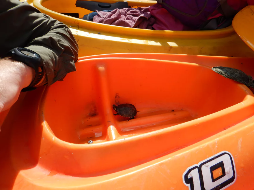
Time to spend time in turtle jail
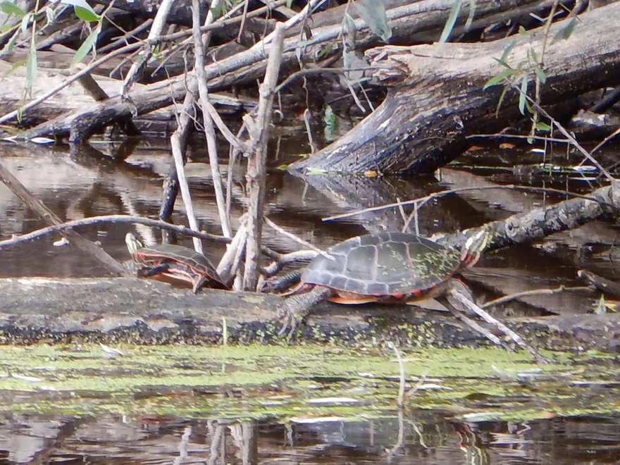
Some upset parents
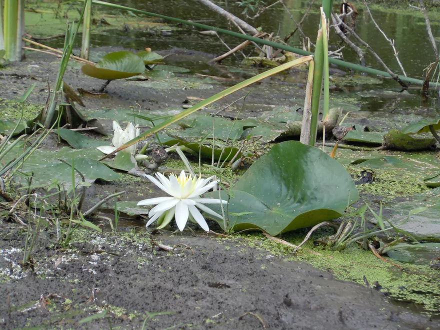
A few more white water lilies
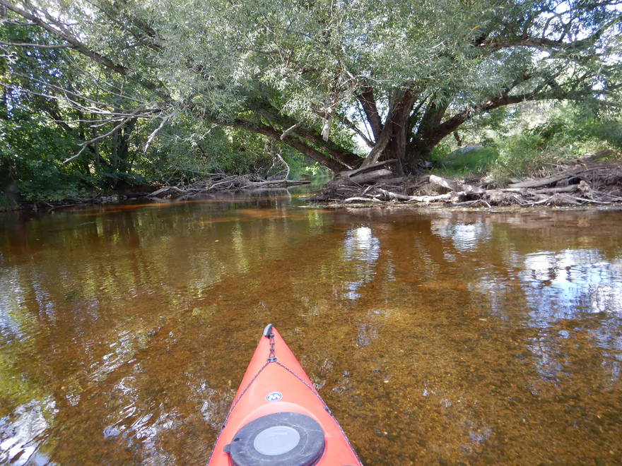
Clear water with gravel bottom
Approaching the Hwy A take-out
Good disembarkation ledge SE side of the bridge
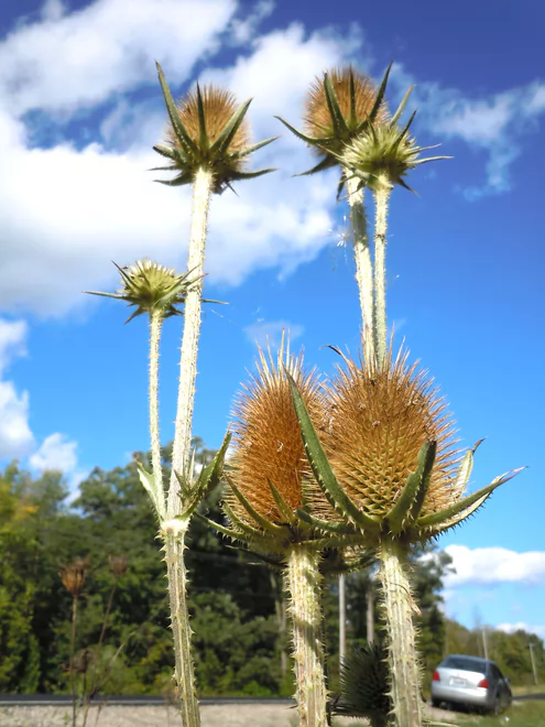
Teasels at the take-out
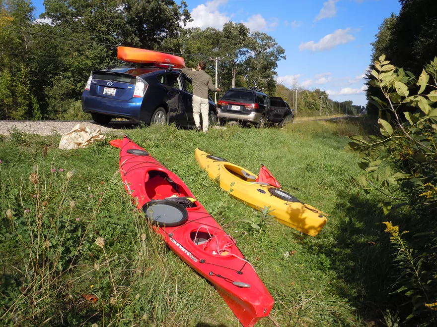
Adequate roadside parking
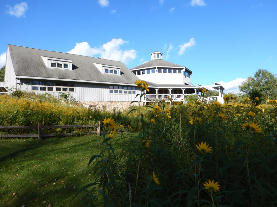
Riveredge Nature Center
Milwaukee River

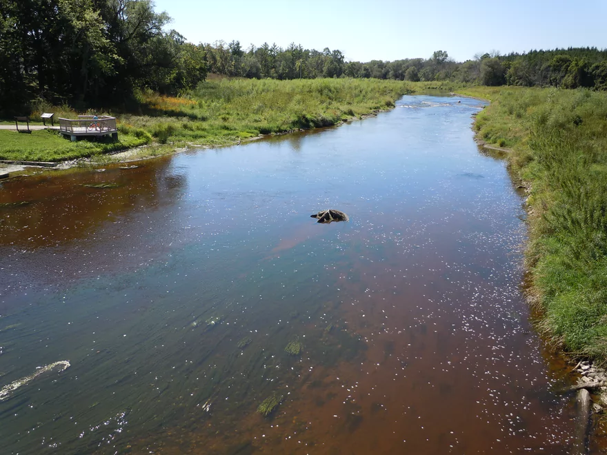
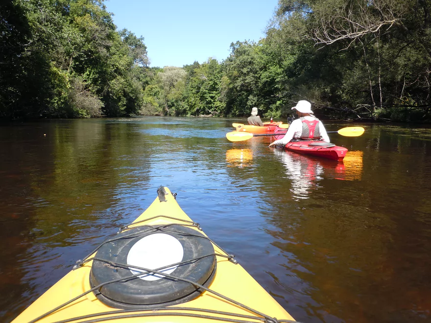
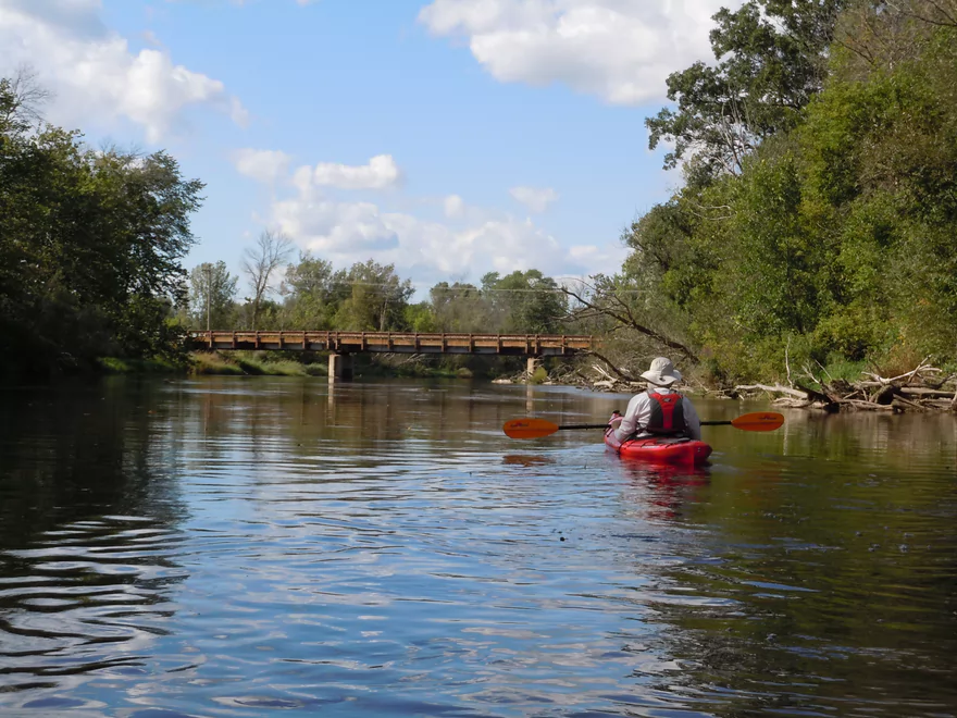
This is probably the best section on the Milwaukee River. A fine paddle, with clear, red water; no jams/hazards; swift, fun current; good bank quality; and a surprising amount of wilderness for a river with this namesake.
Just downstream/east of the Main Street bridge in Newburg is a nice public put-in. Note: while this is part of the Newburg Fireman’s Park, I didn’t see facilities, so plan accordingly. This is the site of the old dam that was recently removed and all that remains are some fun riffles that you can go down. To get the best of the rapids, you might drag your boat under the Main Street bridge and put in upstream of the bridge. There is actually a separate underpass under the bridge that I think was the old mill race for the dam.
There is a livery in West Bend, maybe 7 miles to the west. We used them to rent one kayak. Was a little miffed to find out they charged $55 to rent what was probably a $200 kayak–and that didn’t even include livery service. Grr… Last year, for comparison, we rented kayaks at the Brookfield REI that were high quality 12′ Old Towns for just $20-30 (unfortunately, they no longer rent kayaks). If you don’t mind over-priced service, cheap boats and visiting a scary side of West Bend, then check them out. They are Zodiac – E-hookah and E-cigarette Lounge and can be reached at 262-353-3780.
Otherwise, this would be an easy 3.18 mile bike shuttle over paved roads with little in the way of hills. Car shuttling is, of course, always an option.
A number of reviewers have warned about how shallow this section of the river can be, but honestly, it was good for our trip and, if anything, could have been paddled at lower flow rates. The nearest gauge on the Milwaukee River is close to the town of Cedarburg (not to be mistaken for a nearby gauge on Cedar Creek that is located right in Cedarburg). Noted canoe author Mike Svob says if you go below 350 CFS you’ll scrape a lot, but this was incorrect, as we went at 260 CFS with negligible shallow water issues. I suspect you can go down perhaps as low as 200 CFS. NOT 100 CFS. Maybe 150 CFS with many bumps…don’t know. Call either of the aforementioned liveries or the local Riveredge Nature Center at 262-375-2715 for current conditions. Don’t paddle this river too high, as you’ll lose the water clarity, which is the highlight of the trip.
The river starts fast at 13′ per mile the first two miles (a great thing), but then slows down in the subsequent miles to 6′, 4, 3′ and then finally 4′ per mile for the final leg.
If you have Google Earth, you can download this KML file to see the trip route. To see a graph of the elevation drops, just select “tracks” on the left pane, then go to Edit > Show Elevation Profile. This will show where the steep areas/riffles are and the locations of the drops on the river.
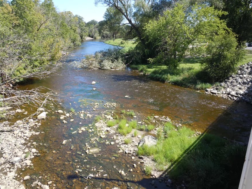
Water quality was surprisingly good, and you frequently could see the bottom through attractive red-tinted water. The substrate was mostly a lot of small rocks with occasional medium-sized boulders that were very striking. Bank quality was refreshingly clean, and it was nice not to see high mud banks (unlike so many rivers in south-central Wisconsin).
Not much, but this is probably seasonal. Saw a great blue heron and clams (which do a great job of cleaning up rivers) and some painted turtles. In fact, we were able to catch a small painted turtle and took a bunch of photos of his “alien abduction.” A number of nice plants and flowers (many of which were past their prime). Best were the water lilies and the flowing Potamogetons in the clear water. For trees, there were a number of maples, which would make this a great fall river trip. Also, there was one grove of white cedar, which was kind of unusual, and unfortunately a lot of dead and dying ash trees from the Emerald Ash Borer.
The trip starts with a bang, with fun little rapids left over from the dam that was recently removed. Was really surprised how fast the river was, but it was a pleasant surprise and never felt dangerous. There are a couple riffles on this river, but at our “higher” (well, medium) depth they were well smothered over and hard to notice. The best current will be at the start of the trip and will gradually slow down over the length of the trip.
The highlight of the trip, and the reason I gave it 4 stars, was the water clarity. It was FANTASTIC and a treat to be able to paddle such clear red water while floating over attractive rock substrate and gorgeous flowing Potamogetons.
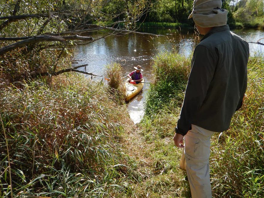
The other highlight is the surprise wilderness feel to the trip, despite this being technically in the Milwaukee metro area. The first half of the trip is easily the best, and some good credit is due to the Riveredge Nature center, which has preserved a good chunk of riverfront land just downstream of Newburg. There are occasional houses on the river, but not many. There are a couple of small islands, including a nice gravel bar (good picnic area), and several small sandbars.
The one weakness of the river is that, while nice….it doesn’t change a lot. Would have been cool to have more variety, but still a great river.
In the water trail review by Mike Svob, he noted (and pictured) that there are limestone bluffs by the water. Based on a meticulous study of his review and of terrain mode in Google, I believe we missed the bluffs completely when we passed a small gravel island. Oh well. If they were there, it appears they were heavily covered up by the trees and plant growth and certainly didn’t look like what Mike took a picture of.
After the trip, we checked out the nearby Riveredge Nature Center, which you might also want to consider visiting after a paddle on the Milwaukee. Described as a “a jewel in the landscape of Ozaukee County,” the sanctuary contains roughly 380 acres of various habitats adjacent to the Milwaukee River and is a resource for both scientific research and recreational opportunities. It has extensive trails and woods, prairie plantings, a boardwalk by a pond, and an outdoor play area (with a fort) for kids (and adults) to play in. One of Riveredge’s more interesting projects is the nursery program for baby Lake Sturgeons. Water is pumped from the Milwaukee River into the tanks so when the young Sturgeons are released into Lake Michigan, they will return to the Milwaukee River (hopefully) as adults to spawn.
None. Maybe one tough duck-under and tricky rapids in REALLY high water, but at most flow rates, this is an easy paddle well suited for beginners. At our flow rate, the rapids were mostly just riffles, with the exception of some class 1’s (easy) at the put-in.
We took out on the southeast side of the Hwy A bridge. Good bridge access with a trail leading to a pull-off area. No facilities (nor privacy), so plan accordingly.
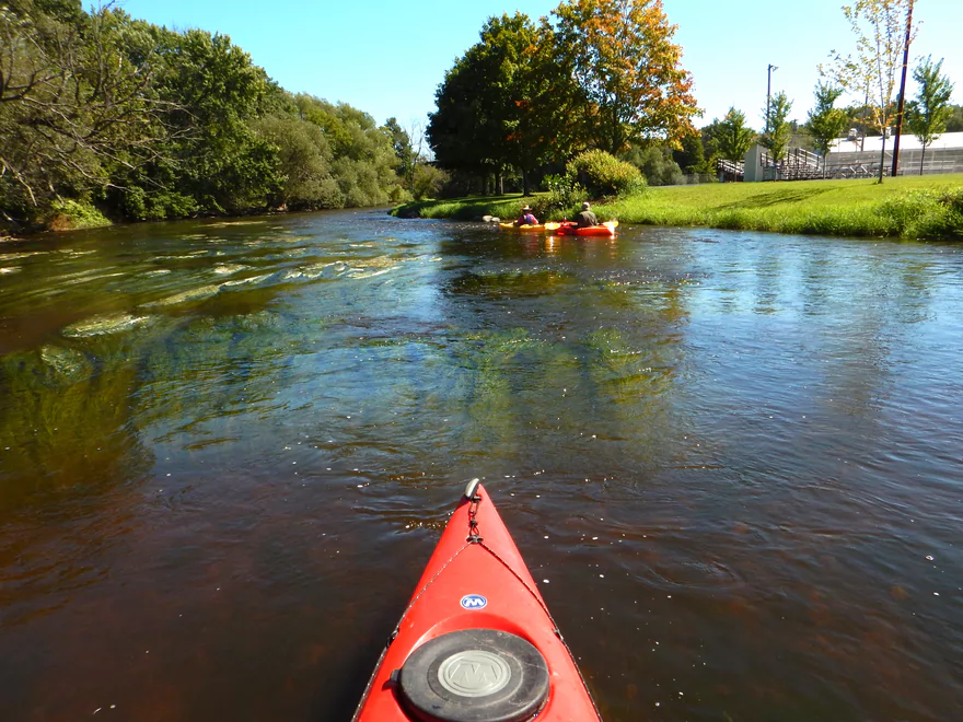
This is an occasionally paddled river trail and for this trip we saw three other canoers.
One of the biggest stories of the Milwaukee River is the effort to remove the dams. They’ve removed four that I know of and this has had terrific results in cleaning up the river, restoring attractive riffles/rapids, giving the river great water clarity, and making it friendly for paddlers. In fact, there are new water trails appearing on the Milwaukee River that haven’t been reviewed because the dam removals have been so recent (much of what noted canoe author Mike Svob has observed is out-of-date).
On this section alone, there used to be dams at Newburg and Waubeka. To the west, they’ve removed two dams around West Bend which have really opened up things there and that is the main water trail serviced by “Zodiac.” Unfortunately, I believe a third dam remains by the Hwy 33 bridge (see my map).
To the east, locals in Grafton have (confusingly so) passed a referendum protecting the bridge street dam until 2019. In fact, they wrote a book, “Saving a Dam: and the Heart of a Community,” in which they chronicle their efforts to proudly fight the dam removal efforts at Grafton (and they won). This is a tragic misunderstanding on their part. Not just for safety (this is a nasty dam), but ecologically speaking, dams are bad news.
They create stagnate, dirty water. They are devastating to many species like clams which need to but can’t get past the dams and get smothered by the sediment. Yet species like clams do a terrific job of cleaning up the water and clean water means high property values. I could go on and on regarding all the reasons dams are bad. Did you know they even slow down the orbit of the earth? Because most water flows toward the equator, dams actually have noticeably slowed down our orbit because they are shifting more weight toward the poles and away from the equator. For paddlers, dams are bad because they cover up the character of the river and remove helping current. Many of these dams smother terrific falls and rapids and it is quite the tragedy that they’ve been buried. These citizens of Grafton should have consulted ecologically competent advisers (like the River Alliance) before making such a major decision to keep this abomination.
- Jsonline.com Article about the Newburg Dam Removal
- American Whitewater writeup and background on the Grafton dam
- Map from the River Alliance of dams in Wisconsin that have been removed
- Review of “Saving a Dam: and the Heart of a Community” (a bad book)
- Amazon review/link of “Saving a Dam: and the Heart of a Community” (don’t buy it…just for reference)
- KML date of trip with elevation/time/distance/route
- Riveredge Nature Center
Detailed Overview
Additional access options are visible on the overview map. Special thanks to Milwaukeeriverkeeper.org which has some detailed information on the river, including this great map.
- Upstream from Happy Road: Not viable for kayaking.
- Happy Road to Meadow Road: (0.7 miles) Small but mostly open stretch partly straightened by farmers. Likely ok.
- Meadow Road to Cty W: (1.5 miles) Very open stretch that flows past wetgrass marshes and farms. Likely an ok prospect with no logjams.
- CTY W to CampbellSport: (4.5 miles)
- Hwy W to Campbellsport Wayside: (4.1 miles) Starts as a narrow wet grass marsh and widens into a slower cattail marsh. Marsh recedes when sandwiched between two drumlins and becomes rockier and faster with some rapids. Overall a varied and scenic paddle. As of 2025 one logjam will have to be portaged.
- Campbellsport Wayside to Columbus PARC: (0.4 miles) A pleasant and scenic leg flowing past the outskirts of Campbellsport and a local town park.
- Campbellsport/Columbus PARC to Cty Y: (2.8 miles) Maybe 2-3 logjams. Otherwise this is a scenic stretch.
- Cty Y to Hwy 45: (1.7 miles) Maybe 3-5 logjams.
- Hwy 45 to Auburn Ashford Drive: (1.3 miles) Maybe 1-3 logjams...some riffles.
- Auburn Ashford Drive to Old Bridge Road: (0.7 miles) Maybe 1-3 logjams.
- Old Bridge Road to West/Main Branch Confluence: (2.0 miles) Maybe two logjams. For those launching above Kewaskum, I think they will start on the West Branch instead.
- Alternate - Hwy 45 to West/Main Branch Confluence: (0.7 miles) Probably one logjam...but more viable than starting from Old Bridge Road.
- West Branch/Main Branch Confluence: (2.8 miles) A mediocre prospect. Maybe one logjam..I don't know much more.
- Kewaskum Dam/Park to Cty H: (2.9 miles) Solid prospect.
- Cty H to First West Bend Dam: (6.3 miles) A solid prospect with some flowage paddling at the end. The take-out entails dragging your boat across a private parking lot.
- First West Bend Dam (Barton Ave) to the Second West Bend Dam: (1.3 miles) Mostly an urban flowage paddle. The first dam is a difficult portage or put-in.
- 2nd West Bend Dam to Quaas Creek Park: (3.8 miles)
- 2nd West Bend Dam (Washington Street) to South River Road: (2.1 miles) Terrific section with a restored prairie, fast current, light rapids, and good urban scenery.
- South River Road to Quaas Creek Park: (1.7 miles) A paddle through urban woods...pleasant but not top-notch.South River Road to Cty M: (6.3 miles) A pleasant stretch with little development and clear water.
- Quaas Creek Park to Goeden County Park: (6.3 miles) A pleasant stretch with little development and clear water.
- Cty M to Main Street Bridge (Newburg): (3.4 miles) Good prospect with small boulder gardens in shallow water.
- Main Street Bridge (Newburg) to Cty A Bridge: (6.3 miles) A popular paddle with great water clarity.
- CTY A to Waubedonia Park (Waubeka): (5.7 miles) A decent leg with good current, some rocky stretches, and nice color in the fall. North Branch joins up and significantly enlarges the river.
- Waubedonia Park to Ehlers Park/Mink Ranch Road: (5.3 miles) A good stretch with a number of light rapids.
- Ehlers Park to Peninsula Park: (2.5 miles) A suburban stretch with maybe one set of rapids.
- Peninsula Park to Grafton Canoe Launch (south Saukville on Cty O): (1.9 miles) Kind of a suburban paddle.
- Grafton Canoe Launch to Veterans Memorial Park (Grafton): (4.1 miles) Some suburban and flowage paddling, although I think there are minor rapids in the upper stretch.
- Grafton Dam (SW of Bridge Street) to Lime Kiln Park: (1.3 miles) A terrific section with class 2-3 whitewater and scenic dells.
- Lime Kiln Park to Hwy T: (1.6 miles) A good section with the scenic 'Grafton Dells' and some Class 1 whitewater. I'm not sure Cty T is a good take-out.
- Cty T to Pioneer Road: (1.9 miles) A solid prospect.
- Pioneer Road to Thiensville Park: (6.9 miles) A solid d prospect but with some flowage paddling at the end.
- Thiensville Park to Badger Meter River Park: (4.8 miles) This is a less popular stretch of the Milwaukee. While not bad, it had somewhat repetitive scenery and lacked unique features.
- Badger Meter River Park to Kletzsch Park: (5.3 miles) This is a solid prospect.
- Kletzsch Park to Estabrook Park: (4.1 miles) Some flowage paddling and a nasty low-head dam to portage. A second dam has been, I believe, recently removed so this section might be very different now.
- Estabrook Park to Riverside Park: (3.1 miles) A number of decent rapids in this wooded but urban paddle.
- Riverside Park to McKinley Marina: (6.3 miles) A great trip on the last section of the Milwaukee.
- Riverside Park to Bruce Street Boat Ramp: (3.9 miles) A scenic paddle through downtown Milwaukee featuring some skyscrapers and great architecture.
- Bruce Street Boat Ramp to McKinley Marina: (2.5 miles) A bonus add-on section along Lake Michigan that features scenic vistas of the downtown.
Trip Map
Overview Map
Video
Photos Size:
Hi – thank you for this post. Super helpful. Question – when did you find this trip when the depth was ideal? What time of year / month? Might have missed it, but couldn’t find it.
My personal preference would be for 200-400 CFS per this gauge http://waterdata.usgs.gov/usa/nwis/uv?site_no=04086600. This will allow for best clarity. The river is likely fine to paddle at 4-600 CFS as well, but won’t be as attractive. 600+ CFS might be not as fun, but likely doable for the determined. The best times of the year will be mid-summer to late fall.
I am trying to make a list of all the cities and towns the Milwaukee River goes through. Can you refer me to a map. From Fond du Lac to Milwaukee. Please and thank you.
I think your best bet would be to simply use Google maps. You can use the “Overview Map” embedded above. Up to you if you want to include the various branches.
I am new to kayaking. Been on the M. river a couple times farther down stream around Fredonia. I want to do the Milwaukee River-2 run and am noticing by your map that the black line on the river goes left at the first 2 splits in the river and then right the last 3 splits in the river. Is this a recommended route or am I over thinking it? Thanks for any input and thanks for a great website! Dan
Thanks Dan for the question and the comments. It’s been a while since I did this route, but if I remember correctly there is usually an obvious route around the islands, and the minor channel isn’t navigable. There could be an exception now though because of the very high water.
Just got off the river today. 9-23-18 …Put in at Newburg bridge & out at Hwy A bridge. Great! Will do this again & again. Took 2 1/2 hrs. Only problem was the one time we went right around and island instead of left. We had to pull kayaks over a log. Everyone stayed dry! Thanks again for a great website! Dan
Appreciate the comment! Today was a great day for paddling.
I’m confused are you paddling upstream on this ? It looks like Newburg is south of the Hwy A.
No I paddled downstream…Newburg is both south of A and upstream of A. Few rivers in Wisconsin flow north, but this leg of the Milwaukee does.