
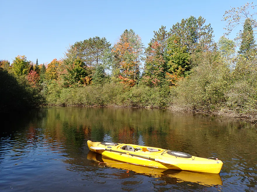
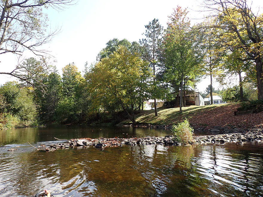
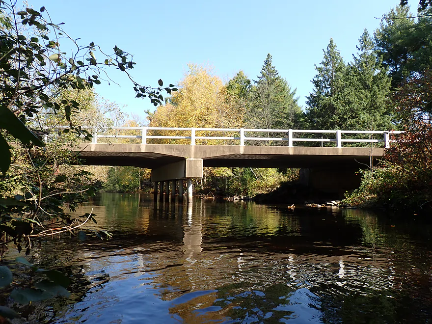
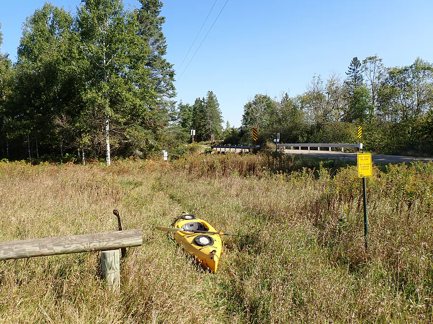
Starting the trip at the Cty CCC bridge
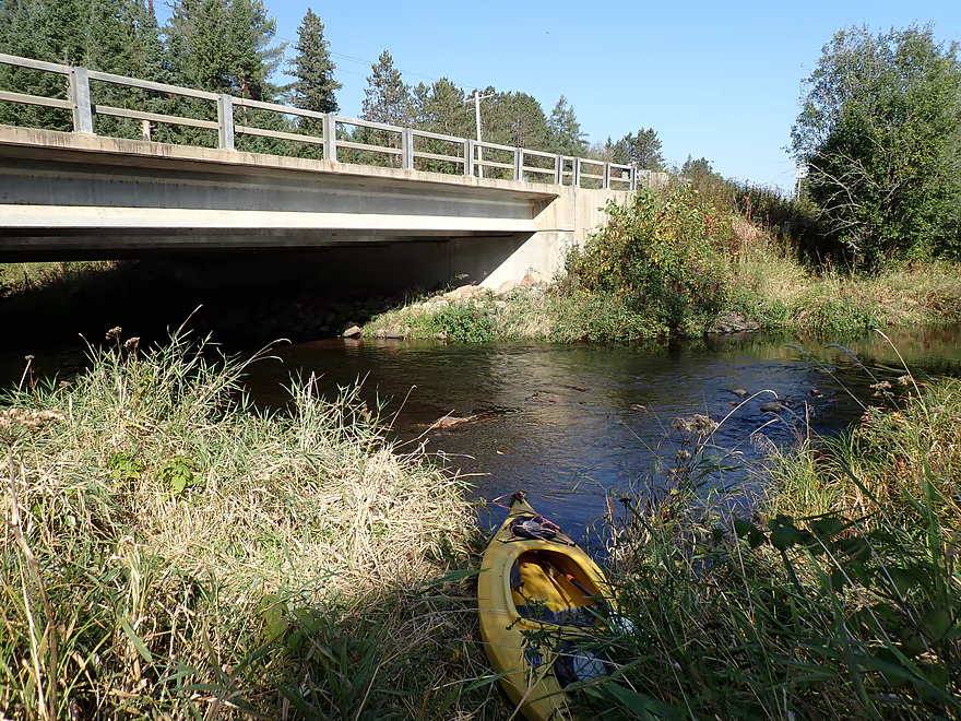
Good access
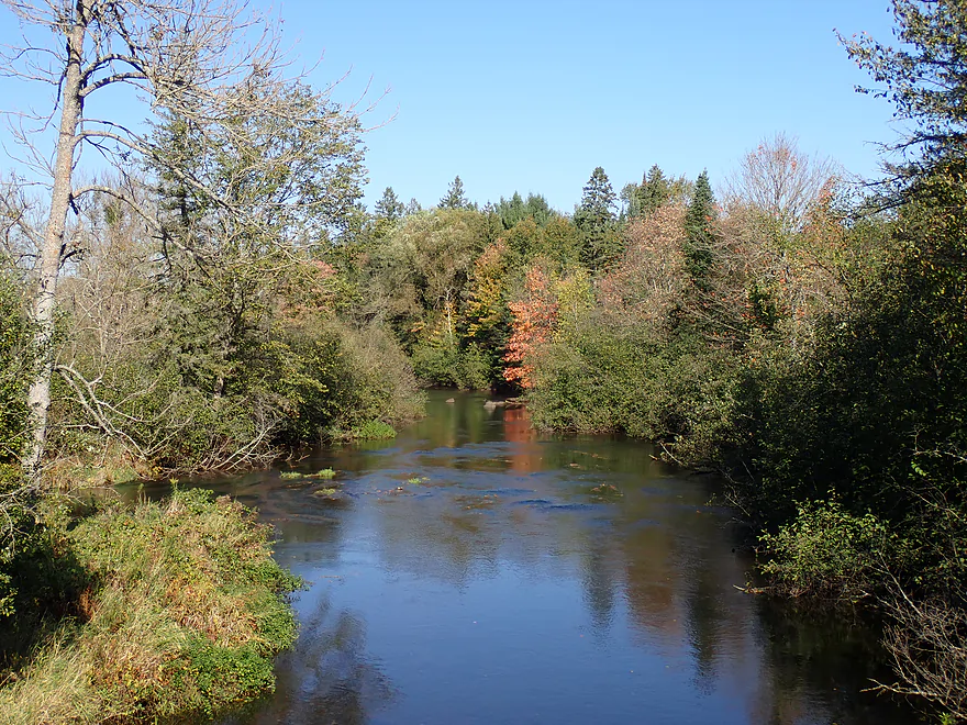
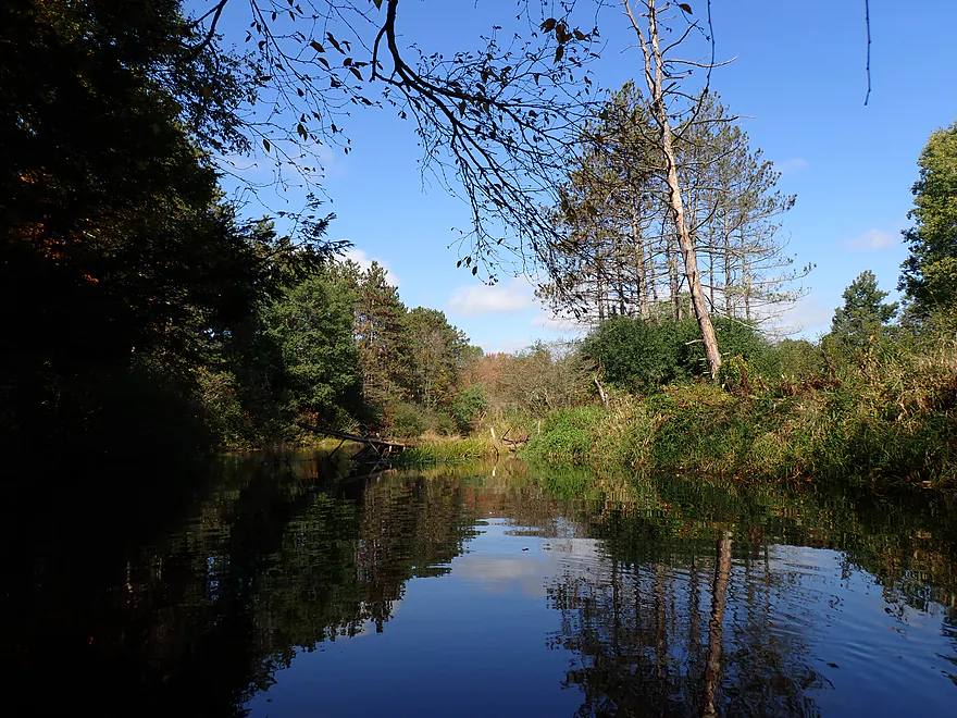
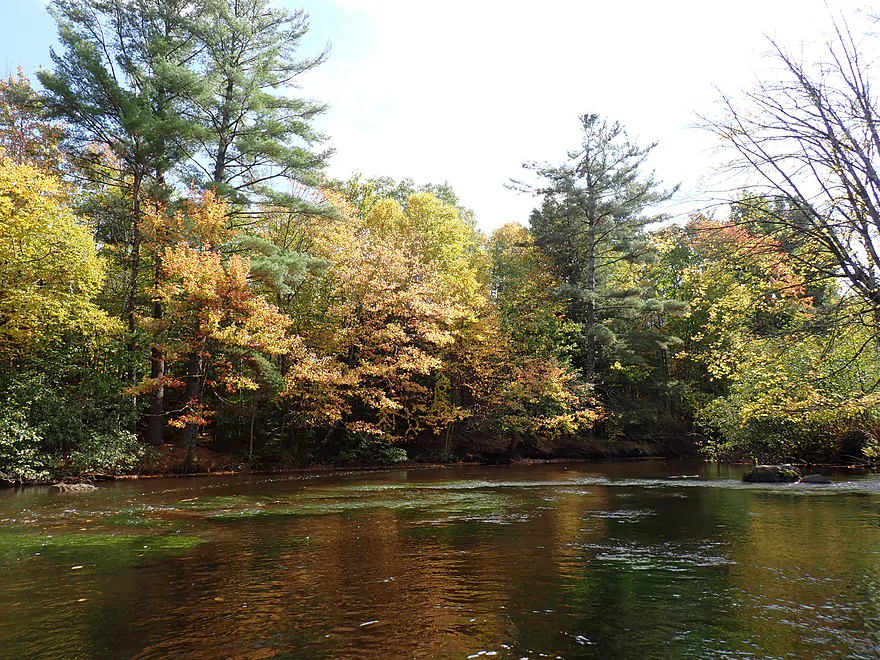
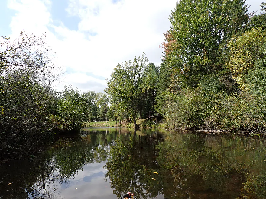
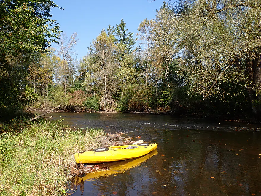
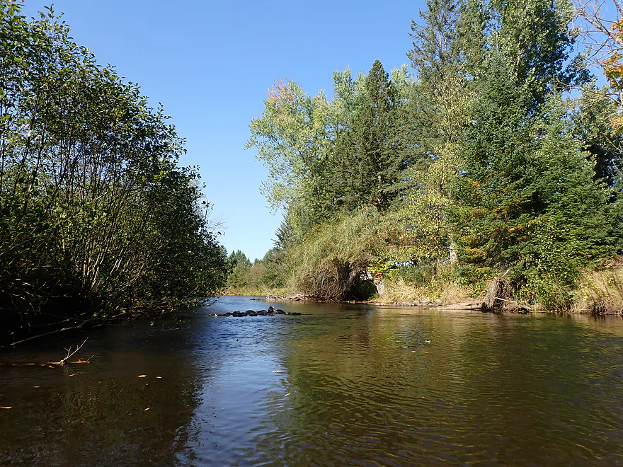
Nice pine wall to start the trip
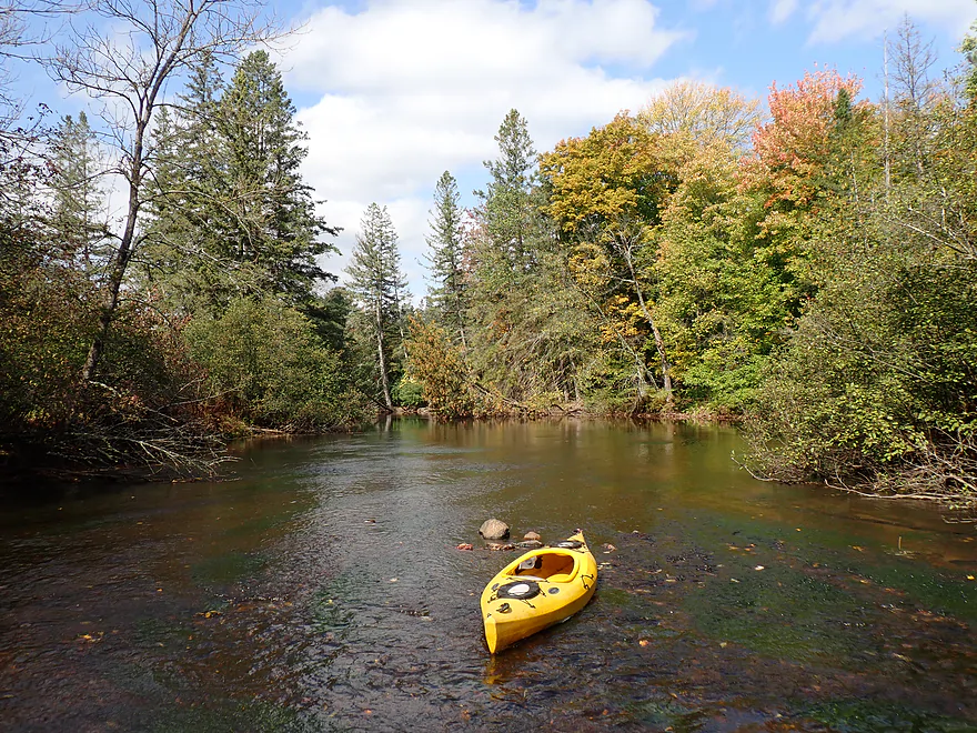
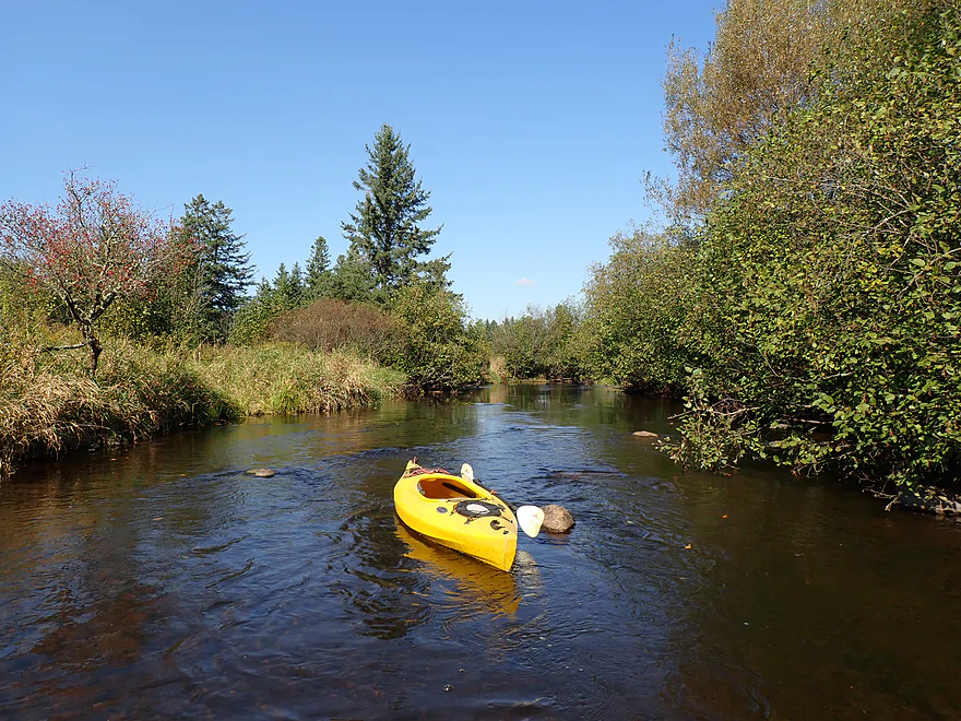
Surprisingly nice clarity
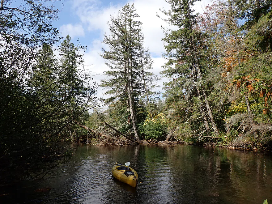
Occasional balsam fir trees
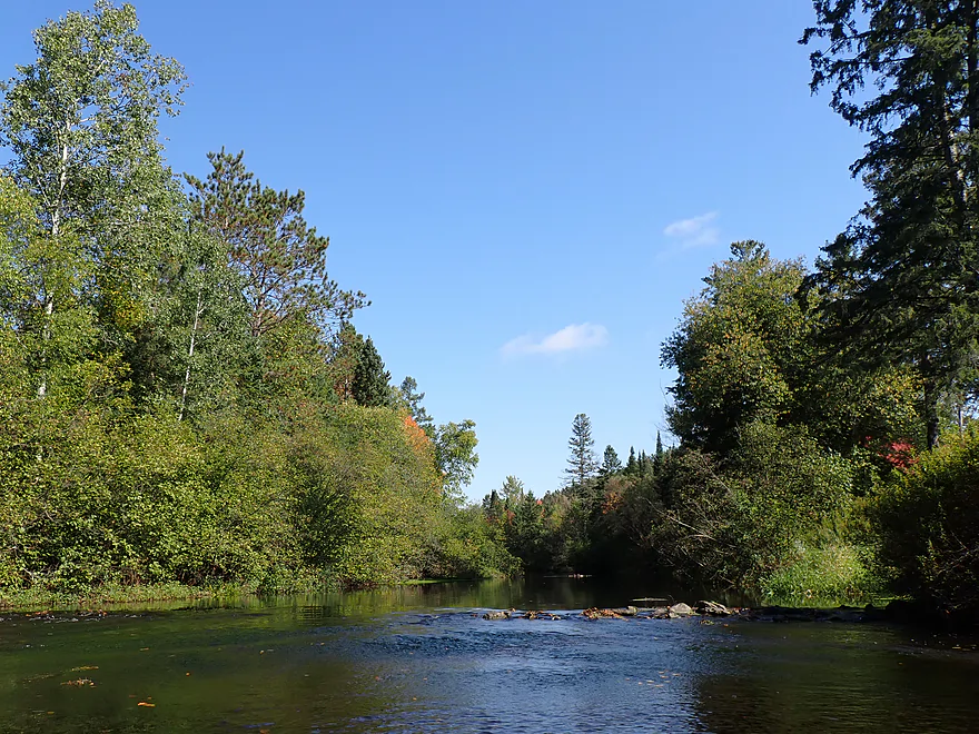
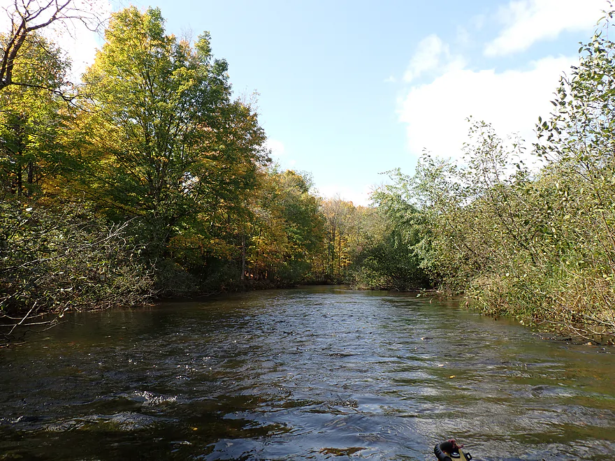
A few minor rapids…nothing major
Reverse view
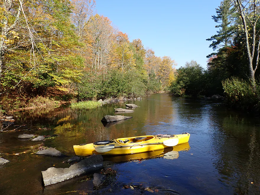
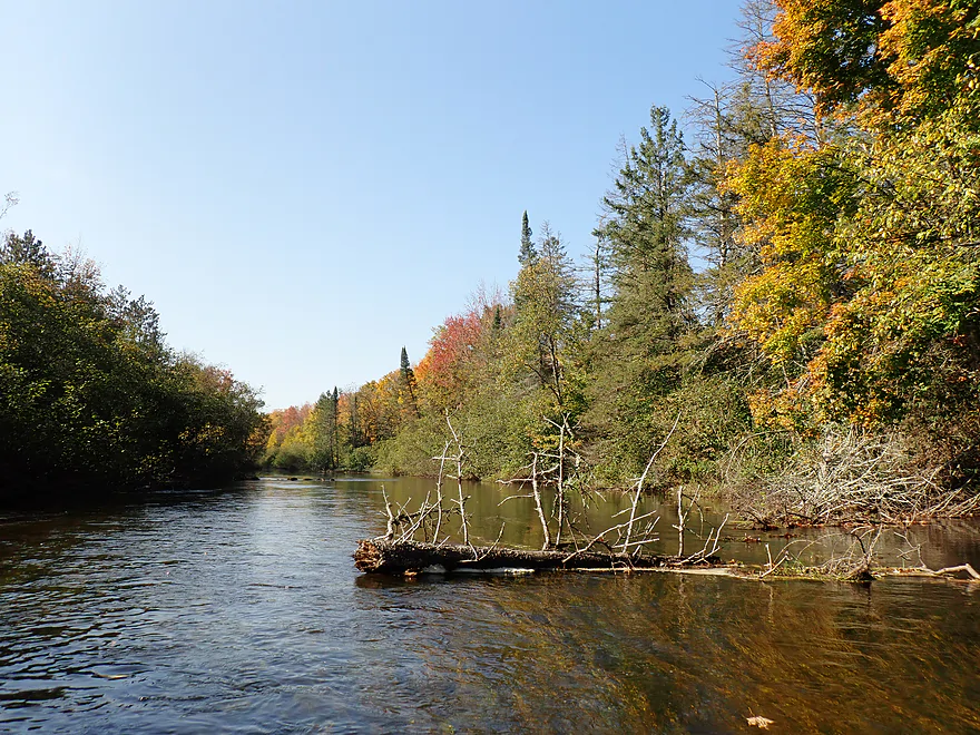
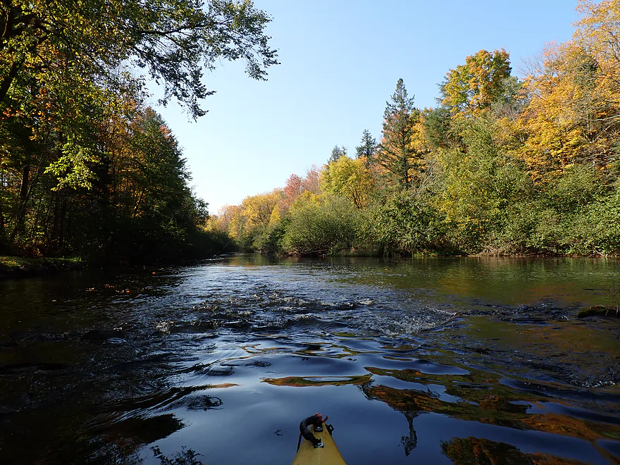
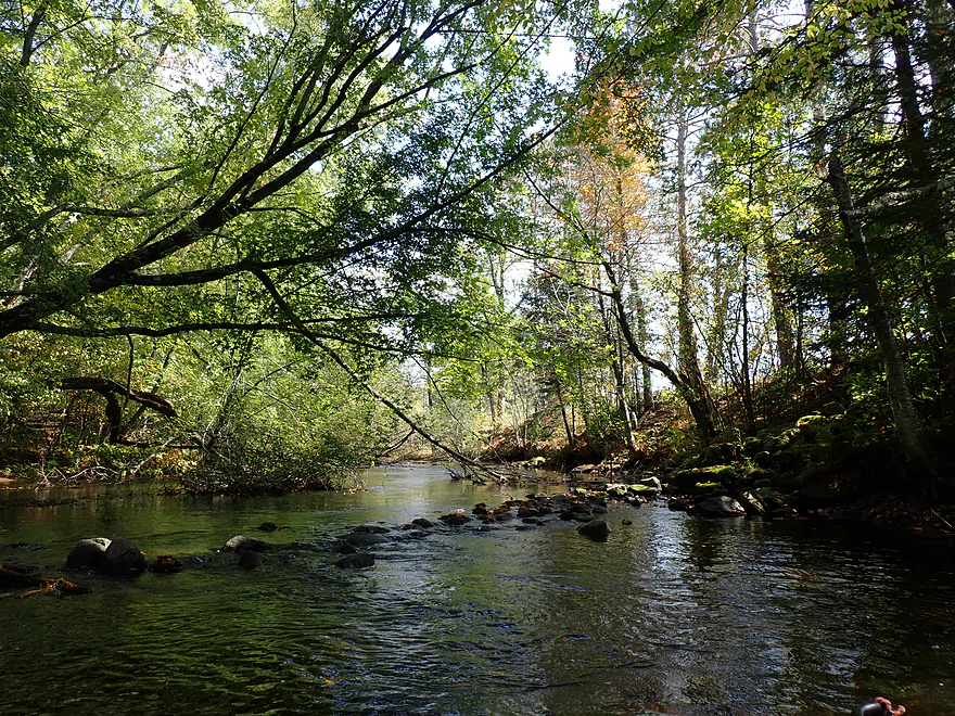
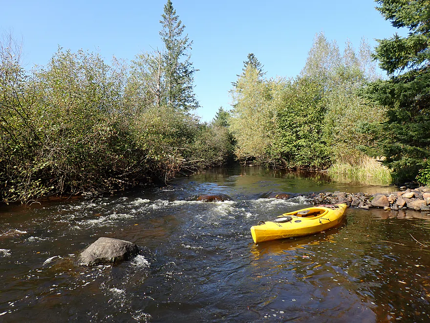
Nice boulder garden
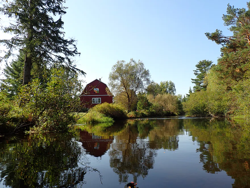
This barn was actually an arts and crafts store
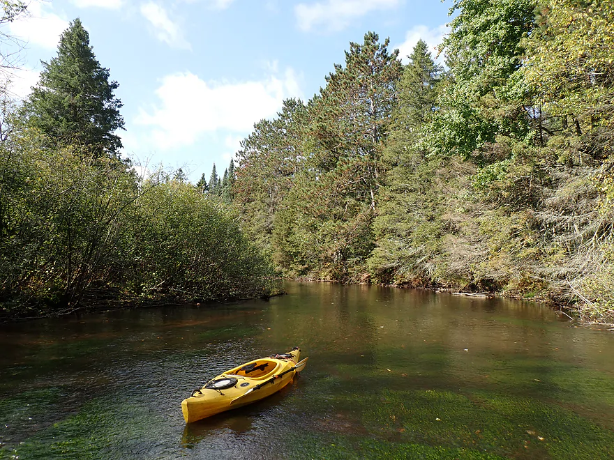
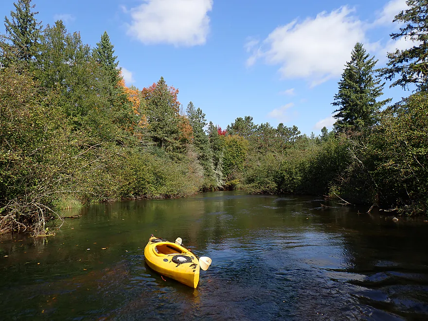
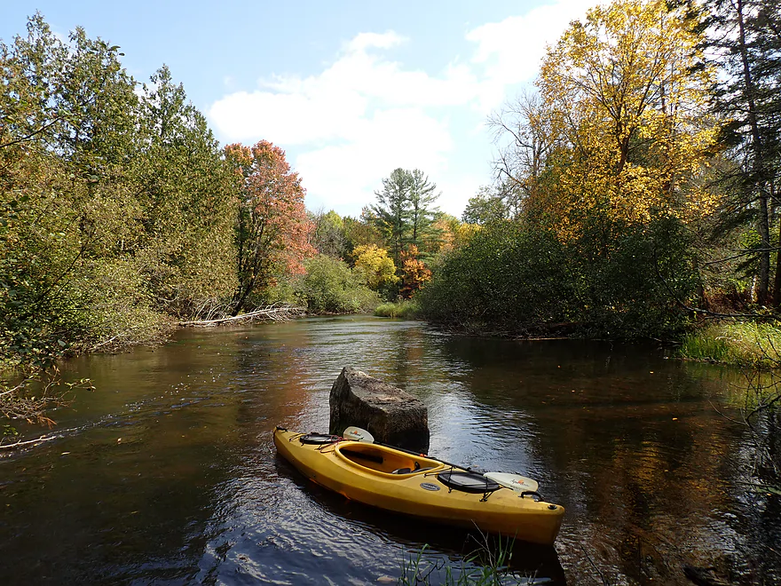
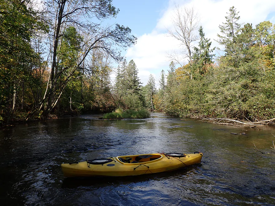
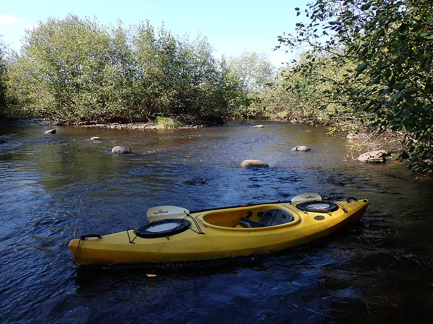
Getting out for pictures
The first mile was the best part of the trip
Entering a brief woods
Artificial rock dam
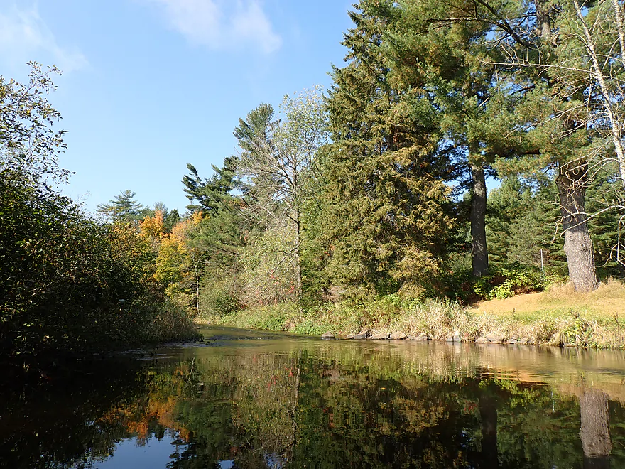
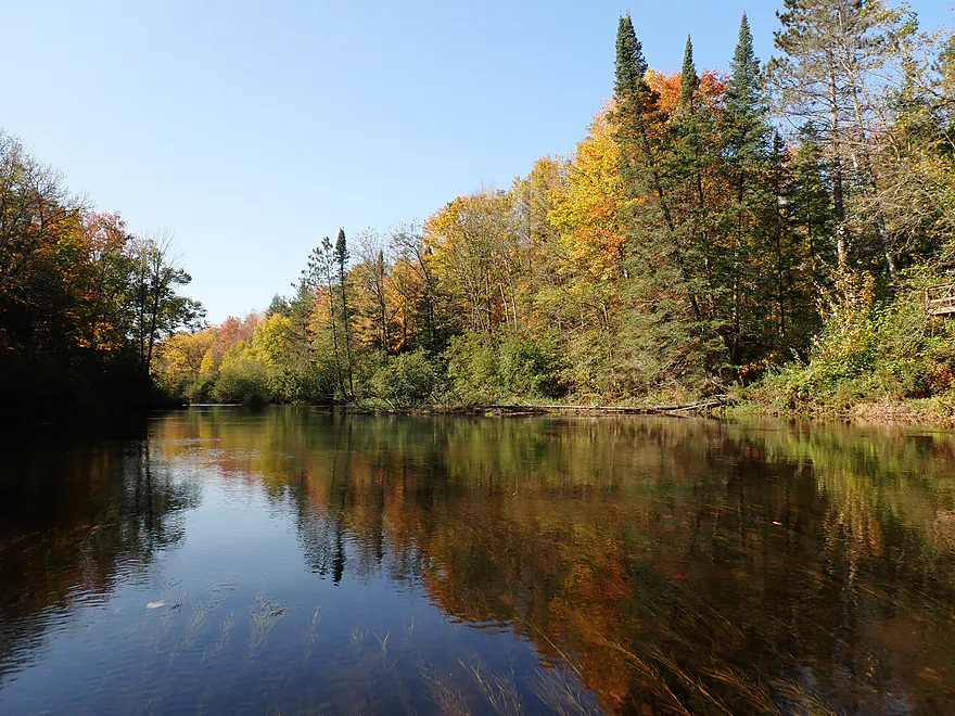
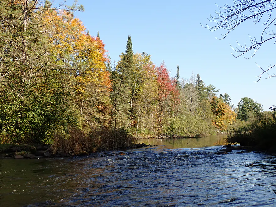
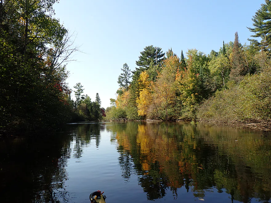
Another terrific pine wall
Reminded me of Bearskin Creek
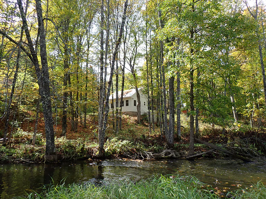
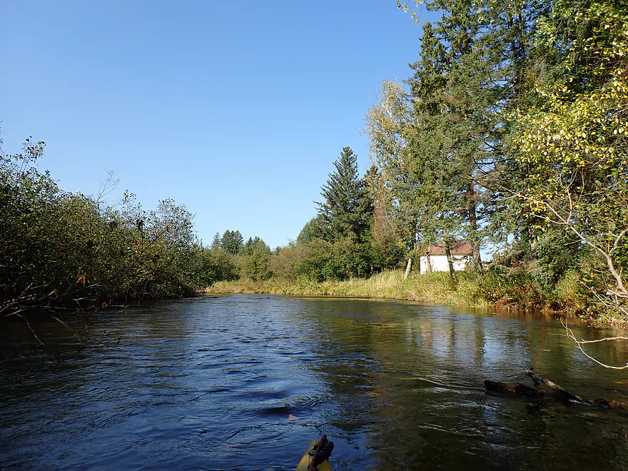
Nice little river cabin
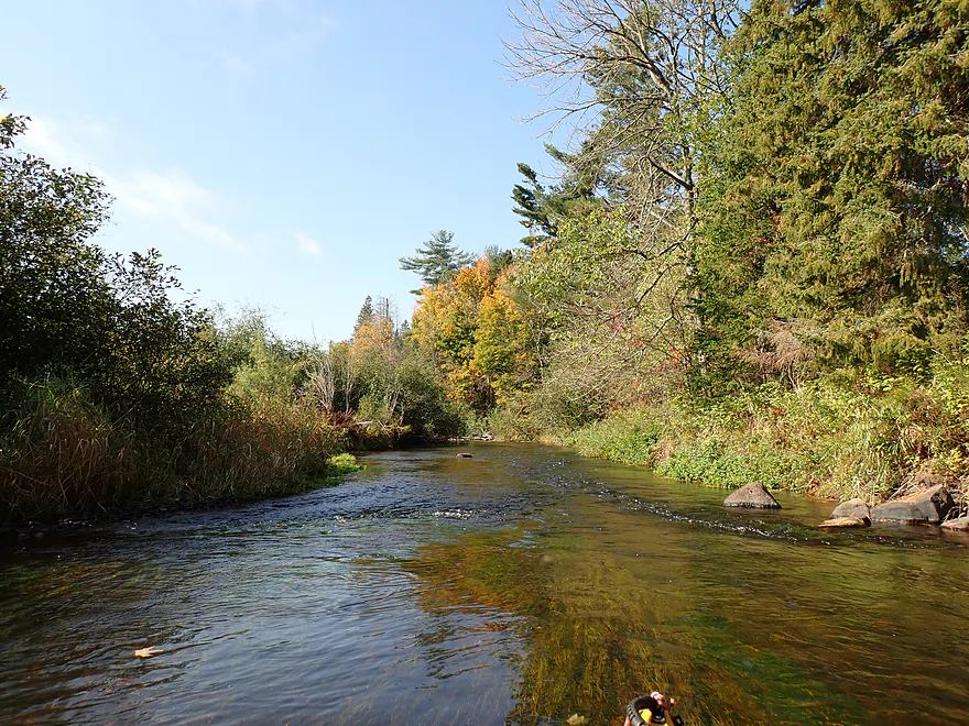
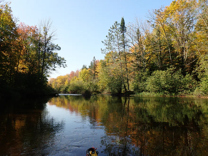
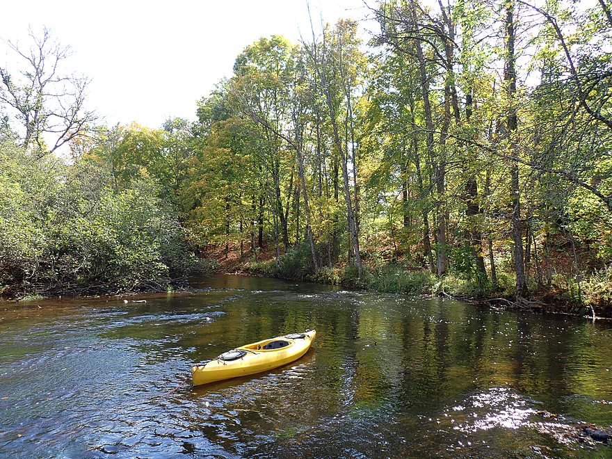
Scenic evergreens leaning over the river
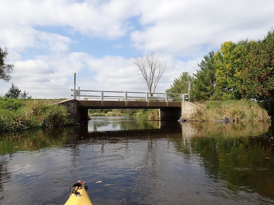
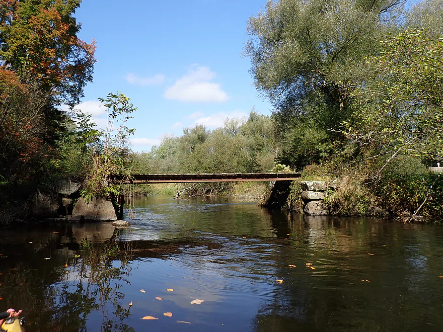
Bachelors Lane–in retrospect, I should have taken out here
River really changes after that….not as scenic
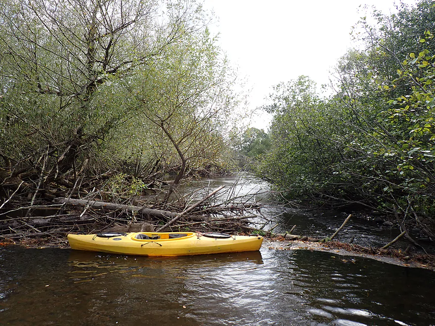
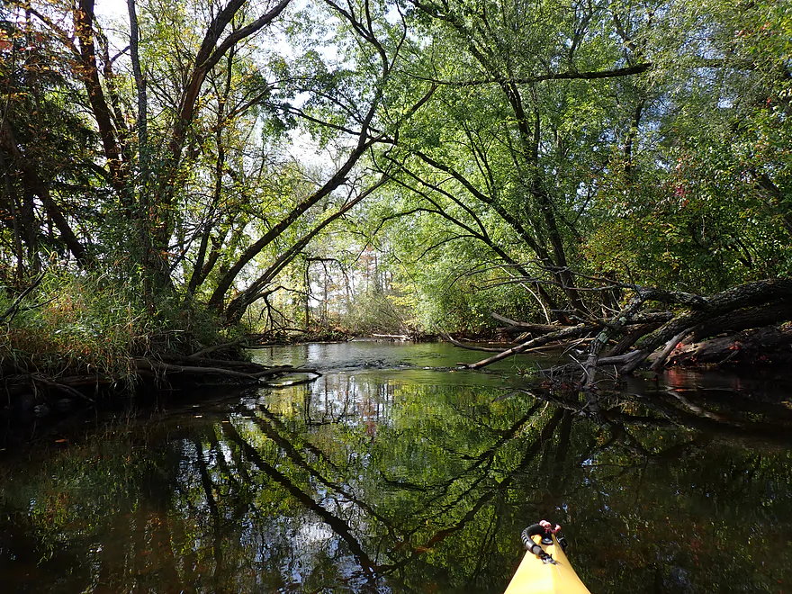
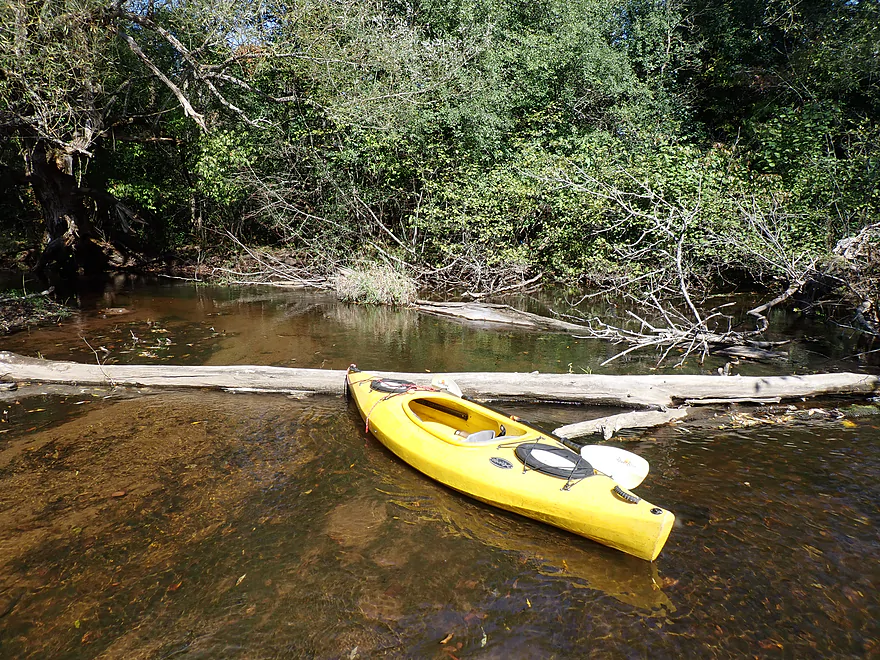
Also logjams start to become an issue (this was an easy wader)
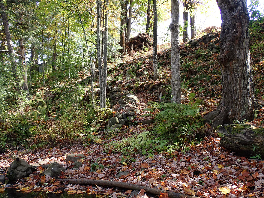
Artistic stone steps (almost hidden by early fallen leaves)
Not so natural wing dam
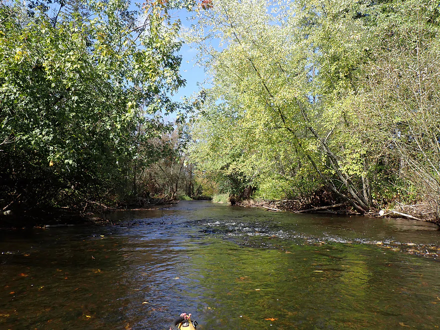
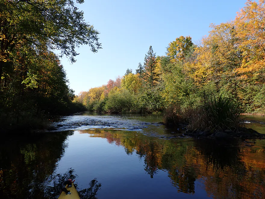
Current stays brisk
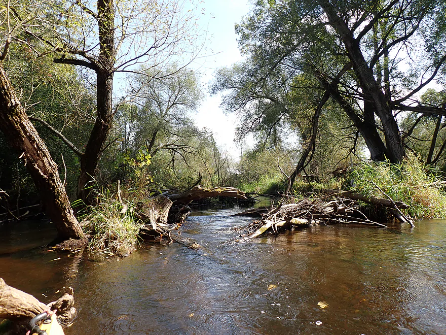
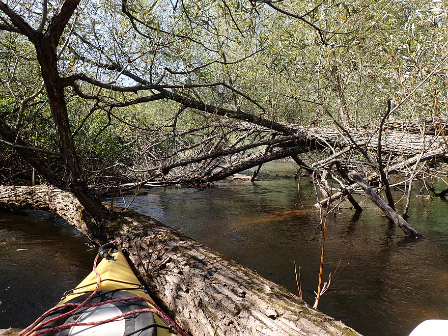
Start of a major cluster of logjams
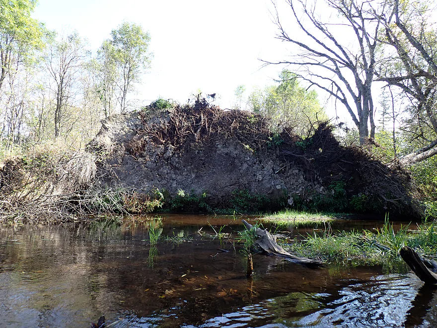
Massive root system
Some of the logjams were easy to wade over
Some were not
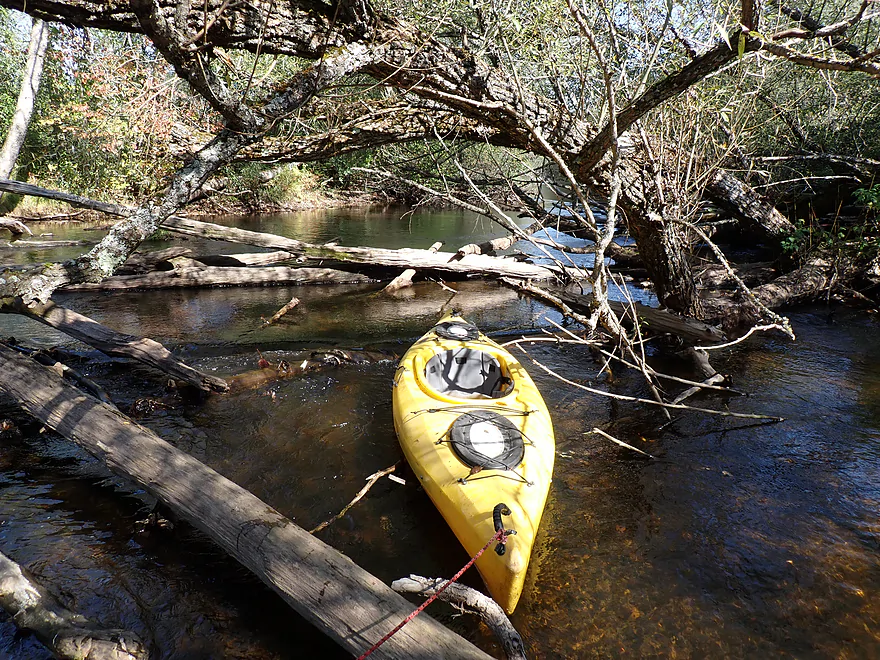
This one was a toughy
Town Hall Road would be an access option
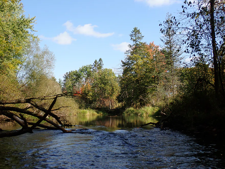
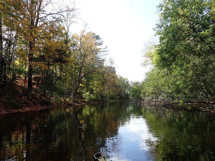
River changes (again) after the bridge
Pleasant stretch
Starting to see more rocks in the river
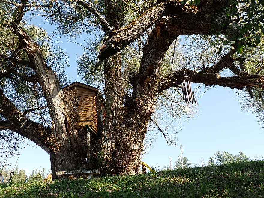
Nice tree house cabin (and one humongous willow)
Biggest rapids of the trip (pretty easy)
Another small boulder garden
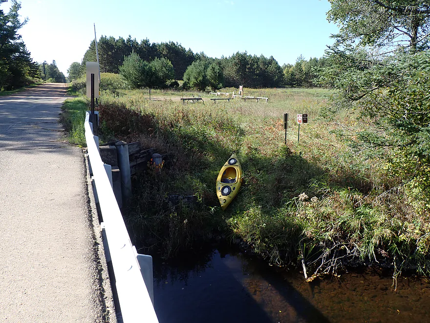
Taking out at Prairie Forks Drive (a public parking area is in the back)
It was fitting to end the trip at a literal prairie
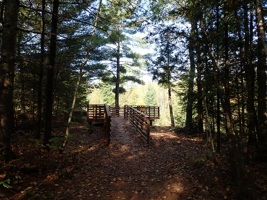
The Prairie Dells Scenic Area is a nice local diversion
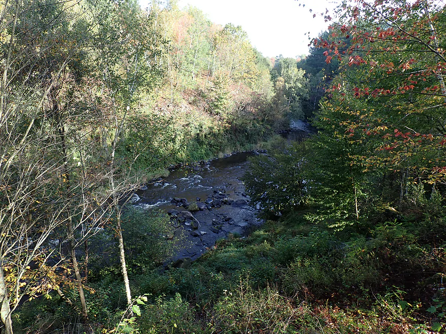
A leaf-obstructed view of a Prairie River gorge and rapids
Prairie River – Dudley

The Prairie is a small tributary to the Wisconsin River located just northeast of Merrill in north central Wisconsin. It sees some paddling traffic…mostly the lower stretch though the city of Merrill or the famous middle leg (which features a gorge, dells, and fun rapids). But few paddle the upper reaches. I did find a few obscure reviews of the Upper Prairie (courtesy of Svob, Kark, and Piraino) and they suggested a pleasant trip, so I decided to go for it.
I started at a small pull-off by Cty Rd CCC, which I believe trout fishermen use, and it proved to be a good kayak launch option. The first two miles of the trip were my favorite. Despite being somewhat narrow and a bit shallow in a few spots, the river was overall well padded and very navigable for a kayak. This was in contrast to my last two trips (the Pine and Lily) which both proved to be very shallow.
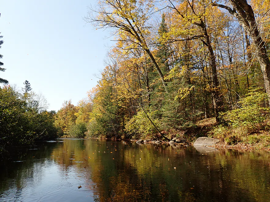
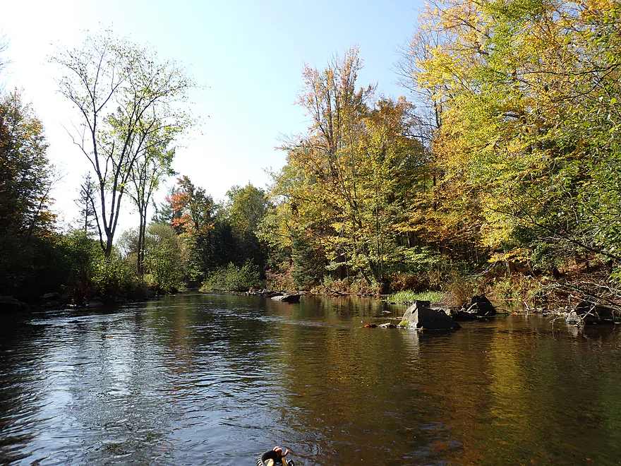
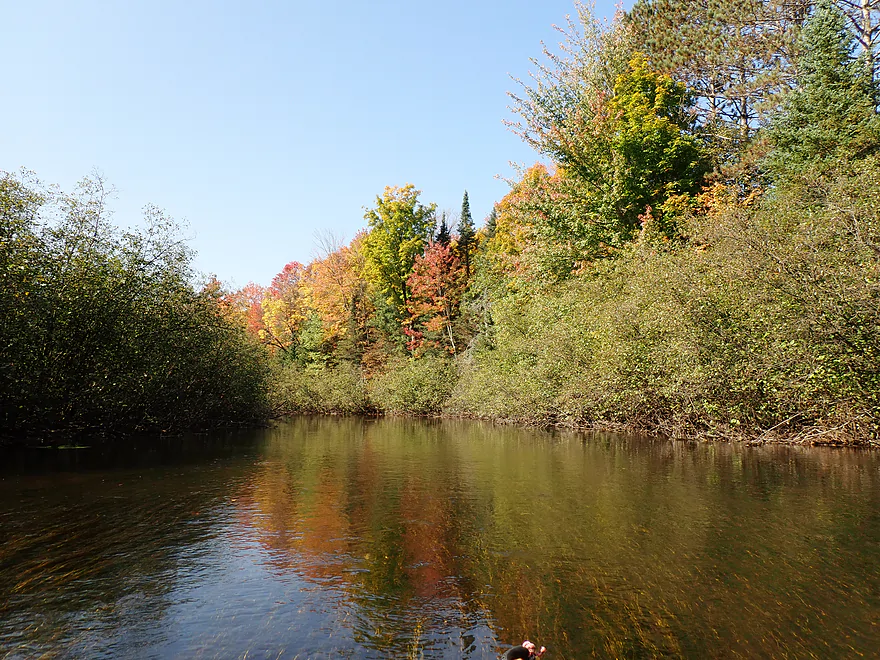
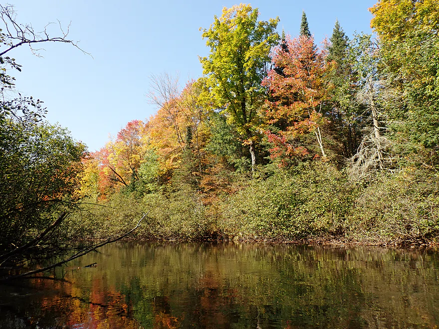
The Prairie’s water clarity was very good, with baseball-sized rocks littering the streambed. The main highlight were the woods that flanked the channel…a mix of conifer trees and hardwoods turning color. It was a very photogenic stretch.
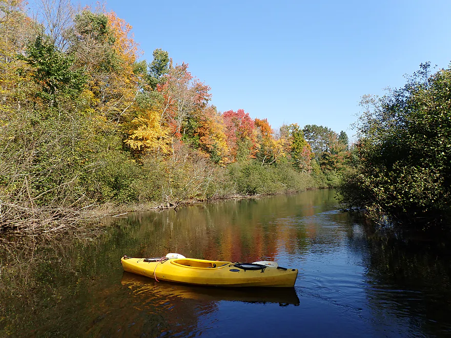
Bachelors Lane represented the 3-mile mark in the trip and would have been a good bridge access option. In fact, in hindsight I probably should have ended the trip here. For the next two miles, the river really changed in character. It started wider and more open, and then entered a messy wooded stretch with a mix of alders, scrub trees, and weed trees. In spots there were still some nice pines and turning color, but overall the woods were much less attractive.
Worse, many of the trees ended up in the river (I suspect a tornado had touched down in the area). Five downed trees required either a portage or significant scooching to get around or through. At least the river was typically not too deep or muddy, so often (but not always) you could just wade over the downed tree.
Town Hall Road represented another decent bridge access. The river again seemed to “flip a switch” after a bridge, and underwent another transformation…this time to become nice again. Here there were still alders, but the woods were better quality with almost no deadfall. I enjoyed this mini-leg and its few tiny boulder gardens. The trip ended at Prairie Forks Road, which, fittingly enough, was located next to an actual prairie. This was a nice public access with a parking lot that I shared with two trout fishermen.
In summary, parts of this trip were enjoyable and parts were not. If you want to paddle the Upper Prairie, I suggest launching from Cty CCC and taking out at Bachelors Lane, which, despite being just a short 3-mile trip, would avoid the logjams on the subsequent leg. Hopefully locals clear these out in the future. For contrast, the best overall river leg though is still the stretch through the Prairie Dells which features terrific scenery and rapids (but you should be comfortable with Class 2-3 whitewater). If you don’t plan on doing the dells, then I can’t consider the Prairie an elite kayaking river–it’s more suitable for local paddlers. If you have to drive a long way to do a kayak trip north of Wausau, you’re better off paddling one of the neighboring rivers instead, which are better prospects.
The last two dams on the Prairie were removed in 1991 and 1999, creating a free-flowing river for the first time in more than 100 years (pictures before the removal). The dam removal increased native brook trout reproduction 30-fold. Today the Prairie is known as one of the state’s first designated trout streams.
Wildlife included one great blue heron, one carp, a bunch of small minnows, lots of ducks, and two trout fishermen (but no trout).
Prairie Dells Scenic Area: This is a nice public access and overlook located along a gorge of the Prairie River. From the parking area there is a trail and closed road where you can hike and check out four different overlooks. They’re nice…but the view of the gorge/rapids/boulder gardens is mostly obstructed by tree cover. If you’re adventurous, you can “hoof” it down the steep hillside to the river for a better view. The best way to see the gorge is by kayak, but there are Class 2-3 rapids to deal with.
County Road CCC: There is a public fishing wayside north of CCC and east of the Hwy 17 bridge. This is a good access option.
Alternate Put-ins: None really. Upstream from CCC there are tricky rapids and logjams. While there are more access points downstream from CCC, it doesn’t make sense to use them, as that would preclude one of the better stretches on the Upper Prairie.
Prairie Forks Drive: This is another good bridge access that is sometimes used by trout fishermen. There is a public parking lot northwest of the bridge.
Alternate Take-outs:
- Town Hall Road (0.9 miles upstream from Prairie Forks): You could get out by the utility station and this is likely an ok bridge access. The leg after Town Hall Road is simple but pleasant.
- Bachelors Lane (3.2 miles upstream from Prairie Forks): This is the recommended take-out (disembark north of the bridge away from the horse farm). The reason to end your trip here is that downstream from Bachelors Lane there are multiple logjams.
- Axen Road (0.8 miles): I think this bonus stretch would be meh…figure more scrubby woods and perhaps a few logjams.
- Cty J (2.5 miles downstream from Prairie Forks): The river doubles after the North Branch confluence. I think this would be a mediocre stretch.
Bike Shuttle – Prairie Forks Drive to Cty Rd CCC: 3.6 miles with 49′ of ascent. This was an easy bike shuttle. Note, shuttle east of the river as those roads are paved and the west ones aren’t.
Current: The river moves at a brisk pace with a number of light riffles.
Rapids: Besides the numerous light riffles there are a few more significant rapids, but these are still easy Class 1 rapids…nothing to worry about.
Fences: None…these were noted by previous paddling authors, but I didn’t see any, so maybe they have been removed.
Logjams: Upstream from Bachelors Lane there are two minor logjams that are easy to either scooch over or simply wade past (the river is shallow and rocky here). Between Bachelors Lane and Town Hall Road there are roughly five noteworthy jams–two of which were difficult to get past. Because of this deadfall, I recommend getting out at Bachelors Lane.
Gauge: Prairie River @ Merrill
Trip Depth: 89 CFS or 2.12′
Navigability Estimates: These are just rough guesses.
- < 60 CFS: The Prairie rarely gets this low.
- 61-100 CFS: Common fall depth and good target range with nice clarity. Just a few shallow spots…the river for the most part will be well padded.
- 101-130 CFS: Above normal depth and lacking in clarity.
- 131-200 CFS: High depth. Could be annoying strainers in spots.
- 201-400 CFS: Very high depth after a heavy rain. Maybe not ideal for kayaking.
- 401+ CFS: Extremely high water levels with poor water quality.
Click here to see an overview map of the Prairie River.
- Upstream from Hanson Road Access: The river here is too narrow to paddle.
- Hanson Road to R and H Road Walk-In Access: 1.9 miles. I don’t know much about this leg, but satellite images suggest it’s relatively open and might be pleasant.
- R and H Road Walk-In Access to Hackbarths Drive: 1.0 miles. Narrow stretch with maybe a logjam or two.
- Hackbarths Drive to County Road CCC: 4.5 miles. Reviewed by paddling author Frank Piraino.
- Hackbarths Drive to Hwy 17 Walk-In Access: 1.1 miles. Wooded stretch with a few possible congested spots.
- Hwy 17 Walk-In Access to Bridge Drive: 2.6 miles. Another wooded section. Figure a handful of light rapids and maybe one logjam.
- Bridge Drive to County Road CCC: 0.8 miles. Rocky with hazardous Class 2-3 rapids which requires a difficult 600′ portage through thick woods. There are also several bad logjams and a dangerous low bridge. This stretch though is scenic. Here is a 360 picture.
- County Road CCC to Prairie Forks Drive: 6.2 miles.
- County Road CCC to Bachelors Lane: 2.9 miles. Great leg with scenic pine trees and in the fall attractive color. Highlights include a few small boulder gardens. There is a minor logjam that isn’t difficult to get past.
- Bachelors Lane to Town Hall Road: 2.3 miles. Not as good of a leg with scrubbier trees and six logjams. Most of the portages weren’t difficult, but two were tricky.
- Town Hall Road to Prairie Forks Drive: 0.9 miles. Nice stretch that is a bit more open. Highlights include no logjams and a few nice, small boulder gardens.
- Prairie Forks Drive to Axen Road: 0.8 miles. River meanders through scrubby woods with maybe two logjams.
- Axen Road to County Road J: 1.7 miles. River doubles from the North Branch. I suspect this is a mediocre stretch.
- County Road J to Heineman Road: 1.7 miles. Mix of pine and hardwoods with alders. Starts slow, but picks up speed. No major rapids.
- Heineman Road to Prairie Road Access: 5.6 miles.
- Heineman Road to Hay Meadow County Park: 1.5 miles. Easygoing with no obstacles.
- Hay Meadow County Park to Shady Lane Ave: 2.5 miles. Scenic section with boulder gardens, outcrops and dells. Includes some Class 2/3 rapids.
- Shady Lane Ave to Prairie Road Access: 1.6 miles. Likely minor rapids and boulder gardens during low water.
- Prairie Road Access to Cty C: 2.9 miles. A handful of large islands. Maybe some minor rapids. Could be a few logjams on some of the island channels.
- Cty C to Prairie Trails Park: 7.4 miles. Likely a pleasant wooded paddle.
- Prairie Trails Park to Strange’s Park: 1.9 miles. A wooded section through downtown Merrill.
- Strange’s Park to Mouth: 1.1 miles. Final stretch of the river. There isn’t really a great access on the Wisconsin River upstream of the Merrill Dam. You might have to do a 1000′ portage to reach better access points east of the dam.
Trip Map
Overview Map
Video
Photos Size: