
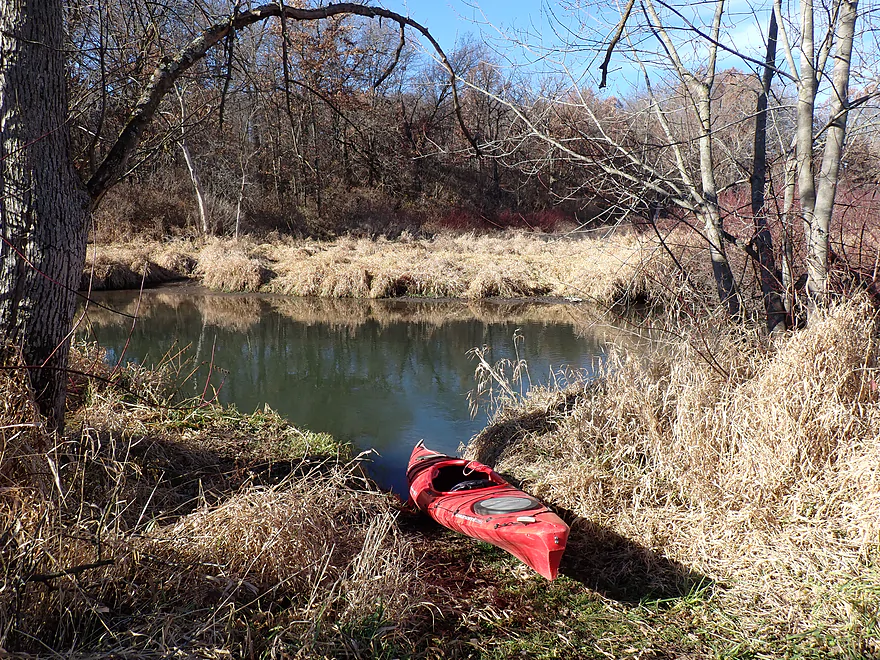
Nice launch area by Tin Can Road
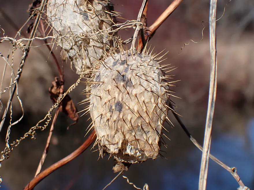
Dried up wild cucumbers
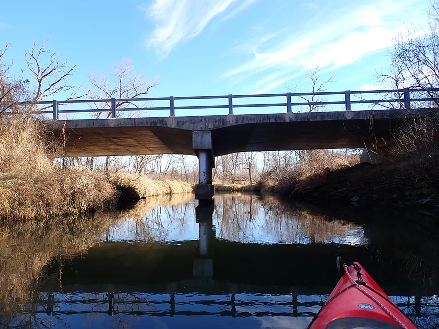
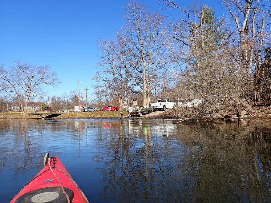
Passing under the Tin Can Road bridge

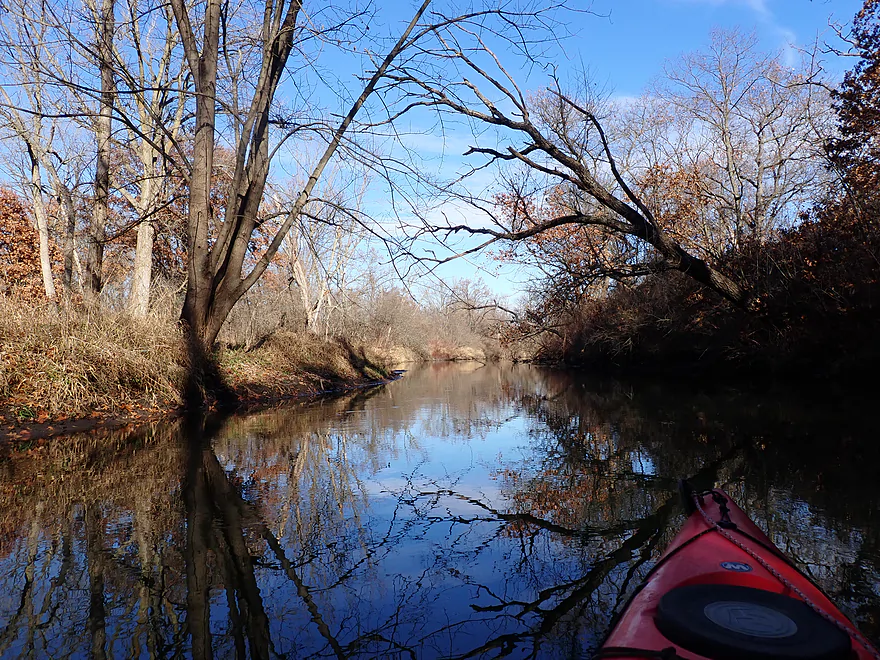
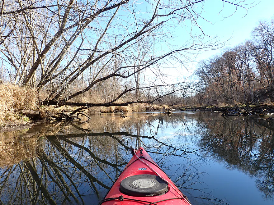
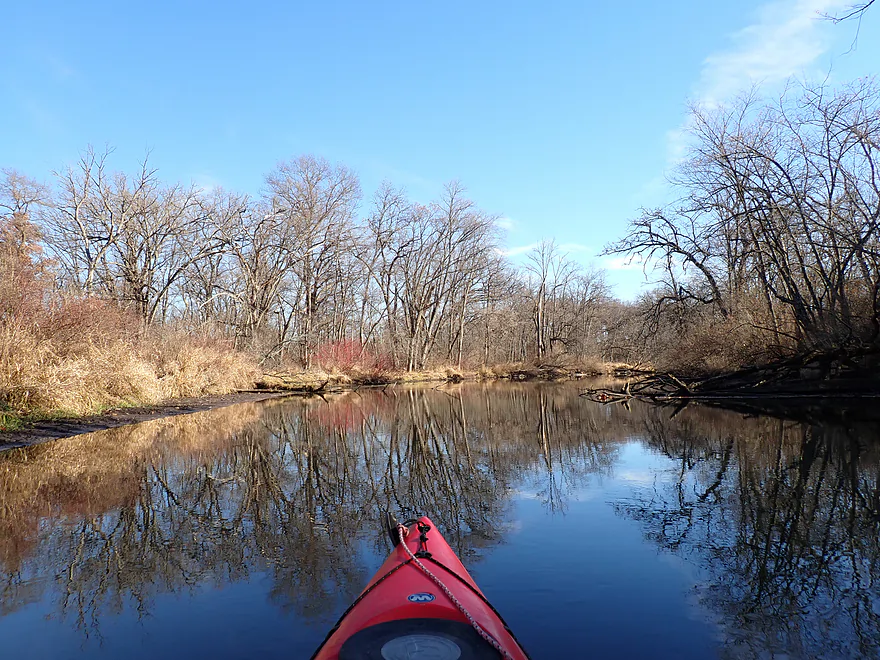
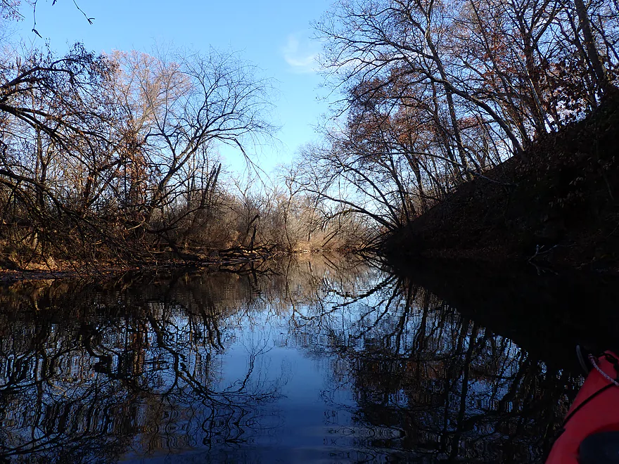
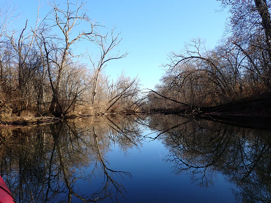
Nice tree silhouettes
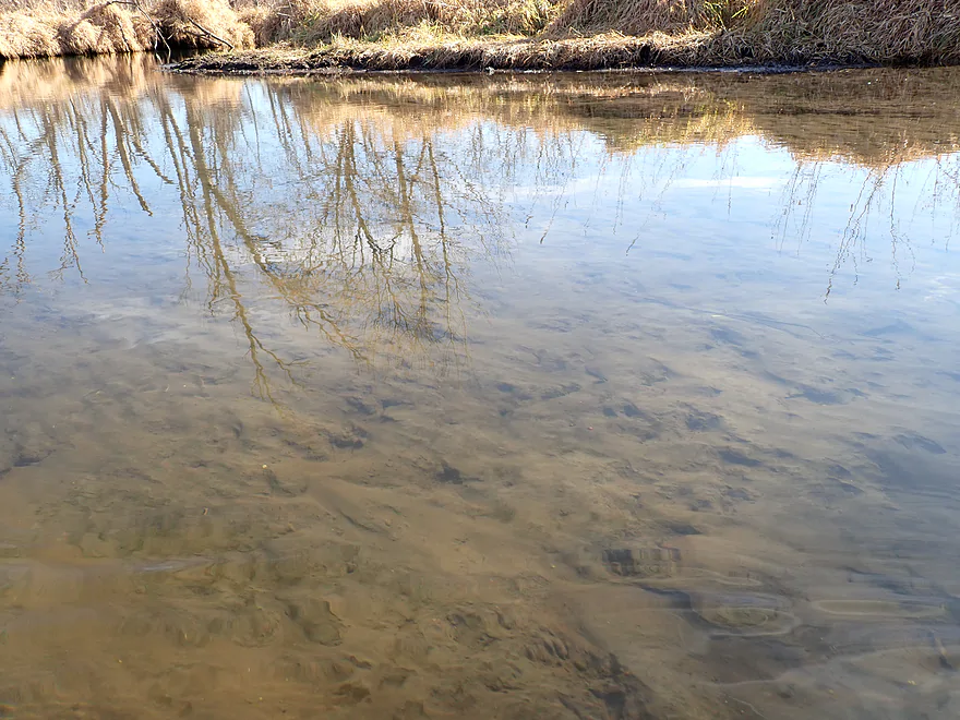
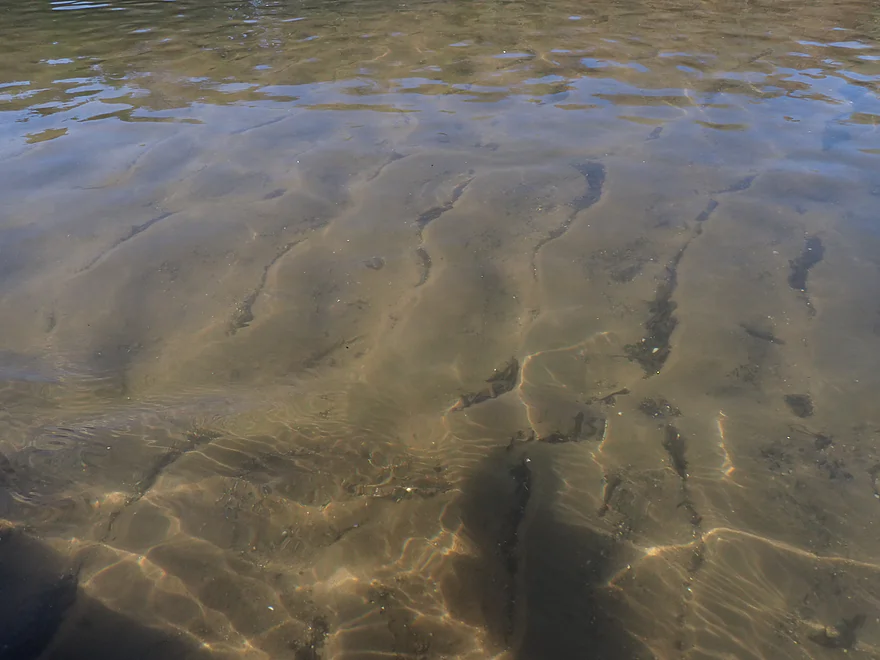
Clarity was surprisingly good
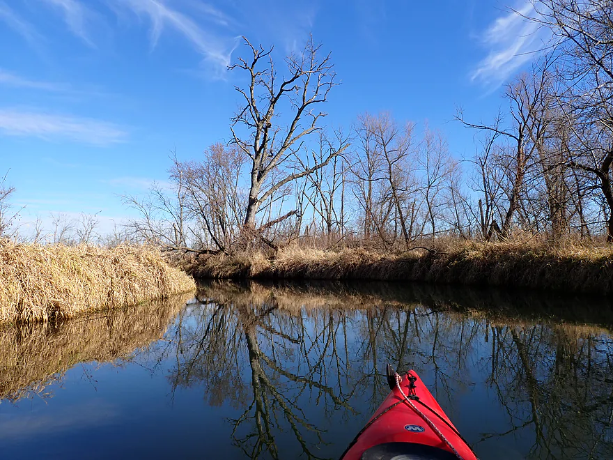
Still some late fall color
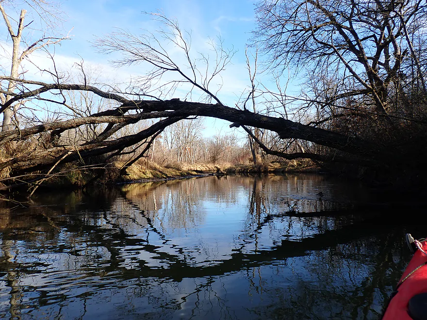
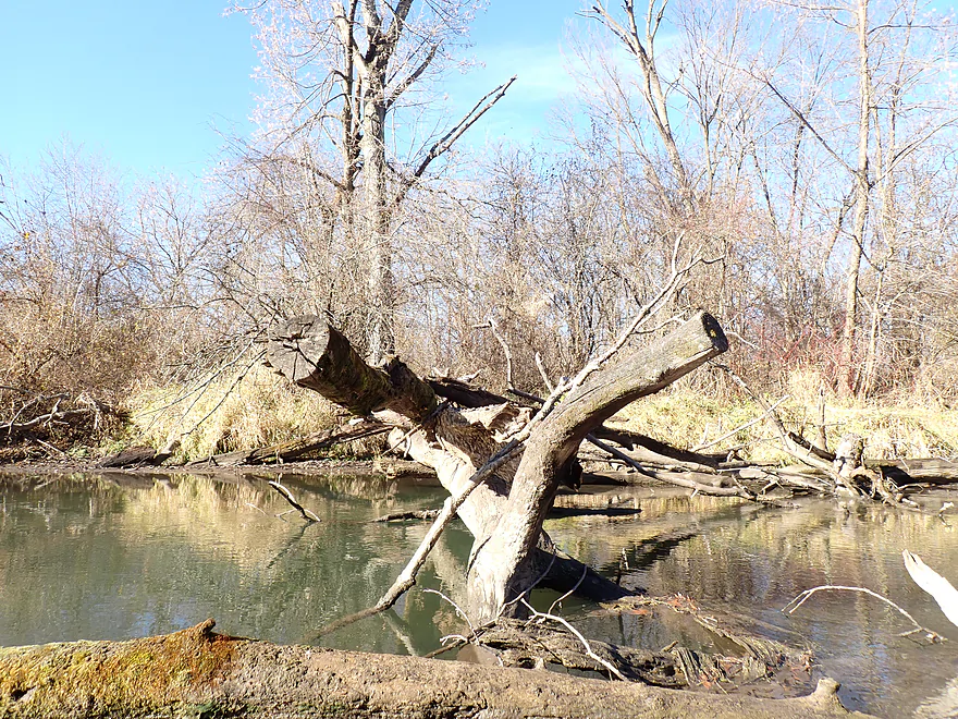
Downed trees never blocked the river
One of several nice glacial hills
Much appreciated
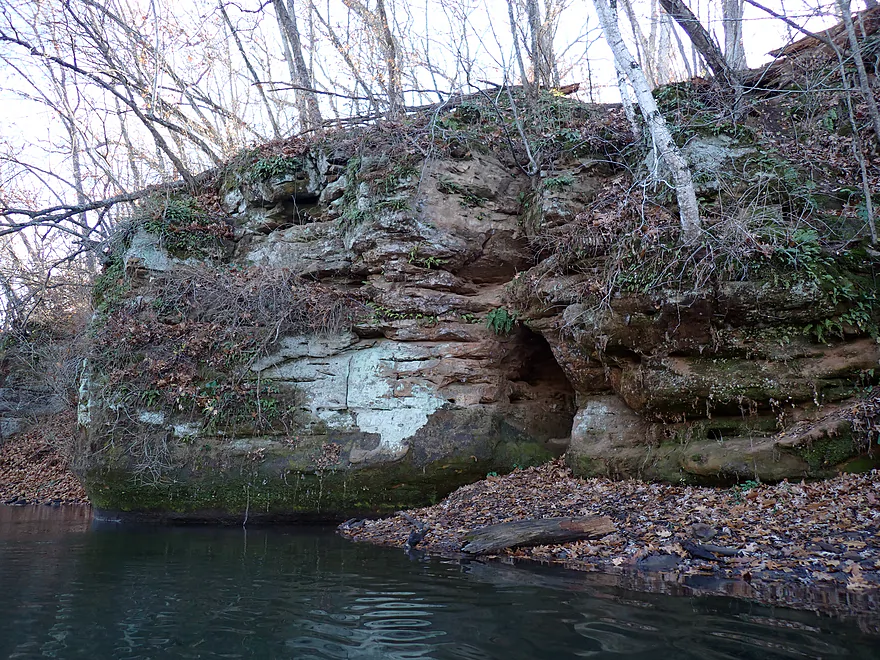
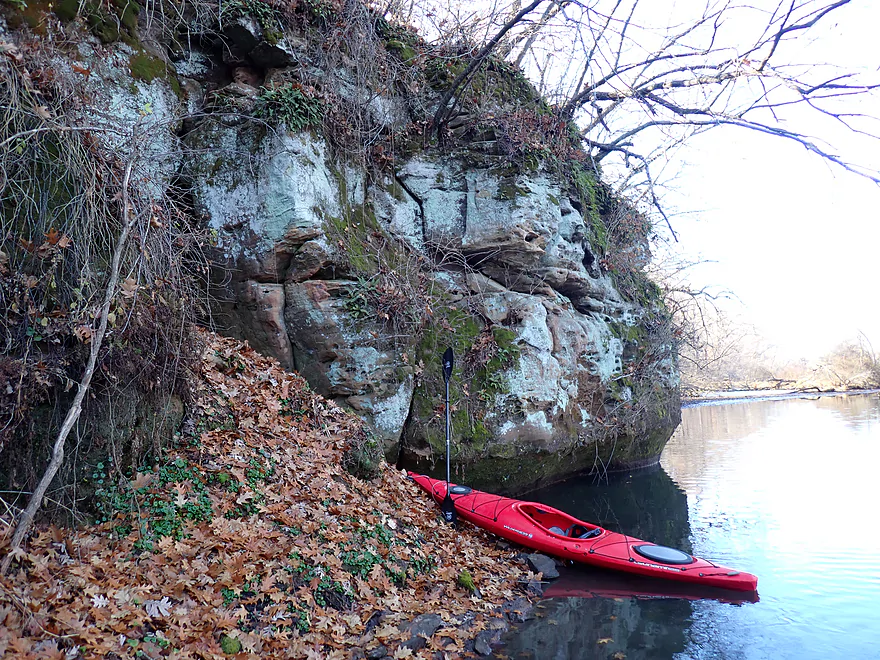
Best bluff of the trip
Hiding in this sandstone cliff…
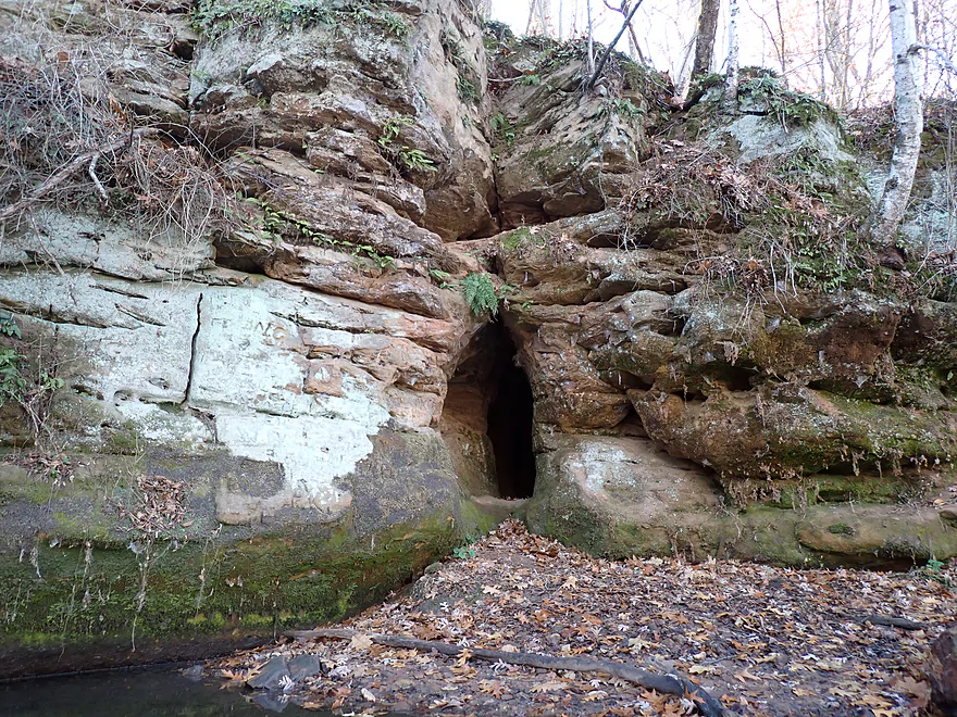
Is a small cave
You can actually go in
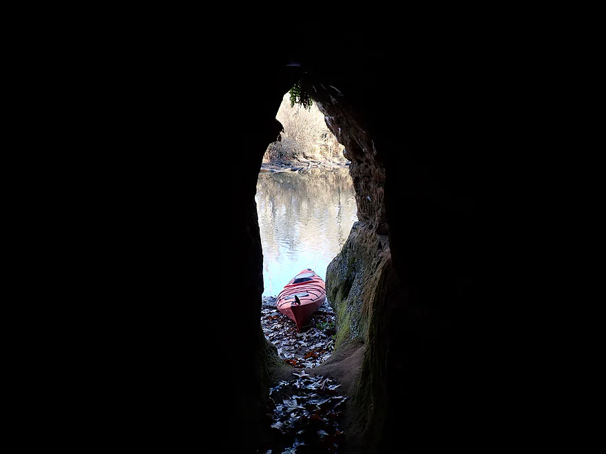
Inside looking out
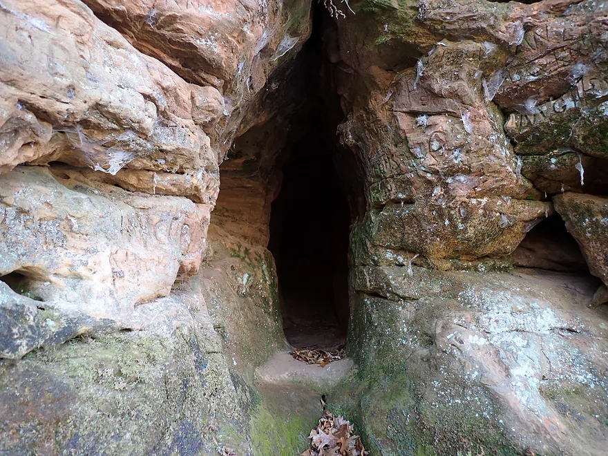
There is actually a hidden second entrance on the downstream side
Part of a longer scenic ridgeline
Great trip for oaks
Mouth of the Little Sugar
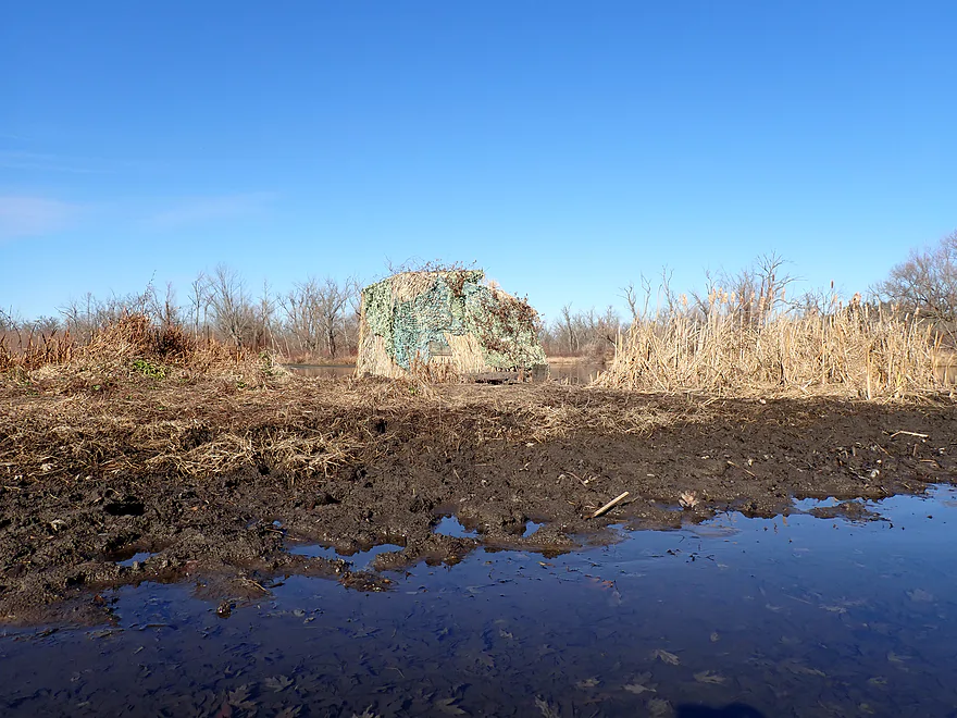
Interesting duck blind
Now on the Sugar River (technically Albany Lake)
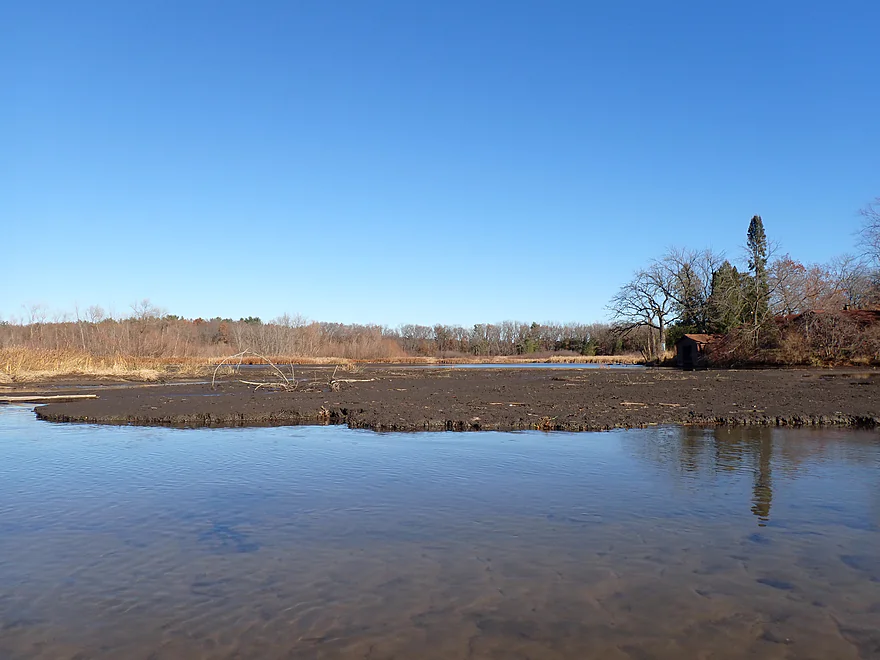
Where there are large mud flats

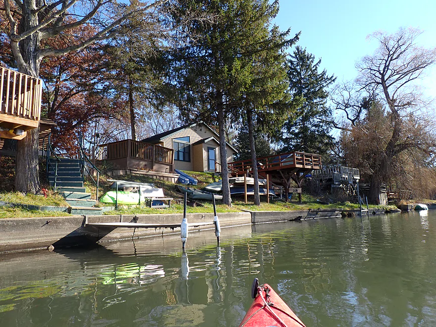
Cluster of small riverside cottages
Nice stretch of the lake

Hard to see, but there is an inviting trail that leads down the hill
Albany Lake is very silted in and shallow
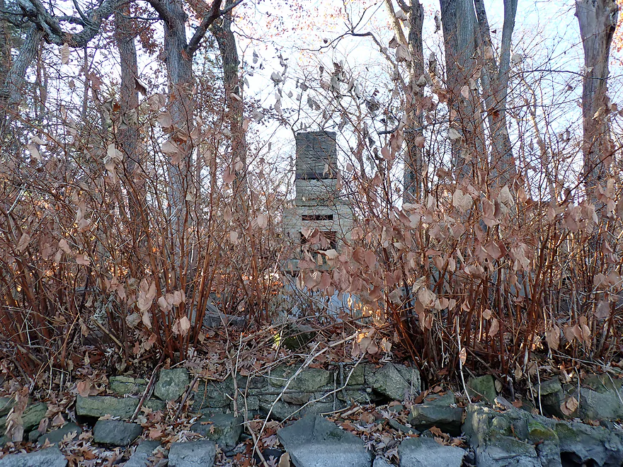
Looks like a river-side kiln
The outskirts of Albany
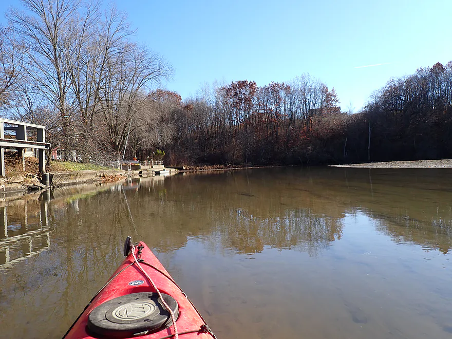
Waiting for the ramp to clear up
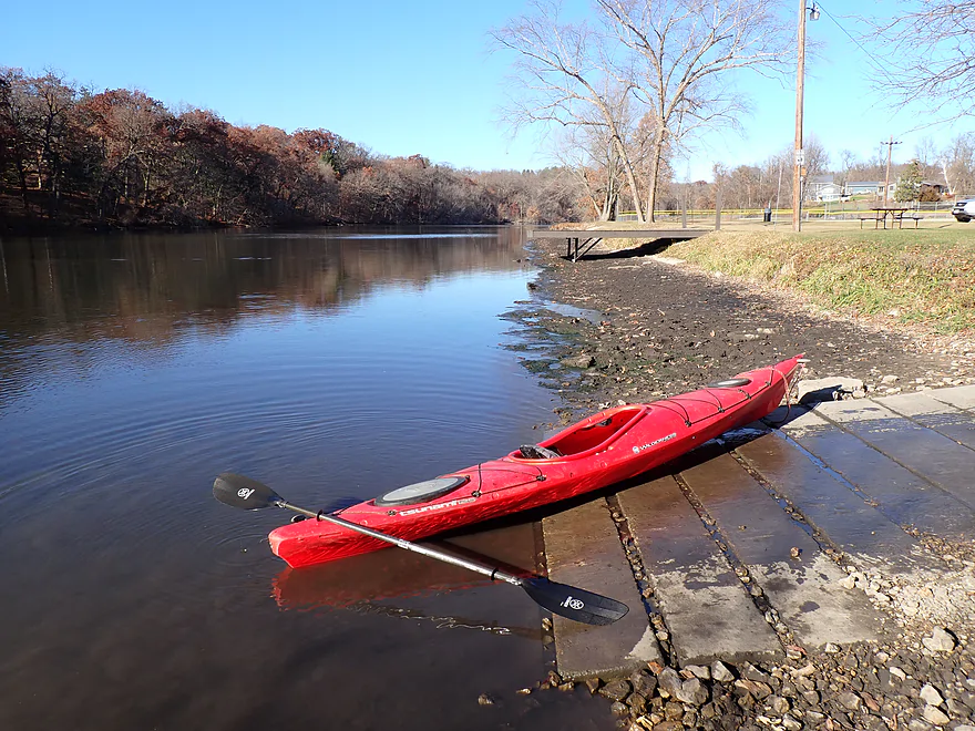
Good take out (American Legion Park)
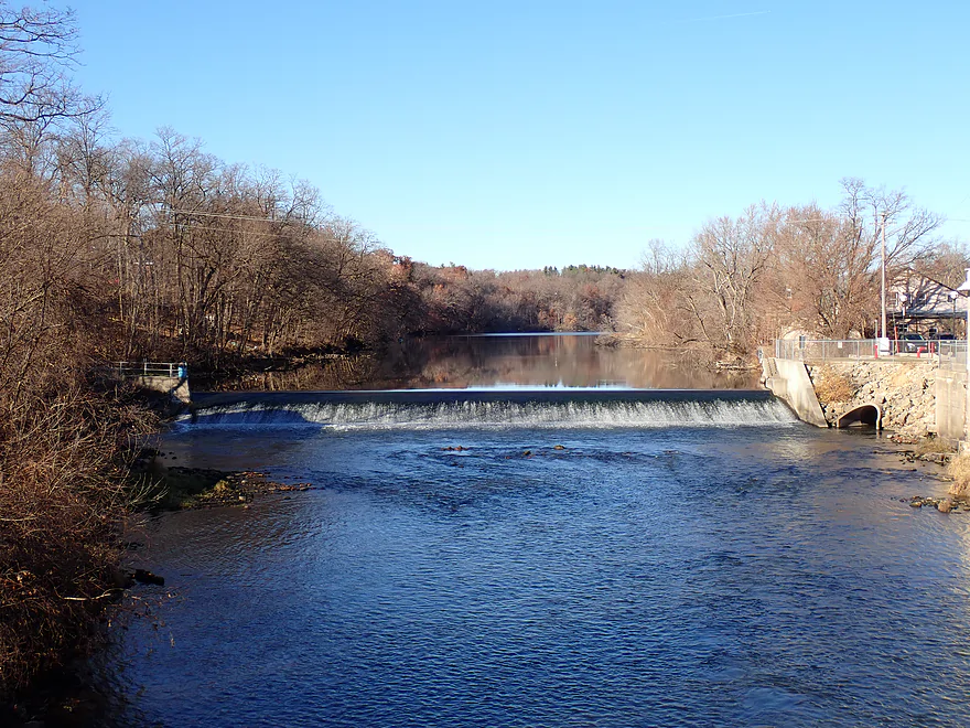
Downstream view of the Albany Dam

Terrific bike shuttle option on the Sugar River State Trail
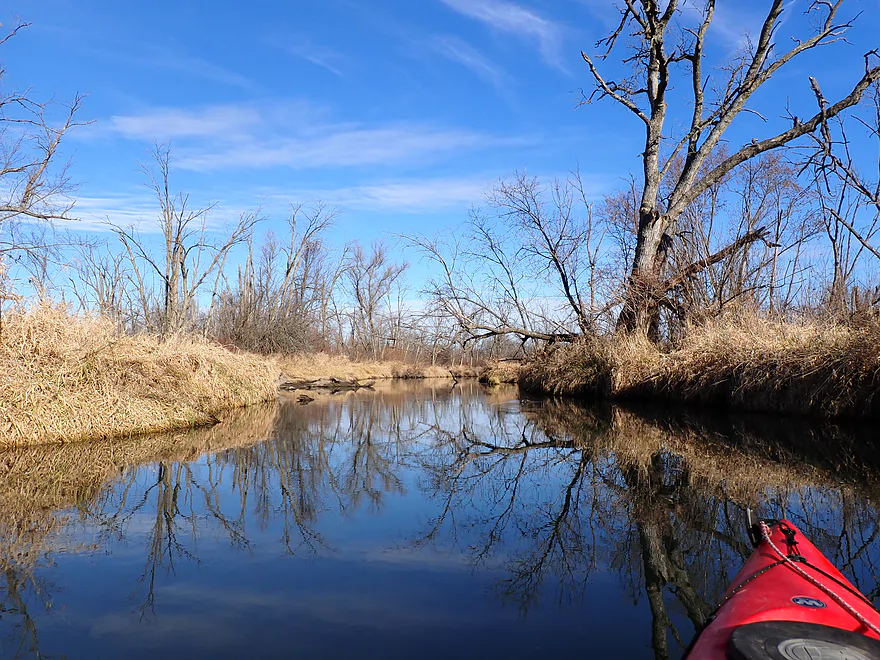
Little Sugar River – Tin Can Road

The Sugar is a popular paddling river in South Central Wisconsin. It has a lesser known tributary, the “Little Sugar River”, which I explored previously by New Glarus. I’ve been hesitant to kayak more legs out of fear of logjams. But one section that I knew would be reliably navigable was the final three miles, which I opted to do as a late November paddle.
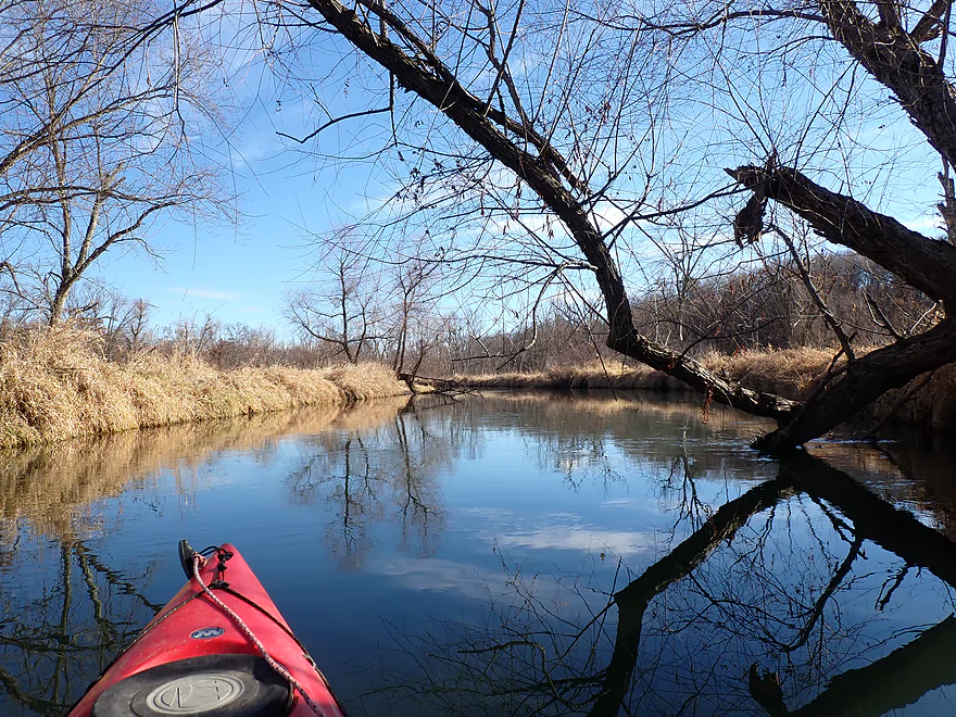
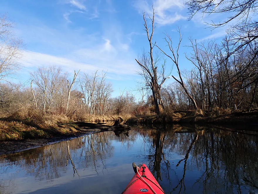
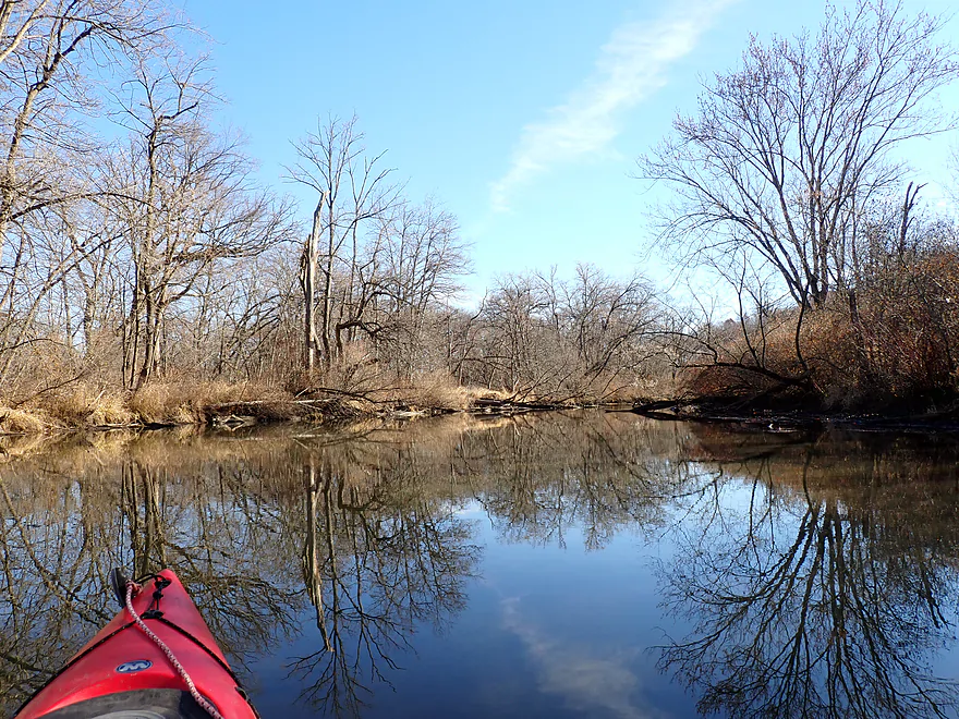
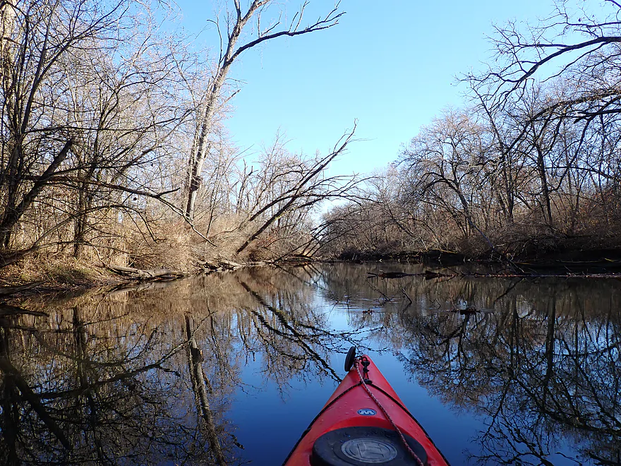
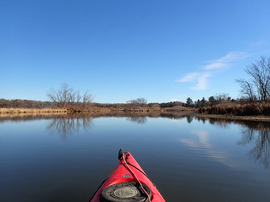
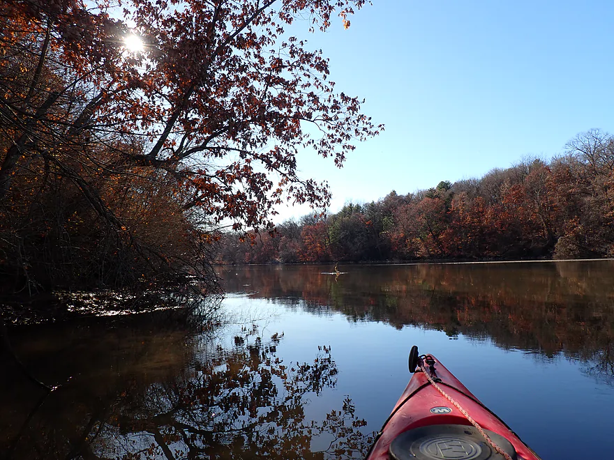
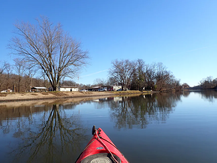
The trip started at Tin Can Road, where I found a nice trail and launch spot northwest of the bridge. A well-beaten path down to the river suggested this is a popular paddle with locals.
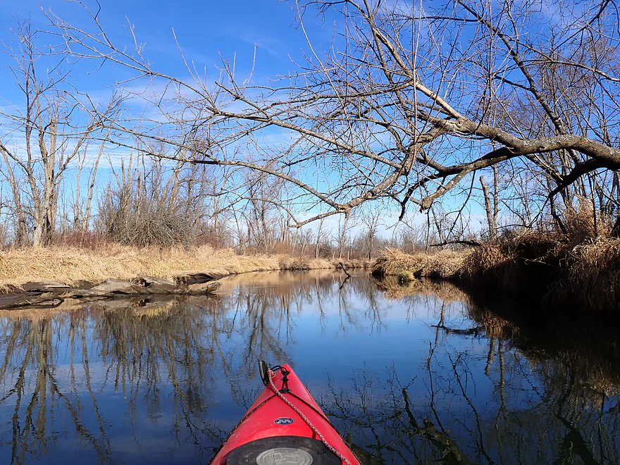
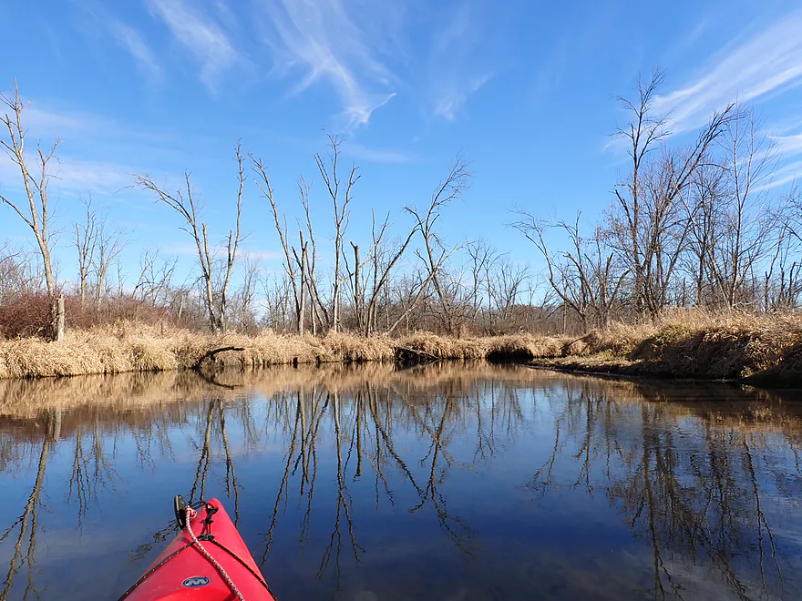
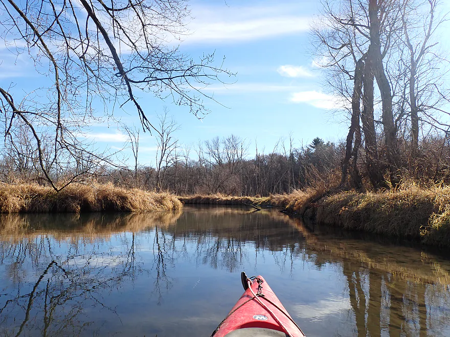
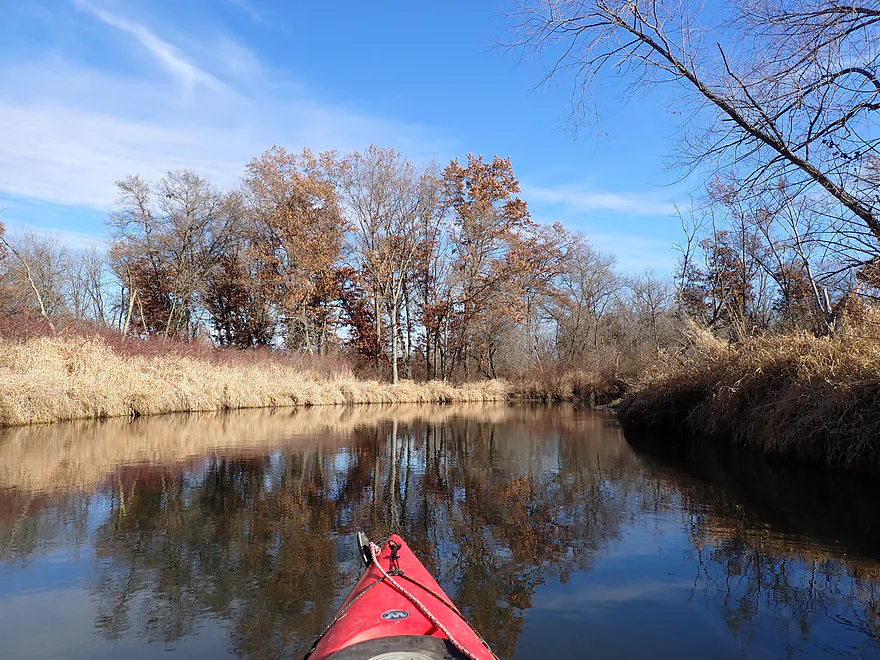
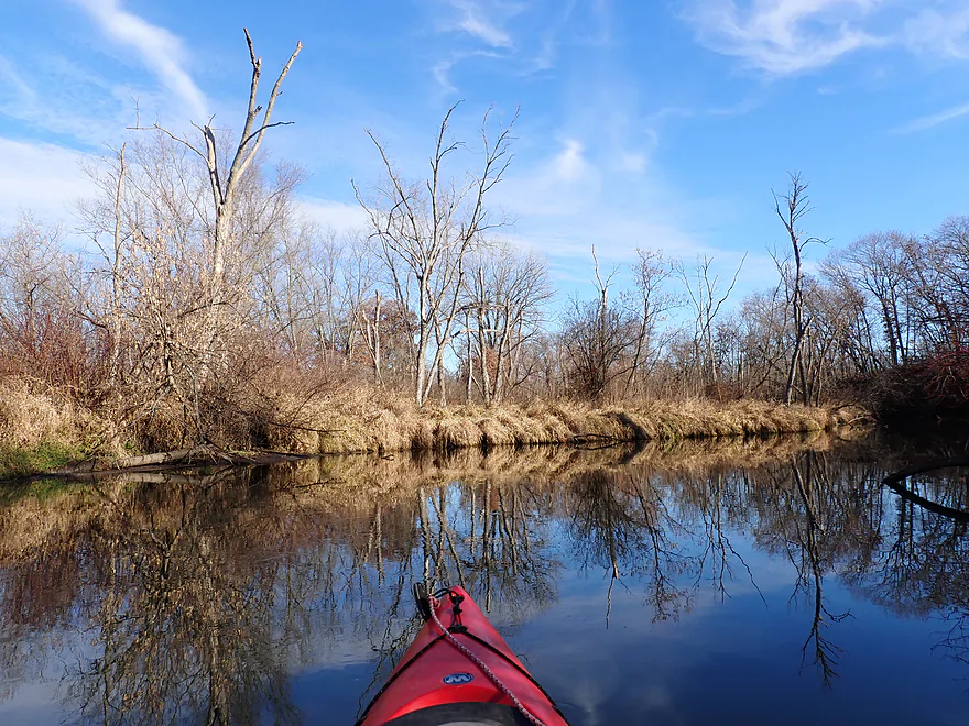
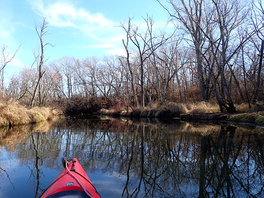
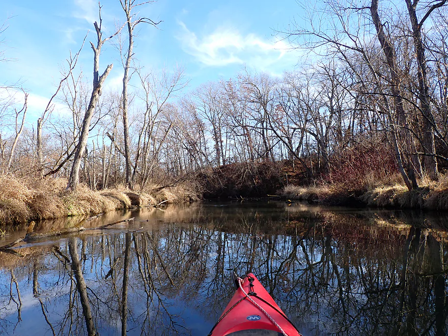
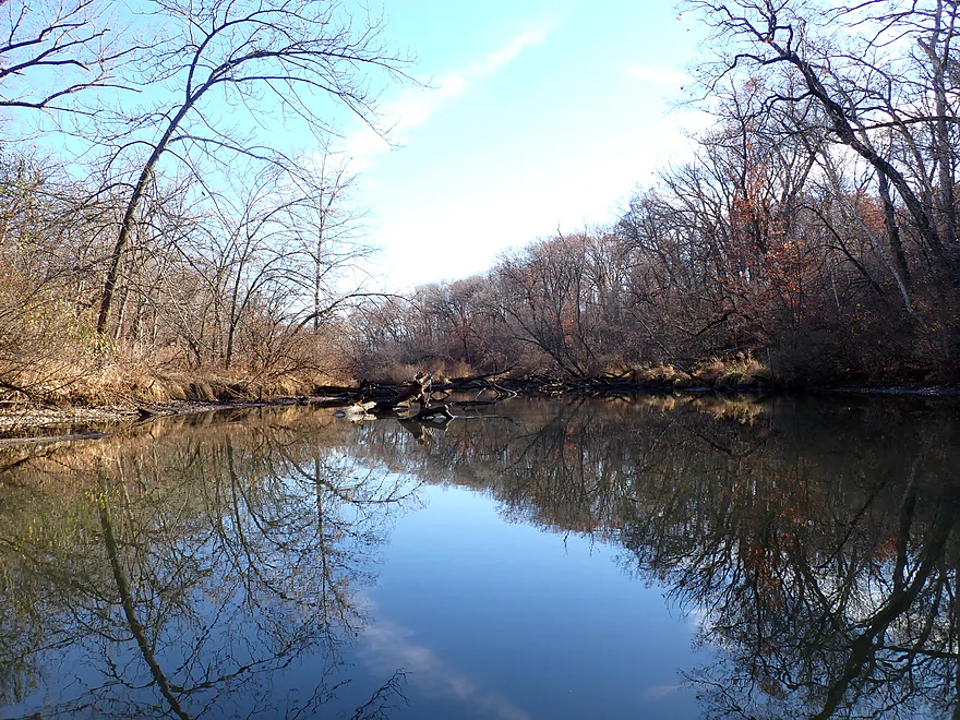
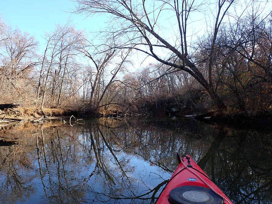
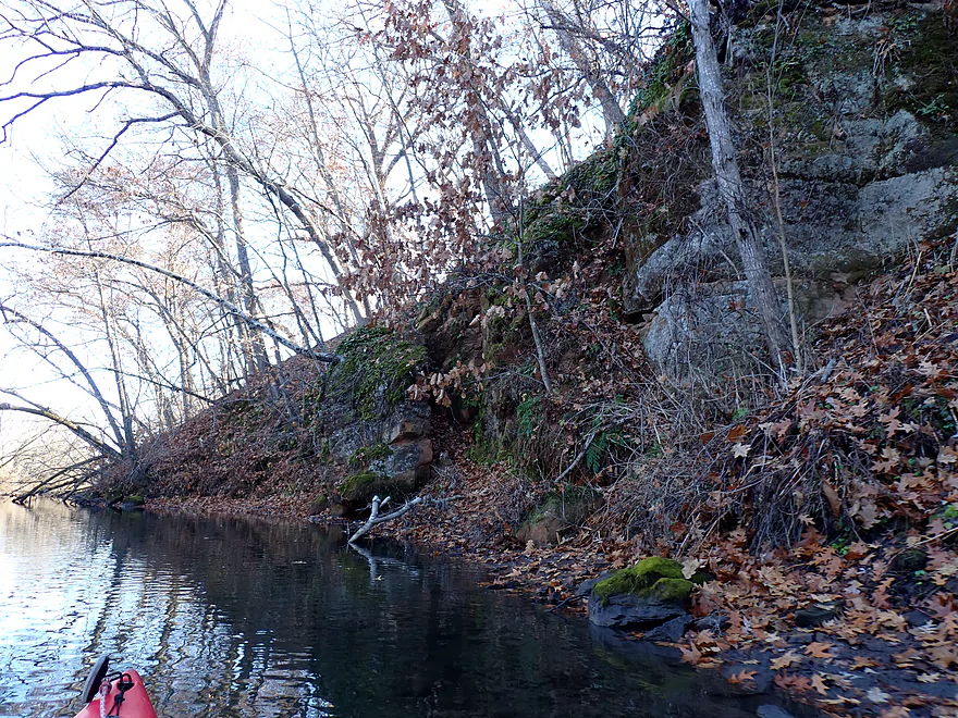
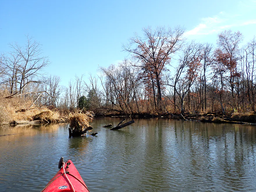
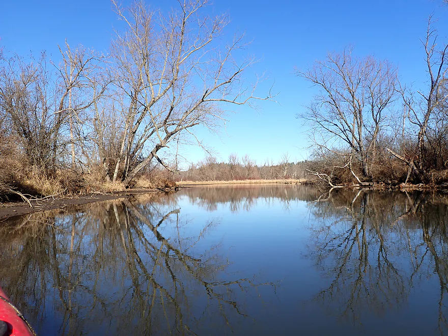
Much of this trip flowed through the Albany Wildlife Area, which is a surprisingly attractive wetland. The river itself twists sharply past glacial hills and wooded banks filled with oaks (still with some late fall color). Bare trees created attractive skeleton silhouette reflections atop the water.
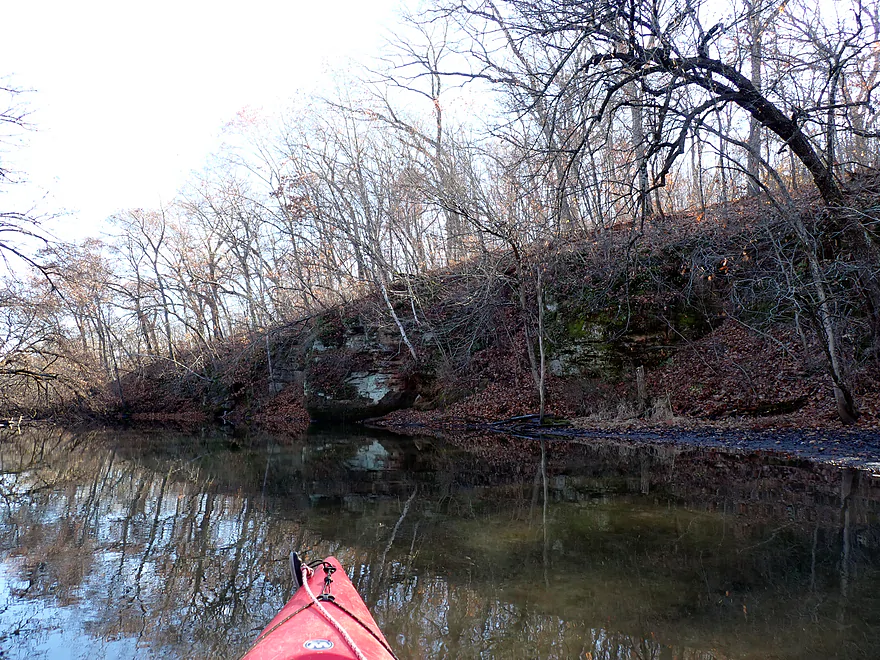
About halfway into the trip, I rounded a corner and encountered a decent-sized sandstone outcrop and bluff. The Little Sugar is sandwiched between the Driftless Area and the Terminal Moraine (where the Green Bay Lobe ended). As a result, there is kind of a mix between ancient hills (like this outcrop), flattened outwash, and moraines.
At the base of the cliff is “Reuben’s Cave”, which you can get out and explore. It’s not very big, but you can fit completely inside and there is a nice framed silhouette view of the river from the interior. There is a lesser-known secondary entrance located just a bit downstream which I checked out as well. Many years ago the Little Sugar was much deeper (8-10’) and small steamboats would actually travel up to the cave with tourists (picture).
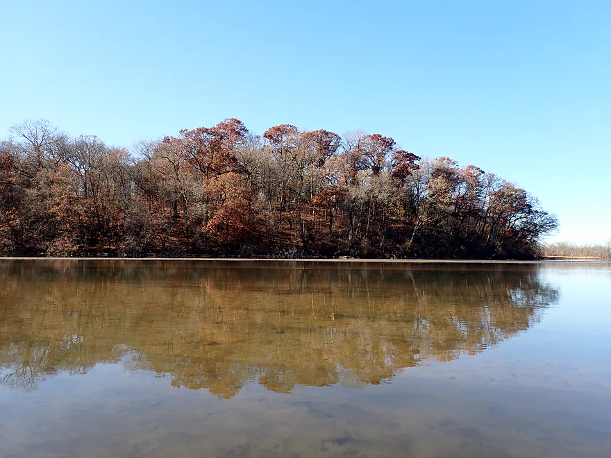
I finally paddled to the mouth and onto the Sugar River (big version). The Sugar here has been impounded by a downstream dam, which left a delta of small muddy islands, little current, and a very silted-in lake. It was significantly less interesting than the Little Sugar River. That being said, Albany Lake wasn’t awful as there were attractive wooded bluffs on both sides of the river and still some late fall color.
As I continued downstream, I encountered the outskirts of Albany and a series of small cottages. These were nicer than the typical riverside homes you see today. Modern waterfront properties tend to be located on oversized and overly-flattened lots, have huge McMansions, and are mostly clearcut to make way for large eco-desert lawns. But here the cottages and lots were very small, quaint, and built into the hillsides and woods. A number of homes had small boathouses, but I doubt these were usable as Albany Lake was (mostly) too silted in for motorboats.
In summary, this was a nice trip that I can recommend. It was surprisingly scenic, and is consistently navigable thanks to the chainsaw efforts of locals. Reuben’s Cave wasn’t exactly Cave of the Mounds, but it was a fun pit-stop. It should be noted that I did this trip in November when everything was mostly died back and open. This really opened up the scenery and I think if I’d done this in mid-summer when everything was overgrown, it would have gotten one less star.
I didn’t see much…just one turtle, a few woodpeckers and what looked like a pheasant.
Tin Can Road: This was a good bridge access. There is a small trail and launch area northwest of the main bridge.
Alternate Put-ins: None really. Upstream from Tin Can Road logjams are too common.
American Legion Park: This is a great public access and boat ramp, located a bit upstream from the Albany Dam.
Alternate Take-outs: I’m not sure there are any. In theory you could continue 2.7 miles downstream on the Sugar River to Decatur Albany Road. That should be a good access and good trip. But this would require portaging the Albany Dam. Supposedly you can do this via a staircase, but when I scouted it, I didn’t see an obvious portage route…especially on the east shore. It’s possible there is a better portage option on the west shore which I wasn’t able to scout.
Bike Shuttle – American Legion Park Landing to Tin Can Road: 3.3 miles with 20′ of ascent. Most of this shuttle route is along the Sugar River State Bike Trail. This is a great option for shuttlers…it’s flat, scenic, and the woods provide good wind cover. The surface isn’t paved but at least there aren’t big gravel chunks like on other “bike trails”. I was surprised to see several groups of hunters on the trail. I guess that is allowed?
Logjams: None…the locals do a good job of keeping this route open.
Dams: There is a dam near the take-out, but it is far enough away from the spillway that safety isn’t an issue.
Wind: The final portion of the trip is in the open, so you’ll want to stay off the river when there are strong south-to-north headwinds.
Current: There wasn’t much current on the Little Sugar, but it was noticeable (and faster than the Rock). The dammed portion of the Sugar River, in contrast, had almost no current.
Deer Hunting Season: The DNR does allow deer hunting in the Albany Wildlife Area. I think most hunters stay close to the roads (and the bike trail where I saw several groups), but I doubt they hunt close to the river as it would be a long walk. I think you’re safe to kayak this river during hunting season, but you should wear bright, colorful clothing.
This trip was done in late November when the water temperature was cold (44 degrees Fahrenheit per the Verona gauge). As a general rule, paddlers should not be kayaking when the air temperature + water temperature is less than 120 degrees. If you do, you should wear protective clothing which can be found at most outdoor shops. I think you can cheat the 120 degree rule a bit if there is: safe, slow current, no logjams, no waves, you stay close to shore, and the river isn’t very wide or deep. It should be noted most fishermen in motorboats don’t obey the 120 degree rule (which I saw a few on the Sugar River).
Closest Gauge: Sugar River @ Verona
Trip Depth: 43 CFS or 2.92′
Navigability Estimates: These are just rough estimates.
- 0-40 CFS: A relatively shallow depth but plenty fine for kayaking.
- 41-70 CFS: An average depth.
- 71-95 CFS: A high depth, but still very navigable.
- 96+ CFS: A very high depth with maybe poor water quality…but likely still viable for paddlers.
Click here to see an overview map of the Little Sugar River.
- Old Madison Road to Hwy 69/W Intersection: (1.3 miles) River is very narrow here and likely requires high water to run. Very good water clarity. Maybe 4-6 logjams.
- Hwy 69/W Intersection to Valle Tell Soccer Park: (0.4 miles) Just northwest of the 69/W intersection there appears to be a public pull-off and a nice pedestrian bridge that might be a good launch spot. This little section looks nice and I wish I had done it. Maybe 1 logjam.
- Valle Tell Soccer Park to Exeter Crossing: (4.1 miles) A nice trip that has seen trout restoration work and channelization. Good current and water clarity.
- Valle Tell Soccer Park to Valley View Road: (1.5 miles) Great section with fast current, small ledges and no logjams. Very narrow, this segment is only suitable for small boats.
- Valley View Road to Exeter Crossing Road: (2.6 miles) A pleasant section that starts open, then flows by a golf course and finally through a more congested bit of woods. There are two serious “duckers” and one low tree I had to portage around.
- Exeter Crossing Road to E. Coates Ave: (2.8 miles) Maybe 0-2 logjams. Looks to be sandy, open and somewhat channelized. A good prospect with clear water.
- E. Coates Ave to Hwy EE: (1.5 miles) Maybe 3-6 logjams. This is a very open and grassy section. Portaging should be much easier because the banks are relatively low.
- Hwy EE to River Road: (2.0 miles) Deadfall is likely an issue. Maybe 8-12 logjams.
- River Road to Silver Road: (4.1 miles) Deadfall is likely an issue. Maybe 12-16 logjams.
- Silver Road to Schneeberger Road: (2.0 miles) Deadfall is likely an issue. Maybe 6-10 logjams.
- Schneeberger Road to Tin Can Road: (4.4 miles) A very wooded section that is attractive and a scenic paddle. However, logjams are a serious issue and several require difficult portages. Not recommended.
- Tin Can Road to American Legion Park: (3.2 miles)
- Tin Can Road to Mouth on Sugar River: (1.9 miles) A simple but pleasant stretch with ok scenery. Most of this flows through the Albany Wildlife Area. The highlight is “Reuben’s Cave” which you can explore.
- Mouth to American Legion Park: (1.0 miles) The Albany Dam creates a shallow impounded lake on the Sugar River. It’s not super interesting and has some shoreside development, but it does feature some attractive wooded hills.
Trip Map
Overview Map
Video
Photos Size: