
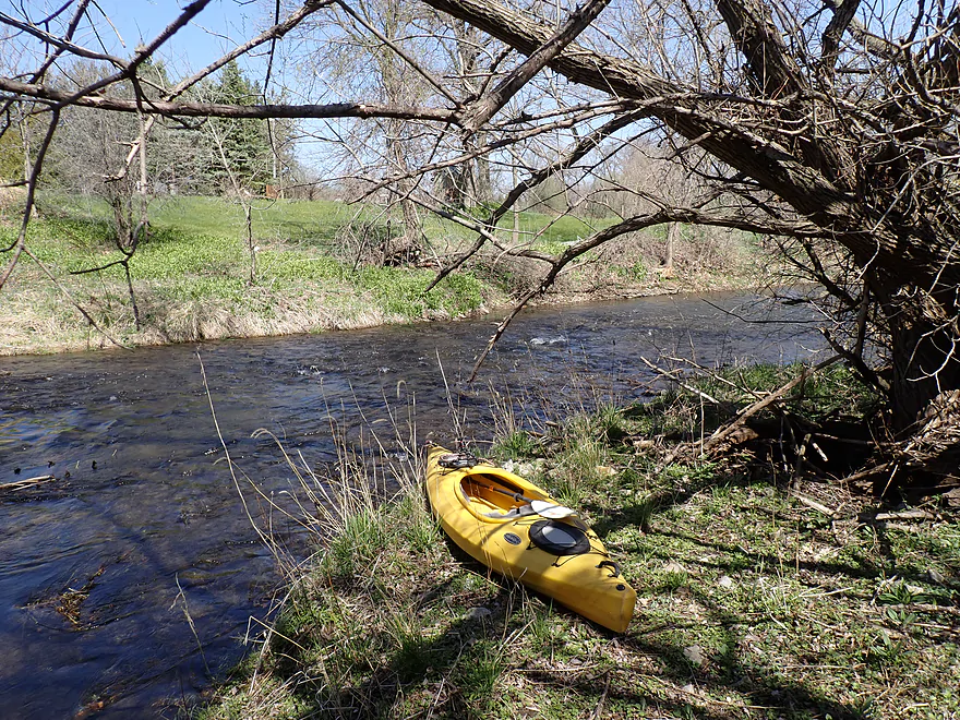
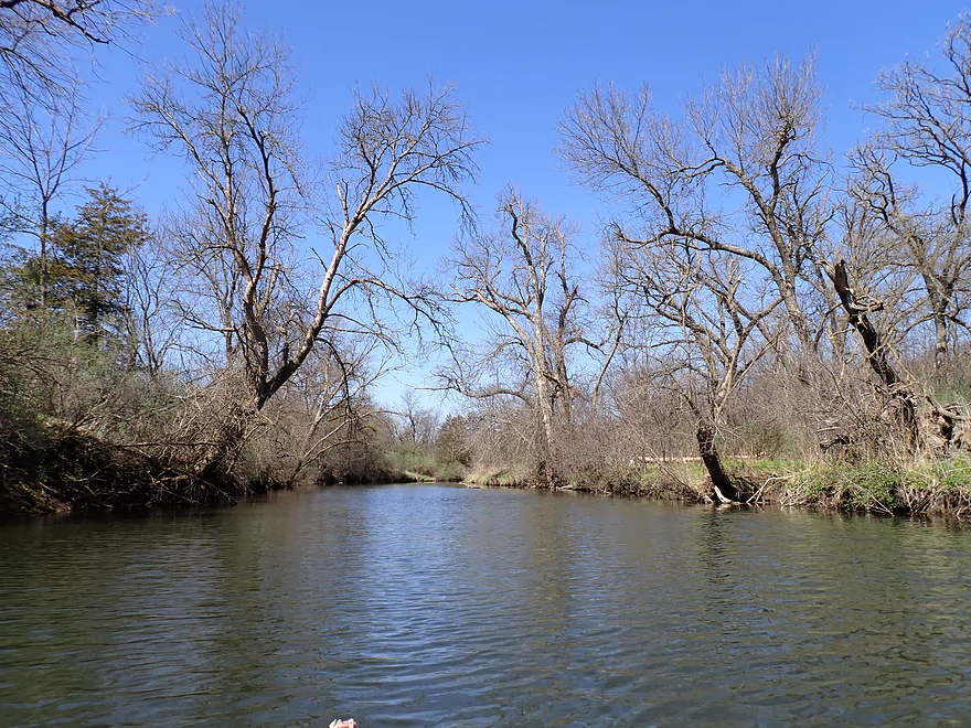
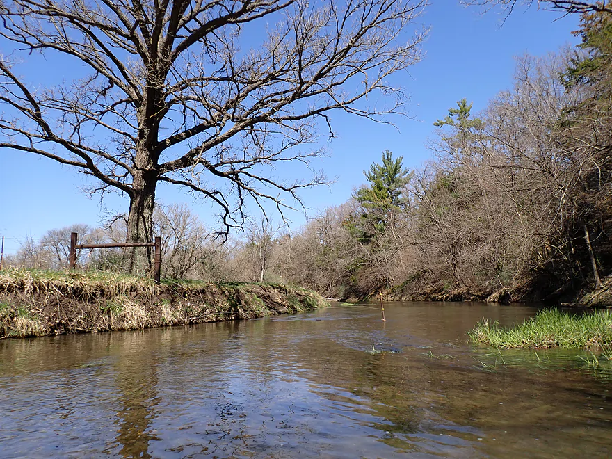
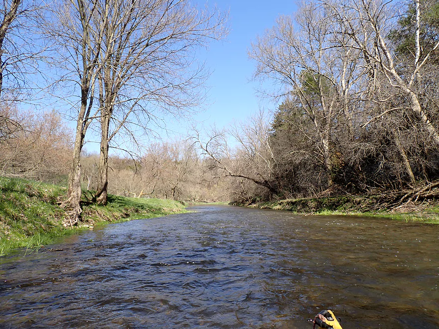
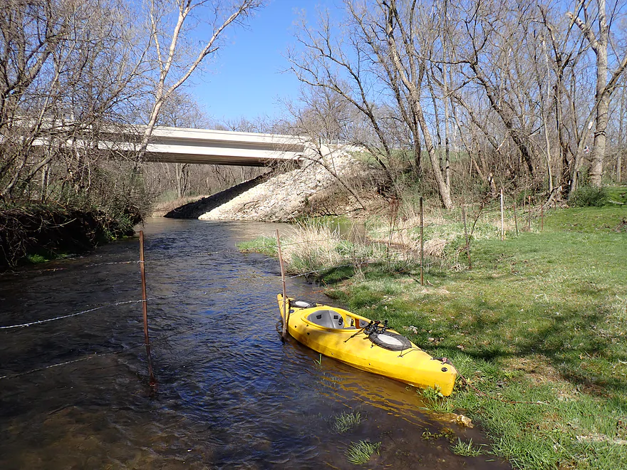
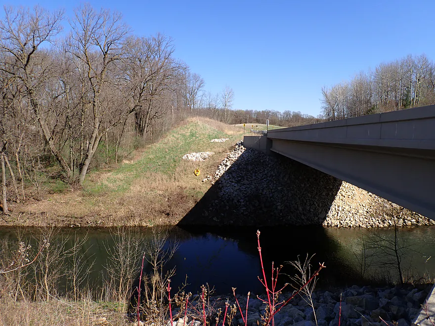
Putting in at Hwy 8…decent bridge access
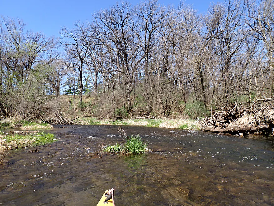
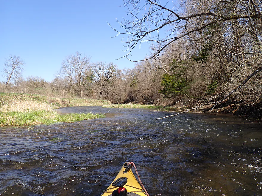
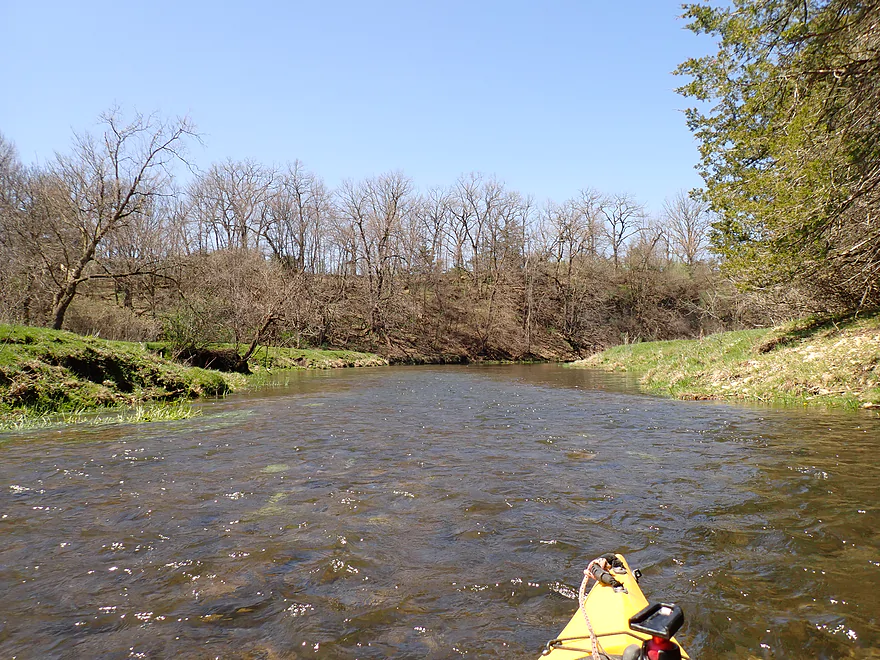
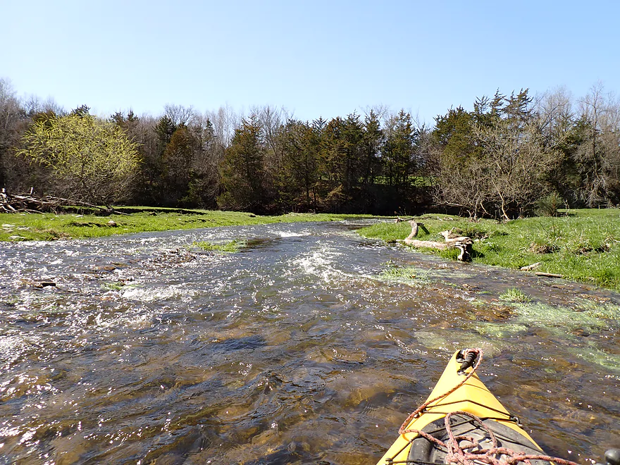
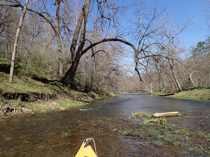
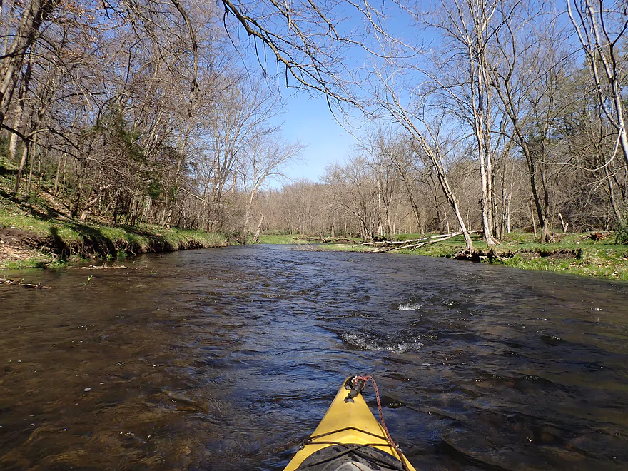
Shallow rapids to start the trip
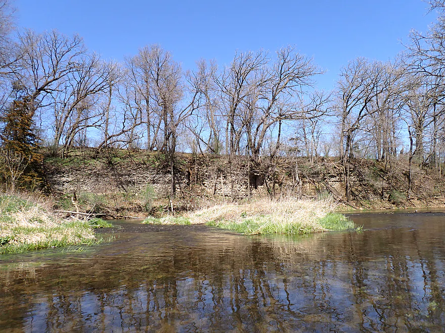
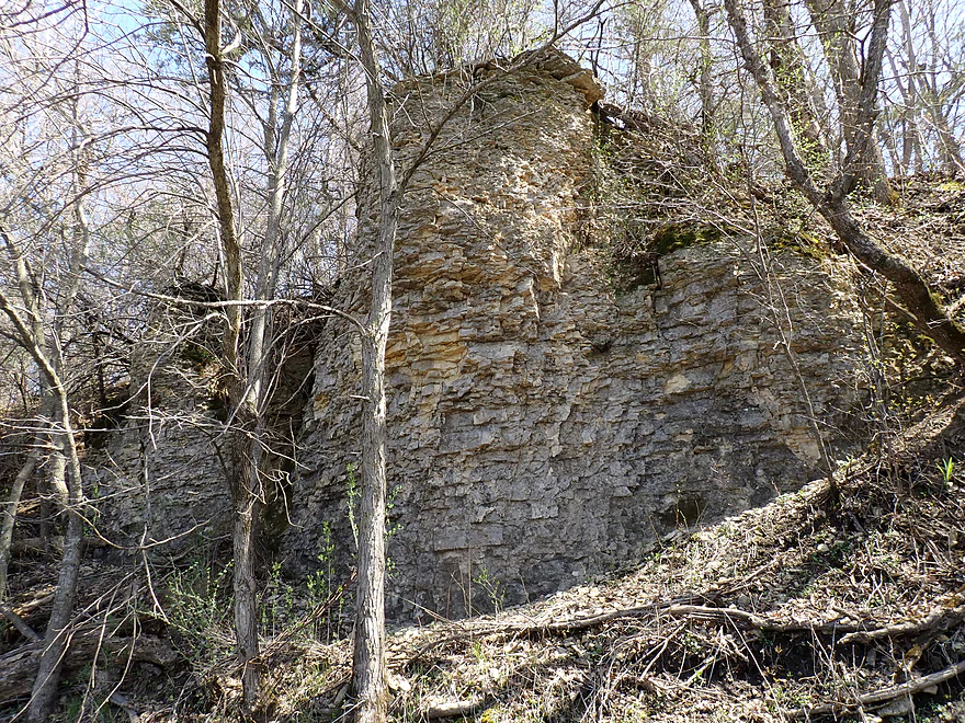
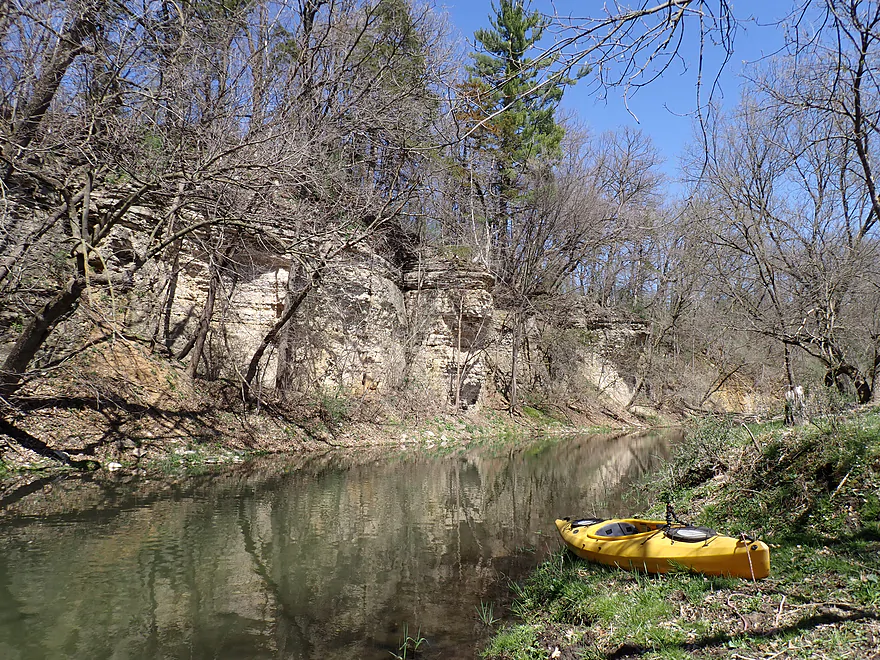
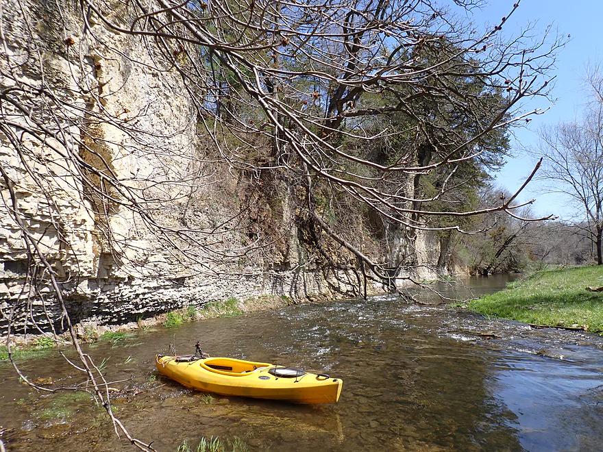
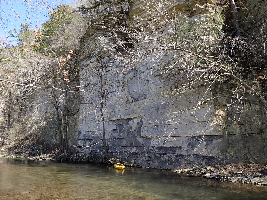
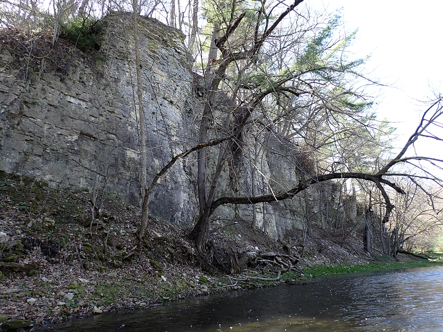
First outcrop (lots more to come)
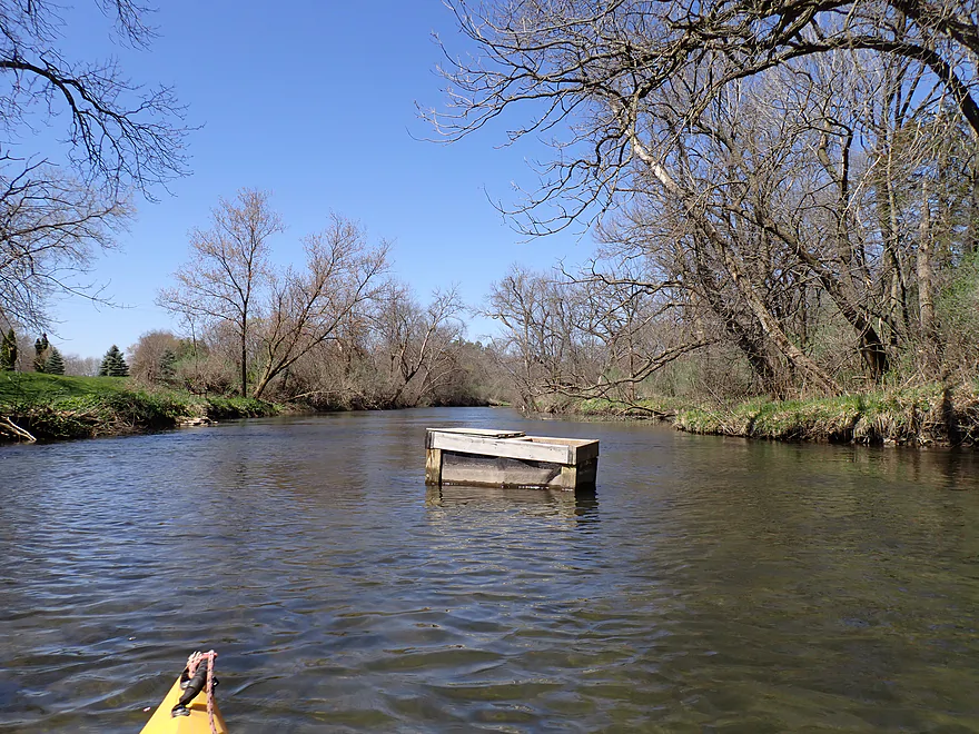
Looks like some kind of trap in the middle of the river
Outcrops in the first mile were really small
…but looked great when underlit by the river
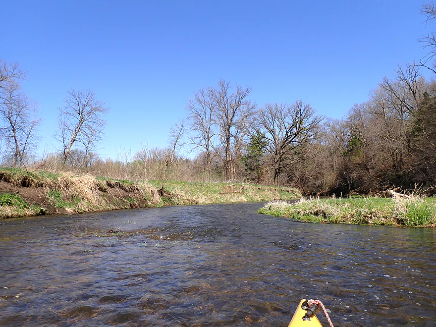
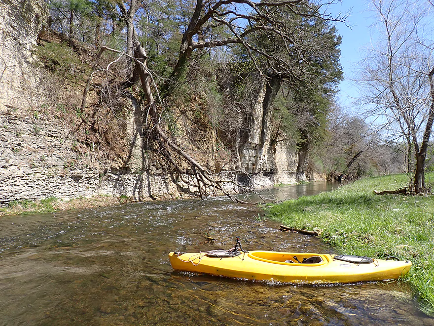
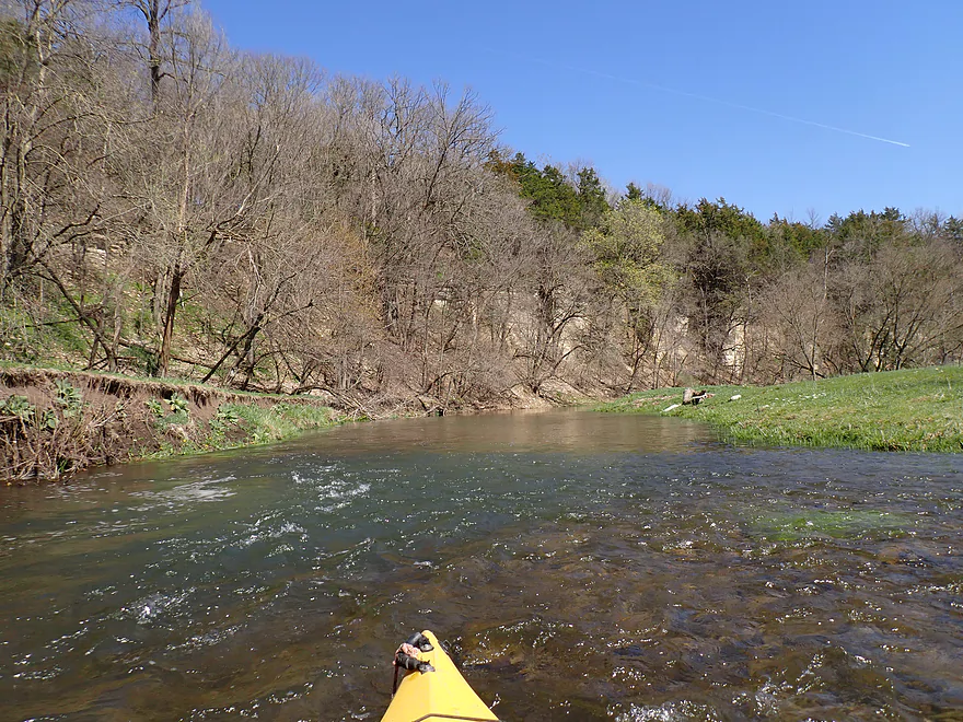
Lot of minor rapids
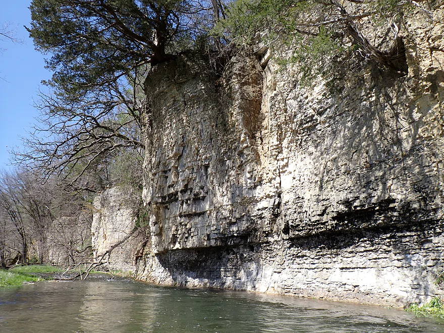
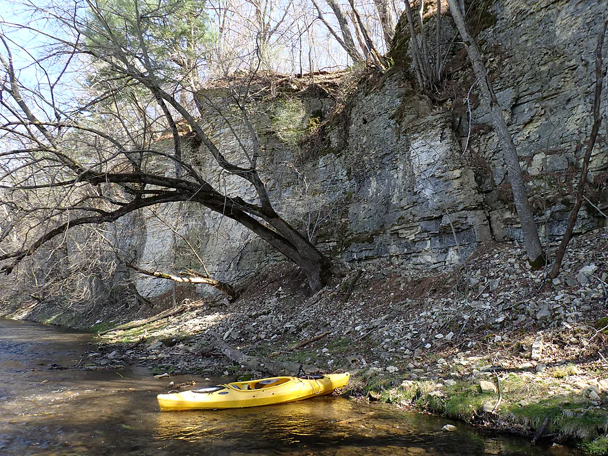
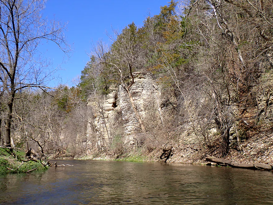
Rapids/cliff combo
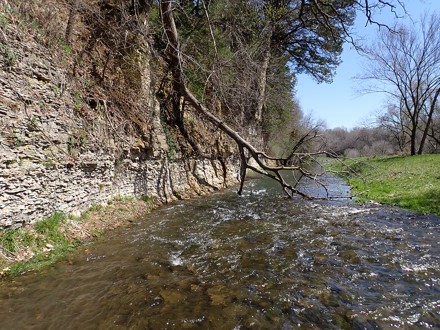
Trees growing from the side of the cliff
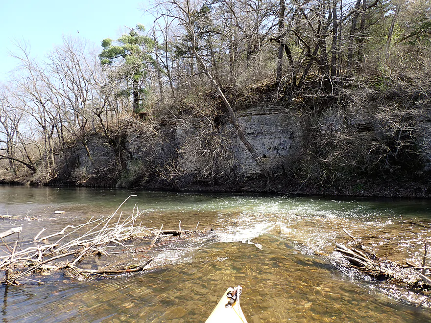
Another cliff/rapids combo
And another
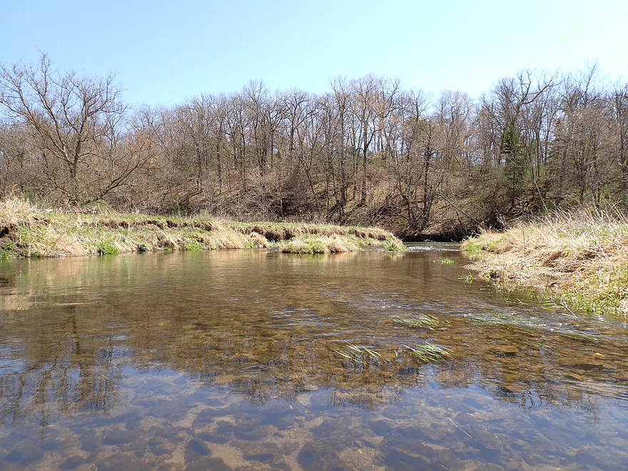
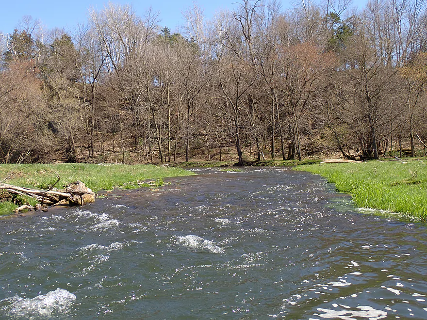
Good clarity
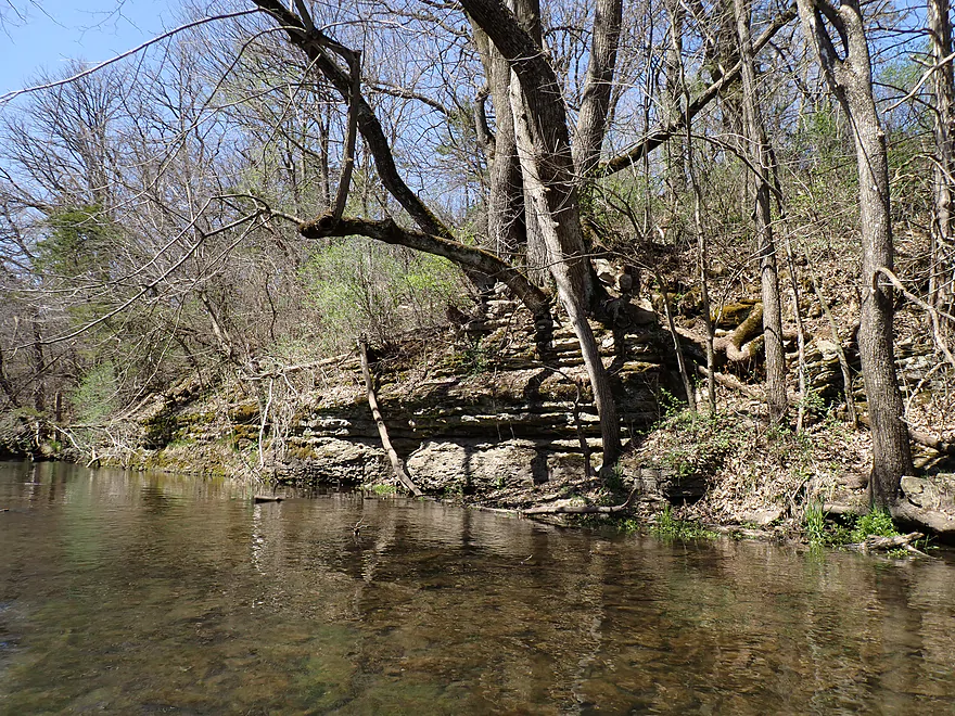
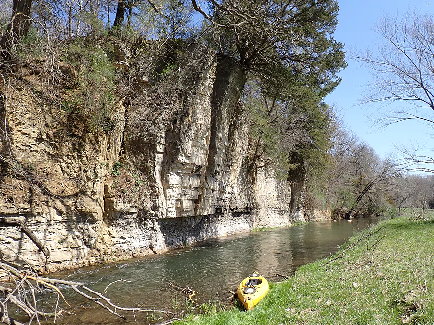
Outcrops starting to get taller
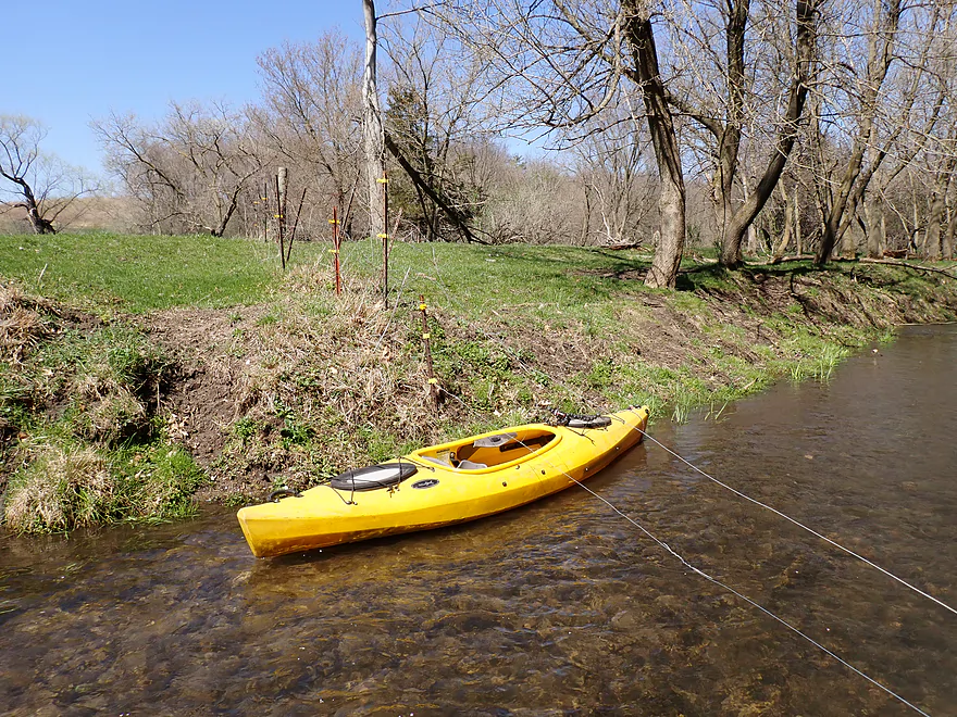
First fence…open on the right so easy to paddle around
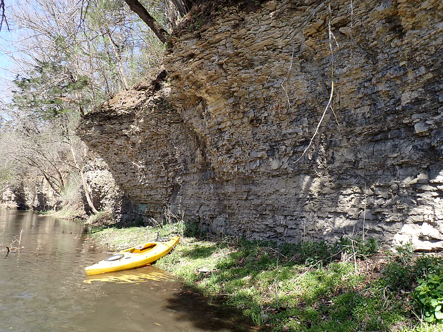
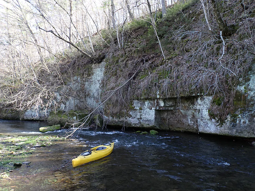
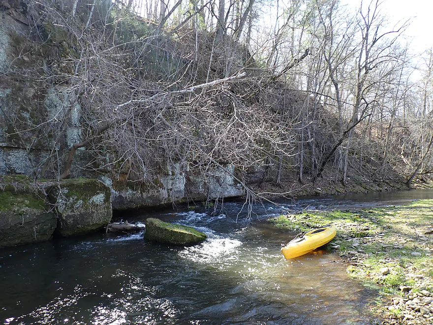
Cool overhang
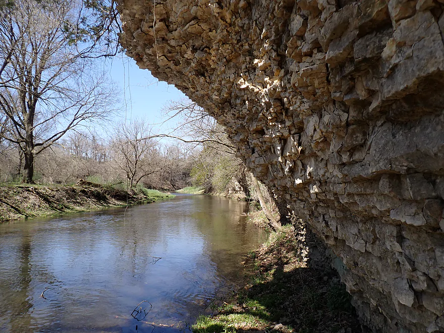
Framed view
Reverse view
This is immediately followed by another cliff
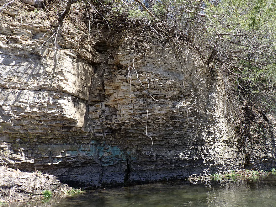
Interesting green stains at base of cliff face…maybe from minerals
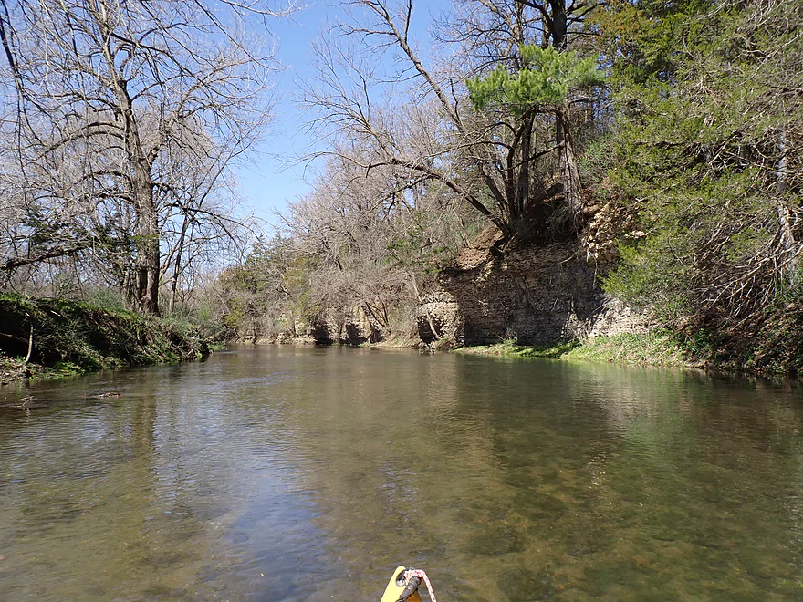
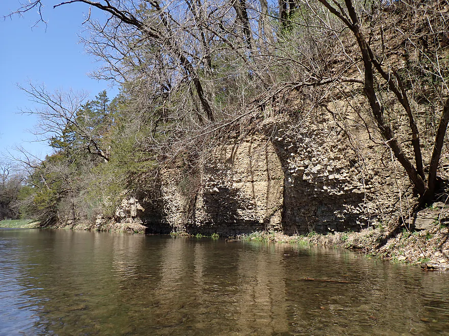
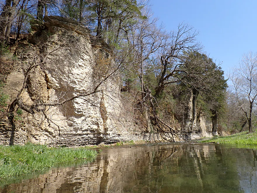
Start of a scenic horseshoe bend

Cliffs continue to wrap around the river
Very photogenic
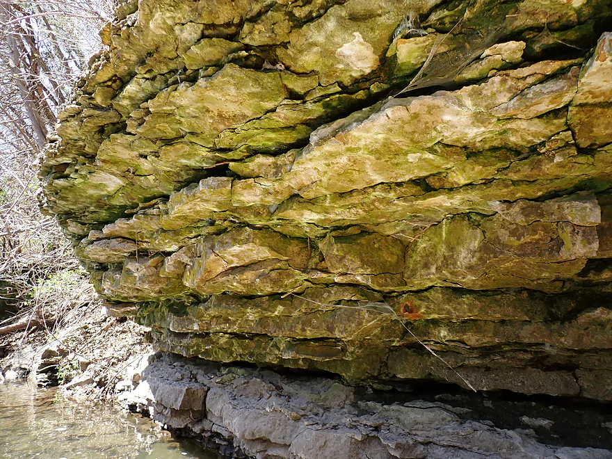
Rugged texture
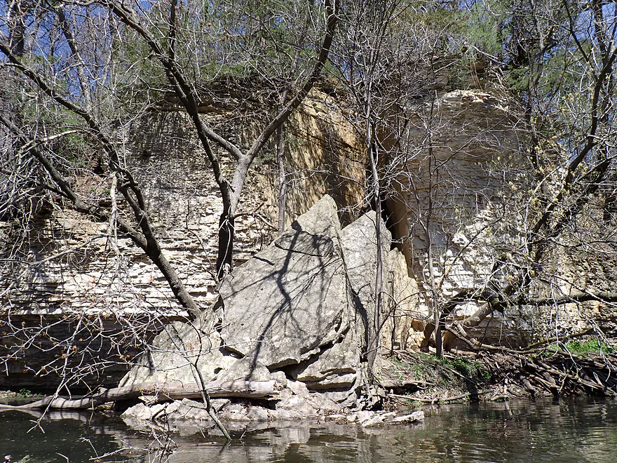
Cliff sliced off like a piece of cake
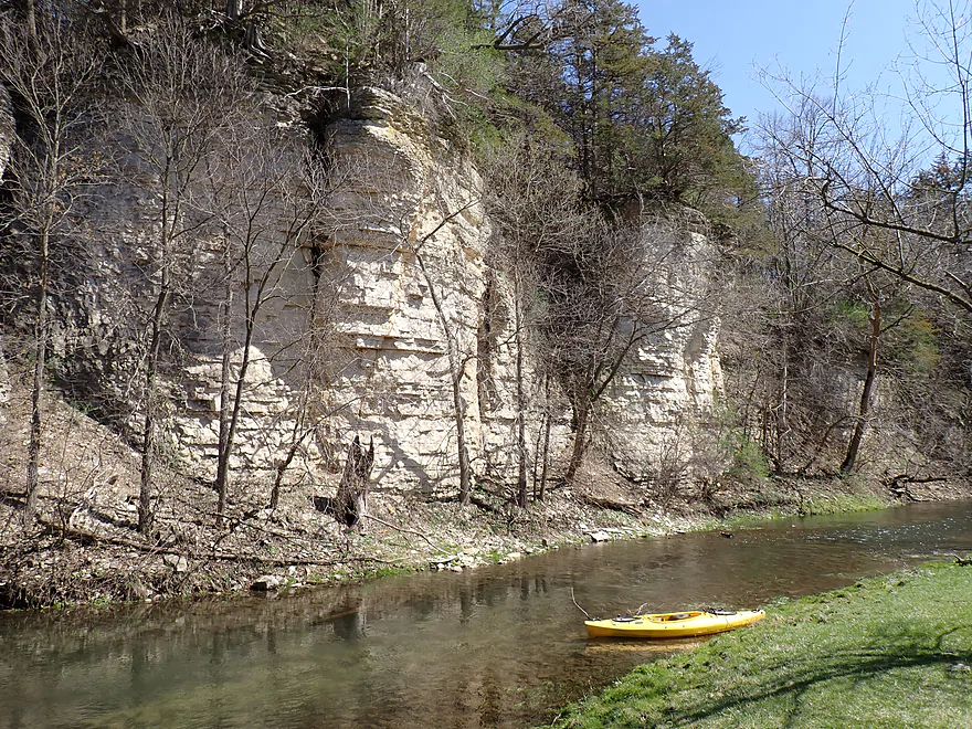
One of my favorite spots
Getting out for pictures
Tricky rapids just downstream
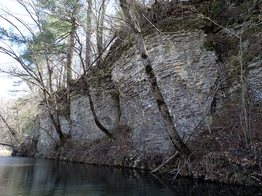
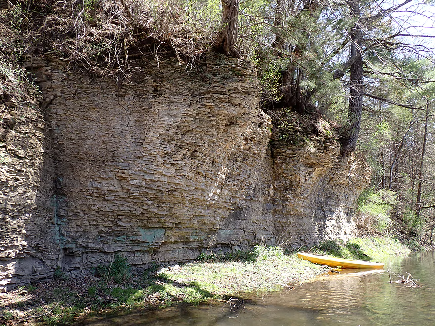
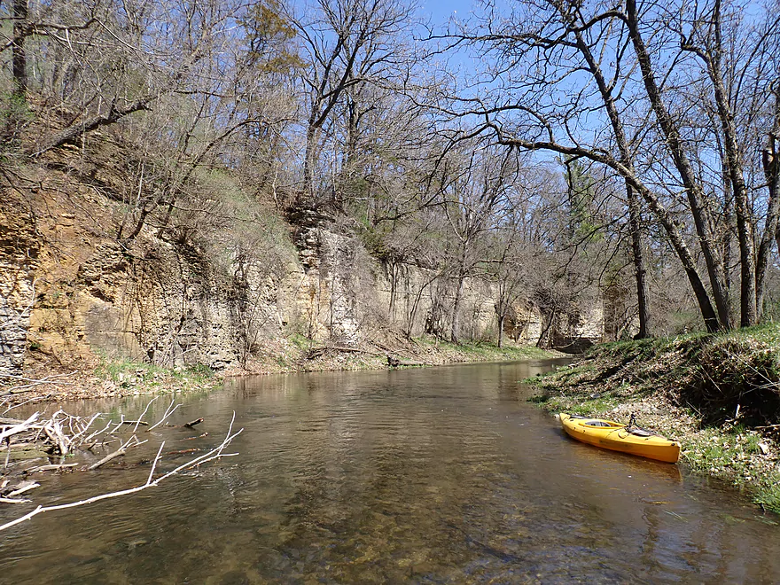
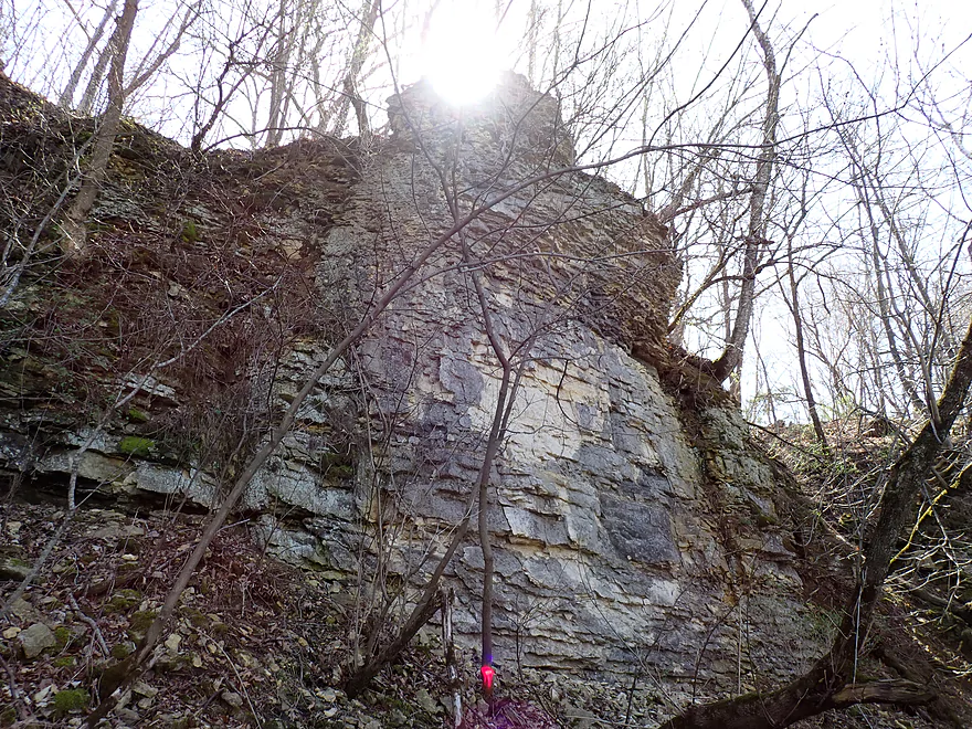
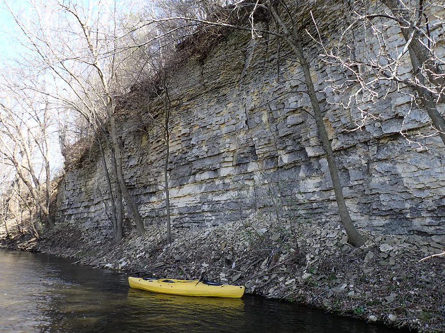
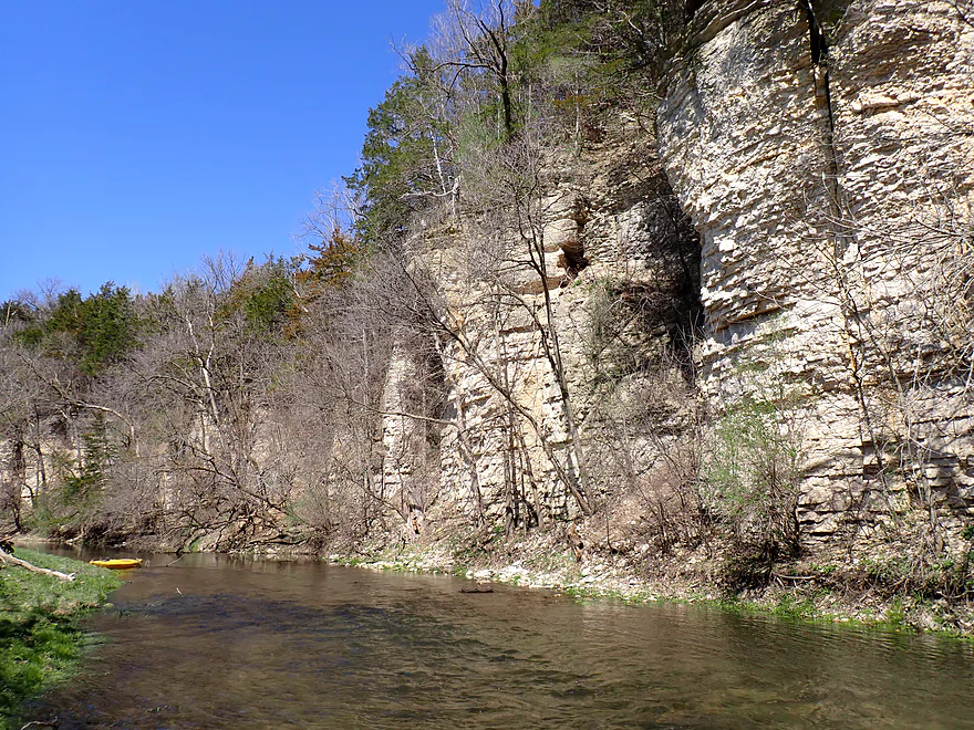
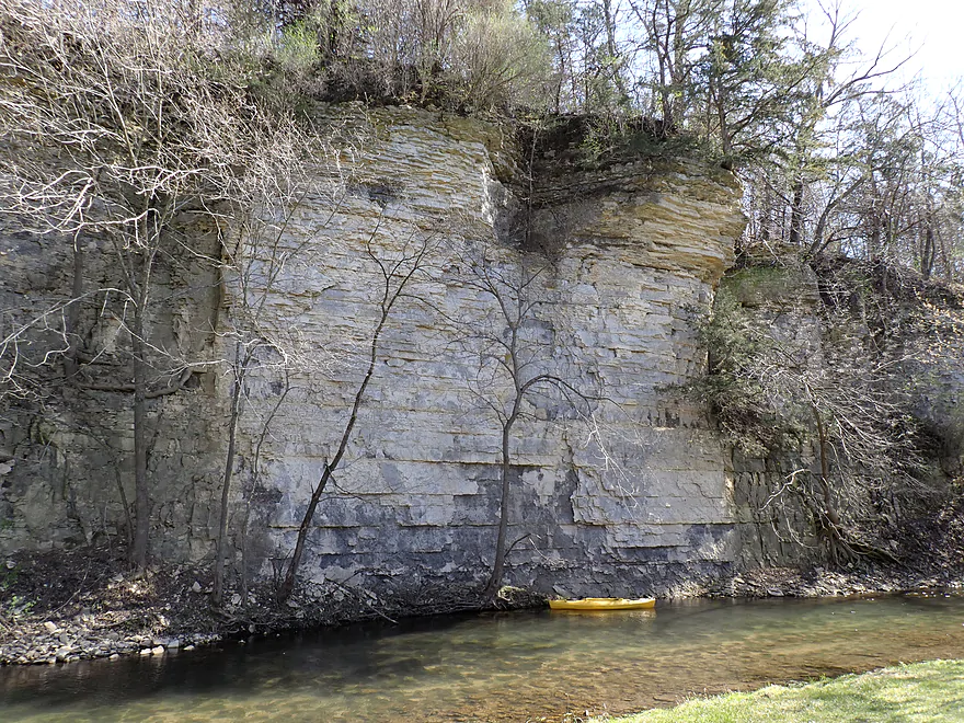
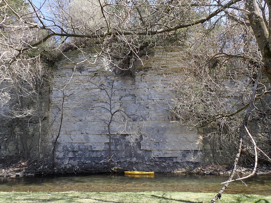
Very long rock face
I tried unsuccessfully to clear out this jam
Portaging the rapids and the snag
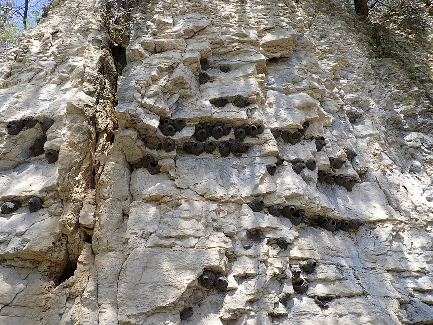
Racoons are not getting at these swallow nests
Lot of open pasture…looks like an oversized lawn
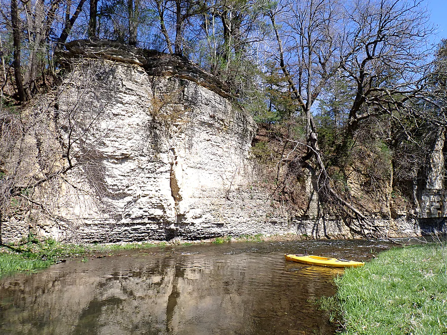
Sun-topped rock face
Another cliff with a lot of great character
Fence #2…looks electric but it wasn’t…still need to be careful though
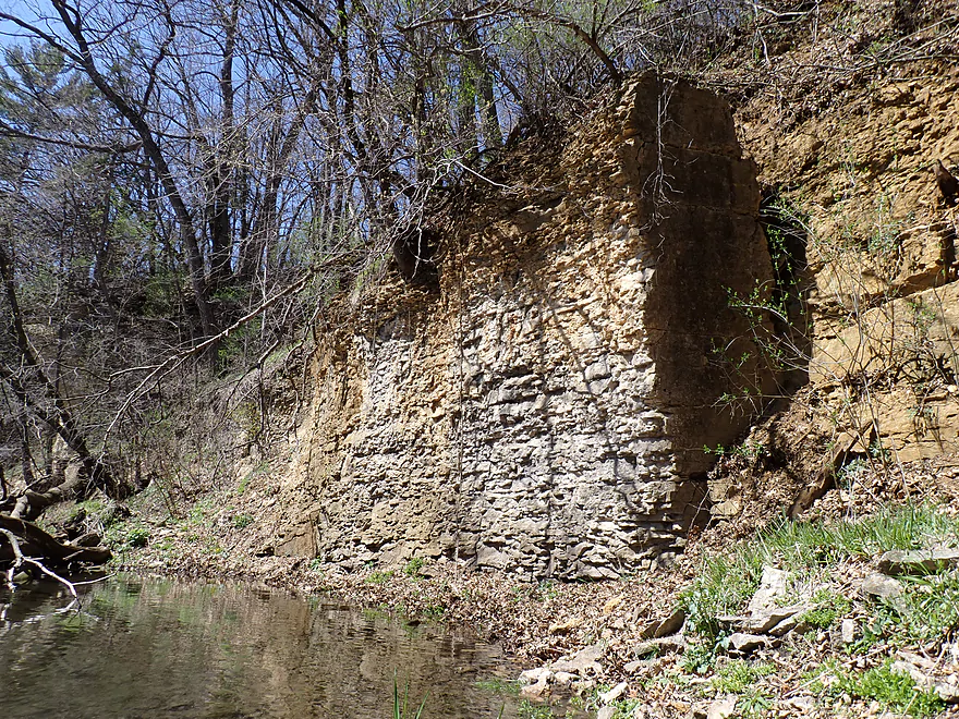
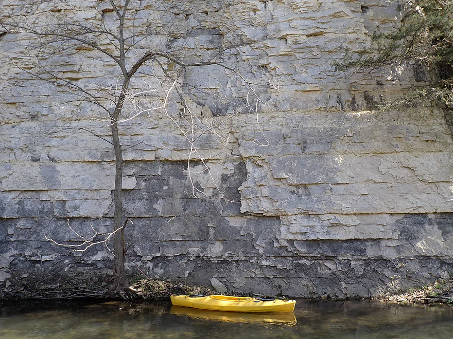
Nature’s version of a brick wall
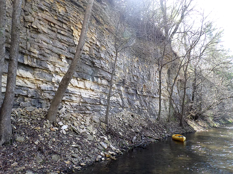
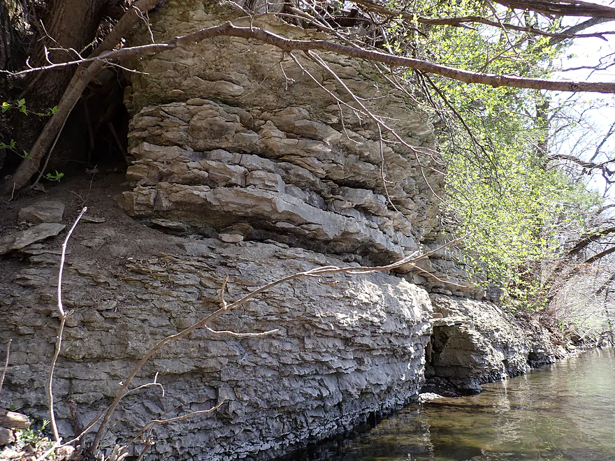
Fantastic limestone
Coming up on another horseshoe bend
Most of the cliffs faced south so were really lit up by the sun
Red cedars top this bluff
One of the tallest rock faces of the trip
Reverse view
Fun rapids
Reverse view
Approaching a pine-topped bluff
This tricky little chute had to be portaged
Reverse view…reminded me of the Rush River
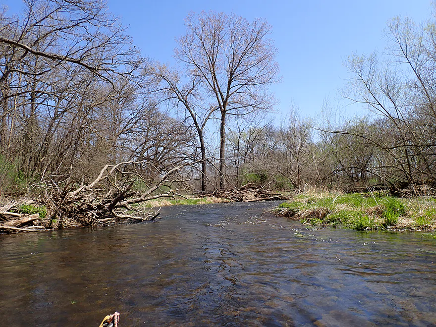
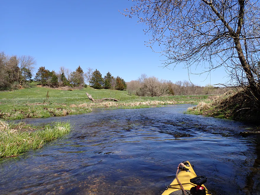
Creek starts to open up
Third and lowest fence. Not electric but barbed (had to crawl under by the grass).
Hwy 1 is a tricky take-out because of the huge bank
It was a long haul up
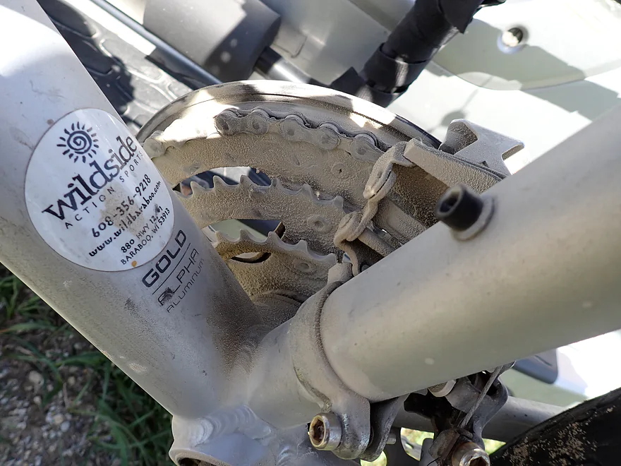
Why I don’t enjoy bike shuttling on gravel roads
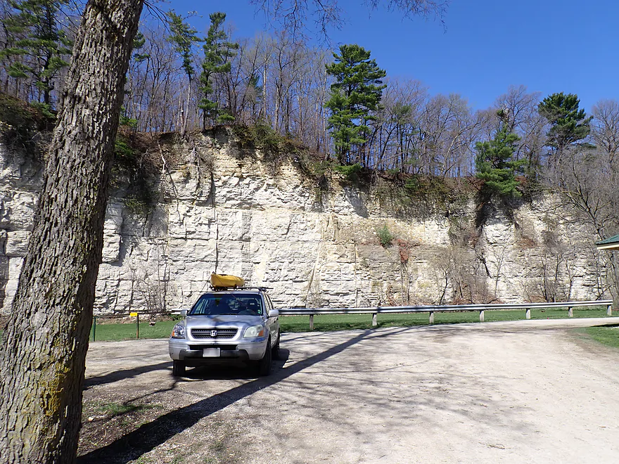
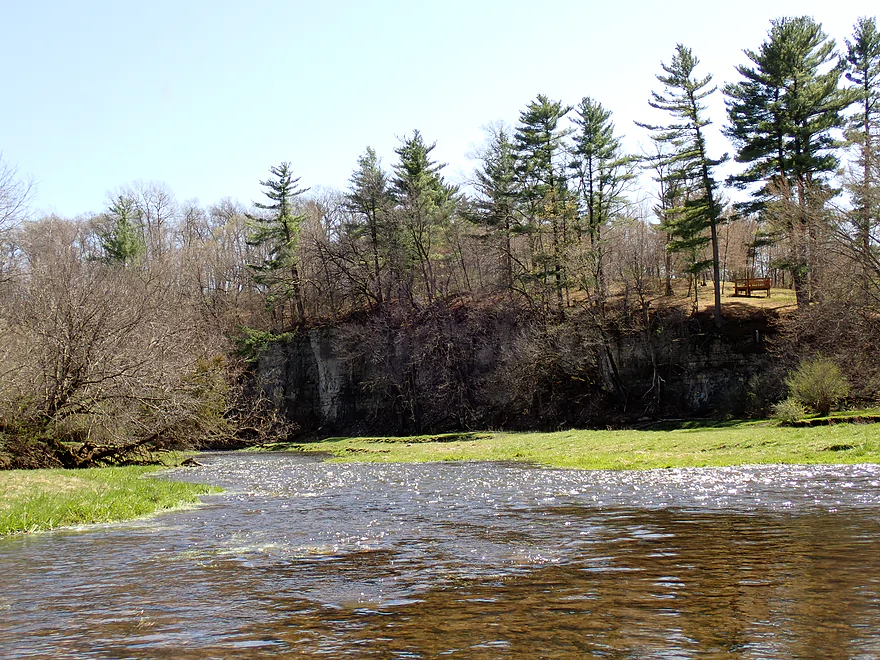
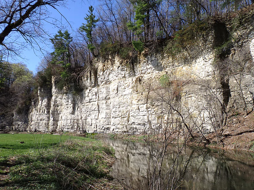
Checking out downstream Masonic Park after the trip
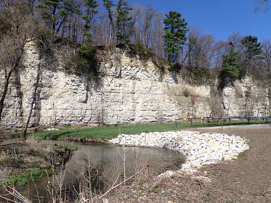
The park is known for its tall white cliffs
Some paddlers will prefer to take out here…but that would be a long trip
Deer Creek – Hwy 8 to Hwy 1

The Root is a terrific river for paddling located in southeast Minnesota. Its best parts are its far upper branches which are not popular with paddlers. This is partly because they are shallow (usually), but more so because kayakers simply don’t know they exist. Previously I paddled the North and South Branches, which were great trips, and the Middle Branch was next on my todo list. The Middle Branch is mostly just a combination of Bear Creek and Deer Creek, both of which were described as being very scenic by paddling author David Lind. Being somewhat new to this region and unsure of water levels, I opted for a simple and short leg on Deer Creek.
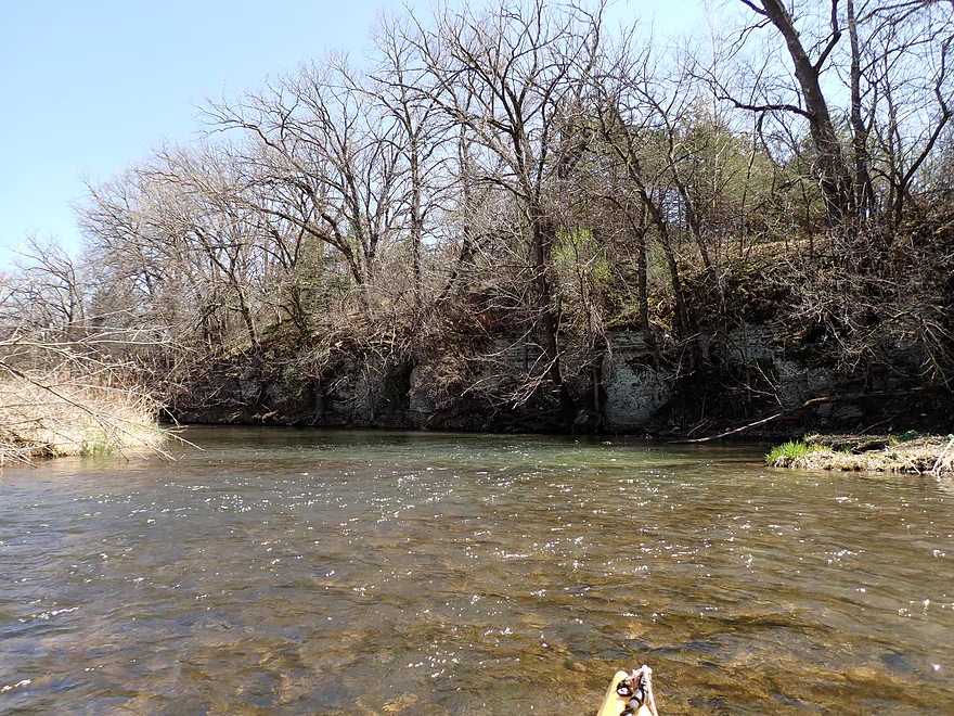
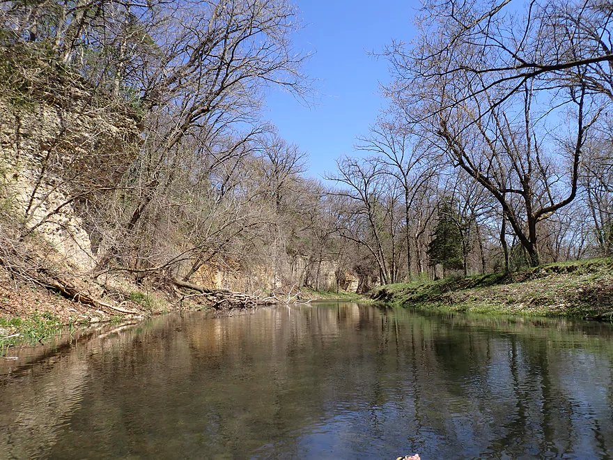
I started at the Hwy 8 bridge which, aside from an annoying tick, was a doable bridge access. The first mile was pleasant, but was the weakest part of the trip. Here there were tiny hills and scraggly banks that were less interesting. But this would change. As a general rule (with some exceptions) the further downstream on Deer Creek you go, the better the scenery gets with more rugged landscapes and geology. There were cliffs/outcrops in the first mile and they were nice, but these early ones were on the small side and obscured by vegetation and trees.
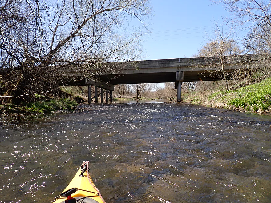
The channel was surprisingly deep with the exception of the many riffles/light rapids. Most of those were bumpy despite heavy rain ~4 days before. But it could have been much worse. Overall stream levels were near the low end of what you would want to aim for.
One of the downers of the trip were its fences. There were only two that completely spanned the river, and while they looked electric, I don’t believe any were. However they were ominous looking and quite low. For one I had to carefully lead my boat partly under, hurdle the fence from a different spot, and then double back and pull my boat the remainder of the way under the fence. After this, I started to see rolling pastures and cow pies (but no cattle). The cattle kept the grasses low…so it was like paddling past a vast lawn.
After the first fence, the cliffs got progressively bigger and nicer. I got out in several spots for pictures despite having to wade in the cold water. I hope readers appreciate how difficult some of the photos and videos were to get.
One of the best parts of the stream was a long horseshoe bend next to an impressive south-facing rock wall. This is a great trip to do when sunny, as most cliffs face south and light up spectacularly when hit by the sun. The limestone cliffs also had terrific texture and character…almost like bricks.
There were several rapids at the base of the cliffs. Some were fun, but a few were a bit pushy and had strainers. I tried to manually clear out one of the strainers but couldn’t do much without a saw. With both strainers, the portages were simple and easy. In high water though, some of the rapids and strainers could be pushier and more difficult.
Following fence #2 (another seemingly electric but not electric fence) and some amazing limestone cliffs, the river turned north again and flowed over some bumpy riffles. Finally the river was rerouted south again by yet another impressive set of cliffs shaped like a horseshoe. Technically I believe these were the tallest cliffs of the trip and were topped by attractive red cedars.
This was followed by yet another nice rapids/cliff combo (very much reminiscent of last week’s trip on the Rush River). Unfortunately it did have a strainer, but that was an easy portage.
I soon had Hwy 1 in sight (my take-out). Unfortunately there were a few remaining challenges. The first was a crazy low cow fence. This wasn’t electric, but was barbed and tricky to get past. I barely was able to slide my boat under. Then I went ashore and crawled like a worm under a small gap in the fence. All of this was within eyesight of “No Trespassing” signs and another sign that said the area was under video surveillance. I presume (hopefully correctly) that Minnesota like Wisconsin lets paddlers portage obstacles.
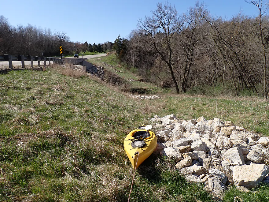
I ended my trip at the Hwy 1 bridge which towered overhead. Most won’t take out here as they will prefer a longer trip, but it was my end of the road. The embankment though is very large and steep. I had to cancel my plan to get out on the upstream side and opted for the downstream side which was much nicer, but it still took some effort to lug my boat up the bank, past the guardrail and to my car.
In summary this was a terrific trip. It has to be one of the most scenic in southern Minnesota, but interestingly enough, it is not even the most scenic on Deer Creek itself. The downstream two legs are even better (I know this from watching this video). The only reason I didn’t do those later legs was my concern about getting back too late (long drive home on a Sunday) and my uncertainty about water levels. Water depth wasn’t as much of a problem as anticipated, but this definitely isn’t a creek to do when very low. I look forward to doing not only more sections of Deer Creek in the future, but also Bear Creek which should be similar.
Sights included small clams, a few schools of fish, lots of singing birds, and nests in the cliffs (both pigeon and cliff swallow). There was a tick at the put-in…as with many kayak trips that involve contact with grasses, you should spray your legs with Deet free insect repellent.
Masonic Park: This is a small and obscure park located along the banks of Deer Creek. Its highlight are the impressive, whitish limestone palisades that border the creek. In fact these might be the best and most impressive cliffs on the river and the park can be a great take-out for paddle trips. Many years ago, I believe the Weisbeck’s Sawmill and Furniture Factory was located here. The cliffs were referred to as the “Hogsback” and a plan was to create a 30′ dam here and then tunnel a millrace through the cliffs. Today there is no evidence of the former sawmill, and it appears the millrace and dam were never built (thankfully). A landowner donated the land to the area Masonic Lodge, who developed the park and built a pavilion. The Masons, in 1999, gave the land to Filmore County.
Hwy 8: This is a doable bridge access, but I recommend NOT launching from the north side as there is an adjacent home and lawn there. Instead launch on the downstream/east side where it is easy to launch just above the light rapids.
Alternate Put-ins:
- Mower Fillmore Road (4.1 miles upstream from Hwy 8): I didn’t scout this, but I assume it would be a doable put-in. This bonus leg is somewhat unknown but I think it would have a number of nice but small outcrops. There could be a few logjams.
Hwy 1: This is a tricky (but doable) bridge access because the banks are so large and steep. The best bet is the northeast corner but you still have to lug your boat 200′ up a grassy hill to reach your car. Shoulder parking though is pretty good.
Alternate Take-outs:
- 141st Ave (2.2 miles downstream from Hwy 1): I’m not sure this is a great bridge access (south end looks steep and north end is next to a house). But this bonus leg should be very scenic with some great cliffs.
- Masonic Park (6.2 miles downstream from Hwy 1): This is a great public take-out option (and super scenic). This bonus leg will include the most scenic part of the creek and is highly recommended. Only downside is this would be a longer trip if you were to start from Hwy 1.
Bike Shuttle – Hwy 1 to Hwy 8: 2.3 miles with 72′ of ascent. This is a relatively short and thus easy bike shuttle. The only downside is about one mile of gravel…dust got everywhere, including in my chain assembly.
Fences: There were three fences on this trip. The location of each is marked on the trip map.
- Fence #1: This fence doesn’t completely span the river, so it is easy to simply paddle around. It had a simple wire so it looked electric, but I don’t think it was.
- Fence #2: A very low fence. I had to lead my boat under and then hurdle the fence. I was worried this was electric, but I tested it (carefully) and it didn’t appear to be.
- Fence #3: This is located close to the take-out/Hwy 1. It is crazy low and I was only barely able to squeak my boat under. I then had to go ashore by the No Trespassing signs and slide under the fence. I don’t think this fence is electric, but don’t quote me on that.
Logjams: None.
Current/Rapids: There are a decent number of riffles and rapids. In general these were doable Class 1 rapids, but there were two sets of rapids with strainers that I portaged (2:42 and 5:25). Note these rapids are much more difficult and pushy in higher water. You can see a video of a kayak trip in high water here. Paddling author David Lind also relayed an account of in which he did Deer Creek when it was very high, and he got dumped by a strainer, and temporarily lost his canoe.
Closest Gauge: South Branch of the Root River @ Lanesboro
My Trip Depth: 191.5 CFS or 2.608′ (Don Schaub took a video of this stretch at 750 CFS for comparative reference)
Gauge Guide: The following are very rough estimates that could be inaccurate. Always use your own judgement.
- < 100 CFS: Probably too shallow.
- 101-160 CFS: Very shallow…a handful of rapids may have to be waded.
- 161-220 CFS: Low depth and you’ll hit a lot of rocks, but it should be doable for shallow drafting boats. These are safe levels for those worrying about the creek getting too pushy.
- 221-320 CFS: Medium depth. You might still hit a few rocks, but this should be a nice target range.
- 321-450 CFS: High depth. River will start to get pushy and lose any semblance of good clarity. The fences and strainers will likely need to be carefully portaged.
- 451-600 CFS: Higher depth. Only suitable for skilled paddlers.
- 601-800 CFS: High depth. Only for advanced paddlers. Current will be tricky and will push you into the rock faces. Video at 750 CFS.
- 801-1000 CFS: Only suitable for advanced whitewater paddlers. The fences and strainers will be difficult to deal with.
- 1001+ CFS: Maybe too high for any paddler.
Misc Notes: There is actually a better gauge at Fillmore just downstream from Deer Creek. I didn’t reference this because it lacked historical data but its readings would be more accurate. I did the a trip at 997.23′ or 173.00 CFS.
Click here to see an overview map of Deer Creek, Bear Creek, and the Middle Branch of the Root River.
Deer Creek:
- Upstream from Hwy 63: I don’t know much about these parts. I suspect they are small and shallow. There might be some outcrops, but relief maps suggest they wouldn’t be very big.
- Hwy 63 to Mower Fillmore Road: 2.0 miles. A small leg with maybe a few logjams. There appear to be outcrops but they are likely small.
- Mower Fillmore Road to Hwy 8: 4.1 miles. Good prospect with multiple medium-sized outcrops. There may be a large logjam cluster under the railroad bridge.
- Hwy 8 to Hwy 1: 3.2 miles. First of the great Deer Creek legs. Includes many impressive limestone outcrops. Portages may be required for two fences and two strainers in rapids. This can get pushy in high water and bumpy in low water.
- Hwy 1 to 141st Ave: 2.2 miles. A terrific leg with fantastic limestone cliffs. In high water the rapids and snags can be tricky. A video of this stretch (1:51 to 3:25) can be seen on Youtube.
- 141st Ave to Masonic Park: 4.0 miles. This has some tricky rapids and possible snags, but it’s also likely the most scenic leg on Deer Creek (if not all of southern Minnesota). Highlights include gorgeous limestone outcrops with the best and tallest residing at Masonic Park. A video of this stretch (3:25) can be seen on Youtube.
- Masonic Park to Hwy 8: 5.1 miles. Great prospect with steep terrain and many cliffs.
- Hwy 8 (1st bridge) to Hwy 8 (2nd bridge): 0.7 miles. Deer Creek starts to flatten out with far fewer scenic outcrops. There should still be a nice bluff along the south bank.
- Hwy 8 (2nd bridge) to Nature Road: 0.9 miles. An open stretch with some pasture and sandbars.
- Nature Road to Mouth (Deer Creek and Bear Creek confluence and start of the Middle Branch): 0.3 miles. Last leg on Deer Creek.
Bear Creek:
- Upstream from Hwy 476: The creek is likely navigable, but I doubt the scenery is as good.
- Hwy 476 to Hwy 1: 8.7 miles. The first half is flatter and less interesting. There may be a few logjams to deal with. The second half should feature terrific wooded bluffs and outcrops. Here is a great video.
- Hwy 1 to 141st Ave: 1.5 miles. Super scenic bluffs and cliffs. Fast current with possible fences and strainers can make this a challenging if not dangerous section in high water. Bear Creek is bigger than Deer Creek but can still run shallow. Here is a nice video of that stretch.
- 141st Ave to Hwy 38: 4.0 miles. Creek twists through a narrow valley with incredible outcrops. This is likely one of the most scenic legs on the river. Warning: it can be trying in low water or high water. Stay alert for electric fences. Here is a nice video of that stretch.
- Hwy 38 to Nature Road 1: 3.1 miles. This might be the second most scenic leg of the creek with three sets of fantastic palisades. More tight turns past incredible bluffs and cliffs. Warning: this too can be trying in low water or high water.
- Nature Road 1 to Nature Road 2: 3.3 miles. Creek is more open and a bit slower…but still some shallow rapids and a few cliffs. Not for beginner paddlers, with some snag dodging…and not to be done during high water. Video of that stretch starting from 6:55.
- Nature Road 2 to Mouth (Deer Creek and Bear Creek confluence and start of the Middle Branch): 0.9 miles. Last leg of the creek. Channel flows past a large west-facing bluff. Video of this stretch starting from 9:03.
Middle Branch:
- Start of the Middle Branch (end of Deer/Bear Creeks) to Hwy 5: 1.5 miles. A mediocre leg, but there might be a nice bluff by Filmore. Video of this stretch starting from 9:25.
- Hwy 5 to Morgan Road: 7.1 miles. While not having the elite scenery of Deer or Bear Creek, this is still a good leg with a few outcrops and light rapids.
- Morgan Road to Hwy 7: 2.6 miles. An ok prospect with perhaps a few outcrops.
- Hwy 7 to Confluence with Main Branch: 1.4 miles. Last leg on the middle branch. Nice stretch through a wooded valley. Might be some outcrops.
- Confluence to Juniper Road: 0.3 miles. A short leg on the main branch to reach an access.
- Juniper Road to Parsley Bridge Access: 3.4 miles. Another take-out option on the main branch. This is a nice leg with good scenery and outcrops.
Trip Map
Overview Map
Video
Photos Size:
Thanks for sharing your trips. Excellent photos and write-up! It’s almost like I’m there.
Thanks for the comment!