
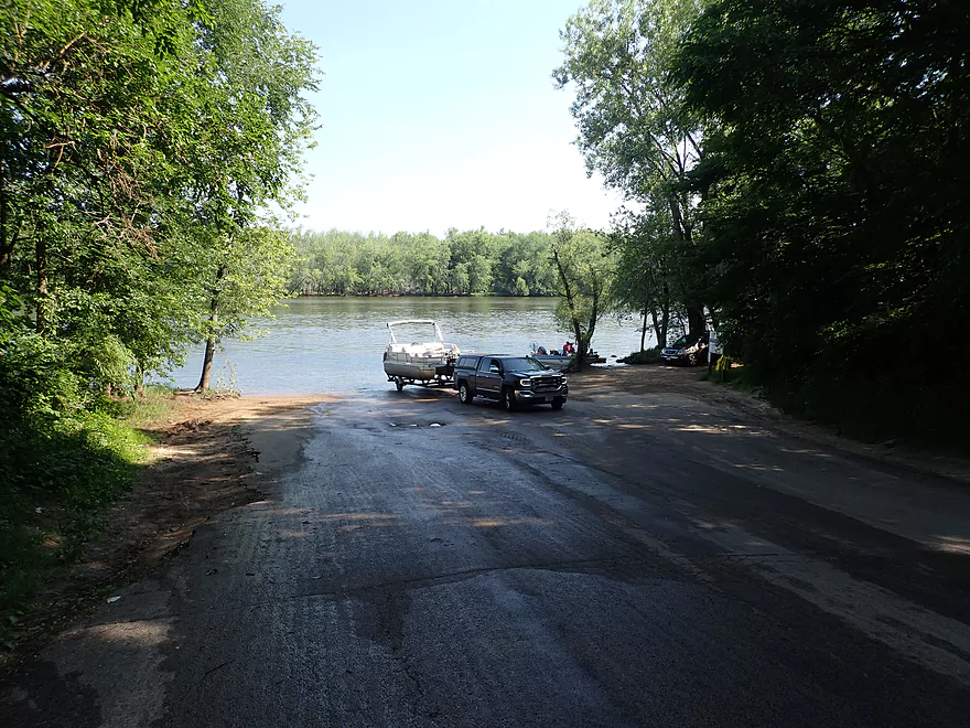
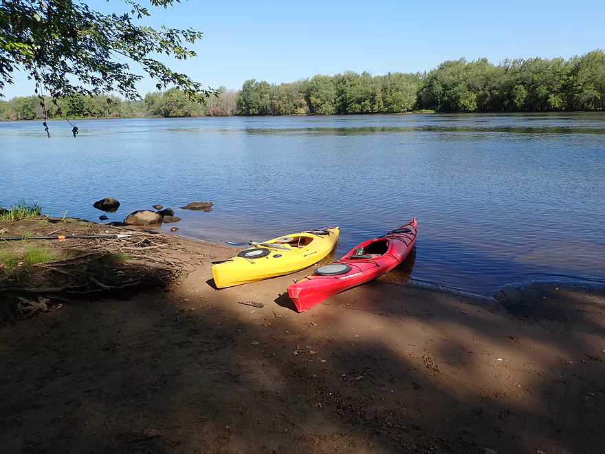
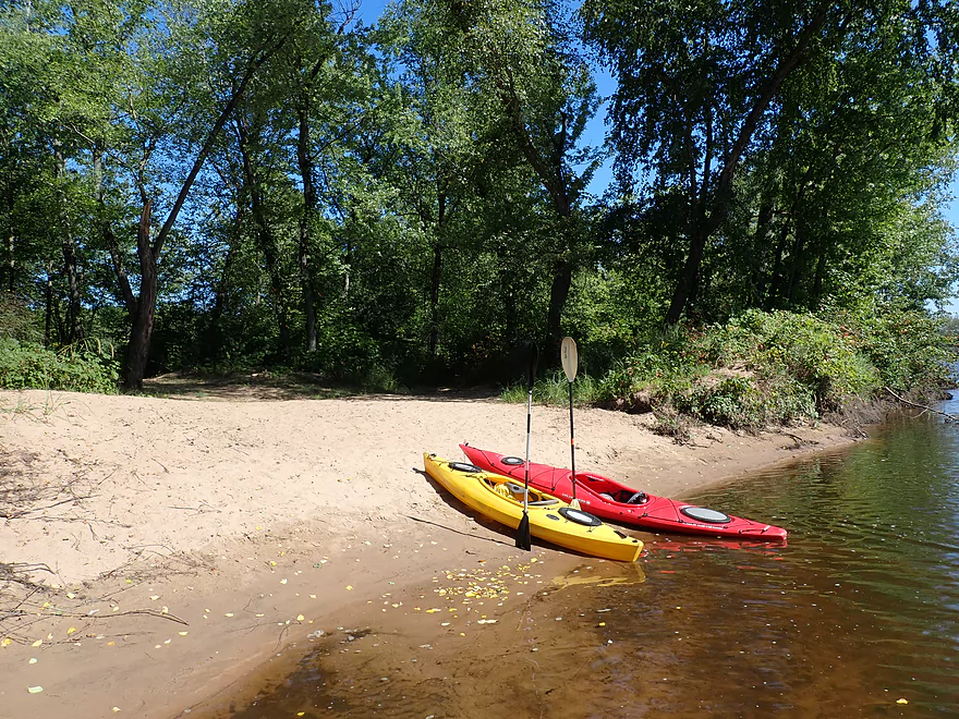
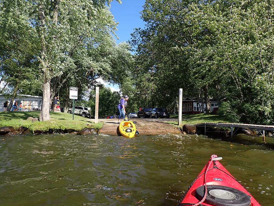
Starting the trip at Dekorra Landing
Good access
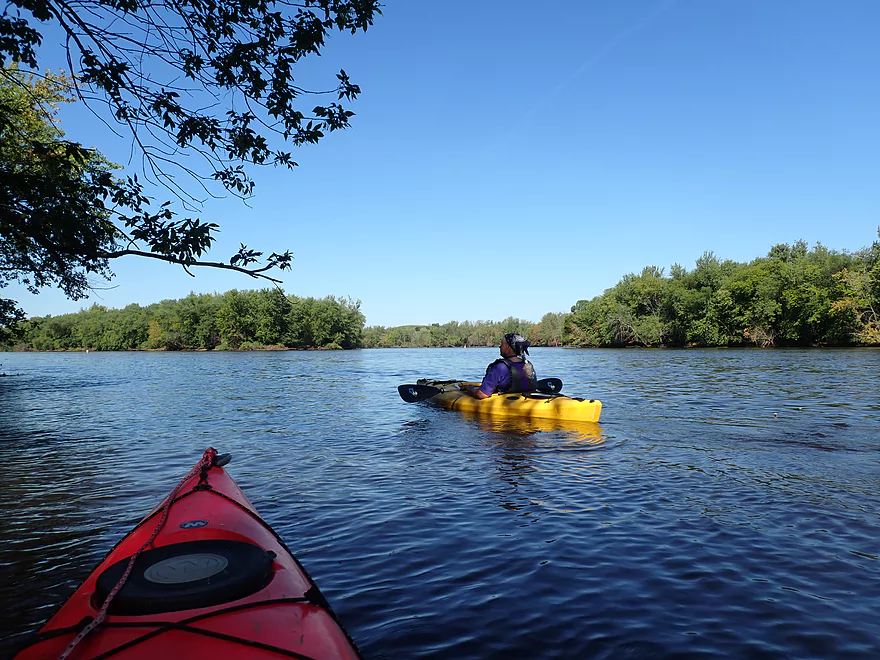
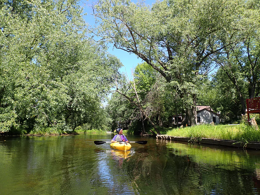
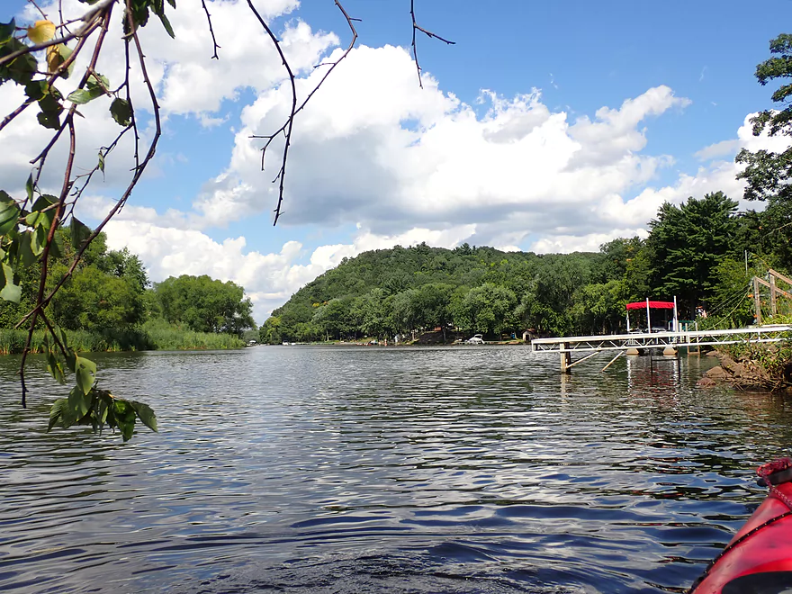
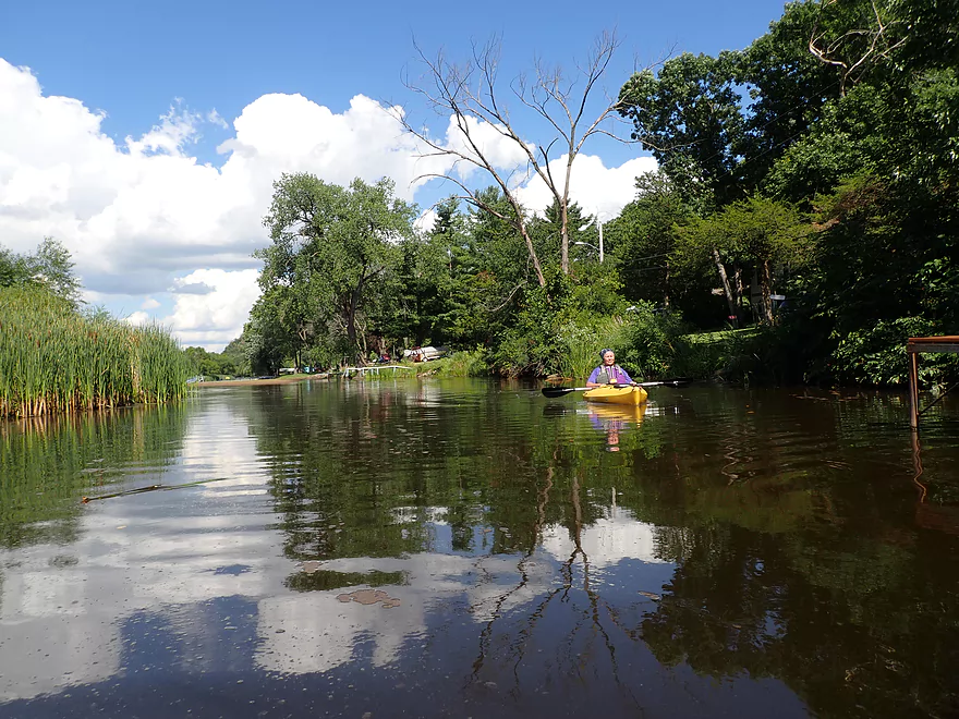
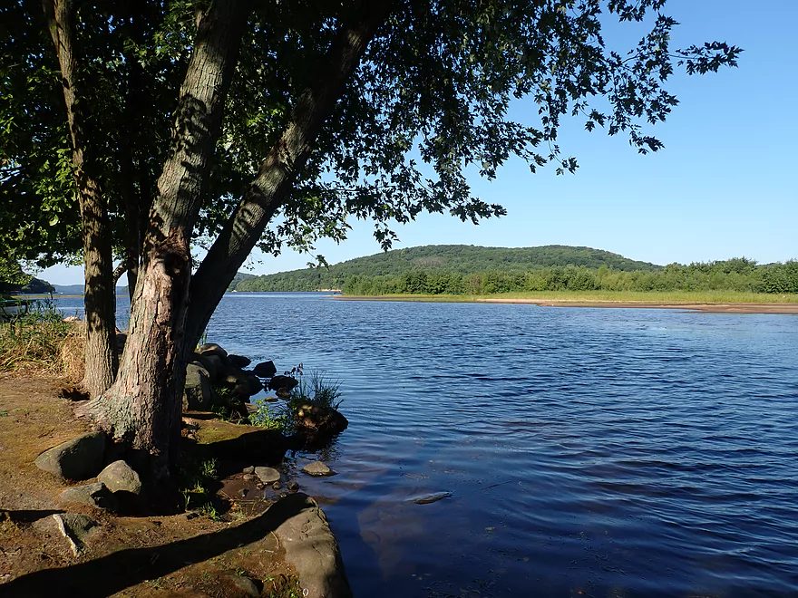
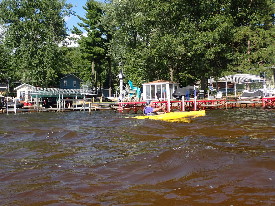
This is the south channel
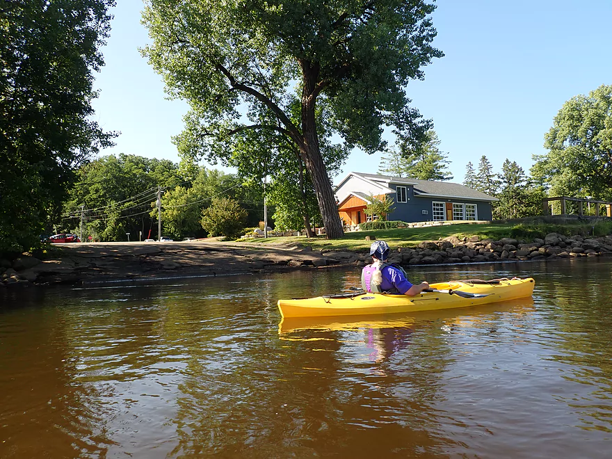
Hooker’s Resort is another public landing
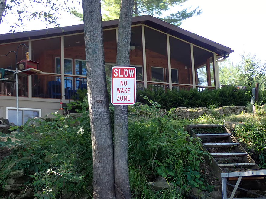
The south channel is No Wake
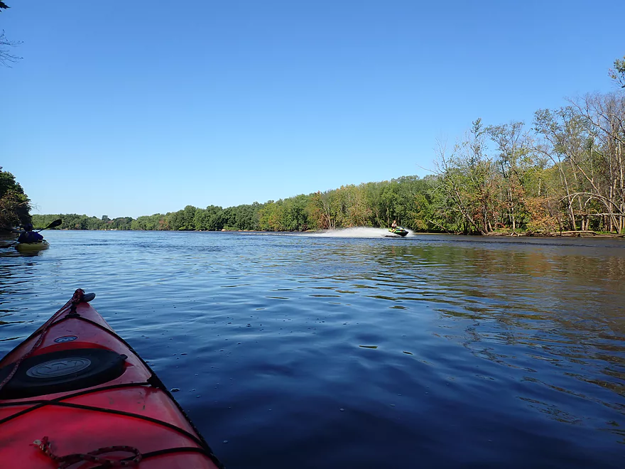
Which the jet skiers ignore
Otherwise a quiet and pleasant section
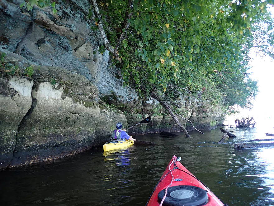
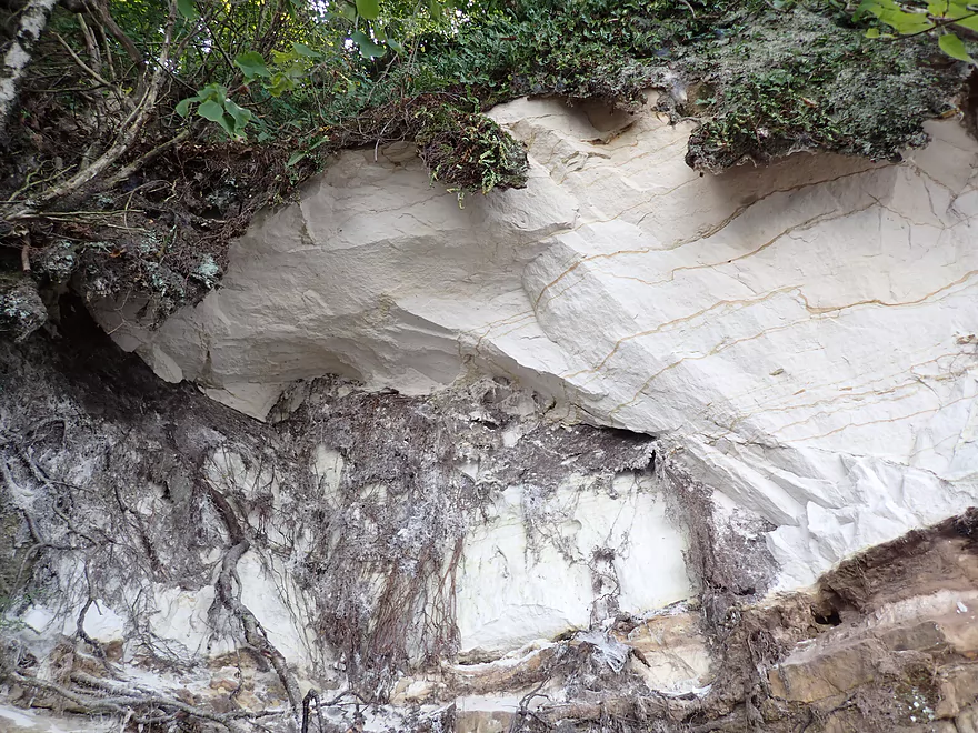
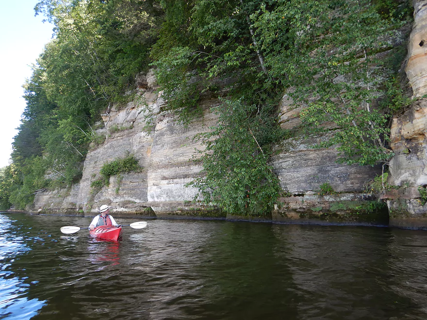
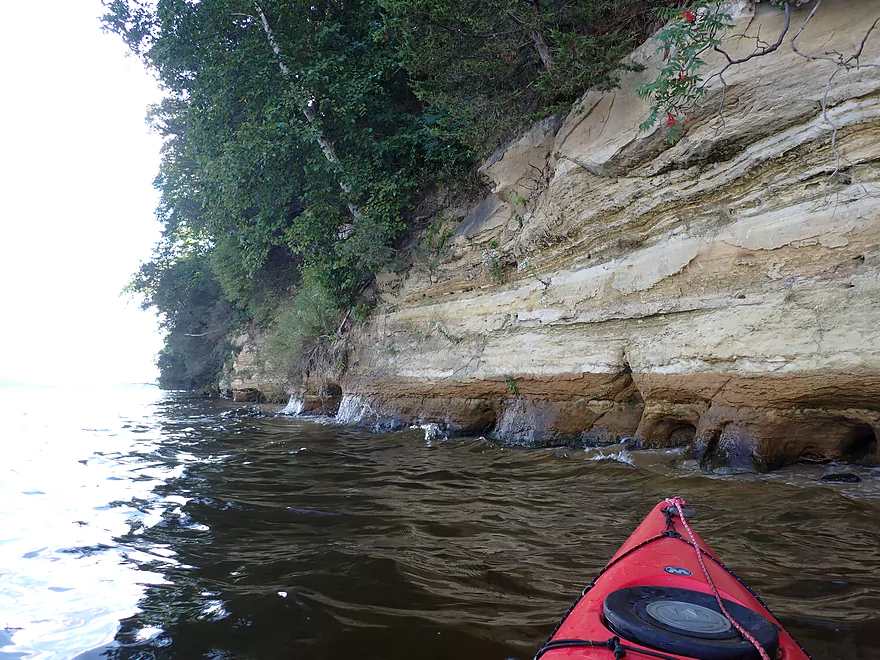
Outcrops below St. Lawrence Bluff
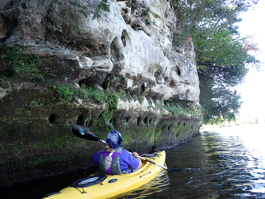
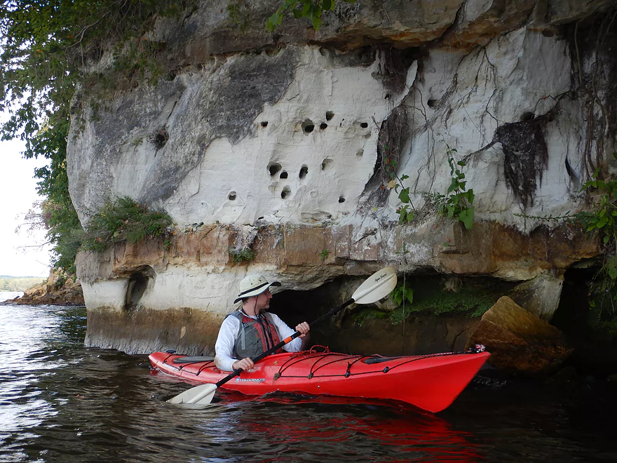
Cliff swallow nest holes
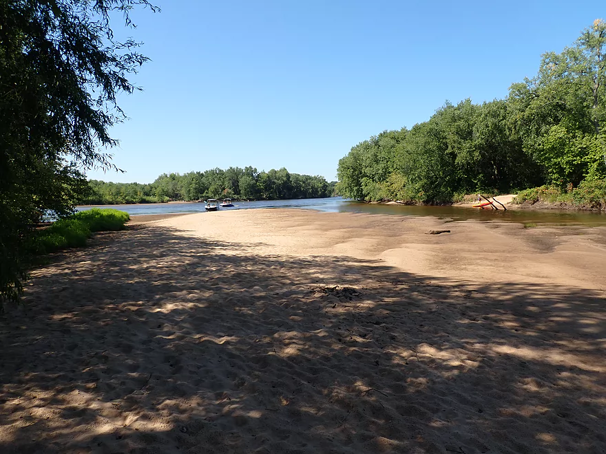
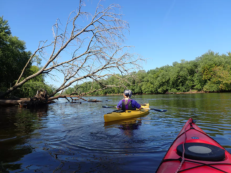
Just north is a nice cluster of islands and sandbars
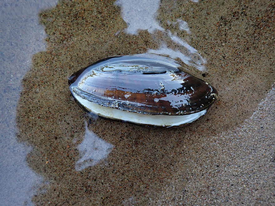
We saw a number of clams (a black sandshell)
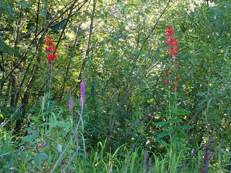
Solitary cardinal flowers dotted the shore and islands
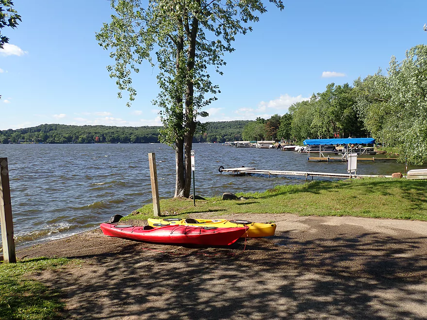
Taking a sandbar break
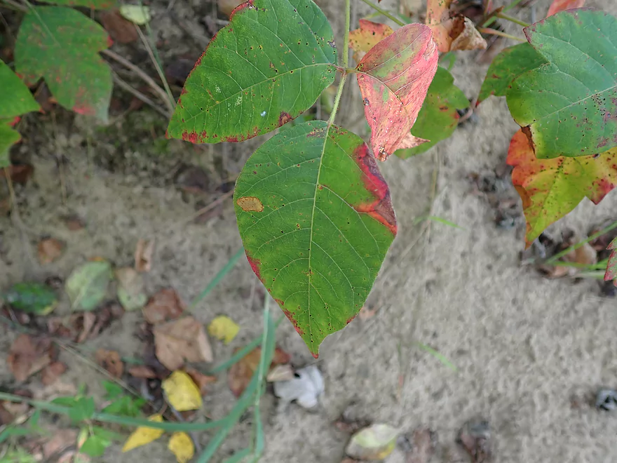
Many of the islands have poison ivy issues though
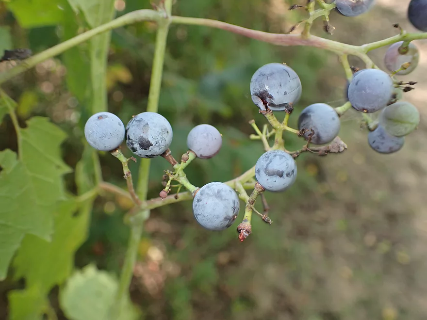
Wild (and edible) grapes
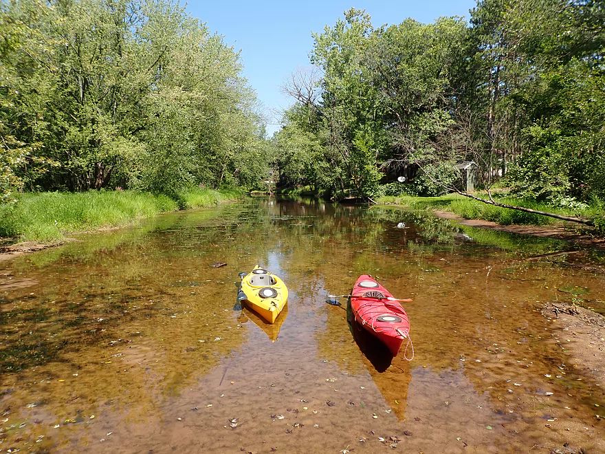
A shallow area that’s difficult for big boats to access
Entrance to the interstate back channel is silted in
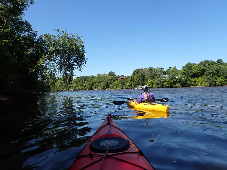
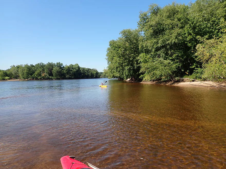
Heading out on the main channel
In high water you can actually paddle between the trees
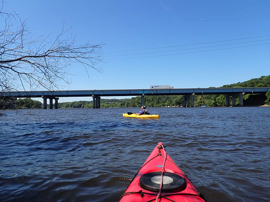
I-90
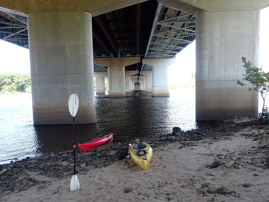
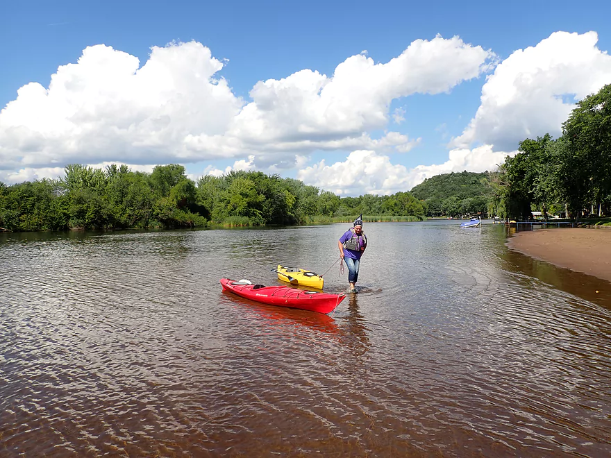
Taking out under the bridge to walk to the back channel
7 years ago, we were able to cross the channel under the bridge in high water
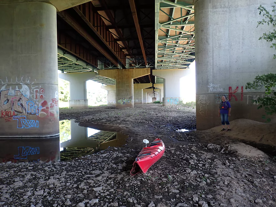
But now we needed to portage to get there
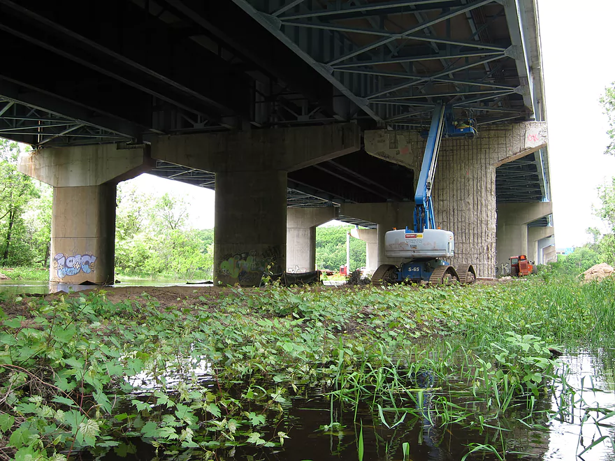
Heavy construction from 7 years ago
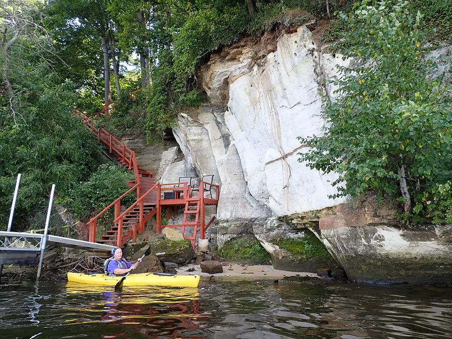
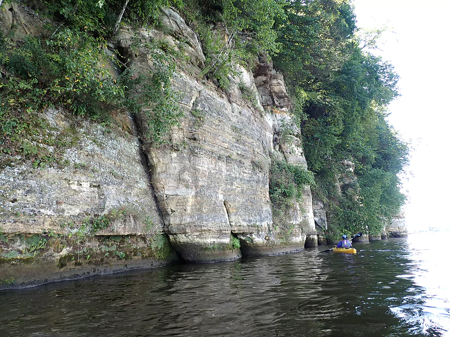
Terrific white bluff on the south channel
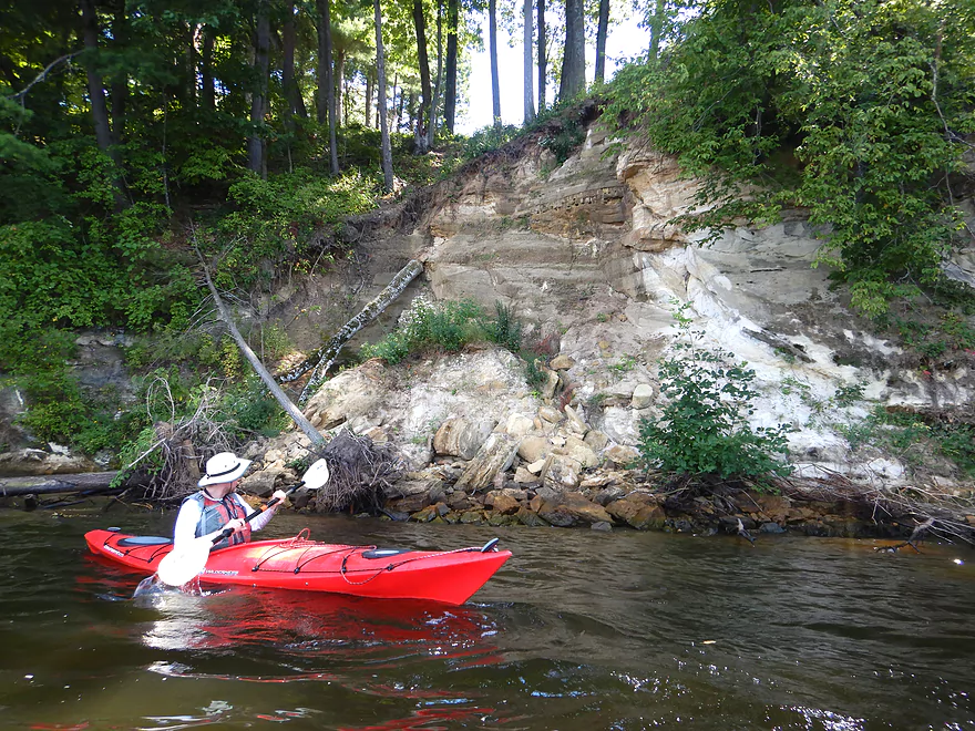
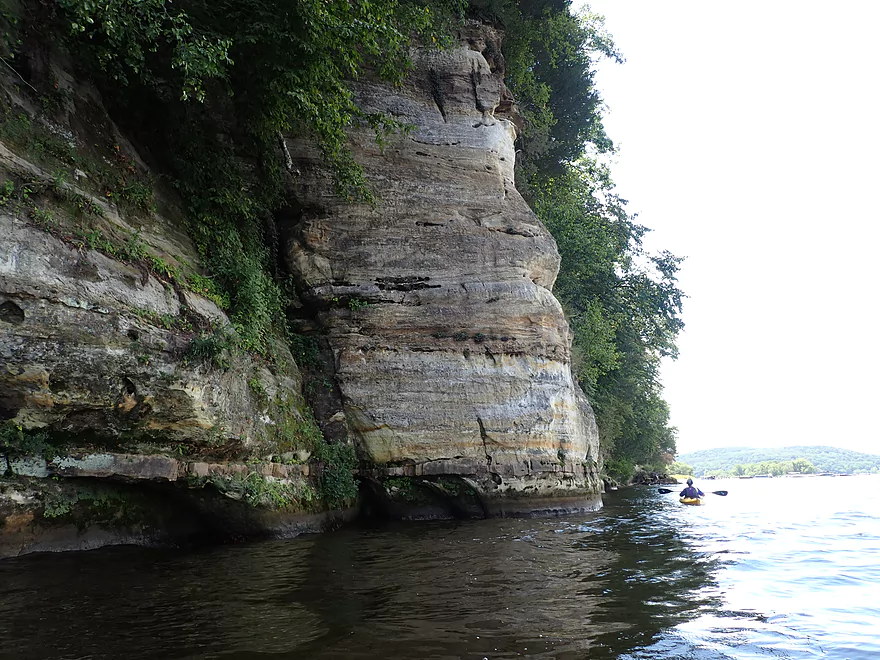
Additional outcrops on the back channel
But this was the nicest one
The south channel was very nice
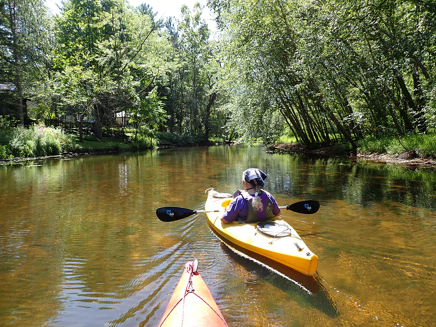
Good clarity
But a bit shallow
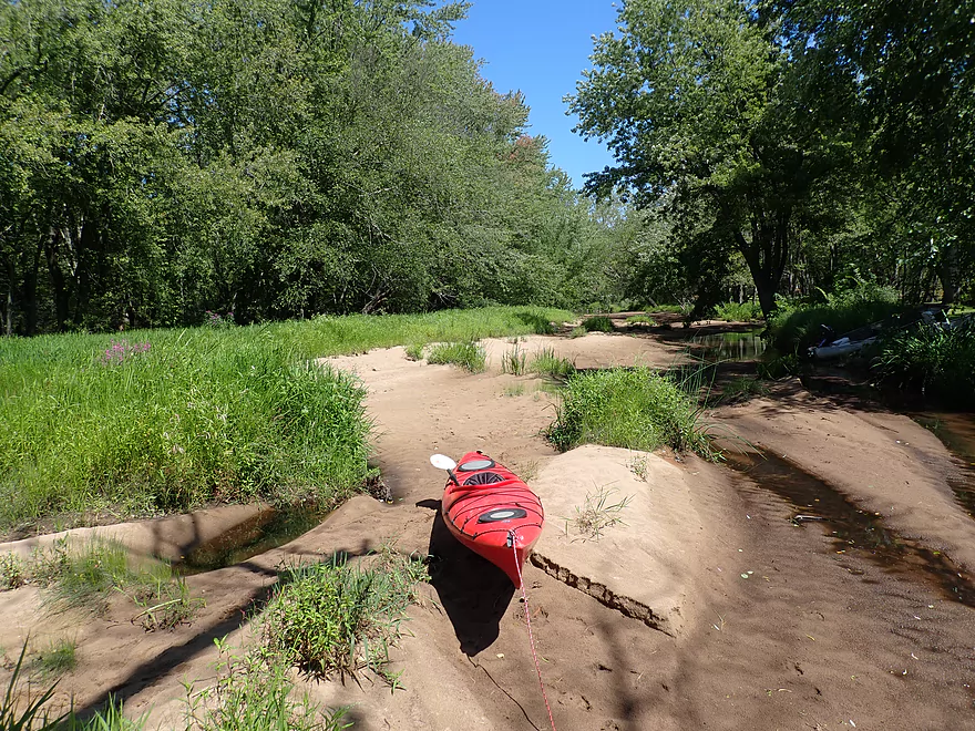
We had to portage some dried up sections
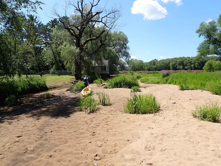
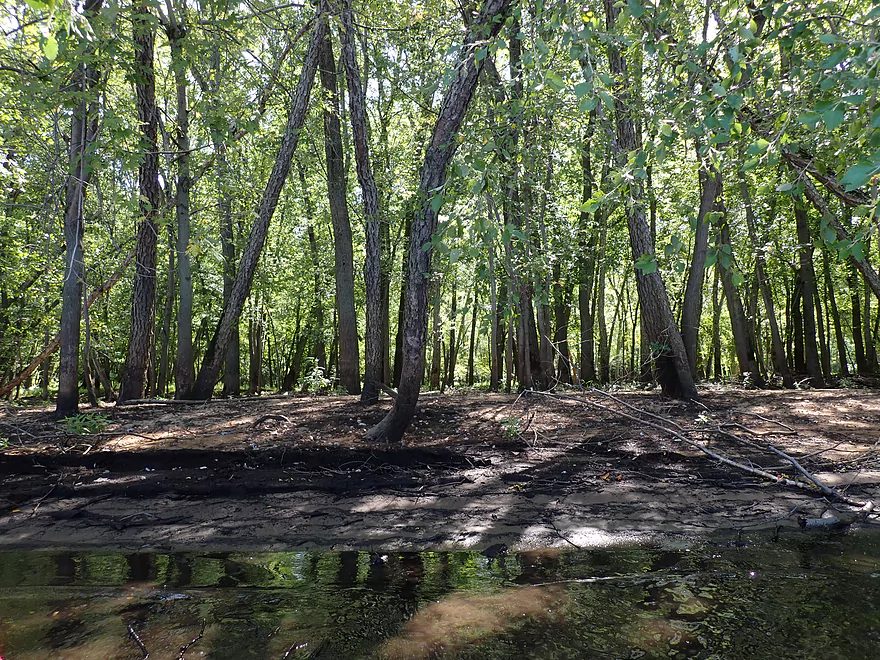
At one point there was a river channel here
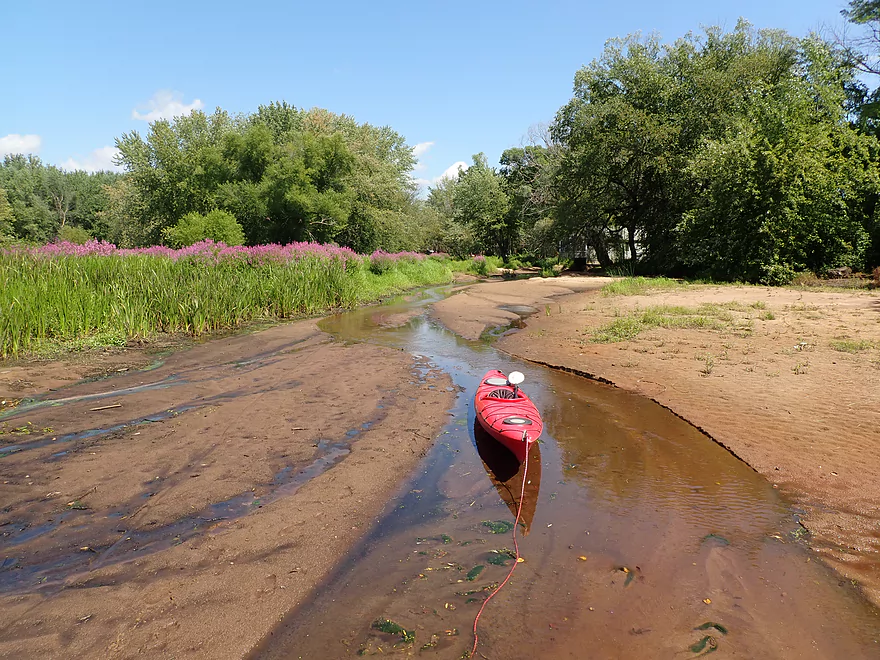
All that remains is a little creek
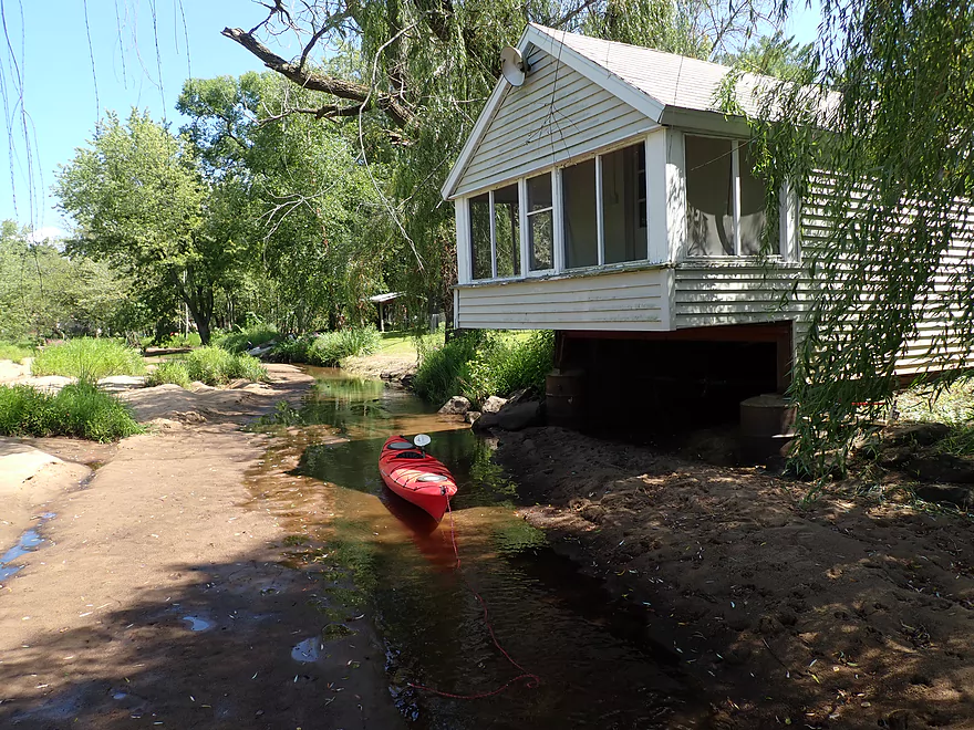
And some stranded boathouses
A very scenic area though
Purple loosestrife marks the way to open water
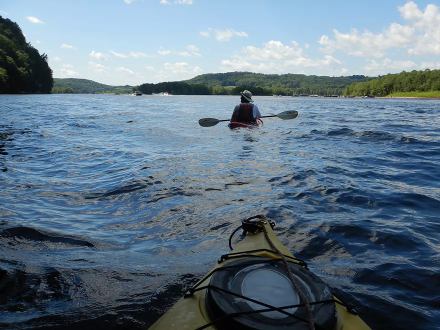
Finally on big water
Another closed up side channel
Same scene…but 7 years ago
Some more sandbars and shallow water
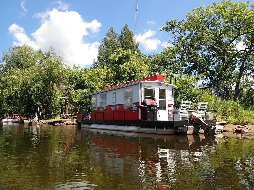
A nice houseboat
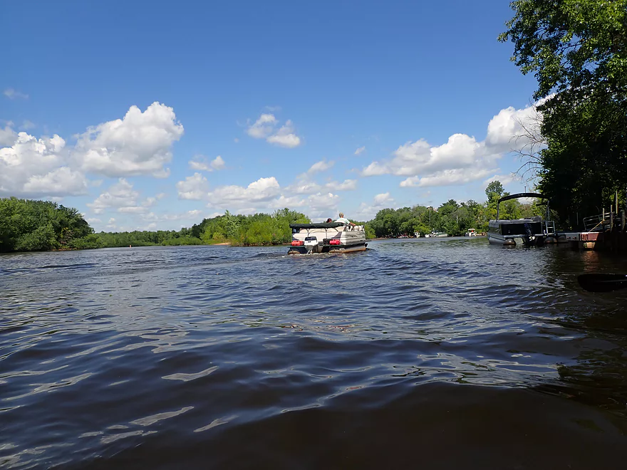
This area by Hwy V is a pleasant side channel protected by no-wake buoys

The start of Focke’s Bluff (almost a mile long)
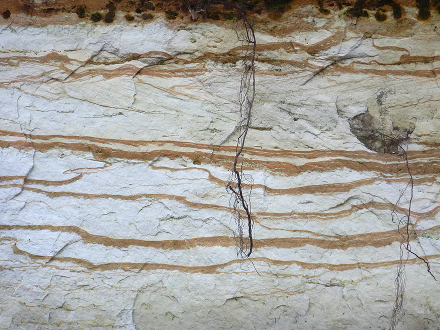
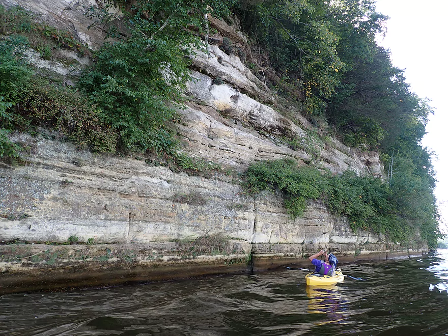
Newly exposed sandstone surfaces showed beautiful layered patterns
Roots doing a number on the sandstone
A number of homes had elaborate staircases
Erosion has gotten really bad here
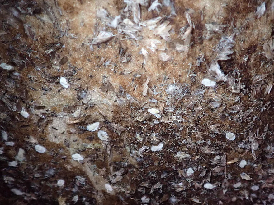
Countless insect exuvia
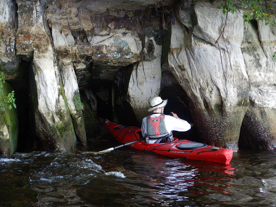
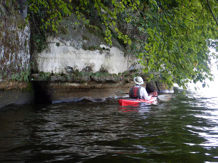
A scenic alcove with pillars and caves
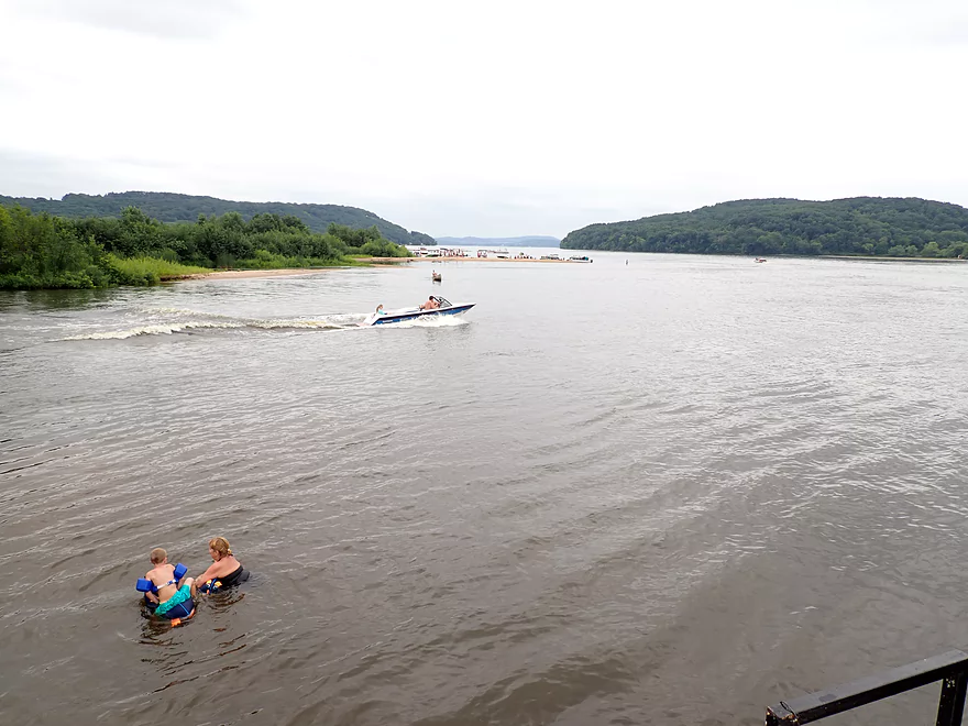
The main channel runs next to the bluffs and is very busy
Biggest cliff of the trip
Reverse view
Something you would expect to see in Wisconsin Dells
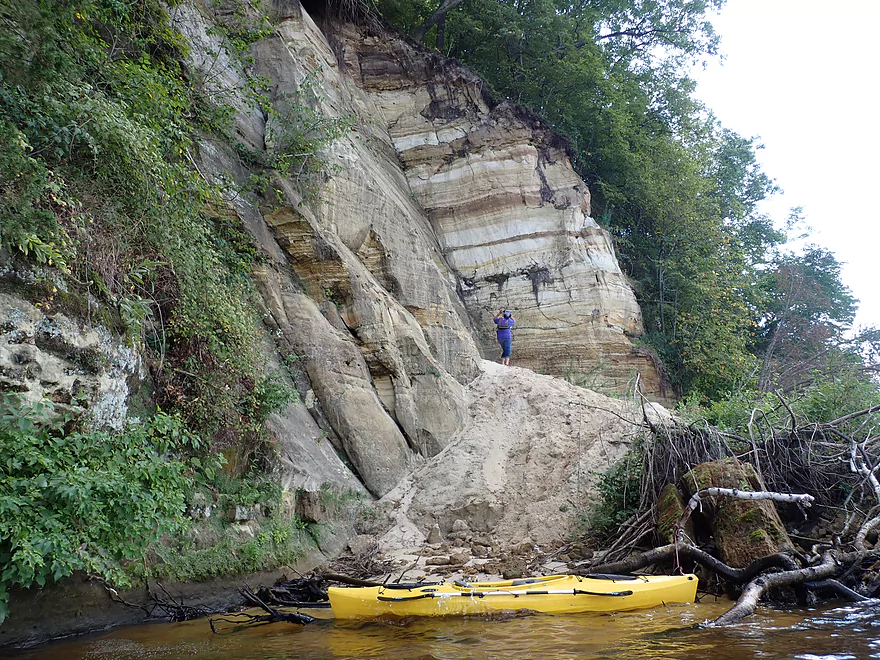
A massive landslide and sand pile
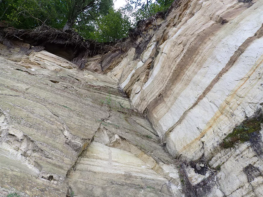
More beautiful layers and color patterns
Great view from atop the sand
Looking down
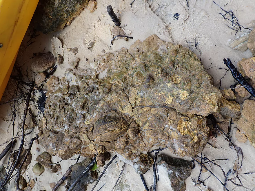
Some fossils
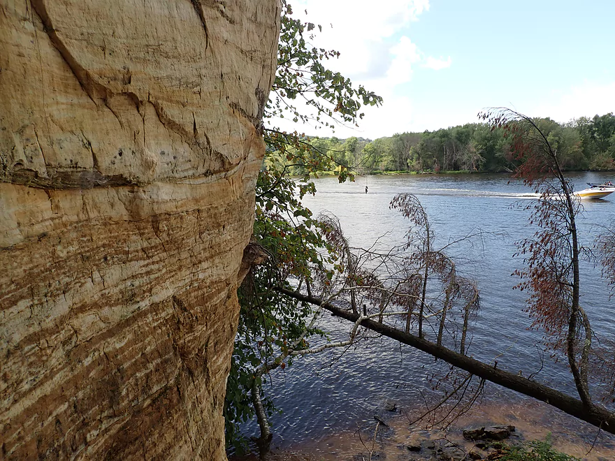
I almost fit through this tunnel
Reminded me of the Apostle Island sea caves
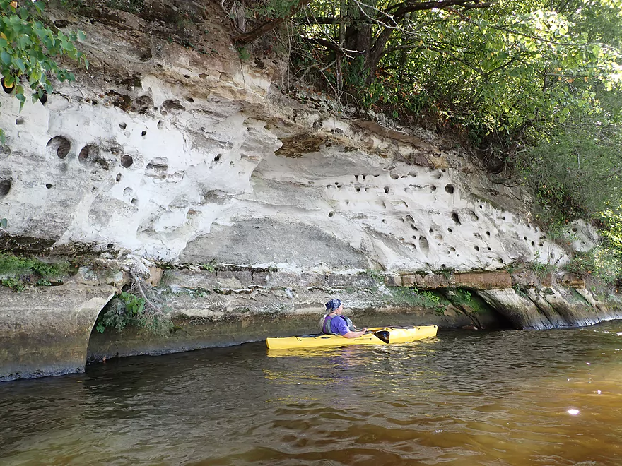
Fantastic cliff swallow holes…like Swiss cheese
Beautiful day for clouds
End of Focke’s Bluff–beginning of lake homes and piers
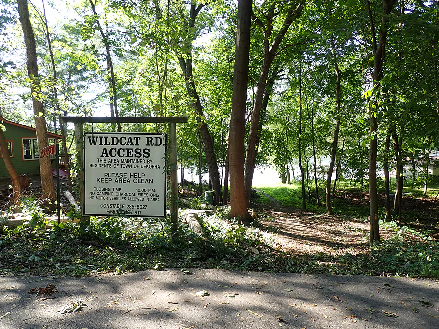
Back channel by Wildcat Road
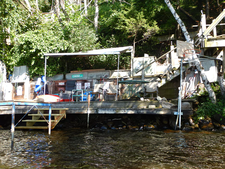
A number of quaint cabins and boathouses
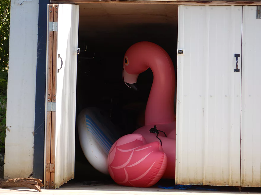
This boathouse had a surprise hiding in it
Nice little area protected from the main channel
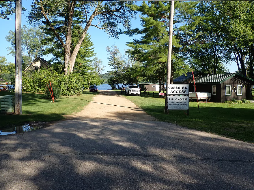
One of several obscure public accesses along the shore
Some more shallow areas
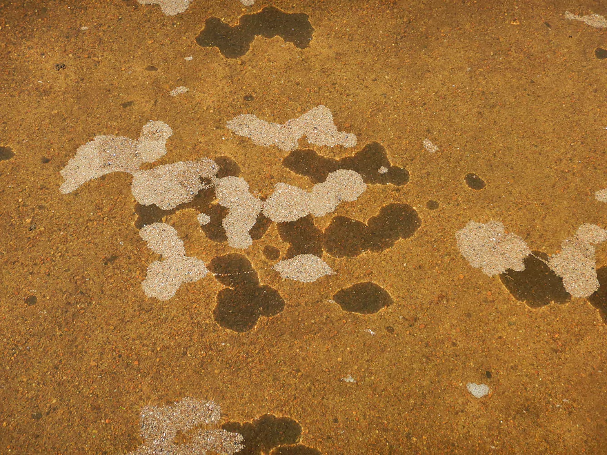
Sand shadows
Now by Tipperary Road
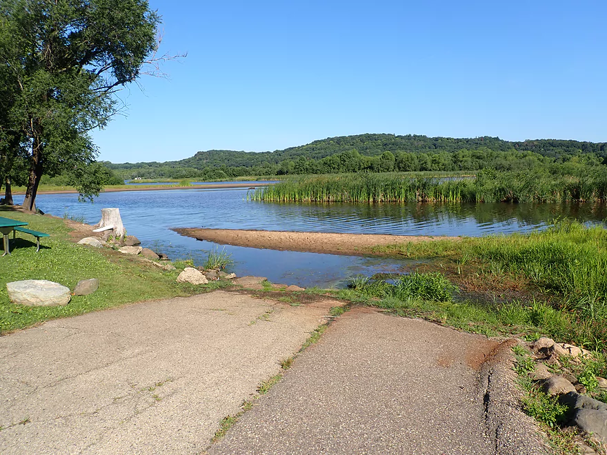
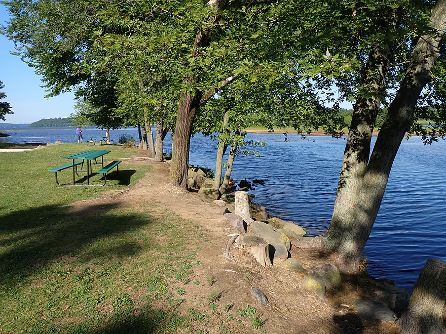
Camp Rest Park is a great access option
View downstream
Faint outcrops in the distance
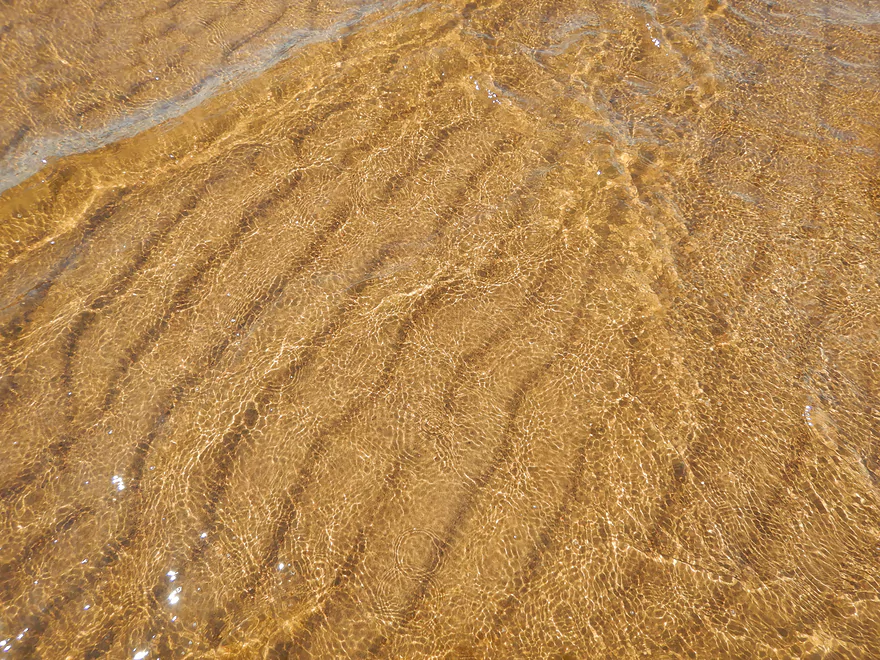
Cool sand patterns
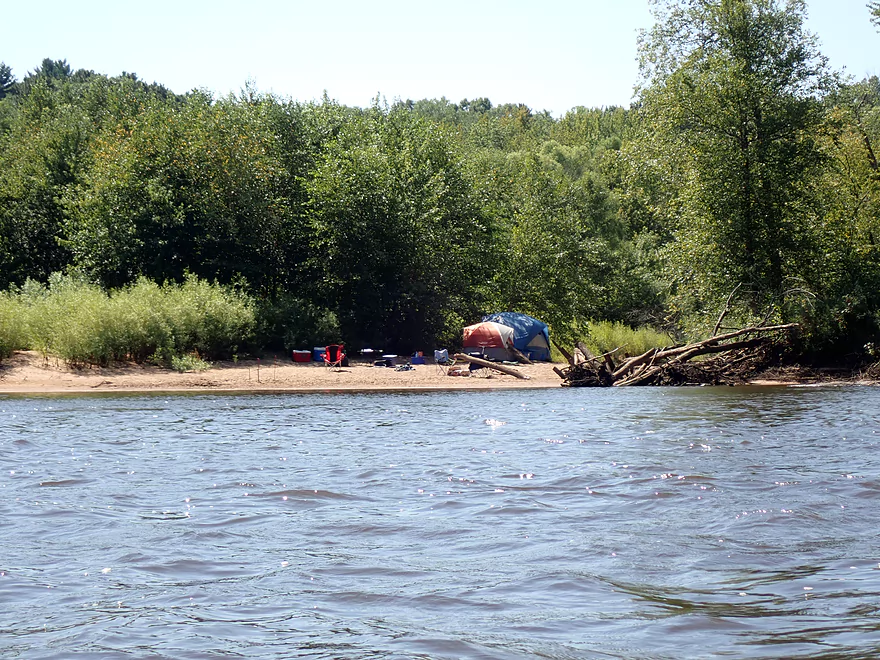
North of Camp Rest is a popular cluster of islands and sandbars
This is a great area for picnics and camping
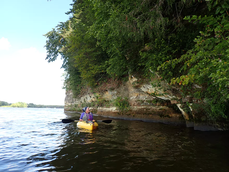
Exploring the bluffs on the west shore
The river really slows and widens at this point
More obscure side accesses
Quite the pier
Getting bounced good by the waves
Taking out at James Whalen Park
View upstream
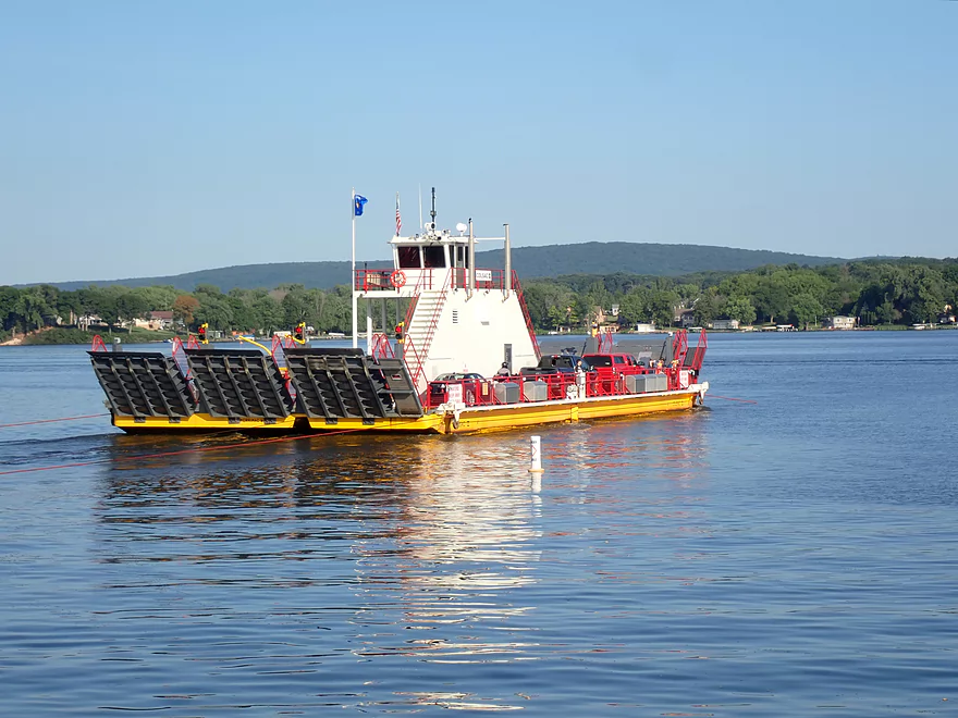
The nearby Merrimac Ferry provides a quick and scenic river crossing to end the day
Wisconsin River – Dekorra to Lake Wisconsin

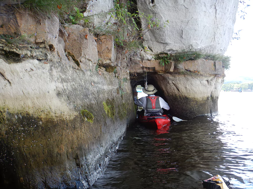
This is the last stretch of the Wisconsin River before Lake Wisconsin (a large flowage created by the Prairie du Sac Dam). There are many put-in options to choose from in Dekorra, but the best IMO is Dekorra Landing, which was where we started our trip. The first highlight of the trip is actually just upstream of the launch where there are scenic cliffs which locals jump off. There’s even a small “sea cave” which you can paddle into.
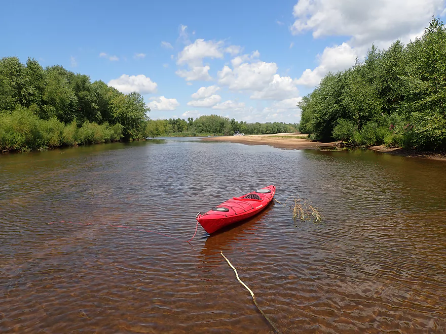
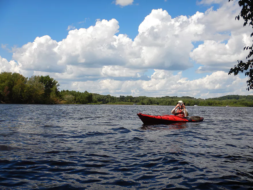
The river here is divided by large islands into a north and south channel. The north channel is much bigger and popular with motorboats, so we opted for the more quiet south channel. This back channel was quite pleasant, with wooded shorelines and a smattering of lakefront homes. Much of the south channel is no-wake (to protect the shoreline), but jet skiers tend to ignore these rules and fly though at high speed.
Soon we came to St. Lawrence Bluff which has an attractive set of cliffs at its base. When water levels are high, you can actually follow these cliffs for some distance into a floodplain back channel. Here you can see more sandstone, white pines, and even paddle between flooded trees.
North of St. Lawrence Bluff is a large cluster of islands where sandbars are common. This can be a good area for picnics and camping…but also can be competitive. The good sandbars get scooped up quickly on summer weekends…which is actually true for almost all sandbars upstream of Lake Wisconsin. As a general rule though, the closer you get to the lake, the more congested the sandbars will become.
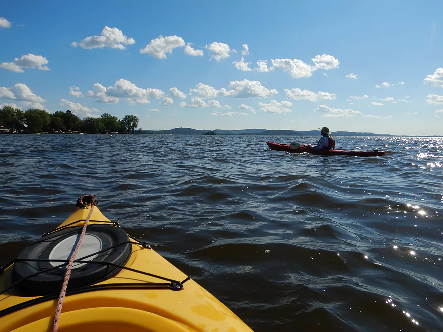
Just past St. Lawrence Bluff, the north and south channels join…but then split again. The new south channel (which I’ll just refer to as the interstate back channel) was on my original itinerary, but unfortunately water levels were low and the entrance was sealed shut by a sandbar. We could have portaged this, but simply decided to take the main channel. Here on the main channel we saw a decent number of motorboats, but also a few canoes.
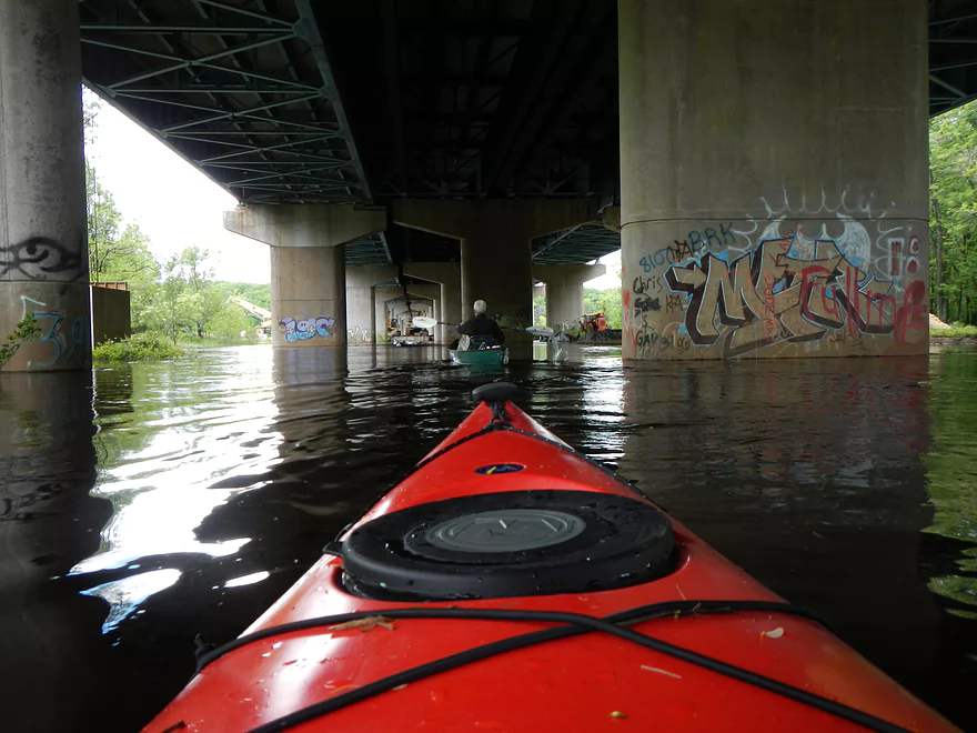
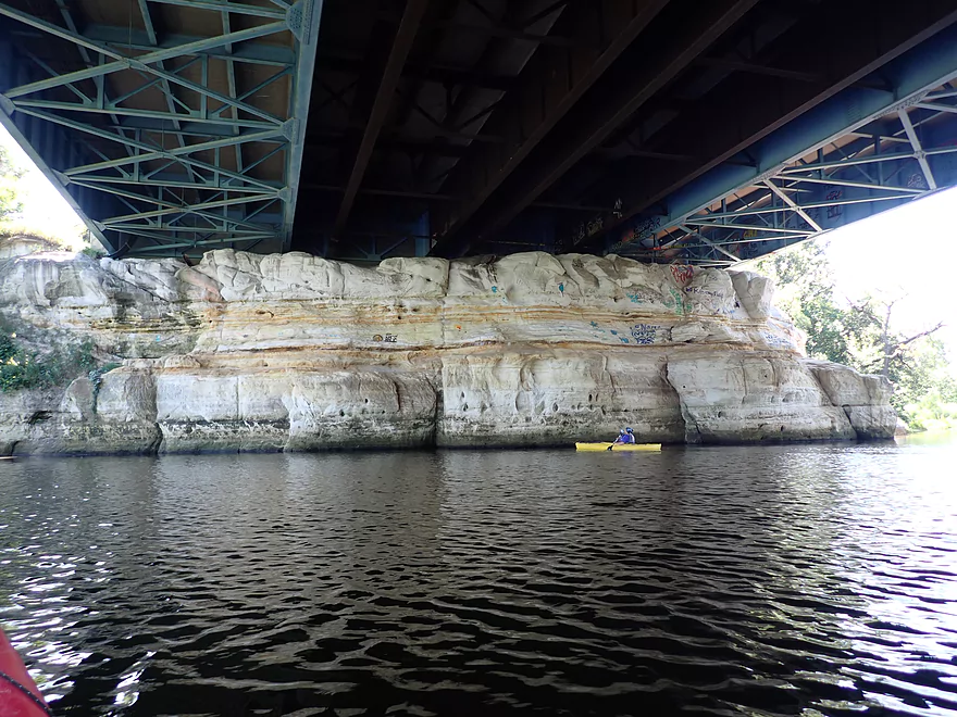
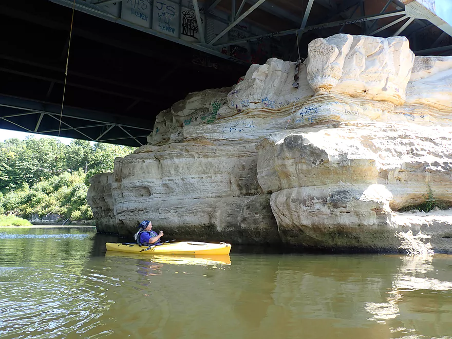
We soon approached the I-90 bridge which was impressive. My plan was to access the interstate back channel by paddling directly under the bridge. This was feasible 7 years ago when I did a similar trip in high water, but now levels were too low. Still wanting to access this back channel, we simply got out and portaged directly under the bridge. This was a somewhat unique experience as the cars rumbling overhead created unique echos and the concrete pillars towered overhead like ancient Roman columns. At the south end of the bridge we finally connected with the interstate back channel. The highlight here was a series of outcrops with the best being directly under the interstate itself. This one had a unique bright color and smooth texture…likely a byproduct of the bridge protecting the rock face from erosion.
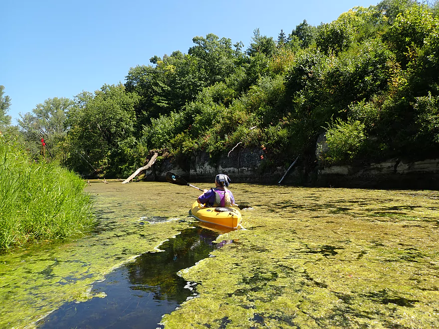
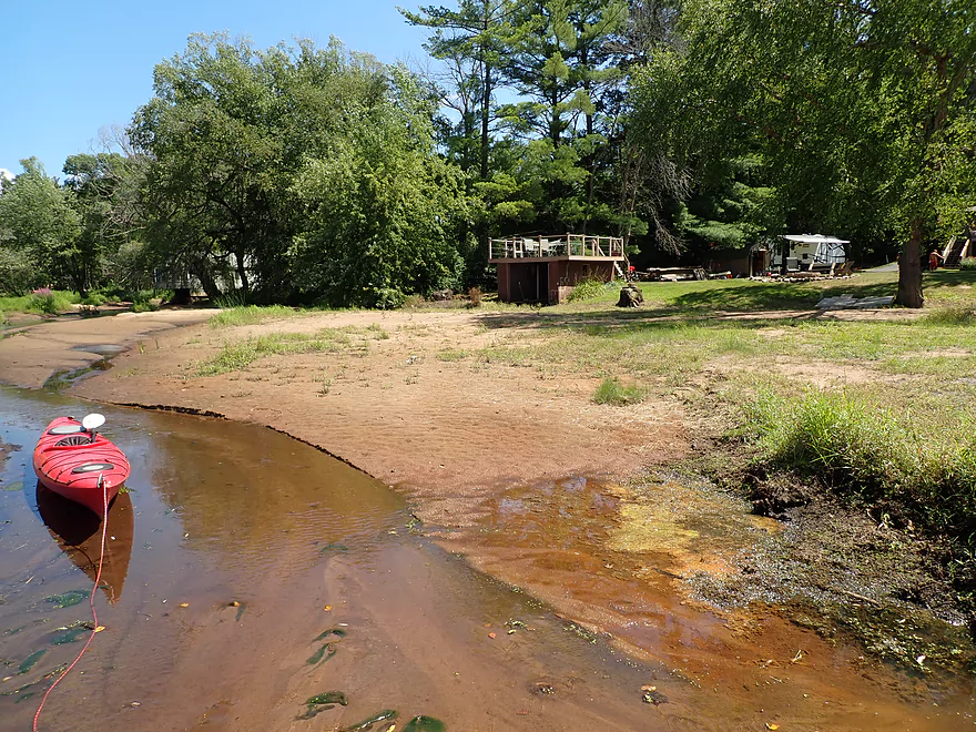
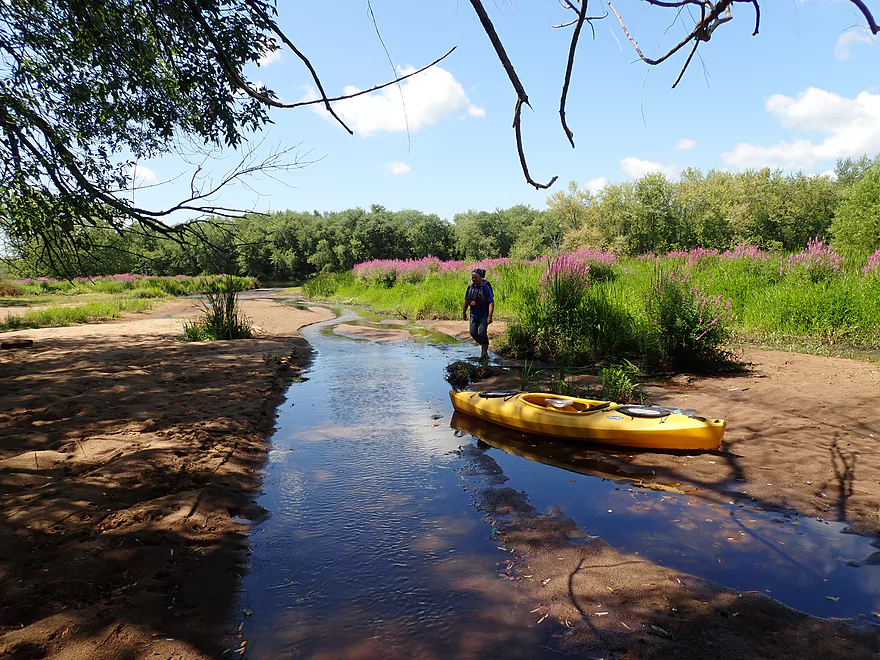
We continued down the interstate back channel which was surprisingly nice. It was peaceful, wooded, and had excellent clarity. We could see the crayfish and fish scurrying along beneath our boats. Unfortunately this channel got shallow and then dried up completely, leaving just a river of sand which forced us to portage. This wasn’t a bad experience though and was kind of scenic as the sand was quite nice. Along the shoreline were piers, cabins and boathouses that had been built when the channel was more open, but now resembled something you might see from the infamous Aral Sea. A small creek joined this channel and scenically cut through the mounds of sand and towering purple loosestrife until it finally it joined the river.
The interstate back channel wasn’t just closed because of low levels but because of recent sedimentation. I used to live in this area and 30 years ago you could actually take a motorboat through here. I hypothesize that things really started to change after the bridge construction done in 2013. Here a lot of heavy equipment was used at the south end of the interstate and massive sand piles were dug up. I suspect these sand piles ended up in these back channels. This slowed the current which created a feedback loop by which more sand filled in the channel. In theory the residents of Oak Knoll Drive could actually open this up again by setting up home-made wing dams (say downed trees/rocks set at angles) which would dig the channel open again.
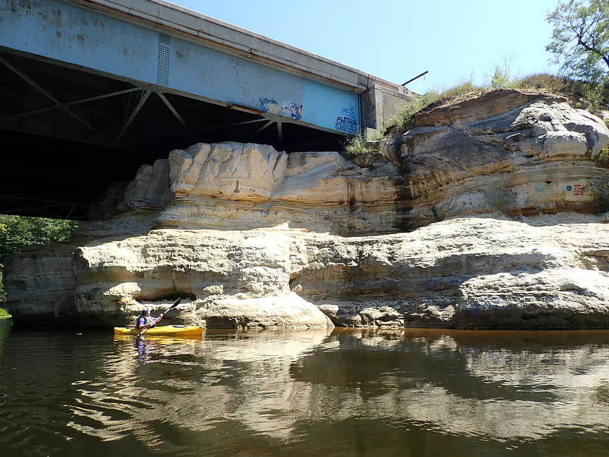
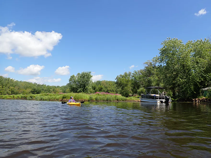
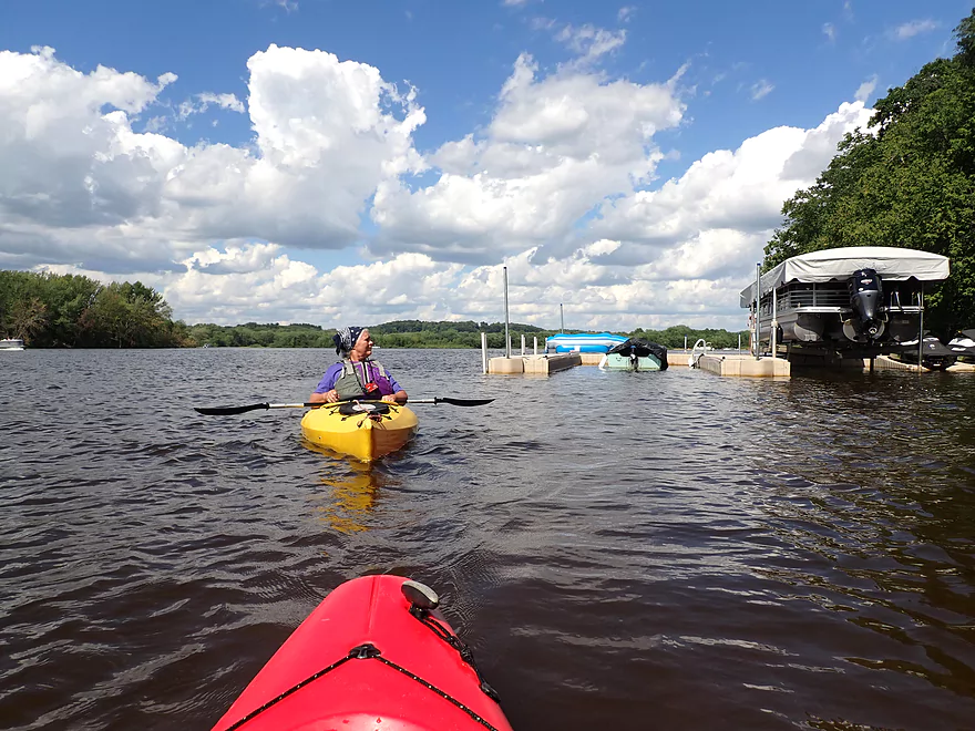
We continued down the river on what I’ll refer to as the Hwy V back channel. This was also quite pleasant and protected from the main channel. Here there was a small cluster of sandbars which gets crazy busy on summer weekends. Several side channels here that used to be navigable (from what I recall 30 years ago) are now silted in and unnavigable.
Following Hwy V, we finally joined up with the main channel again. To the north was an attractive archipelago of islands with hidden sloughs and sandbars we could have explored. But instead we chose to hug the south shore to check out Focke’s Bluff…which was a trip highlight. At the base of the bluff is a nearly mile-long stretch of continuous sandstone cliffs that IMO are Wisconsin Dells caliber. We saw a few fossils, many exotic patterns, and even a small tunnel that I was almost able to paddle completely through. The best part of the bluff was where a massive wedge had been sheered off at a sharp right angle. What remained was huge pile of sand (maybe 30′ high). We were able to get out and climb up this sand tower where there was a great view of the river.
We paddled somewhat close to the cliffs, which was a bit harrowing as a large number of fast motorboats and jet skis raced by us at high speed creating large waves. These waves would bounce off the rock walls at odd angles and create some occasional tippy moments for our boats. These waves weren’t only annoying to paddle through…but were actually harming and eroding the rock face. Focke’s Bluff has changed quite a bit over the years sadly. Some of this is due to natural erosion, such as from tree roots and ice cracks…but artificial waves are also to blame. In fact the waves are so persistent they’ve actually formed micro sea caves along the cliffs.
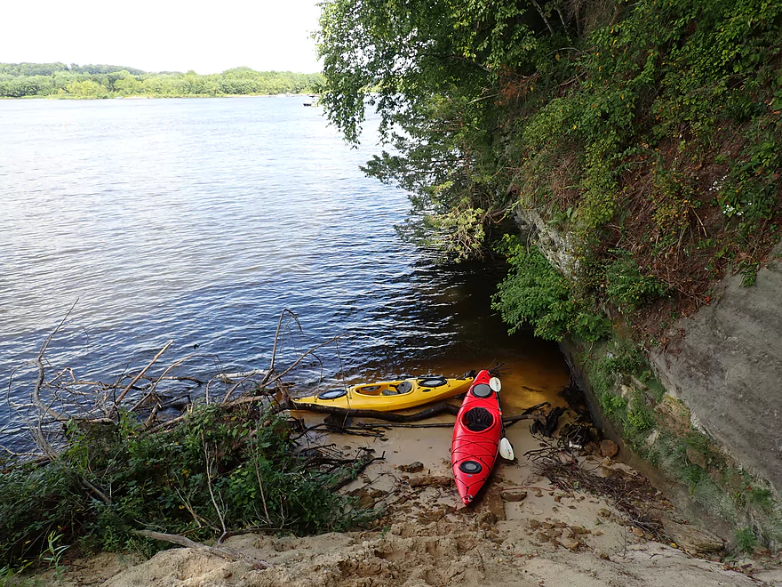
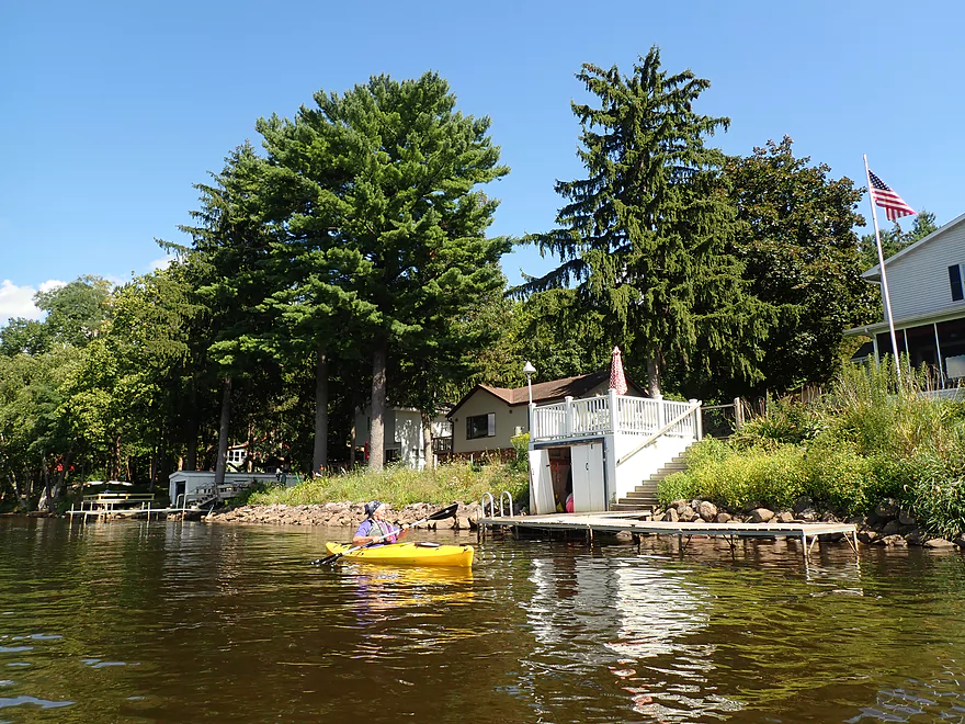
We hugged the south shore until we came to Wildcat Road where there is another nice protected back channel. The shoreline here is heavily developed but has a unique vibe to it. Unlike other lake communities, Dekorra is on the older side which means the homes are smaller (almost cabins in some cases) and the trees much larger. The vibe is also completely unlike other nearby communities (like say Baraboo or Portage). Here the residents are more laid back and affluent. Many have roots from out-of-state (such as from the Chicago area).
We came to Camp Rest Park which was a nice park and access option. Just to the north is a large archipelago of islands and sandbars (the last before Lake Wisconsin). These can be fun to explore but are also the busiest in the area. I crossed the hectic channel to check yet another set of nice sandstone cliffs (by my count the fifth set).
The last mile of the trip was over open water and pretty rough. The wind started to pick up speed and we saw some occasional white caps…but the motorboats created the worst waves. In hindsight we should have taken out at Camp Rest Park which was the last protected stretch of the river. We mostly hugged the south shoreline which was heavily developed. Here the banks were quite steep and the locals had developed some fairly elaborate and exotic staircases to reach the water. We ended the trip at James Whalen Landing by Tipperary Point which I consider the unofficial start of Lake Wisconsin.
In summary this was a great trip. In fact outside of the Wisconsin Dells area, this might be my favorite part of the Wisconsin River (which is high praise). The highlights were the sandbars, hidden back channels and terrific sandstone cliffs. The downsides were the noisy boats and big waves….but much of this can be avoided by taking back channels where possible and to travel at off-peak times. Most residents of Lake Wisconsin wake up fairly late…so setting your alarm for an early morning paddle can be a great strategy for paddlers.
Sights included crayfish, many small fish, a number of clams, a painted turtle and a very large softshell turtle. The highlight was the cliff swallow nests which were a common sight on the sandstone cliffs. The birds used their beaks to carve micro-caves into the sandstone which created a cool Swiss cheese effect on the rock walls.
Dekorra Landing: This is a large boat landing that is a good access. Behind the landing is a large parking lot and outhouse. Note, the ramp closes at 10:00 PM and camping is not allowed. If you use this ramp, make sure you don’t block boat trailers. Paddlers may be advised to simply use Dekorra Park instead of Dekorra Landing which is just next door. The park has better parking, is closer to the water, and you don’t have to compete with boat trailers coming in and going out.
Alternate Put-ins:
- Hooker’s Landing (900′ downstream from Dekorra Park): While this may appear like a private landing given it’s proximity to Hooker’s Resort, it is actually public. The advantage of using this landing is that it is much less crowded and it is a shorter walk from your car.
- Portage (7.1 miles upstream of Dekorra Park): Launches available at Sunset Park or Hwy 33. This would be a long add-on…but would feature some nice sandbars with less motorboat traffic. There aren’t too many outcrops on this leg, but there is a nice stretch just upstream of Dekorra Landing.
- Baraboo River Mouth (1.5 miles upstream of Dekorra Park): There are a pair of launches at Thunderbird Drive and Waterfront Road. These are ok…but badly positioned for shuttlers. Just to cross the river means a 16 mile drive because of how the roads are configured.
James Whalen Memorial Park: This is a good public boat launch located at the tip of Tipperary Point (IMO the spot at which Lake Wisconsin starts). Outhouses are available and there is a public parking lot.
Alternate Take-outs:
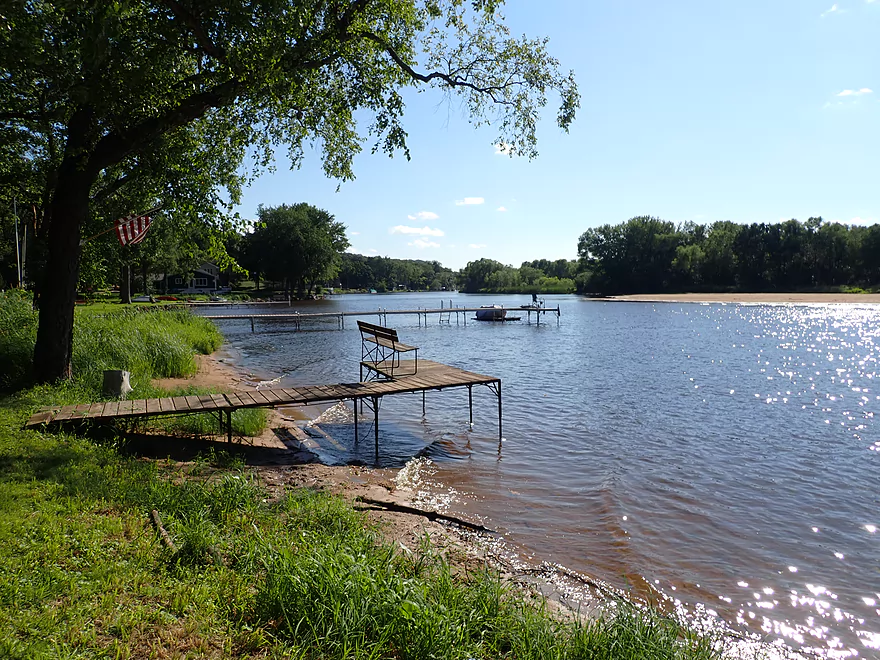
- Camp Rest Park (1.6 miles upstream of James Whalen Park). In hindsight we wish we took out here. It’s a great access (picnic area, outhouse, parking lot). It used to be a boat ramp, but the main ramp silted in…so now paddlers don’t have to compete with motorboats. After Camp Rest Park, the current and islands vanish, and the river becomes much less interesting. These open waters can have rough waves and fast powerboats.
- Lake Wisconsin Take-outs: There are countless other access options on Lake Wisconsin and beyond. Most involve (IMO) uninteresting big water paddling, but some may find this interesting. Here’s a map with launches on the Lake.
Bike Shuttle: James Whalen Memorial Park to Dekorra Park (6.7 miles + 174′ of ascent). This is a longer bike shuttle with a steep hill. Taking out at Camp Rest Park will shave a mile off of this trip.
Wind: This trip will involve a lot of open water paddling in which wind can be an issue. Check the forecast and make sure you don’t paddle into a strong head wind (eg 10+ mph).
Waves: If you stick to the back channels, these are mostly a non-issue. But the main channel can develop big waves created by powerboats. The worst are by Focke’s Bluff (where the waves actually bounce off the rock walls). The waves can also be strong downstream of Camp Rest Park where Lake Wisconsin starts and whitecaps are not an uncommon sight. Paddling early mornings is a great way to avoid the big waves.
Drop-offs: If you go swimming note the river has unpredictable undertows and drop-offs that have claimed numerous lives over the years.
Strainers: Generally speaking this stretch isn’t bad for strainers…but in high water the current picks up speed and there can be some tricky strainers along the shoreline. Give these a wide berth.
Poison Ivy: If you picnic or camp on a sandbar, do note that many have poison ivy.
Nearest Gauge: Wisconsin River @ Wisconsin Dells – 4900 CFS
- 0-4,000 CFS: A very low depth. Optimum for good sandbars. Motorboats will not be able to access parts of the river and therefore will be much less of a plague for paddlers in some areas.
- 4,001-6,000 CFS: An average summer depth. Decent sandbars.
- 6,001-8,000 CFS: An average spring depth. Mediocre sandbars.
- 8,001-10,000 CFS: Very small sandbars. Some of the back channels may open up at this point.
- 10,001-13,000 CFS: A high depth. Likely navigable but not very inviting.
- 13,001-20,000 CFS: A very high depth with no sandbars but open back-channels. I did a trip at 18,000 CFS which was a unique experience. The high water allowed me to paddle among the trees and explore the full extent of the St. Lawrence Bluff cliffs.
- 20,000+ CFS: Perhaps too high for paddling.
For details on access locations, see my Wisconsin River Overview Map.
- Castle Rock Lake to the Lemonweir River: 10 miles. An ok section.
- Lemonweir River Mouth to the Two Rivers Landing: 7 miles. The first half of the classic Upper Dells.
- Two Rivers Landing to Blackhawk Island: 6.5 miles. Second half of the classic Upper Dells known for its fantastic outcrops. Note, the Blackhawk Island landing is no longer accessible without special permission from the local 4H club.
- Black Hawk Island to Wisconsin Dells Dam: 2.0 miles. More nice sandstone outcrops. You can take out at a public ramp off Indiana Ave or portage the dam and take out SW of the dam by a launch off Wisconsin Dells Pkwy/Hwy 12.
- Dells Dam to Indian Trails Landing: 6.2 miles.
- Dells Dam to Newport Park: 2.2 miles. This is the heart of the famous Lower Dells with many scenic outcrops. Unfortunately jet boats are a serious plague on this stretch.
- Newport Park to Indian Trails Landing: 4.0 miles. Features the famous “Sugar Bowl” and four super cool caves. The outcrops soon disappear and this stretch is mostly uneventful (but peaceful) big river paddling.
- Indian Trails Landing to Pine Island Boat Ramp: 9.8 miles. Few paddle this stretch as it isn’t as interesting. But…it does have a good concentration of sandbars and few competing paddlers for them.
- Pine Island Boat Ramp to Portage/Hwy 33 Access: 6.0 miles. Not an elite section that is lacking in cliffs and bluffs. It does have good sandbars though.
- Portage to Baraboo River/Thunderbird Road: 5.2 miles. A good section with great sandbars, but can be crowded in the summer.
- Baraboo River to Dekorra Park: 2.5 miles. River splits into several channels which can be fun to explore.
- Dekorra Park to James Whalen Memorial Park: 6.6 miles.
- Dekorra Park to Camp Rest Park: 5.1 miles. A terrific section with rock outcrops, large island deltas, hidden sloughs, and nice sandbars. Unfortunately this part of the river is popular with motorboats and jet skis which can be a plague. Multiple alternate access options.
- Camp Rest Park to James Whalen Memorial Park: 1.5 miles. Not a great section because of the open water paddling, powerboats and big waves. The west shore though does have nice outcrops.
- James Whalen Memorial Park to Prairie du Sac Dam: 14.5 miles. The river turns into “Lake Wisconsin” here…an inadvisable section due to the amount of open water paddling required. There are many intermediate access options.
- Prairie du Sac to Mazomanie: 8 miles. An ok section of the Wisconsin but lacking in sandbars.
- Mazomanie to Arena: 9.7 miles. A great section with nice sandbars and scenic bluffs.
- Arena to Hwy 14: 8.0 miles. Good section with a high concentration of sandbars. One of the more popular legs on the Lower Wisconsin.
- Hwy 14 to Hwy 23/Spring Green: 2.2 miles. Neat mini-section with sandstone outcrops. Very popular in the summer.
- Spring Green to Lone Rock: 7.4 miles. Another fine sandbar/bluff section with some nice rock outcrops too.
- Lone Rock to Gotham: 8 miles. This stretch has super impressive rock outcrops and sand banks.
- Gotham to Muscoda: 7 miles. Cool limestone rock outcroppings.
- Muscoda to Port Andrew: 7 miles.
- Port Andrew to Boscobel: 9 miles. Wooded islands start to get massive.
- Boscobel to Woodman/Big Green River: 9 miles and start of the less paddled stretch of the Lower Wisconsin. Far fewer sandbars from here to the mouth, but good bluffs and side sloughs to explore.
- Woodman to Adiantum Woods State Natural Area: 3.9 miles.
- Adiantum Woods State Natural Area to Millville: 3.8 miles.
- Millville to Bridgeport: 5.3 miles.
- Bridgeport to Wyalusing (the mouth): 9 miles.
Quick Overview
- Upstream of Stevens Point: I don't have information yet on these stretches.
- Stevens Point to Lake Petenwell: ~42 miles. This stretch in Central Wisconsin used to have many natural rapids, but most have been buried under 8 dams, some of which are now difficult portages. Despite this there is still some good paddling to be had in this region.
- Lake Petenwell: 14.9 miles. This is a large flowage lake that is challenging for paddlers because of frequent strong winds and big waves.
- Castle Rock Lake: 14.5 miles. Another large flowage lake that is likely too big for enjoyable paddling.
- Castle Rock Lake Dam to Lemonweir River: 9.4 miles. This pre-Dells leg isn't elite, but is a pleasant stretch.
- Lemonweir River to Indian Trails Landing: 21.7 miles. This includes the famous Upper Dells and Lower Dells which feature many scenic sandstone outcrops.
- Indian Trails Landing to Portage: 16 miles. This is an overlooked section sandwiched between the Dells and Portage. While the scenery isn't top-notch, it does have many sandbars and few people, which is a nice combination.
- Portage to Lake Wisconsin: 14.3 miles. This is a neat stretch of the river with many sandbars and cliffs, but the shoreline is very developed and motorboat traffic can be heavy on weekends.
- Lake Wisconsin: 14.5 miles. This is a challenging lake for paddling because of the huge and frequent waves created by motorboats.
- Prairie du Sac Dam to Port Andrews: 57 miles. This is the first half of the famous Lower Wisconsin Riverway. This is a super popular stretch for paddlers with the highlights being large sandbars, big bluffs, occasional cliffs, and fun side sloughs to explore.
- Port Andrews to Wyalusing: 40 miles. This is the second half of the Lower Wisconsin Riverway which has far fewer paddlers and sandbars. But the bluffs and sloughs are larger and more interesting.
Detailed Overview
- Upstream of Merrill: I don't have enough information yet on these legs to comment.
- Merrill Dam to Riverside Park: 0.5 miles. Might include some light rapids below the dam.
- Riverside Park in Merrill to Wisconsin River Forest Landing: 8.6 miles. A good prospect.
- Wisconsin River Forest Landing to Brokaw Boat Landing: 5.7 miles.
- Wisconsin River Forest Landing to Jesse Park: 1.4 miles. A terrific stretch with small boulder gardens, one set of Class 1-2 rapids, gravel bars and a nice sand bank.
- Jesse Park to Brokaw Boat Landing: 4.3 miles. A good stretch with scenic wooded banks and occasional gravel bars.
- Brokaw Boat Landing to Gilbert Park: 5.1 miles. River slows down and becomes hillier. This stretch is an ok prospect and goes past the old Brokaw paper plant that has been shut down. Paddlers must navigate Class 1 rapids and a 2' drop where the old Brokaw dam used to be.
- Gilbert Park to Wausau Boat Dock: 1.5 miles. An impounded stretch through Wausau. There are numerous alternate access options to choose from.
- Wausau Boat Dock to Oak Island Boat Ramp: 1.2 miles. A nice stretch that includes Barkers Island and Isle of Ferns Park. But the Wausau dam does require a portage. This stretch parallels the famous Wausau Whitewater Park.
- Oak Island Boat Ramp to Rothschild Dam Access: 5.8 miles. Likely mostly uninteresting flowage paddling. There are many alternate access options to choose from.
- Rothschild Dam Access to Zimpro Park: 1.0 miles. This might be a nice stretch.
- Zimpro Park to River Road Boat Landing: 7.6 miles. The first half of this leg is likely nice river paddling, but the second leg is probably just an uninteresting flowage.
- Chucks Landing/Mosinee Dam to Bean's Eddy Boat Landing: 2.8 miles. Likely a nice leg. You might be able to launch by the dam where there should be some nice rapids and boulders.
- Bean's Eddy Boat Landing to Seagull Boat Landing: 5.1 miles. Mostly uninteresting flowage paddling. Although there might be some nice sand banks on the eastern shore.
- Seagull Boat Landing to Dubay Dam Access: 5.3 miles. Mostly uninteresting flowage paddling.
- Dubay Dam Access to River Road Landing: 5.5 miles. This could be a nice stretch of river.
- River Road Landing to Old US 10 Landing: 2.3 miles. Likely an ok leg.
- Old US 10 Landing to Stevens Point Dam: 5.6 miles. Probably uninteresting flowage paddling. Many alternate access options closer to Stevens Point.
- Stevens Point Dam to Blue Heron Boat Landing: 4.2 miles.
- Steven Point Dam to Whiting Dam: 2.6 miles. Starts slow and uninteresting, but the river becomes very scenic after the Hwy HH bridge. The rock formations below both dams are very striking. Many alt access points.
- Whiting Dam to Kimberly Clark Dam/Al Tech Park: 0.6 miles. Incredible scenery with exposed bedrock and boulder gardens below the Whiting Dam. Some rapids, but nothing major. The Kimberly Clark Dam is a dangerous low-head dam and should be treated carefully.
- Kimberly Clark Dam to Blue Heron Landing: 1.0 miles. Class 2 rapids below the dam, but after that the river slows dramatically and splits into many sub-channels and islands. Round trips on this leg are possible. I chose the far western channel where there were some nice rocky stretches.
- Blue Heron Landing to Mill Creek Landing: 4.1 miles. Likely a mediocre paddle with nothing special. Galecke Park is an alternate access.
- Mill Creek Landing to Biron Dam North Gate: 7.6 miles. Mostly uninteresting flowage paddling. Several alternate access options on route.
- Biron Dam North Gate to Veteran's Memorial Park: 4.5 miles.
- Biron Dam North Gate to Biron Landing: 1.0 miles. Super scenic stretch by two islands with many granite boulders.
- Biron Landing to Legion Park: 3.0 miles. A nice stretch by Big Island. The west channel is more undeveloped...but the east channel has several scenic granite islands.
- Portage through Legion Park: 680'. A steep wall separates the park from the river but in two locations the wall is short enough to get over (see map). Paddlers may want to consider a longer portage to bypass some of the shallow rocky stretches by Legion Park.
- Legion Park to Veteran's Memorial Park: 0.4 miles. A scenic stretch that features a large boulder field and the powerhouse for a large paper mill.
- Veteran's Memorial Park to Port Edwards Landing: 3.8 miles
- Veteran's Memorial Park to Demitz Park: 0.8 miles. A pleasant stretch that includes Belle Island.
- Demitz Park to Ben Hansen Park: 1.2 miles. This leg goes by Garrison Island and Edwards Island. Lyon Park is located across the river from Demitz Park and is another access option.
- Ben Hansen Park to Port Edwards Landing: 1.8 miles. Above the Centralia dam there are several small but nice islands. Portage the dam on the left bank (follow the 1000' trail through the golf course). Below the dam there are scenic rock formations. Close to the Port Edwards dam are a few more scenic islands you can explore.
- Port Edwards Landing to Nekoosa/Riverside Park: 3.6 miles.
- Port Edwards Landing to Port Edwards Powerhouse: 1.3 miles. A half-mile portage is required (east bank). A very scenic boulder field is located below the dam. At high levels, the rocks are submerged and produce a half-mile stretch of rapids (some strong).
- Powerhouse to Moccasin Creek Landing: 1.8 miles. A generic wooded stretch that isn't super interesting.
- Moccasin Creek Landing to Riverside Park: 0.5 miles. During the Nekoosa dam drawdown, this stretch had nice boulder fields and rapids.
- Riverside Park to Hwy 73: 0.8 miles. An ok stretch of the river. There are scenic cliffs south of Hwy 73, but these are past the dam warning line. Hwy 73 is not a good access option.
- Hwy 73 to Point Basse Ave (Portage of the Nekoosa Dam): 1.5 miles. A difficult 1.5 mile portage through downtown Nekoosa. Don't try to portage the south bank. There is a steep hill, cliffs, and large Domtar paper mill fences to deal with.
- Point Basse Ave to Jim Freeman Memorial Boat Landing: 0.8 miles. A generic stretch going by historic Point Basse. If you're willing to backtrack to the dam, you can see scenic boulder fields (during low flows) and a few cliffs. Point Basse Ave is a somewhat speculative access, but it seems public and doable for launching.
- Jim Freeman Memorial Boat Landing to Plank Hill Small Boat Access: 2.0 miles. A generic stretch.
- Plank Hill Small Boat Access to 19th Drive Landing: 5.3 miles. Features two epic sand banks. The main channel has some minor sandbars. Several of the side sloughs can provide fun side adventures.
- 19th Drive to the Petenwell Dam: 14.9 miles. This is Lake Petenwell which is a large and challenging lake for paddling. Waves and strong winds are frequently an issue. But when calm there are nice sandbanks on the northwest shore, hidden sloughs, and large islands to explore. See the overview map for more info.
- Petenwell Dam to Ganter Lane Landing: 3.8 miles. This stretch isn't too impacted by dams and may have nice sandbars at low levels.
- Ganter Lane Landing to Castle Rock Lake Dam: 10.7 miles. Castle Rock Lake is likely too big (wind/waves) for enjoyable paddling. There are many alternate launch options along the shore.
- Castle Rock Lake to the Lemonweir River: 10 miles. An ok section.
- Lemonweir River Mouth to River Bay Landing: 7 miles. The first half of the classic Upper Dells.
- River Bay Landing to Blackhawk Island: 6.5 miles. Second half of the classic Upper Dells, known for its fantastic outcrops. Note, the Blackhawk Island landing is no longer accessible without special permission from the Upham Woods Outdoor Learning Center.
- Black Hawk Island to Wisconsin Dells Dam: 2.0 miles. More nice sandstone outcrops. You can take out at a public ramp off Indiana Ave or portage the dam and take out SW of the dam by a launch off Wisconsin Dells Pkwy/Hwy 12.
- Dells Dam to Indian Trails Landing: 6.2 miles.
- Dells Dam to Newport Park: 2.2 miles. This is the heart of the famous Lower Dells with many scenic outcrops. Unfortunately jet boats are a serious plague on this stretch.
- Newport Park to Indian Trails Landing: 4.0 miles. Features the famous "Sugar Bowl" formation and four super cool caves. The outcrops soon disappear and this stretch is mostly uneventful (but peaceful) big river paddling.
- Indian Trails Landing to Pine Island Boat Ramp: 9.8 miles. Few paddle this stretch as it isn't as interesting. But...it does have a good concentration of sandbars and few competing paddlers for them.
- Pine Island Boat Ramp to Portage/Hwy 33 Access: 6.0 miles. Not an elite section that is lacking in cliffs and bluffs. It does have good sandbars though.
- Portage to Dekorra Park: 7.7 miles
- Portage to Baraboo River/Thunderbird Road: 5.2 miles. A good section with great sandbars. Close to Portage there are few motorboats.
- Baraboo River to Dekorra Park: 2.5 miles. River splits around massive Lib Cross Island. West channel has nice sandbars. St Lawrence Bluff has scenic sandstone outcrops and includes a cave you can paddle into.
- Dekorra Park to James Whalen Memorial Park: 6.6 miles.
- Dekorra Park to Camp Rest Park: 5.1 miles. A terrific section with rock outcrops, large island deltas, hidden sloughs, and nice sandbars. Unfortunately this part of the river is popular with motorboats and jet skis which can be a plague. Multiple alternate access options.
- Camp Rest Park to James Whalen Memorial Park: 1.5 miles. Not a great section because of the open water paddling, powerboats and big waves. The west shore though does have nice outcrops.
- James Whalen Memorial Park to Merrimac Memorial Park: 4.4 miles. River turns into "Lake Wisconsin". Generally speaking this isn't ideal for kayaking as motorboat traffic can be heavy and waves can be surprisingly big. The most direct route is the north shore which has a few bluffs, but generally speaking isn't that interesting.
- Merrimac Memorial Park to Veterans Memorial Park/Prairie du Sac: 9.6 miles.
- Merrimac Memorial Park to Moon Valley Landing: 3.3 miles. Includes a lot of developed shoreline. The ferry, railroad bridge, and Moon Bay are highlights.
- Moon Valley Landing to Veterans Memorial Park/Prairie du Sac: 6.3 miles. Other than Moon Bay and the dam, this is a boring stretch. There are numerous alt access options on this route.
- Prairie du Sac to Mazomanie: 8 miles. An ok section of the Wisconsin but lacking in sandbars.
- Mazomanie to Arena: 9.7 miles. A great section with nice sandbars and scenic bluffs.
- Arena to Hwy 14: 8.0 miles. Good section with a high concentration of sandbars. One of the more popular legs on the Lower Wisconsin.
- Hwy 14 to Hwy 23/Spring Green: 2.2 miles. Neat mini-section with sandstone outcrops. Very popular in the summer.
- Spring Green to Lone Rock: 7.4 miles. Another fine sandbar/bluff section with some nice rock outcrops too.
- Lone Rock to Gotham: 8 miles. This stretch has super impressive rock outcrops and sand banks.
- Gotham to Muscoda: 7.6 miles. This leg includes more large sandbars and great outcrops. Bonus highlights include fast current and not seeing as many people.
- Muscoda to Port Andrew: 7 miles. A good stretch with many islands and sandbars.
- Port Andrew to Boscobel: 9 miles. Wooded islands start to get massive.
- Boscobel to Woodman/Big Green River: 9 miles and start of the less paddled stretch of the Lower Wisconsin. Far fewer sandbars from here to the mouth, but good bluffs and side sloughs to explore.
- Woodman to Millville: 7.7 miles. A good stretch with large bluffs and sandbars.
- Millville to Bridgeport: 5.3 miles. Huge islands, bluffs and sandbars are the highlight on this second-to-last leg on the Wisconsin River.
Bridgeport to Wyalusing (the mouth): 9 miles.
Trip Map
Overview Map
Video
Photos Size: