
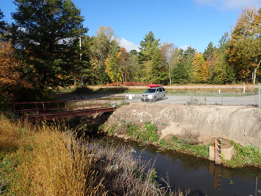
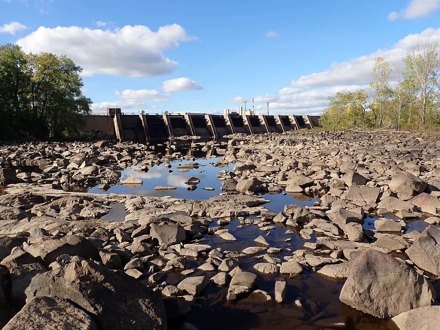
Public access by the Biron dam
Launching below the dam
Very scenic boulder field
Reminded me of the Black River
Exploring a side bay
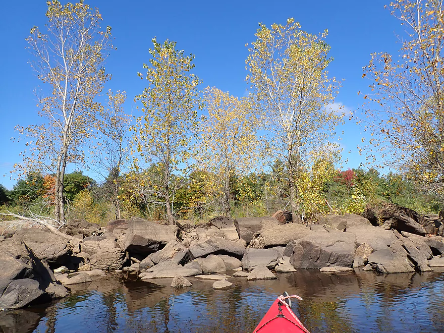
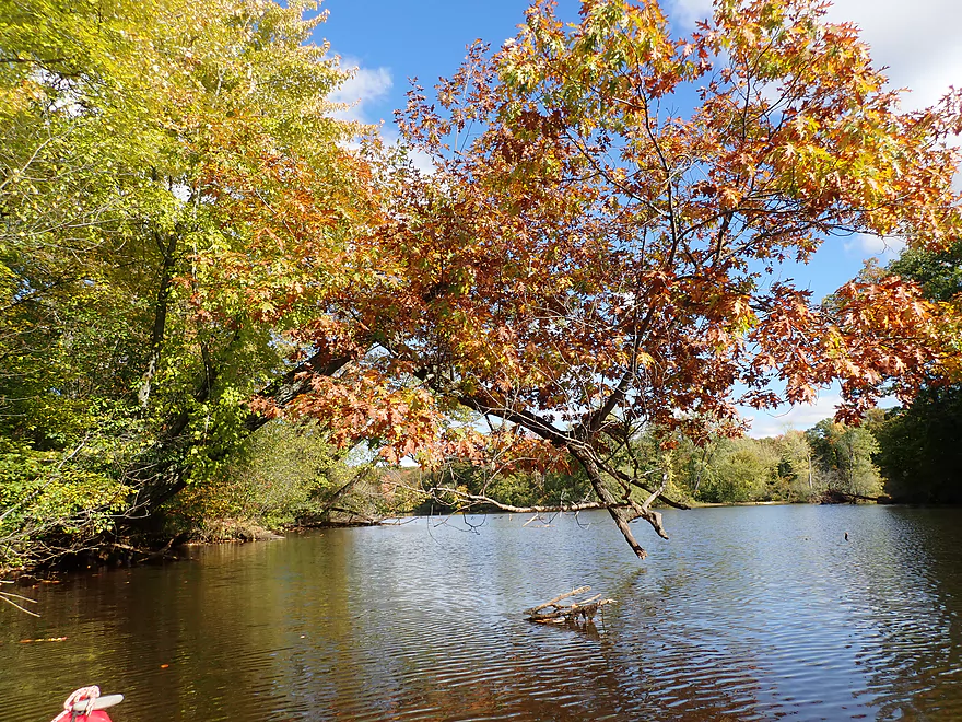
Poplar trees were turning yellow
Trying to find a way out of this maze
A simple portage to access the main river
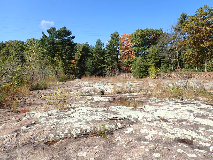
Exposed granite bedrock
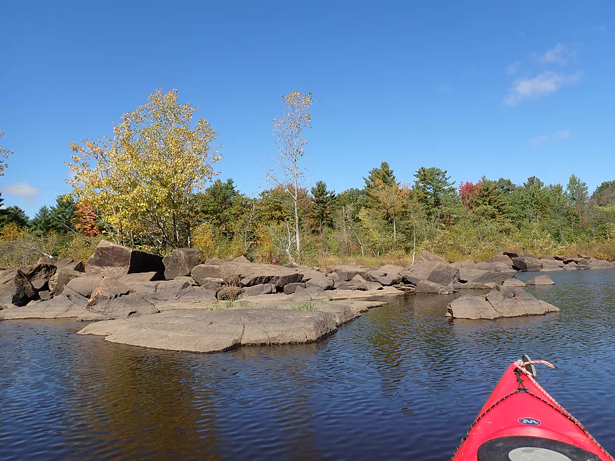
Super cool area
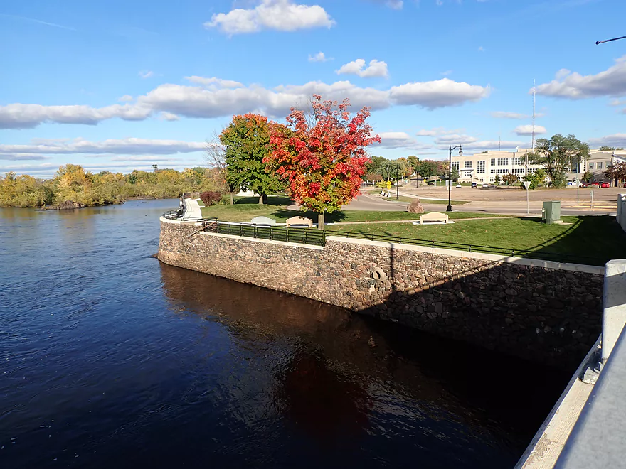
A large island divides the Biron dam
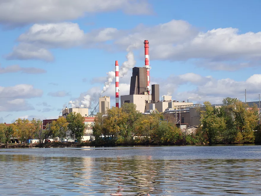
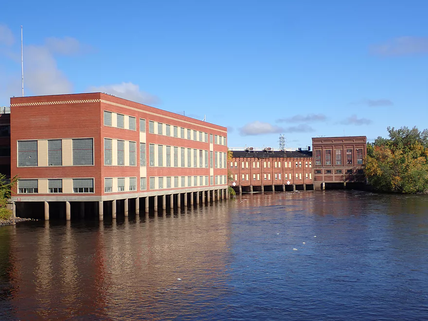
On the other side is the Biron paper mill
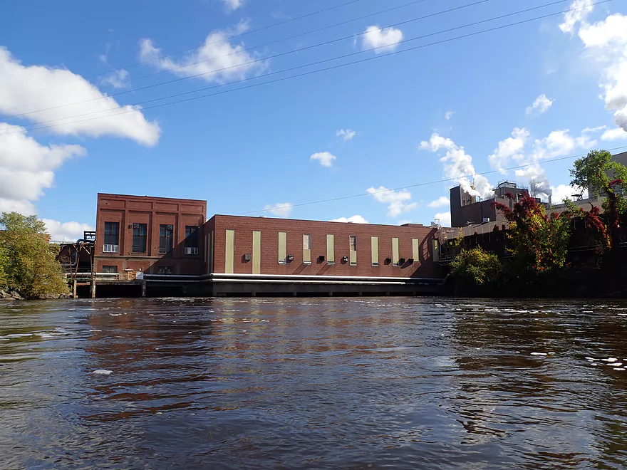
The powerhouse for the paper mill
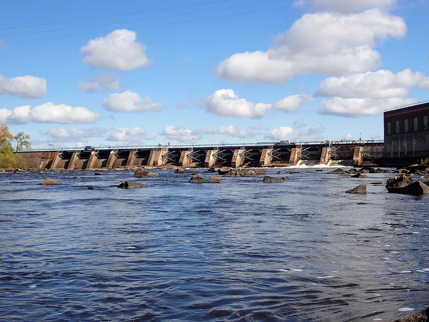
And the dam…two gates were open
A rocky bay below the south gates
With standing waves
Very scenic
Part of another large island
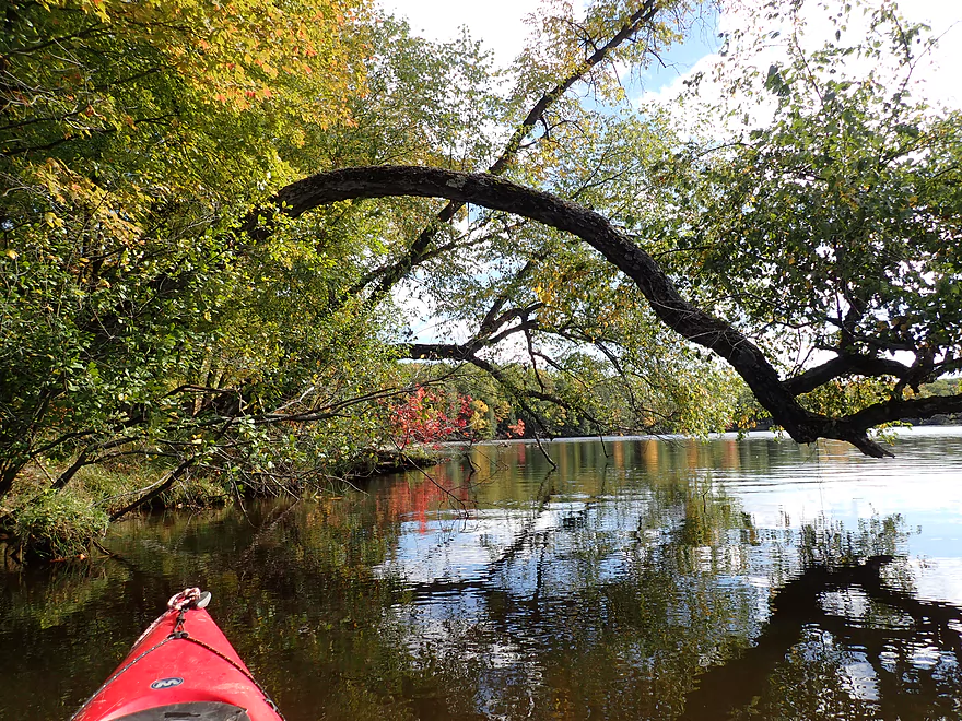
Heading back to the north channel
An easy portage to access a hidden channel
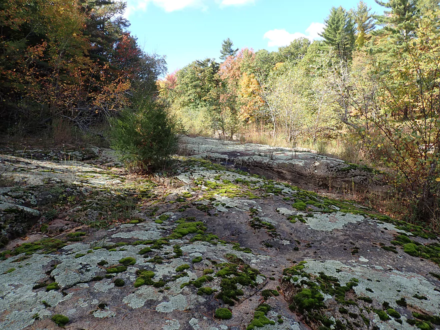
So much granite…these are covered with mosses and lichens
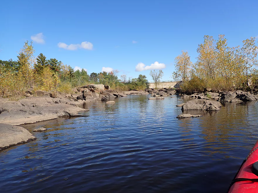
Most scenic part of the trip
Great day for fall color
Most paddlers don’t see this part of the Wisconsin River
Reverse view
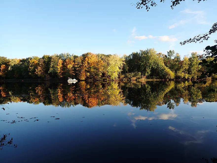
Great reflections
So many maple leaves
Continuing downstream
Another boulder field
Reverse view
Checking out Mosquito Creek
Sheltered creek produces great reflections
A very nice creek
Out on the Wisconsin River…this is the Biron Landing
Start of the third and largest island…aptly called “Big Island”
I’m heading down the west channel
More great fall color
An obscure but good public access
View from access
There was almost no wind that day
Heading up Cranberry Creek
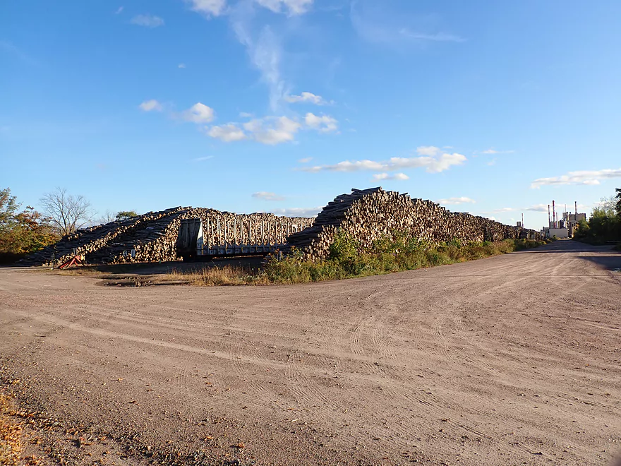
The Verso paper mill lot…this plant consumes 25% of Wisconsin’s cut timber
Cranberry Creek Landing
Great spot to see fall color
Heading back downstream on Cranberry Creek
Back on the Wisconsin River
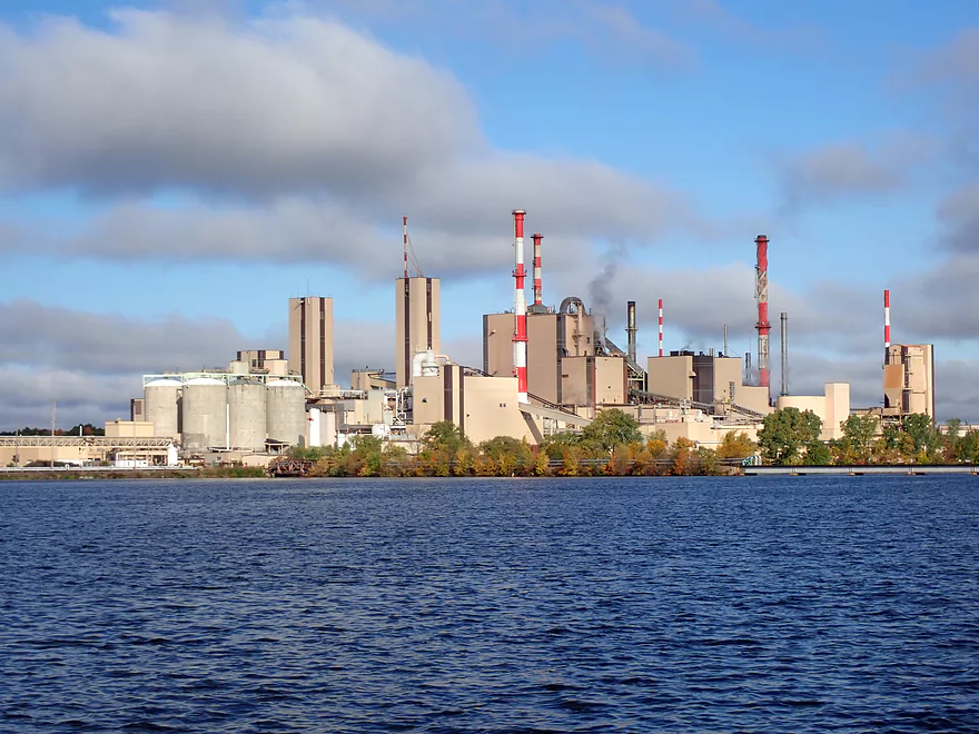
The Verso Paper Mill…for many years the largest in the world
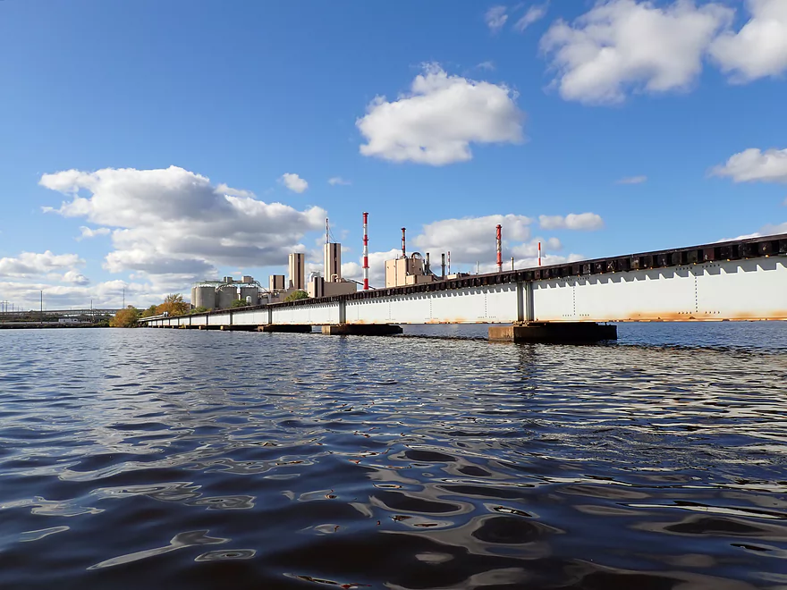
One super low railroad bridge
A portage path is available for those that don’t like limboing
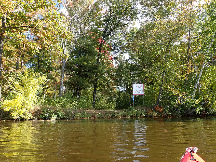
I’m taking out by Apricot Street
A long but scenic portage though Legion Park
Back on the water
This large wall was what made the portage so long and difficult
Part of a 1000′ long boulder field
Getting out to explore
Very rugged terrain
Looking upstream at the Wisconsin Rapids dam
Back on the water
Much of the boulder field was too shallow
Portaging some of the bigger rocks
Finally back on open water, next to a ginormous granite outcrop
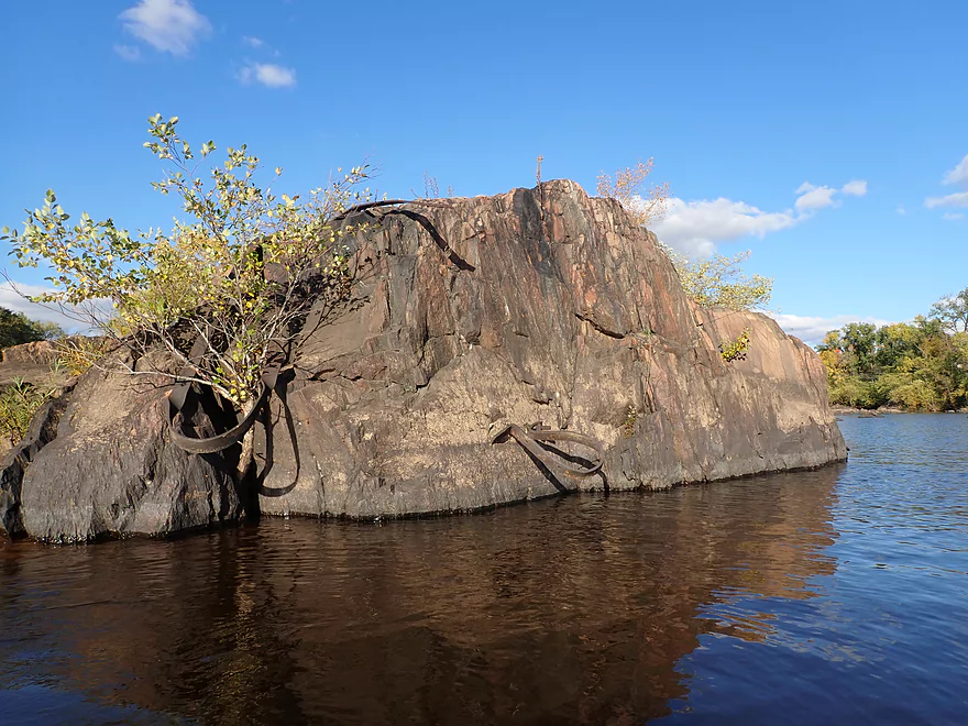
Curious steel parts sticking out of this boulder
The Verso powerhouse
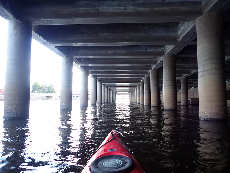
Paddling by large concrete columns
Taking out at Veteran’s Memorial Park
The take-out is a little peninsula that connects to the park
It was tricky getting my boat up past that 90 degree turn
Mead Rapids View Park
The huge retaining wall was why I couldn’t take out here
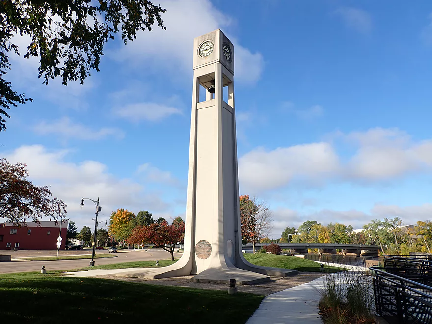
Wisconsin Rapid’s iconic clock tower
Very nice bike shuttle back to the put-in
Wisconsin River – Biron to Wisconsin Rapids

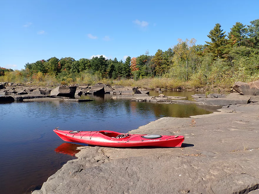
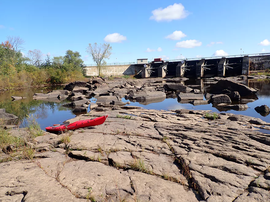
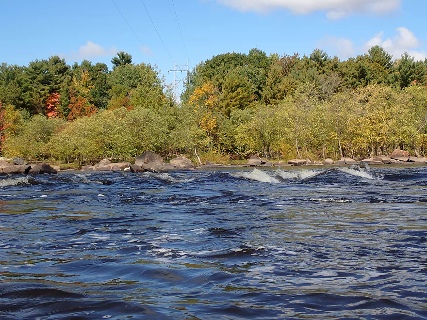
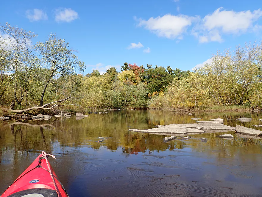
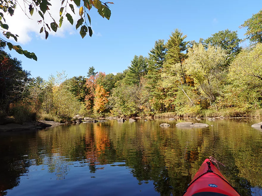
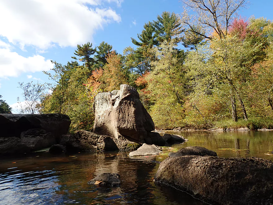
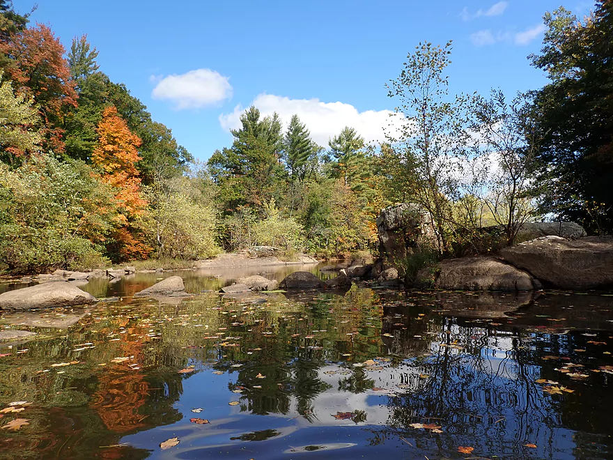
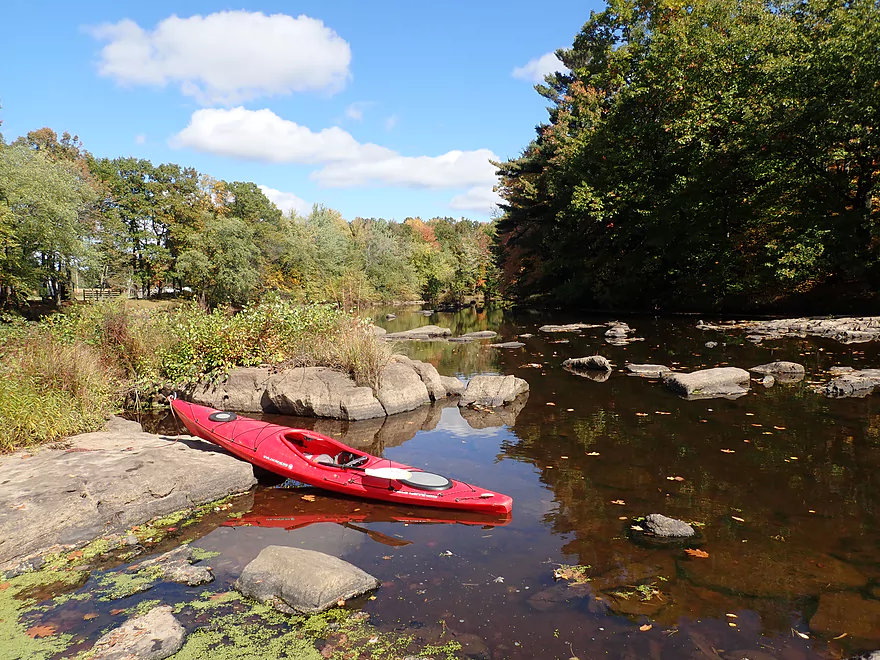
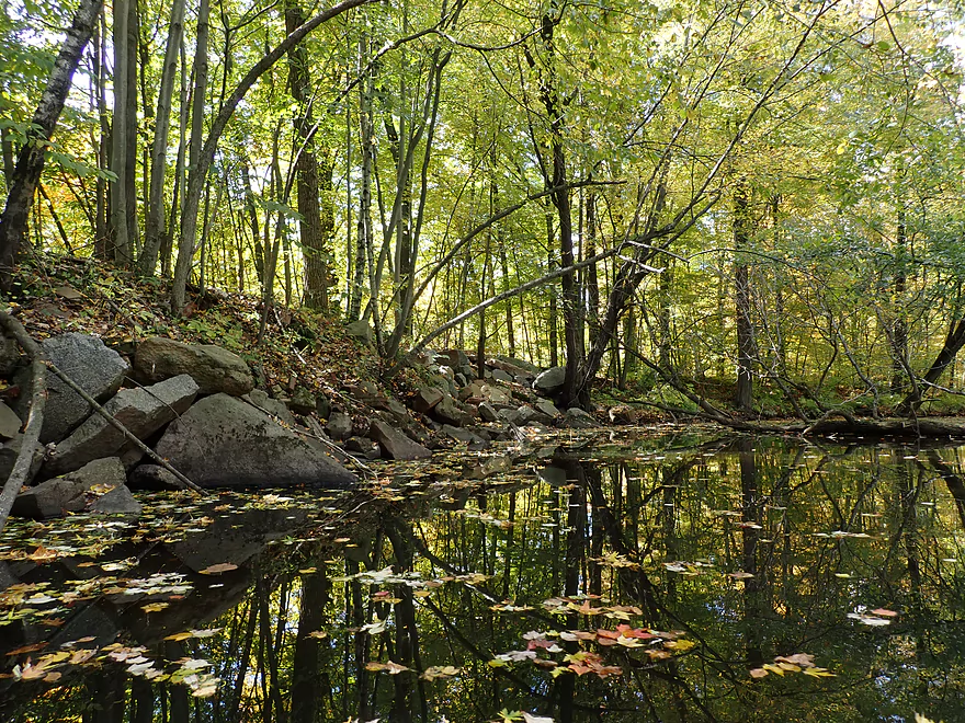
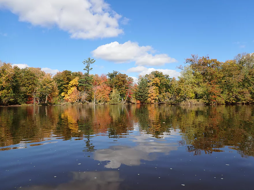
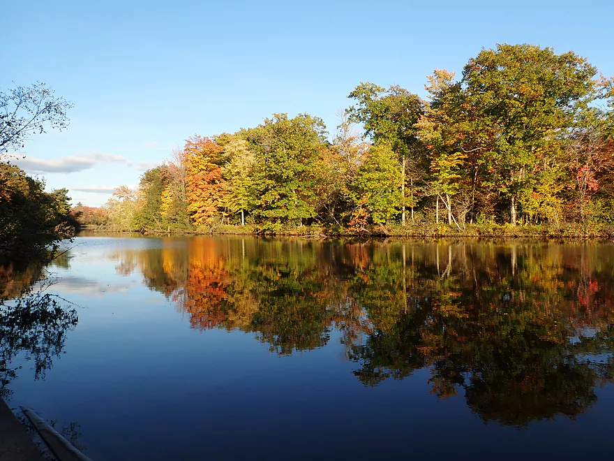
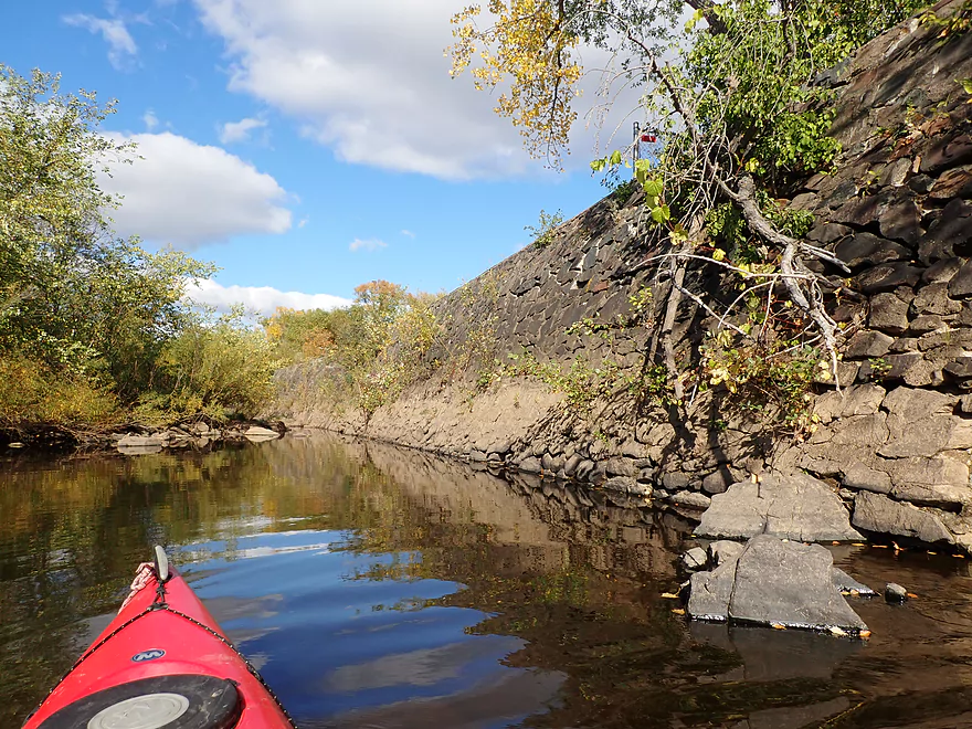
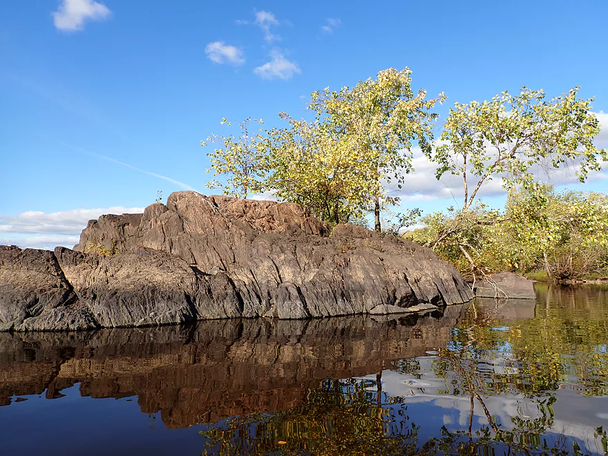
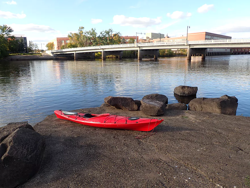
I started the trip at the Biron Dam (North Gate). I wasn’t 100% sure about the area being public but was pleasantly surprised to discover public parking and access. From the parking lot I crossed a narrow pedestrian bridge and followed the base of the dam until I got to the Wisconsin River. There I was greeted by a large granite boulder field, which was really cool. It had a similar vibe to the granite boulder field below the Hatfield dam (although not as big).
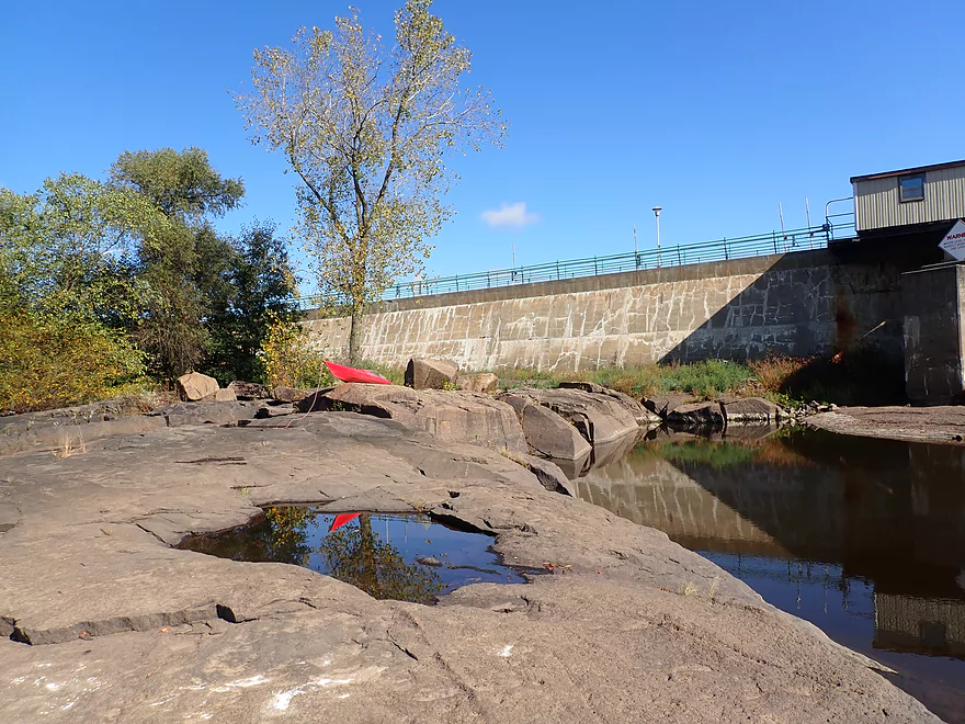
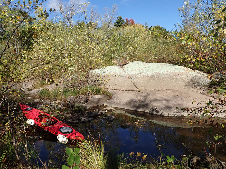
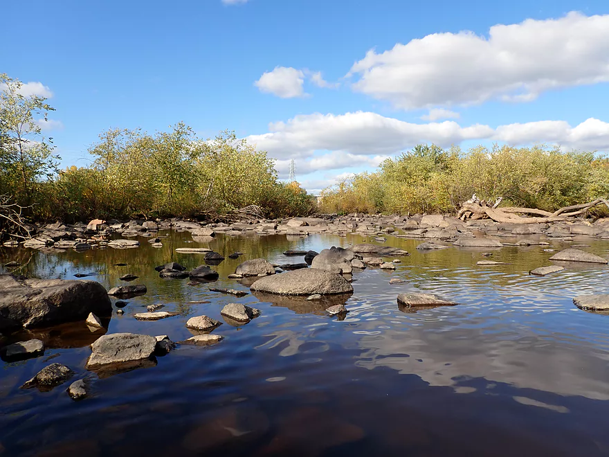
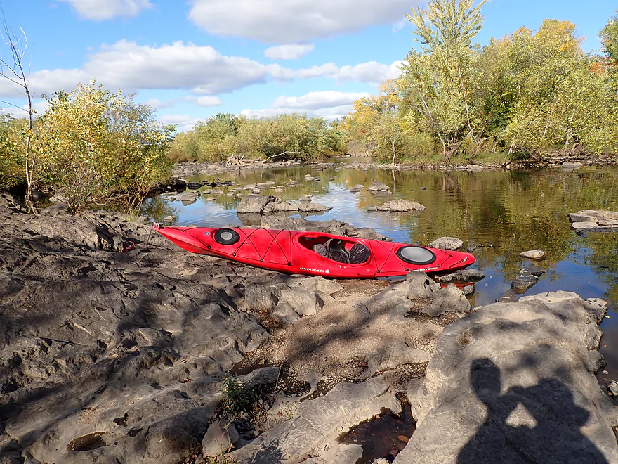
I was able to use the exposed bedrock as a makeshift launch. The bay below the gates is surrounded by a labyrinth of boulders. I explored this and determined I would actually have to portage some of the boulders to join with the main river, but that wasn’t so difficult.
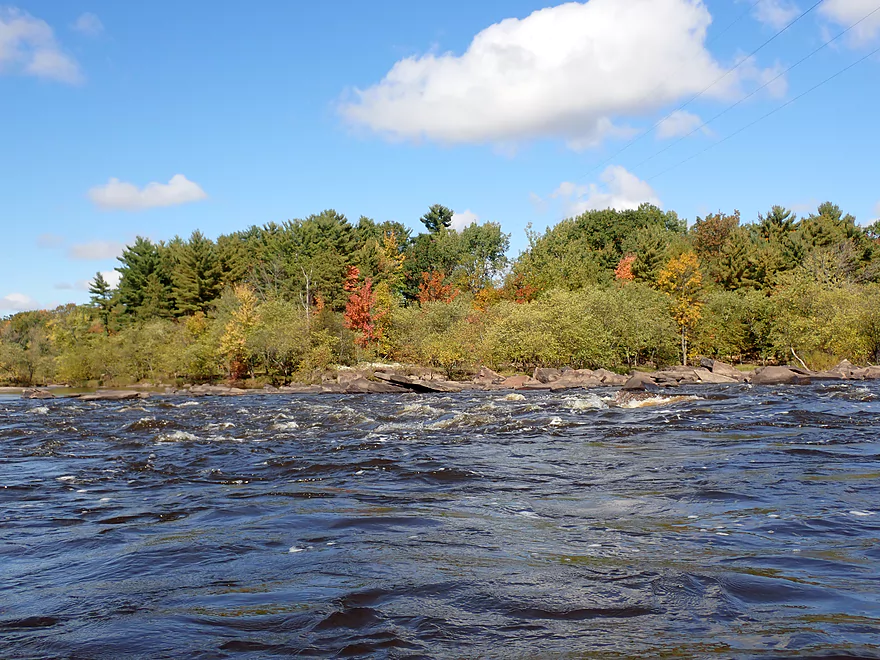
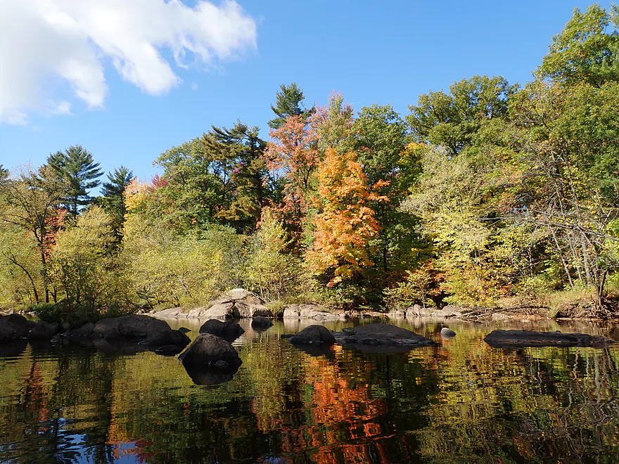
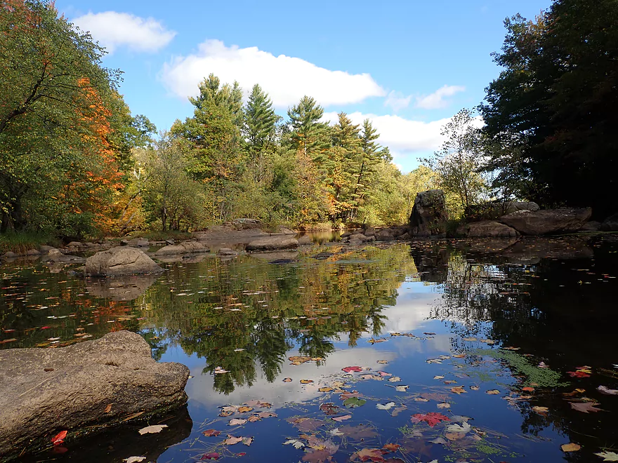
The Biron Dam is split north/south by a large island filled with large granite boulders. While I could have continued on downstream, I decided to wrap around this island to check out the south side. Here I was greeted by more rugged geology…but also some surprise rapids and standing waves just downstream of the south gates (which I stayed well clear of). On the south shore was a powerhouse and the Biron Paper Mill which produces glossy coated paper.
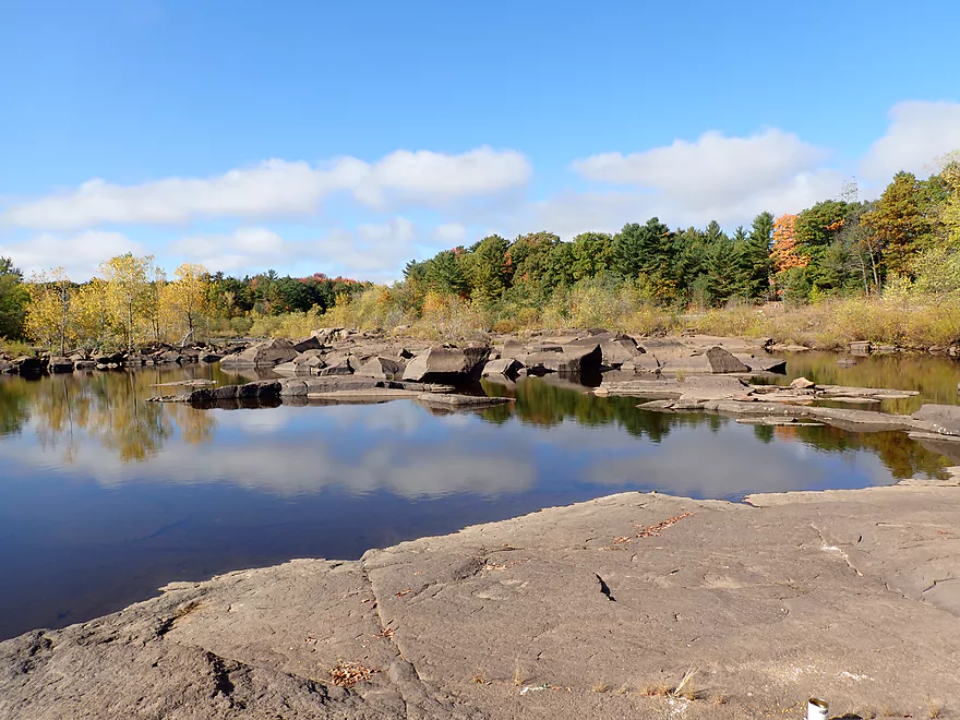
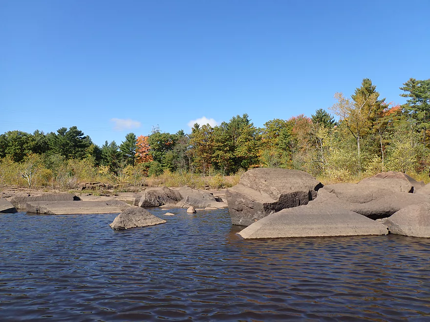
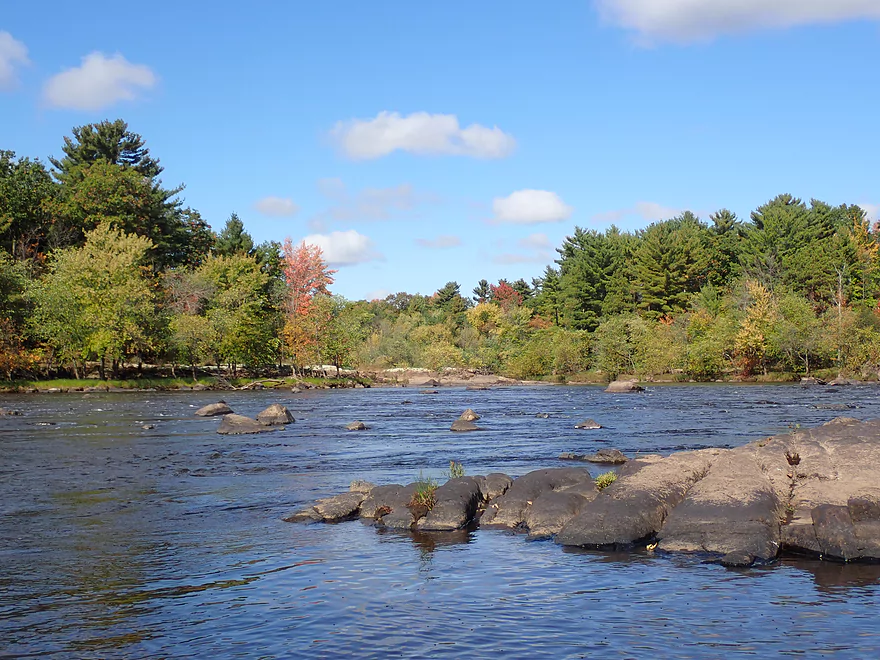
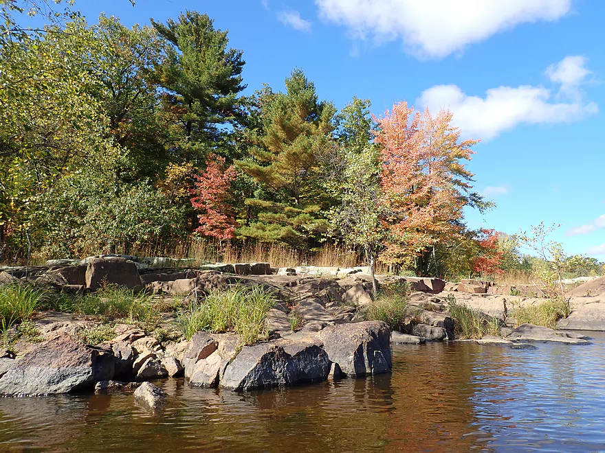
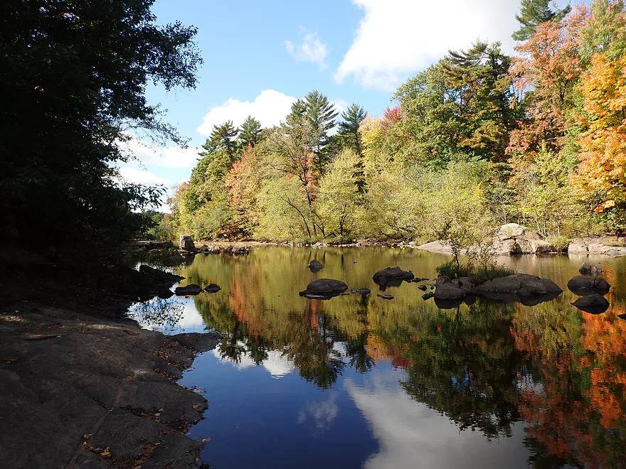
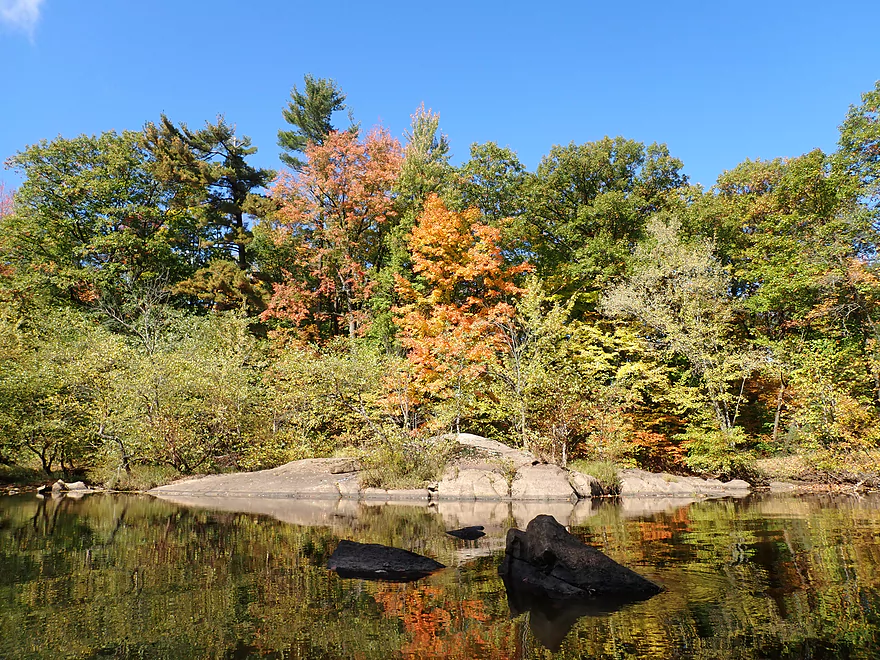
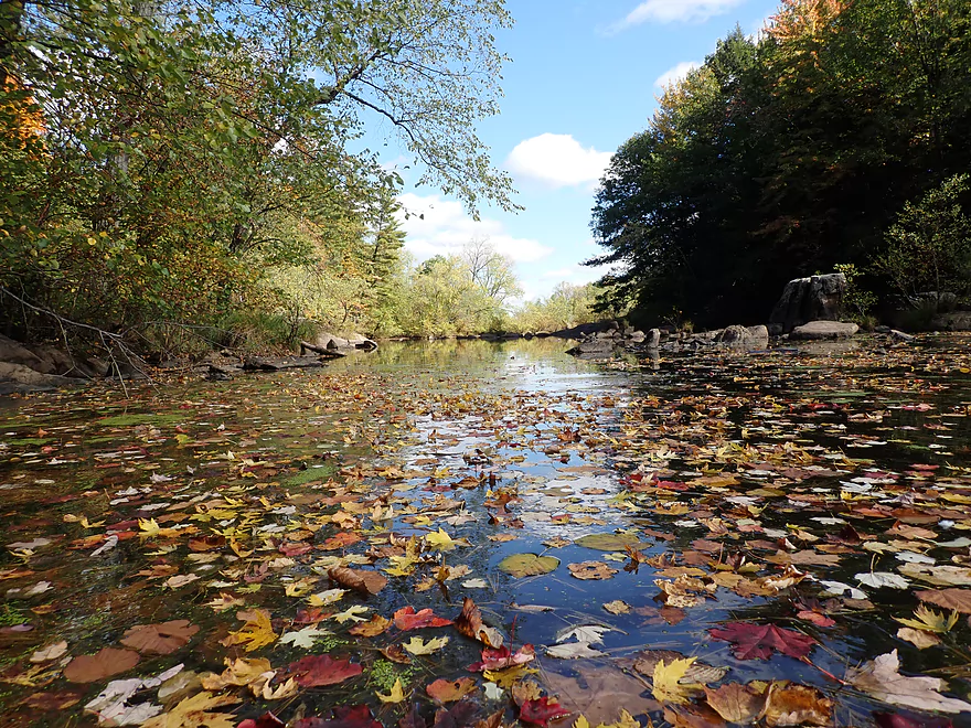
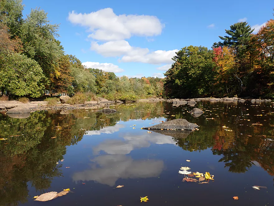
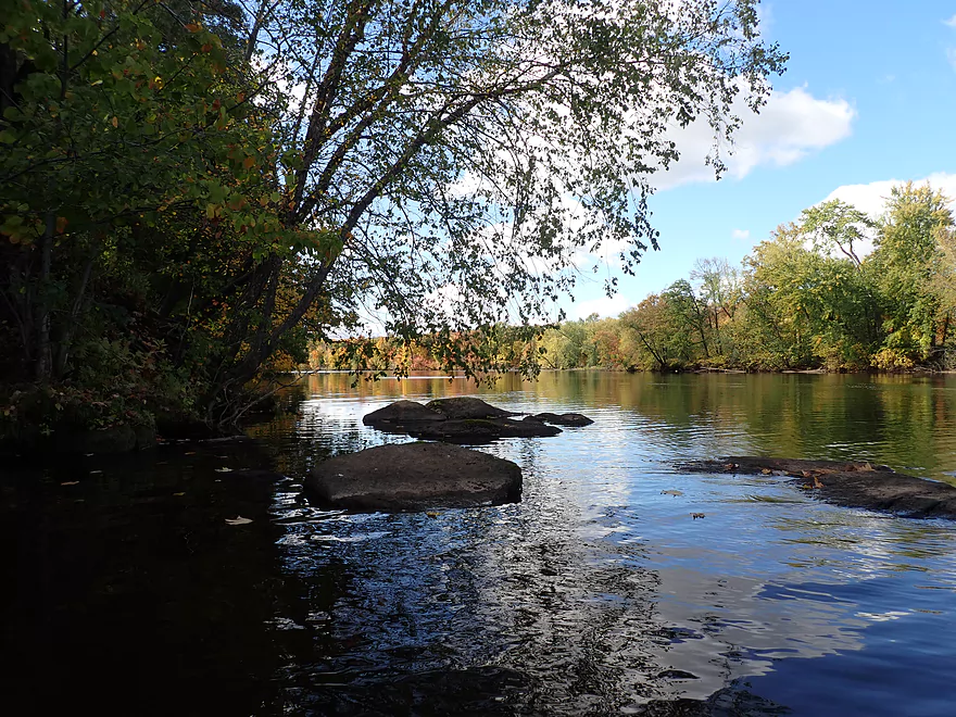
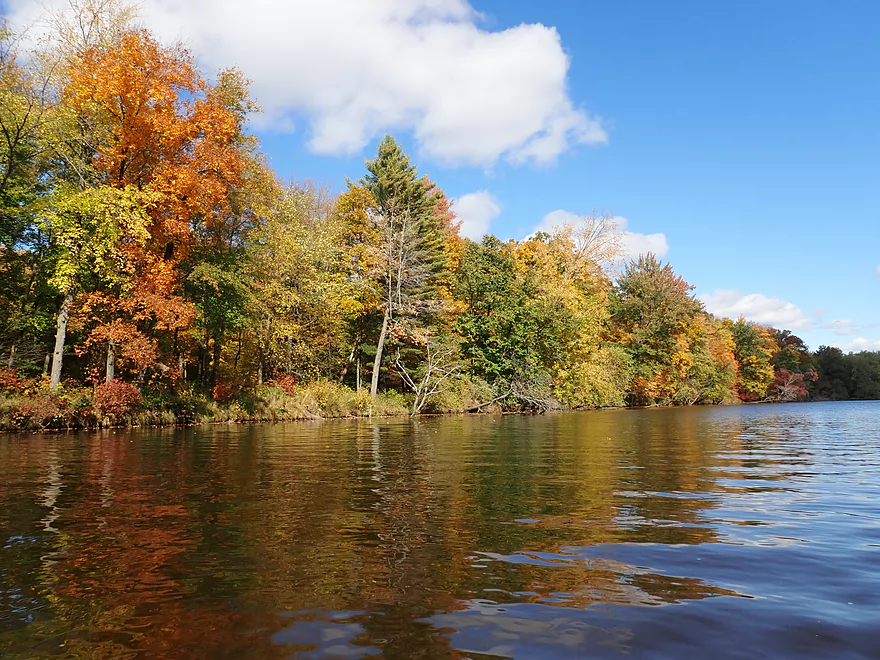
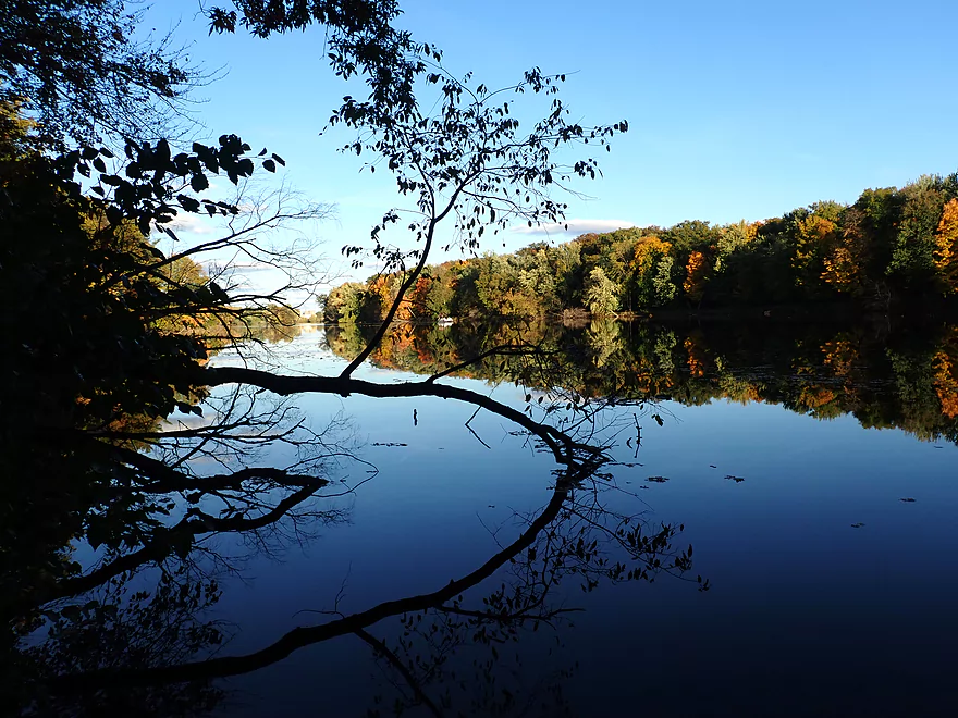
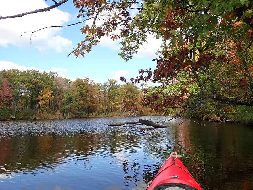
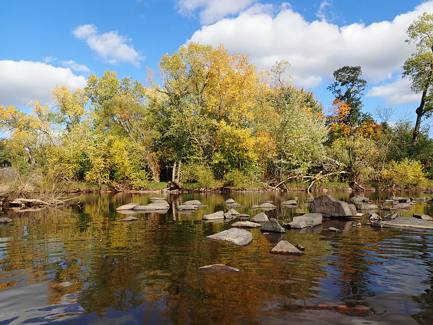
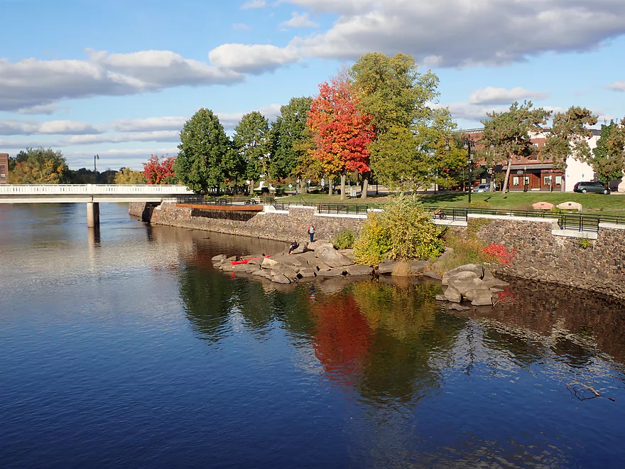
Following the Biron Dam, the Wisconsin River is split in two by another island…this one a half-mile long. The south channel is kind of big and boring…so I headed down the north/right channel which was a wise choice. While perhaps only the size of a creek, this side channel was the most scenic part of the trip. Highlights included incredible fall color, perfect reflections, leaves on the water, scenic boulder gardens, and more exposed bedrock.
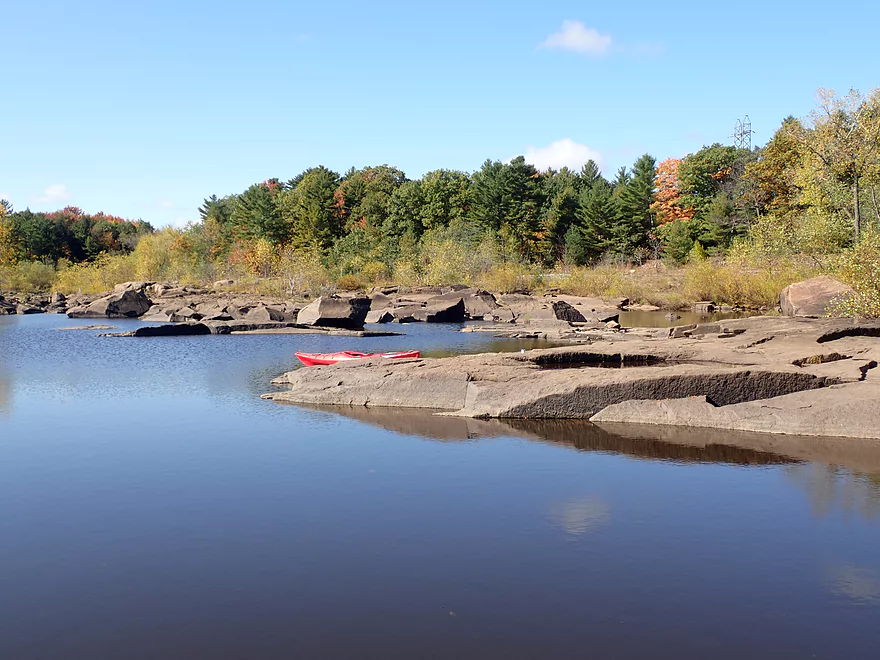
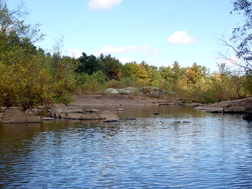
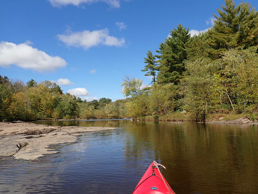
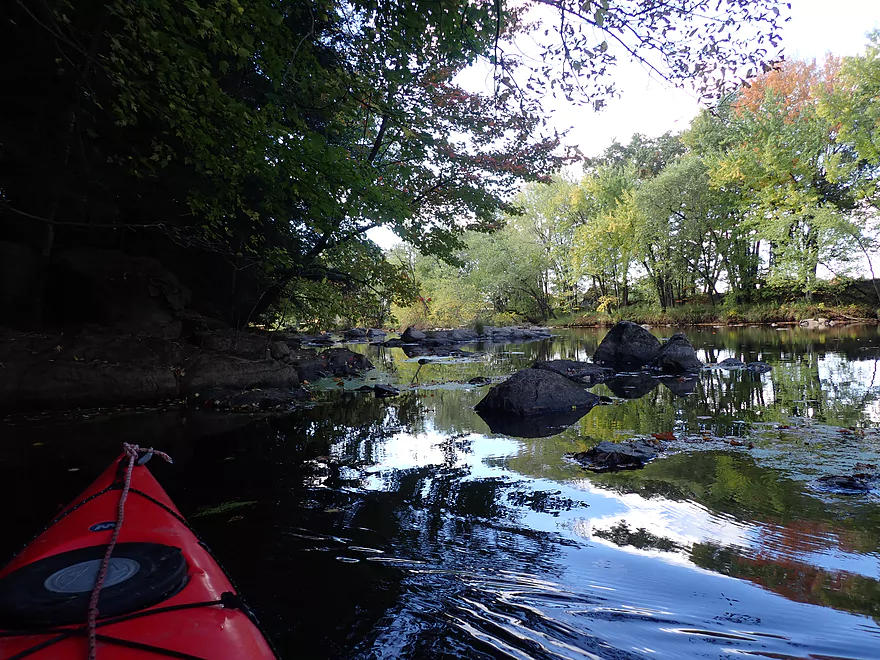
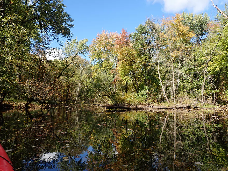
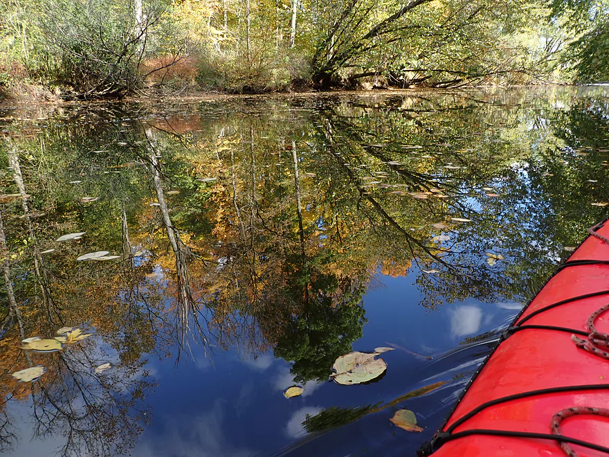
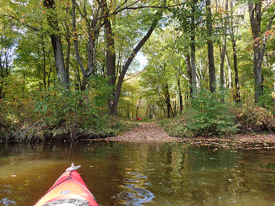
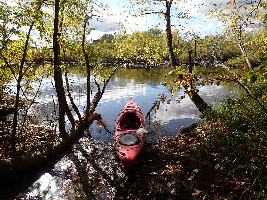
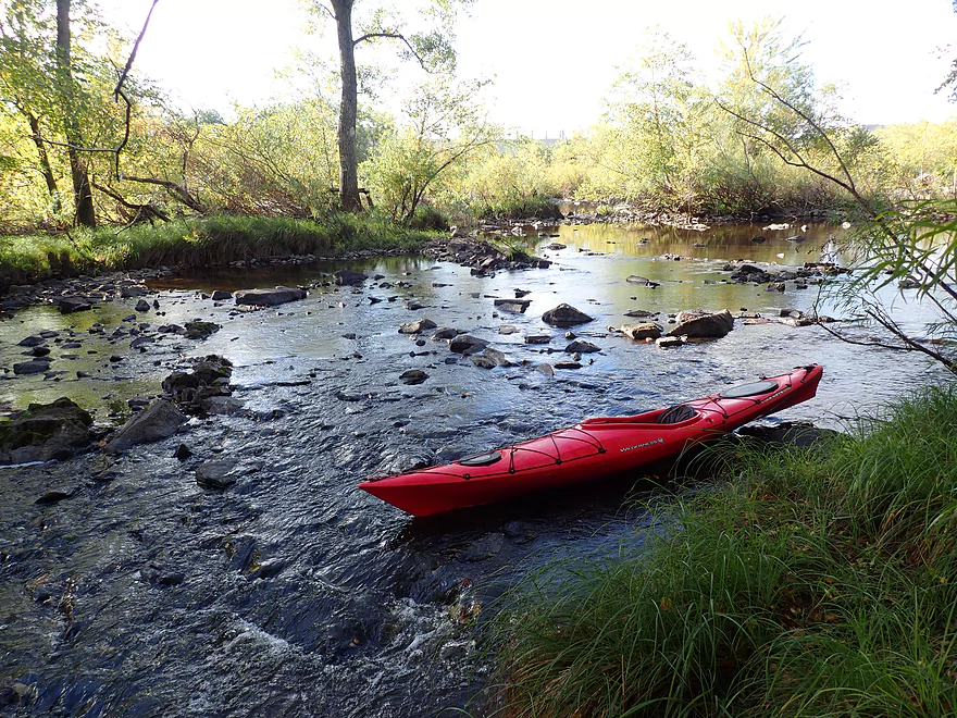
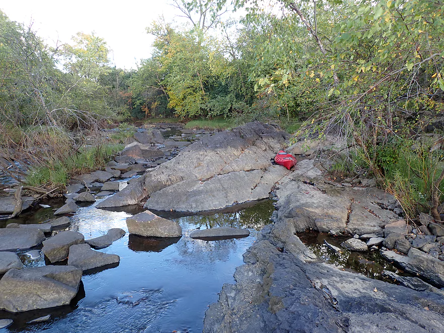
At the base of “island #2”, Mosquito Creek emptied into the Wisconsin. I headed about 1000′ upstream through scenic woods before turning back. I suspect logjams might have been an issue had a I tried to go much further upstream. I would be curious to know though how viable the rest of the creek is for paddling.
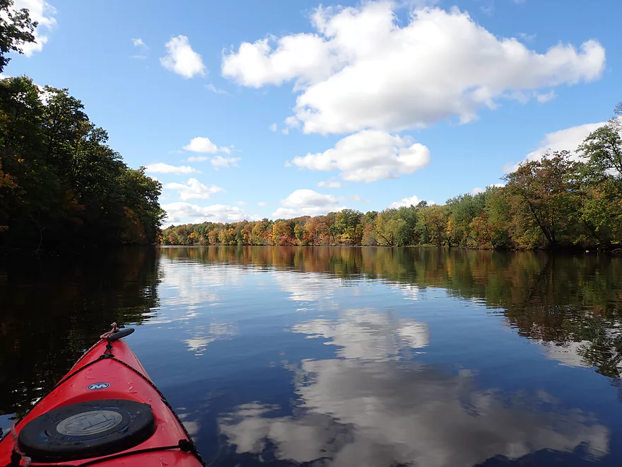
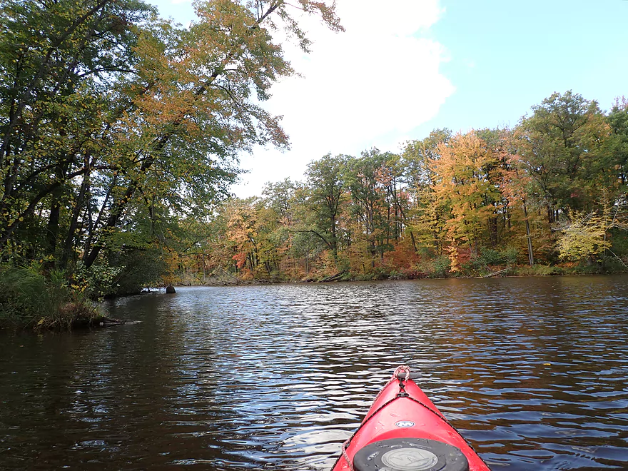
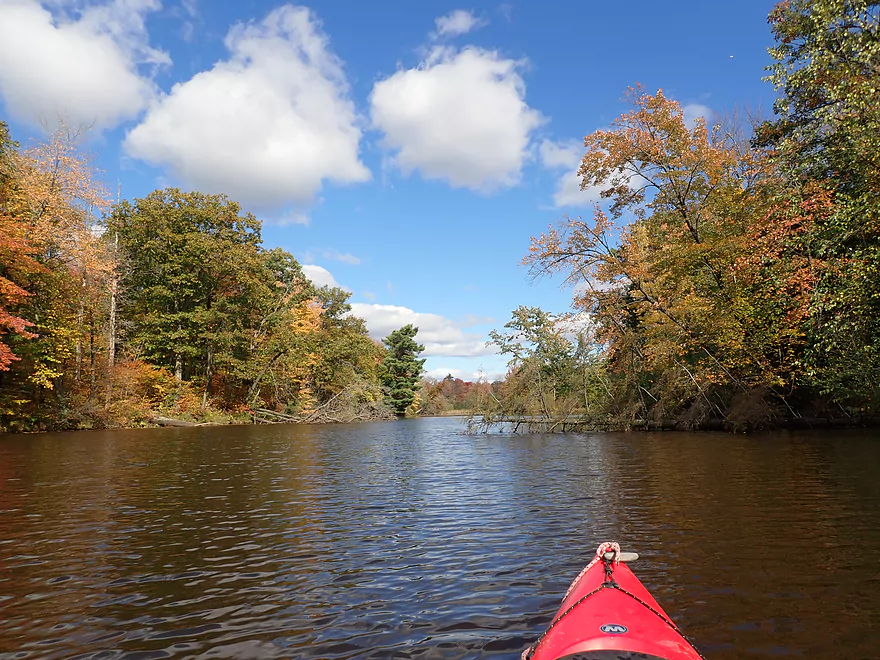
After the second island, the Wisconsin is split again by a third and largest island at over 1.5 miles long called Big Island. I had a decision to make… The east channel was a bit bigger and had homes along the bank, but also had several intriguing smaller islands composed of granite. Ultimitely I decided to the do the smaller west channel because I believed it would have the better fall color.
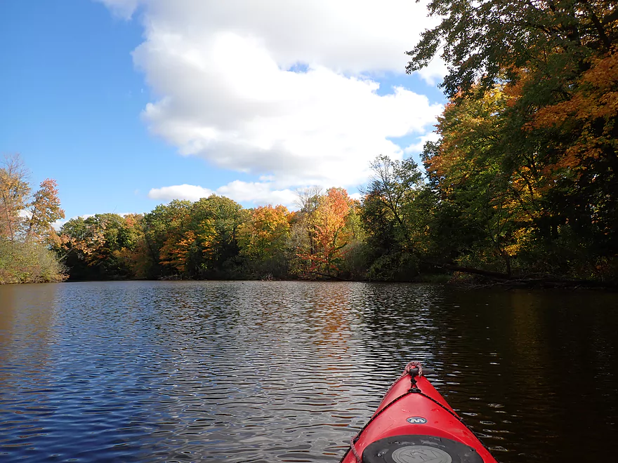
By this time the effects of the downstream dam kicked in and I lost any helping current. Along both banks of the west channel the color was indeed phenomenal…with the best being along the mouth of Cranberry Creek. There’s actually a nice public landing here and this would have been a viable take-out. Just above the banks of Cranberry Creek loomed a huge paper mill and large piles of logs that trains had unloaded.
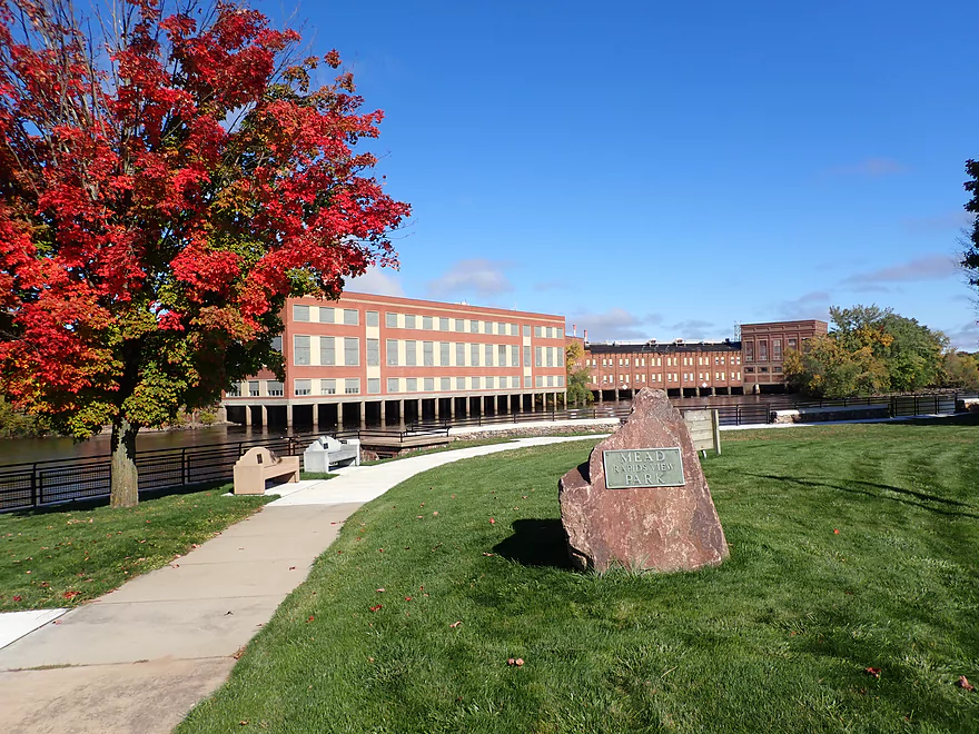
At the base of “Big Island” the two channels rejoined and I came into full view of the famous Verso paper mill. For a long time it was the largest paper mill in the world. Recently it (or rather its parent corporation) have fallen into financial difficulty and the mill is no longer active. The sheer scale and immensity of the plant is tough to convey. It’s a mile long! …and that doesn’t even include its wastewater plant or monster-sized log field.
Downstream from the paper mill I encountered a ridiculously low railroad bridge. I’m not sure how this isn’t frequently over-topped by flood waters. Thankfully I was able to duck under ok. There is a marked take-out/portage area upstream of the railroad for those that don’t like to limbo.
The railroad bridge is an important demarcation as it means you’re getting close to the Verso dam. In fact signs warn not to go past the railroad when warning lights show the gates are open. They were closed for my trip, so it wasn’t a big deal to paddle past the bridge.
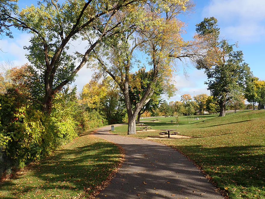
I finally came to the Verso dam (aka the Wisconsin Rapids dam)…which is known as one of the most difficult portages on the entire Wisconsin River. I’ve heard stories that some paddlers will portage a mile to go around it…and that Verso if called will have somebody pick you up to assist with the shuttle. That all sounded too difficult and complicated. I didn’t want to pester anybody on a Sunday…and assumed with Verso being 99% shut down, they were no longer shuttling paddlers past the dam. Instead I opted for a much shorter 680′ portage through nearby Legion Park.
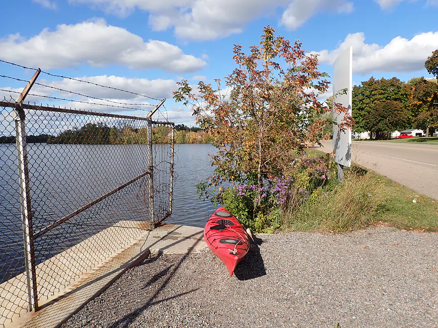
I took out at the junction of the dam and First Street, which wasn’t bad. Street parking is available here and it wouldn’t have been a difficult take-out had I wanted to end my trip here. Sadly, a large chain-link fence separates the park from the shoreline below the dam. I appreciate the sentiment for safety…but really…it’s a river not a prison. So not being able to get over this very tall fence, I followed it south along the park. Thankfully the fence was replaced with a much shorter stone wall, and at a low point, I was able to hoist my boat over and get back onto the river.
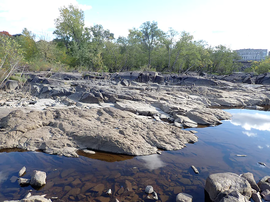
Here I was greeted by a huge boulder field. This was fun to paddle through and scenic…but proved shallow. In fact, if I were to do this trip again, I would avoid this boulder field by taking out at the north end of Legion Park, or doing a much longer portage to Veteran’s Memorial Park. The up side was that I was able to paddle and experience a unique part of the Wisconsin River that few kayakers see. Above the boulder fields, a pair of dams are positioned at right angles to each other which I found unique. You can’t really see the dams unless you climb over a number of boulders though.
Finally by Mead Rapids View Park, I was clear of the boulder field (which was doing a number on my kayak repair patch job). In the open bay was the Verso powerhouse, which was making a terrible racket with its industrial fans. The powerhouse was part of a contiguous building complex which was huge. Part of it overhung the Wisconsin River and was supported by large concrete columns. I had fun paddling through this (although not all kayakers should do this as the current here is strong). During the 2010 floods, these huge concrete pillars and part of the powerhouse were submerged by flood waters that caused havoc with Wisconsin Rapids (video). At one point in time this was home to Grand Rapids, which was among the most fierce rapids on the entire river. Sadly the rapids have been submerged by the Verso dam (more on this later)
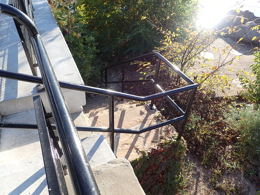
The take-out options below the dam aren’t great. The western shore isn’t viable as it’s practically all part of the paper mill complex. The eastern shore, by Mead Rapids View Park, had a steep retaining wall so it too wasn’t an option. Instead I had to continue floating downstream until I came to Veteran’s Memorial Park which had a public access. But it wasn’t great, as steep stairs with a sharp 90 degree turn made carrying my boat up somewhat tricky (I’m appreciative to the local who helped me lift my boat over the hand railing).
I didn’t see much…highlights included a black squirrel, a great blue heron, and two eagles.
Wisconsin River Papermaking Museum: This museum features exhibits and a pictorial history of the local paper industry and local dams. It’s free of charge to visit, but be warned their hours are really bad…Tuesday and Thursday 1-4. I wasn’t able to visit but the reviews on TripAdvisor sounded very positive. I suspect they have information on the original Grand Rapids. They can be reached at: (715) 424-3037 – 730 1st Ave South, Wisconsin Rapids, WI 54495.
Biron Dam – North Gate: North of the dam is a public access and parking lot. From the parking lot, you can cross a walk bridge and follow the base of the dam 300′ until you reach the water. Here there is a scenic collection of granite boulders and a number of launch spots to choose from. Note, the boulder fields can get a bit shallow when the gates are closed. When this happens you may need to portage some of the rocks (not too difficult) or simply launch below the main boulder field (eg here). Obviously you want to be careful before launching below a dam in case of a release. The Biron Dam will sound a warning alarm every 30 seconds for five minutes prior to a release.
Alternate Put-ins:
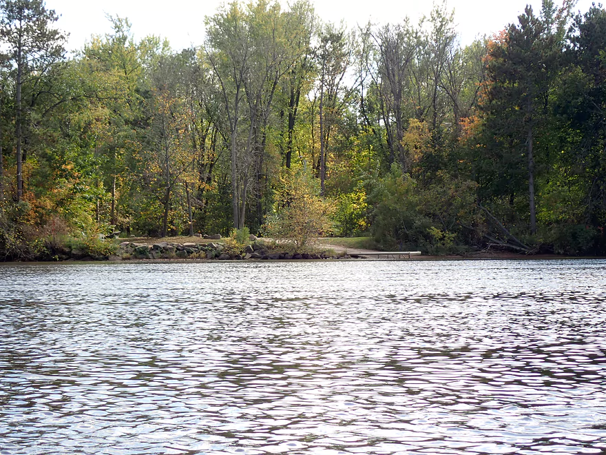
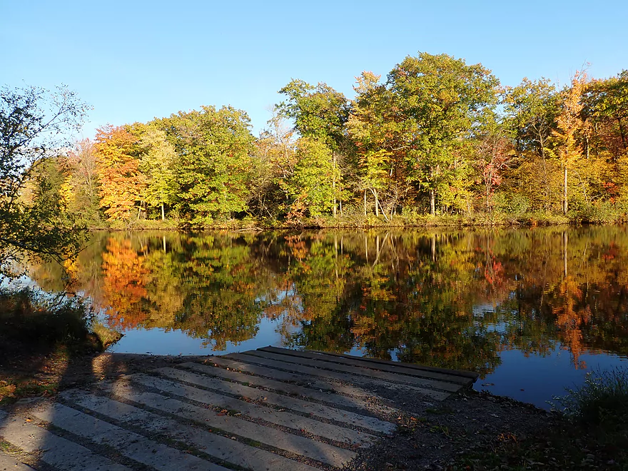
- Biron Landing (0.9 miles downstream from the Biron Dam): This is a good public access…but if you launch here you miss out on one of the most scenic parts of the trip (the boulder fields below the Biron dam).
- Reddin Road Access (1.8 miles downstream from the Biron Dam): This is another good access. The location isn’t great though because it’s halfway into the trip. The current here is somewhat slow so round trip paddles from this launch might be viable.
Veteran’s Memorial Park: This is one of the few areas below the Verso dam where you can take out. While the park is bordered by a steep retaining wall, stairs do lead down to a small granite island where it’s possible to put in or take out. Be mindful the channel is deep by this island…so you’ll need to do a “pier exit” which for some can be tricky. Also of concern…the stairs have a sharp 90 degree turn which will force you to lift your entire boat above the railing.
Alternate Take-outs:
- Cranberry Creek Landing: This is a good public access and a scenic landing.
- Legion Park: This is located at the base of the Verso Dam – East Gate. Street parking is available and the shoreline is acceptably shallow for taking out. Note, if the gates are open, you shouldn’t be this close to the dam and instead should take out upstream of the railroad bridge. I believe there will be warning lights that will flash when the gates are open. Otherwise if the gates are closed it’s very safe to use this as a take-out. The advantage of taking out here is that you avoid a tricky portage to access the water below the dam.
- Demitz Park: (0.8 miles downstream from Veteran’s Memorial Park) This would be an ok access. This longer trip would go by scenic Belle Island.
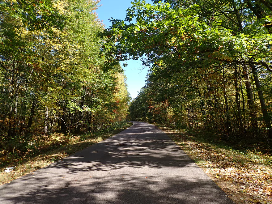
Bike Shuttle: 5.2 miles with 36′ of ascent. This was a really nice bike shuttle. It starts in downtown Wisconsin Rapids and goes by the massive Verso Paper Mill. After that it goes through an attractive wooded stretch by Reddin Road. You can stay clear of most major traffic by using the bike trails/sidewalks/side roads.
Low Railroad Bridge: Just upstream of the Verso Dam is a very low railroad bridge. I was able to duck under by lowering my seat…but others may find this more difficult, especially if the current is flowing fast. There is a marked portage take-out upstream of the bridge if you’re not in a limboing mood.
Biron Dam – North Gates: If these are closed (like they were for my trip) then the subsequent bay will be pretty tame. Tricky rapids and currents can develop when they’re open though. A warning horn will sound every 30 seconds for five minutes prior to a release.
Biron Dam – South Gates: During my trip, two of the south gates were open. This resulted in strong rapids and reverse current. This area should be avoided by inexperienced paddlers.
Biron and Verso Powerhouses: In theory a paddler could venture into the discharge chutes during low flows. This is not advisable as the currents here are strong and releases at the powerhouses (unlike the dams) can happen with little to no warning. Below the Verso Powerhouse a large building juts out over the river and is supported by massive concrete piers. I did paddle by these piers but paddlers should be careful around them because of the strong current.
Rapids:
- Biron Dam – North Gate: There are no rapids when the gates are closed. When the gates are open, I suspect this area sees some interesting whitewater (because of the downstream boulders).
- Biron Dam – South Gate: The rapids below the south gate were Class 2/3 and consisted of standing waves. This could be a fun play spot for experienced whitewater paddlers and the huge eddy would allow kayakers to head upstream to surf them again. Rec paddlers should stay clear of these rapids.
- Wisconsin Rapids/Verso Dam – East Gate: There were no rapids during my trip and the boulder fields were shallow. At high flows though I suspect serious rapids can develop here. Part of the boulder field can be scouted from the adjacent park or the downstream bridge.
Wisconsin River @ Wisconsin Rapids: 4300 CFS or 3.13′
- 0-3000 CFS: A rare low depth. The river will be fine for paddling, but the areas below the dam will be shallow.
- 3001-5000 CFS: An average depth and a good target range.
- 5001-7000 CFS: A higher depth. The current could be a bit tricky below the Biron Dam.
- 7001-9000 CFS: A very high depth. Paddlers should stay clear of the dams at these times unless they really know what they are doing.
- 9001+ CFS: Perhaps too high for enjoyable paddling.
Note also…there is a gauge below the Biron dam that is more accurate than the Wisconsin Rapids gauge, but it lacks historical data for context. The readings for my trip were 1011.42′ and 4130 CFS.
Verso Paper Mill: Located in the heart of Wisconsin Rapids is a mile long paper mill, once the largest in the world. This mill has faced a lot of economic hardships following multiple corporate mergers and reduced demand for magazines. The latest nail in the coffin was Covid-19. Demand for glossy advertisements (aka junk mail) fell dramatically and corporate headquarters in Ohio decided to shut down this plant on July 31st, 2020.
In some ways this was tragic, as ~900 workers lost their jobs. The effect on the Wisconsin Rapids economy will definitely be severe.
In some ways though it wasn’t so tragic… 25% of ALL timber harvested in Wisconsin went to feed this mill’s monstrous appetite. The plant’s closure will dramatically reduce deforestation in Wisconsin and the UP. Fewer papers mills are also good news for landfills (as a quarter of their contents are paper-based). Then there is the air pollution. Paper mills produce an assortment of nasty fumes including some heavy metals. The most noticeable is sulfur which made Wisconsin Rapids stink. I don’t understand how the locals endured it. But after the mill closed, the air quality has improved dramatically. Lastly paper mills such as Verso are infamous for their water pollution. Some of this is nutrient-based which interferes with aquatic ecosystems. But it also includes heavy metals which leach into the groundwater and the Wisconsin River itself.
The politics surrounding this are quite crazy. Wisconsin has a unique “Managed Forest Tax Program”. In exchange for tax benefits, a landowner yields forestry management decisions to the DNR. In some ways this is a good thing as it has reduced logging in select sensitive areas and provided public access to Northern Wisconsin woods. But this program will sometimes MANDATE that owners log their woods…even to the point of clearcutting. Some landowners thinking they signed up for this program to protect their woods for tax breaks are quite upset to discover this clause. Much of this DNR mandated logging on Managed Forest Lands is used to supply Wisconsin paper mills with pulpwood. The Verso closing will have a big impact on this program…owners will be forced by the DNR to chop down their woods but won’t have a customer to sell to. Here’s a ridiculous quote from the Wisconsin Rapids Tribune about this situation and how it’s so “bad” for our forests:
A mill shutdown also impacts forest management and the overall health of forest lands in Wisconsin. Landowners in the Managed Forest Land program would still be required to cut timber, but without a mill, there is nowhere to harvest it, Schienebeck said. Wisconsin has great forests because of sustainable management, he said, with certification systems that are checked regularly. With less management, the forests would suffer, and it would also have an impact on tourism in the area, as well, Schienebeck said.
“Who wants to come see a dead forest?” Schienebeck said.
Grand Rapids: The Wisconsin River in its original state used to have a large number of rapids, many of which were significant. The two greatest rapids were Grandfather Bull Falls and Grand Rapids. All of these rapids are now tragically buried by dams, including the heart of Grand Rapids (courtesy of the Verso Power Plant). Here is an interesting historical excerpt from Richard D. Durbin’s book: “The Wisconsin River: An Odyssey Through Time and Space“.
Grand Rapids was at Wisconsin Rapids. Its Ojibwa name, Ah-dah-wa-gam, means “two-sided rapids.” It was the first in an almost unbroken, ten-mile-long series of rapids with a sixty-foot drop that extended to Pointe Basse. Grand Rapids itself, a mile long, ended above the Grand Ave. bridge; it had a twenty-seven-foot drop. A section by the old railroad bridge as sometimes called Lyon’s Rapids, in reference to Lyons’ sawmill situated nearby. Downstream by Witter’s Island was another set of bad rapids. There was a bad stretch at Hurleytown, too. Some sources speak of White Bull Falls and Barker Rapids, which were purported to be located by Port Edwards, but no details are known about them.
Here is a fascinating PDF excerpt from the book which details the stories of 29 historical rapids on the Wisconsin River.
The rapids before the dam weren’t properly photographed…but I did find these two photos that showed at least what a small portion of Grand Rapids would have looked like.
- https://content.mpl.org/digital/collection/mcml/id/8249
- https://content.mpl.org/digital/collection/mcml/id/1102
Quick Overview
- Upstream of Stevens Point: I don't have information yet on these stretches.
- Stevens Point to Lake Petenwell: ~42 miles. This stretch in Central Wisconsin used to have many natural rapids, but most have been buried under 8 dams, some of which are now difficult portages. Despite this there is still some good paddling to be had in this region.
- Lake Petenwell: 14.9 miles. This is a large flowage lake that is challenging for paddlers because of frequent strong winds and big waves.
- Castle Rock Lake: 14.5 miles. Another large flowage lake that is likely too big for enjoyable paddling.
- Castle Rock Lake Dam to Lemonweir River: 9.4 miles. This pre-Dells leg isn't elite, but is a pleasant stretch.
- Lemonweir River to Indian Trails Landing: 21.7 miles. This includes the famous Upper Dells and Lower Dells which feature many scenic sandstone outcrops.
- Indian Trails Landing to Portage: 16 miles. This is an overlooked section sandwiched between the Dells and Portage. While the scenery isn't top-notch, it does have many sandbars and few people, which is a nice combination.
- Portage to Lake Wisconsin: 14.3 miles. This is a neat stretch of the river with many sandbars and cliffs, but the shoreline is very developed and motorboat traffic can be heavy on weekends.
- Lake Wisconsin: 14.5 miles. This is a challenging lake for paddling because of the huge and frequent waves created by motorboats.
- Prairie du Sac Dam to Port Andrews: 57 miles. This is the first half of the famous Lower Wisconsin Riverway. This is a super popular stretch for paddlers with the highlights being large sandbars, big bluffs, occasional cliffs, and fun side sloughs to explore.
- Port Andrews to Wyalusing: 40 miles. This is the second half of the Lower Wisconsin Riverway which has far fewer paddlers and sandbars. But the bluffs and sloughs are larger and more interesting.
Detailed Overview
- Upstream of Merrill: I don't have enough information yet on these legs to comment.
- Merrill Dam to Riverside Park: 0.5 miles. Might include some light rapids below the dam.
- Riverside Park in Merrill to Wisconsin River Forest Landing: 8.6 miles. A good prospect.
- Wisconsin River Forest Landing to Brokaw Boat Landing: 5.7 miles.
- Wisconsin River Forest Landing to Jesse Park: 1.4 miles. A terrific stretch with small boulder gardens, one set of Class 1-2 rapids, gravel bars and a nice sand bank.
- Jesse Park to Brokaw Boat Landing: 4.3 miles. A good stretch with scenic wooded banks and occasional gravel bars.
- Brokaw Boat Landing to Gilbert Park: 5.1 miles. River slows down and becomes hillier. This stretch is an ok prospect and goes past the old Brokaw paper plant that has been shut down. Paddlers must navigate Class 1 rapids and a 2' drop where the old Brokaw dam used to be.
- Gilbert Park to Wausau Boat Dock: 1.5 miles. An impounded stretch through Wausau. There are numerous alternate access options to choose from.
- Wausau Boat Dock to Oak Island Boat Ramp: 1.2 miles. A nice stretch that includes Barkers Island and Isle of Ferns Park. But the Wausau dam does require a portage. This stretch parallels the famous Wausau Whitewater Park.
- Oak Island Boat Ramp to Rothschild Dam Access: 5.8 miles. Likely mostly uninteresting flowage paddling. There are many alternate access options to choose from.
- Rothschild Dam Access to Zimpro Park: 1.0 miles. This might be a nice stretch.
- Zimpro Park to River Road Boat Landing: 7.6 miles. The first half of this leg is likely nice river paddling, but the second leg is probably just an uninteresting flowage.
- Chucks Landing/Mosinee Dam to Bean's Eddy Boat Landing: 2.8 miles. Likely a nice leg. You might be able to launch by the dam where there should be some nice rapids and boulders.
- Bean's Eddy Boat Landing to Seagull Boat Landing: 5.1 miles. Mostly uninteresting flowage paddling. Although there might be some nice sand banks on the eastern shore.
- Seagull Boat Landing to Dubay Dam Access: 5.3 miles. Mostly uninteresting flowage paddling.
- Dubay Dam Access to River Road Landing: 5.5 miles. This could be a nice stretch of river.
- River Road Landing to Old US 10 Landing: 2.3 miles. Likely an ok leg.
- Old US 10 Landing to Stevens Point Dam: 5.6 miles. Probably uninteresting flowage paddling. Many alternate access options closer to Stevens Point.
- Stevens Point Dam to Blue Heron Boat Landing: 4.2 miles.
- Steven Point Dam to Whiting Dam: 2.6 miles. Starts slow and uninteresting, but the river becomes very scenic after the Hwy HH bridge. The rock formations below both dams are very striking. Many alt access points.
- Whiting Dam to Kimberly Clark Dam/Al Tech Park: 0.6 miles. Incredible scenery with exposed bedrock and boulder gardens below the Whiting Dam. Some rapids, but nothing major. The Kimberly Clark Dam is a dangerous low-head dam and should be treated carefully.
- Kimberly Clark Dam to Blue Heron Landing: 1.0 miles. Class 2 rapids below the dam, but after that the river slows dramatically and splits into many sub-channels and islands. Round trips on this leg are possible. I chose the far western channel where there were some nice rocky stretches.
- Blue Heron Landing to Mill Creek Landing: 4.1 miles. Likely a mediocre paddle with nothing special. Galecke Park is an alternate access.
- Mill Creek Landing to Biron Dam North Gate: 7.6 miles. Mostly uninteresting flowage paddling. Several alternate access options on route.
- Biron Dam North Gate to Veteran's Memorial Park: 4.5 miles.
- Biron Dam North Gate to Biron Landing: 1.0 miles. Super scenic stretch by two islands with many granite boulders.
- Biron Landing to Legion Park: 3.0 miles. A nice stretch by Big Island. The west channel is more undeveloped...but the east channel has several scenic granite islands.
- Portage through Legion Park: 680'. A steep wall separates the park from the river but in two locations the wall is short enough to get over (see map). Paddlers may want to consider a longer portage to bypass some of the shallow rocky stretches by Legion Park.
- Legion Park to Veteran's Memorial Park: 0.4 miles. A scenic stretch that features a large boulder field and the powerhouse for a large paper mill.
- Veteran's Memorial Park to Port Edwards Landing: 3.8 miles
- Veteran's Memorial Park to Demitz Park: 0.8 miles. A pleasant stretch that includes Belle Island.
- Demitz Park to Ben Hansen Park: 1.2 miles. This leg goes by Garrison Island and Edwards Island. Lyon Park is located across the river from Demitz Park and is another access option.
- Ben Hansen Park to Port Edwards Landing: 1.8 miles. Above the Centralia dam there are several small but nice islands. Portage the dam on the left bank (follow the 1000' trail through the golf course). Below the dam there are scenic rock formations. Close to the Port Edwards dam are a few more scenic islands you can explore.
- Port Edwards Landing to Nekoosa/Riverside Park: 3.6 miles.
- Port Edwards Landing to Port Edwards Powerhouse: 1.3 miles. A half-mile portage is required (east bank). A very scenic boulder field is located below the dam. At high levels, the rocks are submerged and produce a half-mile stretch of rapids (some strong).
- Powerhouse to Moccasin Creek Landing: 1.8 miles. A generic wooded stretch that isn't super interesting.
- Moccasin Creek Landing to Riverside Park: 0.5 miles. During the Nekoosa dam drawdown, this stretch had nice boulder fields and rapids.
- Riverside Park to Hwy 73: 0.8 miles. An ok stretch of the river. There are scenic cliffs south of Hwy 73, but these are past the dam warning line. Hwy 73 is not a good access option.
- Hwy 73 to Point Basse Ave (Portage of the Nekoosa Dam): 1.5 miles. A difficult 1.5 mile portage through downtown Nekoosa. Don't try to portage the south bank. There is a steep hill, cliffs, and large Domtar paper mill fences to deal with.
- Point Basse Ave to Jim Freeman Memorial Boat Landing: 0.8 miles. A generic stretch going by historic Point Basse. If you're willing to backtrack to the dam, you can see scenic boulder fields (during low flows) and a few cliffs. Point Basse Ave is a somewhat speculative access, but it seems public and doable for launching.
- Jim Freeman Memorial Boat Landing to Plank Hill Small Boat Access: 2.0 miles. A generic stretch.
- Plank Hill Small Boat Access to 19th Drive Landing: 5.3 miles. Features two epic sand banks. The main channel has some minor sandbars. Several of the side sloughs can provide fun side adventures.
- 19th Drive to the Petenwell Dam: 14.9 miles. This is Lake Petenwell which is a large and challenging lake for paddling. Waves and strong winds are frequently an issue. But when calm there are nice sandbanks on the northwest shore, hidden sloughs, and large islands to explore. See the overview map for more info.
- Petenwell Dam to Ganter Lane Landing: 3.8 miles. This stretch isn't too impacted by dams and may have nice sandbars at low levels.
- Ganter Lane Landing to Castle Rock Lake Dam: 10.7 miles. Castle Rock Lake is likely too big (wind/waves) for enjoyable paddling. There are many alternate launch options along the shore.
- Castle Rock Lake to the Lemonweir River: 10 miles. An ok section.
- Lemonweir River Mouth to River Bay Landing: 7 miles. The first half of the classic Upper Dells.
- River Bay Landing to Blackhawk Island: 6.5 miles. Second half of the classic Upper Dells, known for its fantastic outcrops. Note, the Blackhawk Island landing is no longer accessible without special permission from the Upham Woods Outdoor Learning Center.
- Black Hawk Island to Wisconsin Dells Dam: 2.0 miles. More nice sandstone outcrops. You can take out at a public ramp off Indiana Ave or portage the dam and take out SW of the dam by a launch off Wisconsin Dells Pkwy/Hwy 12.
- Dells Dam to Indian Trails Landing: 6.2 miles.
- Dells Dam to Newport Park: 2.2 miles. This is the heart of the famous Lower Dells with many scenic outcrops. Unfortunately jet boats are a serious plague on this stretch.
- Newport Park to Indian Trails Landing: 4.0 miles. Features the famous "Sugar Bowl" formation and four super cool caves. The outcrops soon disappear and this stretch is mostly uneventful (but peaceful) big river paddling.
- Indian Trails Landing to Pine Island Boat Ramp: 9.8 miles. Few paddle this stretch as it isn't as interesting. But...it does have a good concentration of sandbars and few competing paddlers for them.
- Pine Island Boat Ramp to Portage/Hwy 33 Access: 6.0 miles. Not an elite section that is lacking in cliffs and bluffs. It does have good sandbars though.
- Portage to Dekorra Park: 7.7 miles
- Portage to Baraboo River/Thunderbird Road: 5.2 miles. A good section with great sandbars. Close to Portage there are few motorboats.
- Baraboo River to Dekorra Park: 2.5 miles. River splits around massive Lib Cross Island. West channel has nice sandbars. St Lawrence Bluff has scenic sandstone outcrops and includes a cave you can paddle into.
- Dekorra Park to James Whalen Memorial Park: 6.6 miles.
- Dekorra Park to Camp Rest Park: 5.1 miles. A terrific section with rock outcrops, large island deltas, hidden sloughs, and nice sandbars. Unfortunately this part of the river is popular with motorboats and jet skis which can be a plague. Multiple alternate access options.
- Camp Rest Park to James Whalen Memorial Park: 1.5 miles. Not a great section because of the open water paddling, powerboats and big waves. The west shore though does have nice outcrops.
- James Whalen Memorial Park to Merrimac Memorial Park: 4.4 miles. River turns into "Lake Wisconsin". Generally speaking this isn't ideal for kayaking as motorboat traffic can be heavy and waves can be surprisingly big. The most direct route is the north shore which has a few bluffs, but generally speaking isn't that interesting.
- Merrimac Memorial Park to Veterans Memorial Park/Prairie du Sac: 9.6 miles.
- Merrimac Memorial Park to Moon Valley Landing: 3.3 miles. Includes a lot of developed shoreline. The ferry, railroad bridge, and Moon Bay are highlights.
- Moon Valley Landing to Veterans Memorial Park/Prairie du Sac: 6.3 miles. Other than Moon Bay and the dam, this is a boring stretch. There are numerous alt access options on this route.
- Prairie du Sac to Mazomanie: 8 miles. An ok section of the Wisconsin but lacking in sandbars.
- Mazomanie to Arena: 9.7 miles. A great section with nice sandbars and scenic bluffs.
- Arena to Hwy 14: 8.0 miles. Good section with a high concentration of sandbars. One of the more popular legs on the Lower Wisconsin.
- Hwy 14 to Hwy 23/Spring Green: 2.2 miles. Neat mini-section with sandstone outcrops. Very popular in the summer.
- Spring Green to Lone Rock: 7.4 miles. Another fine sandbar/bluff section with some nice rock outcrops too.
- Lone Rock to Gotham: 8 miles. This stretch has super impressive rock outcrops and sand banks.
- Gotham to Muscoda: 7.6 miles. This leg includes more large sandbars and great outcrops. Bonus highlights include fast current and not seeing as many people.
- Muscoda to Port Andrew: 7 miles. A good stretch with many islands and sandbars.
- Port Andrew to Boscobel: 9 miles. Wooded islands start to get massive.
- Boscobel to Woodman/Big Green River: 9 miles and start of the less paddled stretch of the Lower Wisconsin. Far fewer sandbars from here to the mouth, but good bluffs and side sloughs to explore.
- Woodman to Millville: 7.7 miles. A good stretch with large bluffs and sandbars.
- Millville to Bridgeport: 5.3 miles. Huge islands, bluffs and sandbars are the highlight on this second-to-last leg on the Wisconsin River.
Bridgeport to Wyalusing (the mouth): 9 miles.
Trip Map
Overview Map
Video
Photos Size: