
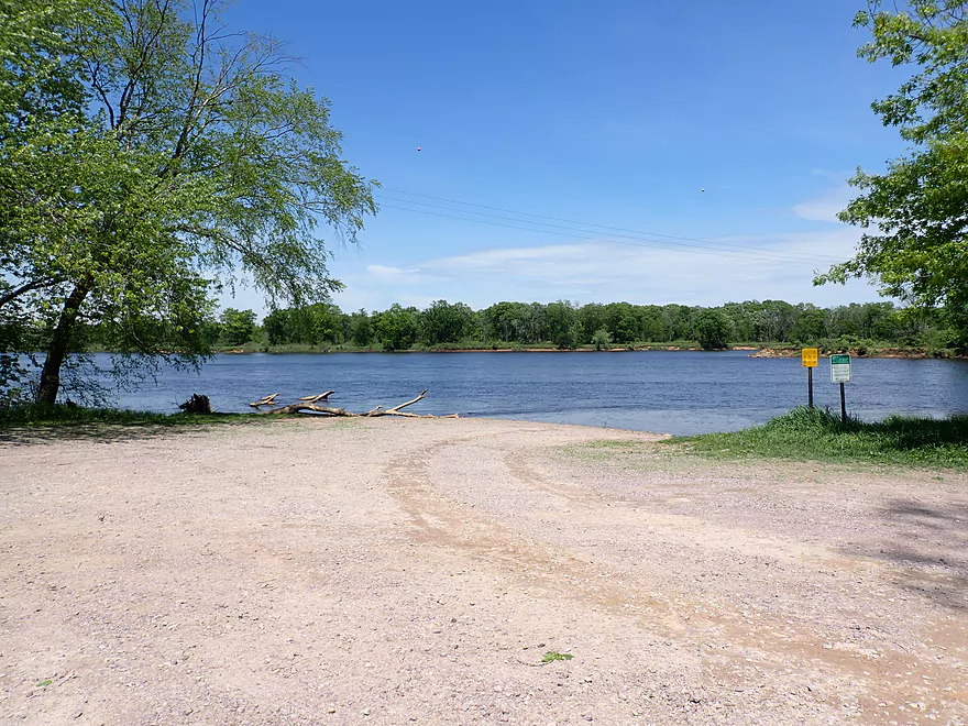
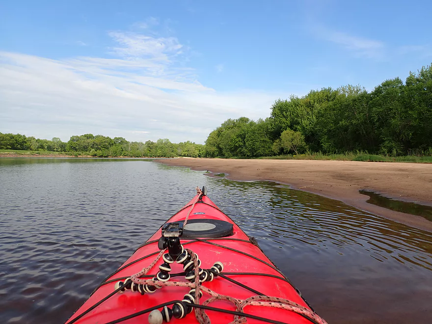
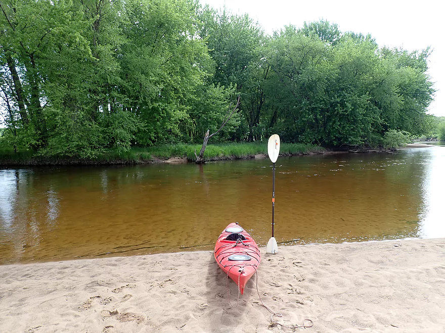
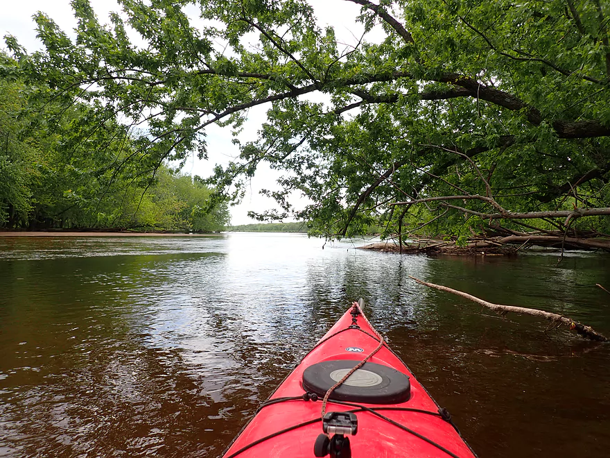
Starting the trip at the Pine Island Boat Ramp
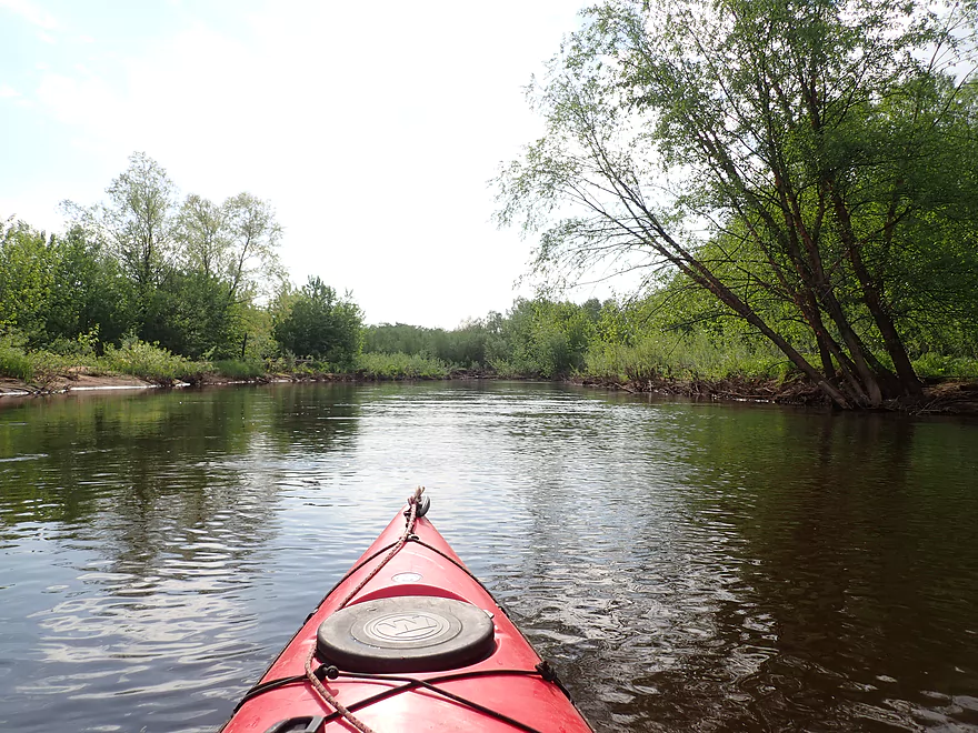
Scenic launch
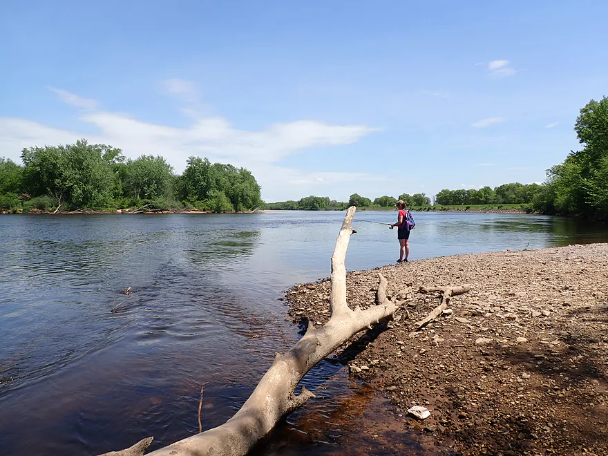
View downstream…this is a popular fishing spot
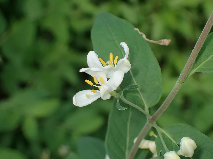
Attractive white flowers
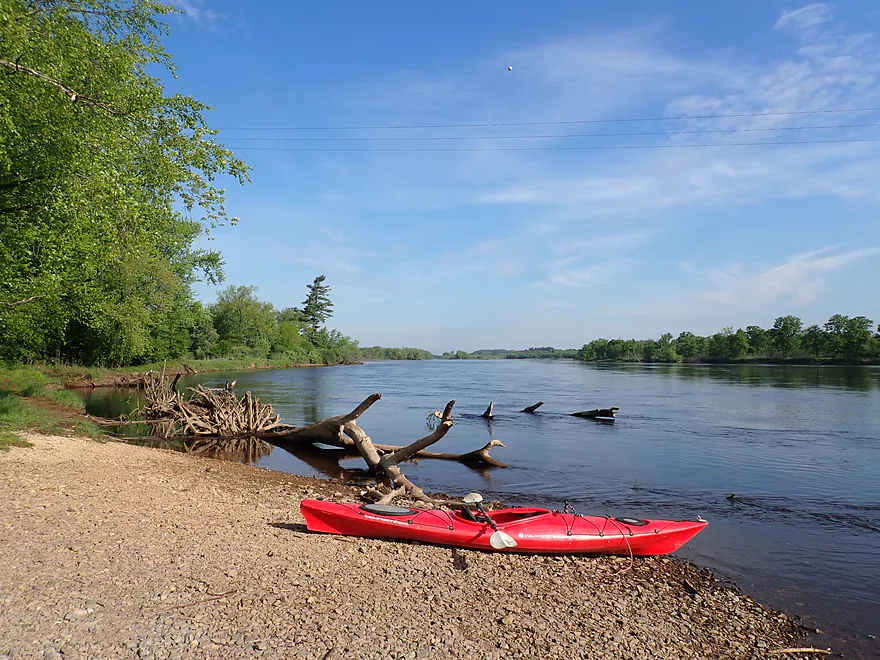
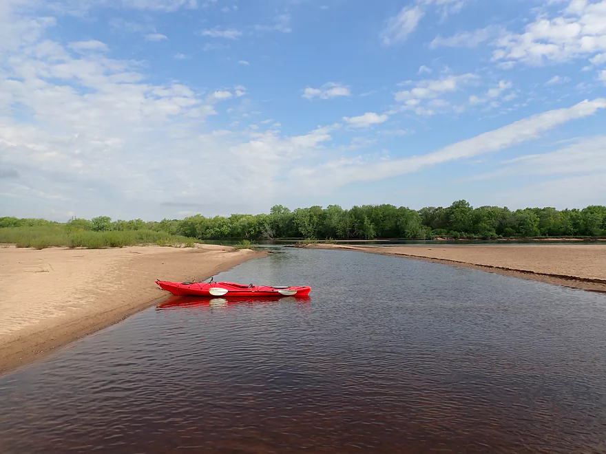
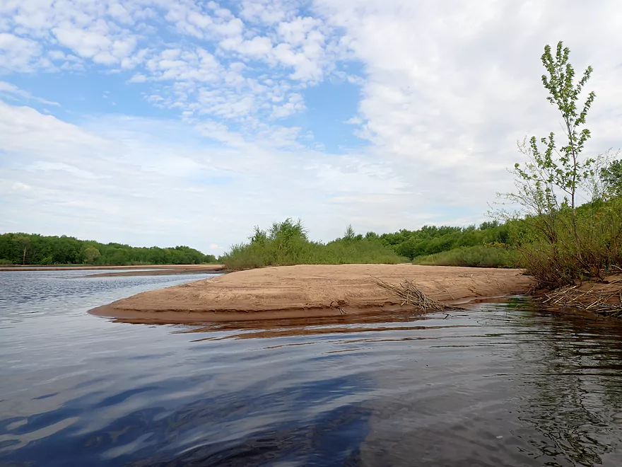
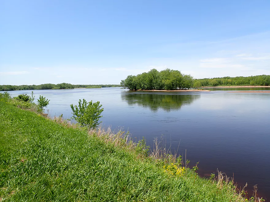
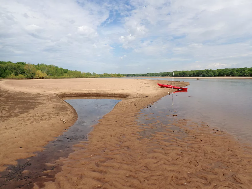
The first of countless sandbars
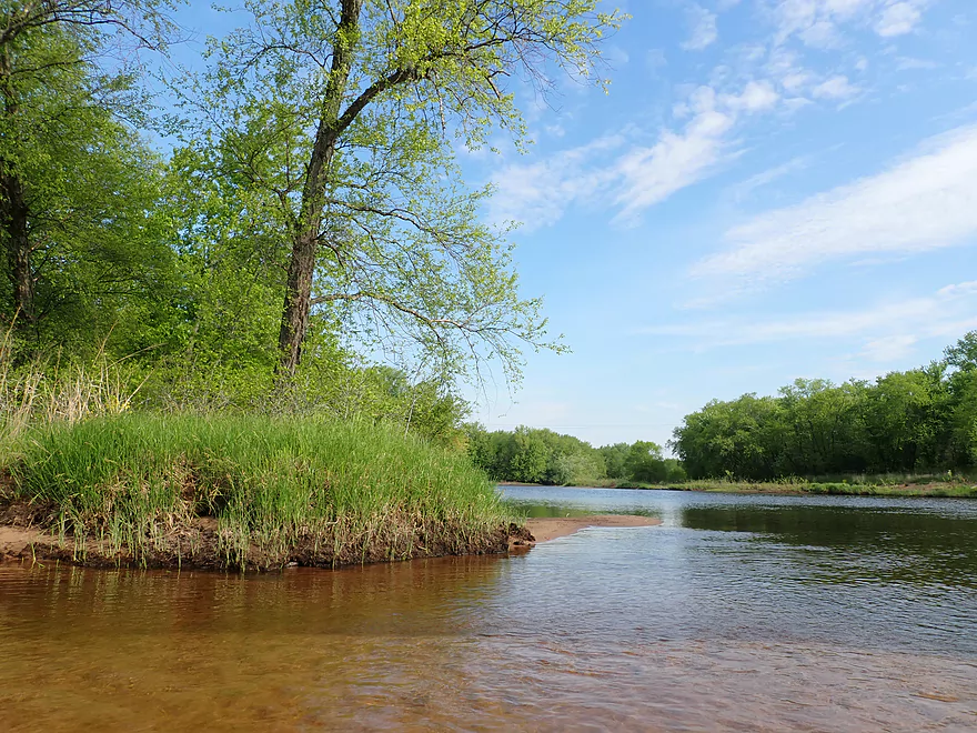
Several large side channels hiding behind Pine Island
View from shore
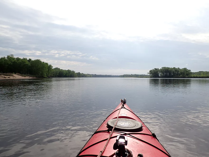
Awful lighting to start the day
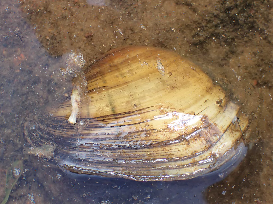
A clam tentacle sneaking out of the water
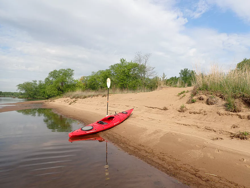
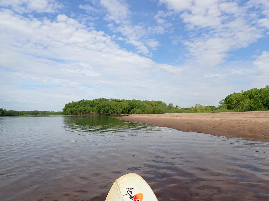
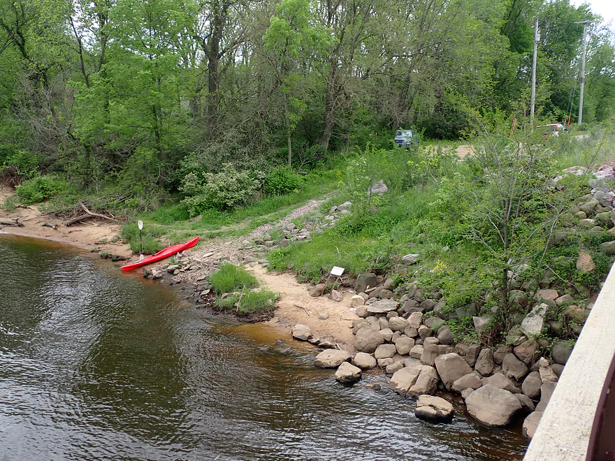
An inviting sandy shoreline
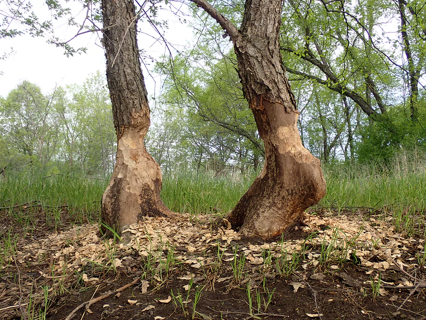
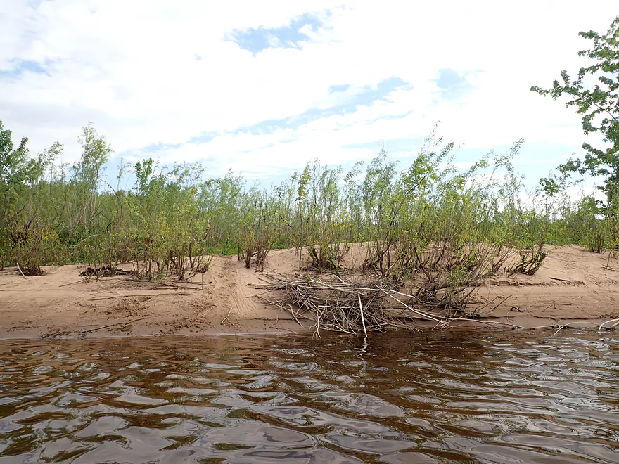
Messy beaver dinner scene
Ok clarity in the shallows
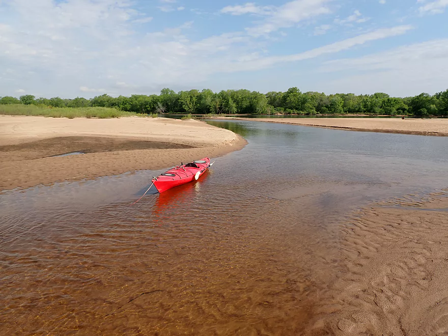
Sneaking between two large sandbars
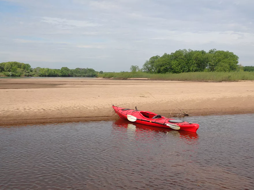
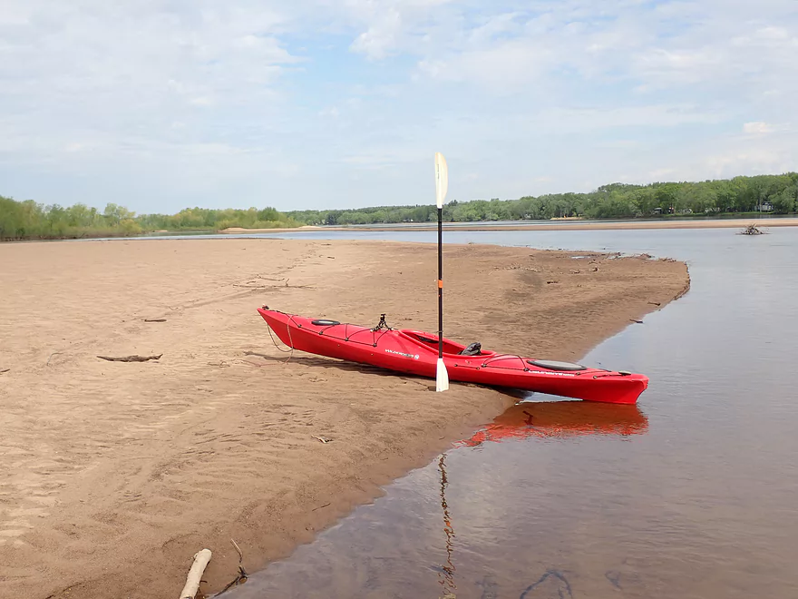
This would have made a great camping spot
The best current was usually by the shoreline
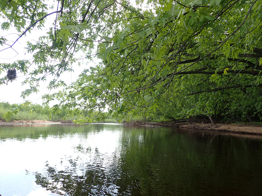
Exploring a back channel
Sandbars getting a bit smaller…the best ones were closest to the put-in
Looks like a beaver path
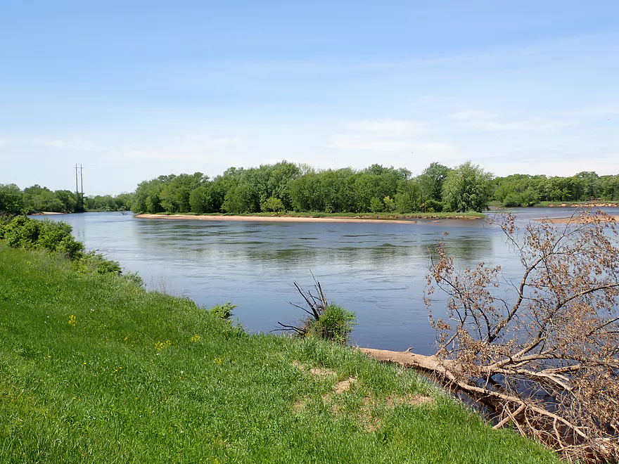
View from the Caledonia Levee
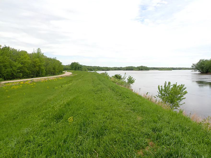
The only thing keeping the Wisconsin River from flooding the Sauk County lowlands
The levee was huge…many miles long
Taking a lunch break
Cool little inlet
Removing this stowaway from my boat
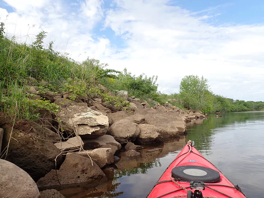
There are strainers, but they are easy to avoid if you pay attention
There is a nice public access by Hwy 39
View from the shore
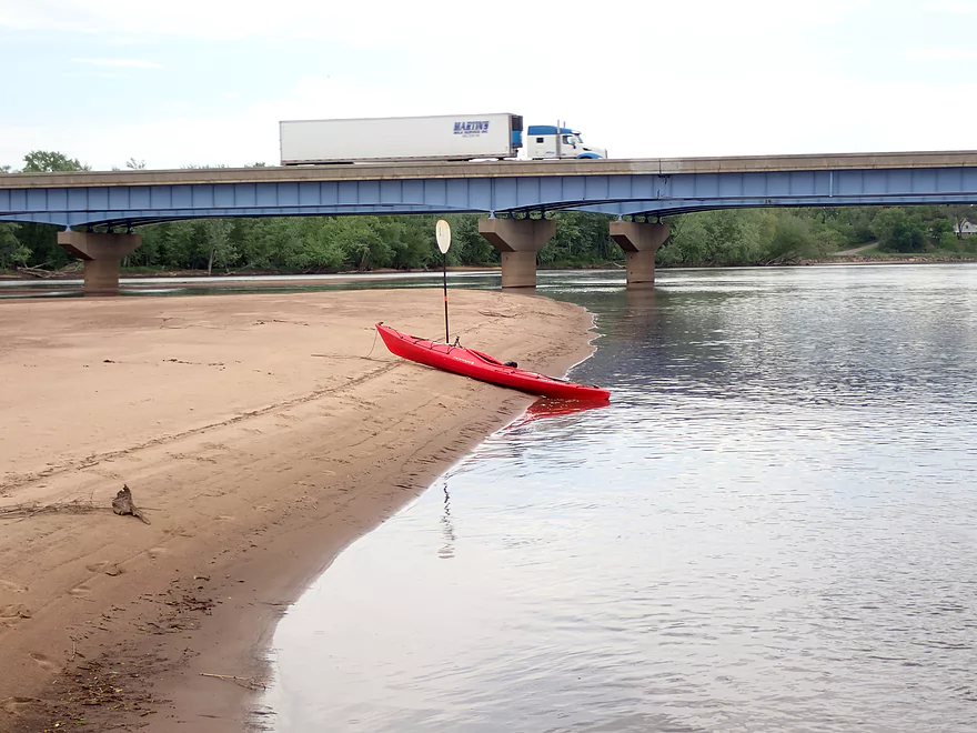
Busy Interstate 39
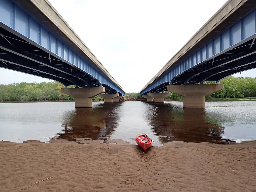
There’s actually a sandbar under the bridge…you could camp under the interstate if you wanted to!
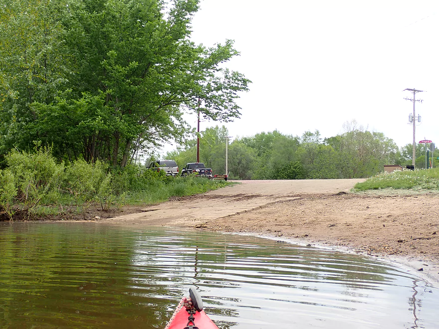
Scouting the Sunset Park Boat Ramp
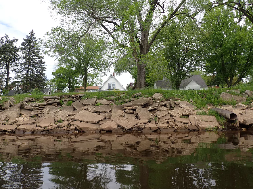
The city of Portage precariously hiding behind a levee
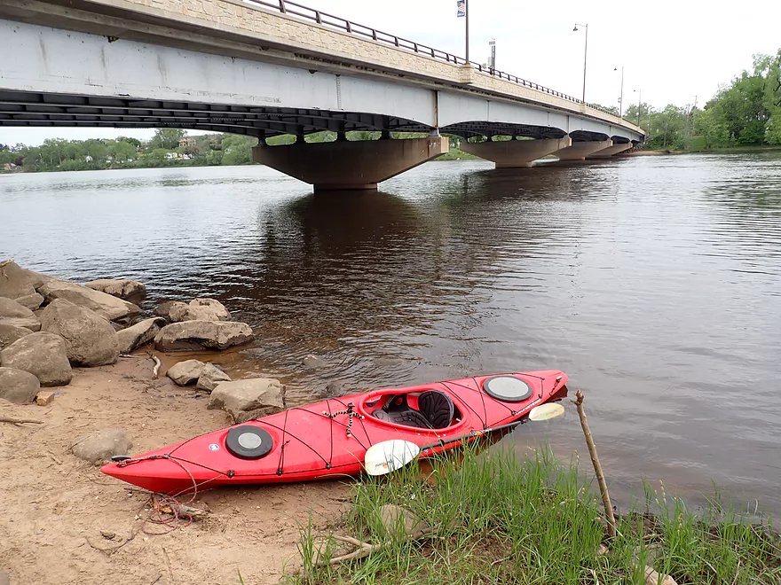
Taking out at Hwy 33
This is a carry-in only launch (not for motorboats)
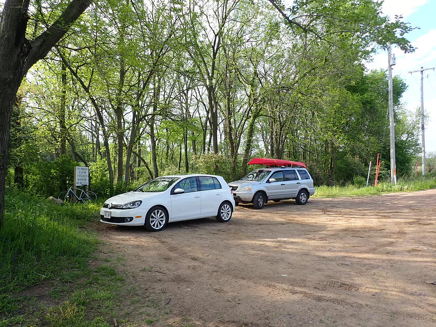
Good parking
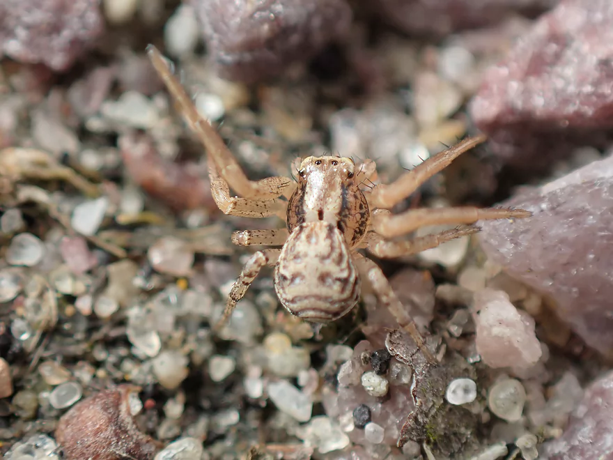
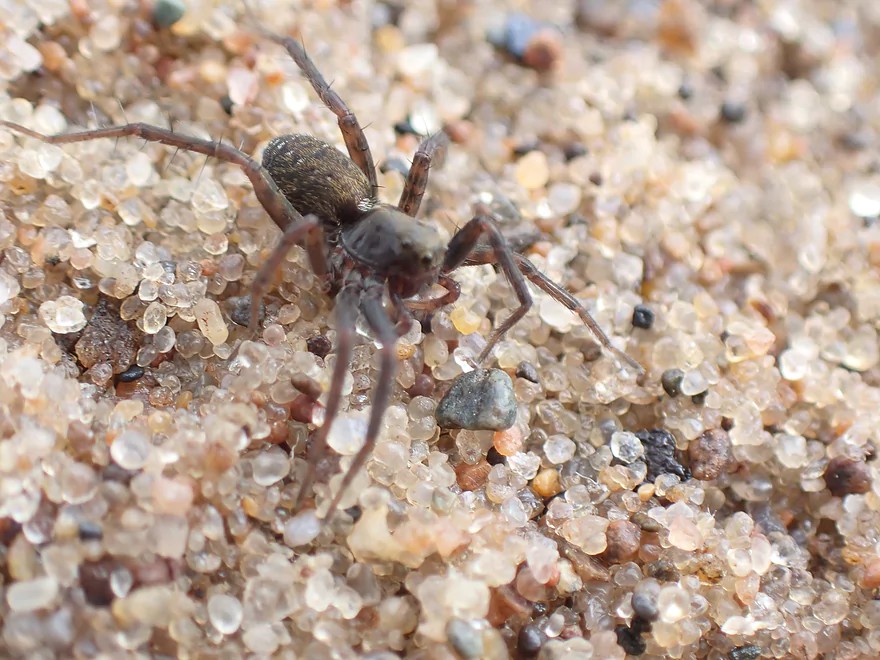
More interesting creatures
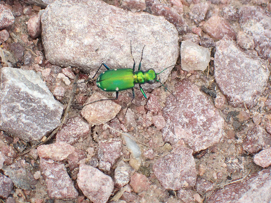
A six-spotted tiger beetle
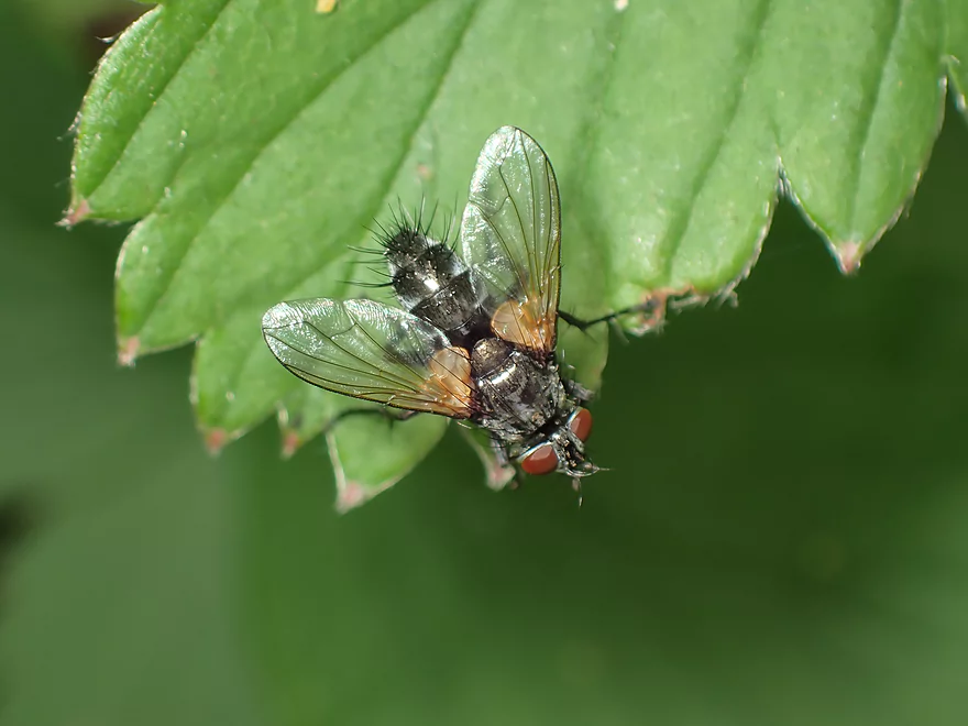
This is just a house fly…but is photogenic

A more exotic orange fly
Wisconsin River – Pine Island


This is a tweener section on the Wisconsin River that isn’t popular for various reasons. It of course can’t compare with the Lower Dells and its famous rock formations located a bit upstream. Downstream from Portage, the river gets big enough for serious motorboat traffic and it’s a very popular “party” section. Yet few venture on the Wisconsin upstream of Portage and I was intrigued to learn more.
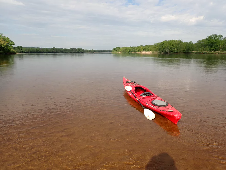
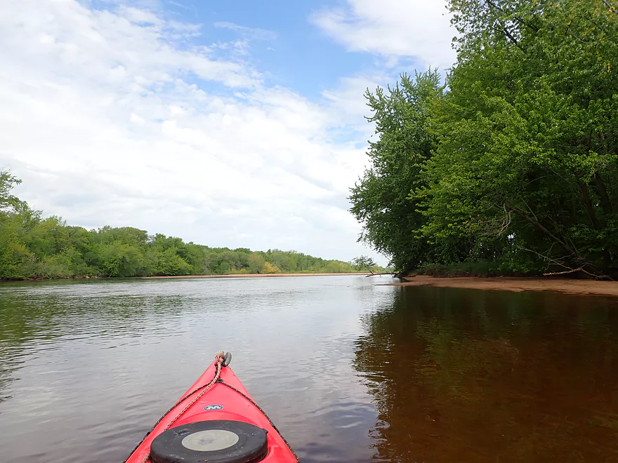
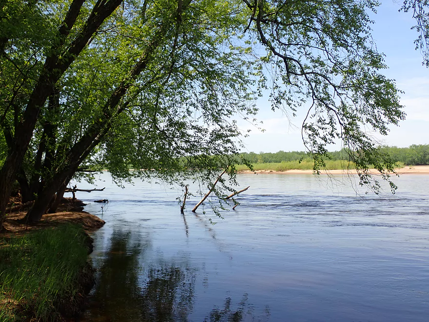
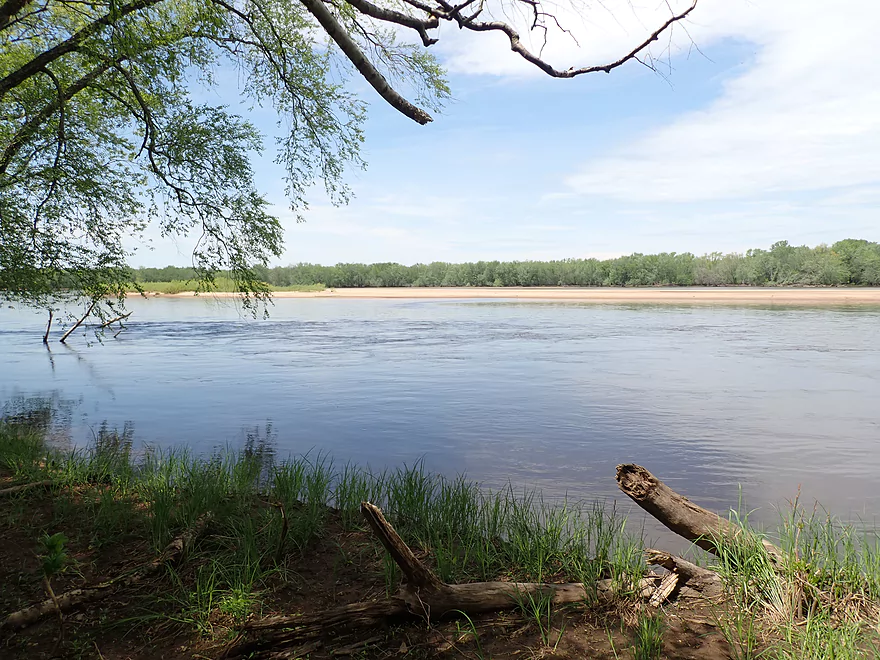
My trip started at the base of Pine Island (which is actually a series of islands). The river here is generic but pleasant. In the first few miles there are a large density of islands and sandbars which create fun back channels and sloughs to explore. The sandbars were actually surprisingly nice and this is a seriously underrated camping leg (as long as you go when the water is low). Unlike the Lower Wisconsin, which can be quite competitive when it comes to sandbar camping, you’ll have your pick among many here.
But there are reasons that most paddlers prefer the Lower Wisconsin. The terrain on this trip was flat and lacking bluffs or sandstone outcrops. In the distance I could hear Interstate 90…at ALL times. Lastly this trip heads east (unlike the Lower Wisconsin) so morning paddlers (which is most of us) will have to paddle directly into the sun and washed out scenery.
One of the unique highlights on this stretch are the historic levees. North of the river is the smaller Lewiston Levee (four miles long) and along the south shore is Caledonia Levee which stretches for an impressive ten miles.
These levees serve an important purpose. The Wisconsin River by Portage is 8′ above the nearby Fox River (and this difference can approach 20′ during flood stage). Back in the day, before the levees, the Wisconsin would routinely split at Portage during flood stage and send a significant portion of its discharge to the Fox River. That was a remarkable geological phenomenon…in essence the Wisconsin River would fork and the Eastern half of the United States would become its huge island (well abstractly).
In 1880 a make-shift dike burst near Portage and the overflow into the Fox River created a lake 100 miles long and two miles wide. Fond du Lac and Oskhosh were mostly submerged under water. History could actually repeat itself. Neither of the levees is in good shape and both are quite old (about 125 years). If the Caledonia Levee burst it could cause havoc for Northeast Sauk County and I-90…while a compromised Lewiston Levee could cause problems from Portage all the way to Lake Winnebago.
This trip went surprisingly fast as there were no winding turns or downed trees to slow me down. Before long I came to busy I-39 were fishermen where fishing along the south bank. There’s actually a decent-size sandbar directly under the interstate and in theory you could camp here, which is a novel thought. I suppose in a rain storm the large bridges could keep your tent dry… Past I-39 was the city of Portage where residential homes hide precariously behind the Lewiston Levee. My take-out was at Portage’s second bridge (Hwy 33) which has a nice carry-in access.
In summary this was an ok trip, but not an elite one. The trip’s best parts were its sandbars, islands and side sloughs…but given that so many other Wisconsin River legs have these features and more…I’m not sure I can recommend this trip for these merits alone. The one advantage this section does have is its relative solitude. It just doesn’t see that many paddlers and it becomes too shallow for motorboats during low flows. So canoe campers wanting seclusion and their choice of prime sandbars may enjoy this section (as well as the previous 10 miles from Indian Trails Parkway).
Pine Island State Wildlife Area: This is an expansive wetland located south of Levee Road. There are numerous pull-offs where you can park and explore. The wetlands do include several small lakes, but I don’t believe they are practical for kayaking.
The Leopold Center: This is a nonprofit organization which promotes environmental education through a series of interactive exhibits and programs. The reserve includes the famous shack where Aldo Leopold, the father of the conservation movement, wrote his famous book, A Sand County Almanac. Unfortunately the visotr center has been closed until further notice.
Pine Island Boat Ramp: This is a popular boat ramp located just south of Pine Island. If you leave your car here make sure to leave room for trailers to turn around. No fee is required to use this launch. There are no outhouses at the landing.
Alternate Put-ins:
- Indian Trails Parkway (9.8 miles upstream): There is a small but nice public access located here. This upstream leg isn’t super interesting and lacks the cliffs of the Lower Dells…but it does have many nice sandbars.
Hwy 33: There is a nice carry-in access located by the Hwy 33 bridge south of Portage. Carry-in means there isn’t a ramp for big boats, but paddlers can use this access no problem. No fee is required to use this launch.
Alternate Take-outs:
- Sunset Park Boat Ramp (across the river and just a bit upstream): This is the main boat ramp for the city of Portage and is a good access option. I simply chose Hwy 33 because it shortened my bike shuttle.
- Thunderbird Road (5.6 miles downstream): There are actually two public launches here to choose from. The stretch from Portage to the Baraboo River is a good one with nice sandbars, but it can get busy and crowded on summer weekends because of its proximity to Lake Wisconsin.
- Lake Wisconsin Access Points: There are of course numerous alternate take-out options available the closer you get to Lake Wisconsin. See the overview map for more details.
Hwy 33 to Pine Island Ramp: (5.9 miles) This is a relatively long bike shuttle but is quite nice. Levee Road is a Rustic Road that parallels the historic Caledonia Levee. The shuttle route is flat with little vehicle traffic.
- Strainers: Really this is a safe trip…but there are downed trees and fast current next to the shoreline. Alert paddlers should have no problems.
- Wind: This is an exposed stretch and wind direction and speed will be important considerations. Avoid a headwind great than 10 mph.
- Drop-offs: Most paddlers will likely take sandbar breaks on this trip. If you do so be careful where you wade as there are surprise drop-offs and undertows.
Nearest Gauge: Wisconsin River @ Wisconsin Dells – 6540 CFS
- 0-4,000 CFS: A very low depth. Monster-sized sandbars.
- 4,001-6,000 CFS: An average summer depth. Good-sized sandbars.
- 6,001-8,000 CFS: An average spring depth. Some decent sandbars.
- 8,001-10,000 CFS: Hardly any good sandbars.
- 10,001-13,000 CFS: A very high depth. Likely navigable but not very inviting.
- 13,001+ CFS: At this point this section might be unsuitable for paddling unless you’re an experienced paddler.
Quick Overview
- Upstream of Stevens Point: I don't have information yet on these stretches.
- Stevens Point to Lake Petenwell: ~42 miles. This stretch in Central Wisconsin used to have many natural rapids, but most have been buried under 8 dams, some of which are now difficult portages. Despite this there is still some good paddling to be had in this region.
- Lake Petenwell: 14.9 miles. This is a large flowage lake that is challenging for paddlers because of frequent strong winds and big waves.
- Castle Rock Lake: 14.5 miles. Another large flowage lake that is likely too big for enjoyable paddling.
- Castle Rock Lake Dam to Lemonweir River: 9.4 miles. This pre-Dells leg isn't elite, but is a pleasant stretch.
- Lemonweir River to Indian Trails Landing: 21.7 miles. This includes the famous Upper Dells and Lower Dells which feature many scenic sandstone outcrops.
- Indian Trails Landing to Portage: 16 miles. This is an overlooked section sandwiched between the Dells and Portage. While the scenery isn't top-notch, it does have many sandbars and few people, which is a nice combination.
- Portage to Lake Wisconsin: 14.3 miles. This is a neat stretch of the river with many sandbars and cliffs, but the shoreline is very developed and motorboat traffic can be heavy on weekends.
- Lake Wisconsin: 14.5 miles. This is a challenging lake for paddling because of the huge and frequent waves created by motorboats.
- Prairie du Sac Dam to Port Andrews: 57 miles. This is the first half of the famous Lower Wisconsin Riverway. This is a super popular stretch for paddlers with the highlights being large sandbars, big bluffs, occasional cliffs, and fun side sloughs to explore.
- Port Andrews to Wyalusing: 40 miles. This is the second half of the Lower Wisconsin Riverway which has far fewer paddlers and sandbars. But the bluffs and sloughs are larger and more interesting.
Detailed Overview
- Upstream of Merrill: I don't have enough information yet on these legs to comment.
- Merrill Dam to Riverside Park: 0.5 miles. Might include some light rapids below the dam.
- Riverside Park in Merrill to Wisconsin River Forest Landing: 8.6 miles. A good prospect.
- Wisconsin River Forest Landing to Brokaw Boat Landing: 5.7 miles.
- Wisconsin River Forest Landing to Jesse Park: 1.4 miles. A terrific stretch with small boulder gardens, one set of Class 1-2 rapids, gravel bars and a nice sand bank.
- Jesse Park to Brokaw Boat Landing: 4.3 miles. A good stretch with scenic wooded banks and occasional gravel bars.
- Brokaw Boat Landing to Gilbert Park: 5.1 miles. River slows down and becomes hillier. This stretch is an ok prospect and goes past the old Brokaw paper plant that has been shut down. Paddlers must navigate Class 1 rapids and a 2' drop where the old Brokaw dam used to be.
- Gilbert Park to Wausau Boat Dock: 1.5 miles. An impounded stretch through Wausau. There are numerous alternate access options to choose from.
- Wausau Boat Dock to Oak Island Boat Ramp: 1.2 miles. A nice stretch that includes Barkers Island and Isle of Ferns Park. But the Wausau dam does require a portage. This stretch parallels the famous Wausau Whitewater Park.
- Oak Island Boat Ramp to Rothschild Dam Access: 5.8 miles. Likely mostly uninteresting flowage paddling. There are many alternate access options to choose from.
- Rothschild Dam Access to Zimpro Park: 1.0 miles. This might be a nice stretch.
- Zimpro Park to River Road Boat Landing: 7.6 miles. The first half of this leg is likely nice river paddling, but the second leg is probably just an uninteresting flowage.
- Chucks Landing/Mosinee Dam to Bean's Eddy Boat Landing: 2.8 miles. Likely a nice leg. You might be able to launch by the dam where there should be some nice rapids and boulders.
- Bean's Eddy Boat Landing to Seagull Boat Landing: 5.1 miles. Mostly uninteresting flowage paddling. Although there might be some nice sand banks on the eastern shore.
- Seagull Boat Landing to Dubay Dam Access: 5.3 miles. Mostly uninteresting flowage paddling.
- Dubay Dam Access to River Road Landing: 5.5 miles. This could be a nice stretch of river.
- River Road Landing to Old US 10 Landing: 2.3 miles. Likely an ok leg.
- Old US 10 Landing to Stevens Point Dam: 5.6 miles. Probably uninteresting flowage paddling. Many alternate access options closer to Stevens Point.
- Stevens Point Dam to Blue Heron Boat Landing: 4.2 miles.
- Steven Point Dam to Whiting Dam: 2.6 miles. Starts slow and uninteresting, but the river becomes very scenic after the Hwy HH bridge. The rock formations below both dams are very striking. Many alt access points.
- Whiting Dam to Kimberly Clark Dam/Al Tech Park: 0.6 miles. Incredible scenery with exposed bedrock and boulder gardens below the Whiting Dam. Some rapids, but nothing major. The Kimberly Clark Dam is a dangerous low-head dam and should be treated carefully.
- Kimberly Clark Dam to Blue Heron Landing: 1.0 miles. Class 2 rapids below the dam, but after that the river slows dramatically and splits into many sub-channels and islands. Round trips on this leg are possible. I chose the far western channel where there were some nice rocky stretches.
- Blue Heron Landing to Mill Creek Landing: 4.1 miles. Likely a mediocre paddle with nothing special. Galecke Park is an alternate access.
- Mill Creek Landing to Biron Dam North Gate: 7.6 miles. Mostly uninteresting flowage paddling. Several alternate access options on route.
- Biron Dam North Gate to Veteran's Memorial Park: 4.5 miles.
- Biron Dam North Gate to Biron Landing: 1.0 miles. Super scenic stretch by two islands with many granite boulders.
- Biron Landing to Legion Park: 3.0 miles. A nice stretch by Big Island. The west channel is more undeveloped...but the east channel has several scenic granite islands.
- Portage through Legion Park: 680'. A steep wall separates the park from the river but in two locations the wall is short enough to get over (see map). Paddlers may want to consider a longer portage to bypass some of the shallow rocky stretches by Legion Park.
- Legion Park to Veteran's Memorial Park: 0.4 miles. A scenic stretch that features a large boulder field and the powerhouse for a large paper mill.
- Veteran's Memorial Park to Port Edwards Landing: 3.8 miles
- Veteran's Memorial Park to Demitz Park: 0.8 miles. A pleasant stretch that includes Belle Island.
- Demitz Park to Ben Hansen Park: 1.2 miles. This leg goes by Garrison Island and Edwards Island. Lyon Park is located across the river from Demitz Park and is another access option.
- Ben Hansen Park to Port Edwards Landing: 1.8 miles. Above the Centralia dam there are several small but nice islands. Portage the dam on the left bank (follow the 1000' trail through the golf course). Below the dam there are scenic rock formations. Close to the Port Edwards dam are a few more scenic islands you can explore.
- Port Edwards Landing to Nekoosa/Riverside Park: 3.6 miles.
- Port Edwards Landing to Port Edwards Powerhouse: 1.3 miles. A half-mile portage is required (east bank). A very scenic boulder field is located below the dam. At high levels, the rocks are submerged and produce a half-mile stretch of rapids (some strong).
- Powerhouse to Moccasin Creek Landing: 1.8 miles. A generic wooded stretch that isn't super interesting.
- Moccasin Creek Landing to Riverside Park: 0.5 miles. During the Nekoosa dam drawdown, this stretch had nice boulder fields and rapids.
- Riverside Park to Hwy 73: 0.8 miles. An ok stretch of the river. There are scenic cliffs south of Hwy 73, but these are past the dam warning line. Hwy 73 is not a good access option.
- Hwy 73 to Point Basse Ave (Portage of the Nekoosa Dam): 1.5 miles. A difficult 1.5 mile portage through downtown Nekoosa. Don't try to portage the south bank. There is a steep hill, cliffs, and large Domtar paper mill fences to deal with.
- Point Basse Ave to Jim Freeman Memorial Boat Landing: 0.8 miles. A generic stretch going by historic Point Basse. If you're willing to backtrack to the dam, you can see scenic boulder fields (during low flows) and a few cliffs. Point Basse Ave is a somewhat speculative access, but it seems public and doable for launching.
- Jim Freeman Memorial Boat Landing to Plank Hill Small Boat Access: 2.0 miles. A generic stretch.
- Plank Hill Small Boat Access to 19th Drive Landing: 5.3 miles. Features two epic sand banks. The main channel has some minor sandbars. Several of the side sloughs can provide fun side adventures.
- 19th Drive to the Petenwell Dam: 14.9 miles. This is Lake Petenwell which is a large and challenging lake for paddling. Waves and strong winds are frequently an issue. But when calm there are nice sandbanks on the northwest shore, hidden sloughs, and large islands to explore. See the overview map for more info.
- Petenwell Dam to Ganter Lane Landing: 3.8 miles. This stretch isn't too impacted by dams and may have nice sandbars at low levels.
- Ganter Lane Landing to Castle Rock Lake Dam: 10.7 miles. Castle Rock Lake is likely too big (wind/waves) for enjoyable paddling. There are many alternate launch options along the shore.
- Castle Rock Lake to the Lemonweir River: 10 miles. An ok section.
- Lemonweir River Mouth to River Bay Landing: 7 miles. The first half of the classic Upper Dells.
- River Bay Landing to Blackhawk Island: 6.5 miles. Second half of the classic Upper Dells, known for its fantastic outcrops. Note, the Blackhawk Island landing is no longer accessible without special permission from the Upham Woods Outdoor Learning Center.
- Black Hawk Island to Wisconsin Dells Dam: 2.0 miles. More nice sandstone outcrops. You can take out at a public ramp off Indiana Ave or portage the dam and take out SW of the dam by a launch off Wisconsin Dells Pkwy/Hwy 12.
- Dells Dam to Indian Trails Landing: 6.2 miles.
- Dells Dam to Newport Park: 2.2 miles. This is the heart of the famous Lower Dells with many scenic outcrops. Unfortunately jet boats are a serious plague on this stretch.
- Newport Park to Indian Trails Landing: 4.0 miles. Features the famous "Sugar Bowl" formation and four super cool caves. The outcrops soon disappear and this stretch is mostly uneventful (but peaceful) big river paddling.
- Indian Trails Landing to Pine Island Boat Ramp: 9.8 miles. Few paddle this stretch as it isn't as interesting. But...it does have a good concentration of sandbars and few competing paddlers for them.
- Pine Island Boat Ramp to Portage/Hwy 33 Access: 6.0 miles. Not an elite section that is lacking in cliffs and bluffs. It does have good sandbars though.
- Portage to Dekorra Park: 7.7 miles
- Portage to Baraboo River/Thunderbird Road: 5.2 miles. A good section with great sandbars. Close to Portage there are few motorboats.
- Baraboo River to Dekorra Park: 2.5 miles. River splits around massive Lib Cross Island. West channel has nice sandbars. St Lawrence Bluff has scenic sandstone outcrops and includes a cave you can paddle into.
- Dekorra Park to James Whalen Memorial Park: 6.6 miles.
- Dekorra Park to Camp Rest Park: 5.1 miles. A terrific section with rock outcrops, large island deltas, hidden sloughs, and nice sandbars. Unfortunately this part of the river is popular with motorboats and jet skis which can be a plague. Multiple alternate access options.
- Camp Rest Park to James Whalen Memorial Park: 1.5 miles. Not a great section because of the open water paddling, powerboats and big waves. The west shore though does have nice outcrops.
- James Whalen Memorial Park to Merrimac Memorial Park: 4.4 miles. River turns into "Lake Wisconsin". Generally speaking this isn't ideal for kayaking as motorboat traffic can be heavy and waves can be surprisingly big. The most direct route is the north shore which has a few bluffs, but generally speaking isn't that interesting.
- Merrimac Memorial Park to Veterans Memorial Park/Prairie du Sac: 9.6 miles.
- Merrimac Memorial Park to Moon Valley Landing: 3.3 miles. Includes a lot of developed shoreline. The ferry, railroad bridge, and Moon Bay are highlights.
- Moon Valley Landing to Veterans Memorial Park/Prairie du Sac: 6.3 miles. Other than Moon Bay and the dam, this is a boring stretch. There are numerous alt access options on this route.
- Prairie du Sac to Mazomanie: 8 miles. An ok section of the Wisconsin but lacking in sandbars.
- Mazomanie to Arena: 9.7 miles. A great section with nice sandbars and scenic bluffs.
- Arena to Hwy 14: 8.0 miles. Good section with a high concentration of sandbars. One of the more popular legs on the Lower Wisconsin.
- Hwy 14 to Hwy 23/Spring Green: 2.2 miles. Neat mini-section with sandstone outcrops. Very popular in the summer.
- Spring Green to Lone Rock: 7.4 miles. Another fine sandbar/bluff section with some nice rock outcrops too.
- Lone Rock to Gotham: 8 miles. This stretch has super impressive rock outcrops and sand banks.
- Gotham to Muscoda: 7.6 miles. This leg includes more large sandbars and great outcrops. Bonus highlights include fast current and not seeing as many people.
- Muscoda to Port Andrew: 7 miles. A good stretch with many islands and sandbars.
- Port Andrew to Boscobel: 9 miles. Wooded islands start to get massive.
- Boscobel to Woodman/Big Green River: 9 miles and start of the less paddled stretch of the Lower Wisconsin. Far fewer sandbars from here to the mouth, but good bluffs and side sloughs to explore.
- Woodman to Millville: 7.7 miles. A good stretch with large bluffs and sandbars.
- Millville to Bridgeport: 5.3 miles. Huge islands, bluffs and sandbars are the highlight on this second-to-last leg on the Wisconsin River.
Bridgeport to Wyalusing (the mouth): 9 miles.
Trip Map
Overview Map
Video
Photos Size:
We have a trip to the Dells in August. We tube the rivers here in MI and were wondering if there are good places to tube in the Dells? We want to bring our own tubes and put in/out ourselves so looking for a family friendly route. Suggestions?
The only spot I can think of that gets tubing traffic would be the Lower Dells. Kilborn Dam to Newport Park would be an option but there would be slow spots.