
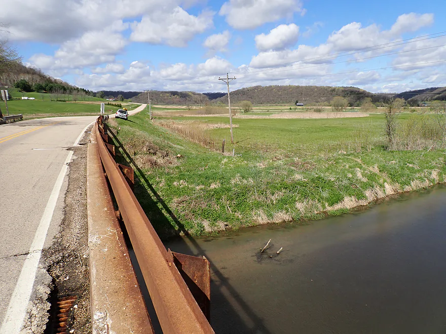
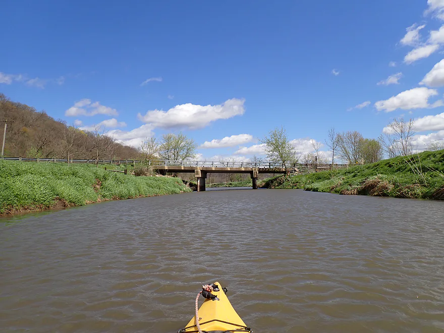
Starting the trip at Hwy G
View from bridge
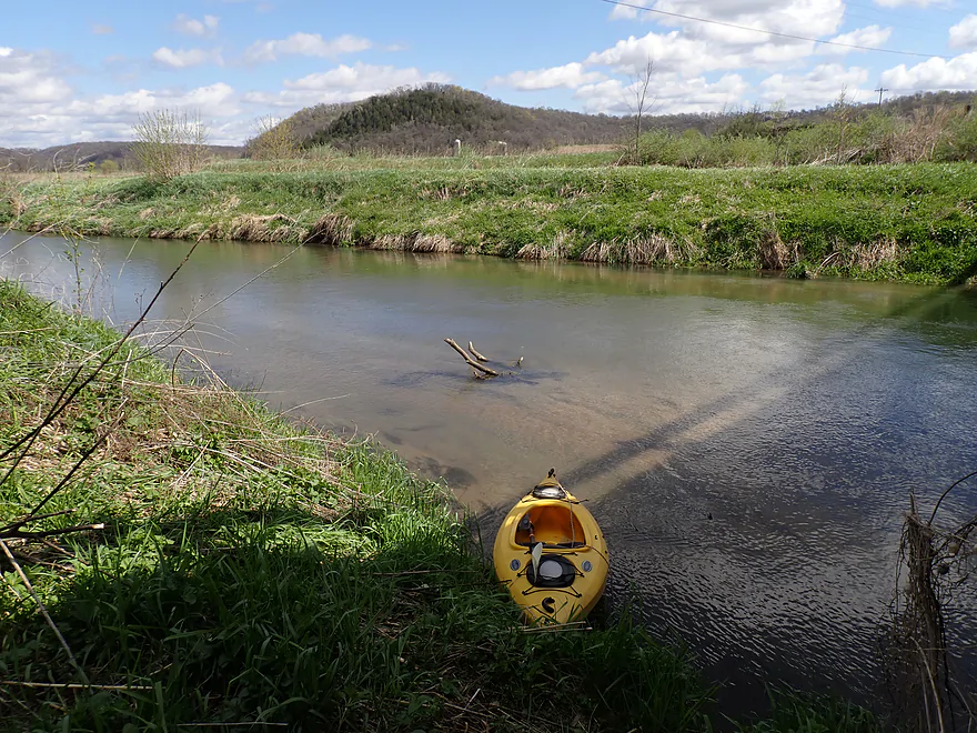
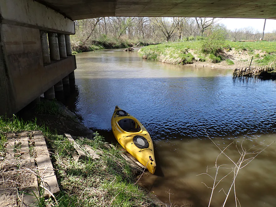
Decent put-in
First quarter mile had been straightened by farmers
A low “ducker”
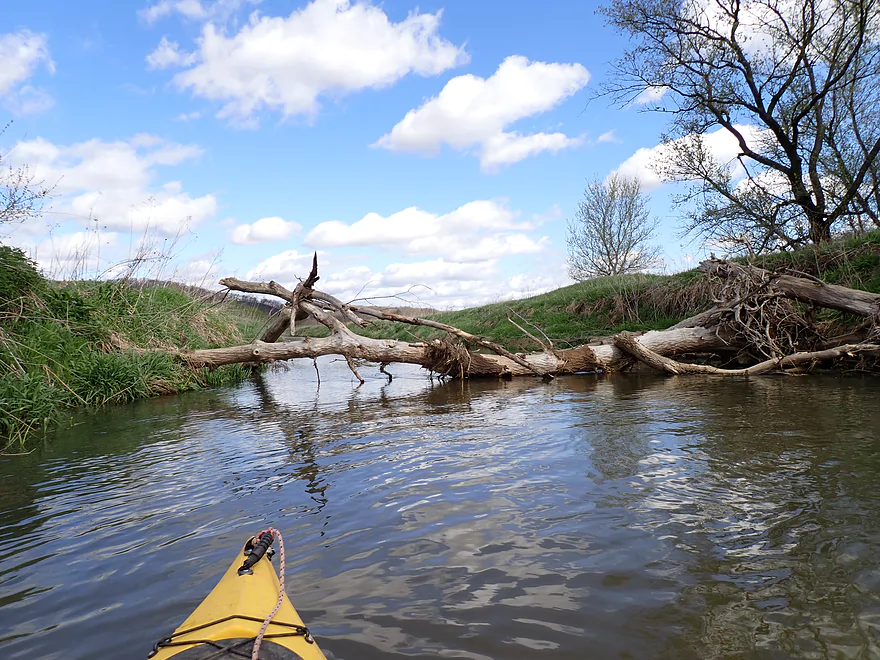
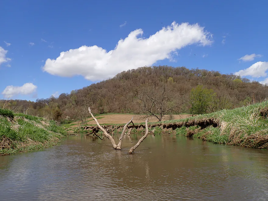
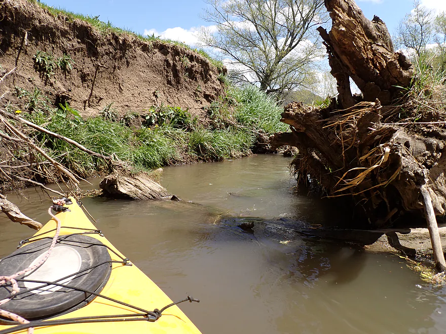
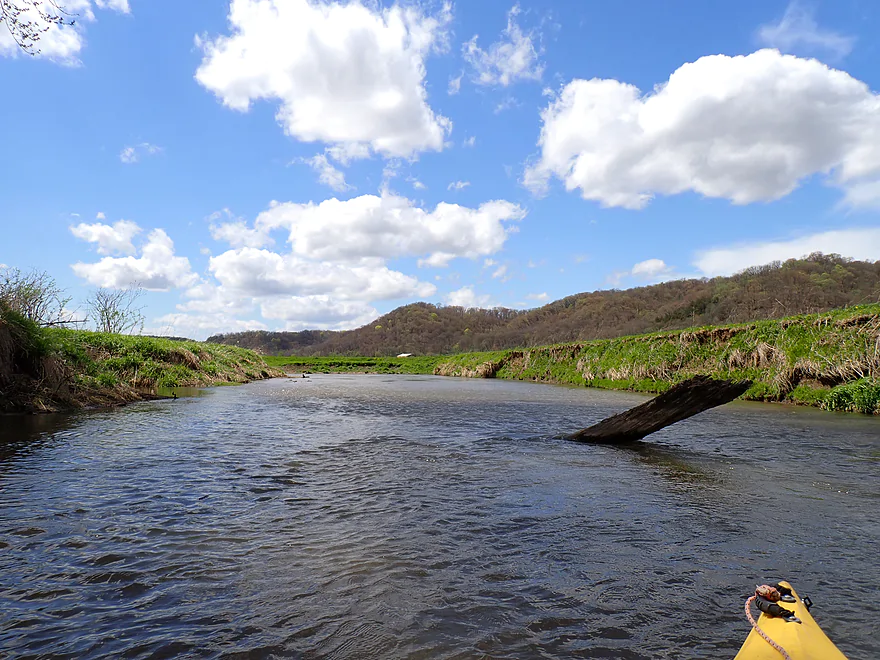
Only logjam portage of the trip
Nearby swans
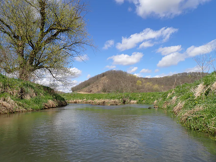
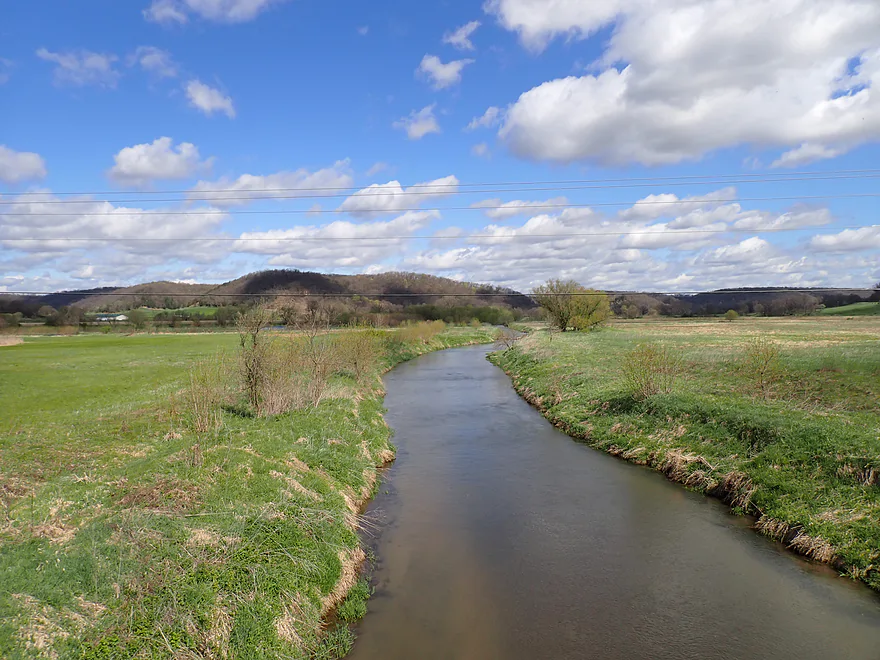
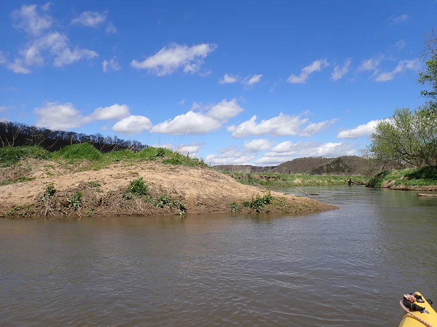
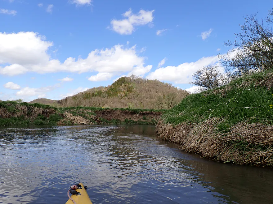
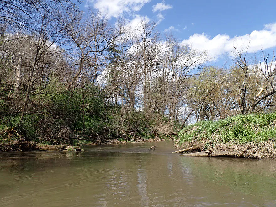
Castle Rock Creek enlarges the Blue River
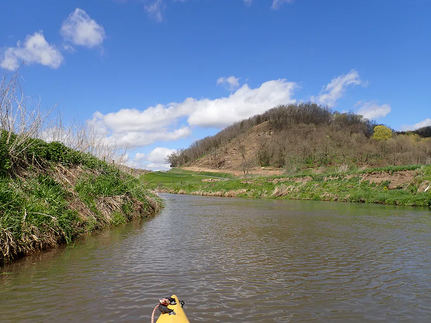
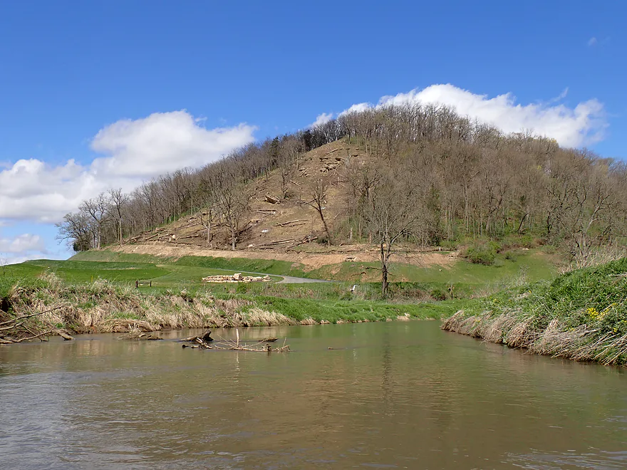
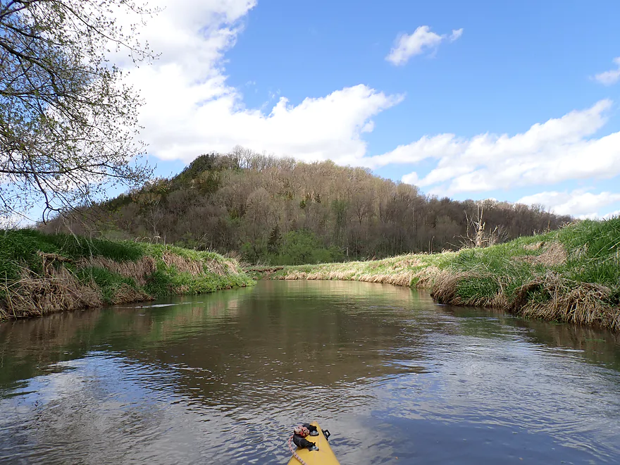
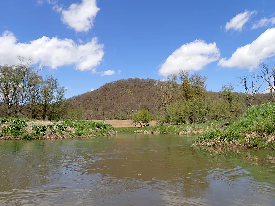
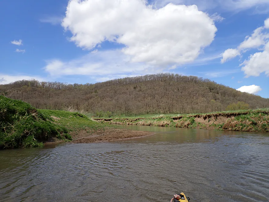
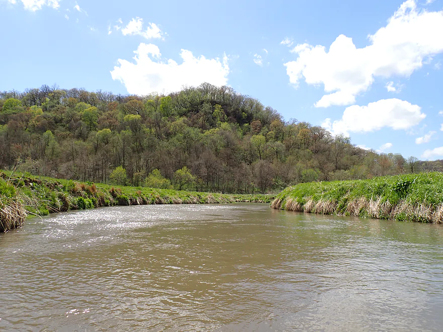
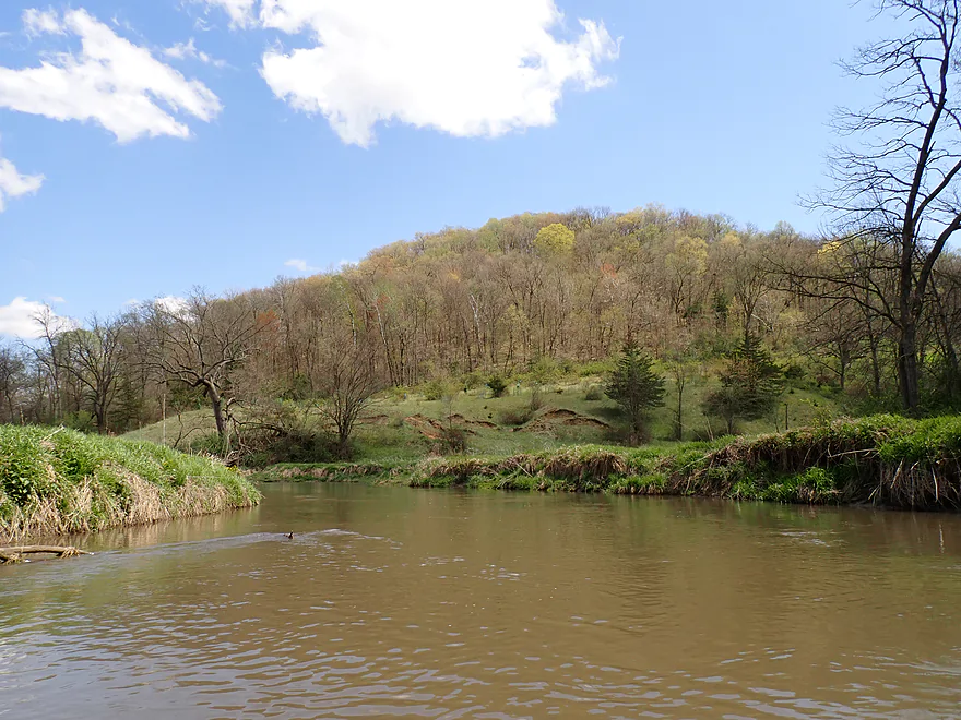
Scenic hill
Studnika Road
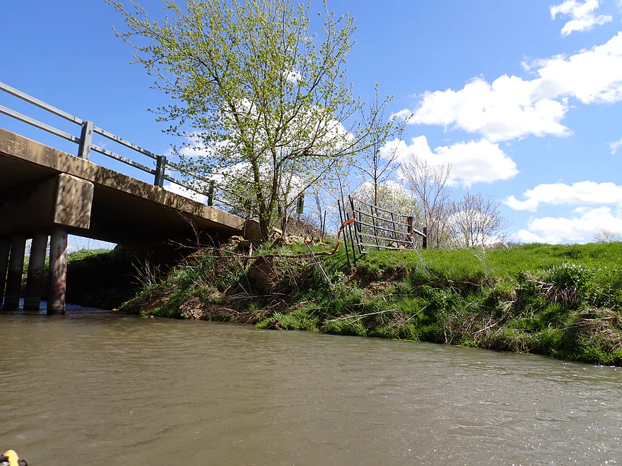
Not really an access option because of the fences
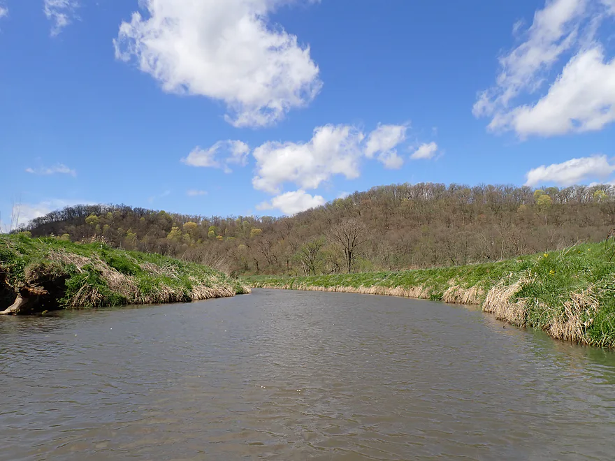
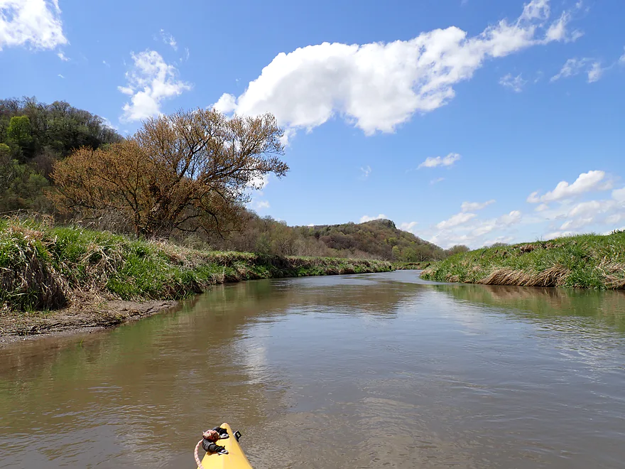
Lot of great bluffs on this trip
Small sandbar
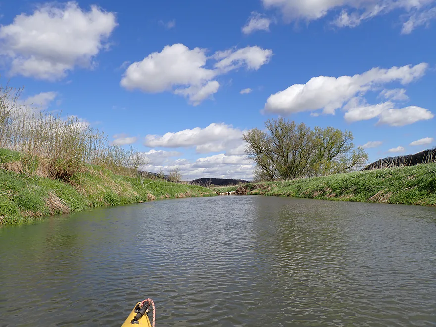
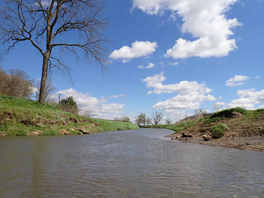
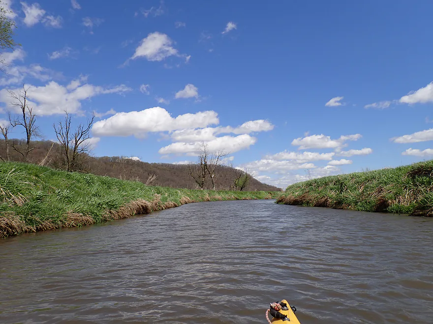
Nice blue skies and clouds
A cedar-sided bluff
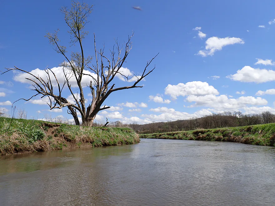
This would look terrific in late October
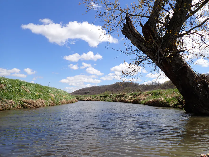
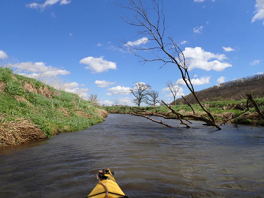
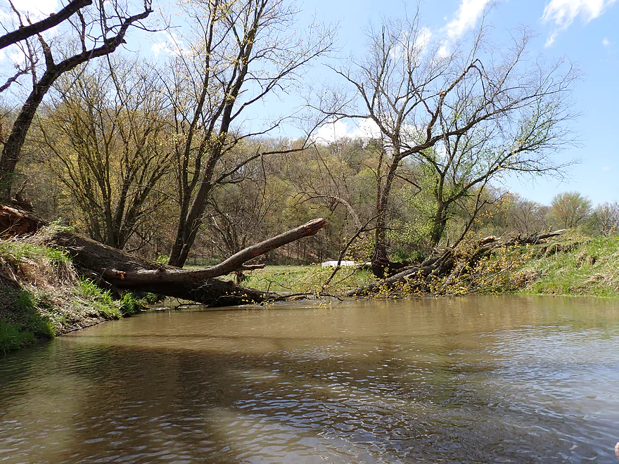
This trip does require some snag dodging
A tricky hopper
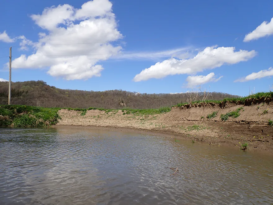
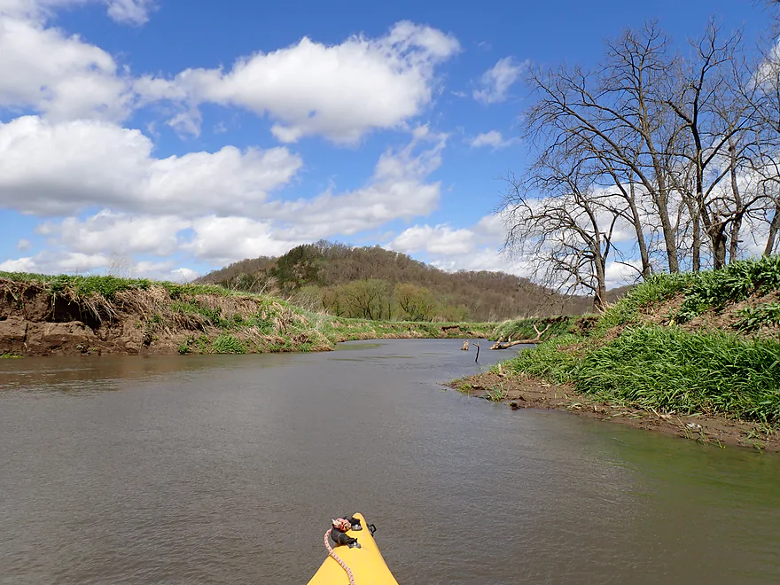
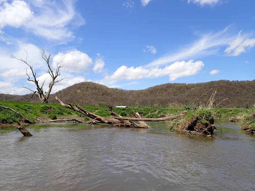
Mud banks were a common sight
Nahley Road…I don’t think this is an access option
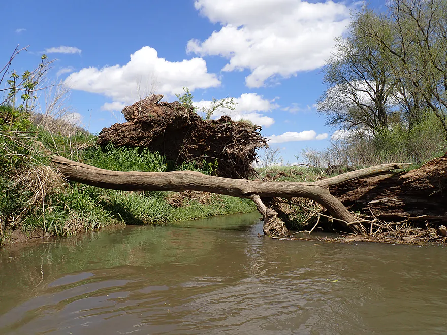
Ducking low to get past this tree
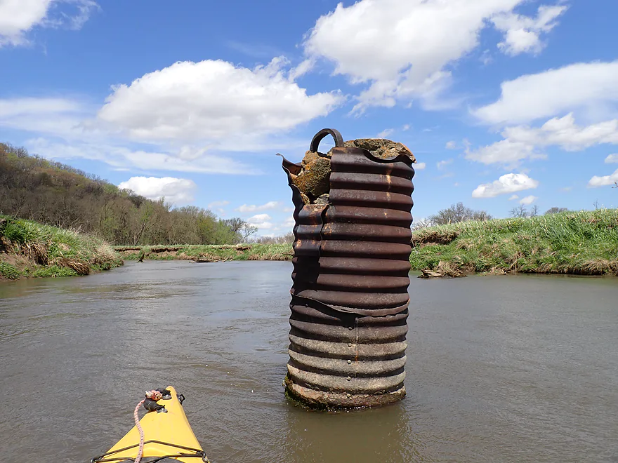
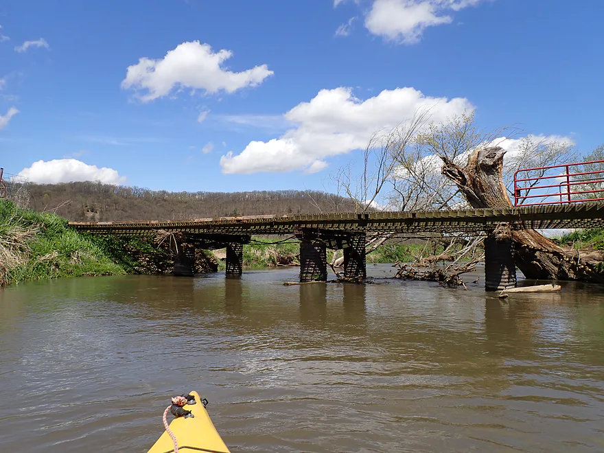
Old bridge pylon
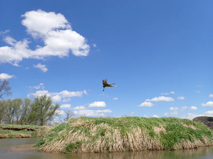
Crane taking off nearly vertically in the strong wind
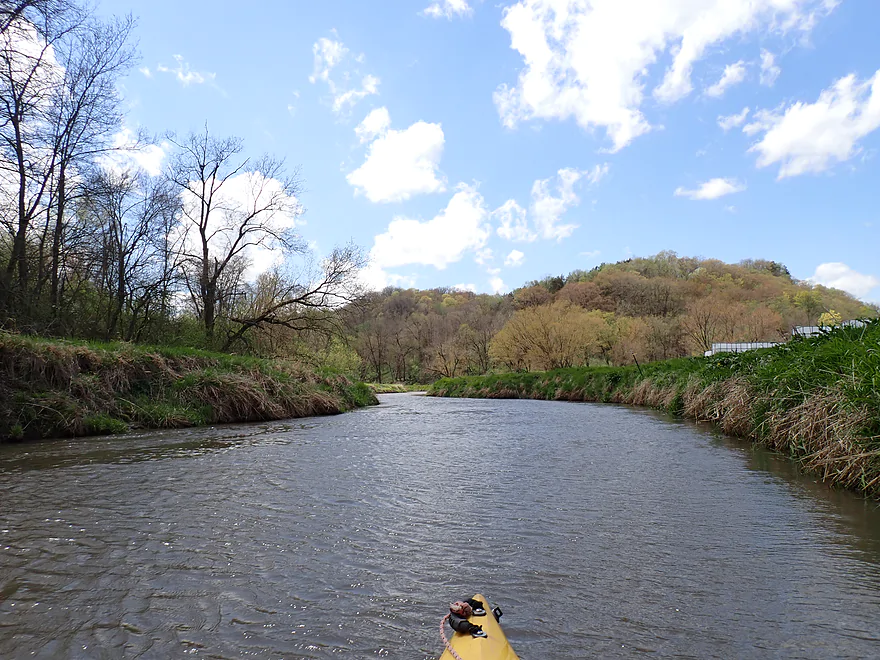
Last half-mile was a bit more wooded
A tricky “hopper”
Forest Road
Old pallets serve as a makeshift ramp
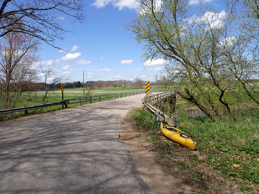
Ok bridge access
Blue River – Hwy G

The Blue is one of the more underrated paddling rivers in Southwest Wisconsin. Its upper portions flow through Snow Bottom State Natural Area and are incredibly scenic (if you have enough water to paddle it). I’ve been curious about the Lower Blue for a while but have always been nervous about logjams. While doing some “satellite scouting” I found an open leg that showed promise and decided to check it out.
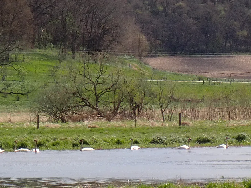
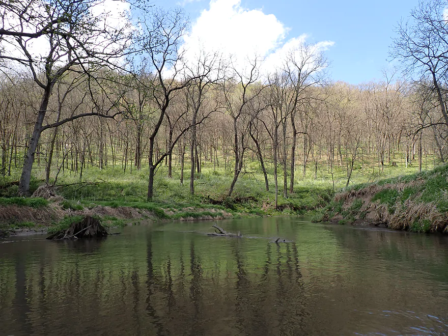
I started the trip at Hwy G, which was a decent bridge access. The bridge area was attractive with a nice view of the open river valley, bluffs, blue skies, white clouds, and a rustic (and rusty) creaking windmill. Within sight of the bridge was a logjam which had me a bit worried, but I was able to limbo under this. This was followed by a large logjam that I was not able to limbo. A tricky portage up steep and muddy banks was required. A flock of nearby swans though made this worthwhile though.
Following the only logjam portage of the trip, I passed the mouth of Castle Rock Creek (aka the Fenimore Branch of the Blue River). It’s much dirtier/muddier than the Blue and its addition nearly doubles the main river in size. I’ve considered paddling the lower portions of Castle Rock Creek, but I suspect it’s pretty congested with deadfall.
The river is soon redirected north by a scenic bluff that is balding with chunks of rock poking above the surface. This would be the only outcrop of the trip.
Studnika Road bridge followed shortly after. I had considered this as a put-in, but the local rancher went overboard with the No Trespassing signs, fences, and “you are under video surveillance” signs. I don’t get why some of these farmers need to be so crazy territorial…like they live in a war zone.
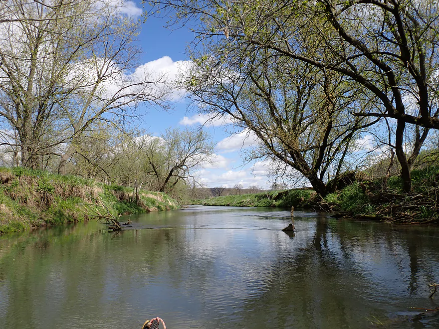
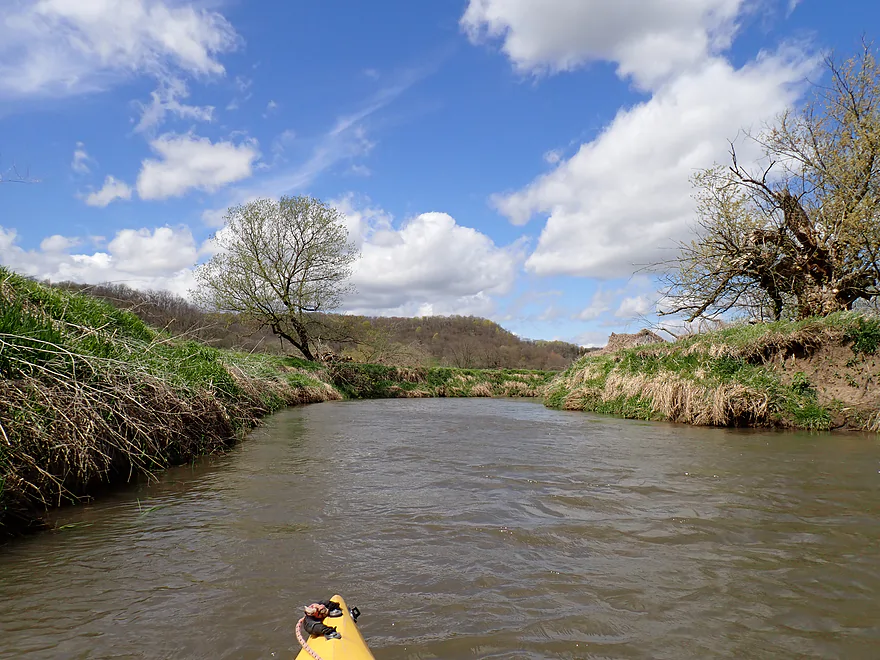
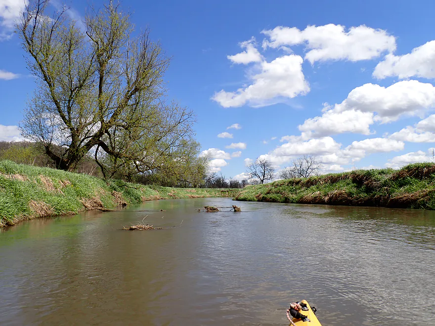
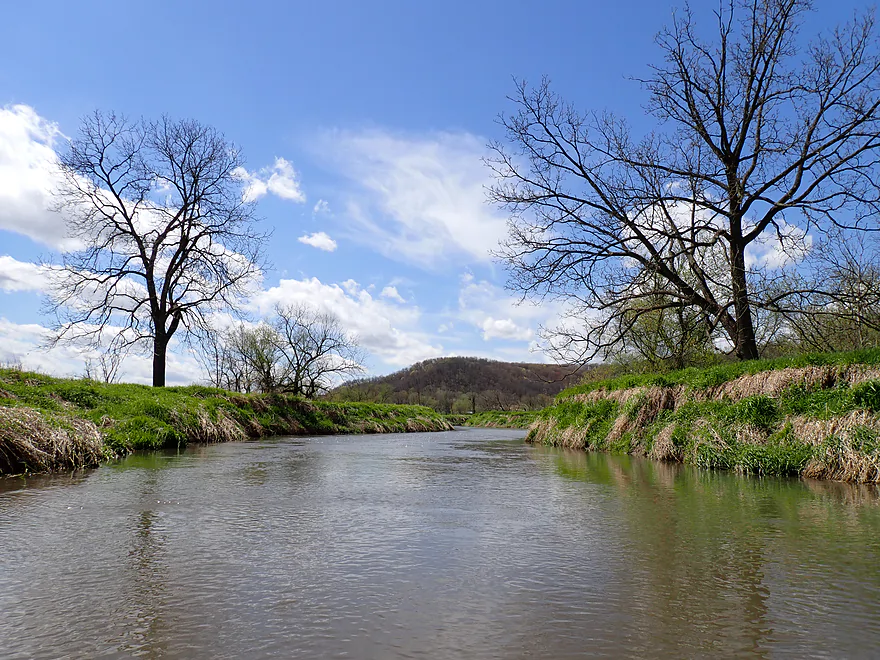
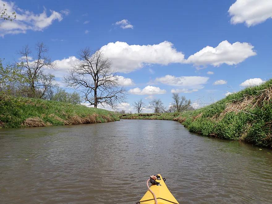
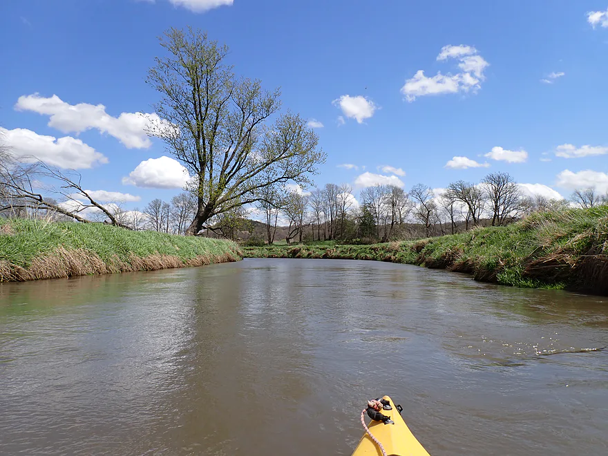
The next ~five miles flowed through through open river valley and pasture. The banks were a bit steep and muddy, but the wooded bluffs were scenic, and reminiscent of the Lower Kickapoo. The Blue River really does seem especially “blue”. I think it is a bit of an optical illusion though. The river is one of the few in the state that flows north…when you paddle away from the sun, the opposite skies will be a darker and more saturated blue, which then reflects off the water. On overcast days the river loses its blues.
The wind was crazy strong during the trip. The nearby Weather Wunderground station at Highland topped out at 33 mph, but I wouldn’t be surprised if it were actually faster in the open river valley. Because the wind was going north and I was heading north, it worked well…at times it felt like I had an outboard motor on my kayak. On the straightaways I could do 5 mph without paddling. That was great fun, but I did have to repay my karma after the trip with a bike shuttle into the headwind.
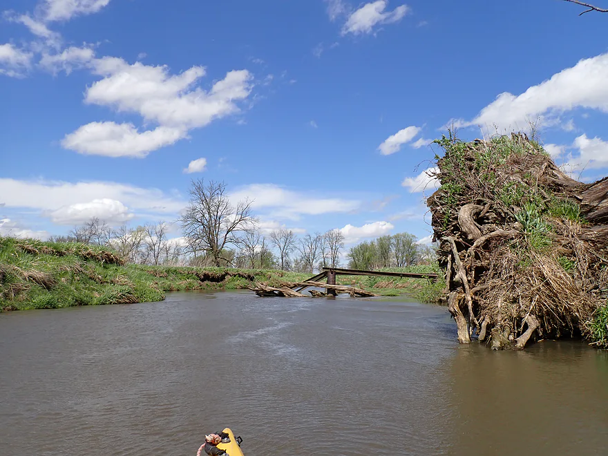
I passed under the Nahley Road bridge which I couldn’t figure out if it was public or not. If so, it might be an ok access option. There were some annoying snags in fast water after this. Nothing that I had to portage, but a few were tricky.
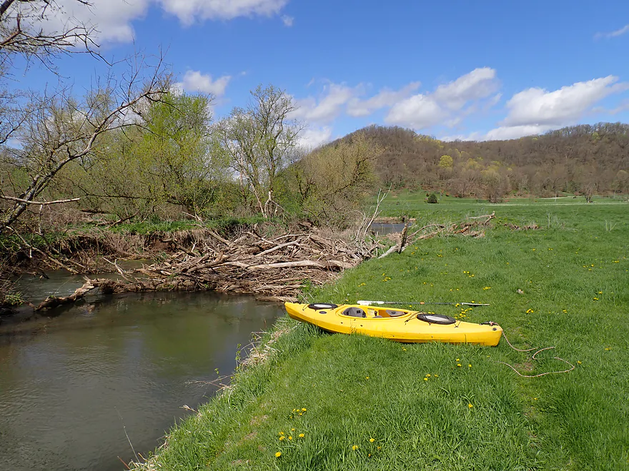
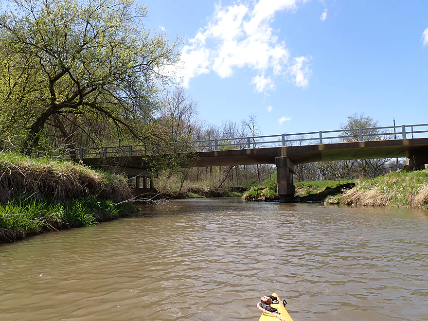
Following a nice wooded bluff, I came to my take-out at Forest Road. It was somewhat muddy, but thankfully there was a make-shift pallet ramp that kept me and my boat from getting too muddy.
In summary this was a pleasant trip with a nice mix of open valleys and bluffs. In October, I suspect the fall color on the hills would be amazing. It’s unfortunate it has a few logjams as that will scare away most paddlers, but I enjoyed the trip regardless. One logjam and a few snags for 8 miles is a good deal in my book. If you’re new to the Blue River though, you should know this isn’t the main or best section. That honor goes to the Snow Bottom leg which is spectacular (if it has enough water). The Lower Blue in contrast isn’t as scenic (it lacks the boulders/outcrops/intimacy) of the Upper Blue, but at least it can be done in low water.
Sights included a painted turtle, a snapping turtle, cranes, geese, songbirds, a red-tail and two eagles. The highlight was seeing a flock of swans near the put-in. I did see cowpies on the banks but no cattle.
Blue River Sand Barrens: This State Natural Area, located on a river terrace just east of Blue River, is a real desert, with sand dunes, cactuses, lizards scurrying around, and alien-looking earth star fungi.
Hwy G: This is a doable bridge access. Best launch option will be on the northwest side (almost under the bridge).
Alternate Put-ins: None really. Upstream I suspect there are too many logjams. Downstream Studinka Road almost looks like an access, but the local farmer went overboard fencing it off to the public (and adding No Trespassing signs and a video camera).
Forest Road: This isn’t a bad bridge access, but don’t get out on the north side as that is fenced off. Instead get out on the southeast corner where there is a make-shift pallet ramp. Access is a bit muddy.
Alternate Take-outs:
- Nahley Road (3.9 miles upstream from Forest Road): I’m not sure if this is a public road or not. If it is, it might be a viable bridge access.
- Hwy 133 (6.3 miles downstream from Forest Road): Hwy 133 is a busy road and has a long guardrail…otherwise I think this would work if you don’t mind a long boat drag (southeast corner). This additional leg may have 2-3 logjams, but perhaps the river is wide enough you can get around most. I’m not sure.
Bike Shuttle – Forest Road to Hwy G: 5.5 miles with 75′ of ascent. This is a relatively easy bike shuttle that doesn’t have too many hills and is paved. The only downside was biking directly into a strong headwind.
Current/Rapids: There are no rapids, but the current is deceptively fast.
Logjams: Only one logjam had to be portaged (see trip map for locations of logjams). But there were also a few duckers and hoppers because of downed trees. If you’re not dexterous, you may want to portage these. Most portaging is doable, but a bit tricky as the banks are often steep and muddy. Generally speaking though this leg is pretty open and navigable.
Strainers: There are several instances of downed trees in fast current which require some tight maneuvers. This is mostly pretty manageable, but you should stay on your toes. These strainers could become difficult in high water.
Closest Gauge: Platte River @ Platteville
My Trip Depth: 45 CFS or 3.3′
Gauge Guide:
- < 100 CFS: A good target range. I doubt this leg ever gets too low to run.
- 101-200 CFS: Higher depth. Should be navigable, but the strainers will be a bit trickier.
- 201-350 CFS: High depth. Strainers will be difficult.
- 351-600 CFS: Very high depth. Only suitable for expert paddlers because of the strainers in fast current.
- 601+ CFS: Maybe too high for any type of paddling.
Detailed Overview
Blue River – Main Branch:
- Upstream of Blue River Road: Likely not practical for paddling.
- Blue River Road → County Road I: 1.4 miles. Mostly clear of logjams, but shallow and would require high water to be navigable.
- County Road I → Bluff Road: 0.9 miles. Nice section that goes through a small woods. Maybe 1 or 2 jams. In hindsight, I wish I had done this. A shallow section but looked just doable when I scouted it during my first trip.
- Bluff Road → Bowers Road: 4.1 miles. Five star trip.
- Bluff Road → Snowbottom Road: 2.4 miles. Fantastic section through driftless valleys with many light rapids.
- Snowbottom Road → Bowers Road: 1.6 miles. A good section through a small woods, then through an open area reminding me of the Platte River.
- Bowers Road → Shemak Road: 6.6 miles. One of the best paddles in Southern Wisconsin with massive boulders, fun rapids and scenic driftless hills.
- Shemak Road → Biba Road: 1.7 miles. Mostly open farm country paddle. Maybe 2 logjams.
- Biba Road → Hwy G: 5.0 miles. Maybe 15-20 logjams.
- Hwy G → Forest Road: 8.0 miles.
- Hwy G → Studnika Road: 1.0 miles. Nice open stretch with an attractive bluff. There are two noteworthy logjams, with one needing a portage. Castle Rock Creek adds significant volume to the Blue River. Note Studnika Road is not a suitable access.
- Studnika Road → Forest Road: 6.7 miles. Nice leg through open pasture and bluffs. There are a couple of downed trees, but I was able to sneak past them without portaging.
- Forest Road → Hwy 133: 6.3 miles. Maybe 3 logjams. The river is wide enough here you might be able to squeak past most of these. Hwy 133 is a busy road with long guardrails, which would make this take-out annoying, but I think it should be doable from the SE side.
- Hwy 133 → Wisconsin River: 1.0 miles. Maybe 6 logjams. This is floodplain forest now.
- Wisconsin River – Cross Slough: From here you can paddle a mile north to reach the Port Andrews Boat Landing. Alternatively, you can paddle down Cross Slough for 3 miles which is like a mini-river and might be a unique paddling experience.
—
Castle Rock Creek (aka Blue River – Fennimore Branch):
- Upstream of Hwy Q1st: The creek is probably too small to run.
- Hwy Q1st → Homer Road: 0.5 miles. Very small. A simple cow pasture paddle that probably isn’t special. Homer Road is not a great take-out…small, near a home, and a nasty pit bull chased me when I tried to scout this bridge.
- Homer Road → Hwy Q2nd: 0.3 miles. Simple open section through overgrazed and eroded banks. The second Hwy Q bridge is a decent access used by fishermen, but there is nowhere to park.
- Hwy Q2nd → Church Road: 0.4 miles. Paddle goes by a steep hillside and quarry. Maybe some interesting geology.
- Church Road → Hwy Q5th: 3.1 miles.
- Church Road → Hwy Q3rd: 1.2 miles. A nice open pasture section with many riffles, but one I-beam to portage.
- Hwy Q3rd → Hwy Q4th: 1.1 miles. A neat section with many rapids that goes by Cedar Cliff.
- Hwy Q4th → Hwy Q5th: 0.7 miles. Shallowest part of the creek during low water. Some neat geology in this section with more great rapids and a spectacular view of Castle Rock. Hwy Q5th is a doable take-out but does require some dragging to get past the guardrails. Many hikers park by the bridge before climbing Castle Rock.
- Hwy Q5th → Witek Road: 7.3 miles. River flows through a massive hidden valley flanked by steep hillsides. Includes the western unit of Snow Bottom State Natural Area. While mostly open, the river does have three logjams that must be portaged. After Snow Bottom, the river loses most woods, gains a lot of mud, and flows through farm country.
- Witek Road → Neff Road: 3.9 miles. A farm pasture paddle with likely a number of downed trees (maybe 7 portages).
- Neff Road → Hwy M: 1.9 miles. Mostly open farm pasture paddle. Maybe one logjam.
- Hwy M → Confluence with Blue River: 3.8 miles. Maybe 3-5 logjams.
Trip Map
Overview Map
Video
Photos Size: