
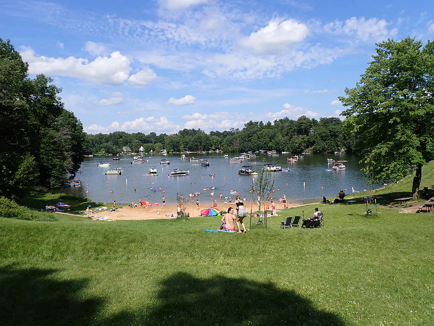
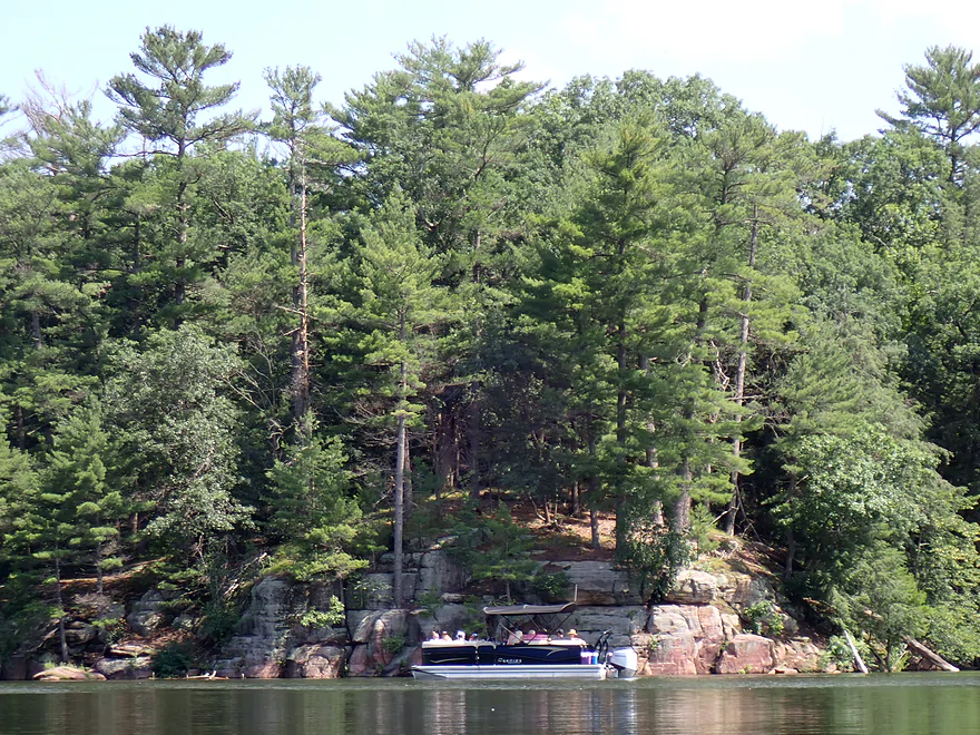
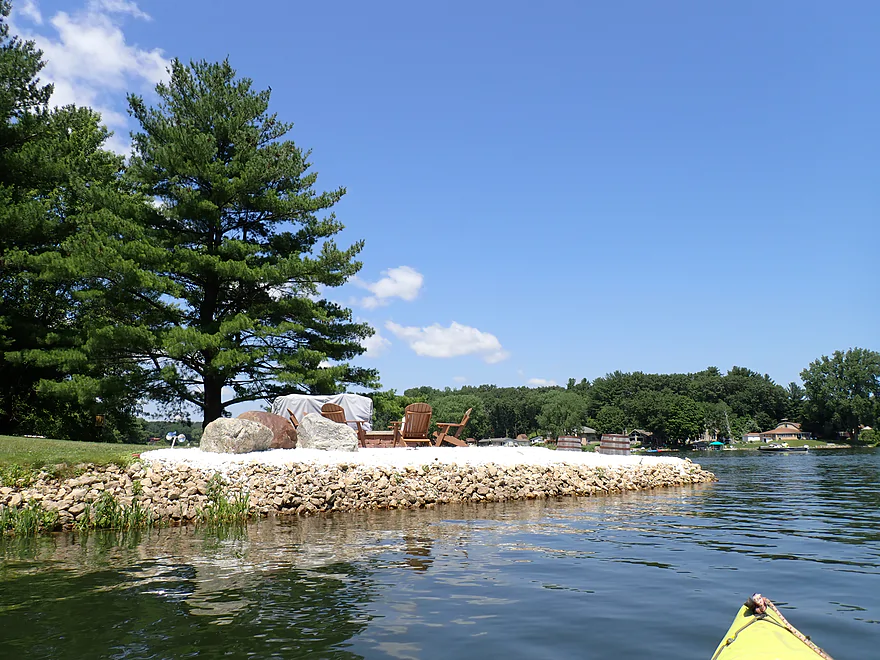
The Lake Redstone Beach on a normal summer afternoon
But it was pretty quiet when I started my trip here in the early morning
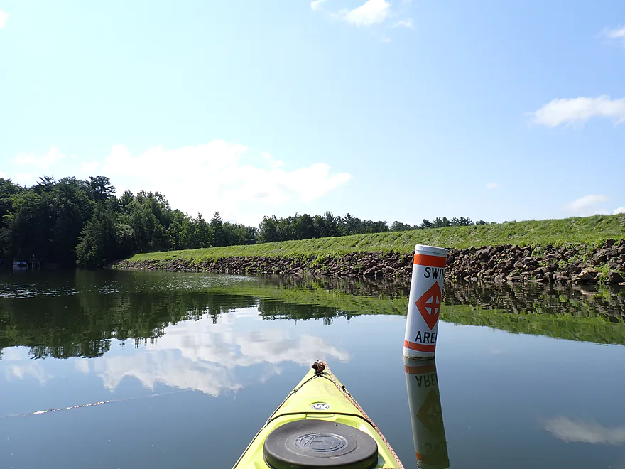
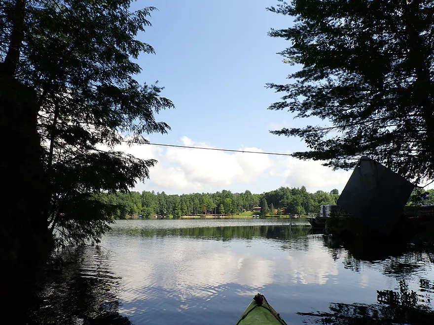
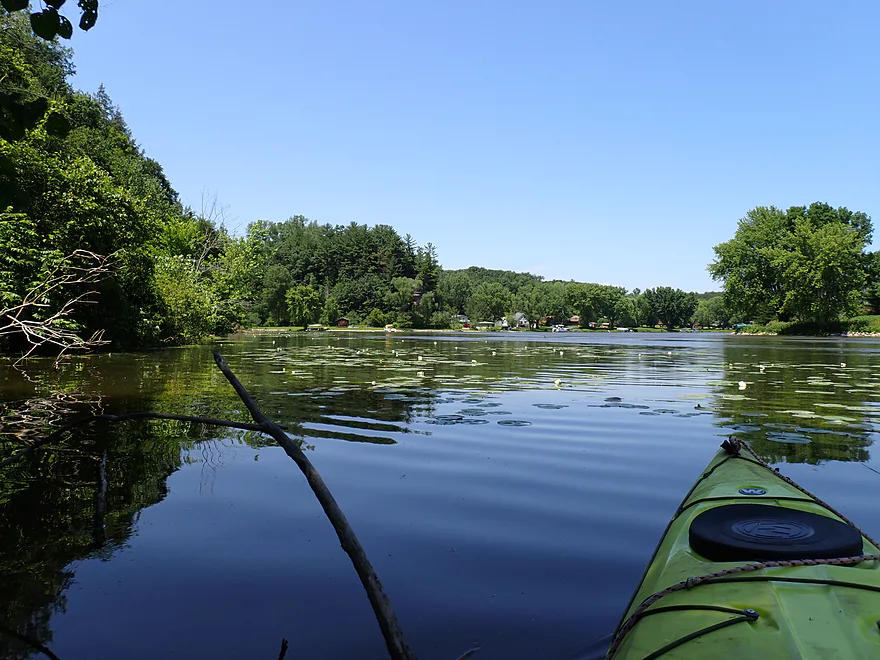
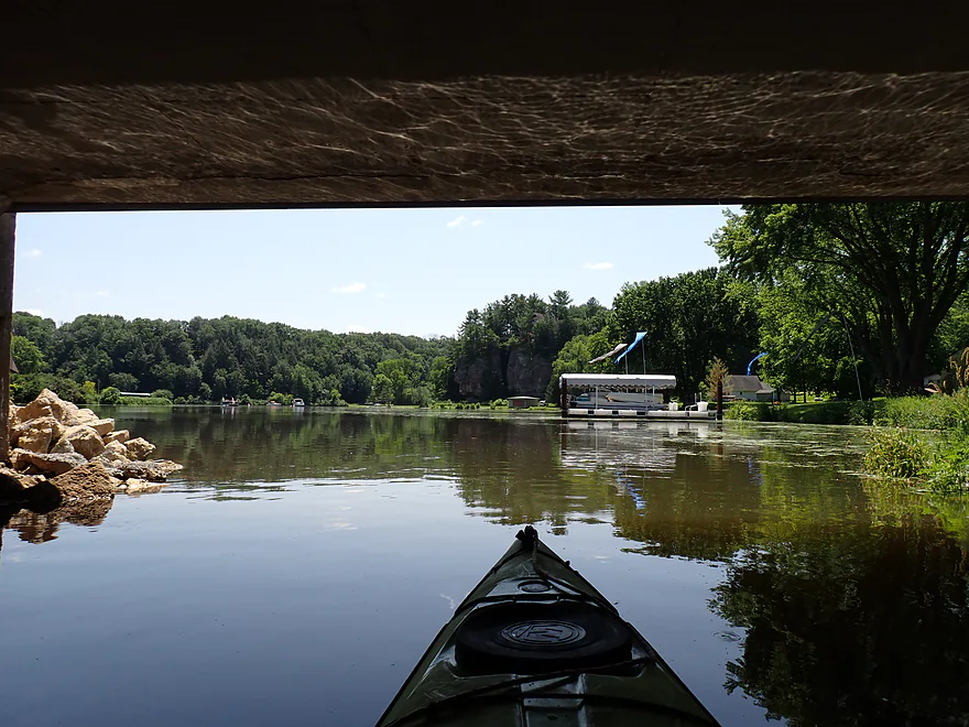
Paddling along the southern dike
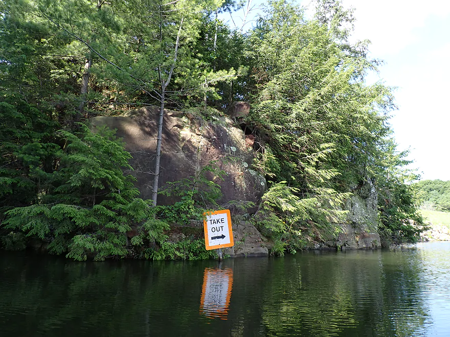
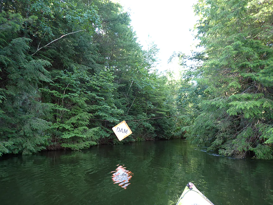
A portage sign marks the outlet of the lake
Short stretch of dells before the dam
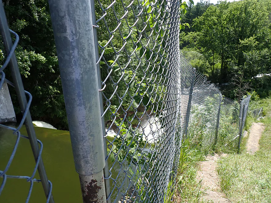
A public path leads to the bottom of the dam
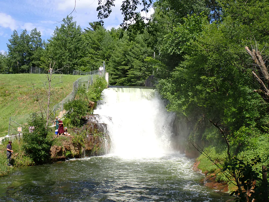
A view of the “Lake Redstone Waterfall” from below the dam
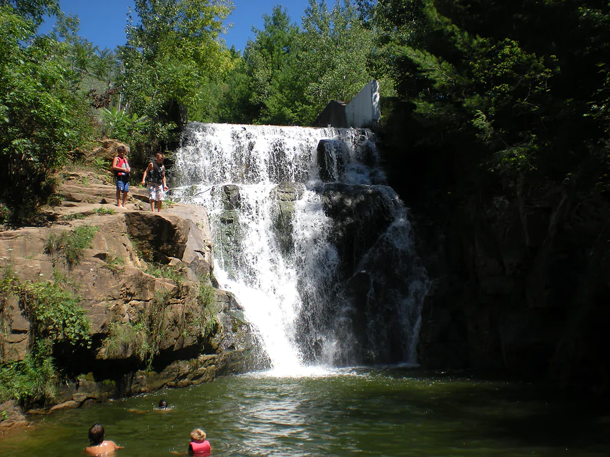
Same waterfall in low water (people like to jump off the rock to the left)
Looking back on the lake from the outlet
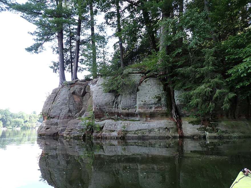
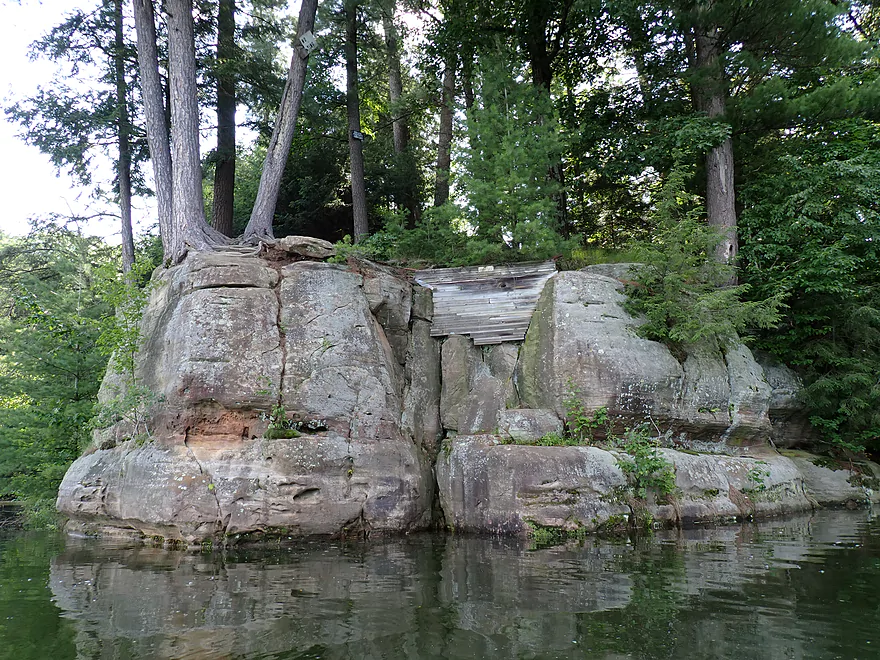
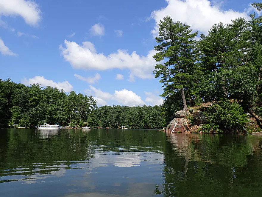
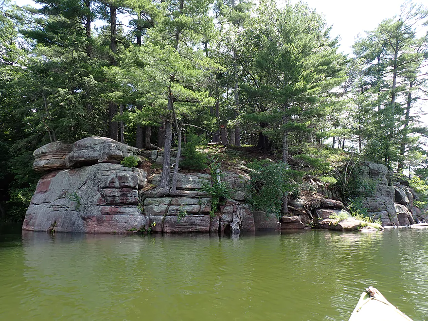
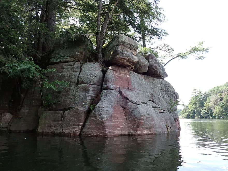
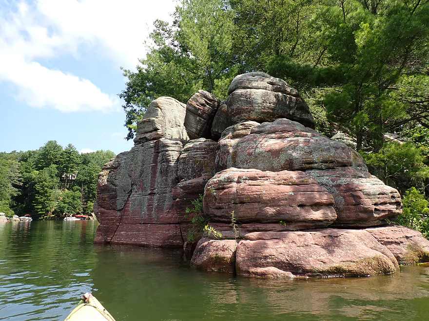
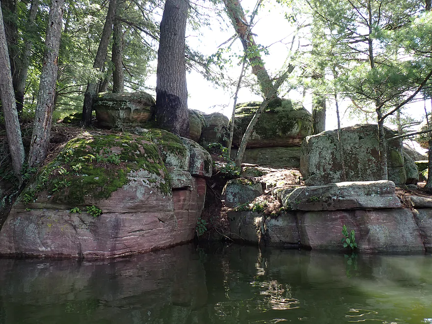
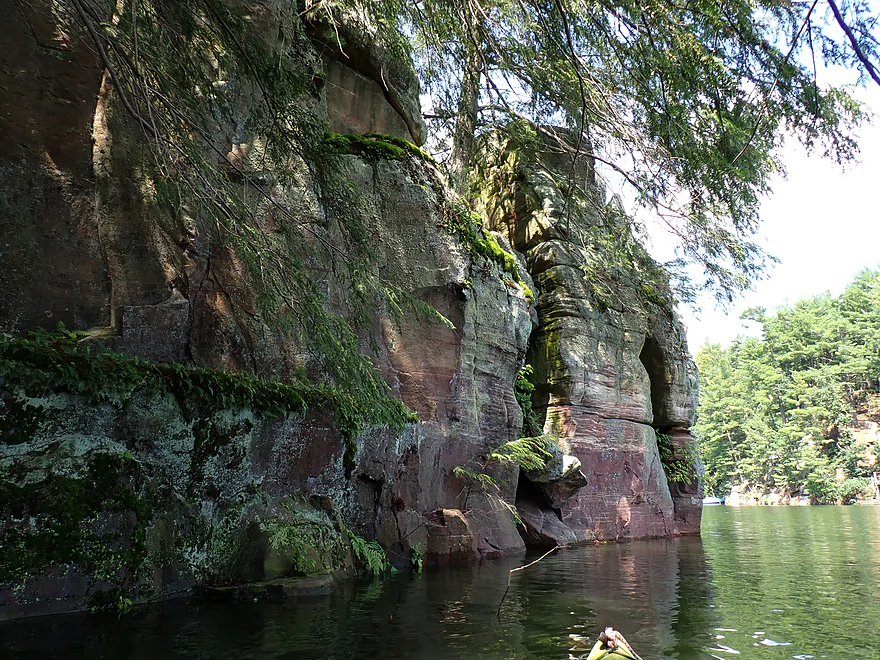
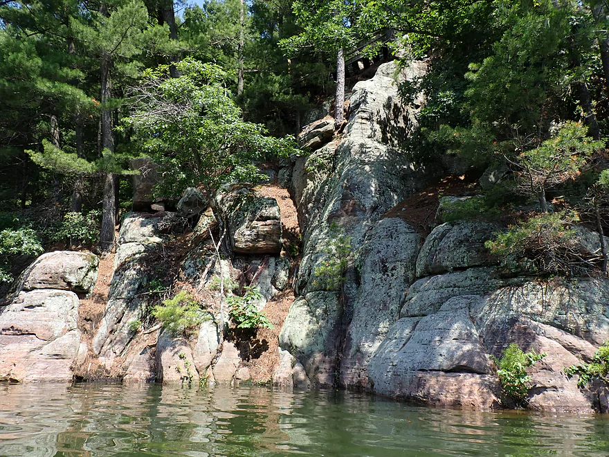
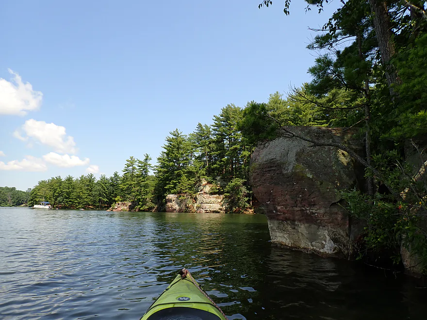
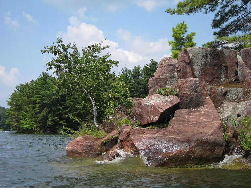
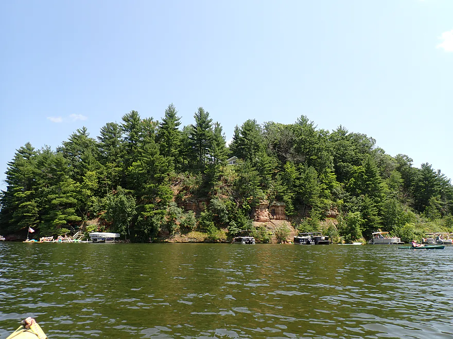
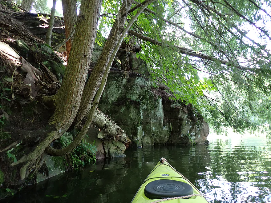
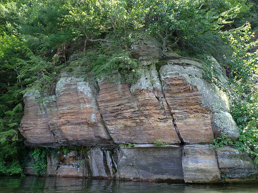
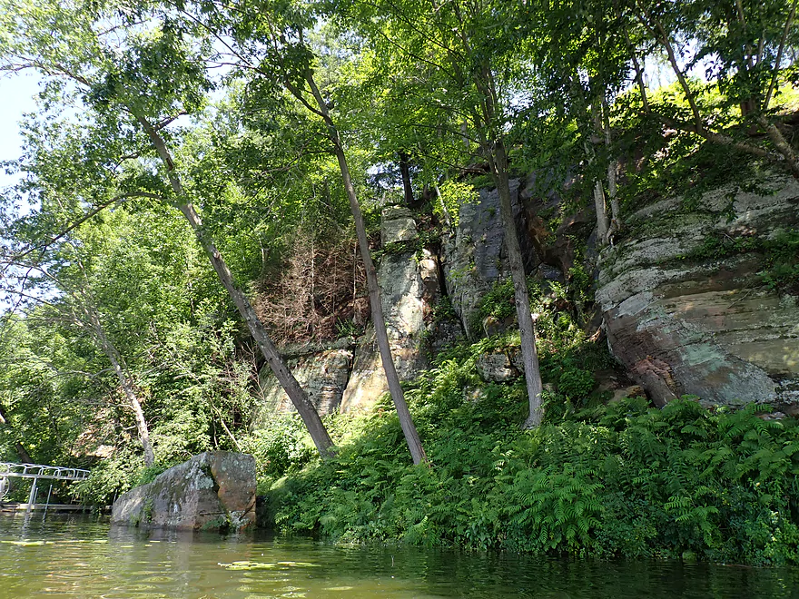
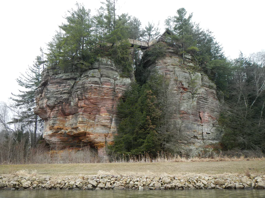
Southeast corner has a lot of great outcrops
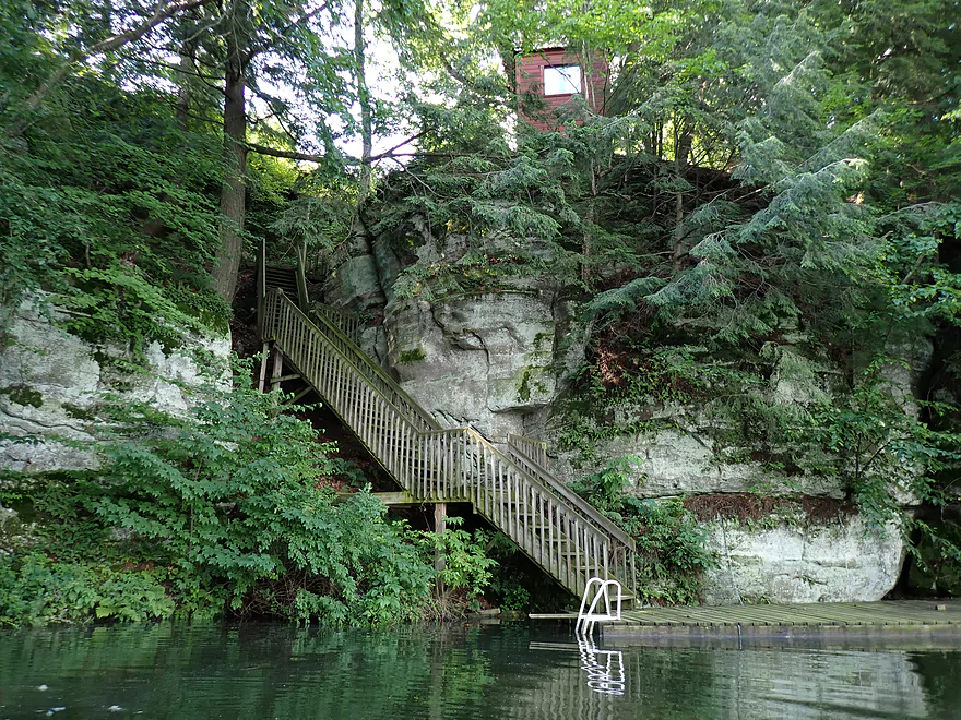
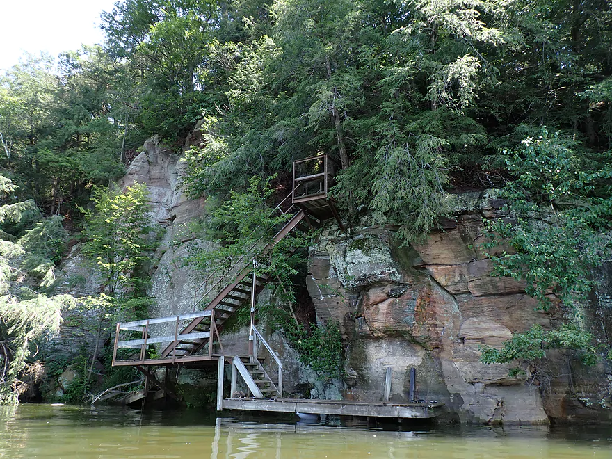
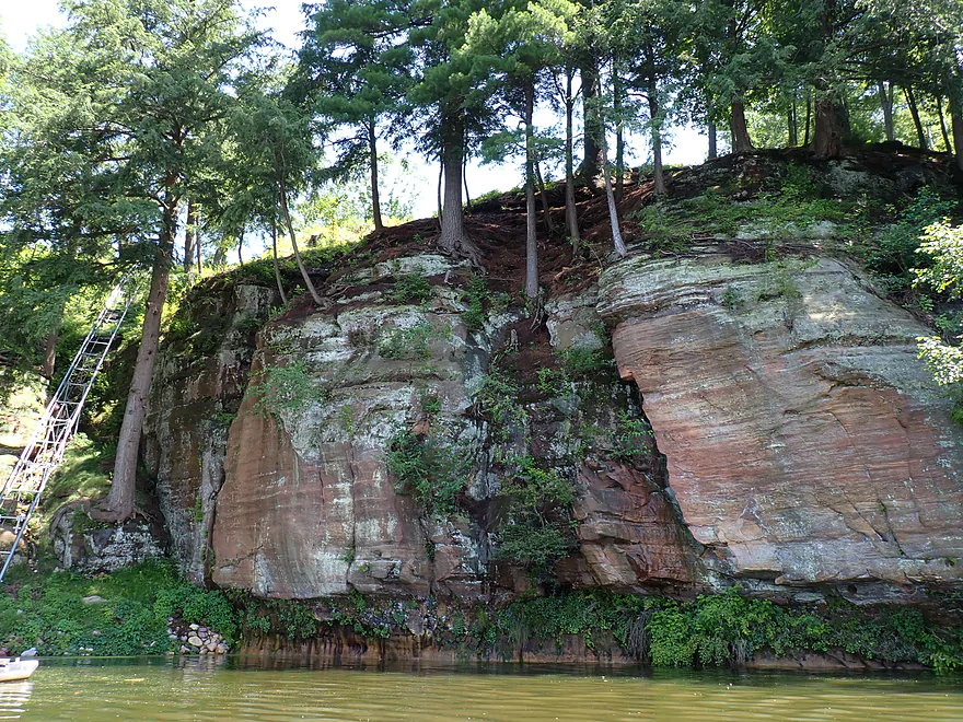
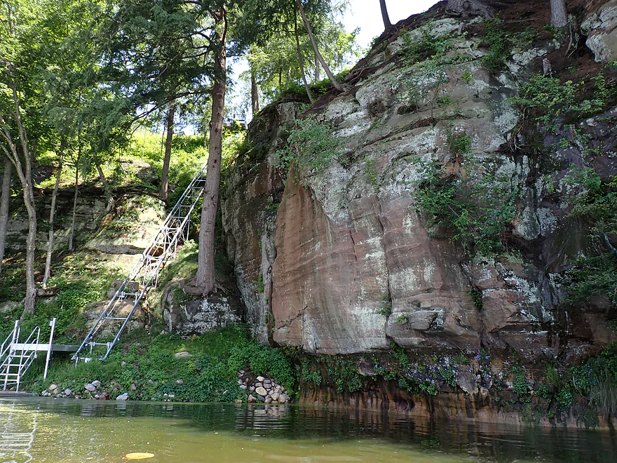
Many of the shoreside cliffs had elaborate stairs
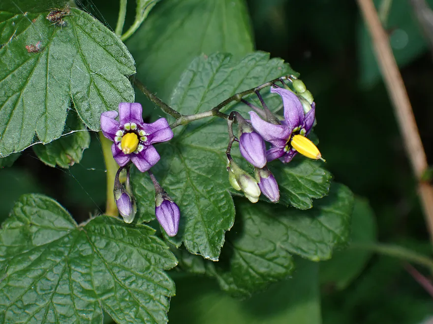
Nightshade flowers
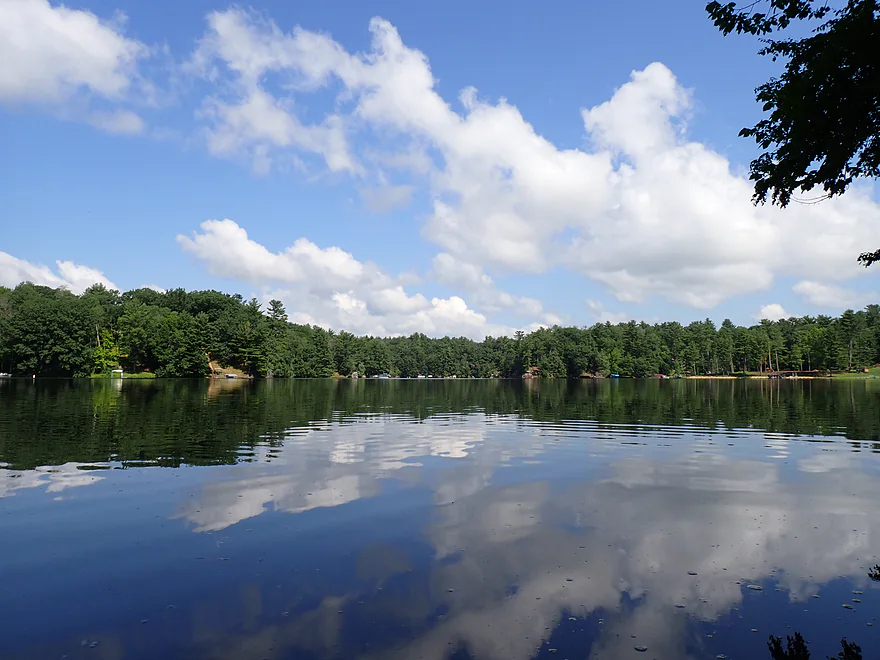
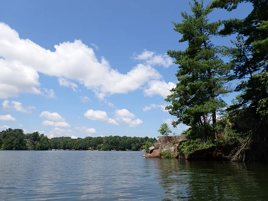
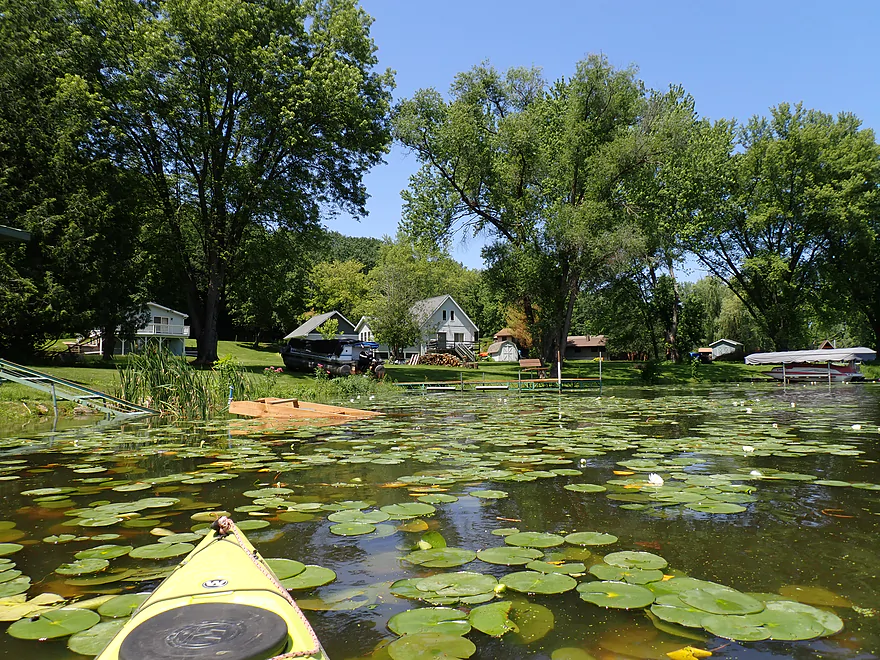
Southern end of the lake
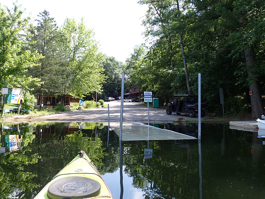
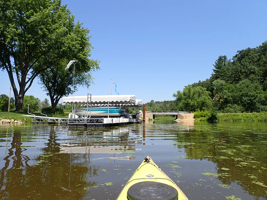
Redstone Fox Court Landing…a bit underwater
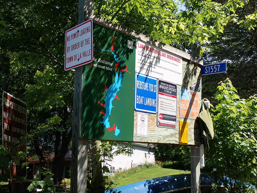
Sign at the landing shows the permanent no-wake zones
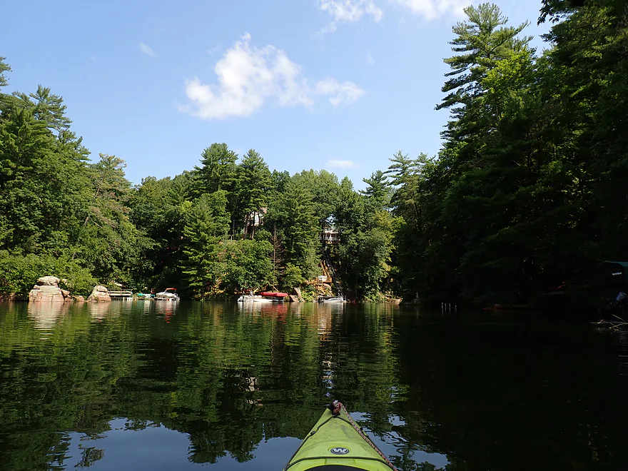
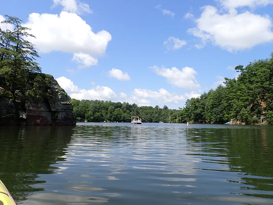
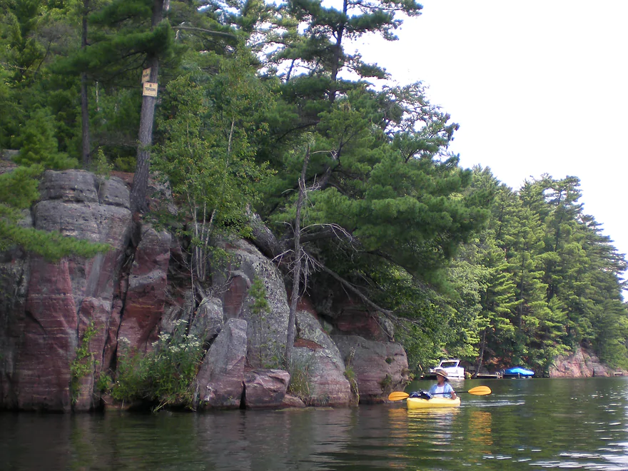
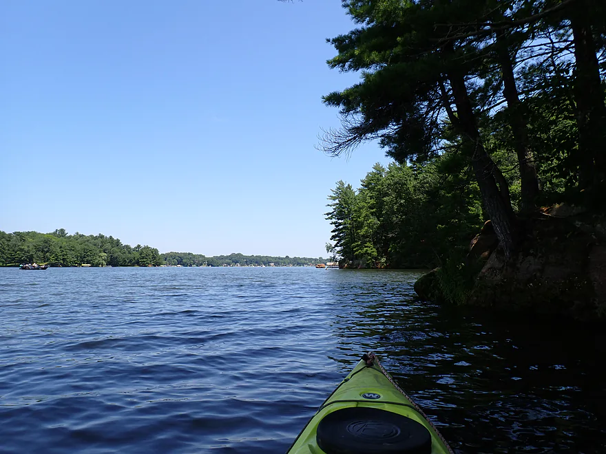
Paddling upstream–the lake has a very “up-north” look
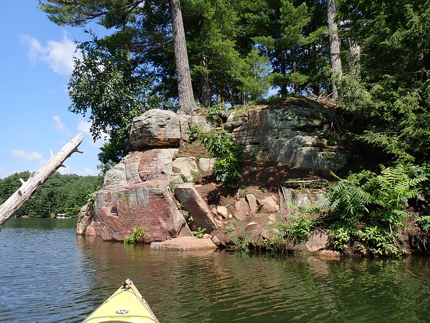
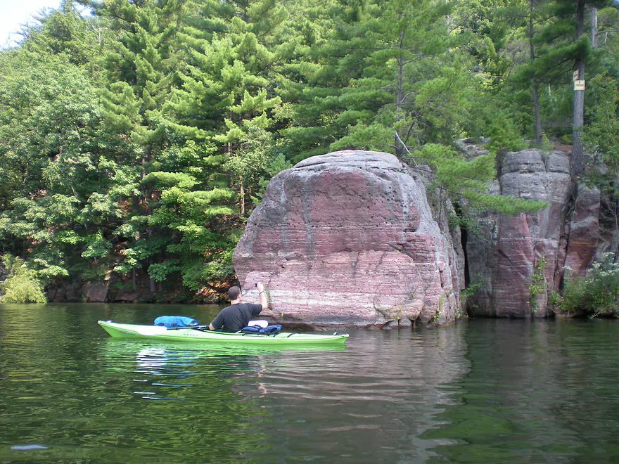
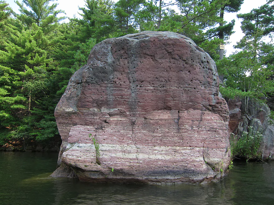
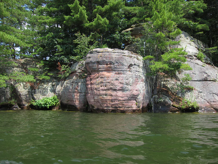
Many of the outcrops had a cool red hue
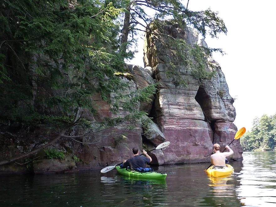
Paddling through the “Straits of Gibraltar” (2011 photo)
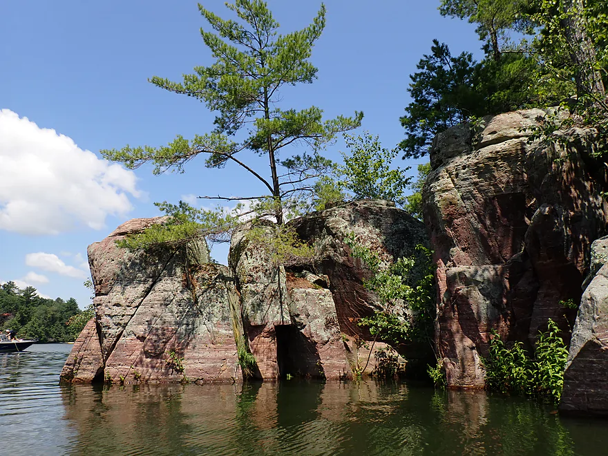
Terrific pine trees
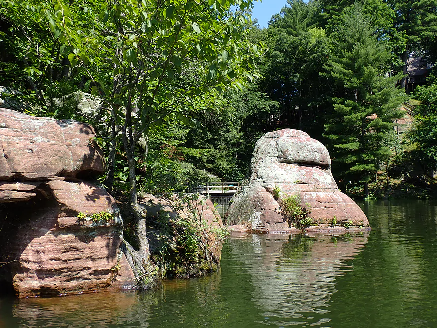
Trees growing into the rocks
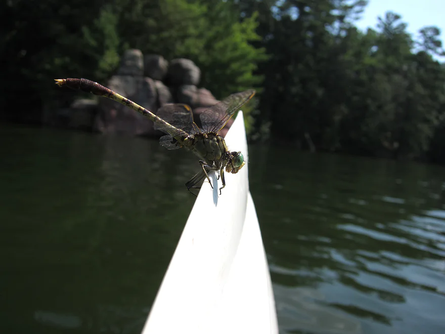
Friendly dragonfly
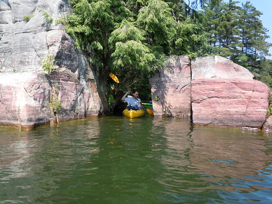
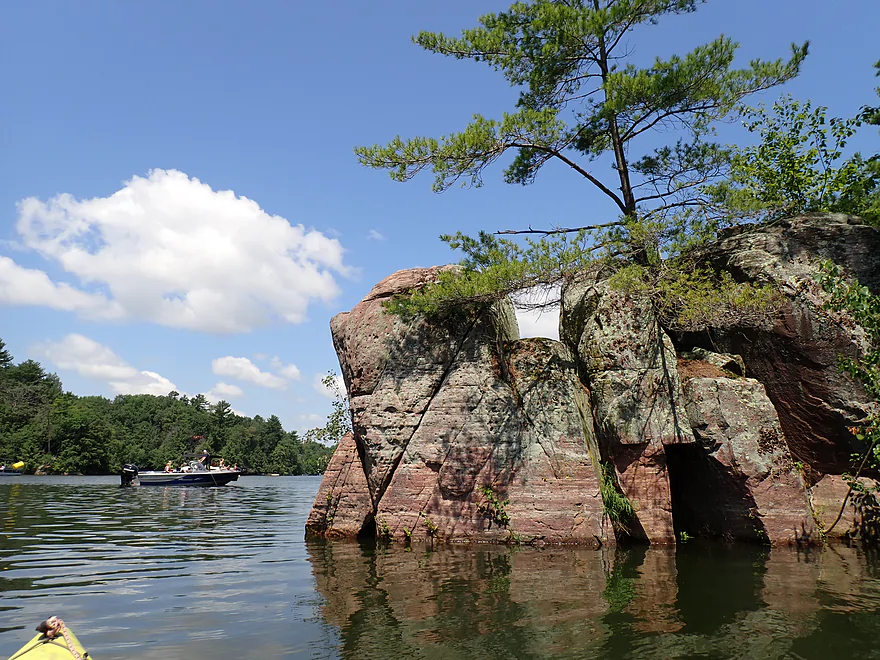
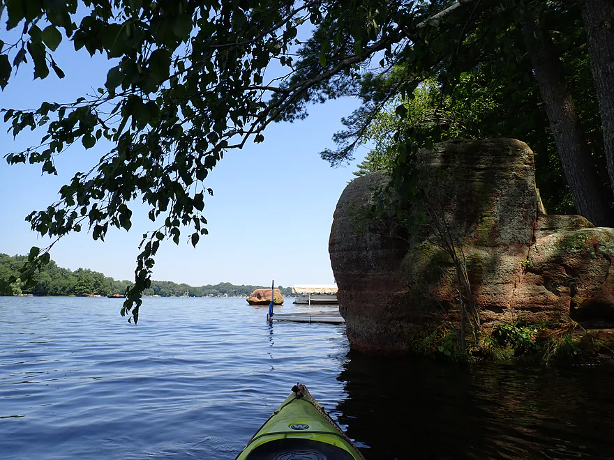
Exploring a side bay
The lake was maybe 1-2′ above normal
Exiting the side bay
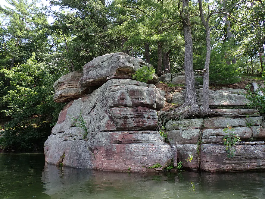
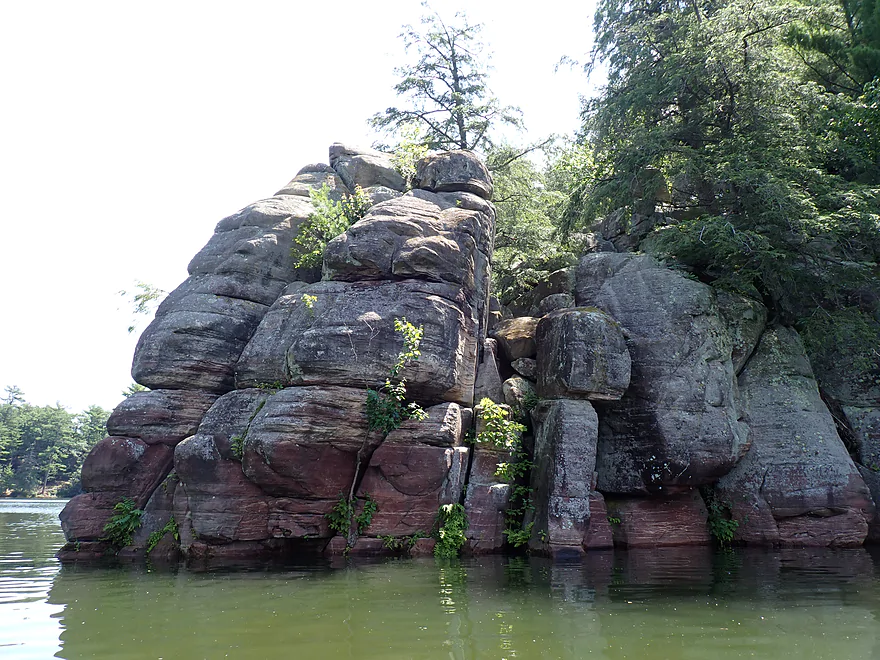
One of the largest outcrops on the southern end (2011 photo)
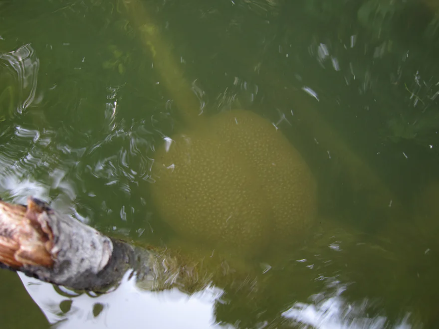
A large bryozoan (a gelatinous colony of tiny organisms similar to corals)
Hemlocks and red sandstone–very cool
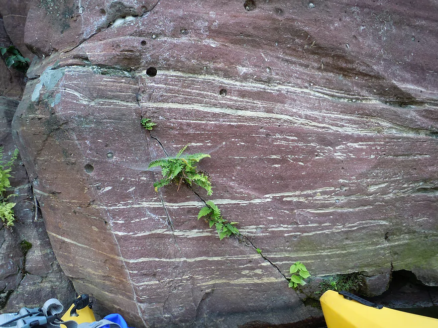
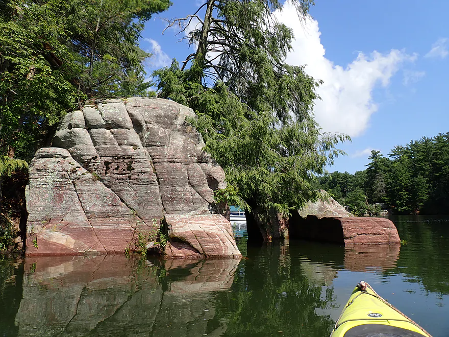
Interesting colors and patterns
Reverse view
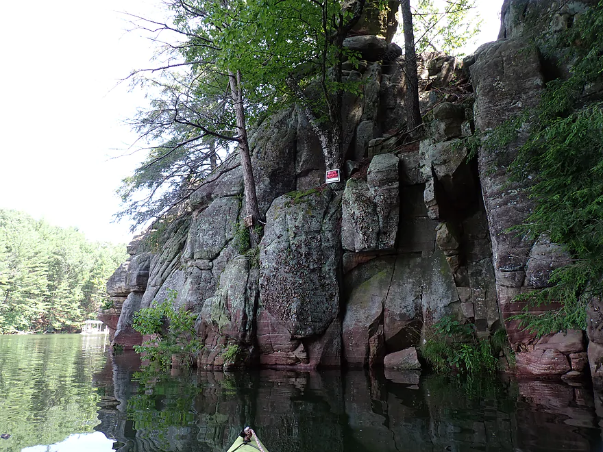
Most cliffs had No Trespassing signs
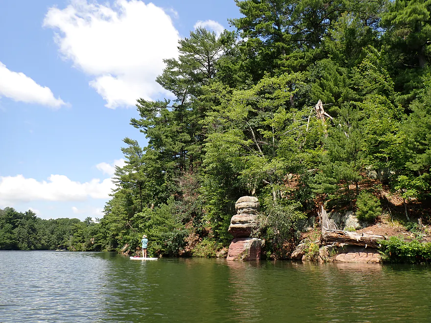
Paddle boarder enjoying the no-wake rules
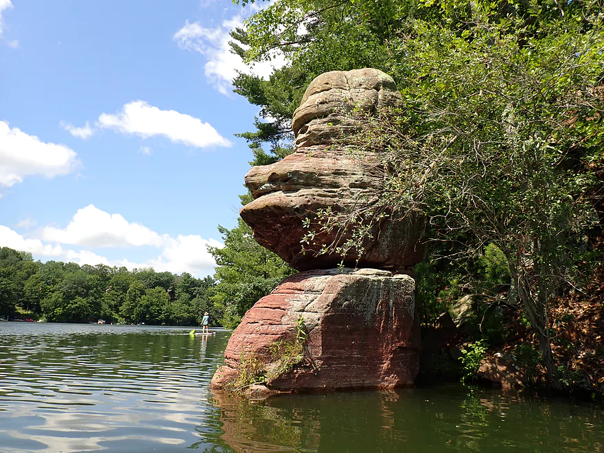
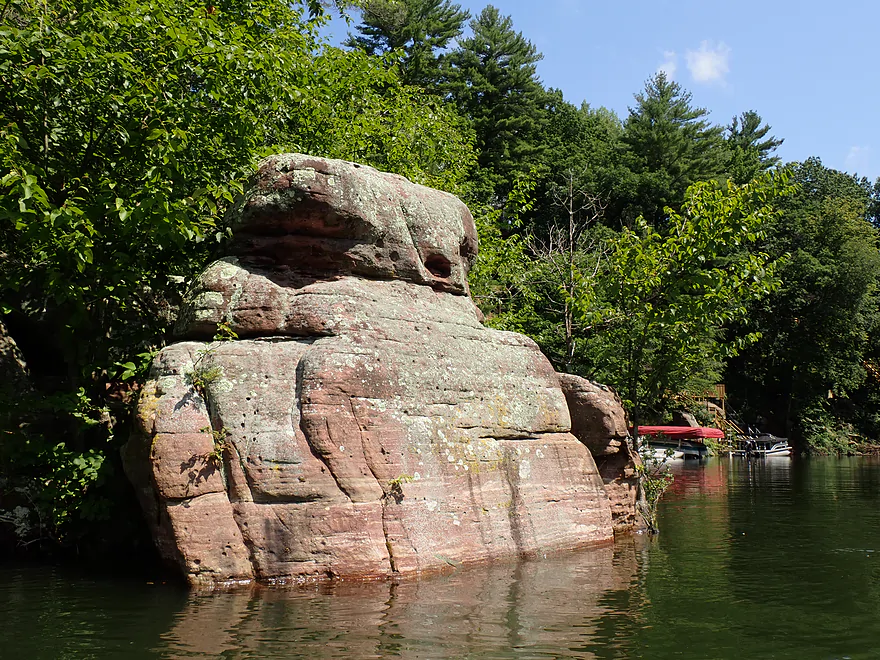
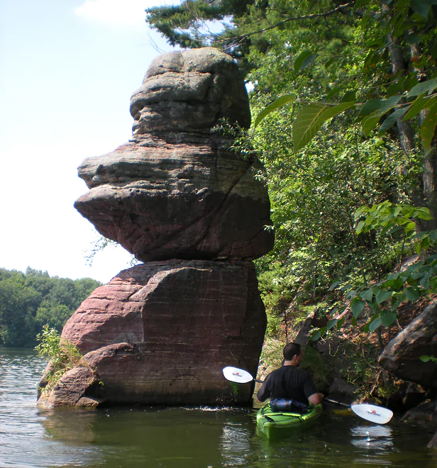
An iconic “Donald Duck” outcrop
Same view but in 2011 (lower water level makes “Donald” look taller)
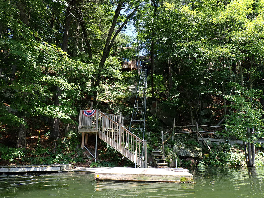
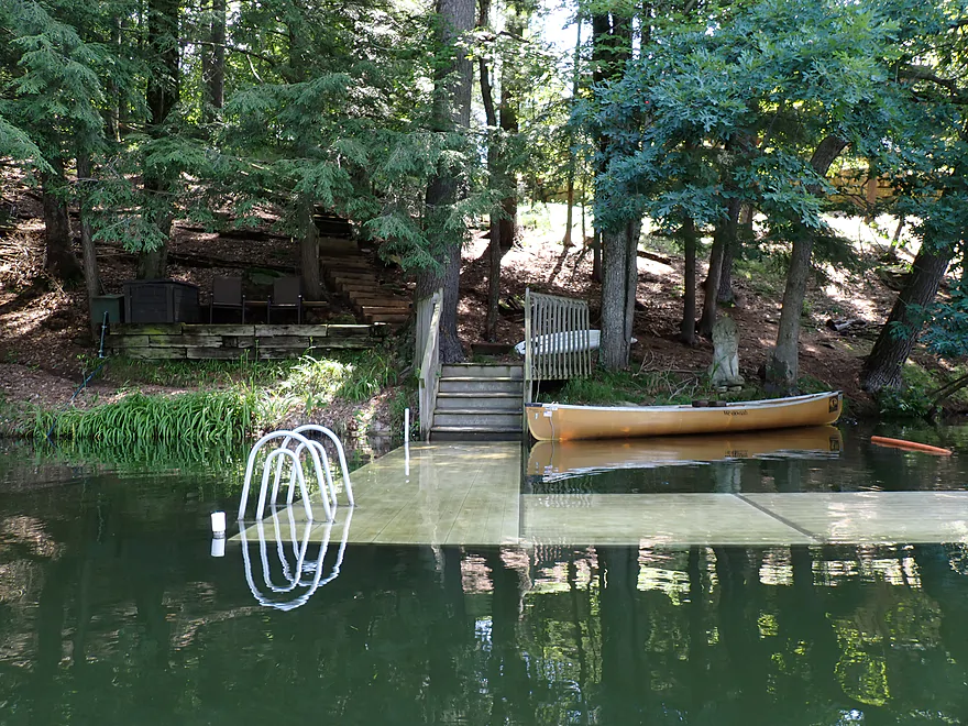
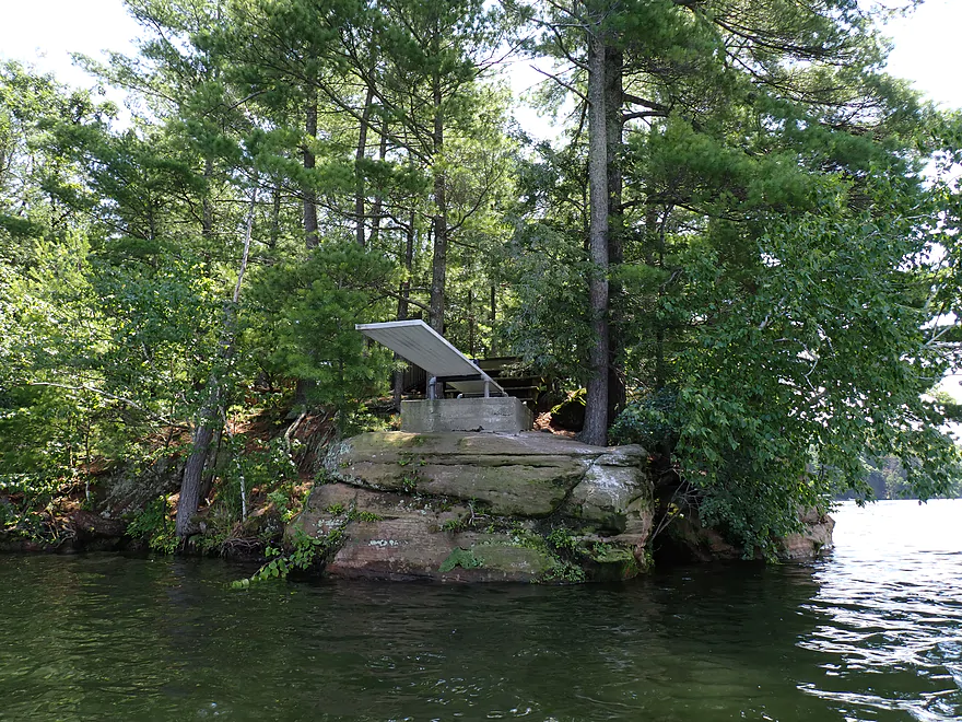
Several homes had fancy elevator systems
2011 photo
Paddling up the eastern shore (2011 photo)
Cool texture
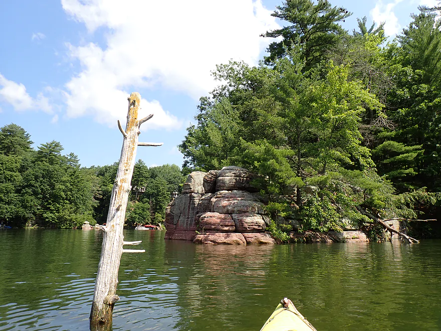
Attractive rock peninsula
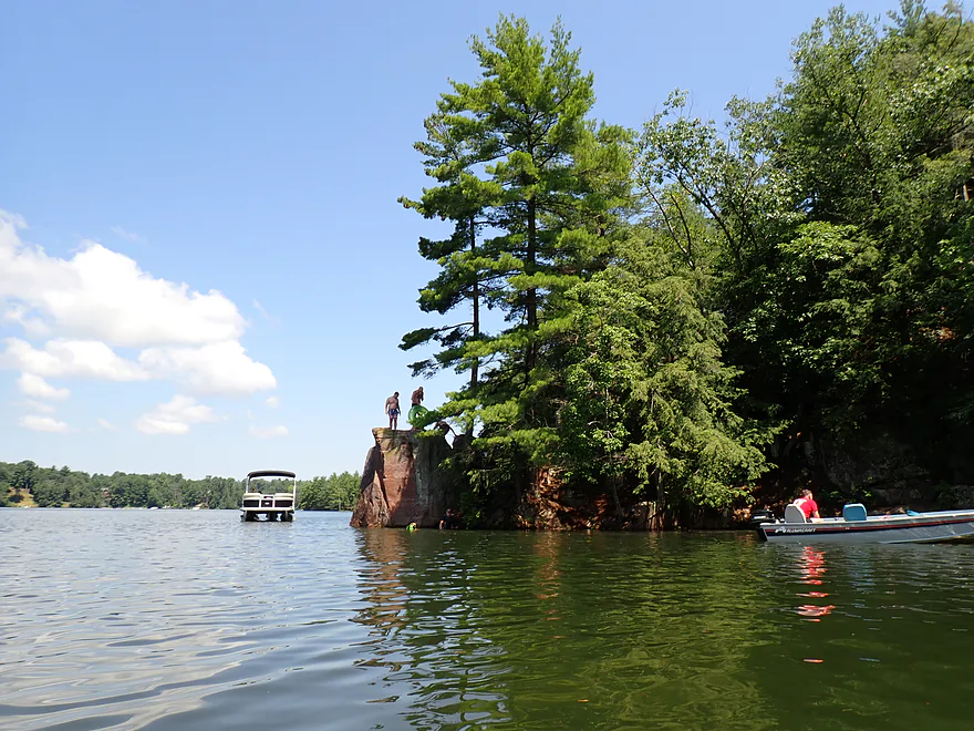
The one spot in the lake where locals were diving off the cliffs
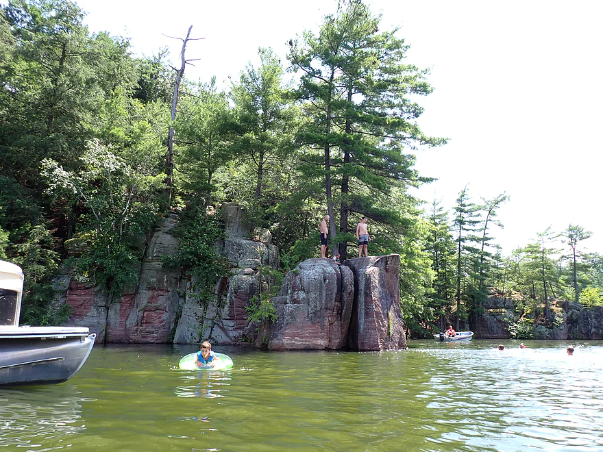
I don’t know if it is public or not…regardless, it looked like fun
Continuing north up the eastern shore
Lake starts to widen
Conveniently placed diving board
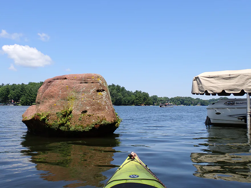
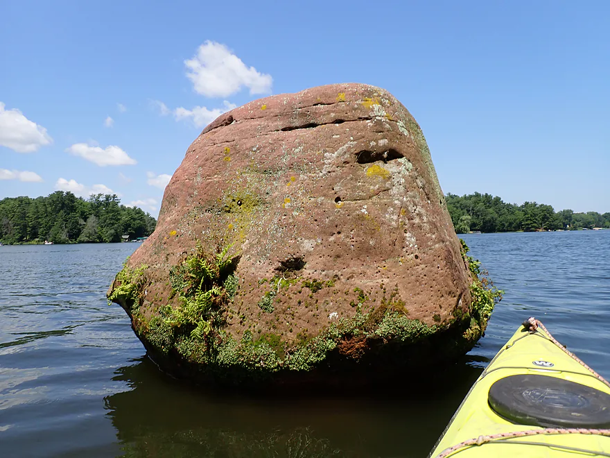
Little boulder island
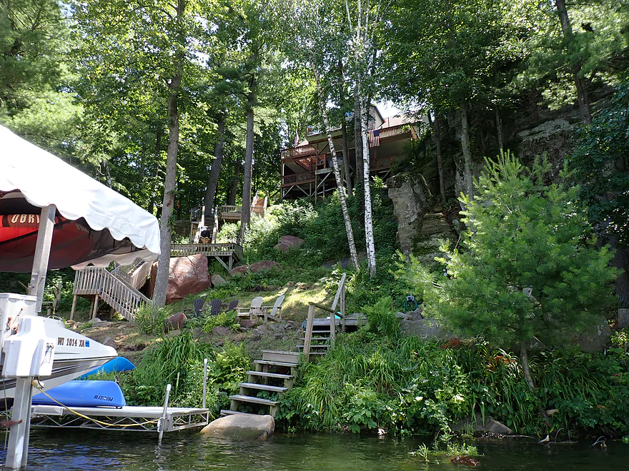
Fantastic staircase system
Sometimes I could paddle faster than the boats (high water no-wake rules in effect)
Switching over to the west side of the lake
Not as many outcrops on the west side
Switching back to the east side
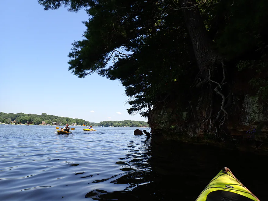
Nice to see other kayakers on the lake
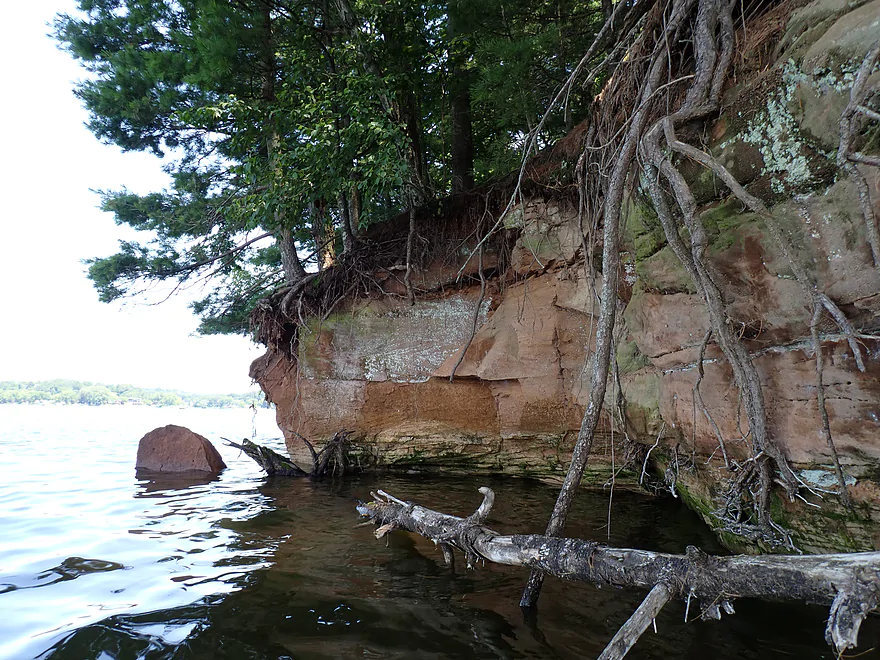
Cliffs being eroded
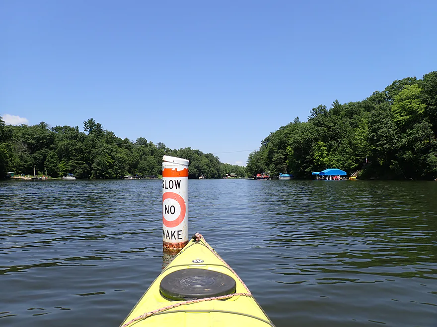
No wake buoy by the Section 11 landing
Nice to see outcrops again
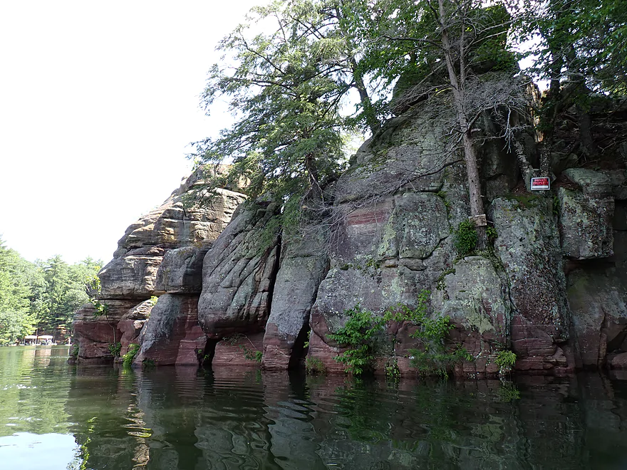
Northern end of the lake had larger outcrops
One of the bigger cliffs of the trip
Attractive ferns
Parts of the northern end were a bit marshy
Paddling north under Hwy F to explore Big Creek
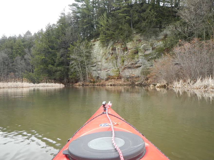
Nice cliff north of Hwy F (2014 photo)

Big Creek has a very different and more wild character to it
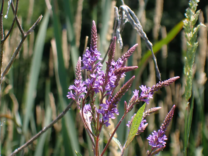
Blue vervain flowers
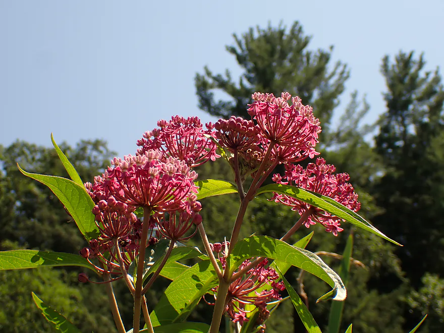
Swamp milkweed
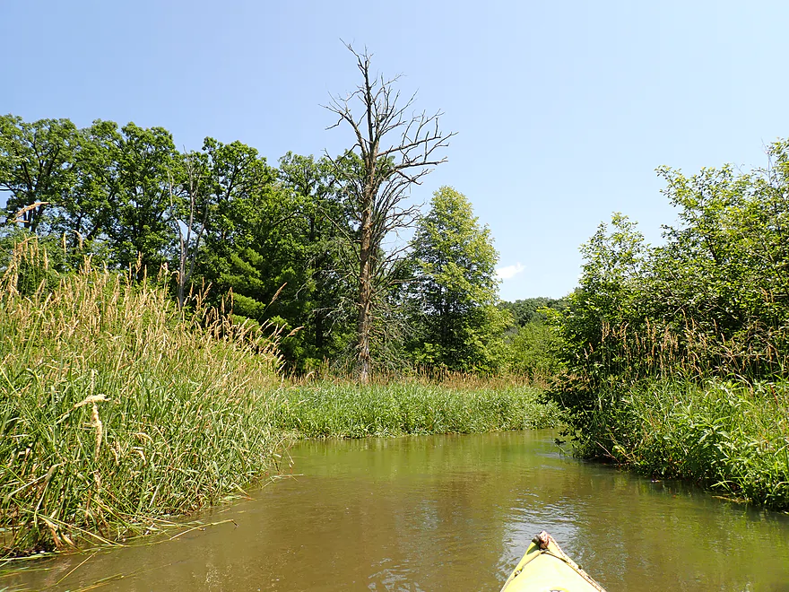
Paddling upstream as far as I can go
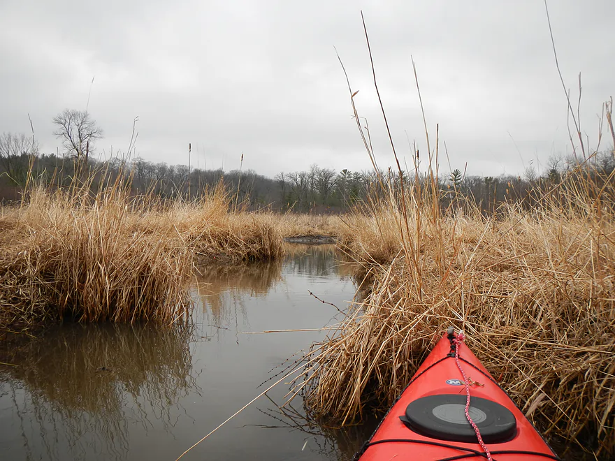
Creek looks very different in the early spring (2014 photo)
Doubling back and paddling south under Hwy F
Largest outcrop of the trip…topped with a house
Ending the day at the Section 11 Landing
View upstream…it’s a very busy landing
Lake Redstone

One of the most under-rated kayaking prospects in southern Wisconsin is Lake Redstone. On the face of it…this wouldn’t seem like a good paddling prospect. It’s merely a very large (more so long) man-made lake with no helping current, little public property, lots of development and many powerboats. But what makes it unique and worth paddling are its red cliffs. Again…the lake is quite long…so most paddlers just do the far southern end, which is somewhat protected by no-wake zones and has the best outcrops. For this “redo” trip, the goal was to paddle the lake end-to-end to explore parts previously missed in my last 2011 review.
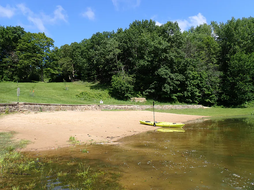
There are roughly five spots a kayaker can launch from (see overview map), but I opted for the beach as it would make my later bike shuttle somewhat more viable. Typically on summer weekends the beach is packed and a hectic zoo…but at 9:00 am, I was the only one there (locals must be late risers).
From the beach, I followed the dike (which creates the lake) east until I reached the dam. The outlet is preceded by a short stretch of creek and scenic dells. There is actually a path and bridge which lead below the dam where there are photogenic views of what the locals call a “waterfall”. Relative to the size of the creek, the dam is quite tall (60′) and water partly cascades over the natural rock face. It would have been interesting to see what the rock formations looked like before being buried by the dam. Many signs prohibit locals from jumping off the rocks below the dam into the pool below because of the hazardous currents, but people do it anyway.
After that, I paddled up the east shore, taking pictures of the incredible outcrops. The lake has many, but the best and highest density are located at the far southern end. It’s not only the most attractive part of the lake but also enjoys some no-wake protection. Often boats will come in from the north and anchor in the south bay because it is so much more peaceful.
At one point I passed the Redstone Fox Court Landing, which actually seemed like a better access than the beach, but its main pier was underwater. The entire lake was high because of recent heavy rains (maybe 1-2′ above normal). I continued north where there was a fantastic collection of red outcrops and pine trees. Unfortunately the outcrops were 1-2′ “shorter” than normal because of the water levels and were partly obscured by summer foliage, but still looked great.
There were countless homes along the shore, and Redstone very much had a “Lake Wisconsin” vibe. The dam was built in 1964 on behalf of real estate developers who sold the newly created lake lots for a large profit. Many of the new homes were marketed to Chicago buyers, and to this day you’ll see a number of Illinois license plates and paraphernalia in the area. Building on the sandstone has had its drawbacks though as septic fields aren’t allowed, which means the holding tanks must be frequently pumped. The sandstone also acidifies the drinking water and many locals have to deal with corroded pipes or tricky ph remediation systems.
It’s not all bad though, as many of the homes are attractive and built on small pine-filled lots. The buildings themselves (with exceptions) aren’t that big and are practically cottages. In multiple instances impressive staircase systems wind up the rocks to connect to the homes. The more expensive homes had shoreside elevators (one of which I got to see in operation). Had Lake Redstone been developed today, it wouldn’t have been for cottages…but for oversized McMansions built on ridiculously large lots. And the pine trees would have been clear-cut in favor of oversized and monocultured lawns.
I continued north past my 2011 turn-around point. From here on I got to see a number of new outcrops missed before. Most had No Trespassing and No Jumping signs. It’s too bad the lake didn’t create any shoresides public parks to provide access to the unique cliffs (but developers tend not to think of these things). I did find one exception (which I’ll mark on the map in orange) where an outcrop didn’t appear to be marked and locals were anchoring their boats and using the outcrop as a diving board (looked like fun).
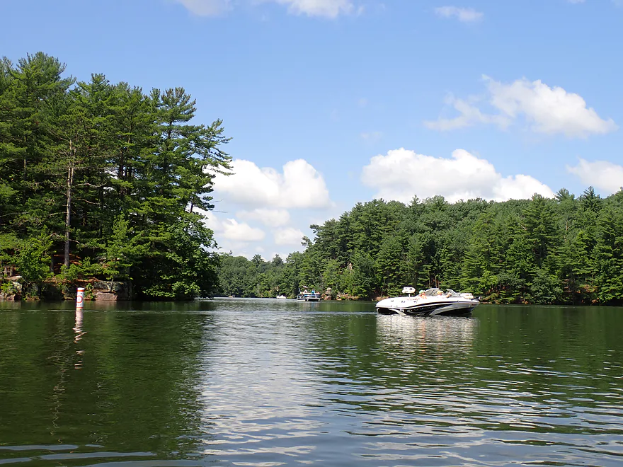
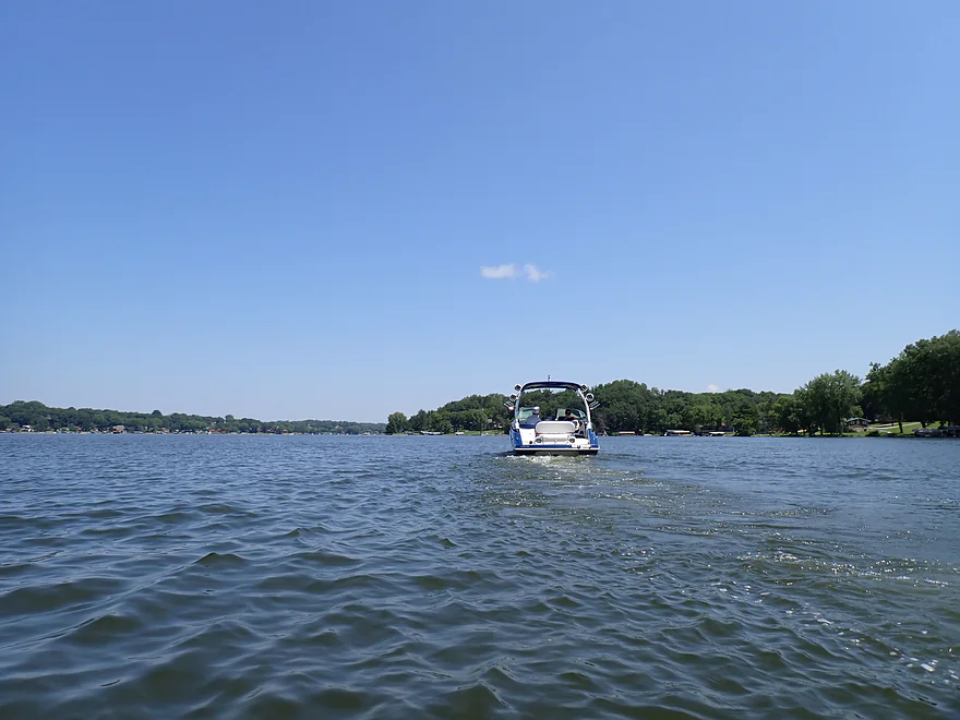
As I continued north, the lake widened significantly and most of the rock outcrops vanished. The middle portion of the trip was the most boring part. There was also a lot of open water, which was a slog to paddle though. What was interesting was there were boats EVERYWHERE…but hardly moving. The local government had issued a No Wake rule for the entire lake to protect shorelines during the high water (not for paddlers). Normally, the central core of the lake is a crazy zoo. In fact, it’s so bad you likely don’t want to be on it during peak times (the central core at least).
It was interesting being able to paddle faster than the no-wake boats (sometimes) and actually be able to hear the occupant’s conversations. Many were observing how unusually nice and peaceful the lake was with the no-wake rules. One lady told me how great it was to actually be able to kayak the lake for once and do some fishing. Another was saying how wonderful it was not to have so many jet skies. IMO locals should really consider enacting a quiet day of the week (say “quiet Sundays”) when no-wake rules for the entire lake are enforced…as well as a restriction on loud music being played on the water (which was an issue and obnoxious).
Continuing north, the main lake is split into two forks…Big Creek comes from the west and Little Big Creek from the east. I chose to go west, which was the larger and more prominent branch. Past the Section 11 landing, I started to see outcrops again (including the biggest ones of the trip) and boat traffic started to tail off. The far northern end was nice…more quiet and low-key than the middle portion.
I passed under Hwy F to check out the large outcrop by the bridge and then headed upstream on flooded Big Creek to see how far I could get. Past the bridge, it’s no longer a lake but a creek proper with current. The character is very different…more quiet, less developed, more insects, and more marsh plants. I was stopped from getting too far upstream by an obstruction, but in theory, if you go far enough upstream, you’ll encounter a series of small dams hidden in obscure Driftless Area valleys as a means to reduce flooding on the lake.
After that I doubled back downstream to end the trip at the Section 11 Ramp. Initially the plan was to also explore Little Big Creek but I was zonked so decided to call it a day.
In summary, the lake was very nice, but I don’t think an end-to-end paddle was the best way to enjoy it. Instead I advise paddlers to just do the south end, which again has the best outcrops. If you like that trip, consider coming back another day to do the northern end, which also has a number of nice outcrops and is also somewhat protected by some no-wake zones. I can’t advocate though kayaking the middle portion…it’s the most boring part with almost no outcrops, has the heaviest boat traffic, and has a lot of open water. If you can time a trip to coincide with high water no-wake restrictions, definitely go for it. It will absolutely make your kayak trip more enjoyable.
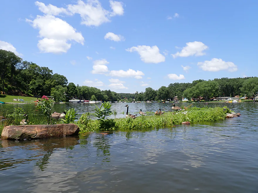
I didn’t see much…just a great blue heron, some flopping fish, ducks, geese, and a few insects. The best “natural find” was a bryozoan, a big gelatinous ball of tiny aquatic organisms that live together in colonies attached to sticks and rocks.
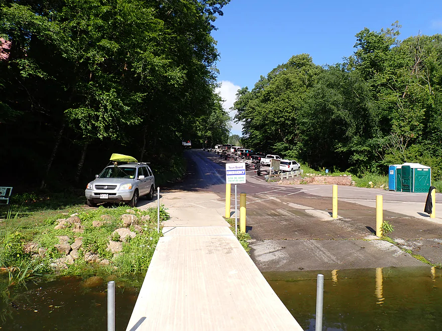
Redstone Beach: This is a nice public area in the southwest corner of the lake, but I’m not sure it was a good kayak access. Paddlers have to drag their boats 350′ down a steep hill to reach the beach from the parking lot. Then you must launch east of the swim fence as there is a No Watercraft sign (that confusingly faces the water). The only reason I launched here was because it facilitated a somewhat more manageable bike shuttle than the alternatives. This access (like the others) has outhouses and is nice…but you must have a Sauk County park sticker. You can buy these at an adjacent self-service station, or at Hartje’s (a local gas station). Cost is $5 daily.
Alternate South-End Access Locations:
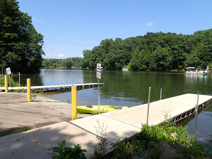
- Redstone Fox Court Landing: This is a boat landing in the southeast corner that should be a viable access for paddlers. A Sauk County park sticker is required. Parking may be very limited.
Section 11 Landing: This is a large and popular boat landing at the northwest end. Outhouses are available, but parking does fill up. There only seems to be trailer parking spots, so I assume a non-trailer vehicle could use a trailer spot? Parking may fill up on busy weekends. A Sauk County park sticker is required.
Alternate North-End Access Locations:
- Sauk County Boat Ramp (by Lavalle Road): Located in the northeast corner, this is my favorite boat ramp. It’s more secluded and not as busy as the others. A Sauk County park sticker is required.
- Hwy F Bridge: This is not a boat ramp, but is a doable bridge access and I’ve launched here before.
Bike Shuttle – Section 11 Ramp to Beach: 5.6 miles with 269′ of ascent. Note, most won’t shuttle and will simply do a round trip. The only reason I shuttled was because I was doing an end-to-end trip. The bike shuttle was difficult because of the many hills…but it was scenic, with many twisty curves, lakeside vistas, and shoreside cottages. If you shuttle, be very careful which route you choose, as some options are incredibly hilly.
Wind: Like most lake paddles you don’t want to be on open water when there is a strong wind.
Motorboats/Waves: Lake Redstone can experience a lot of motorboat and jetski traffic (especially on summer weekends). This can create dangerous wake for paddlers since the waves bounce and reverberate off the steep shoreline. Certain sections are restricted to no-wake (mostly the side gullies and narrow parts). Those are safe for paddling. The best spot for paddlers to target is the southeast end, which is mostly protected and has the best cliffs.
When water levels are high, Lake Redstone will designate the whole lake no-wake. This is a fantastic time to kayak, not only avoid the waves, but also the noise. Typically, changes in no-wake rules are announced on the Lake Redstone Facebook page. Signs by the landings will also indicate if a lake-wide no-wake rule is in effect.
Rock Jumping: A favorite past-time of locals and boaters is to use the lakeside rock formations as diving boards. However, most outcrops are privately owned and posted as No Trespassing. There were a few outcrops where I saw people jumping off that weren’t posted, but that’s no guarantee they too weren’t private. Besides the lake, locals also love to jump off the rocks below the dam/waterfall, but the county strongly discourages this with a fence and signs telling people not to do this.
Crowds: Despite the lake’s relatively large size, it can be very crowded on summer weekends. Going during off-peak times is recommended.
Gauge: Big Creek @ Lake Redstone Outlet
Trip Depth: 150 CFS or 3.69′
Navigability Estimates: While the lake can fluctuate 1-2′ in depth, this generally won’t matter too much. Lower depths will have cleaner water and the outcrops will look taller. Higher depths have a better chance of no-wake rules being enacted.
- < 15 CFS: Relatively low depth….still fine for navigation. Outcrops will be “taller” and more impressive at these levels.
- 15-49 CFS: Average depth.
- 50-99 CFS: High depth…some of the nicer outcrops will be a foot or more “lower” than usual.
- 100+ CFS: Very high depth…typically no-wake is posted at these levels.
Trip Map
Video
Photos Size: