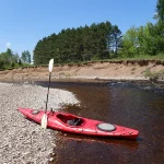
Big Rib River
While not as scenic as its neighbor (the Eau Claire), the Big Rib is a pleasant paddle popular with Wausau locals.
Trip Reports
Lemke Drive to Hwy 64
Date Paddled: May 28th, 2017
Distance: 5.0 Miles
Time: 2 hours 5 minutes
Pleasant, but not exotic, this segment on the far upper Big Rib has a different character relative to its downstream siblings.
Read More...Amco Park to Hwy A
Date Paddled: May 13th, 2018
Distance: 4.3 Miles
Time: 2 hours 31 minutes
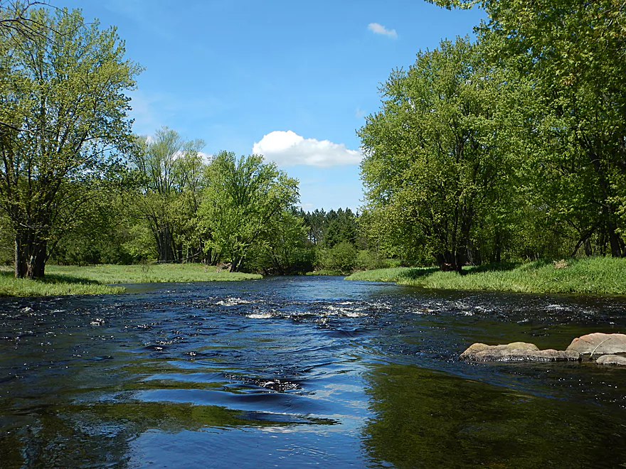
A nice paddle with clean water, good scenery, decent current, and no hazards. This is an easy stretch well suited to beginners and locals wanting to experience the Big Rib for the first time.
Read More...Hwy A to Rib Falls County Park
Date Paddled: May 20th, 2023
Distance: 7.7 miles
Time: Expect 4 hours
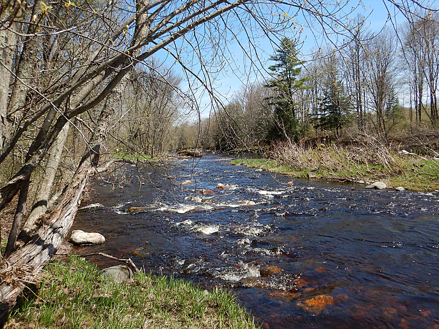
This is one of best legs on the entire Big Rib River. Highlights include attractive hemlocks, light rapids, boulders, and seven sets of gorgeous granite outcrops. The trip ends with a bang with Rib Falls which is incredibly scenic.
Read More...Rib Falls County Park to Marathon Lion's Riverside Park
Date Paddled: May 24th, 2026
Distance: 7.5 Miles
Time: Expect 3-4 hours
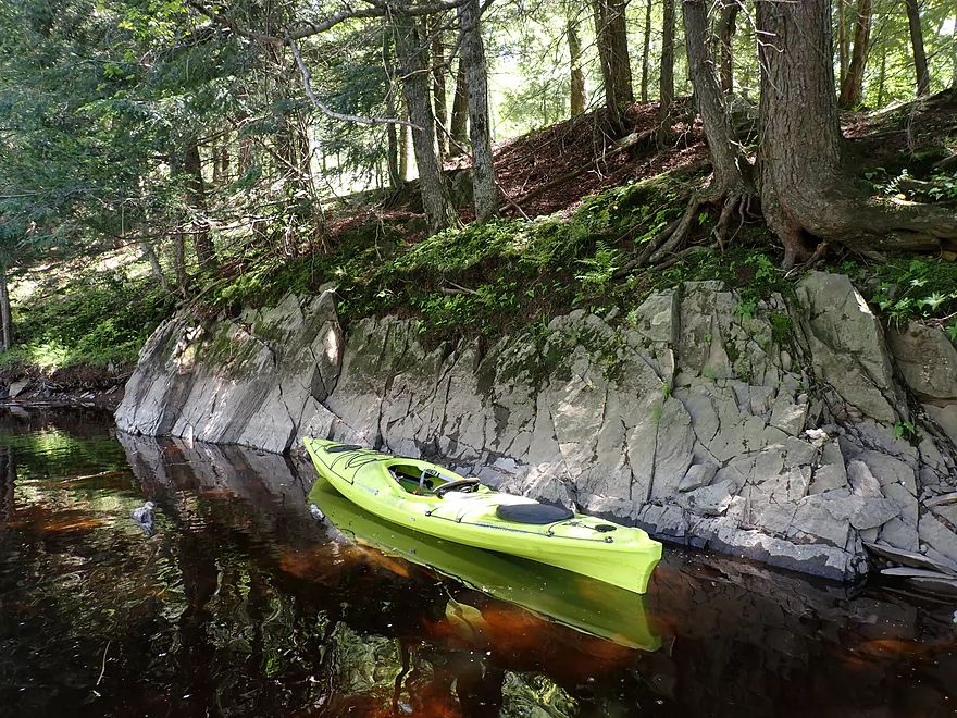
Winding through a mostly undeveloped wilderness just west of Wausau, this downstream leg of the Big Rib River offers a fantastic paddle through dense silver maple canopies, along scenic gravel bars, and past nice sandbanks. The route runs from the roaring drop at Rib Falls down to Marathon City featuring hidden launch points, fun Class I rapids, and unique quarry lakes.
Read More...Overview Map
Detailed Overview
- Upstream of Cty M: Likely navigable paddling, I just don’t know much more.
- Cty M to Lemke Drive: 4.5 miles. An unknown prospect…might be interesting. Could be some downed trees.
- Lemke Drive to Hwy 64: 4.6 miles. Pleasant, but not a special trip.
- Hwy 64 to Silver Fox Road/Greiner Road: 3.7 miles. Famous section that contains the dells, the most rapids and a tough section with Class 3 rapids. Likely 5 stars. Note, the bike shuttle for this section is poor. Reviewed by AmericanWhitewater.org, but note that their flow estimates are very aggressive.
- Silver Fox Road to Cty F/Amco Park: 3.3 Miles. A pleasant section with some light rapids.
- Amco Park to Cty A: 4.5 miles. Slower than upstream sections but pleasant and wooded with a few small outcrops.
- Cty A to Big Rib Falls County Park: 7.7 Miles. A great stretch and maybe the best leg on the entire Big Rib River. Highlights include attractive hemlocks, light rapids, boulders, and seven separate sets of gorgeous granite outcrops. This section ends with a bang with Rib Falls, which is very scenic.
- Big Rib Falls Park to Marathon Lion's Riverside Park/Hwy 107: 6.6 miles. Attractive stretch with exposed sand banks, small boulder gardens, gravel bars, and a handful of Class I rapids. The second half of the trip is more of a slower silver maple floodplain forest, but is still nice.
- Marathon Lion's Riverside Park to Sunnyvale Lake: 9.0 miles. Here the river flows through thick floodplain forest. There are no known rapids or rock formations, but the woods should be nice (especially in fall). Sunnyvale Lake is a speculative access: it is a man-made lake located by the river. You would need to portage the dike, and then paddle a third of a mile north on the lake to reach the beach and public park access.
- Sunnyvale Lake to Little Rib River Landing: 5.7 miles. A squiggly floodplain forest paddle with the highlight being massive sandbars. Technically speaking, the take-out is located on the Little Rib River (just a bit upstream from the mouth).
- Little Rib River Landing to Rookery View Park: 2.0 miles. Here the current finally dies (courtesy of the Rothschild Dam). This is still a nice wooded paddle. There are multiple take-out options on the Wisconsin River. Here is a really cool video taken during fall color.
Not listed are several of the Big Rib tributaries. The most interesting one is Black Creek, running from Erbach Park/Athens to Meridian Road (5.8 miles). This contains neat boulder gardens and rocky gorges but could also have unknown hazards. This creek has been paddled before, with the most popular section being a whitewater stretch by Athens per reviewer Rick Kark. Also reviewed by AmericanWhitewater.org. The Little Rib River should be partially navigable by the mouth as part of a round trip, but if you go too far upstream, you'll likely face logjams.