
Rock River
The Rock River is a larger watershed that starts in East Central Wisconsin and flows south into Illinois. This is mostly not a top-notch river for kayaking because of the slow current, but there are some stretches that can make for pleasant trips.
Trip Reports
Lions Park to Elmwood Road
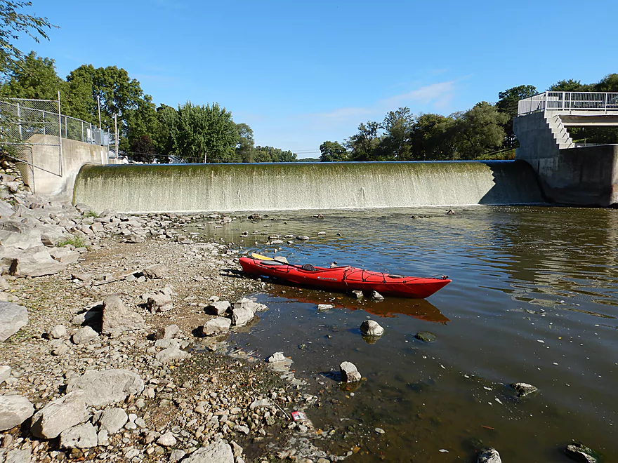
Date Paddled: September 2nd, 2017
Distance: 7.3 miles
Time: 3 hours 28 minutes
One of the better Lower Rock sections that starts really nice with a cool boulder garden. Unfortunately, that was the only major highlight as the rest of the trip was a bit too slow, muddy, and simple.
Read More...Harnischfeger Park to Kaul Park
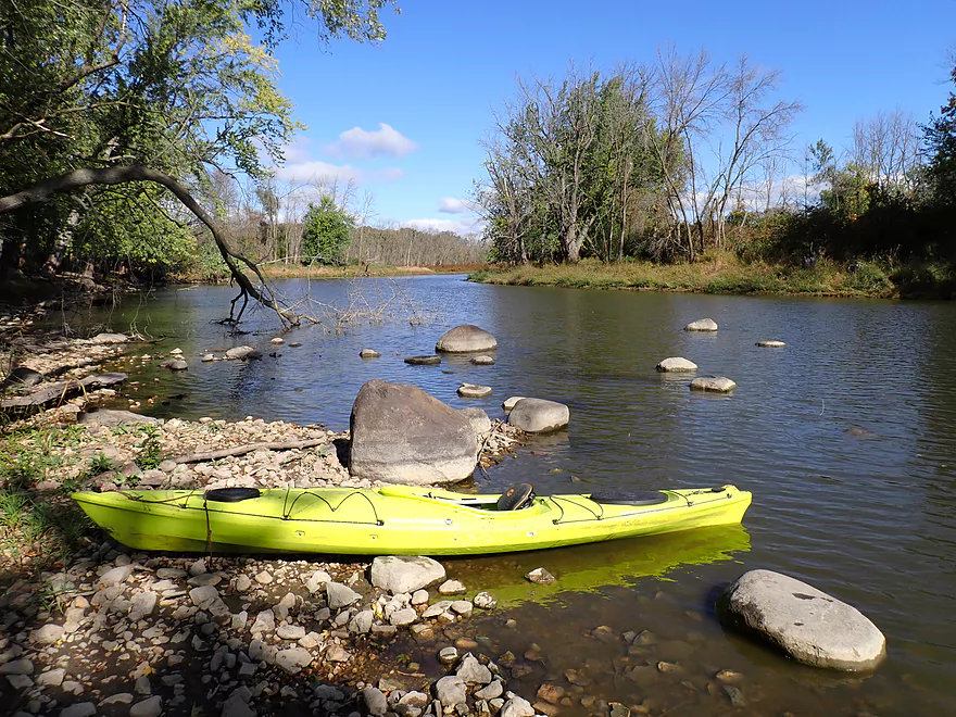
Date Paddled: October 7th, 2023
Distance: 5.0 miles
Time: Expect 2 hours
Despite slow current and some motorboat traffic, this is a pleasant and relatively secluded stretch of the Upper Rock River.
Read More...Kaul Park to Kanow Park
Date Paddled: October 26th, 2024
Distance: 5.9 miles
Time: Expect 3 hours
A surprisingly nice water trail with decent fall color. This is one of the more under-rated water trails in southeast Wisconsin.
Read More...Kanow Park to Hwy F
Date Paddled: November 14th, 2025
Distance: 5.3 miles
Time: Expect 2 hours
Despite slow current, muddy waters, and some highway noise...this was a pleasant trip and featured attractive tree reflections.
Read More...Hwy F to Hwy P
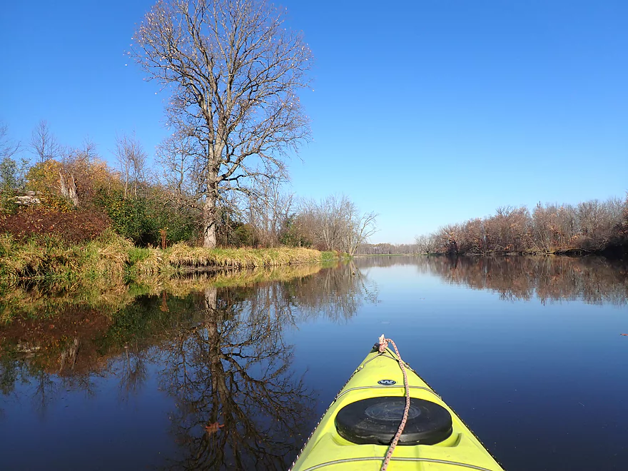
Date Paddled: October 29th, 2022
Distance: 6.0 miles
Time: Expect 3 hours
This was a trip with no interesting geology, almost no current, few rapids, and was honestly boring in spots. But despite all that, it turned out to be a surprisingly scenic, peaceful, and nice paddle.
Read More...Janesville Centerway Dam to Afton Launch
Date Paddled: June 20th, 2026
Distance: 3.2 miles
Time: Expect 1 hour
Thanks to a major dam removal in 2018, a new section of Rock River by Janesville is now open for exploration. It’s not a trip for everyone—the high water made the current shockingly fast and pushy, and you do paddle past a large chemical plant...but it made for an interesting experience. Highlights included a historic rock outcrop and cave, great waterfowl, and a revitalized, vibrant downtown scene.
Read More...Overview Map
Detailed Overview
East Branch:
- Upstream of Hillcrest Drive: I believe these portions are too congested to paddle.
- Hillcrest Drive to Hwy DW: 4.1 miles.
- Hillcrest Drive to Riveredge Park: 0.9 miles. Scenic stretch through the outskirts of Allenton with good clarity. However, there are two major logjams to portage and several minor logjams to squeak past.
- Riveredge Park to Hwy DW: 2.7 miles. An open stretch through wetgrass and a state natural area. One logjam needs to be portaged.
- Hwy DW to Hwy D: 5.5 miles. Outside of one nasty logjam cluster, this is a pretty open creek paddle through a protected wildlife area that might be decent.
- Hwy D Wayside to N. Pole Rd. Launch: 7.3 miles. A good wetland paddle prospect through Theresa Marsh. Maybe 1-2 downed trees on the upper part.
- Kohlsville River: Note, the Kohlsville River joins the East Branch here, but it seems too congested with downed trees to be feasible for paddling.
- N. Pole Rd to Gill Rd (East): 6.0 miles.
- N. Pole Rd Landing to River Edge Park: 1.3 miles. A slow, open, and marshy channel. Nice though.
- River Edge Park to Rock River Street/Dam: 0.5 miles. A nice town paddle through the community of Theresa. One dam to portage.
- Rock River Street/Dam to Hwy AY: 3.5 miles. One of my favorite stretches on the entire Rock River. While shallow in spots, it is scenic with nice woods, small boulder gardens and multiple light rapids.
- Hwy AY to Gill Road (East): 0.7 miles. A brief wooded stretch that is a nice paddle.
- Gill Road (East) to Hwy 67/Dam: 8.3 miles.
- Gill Road (East) to McArthur Road/Fink Creek: 4.7 miles. Starts boring, weedy, and slow, but gets nice with clear water and rocks later on. Gill Road (West) may be a viable halfway access.
- McArthur Road to Hwy 67/Dam: 3.6 miles. A less interesting paddle through a flowage and downtown Mayville with numerous alt take-outs.
- Hwy 67/Dam to Green Head Road Ramp: 6.4 miles.
- Hwy 67 to Hwy Y/Ziegler Park: 1.9 miles. One of the best paddling stretches on the entire Rock River with good current and small boulder gardens.
- Hwy Y to Hwy TW/Kekoskee Pond Ramp: 1.9 miles. A good stretch that includes a little bit of flowage paddling.
- Hwy TW to Green Head Road Ramp: 2.6 miles. An ok stretch as the river really slows and starts to turn into marsh.
- Green Head Road to N. Nebraska St. Ramp: 10.0 miles. The most popular route through Horicon Marsh. Known for its waterfowl.
South Branch:
- Upstream of E. Rock River Rd.: I suspect downed trees are too much of an issue for this to be navigable.
- E. Rock River Road to Hwy 49: 1.6 miles. Perhaps a cluster of downed trees in the middle and an electric fence upstream of Hwy 49.
- Hwy 49 to Waupun Park: 1.7 miles. Hwy 49 is not ideal for launching, but should be doable. A good prospect mostly through a golf course. Maybe 2 logjams?
- Waupun Park to E. Waupun Road: 7.2 miles. A good section.
- Waupun Park to Tanner Park: 3.1 miles. Great section though downtown Waupun. Alt access at Pine Street Park, Meadow View Park and Harris Mill Park.
- Tanner Park to Roadside Park: 3.2 miles. A pleasant paddle through a mixture of woods and open areas. A couple of logjam squeakers and one major portage.
- Roadside Park to E. Waupun Road: 0.9 miles. River widens, slows, and gets less interesting.
- E. Waupun Road to Dike Road: 10.0 miles. This is the northern unit of Horicon Marsh and is off limits to paddlers per National Wildlife Refuge rules.
- Dike Road to N. Nebraska St. Ramp: 5.6 miles. Am 80% sure you can drive on Dike Road from the east to launch in the ditch. Mostly a long, straight canal paddle through Horicon Marsh with perhaps interesting side canals to explore. You can also launch in a west canal by Burnett Ditch Road. The city of Horicon marks the confluence of the South and East Branches of the Rock River.
West Branch:
It’s a neat prospect, but I suspect the logjam situation is too much (I could be wrong).
Main Branch:
- N. Nebraska St. to Legion Park/Dam: 0.9 miles. An ok section through downtown Horicon.
- Legion Park to River Bend Park: 1.1 miles. Simple river segment…probably nothing too special.
- River Bend Park to Lions Park: 8.8 miles. A large and probably uninteresting flowage. If you get permission to take out at Ox-Bo Marine, you can avoid much of the flowage paddling.
- Lions Park to Elmwood Park: 7.2 miles. Trip starts nice with a great boulder garden, but becomes less interesting as the current dies.
- Elmwood Park to Hwy MM: 4.4 miles. An interesting prospect recommended by Frank Piraino.
- Hwy MM to Harnischfeger Park: 6.9 miles.
- Harnischfeger Park to Kaul Park/Hwy CW: 5.1 miles. Despite slow current and some motorboat traffic, this is a pleasant and relatively secluded stretch of the Upper Rock River.
- Kaul Park to Kanow Park: 5.7 miles. Despite a lack of current, dead trees, and some mud, this is a very nice leg and one of the better stretches on the Rock River.
- Kanow Park to Hwy F: 5.0 miles.
- Hwy F to Wayside Park: 0.9 miles. Short but scenic leg.
- Wayside Park to Rockvale Road: 1.9 miles. Slow, simple stretch but pleasant.
- Rockvale Road to Hwy F: 2.4 miles. Scenic leg.
- Hwy F to Hwy P: 6.0 miles. This isn't an elite trip with slow current and no exotic scenery. But it is pleasant and one of the nicer legs on the Lower Rock.
- Hwy P to Dam1st/Front St.: 5.6 miles. Probably an uninteresting flowage paddle.
- Dam(1st)/Front St. to Dam(2nd)/S. 1st Street: 2.6 miles. Possibly a unique paddle through downtown Watertown.
- Watertown Dam/1st Street to Cappie's Landing: 3.5 miles. A mediocre prospect.
- Cappie's Landing to Crossroads Landing: 9.3 miles. The put-in is SE of Hwy 26 via Jefferson Road. This segment is more undeveloped, but is still probably mediocre at best.
- Crossroad Landing to Hwy B Boat Launch: 1.6 miles. Maybe a boring mini leg...it does pass under busy I-94.
- Hwy B to Lubahn Park/N. Watertown Ave: 4.1 miles. Probably uninteresting.
- Lubahn Park to Tensfeldt Park: 2.3 miles. Paddling through downtown Jefferson might be unique, but there is a dam to portage. Many alt landings in Jefferson.
- Tensfeldt Park to Klement Park: 4.2 miles. Probably an uninteresting tweener section between Jefferson and Fort Atkinson.
- Klement Park to Lorman Bicentennial Park: 3.1 miles. A weak prospect through downtown Fort Atkinson.
- Lorman Park to Hwy 26 Ramp: 3.3 miles. A weak prospect.
- Hwy 26 to E. Knudsen Road Ramp: 11.8 miles. Mostly boring paddling on Lake Koshkonong. Many other launches on the lake.
- E. Knudsen Road Ramp to Hwy M/Dam: 3.4 miles. Boring flowage.
- Hwy M/Dam to Hwy 14: 8.2 miles. Probably uninteresting.
- Hwy 14/Rock River Park to Centerway Dam: 4.7 miles. This is a slow impounded stretch that flows through the north end of Janesville. It does include some nice parks and wooded hills, but also many piers, riverside developments, and motorboat traffic. There are many intermediate access points to choose from (see overview map for details).
- Centerway Dam to Afton Boat Launch: 2.9 miles. An interesting leg through Janesville's revitalized riverfront. Highlights include unique bridges, building art, some rapids, a cave, good waterfowl and a recently removed dam. This section can be tricky if not dangerous due to fast currents (especially when water levels are high). There are many alternative access points to choose from that aren't listed.
- Afton Boat Launch to Happy Hollow Park: 7.8 miles. A mediocre section with wooded banks, but mostly beat-up flood-bottom trees. The river here is mostly free flowing and not impounded by any dams.
- Happy Hollow Park to Preservation Park Boat launch: 3.2 miles.
- Preservation Park to Wooton Park Boat Ramp: 3.0 miles. Start of urban paddling in Beloit. Numerous other launch options in Beloit proper.
- Further Rock River Trips: From here on, you are in Illinois. For further information see “Paddling Illinois” or Rockrivertrail.com.
Nearby Guages
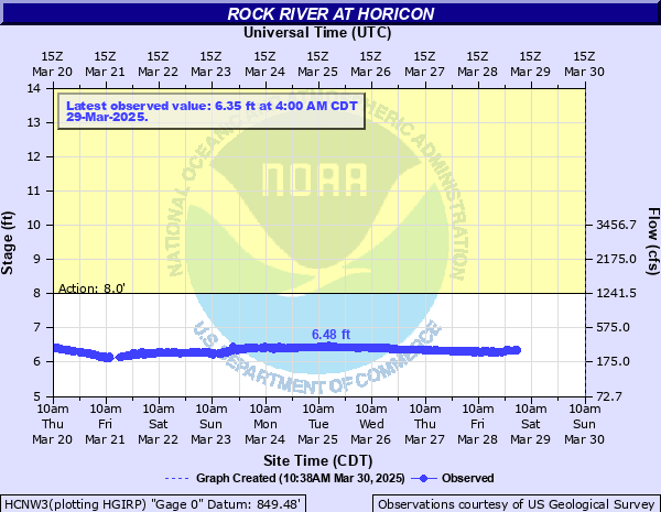
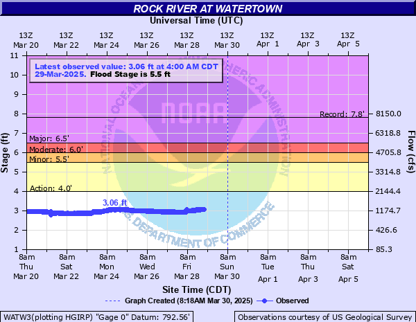
Videos
Comments
How did your trip turn out? Questions or comments? Feel free to leave your feedback.
