
Launching below the dam is only for determined paddlers
Scenic though
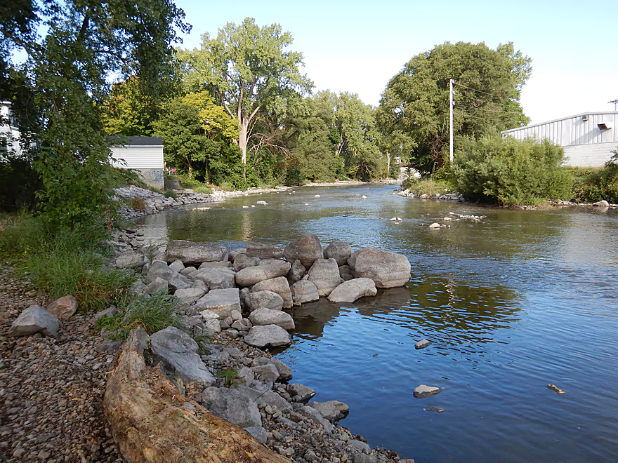
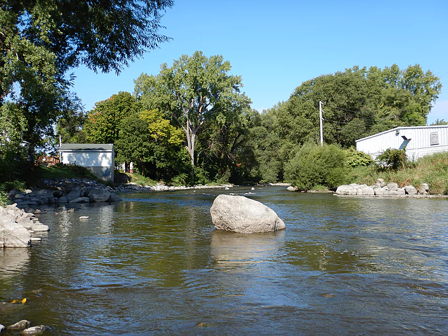
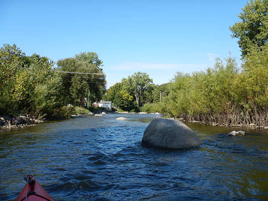
Start of a really neat boulder garden
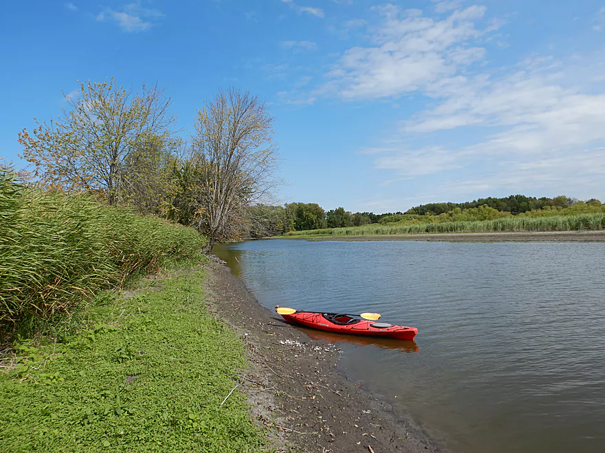
Most paddlers will launch south of Lions Park
Where there is a marked put-in
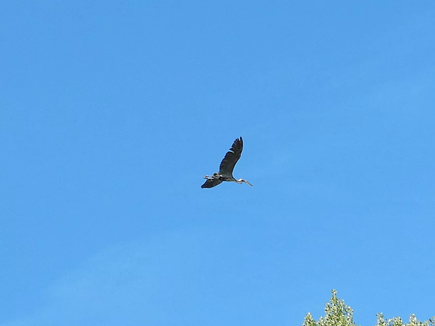
On cue, a blue heron flies above the heron sign
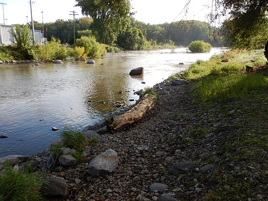
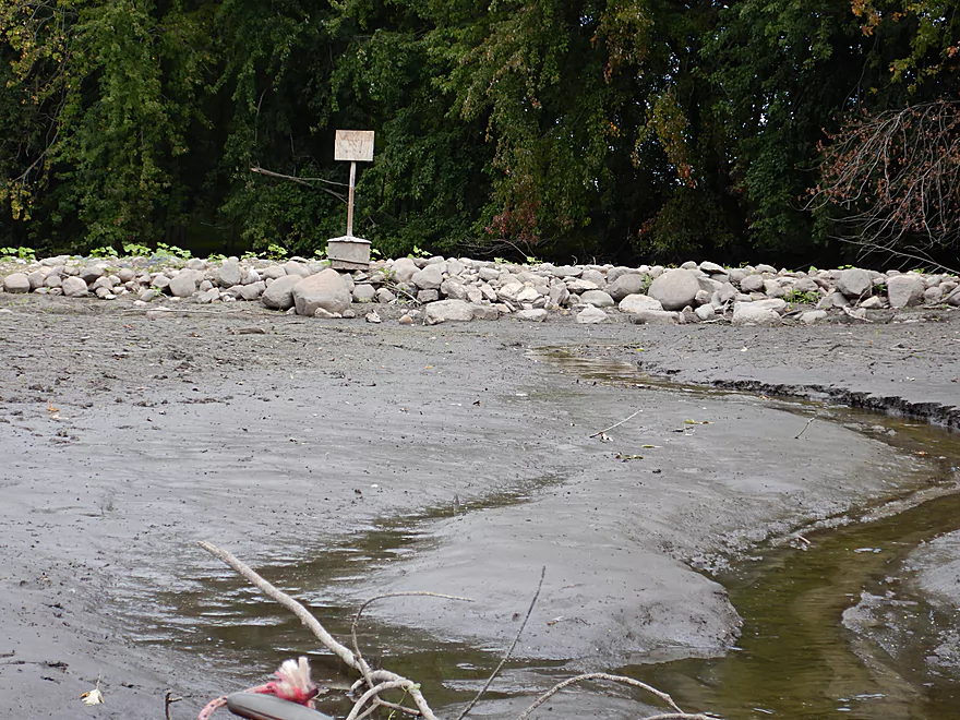
Where is the mud? This took me by surprise.
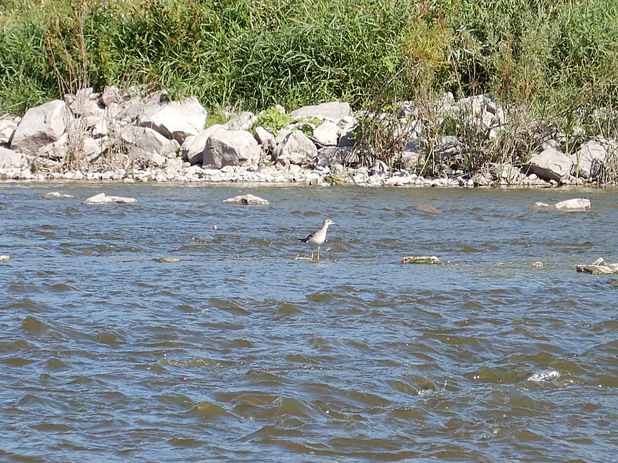
A sandpiper is living dangerously
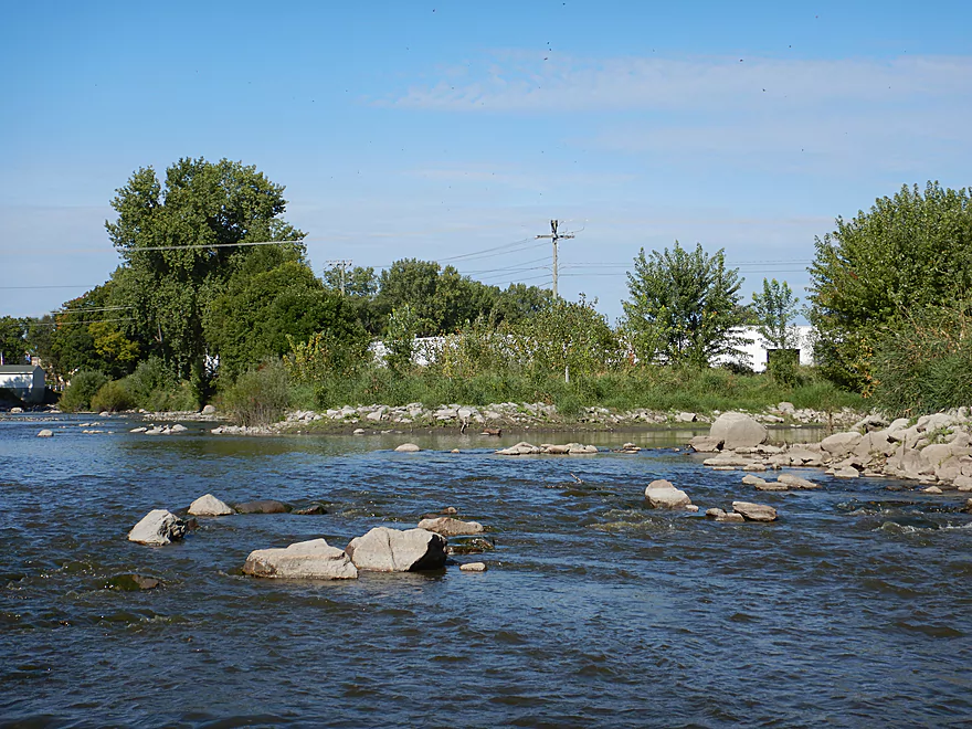
One of several light rapids
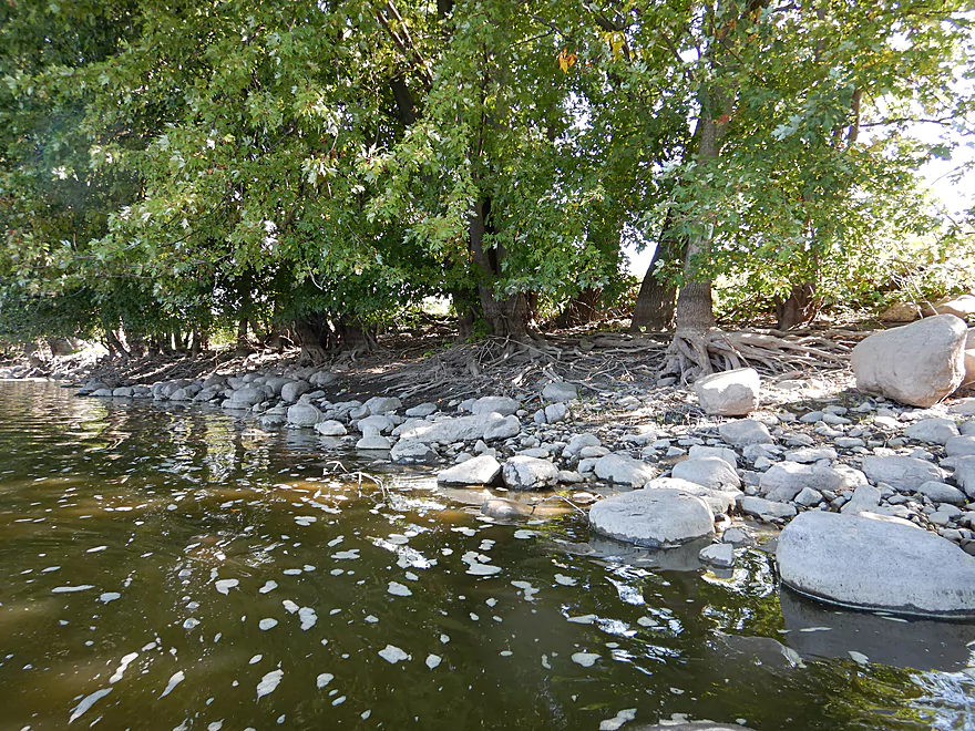
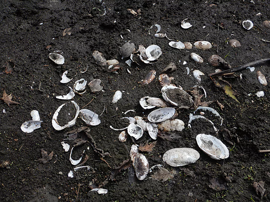
Rocks stained white from the mud
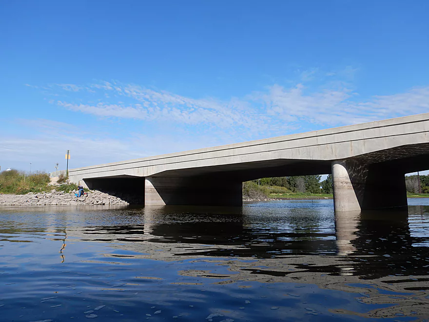
Paddling under Hwy 60
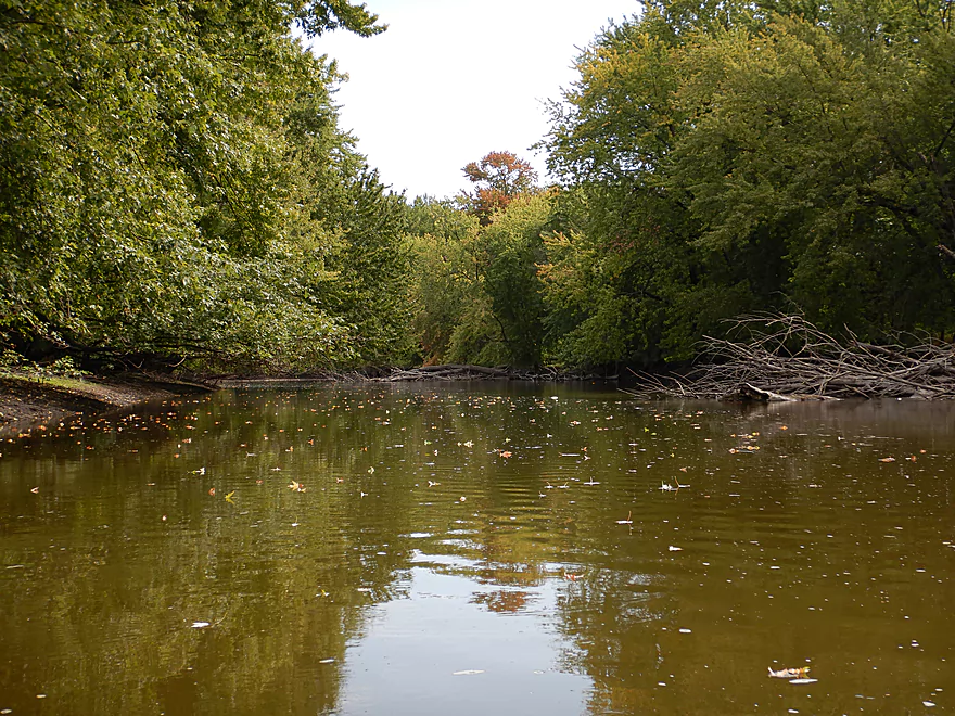
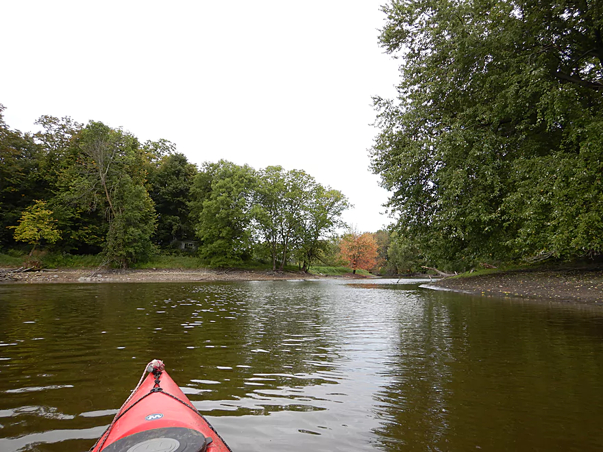
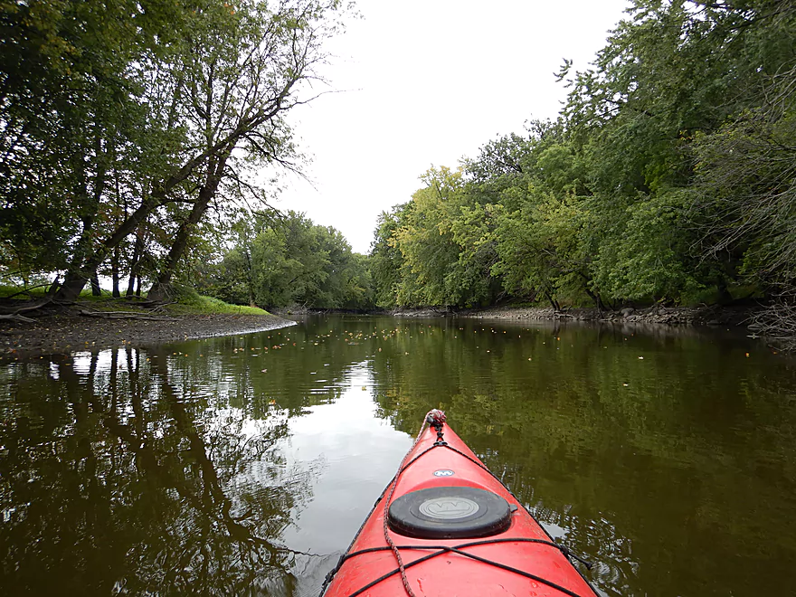
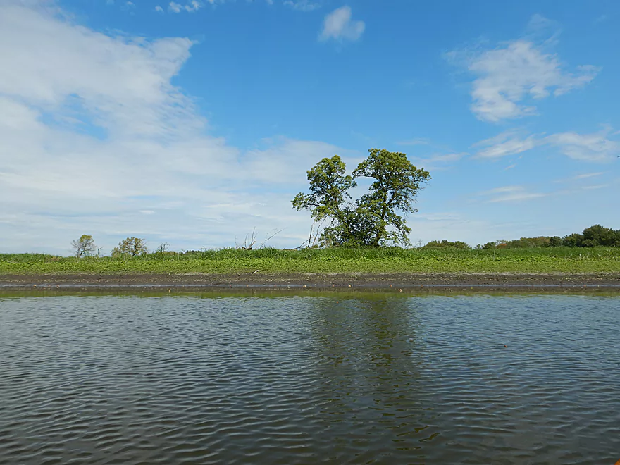
The river really changes here
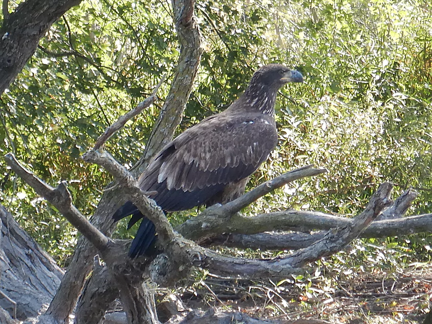
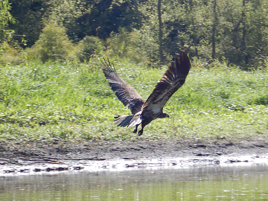
This eagle let me get really close
A group of them were pestering some blue herons
Note the high water mark and the really high water mark
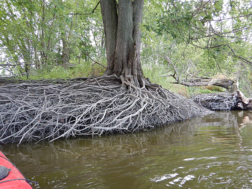
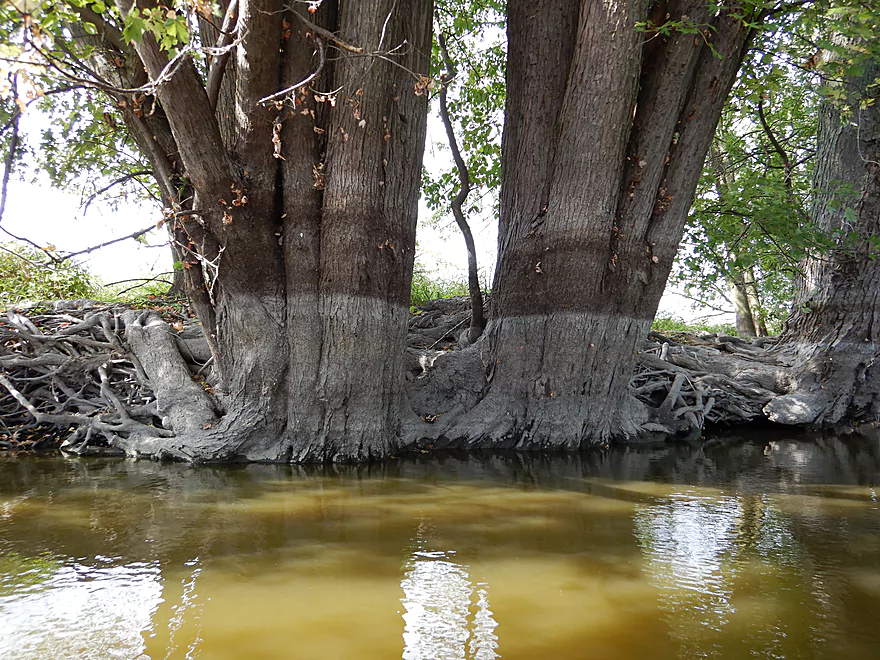
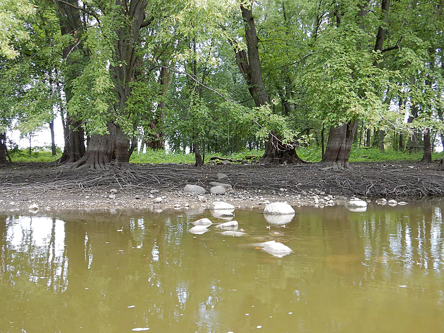
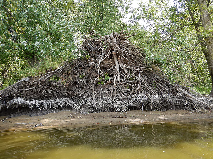
Some naked roots
Somebody constructed a rock dam over one of the marsh inlets
Sandpiper / Heron juxtaposition
A rare reprieve from the mud
Too early (this was Labor Day weekend)
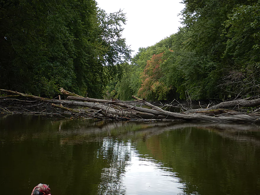
There is always a way through
Some raccoon had quite the dinner
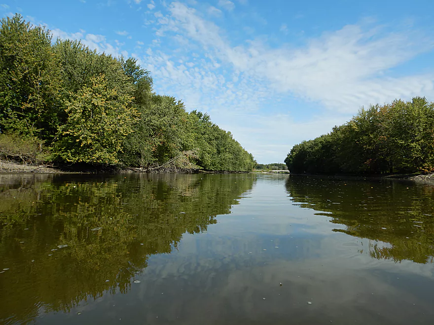
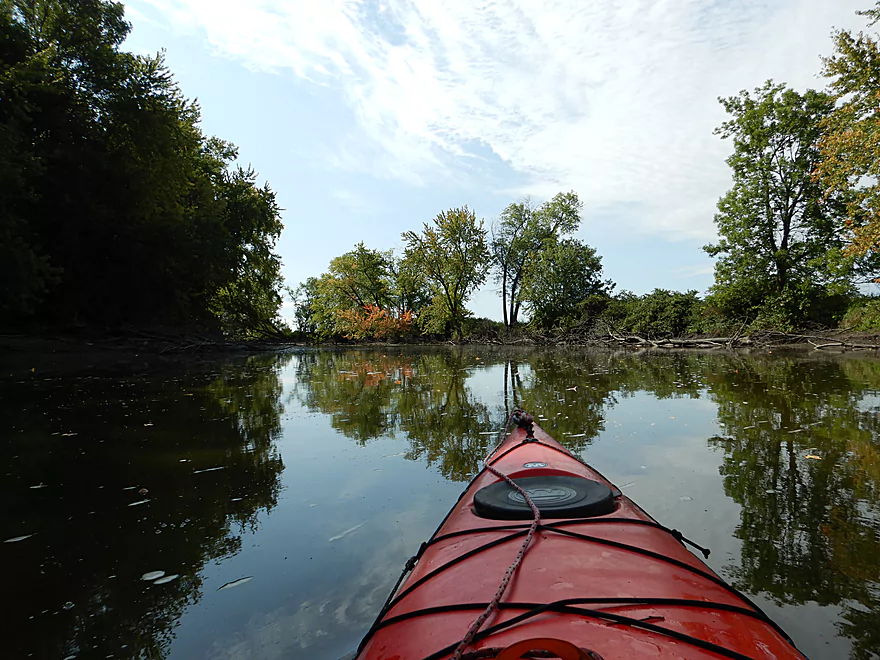
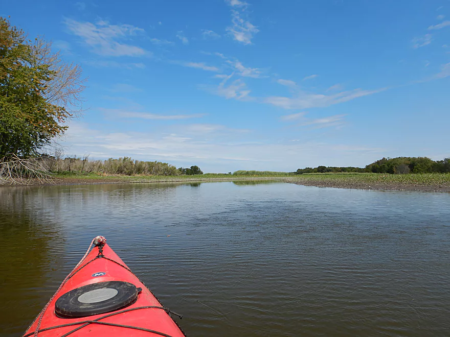
Just a very big, slow channel
These paddlers were actually doing their trip…upstream
These floodplain banks often are submerged by large lakes
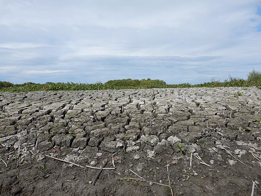
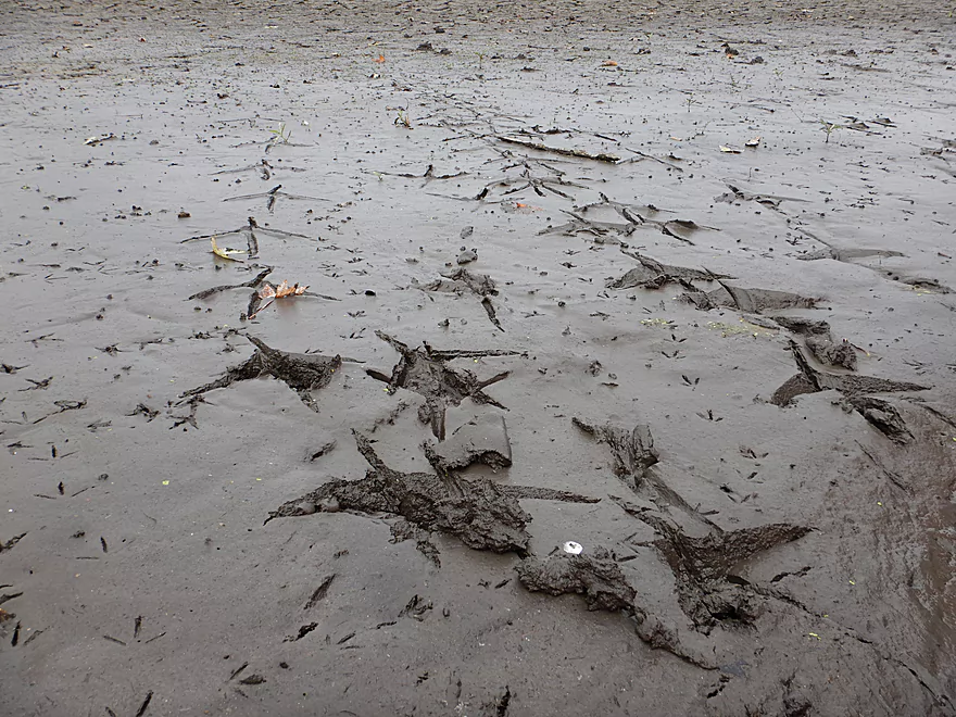
Cool crack pattern
Peeled like an orange
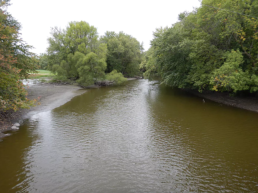
The Rubicon River enters the Rock
Taking out at Elmwood Drive
Very nice take-out
Paddlers can continue 4 more miles to Hwy MM
But it looks like more of the same
Rock River – Hustisford

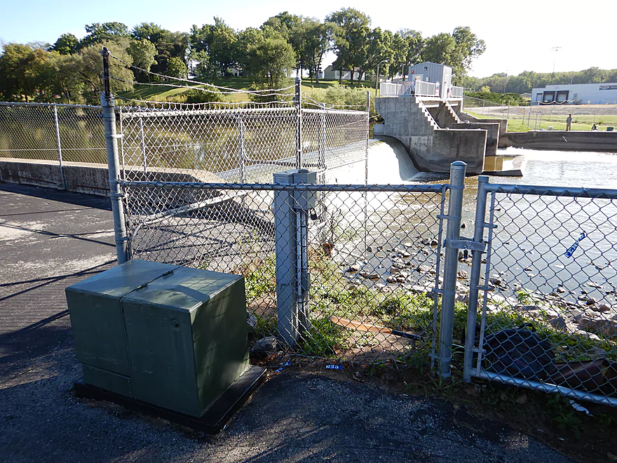
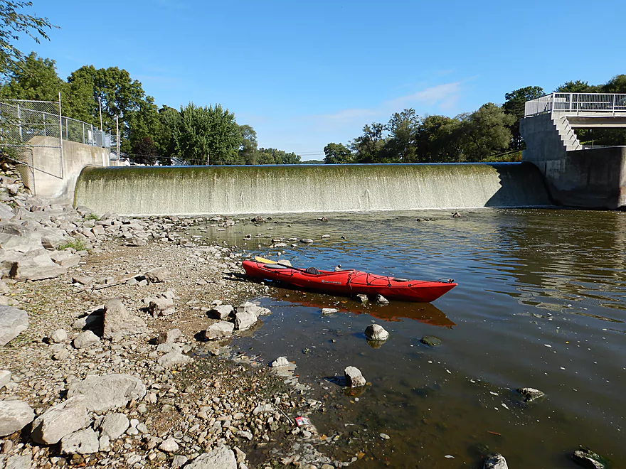
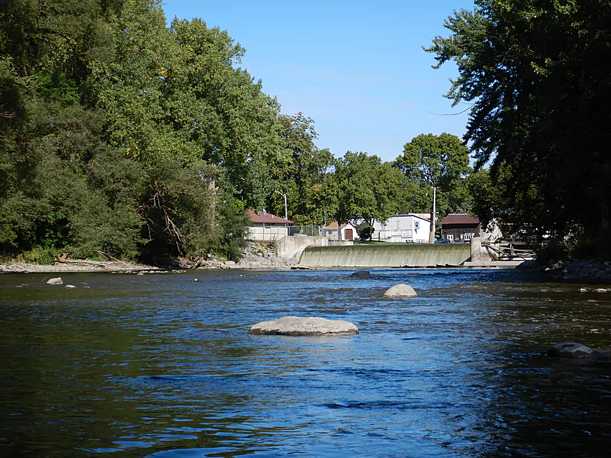
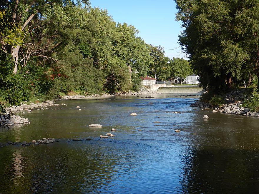
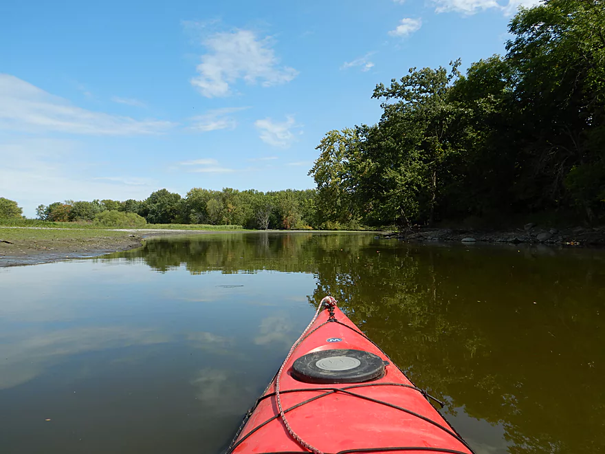
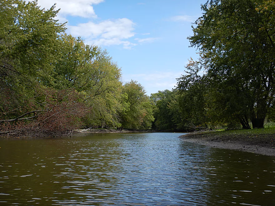
I started the trip in Hustisford directly below the Sinissippi Lake dam where I was pleasantly surprised to see a large boulder garden and a collection of small rapids. Typically “Rock River” is an oxymoron, but because the dam acts as a sediment trap, the native rocky substrate is revealed in all its glory. Before settlers came and ruined the river with topsoil erosion, much of the Rock River was actually like this, hence its namesake. This short section in Hustisford was easily the best part of the entire trip, but unfortunately, most of the trip was not like this.
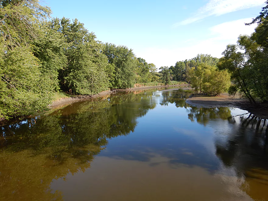
After I passed under the Hwy 60 bridge, the river changed dramatically. The channel was wide, deep, and straight, while the banks consisted of a thin layer of silver maple. It’s not a horrible section as it was peaceful with no signs of development or agriculture after Hwy 60, but really was nothing special.
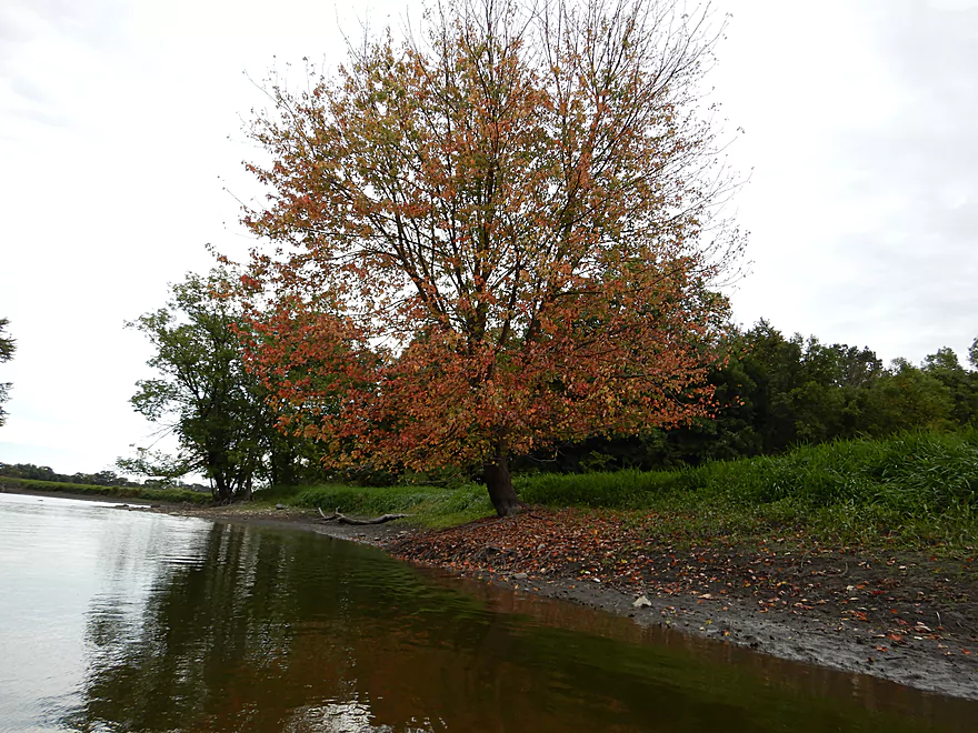
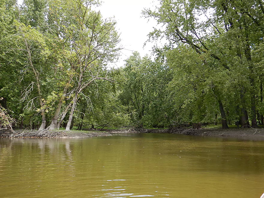
Soon the river enters a flood plain, and like most bottomlands was quite messy and dirty. Here the shoreline was flat and consisted of exposed mud banks…the type you didn’t want to step on. Along the shore you could see the high water mark on the trees marked two feet up as a ghostly shadow along the naked tree roots. The Rock does flood often and it is not uncommon to have to wait until later summer to be able to paddle it during ideal conditions. In high water, the channel easily overflows the banks and it is possible to get somewhat lost.
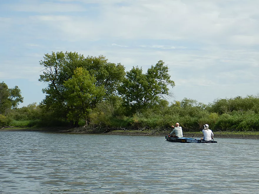
About halfway into the trip I passed some paddlers in a homemade canoe…going upstream! Really that was just how slow this section was. With a good south-to-north wind, it actually might be interesting to do this trip in reverse. The main advantage being that you would be getting front-lit scenery (bright greens and bright blues) as opposed to backlit scenery (more washed out and less interesting because of the sun angle).
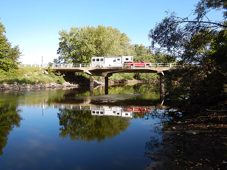
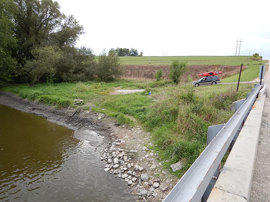
Near the end of the trip, the river narrows and the Rubicon River merges with the Rock. Here there is a really nice take-out for paddlers at Elmwood Road.
In summary, this was a trip that started on a really high note, but the broad, slow, muddy channel just lacked any magic…hence the two star rating. This is subjective though and you may have a positive experience with more ideal conditions (I paddled under overcast skies with a light rain and a bit of a headwind).
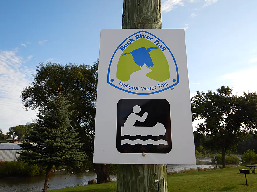
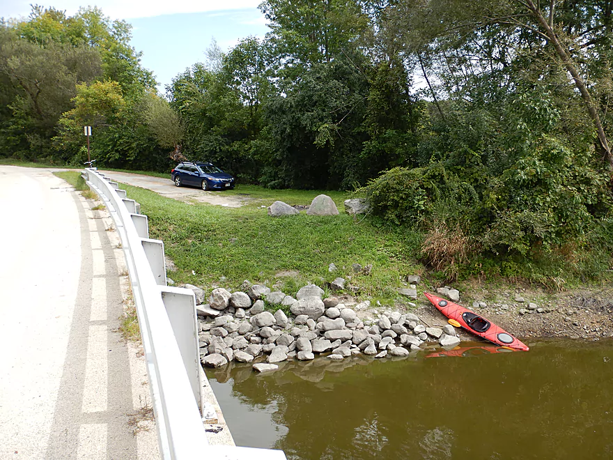
Most paddlers will start their trip in Lion’s Park, Hustisford at the east end of Griffith Street. Here you can park by the shoulder (near the Rock River Trail sign) and simply drag your boat down the grassy hill to easily launch by the rocks.
I did not do this as I wanted to take pictures of the dam and experience more of the boulder garden, so I launched at the north end of Lion’s Park by Ann Street directly below the dam. Here too you can park by the shoulder, but the issue is a chain fence that separates paddlers from the water. This is a bit odd as it is public property and is perhaps an overzealous safety precaution. At any rate I did have to scale the fence and drag my boat over rocks, but after that it was a great way to start the trip. Public restrooms are available at the north end of the park.
There is a nice take-out southeast of the Elmwood Road bridge. Here there is a dedicated pull-off and a faint trail that leads to the water.
For those wanting a longer trip (why??), you can continue 4 more miles to Hwy MM. Here there is a steep gravel pull-off southwest of the bridge with easy access to the water.
The bike shuttle isn’t too bad at 5.0 miles and only a few minor hills (102′ of ascent and 82′ of descent). You will want to peddle east of the river not west. While the west section (on Riverview Road) is a third of a mile shorter it is much hillier. Hwy 60 is a crazy, busy road with a small shoulder but you can sneak around most of it by taking Hilltop Road.
This is a pretty safe river. While there are some light rapids in Hustisford, the current pretty much dies after Hwy 60. In fact this might be the slowest non-flowage river I’ve ever paddled. There are downed trees on the river, but the channel is so big it is easy to paddle around them. The big concern is wind. I don’t suggest doing this trip if there is a decent south-to-north headwind.
I went during a relatively shallow period, yet the channel was still consistently deep (between 2-4′). The one exception was the brief boulder garden and rapids in Hustisford which were bumpy. Here is a super rough depth guide based on the upstream gauge at Horicon.
- 0-50 CFS: A low depth, but I actually think the river should still be mostly navigable.
- 51-100 CFS: A good depth which reveals some of the character along the shoreline. I went at 75 CFS.
- 101-200 CFS: A doable depth, but some of the shoreline character might be lost.
- 201-500 CFS: A high depth. Easily paddleable, but a lot of character would be submerged.
- 501+ CFS: IMO the river would be too unattractive and muddy at this point. The banks might be breached in some areas (these are only rough guesses).
There were a LOT of carp below the dam and I hit a few with my kayak and paddle. I also saw a lot of eagles (or the same group of 3-4 that I kept flushing downstream). It would be curious to know if an eagle could kill a full-sized carp (I’m not sure). There were also a lot of great blue herons who were quite agitated by the eagles. Several of the eagles swooped close to the herons, but generally speaking the herons could bank more sharply and easily escape. Eagles have been known to kill great blue herons though… Lastly, I did see a great white egret which is always a treat.
Detailed Overview
East Branch:
- Upstream of Hillcrest Drive: I believe these portions are too congested to paddle.
- Hillcrest Drive to Hwy DW: 4.1 miles.
- Hillcrest Drive to Riveredge Park: 0.9 miles. Scenic stretch through the outskirts of Allenton with good clarity. However, there are two major logjams to portage and several minor logjams to squeak past.
- Riveredge Park to Hwy DW: 2.7 miles. An open stretch through wetgrass and a state natural area. One logjam needs to be portaged.
- Hwy DW to Hwy D: 5.5 miles. Outside of one nasty logjam cluster, this is a pretty open creek paddle through a protected wildlife area that might be decent.
- Hwy D Wayside to N. Pole Rd. Launch: 7.3 miles. A good wetland paddle prospect through Theresa Marsh. Maybe 1-2 downed trees on the upper part.
- Kohlsville River: Note, the Kohlsville River joins the East Branch here, but it seems too congested with downed trees to be feasible for paddling.
- N. Pole Rd to Gill Rd (East): 6.0 miles.
- N. Pole Rd Landing to River Edge Park: 1.3 miles. A slow, open, and marshy channel. Nice though.
- River Edge Park to Rock River Street/Dam: 0.5 miles. A nice town paddle through the community of Theresa. One dam to portage.
- Rock River Street/Dam to Hwy AY: 3.5 miles. One of my favorite stretches on the entire Rock River. While shallow in spots, it is scenic with nice woods, small boulder gardens and multiple light rapids.
- Hwy AY to Gill Road (East): 0.7 miles. A brief wooded stretch that is a nice paddle.
- Gill Road (East) to Hwy 67/Dam: 8.3 miles.
- Gill Road (East) to McArthur Road/Fink Creek: 4.7 miles. Starts boring, weedy, and slow, but gets nice with clear water and rocks later on. Gill Road (West) may be a viable halfway access.
- McArthur Road to Hwy 67/Dam: 3.6 miles. A less interesting paddle through a flowage and downtown Mayville with numerous alt take-outs.
- Hwy 67/Dam to Green Head Road Ramp: 6.4 miles.
- Hwy 67 to Hwy Y/Ziegler Park: 1.9 miles. One of the best paddling stretches on the entire Rock River with good current and small boulder gardens.
- Hwy Y to Hwy TW/Kekoskee Pond Ramp: 1.9 miles. A good stretch that includes a little bit of flowage paddling.
- Hwy TW to Green Head Road Ramp: 2.6 miles. An ok stretch as the river really slows and starts to turn into marsh.
- Green Head Road to N. Nebraska St. Ramp: 10.0 miles. The most popular route through Horicon Marsh. Known for its waterfowl.
South Branch:
- Upstream of E. Rock River Rd.: I suspect downed trees are too much of an issue for this to be navigable.
- E. Rock River Road to Hwy 49: 1.6 miles. Perhaps a cluster of downed trees in the middle and an electric fence upstream of Hwy 49.
- Hwy 49 to Waupun Park: 1.7 miles. Hwy 49 is not ideal for launching, but should be doable. A good prospect mostly through a golf course. Maybe 2 logjams?
- Waupun Park to E. Waupun Road: 7.2 miles. A good section.
- Waupun Park to Tanner Park: 3.1 miles. Great section though downtown Waupun. Alt access at Pine Street Park, Meadow View Park and Harris Mill Park.
- Tanner Park to Roadside Park: 3.2 miles. A pleasant paddle through a mixture of woods and open areas. A couple of logjam squeakers and one major portage.
- Roadside Park to E. Waupun Road: 0.9 miles. River widens, slows, and gets less interesting.
- E. Waupun Road to Dike Road: 10.0 miles. This is the northern unit of Horicon Marsh and is off limits to paddlers per National Wildlife Refuge rules.
- Dike Road to N. Nebraska St. Ramp: 5.6 miles. Am 80% sure you can drive on Dike Road from the east to launch in the ditch. Mostly a long, straight canal paddle through Horicon Marsh with perhaps interesting side canals to explore. You can also launch in a west canal by Burnett Ditch Road. The city of Horicon marks the confluence of the South and East Branches of the Rock River.
West Branch:
It’s a neat prospect, but I suspect the logjam situation is too much (I could be wrong).
Main Branch:
- N. Nebraska St. to Legion Park/Dam: 0.9 miles. An ok section through downtown Horicon.
- Legion Park to River Bend Park: 1.1 miles. Simple river segment…probably nothing too special.
- River Bend Park to Lions Park: 8.8 miles. A large and probably uninteresting flowage. If you get permission to take out at Ox-Bo Marine, you can avoid much of the flowage paddling.
- Lions Park to Elmwood Park: 7.2 miles. Trip starts nice with a great boulder garden, but becomes less interesting as the current dies.
- Elmwood Park to Hwy MM: 4.4 miles. An interesting prospect recommended by Frank Piraino.
- Hwy MM to Harnischfeger Park: 6.9 miles.
- Harnischfeger Park to Kaul Park/Hwy CW: 5.1 miles. Despite slow current and some motorboat traffic, this is a pleasant and relatively secluded stretch of the Upper Rock River.
- Kaul Park to Kanow Park: 5.7 miles. Despite a lack of current, dead trees, and some mud, this is a very nice leg and one of the better stretches on the Rock River.
- Kanow Park to Hwy F: 5.0 miles.
- Hwy F to Wayside Park: 0.9 miles. Short but scenic leg.
- Wayside Park to Rockvale Road: 1.9 miles. Slow, simple stretch but pleasant.
- Rockvale Road to Hwy F: 2.4 miles. Scenic leg.
- Hwy F to Hwy P: 6.0 miles. This isn't an elite trip with slow current and no exotic scenery. But it is pleasant and one of the nicer legs on the Lower Rock.
- Hwy P to Dam1st/Front St.: 5.6 miles. Probably an uninteresting flowage paddle.
- Dam(1st)/Front St. to Dam(2nd)/S. 1st Street: 2.6 miles. Possibly a unique paddle through downtown Watertown.
- Watertown Dam/1st Street to Cappie's Landing: 3.5 miles. A mediocre prospect.
- Cappie's Landing to Crossroads Landing: 9.3 miles. The put-in is SE of Hwy 26 via Jefferson Road. This segment is more undeveloped, but is still probably mediocre at best.
- Crossroad Landing to Hwy B Boat Launch: 1.6 miles. Maybe a boring mini leg...it does pass under busy I-94.
- Hwy B to Lubahn Park/N. Watertown Ave: 4.1 miles. Probably uninteresting.
- Lubahn Park to Tensfeldt Park: 2.3 miles. Paddling through downtown Jefferson might be unique, but there is a dam to portage. Many alt landings in Jefferson.
- Tensfeldt Park to Klement Park: 4.2 miles. Probably an uninteresting tweener section between Jefferson and Fort Atkinson.
- Klement Park to Lorman Bicentennial Park: 3.1 miles. A weak prospect through downtown Fort Atkinson.
- Lorman Park to Hwy 26 Ramp: 3.3 miles. A weak prospect.
- Hwy 26 to E. Knudsen Road Ramp: 11.8 miles. Mostly boring paddling on Lake Koshkonong. Many other launches on the lake.
- E. Knudsen Road Ramp to Hwy M/Dam: 3.4 miles. Boring flowage.
- Hwy M/Dam to Hwy 14: 8.2 miles. Probably uninteresting.
- Hwy 14/Rock River Park to Centerway Dam: 4.7 miles. This is a slow impounded stretch that flows through the north end of Janesville. It does include some nice parks and wooded hills, but also many piers, riverside developments, and motorboat traffic. There are many intermediate access points to choose from (see overview map for details).
- Centerway Dam to Afton Boat Launch: 2.9 miles. An interesting leg through Janesville's revitalized riverfront. Highlights include unique bridges, building art, some rapids, a cave, good waterfowl and a recently removed dam. This section can be tricky if not dangerous due to fast currents (especially when water levels are high). There are many alternative access points to choose from that aren't listed.
- Afton Boat Launch to Happy Hollow Park: 7.8 miles. A mediocre section with wooded banks, but mostly beat-up flood-bottom trees. The river here is mostly free flowing and not impounded by any dams.
- Happy Hollow Park to Preservation Park Boat launch: 3.2 miles.
- Preservation Park to Wooton Park Boat Ramp: 3.0 miles. Start of urban paddling in Beloit. Numerous other launch options in Beloit proper.
- Further Rock River Trips: From here on, you are in Illinois. For further information see “Paddling Illinois” or Rockrivertrail.com.
Trip Map
Overview Map
Video
Photos Size:
My wife paddled this on 9/28, on a cool overcast day. The river was over 8′ so the river banks were all flooded over. It wasn’t a spectacular trip at all, but the serenity was very enjoyable. We did come across two log jams though. The first one, we were able to paddle around through the weeds. My wife did ended up flipping mud in my face with her paddle, she thought this was hilarious. For the second log jam, we had to put the paddles down and grab onto branches to maneuver through, we were in a tandem kayak. This was only our second paddling adventure, the first was with a canoe. We wanted to try an easy paddle since this was our first time in a tandem kayak. Keeping in mind we are still novices, any recommendations for something with some faster flow in Southeast Wisconsin?
Yeah, this is a slow and uninteresting section of the Rock. It’s endured a lot of floods this year which likely are the cause of the two new jams you experienced. As for better recommendations… I highly recommend the Bark River which I think is really cool. Other ideas would include the Waupaca River, Crystal River, and Sheboygan River.
I did the section from Harnischfeger to Cw in the early morning on 7/9/19 as part of a 2 rivers in one day trip. The river had been high earlier in the week and had dropped quite a bit, so it was fast (for the rock) but there was a lot of exposed mud on the banks, but still was an OK trip. A lot of bird and animal life, and other than a couple of farms no development. There are nice facilities at the put in, none at the take out, but both put-in and take-out were very easy and parking very close by. A very relaxing easy trip, but nothing spectacular, I’m glad I paired it with a fantastic trip on the Beaver Dam River. The 2 rivers couldn’t be more different. One wide, slow, and muddy, the other narrow fast and fairly clean, the only thing they have in common is that they are both short and take less than 2 hours to do.
Yeah, I think the Rock loses most of its magic after Horicon. I think there are still interesting sections on the East Branch to be explored yet though…and they are on my todo list. Thanks for the updates.