
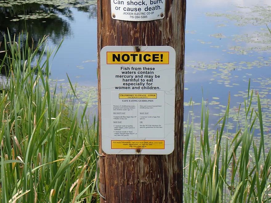
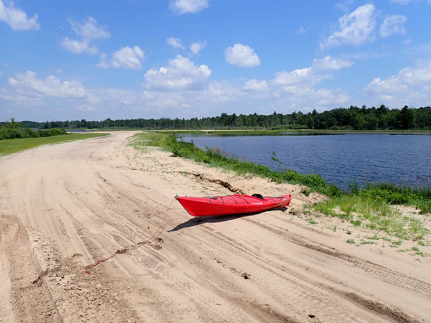
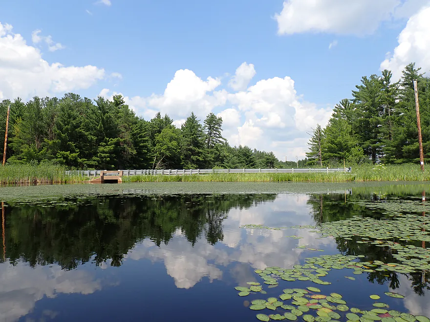
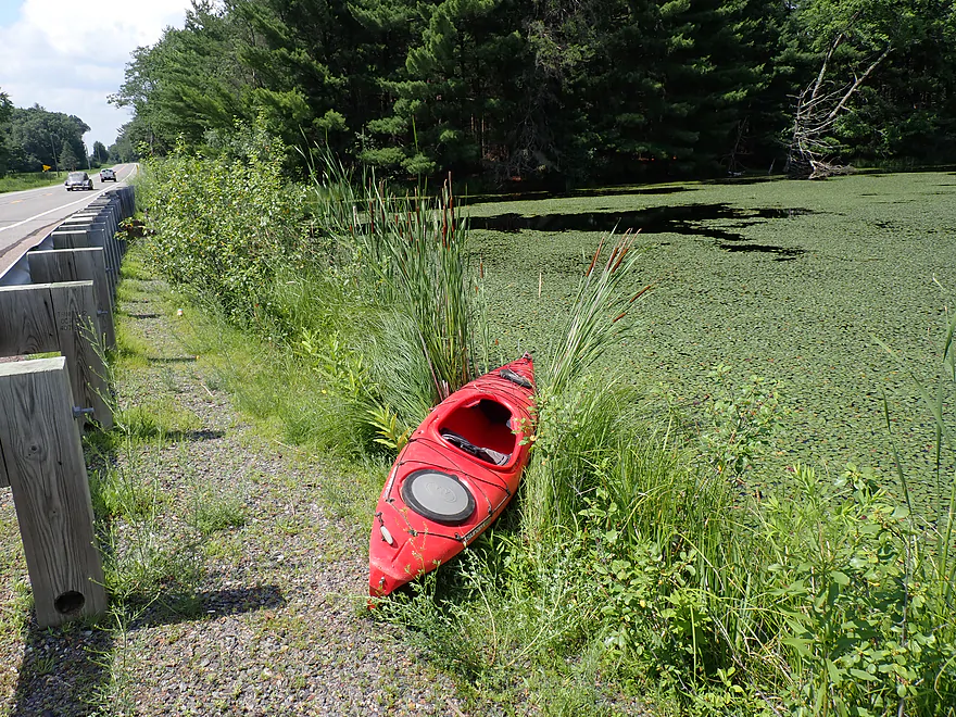
Welcome to Cranberry Flowage…which apparently has a mercury advisory
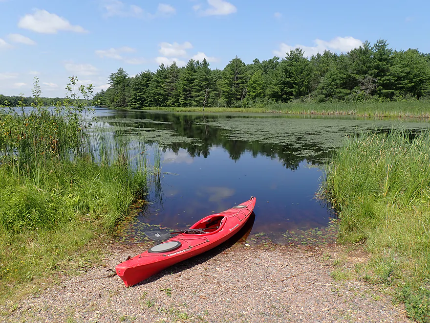
Otherwise a great public put-in
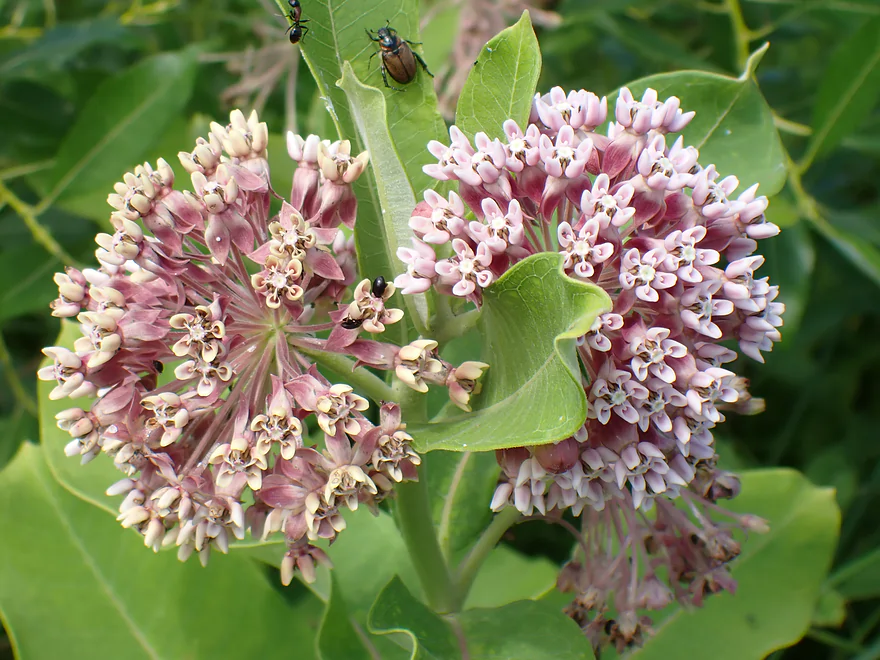
Milkweed flowers (with beetles)
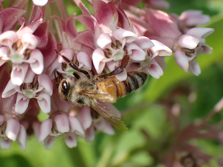
Upside down honey bee
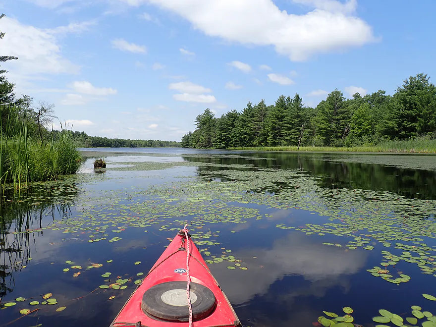
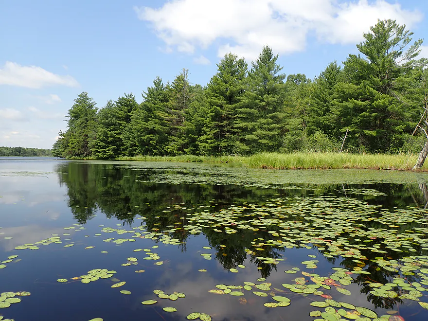
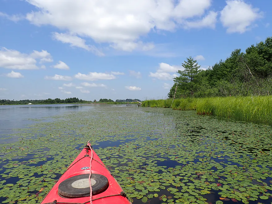
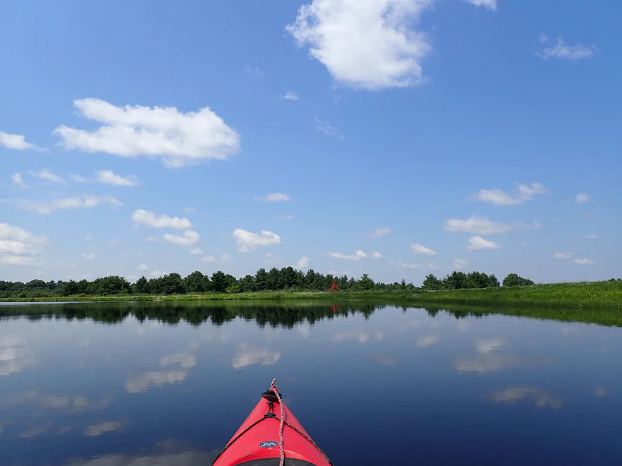
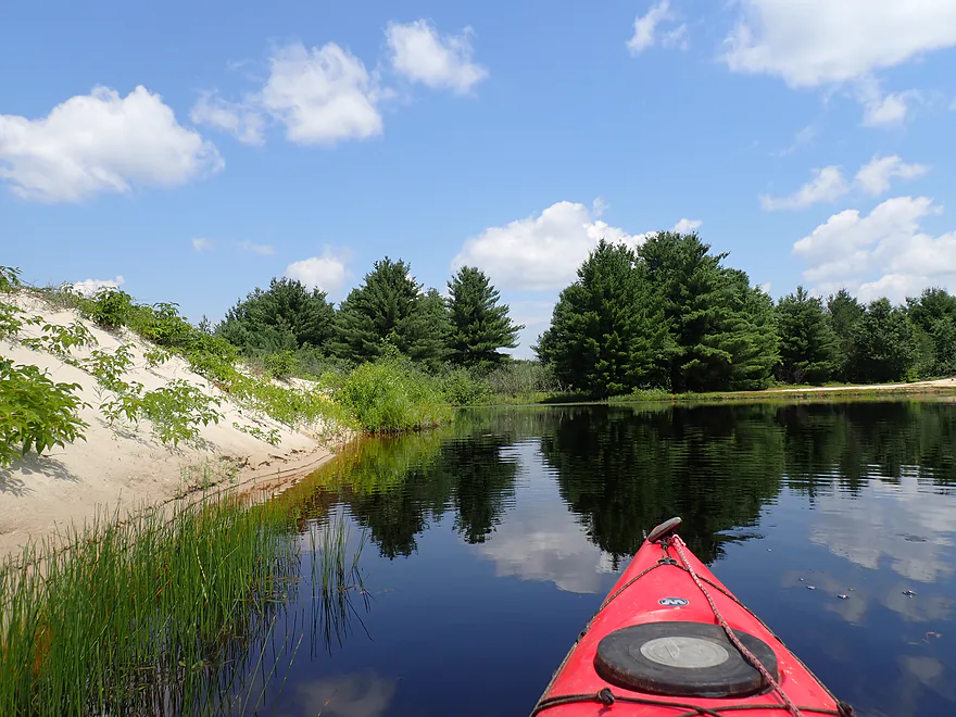
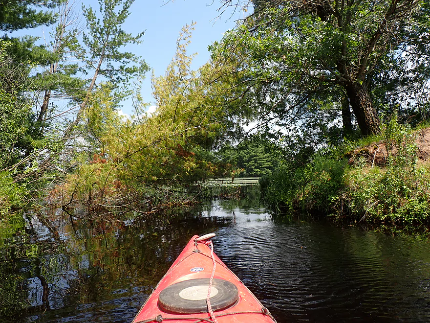
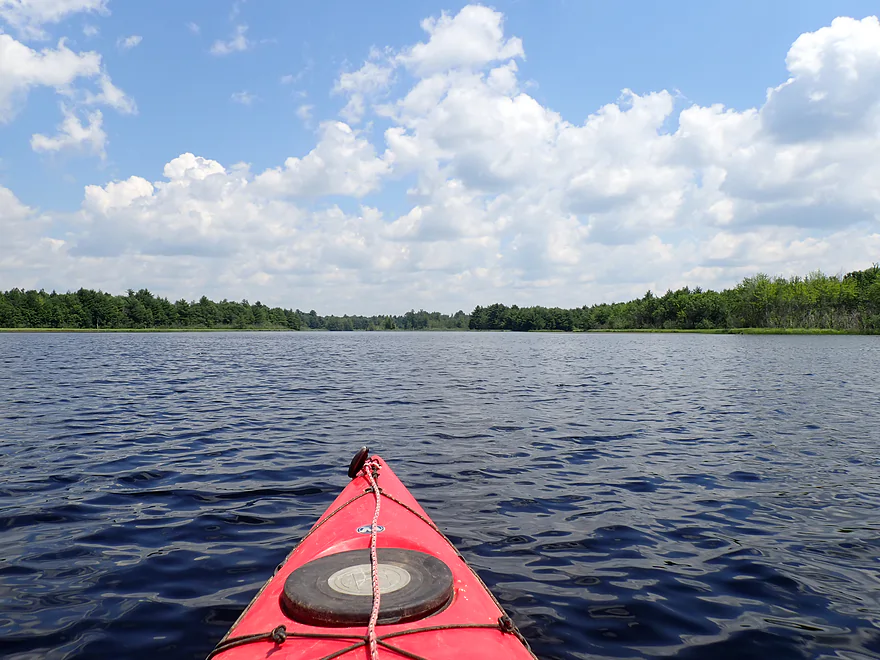
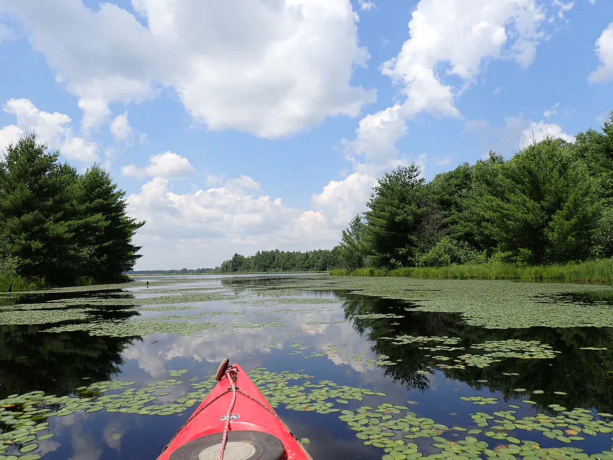
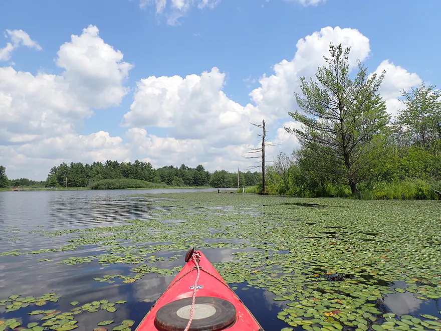
Out onto the first lake
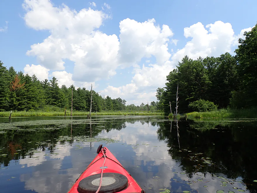
Heading north
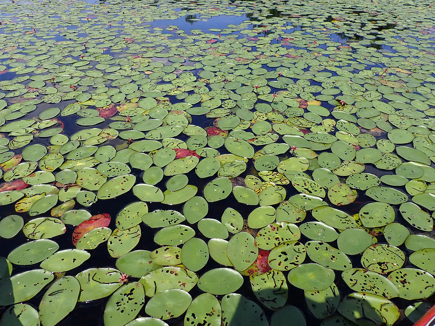
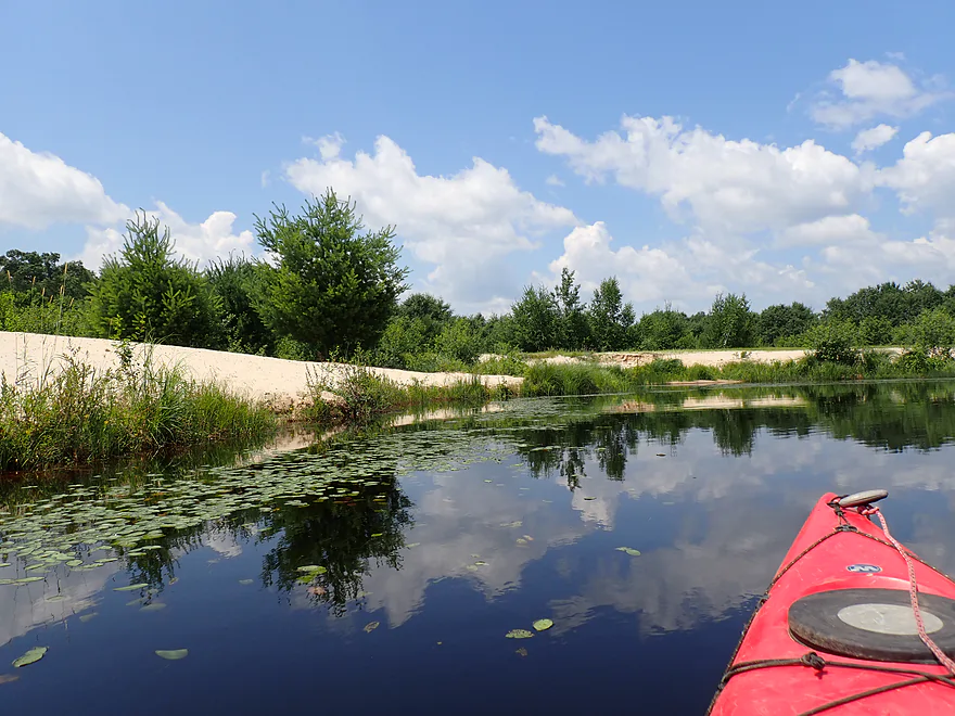
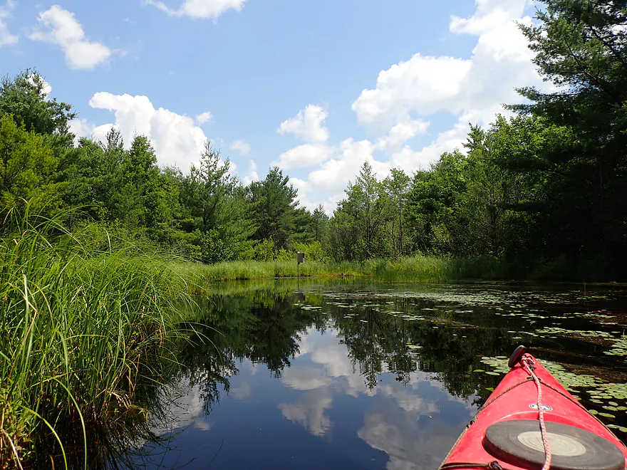
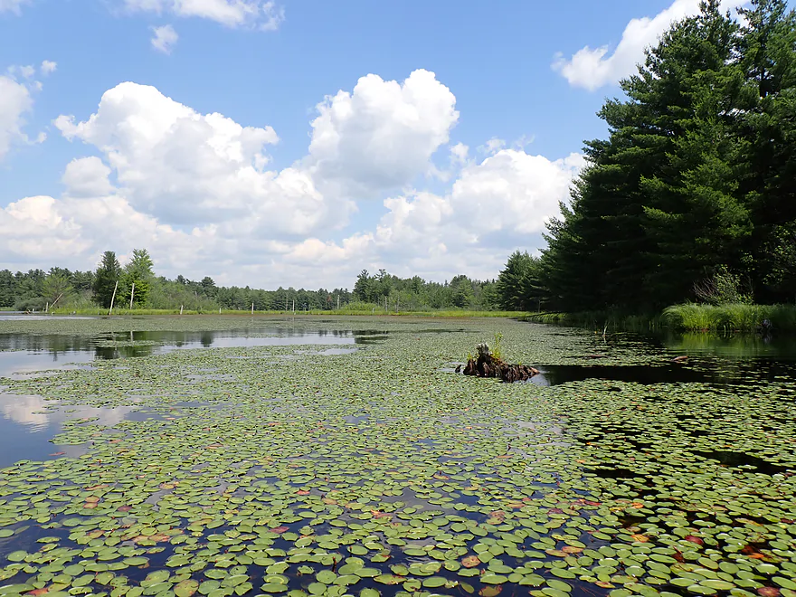
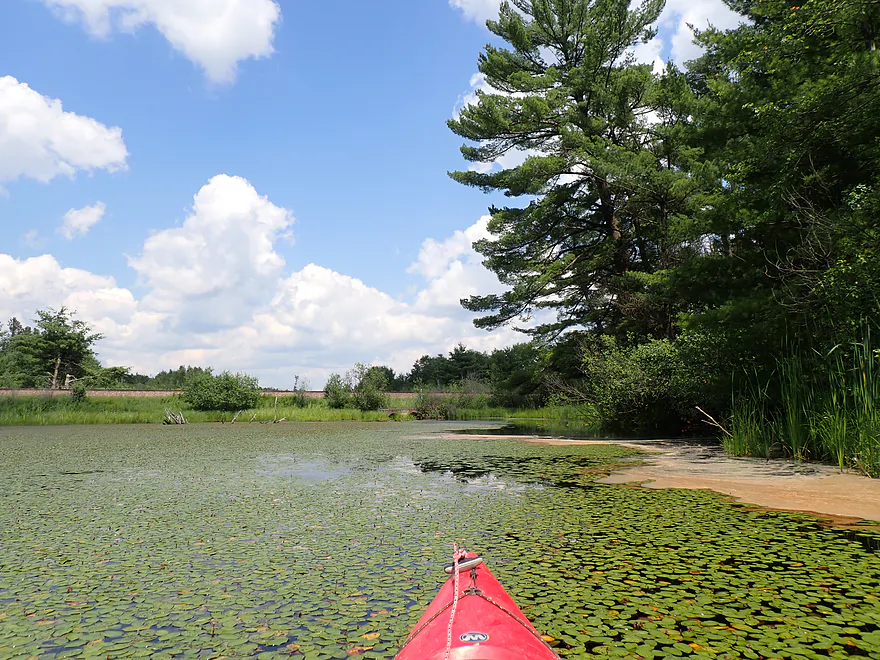
Cool lily pattern
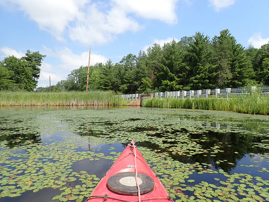
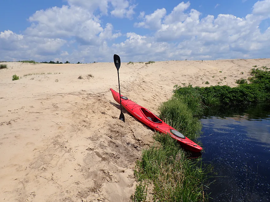
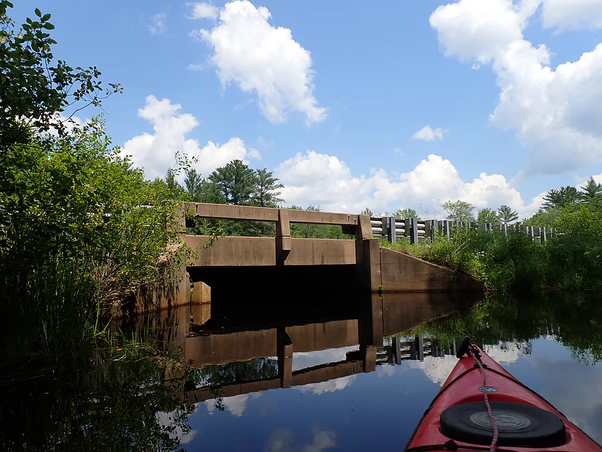
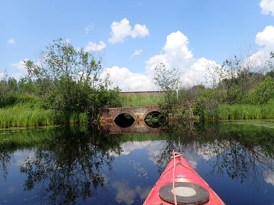
Stopped by a low bridge
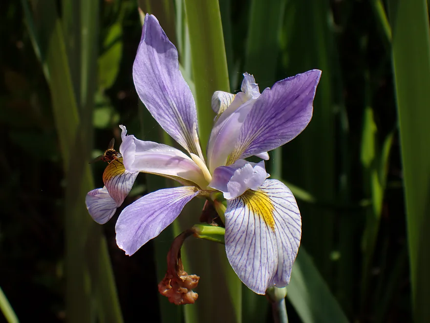
Blue flag (wild iris)
Continuing south
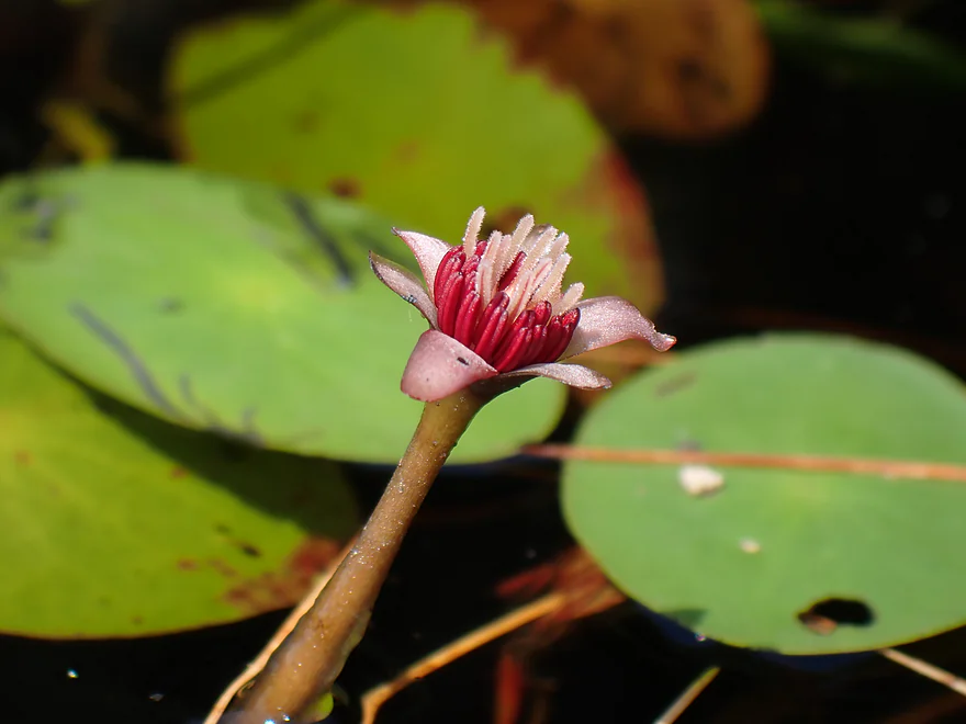
A water shield flower (one of the less showy water lilies)
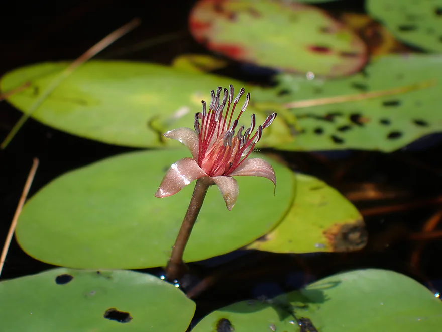
A water shield flower with male anthers
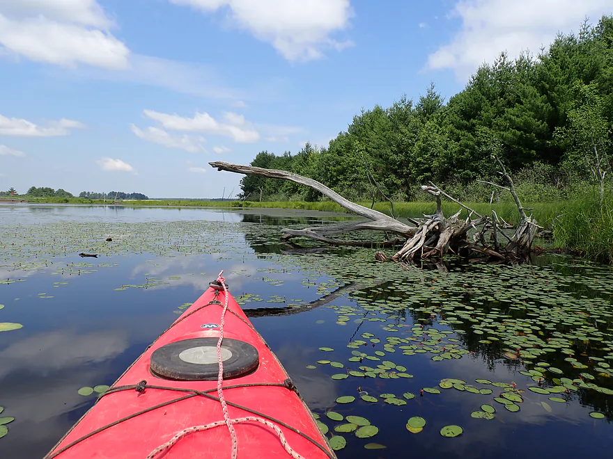
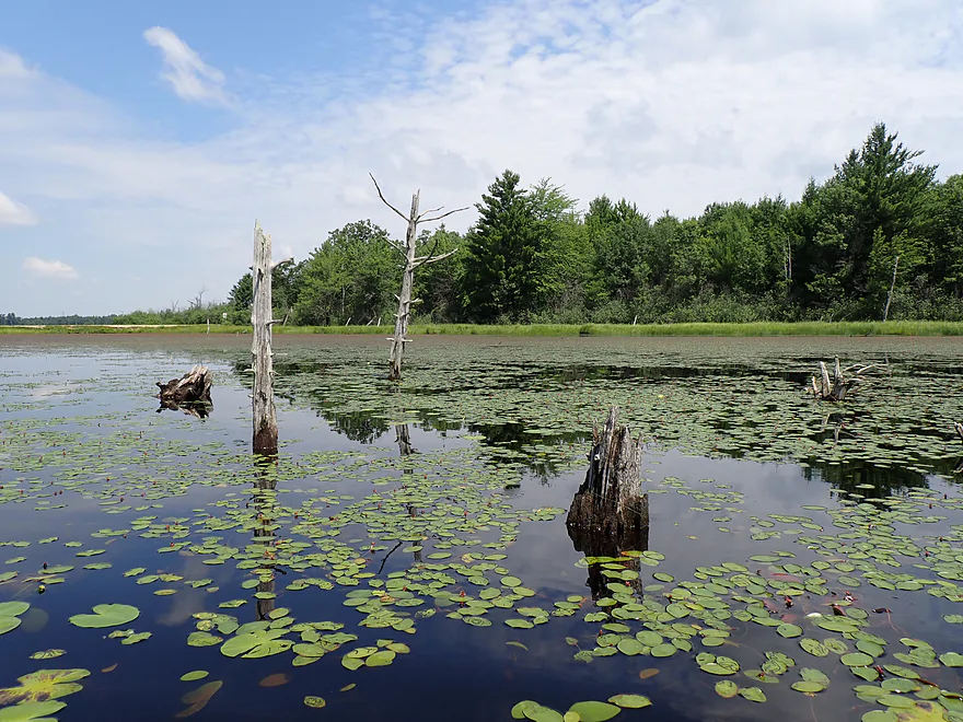
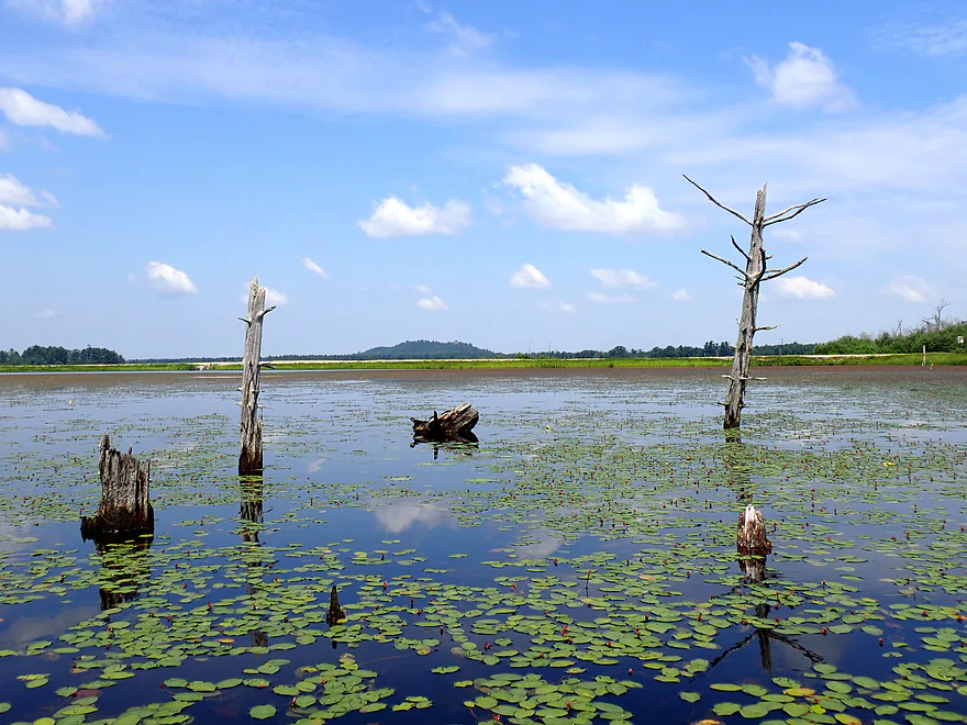
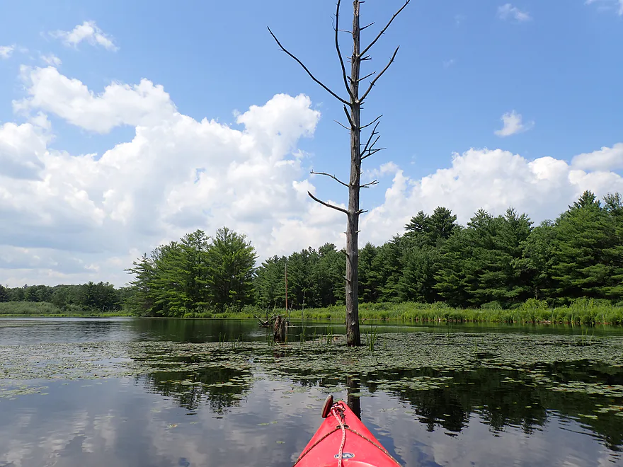
Trees killed by the flowage
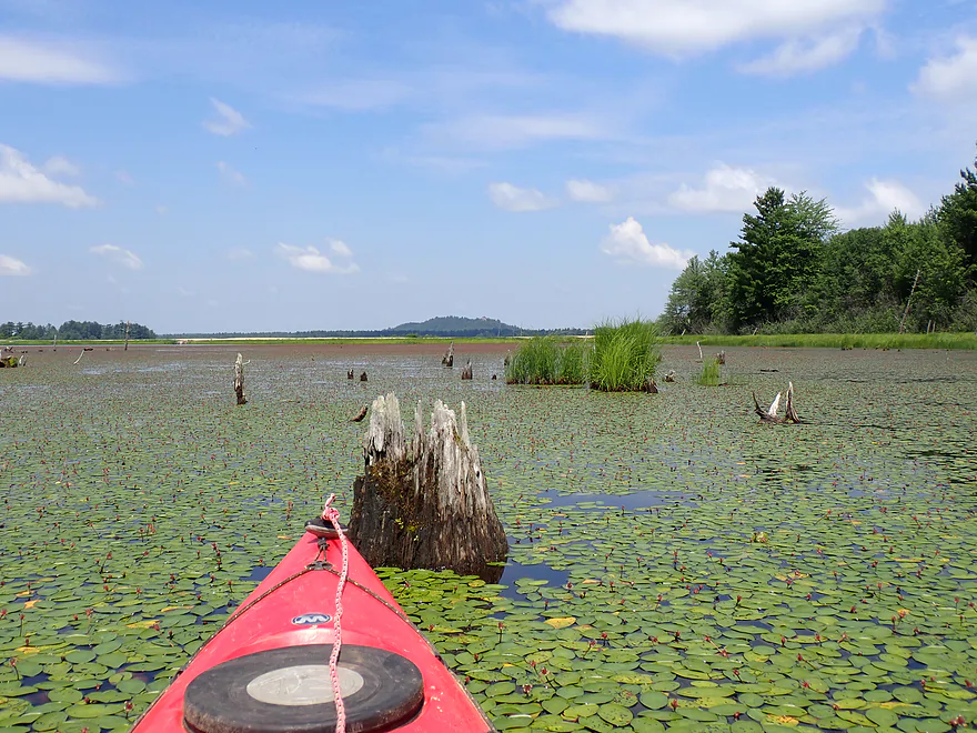
If you squint…you can see the Castle Mound outcrop in the distance
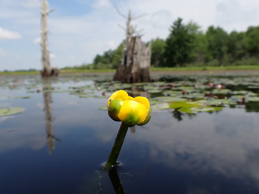
A single bullhead lily flower
Scenic area
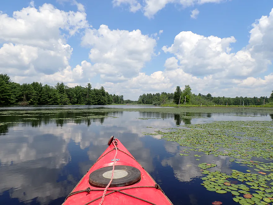
Heading south
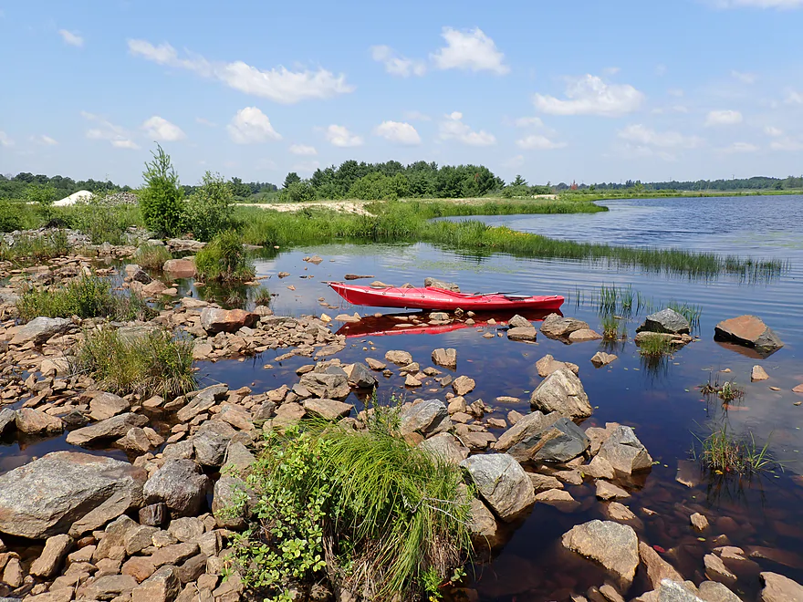
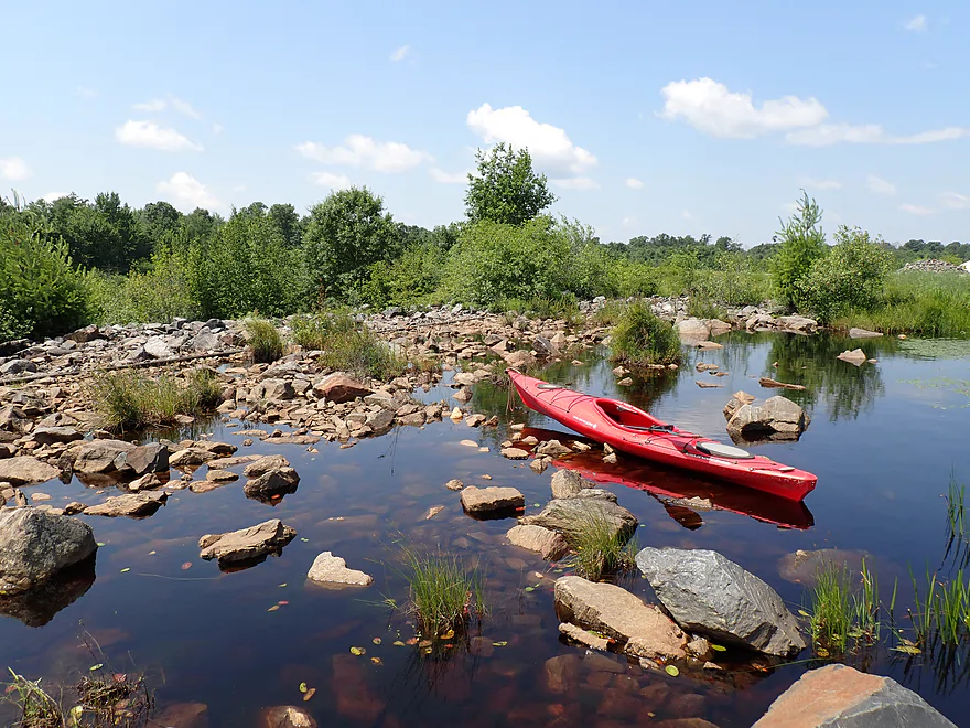
Rocky stretch at the southwest portion of the lake
I think it is a flood overflow channel
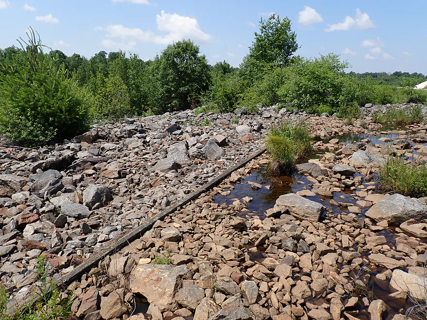
I could see a buried retaining wall
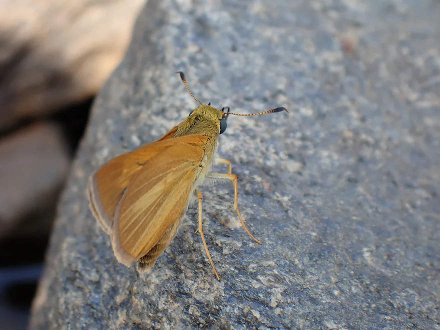
A friendly butterfly
The dam on “Lake #1”
Portaging the dam and dike
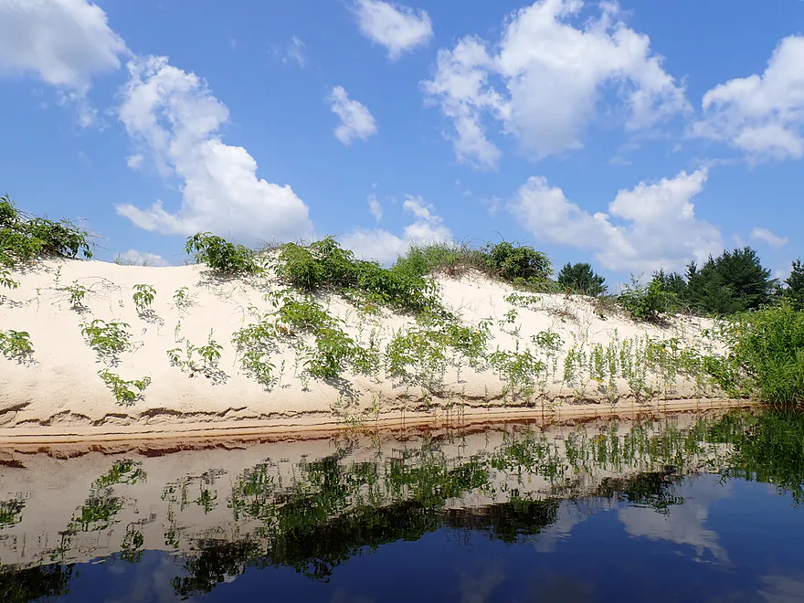
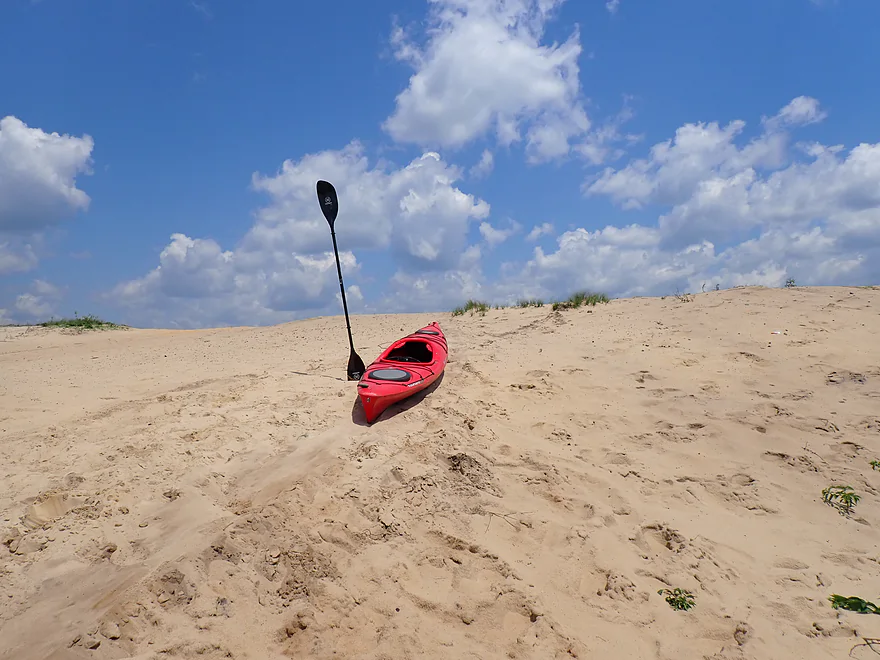
Surprisingly sandy area
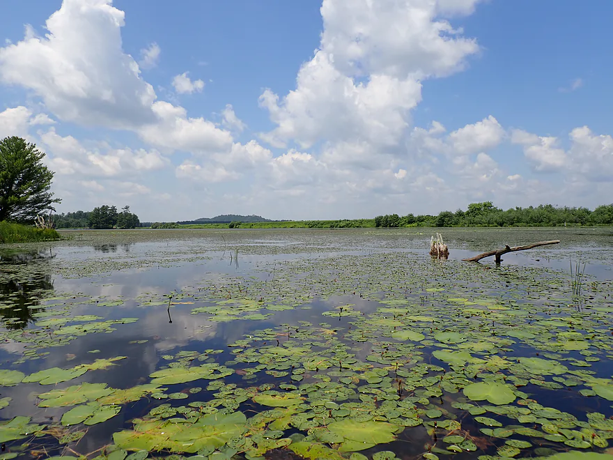
Downstream, Perry Creek empties into a second lake
The sand here was very clean and light
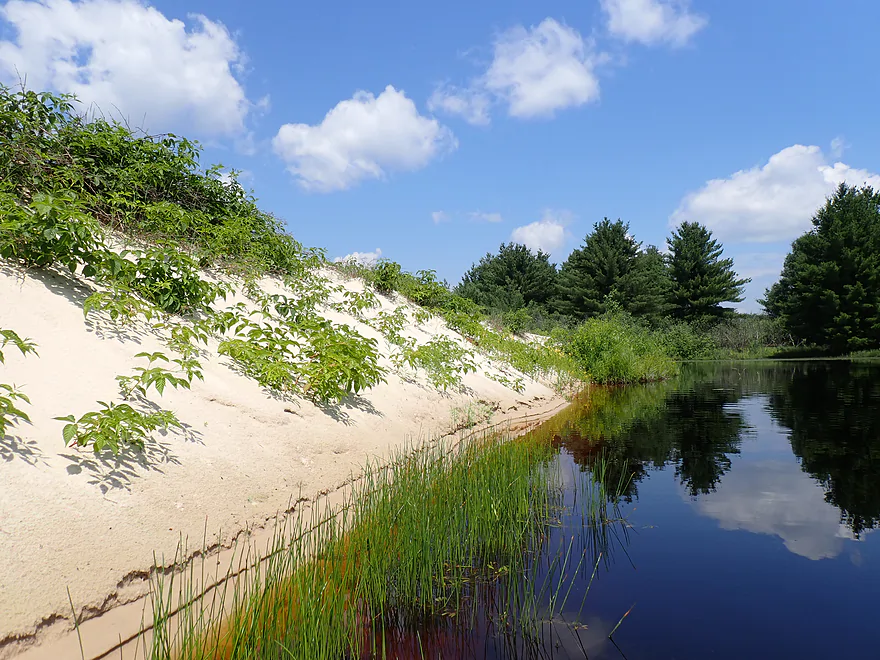
Mind the poison ivy
This was a cool area
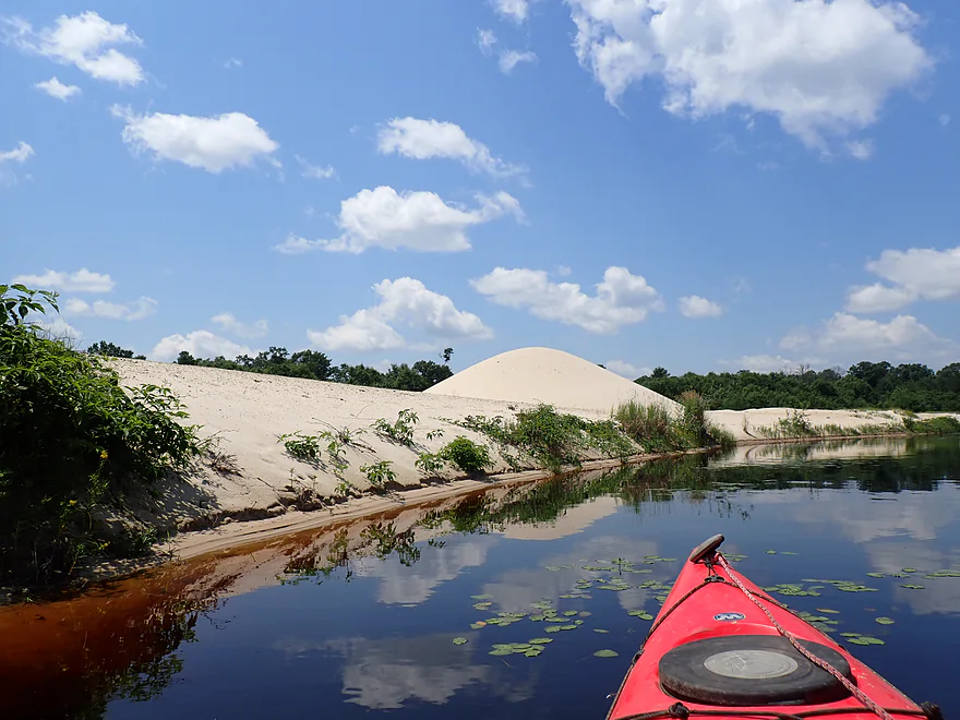
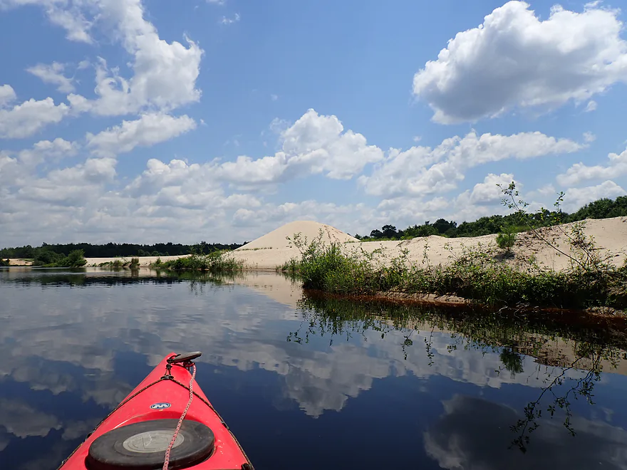
Approaching “sand mountain”
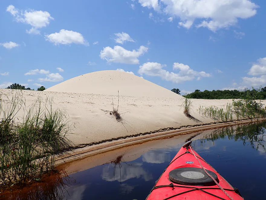
Probably a dredge pile
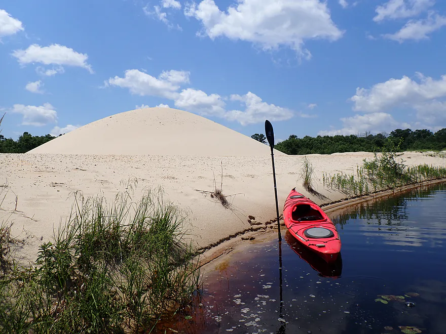
Getting out for pictures
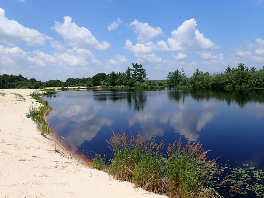
West end of “Lake #2”
A hidden outlet to “Lake #3”
It was kind of weedy…
So I turned back to Lake #2
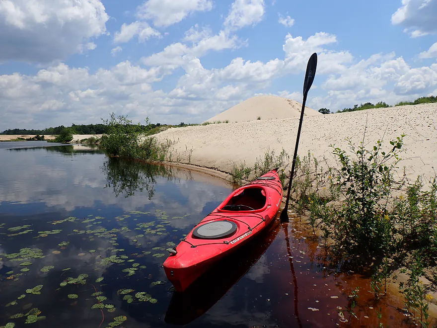
Getting more “sand mountain” shots
Doing a reverse portage of the dam/dike
This was a surprisingly big dike (reminded me of Crater Island on the Mississippi)
Back on “Lake #1”
Exploring a hidden inlet
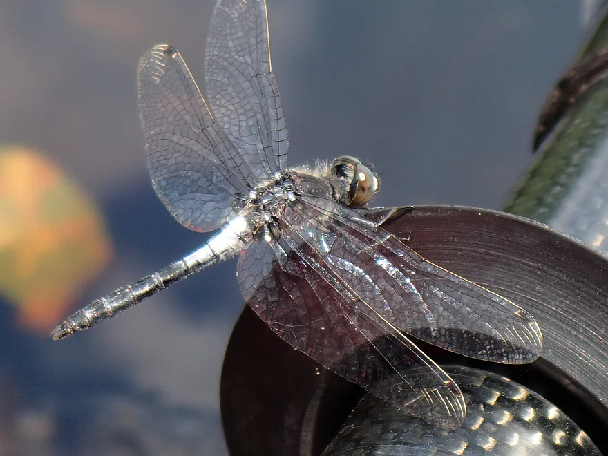
Dragonflies were everywhere
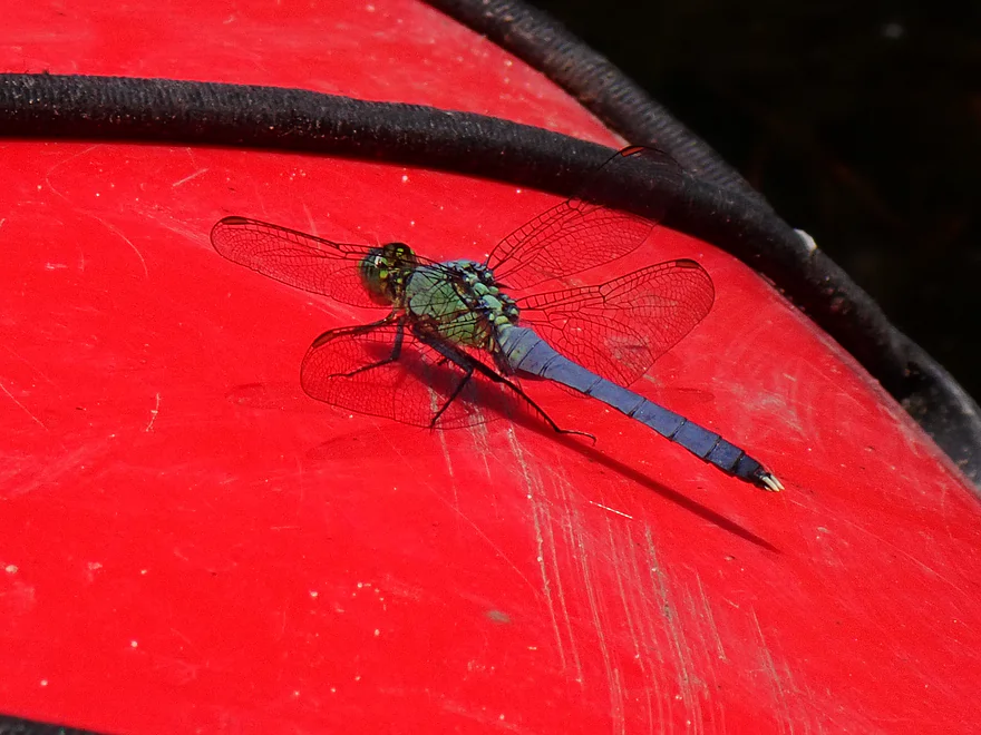
If you didn’t move, they would just land on your boat
Great pine trees on the trip
Lots more water shield
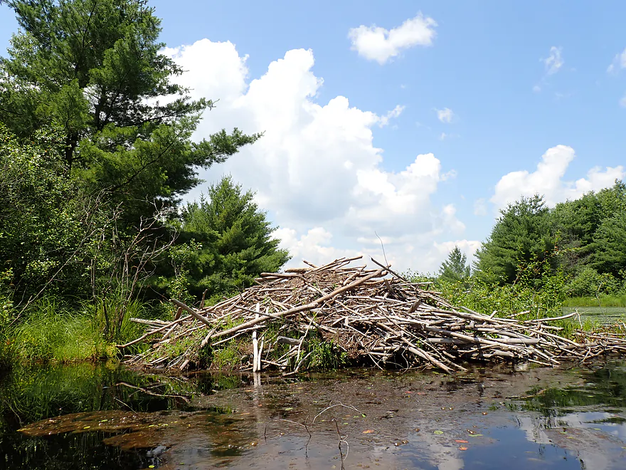
Massive beaver lodge
Heading back east
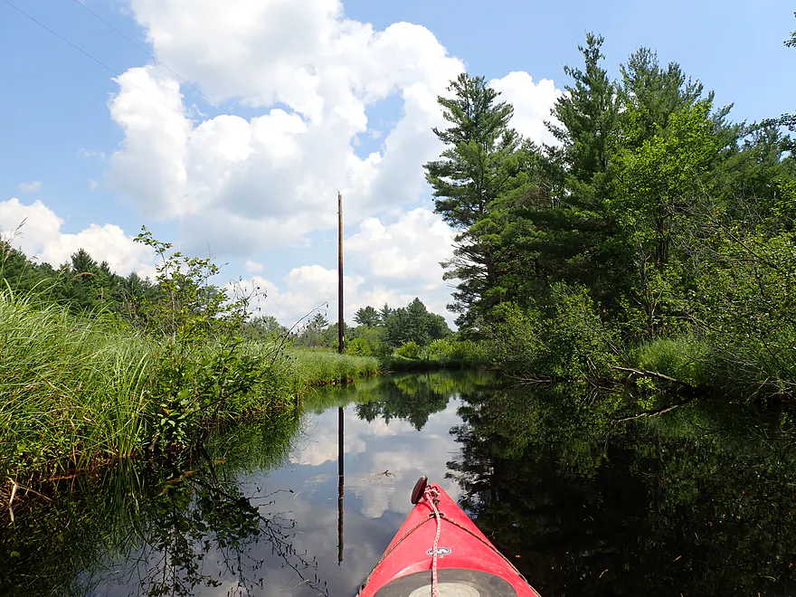
Around the corner is an upper branch of Perry Creek
Seeing how far upstream I can go
This canoe needs to be bailed out
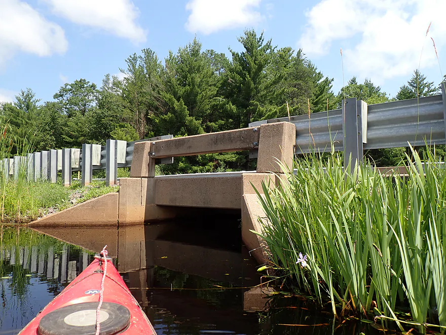
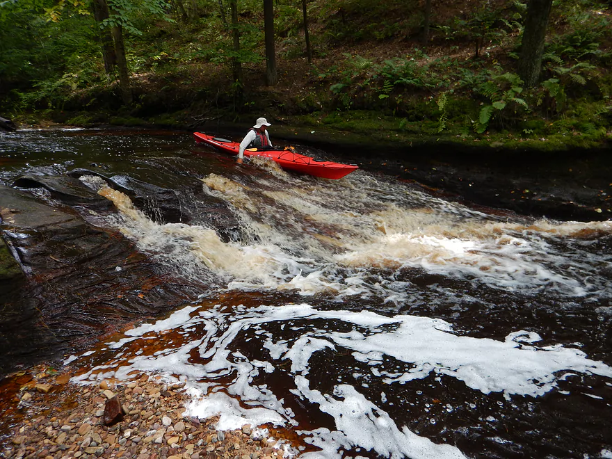
Trying to get past the bridge
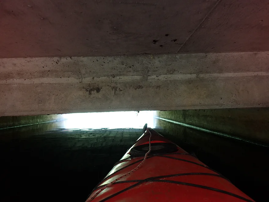
But just too low
Heading back
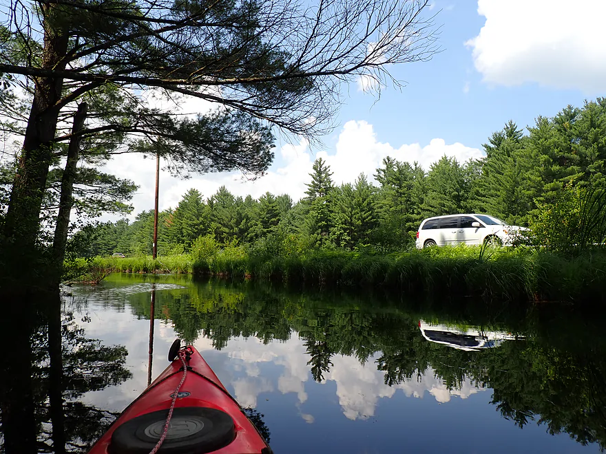
Back to the first bay and my put-in
Almost ready to end the day…
But first I portage the bridge to see if I can get further upstream
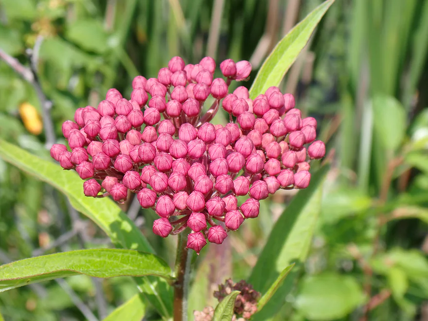
Swamp milkweed flower buds
Beyond the railroad are two more small lakes
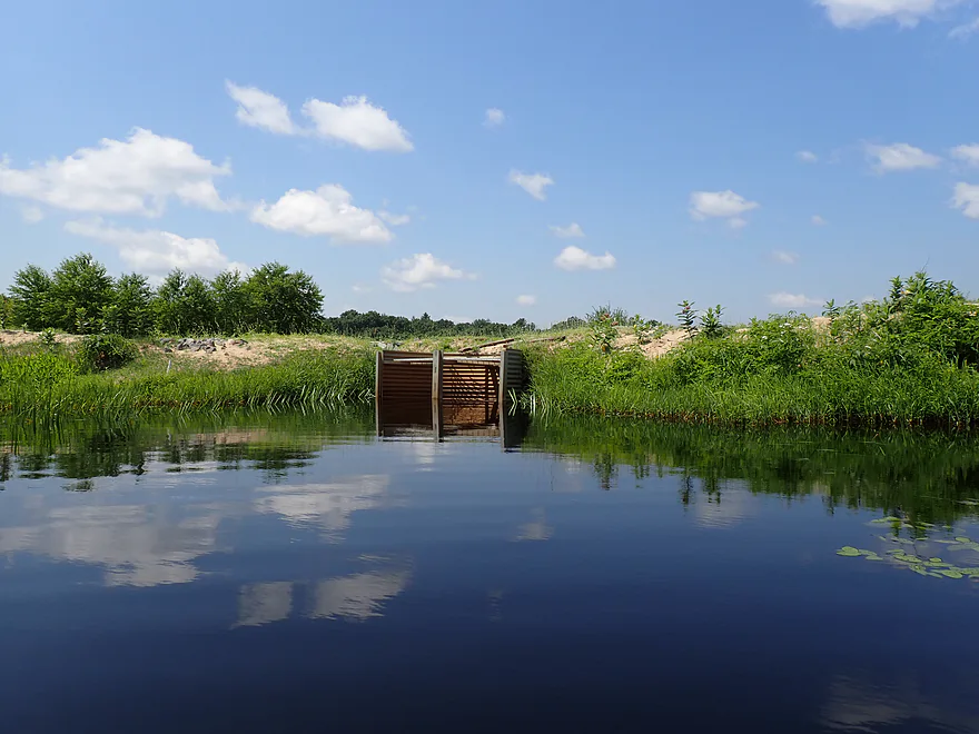
But thwarted by small tunnels
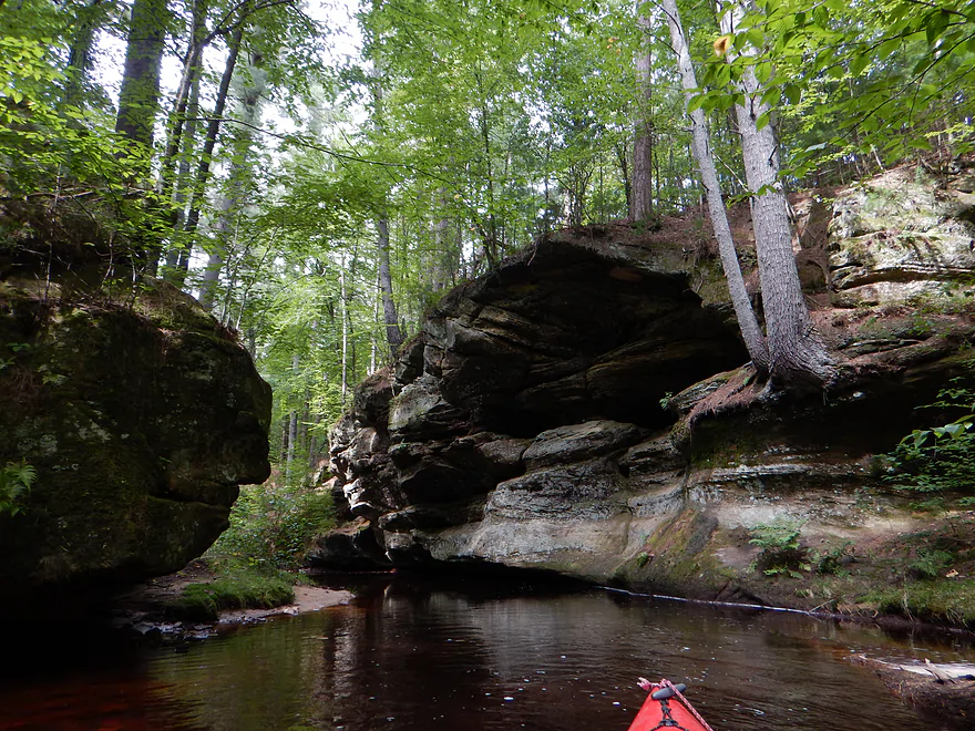
A few miles downstream, Perry Creek is VERY different
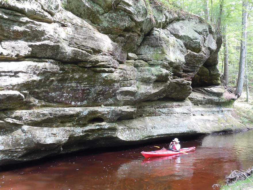
Terrific outcrops
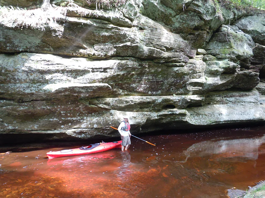
Pictures from a decade ago
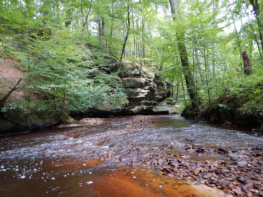
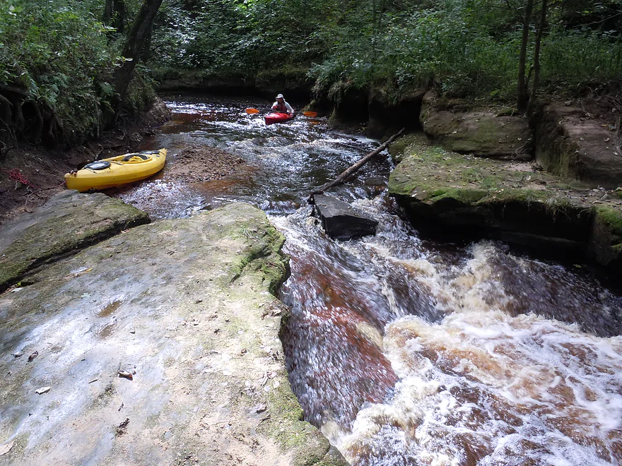
Lower Perry Creek even has some rapids
And a waterfall (not completely navigable but extremely scenic)
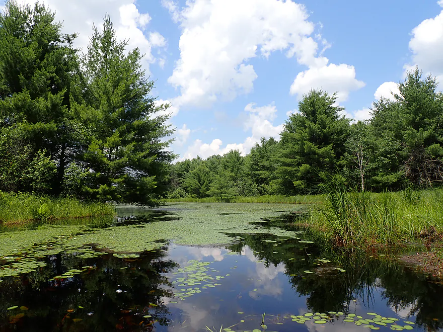
Cranberry Flowage

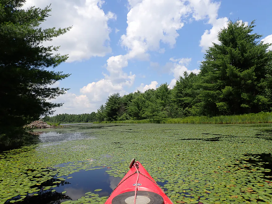
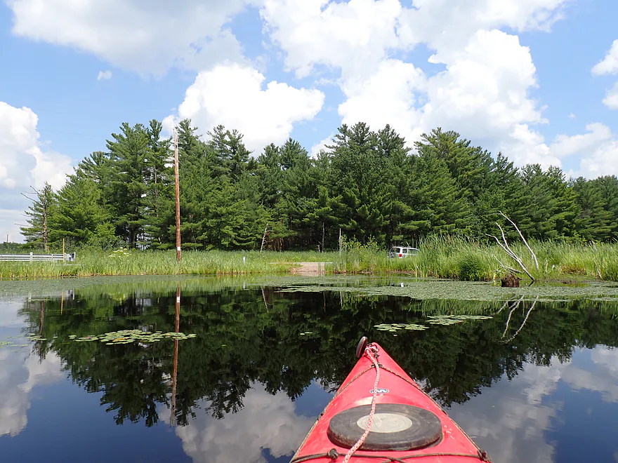
Perry Creek is a small stream located south of Black River Falls. A decade ago I paddled the mouth area, which featured really cool sandstone formations. The goal this week was to explore the upstream portions between the interstate and a large cranberry bog. Most maps refer to this as the “Cranberry Flowage”, but it’s actually a series of roughly eight artificial lakes meant to provide controlled flooding for a large cranberry farm.
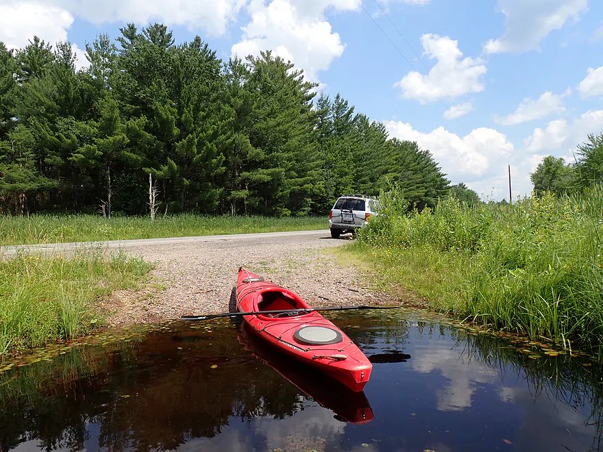
I started at the Iron Brigade Memorial Highway bridge (Hwy 12) where there was a small but scenic public access. The plan was to do a simple outer loop around the upper lake and then return to the put-in.
Along the north shore were some nice pines, and Castle Mound and its exposed cliff could be seen in the far distance. The lake was somewhat generic but there were some nice lilies and marsh plants growing in spots.
The western end of the “first” lake was blocked by an artificial sand dike. I actually saw a truck drive out on top of the dike to check on the dam (it had rained the previous day).
There were several individuals fishing along the north end of the dike wall. I considered warning them about the mercury advisory sign I saw at the put-in, but assumed they already knew. It’s a shame that mercury pollution has gotten so bad you can’t even eat the fish. The polluting culprit was likely one of the big Mississippi coal power plants (most have since been decommissioned). Much of Upper Perry Creek parallels the interstate and freeways can also be a source of trace mercury contamination.
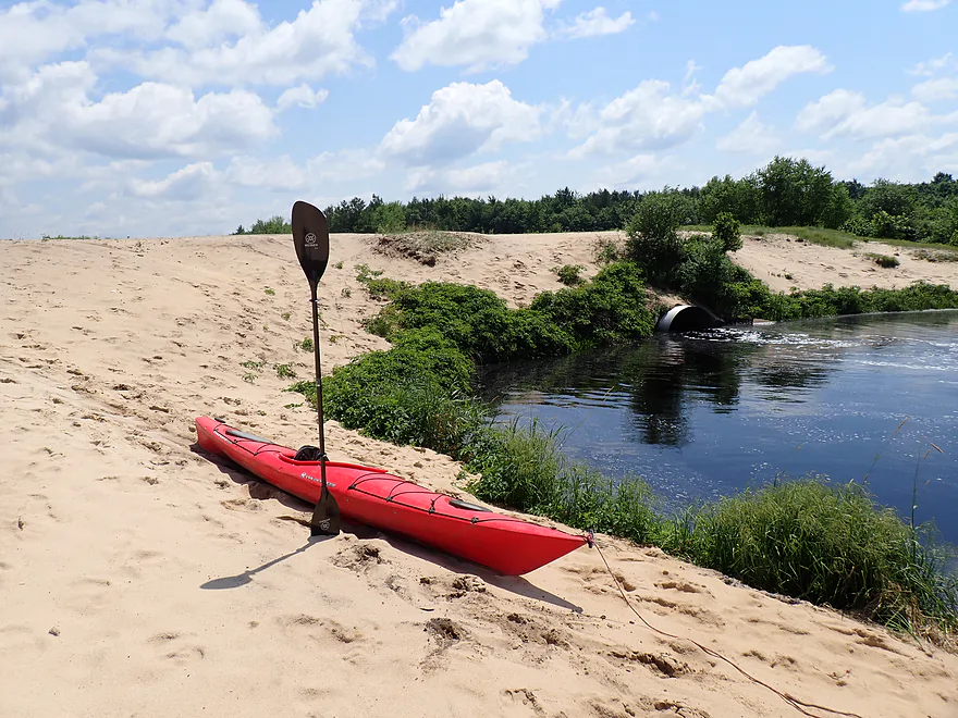
I headed south, paralleling the long sandy dike, and eventually found the dam outlet. I continued south and was stopped by a huge boulder field, which was likely an overflow channel meant to protect the dikes during floods. While the boulders were artificially placed, they did very much remind me of the Upper Black River.
From there I returned to the dam and decided to portage it to check out the downstream lake. I was a bit self-conscious about doing this as the further west I headed, the more artificial Perry Creek became. I was still east of the main cranberry fields though and according to DNR rules you are allowed to portage dams, so I believe I was fine. But I advise not paddling into the main cranberry fields themselves (mostly just a network of ditches and artificial lakes).
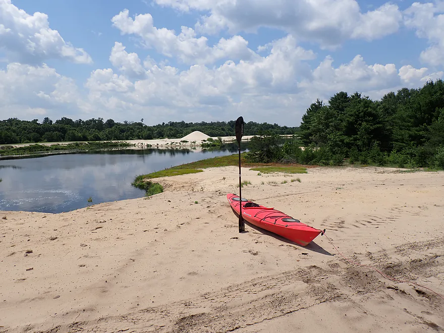
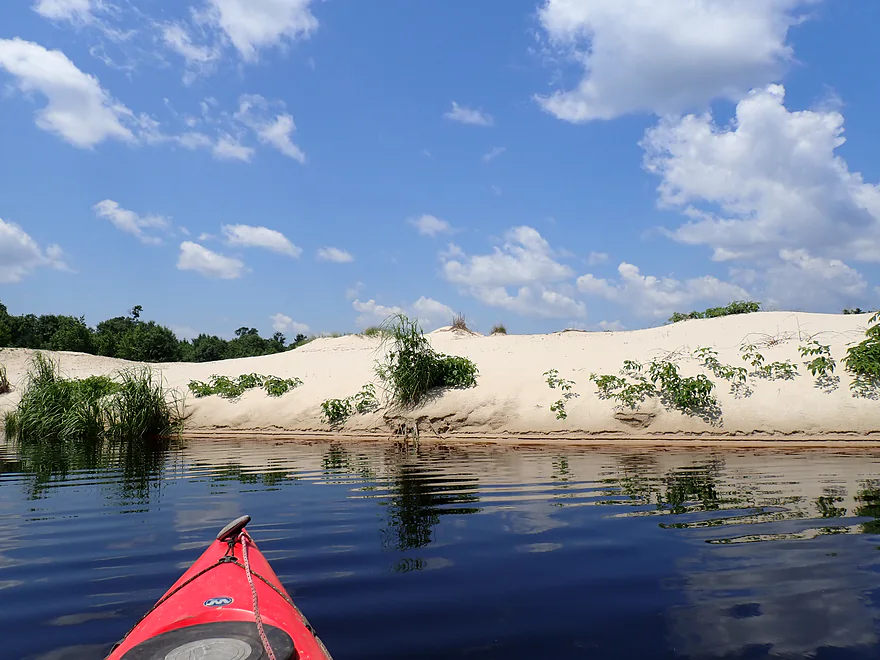
The main feature of “Lake #2” was a large sand bank topped with a 40-ft mound of sand (perhaps a byproduct of dredging). It was really cool and you could see this “gleaming mountain” almost a mile away from the put-in. The quality of the sand was incredible…very light and clean (why there are so many frac sand mines in the area).
There was a small outlet from “Lake #2” to “Lake #3” which I briefly explored. It was a little weedy and didn’t look too interesting, so I turned back. In the distance I could see a fourth lake with several paddlers on it…I looked at a map when I got home and couldn’t quite figure out where they had launched from though.
I then reverse portaged the dam and backtracked east on “Lake #1”. Along the south bank was a cool little sheltered inlet with a massive beaver lodge and tons of dragonflies. If I remained still for a while, they would land on my boat (which allowed for some nice close-up photos). This was one of the better dragonfly paddles I’ve ever done.
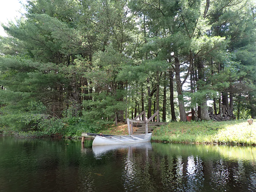
Further east, Perry Creek splits into two branches and my goal was to explore both. I started with the east branch, which started nice and included the only lakeside home on the trip. But unfortunately I was stopped by a low bridge and had to turn back.
I then tried heading up the north branch, but again the highway bridge was too low. Not to be deterred, I portaged it, only to be finally blocked by two railroad tunnels that were also too small to squeak through. Thwarted three times, I decided to head back to the car and call it a day.
In summary this was a nice trip, but it was a lake paddle so it won’t be as interesting as the local creeks/rivers which are REALLY cool (eg Robinson Creek). I would only suggest doing Cranberry Flowage if you’re a local…or you need a backup plan in case the local creeks are too high. In this case they were. In fact “Robinson Creek Preservation Association” had sent out an email to their members warning that Robinson Creek was dangerous and had several difficult downed trees.
Sights included a few flopping fish and many dragonflies. A highlight was a massive beaver lodge.
Perry Creek Dells: The mouth of Perry Creek on the Black River features some really scenic dells. You can park at the Perry Creek Canoe Landing and then hike upstream on a mile-long trail …more information and pictures of the creek and cliffs are available in my 2016 review.
Castle Mound Park: A large sandstone butte rises 180 ft. above the surrounding plain just southeast of Black River Falls. This is an easy hike with fantastic views.
Lake Wazee: A former open pit iron mine and now a county park, Lake Wazee is 350 ft. deep, crystal clear, is popular with both divers and paddlers, and has a fantastic beach.
Iron Brigade Memorial Highway (Hwy 12): This is a nice little launch located by the second bridge.
Alternate Launches: I don’t really think there are any.
Wind: There is a lot of open water…so I would avoid this trip if strong winds are forecasted.
Poison Ivy: This is not uncommon along parts of the shoreline (three leaves; leave it be).
Closest Gauge: Black River @ Neillsville
My Trip Depth: 1600 CFS or 6.0′
Gauge Guide: This likely won’t matter much…it’s a lake paddle and can be done high or low. I did this during 1600 CFS, which was high. It’s possible that when water levels are lower you can get under the bridges and explore further upstream than I was able to.
- Upstream of Iron Brigade Memorial Highway (Hwy 12): There are two small man-made lakes which in theory you could explore, but I was blocked by a low bridge. East of the lakes and closer to the interstate the creek gets pretty brushy and likely isn’t navigable regardless.
- Cranberry Flowage – Eastern Lakes: These are, I believe, mostly flood control lakes, three of which I explored in this review.
- Cranberry Bog: Continuing west, there is a large cranberry farm with about 80 beds. The creek is rearranged in a series of ditches and small lakes. In theory you could likely paddle through (the main creek mostly flows through the south end). But that is not recommended as you don’t want to interfere with the cranberry farm operations.
- Cranberry Bog to Hwy 27: This is a scenic section of creek but likely has many logjams.
Trip Map
Video
Photos Size: