
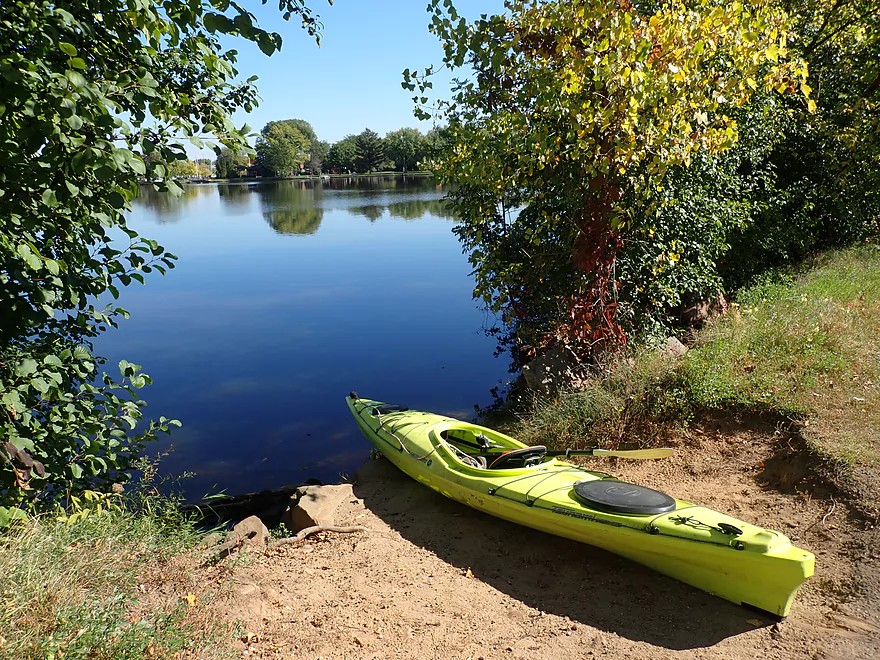
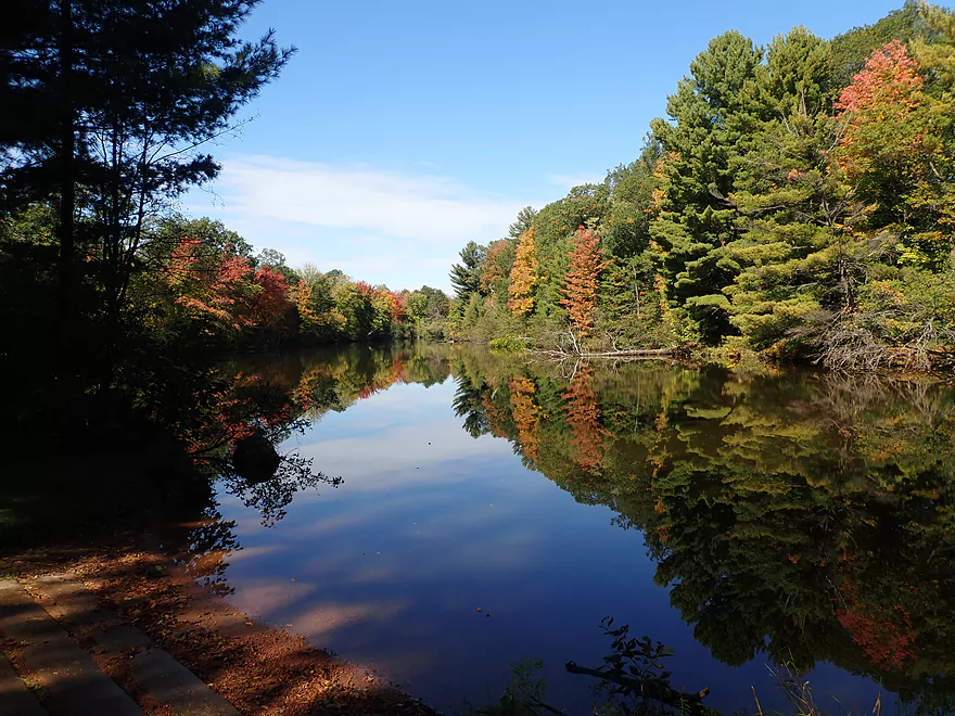
Putting in at Mead Park
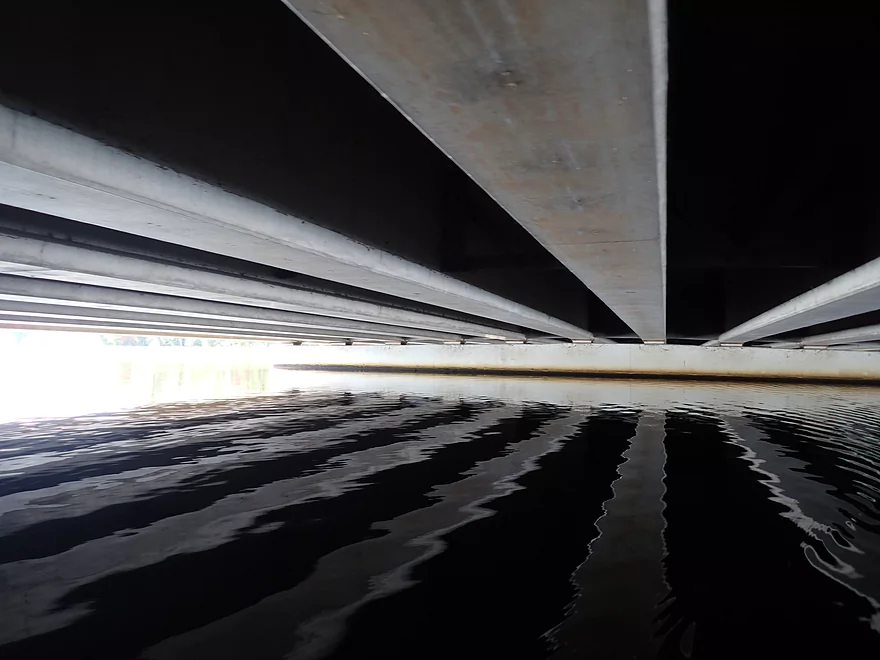
Clark Street is a low bridge
But is nice looking
The local paper plant
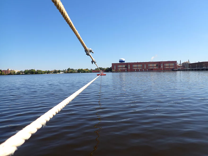
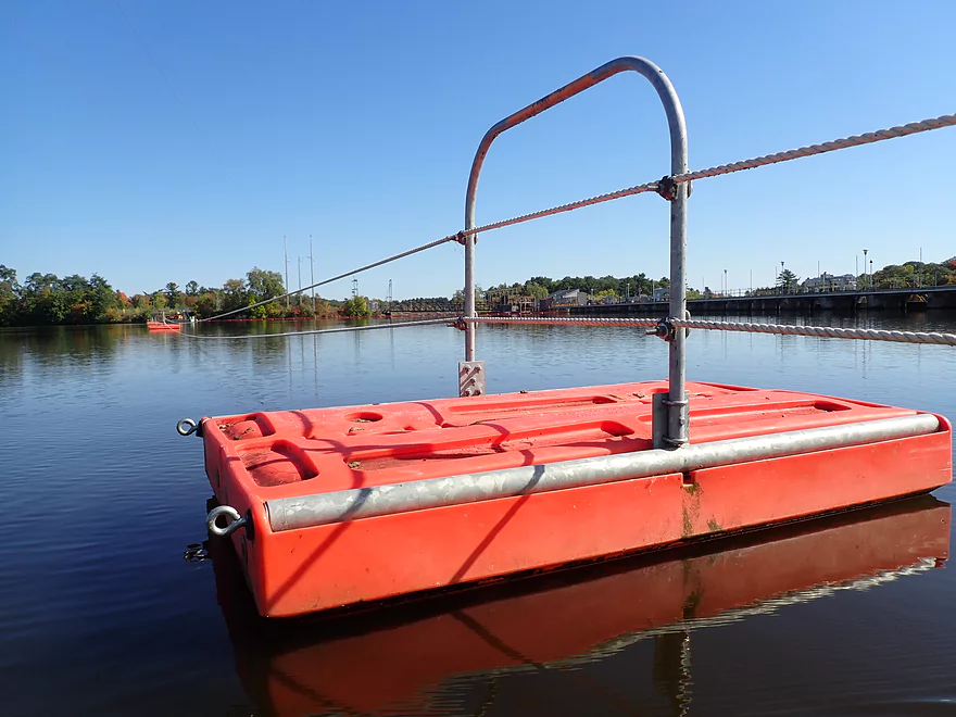
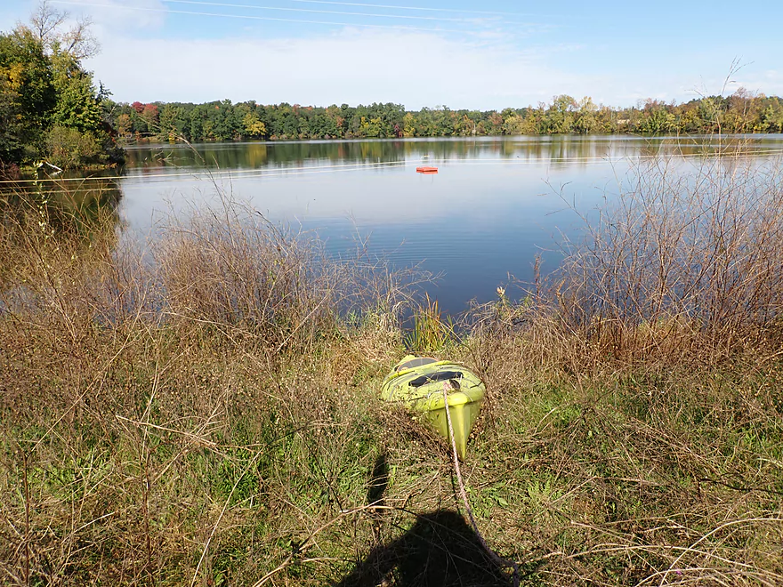
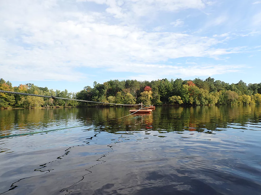
Guard ropes mark the upcoming dam
Easy portage
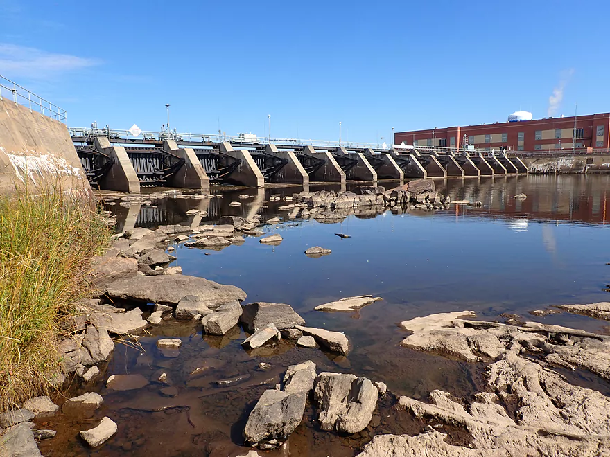
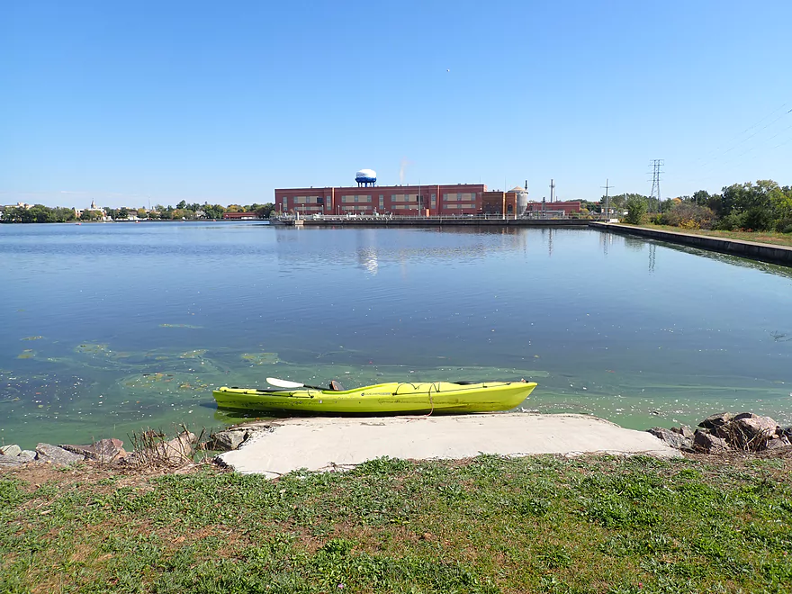
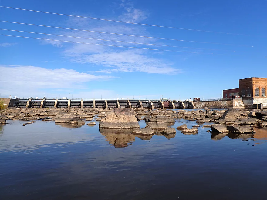
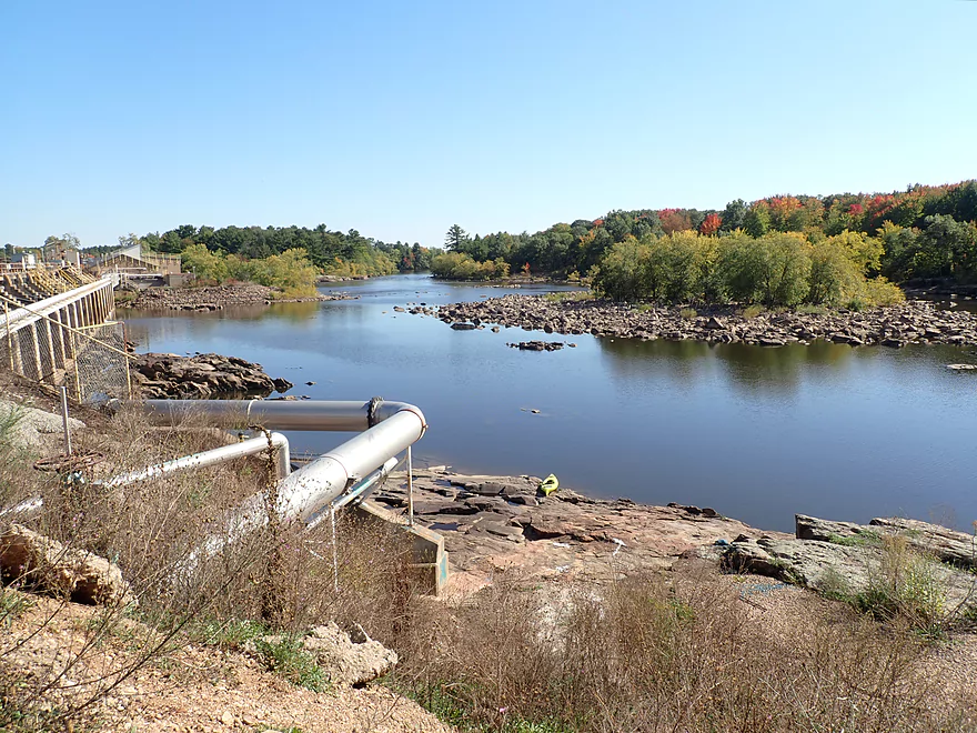
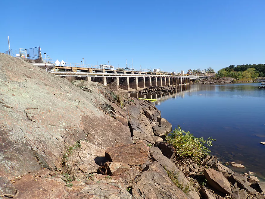
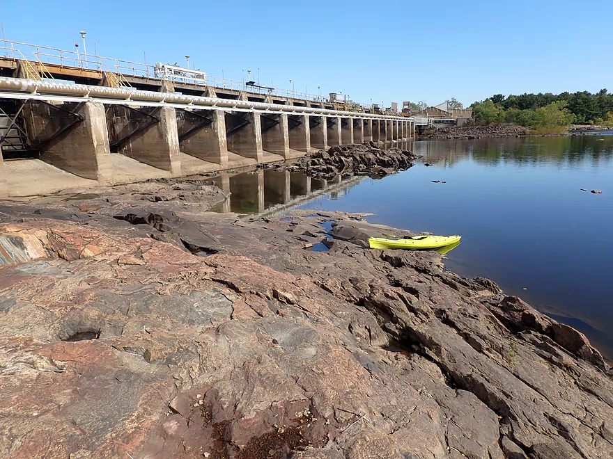
Downstream side of the Stevens Point dam
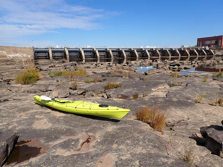
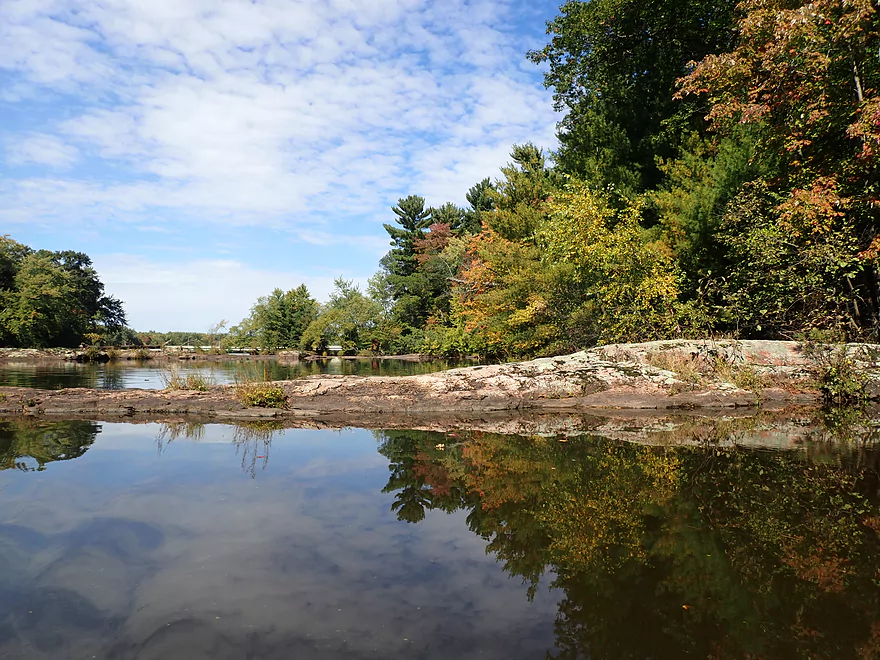
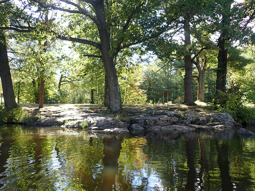
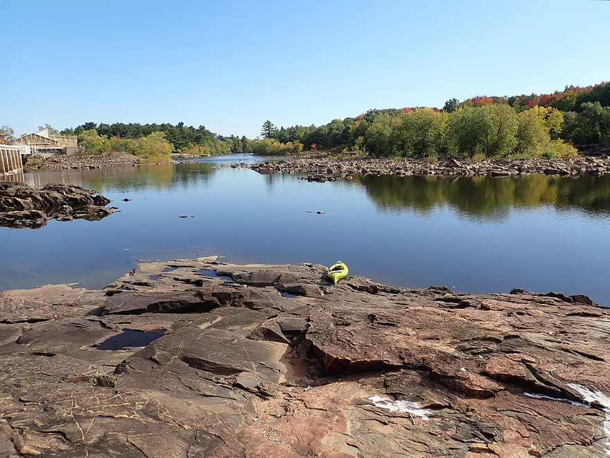
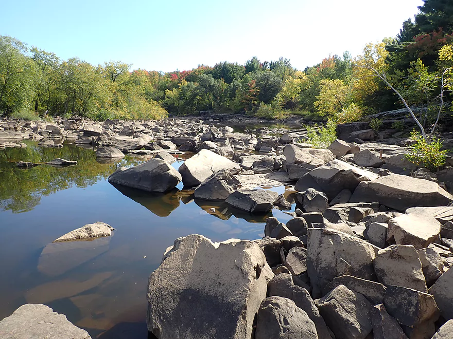
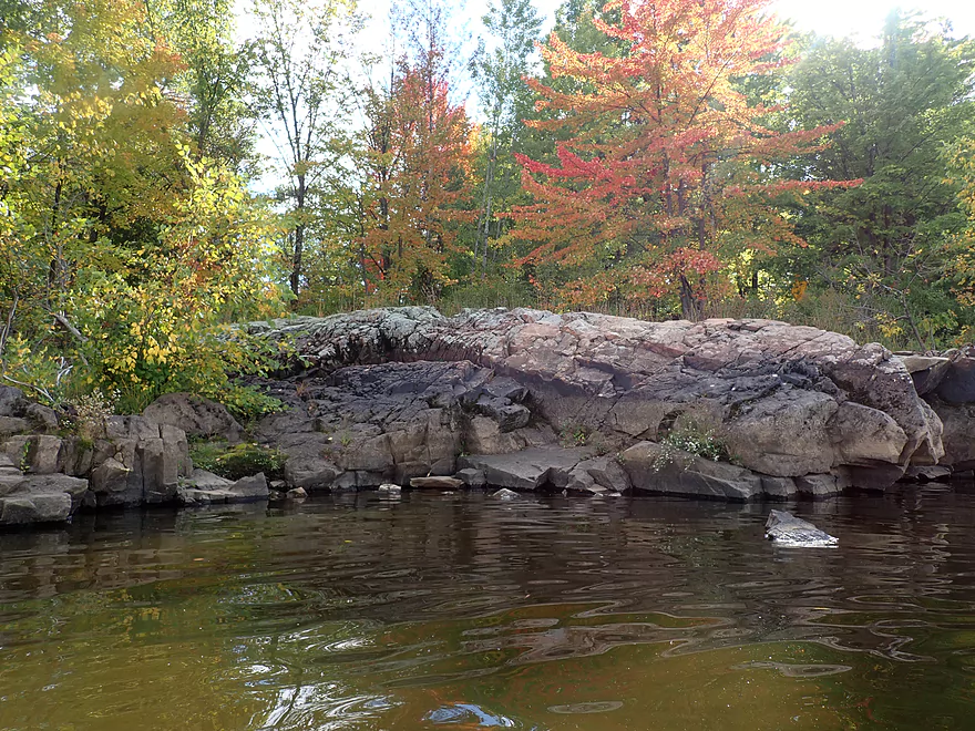
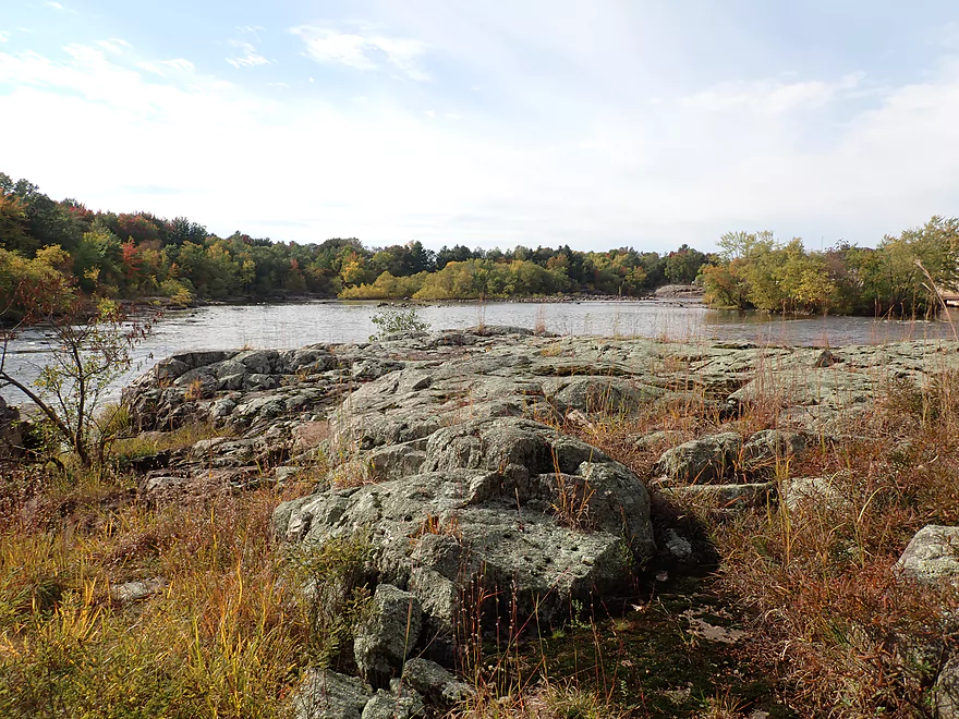
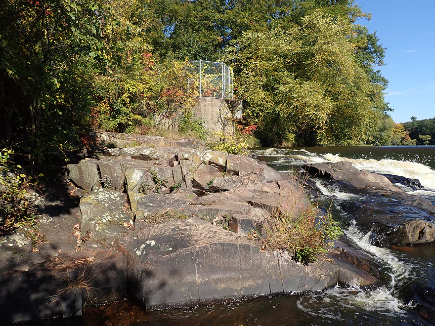
Fantastic granite bedrock
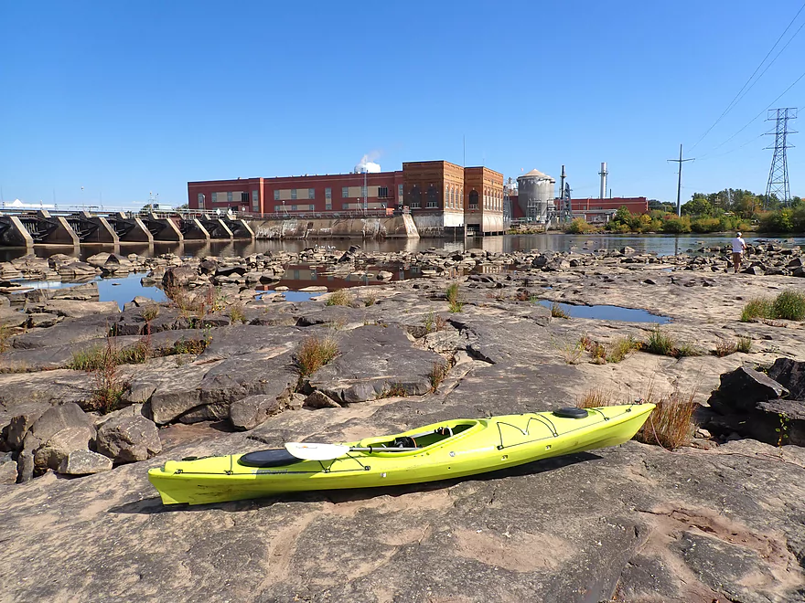
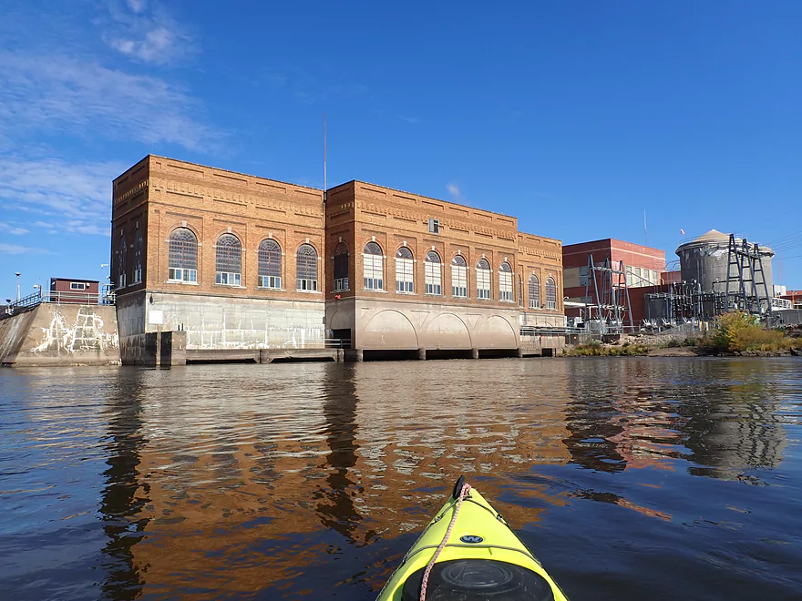
The local powerhouse
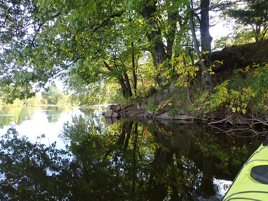
Scenic area
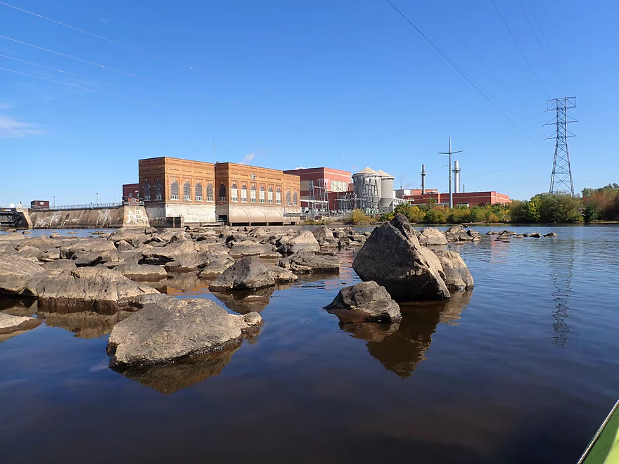
Another view of the powerhouse
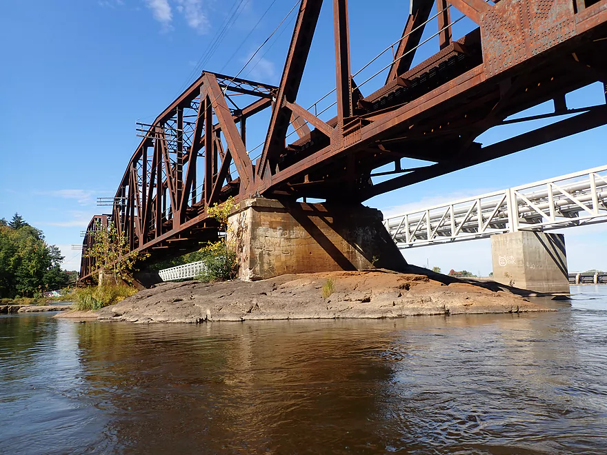
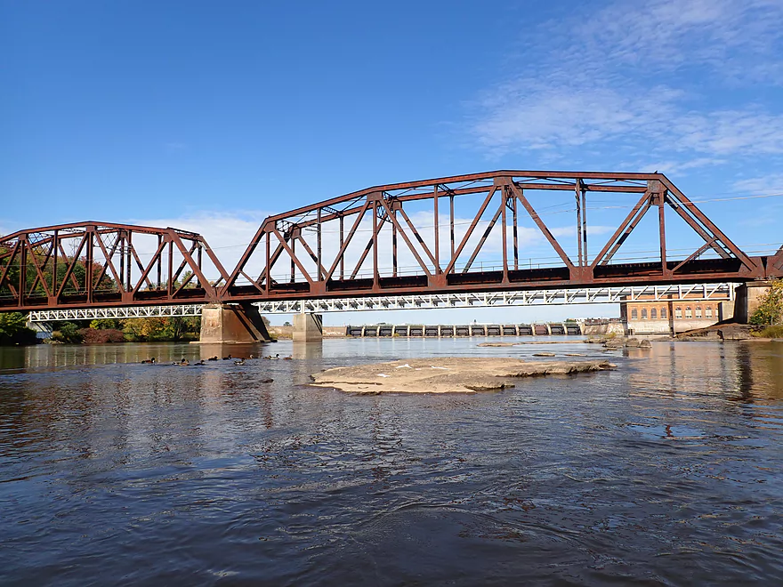
Local railroad tracks built on the exposed granite
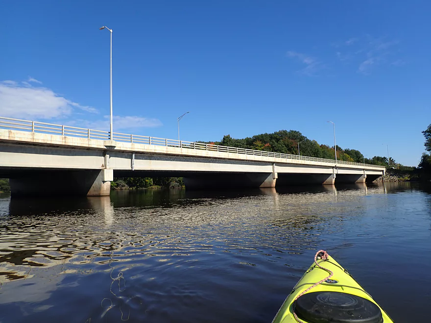
Hwy HH is an access option
Scenic side channel between one of many islands
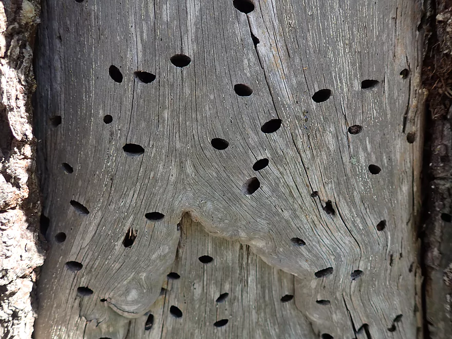
These cool holes were made by wood-boring beetles
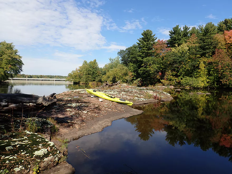
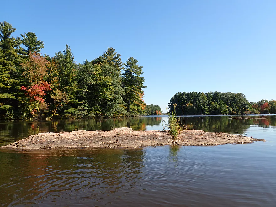
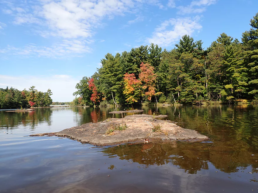
A gorgeous granite isthmus
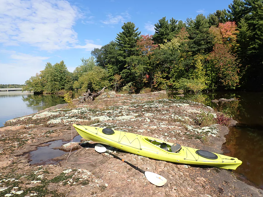
In high water this wouldn’t be visible
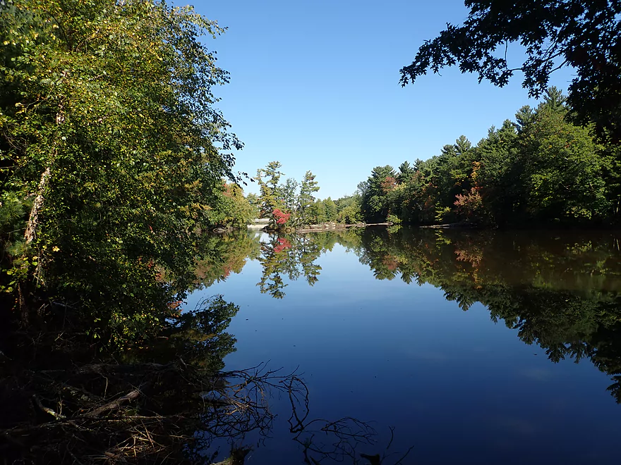
Reverse view
Another small island
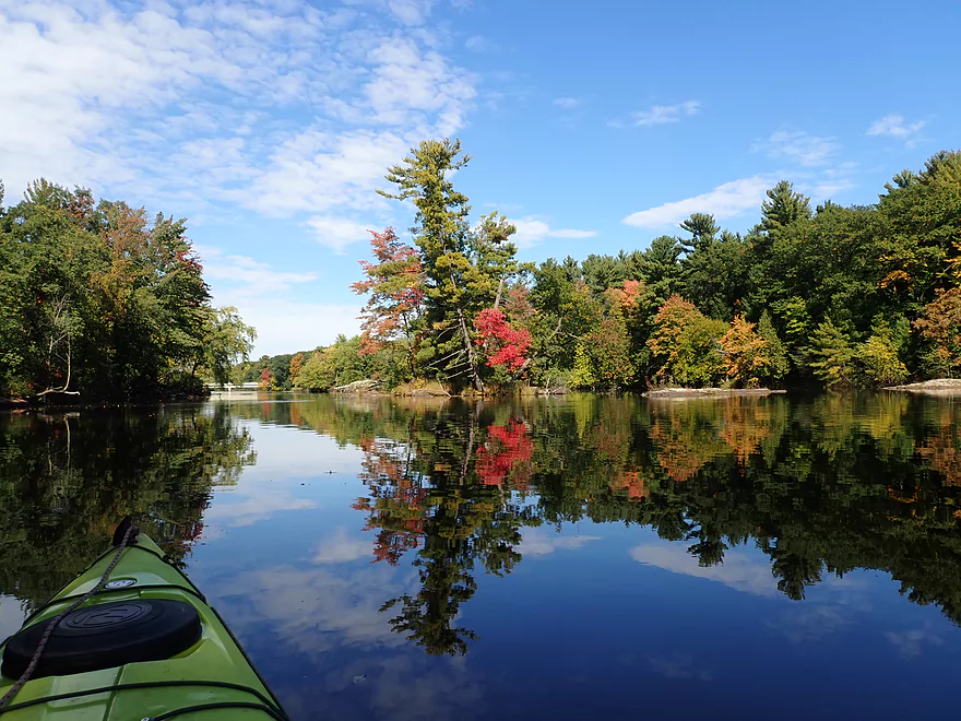
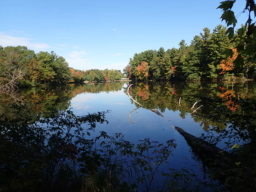
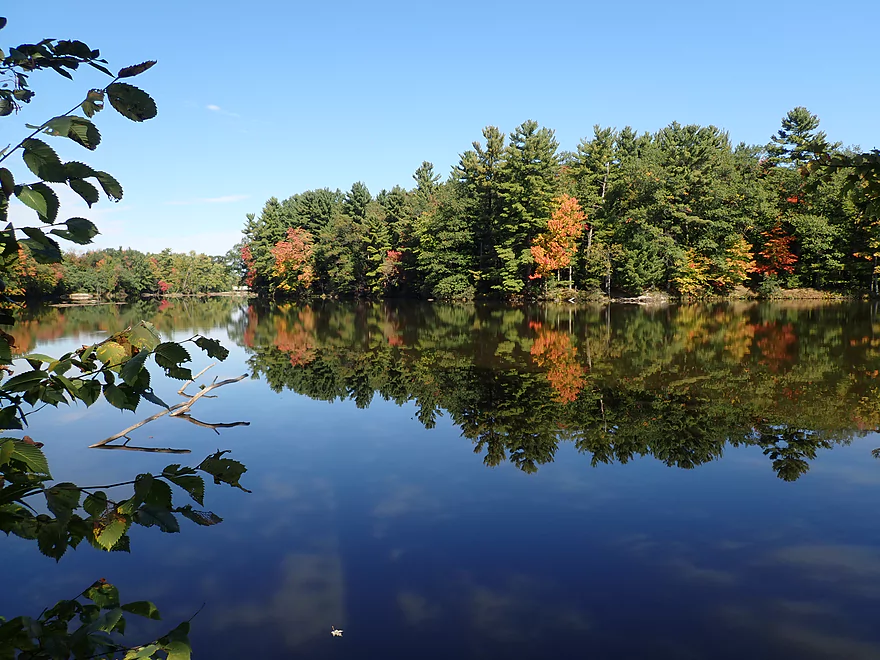
Good reflections when the wind died down
Consolidated Parkway is a nice public access
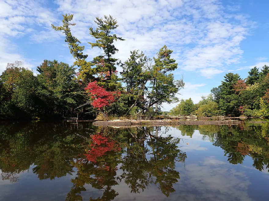
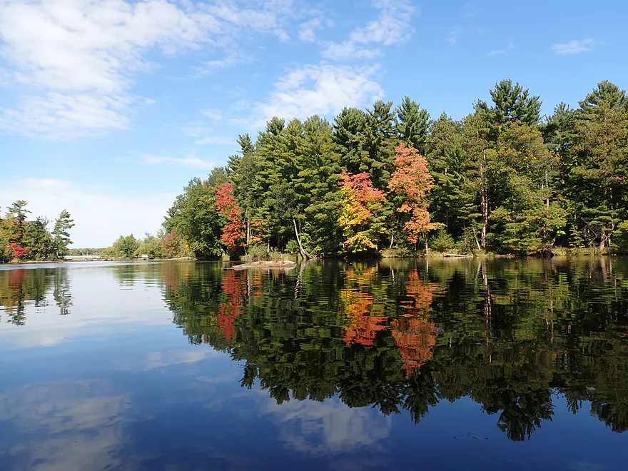
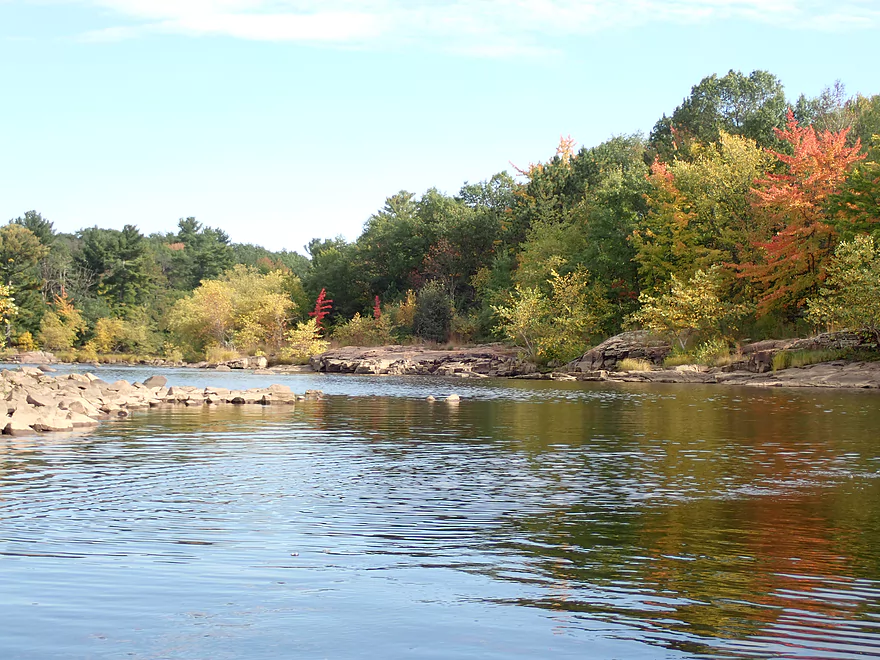
Early fall color
More mirror shots
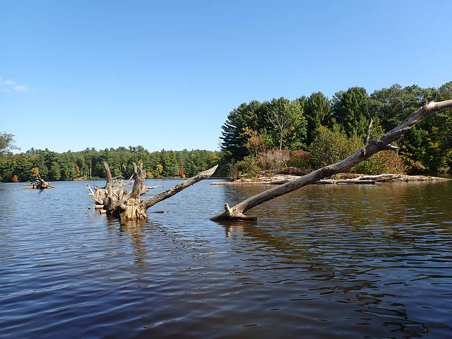
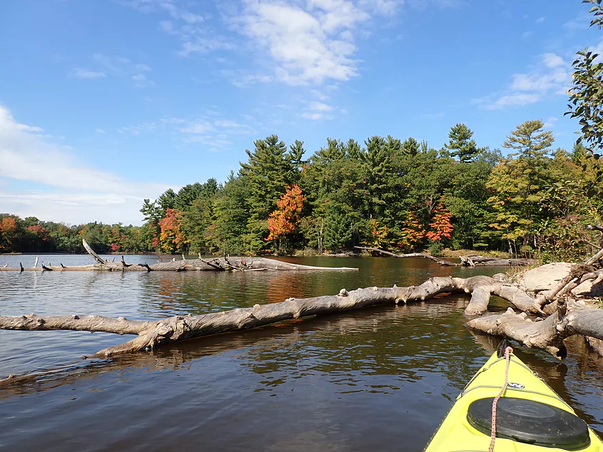
Tree graveyard

Coming up on Consolidated County Park
Terrific view of the river from the park
Two islands in one
Heading back out onto the main channel
Another dam fence
And another portage
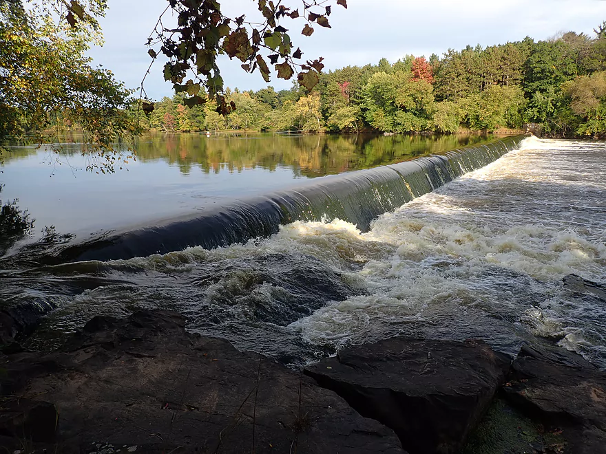
The view from atop the Whiting Dam is very scenic
A large rocky island splits the channel just below the dam
Huge mound of bedrock
Favorite part of the trip
Dam is partially built on granite…wonder what used to be behind the dam
Many area dams are in poor shape…this repair job looks risky
I’m heading back up a side channel
There is a nice public area/wayside below the dam
A huge boulder field below the dam
In low water the right channel closes…in high water there can be rough rapids
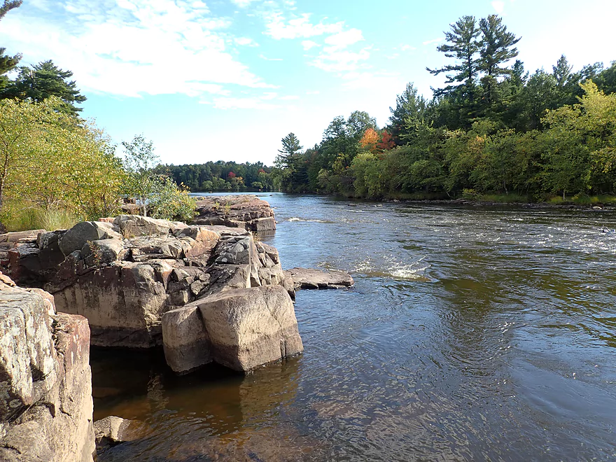
The right/west channel is very scenic
Reminds me of the Black River
End of one island and the start of another ahead
Fall color + granite = nice combo
Top of the second main island
Getting out to explore
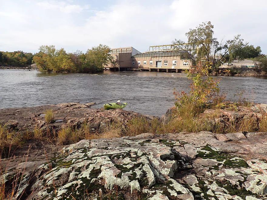
View of the upstream powerhouse
Looking back toward the previous island and dam behind it
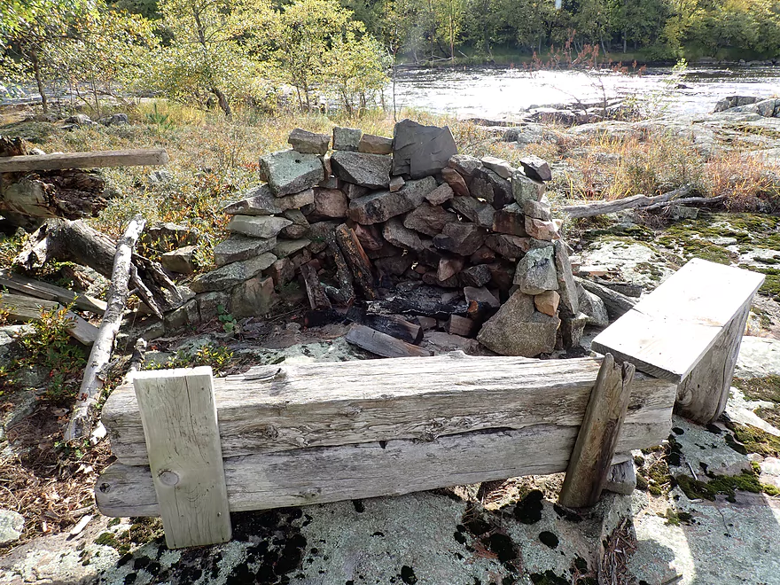
Somebody set up a fancy campfire pit on this island
Another nice side channel
The Kimberly Clark dam quickly follows the Whiting dam
Finding an area to get out and portage
This is a dangerous low-head dam
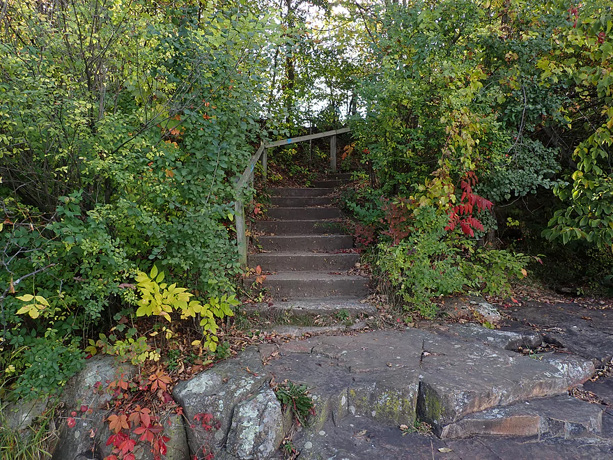
As a shortcut you can portage down these steps
And over the rocks
Class 2 rapids below the dam
Reverse view
Another boulder field and the start of a massive archipelago of islands
Checking out a wooded side channel
Reminded me of the Waupaca River
The final stretch
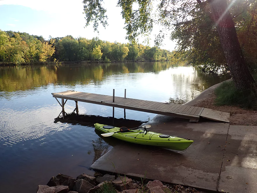
Taking out at Blue Heron Landing
Wisconsin River – Stevens Point

The goal for this trip was to paddle the Wisconsin River for the length it parallels the city of Steven Point. Originally this area had a steep gradient with many natural rapids, boulders and exposed bedrock, but most was buried by three dams. When water levels are low though, you can partially recapture some of the magic this river had before it was ruined by paper mills and dams.
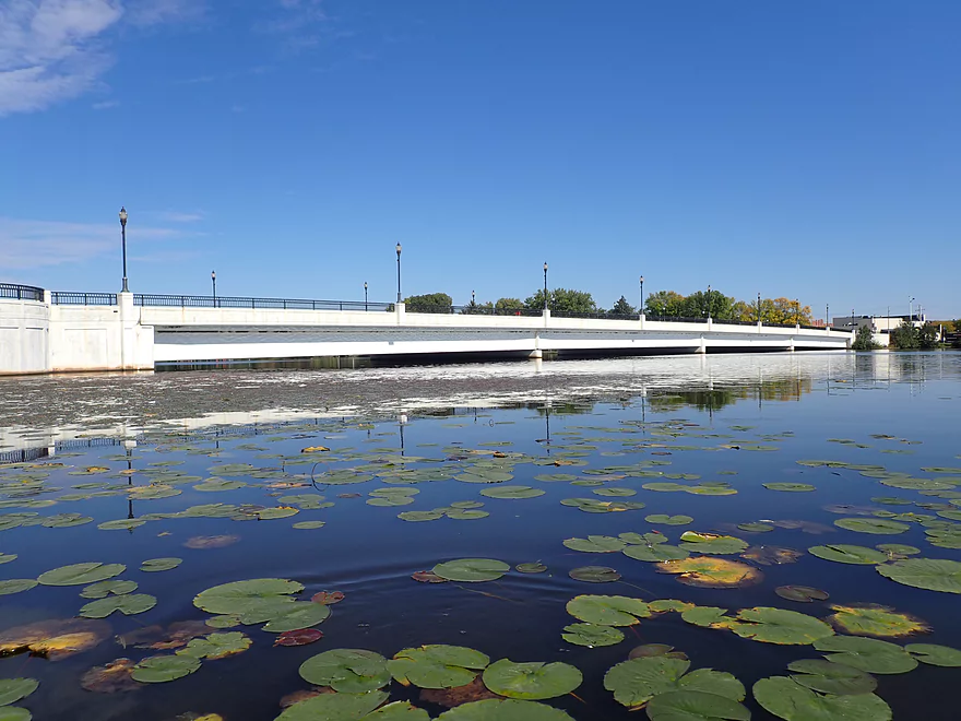
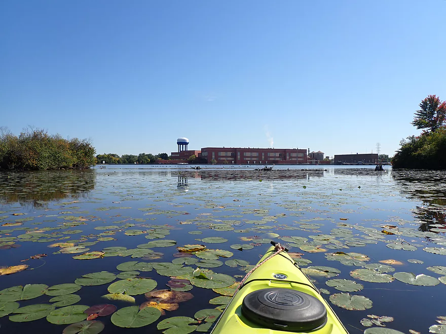
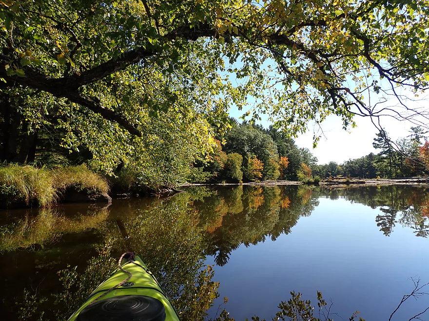
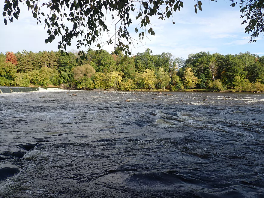
I started the trip at Mead Park which was a busy but suitable park for launching. I passed under the insanely low Clark Street bridge and entered a small bay of impounded water created by the Stevens Point Dam. Aside from some waterlilies and views of Stevens Point, this stretch wasn’t that interesting (here is a great panorama of the bay). It was surprisingly shallow for an impoundment and that may be a sign it is silting in.
Along the eastern shore was a paper mill which apparently makes food pouches, spiral canisters (like for Pringles), bags, label paper for jars/cans, and gift wrap. Paper Mills are horrible for the environment but few (not even environmental groups) criticize them because of their political clout. They are responsible for a lot of heavy metal wastewater, nutrient waste, landfill mass, dams, and are a lot of nasty air pollution.
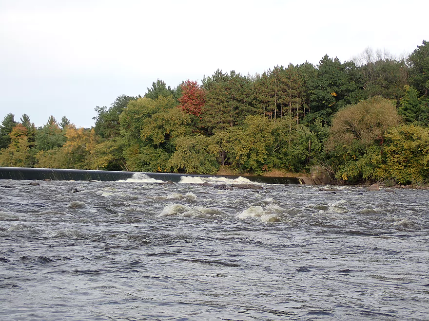
The Stevens Point Dam followed the paper mill and contained a well marked portage path on the western shore. The guard ropes though are positioned ridiculously too far upstream, and I was able to save quite a bit of portage dragging by ducking under the ropes and taking out much closer to the dam. I was surprised to learn there was a public access at the dam itself and had I known this I would have started my trip here.
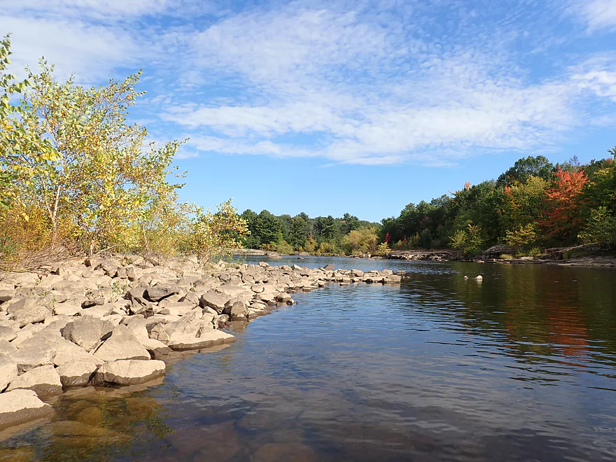
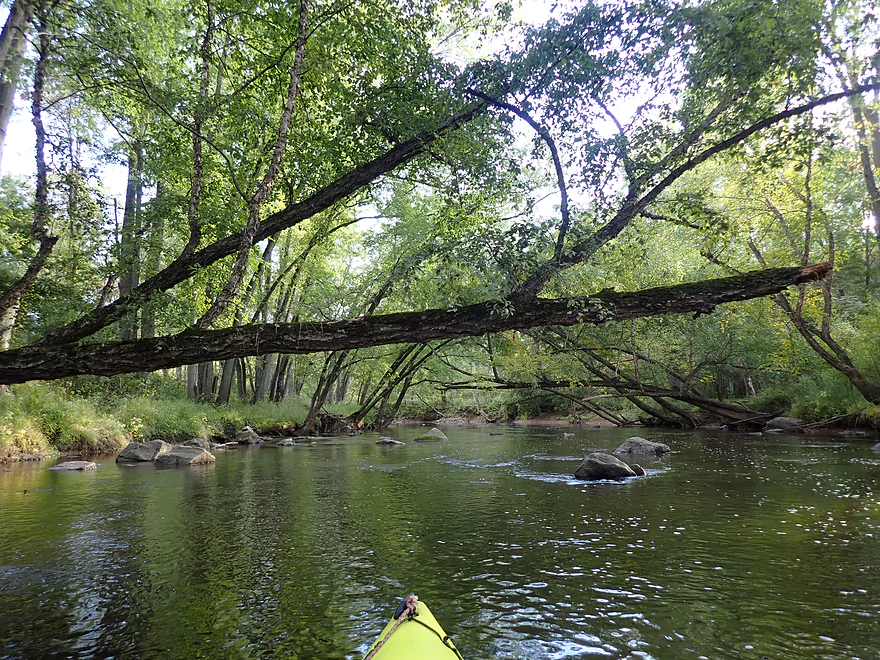
Below the dam was about 900′ of exposed bedrock and boulders which were gorgeous. This was part of the reason I did the trip, but timing is everything as you won’t see the bedrock if water levels are high. There are minor rapids below the dam, but nothing major. I understand this used to be part of a large stretch known as “Shaurette’s Rapids”. I highly recommend the book “The Wisconsin River: An Odyssey Through Time and Space” which provides a fascinating account of what the Wisconsin River was like before it was dammed.
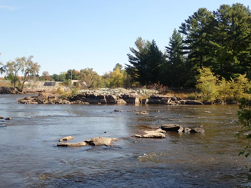
The next mile (Stevens Point Dam to Hwy HH) was one of the more boring parts of the trip. I first passed under a railroad bridge whose supports impressively were melded into large granite outcrops. After that the river is split by a large island. Apparently it is owned by UW-Stevens Point and they put No Trespassing signs in multiple spots. I’m not sure you would want to visit it anyway as it looked kind of boring. This stretch wasn’t always boring as it used to be home to Conant’s Rapids. This was part of a long stretch of rapids that supposedly had a 42′ drop. While Conant’s Rapids were not the most dangerous, they were considered to be among the most difficult to navigate on the river. It’s quite tragic that they were buried. The Wisconsin River between Wausau and Lake Petenwell likely closely resembled the Upper Black River before the dams and would have had stunning scenery and geology.
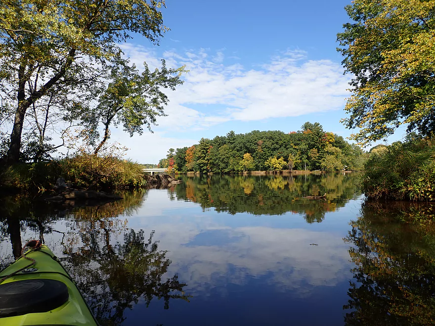
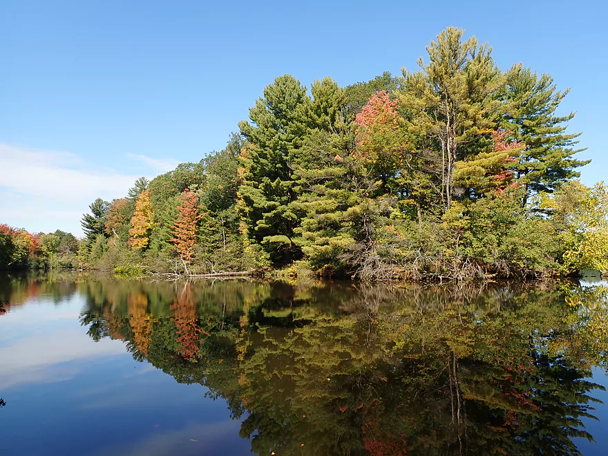
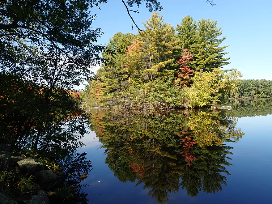
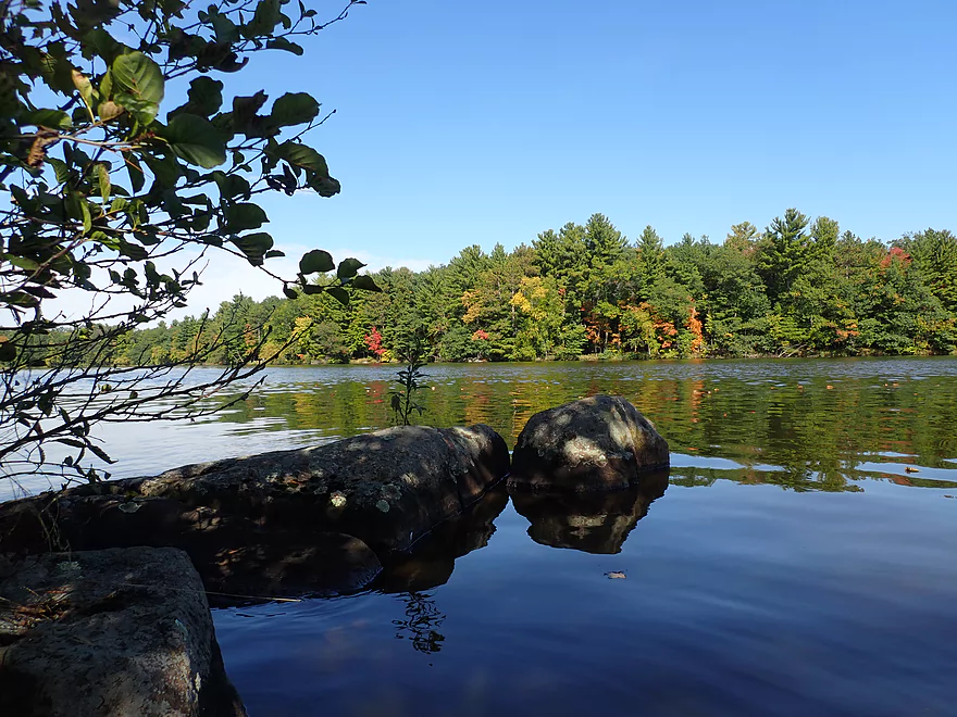
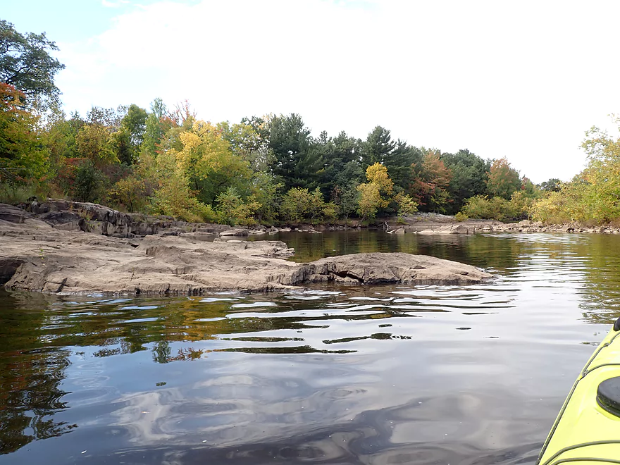
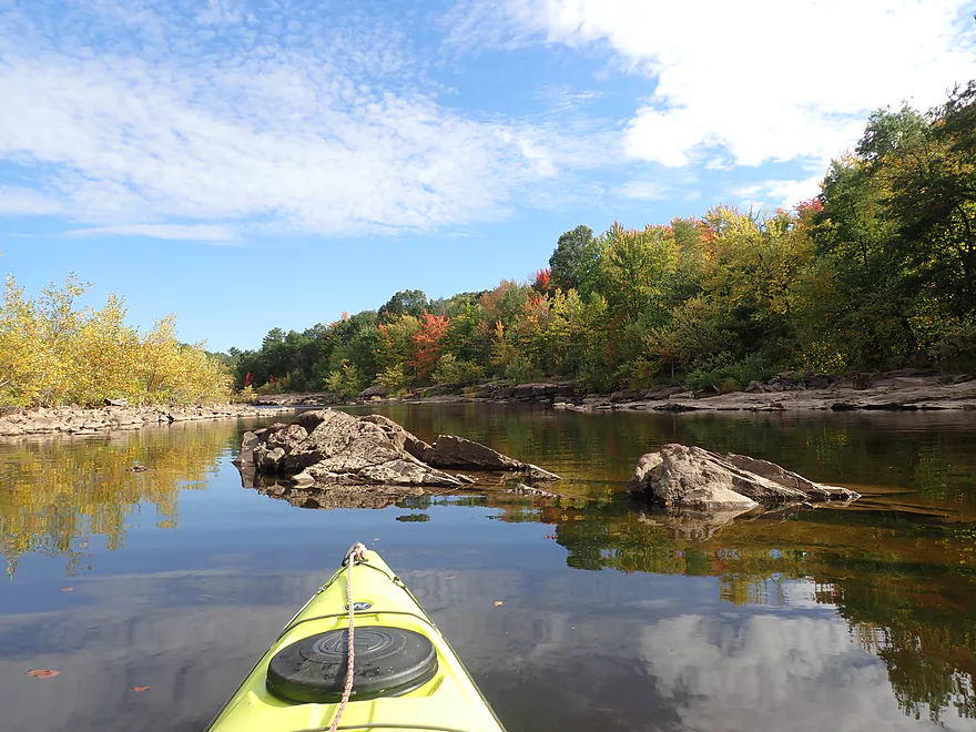
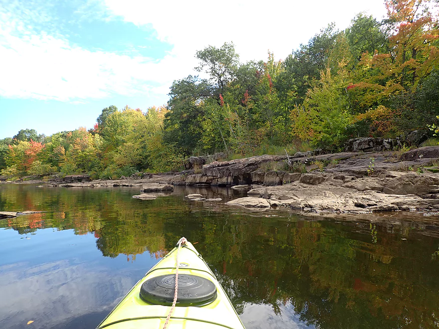
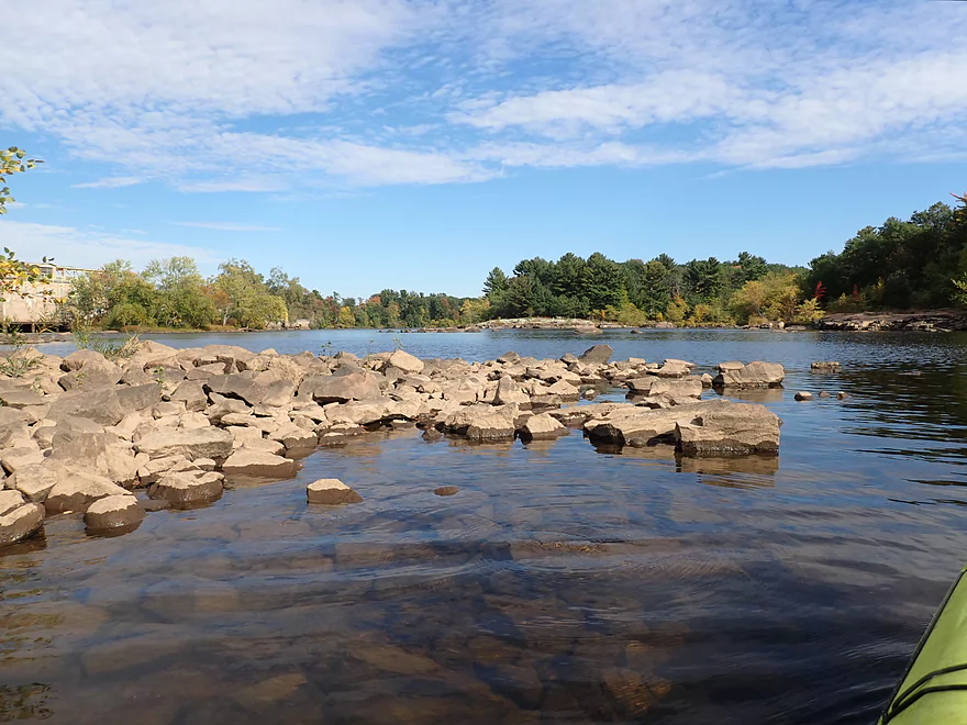
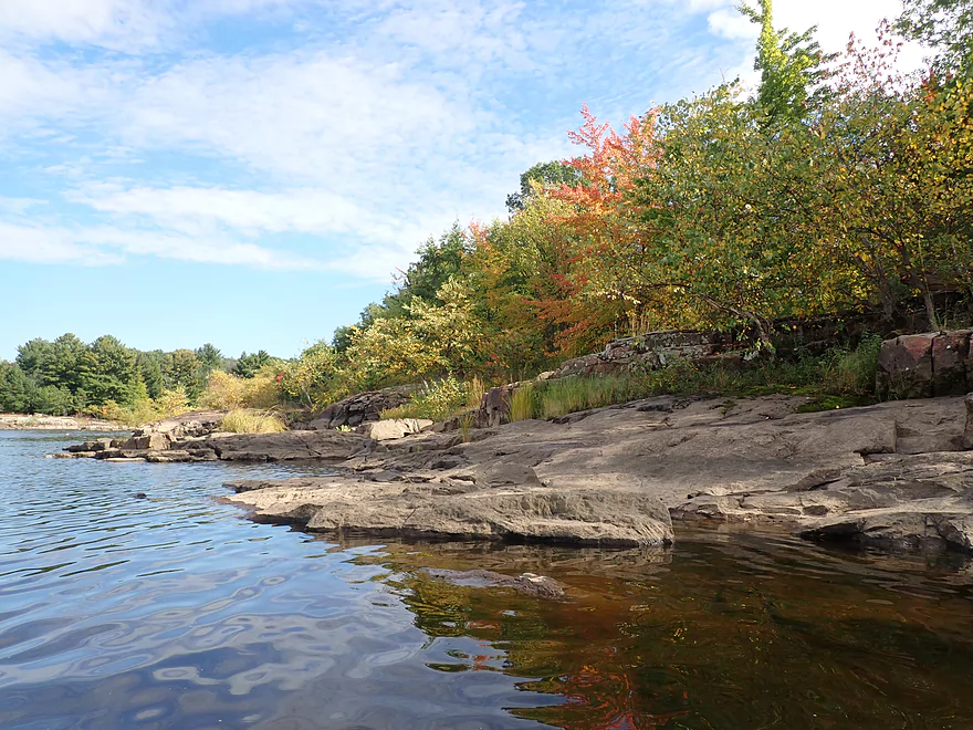
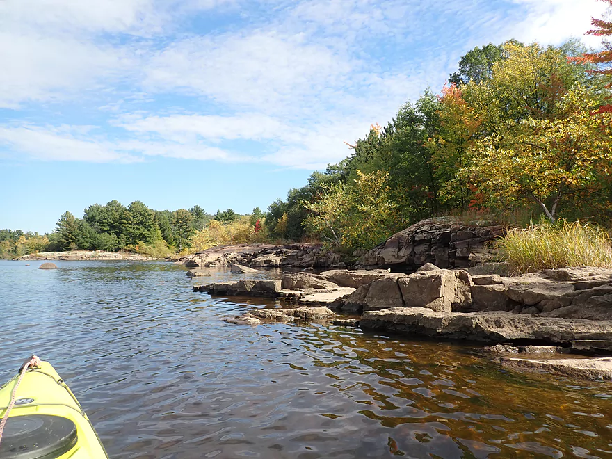
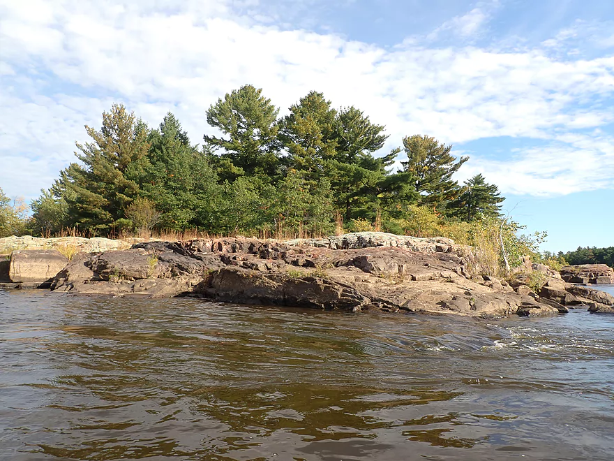
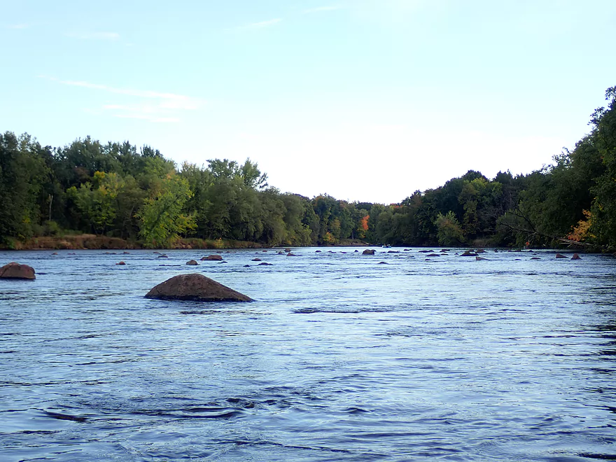
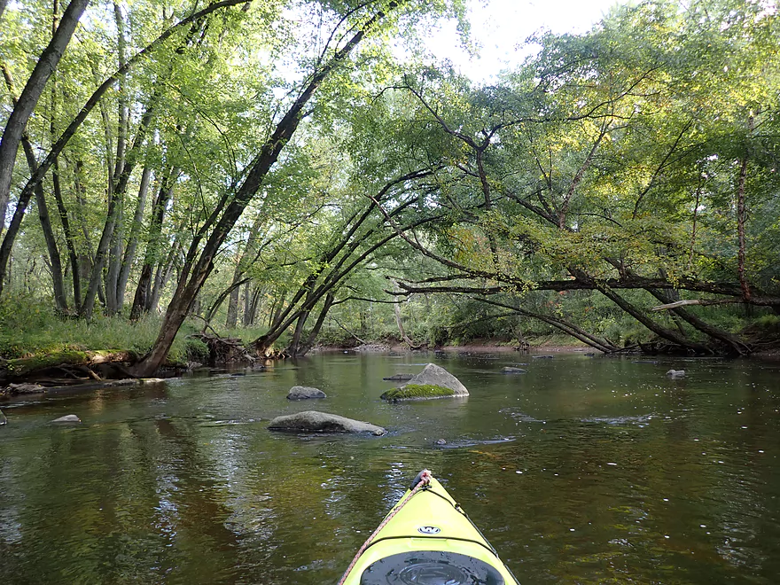
Things improved after the Hwy HH bridge. Here there was the first of many public and nice access points/pull-offs along the western shore. If you do this trip definitely stay right/west. Here I encountered an impressive stretch of exposed granite bedrock and two small islands filled with scenic pines that created great reflections upon the still water. While it was still a week away from peak, this stretch of river still featured good color.
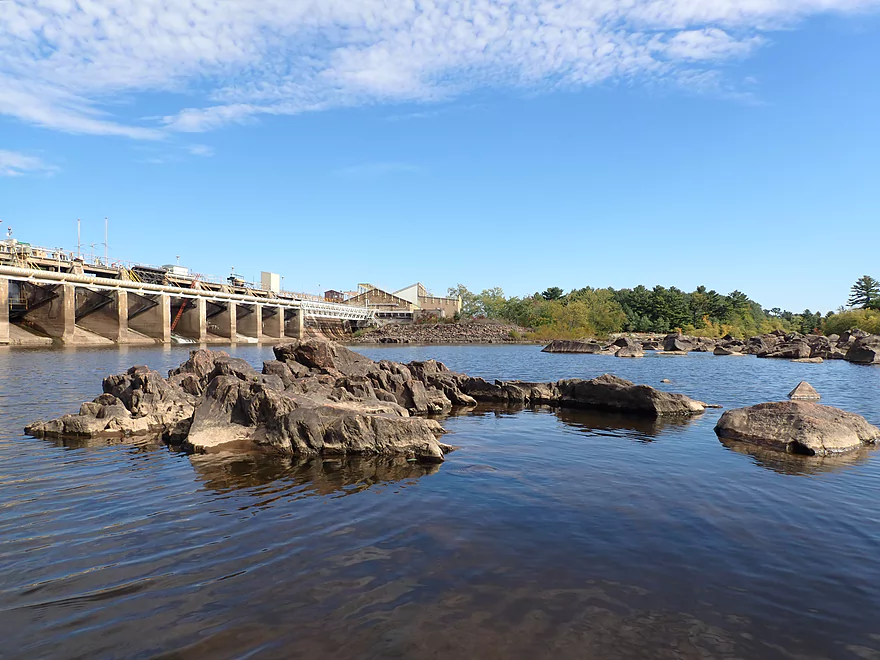
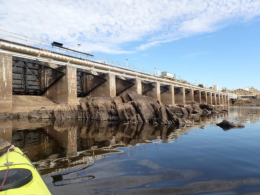
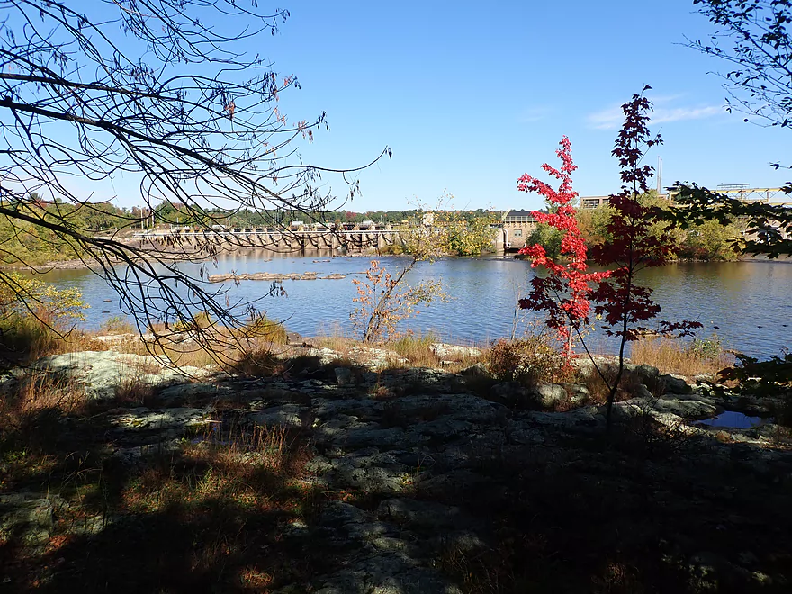
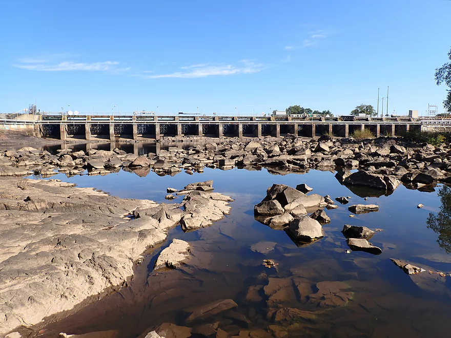
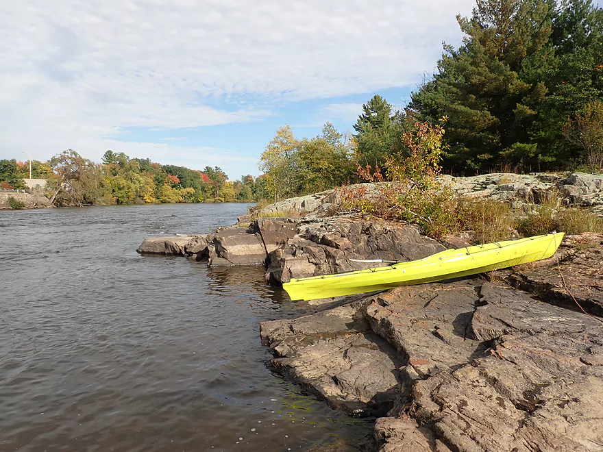
I then encountered the Whiting Dam where again the official portage path was excessively long and I was able to save time by ducking the ropes and getting closer to the dam (not something you should do when the gates are open). The area below the dam is fantastic and was my favorite part of the trip…in fact it might be one of the most scenic parts of the Wisconsin River in Central Wisconsin. Here the river narrows and is turned sharply east by large stretches of exposed granite. Some of which is 15-20′ high. At the base of the dam is an impressive boulder field. The river is divided by two several small islands into separate channels. The best scenery is along the west side of the west channel. The first side channel was too shallow to run so I had to loop around to access it from behind but it was worth it. The second island is another impressive mound of granite and the western channel has a quick stretch of short fun and scenic rapids. This is quite close to the mouth of the Plover River and I believe the rapids here (now mostly submerged) used to be called Bloomer’s Rapids.
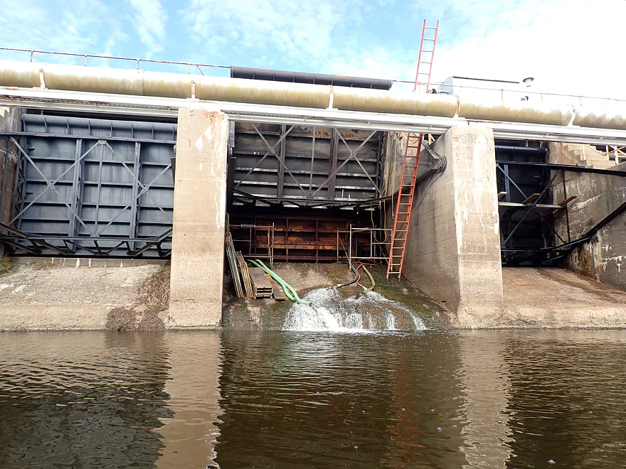
What’s remarkable is that just a half-mile after the Whiting dam was ANOTHER dam (this time the Kimberly Clark Dam). Having dams spaced this close together is a sign that the river used to have impressive gradient and rapids. The Kimberly Clark Dam is located by Al Tech County Park with a marked portage path along the western shore. This portage path though is way too long (over a 1000′) and I think the engineers wanted to be extra careful as this dam is a low-head which are very dangerous (and should always be removed). Because water levels were low I was able to yet again get significantly closer to the dam and get away with a much shorter portage, but don’t try this yourself without scouting beforehand (easy to do from Al Tech Park).
Below the dam there were some surprise Class 2 rapids which I understand can be worse in high water. These aren’t a major problem for paddlers though as you can simply put in at the south end of the park and avoid the worst of it. I ran them anyway and had a good time.
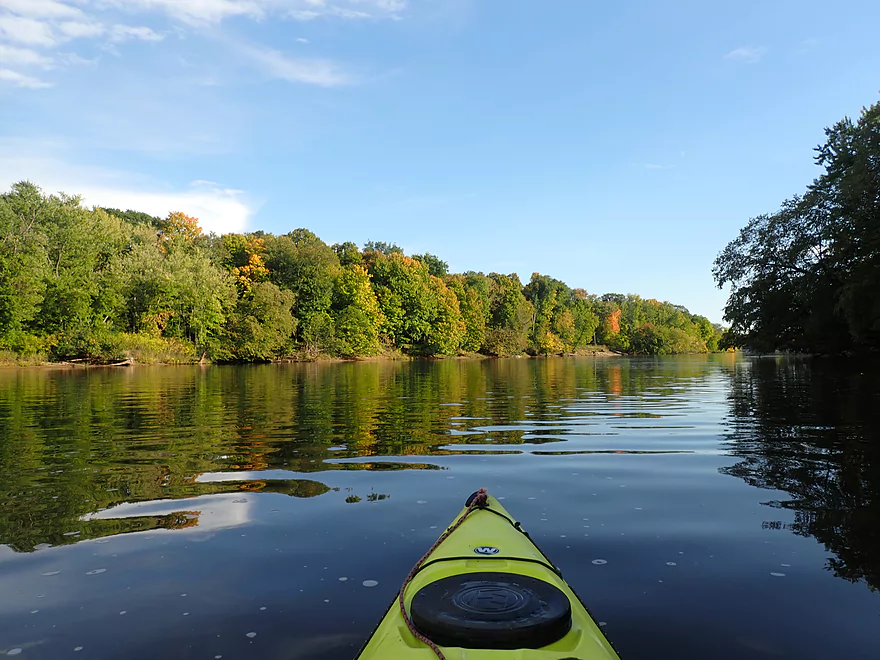
The final mile enters what I refer to as the “Stevens Point Archipelago”. Here the river slows dramatically and splits into many subchannels and large islands. These can be fun for paddlers to explore and round trips are viable because of the slower current. I decided to hug the western shore and took a right by an island next to a large boulder field to check out a scenic side channel. This was a bit shallow, but was very scenic and kind of reminded me of the Waupaca River because of the boulders and low hanging branches. I ended the trip at Blue Heron Landing which was a good access.
In summary this was a good trip, but won’t be for everybody. I suspect most paddlers would just do a round trip on the Whiting Flowage or in the “archipelago” below the Kimberly Clark Dam. If you do the full trip, you should be comfortable doing dam portages which in hindsight weren’t that bad. IMO it is worth it to do some portages as the best scenery is usually located immediately below the dams. But this is only true when water levels are low…when the gates are open all that interesting geology and granite gets submerged. My big regret was launching at Mead Park when I could have launched at the Stevens Point Dam and avoided one of the three portages. Lastly, if you can do this leg in October definitely consider it. The color in the Stevens Point area is quite underrated and this can be one of the nicer fall color paddles to do.
Sights included some dragonflies, clams, and several big fish making splashes.
Mead Park: This is a busy park located just upstream from the Stevens Point dam and the Clark Street bridge. There is a nice spot on the bank for launching, but I can’t recommend the park as it requires 400′ of dragging to reach the shore from the parking lot. I only put in here because I wanted to see the bedrock below the Stevens Point dam, but I didn’t realize in hindsight one can simply just launch at the dam. Live and learn…
Alternative Put-ins: There are many and I won’t list them all. See trip map for details.
- Pre-Stevens Point Dam: You can launch from Mead Mark or Pfiffner Pioneer Park as both are upstream from a dam. But I don’t recommend either (unless you love portaging). I suppose if you are taking out, they aren’t bad options though.
- Stevens Point Dam: West of the dam there is a public fishing access where you could launch (or take out). From here it would be a 400′ hike to the water. But IMO it is worth it, and I wished I had launched here. The bedrock below the dam is really gorgeous. Southeast of the dam (along Wisconsin Street) there is also a good public access. That wouldn’t be as scenic, but you can park closer to the river which means less boat dragging.
- Hwy HH to Whiting Dam: There are several options on the western shore. Hwy HH is an ok access and there are also two parks located downstream by the islands. These mini-parks/waysides are quite scenic and good access points.
- Whiting Dam: There are multiple waysides on the western shore where you can pull off and put in/take out by the dam (both upstream and downstream of it). The best access might be at the dam itself (west shore) where there is a fantastic view of the river below.
- Al Tech County Park: This is a decent access option and you could use it to take out above the dam or launch below it.
Blue Heron Boat Landing: This is a great public access that is free, has good parking, and has an outhouse. Be mindful of where you park, as you don’t want to block cars with trailers.
Alternative Take-out: There are many and I won’t list them all. See trip map for details.
- Hwy HH to Whiting Dam: There are several options on the western shore. Hwy HH is an ok access and there are also two parks located downstream by the islands. These mini-parks/waysides are quite scenic and are good access points.
- Whiting Dam: There are multiple waysides on the western shore where you can pull off and put in/take out by the dam (both upstream and downstream of it). The best access might be at the dam itself (west shore) where there is a fantastic view of the river below.
- Al Tech County Park: This is a decent access option and you could use it to take out above the dam or launch below it.
- Galecke Park: This would be a decent option for those wanting a longer trip. It is on the southeast shore though which can make shuttling more (or less) difficult depending on your put-in.
Bike Shuttle: 4.4 miles with 75′ of ascent. The bike shuttle was really nice and was one of the trip highlights. Much of the route on River Drive parallels and overlooks the river under wooded canopies. There are numerous scenic public pull-offs where you can get out and take pictures of the river. It’s also an excellent way to scout any portages you plan on doing. Note there is an official bike trail on the east shore (Green Circle Trail). That looks really nice and I saw multiple bikers on the trail…but it is on the wrong side of the river so isn’t practical as a kayak shuttle.
Rentals: Northward Peddle and Paddle does offer rentals and tours in the Stevens Point area. They can be contacted at 608-287-4585.
Low Bridge: Clark Street is surprisingly low for a busy highway bridge. You should be able to get through fine under the middle arch, but be mindful it does taper at the end so be careful, especially in high water. Note, I don’t recommend launching above the Steven Point Dam anymore after I learned you can simply launch at the dam, so you shouldn’t even need to worry about this regardless.
Portages:
- Stevens Point Dam: Again I don’t recommend launching above the dam, which would negate this portage. But if you do the portage, note the official portage path is an insane 1200′. If water levels are low, you can simply duck under the warning ropes and take out at the dam itself. Super easy, safe, and a lot shorter than the official marked portage path.
- Whiting Dam: The official portage path on the western shore isn’t too bad at 400′. If the spillways aren’t open you can actually duck the warning fence and take out later to save some walking. You can also re-enter on the granite outcrops as opposed to the official wooded path which would also save some time. Note either way you will be dragging your boat over rocks.
- Kimberly Clark Dam/Al Tech County Park: This is the trickiest portage. There is a well-marked portage path and it is nice…but also quite long at 1000′. You can shorten this significantly by simply taking out upstream from the dam, but be advised this is a very dangerous low-head dam and you don’t want to be swept over. I was able to find a nice stable spot close to the dam for an easy portage (minus a steep bank and some stairs to deal with). All in all this wasn’t bad as it is the shortest and smallest of the three dams. Definitely scout this dam before doing a trip. If levels are high, you don’t want to be anywhere near the ledge.
Dam Releases: When I did the trip all the main gates were closed. Prior to a release a warning horn will sound every 30 seconds for five minutes. You do not want to be under a dam when the gates open.
Rapids: Most of this trip was on slow impounded waters and could be mostly done as a round trip, but there were some surprise rapids.
- Below the Stevens Point Dam: There are minor Class 1 rapids between the dam and the railroad bridge. These are mostly nothing to worry about, but might get interesting in high water.
- Below the Whiting Dam: When water levels are high there are strong Class 2 rapids below the gates, but when the gates are closed the area is pretty calm. There are also minor Class 1 rapids also below the powerhouse but these aren’t a big issue.
- Below the Kimberly Clark Dam: There are serious Class 2 rapids located below the dam. You can avoid most of these by simply doing a longer portage. I ran these and had fun, but did get seriously splashed. Be mindful that rapids on the Wisconsin are “deep water rapids”. This makes them a bit more dangerous and unforgiving than “shallow rapids”. With deeper water, rapids will have more energy and will be more unforgiving if you get pinned on a rock. Here is a video of me running these rapids.
Getting Lost: There are roughly 15 islands on this trip with many side channels. I suppose paddlers could get lost or disoriented especially at the end of the trip but this mostly shouldn’t be an issue. I do however recommend studying a map ahead of time and simply sticking to the western channels which are the most scenic.
Wisconsin River @ Wisconsin Rapids: 3000 CFS or 2.95′. Note, dams on the central section of the Wisconsin tend to be unpredictable and can do large releases on short notice. Several of the area dams are in poor shape and are undergoing emergency repairs. Levels can change quickly as operators change water levels to facilitate gate repair. Definitely check levels prior to doing a trip.
- 0-1500 CFS: The river almost never gets this low.
- 1501-3500 CFS: On the low end, but a great target range. Here the exposed bedrock and boulders will be their most impressive. Note this stretch of the Wisconsin doesn’t really get too low for navigation.
- 3501-5000 CFS: An average depth and ok for a trip, but not as nice or scenic.
- 5001-7000 CFS: A high depth that really isn’t recommended. All the interesting geology will be underwater. And because you won’t be able to get as close to the dams, you’ll have to do longer portages.
- 7001+ CFS: Maybe too high for enjoyable paddling.
Quick Overview
- Upstream of Stevens Point: I don't have information yet on these stretches.
- Stevens Point to Lake Petenwell: ~42 miles. This stretch in Central Wisconsin used to have many natural rapids, but most have been buried under 8 dams, some of which are now difficult portages. Despite this there is still some good paddling to be had in this region.
- Lake Petenwell: 14.9 miles. This is a large flowage lake that is challenging for paddlers because of frequent strong winds and big waves.
- Castle Rock Lake: 14.5 miles. Another large flowage lake that is likely too big for enjoyable paddling.
- Castle Rock Lake Dam to Lemonweir River: 9.4 miles. This pre-Dells leg isn't elite, but is a pleasant stretch.
- Lemonweir River to Indian Trails Landing: 21.7 miles. This includes the famous Upper Dells and Lower Dells which feature many scenic sandstone outcrops.
- Indian Trails Landing to Portage: 16 miles. This is an overlooked section sandwiched between the Dells and Portage. While the scenery isn't top-notch, it does have many sandbars and few people, which is a nice combination.
- Portage to Lake Wisconsin: 14.3 miles. This is a neat stretch of the river with many sandbars and cliffs, but the shoreline is very developed and motorboat traffic can be heavy on weekends.
- Lake Wisconsin: 14.5 miles. This is a challenging lake for paddling because of the huge and frequent waves created by motorboats.
- Prairie du Sac Dam to Port Andrews: 57 miles. This is the first half of the famous Lower Wisconsin Riverway. This is a super popular stretch for paddlers with the highlights being large sandbars, big bluffs, occasional cliffs, and fun side sloughs to explore.
- Port Andrews to Wyalusing: 40 miles. This is the second half of the Lower Wisconsin Riverway which has far fewer paddlers and sandbars. But the bluffs and sloughs are larger and more interesting.
Detailed Overview
- Upstream of Merrill: I don't have enough information yet on these legs to comment.
- Merrill Dam to Riverside Park: 0.5 miles. Might include some light rapids below the dam.
- Riverside Park in Merrill to Wisconsin River Forest Landing: 8.6 miles. A good prospect.
- Wisconsin River Forest Landing to Brokaw Boat Landing: 5.7 miles.
- Wisconsin River Forest Landing to Jesse Park: 1.4 miles. A terrific stretch with small boulder gardens, one set of Class 1-2 rapids, gravel bars and a nice sand bank.
- Jesse Park to Brokaw Boat Landing: 4.3 miles. A good stretch with scenic wooded banks and occasional gravel bars.
- Brokaw Boat Landing to Gilbert Park: 5.1 miles. River slows down and becomes hillier. This stretch is an ok prospect and goes past the old Brokaw paper plant that has been shut down. Paddlers must navigate Class 1 rapids and a 2' drop where the old Brokaw dam used to be.
- Gilbert Park to Wausau Boat Dock: 1.5 miles. An impounded stretch through Wausau. There are numerous alternate access options to choose from.
- Wausau Boat Dock to Oak Island Boat Ramp: 1.2 miles. A nice stretch that includes Barkers Island and Isle of Ferns Park. But the Wausau dam does require a portage. This stretch parallels the famous Wausau Whitewater Park.
- Oak Island Boat Ramp to Rothschild Dam Access: 5.8 miles. Likely mostly uninteresting flowage paddling. There are many alternate access options to choose from.
- Rothschild Dam Access to Zimpro Park: 1.0 miles. This might be a nice stretch.
- Zimpro Park to River Road Boat Landing: 7.6 miles. The first half of this leg is likely nice river paddling, but the second leg is probably just an uninteresting flowage.
- Chucks Landing/Mosinee Dam to Bean's Eddy Boat Landing: 2.8 miles. Likely a nice leg. You might be able to launch by the dam where there should be some nice rapids and boulders.
- Bean's Eddy Boat Landing to Seagull Boat Landing: 5.1 miles. Mostly uninteresting flowage paddling. Although there might be some nice sand banks on the eastern shore.
- Seagull Boat Landing to Dubay Dam Access: 5.3 miles. Mostly uninteresting flowage paddling.
- Dubay Dam Access to River Road Landing: 5.5 miles. This could be a nice stretch of river.
- River Road Landing to Old US 10 Landing: 2.3 miles. Likely an ok leg.
- Old US 10 Landing to Stevens Point Dam: 5.6 miles. Probably uninteresting flowage paddling. Many alternate access options closer to Stevens Point.
- Stevens Point Dam to Blue Heron Boat Landing: 4.2 miles.
- Steven Point Dam to Whiting Dam: 2.6 miles. Starts slow and uninteresting, but the river becomes very scenic after the Hwy HH bridge. The rock formations below both dams are very striking. Many alt access points.
- Whiting Dam to Kimberly Clark Dam/Al Tech Park: 0.6 miles. Incredible scenery with exposed bedrock and boulder gardens below the Whiting Dam. Some rapids, but nothing major. The Kimberly Clark Dam is a dangerous low-head dam and should be treated carefully.
- Kimberly Clark Dam to Blue Heron Landing: 1.0 miles. Class 2 rapids below the dam, but after that the river slows dramatically and splits into many sub-channels and islands. Round trips on this leg are possible. I chose the far western channel where there were some nice rocky stretches.
- Blue Heron Landing to Mill Creek Landing: 4.1 miles. Likely a mediocre paddle with nothing special. Galecke Park is an alternate access.
- Mill Creek Landing to Biron Dam North Gate: 7.6 miles. Mostly uninteresting flowage paddling. Several alternate access options on route.
- Biron Dam North Gate to Veteran's Memorial Park: 4.5 miles.
- Biron Dam North Gate to Biron Landing: 1.0 miles. Super scenic stretch by two islands with many granite boulders.
- Biron Landing to Legion Park: 3.0 miles. A nice stretch by Big Island. The west channel is more undeveloped...but the east channel has several scenic granite islands.
- Portage through Legion Park: 680'. A steep wall separates the park from the river but in two locations the wall is short enough to get over (see map). Paddlers may want to consider a longer portage to bypass some of the shallow rocky stretches by Legion Park.
- Legion Park to Veteran's Memorial Park: 0.4 miles. A scenic stretch that features a large boulder field and the powerhouse for a large paper mill.
- Veteran's Memorial Park to Port Edwards Landing: 3.8 miles
- Veteran's Memorial Park to Demitz Park: 0.8 miles. A pleasant stretch that includes Belle Island.
- Demitz Park to Ben Hansen Park: 1.2 miles. This leg goes by Garrison Island and Edwards Island. Lyon Park is located across the river from Demitz Park and is another access option.
- Ben Hansen Park to Port Edwards Landing: 1.8 miles. Above the Centralia dam there are several small but nice islands. Portage the dam on the left bank (follow the 1000' trail through the golf course). Below the dam there are scenic rock formations. Close to the Port Edwards dam are a few more scenic islands you can explore.
- Port Edwards Landing to Nekoosa/Riverside Park: 3.6 miles.
- Port Edwards Landing to Port Edwards Powerhouse: 1.3 miles. A half-mile portage is required (east bank). A very scenic boulder field is located below the dam. At high levels, the rocks are submerged and produce a half-mile stretch of rapids (some strong).
- Powerhouse to Moccasin Creek Landing: 1.8 miles. A generic wooded stretch that isn't super interesting.
- Moccasin Creek Landing to Riverside Park: 0.5 miles. During the Nekoosa dam drawdown, this stretch had nice boulder fields and rapids.
- Riverside Park to Hwy 73: 0.8 miles. An ok stretch of the river. There are scenic cliffs south of Hwy 73, but these are past the dam warning line. Hwy 73 is not a good access option.
- Hwy 73 to Point Basse Ave (Portage of the Nekoosa Dam): 1.5 miles. A difficult 1.5 mile portage through downtown Nekoosa. Don't try to portage the south bank. There is a steep hill, cliffs, and large Domtar paper mill fences to deal with.
- Point Basse Ave to Jim Freeman Memorial Boat Landing: 0.8 miles. A generic stretch going by historic Point Basse. If you're willing to backtrack to the dam, you can see scenic boulder fields (during low flows) and a few cliffs. Point Basse Ave is a somewhat speculative access, but it seems public and doable for launching.
- Jim Freeman Memorial Boat Landing to Plank Hill Small Boat Access: 2.0 miles. A generic stretch.
- Plank Hill Small Boat Access to 19th Drive Landing: 5.3 miles. Features two epic sand banks. The main channel has some minor sandbars. Several of the side sloughs can provide fun side adventures.
- 19th Drive to the Petenwell Dam: 14.9 miles. This is Lake Petenwell which is a large and challenging lake for paddling. Waves and strong winds are frequently an issue. But when calm there are nice sandbanks on the northwest shore, hidden sloughs, and large islands to explore. See the overview map for more info.
- Petenwell Dam to Ganter Lane Landing: 3.8 miles. This stretch isn't too impacted by dams and may have nice sandbars at low levels.
- Ganter Lane Landing to Castle Rock Lake Dam: 10.7 miles. Castle Rock Lake is likely too big (wind/waves) for enjoyable paddling. There are many alternate launch options along the shore.
- Castle Rock Lake to the Lemonweir River: 10 miles. An ok section.
- Lemonweir River Mouth to River Bay Landing: 7 miles. The first half of the classic Upper Dells.
- River Bay Landing to Blackhawk Island: 6.5 miles. Second half of the classic Upper Dells, known for its fantastic outcrops. Note, the Blackhawk Island landing is no longer accessible without special permission from the Upham Woods Outdoor Learning Center.
- Black Hawk Island to Wisconsin Dells Dam: 2.0 miles. More nice sandstone outcrops. You can take out at a public ramp off Indiana Ave or portage the dam and take out SW of the dam by a launch off Wisconsin Dells Pkwy/Hwy 12.
- Dells Dam to Indian Trails Landing: 6.2 miles.
- Dells Dam to Newport Park: 2.2 miles. This is the heart of the famous Lower Dells with many scenic outcrops. Unfortunately jet boats are a serious plague on this stretch.
- Newport Park to Indian Trails Landing: 4.0 miles. Features the famous "Sugar Bowl" formation and four super cool caves. The outcrops soon disappear and this stretch is mostly uneventful (but peaceful) big river paddling.
- Indian Trails Landing to Pine Island Boat Ramp: 9.8 miles. Few paddle this stretch as it isn't as interesting. But...it does have a good concentration of sandbars and few competing paddlers for them.
- Pine Island Boat Ramp to Portage/Hwy 33 Access: 6.0 miles. Not an elite section that is lacking in cliffs and bluffs. It does have good sandbars though.
- Portage to Dekorra Park: 7.7 miles
- Portage to Baraboo River/Thunderbird Road: 5.2 miles. A good section with great sandbars. Close to Portage there are few motorboats.
- Baraboo River to Dekorra Park: 2.5 miles. River splits around massive Lib Cross Island. West channel has nice sandbars. St Lawrence Bluff has scenic sandstone outcrops and includes a cave you can paddle into.
- Dekorra Park to James Whalen Memorial Park: 6.6 miles.
- Dekorra Park to Camp Rest Park: 5.1 miles. A terrific section with rock outcrops, large island deltas, hidden sloughs, and nice sandbars. Unfortunately this part of the river is popular with motorboats and jet skis which can be a plague. Multiple alternate access options.
- Camp Rest Park to James Whalen Memorial Park: 1.5 miles. Not a great section because of the open water paddling, powerboats and big waves. The west shore though does have nice outcrops.
- James Whalen Memorial Park to Merrimac Memorial Park: 4.4 miles. River turns into "Lake Wisconsin". Generally speaking this isn't ideal for kayaking as motorboat traffic can be heavy and waves can be surprisingly big. The most direct route is the north shore which has a few bluffs, but generally speaking isn't that interesting.
- Merrimac Memorial Park to Veterans Memorial Park/Prairie du Sac: 9.6 miles.
- Merrimac Memorial Park to Moon Valley Landing: 3.3 miles. Includes a lot of developed shoreline. The ferry, railroad bridge, and Moon Bay are highlights.
- Moon Valley Landing to Veterans Memorial Park/Prairie du Sac: 6.3 miles. Other than Moon Bay and the dam, this is a boring stretch. There are numerous alt access options on this route.
- Prairie du Sac to Mazomanie: 8 miles. An ok section of the Wisconsin but lacking in sandbars.
- Mazomanie to Arena: 9.7 miles. A great section with nice sandbars and scenic bluffs.
- Arena to Hwy 14: 8.0 miles. Good section with a high concentration of sandbars. One of the more popular legs on the Lower Wisconsin.
- Hwy 14 to Hwy 23/Spring Green: 2.2 miles. Neat mini-section with sandstone outcrops. Very popular in the summer.
- Spring Green to Lone Rock: 7.4 miles. Another fine sandbar/bluff section with some nice rock outcrops too.
- Lone Rock to Gotham: 8 miles. This stretch has super impressive rock outcrops and sand banks.
- Gotham to Muscoda: 7.6 miles. This leg includes more large sandbars and great outcrops. Bonus highlights include fast current and not seeing as many people.
- Muscoda to Port Andrew: 7 miles. A good stretch with many islands and sandbars.
- Port Andrew to Boscobel: 9 miles. Wooded islands start to get massive.
- Boscobel to Woodman/Big Green River: 9 miles and start of the less paddled stretch of the Lower Wisconsin. Far fewer sandbars from here to the mouth, but good bluffs and side sloughs to explore.
- Woodman to Millville: 7.7 miles. A good stretch with large bluffs and sandbars.
- Millville to Bridgeport: 5.3 miles. Huge islands, bluffs and sandbars are the highlight on this second-to-last leg on the Wisconsin River.
Bridgeport to Wyalusing (the mouth): 9 miles.
Trip Map
Overview Map
Video
Photos Size:
Put in at the north end of Mead Park, where the dog beach is. You can park on the street very close to the water. There is a sand beach there. The spillway (which you call a low head dam) is EXTREMELY DANGEROUS. Two people (one of my students and his father, one of my colleagues at the University) drowned there. I would not recommend that anyone get anywhere near it. Especially in the Spring.
Thanks for the warning. I 100% agree that dam is very dangerous and should be avoided.