
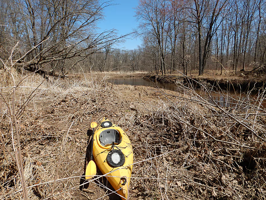
Welcome to Hemlock Creek
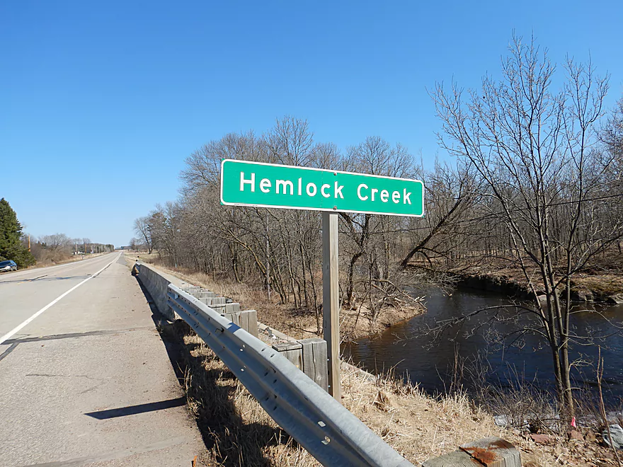
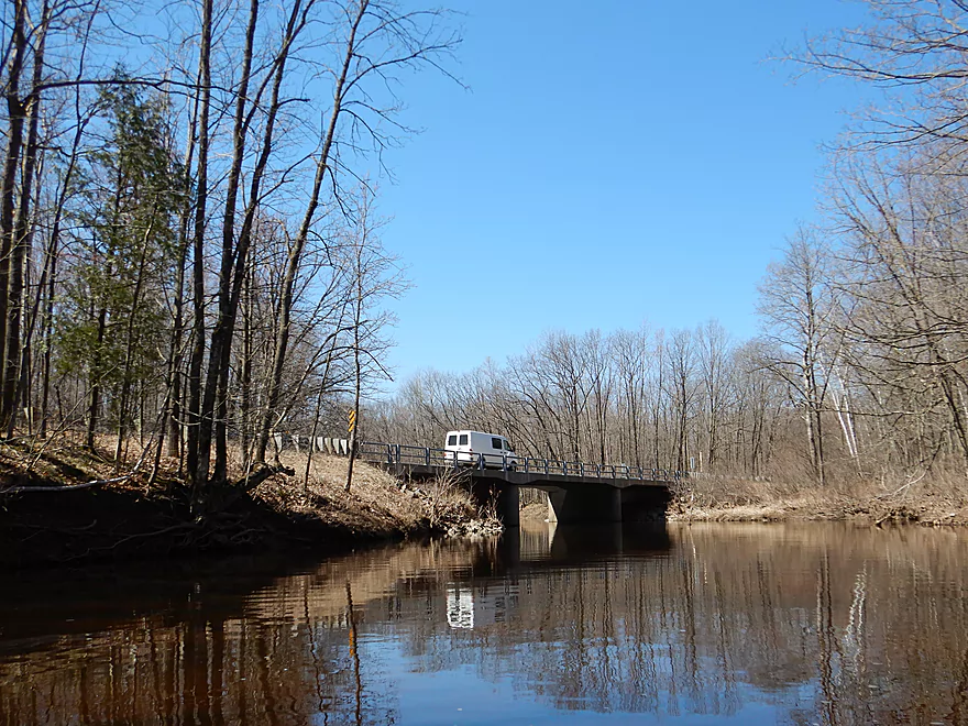
Decent bridge access at Hwy 73
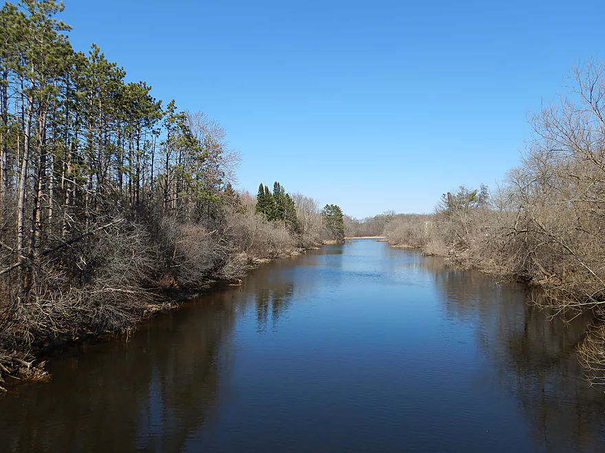
Scenic too
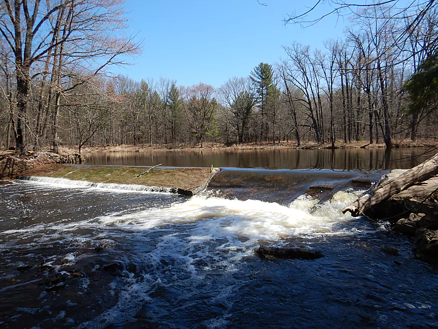
The granite here acts like a natural dam
Trip starts fast
With fantastic granite rock formations
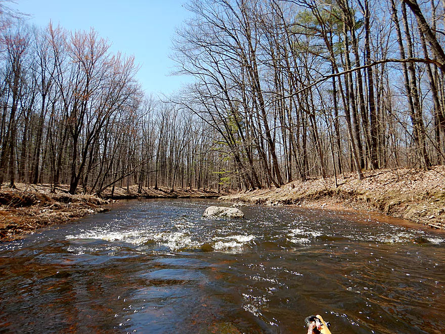
One of many light riffles
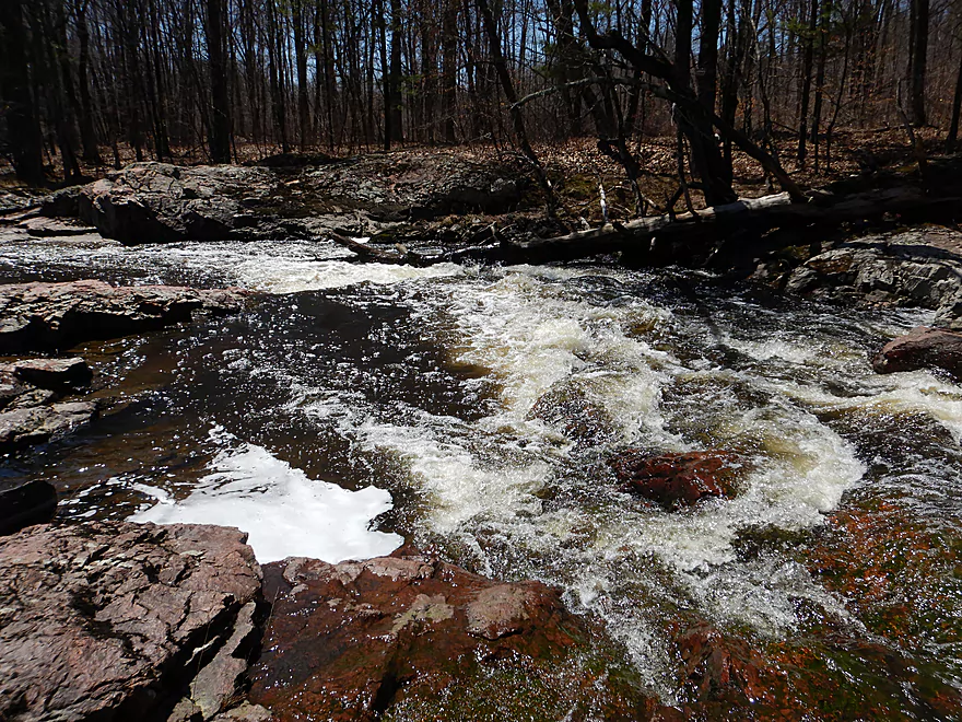
Some stronger rapids
Looks like there used to be a dam here
River stays fast
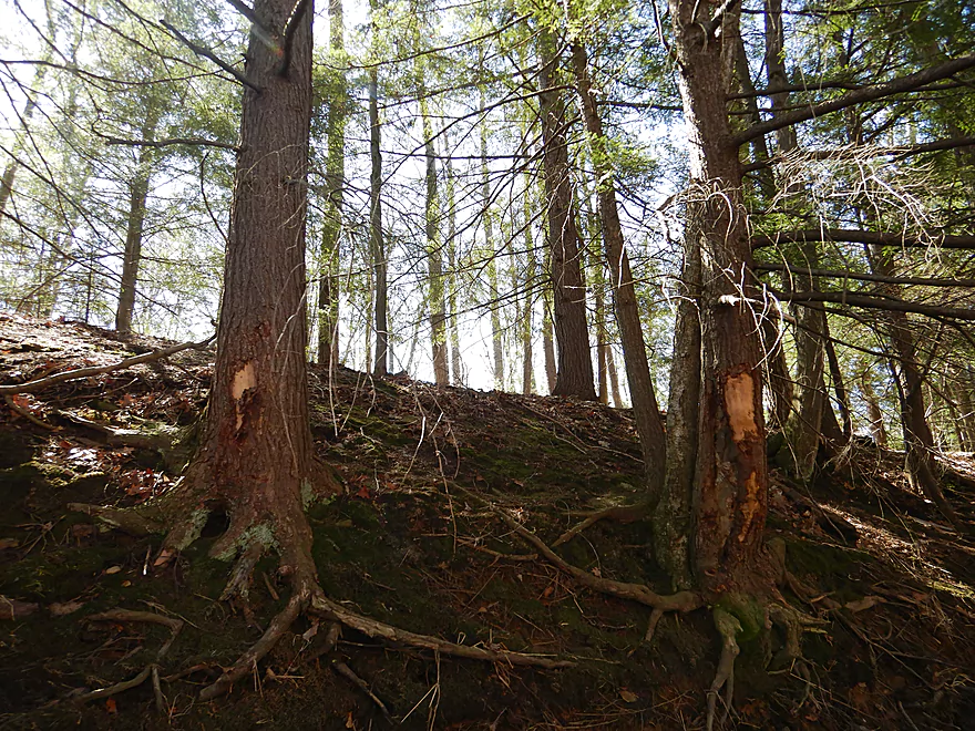
Hemlocks on the Hemlock
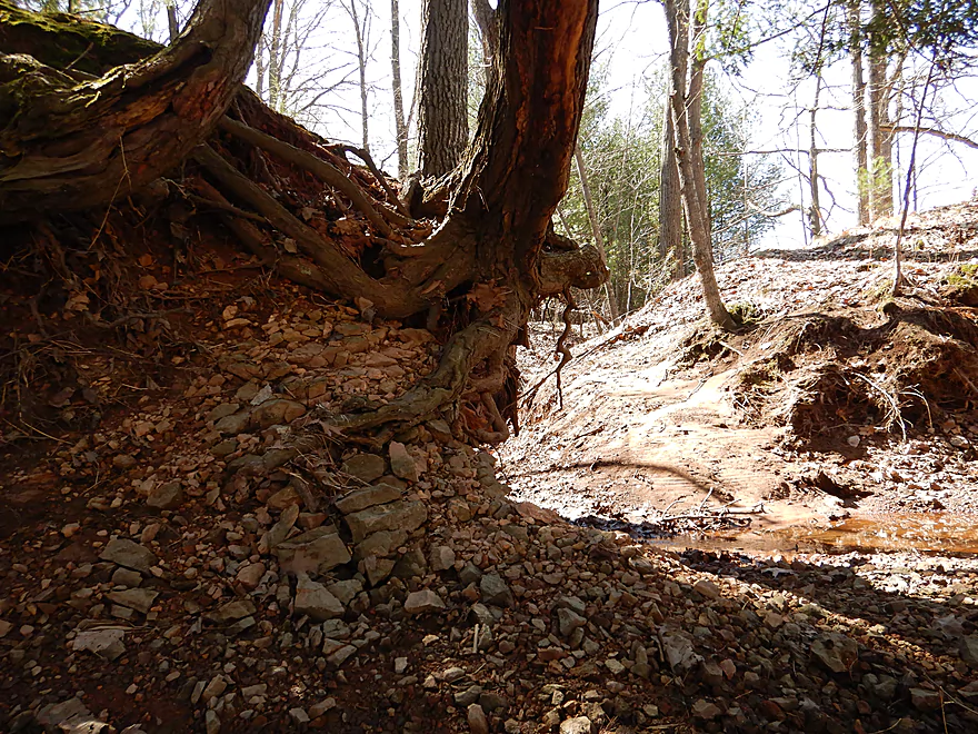
Hanging on for dear life
This creek reminded me of the East Fork
More hemlocks
I think this is from ice flows
Lincoln Road (not a a great access option)
Very scenic
One of my favorite parts of the trip
The granite acts like wing dams
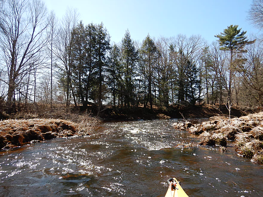
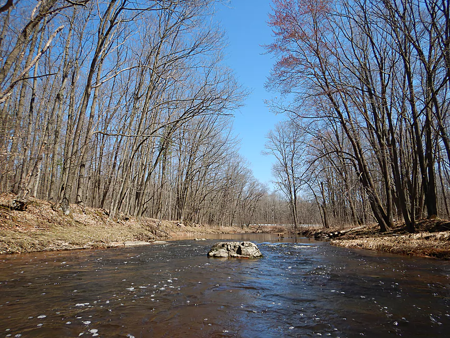
Looking downstream
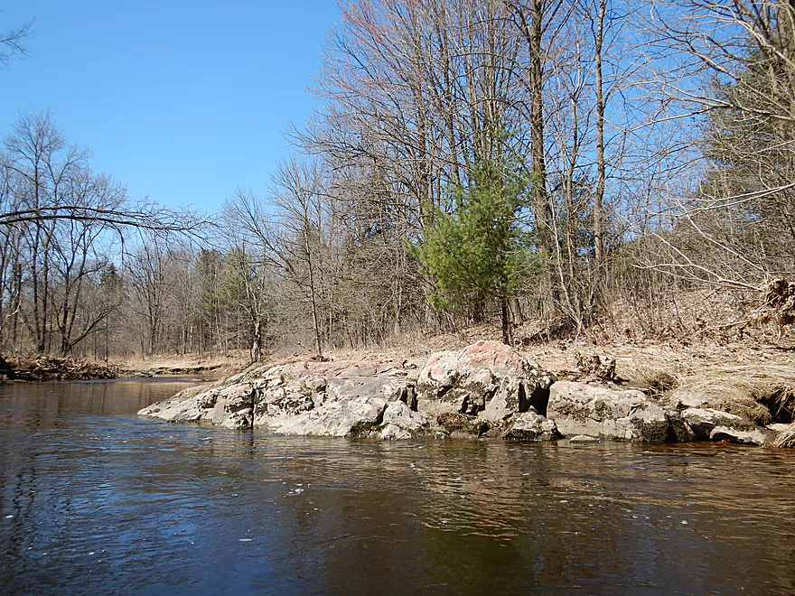
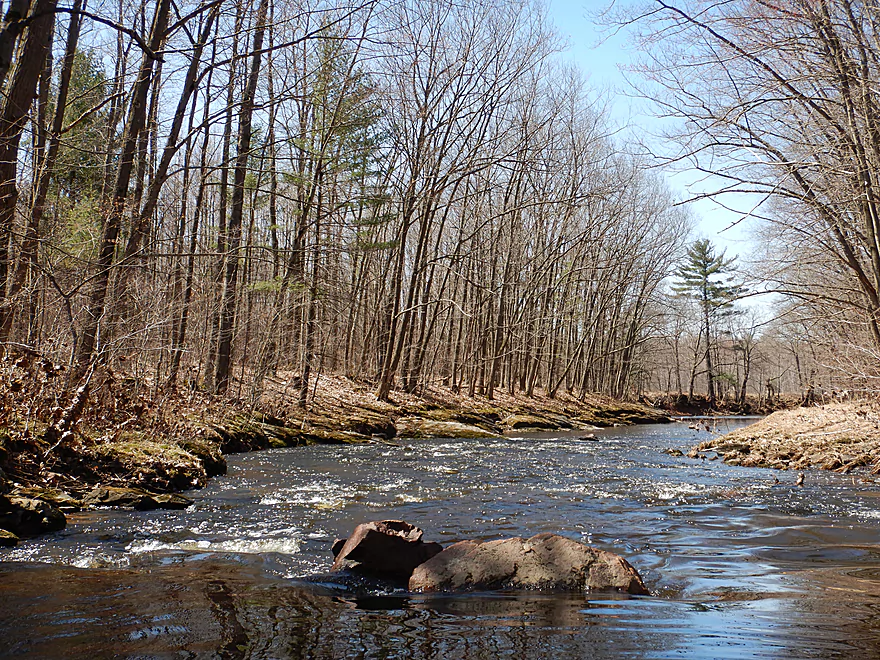
Beautiful solid bedrock
Attractive gravel substrate
Portage #1
Pretty easy
Creek opens up into a surprise flowage
The culprit
This dam was created by a local cranberry farmer
But nature is cutting a path around the dam
Some light rapids to start a large section of rapids
Rapids getting stronger
I would rate this Class 3 because of the tree
Time to portage
Really scenic granite
Full zoom
Half zoom
No zoom
The snowmobilers must enjoy a great view
Some residual rapids
Creek starts to change in character
Logjam #2
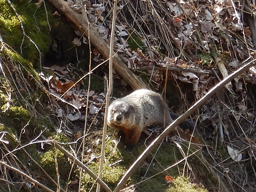
A friendly woodchuck
Logjam #3
Logjam #4 (and 4b hiding around the corner)
Creek starts to become sandy (a sign we are nearing Glacial Lake Wisconsin)
A final scenic outcrop near the take-out
Hemlock Road hiding just around the corner
Nicely framed by white pines
This is a decent access option
Scouting Spruce Road much further upstream (looks nice)
Scouting Hwy 186 (mostly a flowage here)
Hemlock Creek

I’m a big fan of paddling Central Wisconsin, but there exists a large swath of the state spanning from Black River Falls to Stevens Point to Wisconsin Dells which I dub the Bermuda Triangle. Here most streams and rivers suffer an inordinate number of logjams due to the large sand deposits left by Glacial Lake Wisconsin. The Yellow River is one of those victims and despite it being a somewhat local river, I haven’t been motivated to explore it. The exception is the far Upper Yellow, which escapes this sand trap and has some fantastic geology. I liked my 2016 trip so much, I looked for neighbors and discovered Hemlock Creek to the east which seemed very promising. After a lot of planning, map study, and car scouting… a window with perfect water levels opened up which I was pleased to take advantage of.
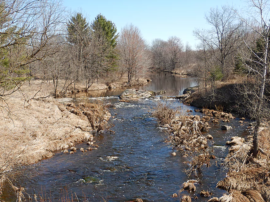
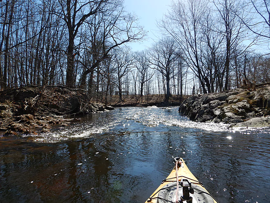
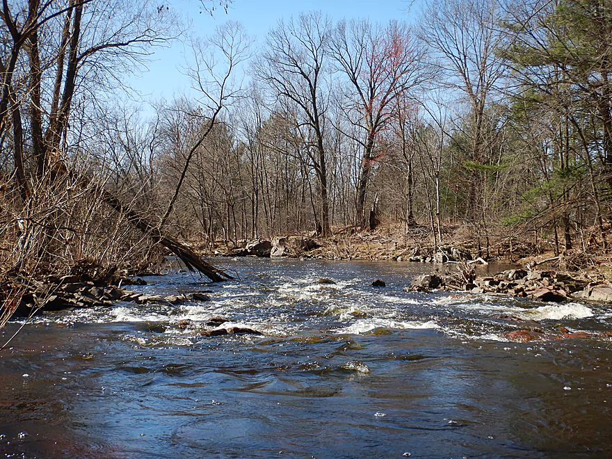
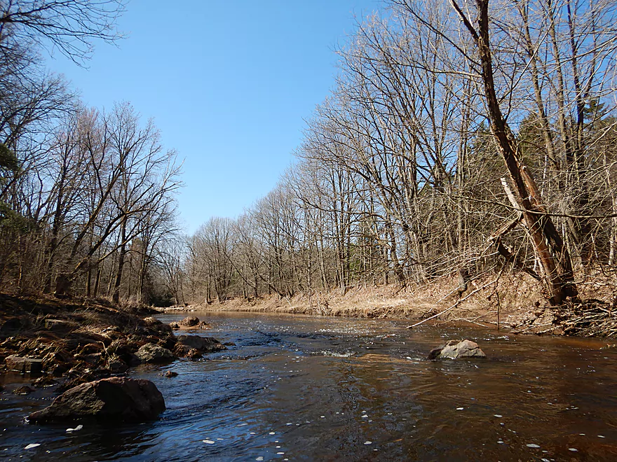
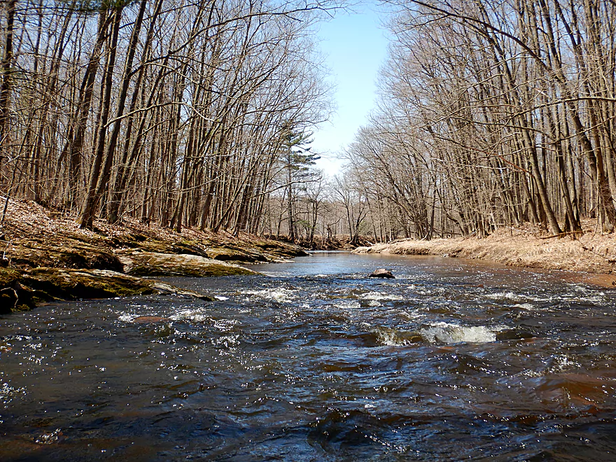
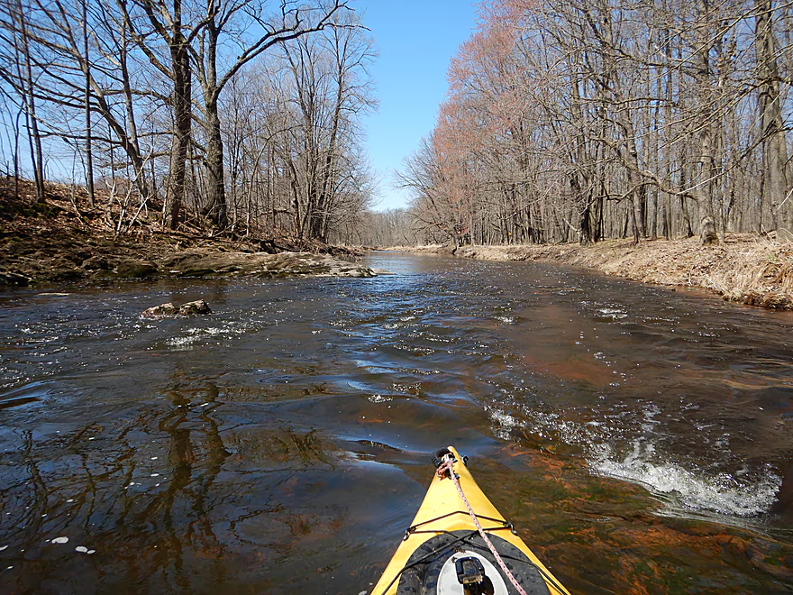
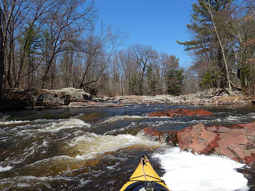
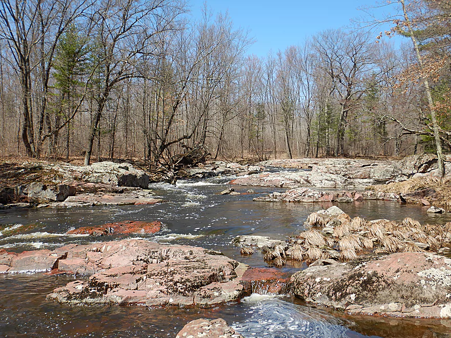
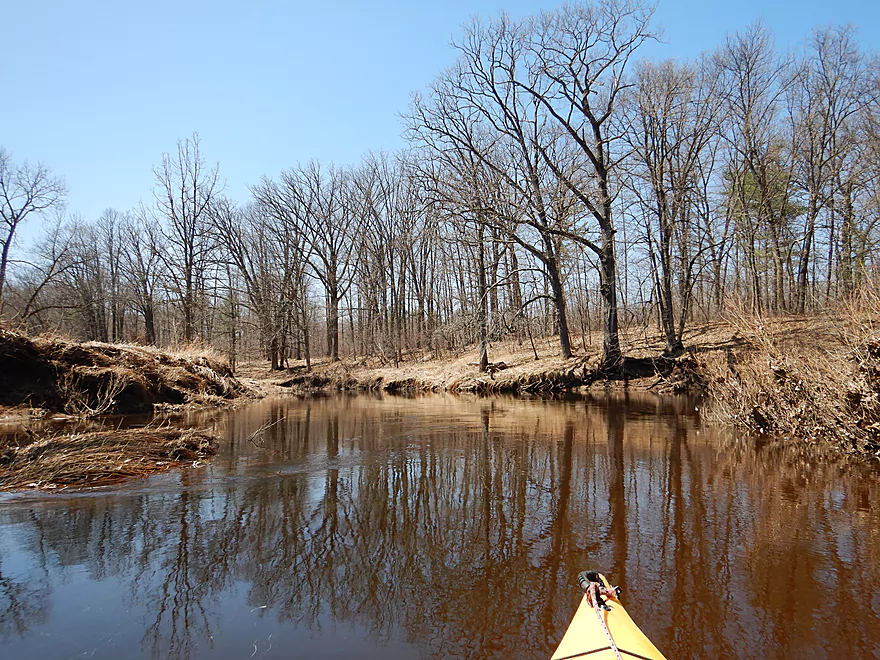
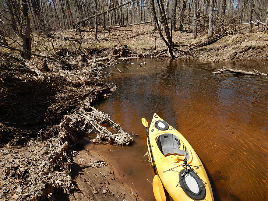
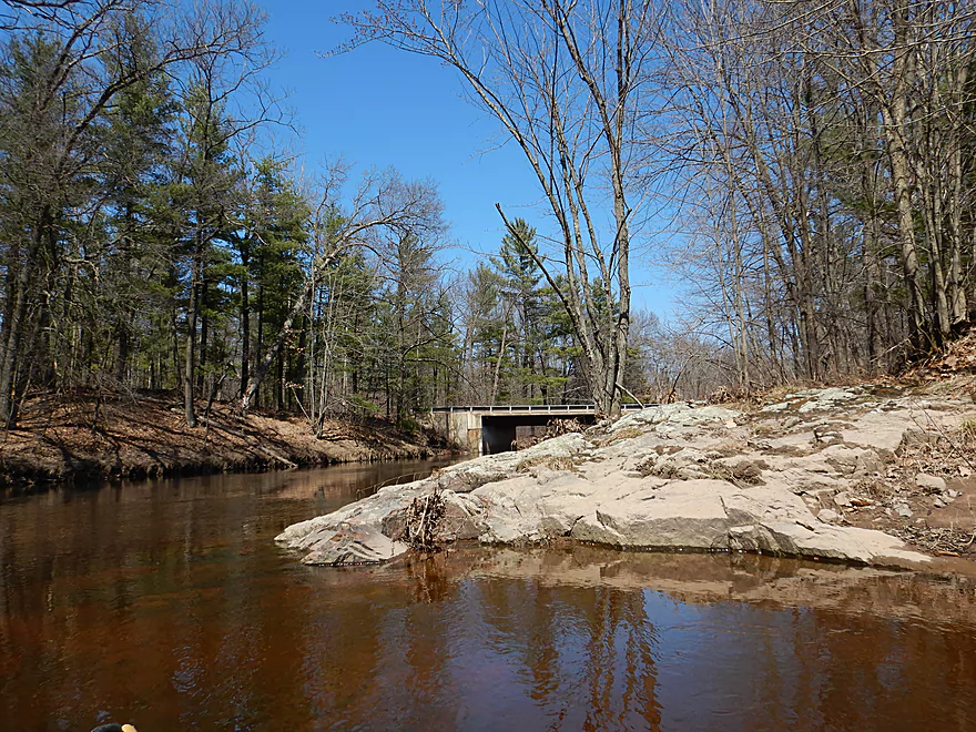
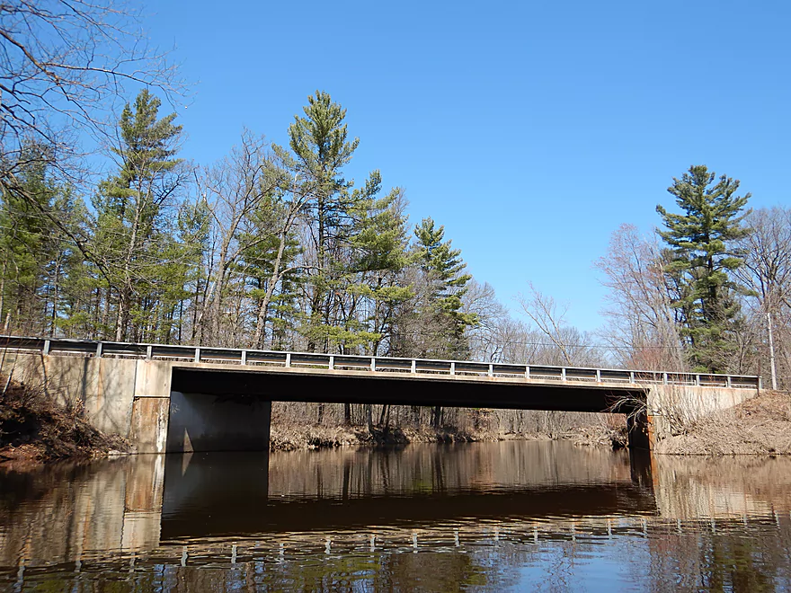
The trip started on a great note by the Hwy 73 bridge. Upstream of the bridge is a scenic slab of exposed granite bedrock that acts as a small dam on the creek. This is followed by small rapids that flow under the bridge. Note these are among the most shallow of the entire trip, so don’t be overly discouraged if they look bumpy. Following the bridge, the creek takes a sharp left past a large mound of granite and then riffles through a granite chute. A great start to the trip!
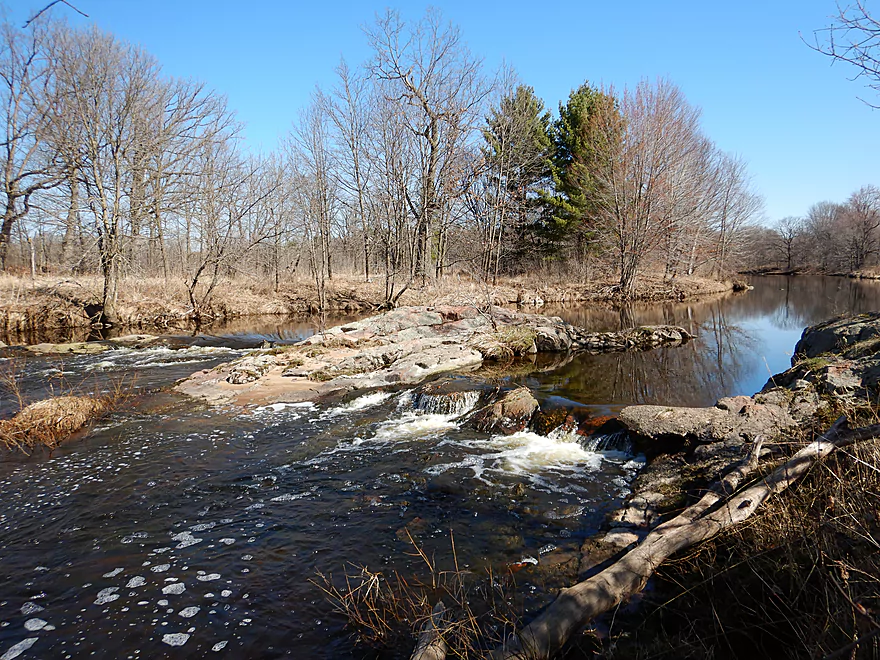
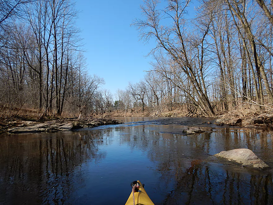
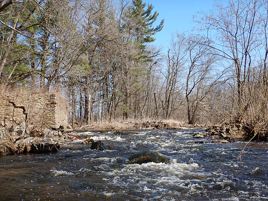
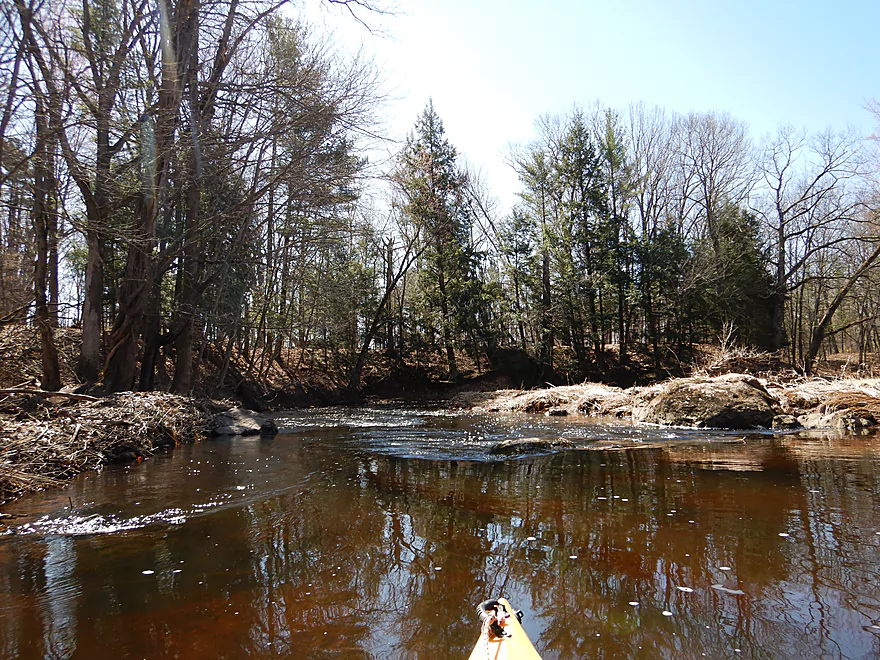
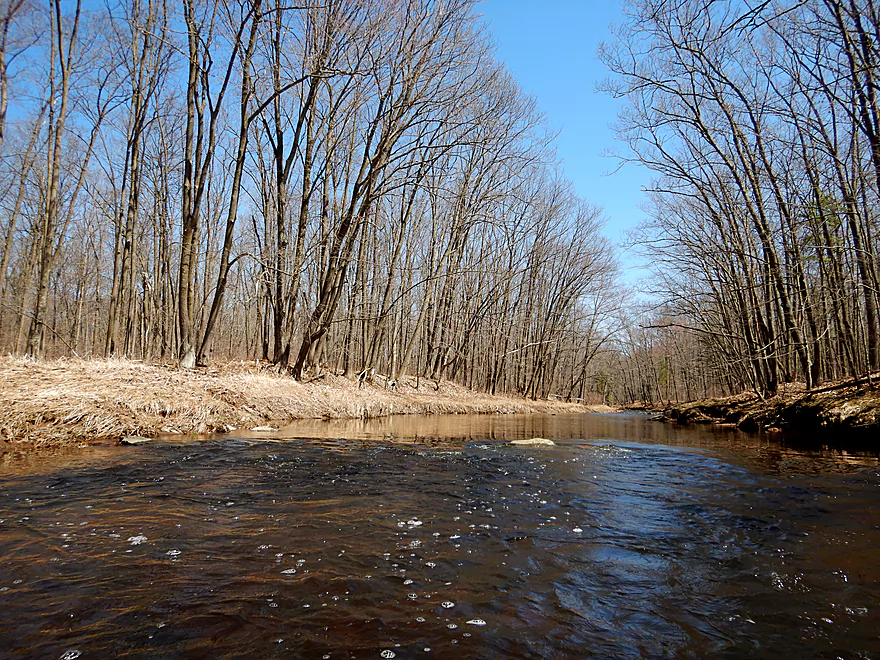
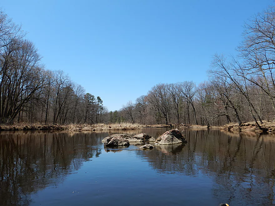
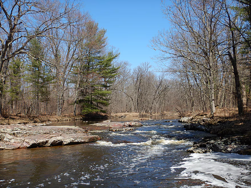
The creek continues with sporadic riffles and granite outcrops. A highlight early on were some rapids by what appeared to be an old mill, which might have been a weak Class 2 and were quite striking. Having done so many shallow rapids in previous trips, it was a nice change of pace to finally paddle some with proper padding.
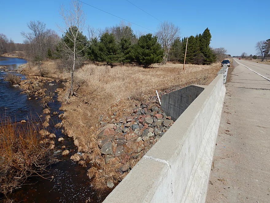
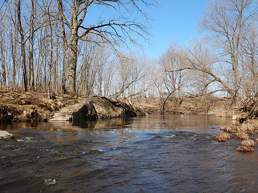
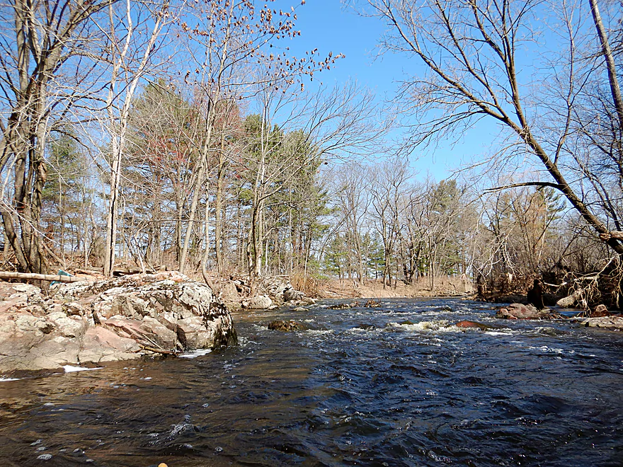
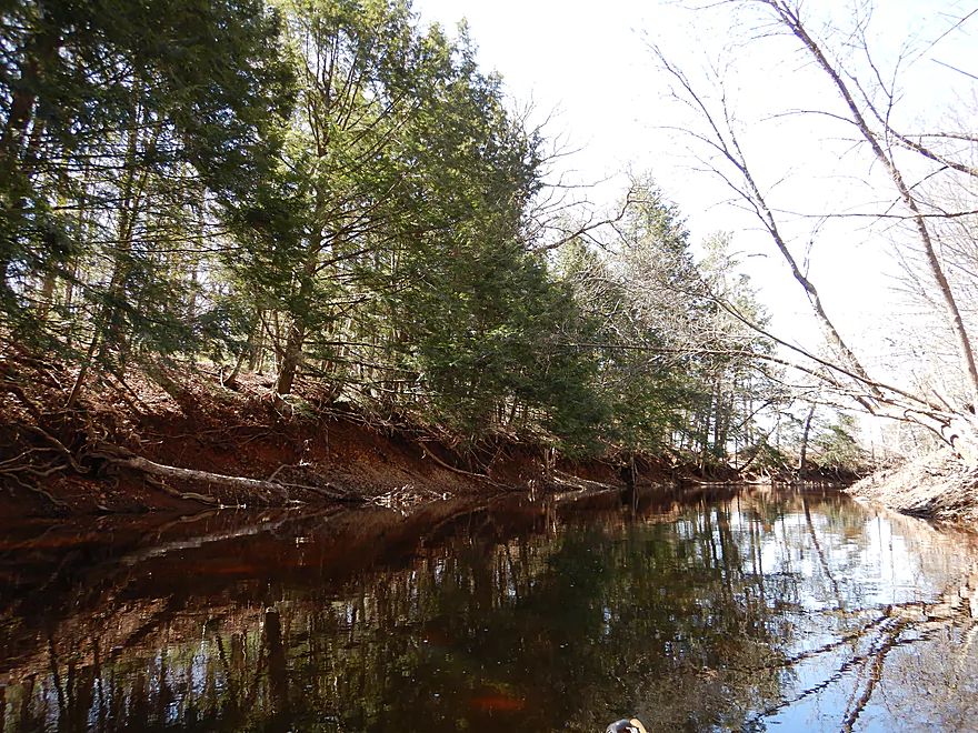
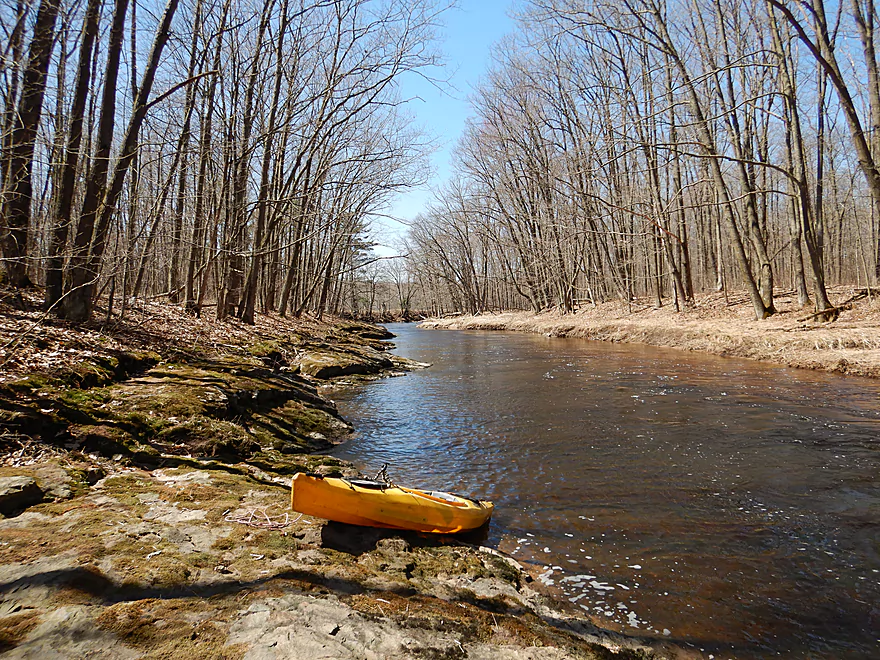
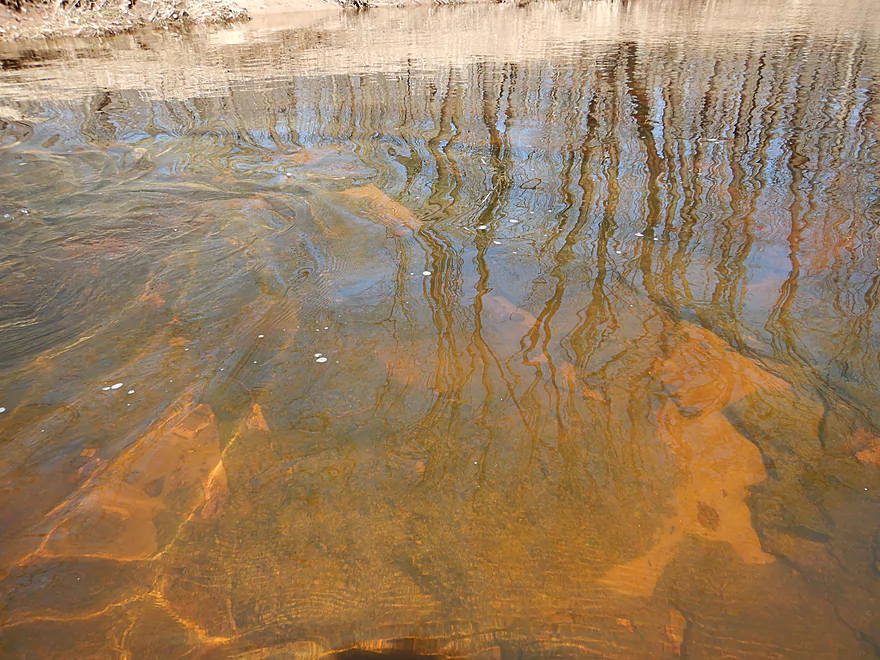
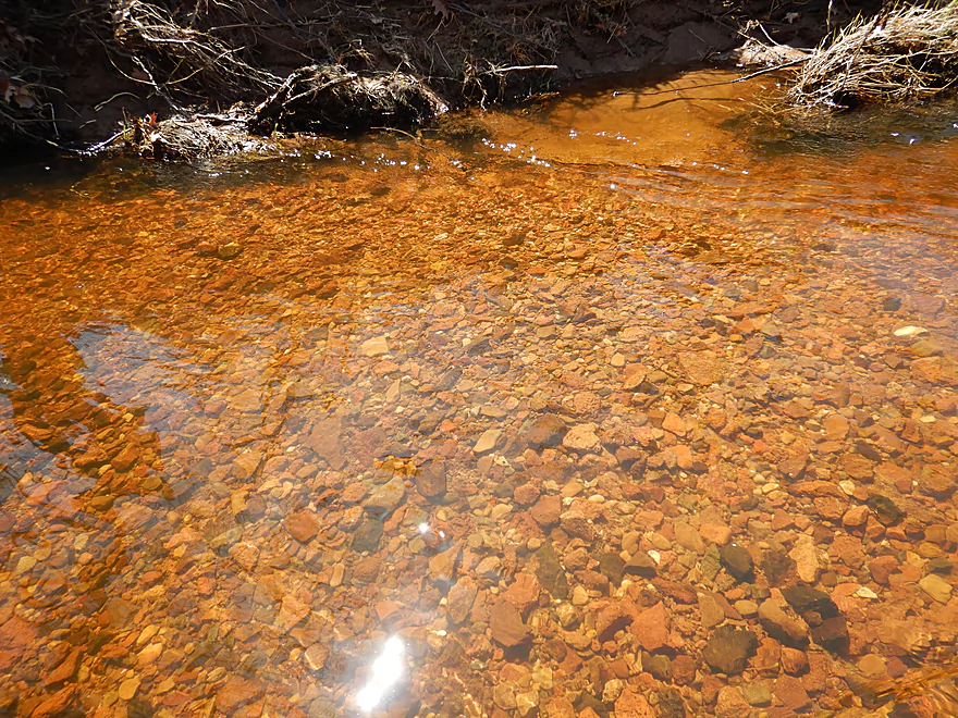
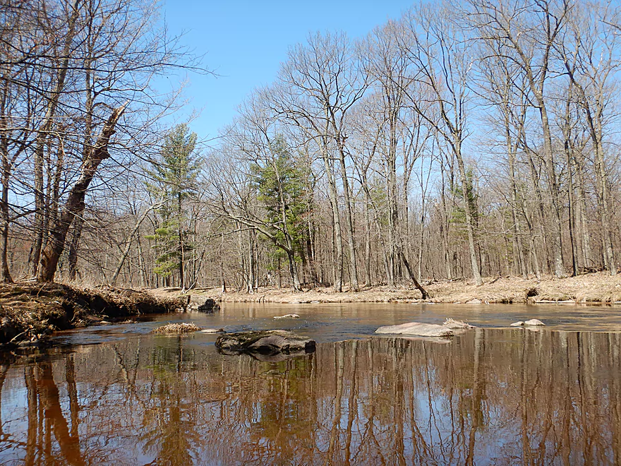
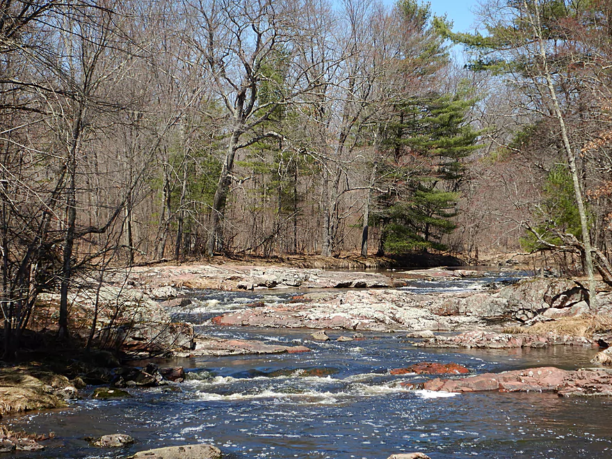
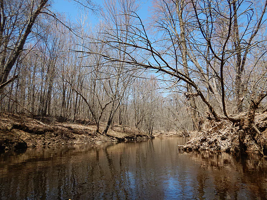
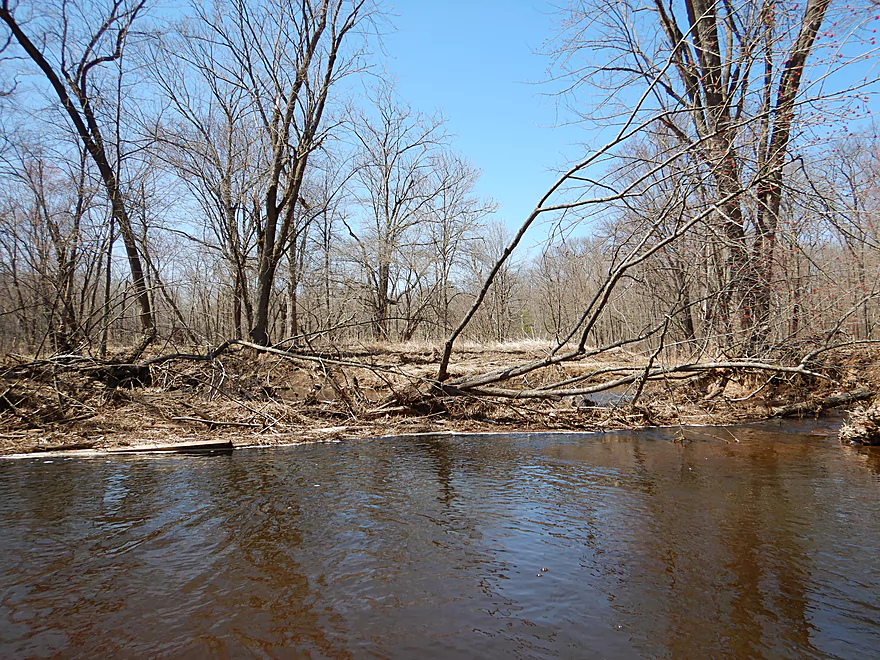
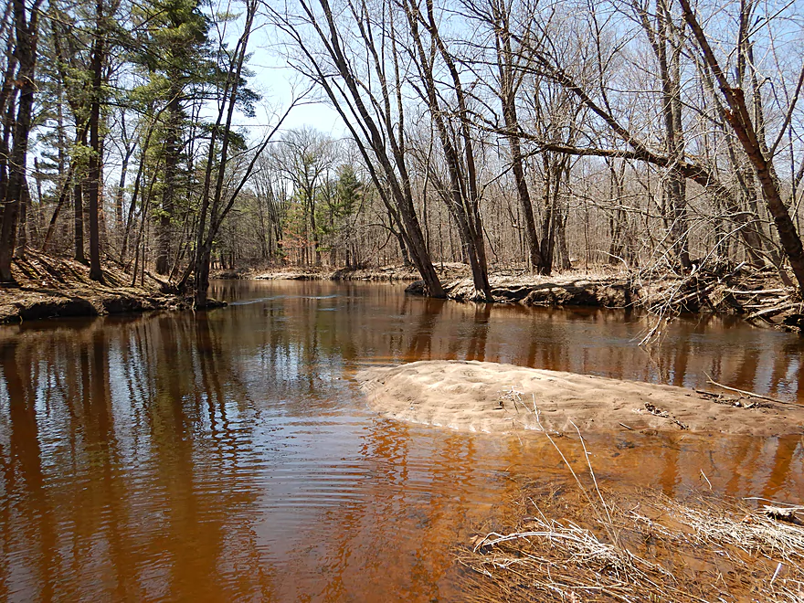
Another pleasant surprise was the lack of houses or agriculture along the banks. It was largely wooded with a mixture of hardwoods and pines…and true to its namesake, hemlocks. There was an occasional cranberry bog by the banks, but for the most part you don’t really notice them. The banks themselves consisted of crumbling rock with exposed tree roots digging in for dear life. Water clarity was good with a slight red hue similar to the Black River. The substrate often consisted of an attractive pebble bottom but in some cases was flat, smooth bedrock. Not only did the creek look nice, it sounded nice with the many riffles, the wind blowing through the pines, and the lack of road noise.
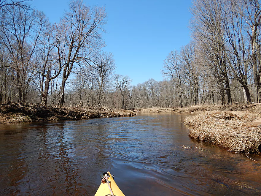
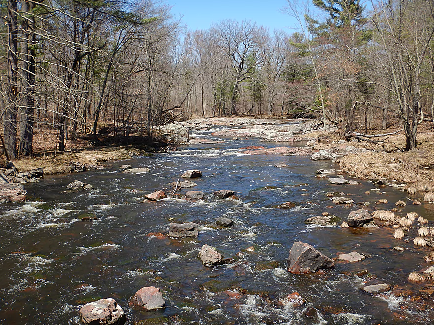
Shortly after Lincoln Road (not a practical access option BTW) was one of my favorite parts of the trip. Here the creek narrowed and hardwoods leaned over to form an arch. The channel was constricted by mounds of granite that acted like wing dams to form a series of fun rapids. Very scenic.
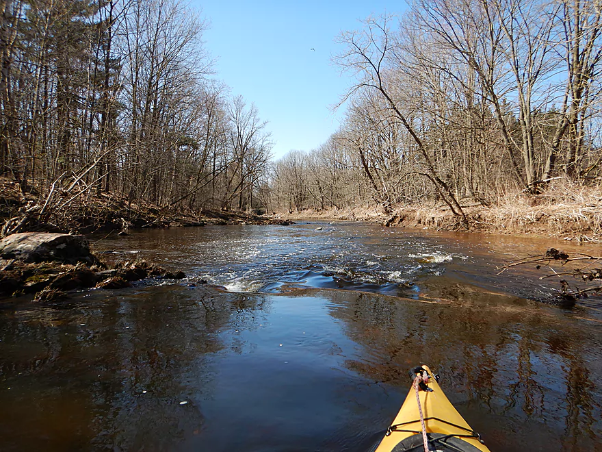
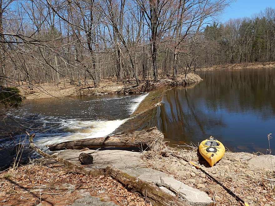
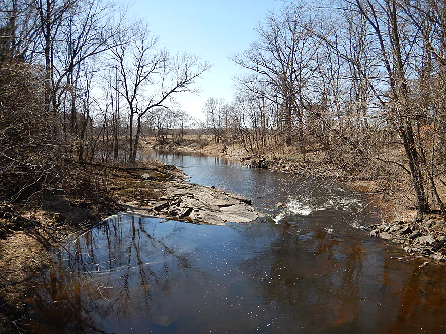
After this the creek slowed and widened into a small flowage that I didn’t expect. At the end was a loud dam that connected to a canal leading to a nearby cranberry farm. It is most unfortunate that this dam exists as it likely submerges some neat geology and rapids, and the cranberry farmer could use conventional pumps to flood his fields for harvest. Interestingly enough the creek appeared to be cutting a side channel around the dam, so the flowage’s days may be numbered. For paddlers, this is a very easy dam to portage.
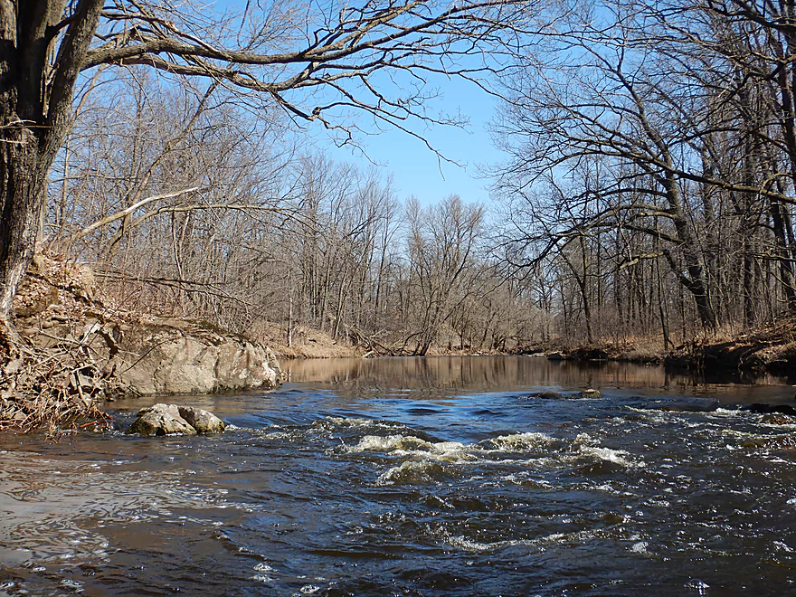
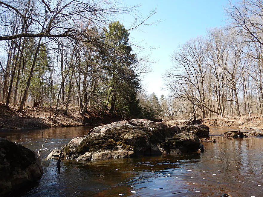
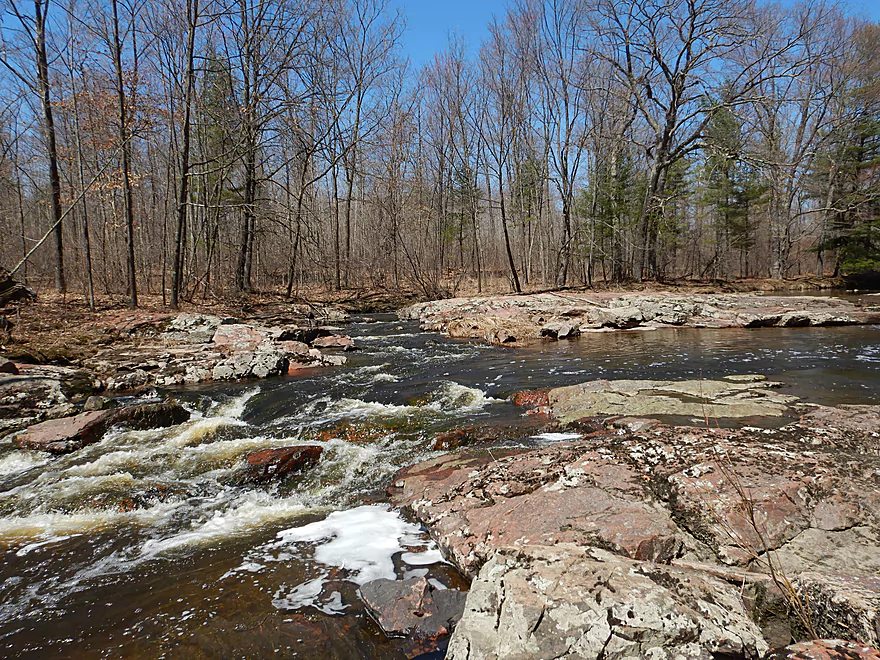
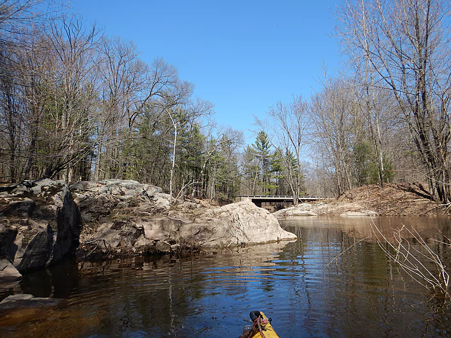
Following the dam, I heard another loud noise…but this time it wasn’t a dam, but rather some major rapids. Here the creek was constricted by massive mounds of granite which resulted in a series of Class 2 rapids and one Class 3. I did scout this before running it which was a good thing as the biggest ledge had a downed tree partially blocking its chute. This seemed dangerous and at least Class 3 in difficulty. After a short portage, I didn’t give up on this section entirely and instead launched right after the Class 3 to still enjoy the remaining rapids. This was a really scenic section…I took so many pictures here it wasn’t even funny. If you are doing a portage, it is very easy to get out and climb on the granite boulders for a better view. I would like to think I discovered this (it is comparable to Little Bull Falls on the Yellow River just to the west), but there is a nearby snowmobile bridge and the locals likely know all about it.
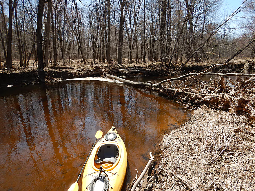
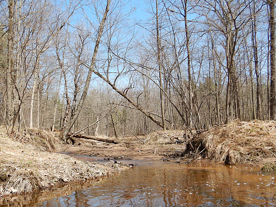
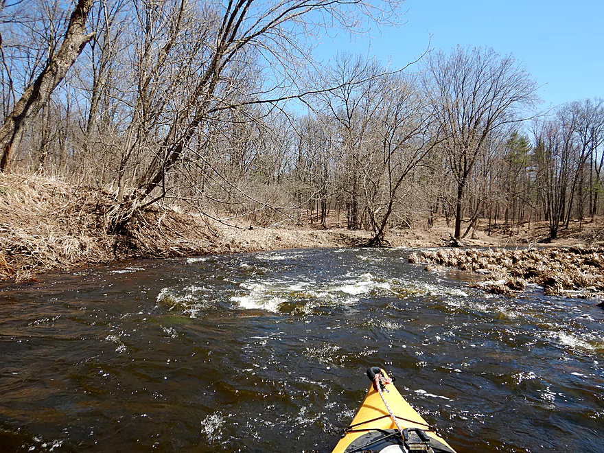
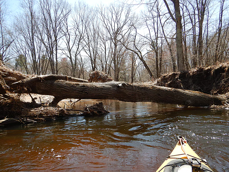
After the big rapids the river did start to change. There were still some nice examples of geology here and there, but sand and even a little mud started to replace the rocks in the banks. Downed trees starting showing up and I did have to portage several times close to the end of the trip (all easy).
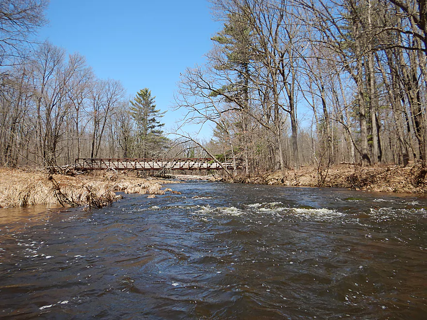
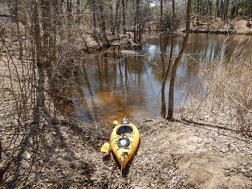
Hemlock Road was a nice bridge take-out and, as a last hooray, there was a final granite outcrop by the bridge. Hemlock Road roughly marks the point in which the creek enters old Glacial Lake Wisconsin, which pretty much ruins downstream prospects for paddling (way, way too many logjams). However, I’m definitely looking forward to a future trip from Vesper to Hwy 73, which while being shallower could actually be even more scenic with perhaps some dells.
2025 Webmaster Update – New logjams are now a signifant challenge and this route might no longer be recommended. See this comment for more info.
Hwy 73 is a good bridge access with plenty of shoulder parking. Scenic too!
Alternate upstream launch options aren’t that great. Spruce Road is technically a good bridge access, but uncomfortably close to a house. You could launch in Vesper (which I will do for a future trip) but this won’t be easy. You would likely have to launch from W. Cameron Ave, but you can’t launch from the southeast corner and the other corners have coarse riprap to deal with. You should be able to leave your car on Anderton Ave by the park. On top of that shortly after launching you’ll have to portage a dam on the right bank.
Alternate downstream launch options aren’t great either. Lincoln Road has very steep shoulders, although there is a small spot to pull over. This bridge is unfortunately close to a home and there are No Trespassing signs on the land past the ditch. Legally, you are likely ok as long as long as you stay within the DOT right-of-way, but it still feels awkward launching a boat close to a private home.
Hemlock Road is a good bridge take-out and also scenic!
Alternate downstream take-out options aren’t really practical. The river from here to the mouth on the Yellow River loses its geology and logjams become a plague.
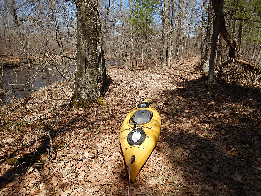
The bike shuttle wasn’t bad – 6.3 total miles, but flat with only minor hills and no gravel. The only issue was an insolent pooch near the take-out who in chasing my bike, almost got tangled in my peddles before the owner called it back. Wish I had brought my bear spray…
The current was inconsistent with it being quite fast at times while other times being quite slow. Very much a “pool and riffle” stream.
There are many light rapids that are pretty fun, scenic, and safe. One or two were stronger (perhaps Class 2) but these should be manageable even for casual paddlers.
However, there is one set of Class 3 rapids that should be taken very seriously (marked on the map, pictured, and in the video). Basically the river is constricted by large mounds of granite (very scenic) and this creates a series of rapids, chutes and ledges. IMO it is quite important that paddlers scout this first. The rapids start with a manageable Class 2, but quickly you are pushed to the right and down a Class 3 ledge partially blocked by a tree. This is followed by weak Class 2 rapids that shouldn’t be a problem. The east (or river left) shore is the easier portage but a bit trickier to get out on relative to the west bank. I suggest a compromise in portaging the Class 3, but running the remaining rapids.
There is a dam…and it is ALMOST runnable because it has a slanted ramp. But I highly advise scouting this first from shore. There are odd bumps on the dam and it is shallow…which means it would be easier for your kayak to catch and fall sideways which could get you into trouble with the recirculating current at the bottom. I portaged. Easiest portage path is river right.
There were four downed trees that had to be portaged, but this was actually pretty easy because the banks were relatively shallow.
For those keeping score, I’ve listed six things to portage which sounds like a pain, but I didn’t think it was a big deal.
2025 Webmaster Update – New logjams are now a signifant challenge and this route might no longer be recommended. See this comment for more info.
There is no gauge on Hemlock Creek, but there is one on the upper Yellow River at Babcock. Hemlock Creek joins the Upper Yellow just downstream of Babcock so this is a somewhat representative gauge, but because both streams endure multiple dams, my estimates are likely be to somewhat inaccurate…perhaps as much as 100 CFS. Both the Upper Yellow and Hemlock rise and fall very quickly in response to rain, which can make finding a nice paddling window difficult.
- < 199 CFS: I suspect this is too shallow a depth. I could be wrong though.
- 200-324 CFS: Most of the creek should be plenty navigable but the rapids might be bumpy.
- 325-450 CFS: A very good target range. You shouldn’t get hung up on the rapids and they shouldn’t be too dangerous. This trip was done at 390 CFS which was a perfect depth.
- 451-600 CFS: High water and strong current. Likely only suitable for experienced paddlers in maneuverable boats.
- 601-800 CFS: Very high water. Likely only suitable for whitewater paddlers in whitewater boats.
- 801+ CFS: Likely too high. Just a heads up that Hemlock Creek can get very high very quickly and be very dangerous. I saw evidence that the creek had been at least two feet higher just a few days before. Stay safe.
Not too much… A few deer, two crayfish, one big fish below the Class 3 rapids, a few clam shells and a crane on the bike shuttle. The highlight was a somewhat friendly groundhog who watched me paddle by from the bank.
- Hwy HH to Hwy 186: 1.9 miles. A very shallow prospect that needs high water, but has potential for fantastic scenery.
- Hwy 186 to Hwy 73: 3.8 miles. A very interesting prospect with likely scenic granite outcrops and some boulder gardens. Unfortunately it is shallow, there is a dam to portage and there are likely a few logjams to deal with. Hwy 186 is also not an easy put-in. You might be able to launch from the west side of the bridge but leave your car on the east on Anderton Ave.
- Hwy 73 to Hemlock Road: 4.5 miles. A great trip with many light rapids, scenic undeveloped banks, exposed granite bedrock and one Class 3 rapids. Reviewed here.
- Hemlock Road to Hwy 54: 8.6 miles. Probably many logjams and no interesting geology. This likely marks the start of Glacial Lake Wisconsin. The take-out at Hwy 54 would be difficult because of the long guardrail.
- Hwy 54 to Hwy 173: 8.8 miles. Countless logjams.
- Hwy 173 to Necedah Road: 3.4 Miles. Likely many logjams.
- Necedah Road to Mouth on Yellow River: 2.2 miles. Very wooded with likely many logjams.
For more information on the Yellow River, click here.
Trip Map
Overview Map
Video
Photos Size:
My wife and I did this section on June 18, 2018 after strong storms moved through Central Wisconsin the night before. The Yellow River gauge that morning was 130cfs, but I knew it was rising. A mere 18 hours after our trip, the Yellow gauge was at 1760 and still climbing! Judging by your pictures, I would guess our water level was a little higher than yours. The water was very muddy, but all very manageable. The worst part: by June, everything is very thickly overgrown. The bridge accesses and portages were all very thick and, of course, the mosquitoes were bad.
We love your website since we discovered kayaking last summer. We’ve used your routes and recommendations for two sections of the Yellow River, two sections of the Plover River, the Mecan, the Kickapoo, the Baraboo (3x), and two sections of the Waupaca/Tomorrow/Chrystal–often taking friends along for the ride.
Our to-do list for this year includes the Black River and hopefully some more driftless streams (the Blue, perhaps?), in addition to revisiting our favorites from last year.
Thanks for your labor of love.
Cory & Becky
It’s too bad to hear that the Yellow River gauge was so unreliable. Both Hemlock Creek and the Yellow River are such volatile rivers they are difficult to predict, and the best bet might be to eyeball the levels at the put-in to get an idea of where things are at. You make a good point about the the portages being more difficult in summer which I didn’t factor in. Thank you for your kind words and comments.
My daughter and I kayaked this route on May 27, 2025. The Yellow River gauge was at 100 cfs. We were unable to run *any* of the rapids and dragged other places as well. Mosquitos were very bad. Multiple massive logjams required long treks through tall (4′) weeds to work around.
We did see a couple eagles, but sadly, it wasn’t worth it. This should not be a 5*. Other rivers to do instead of this:
* Mill Creek
* Crystal
* Tomorrow/Waupaca
* Wolf
* Little Wolf
* Eau Claire
Thanks for the warning. I’ll update my review to include your notes.