
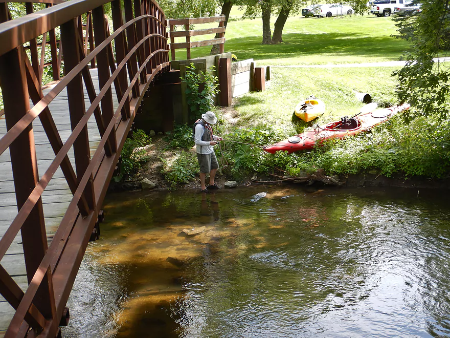
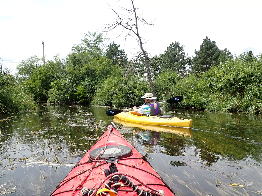
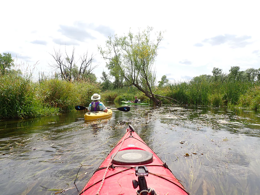
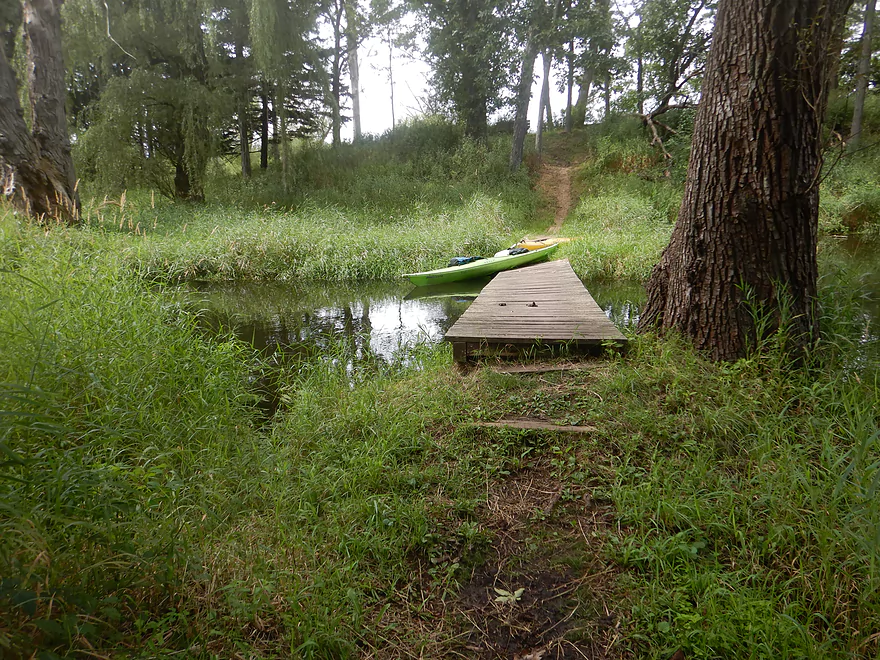
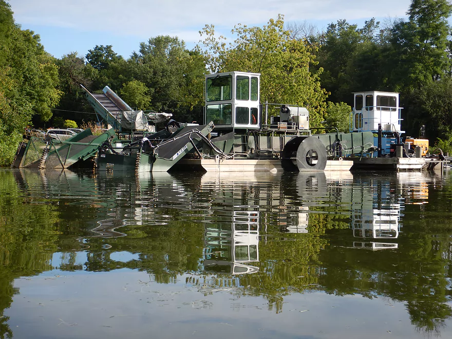
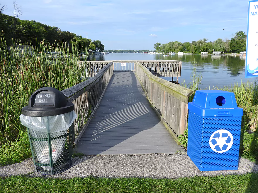
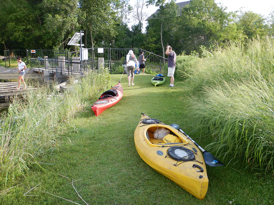
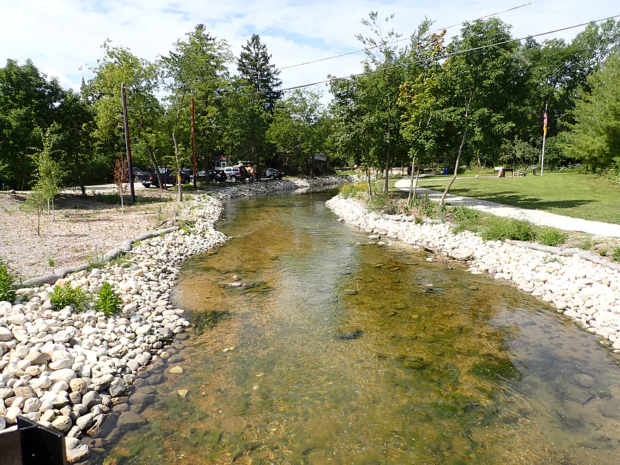
Starting the trip at Bark River Park
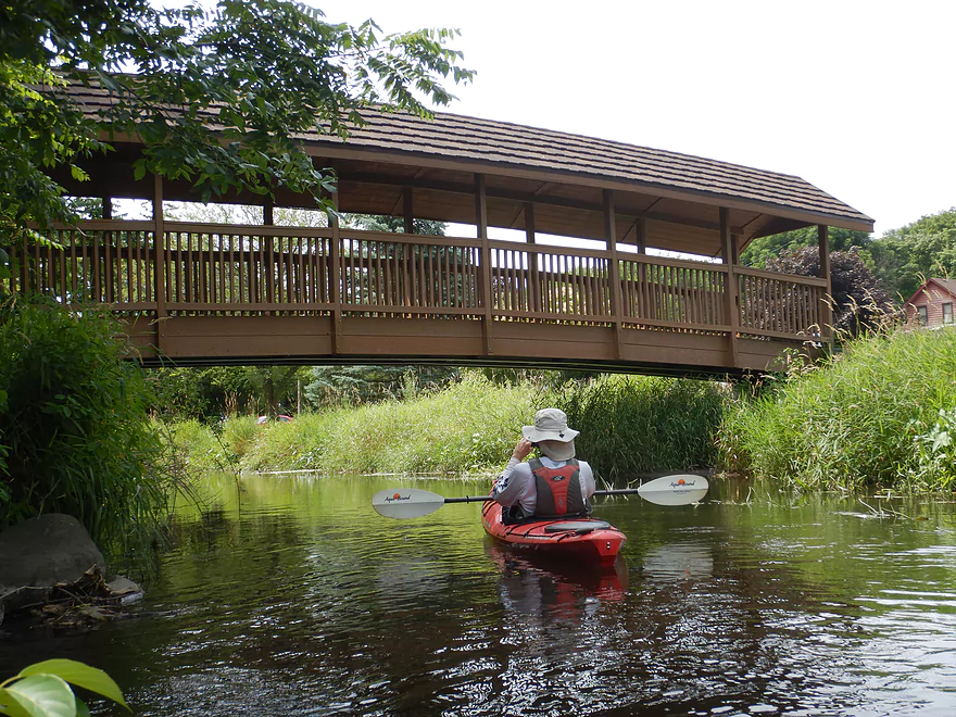
Best access is by the pedestrian bridge
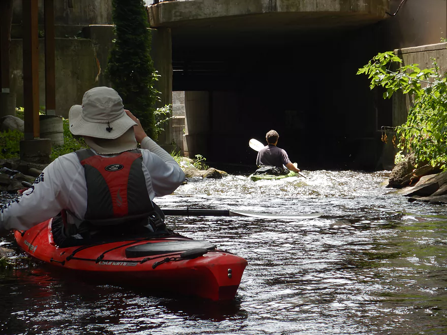
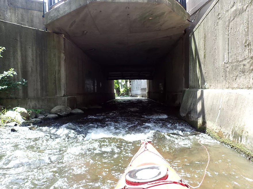
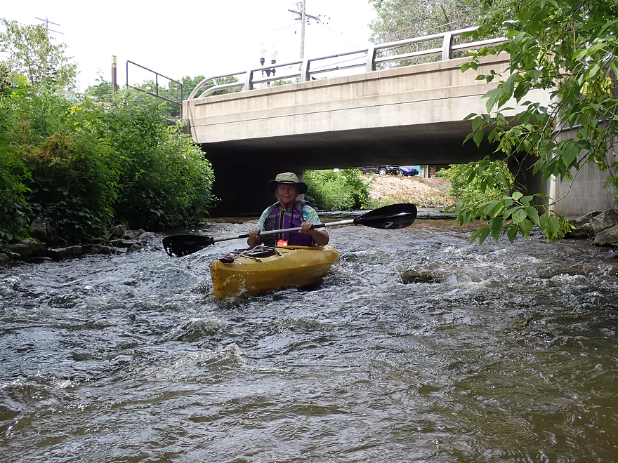
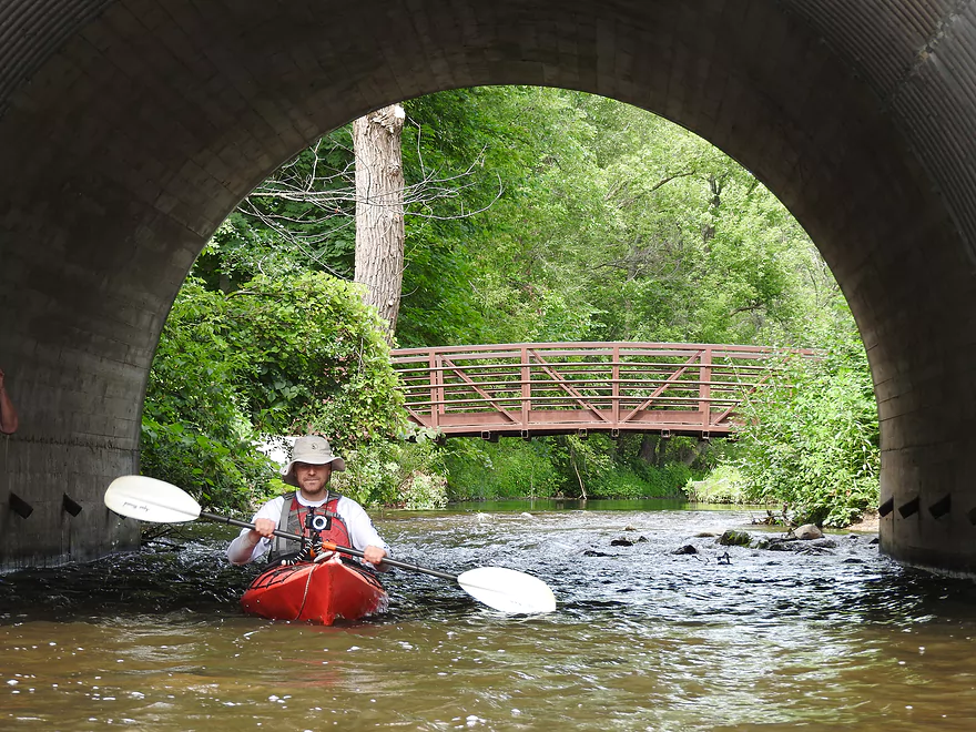
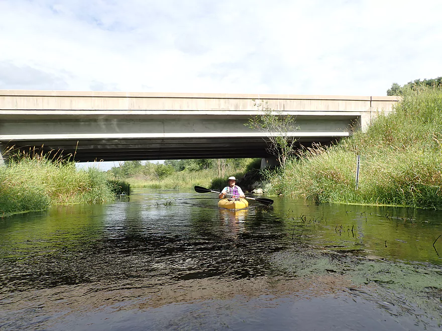
The Hwy 16 tunnel bends which blocks light
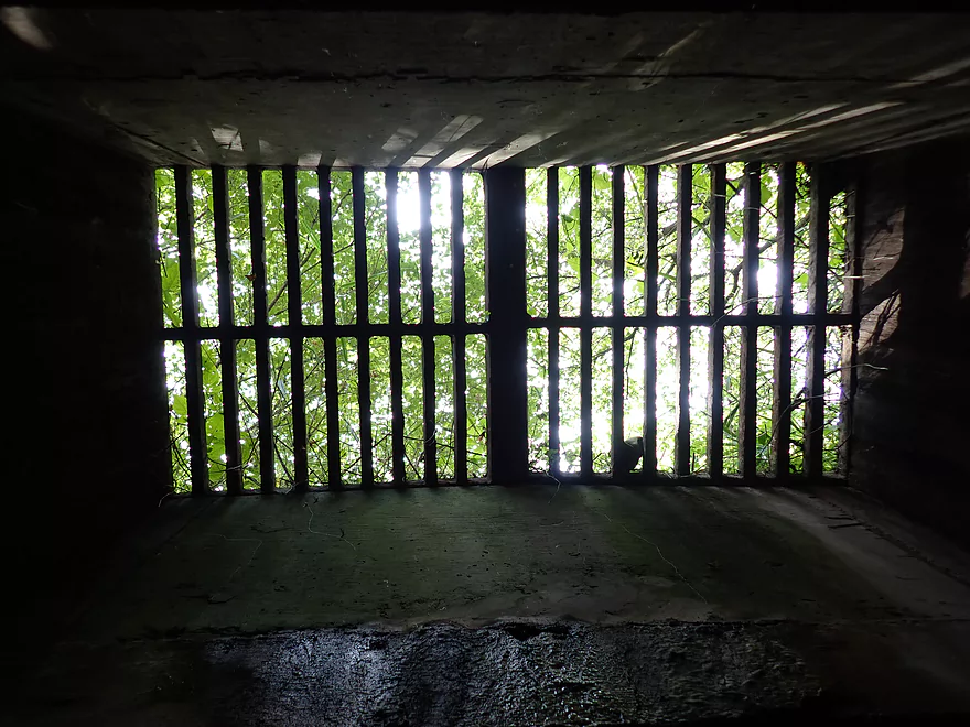
But there is a skylight in the middle
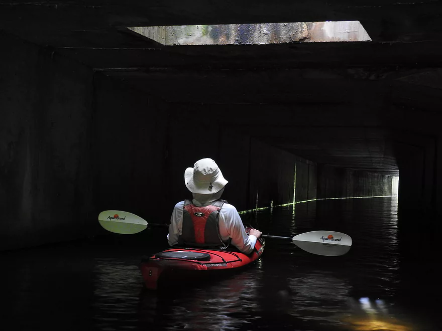
Creates unique lighting
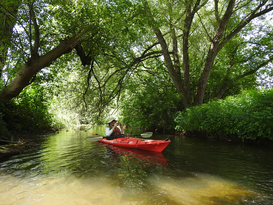
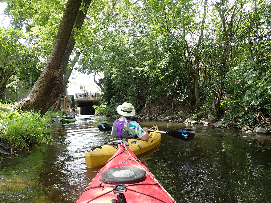
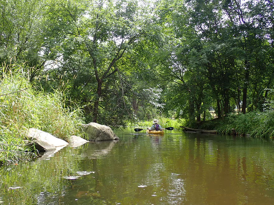
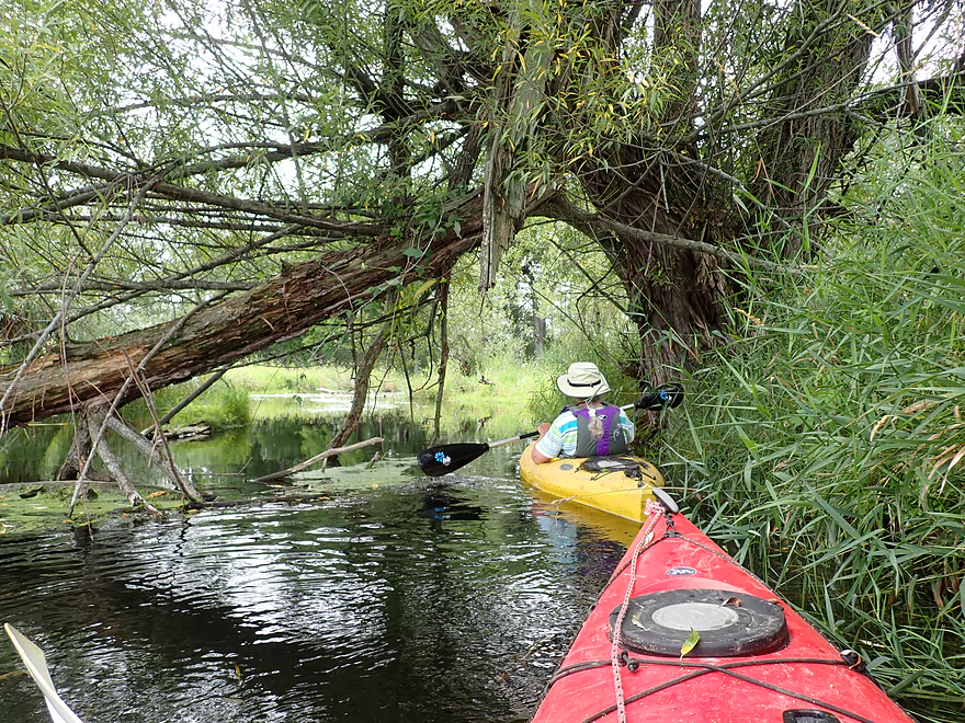
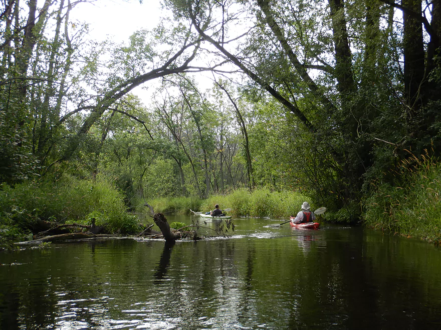
The first hundred feet is very wooded
Coming up on Lawn Street
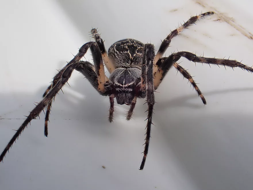
Home to this guy
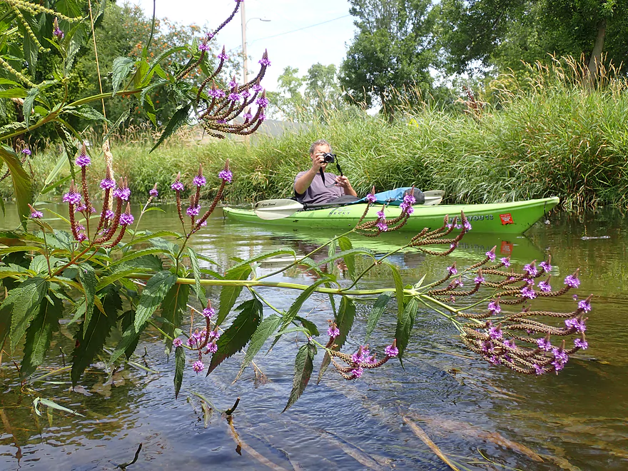
Framed by blue vervain
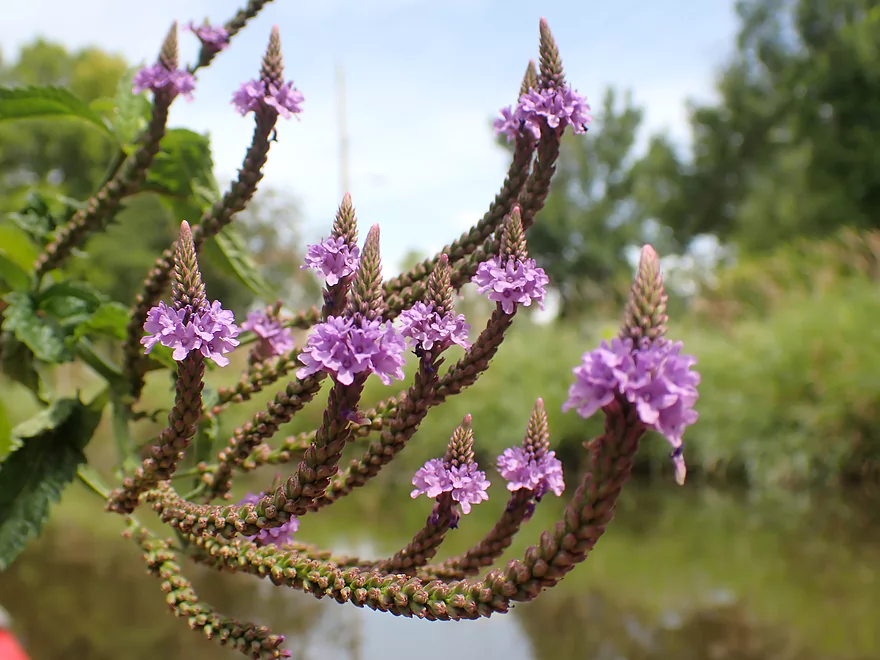
Very Photogenic
The Ice Age Trail
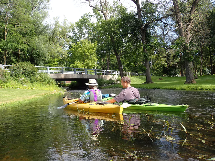
Coming up on Hartland’s downtown
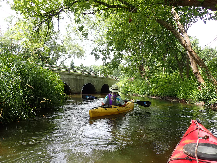
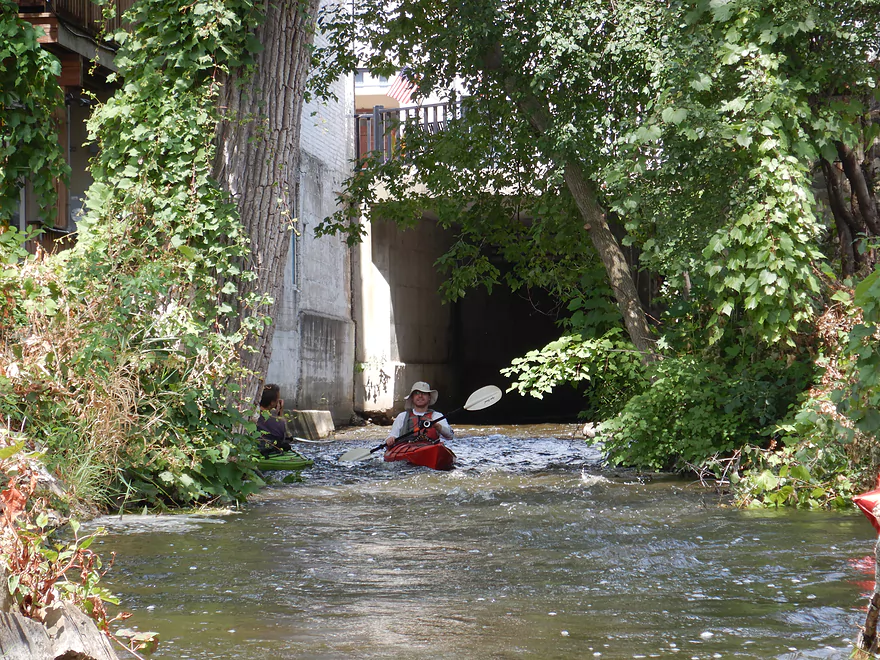
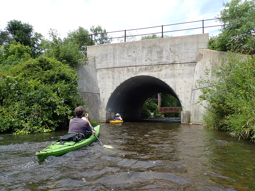
A large tunnel by the BMO Harris bank
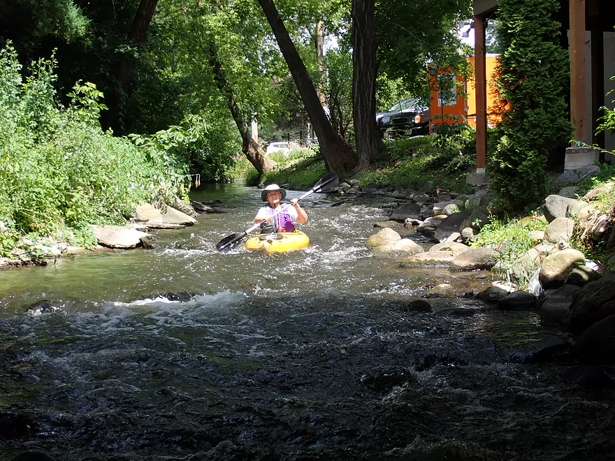
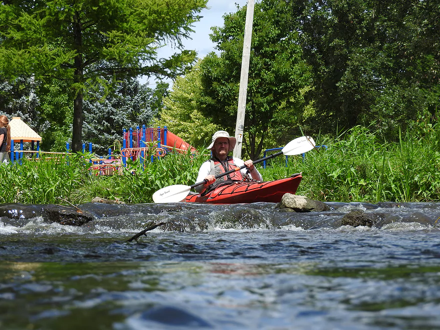
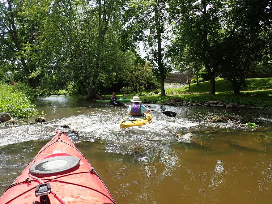
With fun rapids
Reverse view
The other side
Rapids continue past Haight Drive
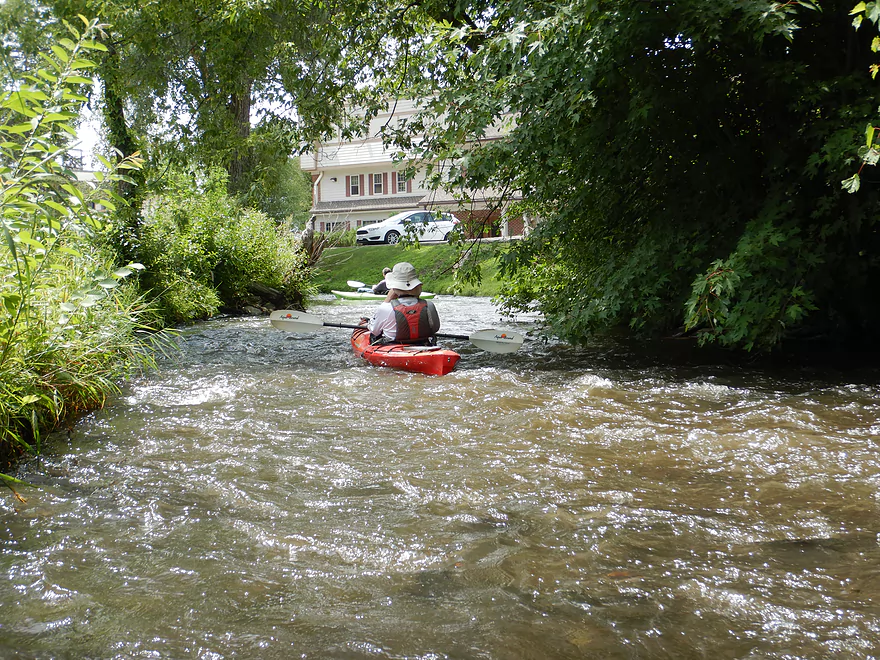
And by the library
One of several small glacial boulders
One of the steeper ledges (possibly remnants of an old mill)
The shallowest part of the entire trip
Nixon Park is an alternate access option
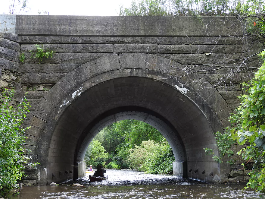
A fantastic stone arch railroad bridge
They don’t make them like they used to
More rapids…try not to lose your paddle
Other side
Starting to leave Hartland behind
Cardinal Lane is not an access option
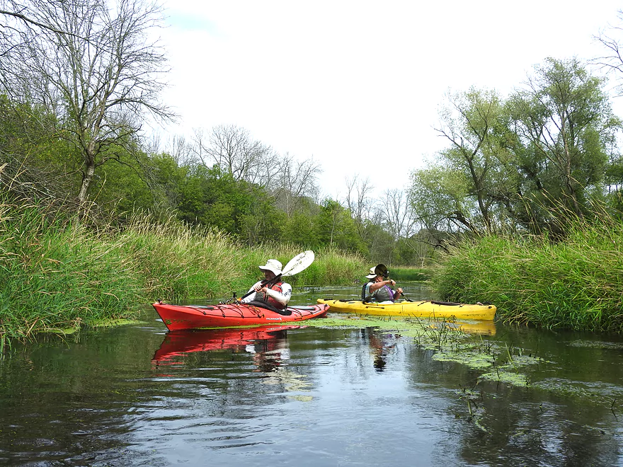
Entering a marshy area of the river
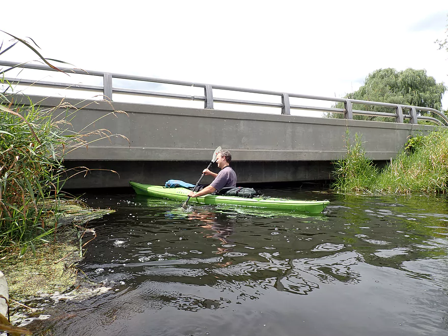
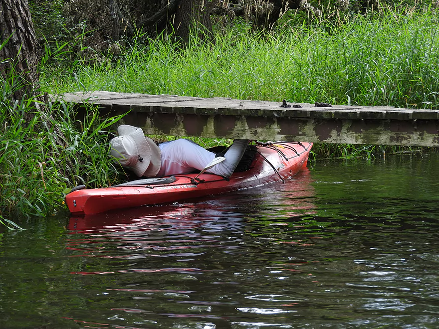
The lowest bridge I’ve ever seen
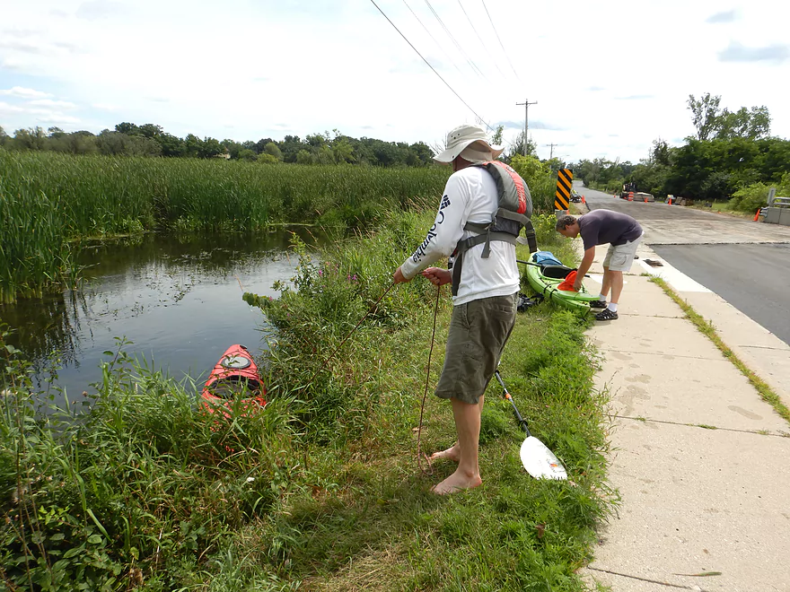
Fortunately Cottonwood Drive is an easy portage
It’s also an access option
More marsh paddling
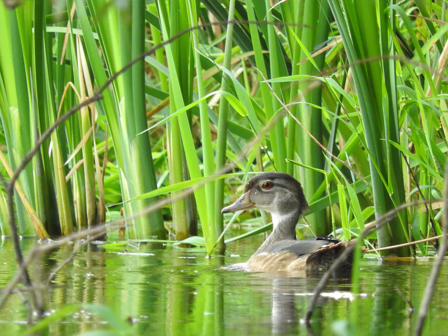
Young wood duck
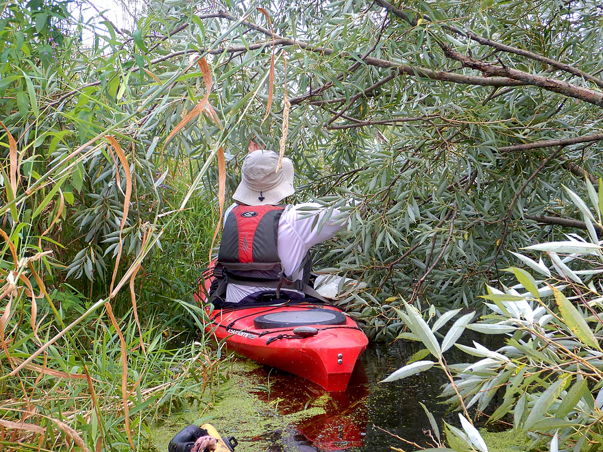
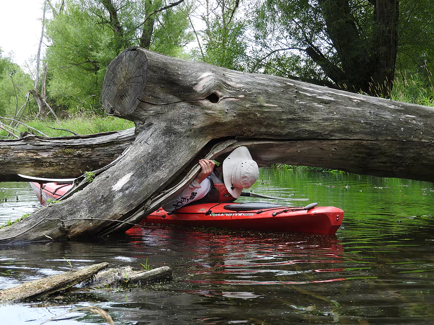
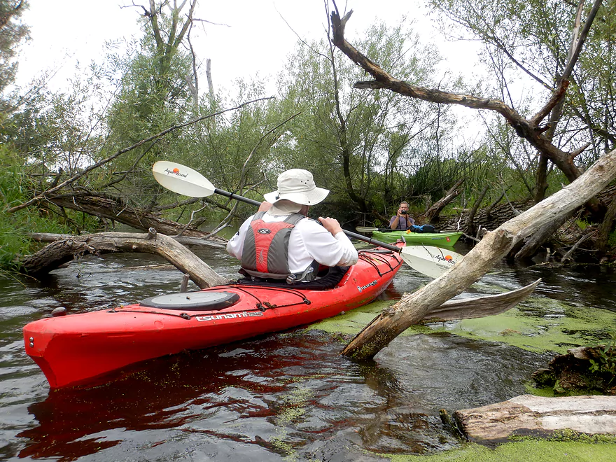
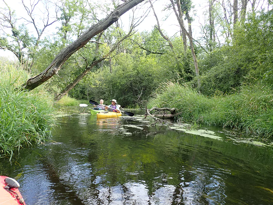
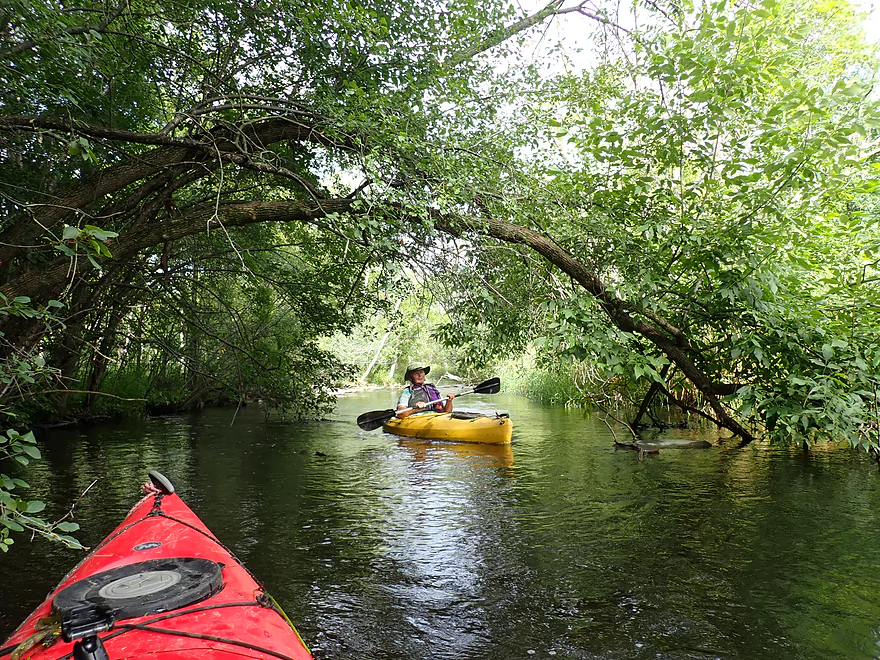
A few snapped branches later, and it was easy to get through
Some dead black willows
Some of the downed trees added character
A grove of bur oaks–sign of higher ground
Classic Bark
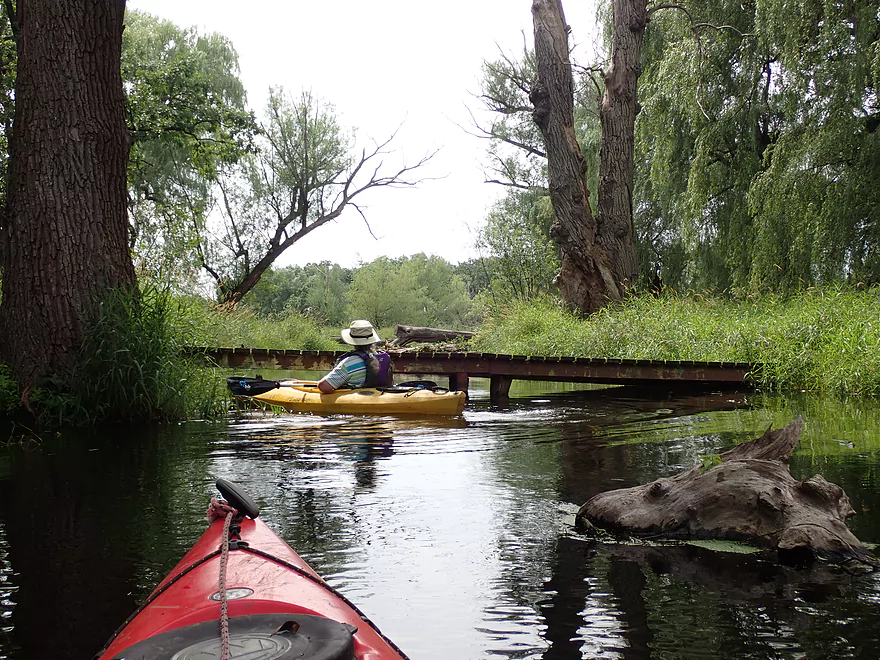
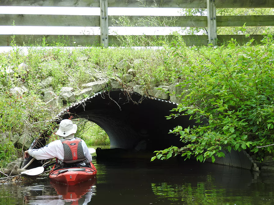
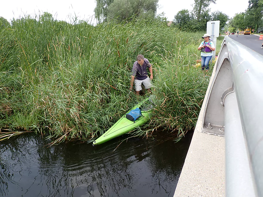
A very low trail bridge
I just barely fit (life jacket had to come off)
Part of a larger trail network
Another low ducker
Going over is another option
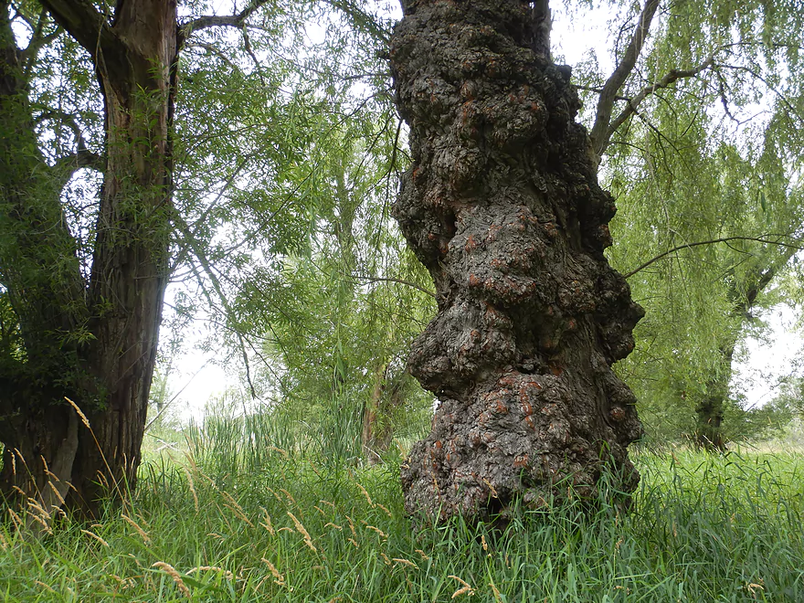
This burl-covered willow tree was quite unique
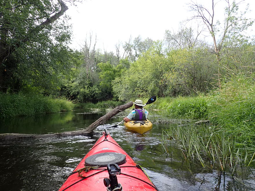
Some more snag dodging
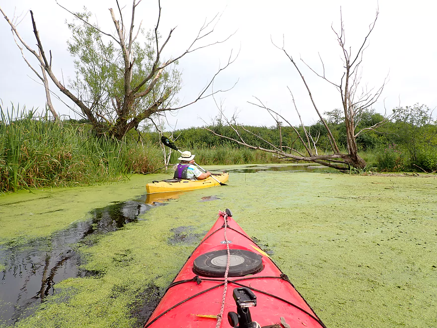
Duckweed city
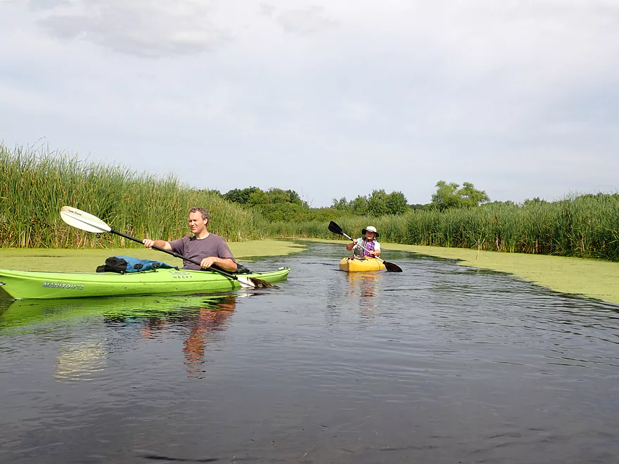
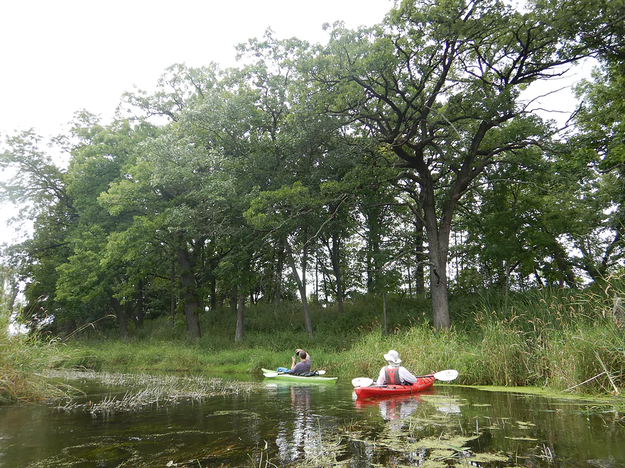
Paddling the Hartland Marsh
Busy Hwy 83 is an access option, but not a great one
Just by the bridge is a logjam that has to be portaged
Several ways around this one
Duckweed was everywhere
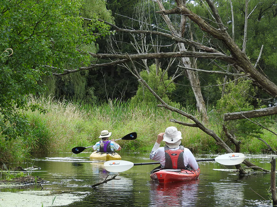
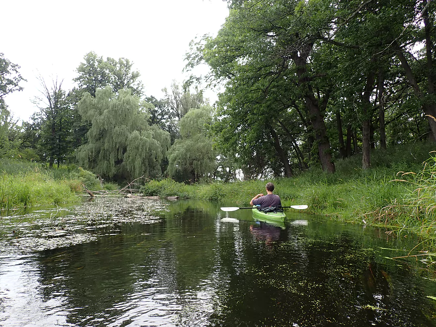
Bit more trees…adds nice flavor to the marsh
More classic Bark
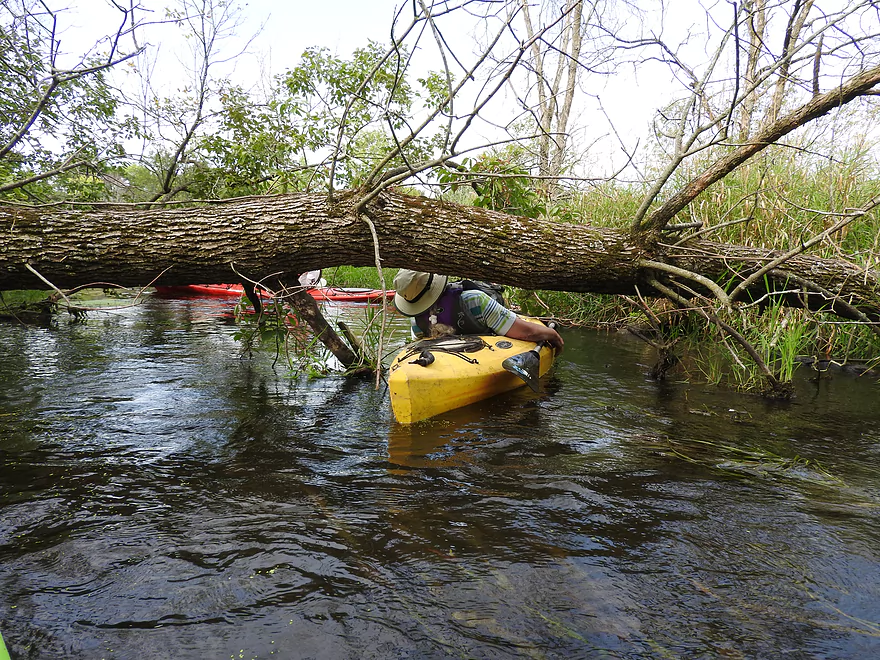
Some ducking still required
Nice part of the trip
Dr. Zoidberg says hello
Nagawicka Road doesn’t look like a good access option
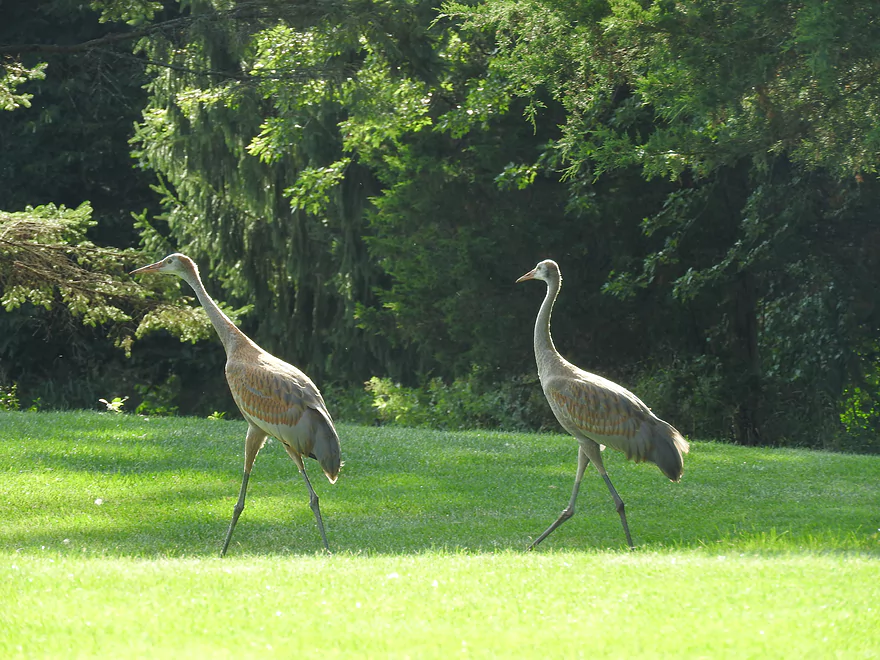
A family of cranes loitering on somebody’s lawn
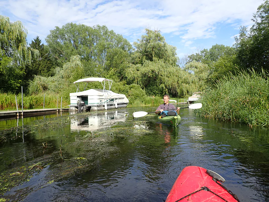
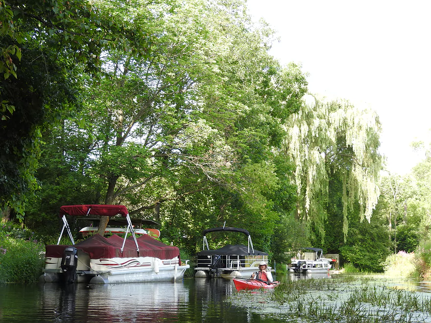
River gets deep enough to float pontoons
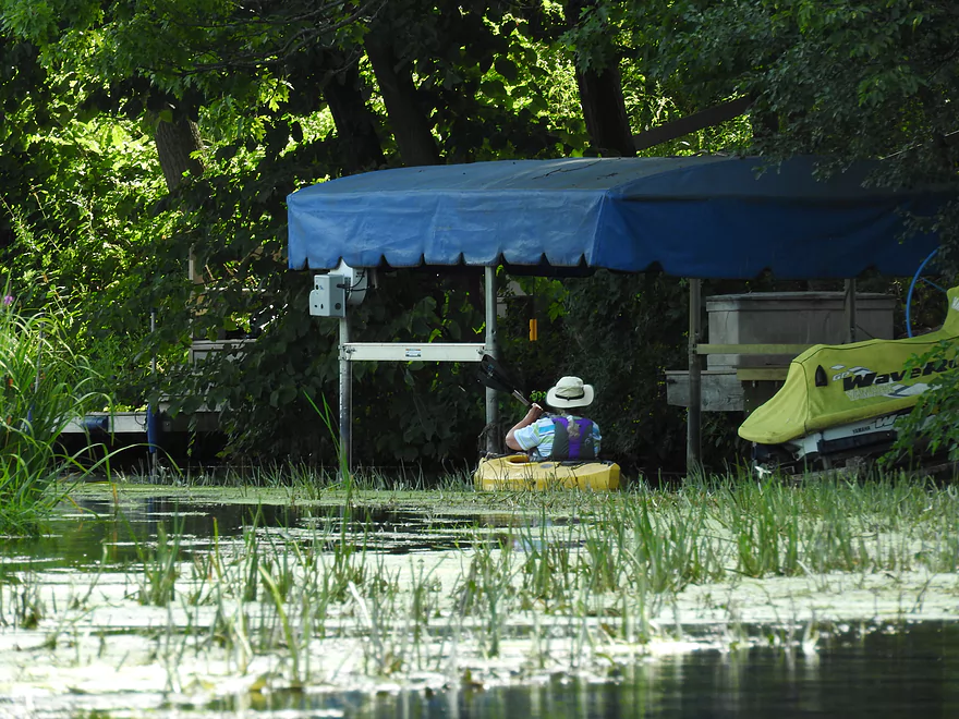
Rain tarps were everywhere
Flowing pondweed in the clear water
Nice little section
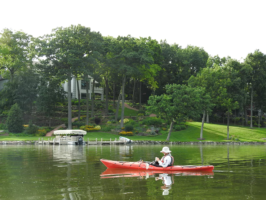
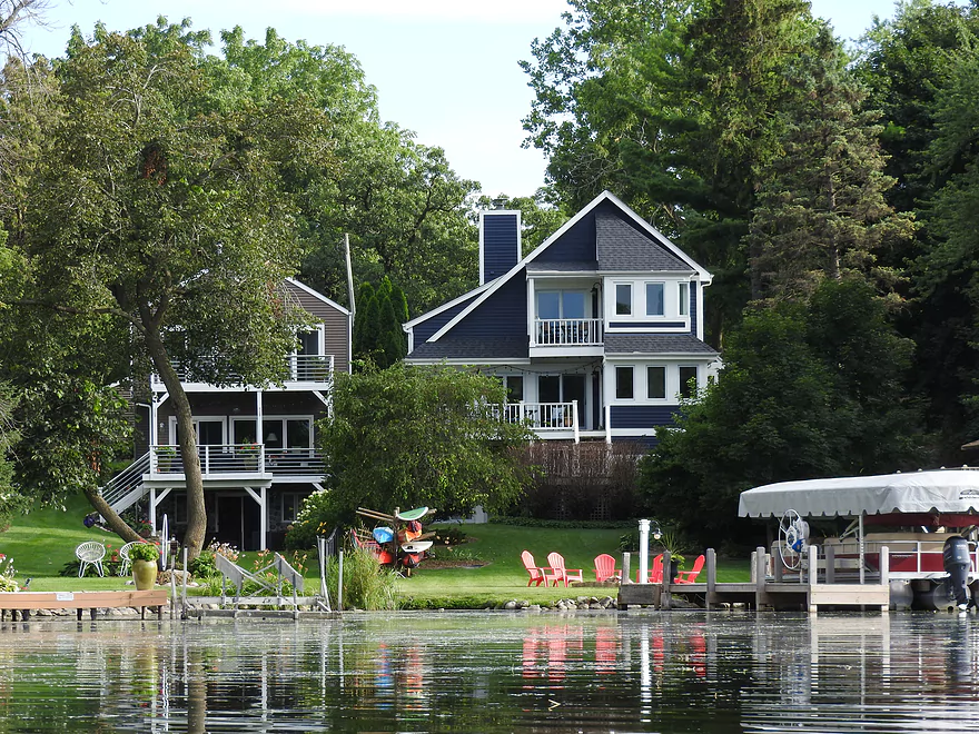
The big houses mark the start of Lake Nagawicka
Countless piers and powerboats parked along the shore
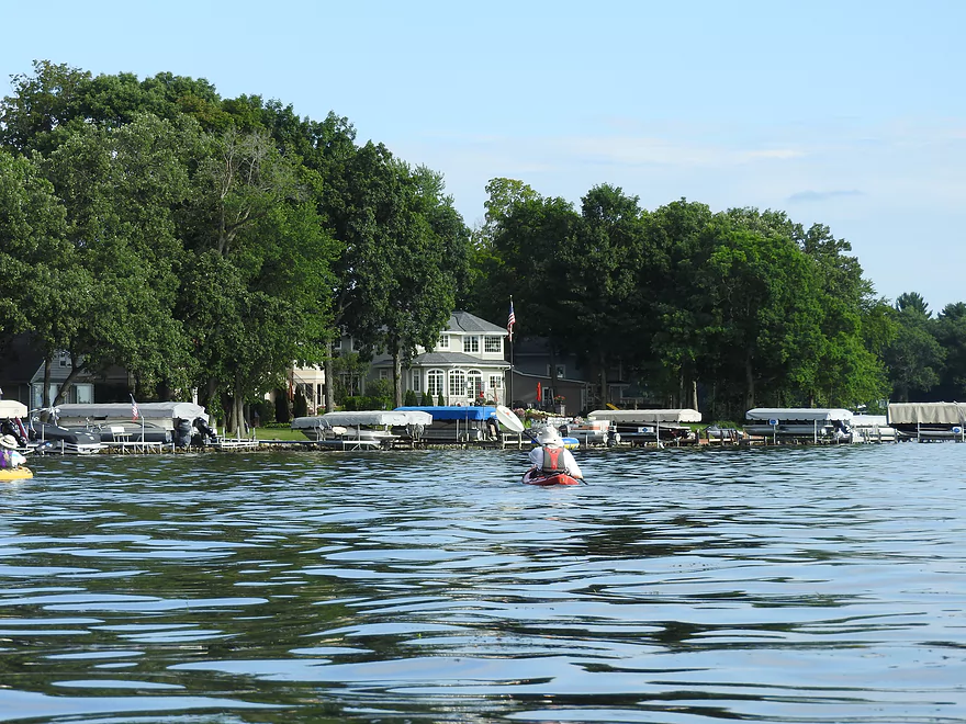
A very developed lake
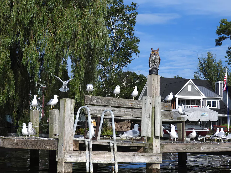
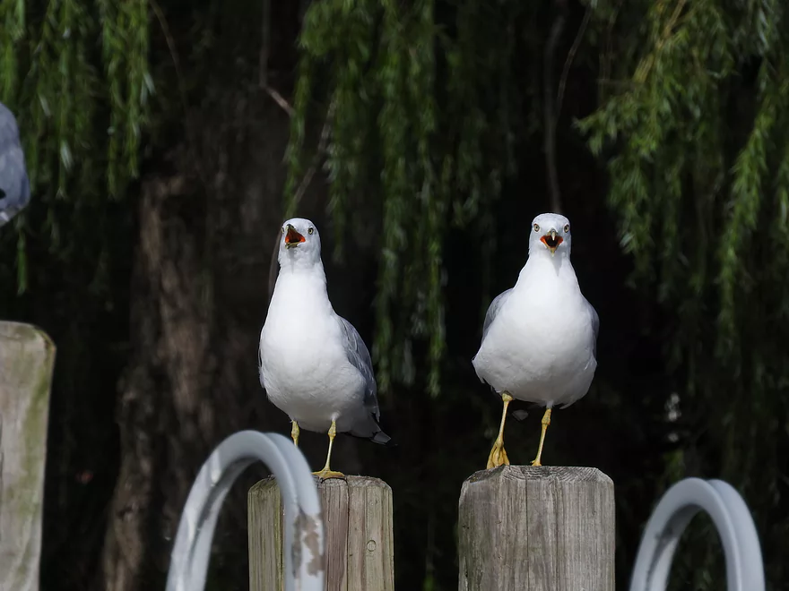
A large flock
They’re amused by the fake owl
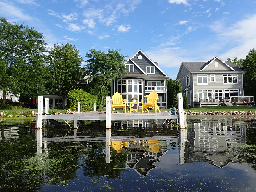
Nagawicka is a very attractive lake
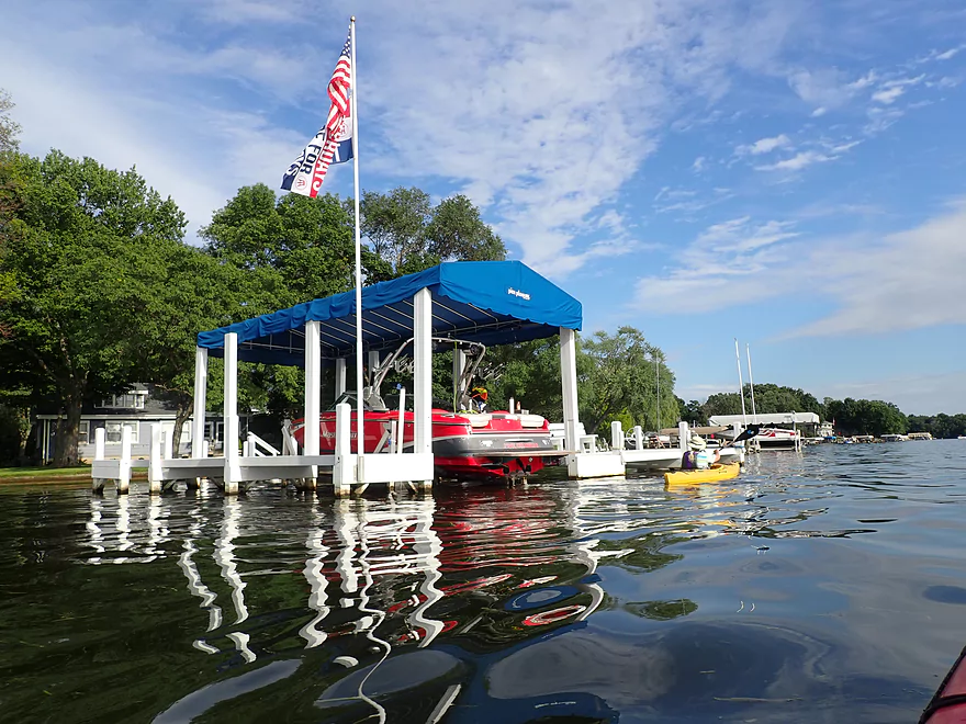
While parts were no-wake, waves were an issue most everywhere else
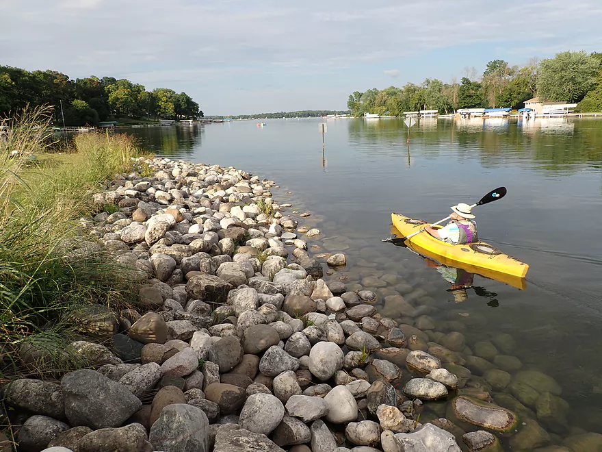
Crossing the main body
Naga-Waukee Park is a fantastic park and access option
Entering the western bay
Some expensive real estate
Large weed eaters
Quite the colorful property
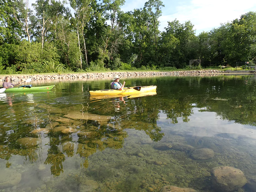
Nagawicka has great clarity
Getting out at Saint John’s Park
Easy to disembark by the pier
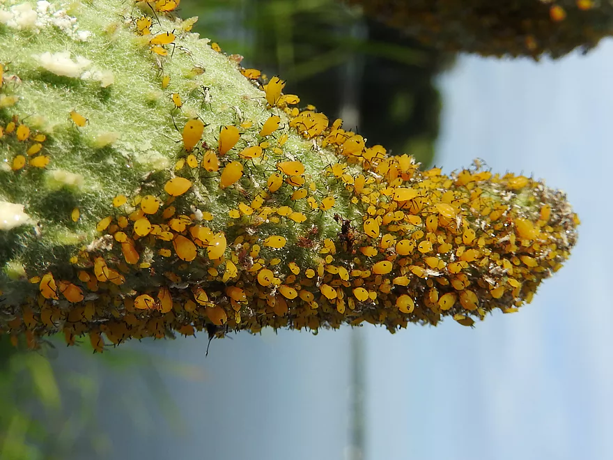
Those are all living aphids…quite the sight
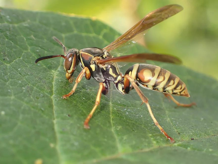
Distracted wasp lets me get close for a photo
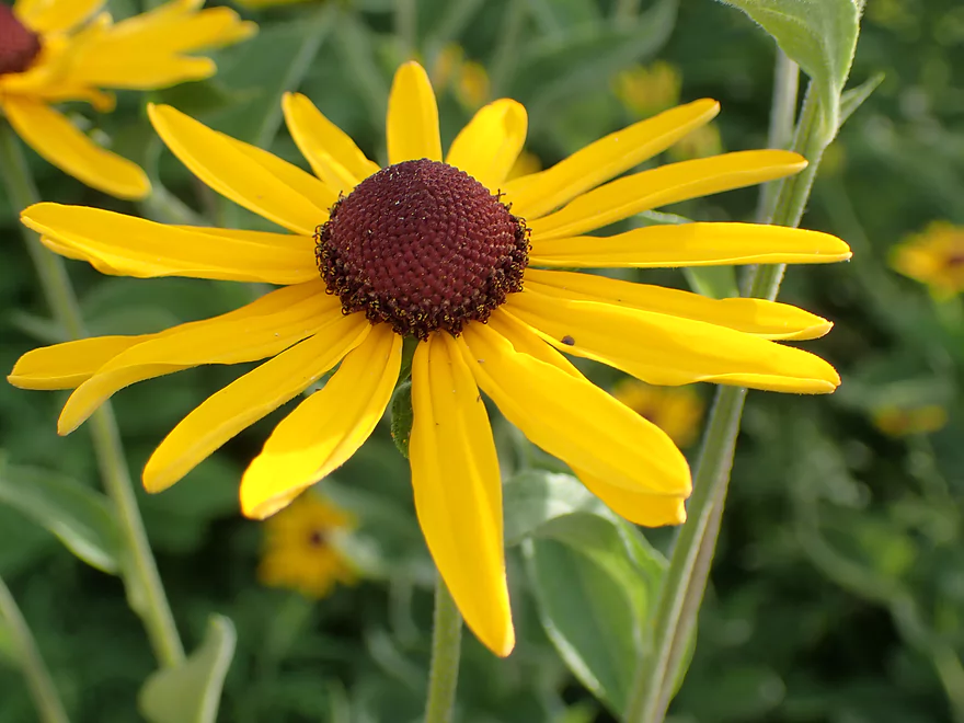
Black-eyed Susan
Portaging the dam
Easy re-entry
Section below the dam is really nice
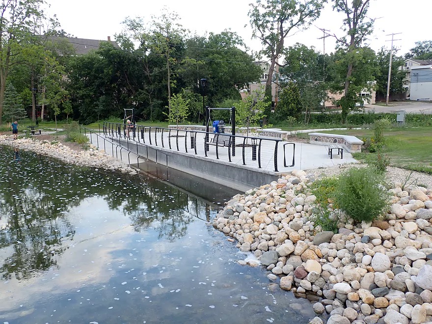
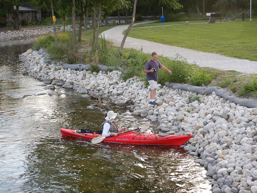
A brand new kayak launch!
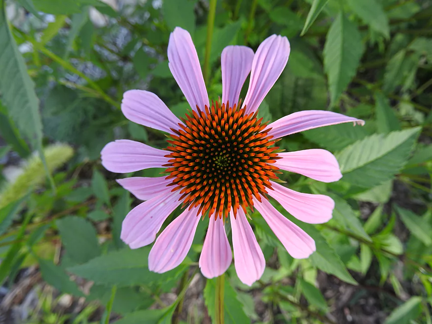
Coneflowers are always photogenic
Downstream of Genessee Street
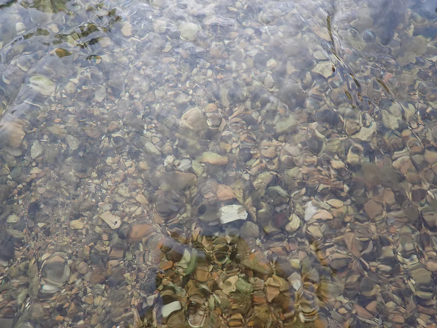
Stunning clarity
Good spot to get out
Taking out by the post office
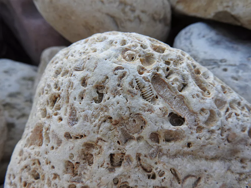
There are fossils in this rock!
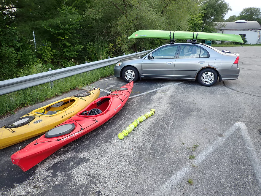
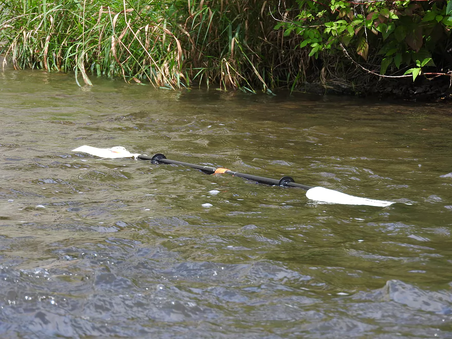
Those weren’t even all the baseballs we fished out of the river
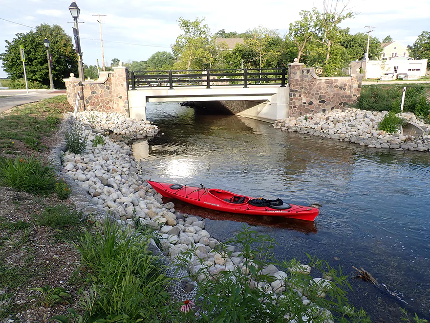
Bark River – Hartland


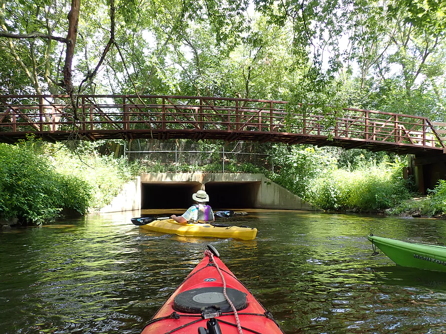
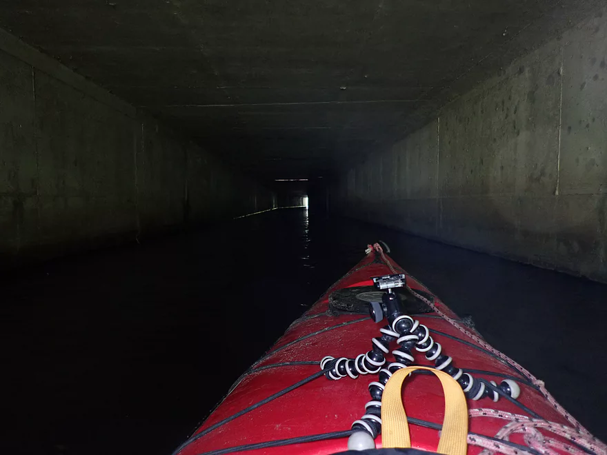
We started the trip at Bark River Park in Hartland Wisconsin. Here the river isn’t much more than a creek and was encapsulated by low hanging branches. Just upstream is a large 350′ tunnel which because of a bend is almost completely dark. This was a fun side diversion and featured a “skylight” (drainage grate) which shot a beam of light from the top into the darkness below.
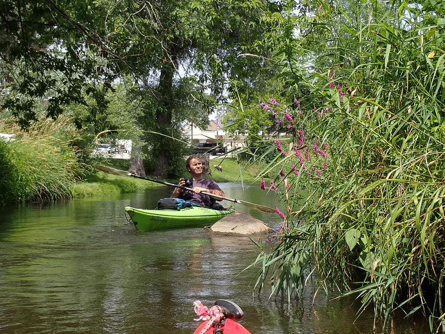
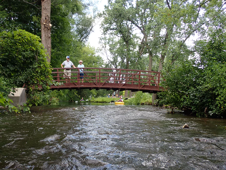
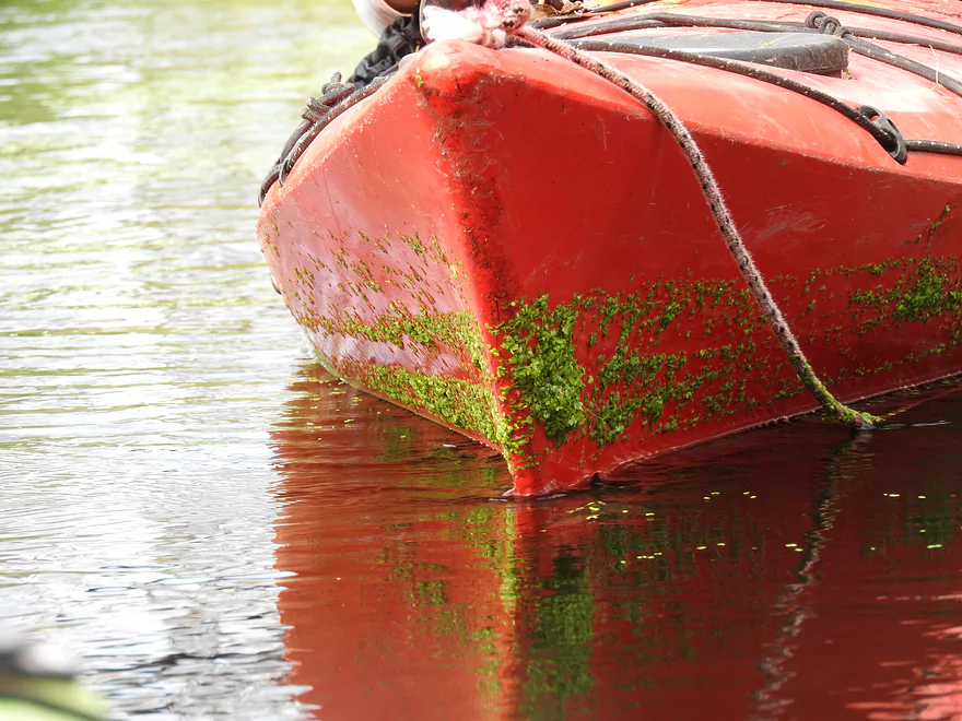
We continued downstream through suburban Hartland past several scenic bridges including one covered bridge. A large softball complex is located next to the creek and we frequently found balls in the water (we collected a total of 15 on the trip). The channel had good clarity, but wasn’t as top-notch as the Delafield leg which we did three years ago.
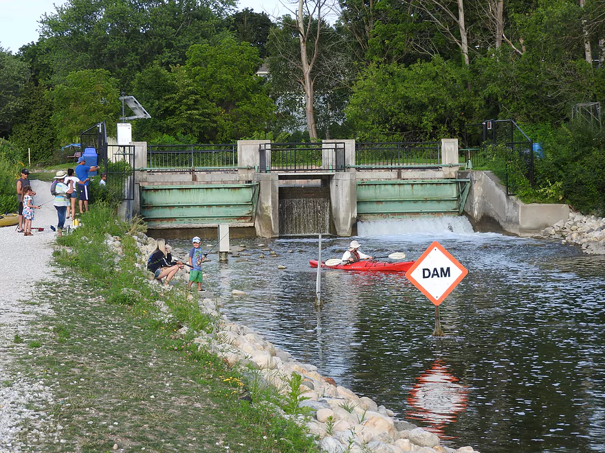
Upon entering downtown Hartland we encountered a 90′ tunnel that ran under Capitol Drive (site of an old mill). Here were the strongest rapids of the trip which were a lot of fun. The rapids would continue up to Cardinal Lane and were a trip highlight. Unfortunately while the vast majority of our trip was well padded, the Hartland rapids were occasionally bumpy and shallow. Another trip highlight was at Nixon Park where a fantastic stone arch railroad bridge crossed the river (very scenic and used as the featured image of this review).
Cardinal Lane roughly marks the end of Hartland and most of our urban paddling. This bridge is quickly followed by Cottonwood Ave, which is THE lowest bridge I’ve ever seen. It was built mere inches above the water and I honestly don’t know why the city doesn’t consider it a major flood hazard. Thankfully it was an easy portage.
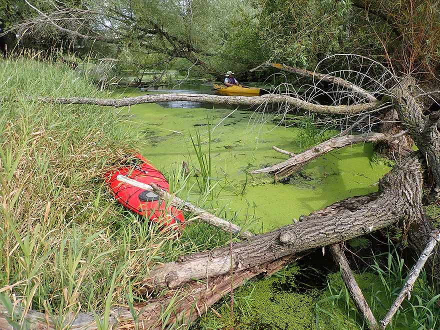
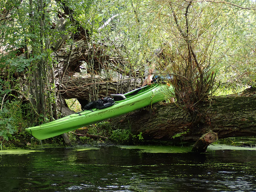
From Cottonwood Ave to Hwy 83 spans the Hartland Ice Age Marsh. Along the eastern end was a brief wooded section that did have some deadfall issues that took some extreme limbos to get past. On top of this there is a super low trail bridge that had to be circumnavigated. Before 2015, this all used to be much worse but “Buckthorn Man” and the “River Rats” did some considerable cleanup work on this very stretch and their efforts are very much appreciated.
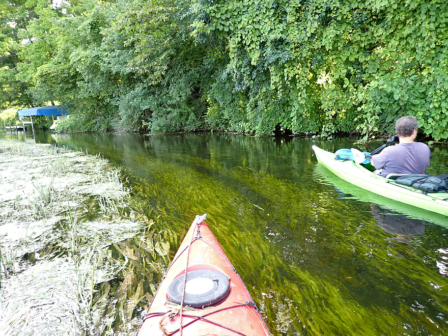
Following Hwy 83, the river channel narrowed and became a bit more wooded. While still marsh-like, this “lower marsh” was much nicer, had more wildlife, and was more varied. It also had less deadfall, but we did have to portage one logjam. Following Nagawicka Road, the river becomes more developed and pontoon boats were frequently parked along the shore. It was interesting seeing these large boats crowded onto what really is in essence just a small 30′ wide creek.
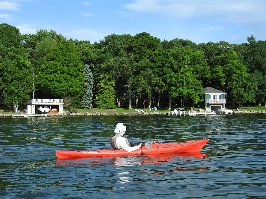
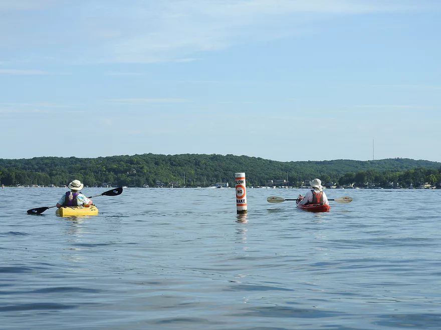
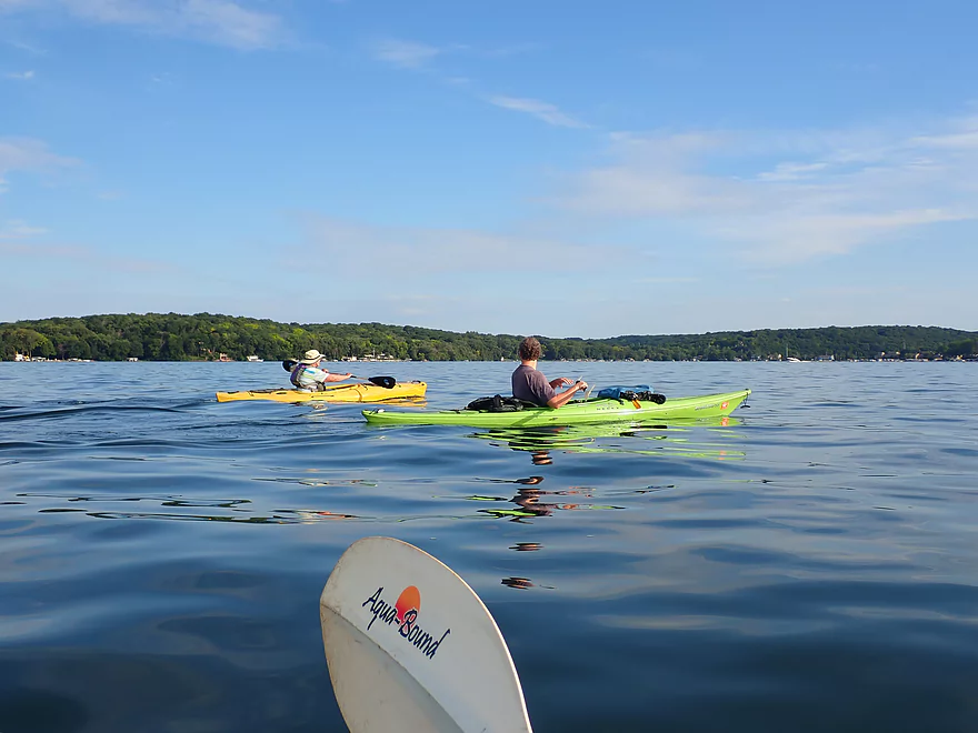
Next up was Lake Nagawicka which took about two miles to cross. This is actually a nice lake with clear water and some quiet parts…but the shoreline is heavily developed and occasional motorboats were a nuisance. There are several access options on the lake itself, but we opted to exit the lake by the dam. Finding the outlet isn’t super easy on such a big lake, but if in doubt just follow the cell tower and steeple located in Delafield.
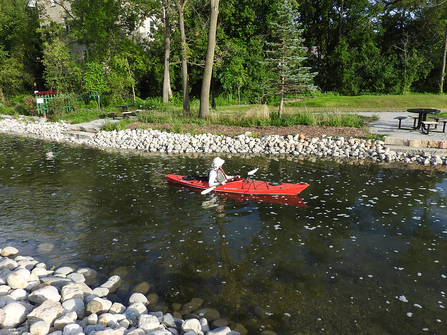
After the dam was a small rocky section with exceptionally clear water. It was here we launched our Delafield trip three years ago and things have changed since. Kayaking the Delafield Bark has become quite popular with locals, a new kayak ramp exist north of Mill Street, and there are now kayak rentals available at Saint John’s Park. Despite having several nice take-out options we opted to disembark by the Delafield Post Office which was a good access option because the parking lot is close to the water.
In summary, this was a varied and good trip, but some of the logjam dodging in the Hartland Ice Age Marsh knocked a star off the ratings. Hopefully locals will do another cleanup effort…I really think kayaking could take off in Hartland like it did in Delafield if this were to happen. The trip highlights were the rapids and historic railroad bridge. The lowlight was Nagawicka Lake…not because it is a bad lake paddle, but rather it was so big and almost was a small trip in itself. Paddlers certainly don’t have to go across the lake if they don’t want to. On my overview map, I’ve subdivided this trip into segments and show additional access options, so paddlers can make their own plans.
Hartland Ice Age Marsh: This is a large marsh located just south of Hartland and is popular with locals.
Ice Age Trail: The Bark River is located along the edge of the Terminal Moraine. There is an Ice Age Trail segment that parallels the river in Hartland and it looks like a neat hike.
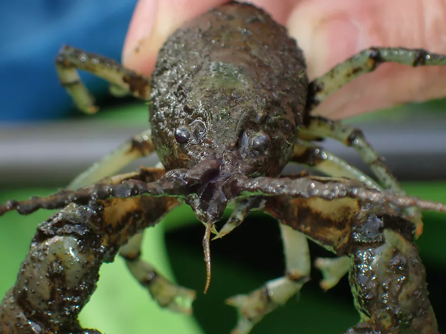
Sights included deer, two otters, a mink, one beaver, two great blue herons, a crayfish, many cool looking spiders, and a number of zebra mussels. The highlight were four relatively tame cranes hanging out on a lawn by Nagawicka Road.
We started the trip at Bark River Park located in Hartland. Bark Park is mostly used for community softball games, but is well suited as an access with free parking and nearby restrooms. The best launch option will be at the north end of the park by the pedestrian bridge
For those interested in a longer trip, there are several decent upstream access options. But be warned…satellite images appear to show some logjams north of Hwy 16.
Conversely you could shorten the trip by using one of the downstream bridges, but this isn’t recommended as you would miss out on the rapids.
We took out by the Delafield Post Office (just downstream of Genessee Street). Here the river is shallow and it is easy to climb out onto the riprapped shoreline just next to the post office parking lot.
There are numerous alternate take-out options.
- Mill Street Landing: There is a brand new ramp and launch area east of Genessee Street. This is a good access option, but you must park on the street which can fill up.
- St. John’s Park: The land north of the dam is a public park and you can drag a boat along the park trail to the parking lot. But…this is a long 500′ hike and the small parking lot fills up quickly on weekends.
- Bleeker Street Boat Launch: Located east of the dam on Lake Nagawicka, this should be a good launch option…but only if you are a Delafield resident.
- Naga-Waukee Park: This is a fantastic park and does have a boat ramp. But…you must pay $6 for a launch fee and the parking lot is a 1200′ hike uphill from the ramp.
- Other Options: For many more access options on the Bark River, see my overview map.
Bike Shuttle: The bike route would be 5.9 miles, would include 95′ of hill climbing, and some town pedaling would be required. You’ll have to deal with some traffic, but it should be manageable as long as you avoid Hwy 16.
Kayak Rentals: There is a kayak rental now located in St. John’s Park which appears to be new. For more information contact ‘Clear Water Outdoor’ at (262) 303-4206.
Current: The current was quite varied….Hartland was fast because of the rapids, while the marsh segments were slow. The river picked up steam though when it got closer to woods.
Low Bridges: Cottonwood Ave was the lowest bridge I’ve ever seen and must be portaged. There is also a ridiculously low trail bridge after Cottonwood Ave. Both portages were really easy.
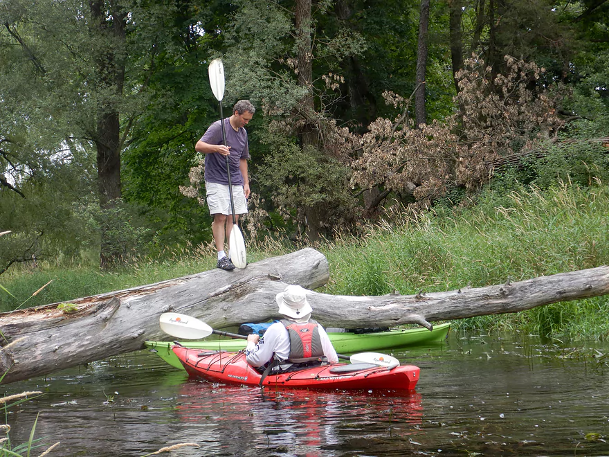
Logjams: About a half mile past Cottonwood Ave there was a congested section that included a handful of “duckers” and “hoppers”. Most paddlers will need to undertake 2-3 logjam portages here (unless you are very good at limbo-ing like your truly). I don’t think portaging the Bark River here is a major deal because the banks are relatively flat with little mud. Past Hwy 83 is a logjam that will also have to be portaged (river right).
Lake Paddling: Roughly two miles of this trip were over Lake Nagawicka. This means you should be mindful of forecasted headwinds, be careful around speedboats, and should wear a life jacket when far from shore.
Rapids: There are a number of rapids in Hartland between Capitol Drive and Cardinal Lane. They are mostly simple Class 1 rapids, but the chute under Capitol Drive could be Class 2 in higher water.
There is a gauge conveniently located at the take-out.
- 0-20 CFS: A very low depth with exceptional clarity. The Hartland section though will likely be too shallow to run.
- 21-35 CFS: We did the trip at 31 CFS which was a low depth. The Hartland rapids were pretty bumpy and we did run aground here and there, but this was still a viable depth for flatwater kayaks (v-hull and whitewater kayaks will need higher water). Past Hartland, everything is plenty deep (minus a quick stretch under the Nagawicka Road bridge).
- 36-60 CFS: A good depth, but clarity won’t be as good.
- 61-80 CFS: A high depth but likely still viable.
- 81+ CFS: The river might be too dirty and pushy in Hartland to run. If you know for sure, let me know in the comments below.
Detailed Overview
For more information on access options, see my Overview Map. For a background on area human interest stories, I recommend the book “The Bark River Chronicles“.
- Cty Q to N Road: 0.1 miles. Small, channelized and weedy…this may require high water to run.
- N Road to Hillside Road: 1.4 miles. Small and marshy with maybe 2-4 logjams. High water is likely needed to run this part.
- Hillside Road to Hwy 164: 2.0 miles. Maybe 5-10 logjams. Very small and marshy. Likely needs high water to run.
- Hwy 164 to Lisbon Park: 2.9 miles. Maybe 2-4 logjams. The channel here is small, shallow, weedy and bog-like. High water is recommended.
- Lisbon Park to Merton Dam/Firemen’s Park: 1.3 miles. Mostly simple flowage paddling.
- Merton Dam to Bark River Park: 4.9 miles.
- Merton Dam to Dorn Road: 1.2 miles. Very scenic section with great fall color. Highlights include some boulder gardens, springs, clear water, and pine trees. Diverse banks with some woods and some marsh. There is one tricky logjam by the old mill.
- Dorn Road to Hartling Road: 0.7 miles. A short but pleasant open section with no logjams.
- Hartling Road to Rybeck Road: 1.0 miles. A scenic mix of light woods, marsh, and a few boulder gardens. There was one easy logjam to portage and a few hoppers/duckers, but it is mostly open.
- Rybeck Road to Centennial Park: 1.0 miles. Starts open and has a fantastic boulder garden. The last part is more cluttered with a number of logjams to hop over. I never had to portage though.
- Centennial Park to Bark River Park: 1.0 miles. A fast wooded section with multiple logjams. There are about four major logjams in a row, but you can skip them all by portaging on the boardwalk to the east (super easy). There are some additional hoppers beyond this stretch, but I didn’t think they were too bad.
- Bark River Park to Delafield Post Office: 6.1 miles.
- Bark River Park to Nixon Park: 0.7 miles. Terrific stretch through the heart of Hartland. Highlights included many fun Class 1 rapids and one Class 2.
- Nixon Park to Cottonwood Ave: 0.5 miles. Nice stretch with a mix of light woods and suburban homes.
- Cottonwood Ave to Hwy 83: 1.4 miles. Mostly an open marsh section. A few portages are required for downed trees.
- Hwy 83 to Lake Nagawicka Mouth: 1.3 miles. Less marsh and more woods…this is a nice stretch with good water clarity.
- Lake Nagawicka Mouth to Delafield Post Office: 2.2 miles. This is almost all lake paddling. Lake Nagawicka has good clarity and some attractive shoreline homes, but it is heavily developed and suffers from excess motorboat traffic. Several alternate access options exist along the lake shore.
- Delafield Post Office to Hwy 67: 7.7 miles.
- Delafield Post Office to Nemahbin Lake Boat Launch: 1.8 miles. Likely the best stretch on the entire river. Highlights include attractive rocky sections and stunning clarity.
- Nemahbin Lake Boat Launch to Sawyer Road: 0.7 miles. Mostly a simple paddle on Lower Nemahbin Lake. Highlights include great water clarity, an attractive cattail corridor and the “Blue Hole”.
- Sawyer Road to Genesee Lake Road: 2.2 miles. Very nice marsh paddle.
- Genesee Lake Road to Summit Ave: 3.0 miles. A good stretch with ecologically diverse banks.
- Summit Ave to Hwy 18 Wayside: 3.8 miles. A decent prospect. The take-out is a small park/wayside and the last of the three Hwy 18 bridge crossings. Note, a recent reader comment says this stretch has many serious logjams.
- Hwy 18 Wayside to Hwy E: 6.2 Miles. Heavily channelized, but some of it still seems like it has potential. Note a reader noted that this stretch has many serious logjams, some of which are difficult to portage.
- Hwy E to the Rome dam: 4.2 miles. Half of this leg would be a flowage paddle on Rome Pond.
- Rome to Cushman Road: 5.6 miles. A fantastic stretch and one of southeast Wisconsin’s paddling gems.
- Cushman Rd to Hwy 106 Canoe Launch: 4.4 miles.
- Cushman Rd to Hagedorn Rd: 0.6 miles. A great leg with clear, fast water and many rocks. Only downside is, it can get shallow.
- Hagedorn Rd to Hwy 106: 3.8 miles. The first half is pleasant, clear and rocky. The second half is more of a floodplain paddle with more mud and downed trees, which was less interesting.
- Hwy 106 canoe launch to Prince's Point Wildlife Area: 5.5 miles. Be careful of the partly removed dam at Hebron. There are definitely downed trees in this section.
- Prince's Point to Burnt Village County Park: 7.1 miles. Much of this was a mediocre wetgrass paddle through a large marsh. However kayaking through the floodplain forests of the Prince's Point Wildlife Area was very cool.
- Burnt Village County Park to the Rock River: 5.5 miles. Does not seem super interesting. Landing is just upstream of the mouth on the east bank.
Trip Map
Overview Map
Video
Photos Size:
Google “kayak 2154128”. In the website description it list a phone number for Clearwater outdoor in Lake Geneva. The number listed is incorrect. That number belongs to me. Please correct the number as I am recieving multiple calls a day asking for kayaks.
At the time the Delafield branch did list your phone number as the contact. This has been updated and you will no longer receive kayak inquiries from this website. Thanks for the heads up.
Such a fun section of the river! Going through the village of Hartland we saw a turtle (I think a snapper) about 2 feet in diameter. It was just grazing on a rock. The path was clear to Nixon park, but we had a few obstacles coming out of Nixon park and getting into the Hartland marsh. The marsh was really pretty with large and small birds, fish and generally enjoyable sections… though we did encounter a few tree blockages and even had to take the kayak out of the river and carry it around through tall marshy grass a few times. As we came out of the marsh and into the green areas approaching Lake Nagawicka, there were sections of fallen trees that present some minor challenges. It doesn’t appear there are many kayakers through this stretch, but it’s a fun experience if you are up for a challenge.
Yeah this section is more open than the Marton leg, but still needs some cleanup work. Appreciate the update!