Yellow River
The Lower Yellow is a generic bottom-land paddle with many logjams. But the upper stretch is quite nice with many rapids and boulder gardens. Timing though can be pretty tricky as often this river is either too high or too low.
Trip Reports
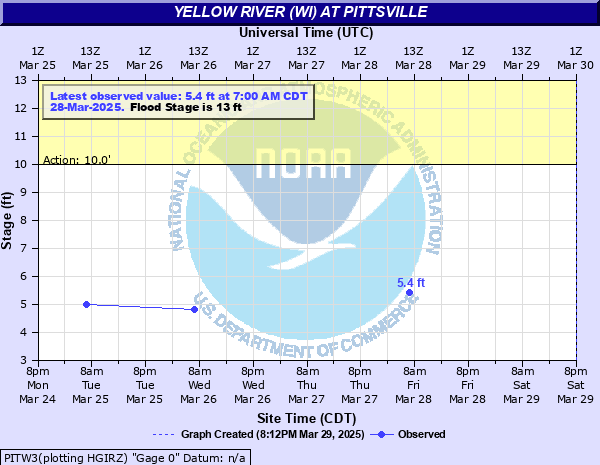
Yellow River Road to Hwy 10
Date Paddled: October 15th, 2023
Distance: 4.3 miles
Time: Expect 2 hours
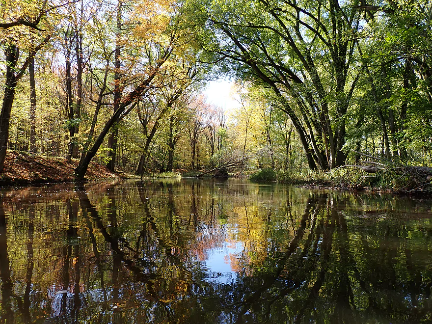
This is an obscure leg of the Upper Yellow River located near Marshfield. It's a scenic stretch that can feature some nice fall color. Unfortunately the trip was marred by high water levels.
Read More...Hwy 10 to Hwy 80
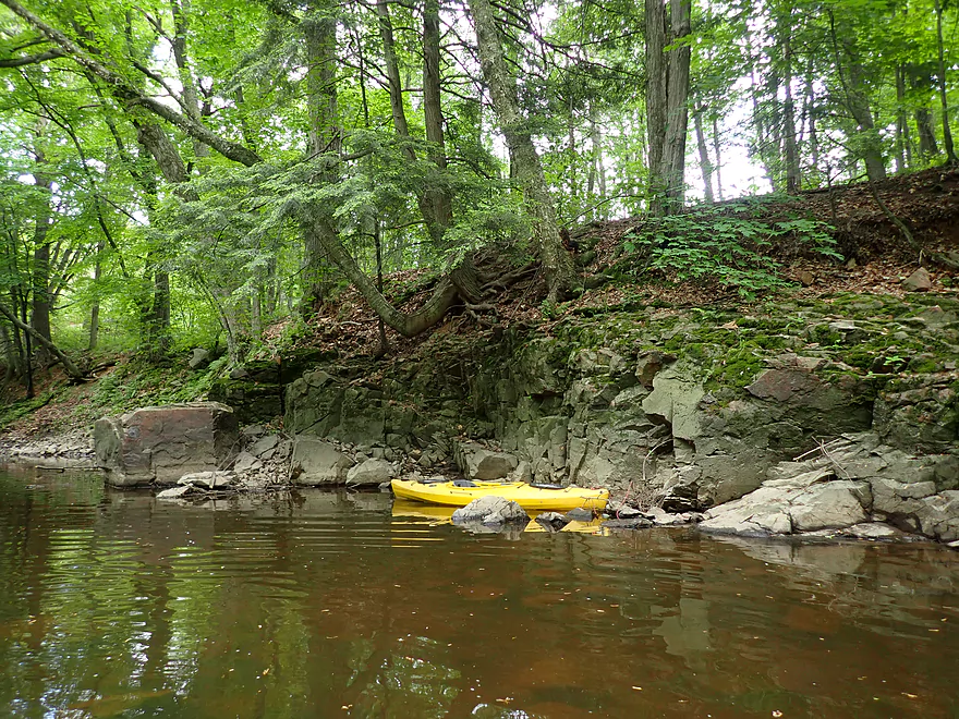
Date Paddled: June 12th, 2022
Distance: 4.0 miles
Time: Expect 2 hours
Scenic boulder gardens, light rapids, and the best tree canopies I've ever paddled under make this a highlight paddle of the year.
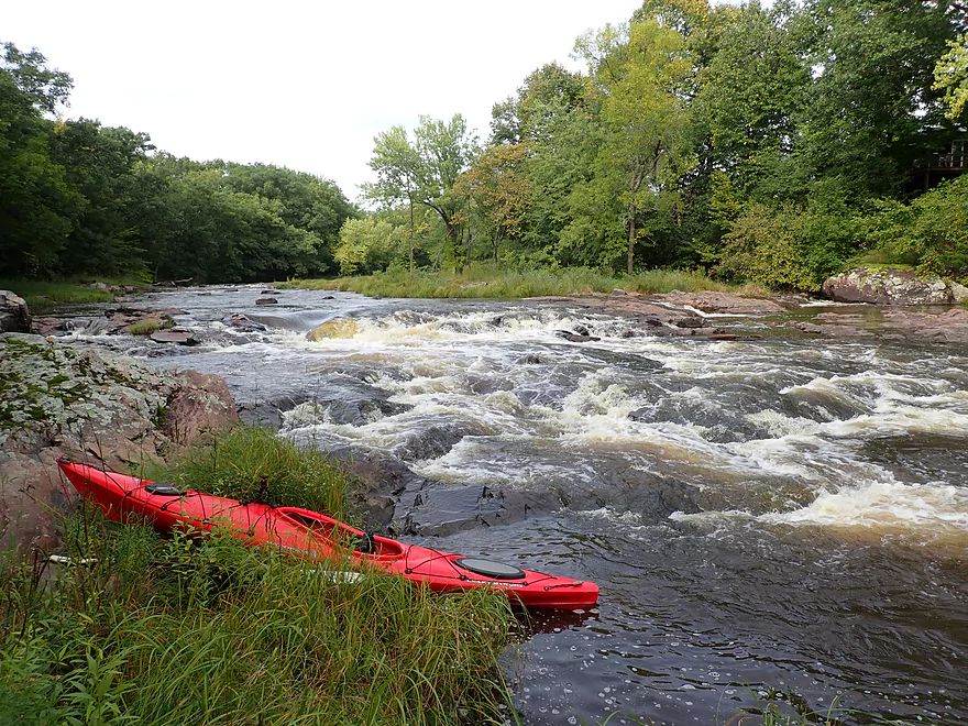
Read More...Hwy 80 to Hwy N
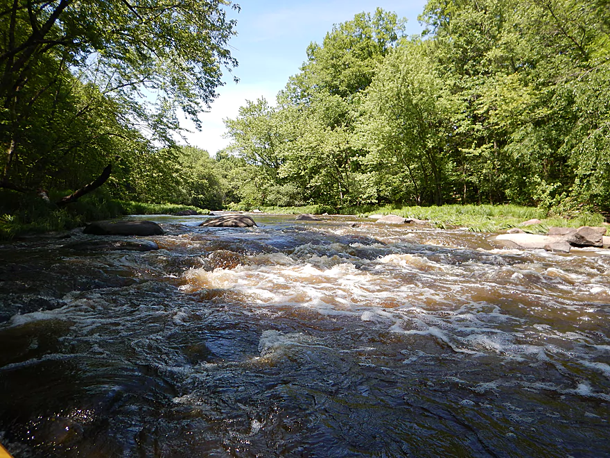
Date Paddled: June 11th, 2016
Distance: 3.4 Miles
Time: 2 hours 48 minutes
This segment of the Yellow starts with a whimper and ends with a bang. Highlights include fun rapids, boulder gardens, massive river boulders and a lack of development.
Read More...Hwy N to North Wood County Park
Date Paddled: July 27th, 2025
Distance: 3.0 miles
Time: Figure 1-2 hours
Another week and another Yellow River. This time we're in Wood County to paddle the most difficult stretch upstream from Pittsville. The scenery was terrific, but some of the boulder gardens and rapids were a bit challenging. This is not a section for beginners.
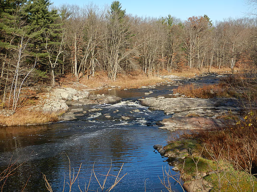
Read More...North Wood County Park to Little Bull Falls
Date Paddled: September 13th, 2020
Distance: 4.2 miles
Time: Expect 2 hours
Yet another underrated Central Wisconsin paddle that is super scenic and has a lot of fun rapids. This is a tough river to time though as it is often too low or too high.
Read More...Little Bull Falls to Dexter County Park
Date Paddled: November 6th, 2016
Distance: 7.5 miles
Time: 5 hours 8 minutes (3.5 hours would be more typical)
An unexplored section on the Upper Yellow River with some really nice surprises.
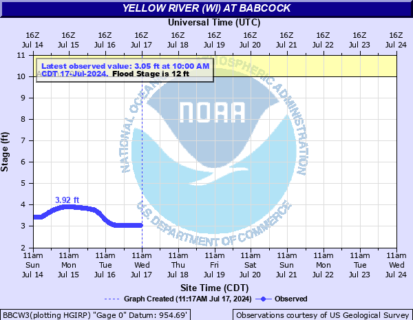
Read More...Juneau Cty. Rd F, near Finley to 9th Street East, east of Sprague
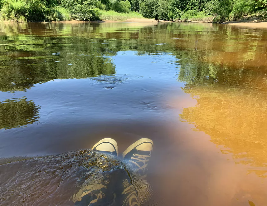
Date Paddled: July 22nd, 2022
Distance: 8.3 miles
Time: 3.5 hours
A guest review for the Yellow River near Babcock.
Read More...Necedah Dam to Yellow River Bay
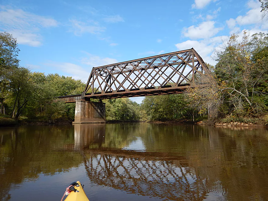
Date Paddled: October 6th, 2015
Distance: 10 Miles
Time: 5 hours 8 minutes
An obscure central Wisconsin prospect that is pleasant with great sandbars, but has some snags to contend with.
Read More...Overview Map
Detailed Overview
- Eagle Road to Yellow River Road: 4.3 miles. Background provided by WisconsinRiverTrips.com contributor Daniel Akin.
- Eagle Road to Hwy HH: 2.2 miles. This is a dangerous section with Class 3 and 4 rapids. There’s also a wire fence across the river to deal with.
- Hwy HH to Yellow River Road: 2.1 miles. A more wooded stretch that I don’t know much about. Nice street view image.
- Yellow River Road to Hwy 10: 4.3 miles.
- Yellow River Road to Hwy BB: 1.3 miles. A nice wooded stretch with no major rapids.
- Hwy BB to Robin Road: 0.8 miles. A scenic stretch of the river. The South Branch joins up by the BB bridge and adds significant volume.
- Robin Road to Hwy 10: 2.1 miles. A great stretch featuring several fun rapids and small outcrops. Much of this flows by a large golf course which can be scenic in the fall because of all the maple trees.
- Hwy 10 to Hwy 80: 4.0 miles.
- Hwy 10 to Lincoln Ave: 2.2 miles. Very narrow and wooded. At times little light reaches the river, which is really cool. Neat boulder gardens and a great stretch, but there are two logjams.
- Lincoln Ave to Hwy 80: 1.7 miles. Good stretch with a number of scenic boulder gardens and one nice outcrop.
- Hwy 80 to Hwy N: 3.4 miles. Starts slow, but ends with nice boulder gardens and rapids.
- Hwy N to North Wood County Park (2nd Dam): 2.9 miles. A rocky stretch with some rough whitewater, including a Class 3 near the put-in by the “dells”.
- North Wood County Park (2nd Dam) to Little Bull Falls Grill: 4.2 miles.
- North Wood County Park (2nd Dam) to Hwy C: 2.8 miles. Scenic stretch with many boulder gardens and rapids. The most serious rapids are near Hwy C and include Jenny Falls, which is a Class 3.
- Hwy C to Little Bull Falls: 1.2 miles. More rapids and boulder gardens. There is a logjam shortly after Hwy C. Little Bull Falls is a Class 4 and is preceded by a Class 3.
- Little Bull Falls to Dexter Park: 7.5 miles.
- Little Bull Falls to Hwy 73: 1.6 miles. Many rapids on this stretch with some nice rock outcrops. Launch below the falls and at a private access.
- Hwy 73 to Riverside Park: 1.7 miles. More rapids and the biggest and best outcrops. Hwy 73 is a weedy but doable access option.
- Riverside Park to Dexter Park: 4.2 miles. Far fewer outcrops and rapids, but a nice wooded section. Two miles in the flowage kicks in which is less interesting.
- Hwy 54 (Dexter Park) to Hwy 80 (Babcock): 9.7 miles. While you could launch by the park, your best bet will be to launch SW of the dam off Hwy 54. Paddling author Frank Piraino liked this section and said it had no logjams, but I think it has since filled in...could have 10+ logjams. Can be pushy when high and only for adventurers. Not too many sandbars.
- Hwy 80 to Hwy F: 10.6 miles. Good sandbars. Am not sure about jams....maybe 6.
- Hwy F to 9th Street: 8.3 miles. A nice stretch with good sandbars. 2024 update...this stretch now has many logjams (~8?) because of recent storms.
- 9th Street to the dam (Necedah): 16 miles. A lot less sandy and many oxbows. Jams are a question mark. I suspect this is a weak section.
- Necedah to Yellow River Bay: A nice stretch with good sandbars.
- Castle Rock Lake: Blah. A big , open and dangerous flowage (3rd largest in the state).
- Buckhorn State Park: You can explore the back channels and they seem nice, with interpretive signs…but with no current and only 1.5 miles. Here is a map of the official water trail in the park.