
Put in at Chimney Rock
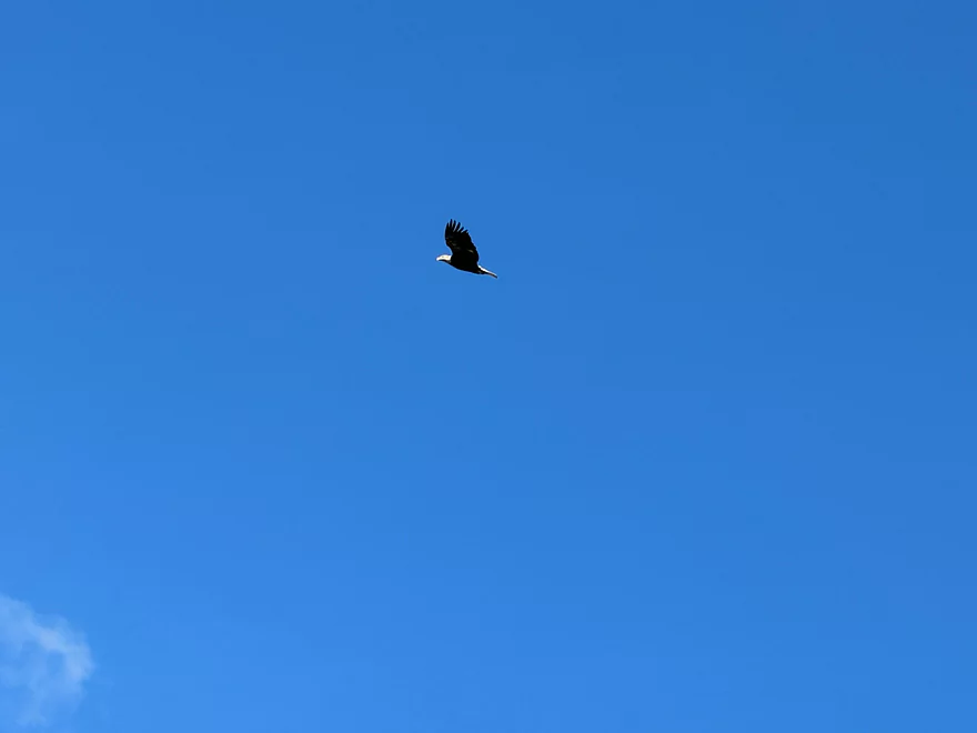
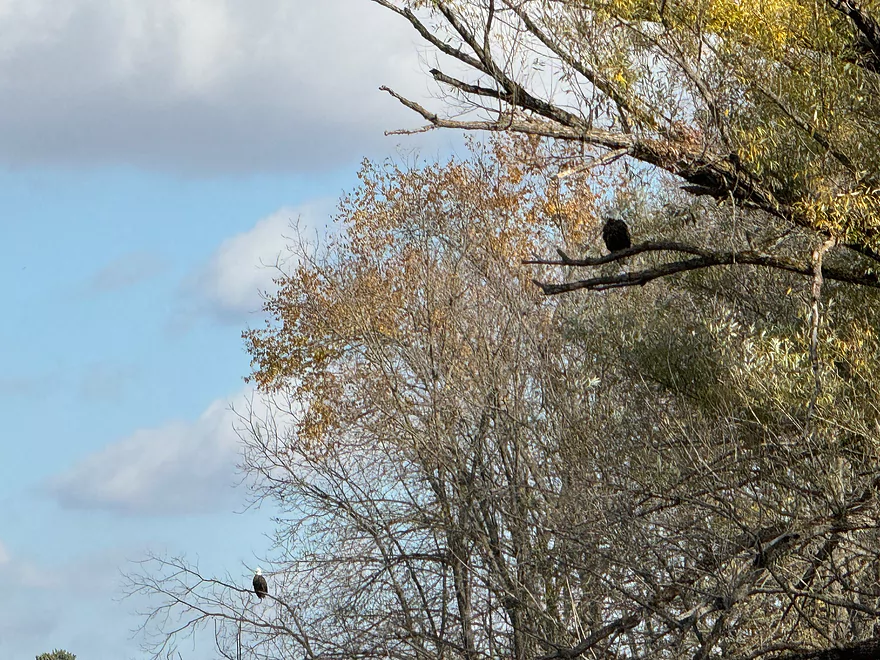
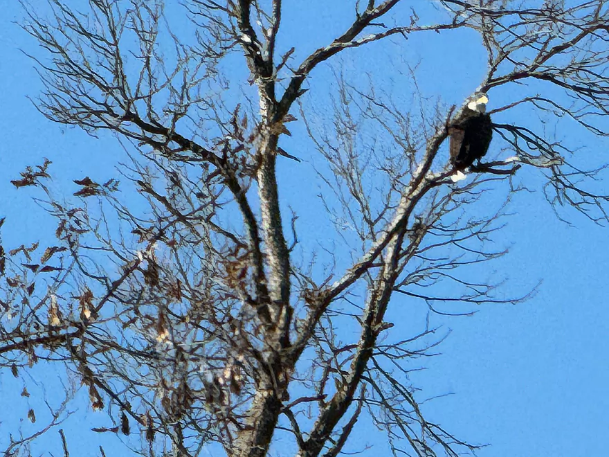
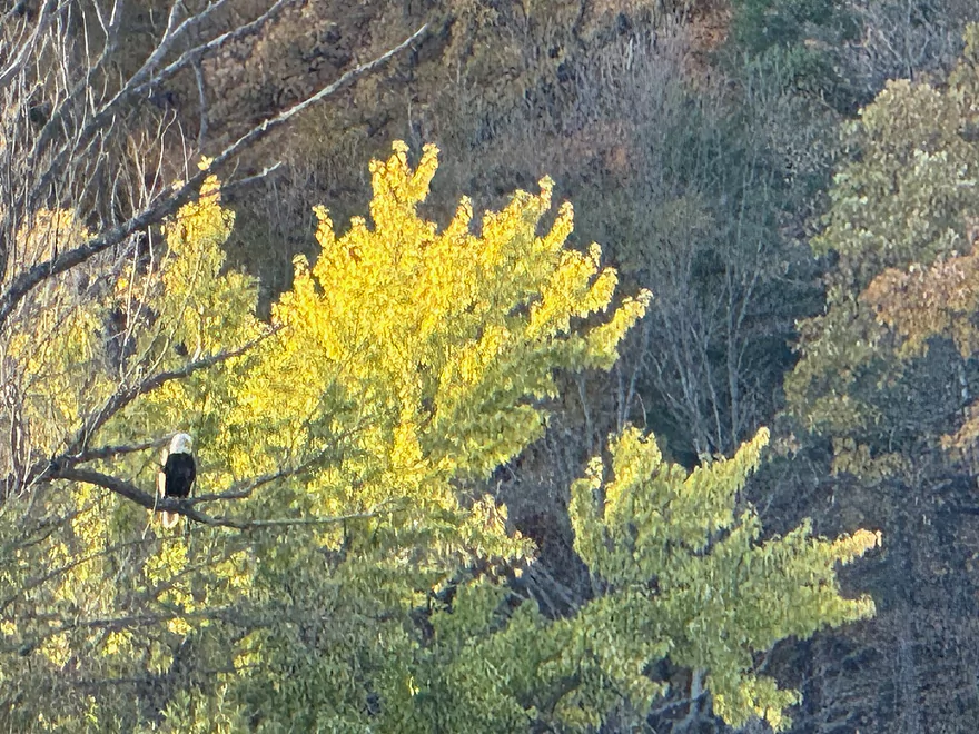
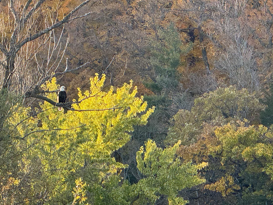
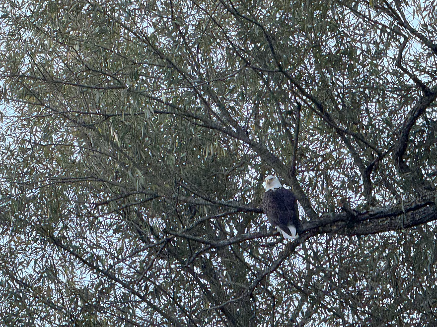
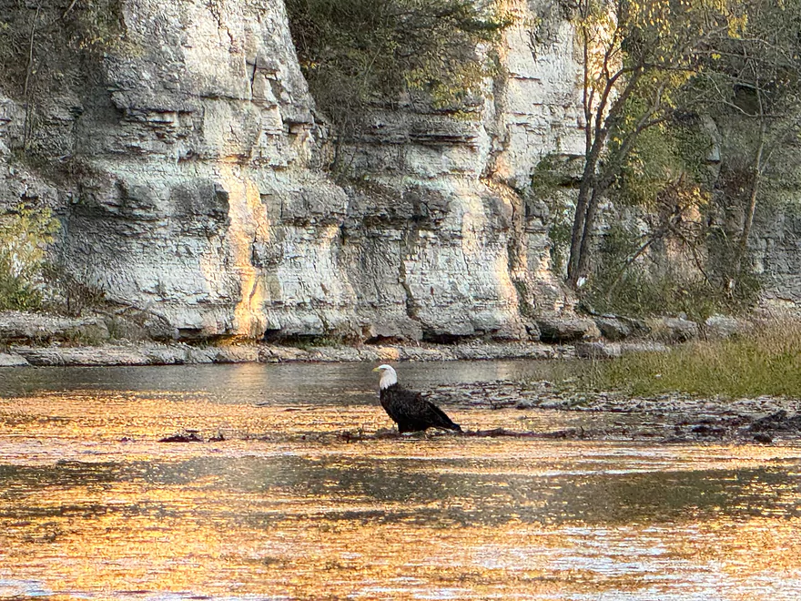
First of many bald eagle sightings
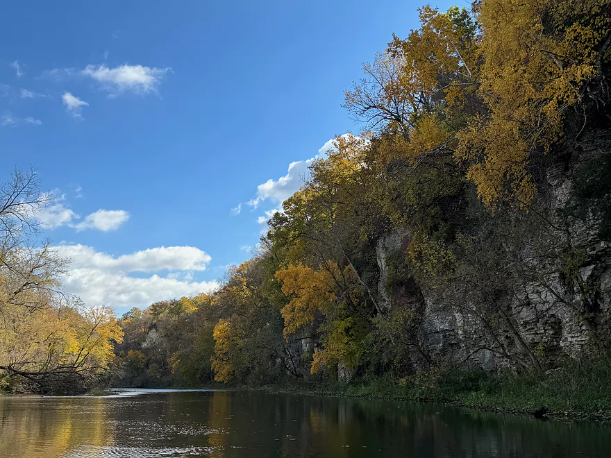
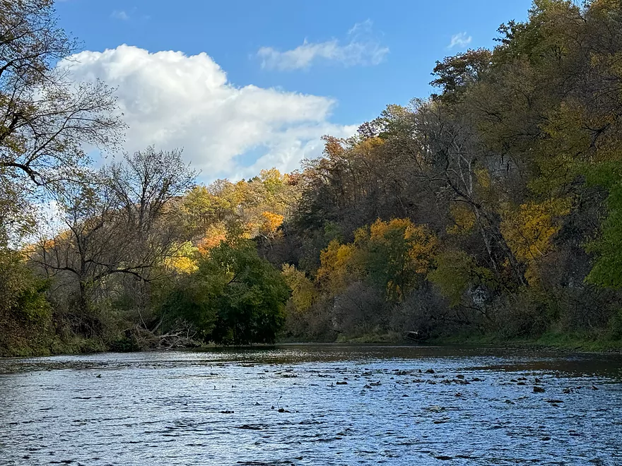
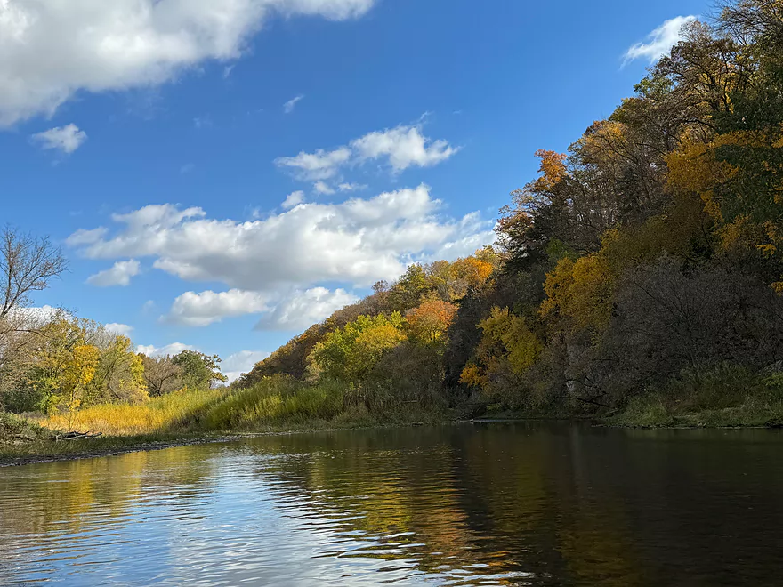
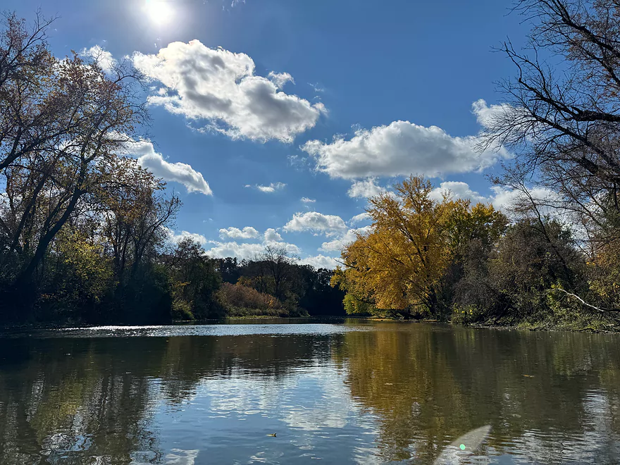
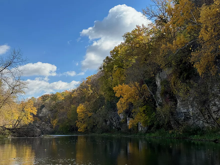
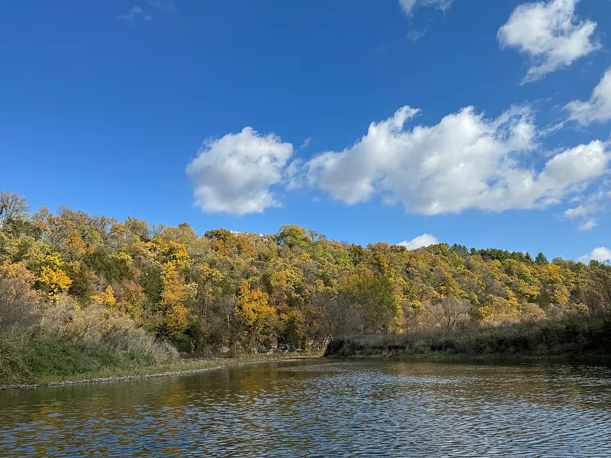
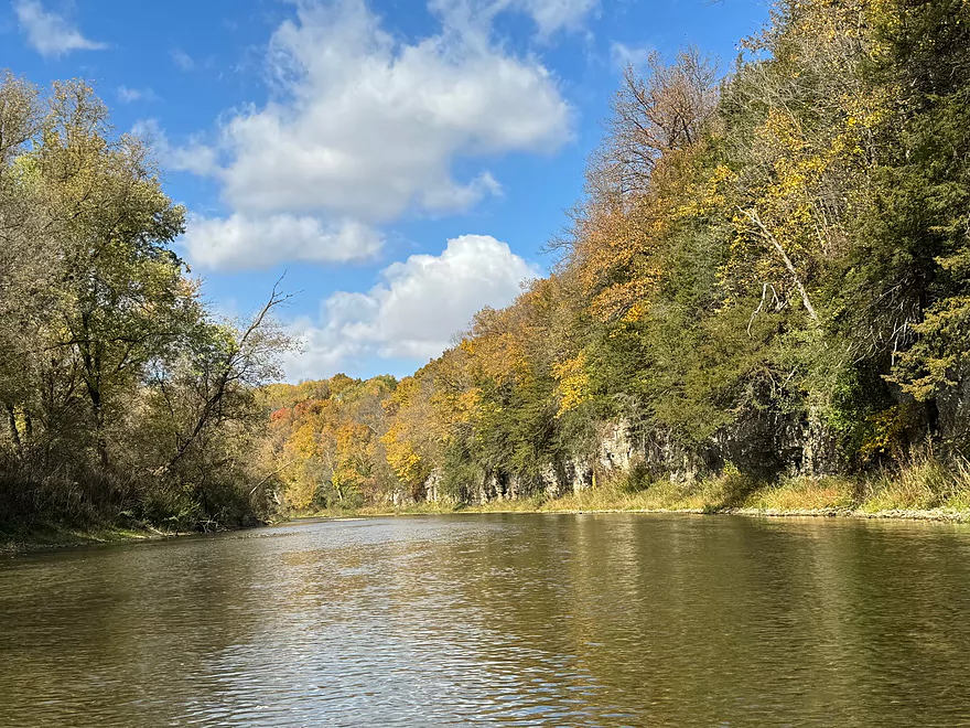
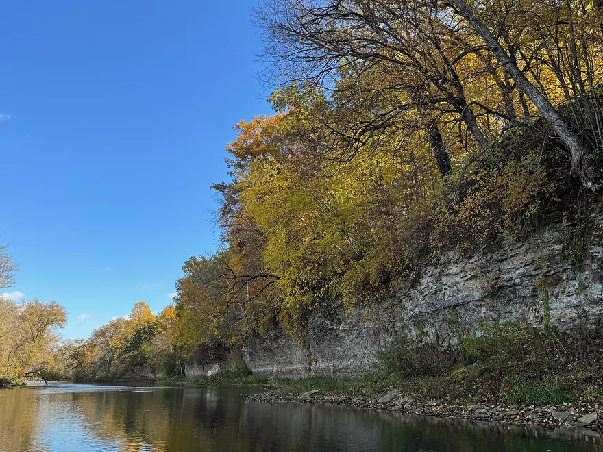
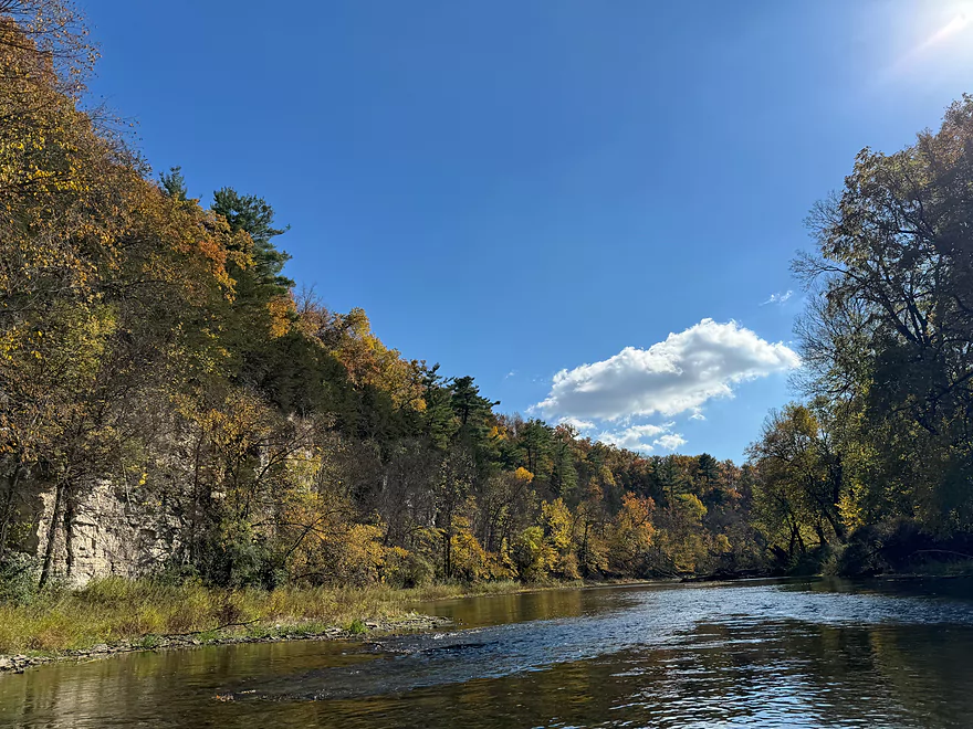
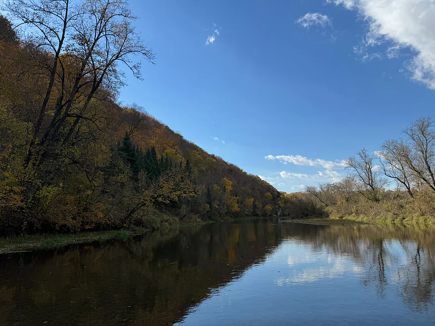
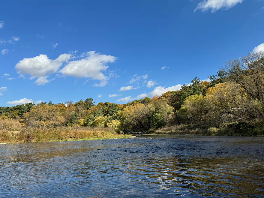
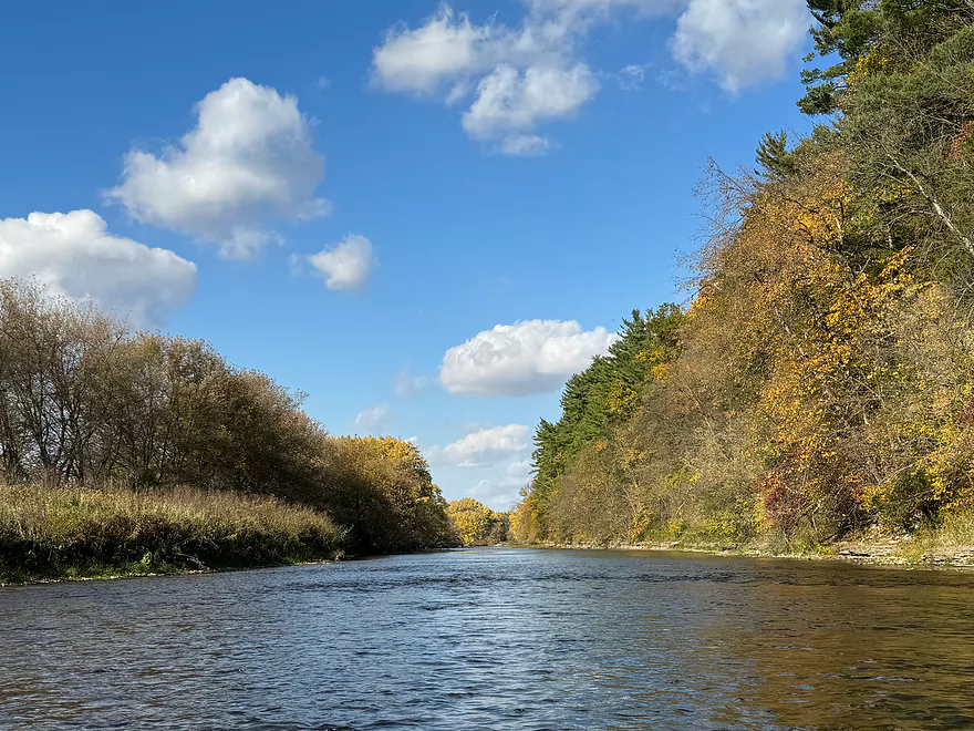
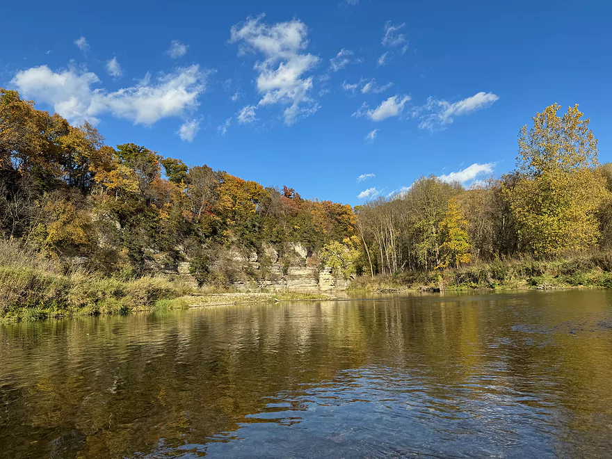
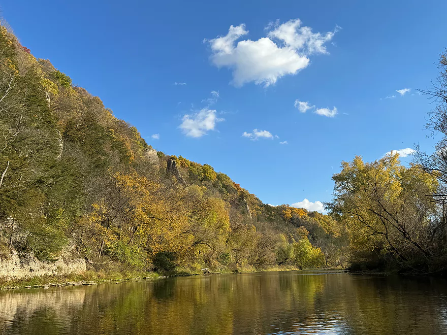
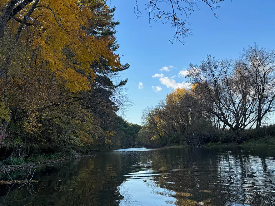
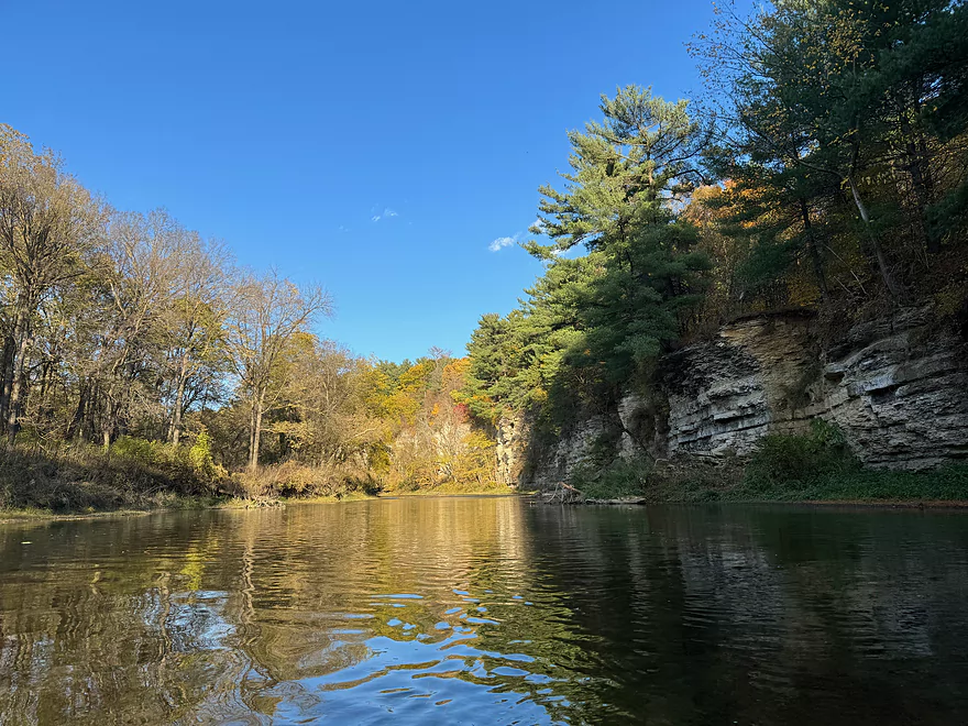
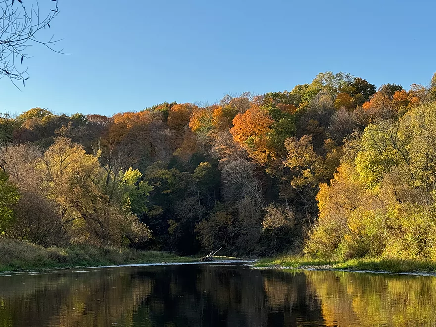
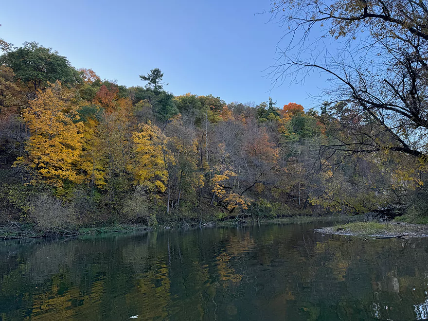
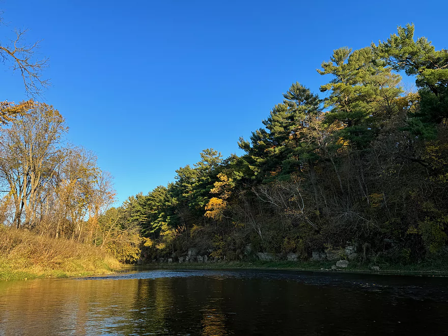
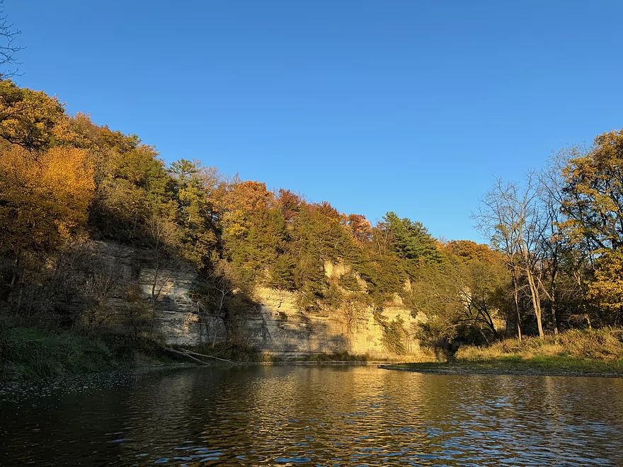
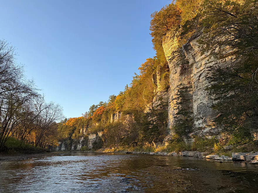
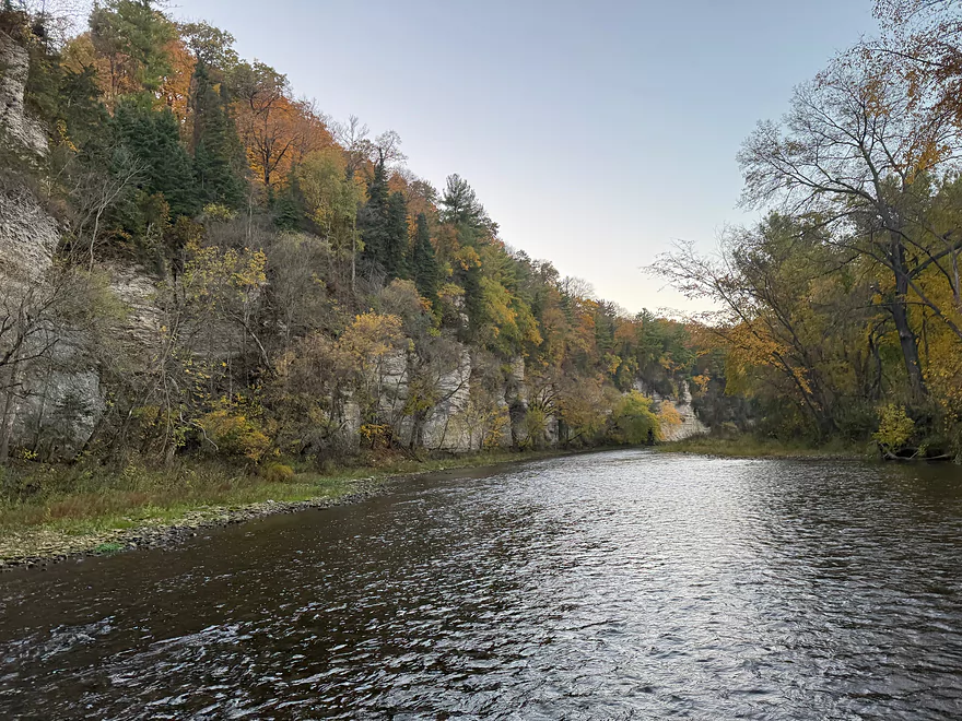
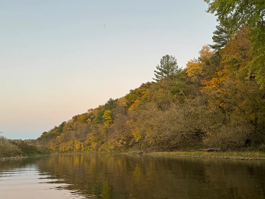
Upstream view
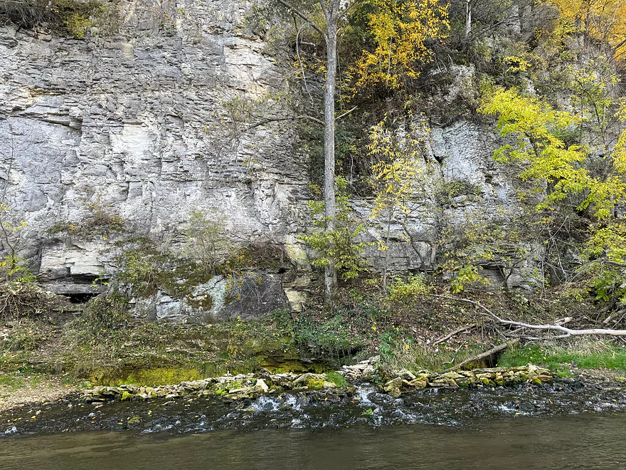
Large spring
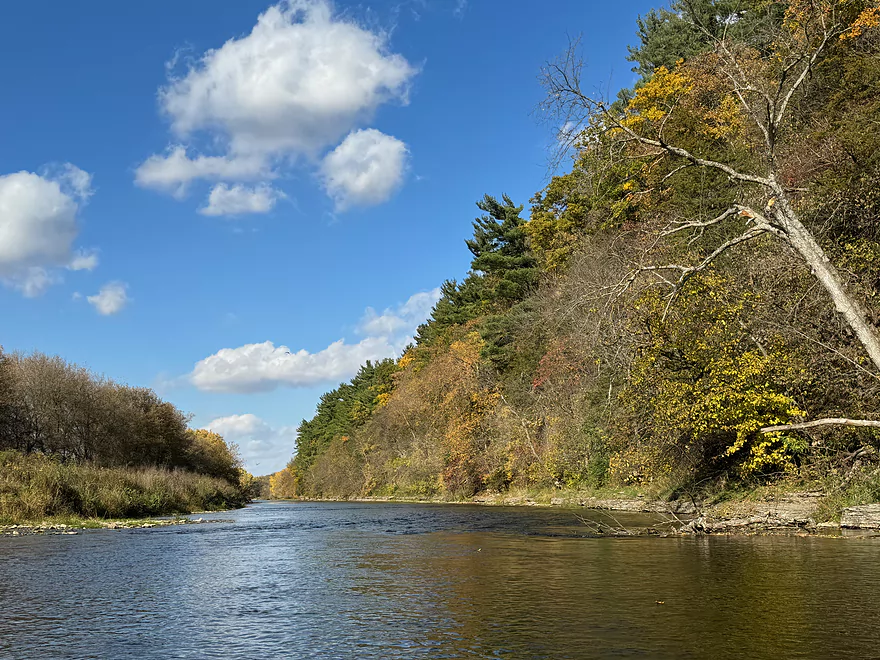
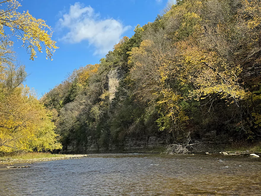
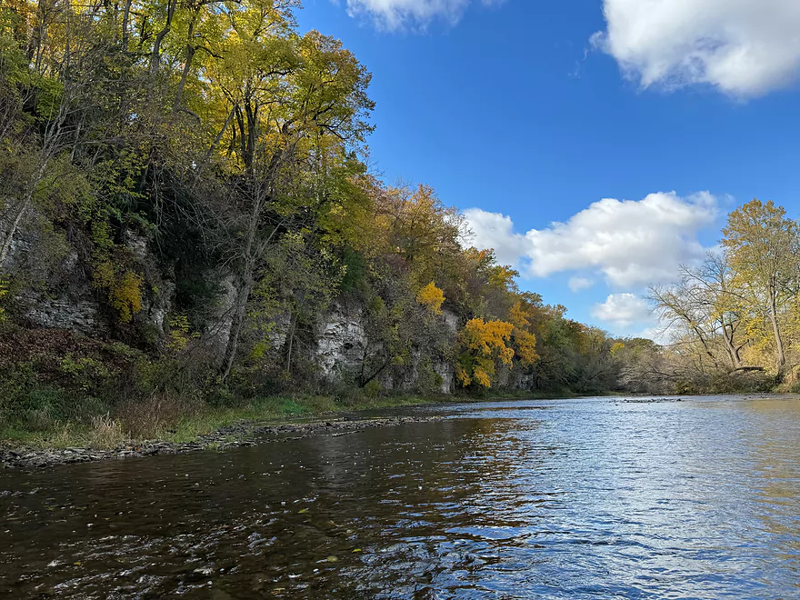
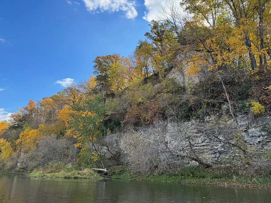
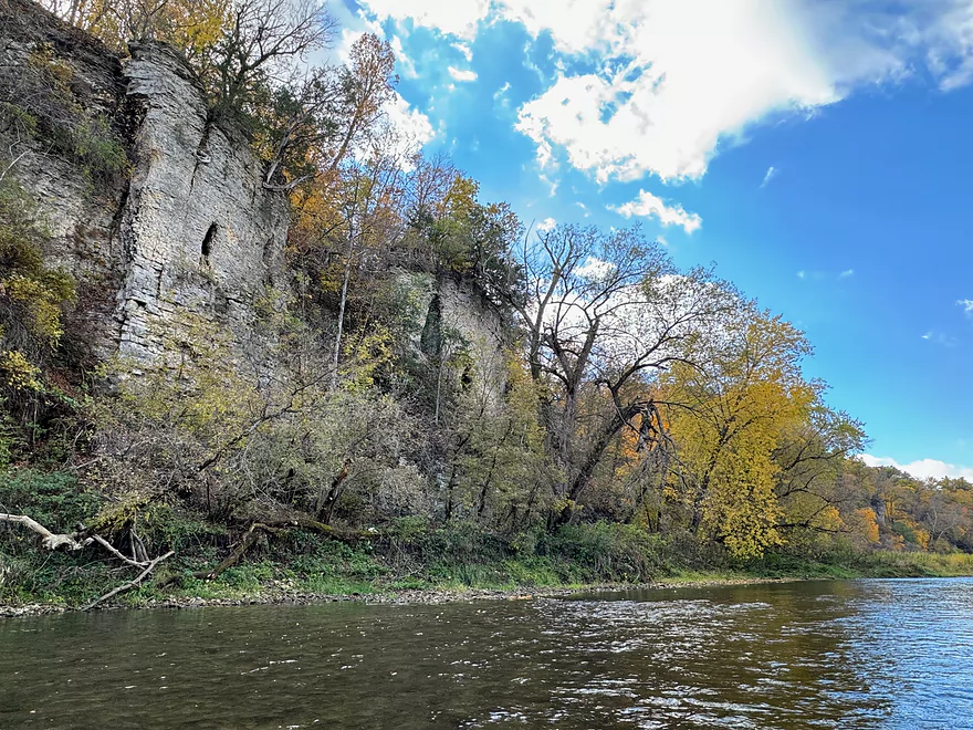
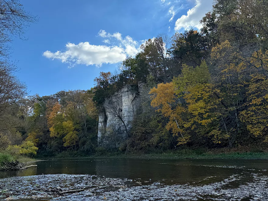
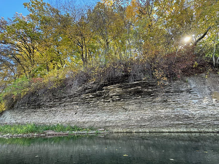
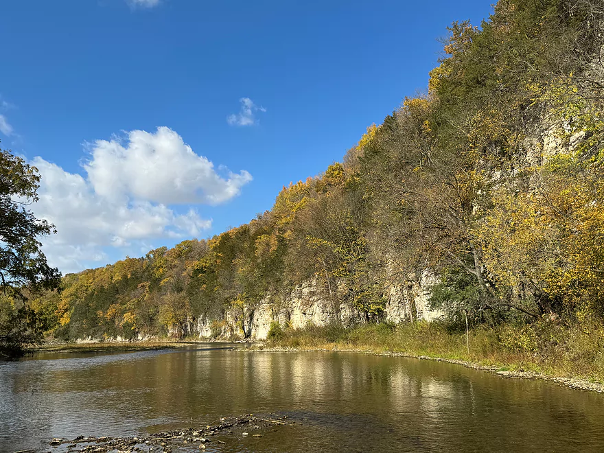
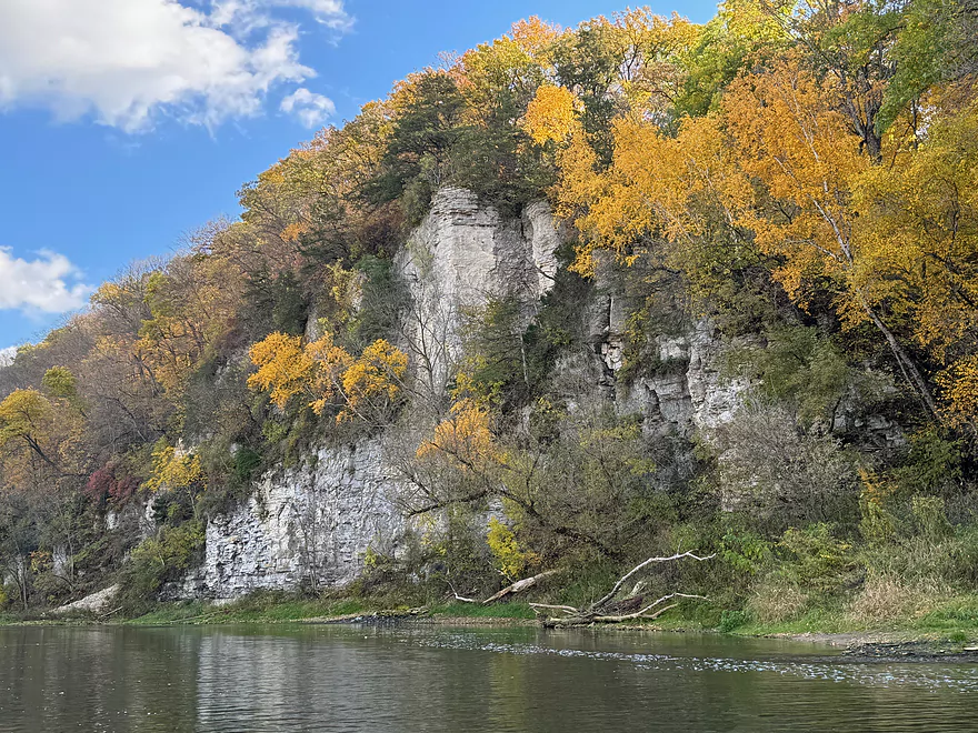
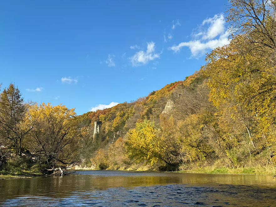
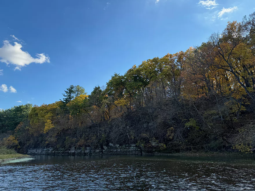
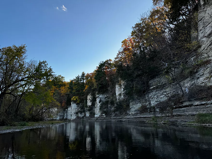
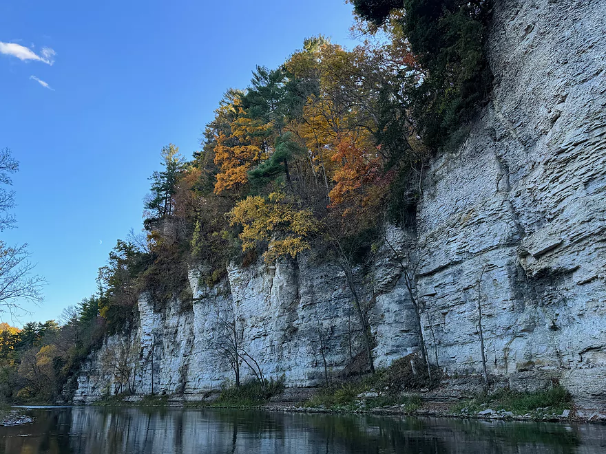
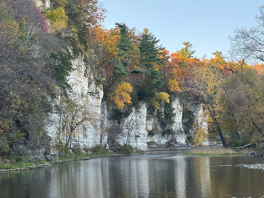
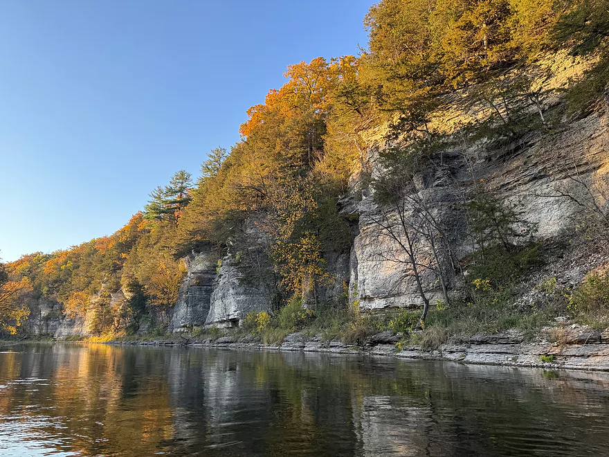
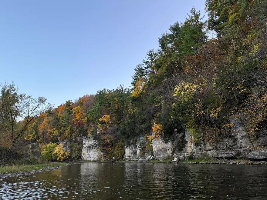
Approaching Chimney Rock
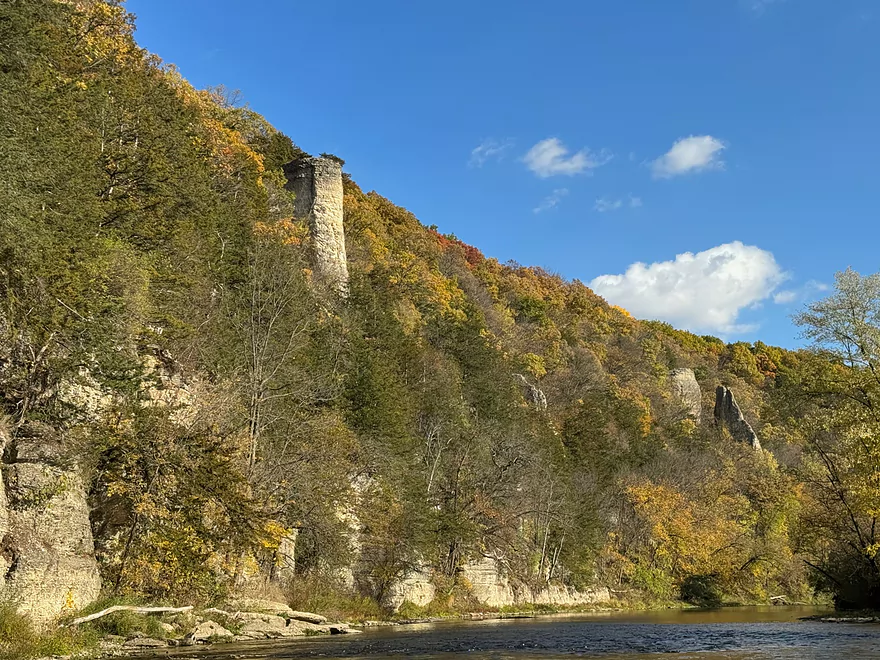
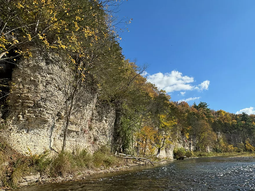
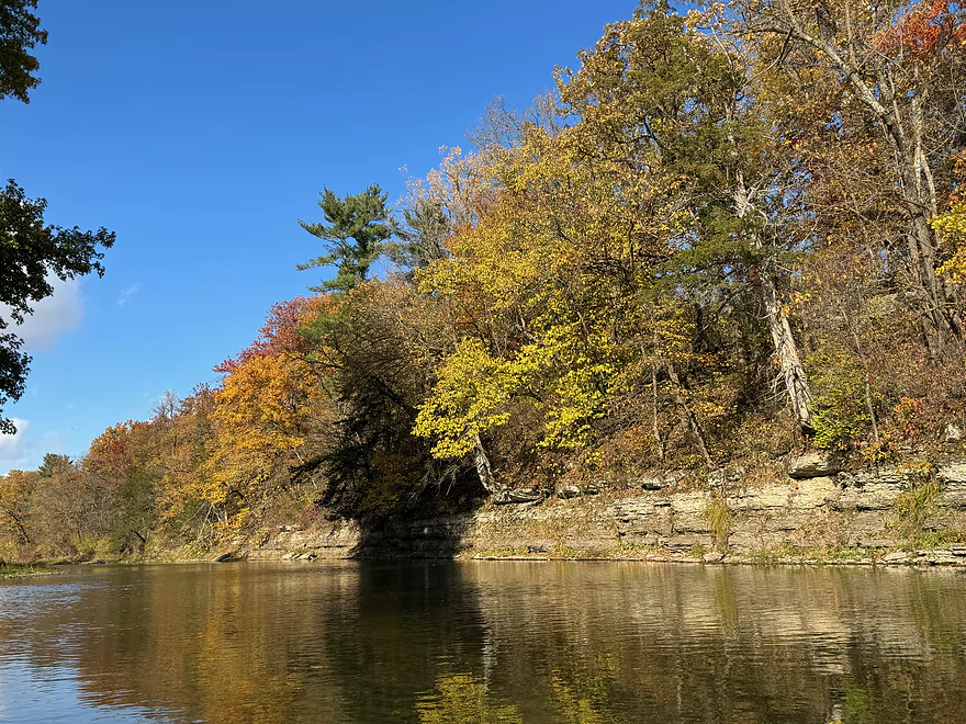
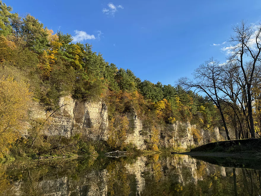
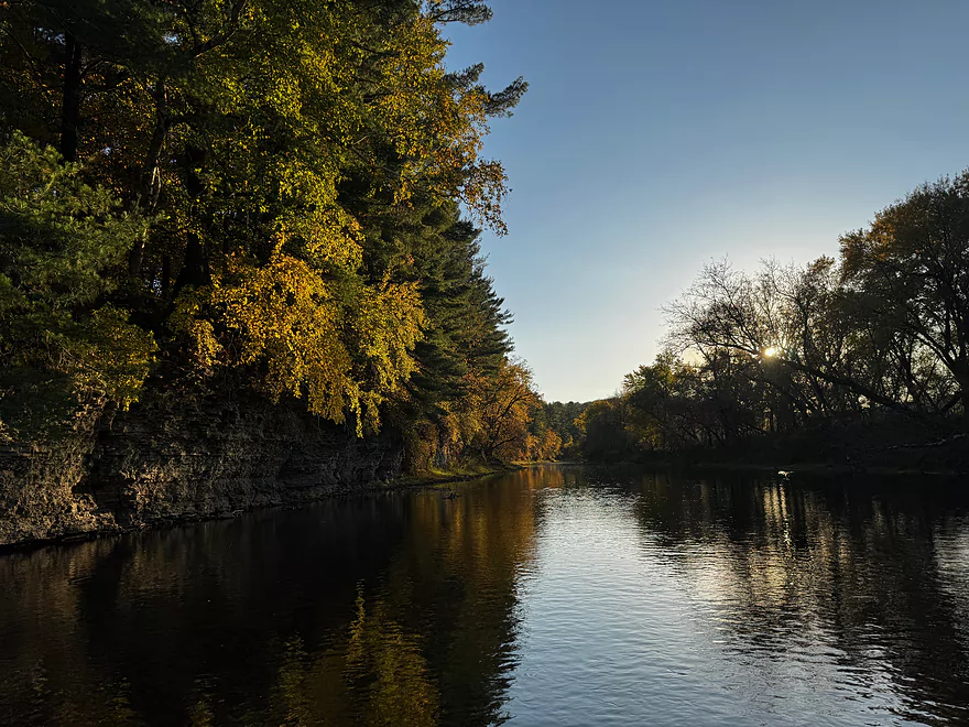
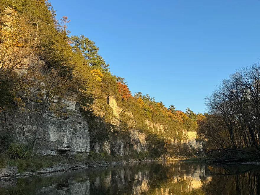
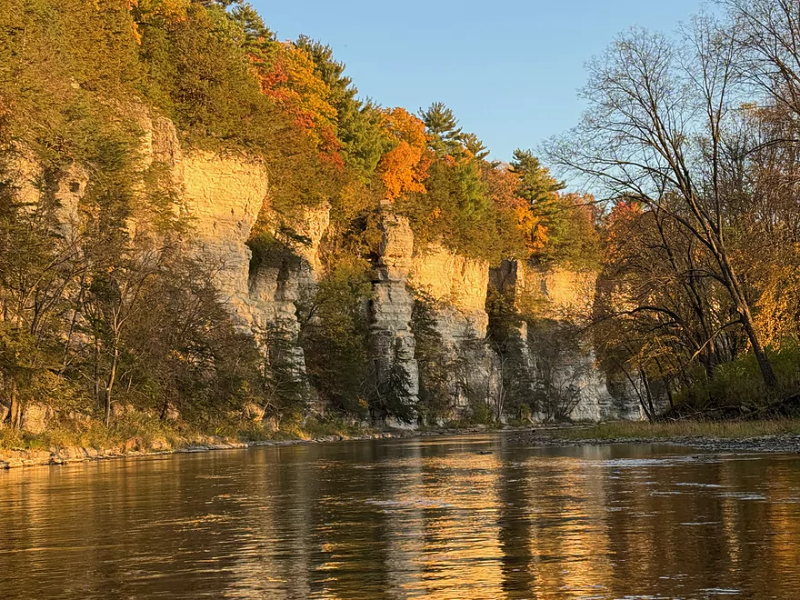
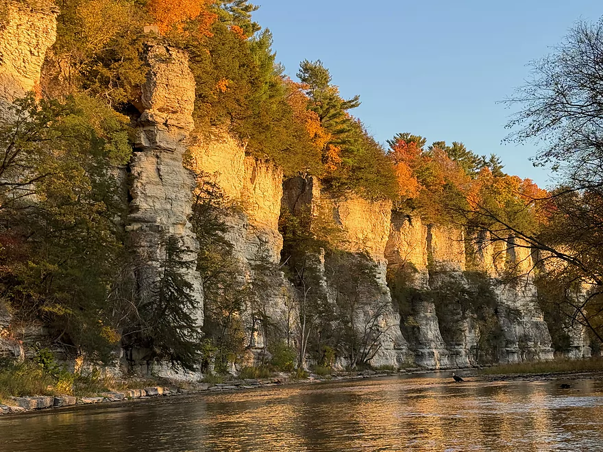
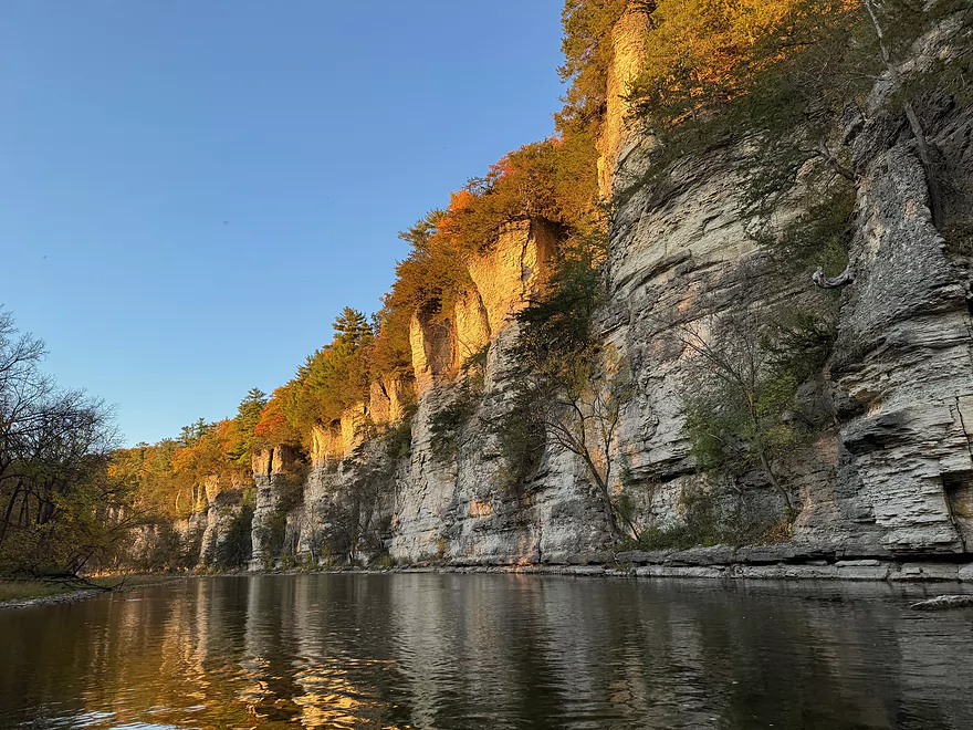
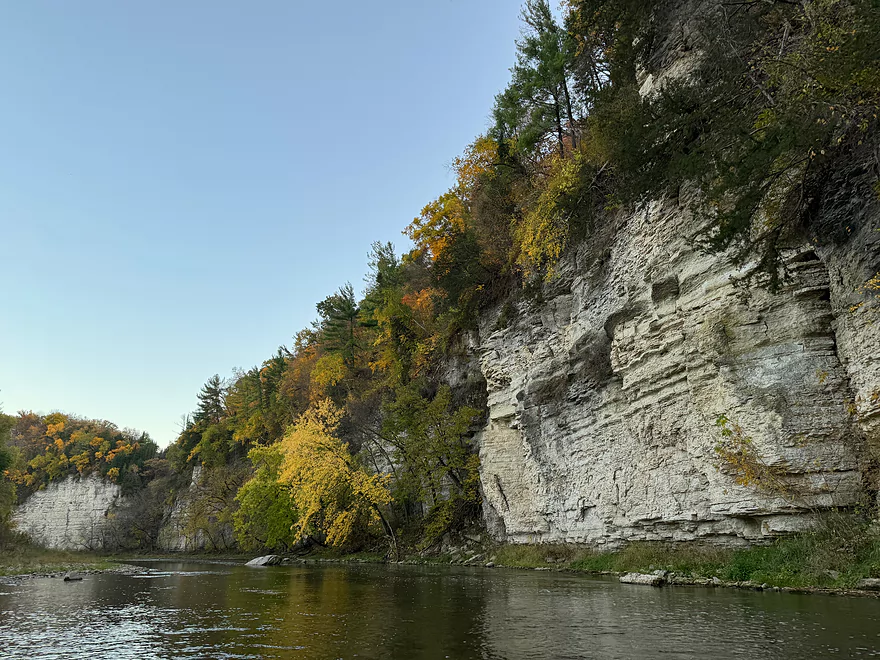
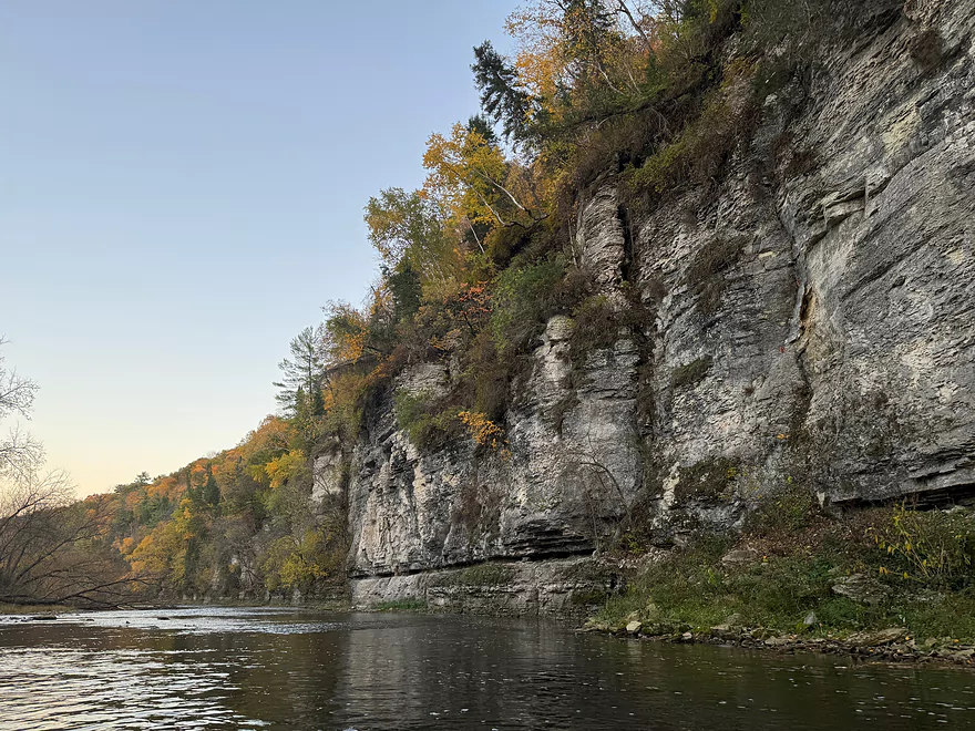
Chimney Rock
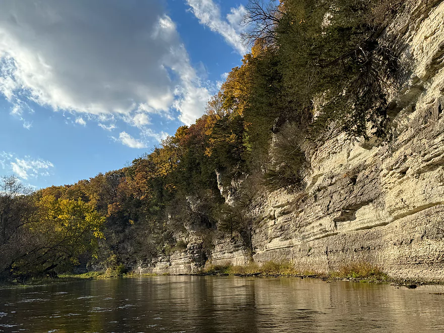
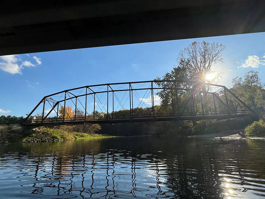
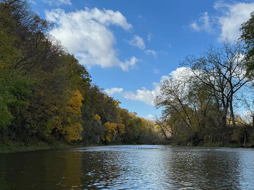
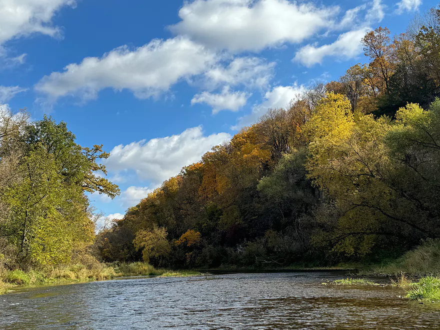
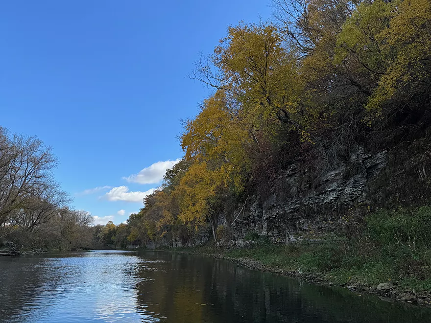
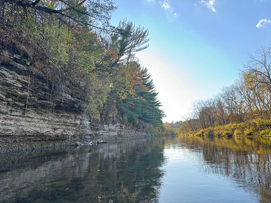
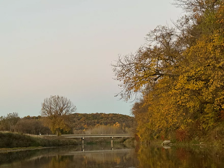
Old Chimney Rock Rd bridge
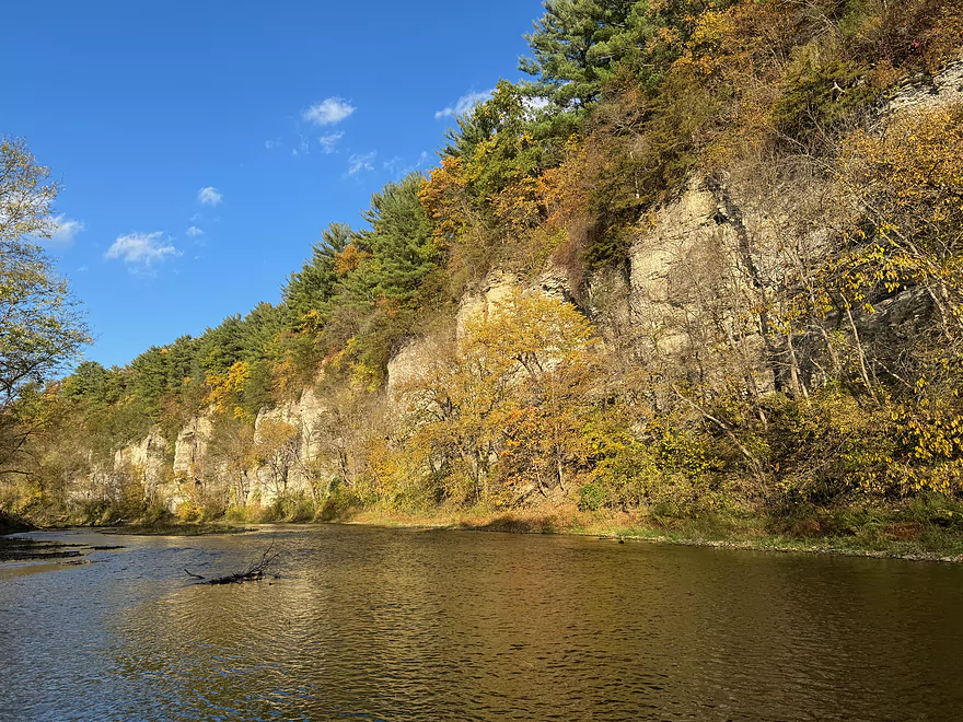
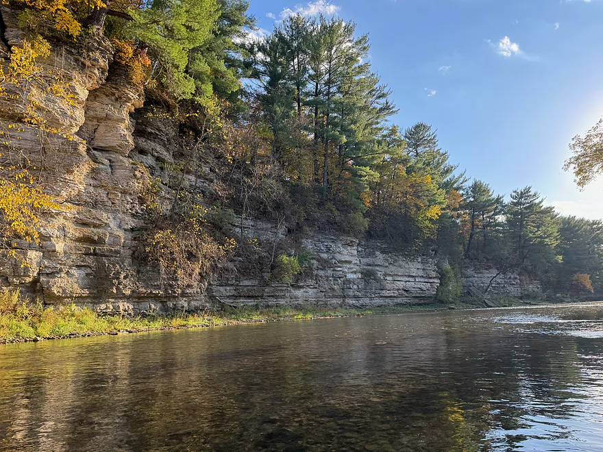
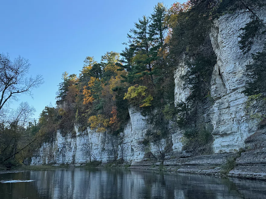
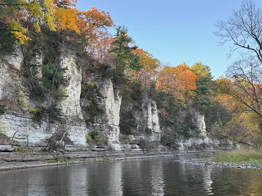
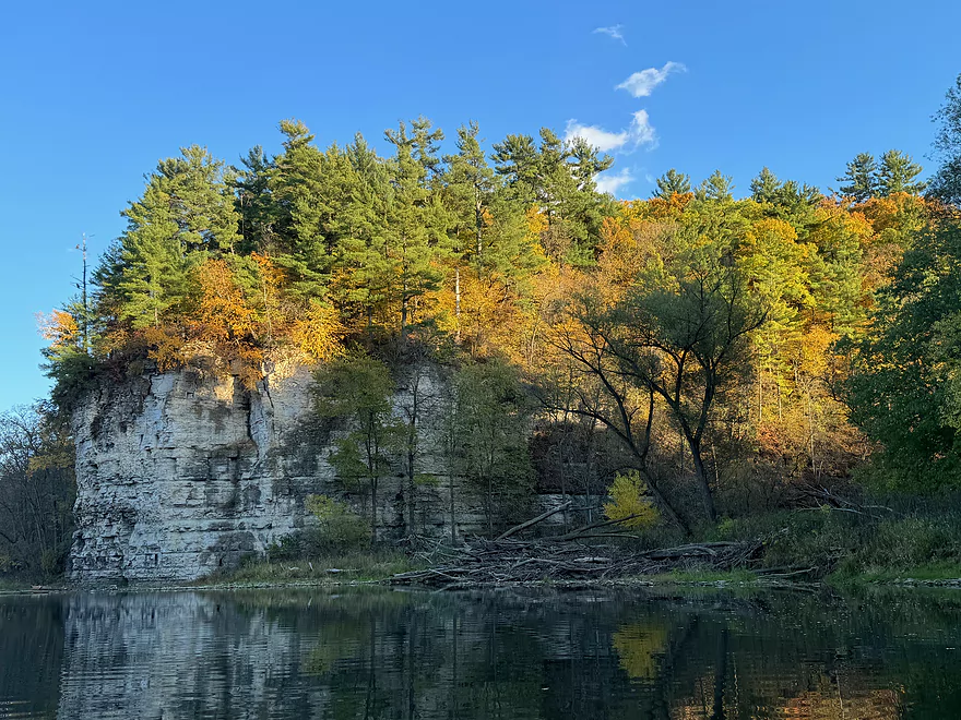
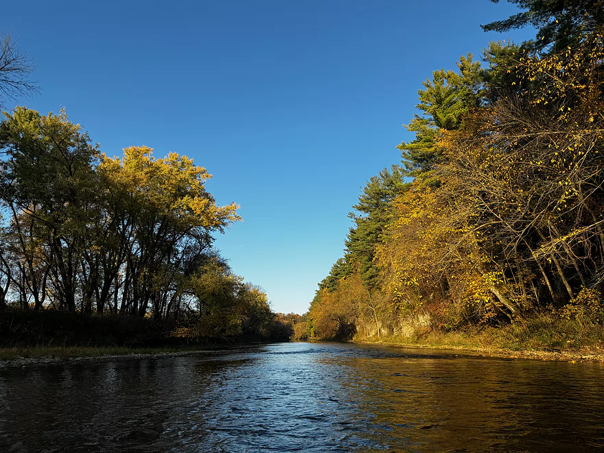
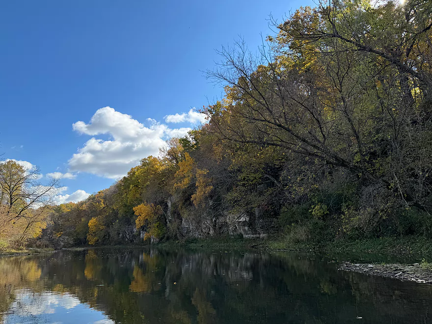
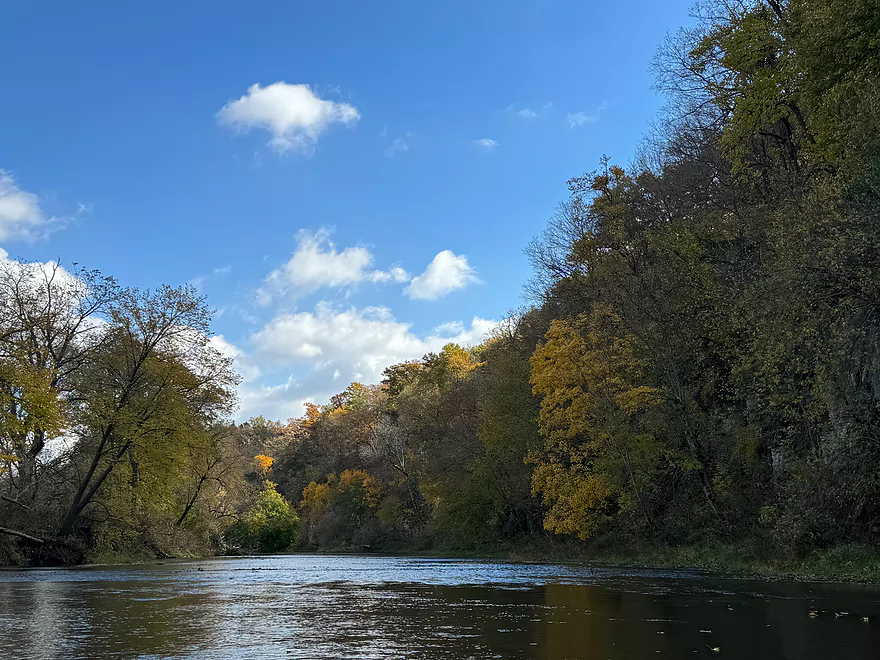
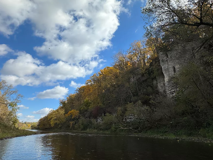
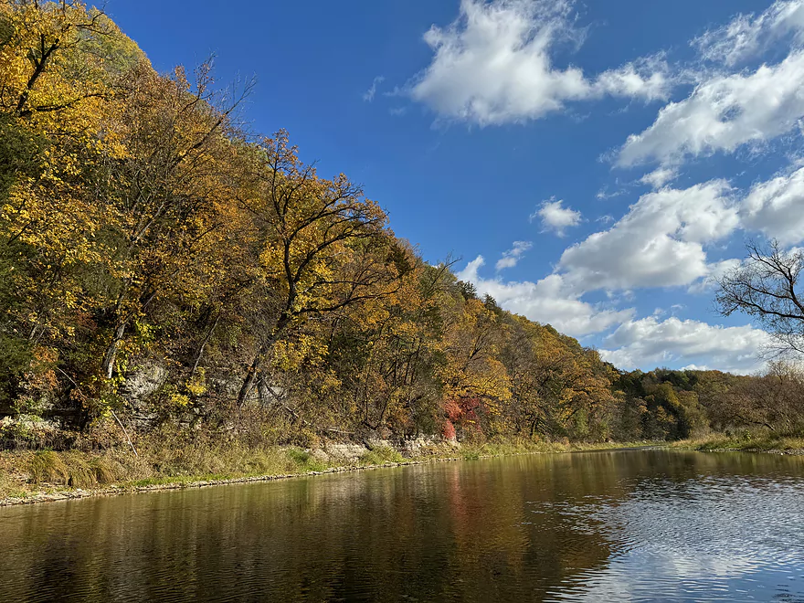
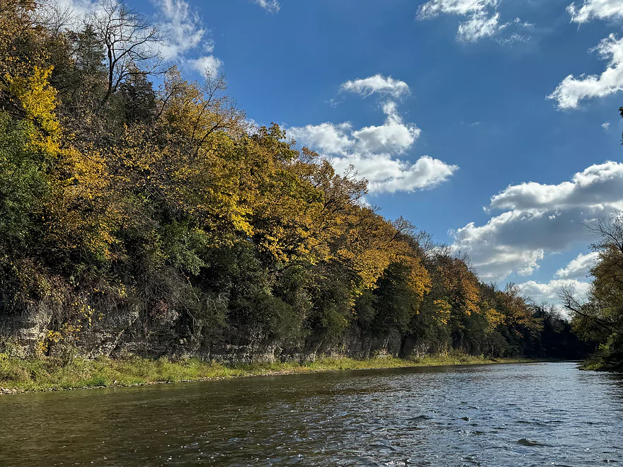
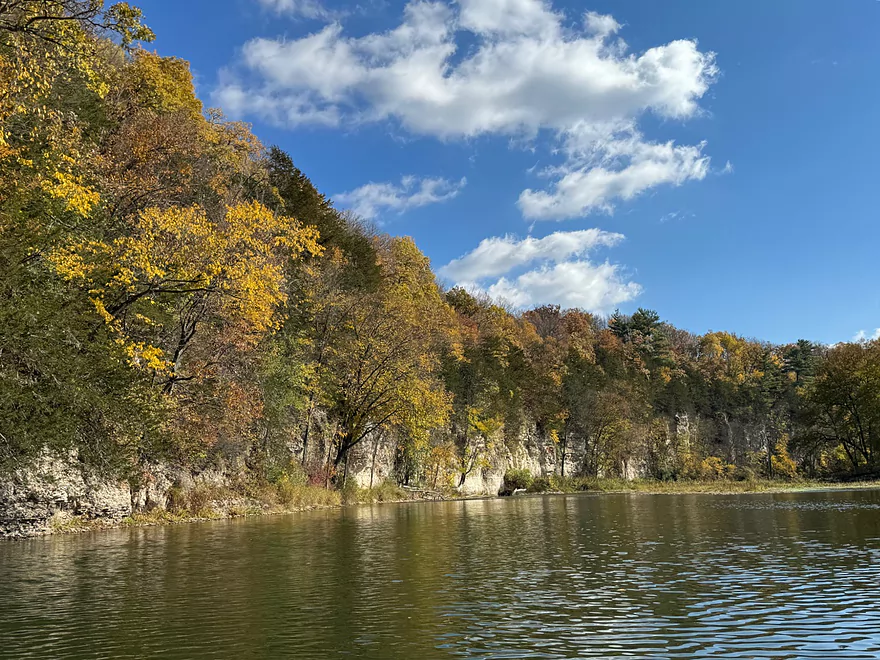
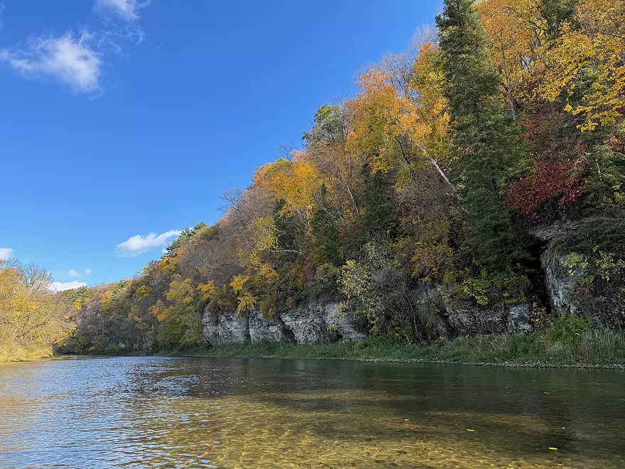
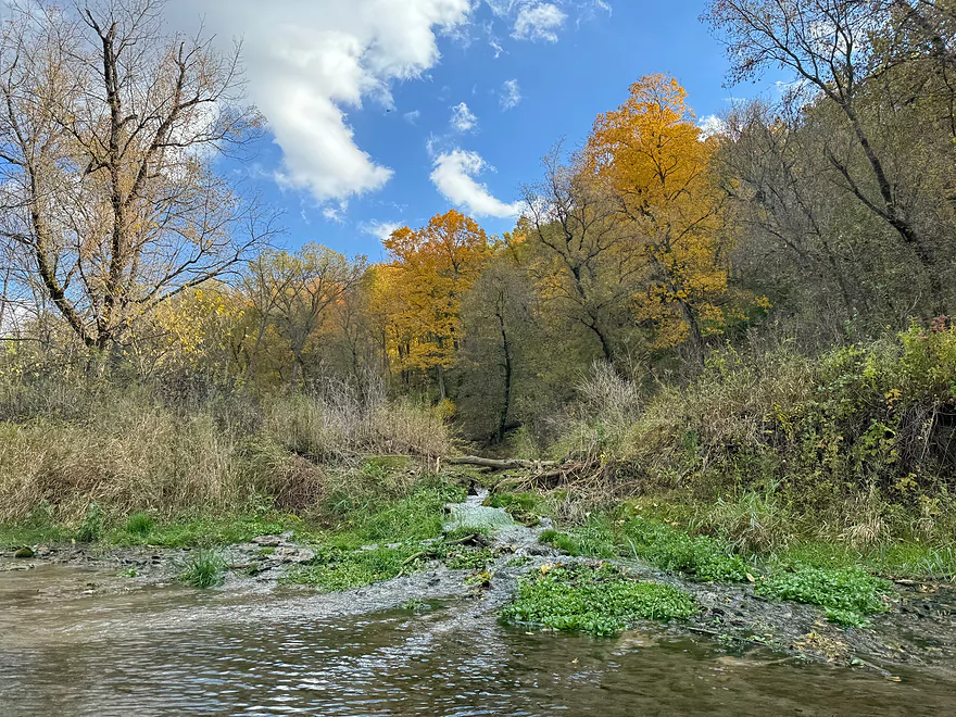
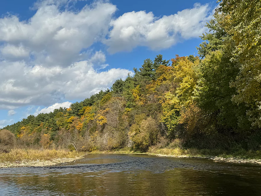
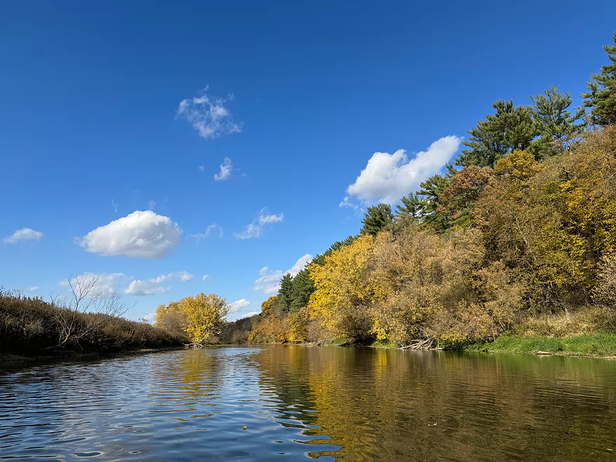
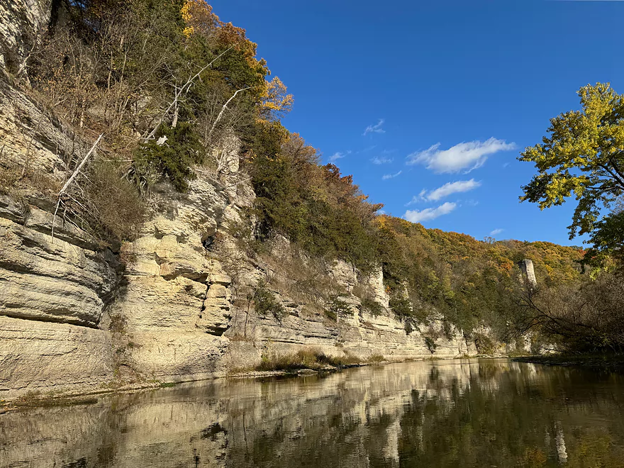
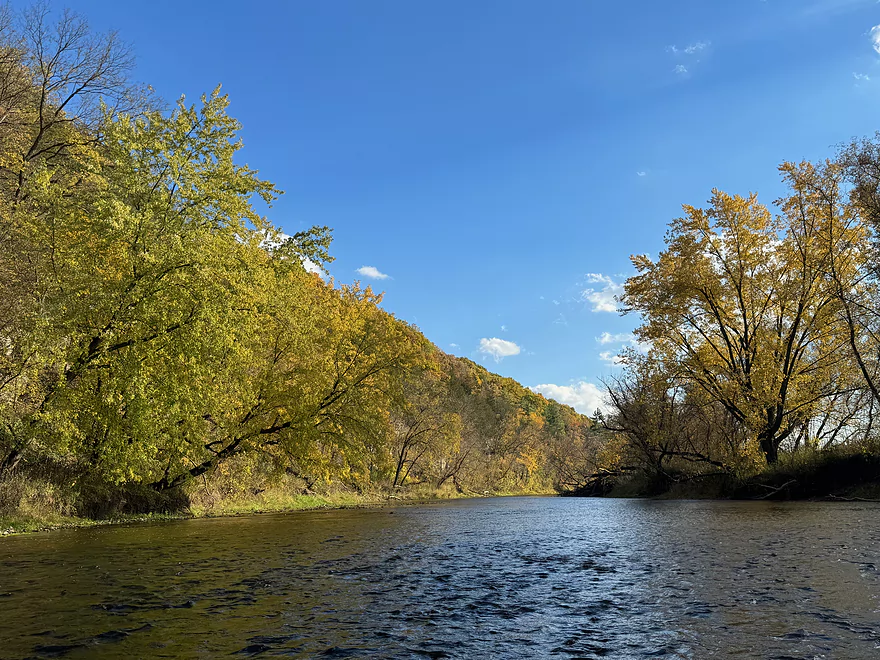
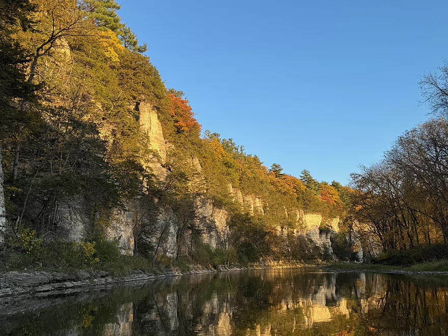
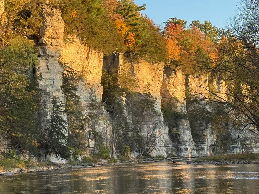
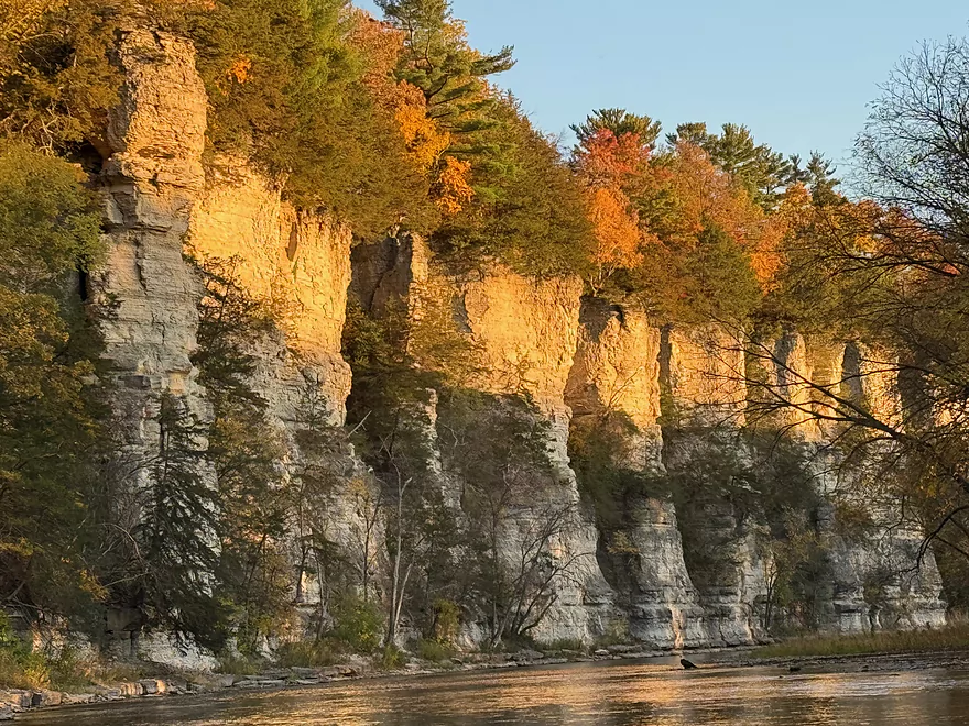
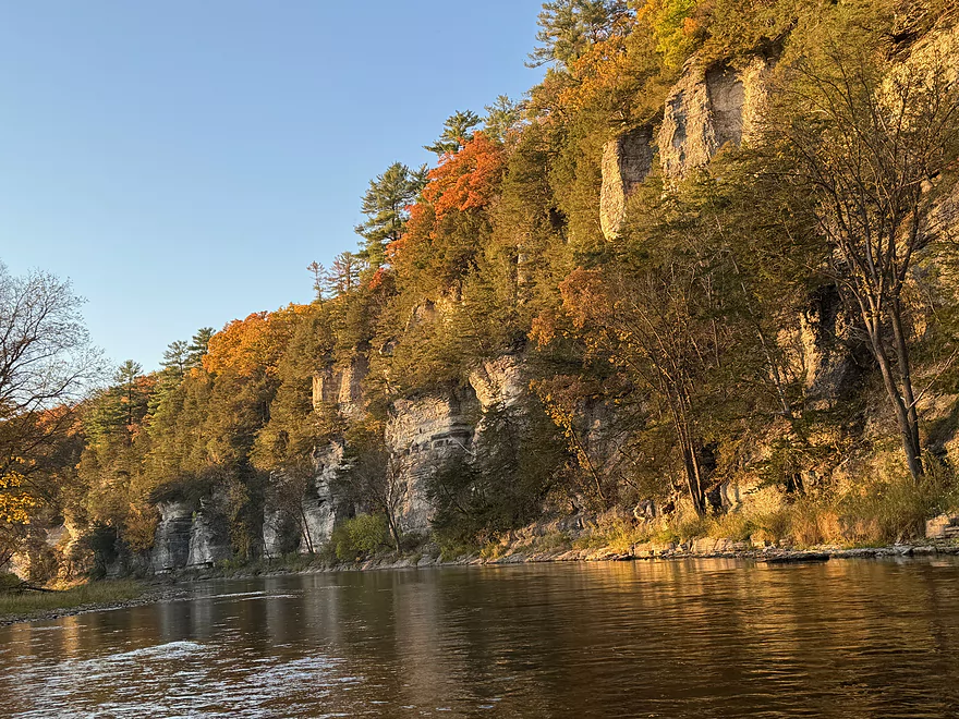
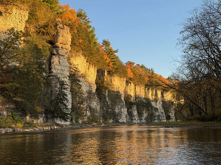
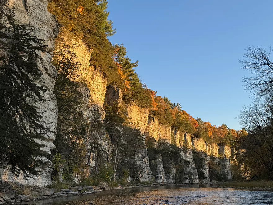
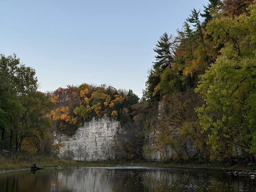
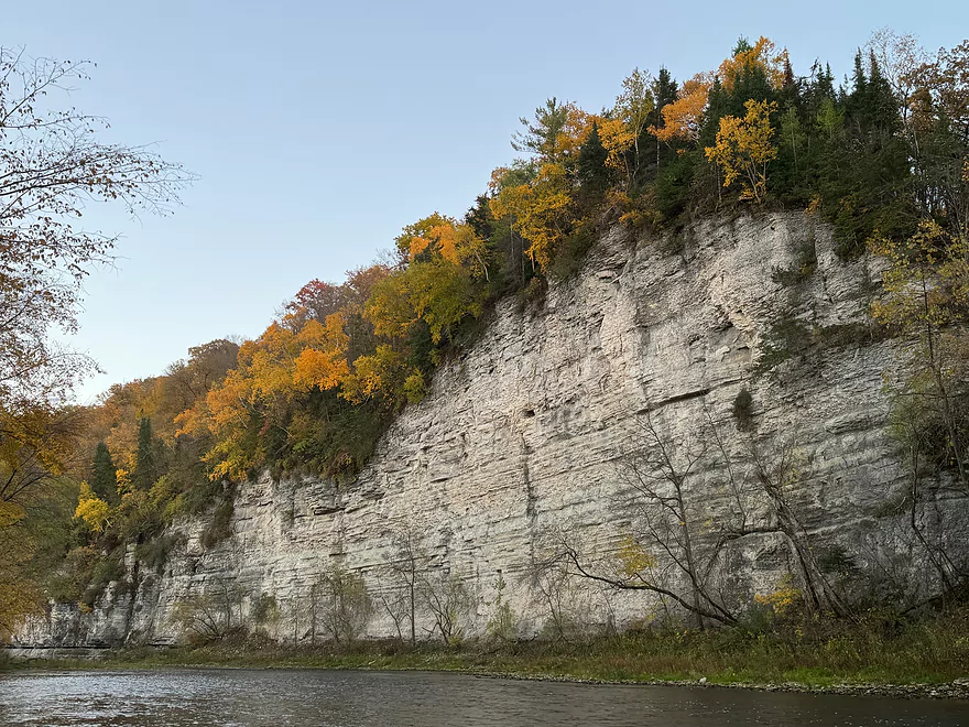
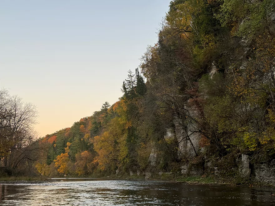
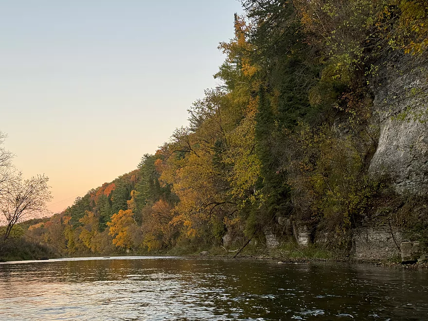
Approaching the most scenic portion of the trip
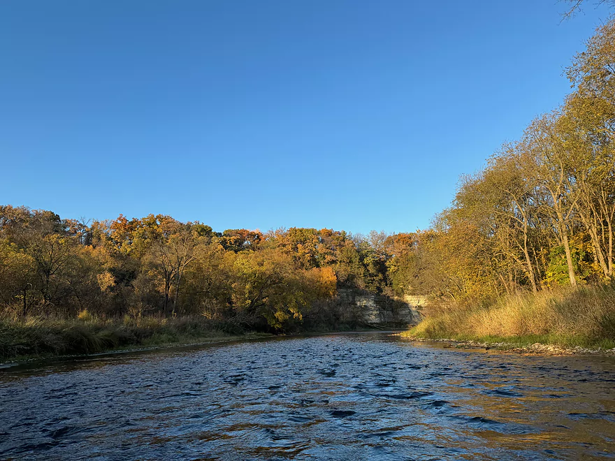
End of the trip at Bluffton Rd
Upper Iowa – Plymouth Rock Landing

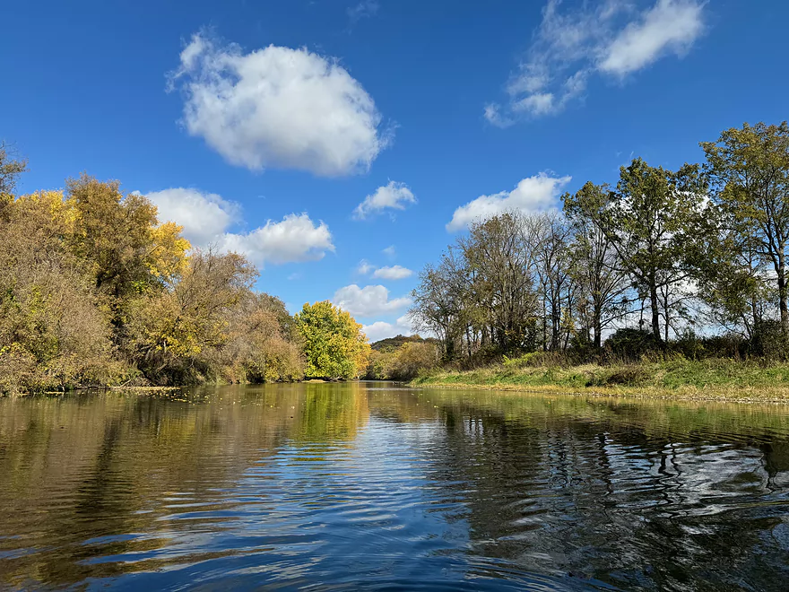
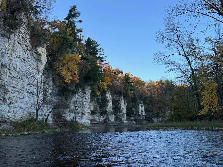
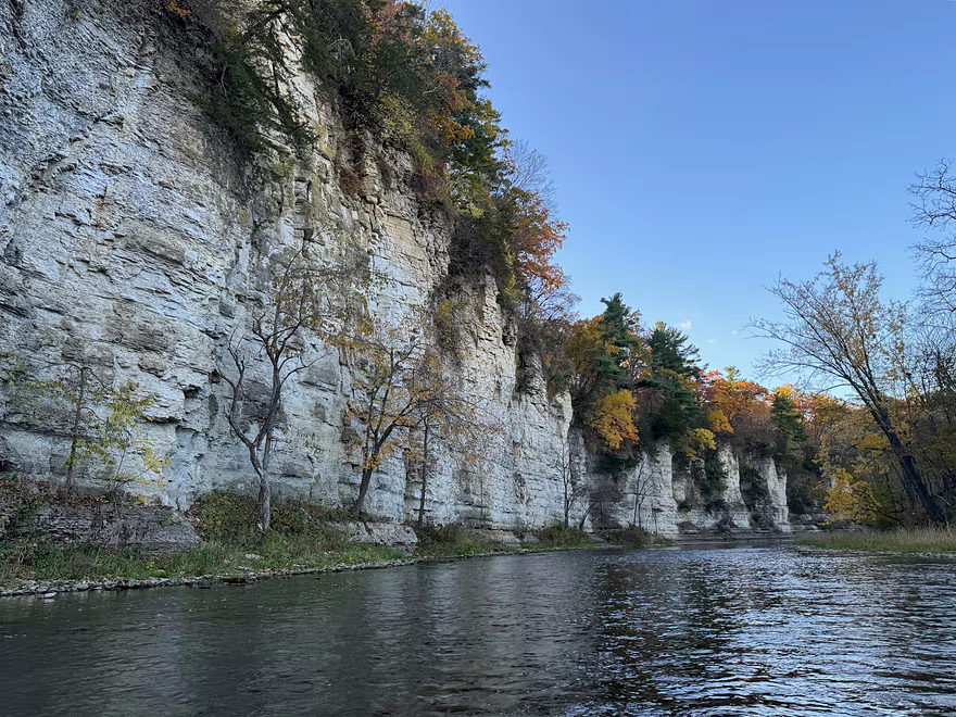
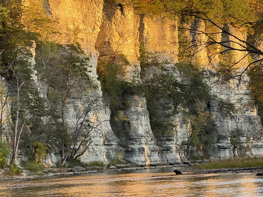
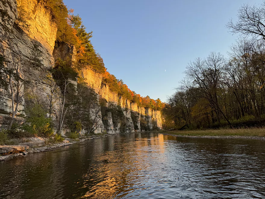
The Upper Iowa River is very scenic and a very popular summer paddle mainly due to its famous bluffs and cliffs. On this comfortable fall Friday, there was not a single person on the river and it was quiet as can be.
The fall colors enhanced the breathtaking scenery even greater. There were quite a few bald eagles along the way and they were everywhere. The lack of people combined with the extremely clear water likely attracted them to the river. In deeper water, there were schools of trout that could easily be seen.
Due to the ongoing drought there were several low spots where I had to exit the kayak and walk. However, the amazing scenery made up for the slight inconveniences. If you enjoy the Upper Iowa River in the summer you will love paddling the river in the fall!
Thanks Peter for the review! WisconsinRiverTrips.com is always very appreciative of guest reviews, and if you the reader is ever interested in submitting one, you can use this online form.
Starting upstream and working downstream, here is a segment guide to the Upper Iowa River. Thanks to the book “Paddling Iowa” and the website Northeast Iowa RC&D for much of this information.
- Chester/River Street to Lidke Park: 7.5 miles. Pleasant paddle. Navigation could be difficult during low water. Maybe some logjams and snags.
- Lidke Park to Florence/Victory Ave: 14.8 miles. Few paddle this section. Will be some minor bluffs. Perhaps some electric fences to deal with.
- Florence to Hwy 30 Wayside: 1.7 miles. Some riffles. Odessa Springs is located near the take-out.
- Hwy 30 to A14: 5.8 miles. It looks like there are some decent bluffs on this stretch.
- A14 to 370th Street: 1.0 miles. Mostly a straight section with some larger sandbars.
- 370th Street to Kendallville Park: 5.6 miles. Likely good bluffs. I believe this stretch is serviced by “Harvest Farm”.
- Kendallville to Cattle Creek Road: 8.4 miles.
- Kendallville Park to Plymouth Rock Access: 4.2 miles. Start of the famous Kendallville to Bluffton stretch. Good part of the river with scenic bluffs.
- Plymouth Rock Access to Cattle Creek Road: 4.2 miles. Good stretch with scenic bluffs.
- Cattle Creek Road to Bluffton Fir Stand Access: 9.8 miles.
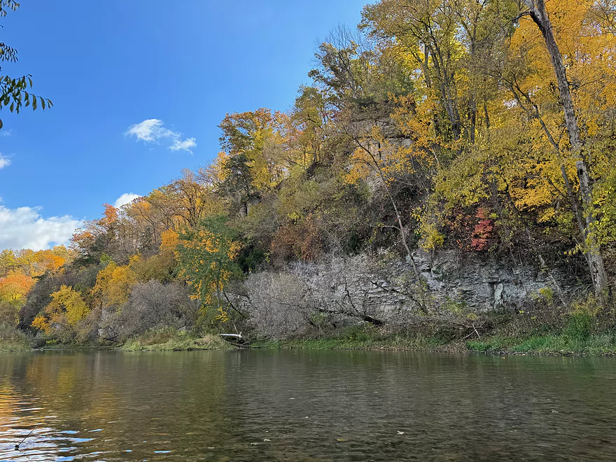
- Cattle Creek Road to Chimney Rock Access: 4.5 miles. Great section with several nice bluffs with the best being Chimney Rock.
- Chimney Rock Access to Bluffton Bluff Access: 4.0 miles. The most popular and most scenic section perhaps on the entire river. The best bluffs and palisades are located here.
- Bluffton Bluff Access to Bluffton Fir Stand Access: 1.3 miles. One final nice bluff followed by a pleasant open section.
- Bluffton Fir Stand Access to Malanaphy Springs: 8.7 miles. Good current and riffles, but not as many of the nice bluffs.
- Malanaphy Springs to Will Baker Park in Decorah: 6.1 miles. Pleasant with good riffles and some bluffs. Several intermediate access options.
- Will Baker Park to Freeport access: 6.1 miles. A pleasant paddle through the city of Decorah with good views of the bluffs.
- Freeport Access to River Road: 4.1 miles. Considered scenic.
- River Road to Upper Dam: 3.0 miles. Considered scenic, but with some flowage paddling.
- Upper Dam to Lower Dam: 4.9 miles. Not as popular a segment. Some flowage paddling.
- Lower Dam to Ferris Mill Road: 4.8 miles. Starts with some nice wooded sections before widening out.
- Ferris Mill Road to Ellingson Bridge Drive: 4.5 miles. Possibly a decent stretch for sandbars and gravel bars.
- Ellingson Bridge Drive to Hwy 76: 13.5 miles.
- Ellingson Bridge Drive to Red Bud Drive: 0.8 miles. Short stretch that goes around a large island.
- Red Bud Drive to Iverson Bottoms Access: 5.0 miles. Some nice hillsides but lacking in cliffs.
- Iverson Bottoms Access to Iverson Bridge Access: 1.2 miles. Short stretch that includes part of Iverson Bottoms Wildlife Area.
- Iverson Bridge Access to Hwy 76: 6.3 miles. Decent, but not a spectacular stretch.
- Hwy 76 to Kumpf Access/Upper Iowa Access: 3.5 miles. Probably a generic stretch.
- Upper Iowa Access to Iowa River Drive: 4.0 miles. Likely a generic section.
- Iowa River Drive to Ray’s Landing/Morgan Bridge: 5.7 miles. Likely a generic section.
- Ray’s Landing to Black Hawk Point: 2.2 miles. Likely slow and channelized.
- Black Hawk Point to Mouth on Mississippi: 3.2 miles. Mostly channelized floodbottom.
- Mouth to Blackhawk County Park: 0.6 miles. Trip across the Mississippi to reach a take-out in Wisconsin.
Trip Map
Overview Map
Photos Size: