
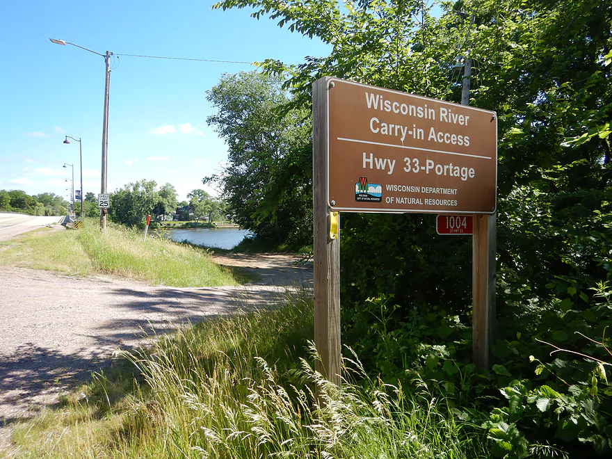
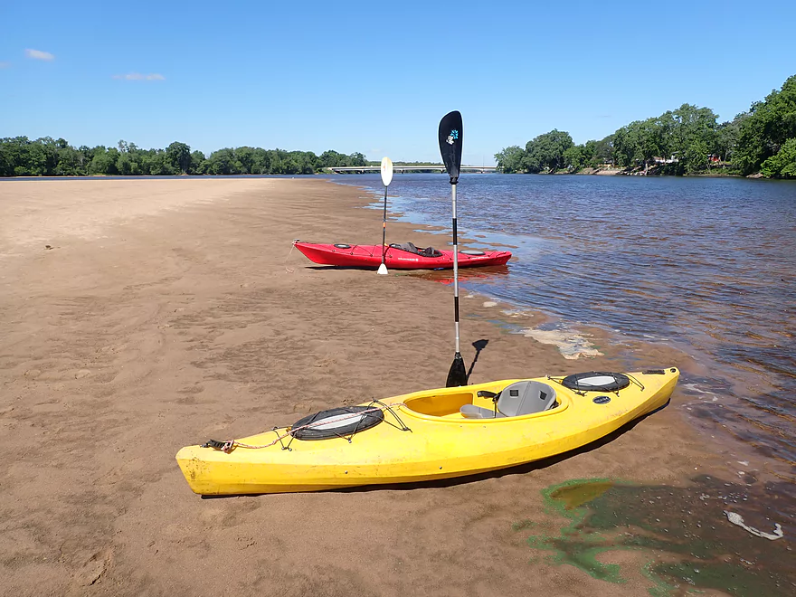
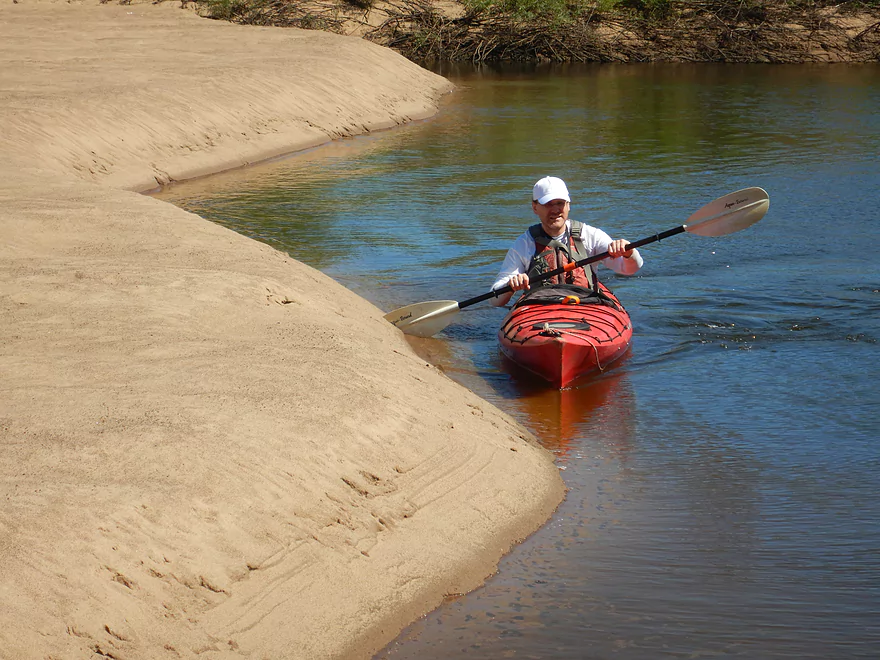
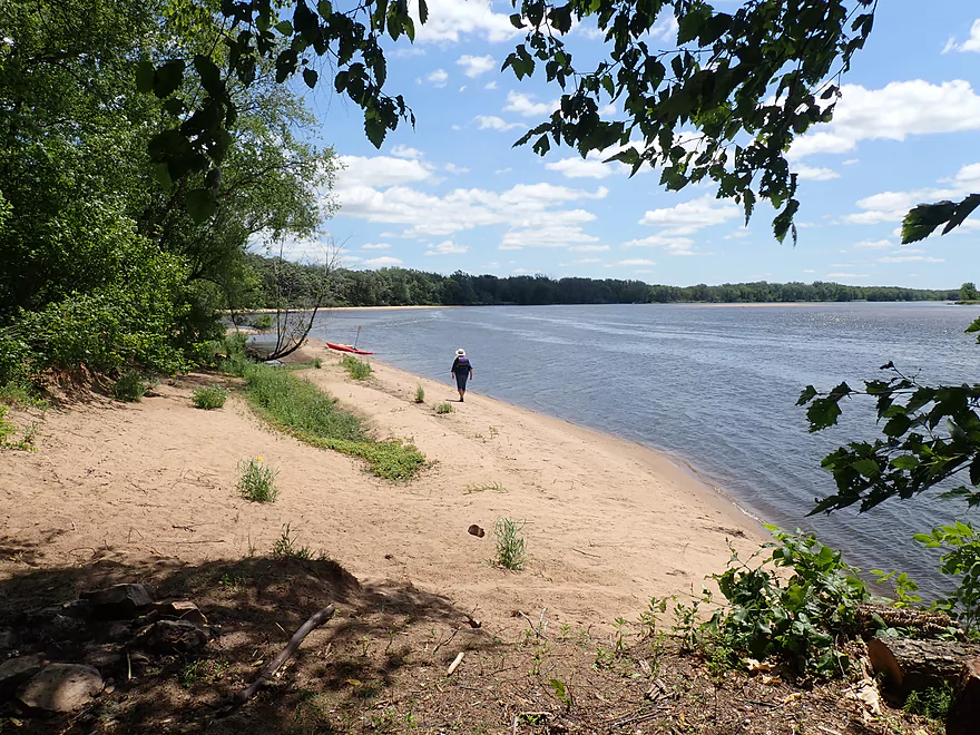
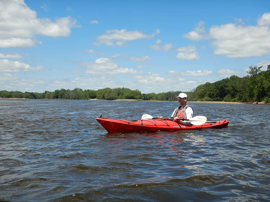
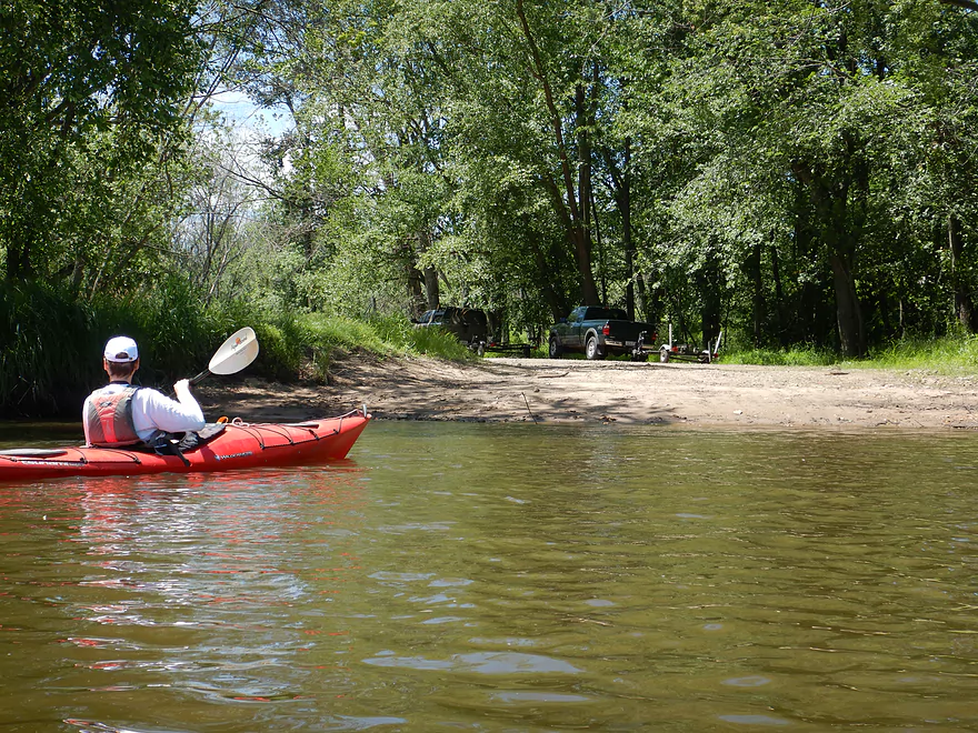
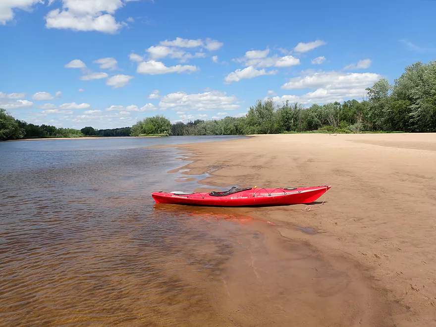
Nice carry-in access off Hwy 33
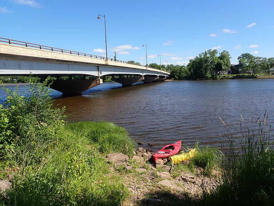
Hwy 33 bridge to Portage
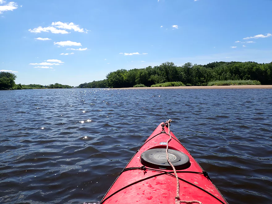
Light reflections on the water
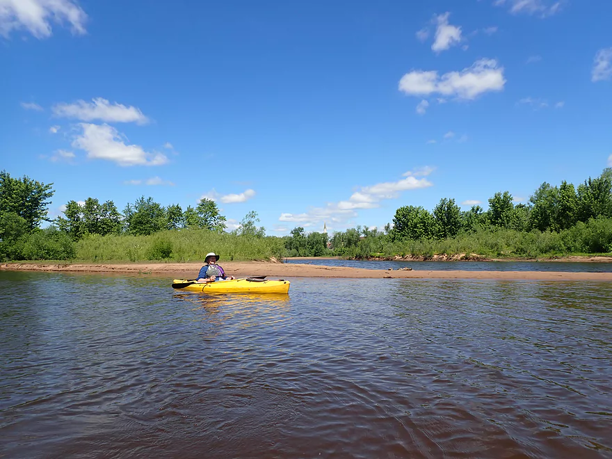
The city of Portage
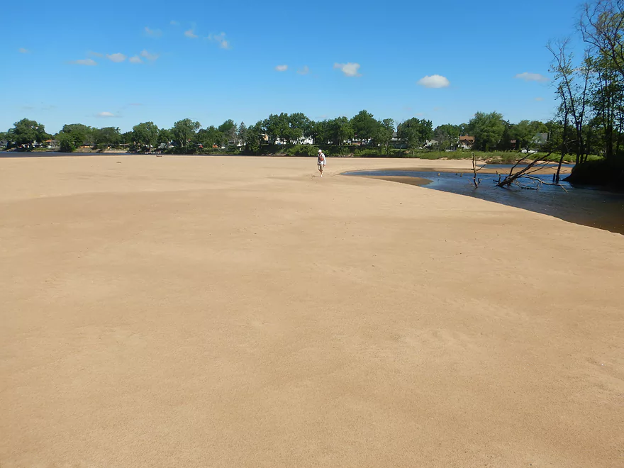
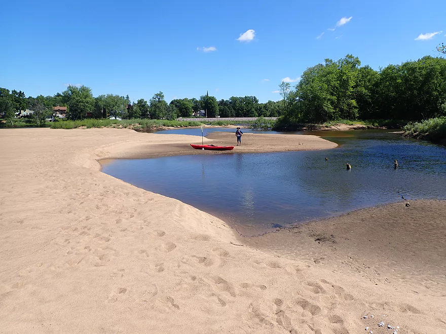
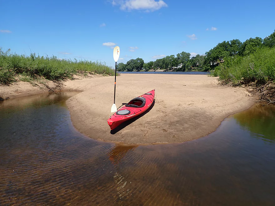
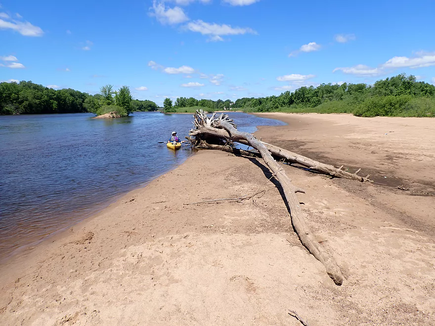
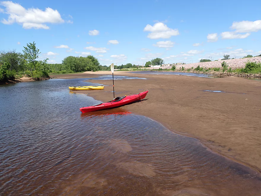
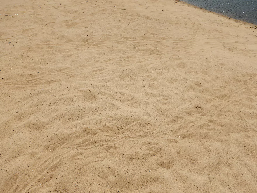
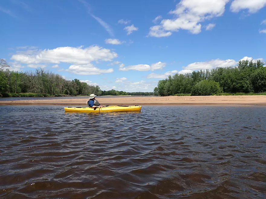
Stopping to check out a sandbar
This one was HUGE
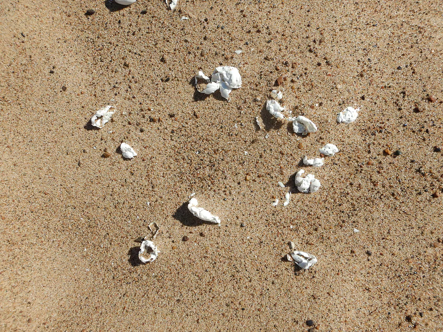
There were a lot of turtle egg remnants on the sand
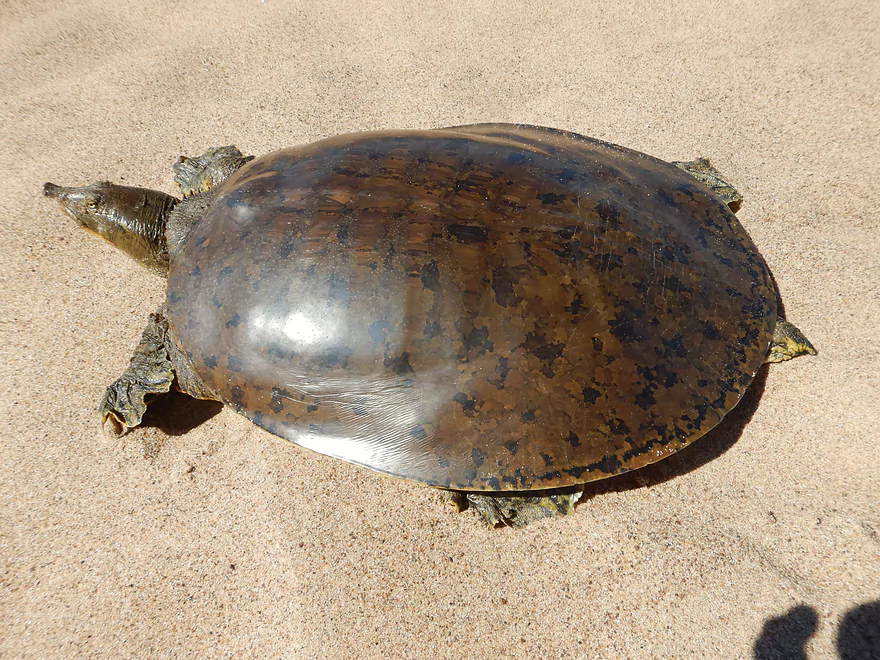
One speedy softshell turtle
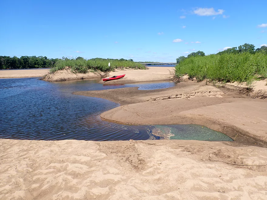
Exploring a side channel in the sandbar
Cool lagoon
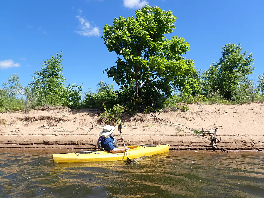
Some high sandbanks
The tree probably helped create the sandbar by slowing the current
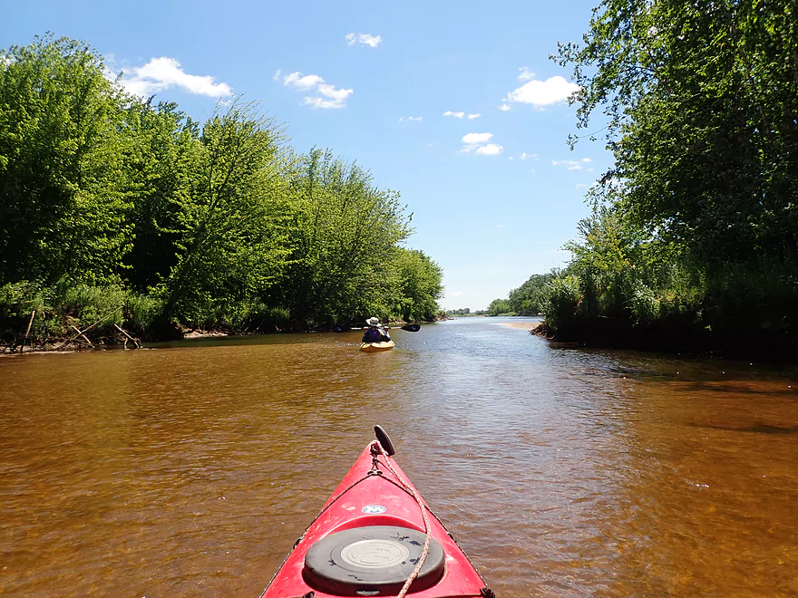
Checking out another neat side channel
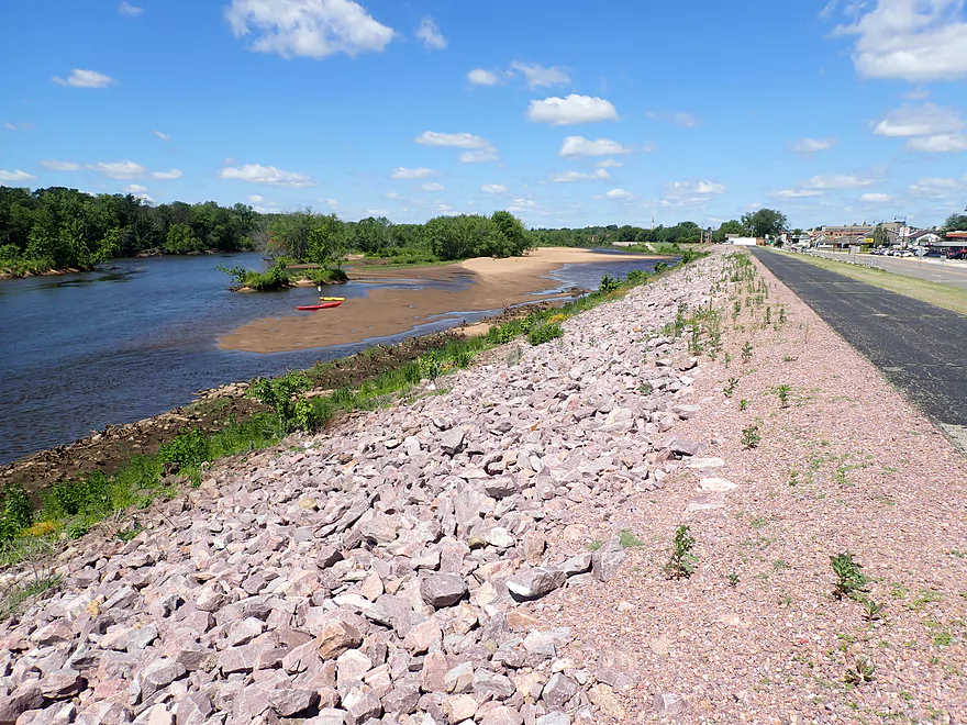
The famous Portage levee (aka the Lewiston levee)
Getting out to explore
The top of the dike offers a popular hiking trail and a great view
Turtles reminded us of turtle sundaes
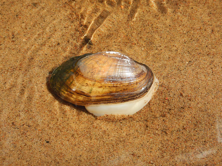
A rare live clam–several were in a pool by the levee
The Portage (Lewiston) levee extends for a little over 4 miles (the Caledonia levee extends for about 10 miles on the other side of the river)
Had to wade this shallow stretch
Yet another sandbar…this one is at the base of a massive island
Turtle tracks
A firepit and wood: evidence others have camped here
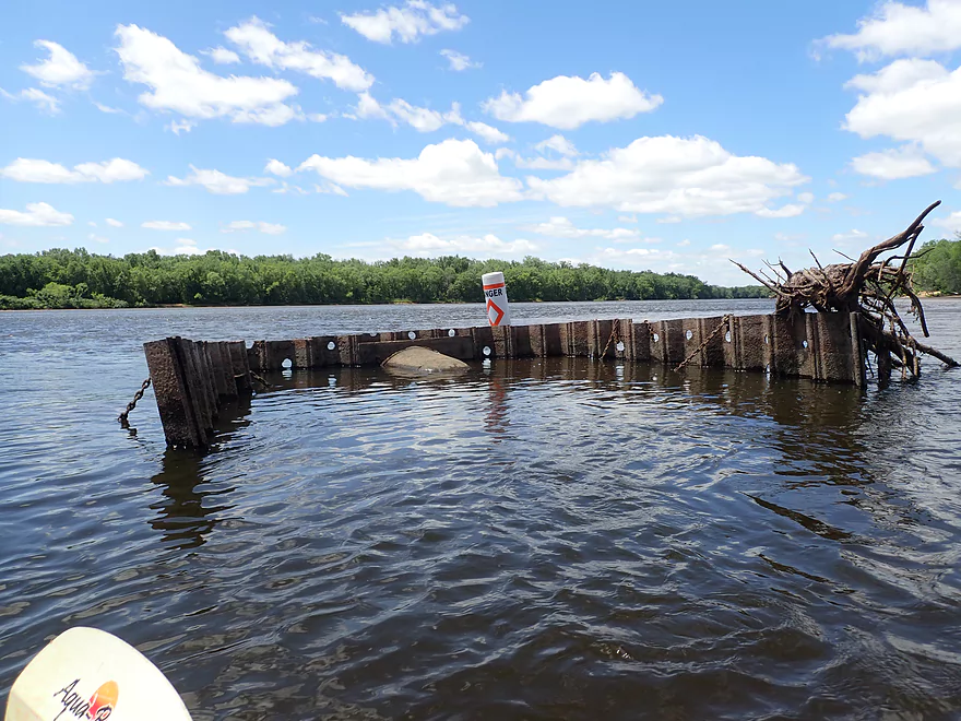
This looks like 2018 Lake Delton flood debris
The Portage wastewater outlet
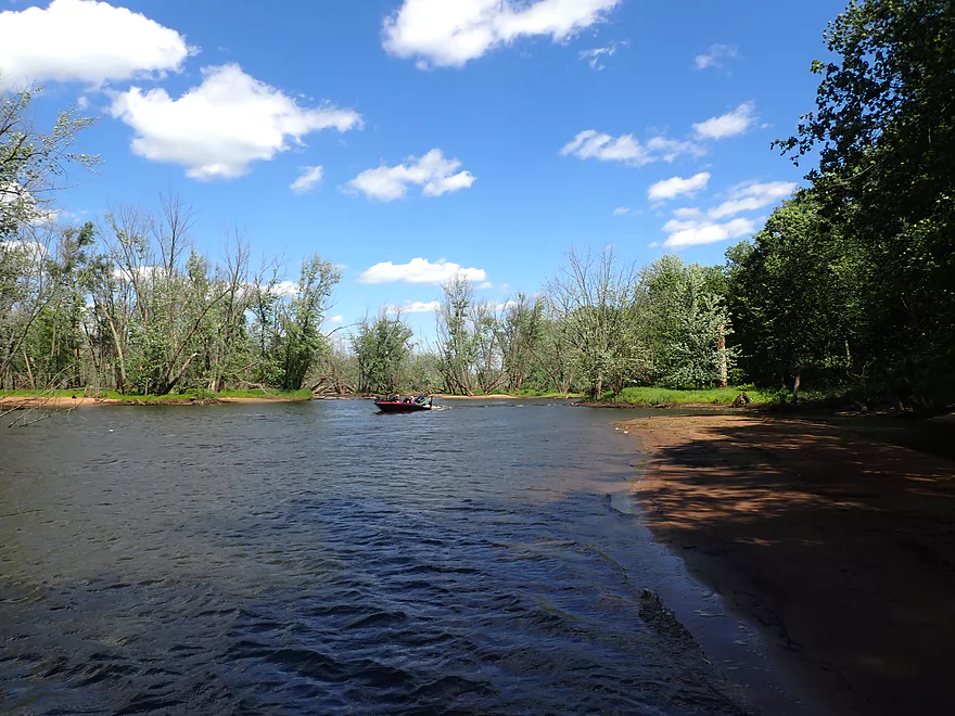
River widens after both island channels combine
Still nice sandbars
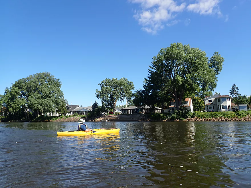
The beginning of a long border of summer homes and cabins
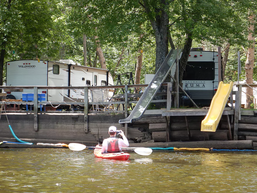
Some fun-looking slides
The Columbia Power Plant smokestacks were a visual anchor for much of the trip
House on stilts…not sure they help much
Mouth of the Baraboo River (hill to left and sandbar to right)
One of several small boat landings
Taking another break
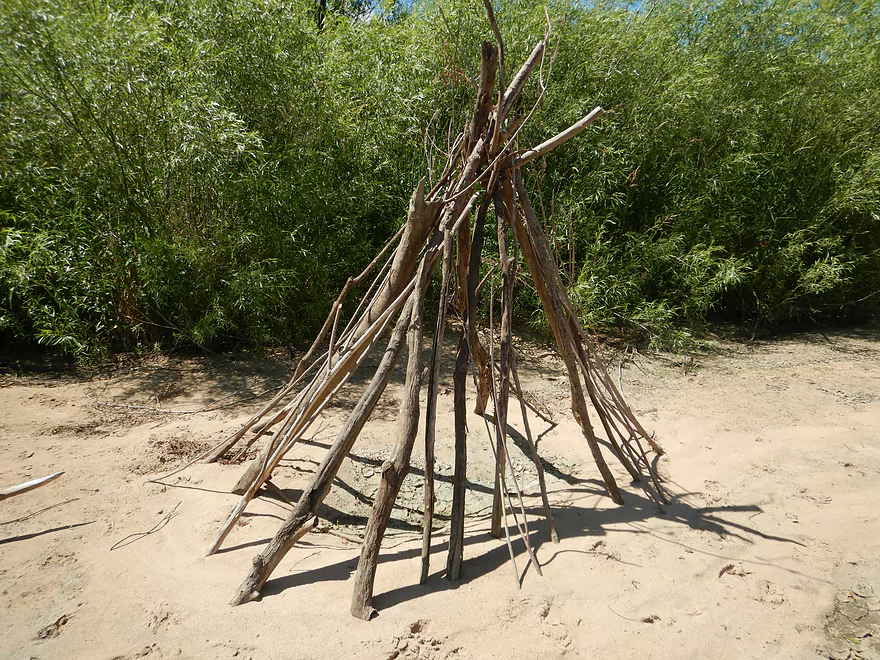
Wood tepee
The bottom end of massive Lib Cross Island
The mouth of Rocky Run Creek (just southeast of Lib Cross Island)
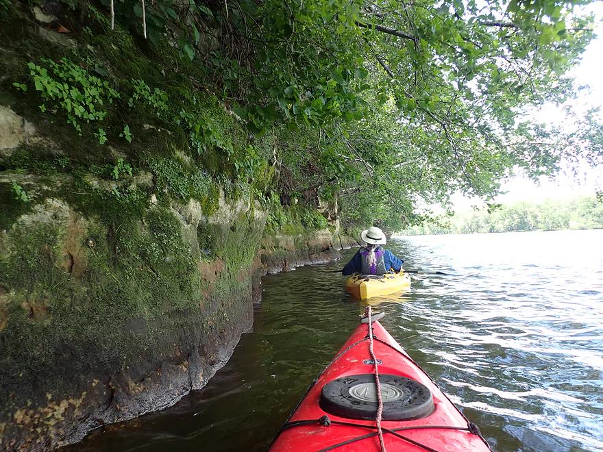
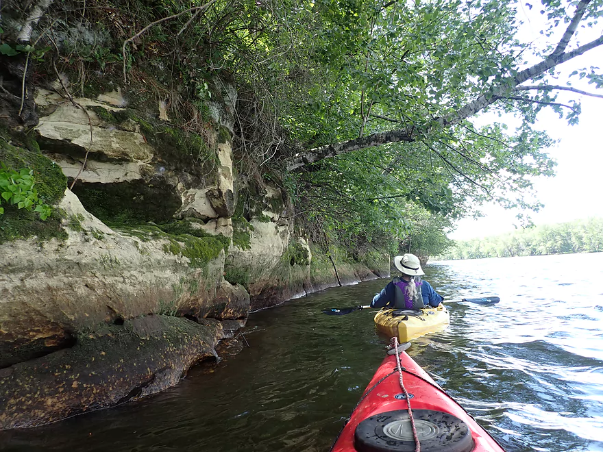
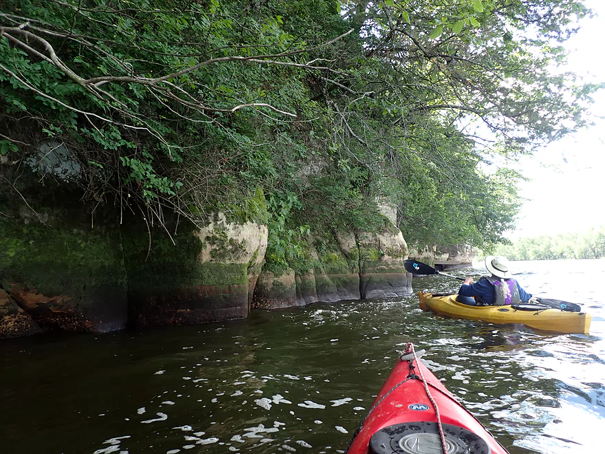
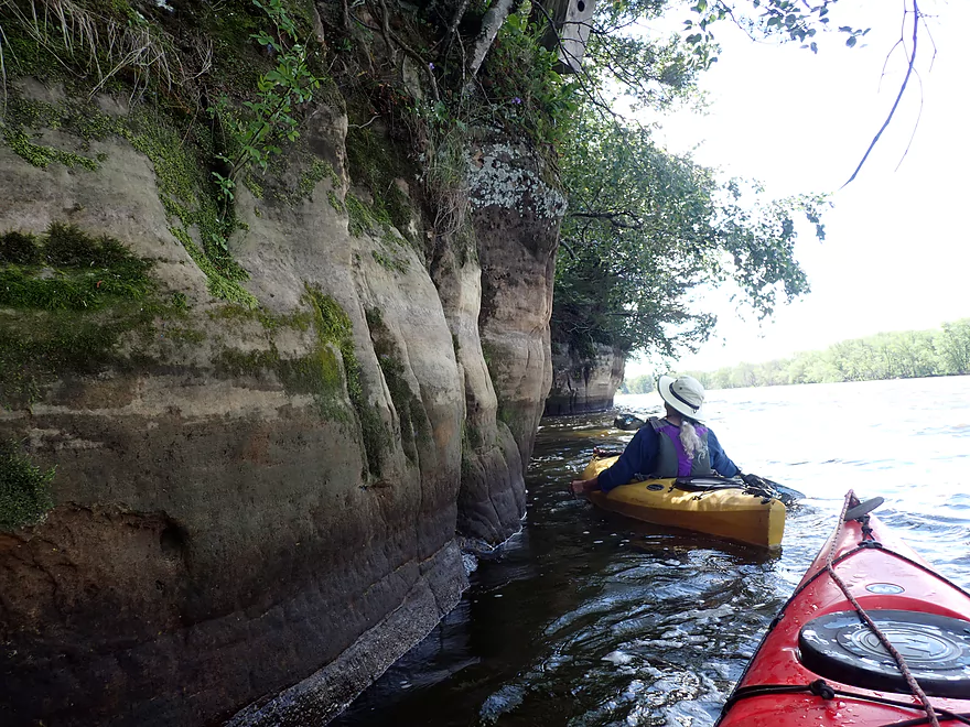
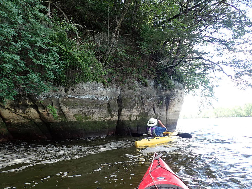
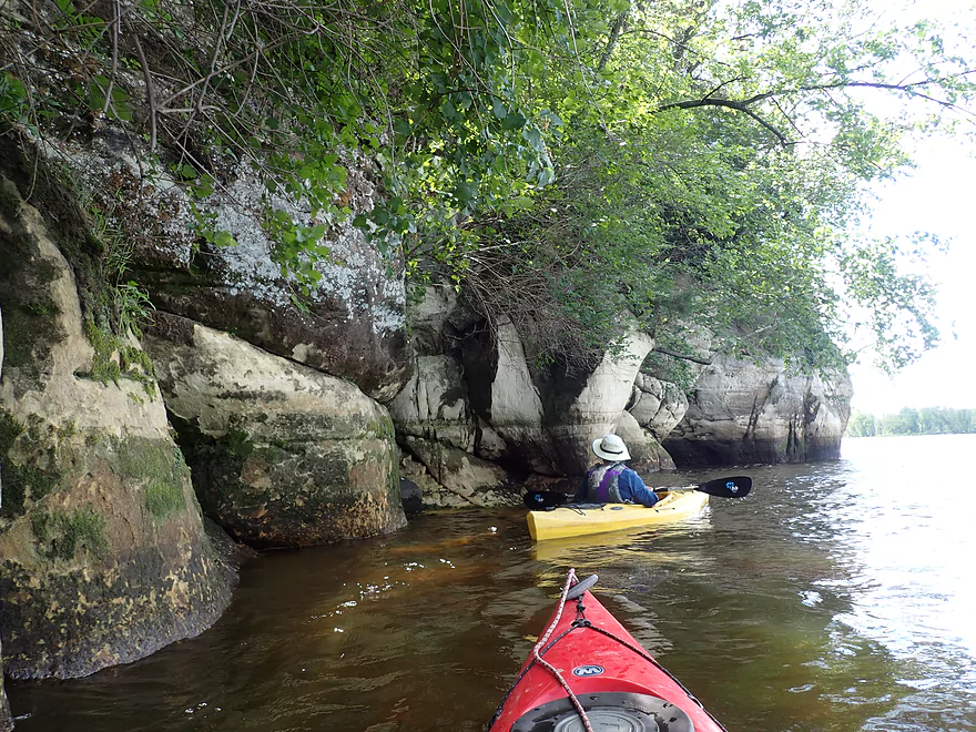
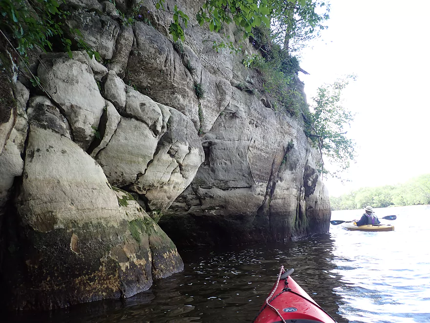
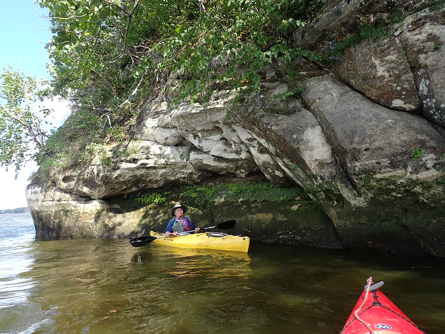
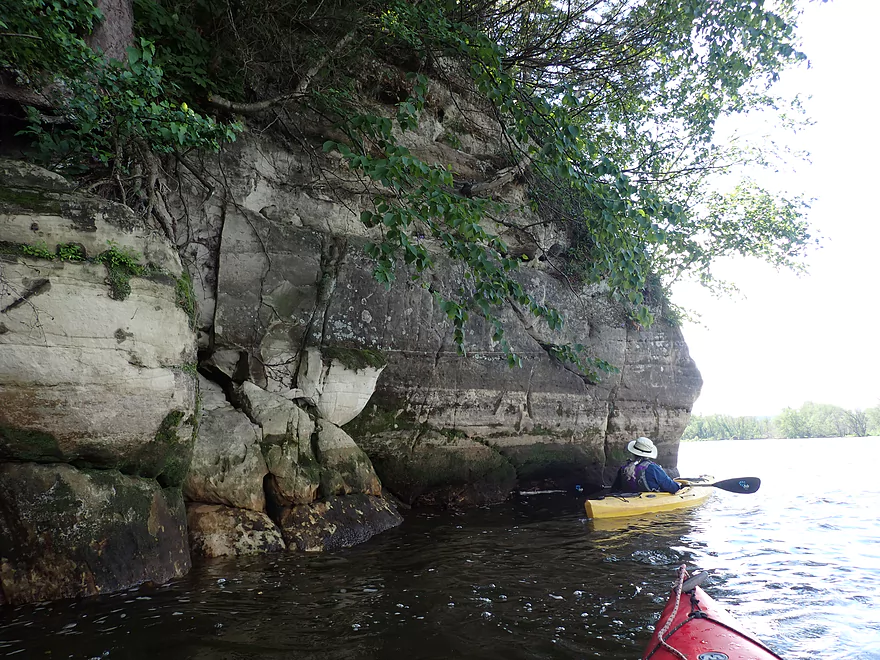
Start of St. Lawrence Bluff
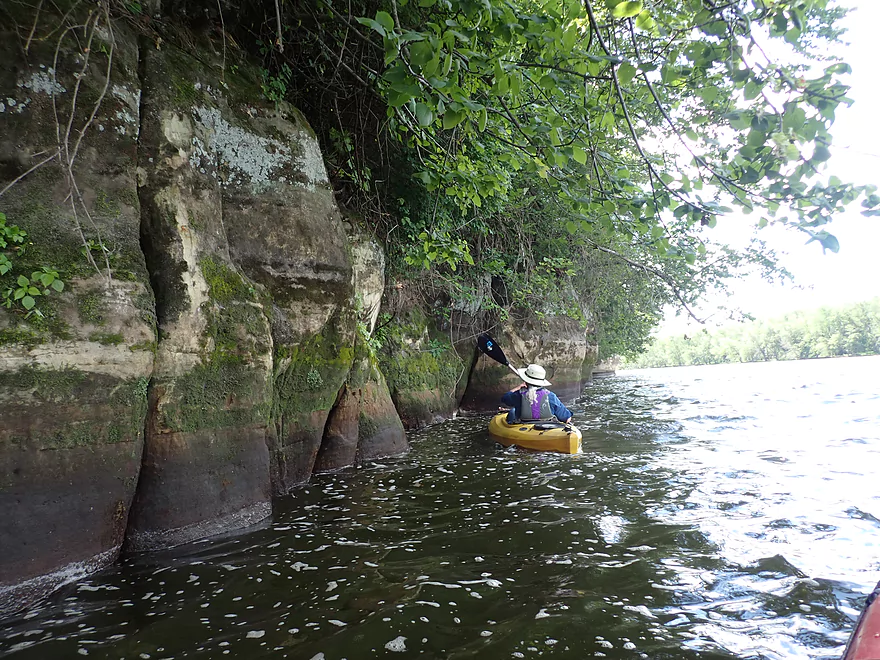
Huge roots probably helped break up this sandstone wall
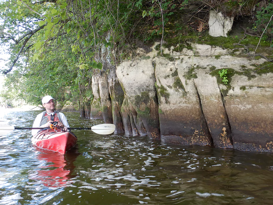
Undulating surfaces
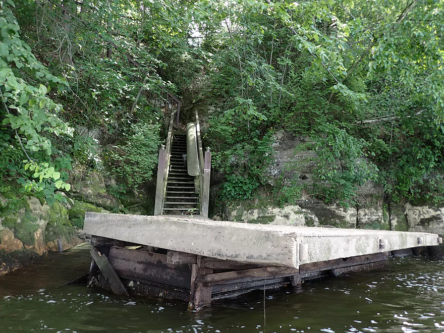
Staircase leads to a home atop the bluff
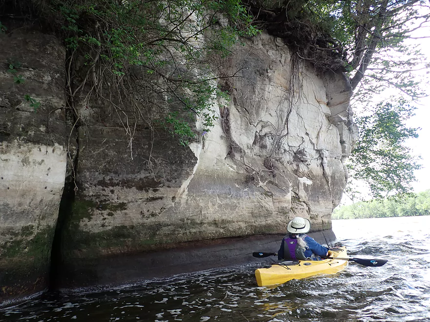
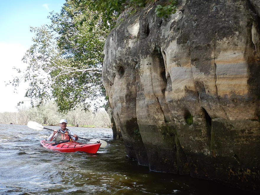
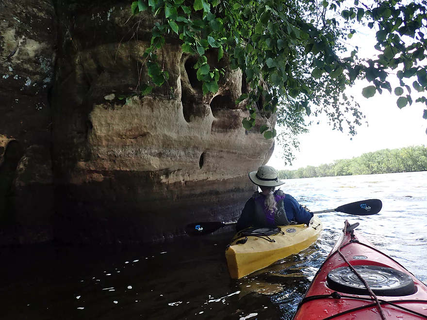
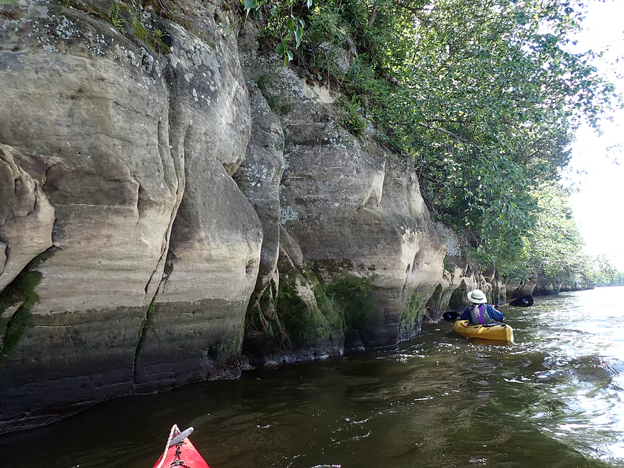
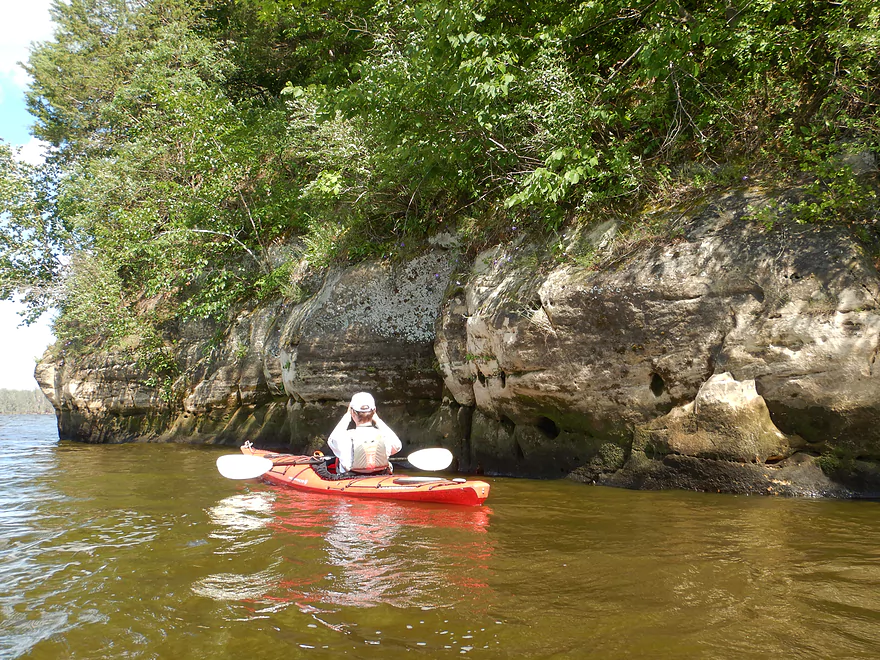
Terrific cliffs
Waves starting to get choppy
This formation is likely a continuation of Dells sandstone
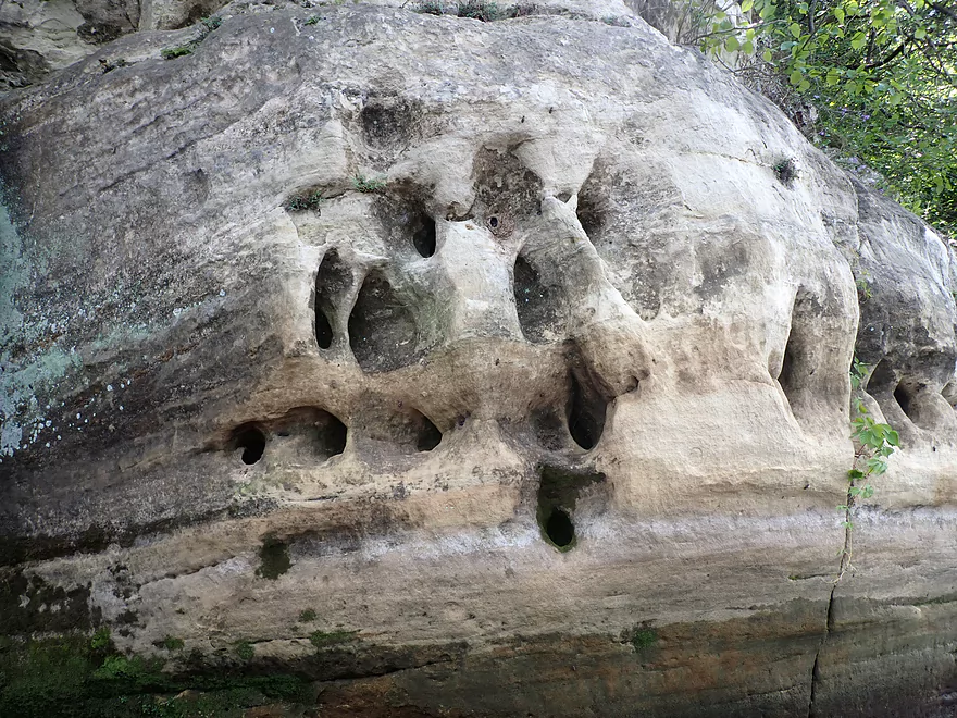
Cliff swallows scrape these holes out with their beaks and then build mud nests inside
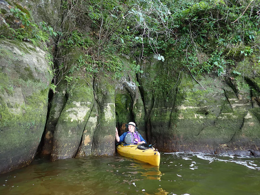
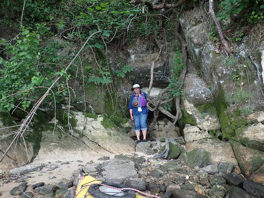
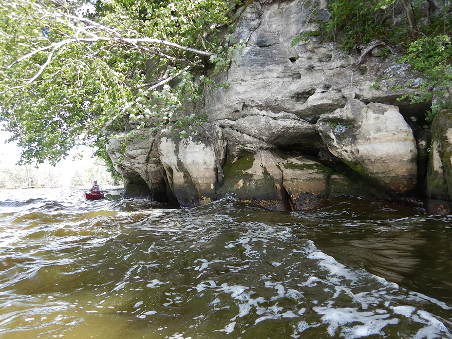
Fun little mini-cave
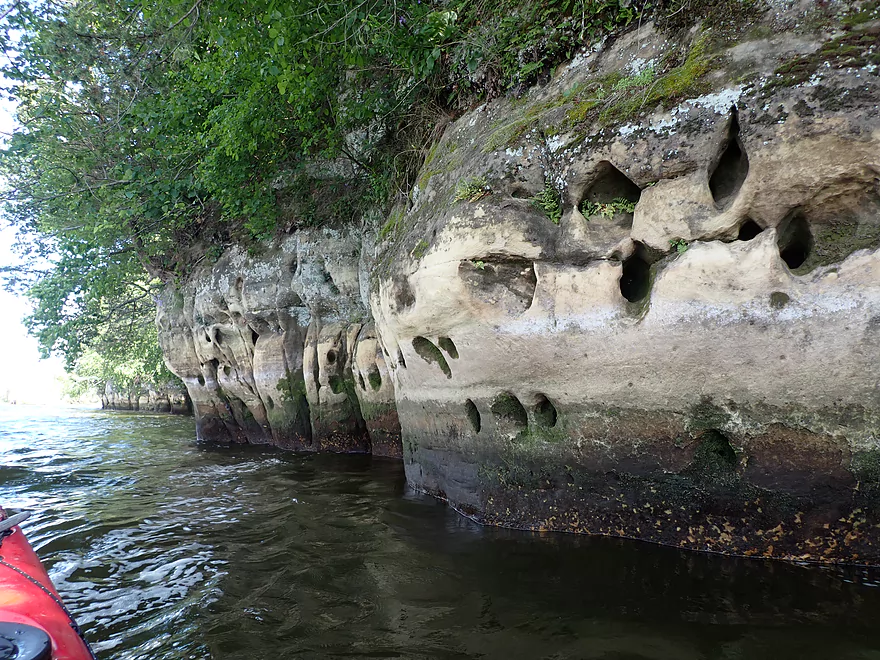
More swiss-cheese cliffs
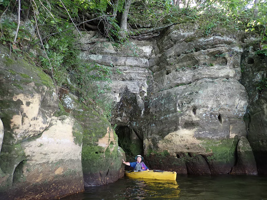
Another little cave
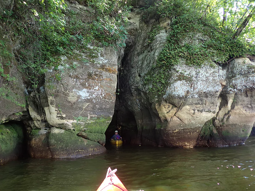
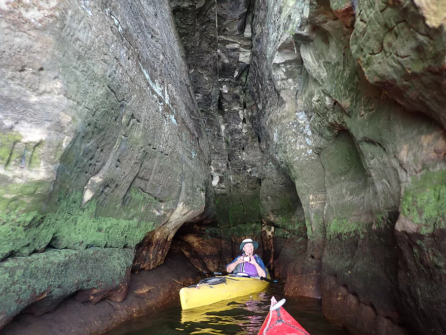
Finally…a big cave
Some of the dates carved here were extremely old
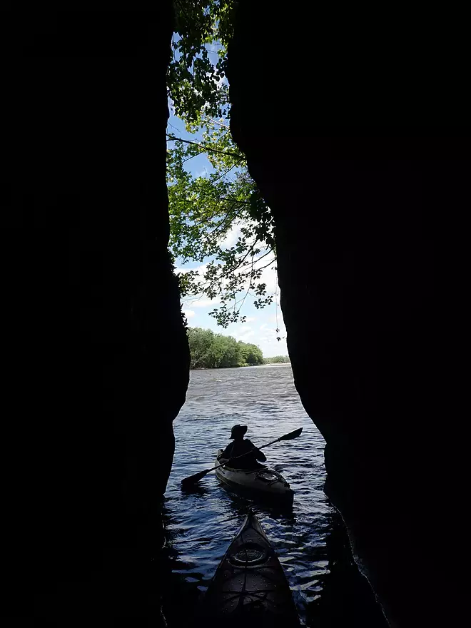
Keyhole looking out
Future cave in the making
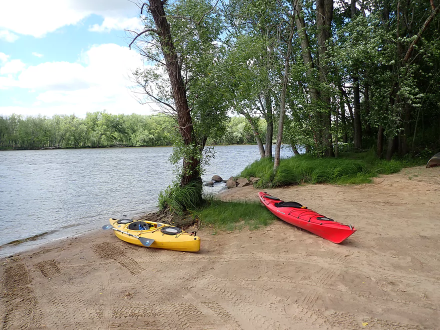
Taking out at Dekorra Park
Wisconsin River – Portage


Sandwiched between popular Wisconsin Dells and Lake Wisconsin, the Portage leg of the Wisconsin River is often overlooked but is surprisingly nice for paddling.
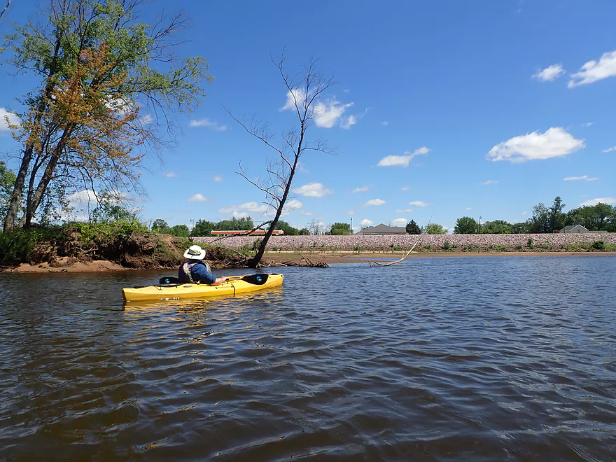
We started the trip at the Hwy 33 bridge where there was a good carry-in access. On the north shore is the city of Portage and a large levee intended to keep out floodwaters (it doesn’t always work though). From the river, paddlers can see the roofs of Portage sticking up above the levee. An A&W restaurant is located by the river and paddlers can get out for a quick ice cream treat if they wish.
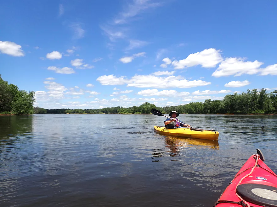
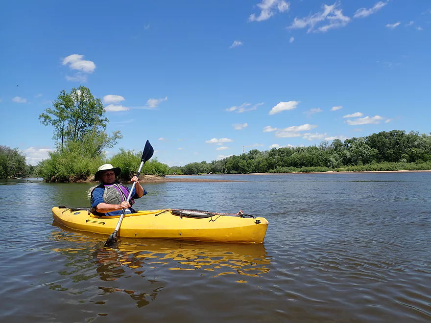
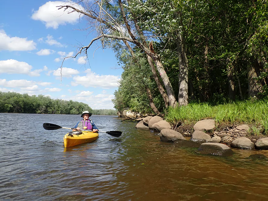
Downstream from Portage, the Wisconsin River is split by a huge-mile long island. Paddlers will have to decide between paddling the north or south channels. I advise staying north as that parallels the levee and the city which are interesting. You’ll also see more sandbars. The sandbars around the fringes of this “super island” are fantastic and huge. “Super Island” also contains several side channels, sub-islands, and hidden sandy lagoons that are fun to explore. What’s neat about Portage area sandbars is that motorboats usually don’t come this far north because of the shallow water, which means paddlers who camp or picnic will have more privacy.
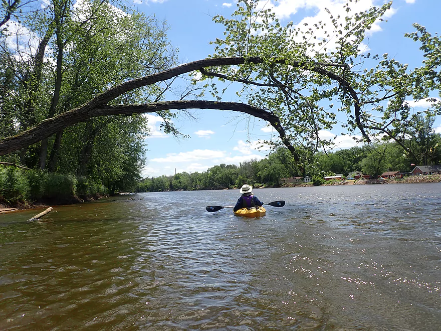
Following the Portage Waste Water outlet pipe and what looked like Lake Delton 2008 home debris, the two channels recombined into one. The next few miles were more generic and less interesting. Along the west bank were some small cabins on stilts. These homes extend for some distance along the river adjacent to Blackhawk Road. They are mostly summer homes, and are notorious for getting flooded when the river rises. On the east shore is a floodbottom forest that is part of the Duck Creek delta. Adventurous paddlers can explore these Duck Creek sloughs which are scenic, but heavily wooded and easy to get lost on.
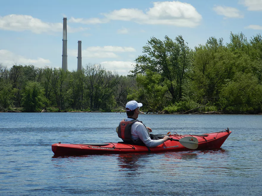
For much of this trip we saw iconic twin smokestacks of the Columbia Power Plant. It’s one of the last coal plants left in the state and Alliant Energy had announced plans to shut it down, but unfortunately recently postponed this until 2026. Hopefully the closure still happens as not only do coal plants produce a lot of greenhouse gases, they emit toxic heavy metals (like mercury). These end up in area rivers and streams, and in turn in wildlife. I know for example mercury pollution had been a problem on the Lemonweir River courtesy of the La Crosse area coal plants that were later shuttered. Closing the Columbia plant should mean cleaner waters east of Portage.
The next major landmark was the Baraboo River which is a significant tributary to the Wisconsin. Yes, the Baraboo is kind of a muddy, silty river, but it can be fun to explore. In high water paddlers can actually venture up the mouth and into a fantastic flooded forest.
Following the “Boo”, we passed a couple of small islands and then came upon a huge split in the river created by Lib Cross Island. This is another monster-sized island almost 1.5 miles long and presents another choice for paddlers. The east channel is bigger and deeper, but less sandy and contains more floodbottom forest. The west channel in contrast is more shallow, but has a lot of cool sandbars. It was here we saw a pontoon get stuck and its owners quibble over how to get it free. This is the main reason powerboats don’t like to go this far upstream.
At the base of Lib Cross Island, the river opened up into a large expanse. Here on the open water, fast boats and bigger waves were finally a nuisance. We cut across the channel to “St Lawrence Bluff” which is located at the mouth of Rocky Run Creek. The bluff featured fantastic sandstone cliffs including several alcoves and even a cool cave you can paddle into. Most powerboats and even kayakers will miss this if they are too far away. I highly recommend paddling as close to the cliffs as possible for the best experience.
In summary this was a good trip, but wasn’t completely consistent. The islands and sandbars by the city of Portage were fantastic, but the river paddling after that wasn’t as interesting. However the final leg by St. Lawrence Bluff was a real treat and was the highlight of the trip. For comparison, this isn’t the best leg on the Wisconsin River. Other legs have more sandbars, bluffs, and/or cliffs…but this is a nice option when the wind is blowing out of the north and you’re looking to avoid most motorboats.
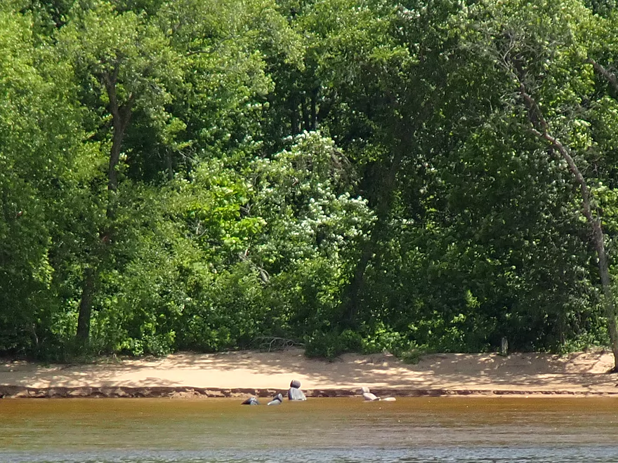
Sights included blue herons and clams. There were a number of swallows, many of which nested in mud homes on the sandstone cliffs along the river. The highlight was all the turtles which included a few softshells that ran surprisingly fast over the sandbars. Turtle egg remnants were a common sight on the sandbars. Unfortunately on one sandbar somebody’s dog was enthusiastically sniffing and digging out (what I presume were) softshell turtle eggs.
Portage Canal: This is a historic canal that used to connect the Wisconsin and Fox rivers and is worth checking out. It recently underwent a renovation in which the southwest end was dredged. Because of this, I suspect the canal will become more popular for paddlers. But just a warning, the northeast end was not dredged, so there is still some muck to deal with.
Portage Canoes on Parade: I’m sure you have heard of “Cows on Parade” or “Bucky on Parade”, well this is similar. A handful of Portage area businesses have outdoor art displays in which canoes are colorfully decorated and painted.
Hwy 33: This was a good public carry-in access used by paddlers and fishermen. There isn’t a huge parking area, but few use this so you don’t have to worry.
Alternative Put-ins:
- Pine Island Boat Landing (6.0 miles upstream from my put-in): This is a very good public boat ramp. When water levels are low, this is a great stretch for sandbars.
- Sunset Park (0.5 miles upstream from my put-in): This is a good public boat ramp also located in Portage. I personally prefer the carry-in access at Hwy 33, as it is less crowded and lacks boat trailers.
Dekorra Park: This is a large public boat landing and a good access option. There are no parking fees (that I saw) and outhouses are available. You have two launch options…either the main boat ramp to the east or the park to the west. The ramp is busier and more crowded, but more convenient because you can drive your car up to the water.
Alternate Take-outs:
- Waterfront Road and Thunderbird Drive Landings (1.5 miles upstream from my take-out): These are a pair of boat landings located just downstream from the Baraboo River. These are small, but suitable landings. The downside of taking out here is that you would miss out on the cliffs upstream of Dekorra.
- Hooker’s Resort (0.25 miles downstream from my take-out): This seems like a private landing but is actually public and a suitable access.
Bike Shuttle – Dekorra to Portage: 10.5 miles with 59′ of ascent. This isn’t a great bike shuttle because of its length, and Hwy 51 is pretty busy. If you really want to bike shuttle, I wouldn’t take out at Dekorra, but instead at either of the Baraboo River landings. This would allow you to shuttle on the west side of the river which is more direct (5.4 miles + 200′ ascent).
Rental/Shuttle – Wild Wisco Waters: This is a relatively new business that services this section of the river. Reservations are required. For more information see their website.
Wind: Much of this trip is over open water and is vulnerable to strong winds. However, the prevailing winds in Wisconsin usually blow west-to-east, so often this trip is still viable even in strong wind, but not a headwind. During our trip we had gusty winds behind us which was great…it was like sailing. The winds were so strong they kicked up cool dust clouds off of the sandbars.
Waves: Most of this trip wasn’t too bad for waves. The exception was an open stretch just prior to the take-out at Dekorra. Here the river widened, deepened, and powerboat traffic became more common. The cliffs in this area can bounce the waves back onto the main channel which can create for turbulent paddling in spots.
Current: This was a mix of slow and decent current. Overall this wasn’t a factor outside of a few stretches.
Strainers: Be careful about paddling too close to shore. Low branches and downed trees can trap boats where the current is deceptively deep and fast. Wisconsin River shoreline strainers are especially problematic in high water.
Motorboats: Because of the shallow water, few powerboats venture upstream of the Columbia Power Plant. Even fewer venture all the way up to Portage. But close to Dekorra powerboats are common and can be a nuisance because of the noise/waves they create. Powerboats can also compete for the best sandbars, so often your best picnic options will be located further upstream.
Nearest Gauge: Wisconsin River @ Wisconsin Dells – 4300 CFS
- 0-4,000 CFS: A very low depth. Monster-sized sandbars.
- 4,001-6,000 CFS: An average summer depth. Good-sized sandbars.
- 6,001-8,000 CFS: An average spring depth. Some decent sandbars.
- 8,001-10,000 CFS: Hardly any good sandbars.
- 10,001-13,000 CFS: A very high depth. Likely navigable but not very inviting.
- 13,001+ CFS: At this point this section might be unsuitable for paddling unless you’re an experienced paddler.
Quick Overview
- Upstream of Stevens Point: I don't have information yet on these stretches.
- Stevens Point to Lake Petenwell: ~42 miles. This stretch in Central Wisconsin used to have many natural rapids, but most have been buried under 8 dams, some of which are now difficult portages. Despite this there is still some good paddling to be had in this region.
- Lake Petenwell: 14.9 miles. This is a large flowage lake that is challenging for paddlers because of frequent strong winds and big waves.
- Castle Rock Lake: 14.5 miles. Another large flowage lake that is likely too big for enjoyable paddling.
- Castle Rock Lake Dam to Lemonweir River: 9.4 miles. This pre-Dells leg isn't elite, but is a pleasant stretch.
- Lemonweir River to Indian Trails Landing: 21.7 miles. This includes the famous Upper Dells and Lower Dells which feature many scenic sandstone outcrops.
- Indian Trails Landing to Portage: 16 miles. This is an overlooked section sandwiched between the Dells and Portage. While the scenery isn't top-notch, it does have many sandbars and few people, which is a nice combination.
- Portage to Lake Wisconsin: 14.3 miles. This is a neat stretch of the river with many sandbars and cliffs, but the shoreline is very developed and motorboat traffic can be heavy on weekends.
- Lake Wisconsin: 14.5 miles. This is a challenging lake for paddling because of the huge and frequent waves created by motorboats.
- Prairie du Sac Dam to Port Andrews: 57 miles. This is the first half of the famous Lower Wisconsin Riverway. This is a super popular stretch for paddlers with the highlights being large sandbars, big bluffs, occasional cliffs, and fun side sloughs to explore.
- Port Andrews to Wyalusing: 40 miles. This is the second half of the Lower Wisconsin Riverway which has far fewer paddlers and sandbars. But the bluffs and sloughs are larger and more interesting.
Detailed Overview
- Upstream of Merrill: I don't have enough information yet on these legs to comment.
- Merrill Dam to Riverside Park: 0.5 miles. Might include some light rapids below the dam.
- Riverside Park in Merrill to Wisconsin River Forest Landing: 8.6 miles. A good prospect.
- Wisconsin River Forest Landing to Brokaw Boat Landing: 5.7 miles.
- Wisconsin River Forest Landing to Jesse Park: 1.4 miles. A terrific stretch with small boulder gardens, one set of Class 1-2 rapids, gravel bars and a nice sand bank.
- Jesse Park to Brokaw Boat Landing: 4.3 miles. A good stretch with scenic wooded banks and occasional gravel bars.
- Brokaw Boat Landing to Gilbert Park: 5.1 miles. River slows down and becomes hillier. This stretch is an ok prospect and goes past the old Brokaw paper plant that has been shut down. Paddlers must navigate Class 1 rapids and a 2' drop where the old Brokaw dam used to be.
- Gilbert Park to Wausau Boat Dock: 1.5 miles. An impounded stretch through Wausau. There are numerous alternate access options to choose from.
- Wausau Boat Dock to Oak Island Boat Ramp: 1.2 miles. A nice stretch that includes Barkers Island and Isle of Ferns Park. But the Wausau dam does require a portage. This stretch parallels the famous Wausau Whitewater Park.
- Oak Island Boat Ramp to Rothschild Dam Access: 5.8 miles. Likely mostly uninteresting flowage paddling. There are many alternate access options to choose from.
- Rothschild Dam Access to Zimpro Park: 1.0 miles. This might be a nice stretch.
- Zimpro Park to River Road Boat Landing: 7.6 miles. The first half of this leg is likely nice river paddling, but the second leg is probably just an uninteresting flowage.
- Chucks Landing/Mosinee Dam to Bean's Eddy Boat Landing: 2.8 miles. Likely a nice leg. You might be able to launch by the dam where there should be some nice rapids and boulders.
- Bean's Eddy Boat Landing to Seagull Boat Landing: 5.1 miles. Mostly uninteresting flowage paddling. Although there might be some nice sand banks on the eastern shore.
- Seagull Boat Landing to Dubay Dam Access: 5.3 miles. Mostly uninteresting flowage paddling.
- Dubay Dam Access to River Road Landing: 5.5 miles. This could be a nice stretch of river.
- River Road Landing to Old US 10 Landing: 2.3 miles. Likely an ok leg.
- Old US 10 Landing to Stevens Point Dam: 5.6 miles. Probably uninteresting flowage paddling. Many alternate access options closer to Stevens Point.
- Stevens Point Dam to Blue Heron Boat Landing: 4.2 miles.
- Steven Point Dam to Whiting Dam: 2.6 miles. Starts slow and uninteresting, but the river becomes very scenic after the Hwy HH bridge. The rock formations below both dams are very striking. Many alt access points.
- Whiting Dam to Kimberly Clark Dam/Al Tech Park: 0.6 miles. Incredible scenery with exposed bedrock and boulder gardens below the Whiting Dam. Some rapids, but nothing major. The Kimberly Clark Dam is a dangerous low-head dam and should be treated carefully.
- Kimberly Clark Dam to Blue Heron Landing: 1.0 miles. Class 2 rapids below the dam, but after that the river slows dramatically and splits into many sub-channels and islands. Round trips on this leg are possible. I chose the far western channel where there were some nice rocky stretches.
- Blue Heron Landing to Mill Creek Landing: 4.1 miles. Likely a mediocre paddle with nothing special. Galecke Park is an alternate access.
- Mill Creek Landing to Biron Dam North Gate: 7.6 miles. Mostly uninteresting flowage paddling. Several alternate access options on route.
- Biron Dam North Gate to Veteran's Memorial Park: 4.5 miles.
- Biron Dam North Gate to Biron Landing: 1.0 miles. Super scenic stretch by two islands with many granite boulders.
- Biron Landing to Legion Park: 3.0 miles. A nice stretch by Big Island. The west channel is more undeveloped...but the east channel has several scenic granite islands.
- Portage through Legion Park: 680'. A steep wall separates the park from the river but in two locations the wall is short enough to get over (see map). Paddlers may want to consider a longer portage to bypass some of the shallow rocky stretches by Legion Park.
- Legion Park to Veteran's Memorial Park: 0.4 miles. A scenic stretch that features a large boulder field and the powerhouse for a large paper mill.
- Veteran's Memorial Park to Port Edwards Landing: 3.8 miles
- Veteran's Memorial Park to Demitz Park: 0.8 miles. A pleasant stretch that includes Belle Island.
- Demitz Park to Ben Hansen Park: 1.2 miles. This leg goes by Garrison Island and Edwards Island. Lyon Park is located across the river from Demitz Park and is another access option.
- Ben Hansen Park to Port Edwards Landing: 1.8 miles. Above the Centralia dam there are several small but nice islands. Portage the dam on the left bank (follow the 1000' trail through the golf course). Below the dam there are scenic rock formations. Close to the Port Edwards dam are a few more scenic islands you can explore.
- Port Edwards Landing to Nekoosa/Riverside Park: 3.6 miles.
- Port Edwards Landing to Port Edwards Powerhouse: 1.3 miles. A half-mile portage is required (east bank). A very scenic boulder field is located below the dam. At high levels, the rocks are submerged and produce a half-mile stretch of rapids (some strong).
- Powerhouse to Moccasin Creek Landing: 1.8 miles. A generic wooded stretch that isn't super interesting.
- Moccasin Creek Landing to Riverside Park: 0.5 miles. During the Nekoosa dam drawdown, this stretch had nice boulder fields and rapids.
- Riverside Park to Hwy 73: 0.8 miles. An ok stretch of the river. There are scenic cliffs south of Hwy 73, but these are past the dam warning line. Hwy 73 is not a good access option.
- Hwy 73 to Point Basse Ave (Portage of the Nekoosa Dam): 1.5 miles. A difficult 1.5 mile portage through downtown Nekoosa. Don't try to portage the south bank. There is a steep hill, cliffs, and large Domtar paper mill fences to deal with.
- Point Basse Ave to Jim Freeman Memorial Boat Landing: 0.8 miles. A generic stretch going by historic Point Basse. If you're willing to backtrack to the dam, you can see scenic boulder fields (during low flows) and a few cliffs. Point Basse Ave is a somewhat speculative access, but it seems public and doable for launching.
- Jim Freeman Memorial Boat Landing to Plank Hill Small Boat Access: 2.0 miles. A generic stretch.
- Plank Hill Small Boat Access to 19th Drive Landing: 5.3 miles. Features two epic sand banks. The main channel has some minor sandbars. Several of the side sloughs can provide fun side adventures.
- 19th Drive to the Petenwell Dam: 14.9 miles. This is Lake Petenwell which is a large and challenging lake for paddling. Waves and strong winds are frequently an issue. But when calm there are nice sandbanks on the northwest shore, hidden sloughs, and large islands to explore. See the overview map for more info.
- Petenwell Dam to Ganter Lane Landing: 3.8 miles. This stretch isn't too impacted by dams and may have nice sandbars at low levels.
- Ganter Lane Landing to Castle Rock Lake Dam: 10.7 miles. Castle Rock Lake is likely too big (wind/waves) for enjoyable paddling. There are many alternate launch options along the shore.
- Castle Rock Lake to the Lemonweir River: 10 miles. An ok section.
- Lemonweir River Mouth to River Bay Landing: 7 miles. The first half of the classic Upper Dells.
- River Bay Landing to Blackhawk Island: 6.5 miles. Second half of the classic Upper Dells, known for its fantastic outcrops. Note, the Blackhawk Island landing is no longer accessible without special permission from the Upham Woods Outdoor Learning Center.
- Black Hawk Island to Wisconsin Dells Dam: 2.0 miles. More nice sandstone outcrops. You can take out at a public ramp off Indiana Ave or portage the dam and take out SW of the dam by a launch off Wisconsin Dells Pkwy/Hwy 12.
- Dells Dam to Indian Trails Landing: 6.2 miles.
- Dells Dam to Newport Park: 2.2 miles. This is the heart of the famous Lower Dells with many scenic outcrops. Unfortunately jet boats are a serious plague on this stretch.
- Newport Park to Indian Trails Landing: 4.0 miles. Features the famous "Sugar Bowl" formation and four super cool caves. The outcrops soon disappear and this stretch is mostly uneventful (but peaceful) big river paddling.
- Indian Trails Landing to Pine Island Boat Ramp: 9.8 miles. Few paddle this stretch as it isn't as interesting. But...it does have a good concentration of sandbars and few competing paddlers for them.
- Pine Island Boat Ramp to Portage/Hwy 33 Access: 6.0 miles. Not an elite section that is lacking in cliffs and bluffs. It does have good sandbars though.
- Portage to Dekorra Park: 7.7 miles
- Portage to Baraboo River/Thunderbird Road: 5.2 miles. A good section with great sandbars. Close to Portage there are few motorboats.
- Baraboo River to Dekorra Park: 2.5 miles. River splits around massive Lib Cross Island. West channel has nice sandbars. St Lawrence Bluff has scenic sandstone outcrops and includes a cave you can paddle into.
- Dekorra Park to James Whalen Memorial Park: 6.6 miles.
- Dekorra Park to Camp Rest Park: 5.1 miles. A terrific section with rock outcrops, large island deltas, hidden sloughs, and nice sandbars. Unfortunately this part of the river is popular with motorboats and jet skis which can be a plague. Multiple alternate access options.
- Camp Rest Park to James Whalen Memorial Park: 1.5 miles. Not a great section because of the open water paddling, powerboats and big waves. The west shore though does have nice outcrops.
- James Whalen Memorial Park to Merrimac Memorial Park: 4.4 miles. River turns into "Lake Wisconsin". Generally speaking this isn't ideal for kayaking as motorboat traffic can be heavy and waves can be surprisingly big. The most direct route is the north shore which has a few bluffs, but generally speaking isn't that interesting.
- Merrimac Memorial Park to Veterans Memorial Park/Prairie du Sac: 9.6 miles.
- Merrimac Memorial Park to Moon Valley Landing: 3.3 miles. Includes a lot of developed shoreline. The ferry, railroad bridge, and Moon Bay are highlights.
- Moon Valley Landing to Veterans Memorial Park/Prairie du Sac: 6.3 miles. Other than Moon Bay and the dam, this is a boring stretch. There are numerous alt access options on this route.
- Prairie du Sac to Mazomanie: 8 miles. An ok section of the Wisconsin but lacking in sandbars.
- Mazomanie to Arena: 9.7 miles. A great section with nice sandbars and scenic bluffs.
- Arena to Hwy 14: 8.0 miles. Good section with a high concentration of sandbars. One of the more popular legs on the Lower Wisconsin.
- Hwy 14 to Hwy 23/Spring Green: 2.2 miles. Neat mini-section with sandstone outcrops. Very popular in the summer.
- Spring Green to Lone Rock: 7.4 miles. Another fine sandbar/bluff section with some nice rock outcrops too.
- Lone Rock to Gotham: 8 miles. This stretch has super impressive rock outcrops and sand banks.
- Gotham to Muscoda: 7.6 miles. This leg includes more large sandbars and great outcrops. Bonus highlights include fast current and not seeing as many people.
- Muscoda to Port Andrew: 7 miles. A good stretch with many islands and sandbars.
- Port Andrew to Boscobel: 9 miles. Wooded islands start to get massive.
- Boscobel to Woodman/Big Green River: 9 miles and start of the less paddled stretch of the Lower Wisconsin. Far fewer sandbars from here to the mouth, but good bluffs and side sloughs to explore.
- Woodman to Millville: 7.7 miles. A good stretch with large bluffs and sandbars.
- Millville to Bridgeport: 5.3 miles. Huge islands, bluffs and sandbars are the highlight on this second-to-last leg on the Wisconsin River.
Bridgeport to Wyalusing (the mouth): 9 miles.
Trip Map
Overview Map
Video
Photos Size: