
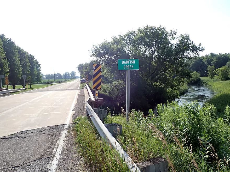
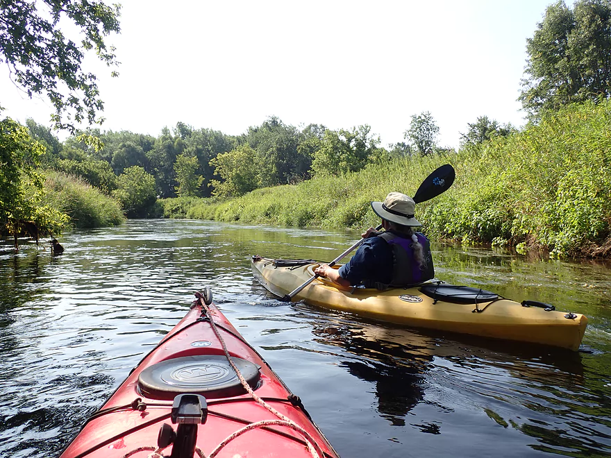
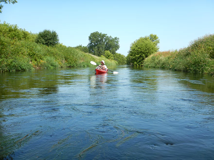
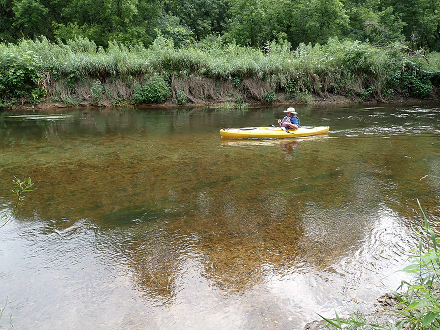
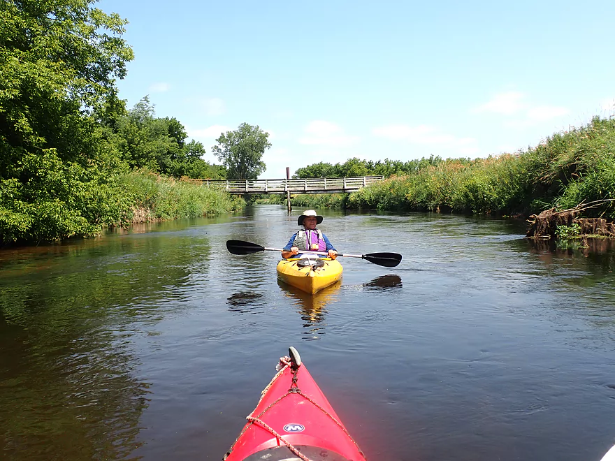
Starting the trip at Hwy A
Kind of weedy
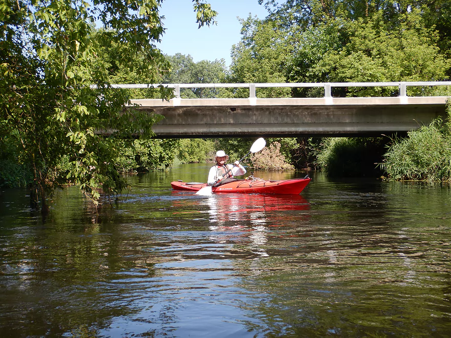
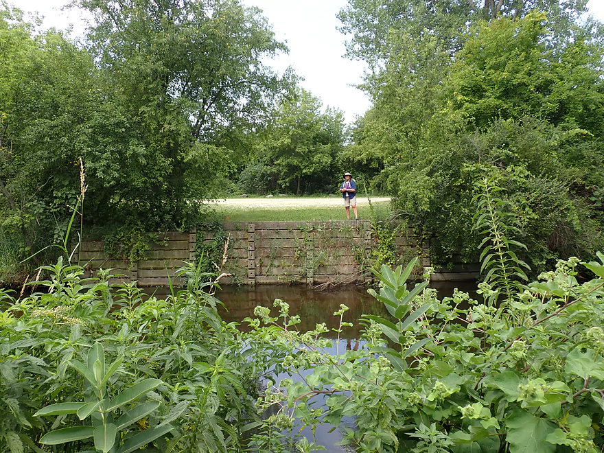
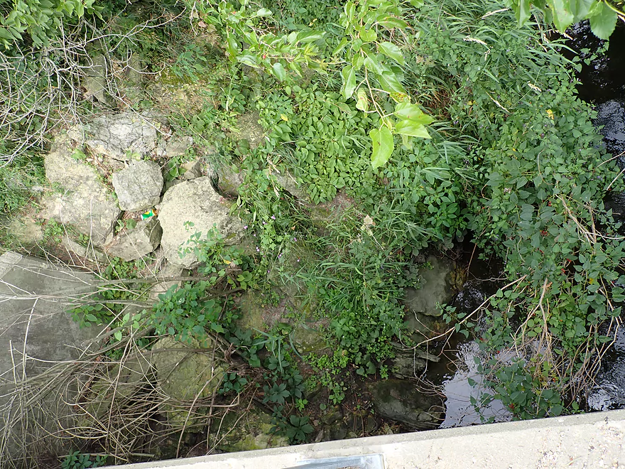
But an ok bridge access
Reverse view
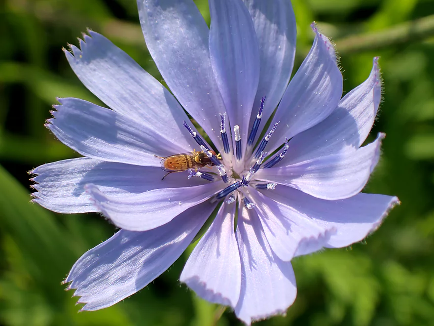
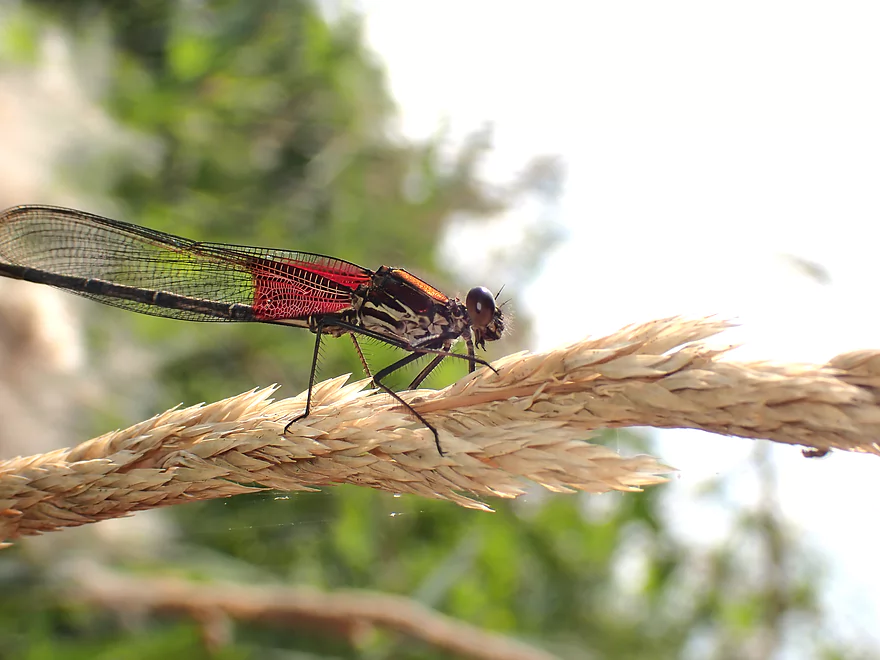
This was a great spot for macro photography
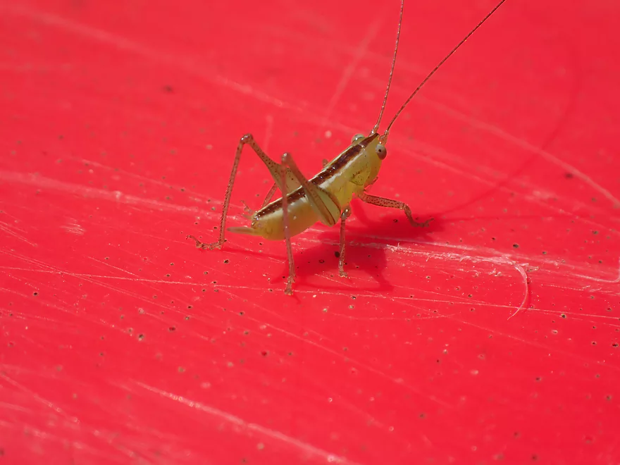
Friendly meadow katydid nymph tagging along
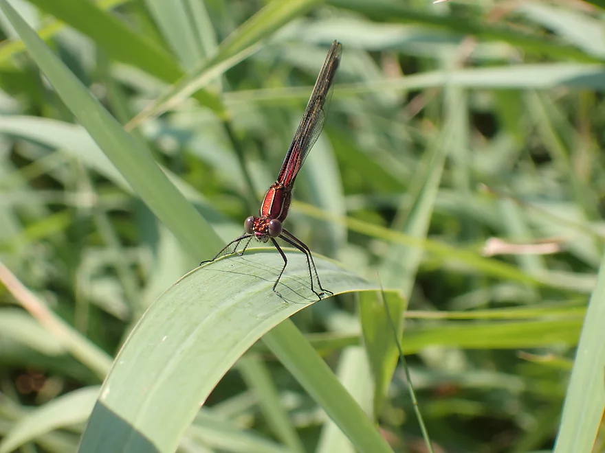
Damselfly sunbathing on a blade of grass
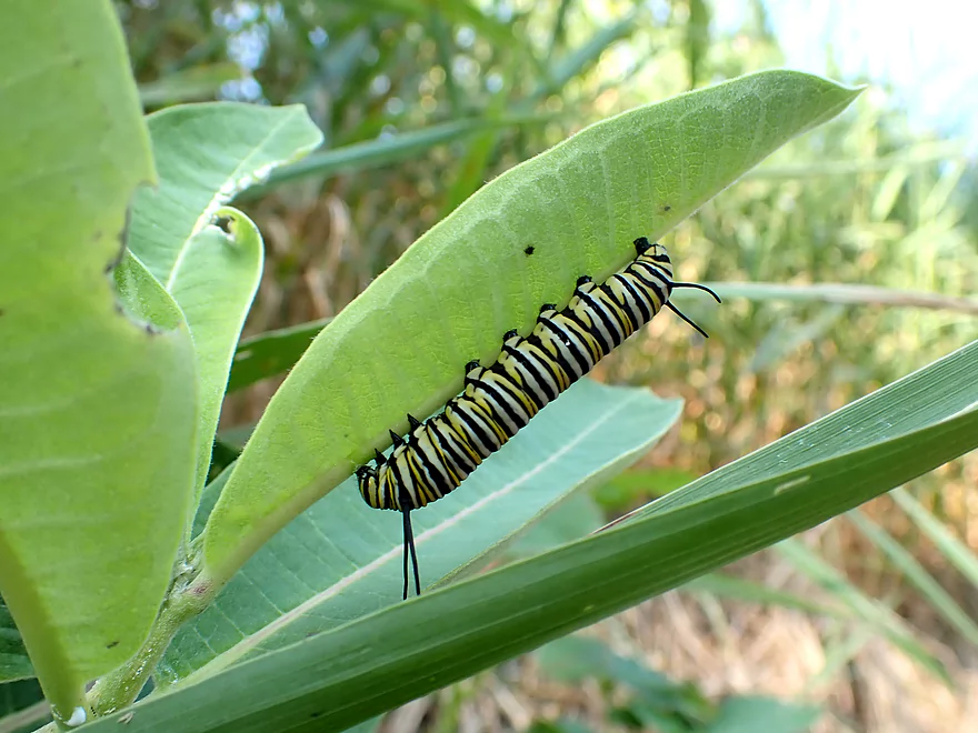
Monarch caterpillar having a snack
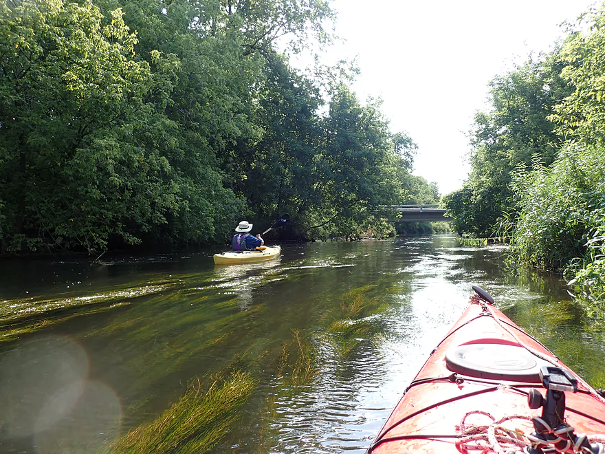
Zipping along in fast current between artificial banks
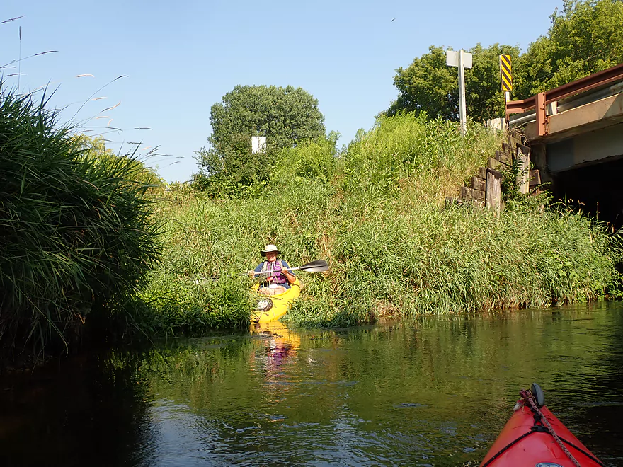
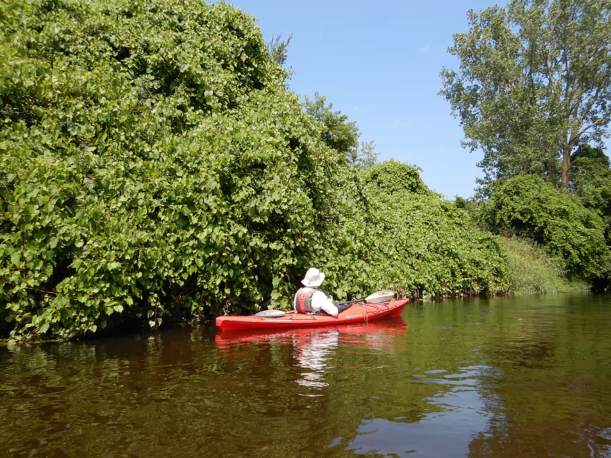
Very overgrown banks
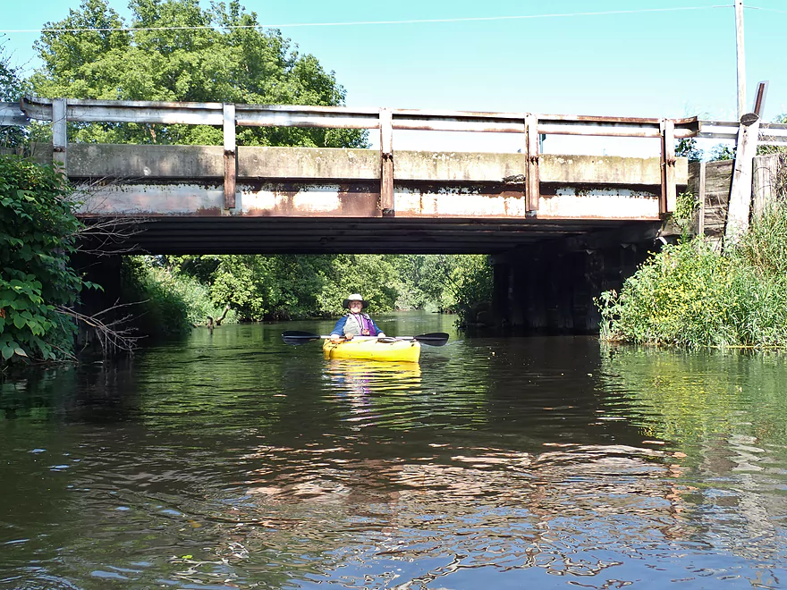
Lake Kegonsa Road…not a great bridge access
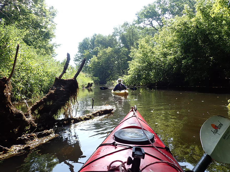
Some ducking…nothing serious so far
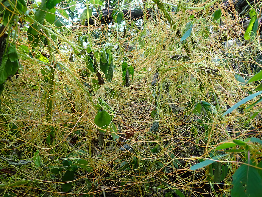
This is dodder
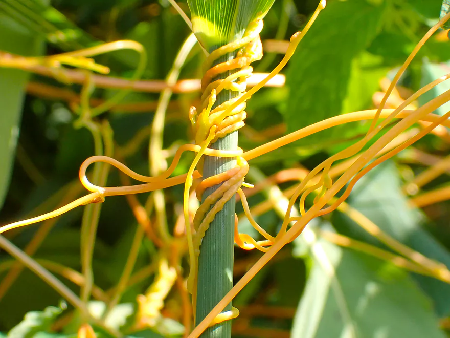
It’s a parasitic plant that attacks other plants (cool!)
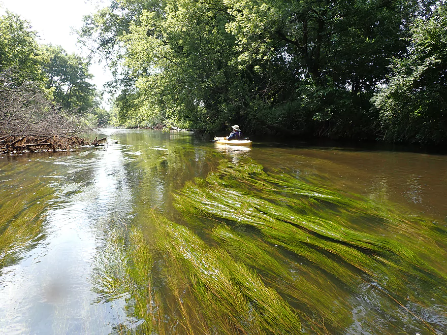
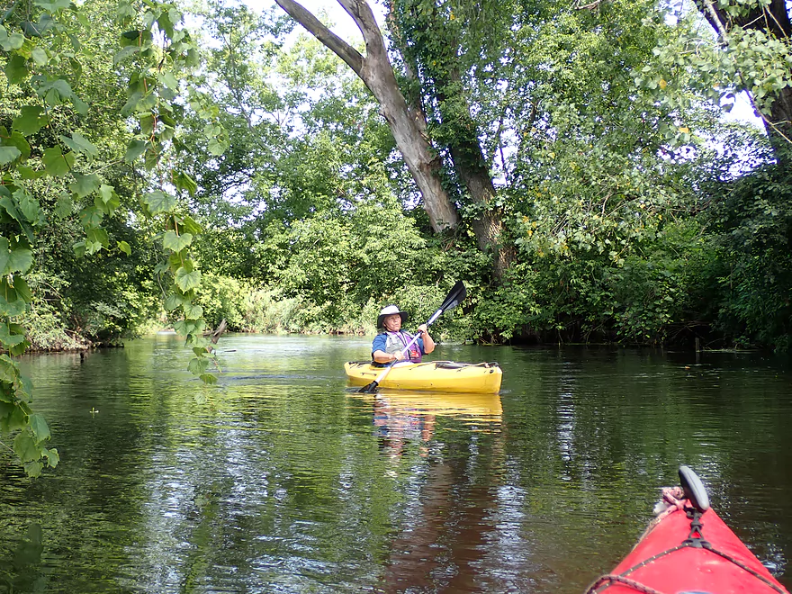
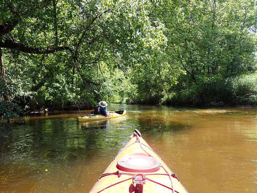
Flowing potamogeton
Some trees in this stretch…not many
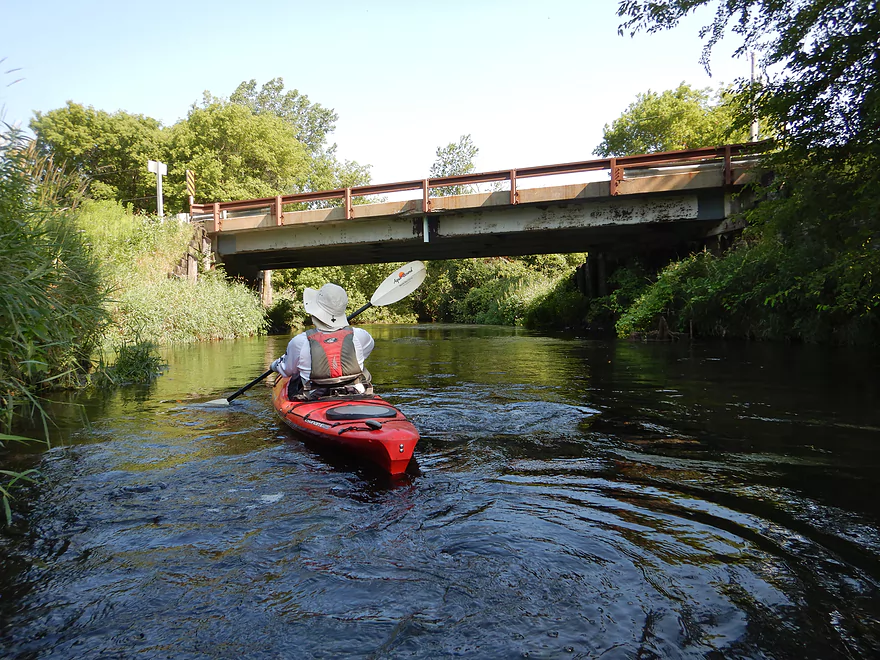
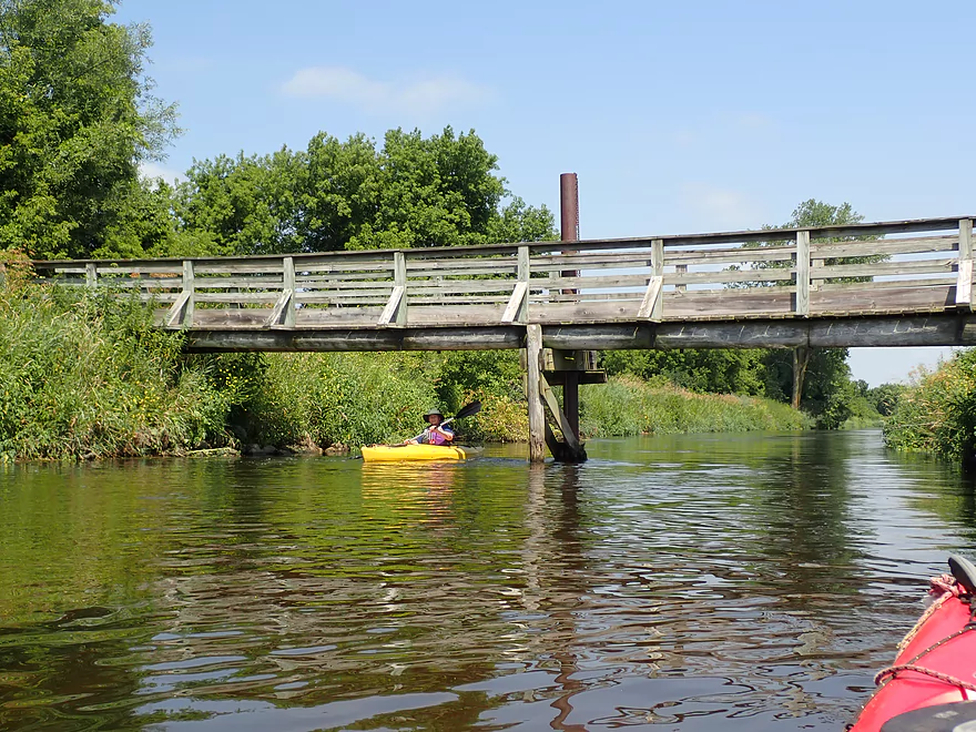
An elaborate farm bridge
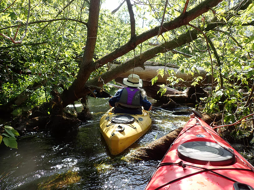
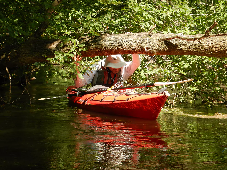
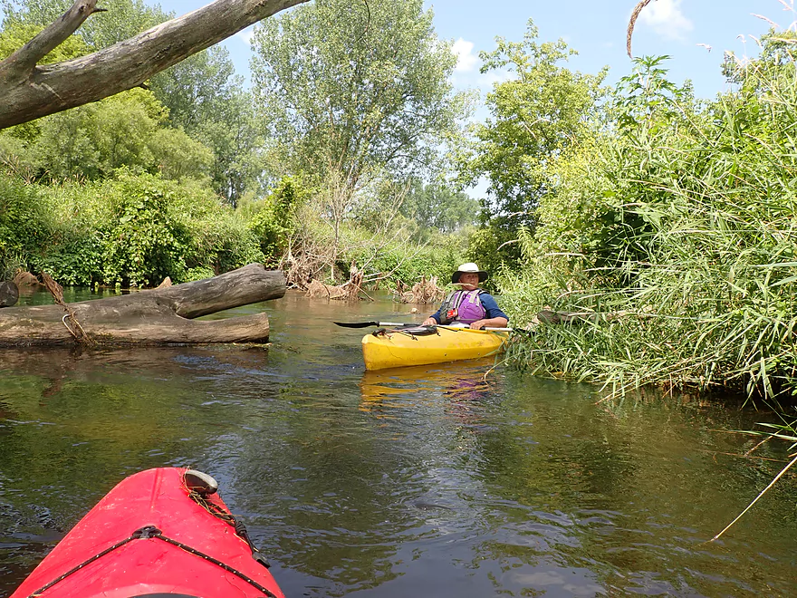
Some tighter fits
But still navigable
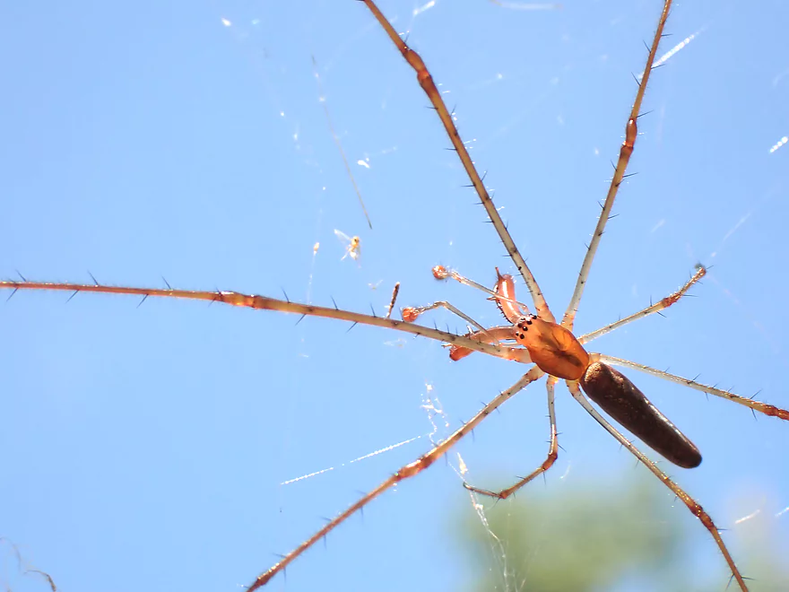
Showing off its mandibles
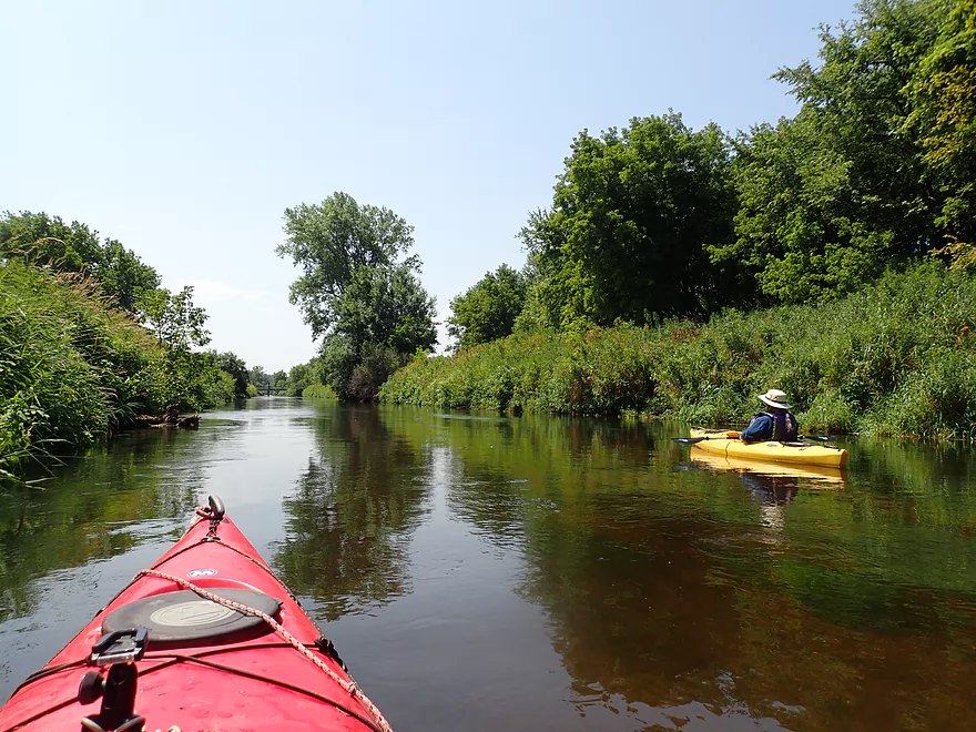
Most of this trip was straight and open
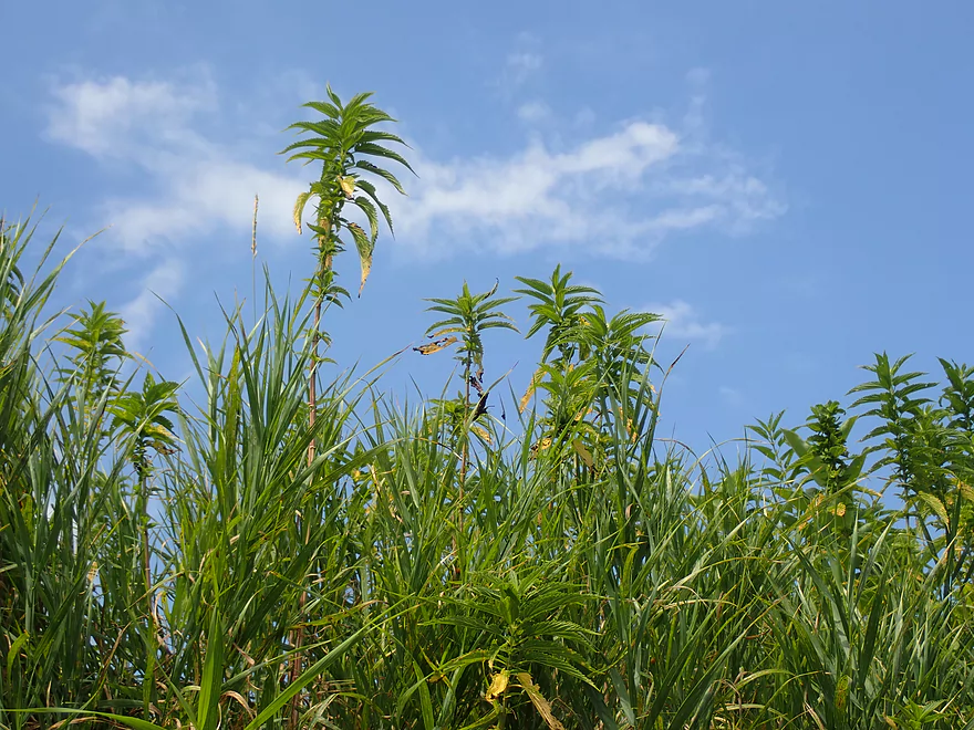
Lot of disturbed ground species
Coming up on Old Stone Drive
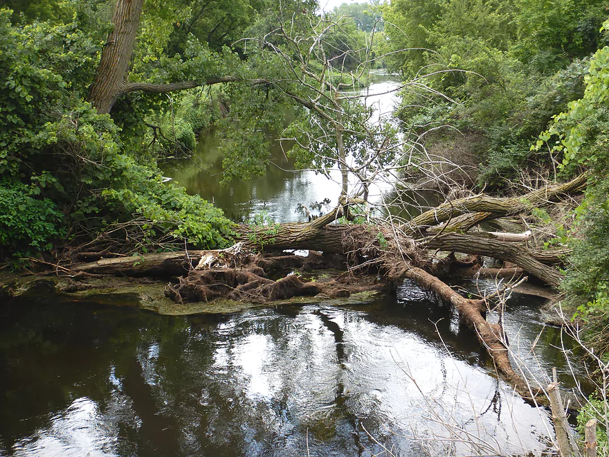
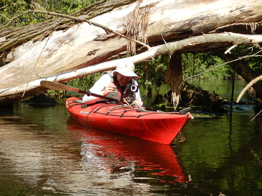
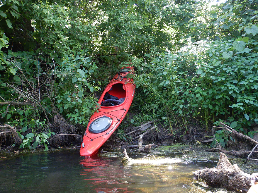
The only logjam of the trip
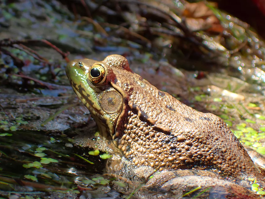
A very tame green frog
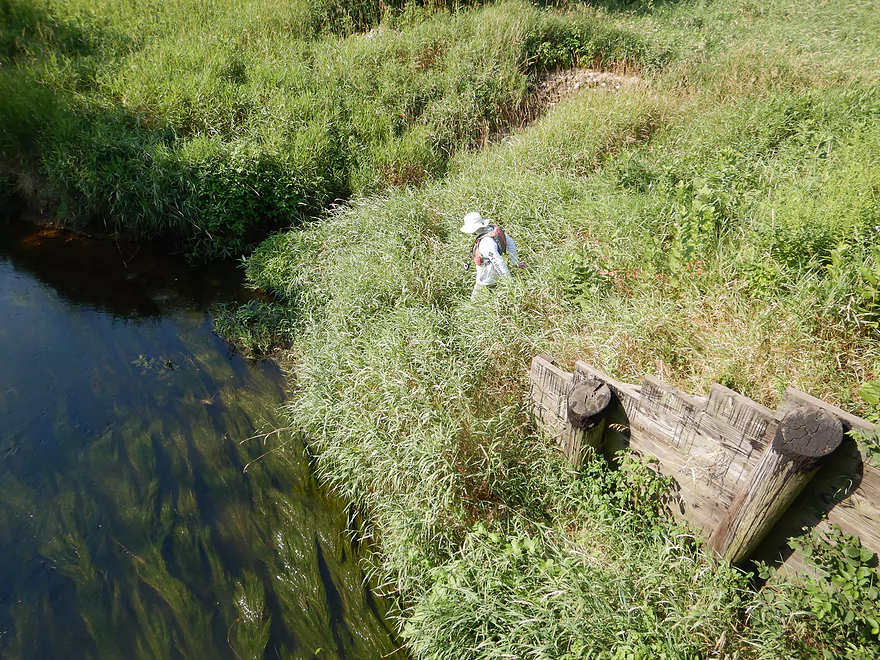
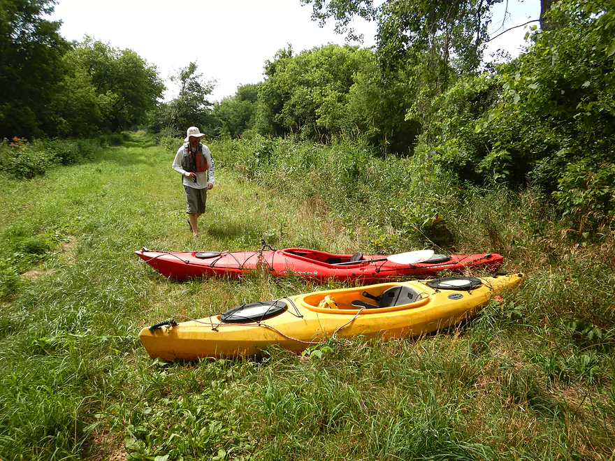
The portage along the east bank was steep and congested
A surprise road atop the embankment (likely an old dredge road)
Turns out this is part of a public wildlife area
And we should have taken out northwest of the bridge
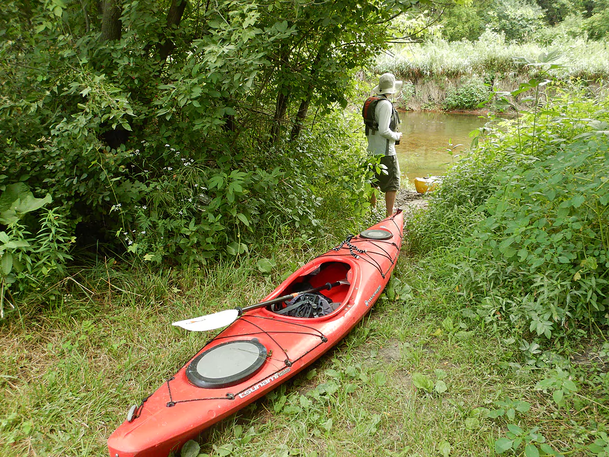
A nice landing that doubles as a nice portage reentry
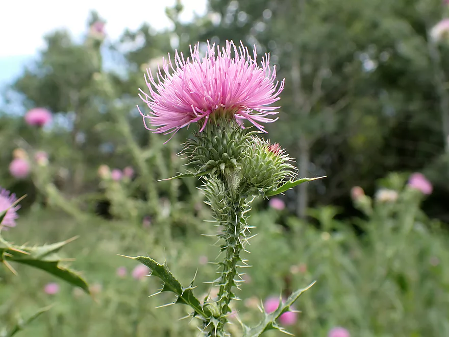
A prickly thistle
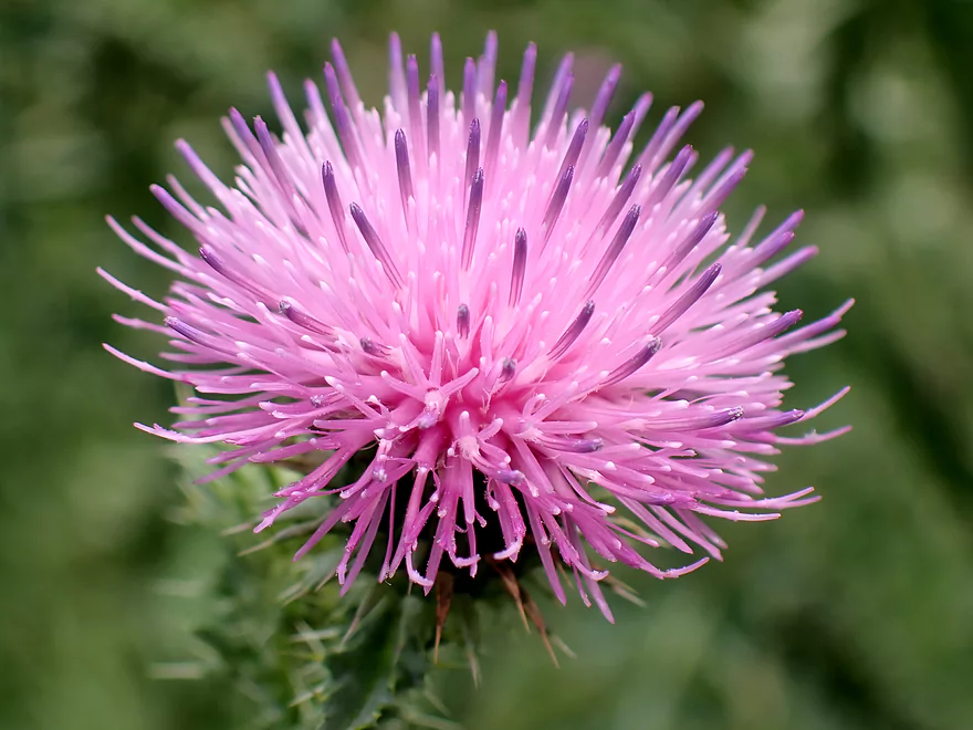
Great color
Much of the creek had good clarity
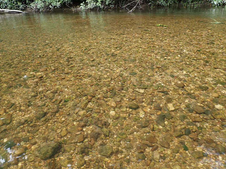
As well as a nice pebble substrate
The logjam cleanup work was fantastic
Sitting pretty
Current slows a bit at this point
Some huge grape vines
A suspiciously straight section (it’s been channelized)
Part of the local trail system
Kind of a simple paddle at this point
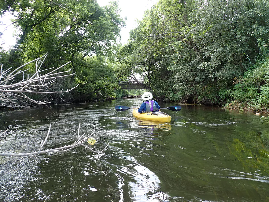
Entering a significant wooded stretch
Nice rocky section
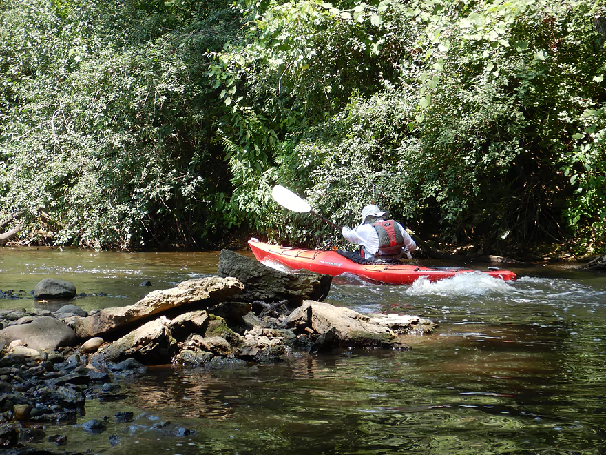
Only noteworthy rapids (going up to run them again)
Cathedral-like tree canopy
Logjams were never an issue in the woods
Neat part of the creek
Favorite part of the trip
Taking out just before Old Stage Road
There is a fantastic access here
Trail considerately created with woodchips (gravel scratches boats)
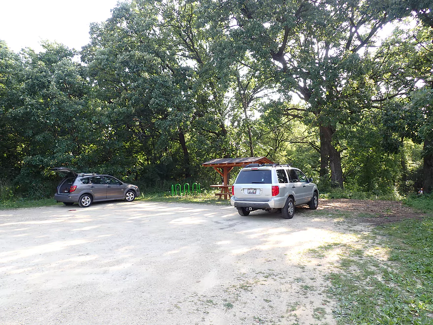
This access is pretty new
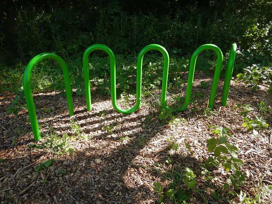
It even has locking stations for bikes and boats
A nice scenic end to the trip
Badfish Creek – Hwy A to Old Stage Road


The Badfish is a unique creek whose origins are none other than MMSD (Madison’s wastewater plant). Located near Nine Springs Park, the Madison plant sends some effluent down Badger Mill Creek, but most is shipped south via a five-mile underground pipe, where it emerges to form Badfish Creek (just north of Hwy B). It’s not ideal that effluent is discharged into any creek, but this is preferable to the old days, when Madison actually sent their wastewater directly into the lakes (which predictably caused many issues). Part of the reason the Badfish is preferable over the Yahara River, is it has a much higher grade which prevents algae growth. To facilitate this, MMSD actually has to pump their effluent 80′ uphill to get it into the creek.
This may all sound somewhat morbid, but surprisingly enough Badfish Creek is one of the nicer paddles located in Southern Wisconsin. In fact we previously did the Lower Badfish, which was a great five-star trip. One of our readers (Jon) made an interesting observation that a new landing had been created at Old Stage Road, and that the leg between Old Stone Road and Old Stage Road was finally clear of logjams (I believe thanks to Capitol Water Trails). With this in mind, I planned a return visit to the Badfish to see if the upper portion was as interesting as the lower portion.
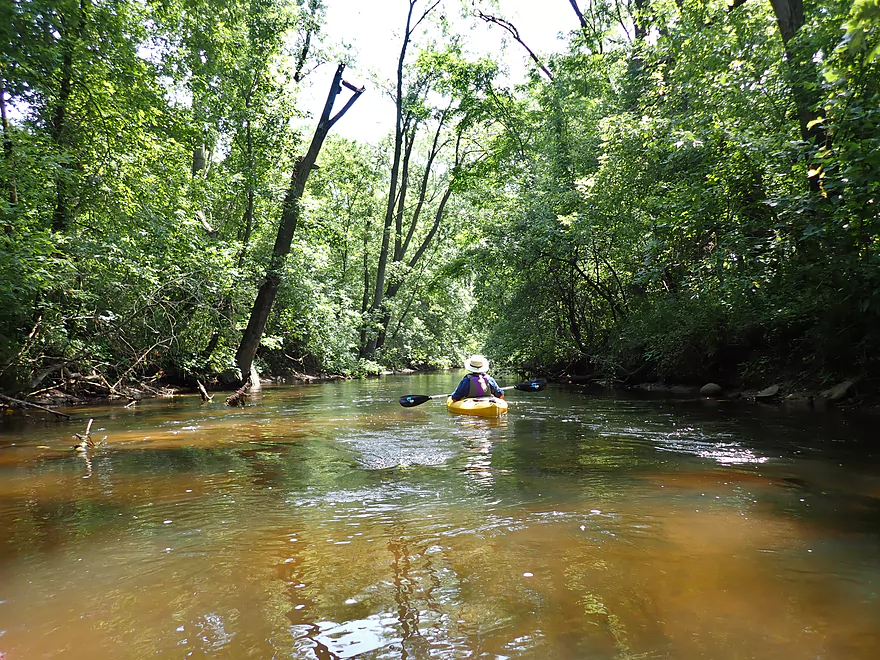
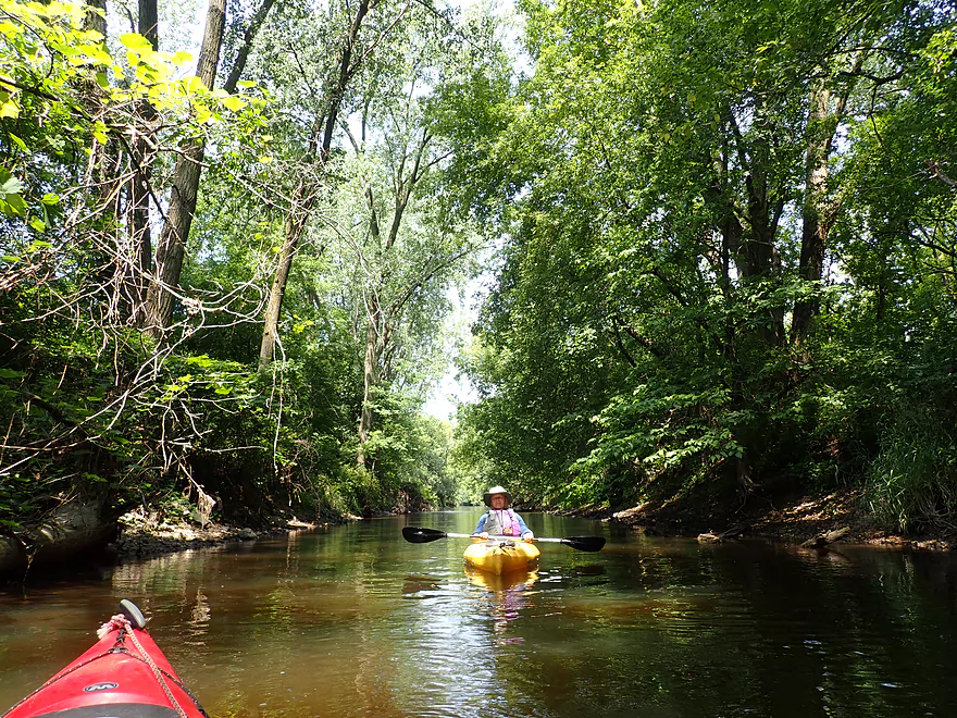
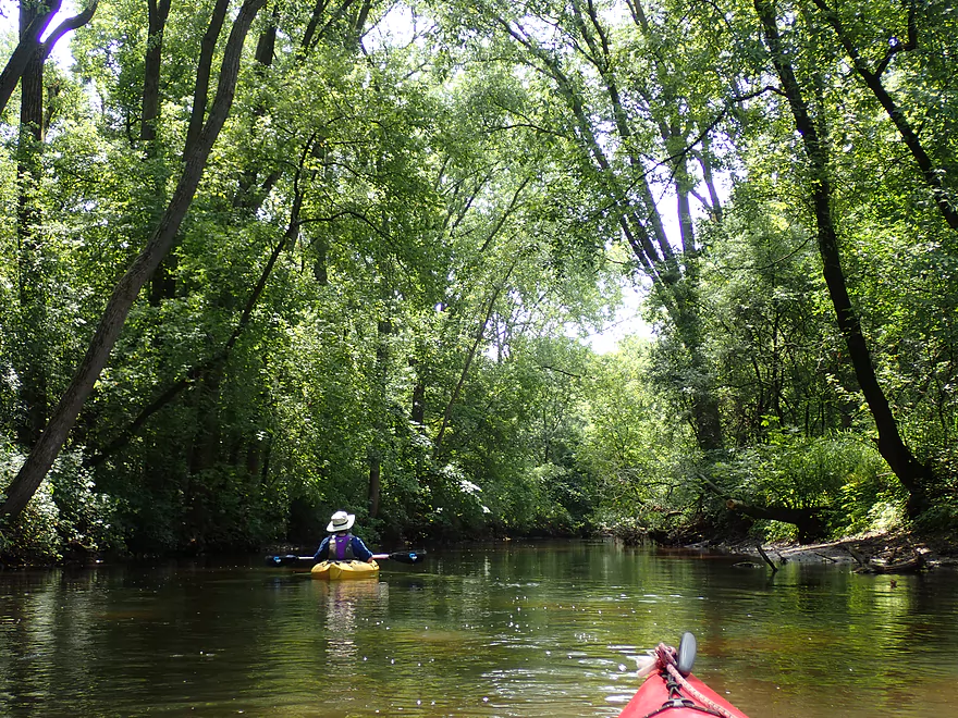
That day forecasted thunderstorms were ‘supposed’ to roll in at about 2:00, so we opted for a short four-mile stretch starting from Hwy A and ending at Old Stage Road. Right away this reminded us of our last trip because of the clear water, flowing potamogeton, and zippy current. But this time, we didn’t smell chlorine which was welcome (perhaps because of the high water). The channel itself was pretty simplistic and straight with no meanders. Occasional trees dotted the shoreline and separated the adjacent farm fields from the creek. The banks were filled with mostly weedy plants and disturbed ground species (wild parsnip, stinging nettles, wild mustard, invasive grasses, etc…). While not as nice as our 2012 trip, it was still solid because of the good current, clarity and clean gravel substrate.
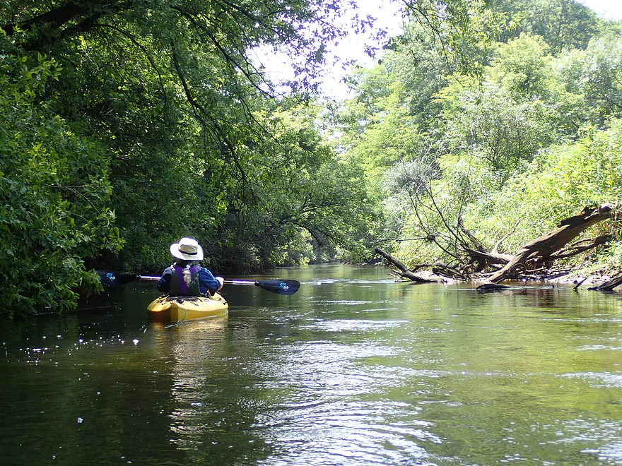
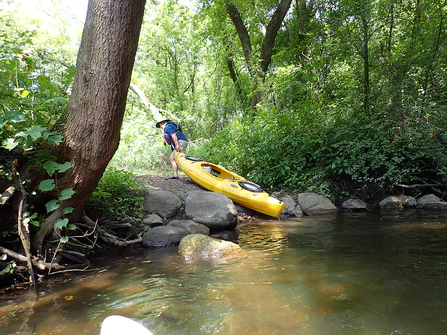
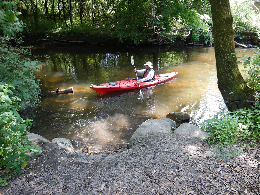
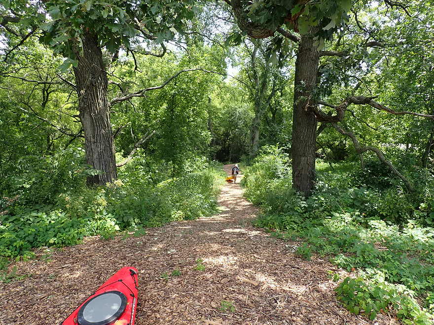
There were occasional trees in the water, but these were mostly easy to duck or zigzag around. That changed though right after Old Stone Road bridge where a large tree completely blocked the channel. We portaged out along the left bank, which was quite difficult because of the steep weedy bank and because the deep channel made it difficult to brace our boats. As I pulled my kayak up the bank and through the foliage, I came out onto an unexpected back road and actually surprised an elderly gentlemen walking his dog (it must have seemed as if I materialized out of nowhere). After scouting the situation from the Old Stone bridge (which we should have done beforehand), it turns out this area was part of a local park and canoe landing. We could have done a far easier portage by simply taking out along the northwest corner of the bridge, crossing the road, and then using the launch on the west bank to re-enter. Live and learn.
Following Old Stone Road was the start of Badfish Creek State Wildlife Area, where the creek flowed suspiciously straight as an arrow. It turns out MMSD had artificially channelized and straightened the creek here to improve flowage and to protect area groundwater wells. Atop the artificial embankments were more scruffy plant species that weren’t super exciting. Honestly some of these southern Wisconsin “jungle paddles” are actually better experienced in early spring before the banks become overgrown and weedy.
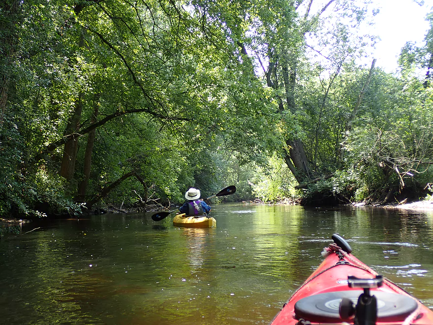
This all changes once the creek takes a sharp turn east. For the next mile, the creek flows through a thick forest which was fantastic and reminiscent of the Badfish below Old Stage Road. This also reminded us of Lower Turtle Creek and the White River because of the fast current and tree canopies. Unfortunately it was sunny out, which is horrible for woodland photography and few of our videos/pictures turned out well. We completed the trip at Old Stage Road. This was where we started our previous trip, but this time around we got to use the new canoe landing which is fantastic.
In summary, this was a solid trip, but wasn’t in the same league as the Lower Badfish. The lower creek was just more scenic and varied…and it actually meandered! Badfish newbies should start at Old Stage Road and do a downstream leg. But locals looking for a new adventure will enjoy the upper Badfish (just portage the logjam prior to the Old Stone Road bridge…not after). The trip highlight was definitely the last mile and the woods. Doing a lower creek paddle but starting at Old Stone Road may be a good way to experience the best of both worlds.
There were a number of damseflies, one deer and a muskrat. Surprisingly enough there were no fish (that we saw). The highlight was two barred owls.
Hwy A was a bit weedy, but was still a plenty doable bridge option. The best launch area is along the southwest corner. Be mindful not to block the neighbor’s driveway…best parking is southeast of the bridge.
An alternate upstream put-in would be at Hwy 138. This leg would add 2.8 miles to the trip and should be a decent prospect despite being artificially straightened and flanked by farm fields. Hwy 138 is very busy and launching here would be a bit difficult because the embankment is large and weedy.
An alternate put-in located 1.6 miles downstream would be at Old Stone Road where there is a very nice public landing.
We took out at Old Stage Road where there is a new (and excellent) public kayak access. Northwest of the bridge is a secluded parking lot, picnic table, creek map, locking area (for boats/bikes), and a woodchip trail to the landing (much better than gravel which scratches boats). This landing was sponsored by the “Friends of Badfish Creek Watershed” who do a lot for the creek.
The bike shuttle would be 4.6 miles. The roads are a bit narrow with non-existant shoulders, but traffic is light and there are few hills so should be an easy bike ride.
Current: There are no rapids and only a few minor riffles. But…the current moves at a consistently brisk rate.
Logjams: Almost all logjams have been cleared from the creek. The only one remaining is just downstream of the Old Stone Road bridge. This was a difficult portage for us, but in hindsight would have been much easier had we portaged from the bridge (northwest abutment), crossed the road, and re-entered at the canoe landing. Live and learn. Aside from that there are a few “duckers”, but I didn’t find these super difficult to get through. As parts of this segment are wooded, future logjams are always a possibility.
Webmaster’s Update – In 2020 the major logjam was cleared out, so this should now be clear sailing.
Strainers: There are a few cases where the current flows quickly past downed limbs. These should be easy to avoid if you are paying attention.
E. coli: Badfish is a clean creek…it really is…but it does suffer from occasional ecoli outbreaks (like other lakes and streams). At the time of our paddle it was rated 517 which is high…just don’t drink the water and you should be ok. If you do any wading, definitely consider a shower after your trip.
There is a gauge conveniently located downstream at Cooksville. Note levels tend to oscillate by 20 CFS during the day which correlate with MMSD discharge schedules.
- 0-50 CFS: In recent years the creek hasn’t gotten this low. This might happen in drought conditions which would result in sublime clarity and maybe a few shallow areas. Otherwise I think this would be a great paddling depth.
- 51-100 CFS: A very good target with good clarity. This used to the a summertime norm 5+ years ago…but climate change these past few years has meant that the creek almost never dips down this low anymore.
- 101-150 CFS: An ok target range with decent clarity.
- 151-200 CFS: In times past this would have been a high depth, but it is now more of a norm. Clarity is still nice in spots. We did the trip at 155 CFS.
- 201-300 CFS: A very high depth that might be pushy and dirty in spots. Only recommended for experienced paddlers.
- 301+ CFS: The creek might not be enjoyable at these levels.
Detailed Overview
- Hwy B to Rutland Dunn Town Line Road: 2.5 miles. A challenging section because of the steep put-in, low clearance bridge and logjams.
- Rutland Dunn Town Line Road to Sunrise Road: 2.5 miles. A good prospect with one dam to portage.
- Sunrise Road to Hwy 138: 1.4 miles. A good prospect with maybe a few jams, although Hwy 138 might not be a good access point.
- Hwy 138 to Hwy A: 2.8 miles. A good prospect, but again Hwy 138 is very busy.
- Hwy A to Old Stage Road: 4.2 miles.
- Hwy A to Old Stone Road Landing: 1.6 miles. A mediocre section...good clarity and current, but uninteresting scenery and poor bank quality. One logjam just above the put-in.
- Old Stone Road Landing to Old Stage Road: 2.6 miles. Starts open and channelized...not as interesting. The last half through dense woods in the Badfish Creek State Wildlife Area is terrific though.
- Old Stage Road to North Casey Road: 5.0 miles.
- Old Stage Road to Hwy 138: 1.9 miles. The best section on the entire creek.
- Hwy 138 to Riley Road: 3.1 miles. Probably the second best leg on Badfish Creek.
- Riley Road to Yahara River/Hwy 59: 5.0 miles.
- Riley Road to North Casey Road: 2.0 miles. A more open stretch but still very nice with great current and clear water.
- North Casey Road to Hwy 59: 3.1 miles. The final stretch on Badfish Creek. Starts open but then flows through a more wooded stretch. Not as scenic as previous legs, but still very nice.
Trip Map
Overview Map
Video
Photos Size:
We did the Badfish on Sunday, 7/12, from Hwy A to N. Casey Rd, an 11-mile stretch. The river was at ~220 cfs and it took us 4 hrs, no doubt helped by a nice current. It was a good stretch with nice stretches of shade in the earlier sections but also open meandering and winding river stretches towards the end. The occasional riffles were enjoyable, too.
We’d recommend putting in on the NE corner of the Hwy A bridge, as there’s no thick overgrowth at all there, just a bit of a steep bank, but nothing too bad. Exit at N. Casey Rd. was a breeze as well as there’s a decent landing area there.
While there were some tree and branch obstacles, we never had to get out of our boat to navigate through.
Because we don’t live in the area and only had one vehicle, we contacted Clark at Drift Away Paddle (608-295-4348) for a lift (with our kayaks) back to our car once we got out at N. Casey Rd. Their rates are VERY, VERY reasonable and certainly helped us in our situation.
Thanks Badfish, this website, and to all those who’ve posted before to help make our planning considerably easier!
Drif away paddle company offers rentals and shuttle for the bad fish and yahara.
We paddled from “A” to Cooksville (138) yesterday (June 9, 2024). The county road A bridge is brand new as of last year and the put-in is steep but do-able. The water is in the high 100s and passable the entire way with current rains. We did have to slide over a few tree trunks but we were in a 17′ canoe and made it fine, so kayaks should be no problem.
It took us 2 hours but we actively paddle the whole way, and your time may vary.
Good to hear that logjams weren’t more of an issue. Strong winds did down a lot of trees in the area.
Old Stone to Old Stage was just cleared of logjams. More info at: https://www.facebook.com/photo/?fbid=10233023864079858&set=gm.2378970712548068&idorvanity=1833892170389261