
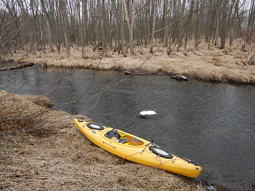
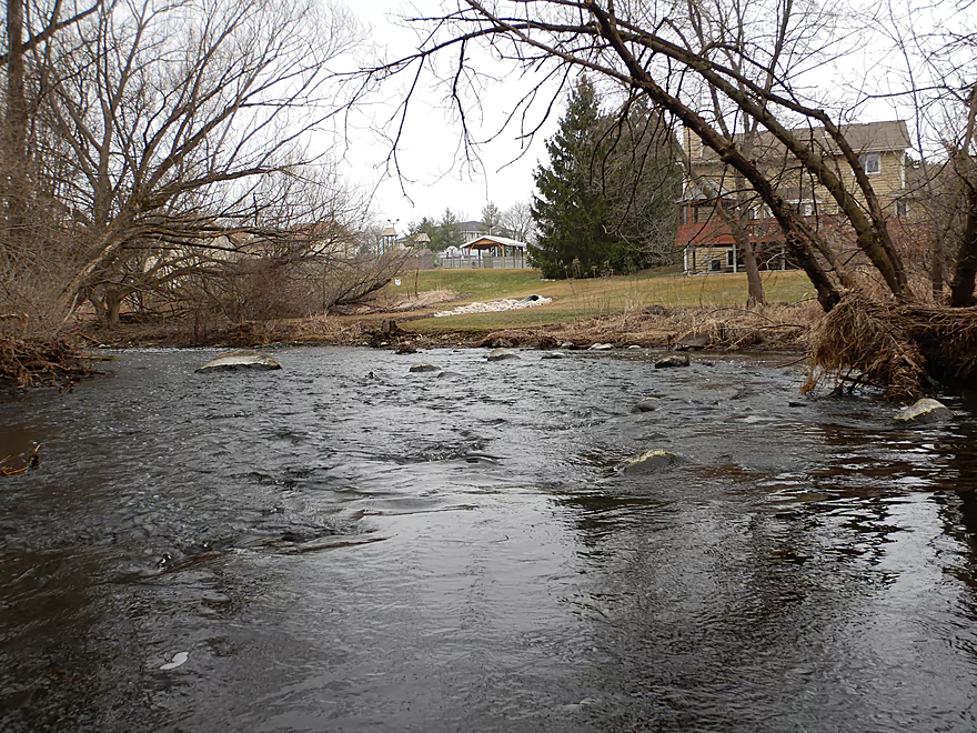
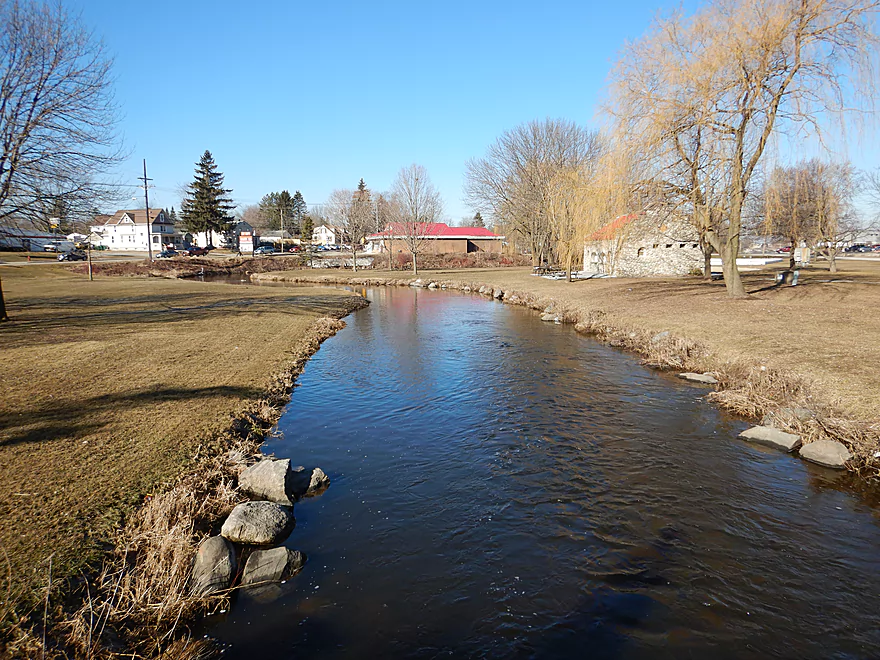
Nice put-in area by Hilldale Drive
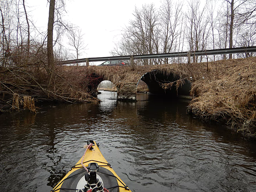
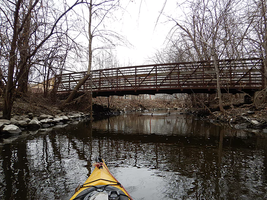
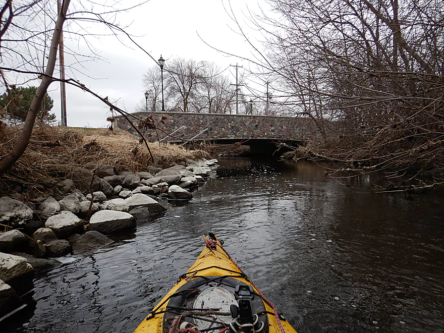
Paddling under the bridge
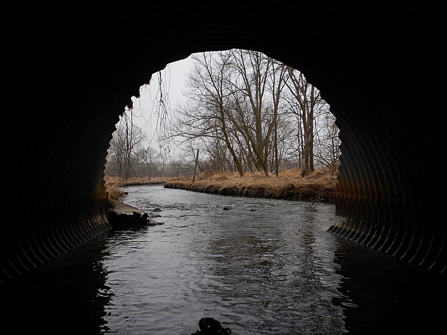
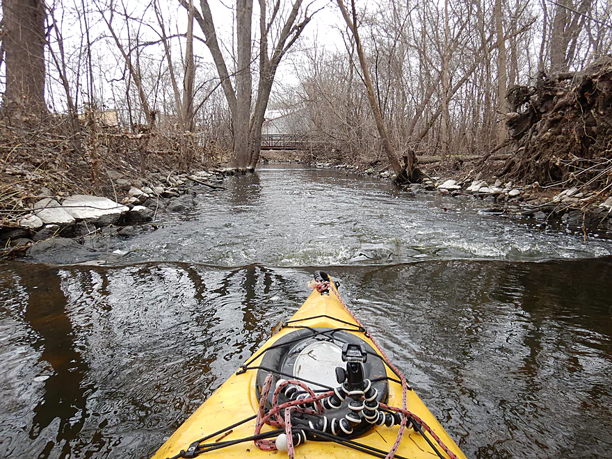
Framed view
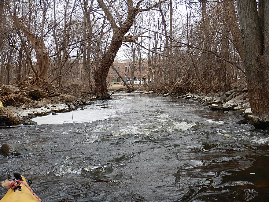
Some light rapids
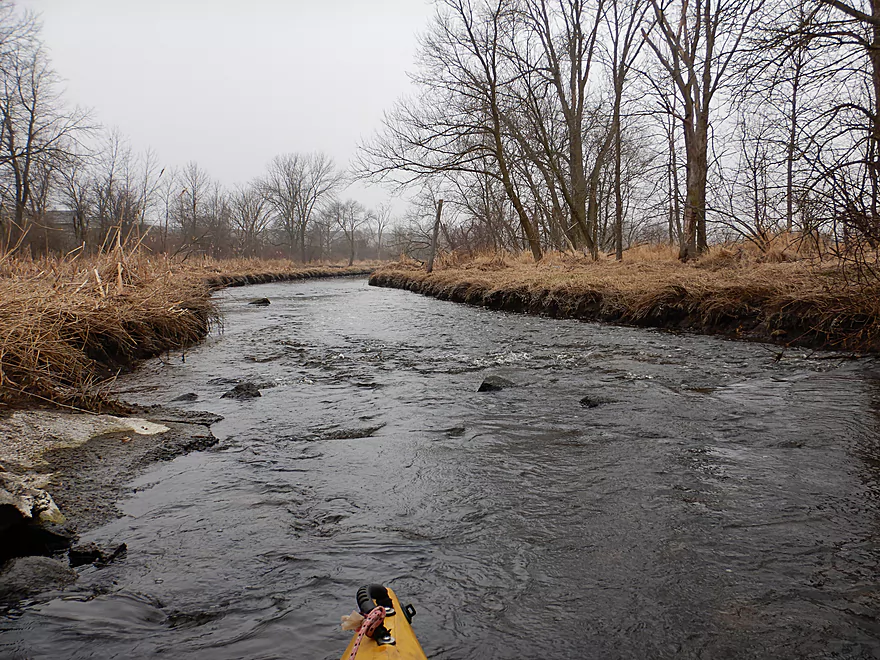
Very shallow
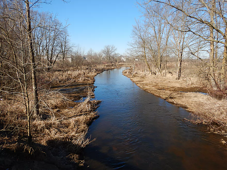
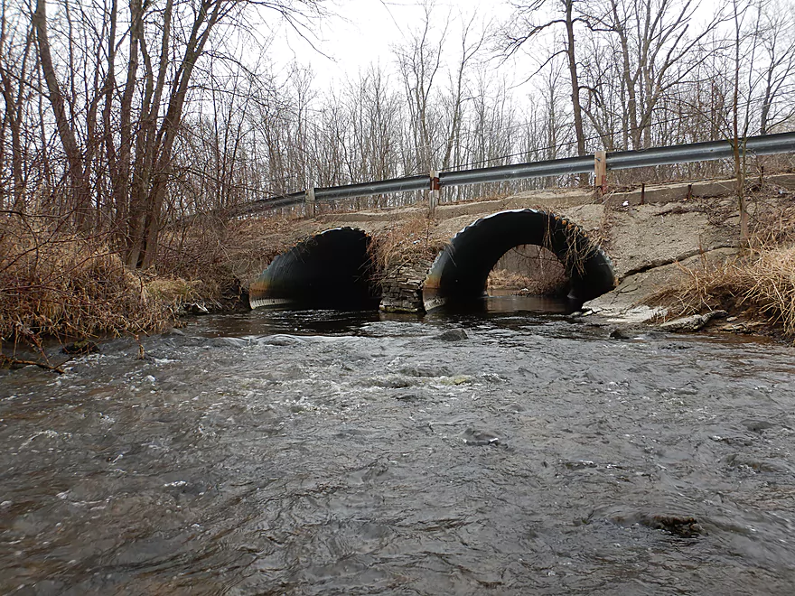
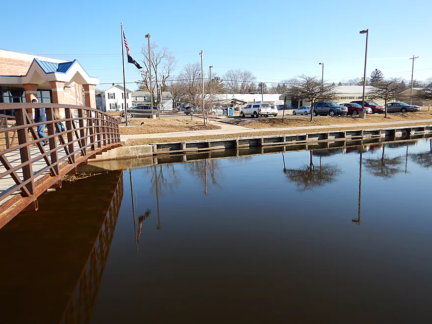
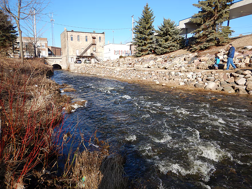
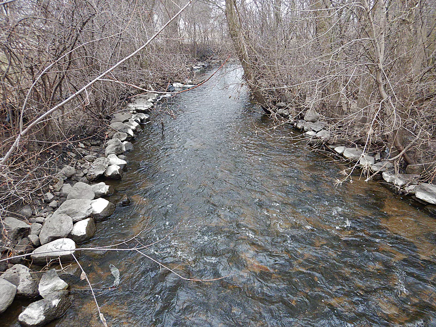
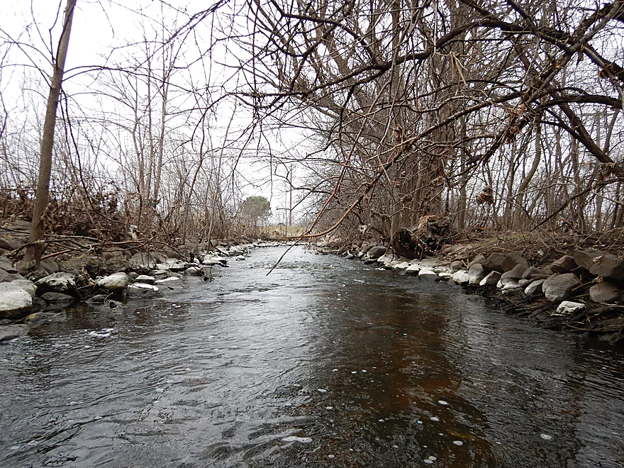
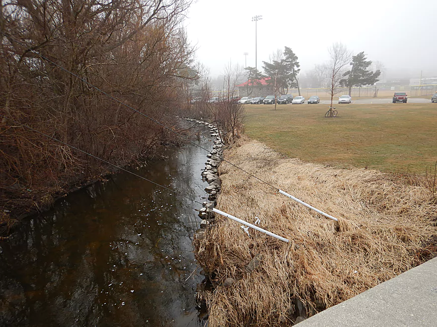
View from bridge
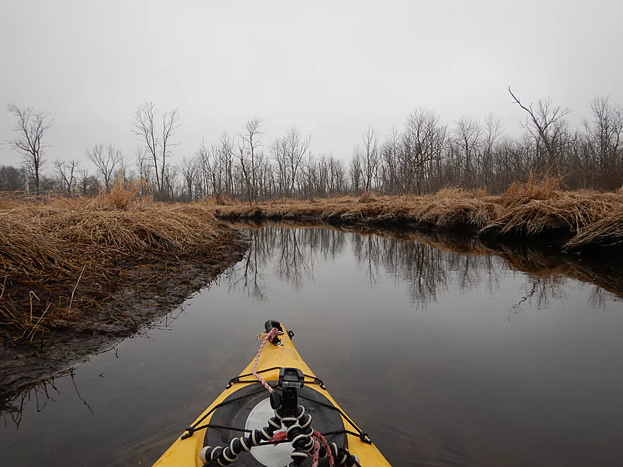
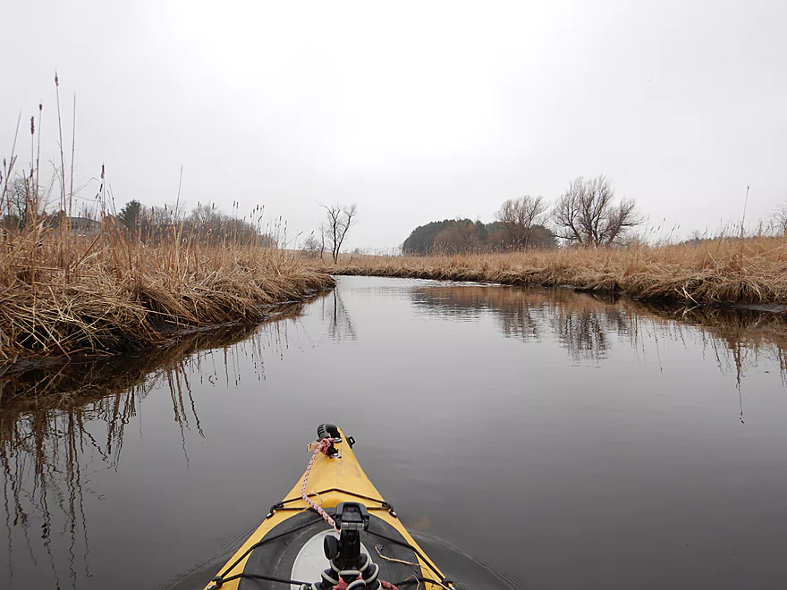
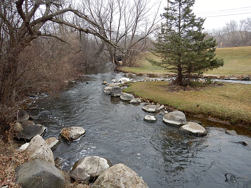
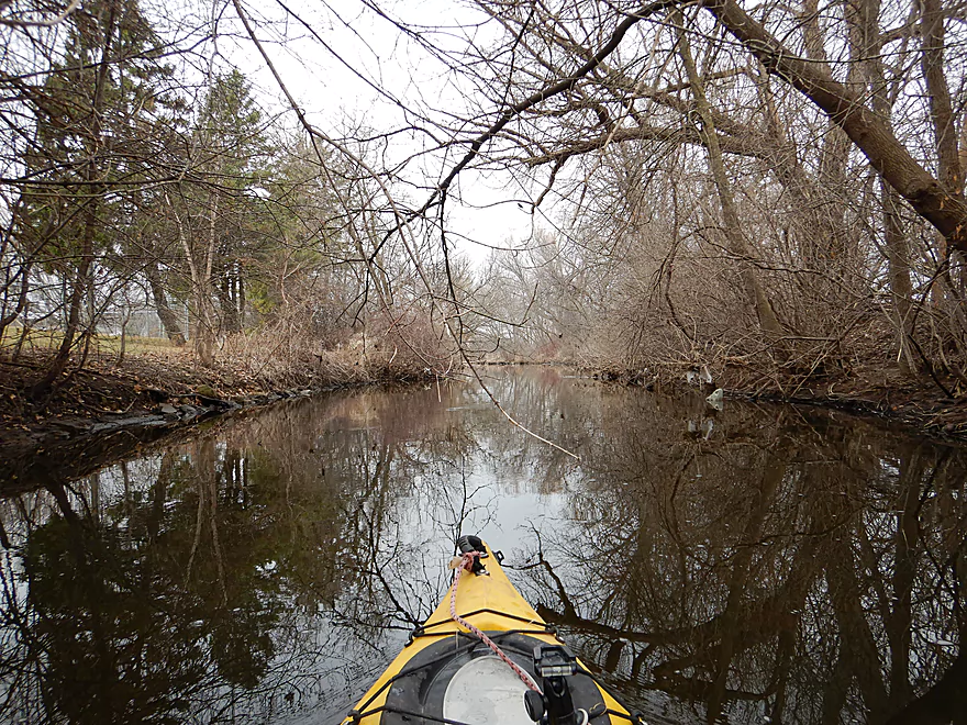
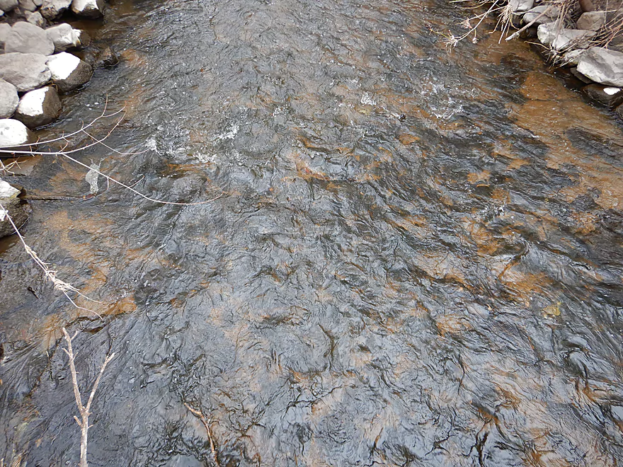
The first mile flows through a marsh
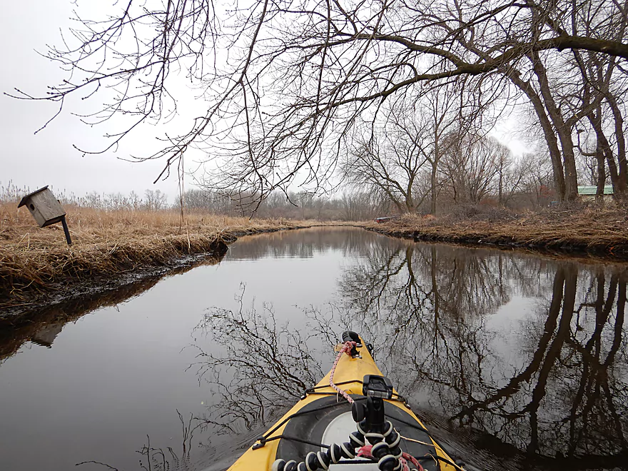
It’s been beat up by floods, but is still nice
Lot of cattails
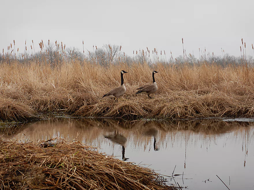
Pair of geese guarding their nest
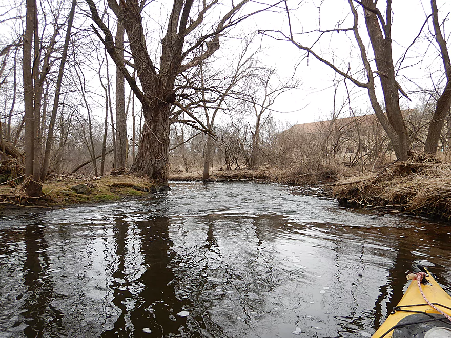
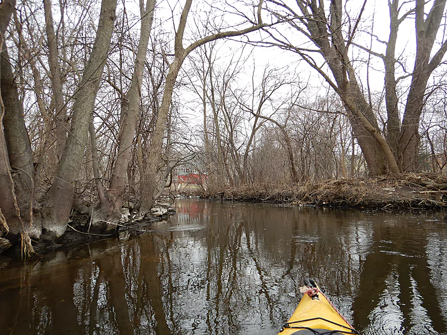
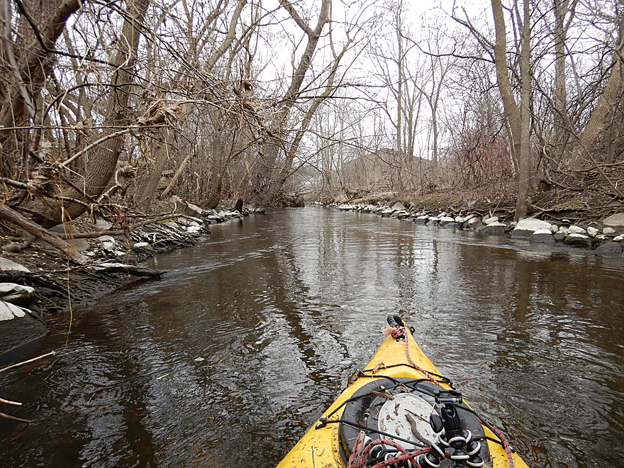
Very peaceful section
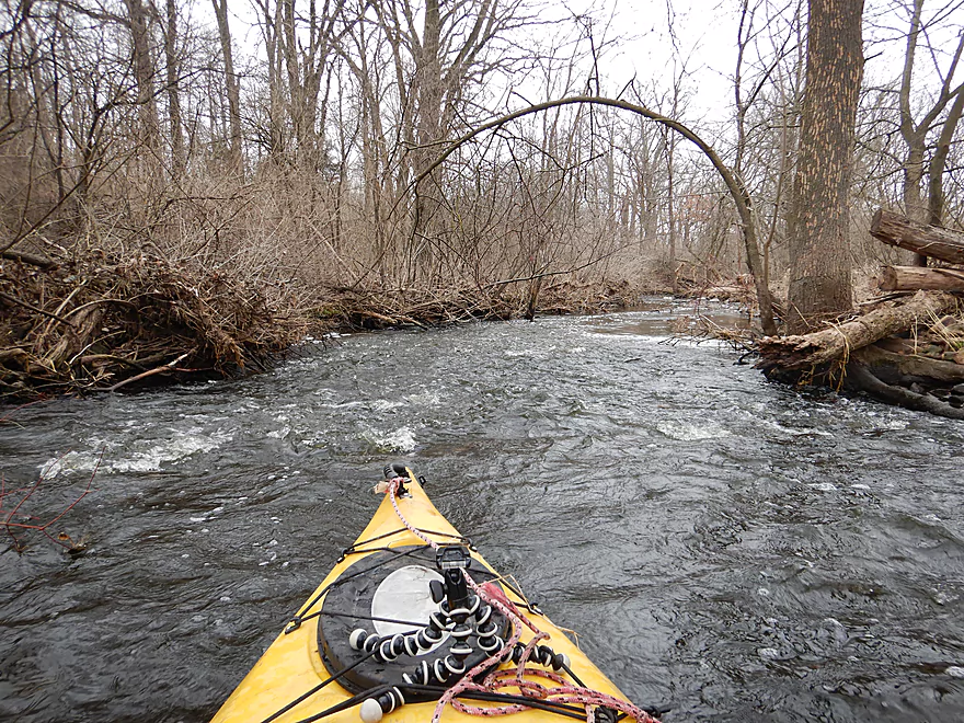
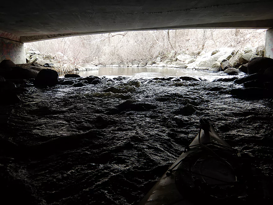
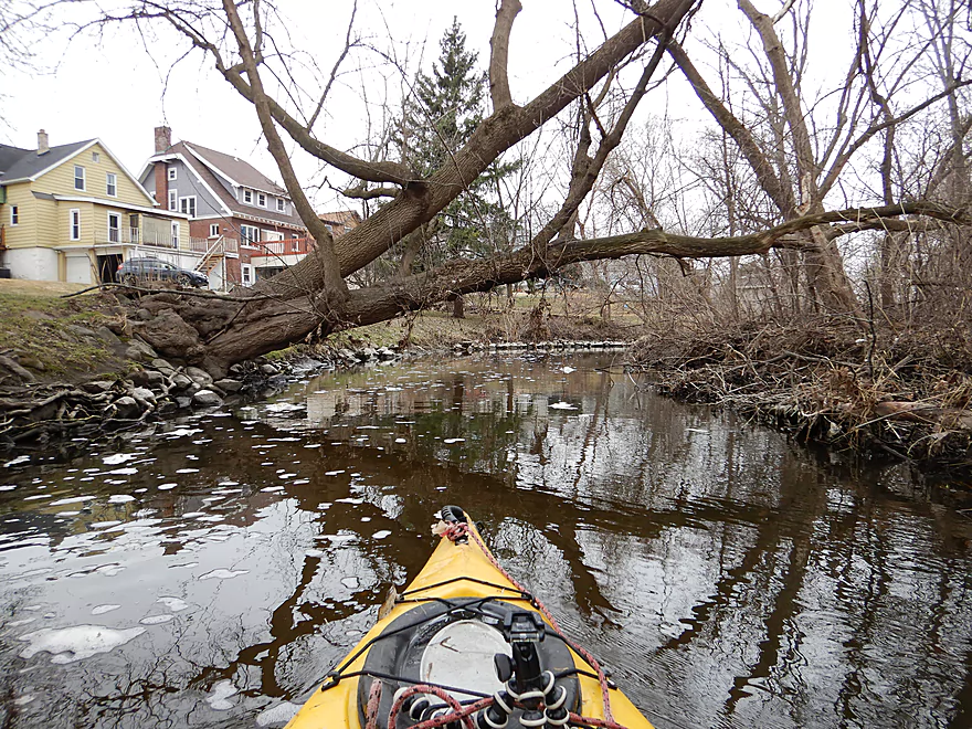
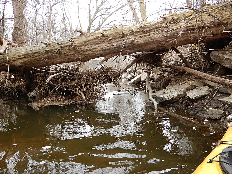
I barely fit under that
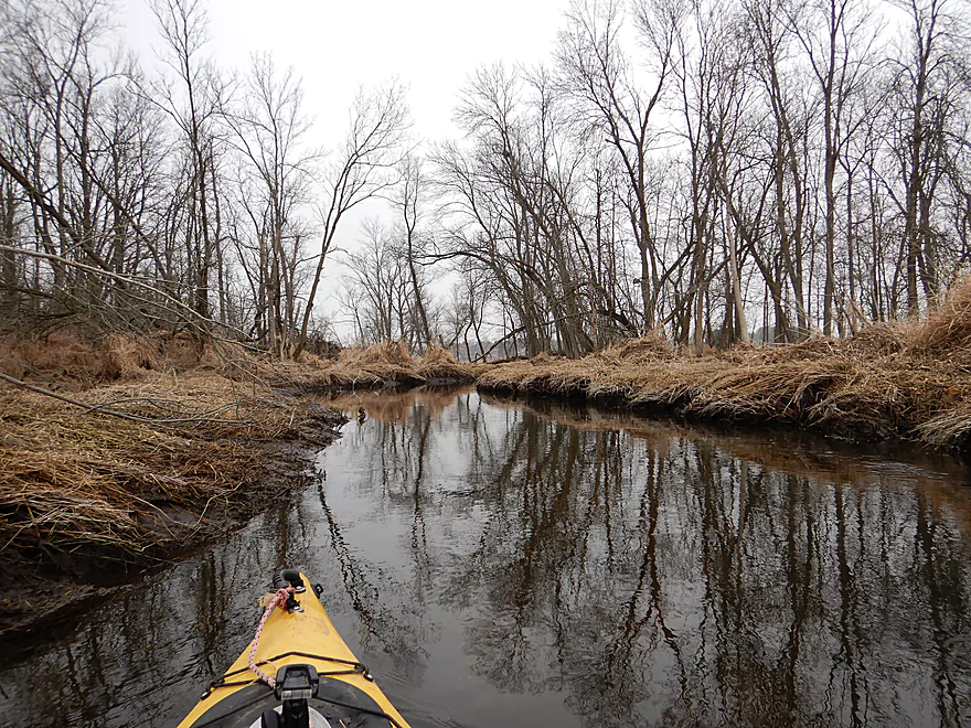
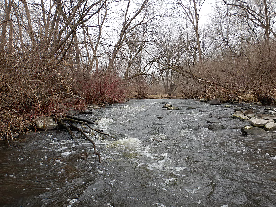
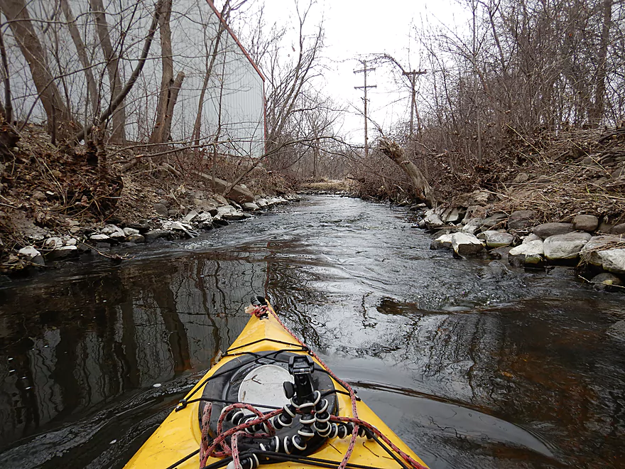
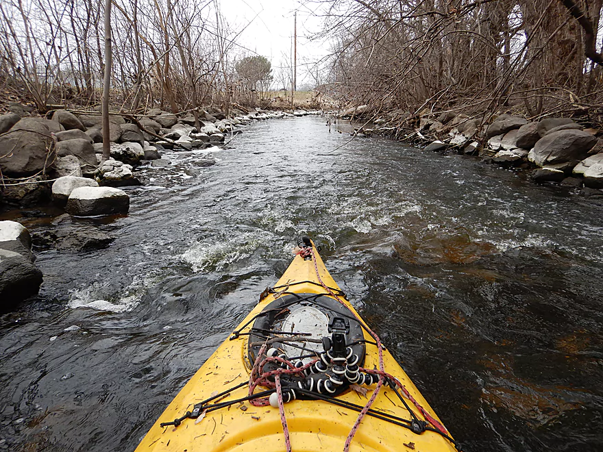
No more marsh…start to see more rapids now
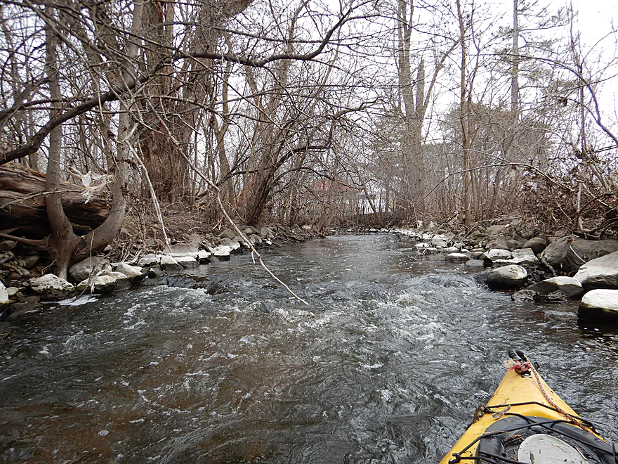
Lot of fun
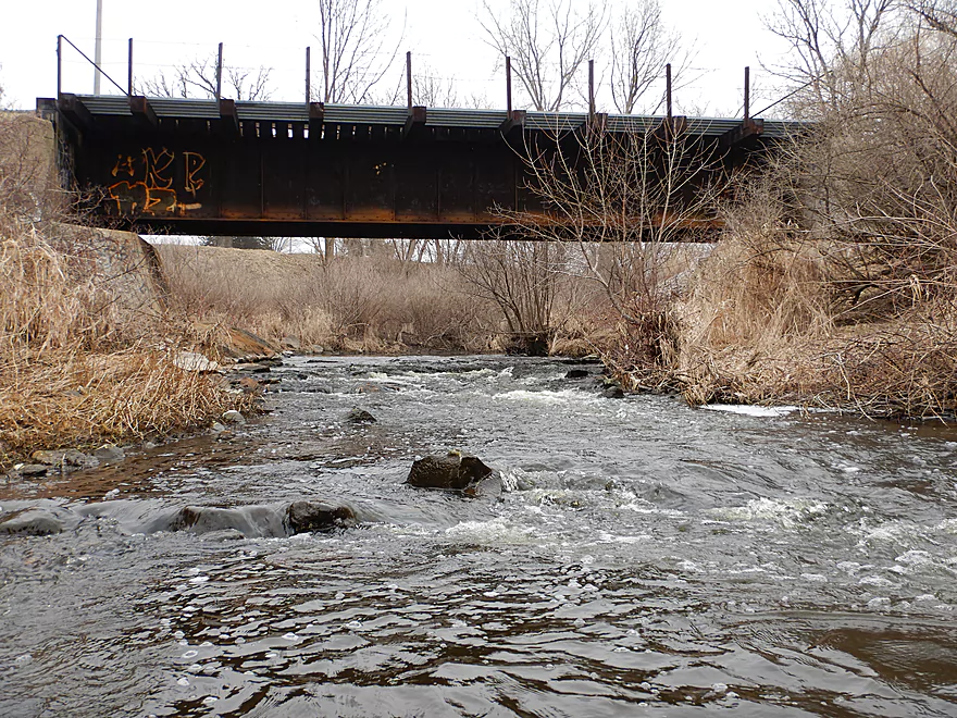
Some of the stronger rapids are under the railroad bridge
Some tricky rapids because of that branch on the right
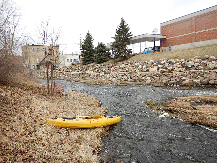
I moved it somewhat…reverse view
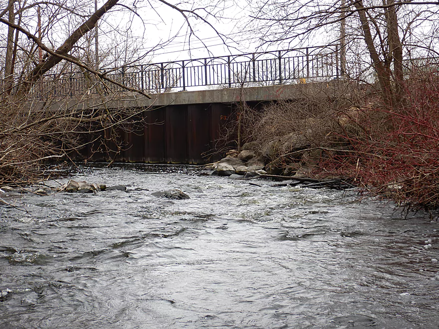
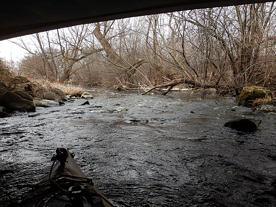
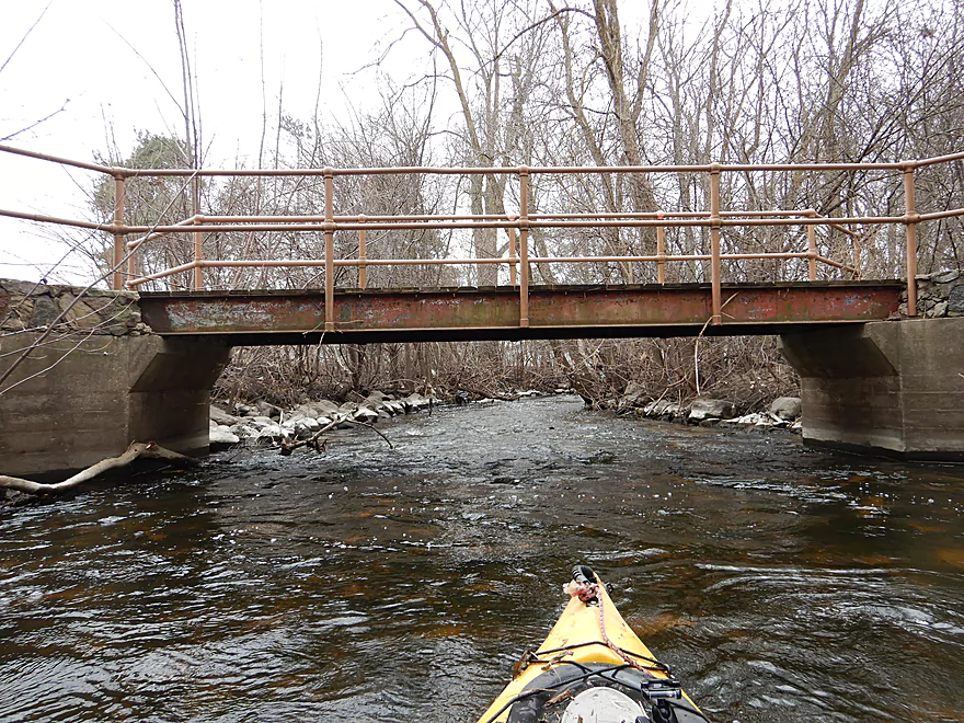
Coming up on Wilson Ave
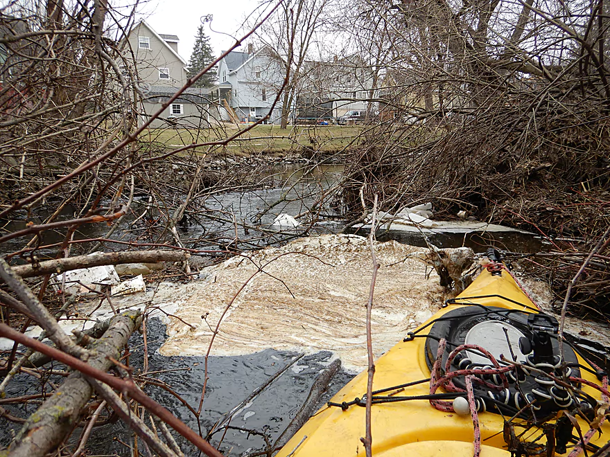
Which has a surprise hiding under it
These rapids were very shallow
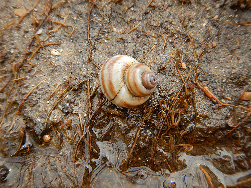
Lot of snails
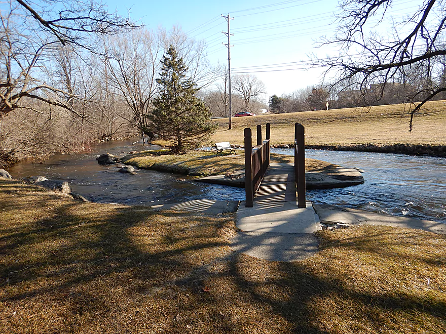
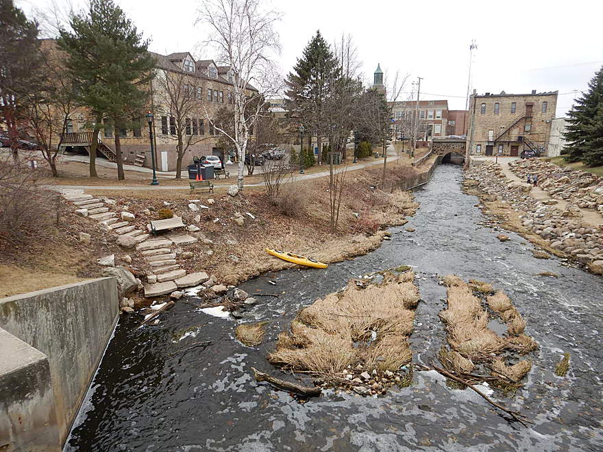
Coming up on a cool little island
Has an up-North vibe
Reverse view
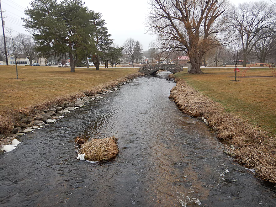
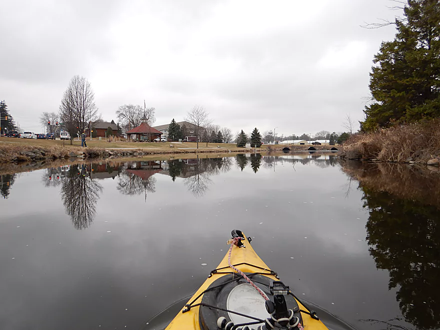
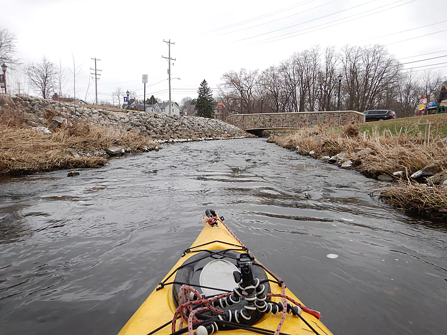
Entering Willowbrook Park which has several attractive bridges
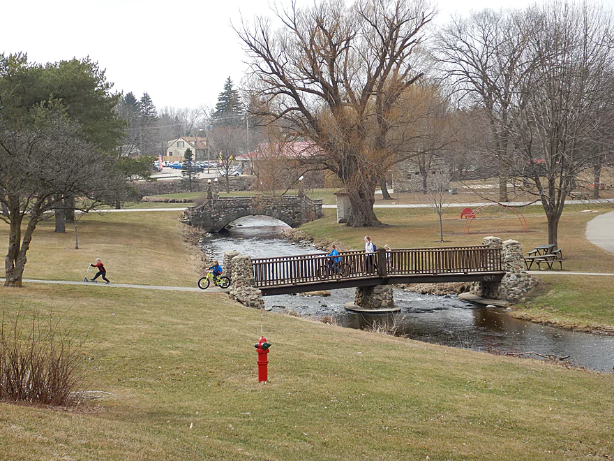
Great park
And scenic section
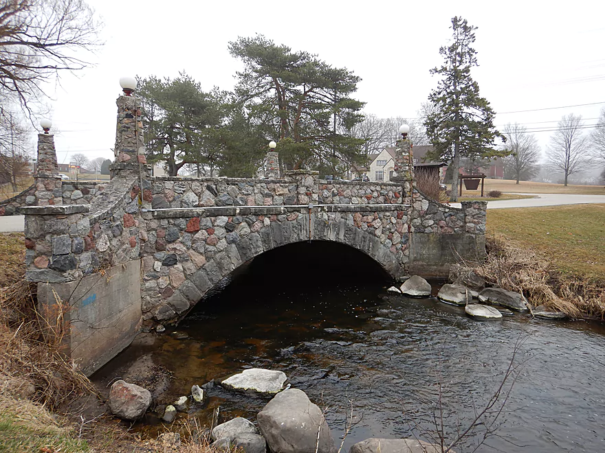
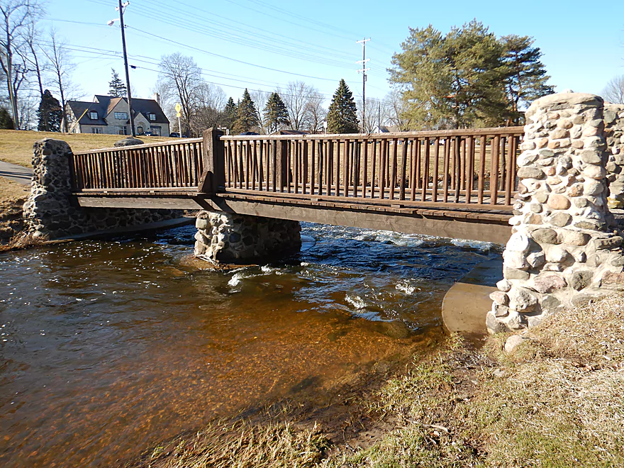
Fantastic stonework
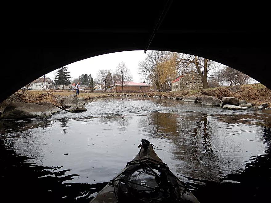
Paddling under
View upstream
View downstream
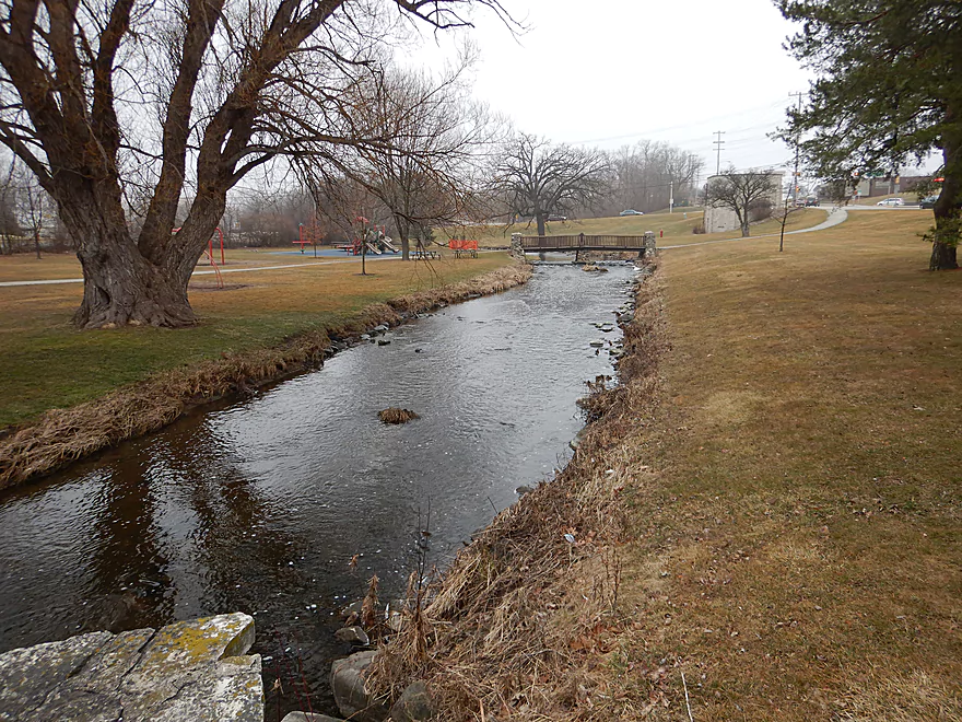
Paddling through Rotary Park
River starts to slow and widen
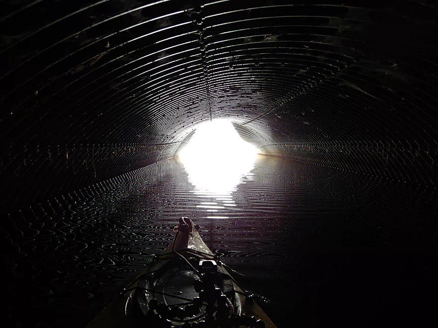
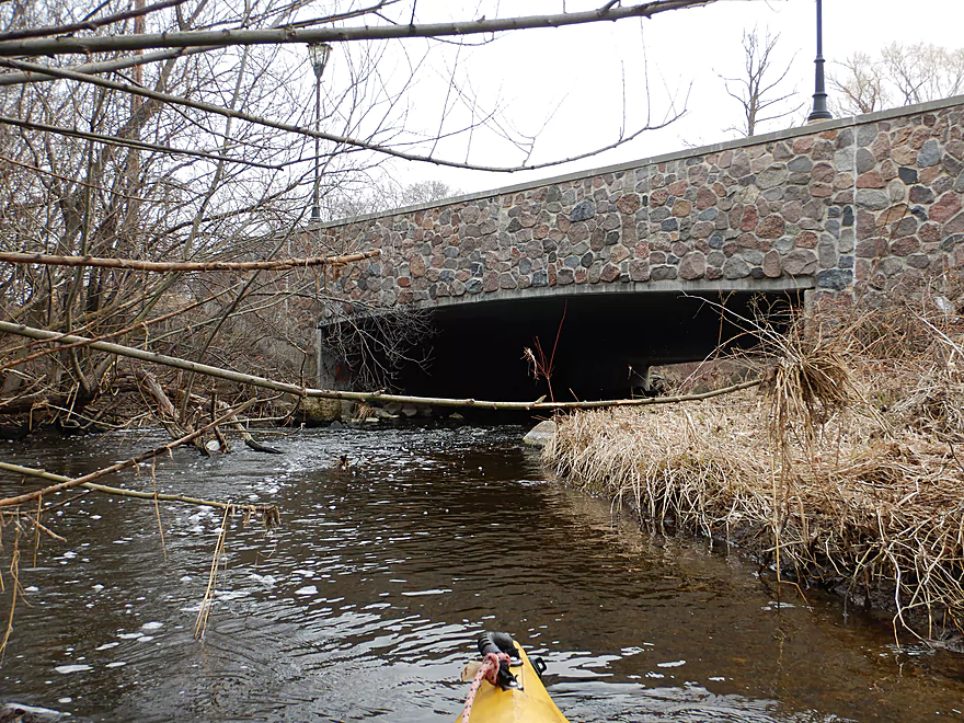
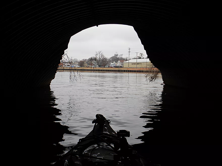
Fun tunnel under 4th Street
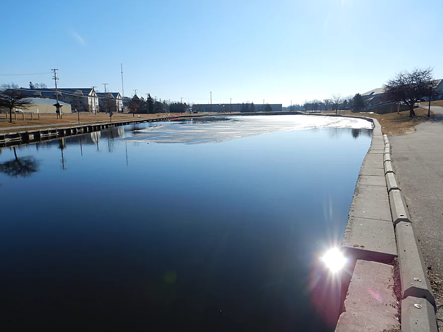
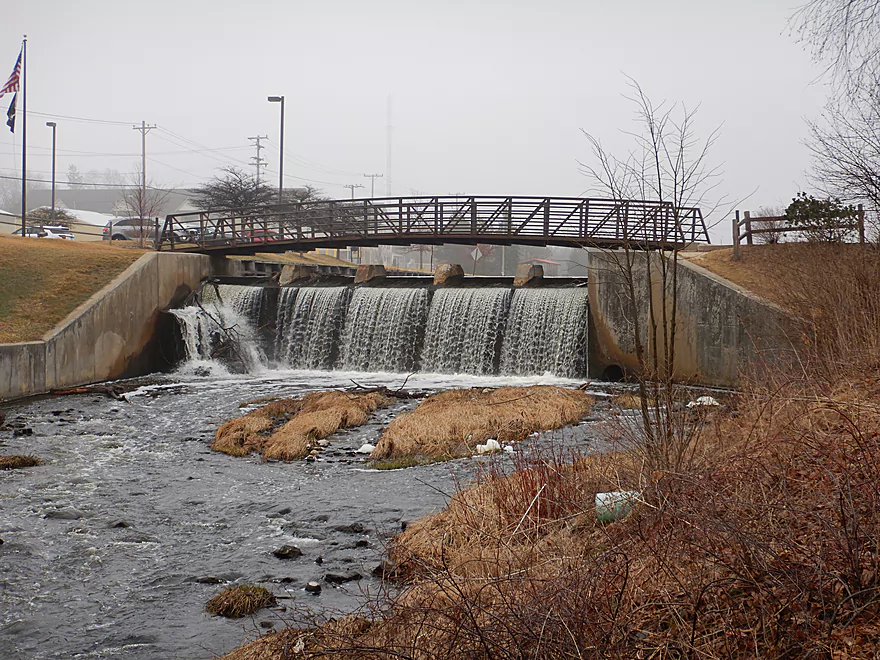
Now on the Hartford Millpond
Created by this dam
I portaged by those boards
Striking view from the dam walk bridge
Very easy to re-enter
A series of rapids below the dam
Reverse view of the dam itself
I got stuck in the shallow rapids
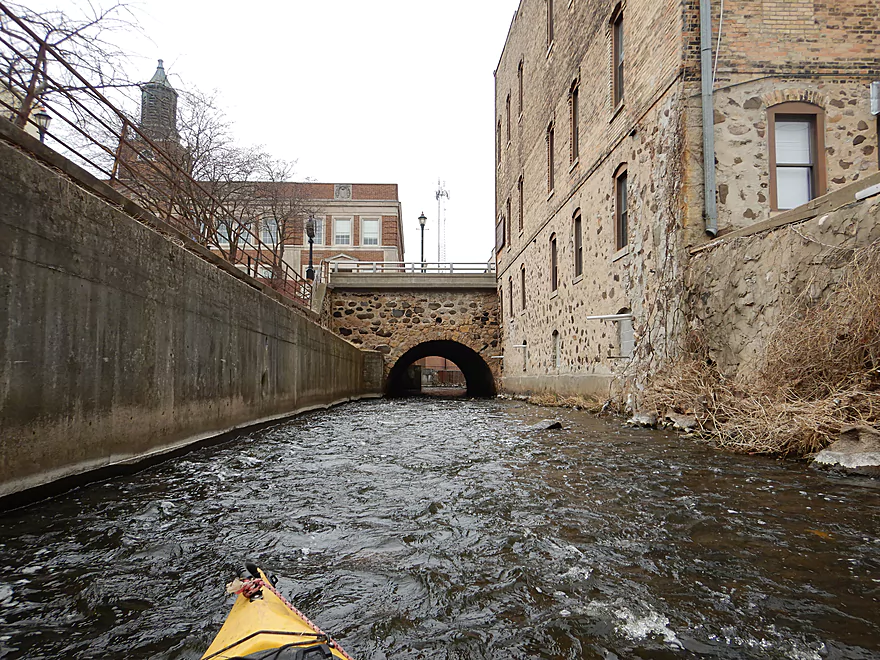
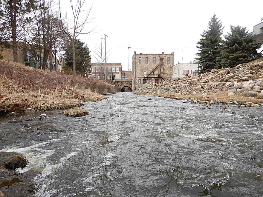
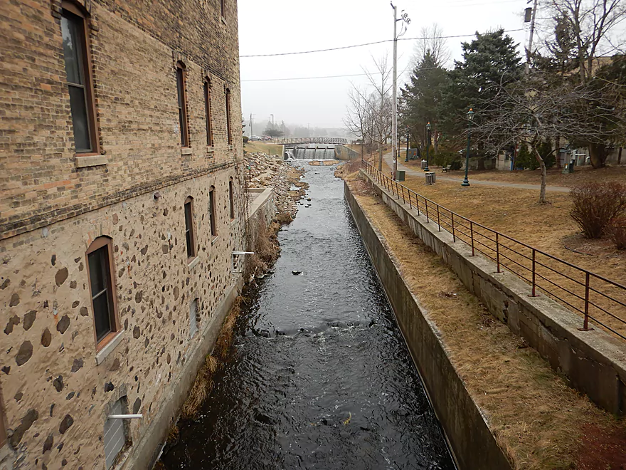
Approaching the downtown
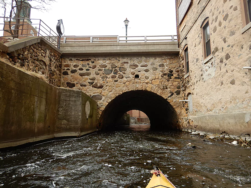
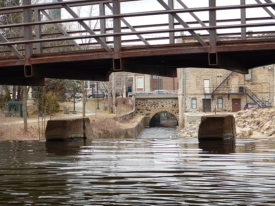
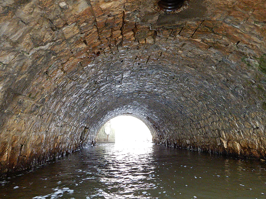
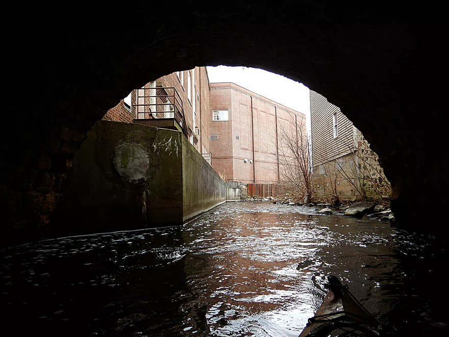
Fantastic stone tunnel under Main Street
Looking back from the Main Street bridge
Continuing on
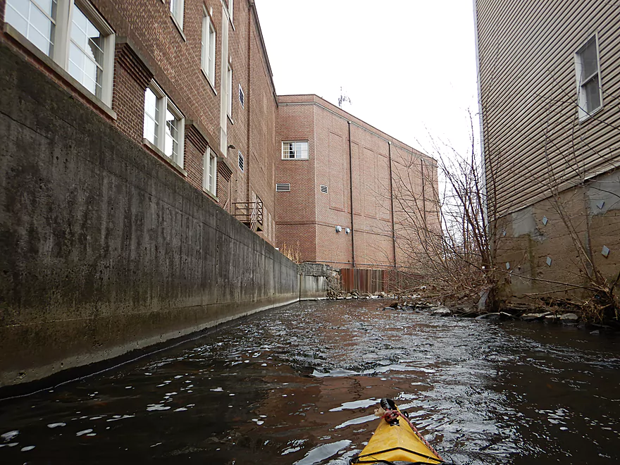
The tall buildings create a canyon-like effect
Without the dam, the river stays fast
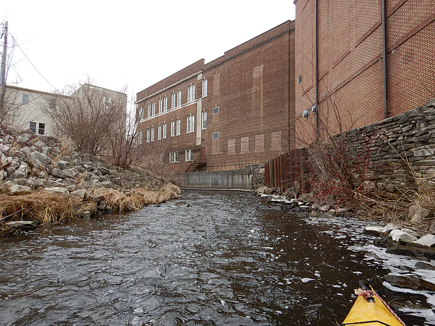
Looking back at the police station and townhall
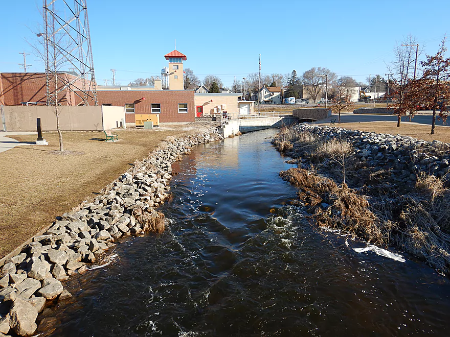
Paddling past the fire station
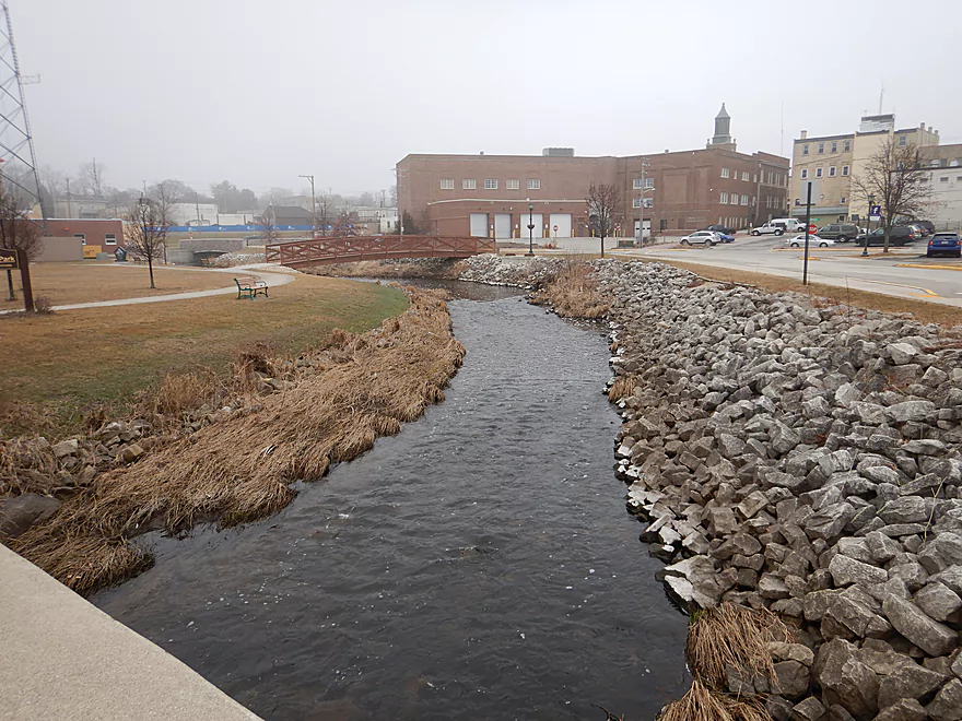
A month ago much of this area was filled with foam
Paddling past Bernd Park
Entering a wooded section
Some snags, but always a way through
Lots more rapids
The pedestrian bridges were very handy for the bike shuttle
I think those white stains are from the last month’s foam outbreak
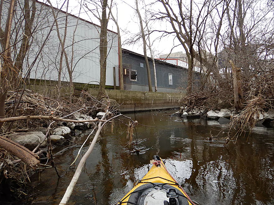
Paddling past a large factory (maybe a tannery)
A trickier logjam…but I fit
The white rocks give this section a unique character
Another pedestrian bridge
Scenic view from atop
Great clarity
On the home stretch
Last rapids
Reverse view
Ending the trip at Grant Street
West Side Park is nearby…great access
Rubicon River


The Rubicon is a small tributary of the Rock River located along the terminal moraine in southeast Wisconsin. My initial plan was to start the trip at Pike Lake State Park, but the logjams between Hwy 60 and Hilldale Drive seemed concerning, so I settled for launching at Hilldale Road instead. The first 1.5 miles flowed through a simple cattail marsh with no hazards or obstructions. Not exactly a super exciting section, but with all the spring birds singing in the marsh it had its moments.
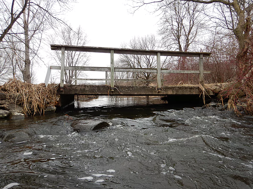
The marsh gradually gave way to a cluster of residential developments which marked the start of Hartford. Here I encountered a super, super low trail bridge that took some serious squeaking to fit under…and in hindsight I should have portaged. The channel became rockier with occasional rapids that were a lot of fun. I soon paddled under the railroad bridge, which contained perhaps the strongest rapids of the trip. This was followed by several more rapids including some hidden directly under Wilson Ave.
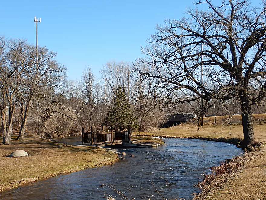
After this, the river opened up and flowed past the first of a series of parks, starting with Willowbrook. This was a very photogenic park because of its stone bridges and an artificial island flanked by boulders and light rapids.
By Rotary Park, the channel slowed significantly, and then by 4th Street tunnel it sprawled out into the Hartford Millpond. This was a mini-flowage created by a dam which I was slightly worried about portaging because there are no natural ramps just upstream of it. But just south of the post office there were exposed boards along the retaining wall which made for a decent make-shift dock landing. I then crossed the dam (with my boat) over a pedestrian boardwalk and re-entered on the southwest side by the library…which was very easy.
The dam area was very striking and the highlight of the entire trip. Below it there are almost continuous light rapids that are flanked by tall buildings. Then the channel disappears under a majestic stone arch tunnel that runs under Main Street. This area is very popular with locals as it is within a triangle connecting the library, post office and downtown, and contains several great hiking trails. Some of the hikers got to watch me portage the dam and then “paddle” the subsequent rapids…but as it was shallow I had to bump my way down which was embarrassing.
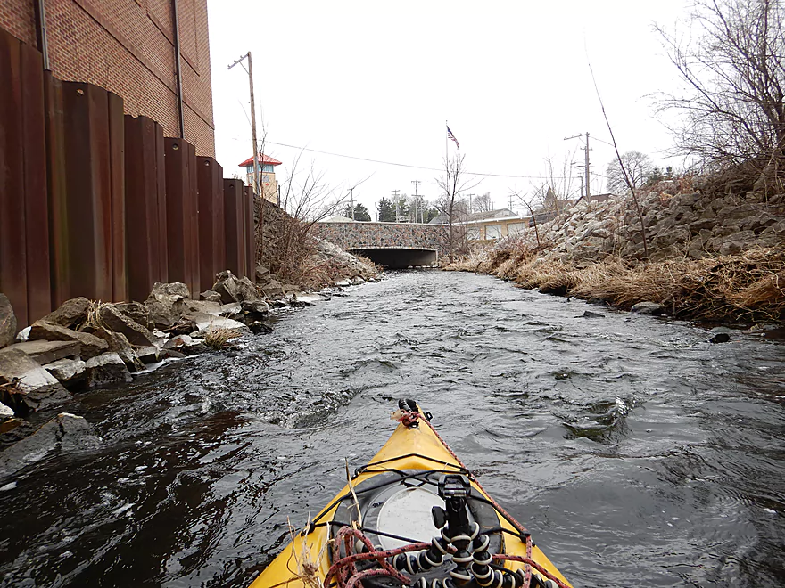
After Main Street, the river continued quickly along heavily ripped-rapped shoreline, past the fire station, through several more attractive parks, and under more attractive bridges. Many of these locations would be suitable take-outs or put-ins. It was by the fire station where a MASSIVE foam buildup occurred last month that made the local news. Cool video.
Following Rural Street, the river then left the downtown behind as it entered a dense canopy of urban woods. This was a very narrow section, but fantastic because of the good current, good clarity, occasional rapids, and overhanging trees, which created a tunnel-like experience. After a sharp turn north, the river then flowed by a large industrial complex (I think it was a tannery). It was there I encountered several downed trees. Some ducking and dodging was required, but I was always able to get through without portaging. This was followed by West Side Park, which was a great take-out.
In summary this was an exploratory Ice Age paddle that turned out surprisingly well. I was shocked that I never had to portage a logjam and how scenic the river was for being such an urban paddle. On the down side, most of the rapids were on the shallow side and I would have preferred more padding. It would be great to see the locals take an interest in sprucing this river up as there was trash and log debris in the channel (especially between Rural Street and West Side Park). My only regret was that I took out too soon, and in hindsight wish I had continued a few more miles to Hwy 60 where I know there would have been more good paddling to be had.
…
2024-05-25 update from a reader: From Wacker Dr to Liberty Avenue there are now over half a dozen log jams that seriously impede paddlers. None were easy portages due to the thickets of vegetation and steep banks. Unfortunately, now almost the entirety of the Hartford section of the Rubicon is not worth paddling and is impassable with dead ash, willows, and boxelder.
Many geese, ducks, snails, and one cat relaxing by the leather factory. A local told me carp could be a problem. I never saw any, but did see suspicious bubble trails that veered away from my boat. The highlight were the many red-wing blackbirds singing in the marsh.
I started the trip at Hilldale Drive, which was a decent bridge access option.
An alternate put-in 1.7 miles downstream would be at Willowbrook Park. This would cut out much of the wetgrass paddling, but also some of the best and strongest rapids.
I took out at West Side Park which is an excellent paddling access. You could disembark at the walk bridge or by Grant Street (I did the latter to slightly extend the trip). Public parking and outhouses are available in the park.
There are many alternate take-out options (see overview map for ideas). IMO the best take-out idea would be 3.5 miles downstream at Hwy 60. This would include some very nice parts of the river and make the total trip length 6.5 miles.
The bike shuttle was really easy and only 2.7 miles. Note, Google’s suggested bike route is bad…it goes along Hwy 60 which is busy, noisy, and congested. Instead I suggest hugging the river and park properties where there are several obscure bike trails and bridges that are much more enjoyable and scenic.
Logjams: I never had to portage a logjam, but there were several snags between Rural St. and Grant St. that took some creativity to get through. I broke a few branches so hopefully future paddlers can get through easier.
In 2023 a paddler reported multiple serious jams in this stretch. Taking out at Rural Street is now recommended unless you scout the downstream leg.
2024-05-25 update from a reader: From Wacker Dr to Liberty Avenue there are now over half a dozen log jams that seriously impede paddlers. None were easy portages due to the thickets of vegetation and steep banks. Unfortunately, now almost the entirety of the Hartford section of the Rubicon is not worth paddling and is impassable with dead ash, willows, and boxelder.
Current: The first 1.5 miles flowed through a wetgrass marsh where the current was slow. By the railroad bridge, the current sped up dramatically for a short section of rapids, but then slowed after Willlowbrook Park because of the dam. After the dam and up to the take-out, the current was very fast with multiple light rapids..
Low Bridges: All the bridges were easy to get under with just two exceptions.
- A residential trail bridge was way too low and must be portaged. Easily done.
- There is a park bridge in Willowbrook Park that is low. But as this is on an island, you merely need to take the other island channel to get around it.
Rapids: Outside of the flowage and marsh, Class 1 rapids were a frequent feature of the trip. While none were over Class 1, there are several stronger sets just upstream of Willowbrook Park that could be Class 2 or higher during high flow rates. What could make them tricky (in high water) is the fact that the channel is narrow and there are protruding branches hanging over the river. This could make it tricky to maneuver.
The rapids directly under Wilson Ave are somewhat noteworthy. Because of the lack of light, it can be tricky to see them (it’s not that bad though).
The largest rapids are likely under the railroad bridge, but I thought these were pretty easy.
This is a shallow river that will require above normal flow rates to be navigable. But note, the put-in is THE shallowest part of the entire river so don’t be discouraged if you hit a few rocks there. I’m using the Bark River gauge as a reference.
- < 50 CFS: Likely too shallow.
- 51-65 CFS: A very shallow depth where most of the rapids are very bumpy. I did the trip at 55 CFS and had a good time, but I did get hung up multiple times.
- 66-80 CFS: Maybe some bumpy rapids, but likely a good target depth.
- 81-95 CFS: A high depth in which some banks will be overflowing. Some rapids may be much more stronger and difficult at these levels.
- 96+ CFS: Perhaps too high to run? I don’t know.
Just upstream of my put-in, the Rubicon River sprawls out as a large Kettle Lake. Under Hwy 60 is a dam that maintains stable lake levels. Along the eastern shore is Pike Lake State Park. Park highlights include a beach area, campground, hiking trails, an overlook tower, and attractive ski trails. Part of what makes this area unique is that it is part of the glacial terminal moraine which left behind many unique geological features. This is not a super exotic park (unlike other Kettle Moraine Forest Units) but is likely worth checking out if you’re a local.
Detailed Overview
- Beach at Pike Lake State Park to Hwy 60: 1.1 miles. This is a large lake. The northern shoreline along the state park boundary might be nice.
- Hwy 60 to Hilldale Drive: 0.9 miles. Maybe 7 logjams. Very congested. Hwy 60 is a poor access option and poor dam portage.
- Hilldale Drive to West Side Park: 3.0 miles.
- Hilldale Drive to Willowbrook Park: 1.7 miles. Mostly an open and simple wetgrass paddle. There are several Class 1 rapids above the railroad bridge and several strong Class 1 rapids below it. One low walk bridge will have to be portaged.
- Willowbrook Park to Post Office/Library/Dam: 0.6 miles. Mostly open flowage paddling, but some light rapids by Willowbrook Park. The park area and its bridges are quite striking.
- Dam to Jordan Park/Rural St: 0.2 miles. A very scenic urban paddle through downtown Hartford.
- Jordan Park to West Side Park: 0.5 miles. Cool section. Very narrow and rocky with several light rapids. Mostly wooded, but goes by some industry. Some snags, but I didn’t have to portage. Note in 2023 a paddler reported multiple serious jams in this stretch. Taking out at Rural Street is now recommended unless you scout the downstream leg.
- West Side Park to Hwy 60: 3.5 miles.
- West Side Park to Wacker Drive: 0.2 miles. A short section through an industrial stretch. Some deadfall to dodge.
- Wacker Drive to Liberty Ave/Sewage Plant: 1.5 miles. Starts with a wooded section with a lot of deadfall and two logjams that have to be portaged. After that the river opens up. As of 2024 this stretch has filled in with logjams. It is not recommended.
- Liberty Ave to Goodland Road: 1.3 miles. A rocky section with multiple sets of rapids.
- Goodland Road to Hwy 60: 0.5 miles. Neat section with fast current.
- Hwy 60 to Pond Road: 1.9 miles. Maybe 7 logjams mostly in the first half. The second half of this leg looks really scenic though. Parking at Pond Road looks steep and difficult.
- Pond Road to Saylesville Road: 1.4 miles. Good prospect with a lot of rocks. Maybe one logjam.
- Saylesville Road to Resthaven Road: 2.0 miles. Interesting prospect that is very rocky. Maybe 3-4 logjams.
- Resthaven Road to Hwy P: 2.3 miles. Maybe 4-5 logjams. Very scenic.
- Hwy P to Jefferson Road: 2.0 miles. Maybe 5 logjams.
- Jefferson Road to Hale Road: 4.4 miles.
- Jefferson Road to Woodlawn Park: 2.6 miles. Slow, muddy stretch through mostly impounded and carp infested waters. Neosho Millpond features some motorboat traffic and shoreline development.
- Woodlawn Park to Neosha Dam Fishing Access: 0.3 miles. Short leg on the flowage. Portage is a bit tricky because of a guardrail and medium busy road.
- Neosha Dam Fishing Access to Hale Road: 1.5 miles. A great stretch with some light rapids, boulder gardens, and nice woods. 2024 update...After the dam, there are massive white poplar trees toppled over into the river forcing two difficult portages through a hunting stand in thick brush.
- Hale Road to Hwy EE: 5.6 miles. Maybe over 30 logjams.
- Hwy EE to Mouth on Rock River: 3.5 miles. Reviewed by Rick Kark (critically).
- Hwy EE to Pike Road Pull-off/Creek Bridge: 1.5 miles. Somewhat open, but still ~4 logjams.
- Pike Road to Rock River: 2.0 miles. Floodbottom forest. Maybe 20 logjams.
- Mouth to Elmwood Road: 0.3 miles. Short easy stretch on the Rock River.
Trip Map
Overview Map
Video
Photos Size:
I tried combining both Rubicon River trips you reviewed today (04/22/23) through Hartford. The first trip for the most part (from Hilldale Dr. to N. Rural Road) was great. I really enjoyed the sections going under the bridges downtown and the rapids after putting in in front of the dam. However, I cannot recommend trying to kayak from N Rural st. through to Wacker Drive. This section is extremely overgrown with Buckthorn & Boxelder thickets, with numerous logjams. Portaging around the industrial complex was difficult given the growth of the vegetation into the stream.
Behind West Side Park was the worst strainer I have seen, a sturdy downed Willow tree at chest height completely across the water. At 63 CFS (Bark River gauge) the river was moving quickly enough and there is little time to react without capsizing or hitting this in the chest. The banks are also too steep to get out of the boat without plunging into chest deep water. Nature is reclaiming the river. I’d recommend editing the first trip details to stopping at N. Rural Road for leg 1, and then starting the second section again at Wacker Dr. Although that isn’t a great portage with rocky embankments.
Thanks for the comments and the very valuable information. I’ll update the review to warn other paddlers.
Hi Aaron, I paddled this stretch last night at 42 CFS. From Wacker Dr to Liberty Avenue there are now over half a dozen log jams that seriously impede paddlers. None were easy portages due to the thickets of vegetation and steep banks. Unfortunately, now almost the entirety of the Hartford section of the Rubicon is not worth paddling and is impassable with dead ash, willows, and boxelder. It’s surprising that at one point you enjoyed this trip, so I’m not sure why deadfall is no longer being managed.
The stretch from Liberty Ave to Hwy 60 saved the trip, and I really enjoyed how the current picked up. However, I wouldn’t run this again at 42cfs as I dragged on the rocks a lot. There is also a newer metal pedestrian bridge right at the sweet spot of the class II rapids where the river corners and heads south that is ripe for collisions with kayaks.
I’m curious about heading south of 60 towards pond road, but not sure it’s worth my effort. Are you mainly looking at Google Earth to scout log jams? I’m not sure it could be worse than the prior industrial section is now.
Thanks Gregor for the warning. I’ll post an update to the review on this. 60 to Pond Road looks bad. Yes, I’m mostly using satellite images…but I’m getting a bad vibe from it and would advice avoiding it. If you do this let us know how it turns out.