
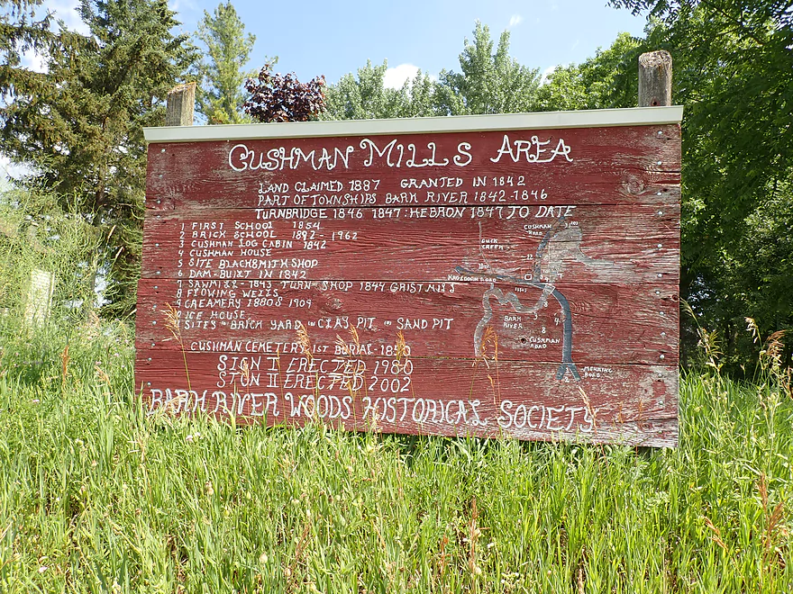
Starting the trip at the former Cushman Mill
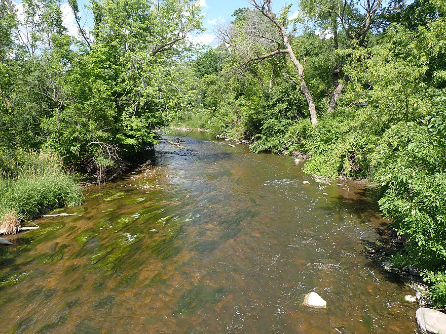
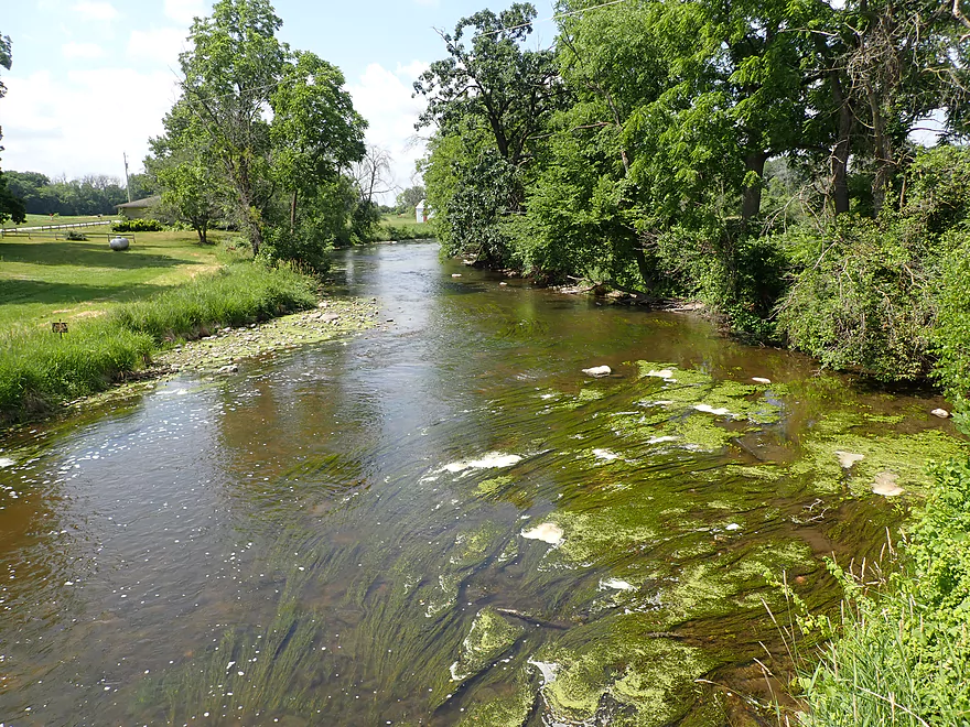
Nice view upstream from bridge
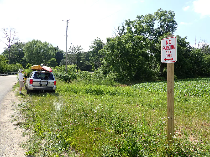
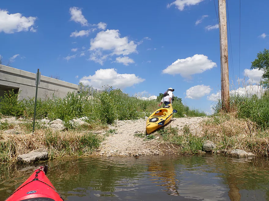
Horrible put-in
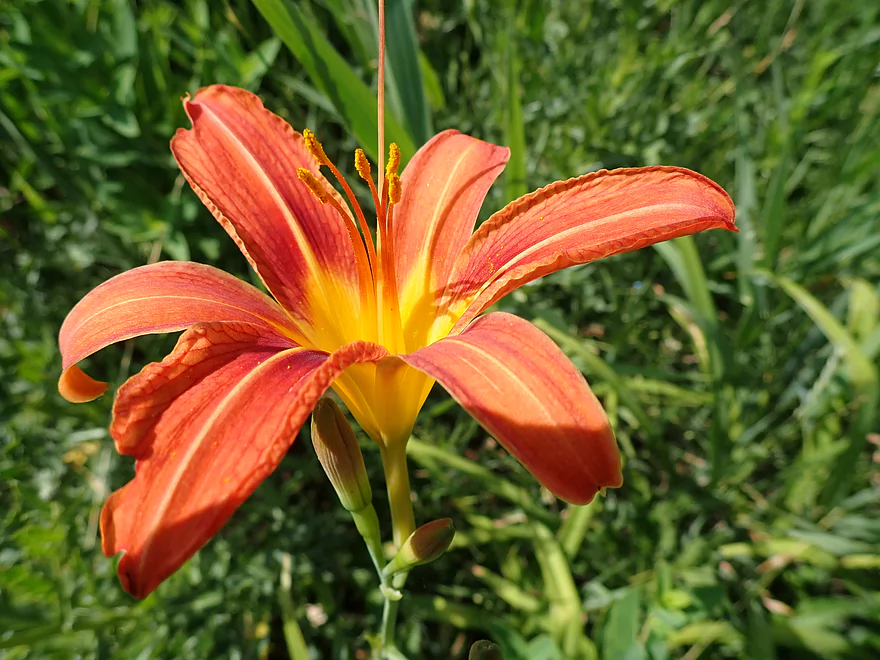
Nice flowers though
Downstream view from bridge
Access area is weedy and rocky
The river here is nice though
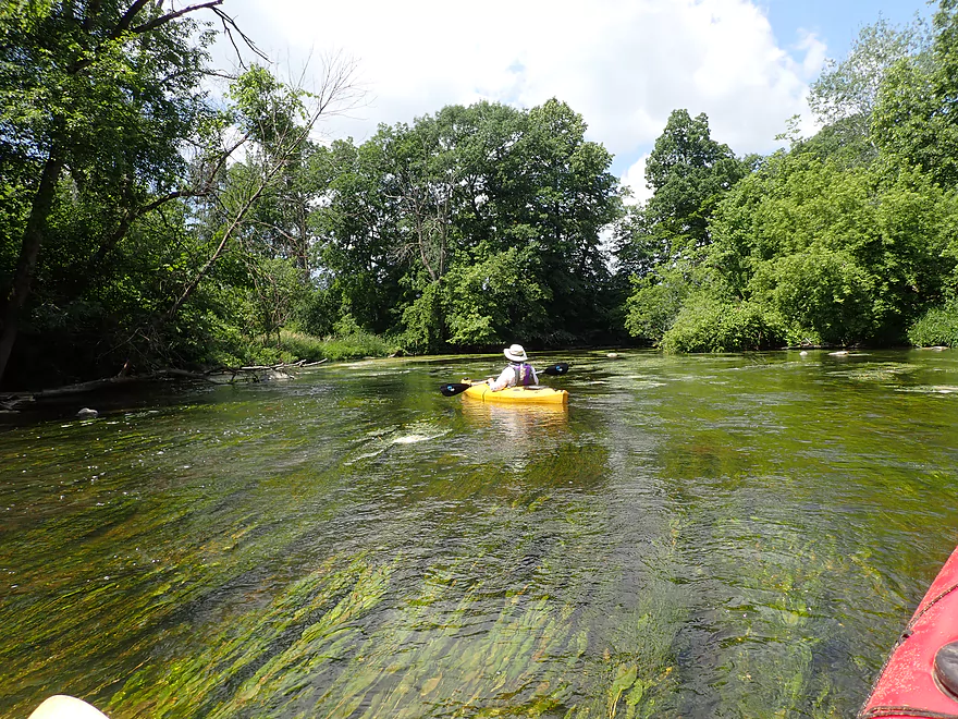
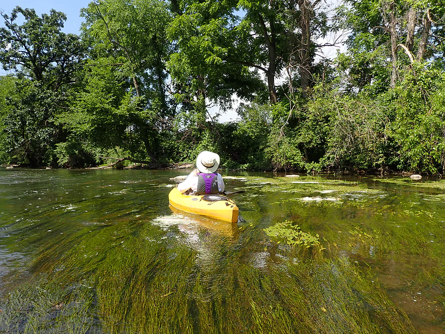
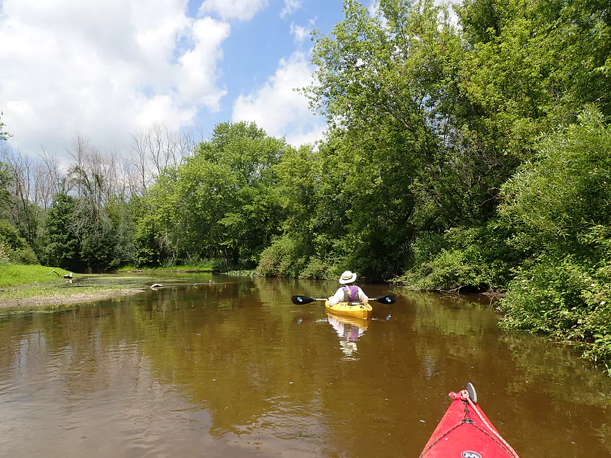
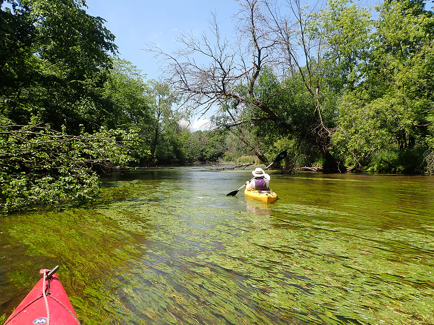
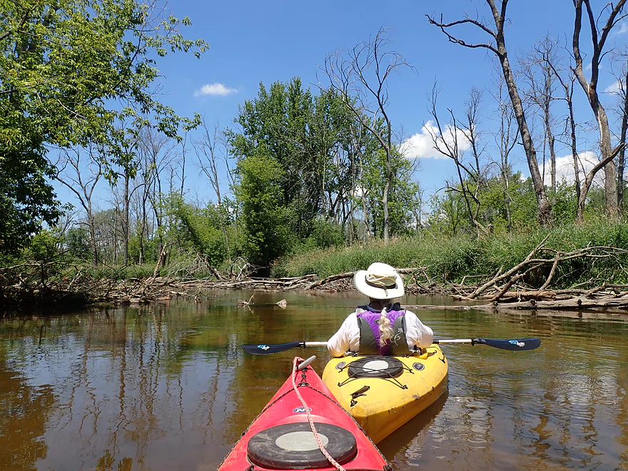
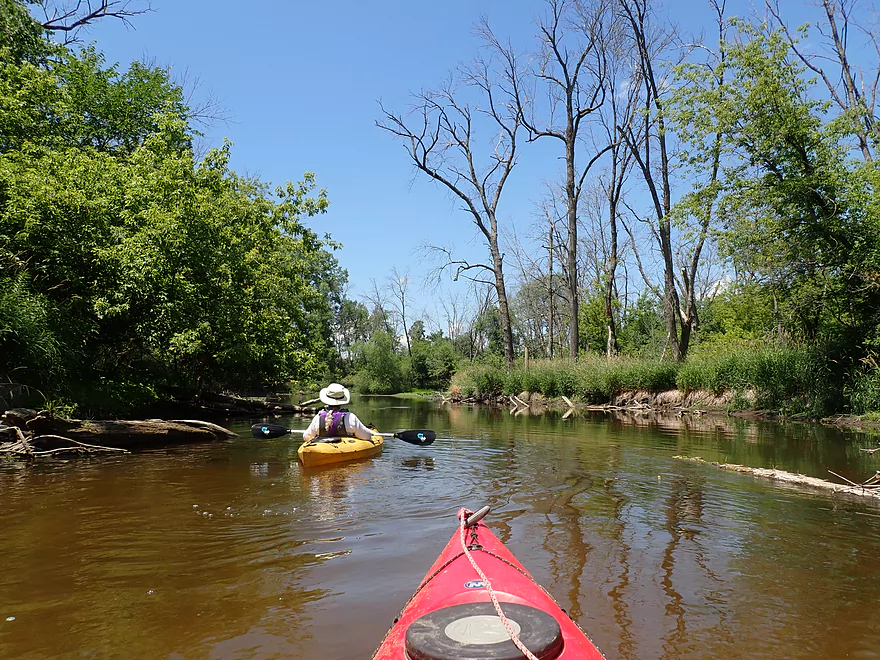
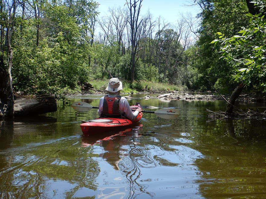
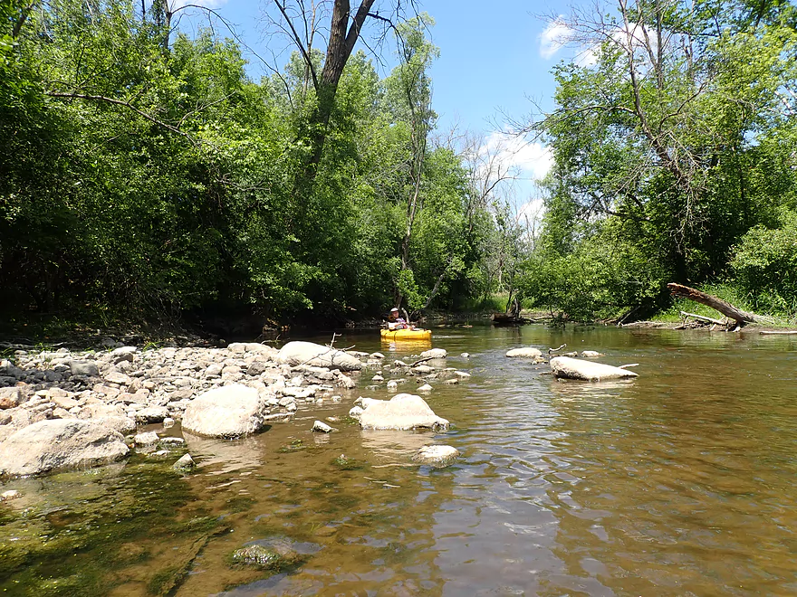
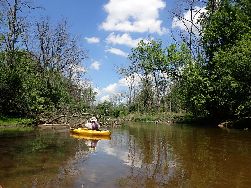
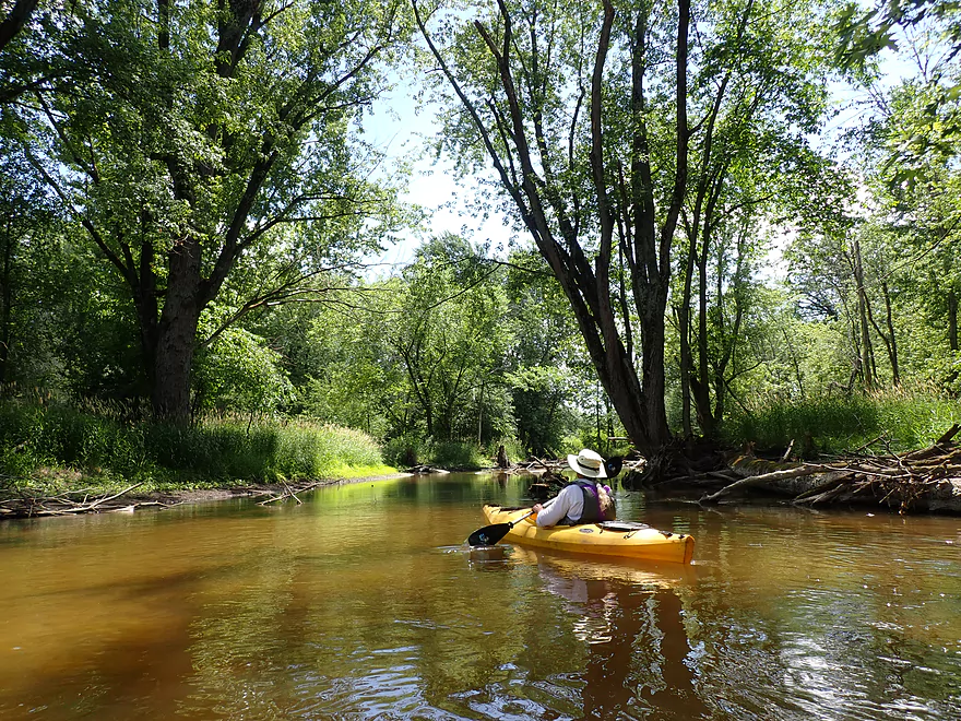
The first leg of the river was really nice
Potamogeton
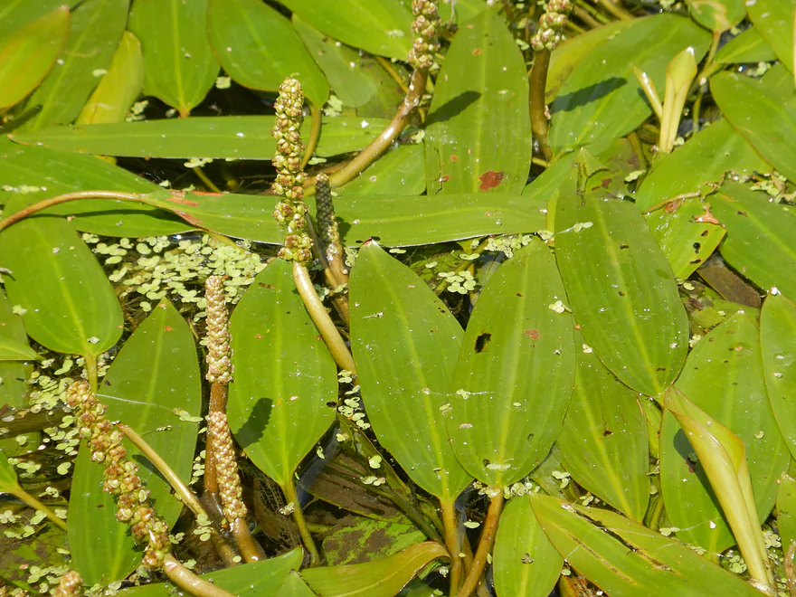
Potamogeton flowers

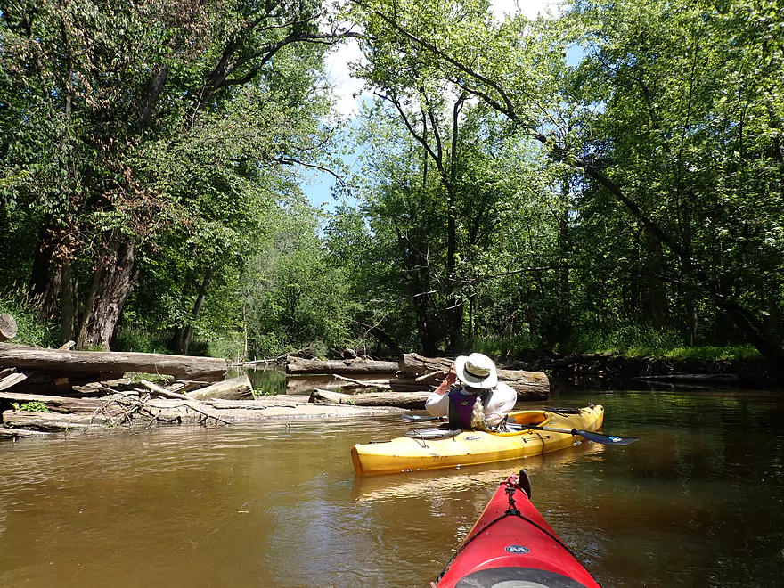
Glacial erratics occasionally dot the river
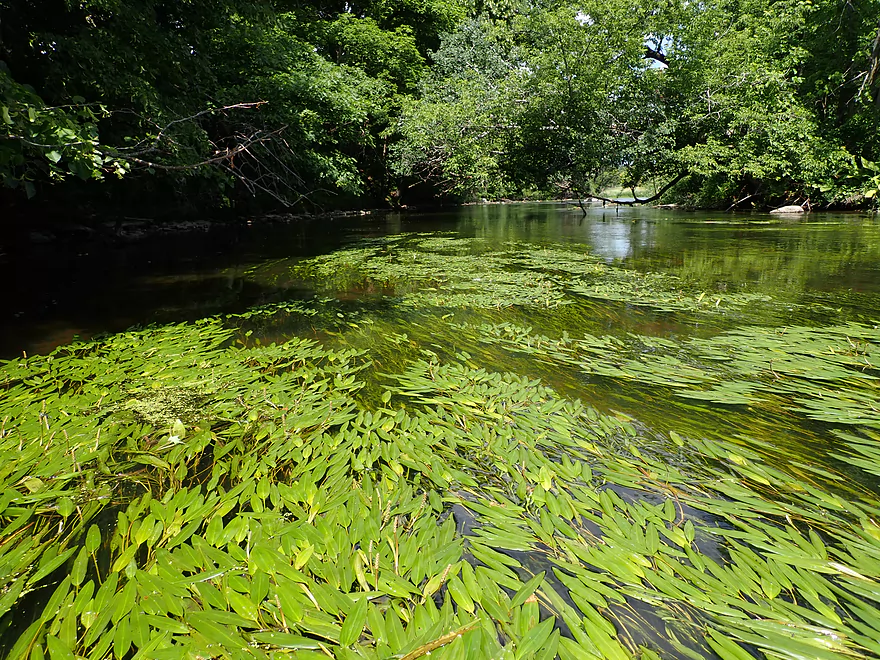
Long pondweeds swaying in the current
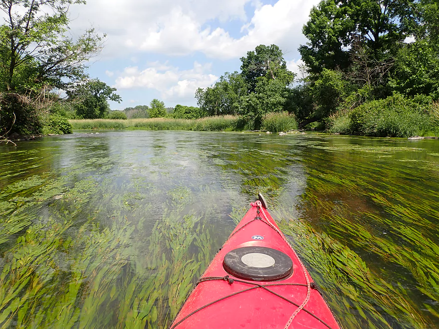
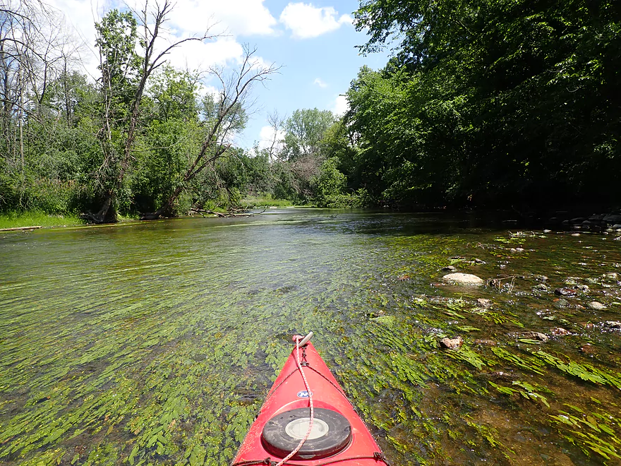
The first part of the trip was shallow
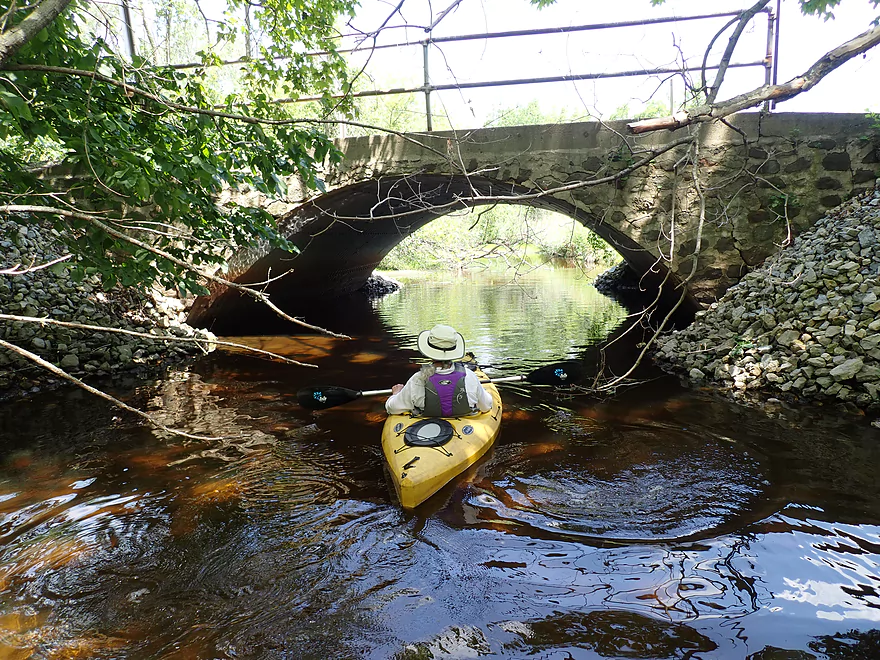
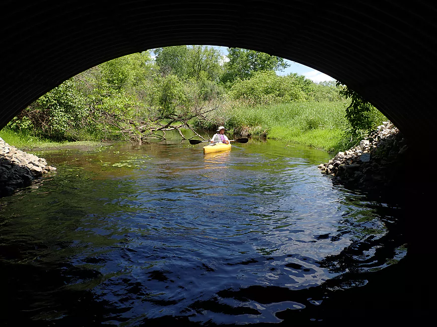
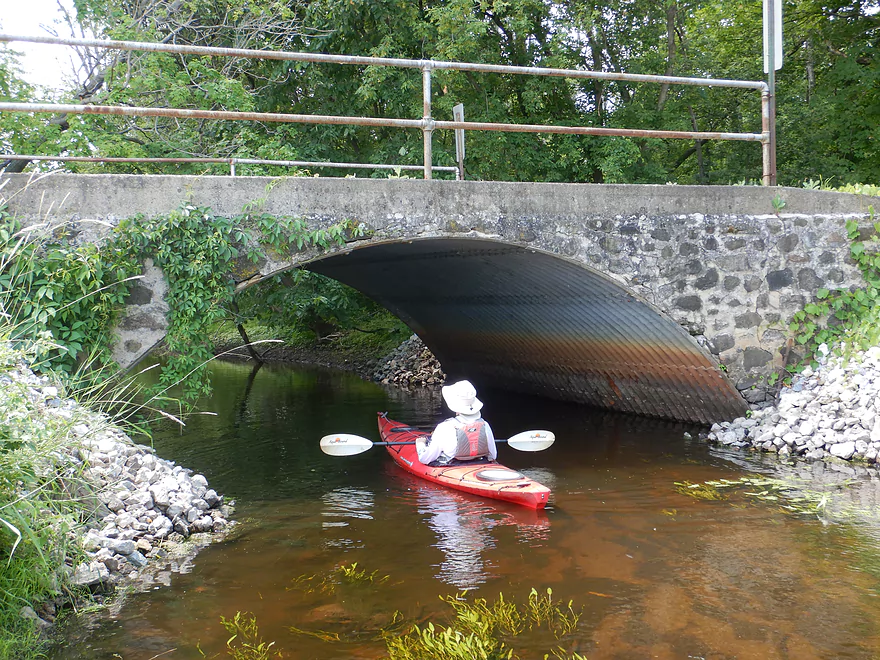
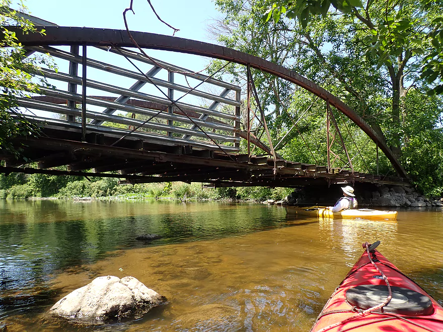
Scenic Duck Creek bridge
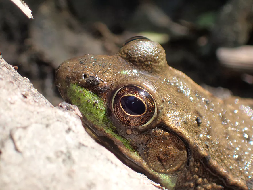
Green frog
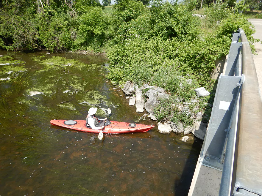
This is actually a better put-in option than Cushman
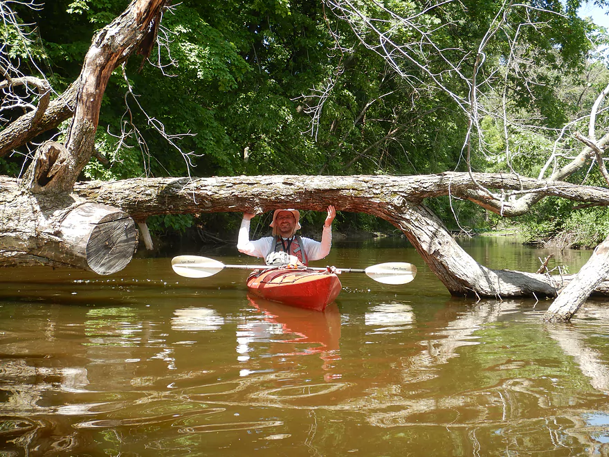
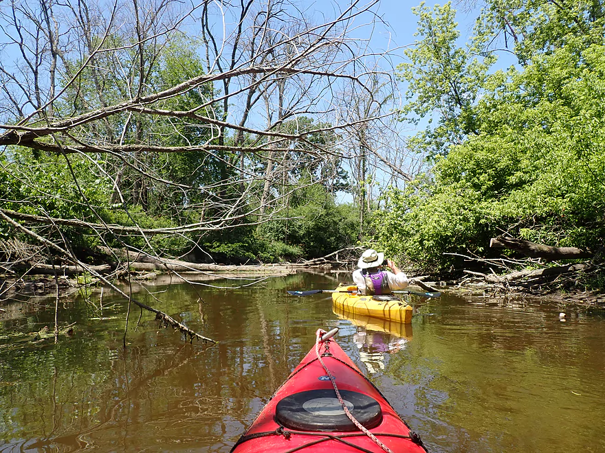
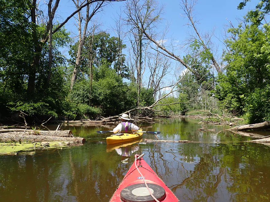
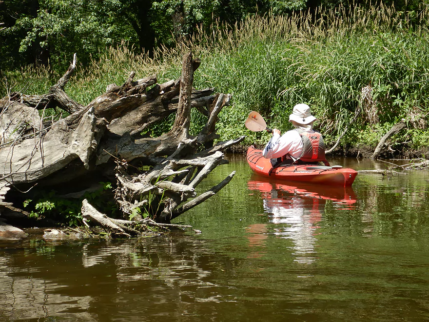
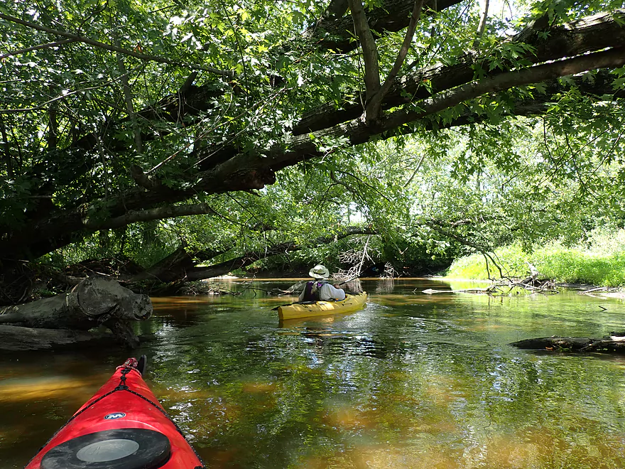
Some easy log limbos
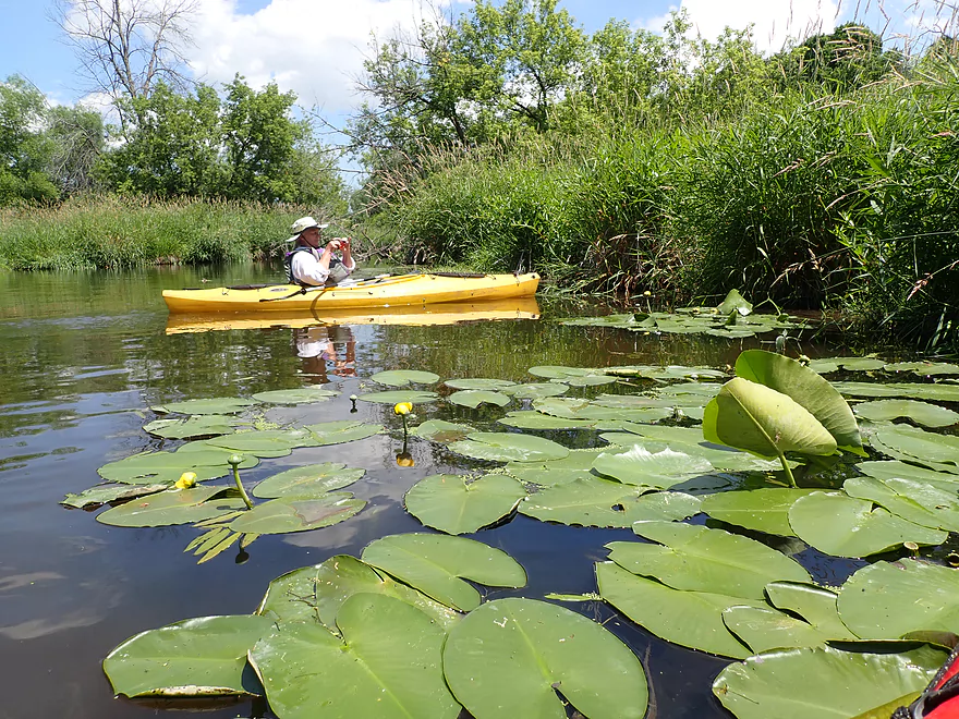
Lilies occasionally dot the shoreline
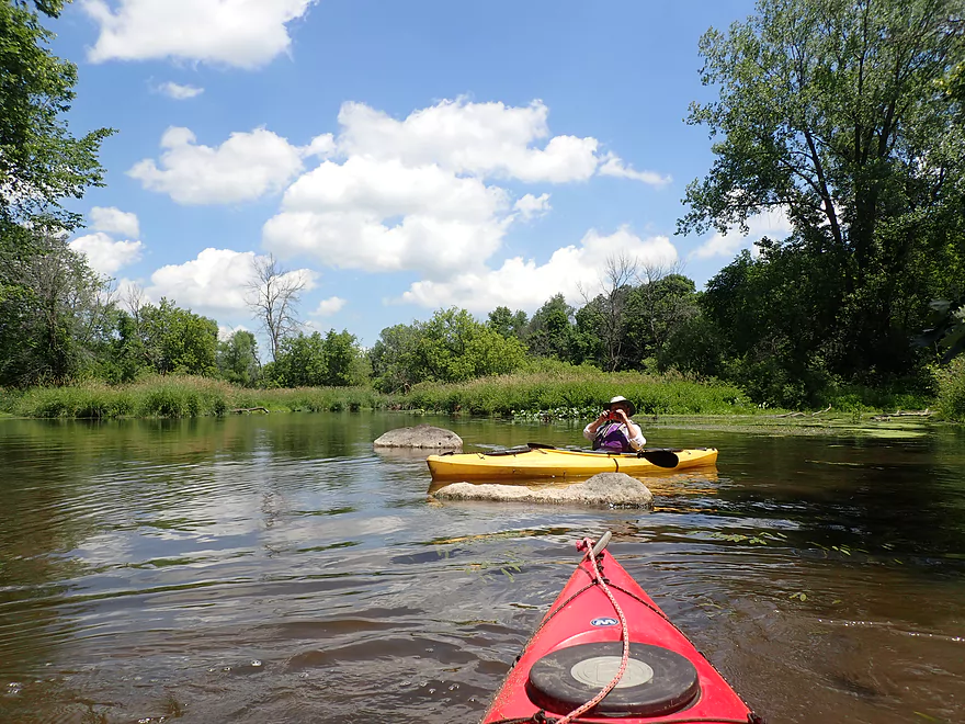
More erratics
So much green…
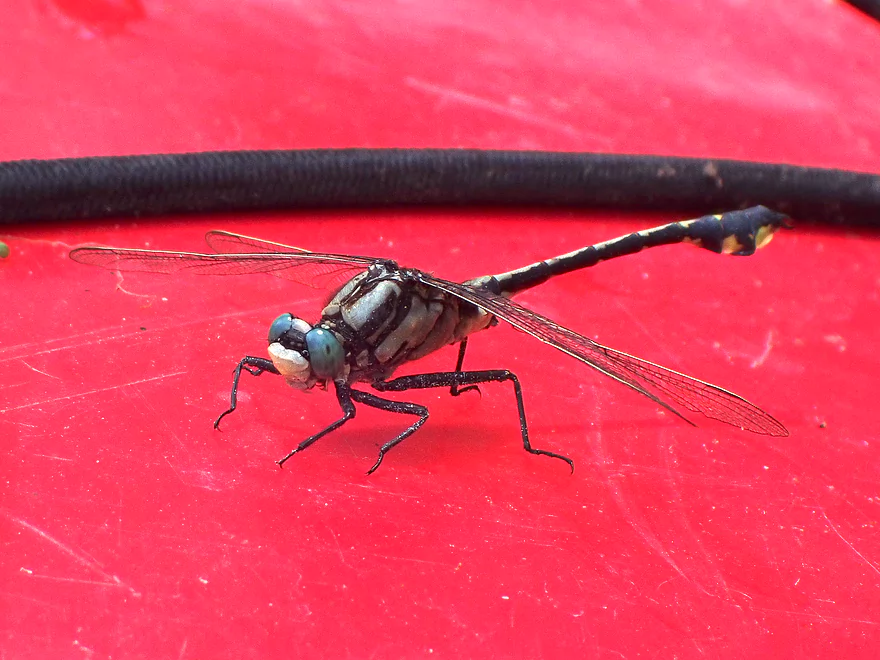
This trip had a number of dragonflies
Abandoned bridge
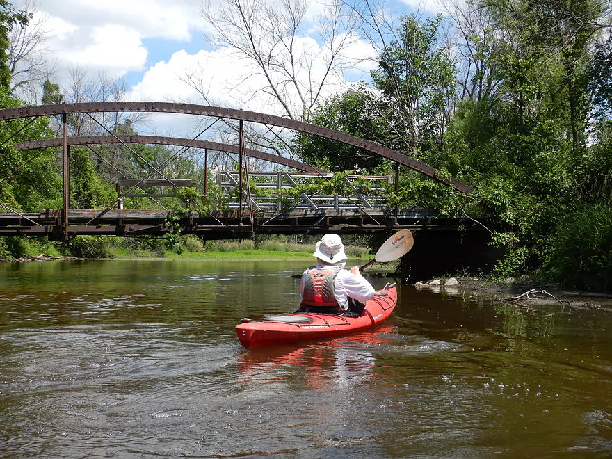
Reverse view
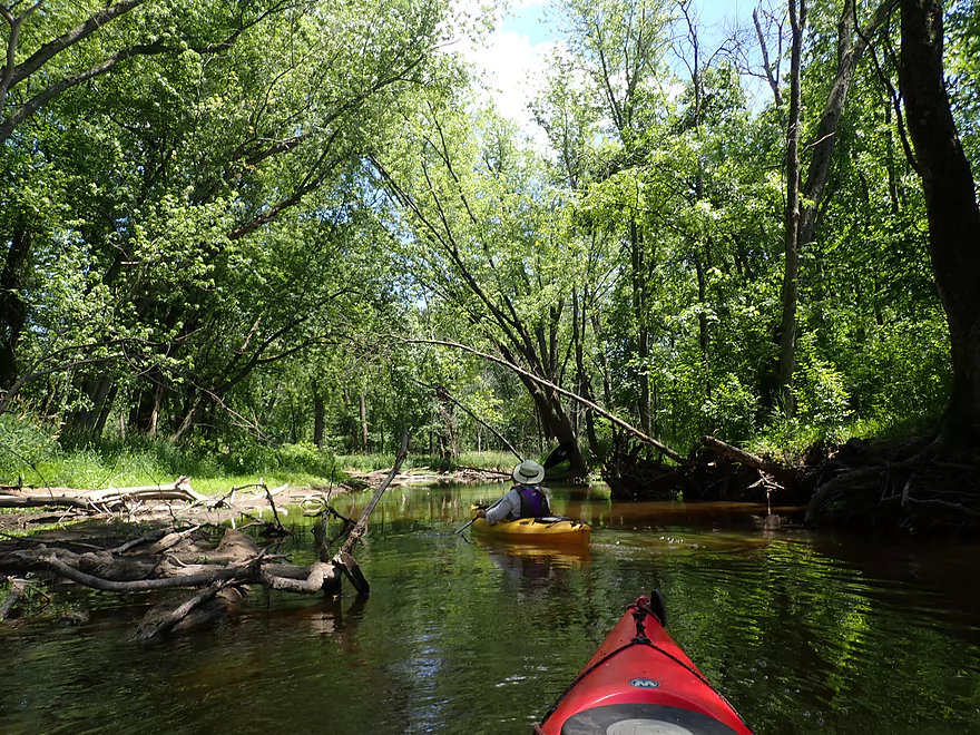
Entering a stretch with many dead ash trees
Kind of a war zone
Nice rock bar

Most of the clams were dead, but a few were alive
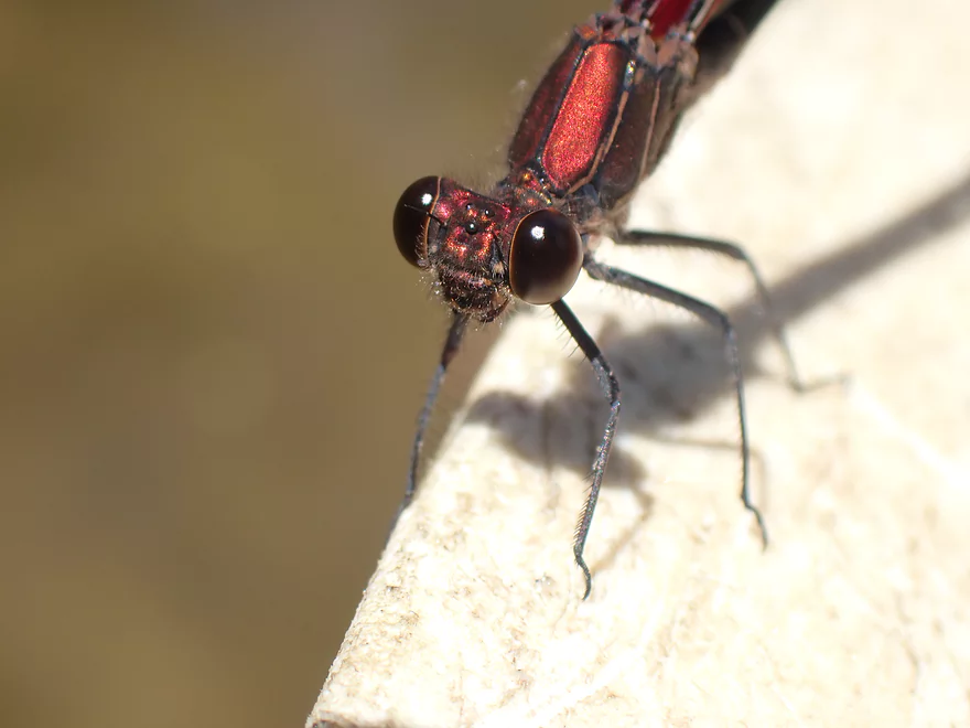
Friendly damselfly
River gets deeper and wider
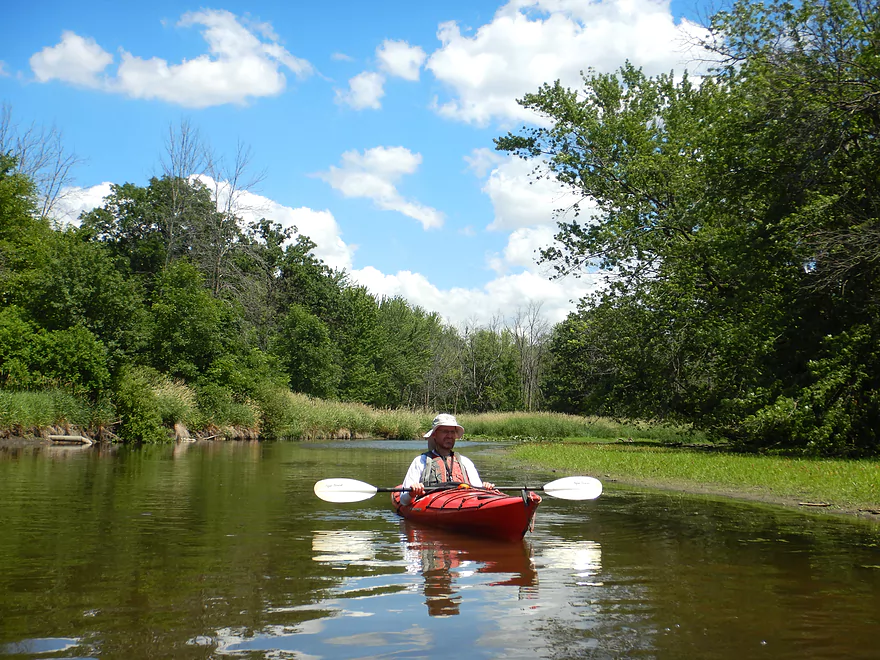
Nice clouds
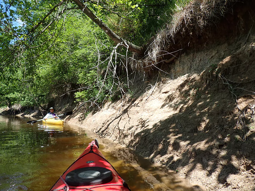
Clay banks
Invasive reed canary grass
Entering a more wooded stretch
River really changes from here on
Terrific work cleaning up logjams
This tire swing hasn’t been used in a while
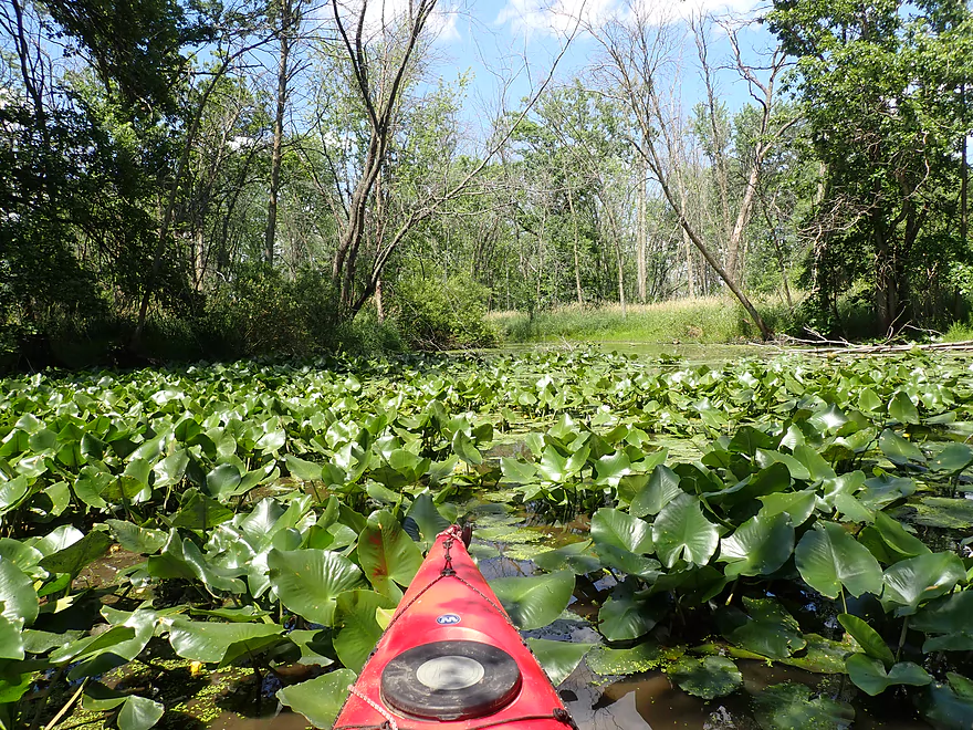
Attractive lily field
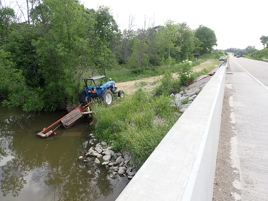
An odd tractor…maybe pumping water out of the river
Taking out at Hwy 106
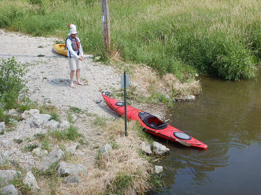
Not a bad access
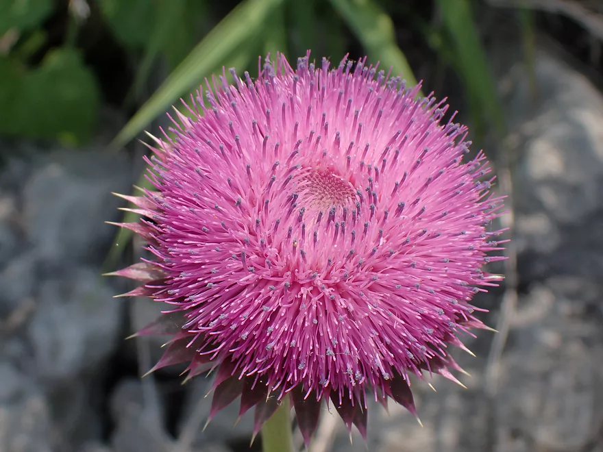
Thistle flower
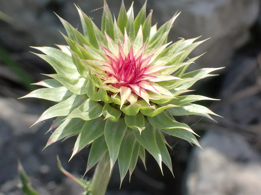
Not sure what this is…but it’s cool looking
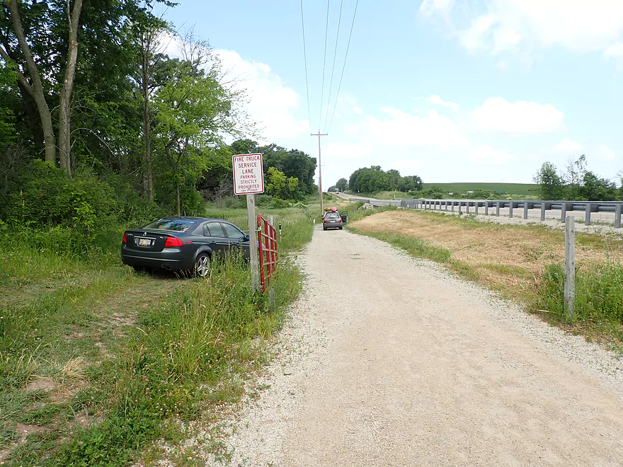
When you park, don’t block the fire lane
Bark River – Cushman to Hwy 106

This trip started on a bit of a sour note. First there were the excessive number of “No Parking” signs at our put-in off Cushman Rd (some of which seemed new since our last trip). Then as we were unloading our boats, some locals pulled up and warned us the river was too shallow for kayaking. Undeterred we still launched. The bridge is at the site of a former mill. The mill and dam have since been removed and all that remain is a scenic stretch of riffles. An attempt by the DNR was made to turn the area into a park but it didn’t succeed.
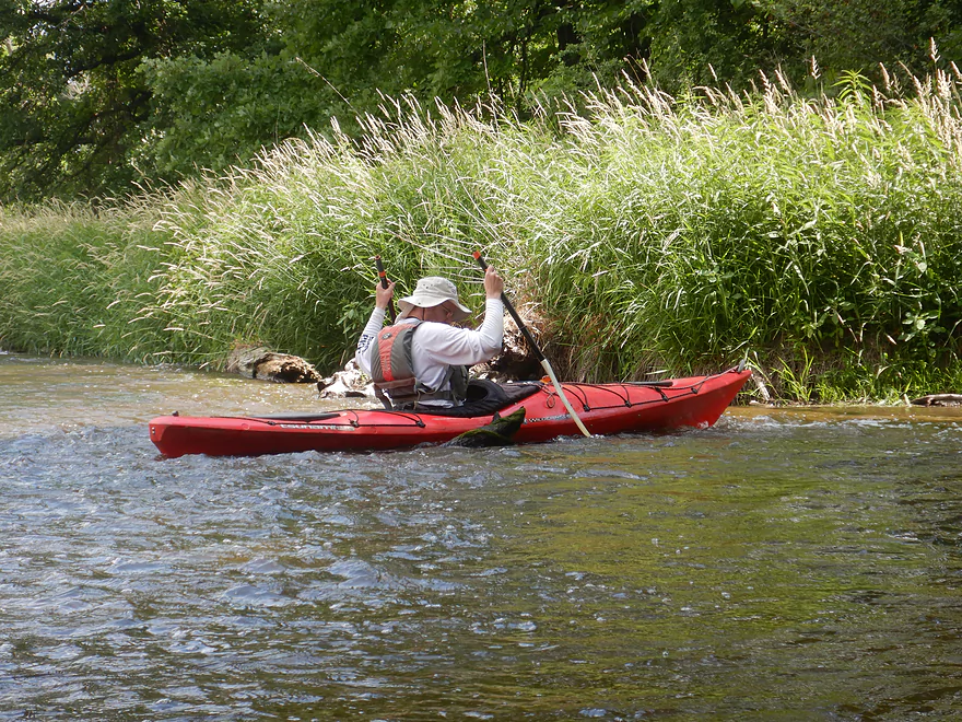
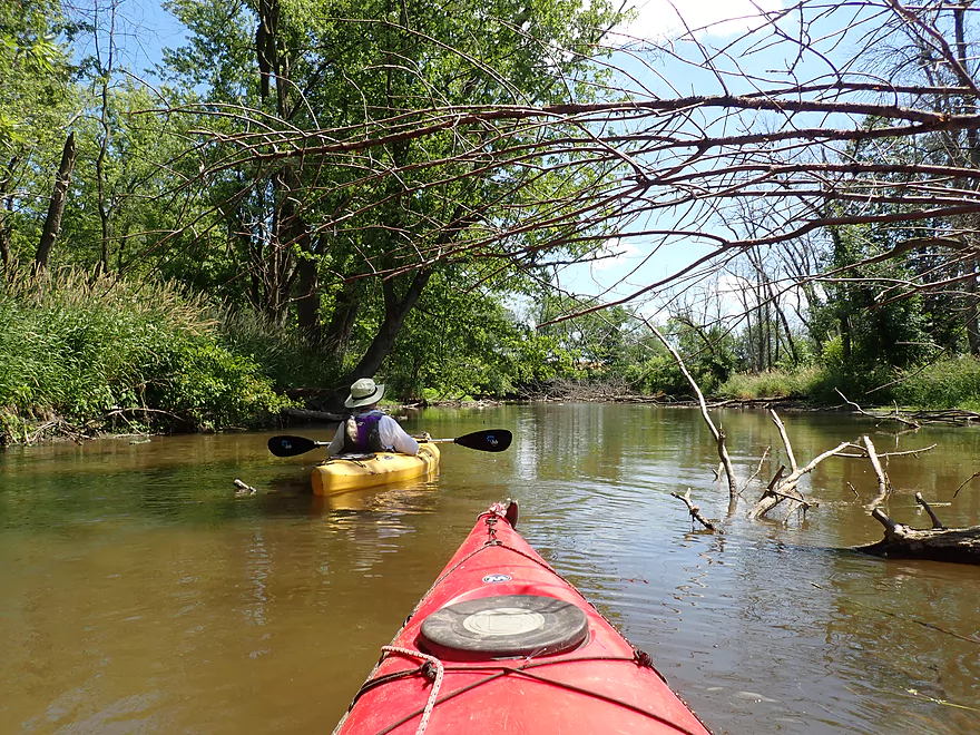
The first half mile of the trip (Cushman to Duck Creek) was the shallowest part of the trip. Our boats got hung up on shallow riffles multiple times. On the plus side, the river here was very scenic. Highlights included multiple light rapids, clear water, a gravel substrate, and long green pond weeds that gracefully swayed with the current.
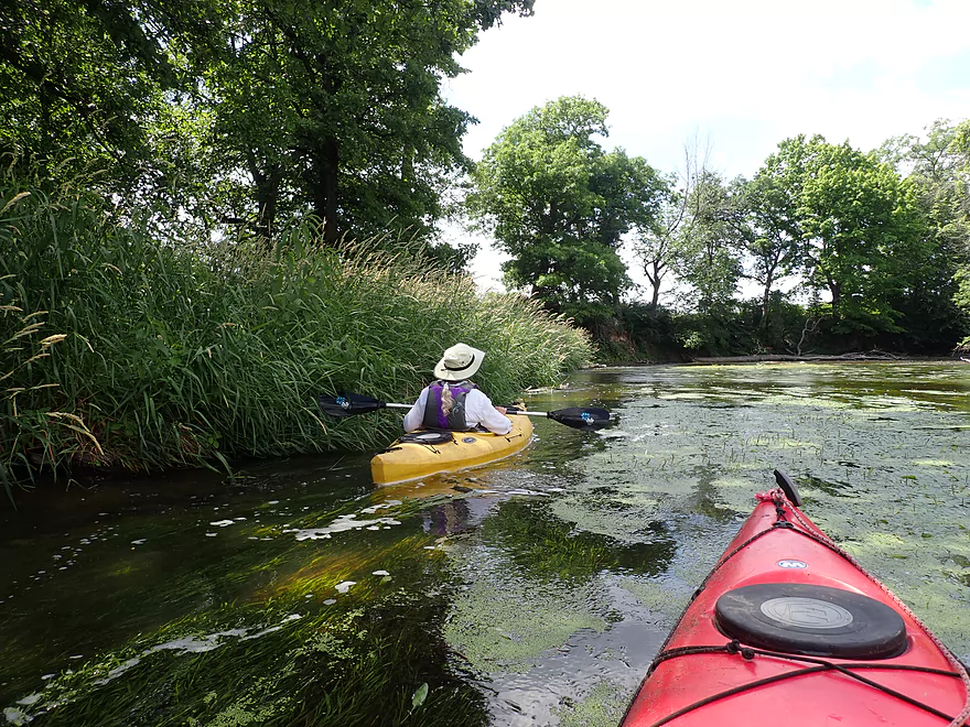
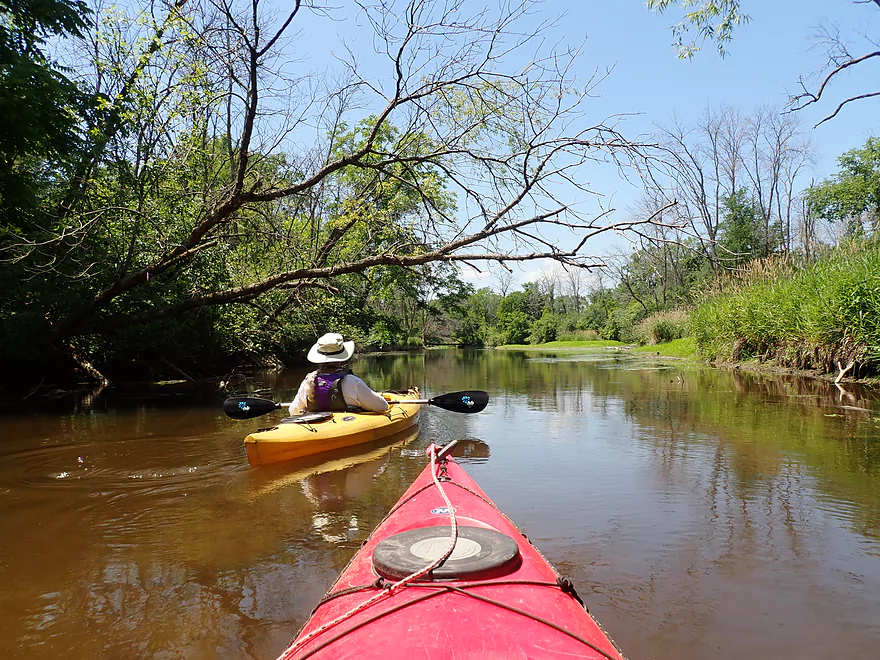
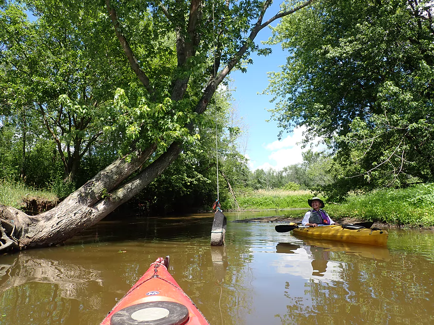
Duck Creek joins the Bark River at the Hagedorn bridge, and is a viable access I recommend to paddlers over Cushman Rd. We paddled upstream on Duck Creek a bit to check out the scenic stone arch bridge. There is a path south of the bridge, but it’s not an option for kayakers because there is a “No Tresspassing” sign south of the bridge (and a large sack of dog/cat poo is placed on the trail). I’m not sure if this was placed by an outsider, or if the local landowner put it there as a bad joke for those wanting to access the river.
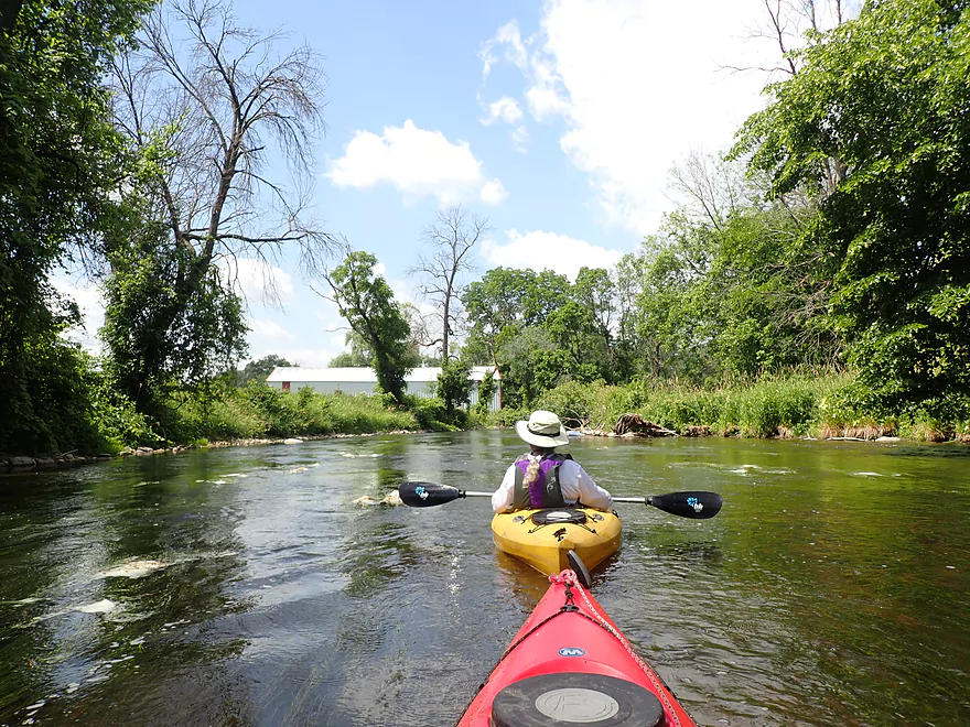
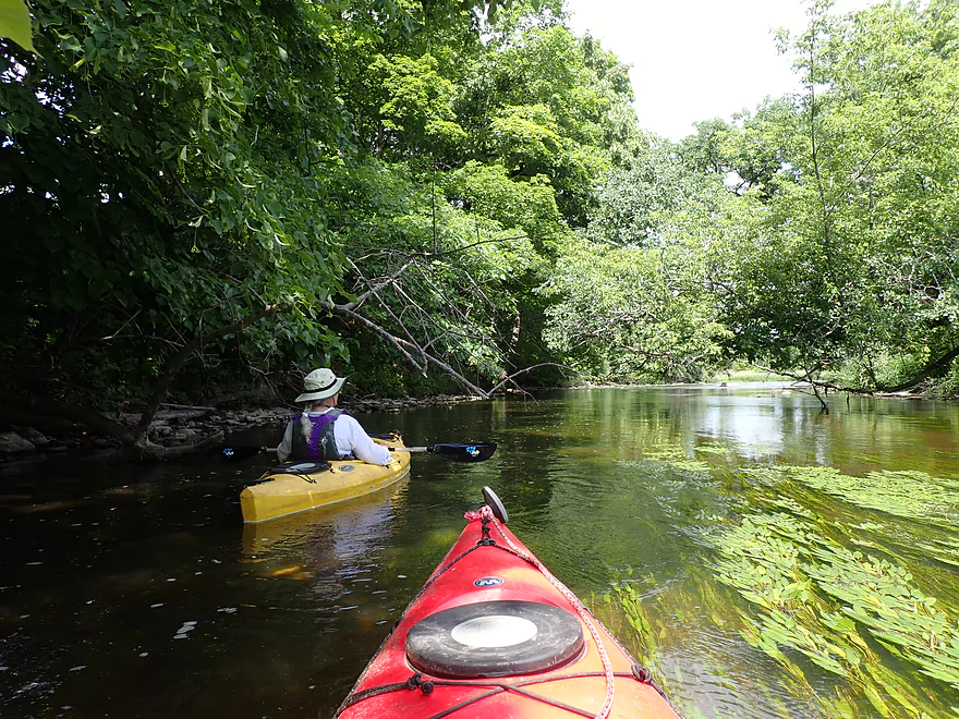
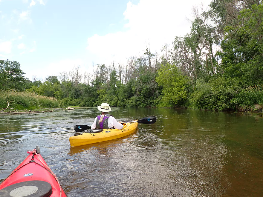
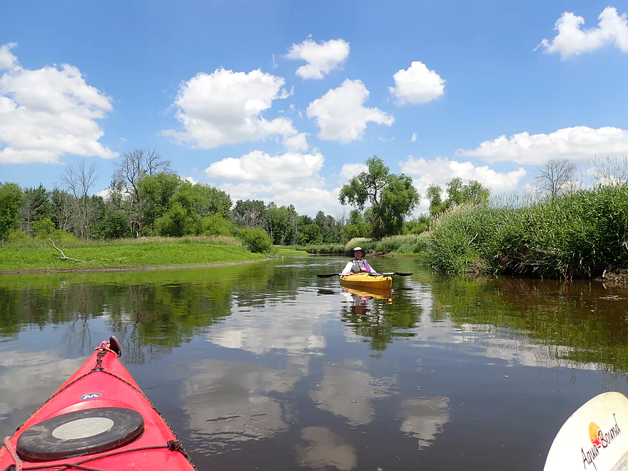
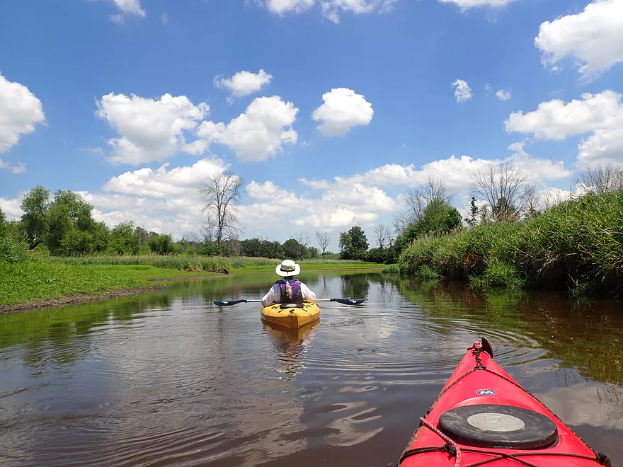
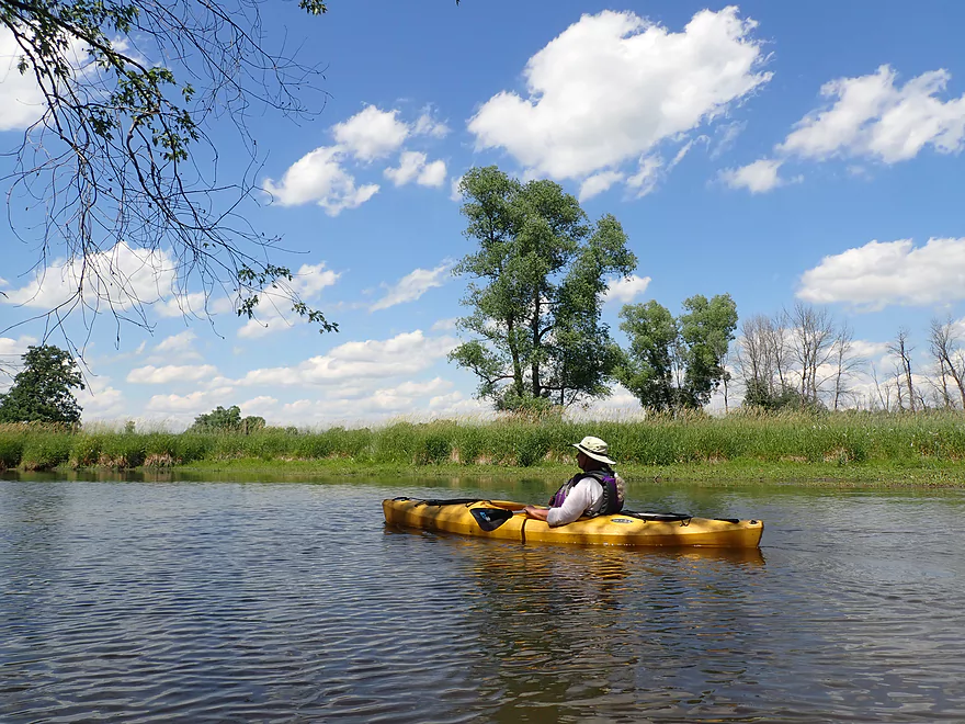
The next mile-plus was pretty nice, and featured mostly open banks, bur oaks, clear water, clay banks, and little development. This really reminded me of Turtle Creek (a neighbor to the South). I suspect this part of the Bark was favorably shaped by the terminal moraine (from our last ice age). A downer was the countless dead ash trees that lined the river (maybe the most I’ve ever seen), and it’s likely this area was a hotspot for the emerald ash borer.
The second half of the trip really changed in character. From here on (and ultimately to the mouth at Fort Atkinson), the Bark loses its clear water and nice character, and becomes a floodplain paddle. The river becomes much deeper, more wooded, muddier, more eroded, and less interesting. The more interesting trees like bur oaks are replaced by less interesting silver maple. The second half of the trip wasn’t entirely a disappointment though as the thick woods provided some shady tree canopies and it reminded me at times (favorably) of the Maunesha River near Waterloo.
One of the more remarkable sights was the number of logjams in the river…or used to be in the river. Somebody has performed a herculean effort to clean these up and it was quite appreciated. We never had to portage a single downed tree.
Sights included dragonflies, one eagle, several clams, and quite a few small fingernail clam fragments. The highlight was the live clams which you don’t see as often anymore (I suspect agricultural pesticides might be killing a lot of them).
Cushman Rd: This was a bad access that I just can’t recommend. For starters there are “No Parking” signs everywhere…so you pretty much have to park 1000′ west of the bridge. Then the landowner east of the bridge doesn’t care for kayakers, so no launching there (even if you stay within the DOT right-of-way). West of the bridge there is a decent fishing trail leading to the water but that too has a “No Tresspassing” sign. If you launch here (not recommended), then launch west of the bridge but hug the road to stay within the DOT right-of-way. But even that isn’t easy as the shoulder is steep and weedy.
Alt Put-ins:
- Hagedorn Rd/Duck Creek (0.6 miles downstream from Reese Rd): This Duck Creek bridge is close enough to the Bark that it’s a viable access. It’s actually much better than Cushman Rd, but make sure to park outside of the No Parking signs. Also don’t launch south of the bridge as there is a “No Tresspassing” sign here and an open sack of dog/cat poo. Instead launch on the north side and stay within the DOT right-of-way. This short leg (Cushman to Duck Creek) is shallow, but very nice with clear water and a rocky substrate.
Hwy 106: This is a good public launch but parking was a bit tricky. The main launch area has signs telling you not to park on the main drive (reserved for fire trucks). Instead park on the shoulder or opposite the gate (which most people do).
Bike Shuttle – Hwy 106 to Cushman Rd: 2.8 miles with 69′ of ascent. This would be a very easy bike shuttle with only one minor hill.
Logjams: None. There is evidence there used to be many though, but they’ve all been cleared out.
Current: The first half of the trip features several minor riffles, but the second half was fairly slow.
Closest Gauge – Bark River @ Rome: Trip done at 36 CFS (shallow but doable).
- 0-20 CFS: Maybe too shallow.
- 21-30 CFS: On the shallow side but excellent clarity. The half mile between Cushman and Hagedorn may require some some wading, especially for v-bottom boats. The river is much deeper after Hagedorn.
- 31-40 CFS: Some scooching required between Cushman and Hagedorn. A good depth thereafter.
- 41-50 CFS: A good target range.
- 51-70 CFS: River should be well padded, but clarity won’t be that good.
- 71-90 CFS: A high depth with poor clarity.
- 91+ CFS: Maybe too high for enjoyable paddling.
Detailed Overview
For more information on access options, see my Overview Map. For a background on area human interest stories, I recommend the book “The Bark River Chronicles“.
- Cty Q to N Road: 0.1 miles. Small, channelized and weedy…this may require high water to run.
- N Road to Hillside Road: 1.4 miles. Small and marshy with maybe 2-4 logjams. High water is likely needed to run this part.
- Hillside Road to Hwy 164: 2.0 miles. Maybe 5-10 logjams. Very small and marshy. Likely needs high water to run.
- Hwy 164 to Lisbon Park: 2.9 miles. Maybe 2-4 logjams. The channel here is small, shallow, weedy and bog-like. High water is recommended.
- Lisbon Park to Merton Dam/Firemen’s Park: 1.3 miles. Mostly simple flowage paddling.
- Merton Dam to Bark River Park: 4.9 miles.
- Merton Dam to Dorn Road: 1.2 miles. Very scenic section with great fall color. Highlights include some boulder gardens, springs, clear water, and pine trees. Diverse banks with some woods and some marsh. There is one tricky logjam by the old mill.
- Dorn Road to Hartling Road: 0.7 miles. A short but pleasant open section with no logjams.
- Hartling Road to Rybeck Road: 1.0 miles. A scenic mix of light woods, marsh, and a few boulder gardens. There was one easy logjam to portage and a few hoppers/duckers, but it is mostly open.
- Rybeck Road to Centennial Park: 1.0 miles. Starts open and has a fantastic boulder garden. The last part is more cluttered with a number of logjams to hop over. I never had to portage though.
- Centennial Park to Bark River Park: 1.0 miles. A fast wooded section with multiple logjams. There are about four major logjams in a row, but you can skip them all by portaging on the boardwalk to the east (super easy). There are some additional hoppers beyond this stretch, but I didn’t think they were too bad.
- Bark River Park to Delafield Post Office: 6.1 miles.
- Bark River Park to Nixon Park: 0.7 miles. Terrific stretch through the heart of Hartland. Highlights included many fun Class 1 rapids and one Class 2.
- Nixon Park to Cottonwood Ave: 0.5 miles. Nice stretch with a mix of light woods and suburban homes.
- Cottonwood Ave to Hwy 83: 1.4 miles. Mostly an open marsh section. A few portages are required for downed trees.
- Hwy 83 to Lake Nagawicka Mouth: 1.3 miles. Less marsh and more woods…this is a nice stretch with good water clarity.
- Lake Nagawicka Mouth to Delafield Post Office: 2.2 miles. This is almost all lake paddling. Lake Nagawicka has good clarity and some attractive shoreline homes, but it is heavily developed and suffers from excess motorboat traffic. Several alternate access options exist along the lake shore.
- Delafield Post Office to Hwy 67: 7.7 miles.
- Delafield Post Office to Nemahbin Lake Boat Launch: 1.8 miles. Likely the best stretch on the entire river. Highlights include attractive rocky sections and stunning clarity.
- Nemahbin Lake Boat Launch to Sawyer Road: 0.7 miles. Mostly a simple paddle on Lower Nemahbin Lake. Highlights include great water clarity, an attractive cattail corridor and the “Blue Hole”.
- Sawyer Road to Genesee Lake Road: 2.2 miles. Very nice marsh paddle.
- Genesee Lake Road to Summit Ave: 3.0 miles. A good stretch with ecologically diverse banks.
- Summit Ave to Hwy 18 Wayside: 3.8 miles. A decent prospect. The take-out is a small park/wayside and the last of the three Hwy 18 bridge crossings. Note, a recent reader comment says this stretch has many serious logjams.
- Hwy 18 Wayside to Hwy E: 6.2 Miles. Heavily channelized, but some of it still seems like it has potential. Note a reader noted that this stretch has many serious logjams, some of which are difficult to portage.
- Hwy E to the Rome dam: 4.2 miles. Half of this leg would be a flowage paddle on Rome Pond.
- Rome to Cushman Road: 5.6 miles. A fantastic stretch and one of southeast Wisconsin’s paddling gems.
- Cushman Rd to Hwy 106 Canoe Launch: 4.4 miles.
- Cushman Rd to Hagedorn Rd: 0.6 miles. A great leg with clear, fast water and many rocks. Only downside is, it can get shallow.
- Hagedorn Rd to Hwy 106: 3.8 miles. The first half is pleasant, clear and rocky. The second half is more of a floodplain paddle with more mud and downed trees, which was less interesting.
- Hwy 106 canoe launch to Prince's Point Wildlife Area: 5.5 miles. Be careful of the partly removed dam at Hebron. There are definitely downed trees in this section.
- Prince's Point to Burnt Village County Park: 7.1 miles. Much of this was a mediocre wetgrass paddle through a large marsh. However kayaking through the floodplain forests of the Prince's Point Wildlife Area was very cool.
- Burnt Village County Park to the Rock River: 5.5 miles. Does not seem super interesting. Landing is just upstream of the mouth on the east bank.
Trip Map
Overview Map
Video
Photos Size: