
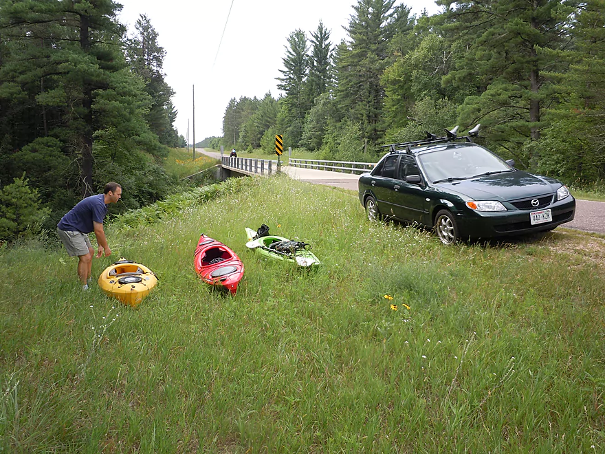
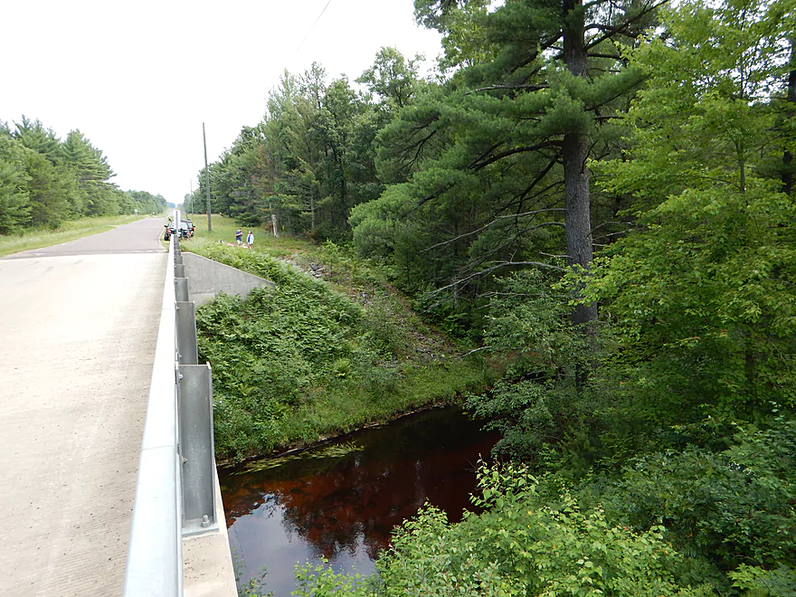
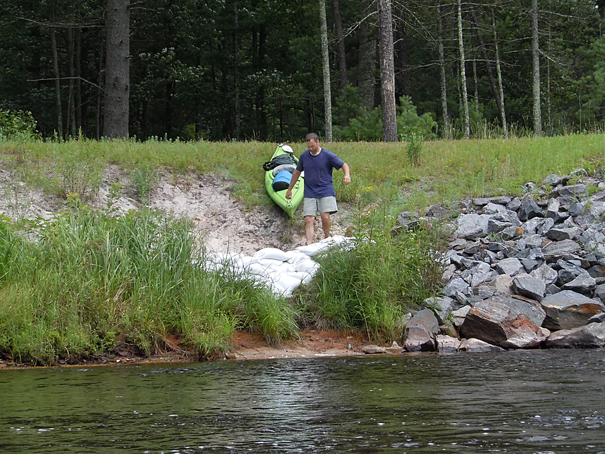
Good parking at the Old Country Road bridge
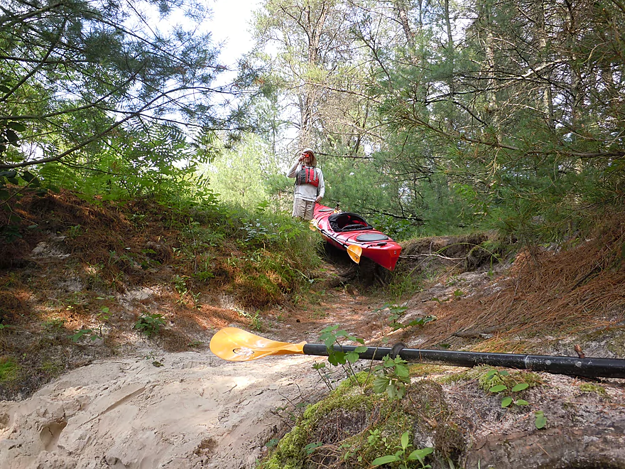
Steep slope to put-in
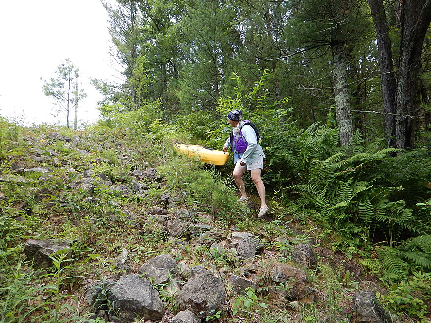
But manageable with trail
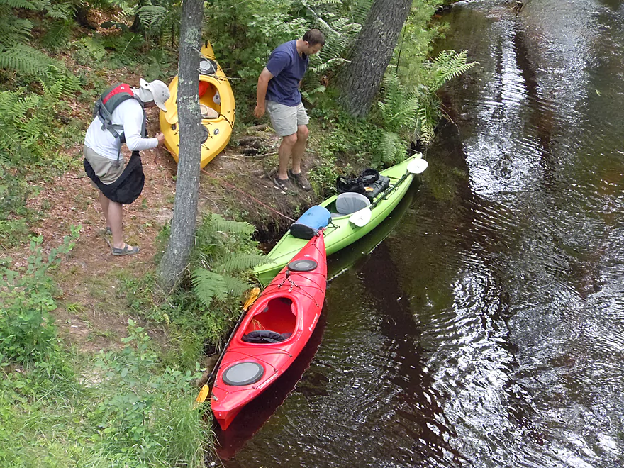
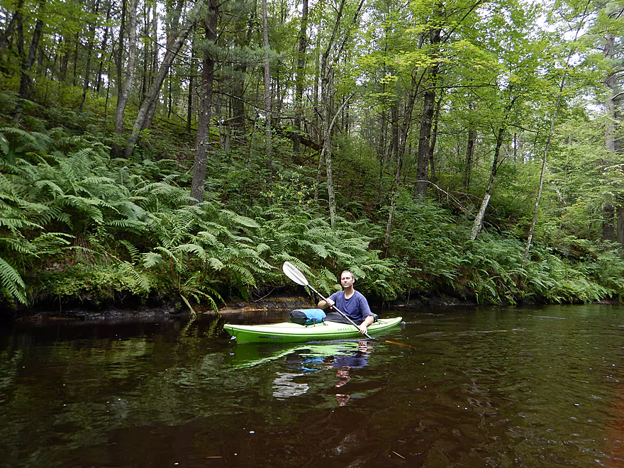
Nice launch area
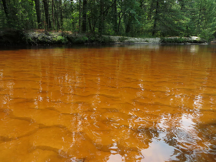
Terrific water quality
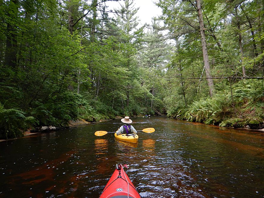
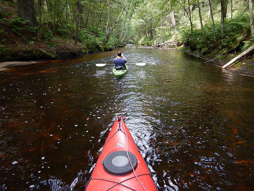
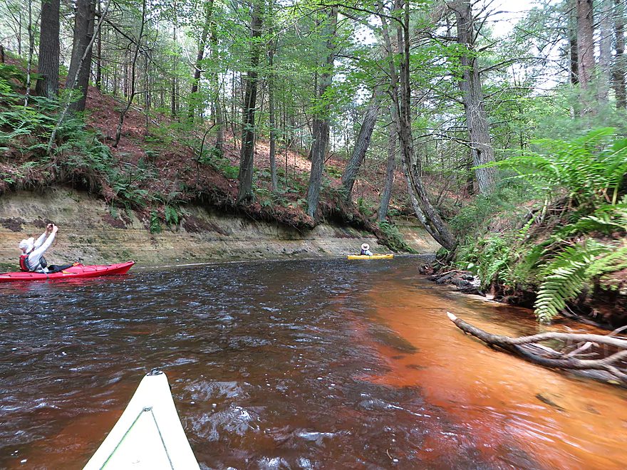
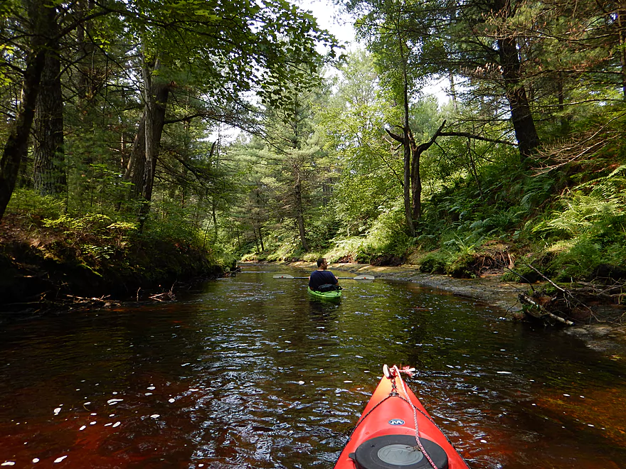
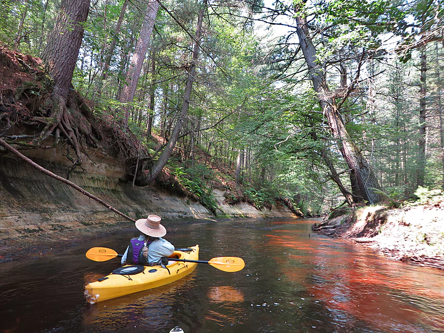
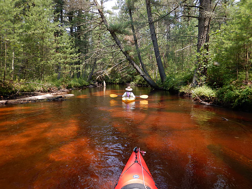
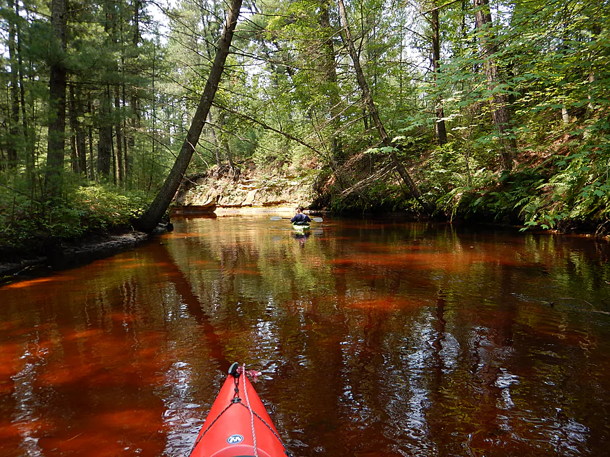
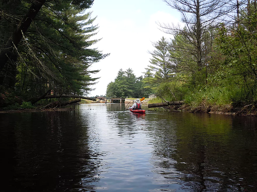
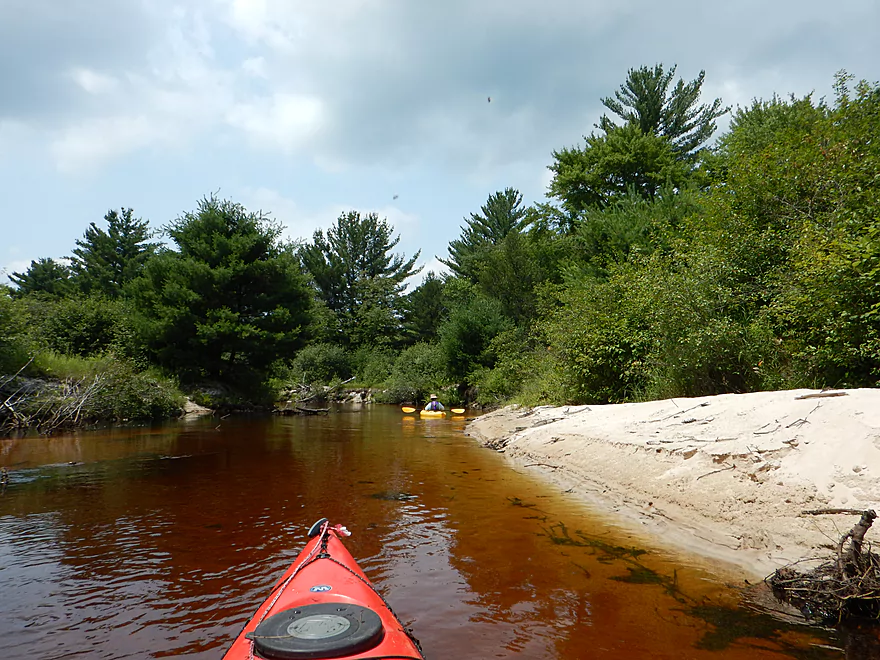
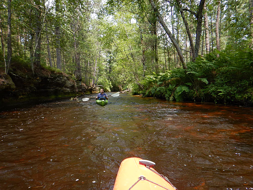
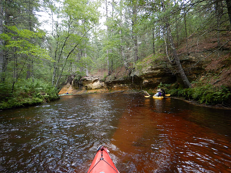
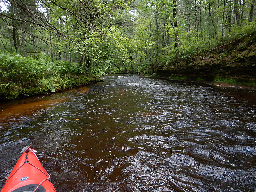
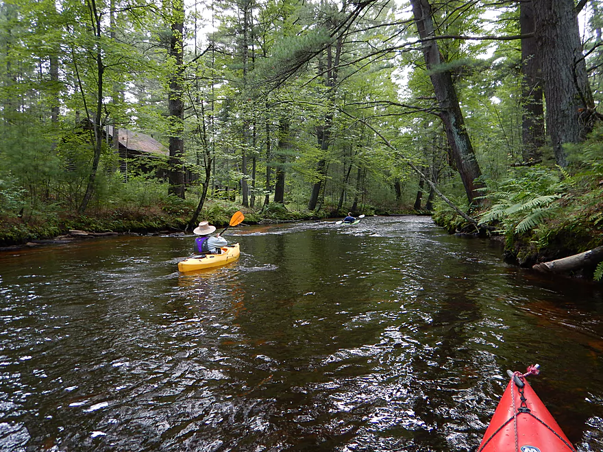
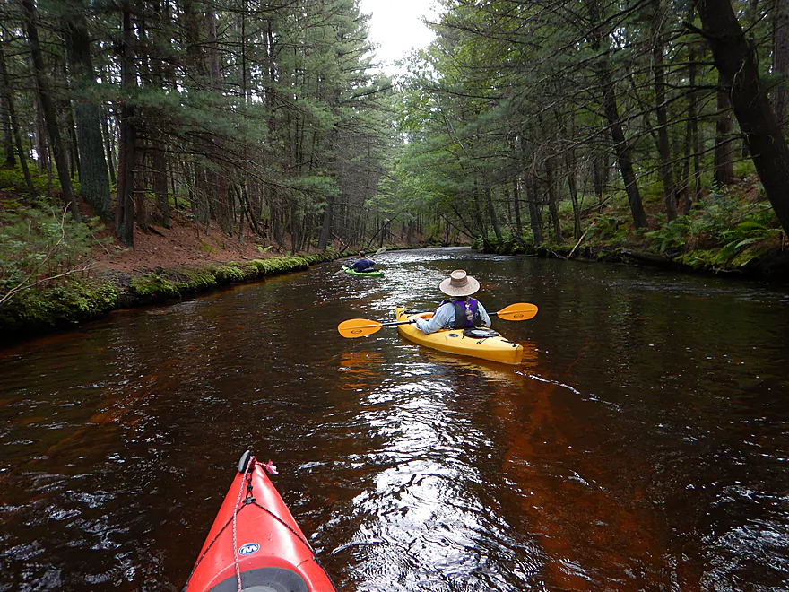
Looking upstream
Fern city
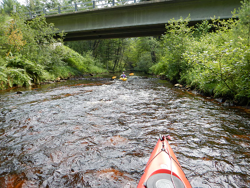
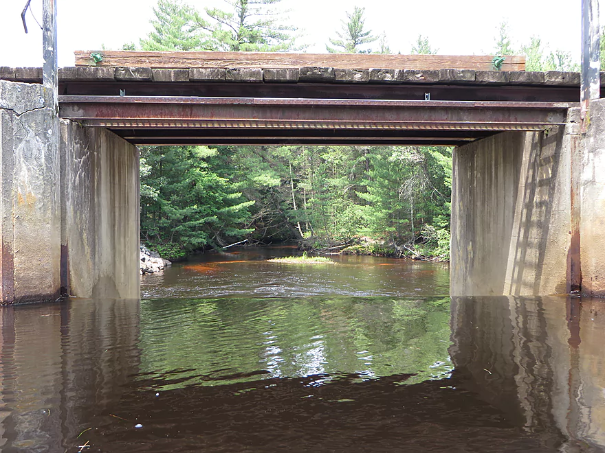
Old Country Road bridge again
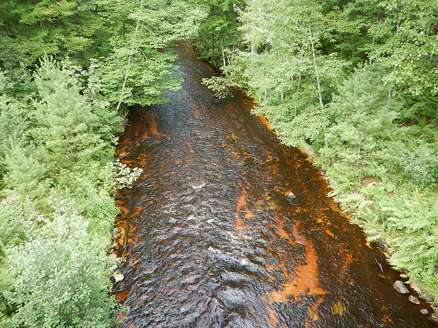
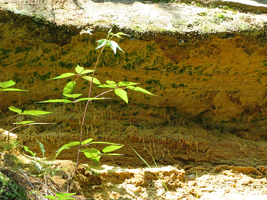
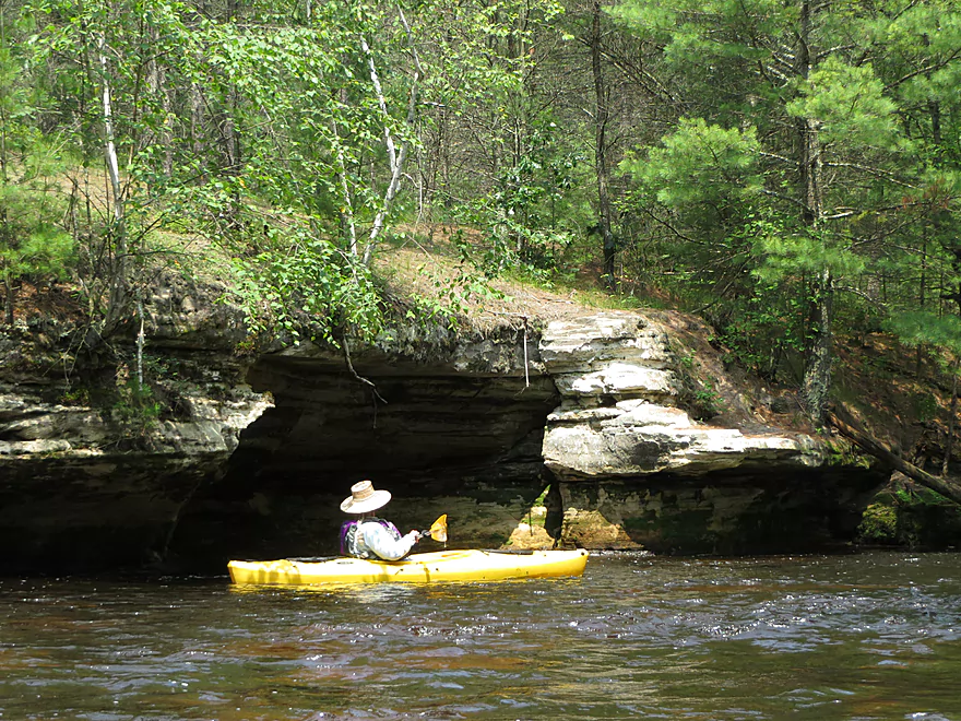
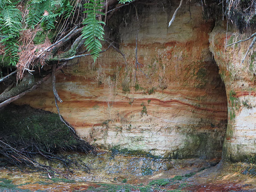
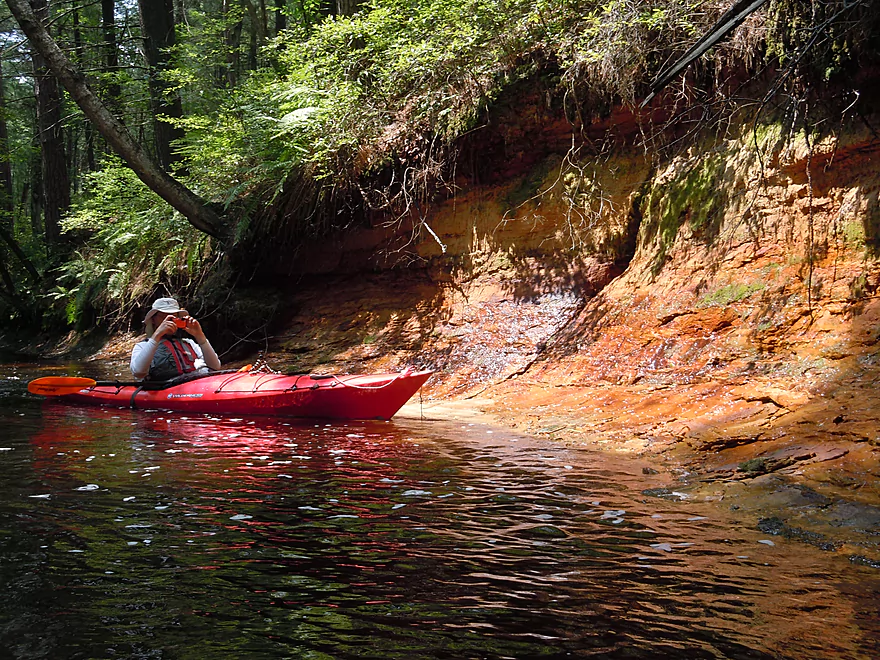
Interesting rock colorations
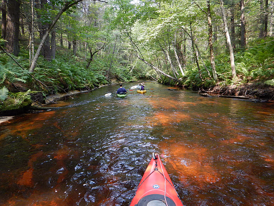
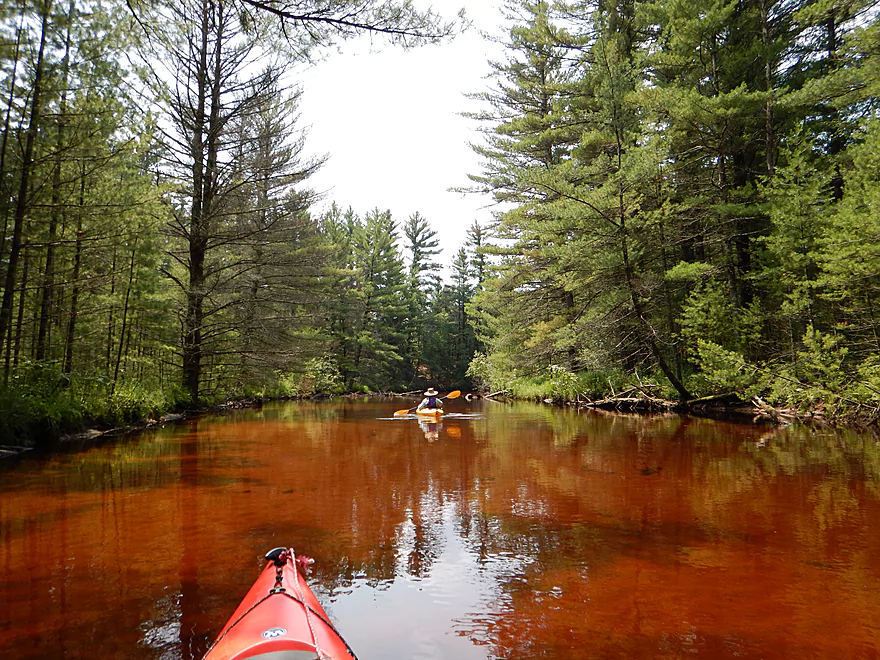
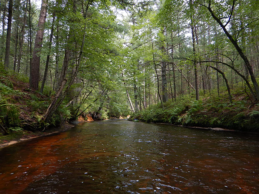
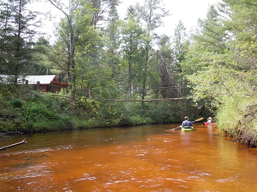
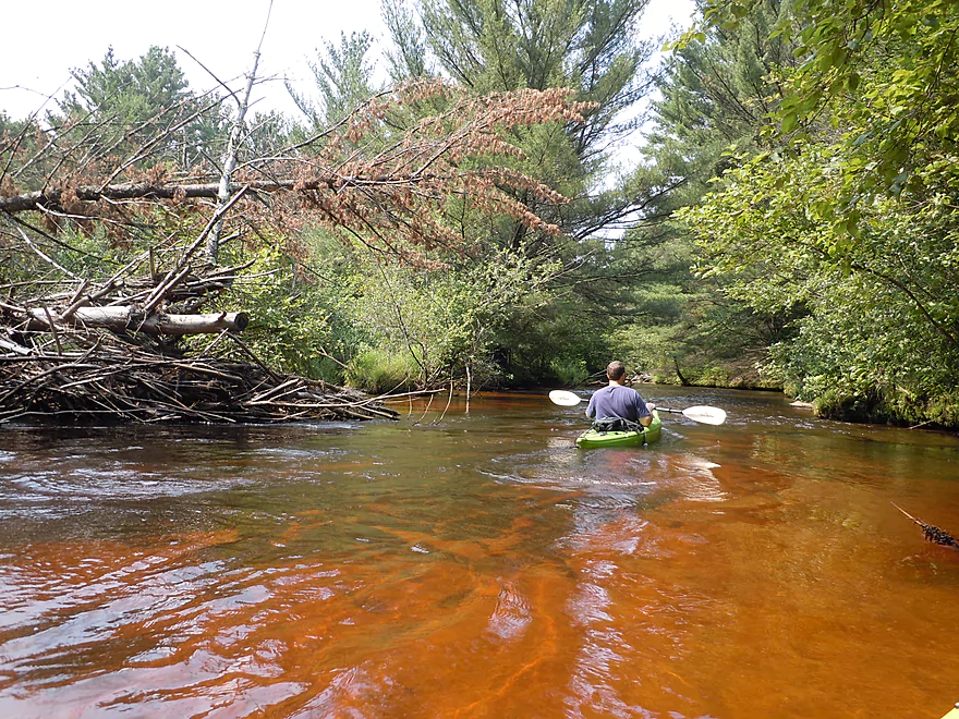
Magma water

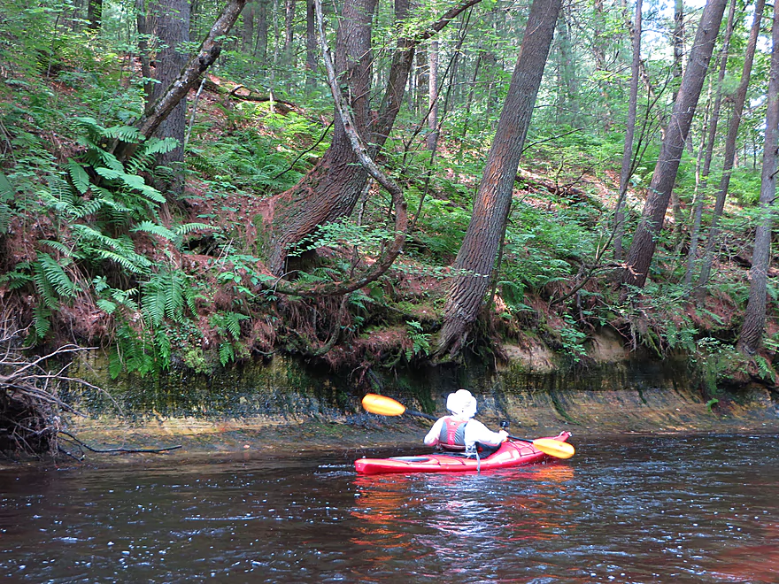
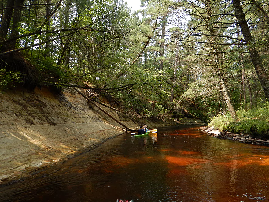
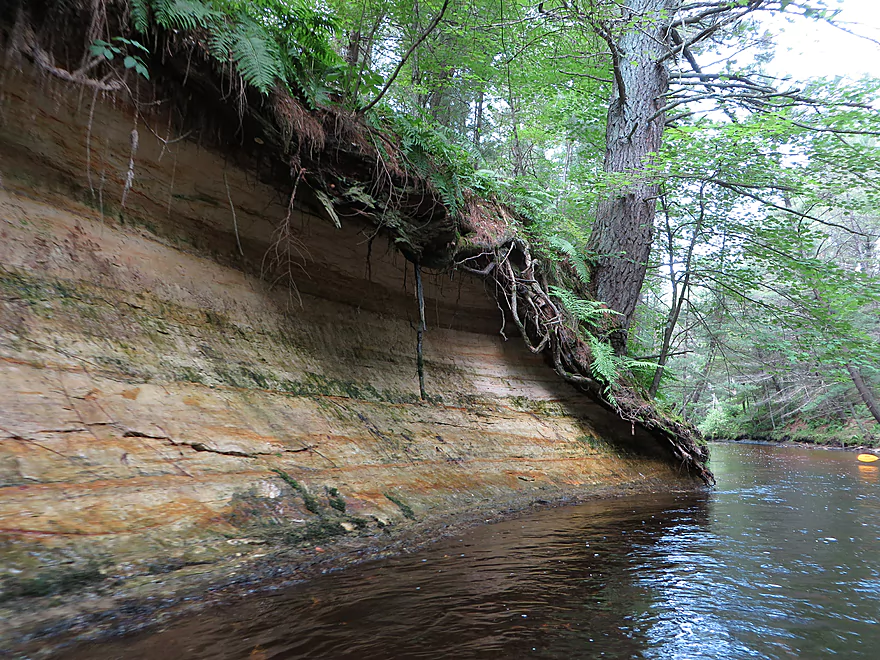
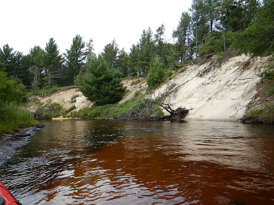
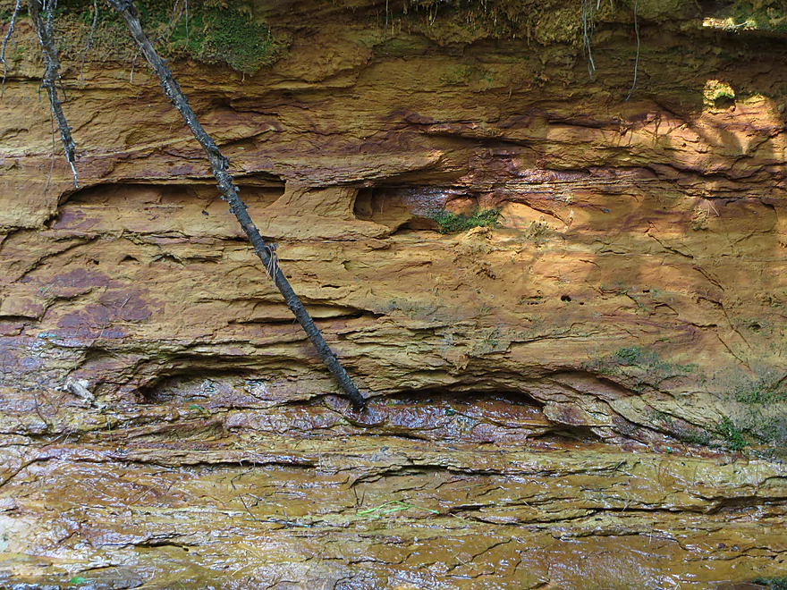
Incredible sandstone banks
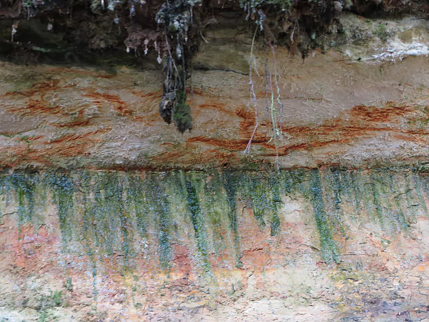
Perhaps mineral stains?
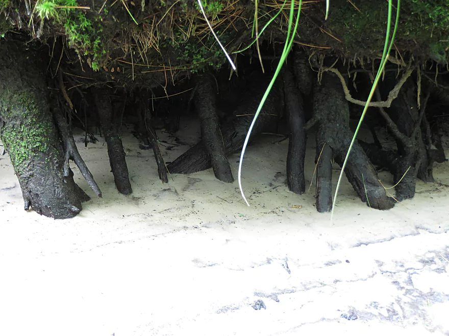
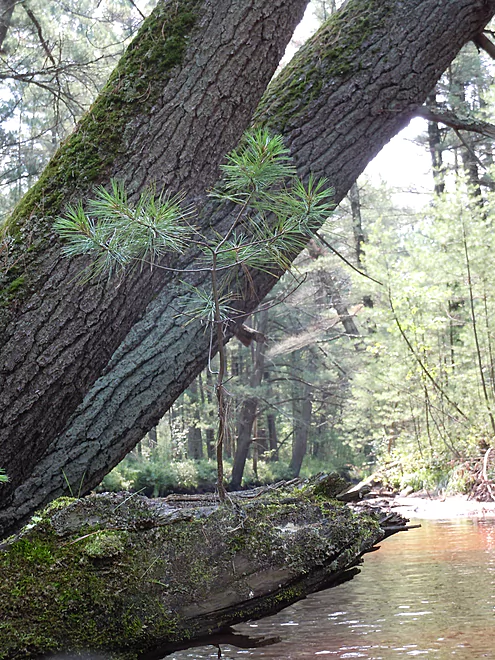
Cool roots
Another bowl-edge rock face
Tree sliding slow motion into the water
A canopy of pines
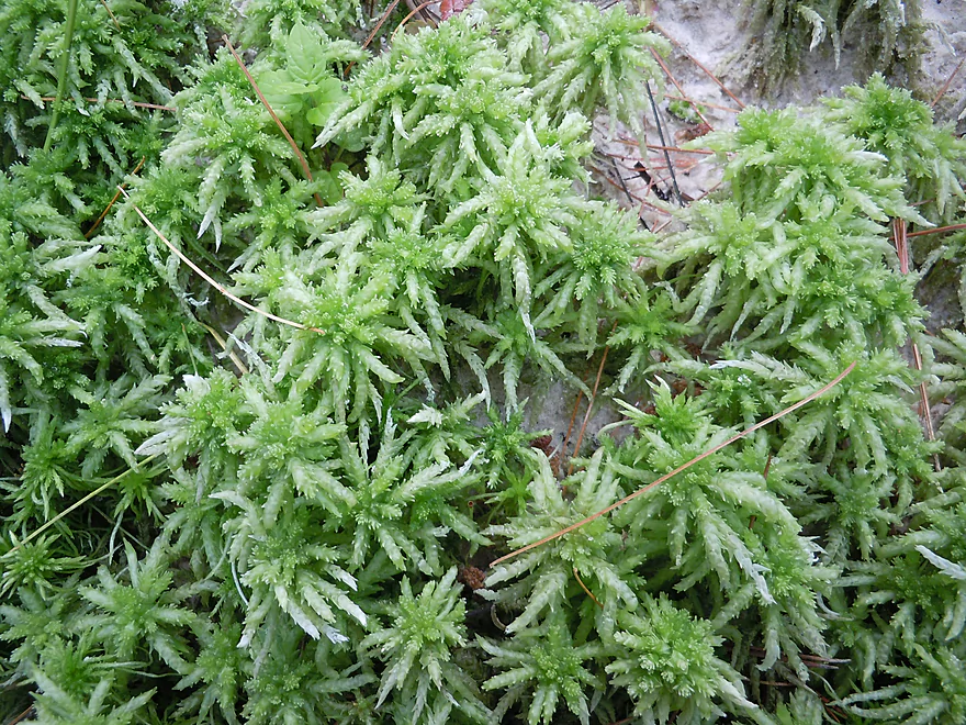
Sphagnum–usually just found in acid bogs
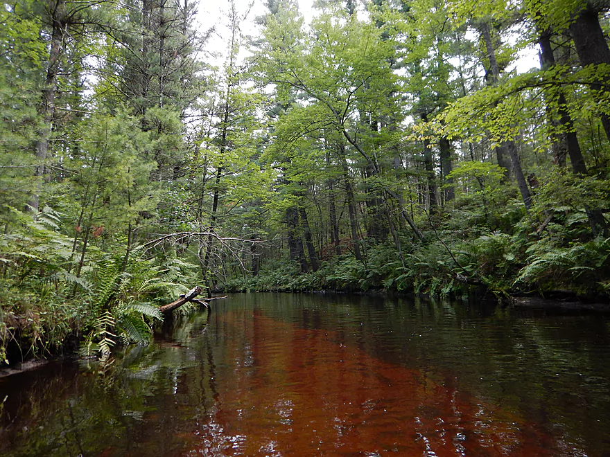
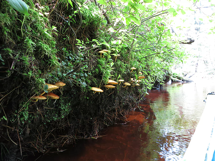
More root beer water
Current slows from upcoming dam and sand accumulates
So what happens when this tree grows up?
Strange hanging lines formed by an insect?
Interesting geologic history
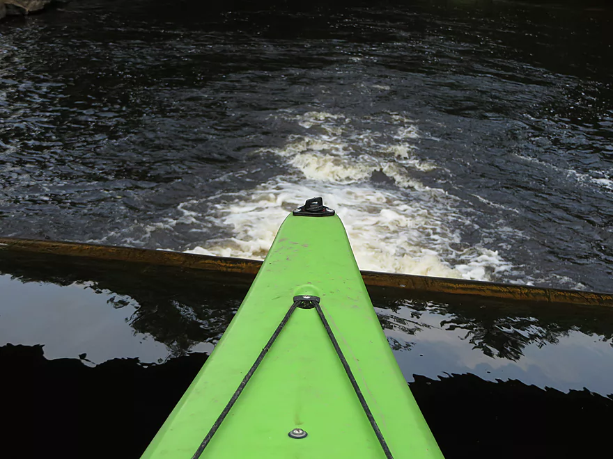
Approaching
Not runnable
Do not get this close
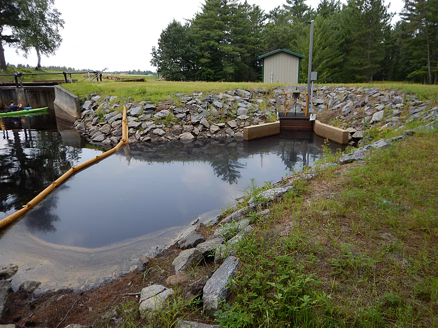
Intake for the cranberry bog (notice the scum)
Portage path on right
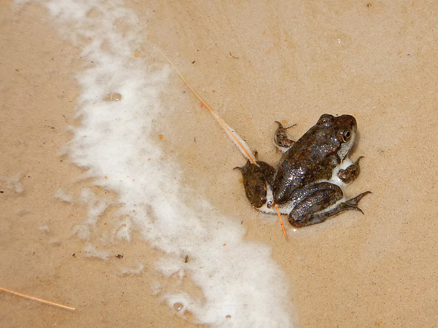
Scum froth plus frog
Manageable re-entry
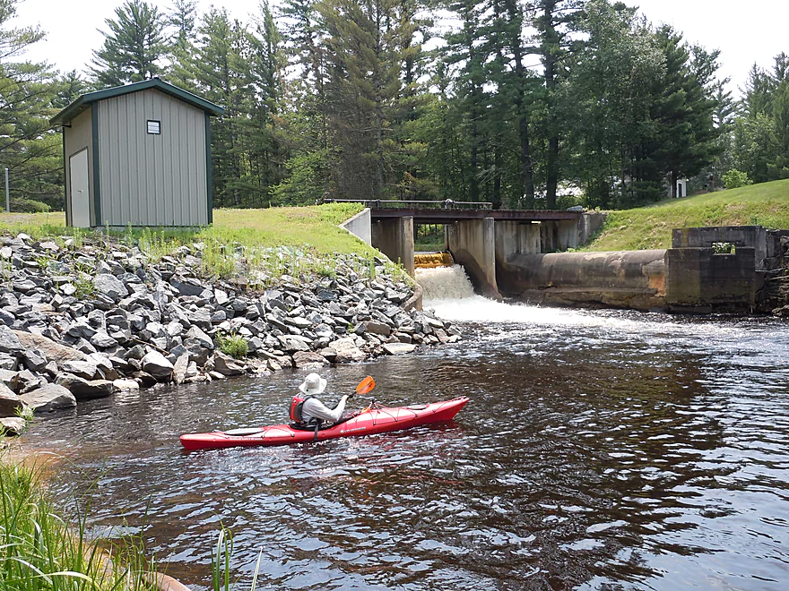
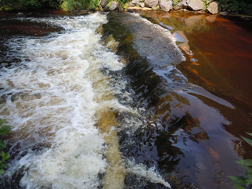
Golden waterfall
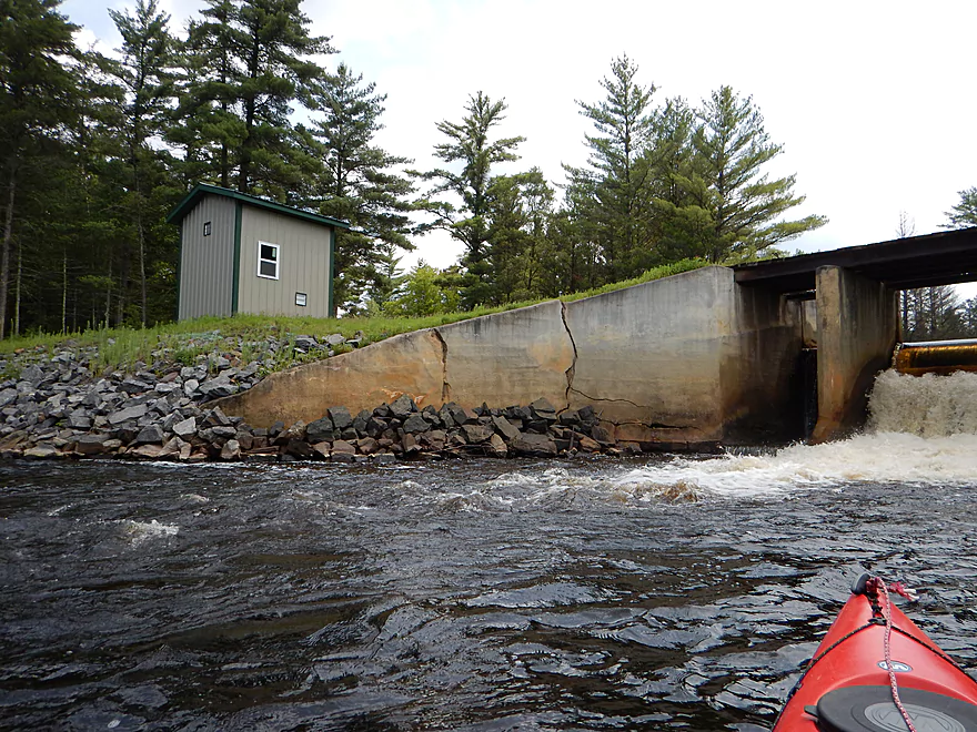
Think this means the dam is eroding its own foundation
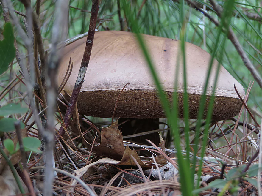
A hamburger bun mushroom (aka a bolete)
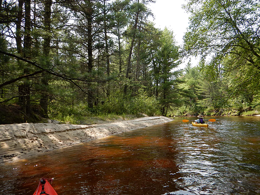
A large sandbank
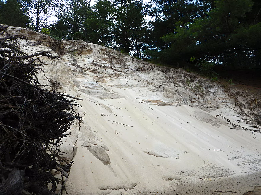
Very light and high quality sand–what a local called sugar sand
From here on, small sandbars appear on the creek
Cranberry bogs above the river
Hagenius–a huge dragonfly that eats other dragonflies
Sarlacc gets kayaker
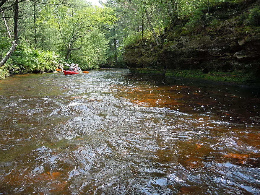
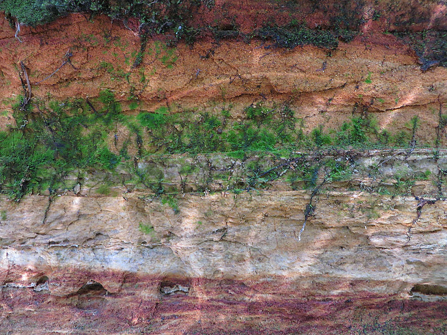
Favorite rock outcroppings on the trip
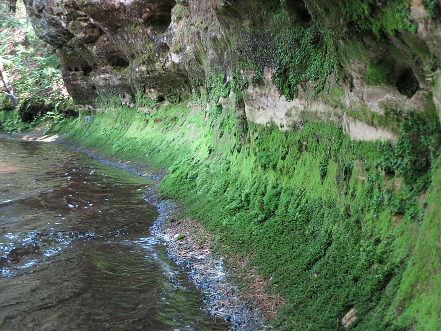
Nice moss and liverwort coating
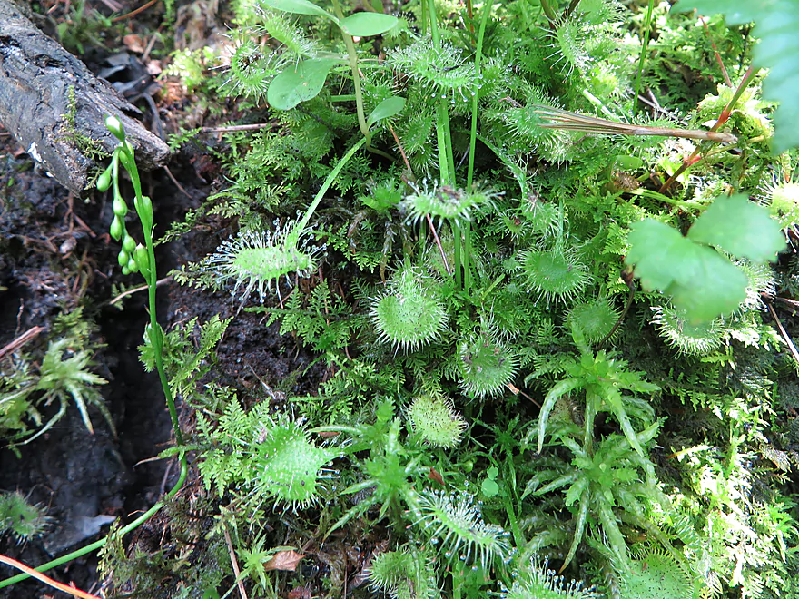
Sundew–a carnivorous plant that traps and eats insects
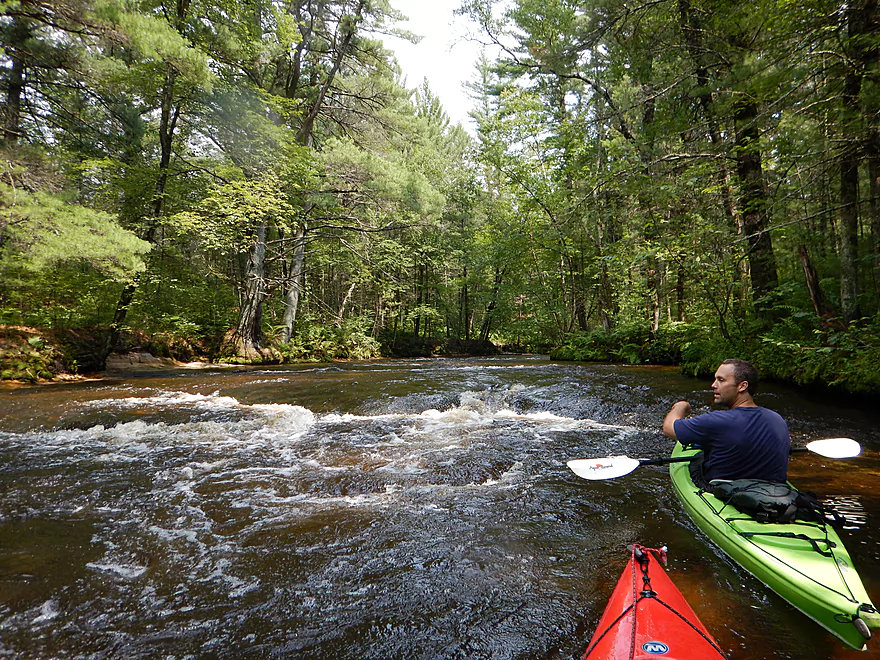
One of many riffles on this trip
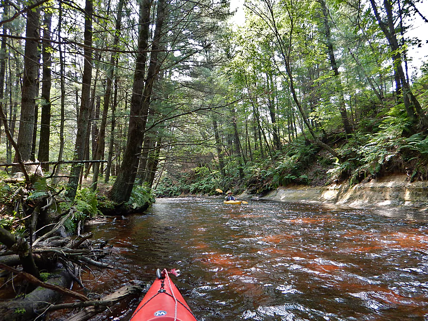
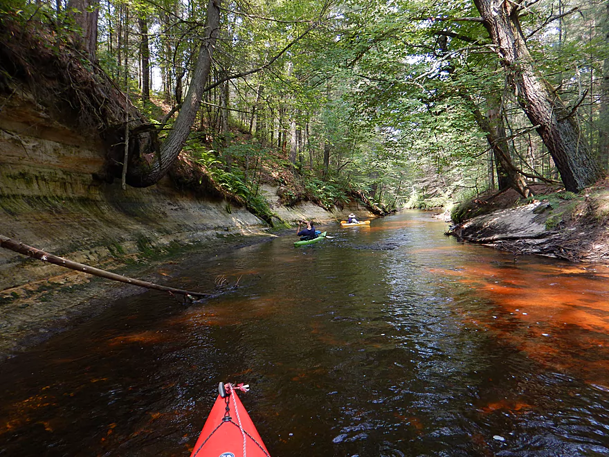
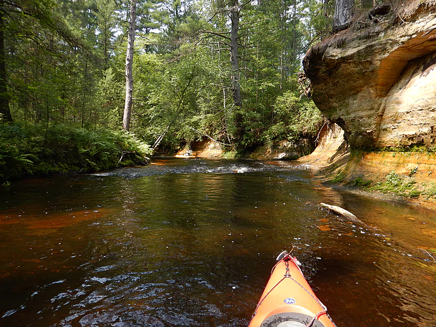
Amazing sandstone colors
Interesting geology
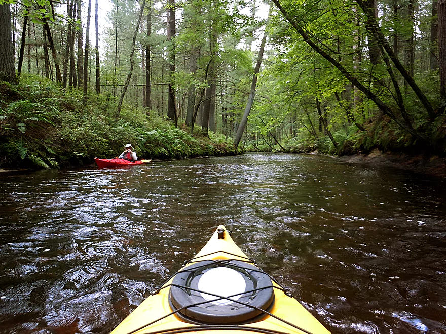
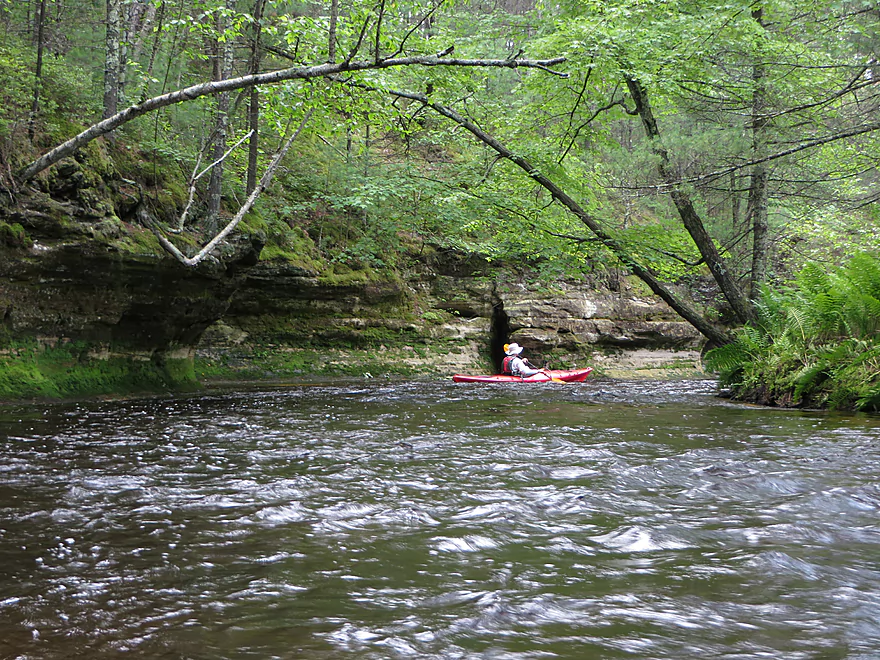
Like being in a tunnel
More serious riffles, but still an easy class 1
Inflatable toy in the river
Neat pattern
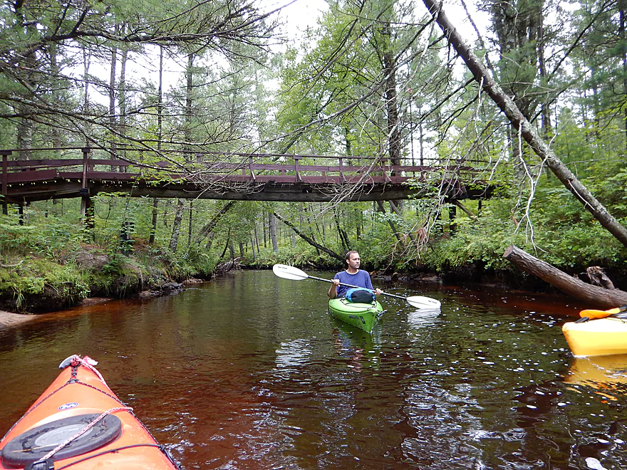
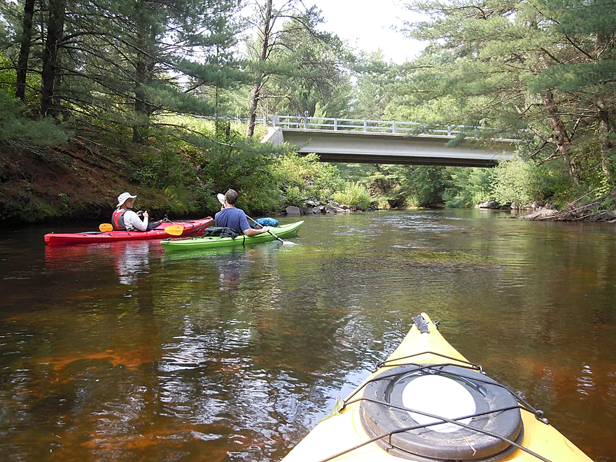
One of two walk bridges on the creek
Mushrooms that have to grow out then up

These sandbars are new and a bad sign of erosion
Only log portage of the trip
Deep water…would not recommend this approach
Couple of cabins on the creek
Biggest rapids of our trip
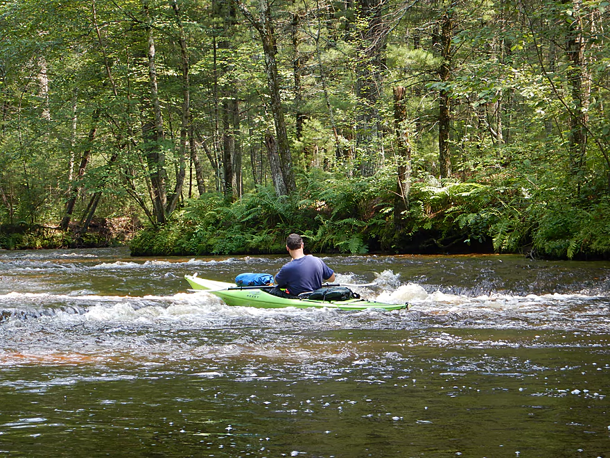
But easy at our CFS (we got wet though)
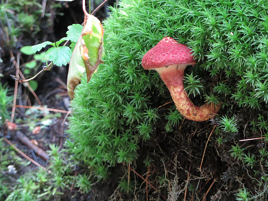
Another bending mushroom
Another walk bridge
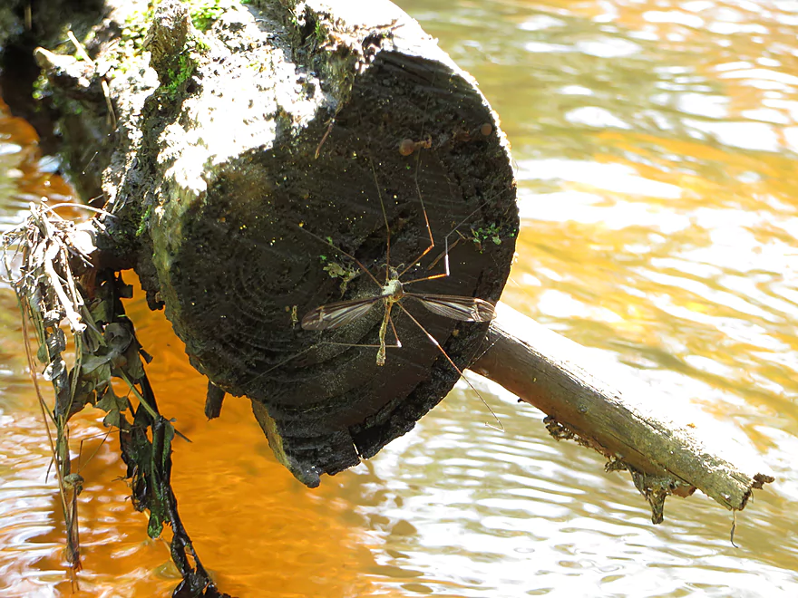
Giant cranefly
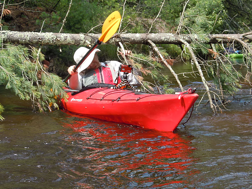
A tight duck-under
MAJOR chainsaw work to clear jams
This sandbank has erosion nets on it
Another new tree down
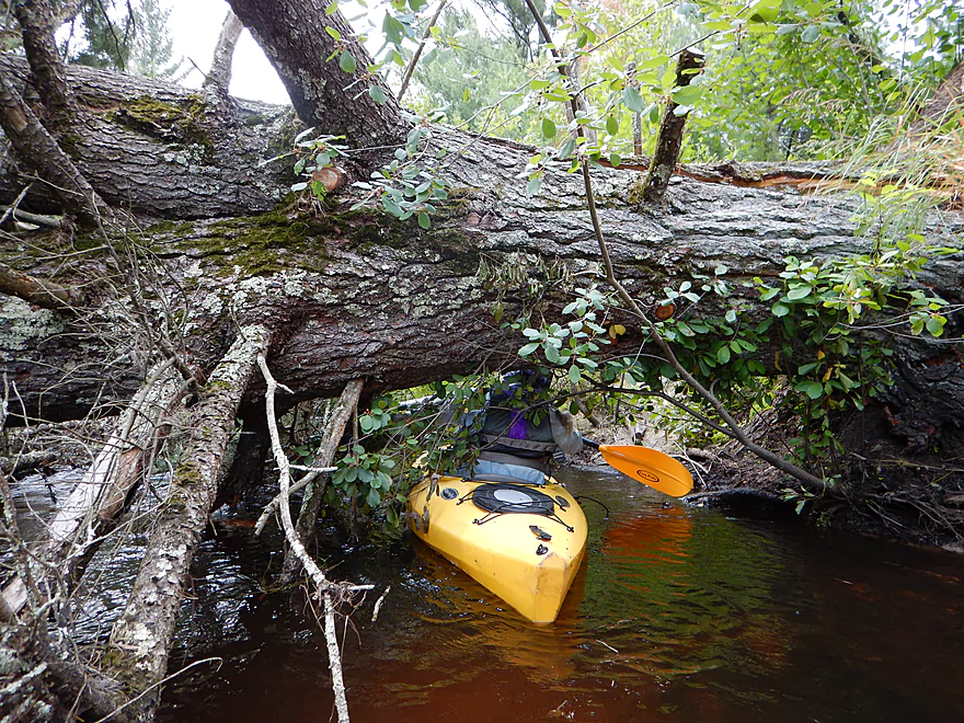
But this is duckable
Water quality stays fantastic
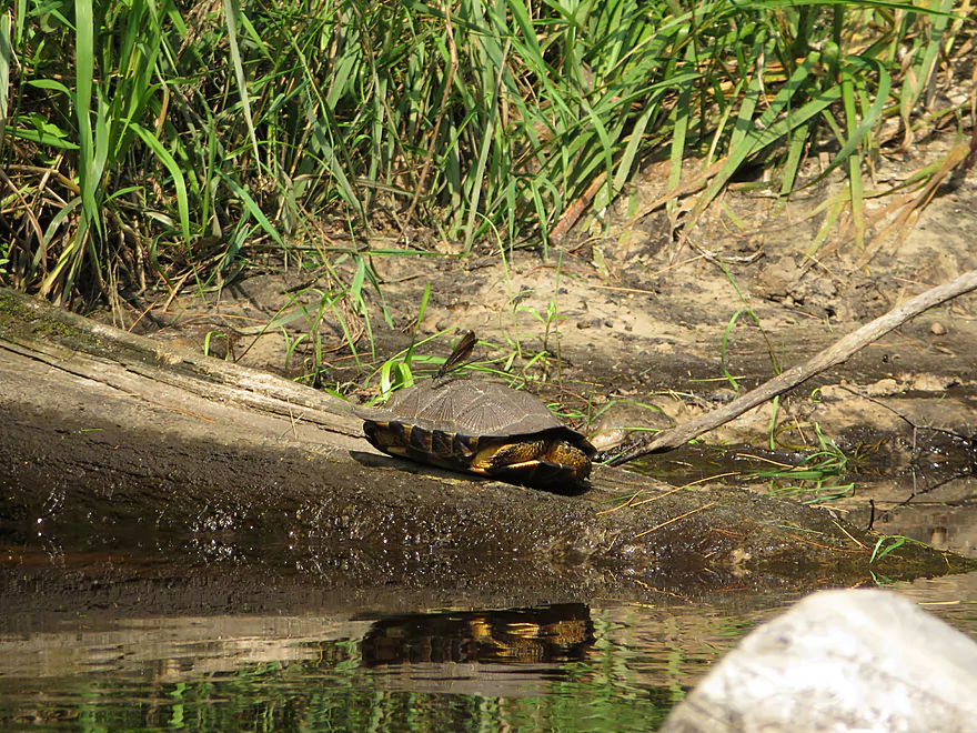
Wood turtle and his pet damselfly
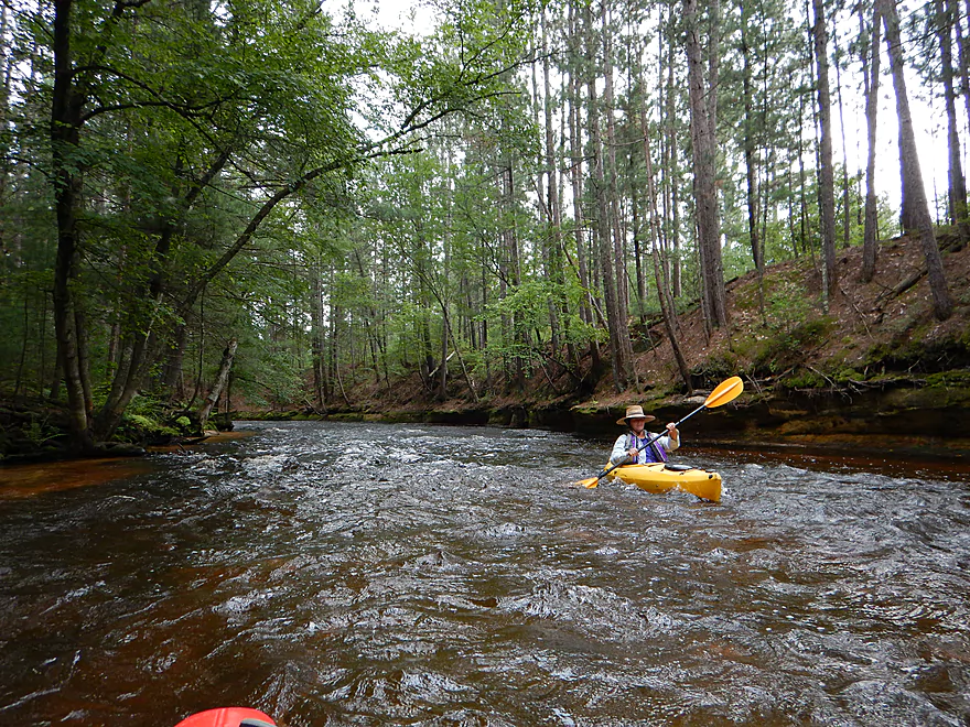
Riffly but safe at our CFS
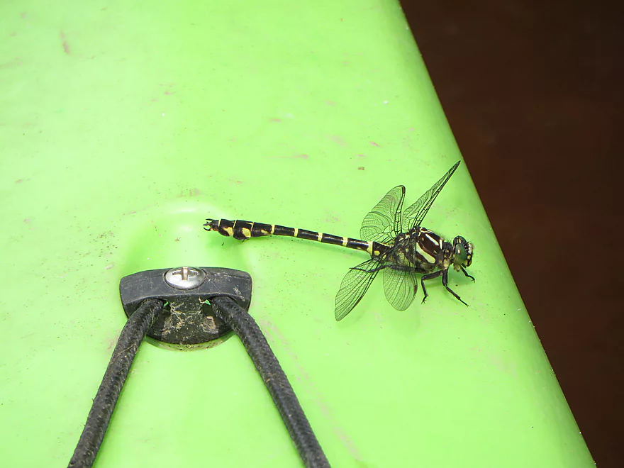
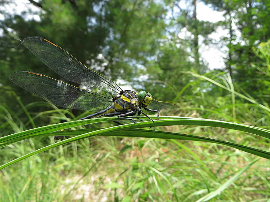
Clubtail dragonfly
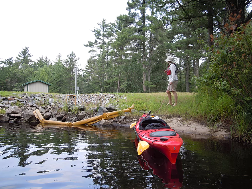
Kelly Road bridge
Ok take-out
Great organization!
Ok parking
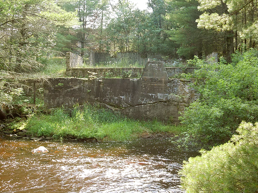
Looks like the foundation of an old mill below the bridge
You do not want to go over this!
Saying goodbye to Robinson Creek
Robinson Creek

My new favorite water trail! I’ve paddled a lot of places…and have had a lot of top paddling experiences (including Bois Brule, Kickapoo, Wisconsin Dells Area, Halls Creek, Morison Creek and Apostle Islands National Lakeshore), but this is my new favorite and might be the best paddling prospect in all of Wisconsin.
A little background on the creek itself. It’s located south of Black River Falls and north of the La Crosse River and flows west before joining the Black River. It’s been kind of an obscure prospect, but has gained traction recently from recent paddle reviews to the point where it probably averages 10 paddlers a day on weekends (according to a local). The lower section is considered too rough for rec kayakers (more on this later) and the upper section appears to have poor access areas and poor information in general regarding its navigability. The middle section however, from Old Country Road to Kelly Road, is near perfect.
The Black River and it’s tributaries tend to run dry for paddlers in the late summer, but Robinson Creek is supposedly pretty resilient and can usually be run most of the summer. On the flip side, this is a small creek with steep banks, so high water after a rain could be an issue. The creek itself doesn’t have a gauge, but the following are some nearby gauges that you can use as a reference with the flows we ran them at:
- Black River – East Fork (maybe the best): 891.8′ above sea level or 238 CFS
- La Crosse River: 3.42′ or 460 CFS
- Black River at Niellsville: 220 CFS or 3.44′
- Kickapoo River: 76 CFS or 8.41′
Because of the nice plant life, I would not run Robinson in the spring, but would wait until at least late May. To ensure you enjoy the same water clarity we did, I would absolutely suggest running this on the low side (using the above gauges as a reference). We didn’t hit bottom too often and certainly never had to get out due to the low water, so I think this could be run at lower flow rates.
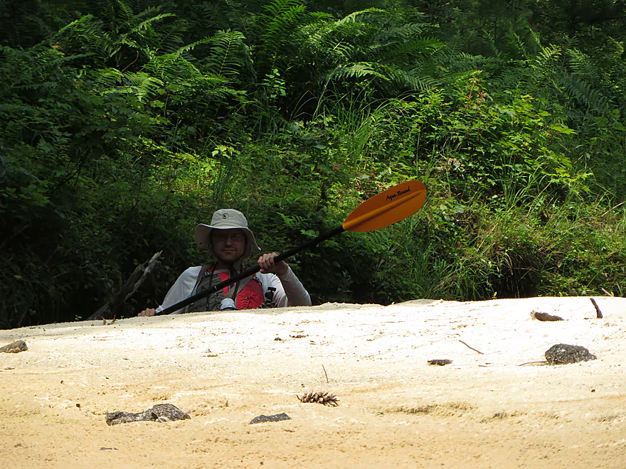
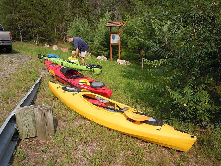
The put-in at Old Country Road is very good, with nice parking and a launching ledge in shallow water. On the flip side, ticks and mosquitoes were an issue and there are no facilities. Morrall Films thought this was a very steep put-in and suggested possibly using rope…but honestly, I didn’t think it was too bad and there is a little trail that leads to the water’s edge (might be worse after a rain).
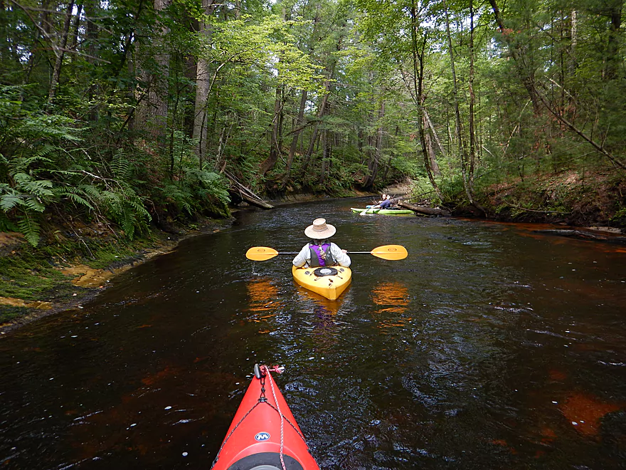
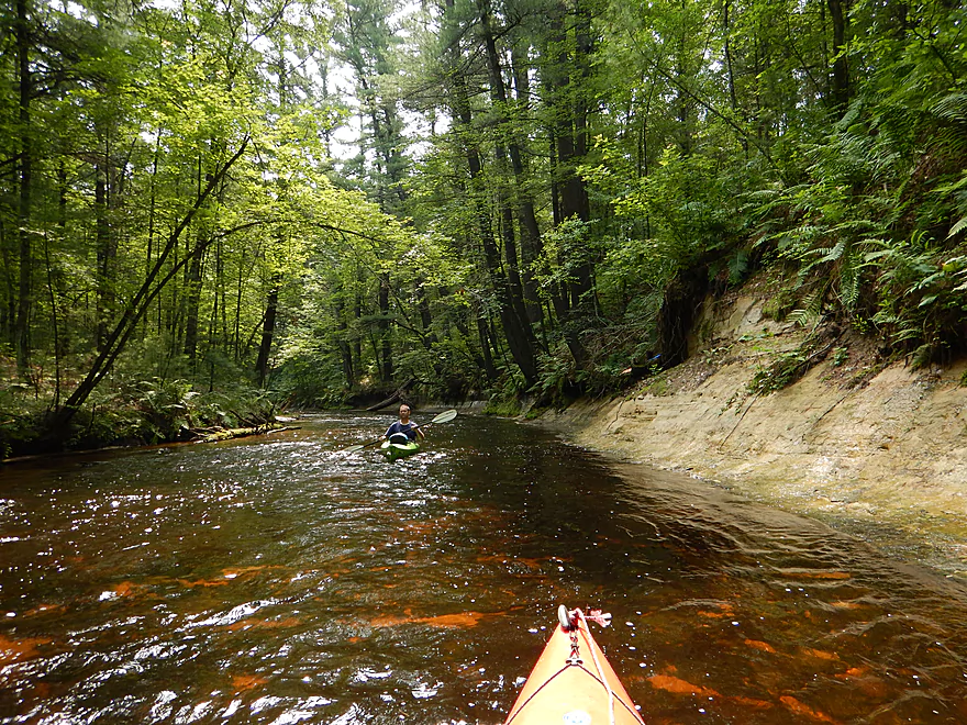
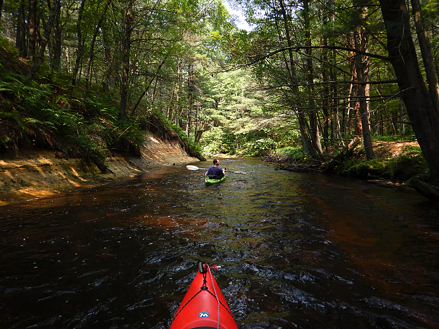
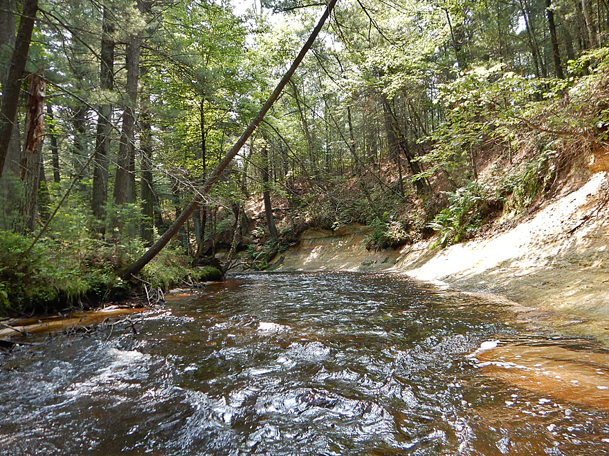
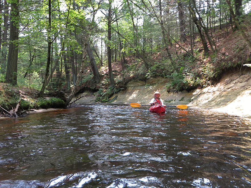
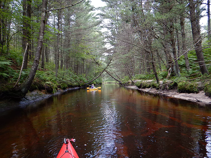
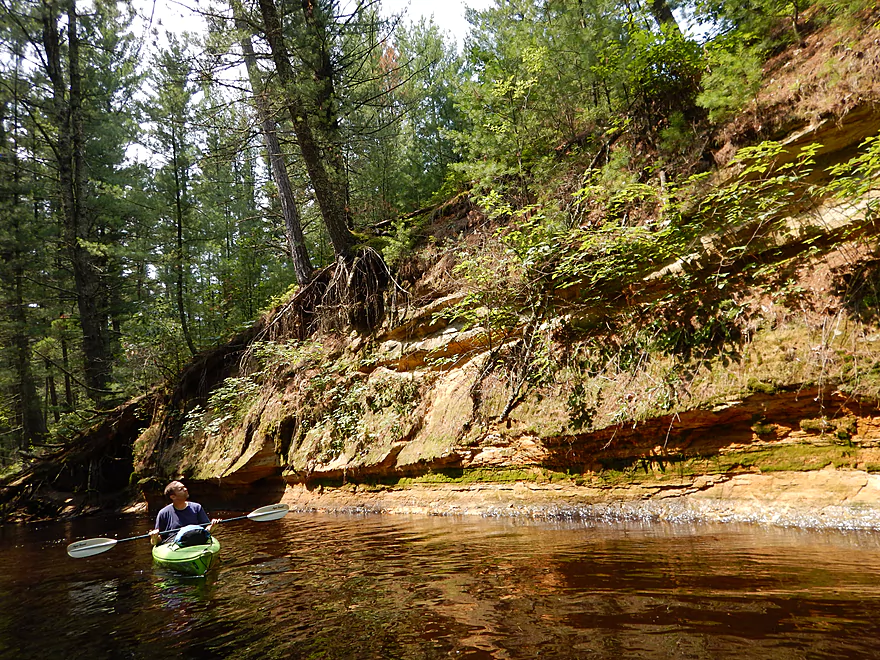
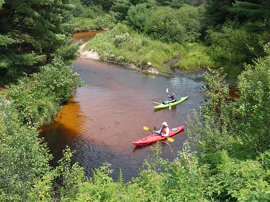
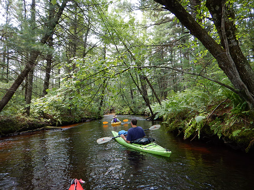
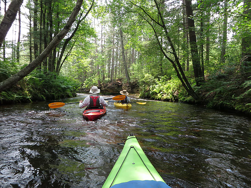
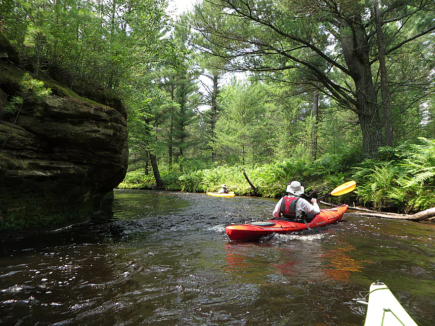
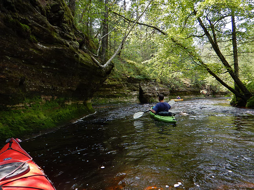
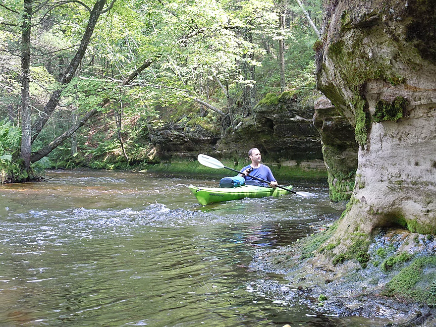
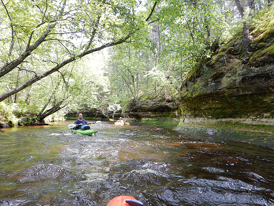
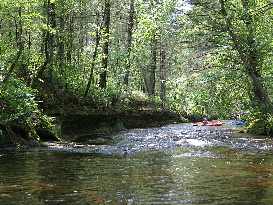
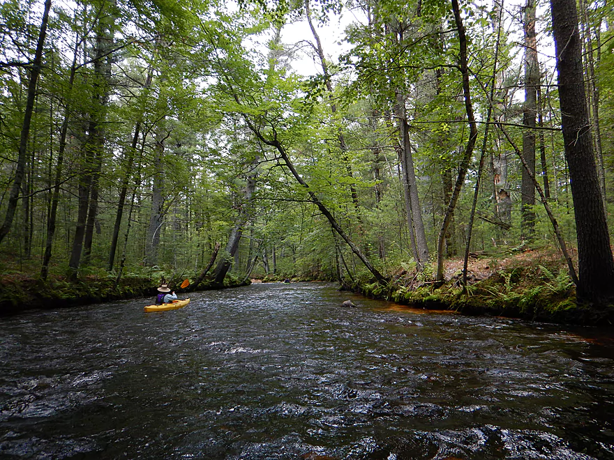
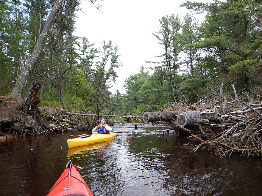
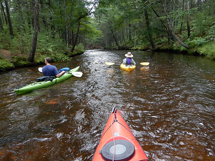
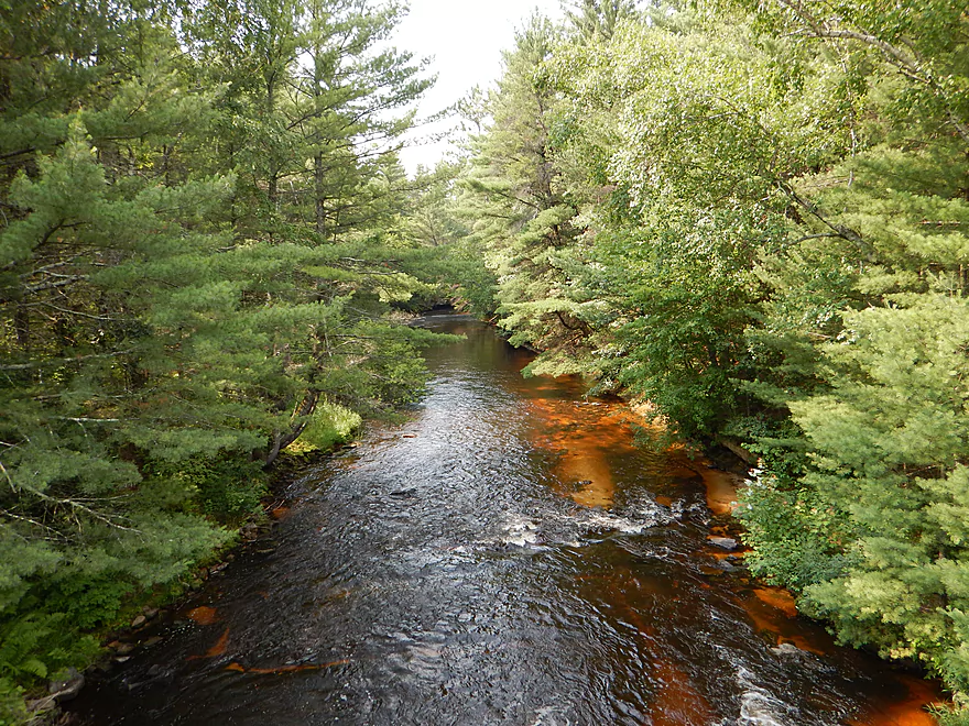
Right off the bat, the creek makes a great impression. You start in a steep valley with terrific lush fern beds on the banks, clear root beer water, and an easy riffle going under the bridge. Take your time to start, as the first mile might be the most scenic of the entire creek. The banks are very steep but exceptionally clean and shady with lush plants, while the trees overhead (mostly white pine) form a nice canopy to complete the tunnel effect. The substrate for most of the trip alternates between nice sand and small gravel/rocks. Despite this being a fast creek with many riffles, few were an issue because there aren’t that many large rocks in the main channel. This is not a a creek for a first time paddler…but it is not a difficult creek either and was plenty safe and fun at our low water level. Because of the current, I suspect it could be dangerous in high water though (I don’t know for sure). The section below Kelly Road is absolutely dangerous (more on that later).
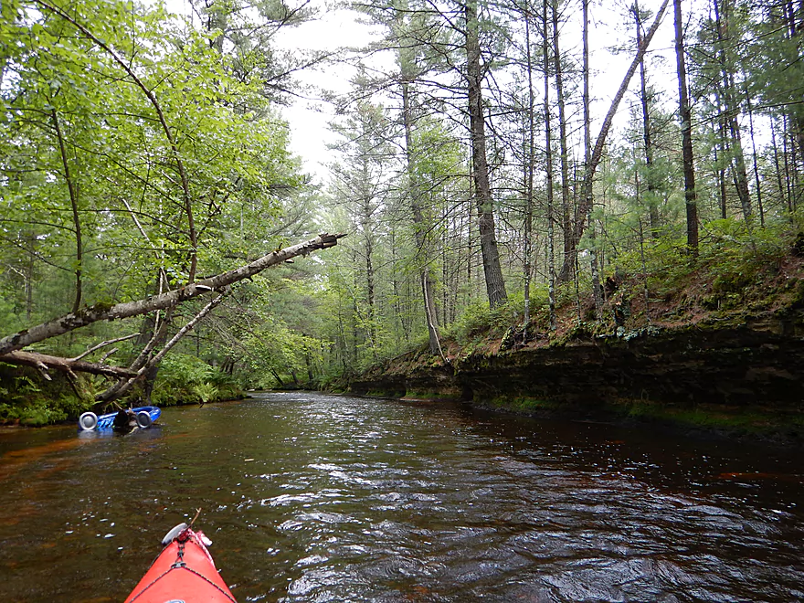
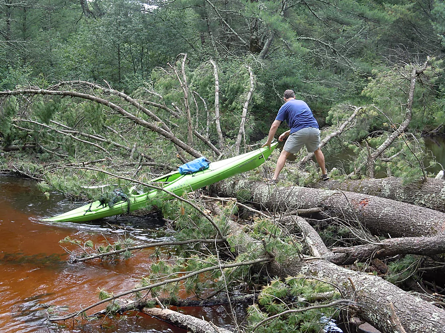
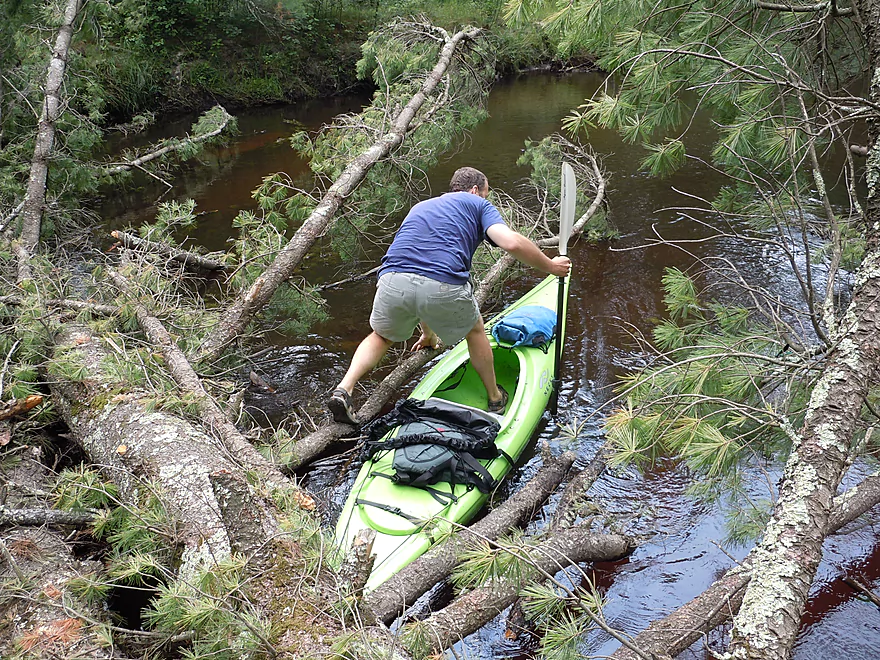
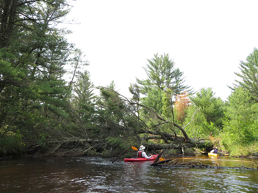
For as much forest cover as there is on this creek, you would expect a lot of log jams…but they aren’t really an issue. There is a local group that cleans up the river every year and the work they do is extensive and quite impressive. Can’t say Robinson is free of log jams though. In the second half of the trip there was a tight “duck-under” that could be an adventure in high water. There was also a fresh downed tree (marked on map) that required a serious portage (not fun, but not major). I’m sure both of these will be taken care of during the next cleanup cycle. Near the end of the trip, there is a section with a lot of old deadfall in the water but this is easy to navigate through.
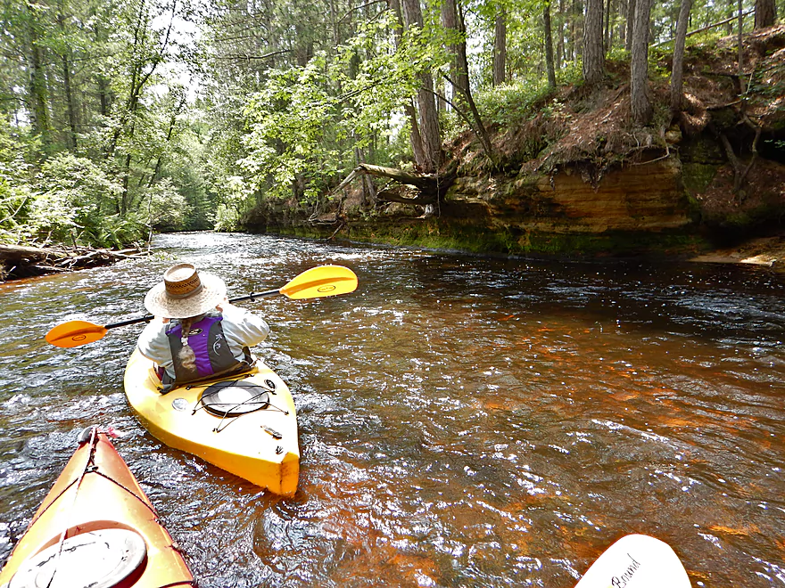
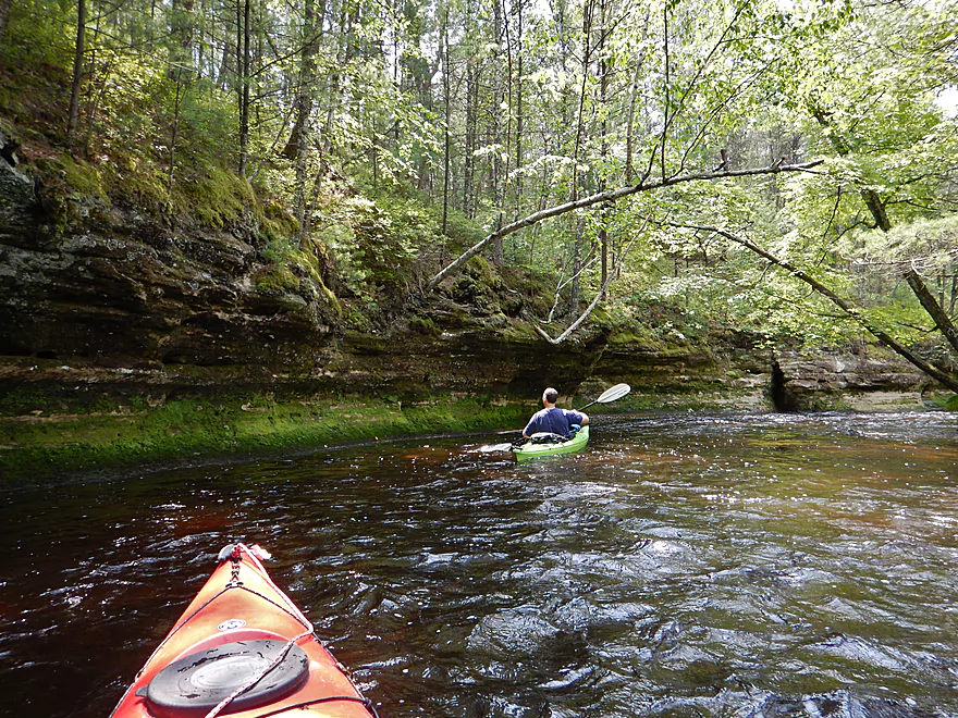
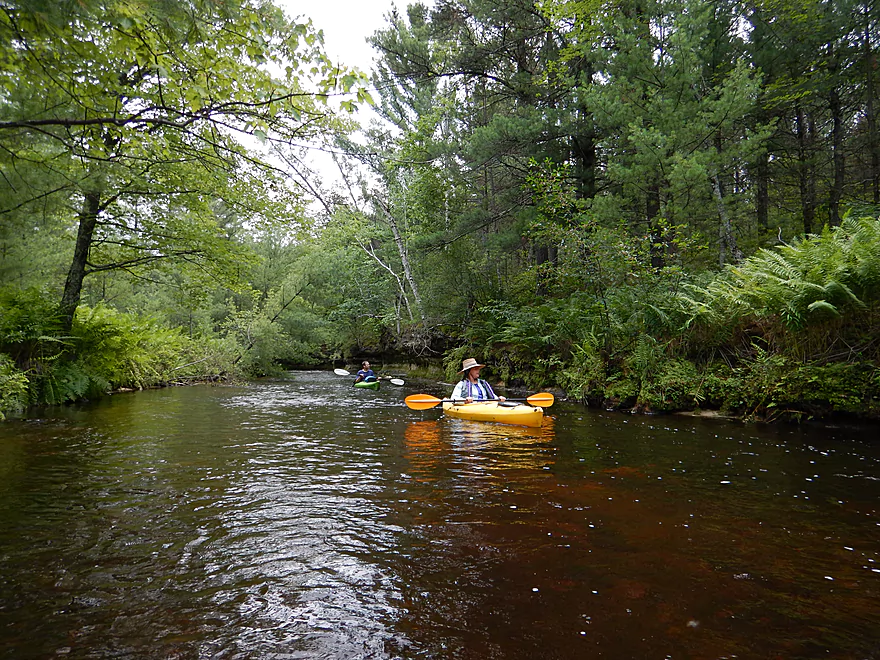
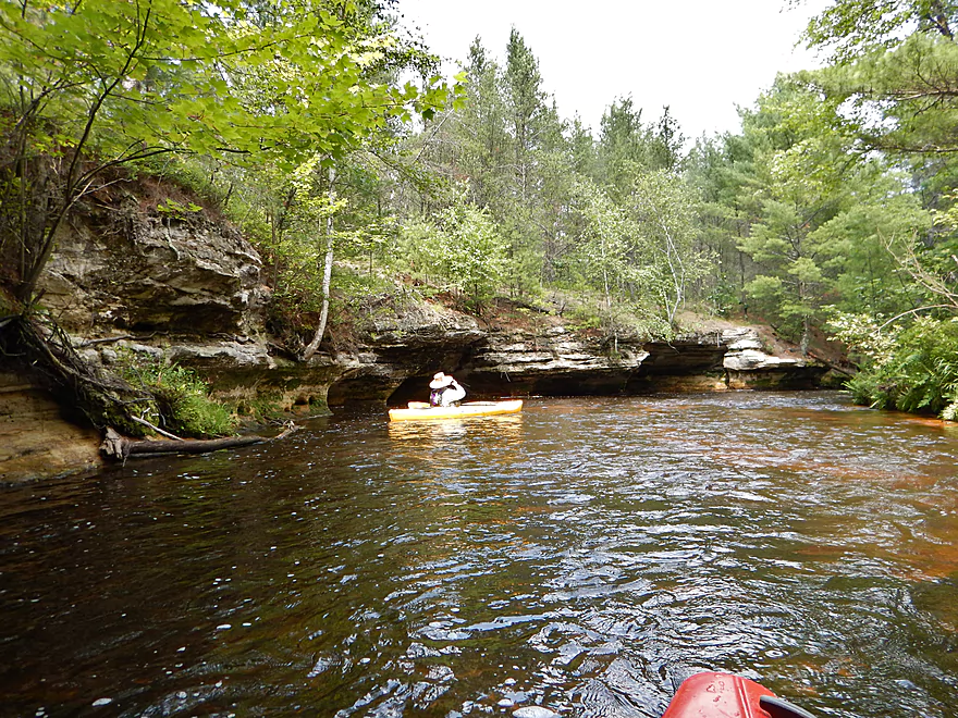
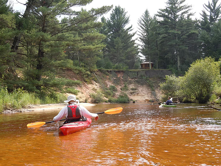
The river itself alternates in character. The best sections will be the ones with the steep banks and close forest cover. You’ll frequently see incredible rock outcroppings in these sections with “weeping seeps” and normally I would mark the best scenic areas of a river on my map with little camera icons, but there are too many for this creek! On the flip side, you have multiple open sections of the creek with scrubby shrubs/grass and sloppy sand banks with random dead trees. Not terrible, as the sand quality is top notch (there are a couple of sandbars on the creek) and the water clarity is still terrific, but definitely inferior to the “tunnel sections” of the creek. So a bit of Jeckle and Hyde flavor to the creek, with again the best section being perhaps the first mile.
After a couple of miles into the trip, you’ll encounter an old flowage and dam on the creek. Odd, because there isn’t much in the way of civilization that you’ll see or hear on the creek (we saw a few houses, but not many). You definitely don’t want to go over this dam. The left bank is private property, as is the right bank. But state law allows for portages in these situations and there is a make-shift area on right/north bank that paddlers use that is easy enough.
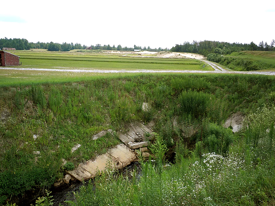
So why is there a dam here? It’s for the local cranberry marsh to ensure it has enough water. Time for a quick digression to delve into cranberry politics! In short, the cranberry bogs are killing the creek. We met an interesting couple near the end of the trip that really provided some helpful background into what is going on. While paddling the entire creek, we were shocked to see so little in the way of fish and other aquatic plants and animals. Sure the plant life above the waterline was terrific and there were a lot insects (including mosquitoes and other biting insects), but not much below water. Turns out this wasn’t always the case. The woman we talked to had lived in the area ~50 years and said the river used to be rich in life and was good for fishing. But once the cranberry bogs set up, this all changed. There are two major cranberry bog operations on the creek. An absolutely massive operation lies far upstream of the creek east of I-94. The second operation is a smaller (but rapidly growing) operation that you’ll encounter a couple of miles into this trip. Non-organic cranberry marshes are notorious for polluting local waterways. They require and discharge lots of water for harvesting which upsets the natural hydrological balance of a watershed (the couple we talked to said they always knew when the harvest was happening, because they would see cranberries floating downstream). Other problems include the pesticides, herbicides and nutrients that end up flushed into the watershed. The dam/flowage set-up, of course, also upsets temperature, erosion, fish migration, and a whole host of other issues.
At certain points on the river, the creek is very sandy, with massive sand banks (some are cool) and a lot of runty sandbars and flat shallow areas. The woman we talked to said it didn’t used to be like this and is all new, thanks to the cranberry growers (she doesn’t buy any cranberries!). This makes sense. Robinson Creek has a lot of soft sandstone and very sandy soil that is very vulnerable to erosion. With aquatic plants being killed by cranberry herbicides and the flow rate enduring artificial fluctuations due to the dams/harvest schedule, I could see how the marshes are causing so much erosion. Even during a non-harvest time, there was a decent-sized drainage ditch feeding the creek by the cranberry bog that doubtless contributes its share of eroded sand as well (the cranberry marshes look like big sandboxes because of the local sandy geology).
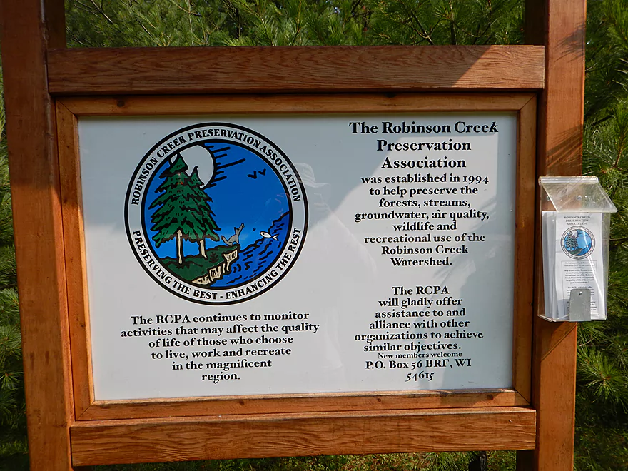
In reaction to what the cranberry bogs were doing to the creek (and a proposal to set up a nearby large-scale pork producing and processing facility), the locals banded together to form the “Robinson Creek Preservation Association.” The cranberry growers are politically powerful (for a time they were actually tax exempt) and it’s been an uphill battle for this group, so definitely consider helping them protect one of the state’s most scenic and valuable paddle trails. They don’t have a website that I know of, but can be reached via snail mail at PO Box 56, Black River Falls, WI 54615. I believe a contact number is 608.498.2888 and their email robinsoncreekpa@gmail.com. If anybody knows of better ways of contacting this group, please share in the comments below.
So it was kind of depressing to learn where our Ocean Spray cranberry juice comes from (literally). Only other gripe (besides the heavy local logging), would be the “blasts” we heard through the first half of the trip. We thought it was frac sand miners (and boy are they popping up like fleas in this area of the state), but it turns out it was Fort McCoy…located almost 20 miles to the south! Turns out talking to this couple that while this was bad, it used to be a lot worse and the blasts from these little war games would actually shake their windows (incredible considering how far away the army base is).
While we didn’t see much in the way of animals, we saw (and felt) many insects. A lot of damselflies and some dragonflies, including Hagenius (they actually are so big they eat other dragonflies and damselflies). The trees were fantastic and frequently the roots would brave the open air to span across a cliff or reach safety in the ground below. It almost looked like some trees were “sliding” into the water with the roots hanging on for dear life–and perhaps from the erosion they were. Lots of terrific mushrooms, mosses and ferns to enjoy, including many rare and unique ones. While a lot of exotic beauty is on this trip, there is a lot of subtle beauty as well if you take your time to enjoy it. The highlight was a clump of sundew, which is a carnivorous plant that eats insects (it’s NOT a venus flytrap). The sundew, like the extensive sphagnum moss that grew along the banks, is normally just found in bogs. Here is a video of a sundew dispatching an insect (not our video).
The take-out is pretty good. It will be on your right just before the only other road bridge on the trip (Kelly Road). Not an ideal take-out ledge but manageable. Tad steep pull-out area, but well within acceptable parameters. Parking is pretty good (you’ll no doubt have company here if paddling on the weekend).
Despite multiple liveries being nearby, I don’t believe any will service the areas east of the Black River, including Robinson. This is however a good route for a bike shuttle–relatively flat, low traffic, only 5.3 miles and no gravel roads.
So what if you want to do more of Robinson Creek? Honestly, I don’t know too much about the upper sections. The creek splits in two above Old Country Road and you might be able to launch at either the Hwy 12 bridge or at Lee Lake. Could be terrific as much of it (unlike the lower section) is protected as a state natural area (with a cranberry exception). But it could be a log jam nightmare with nasty rapids. If you know more, absolutely post in the comments below!
The section below Kelly Road to the mouth at the Black River IS well known though. Simply put, while the scenery is no doubt terrific in this stretch, this should only be run with helmets, whitewater boats, whitewater training and high buoyancy life jackets. The problem is the ledges–the first of which you’ll encounter just under the Kelly Road bridge after your take-out. The issue is not making it over them…you probably will…it’s the small chance you tip over and get stuck in their hydraulics, where the current flows under the surface in a circle and causes all sorts of problems. The American Whitewater site has a great write-up/guide to this section, but keep in mind their website is geared toward hardcore whitewater paddlers and much of what they share isn’t appropriate for rec kayakers and they often understate risk.
In 1995 a young women drowned in Robinson Creek going over Polly Falls (got stuck in the hole/hydraulics at the base of the falls). Her dad tried to rescue her but also drowned. Two days later three firefighters trying to retrieve the remaining body got sucked into the hydraulics and one ultimately drowned. So, not to harp too much, but treat the lower Robinson with respect (the middle segment we did might be dangerous during high water too but was safe at our water level).
There are other good prospects in the area if you are curious, including Halls Creek, Morrison Creek, the East Fork of the Black River, and of course the Black River itself. For more info, check out the “Neighboring Water Trails” map at the bottom of this page. Of the three creeks (each super), Morrison is the roughest (not counting lower Robinson), fastest and rockiest–the best wilderness and whitewater experience of the three though. Halls is more consistent than “middle” Robinson, and perhaps has more rock outcroppings, but isn’t as amazing IMO. It’s definitely rougher than Robinson as well, but not close to Morrison’s level.
If you paddle this stream, try to be a quiet, low impact kayaker. The couple we talked to weren’t thrilled that I would be reviewing this creek for other paddlers, but I do think the more people that know about Robinson’s plight the better.
For more information on bridge access points see the overview map.
- Hwy 12 to N. Old Country Road: 5.2 miles. This could be scenic, but the creek splinters into small branches that have a high likelihood of logjams.
- N. Old Country Road to Kelly Road: 6.4 miles. The most popular and scenic stretch on the creek. This leg is my favorite water trail in the entire state.
- Kelly Road to Stony Creek Mouth: 1.2 miles. A fast and super scenic stretch with multiple outcrops and Class 2-3 rapids. This is a tricky section that should only be attempted by skilled paddlers. The biggest hazard is a 5-6 foot ledge called Polly Falls that has claimed lives in the past. See overview map for more details. Note, as of 2023 there are many downed trees in this stretch.
- Stony Creek Mouth to Fall Hall Road: 2.6 miles. Note, as of 2023 there are many downed trees in this stretch.
- Stony Creek Mouth to Hwy 27: 1.9 miles. A very open and sandy stretch with no outcrops. By Robinson standards, disappointing…but still nice with clear red water and several small sandbars.
- Hwy 27 to Fall Hall Road: 0.7 miles. No outcrops on this section, but it’s still pleasant with tall white pines and clear sandy water. A bit more wooded than the leg upstream of Hwy 27.
- Fall Hall Road to W. Pine Hill Road: 2.6 miles. The first half mile is incredibly rugged and scenic with exposed bedrock and impressive sandstone cliffs. There are several light rapids but also 2 very serious Class 3 ledges that should be treated with respect. After the gorge, the creek gets a bit messy and becomes much less interesting. See overview map for more details.
- W. Pine Hill Road to Mouth on Black River: 1.2 miles. I don’t know too much about this stretch…it’s likely sandy with many downed trees and logjams.
- Mouth to Irving Landing: 3.0 miles. A pleasant stretch on the Black River with one scenic outcrop.
Robinson Creek Tributary – Stony Creek:
- Kelly Road to Stony Creek Mouth: 0.6 miles. A clear and sandy creek with exceptional scenery by Kelly Road. Unfortunately there are too many logjams on this creek for it to be recommended.
Trip Map
Overview Map
Video
Photos Size:
I did Robinson Creek on Sunday the 29th with my brother and his GF. It started out cool and drizzly but by the afternoon the sun came out and it was very nice. What a fantastic creek! It is now my new favorite too! The area had gotten some good rain during the week so we took a chance with out scouting it first, it was flowing perfect. I love this site and all of your outstanding reviews, keep on paddling!
Don
Thanks for the comment! If you liked Robinson, consider Halls which is very similar and in some ways better.
Very pretty stream…BUT, loaded with log jams, deadfall, and numerous strainers. We ran this in late July 2016. We had to cut through three jams with an axe and a bow saw, and line the boats under a huge tree with less than 10 inches clearance beneath. Both boats dumped trying to dodge a strainer from the right bank and a large trunk extending about 12 feet from the left bank in less than 15 feet beyond in a current of about 4 knots. I had never dumped an open boat before in over 50 years of canoeing up to Class III rivers. Possibly the volunteers who opened up the holes in the older jams were overwhelmed by a lot of new dead fall. Who knows. Not much fun in Stalingrad.
Thanks so much for the heads up. It is tragic to think that this creek could be filling up with deadfall and hopefully this gets cleared out in the future.
I just ran the creek today. People who fuss about deadfalls should take up bowling,or emigrate to Stalingrad, I guess. Deadfalls are part of the paddling experience. I ducked under a few with no problem, but had to portage two new-ish deadfalls that will challenge those who clean up the creek. (If those who do so get my email address, let me know and I will be most pleased to join you to go after these obstacles.)
Appreciate the feedback Denny. Perhaps the obstructions are more of a challenge for bigger boats? At any rate, if I do hear about any cleanup news I’ll let you know.
I met the guy who works on the crews who keep Halls and Morrison free flowing while we were paddling Halls Creek. I didn’t get information from him however it wouldn’t surprise me if his group also cleans up Robinson. He mentioned that Morrison is navigable above Cemetery road for a few miles after they did some work, which may be the first time people were able to paddle down that section(his words not mine).
He met us as we returned to our boats from our side creek adventure, their crew was working on the opposite side of Halls(anyone who paddles down Halls probably knows about this one, it is a pull over and explore up the stream sort of side adventure).
Apologies Jakes for the delay in getting back to you…my email notifications from the website were going to my spam box. What this guy is doing to keep these creeks navigable is really appreciated. Am most curious about upper Morrison creek, as this could be an amazing prospect. Trick would be put-in and bike shuttle… There is a dirt road off Seils Road, but I don’t know much about this. You could possibly launch off Hwy 54 on the main branch or a trib…will have to reserach this more. Appreciate the tips!
Ran Robinson July 6th 2019 – Clear water and nice flow. The most scenic and serene “yak we’ve done to date! Nice extended riffle sections but NUMEROUS trees and strainers from bank to bank with steep banks and difficult get-outs = fatiguing day!
NOTE: 1st bridge on Kelly Rd off County O IS NOT Robinson Creek so our ride back was left in the wrong spot. Luckily due to the many obstacles and delays, with fading light we chose to walk Kelly Rd from Waterfall get-out and found our mistake. Will check Topo maps better next time in unfamiliar areas.
All in all, a great creek/river – riffles nearly made up for obstacles and beauty edged it into favorite status.
It’s too bad to hear about those strainers…hope that Robinson Creek doesn’t turn into Dickey Creek. Thanks for the update.
We ran this section today (300 cfs Black River @ Neilsville). It was perfect. All trees have been cleared. The water was excellent–a few bottom scrapes but no hang-ups. Thanks, as always, for your work in reviewing these amazing waterways.
Greetings,
Please feel free to update the contact for the RCPA (Robinson Creek Preservation Association) to robinsoncreekpa@gmail.com
Membership is free and if you want to join, simply email a request. Members receive updates and newsletters and have the opportunity to participate in events and scholarship.
Annual events:
Spring/Fall Adopt a Highway clean up
Summer Pancake Breakfast and Paddle
Winter Soup and Snowshoe
February candlelight ski
Other events include clearing/cleaning the creek, water monitoring protocols, and trout stocking.
Finally, the UW-Wisconsin Cranberry Research Center located on the Robinson Creek and other marshes in the watershed have been integral partners and founding members of the RCPA since its inception in 1993. Also, your re-telling of the drowning at Polly Falls is inaccurate. Please call if you would like to update your site: 608.498.2888.
Sincerely,
Tim Sprain
RCPA President
Thanks Tim for the update. I’ve updated your contact information in the main review. Hopefully in the future you’ll get a website!
Boy you sure are a tree hugger aren’t you?
I am a very proud one, and I suspect this site is thick with them. The future is green
Could someone please tell the real Polly Falls drowning story?I first fished that stream with my Dad in 1970 followed by many canoe/kayak trips.The Steele family used to let us park and fish off their banks,those were the days!
I personally have no first hand accounts of what happened. All that I know came from either newspapers or Americanwhitewater.org.
The 2023 annual Robinson Creek Preservation Association pancake breakfast will be at the historic logging camp at Polly Falls on Saturday June 10 from 9-11 with paddle to follow. Please consider joining the RCPA (no membership fees) by emailing robinsoncreekpa@gmail.com and enjoy a day on the creek.
Thanks for the heads up!
“Robinson Creek Preservation Association” is warning: “The Robinson Creek Extremely High and Dangerous – do not paddle. There are many trees reported down.”
I advice waiting for the water to subside for the logjams to get cleared out.
I did this section on Fri 8/8/25, WOW what a great river, absolutely beautiful! The river was fairly low so we scrapped a bit and there were several shallow spots, but still total doable. There were a few trees to duck under and 2 that required those in kayaks to get out but I was able to get under all but one in my solo canoe, we were able to float the boats under that one and then float/swim under it ourselves. 2 FYI’s to add the Put-in ( the “Zelensky” ?) road is called Old County I and there is a visual gauge on the Hwy 27 bridge, it is a “yardstick” type gauge attached to the NW bridge abutment on the down river side. Oddly the gauge goes below zero and was at -0.2 when we went, While this level was OK, I would not recommend going when the river was any lower.
Thanks for the feedback. I was curious about the logjam situation…and it is good to hear there are only two duckers now as the situation was worse. Hopefully these get cleared out soon though.