
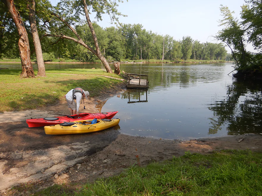
Starting the trip at the Millville Boat Launch
The launch is located across from two islands (this one is Hacklin)
One of several canoe camping convoys we saw
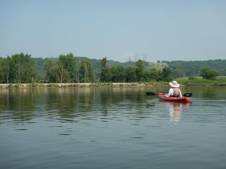
Nice bluffs to start the trip
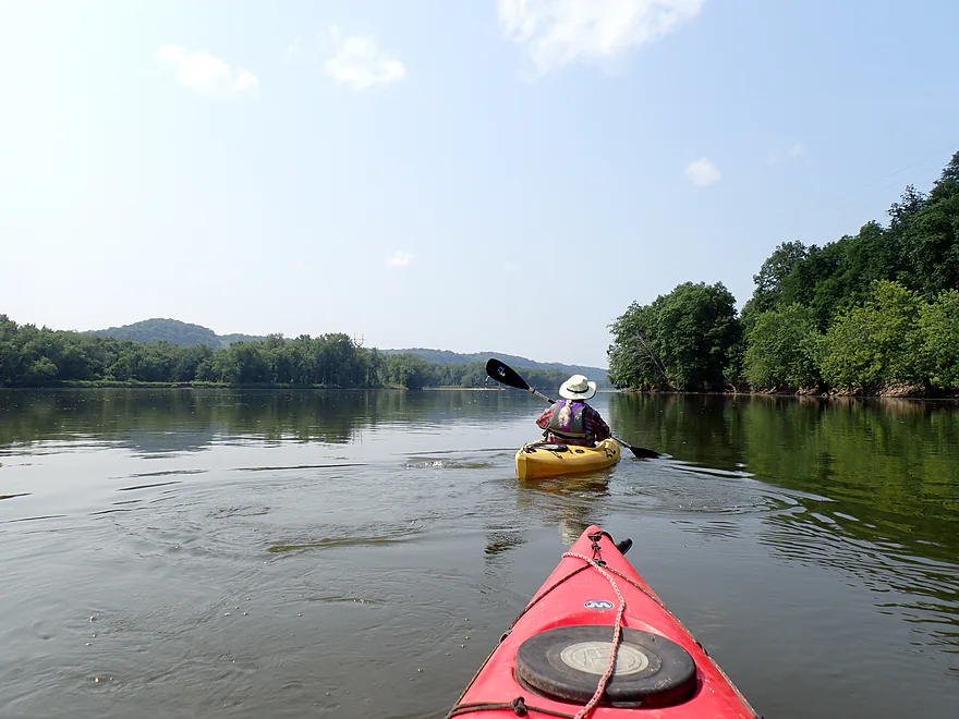
Islands split the river into subchannels…different optoins for paddlers
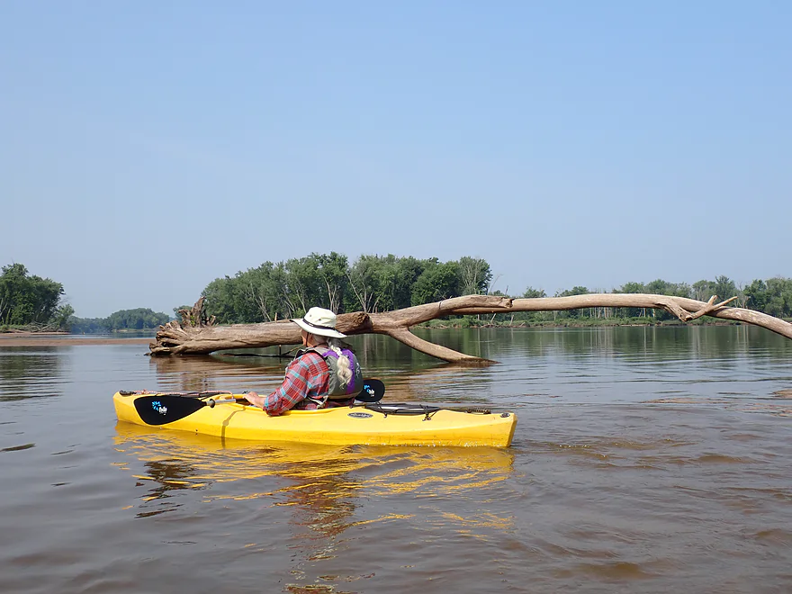
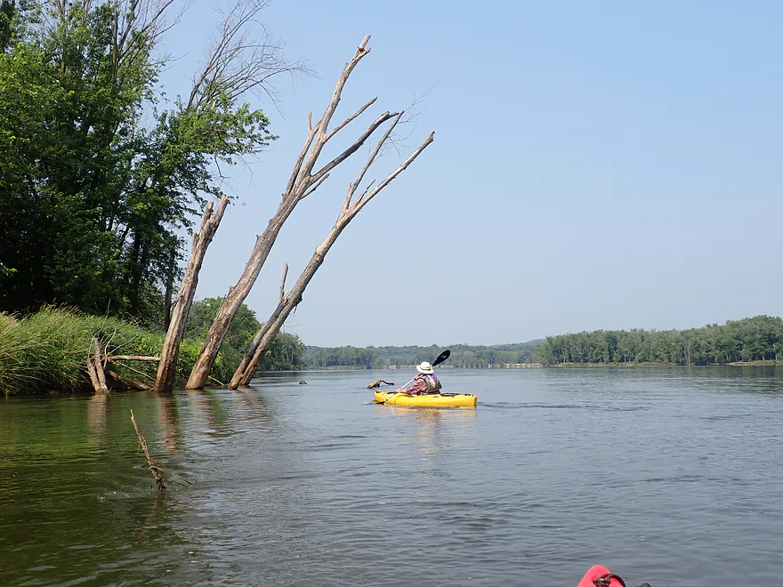
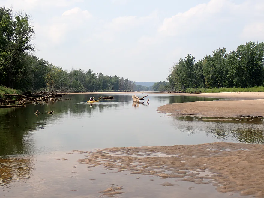
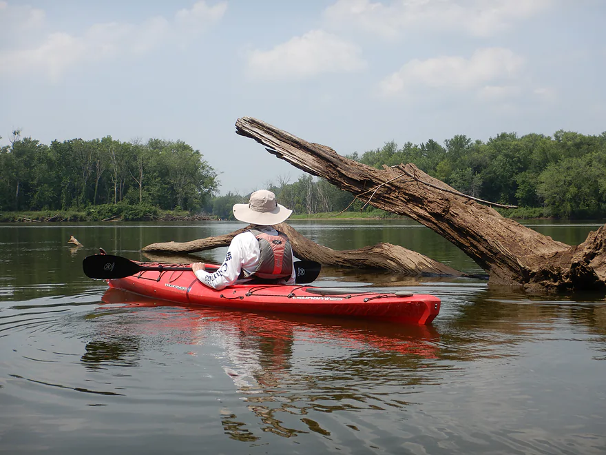
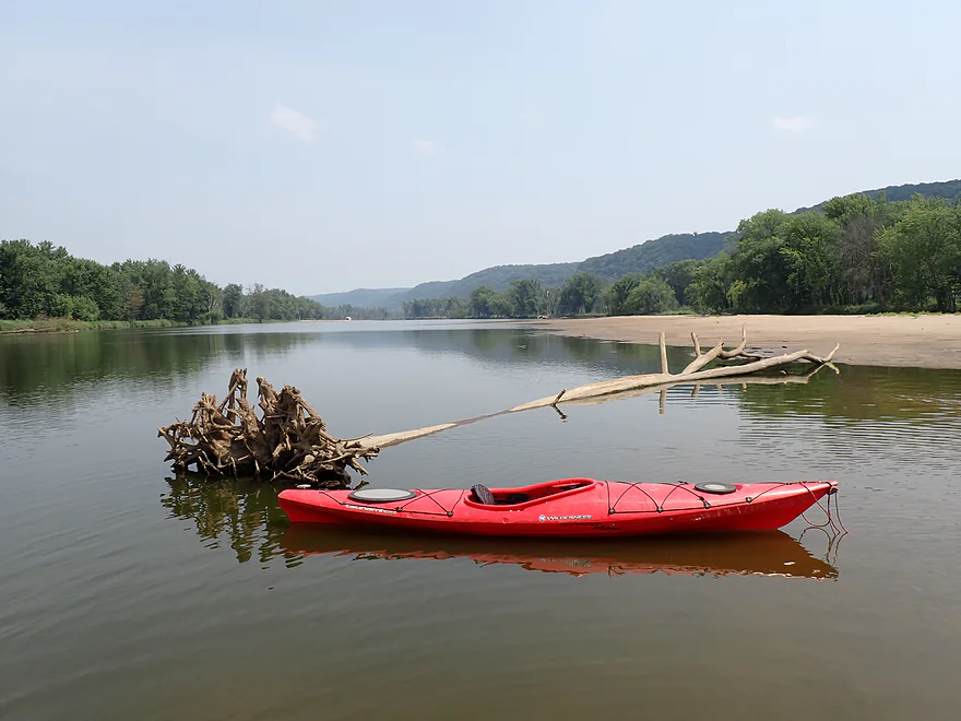
Not sure how this tree ended up in the middle of the river
Exploring a side channel
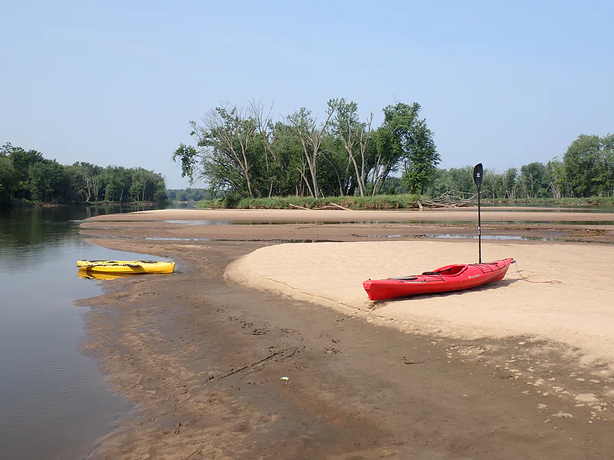
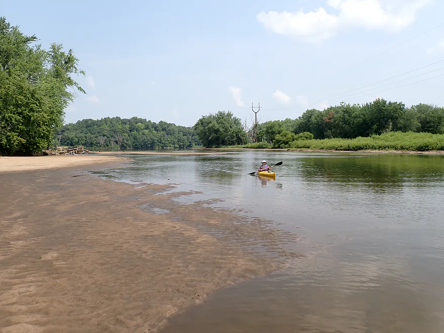
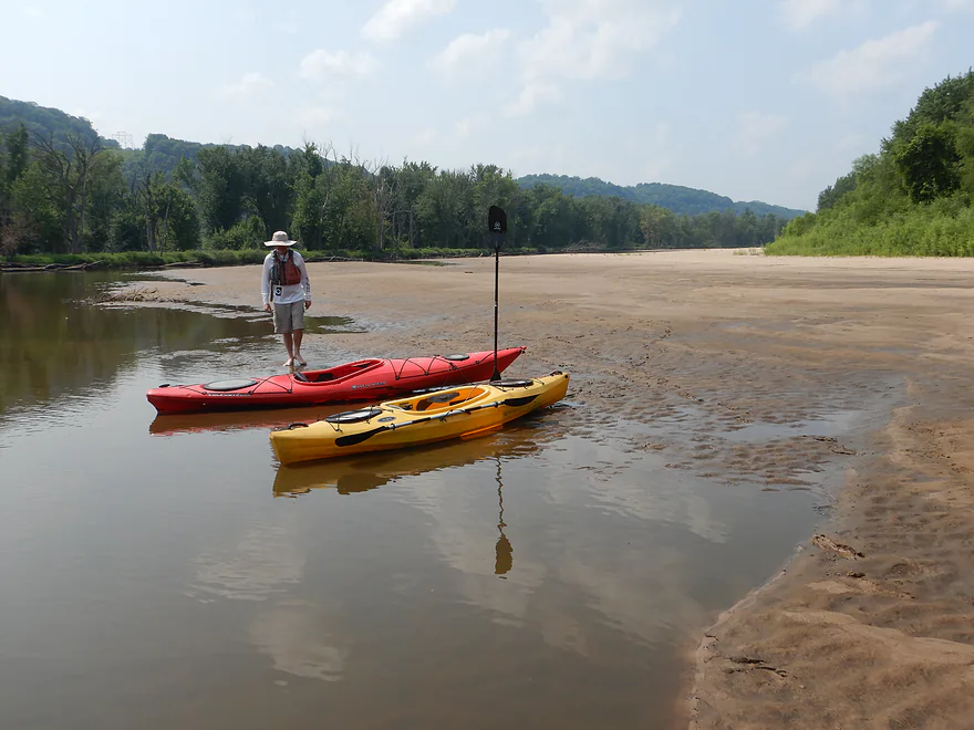
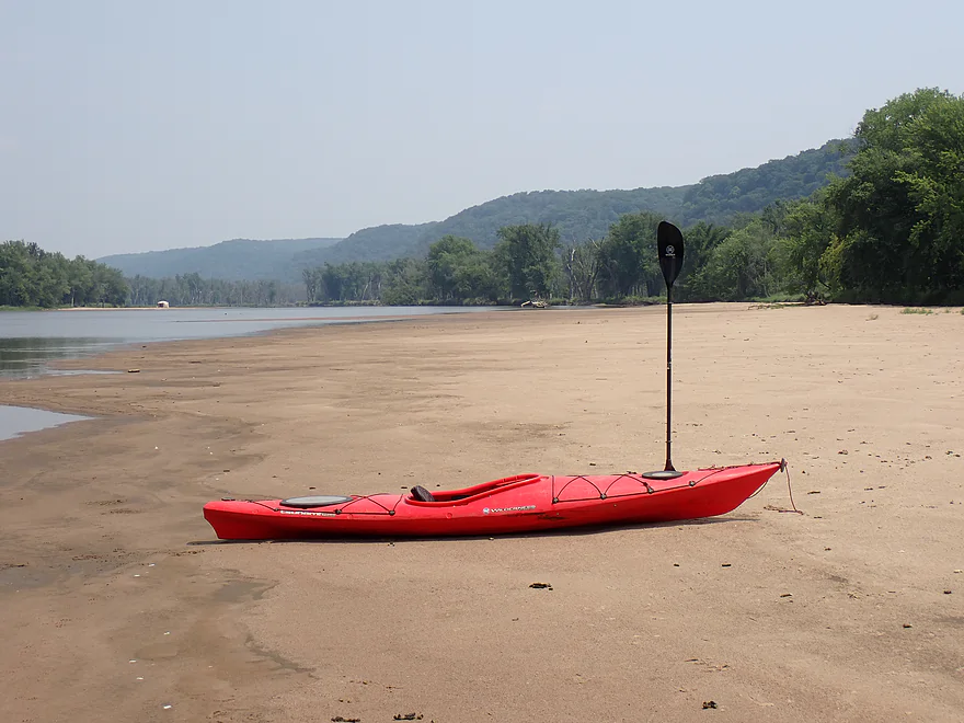
First decent sandbar
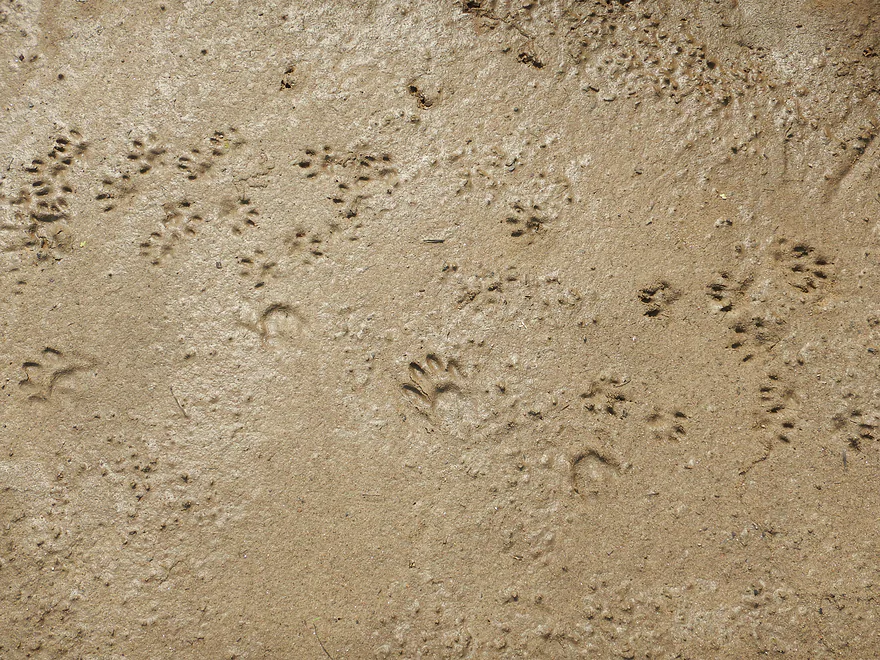
Tracks in the sand (top ones are mink)
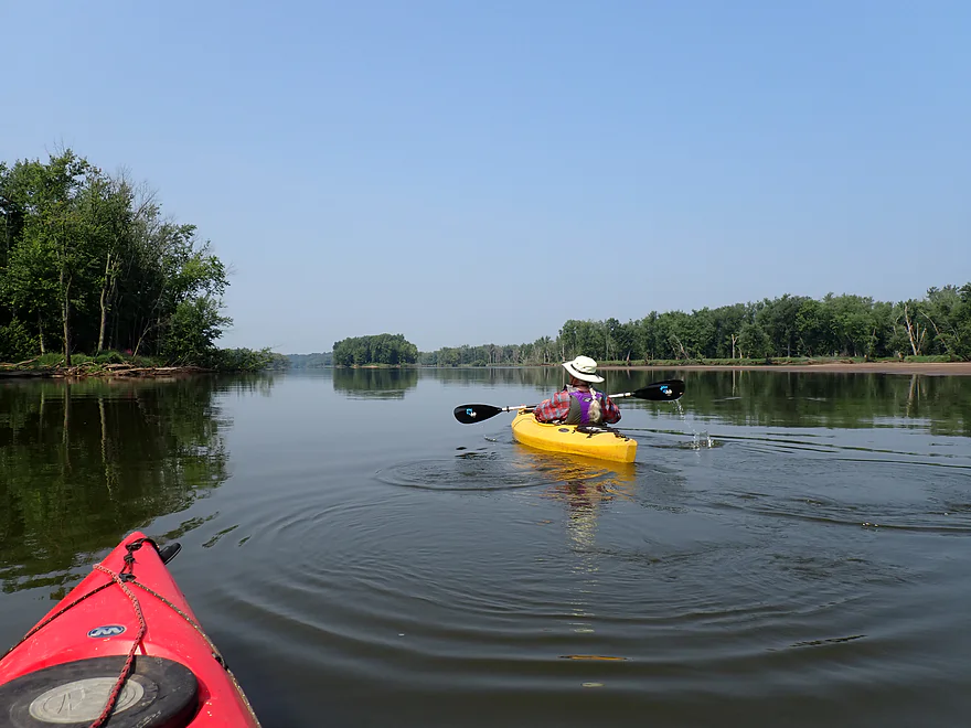
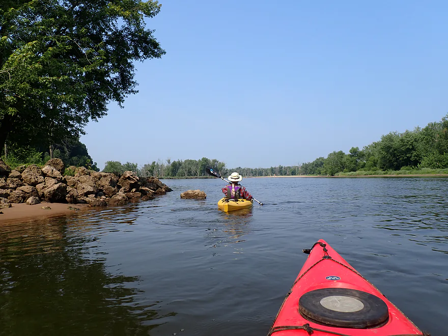
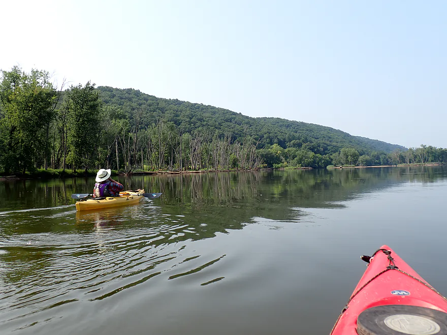
Back on the main channel
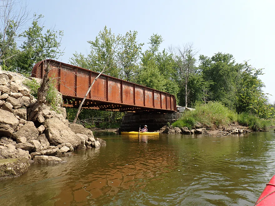
Active railroad on the north shore
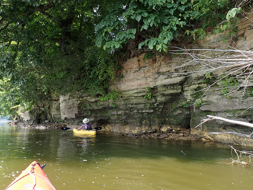
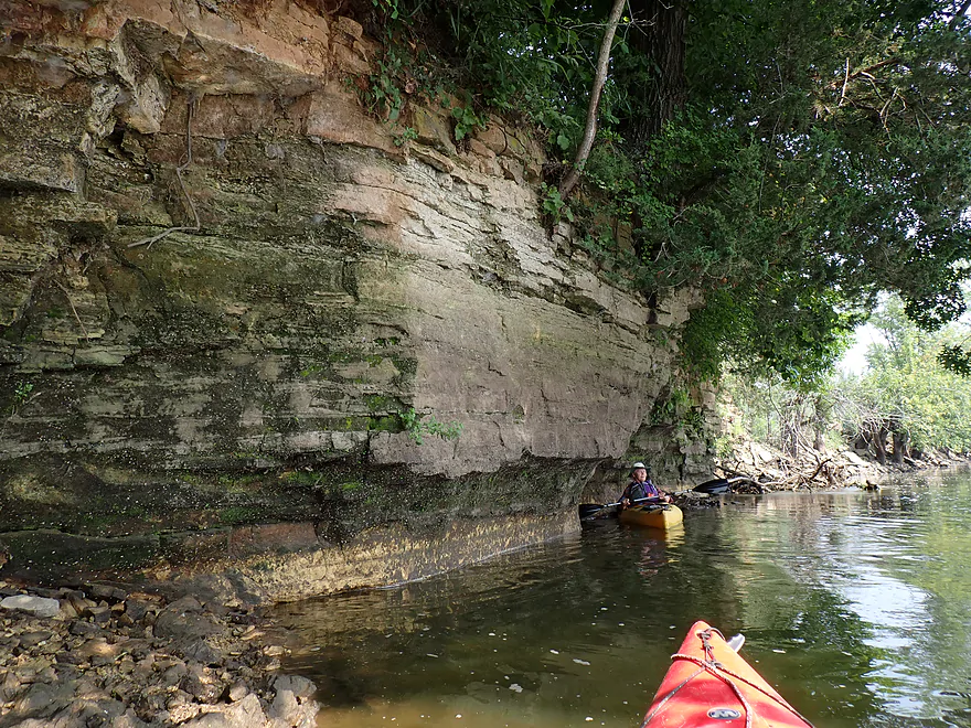
Only cliff of the trip
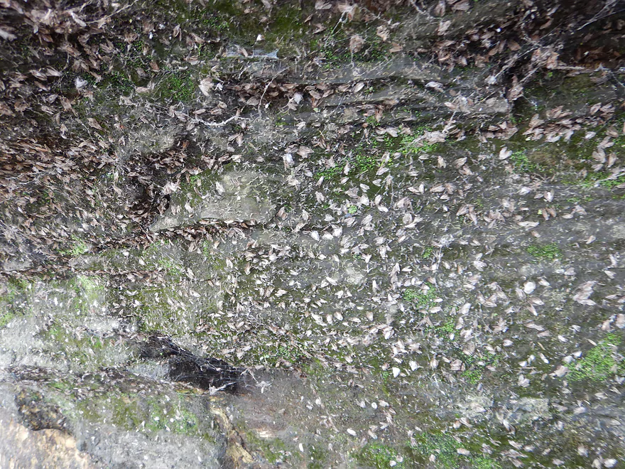
Tons of mayfly exuvia (immatures crawl out of the water, shed their skins, and then fly away)
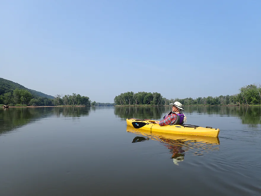
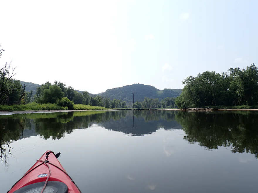
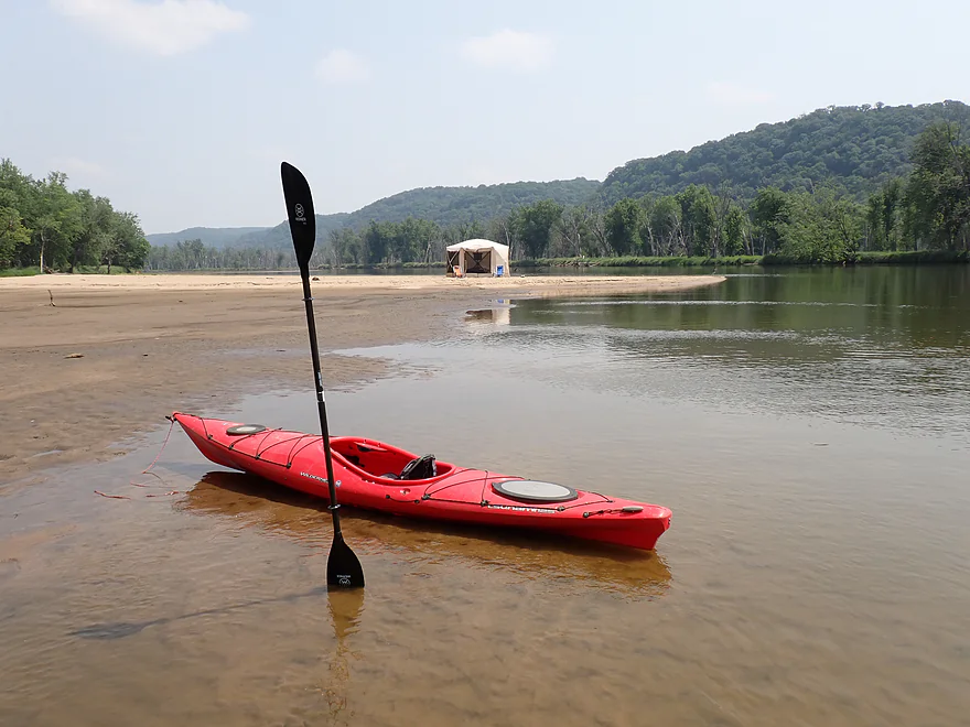
Pretty nice
Heading south down a side channel
A little shallow
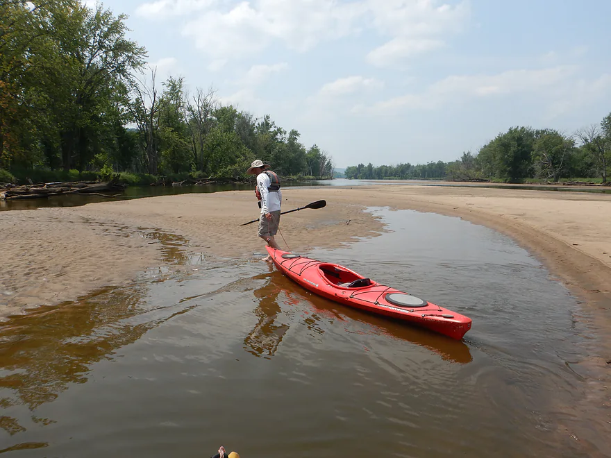
Getting out for a break
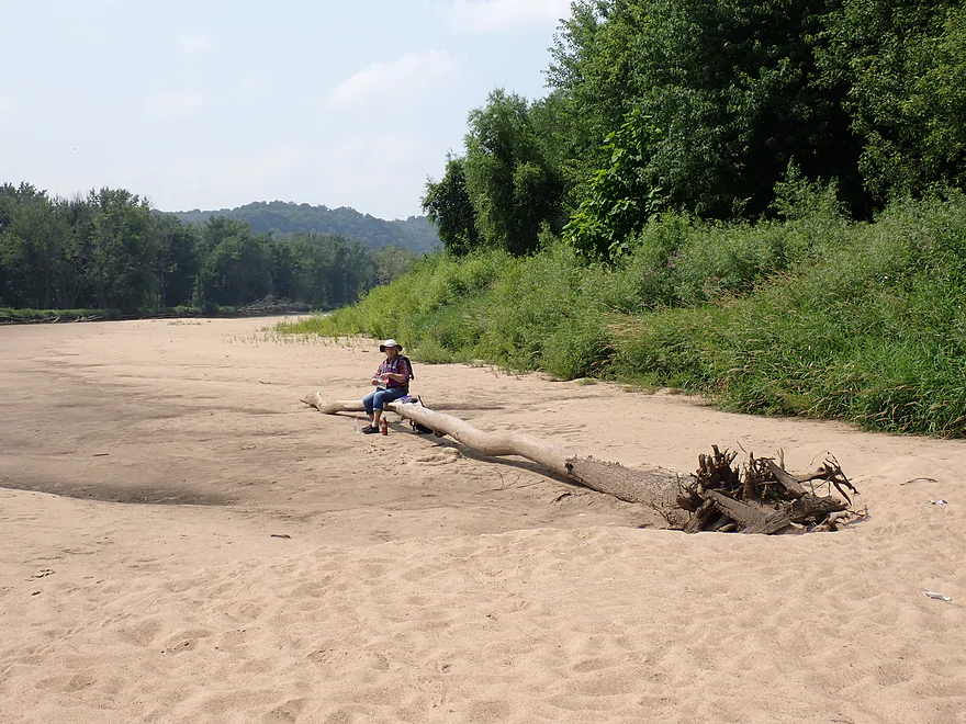
Nice picnic spot
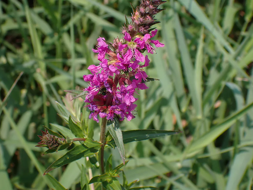
Purple loosestrife (beautiful, but invasive)
Continuing down the side channel
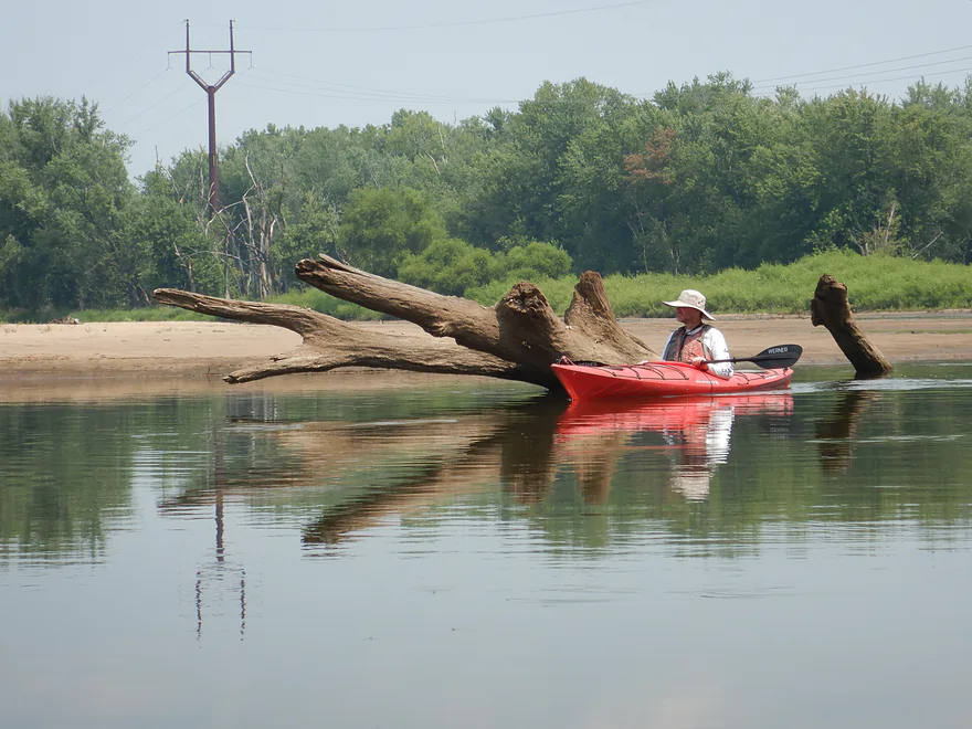
Another mystery tree in the channel
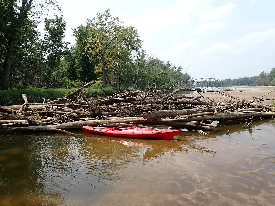
A surprise logjam
Easy portage
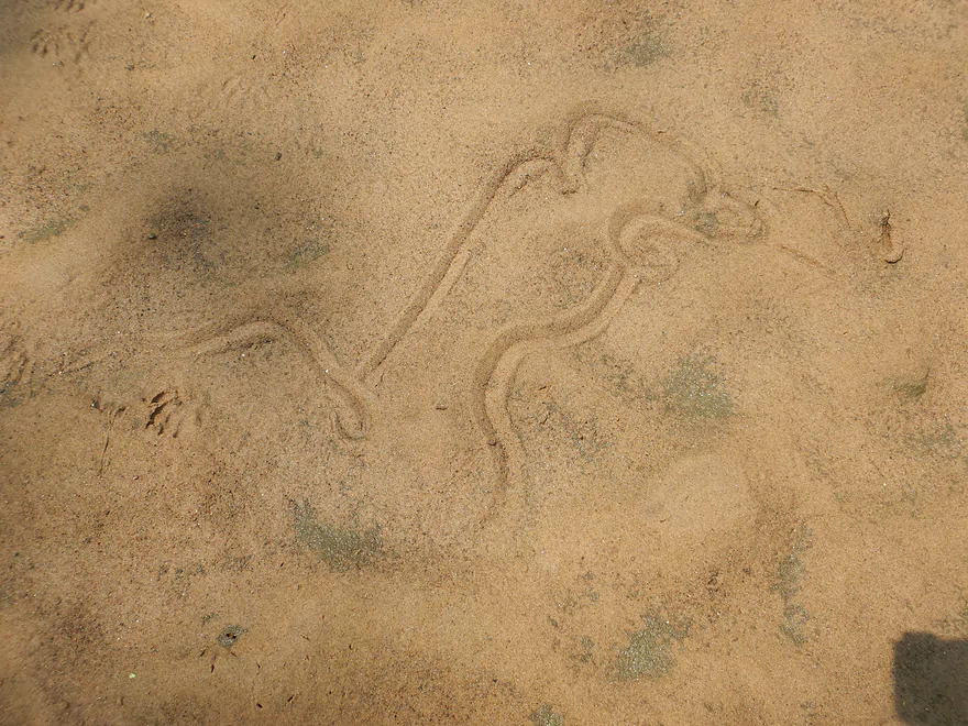
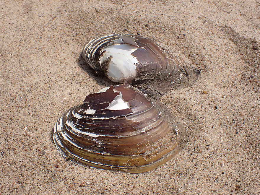
Clam trails (this guy looks a little drunk)
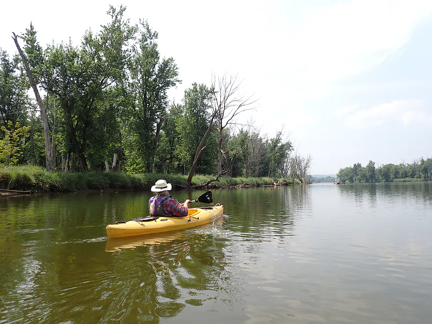
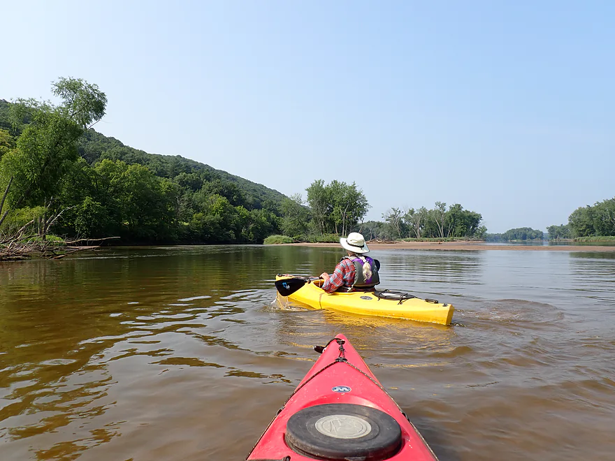
Back on the main channel
Checking out a south channel which we ultimately didn’t explore
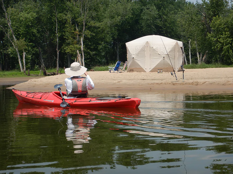
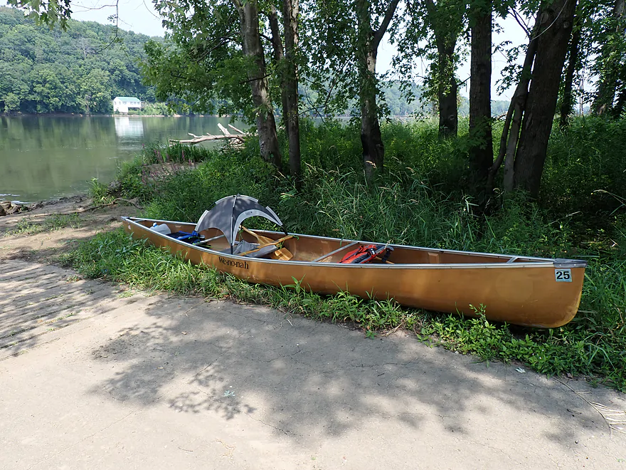
Cool tent
Picturesque scene
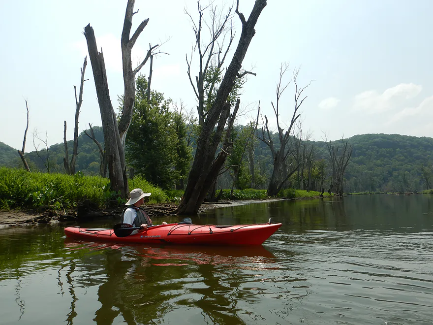
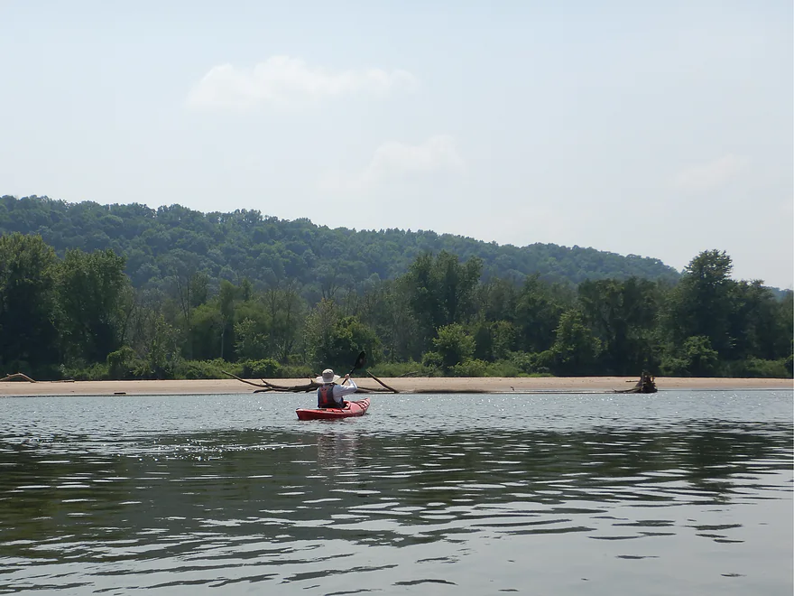
Terrific bluffs in the last mile
Getting out again for pictures
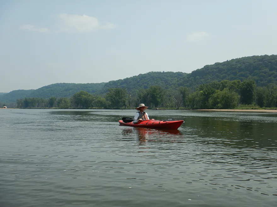
Terrific scenery
Final island of the trip
Hwy 18 with a Wyalusing bluff in the background
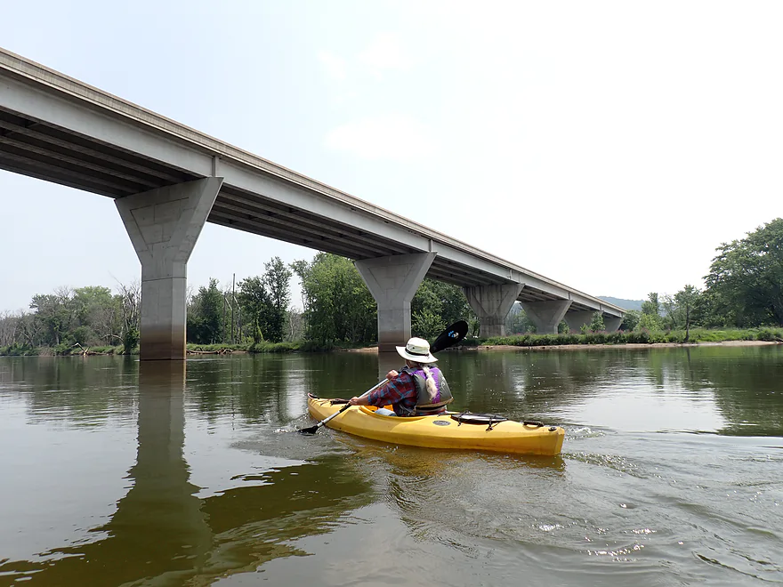
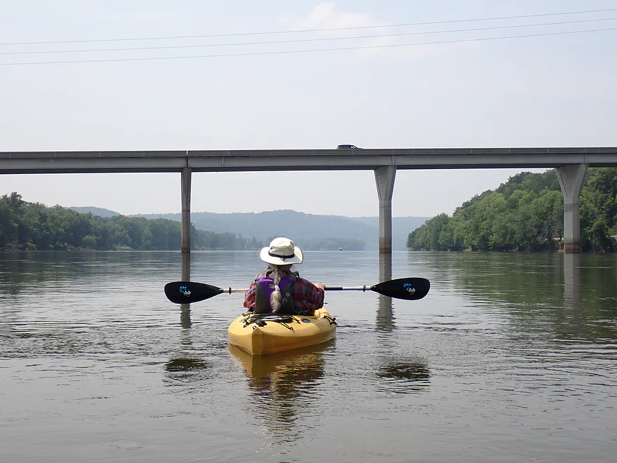
Impressive bridge
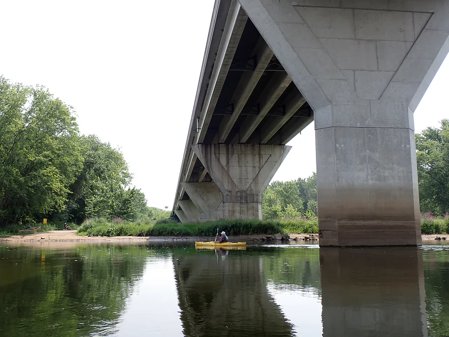
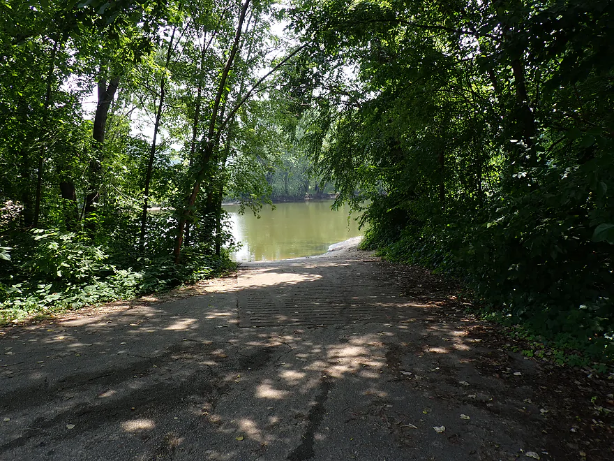
There is a landing located almost under the bridge
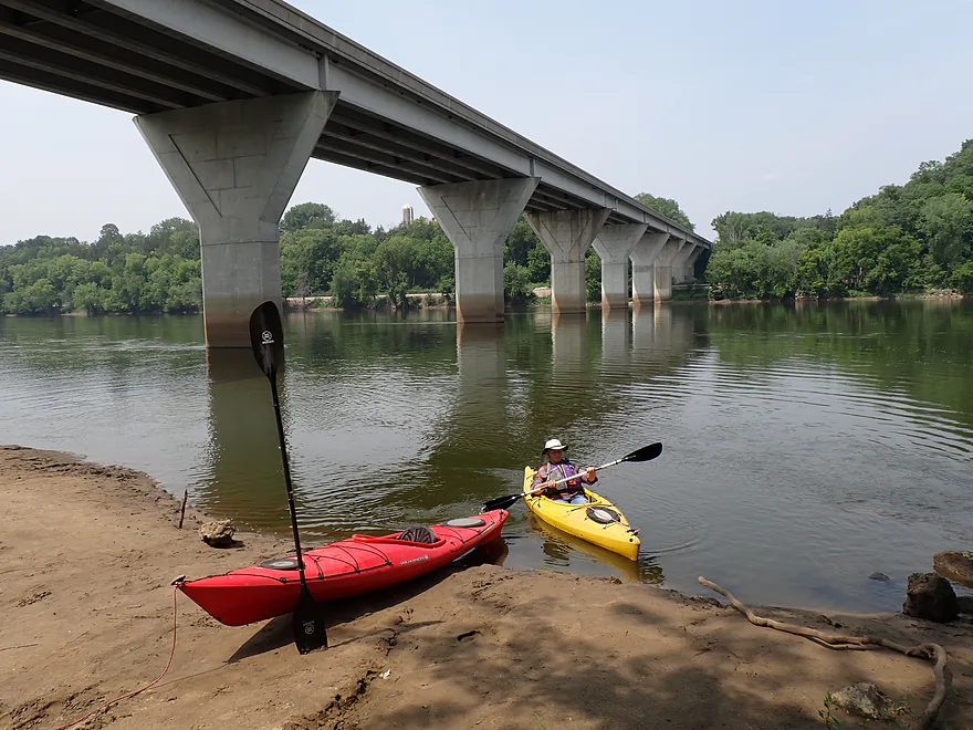
North Bridgeport Landing is a scenic take-out
This canoer had a shade tent for their dog
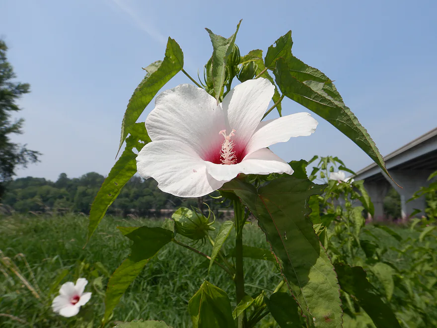
Rose mallow or hardy hibiscus (seems to be unique for this location)
Bridgeport also has a second slough access on the south side of Weniger Island
Wisconsin River – Millville

The Lower Wisconsin is one of the state’s most famous water trails. Stretching undammed from Sauk City to Prairie du Chien, it is 92+ miles long with many cool legs to explore. Most paddlers focus on the Sauk City to Spring Green sections, which are nice but can be crowded during summer weekends. The plan this week was to explore one of the more obscure legs between Millville and Bridgeport (the second to last stretch on the river).
We started at the Millville Boat Landing, which was a great access. Right away you see what makes this part of the river unique: its large and frequent islands. Some of these puppies are huge (miles long) and break the river into a labyrinth of braided channels. These present paddlers with some interesting choices. Generally speaking you want to take the larger channels as some of the smaller ones are floodbottom mucklands with fallen trees. A possible exception is the Shulz Crossing Slough, which is a massive 3-mile backwater slough that might be fun to explore in a future trip.
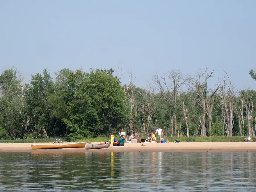
We soon passed campers…the first of several groups, which surprised us as I didn’t think there would be many campers this close to the Mississippi. Water levels were on the low side, which was perfect for camping (and deterring motorboat traffic). To be honest, this isn’t among the elite sandbar stretches on the Lower Wisconsin, but they were still nice.
The majority of sandbars had either picnickers or campers on them, so I was a bit worried about finding a free one for our own lunch break, but we finally did settle on a nice sandbar located in one of the more secluded back channels. The sandbars on the Lower Wisconsin are unique for their size, cleanliness, and lack of weeds. Paddlers shouldn’t take them for granted though as I’m not sure there are too many U.S. rivers that rival it (outside of the Missouri).
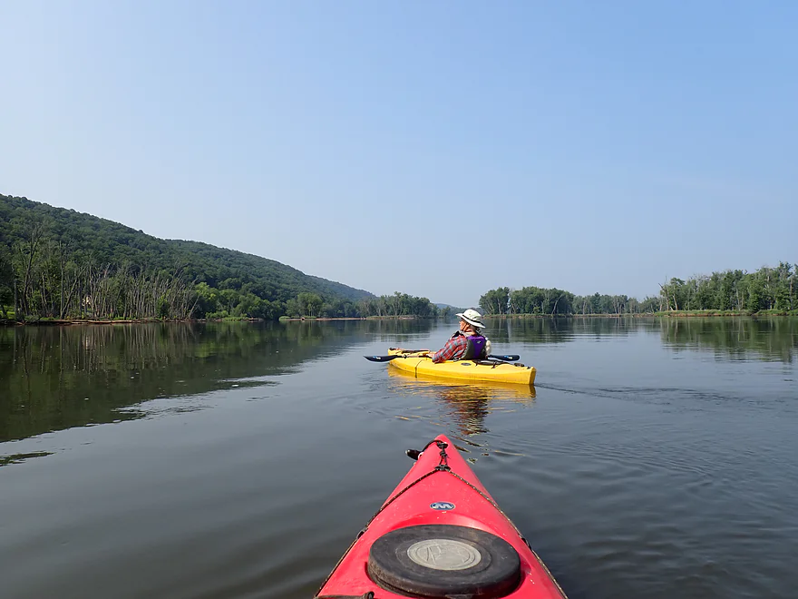
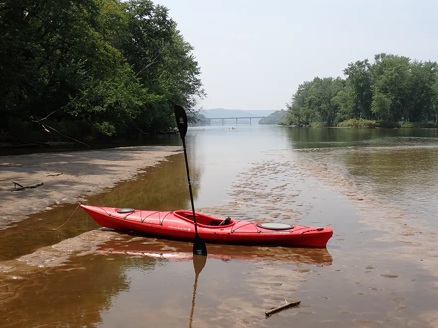
We then island hopped across channels to reach the north channel, which we knew we had to be on to reach our take-out. The final half mile of the trip featured fantastic bluff vistas both behind and ahead of us.
Hwy 35 marked the end of the trip, which was one of the most scenic parts of our paddle. Here the huge Hwy 35 bridge is backdropped by a massive 500’+ Wyalusing bluff. The mouth on the Mississippi beckoned beyond those bluffs but that would have to wait for a future trip. We took out at the Bridgeport boat landing, which is a great access…but a bit confusing as it is on an island with landings on both sides. You want the north access, as it is much more scenic.
In summary, this was a really nice trip. This section doesn’t have the rock outcrops (although there was one) or the sheer number/scale of sandbars like the upper stretches have…but the huge bluffs, massive islands and many island channels keep things interesting. Adventurous paddlers can continue a few more miles to reach the official mouth on the Mississippi. From there you can paddle about 3 miles south to take out at one of the Wyalusing access points.
Sights included 3 eagles, quite a few flopping fish, dragonflies, 9-10 turtles (probably painted turtles), a barred owl, several red-headed woodpeckers, and lots of songbirds. There were a few animal tracks on the sandbars (blue herons, sandpipers, coon, and mink). The highlight were the live clams…especially on one back channel. Some of the more adventurous clams were getting too close to shallow water and risked being stranded if water levels dropped.
Pike’s Peak State Park: This is located on the Iowa side of the Mississippi. It’s main feature is an overlook with a great view of the Wisconsin River mouth, but from the west.
Wyalusing State Park: This is an attractive Wisconsin state park with trails and campsites. Its main feature is an overlook with a great view of the Wisconsin River confluence with the Mississippi River.
The Prairie du Sac dam is the last “obstacle” on the Wisconsin River, making the Lower Riverway a paddler’s/camper’s paradise. Farsighted state employees worked with private citizens to designate and protect this portion of the river from development. It is one of the greatest accomplishments of the DNR.
Millville Boat Landing: This is a terrific public access and boat landing. An outhouse is available.
Alternate Put-ins:
- Woodman Access: (7.7 miles upstream from Millville) This is a good public boat landing. The stretch between Millville and Woodman should be nice with cool bluffs and sandbars.
Bridgeport Access – North Channel: Note that the access is on a huge island (Weniger Island) with ramps for both the north and south channels. Both are viable take-outs, but the north channel is more scenic. Make sure you get in the right “off-ramp” channel in time, as Weniger Island is 3 miles long with brisk current…so backpaddling around the island to reach a missed landing would be difficult.
Alternate Take-outs:
- Wyalusing Boat Ramp: (9.3 miles downstream from Bridgeport) This is the last leg of the Wisconsin River and includes some of the biggest and most impressive river bluffs. The take-out is on the Mississippi and requires a bit of upstream paddling to reach.
- Wyalusing Public Beach (9.2 miles downstream from Bridgeport) This route is similar to above but continues south to the beach instead of doubling back north to the landing. It’s not as scenic, but it would be a bit more efficient for paddlers and shuttlers.
Bike Shuttle – Bridgeport to Millville: 5.9 miles with 56′ of ascent. This is an easy and scenic bike shuttle. In fact…for the Lower Wisconsin (which is known for its tricky bike shuttles), this might be one of the easiest.
Wind: The Lower Wisconsin can have strong headwinds. Be mindful of the forecasts before planning your paddle.
Rapids/Current: There are no rapids. The current moves at an ok pace but isn’t as brisk as some of the upstream legs. The fastest part will be at the take-out by Bridgeport.
Strainers: There are a number of fallen trees along the shoreline. Here the current is fast and deep… a deceptively VERY dangerous part of the river. Paddlers should stay well clear of strainers and wear a life jacket.
Undertows: The Lower Wisconsin is infamous for its unpredictable currents and undertows. Many paddlers like to take swim breaks by the sandbars, not realizing the danger they are in. You can be innocently wading in shallow water and then step into deeper water with current and get pulled in (often at the back end of the sandbar). If you must swim, stay away from the deep spots with fast current (and consider wearing a life jacket).
Closest Gauge: Wisconsin River @ Muscoda
Trip Depth: 7100 CFS or 1.8′
Navigability Estimates: The following are very rough estimates. Always use your own judgement.
- 2,000-3,000 CFS: Very rarely does the river get this low. These levels would be a sandbar utopia. You might have to walk some sections but this would be easy to do in the clean sand.
- 3,001-5,000 CFS: Very ideal conditions. Great sandbars and the low levels tend to deter motorboat traffic.
- 5,001-7,500 CFS: A common depth and ok conditions for sandbars.
- 7,501-10,000 CFS: Much smaller sandbars but still viable for camping.
- 10,001-12,500 CFS: Only the tops of the largest sandbars will be available. Likely not ideal for camping.
- 12,501-15,000 CFS: You would be lucky to see any sandbars. Water quality will likely be very murky and dirty at these levels.
- 15,001-20,000 CFS: The river will be very high, pushy in spots and likely not attractive for paddling.
- 20,001+ CFS: This is probably too high for safe paddling.
Quick Overview
- Upstream of Stevens Point: I don't have information yet on these stretches.
- Stevens Point to Lake Petenwell: ~42 miles. This stretch in Central Wisconsin used to have many natural rapids, but most have been buried under 8 dams, some of which are now difficult portages. Despite this there is still some good paddling to be had in this region.
- Lake Petenwell: 14.9 miles. This is a large flowage lake that is challenging for paddlers because of frequent strong winds and big waves.
- Castle Rock Lake: 14.5 miles. Another large flowage lake that is likely too big for enjoyable paddling.
- Castle Rock Lake Dam to Lemonweir River: 9.4 miles. This pre-Dells leg isn't elite, but is a pleasant stretch.
- Lemonweir River to Indian Trails Landing: 21.7 miles. This includes the famous Upper Dells and Lower Dells which feature many scenic sandstone outcrops.
- Indian Trails Landing to Portage: 16 miles. This is an overlooked section sandwiched between the Dells and Portage. While the scenery isn't top-notch, it does have many sandbars and few people, which is a nice combination.
- Portage to Lake Wisconsin: 14.3 miles. This is a neat stretch of the river with many sandbars and cliffs, but the shoreline is very developed and motorboat traffic can be heavy on weekends.
- Lake Wisconsin: 14.5 miles. This is a challenging lake for paddling because of the huge and frequent waves created by motorboats.
- Prairie du Sac Dam to Port Andrews: 57 miles. This is the first half of the famous Lower Wisconsin Riverway. This is a super popular stretch for paddlers with the highlights being large sandbars, big bluffs, occasional cliffs, and fun side sloughs to explore.
- Port Andrews to Wyalusing: 40 miles. This is the second half of the Lower Wisconsin Riverway which has far fewer paddlers and sandbars. But the bluffs and sloughs are larger and more interesting.
Detailed Overview
- Upstream of Merrill: I don't have enough information yet on these legs to comment.
- Merrill Dam to Riverside Park: 0.5 miles. Might include some light rapids below the dam.
- Riverside Park in Merrill to Wisconsin River Forest Landing: 8.6 miles. A good prospect.
- Wisconsin River Forest Landing to Brokaw Boat Landing: 5.7 miles.
- Wisconsin River Forest Landing to Jesse Park: 1.4 miles. A terrific stretch with small boulder gardens, one set of Class 1-2 rapids, gravel bars and a nice sand bank.
- Jesse Park to Brokaw Boat Landing: 4.3 miles. A good stretch with scenic wooded banks and occasional gravel bars.
- Brokaw Boat Landing to Gilbert Park: 5.1 miles. River slows down and becomes hillier. This stretch is an ok prospect and goes past the old Brokaw paper plant that has been shut down. Paddlers must navigate Class 1 rapids and a 2' drop where the old Brokaw dam used to be.
- Gilbert Park to Wausau Boat Dock: 1.5 miles. An impounded stretch through Wausau. There are numerous alternate access options to choose from.
- Wausau Boat Dock to Oak Island Boat Ramp: 1.2 miles. A nice stretch that includes Barkers Island and Isle of Ferns Park. But the Wausau dam does require a portage. This stretch parallels the famous Wausau Whitewater Park.
- Oak Island Boat Ramp to Rothschild Dam Access: 5.8 miles. Likely mostly uninteresting flowage paddling. There are many alternate access options to choose from.
- Rothschild Dam Access to Zimpro Park: 1.0 miles. This might be a nice stretch.
- Zimpro Park to River Road Boat Landing: 7.6 miles. The first half of this leg is likely nice river paddling, but the second leg is probably just an uninteresting flowage.
- Chucks Landing/Mosinee Dam to Bean's Eddy Boat Landing: 2.8 miles. Likely a nice leg. You might be able to launch by the dam where there should be some nice rapids and boulders.
- Bean's Eddy Boat Landing to Seagull Boat Landing: 5.1 miles. Mostly uninteresting flowage paddling. Although there might be some nice sand banks on the eastern shore.
- Seagull Boat Landing to Dubay Dam Access: 5.3 miles. Mostly uninteresting flowage paddling.
- Dubay Dam Access to River Road Landing: 5.5 miles. This could be a nice stretch of river.
- River Road Landing to Old US 10 Landing: 2.3 miles. Likely an ok leg.
- Old US 10 Landing to Stevens Point Dam: 5.6 miles. Probably uninteresting flowage paddling. Many alternate access options closer to Stevens Point.
- Stevens Point Dam to Blue Heron Boat Landing: 4.2 miles.
- Steven Point Dam to Whiting Dam: 2.6 miles. Starts slow and uninteresting, but the river becomes very scenic after the Hwy HH bridge. The rock formations below both dams are very striking. Many alt access points.
- Whiting Dam to Kimberly Clark Dam/Al Tech Park: 0.6 miles. Incredible scenery with exposed bedrock and boulder gardens below the Whiting Dam. Some rapids, but nothing major. The Kimberly Clark Dam is a dangerous low-head dam and should be treated carefully.
- Kimberly Clark Dam to Blue Heron Landing: 1.0 miles. Class 2 rapids below the dam, but after that the river slows dramatically and splits into many sub-channels and islands. Round trips on this leg are possible. I chose the far western channel where there were some nice rocky stretches.
- Blue Heron Landing to Mill Creek Landing: 4.1 miles. Likely a mediocre paddle with nothing special. Galecke Park is an alternate access.
- Mill Creek Landing to Biron Dam North Gate: 7.6 miles. Mostly uninteresting flowage paddling. Several alternate access options on route.
- Biron Dam North Gate to Veteran's Memorial Park: 4.5 miles.
- Biron Dam North Gate to Biron Landing: 1.0 miles. Super scenic stretch by two islands with many granite boulders.
- Biron Landing to Legion Park: 3.0 miles. A nice stretch by Big Island. The west channel is more undeveloped...but the east channel has several scenic granite islands.
- Portage through Legion Park: 680'. A steep wall separates the park from the river but in two locations the wall is short enough to get over (see map). Paddlers may want to consider a longer portage to bypass some of the shallow rocky stretches by Legion Park.
- Legion Park to Veteran's Memorial Park: 0.4 miles. A scenic stretch that features a large boulder field and the powerhouse for a large paper mill.
- Veteran's Memorial Park to Port Edwards Landing: 3.8 miles
- Veteran's Memorial Park to Demitz Park: 0.8 miles. A pleasant stretch that includes Belle Island.
- Demitz Park to Ben Hansen Park: 1.2 miles. This leg goes by Garrison Island and Edwards Island. Lyon Park is located across the river from Demitz Park and is another access option.
- Ben Hansen Park to Port Edwards Landing: 1.8 miles. Above the Centralia dam there are several small but nice islands. Portage the dam on the left bank (follow the 1000' trail through the golf course). Below the dam there are scenic rock formations. Close to the Port Edwards dam are a few more scenic islands you can explore.
- Port Edwards Landing to Nekoosa/Riverside Park: 3.6 miles.
- Port Edwards Landing to Port Edwards Powerhouse: 1.3 miles. A half-mile portage is required (east bank). A very scenic boulder field is located below the dam. At high levels, the rocks are submerged and produce a half-mile stretch of rapids (some strong).
- Powerhouse to Moccasin Creek Landing: 1.8 miles. A generic wooded stretch that isn't super interesting.
- Moccasin Creek Landing to Riverside Park: 0.5 miles. During the Nekoosa dam drawdown, this stretch had nice boulder fields and rapids.
- Riverside Park to Hwy 73: 0.8 miles. An ok stretch of the river. There are scenic cliffs south of Hwy 73, but these are past the dam warning line. Hwy 73 is not a good access option.
- Hwy 73 to Point Basse Ave (Portage of the Nekoosa Dam): 1.5 miles. A difficult 1.5 mile portage through downtown Nekoosa. Don't try to portage the south bank. There is a steep hill, cliffs, and large Domtar paper mill fences to deal with.
- Point Basse Ave to Jim Freeman Memorial Boat Landing: 0.8 miles. A generic stretch going by historic Point Basse. If you're willing to backtrack to the dam, you can see scenic boulder fields (during low flows) and a few cliffs. Point Basse Ave is a somewhat speculative access, but it seems public and doable for launching.
- Jim Freeman Memorial Boat Landing to Plank Hill Small Boat Access: 2.0 miles. A generic stretch.
- Plank Hill Small Boat Access to 19th Drive Landing: 5.3 miles. Features two epic sand banks. The main channel has some minor sandbars. Several of the side sloughs can provide fun side adventures.
- 19th Drive to the Petenwell Dam: 14.9 miles. This is Lake Petenwell which is a large and challenging lake for paddling. Waves and strong winds are frequently an issue. But when calm there are nice sandbanks on the northwest shore, hidden sloughs, and large islands to explore. See the overview map for more info.
- Petenwell Dam to Ganter Lane Landing: 3.8 miles. This stretch isn't too impacted by dams and may have nice sandbars at low levels.
- Ganter Lane Landing to Castle Rock Lake Dam: 10.7 miles. Castle Rock Lake is likely too big (wind/waves) for enjoyable paddling. There are many alternate launch options along the shore.
- Castle Rock Lake to the Lemonweir River: 10 miles. An ok section.
- Lemonweir River Mouth to River Bay Landing: 7 miles. The first half of the classic Upper Dells.
- River Bay Landing to Blackhawk Island: 6.5 miles. Second half of the classic Upper Dells, known for its fantastic outcrops. Note, the Blackhawk Island landing is no longer accessible without special permission from the Upham Woods Outdoor Learning Center.
- Black Hawk Island to Wisconsin Dells Dam: 2.0 miles. More nice sandstone outcrops. You can take out at a public ramp off Indiana Ave or portage the dam and take out SW of the dam by a launch off Wisconsin Dells Pkwy/Hwy 12.
- Dells Dam to Indian Trails Landing: 6.2 miles.
- Dells Dam to Newport Park: 2.2 miles. This is the heart of the famous Lower Dells with many scenic outcrops. Unfortunately jet boats are a serious plague on this stretch.
- Newport Park to Indian Trails Landing: 4.0 miles. Features the famous "Sugar Bowl" formation and four super cool caves. The outcrops soon disappear and this stretch is mostly uneventful (but peaceful) big river paddling.
- Indian Trails Landing to Pine Island Boat Ramp: 9.8 miles. Few paddle this stretch as it isn't as interesting. But...it does have a good concentration of sandbars and few competing paddlers for them.
- Pine Island Boat Ramp to Portage/Hwy 33 Access: 6.0 miles. Not an elite section that is lacking in cliffs and bluffs. It does have good sandbars though.
- Portage to Dekorra Park: 7.7 miles
- Portage to Baraboo River/Thunderbird Road: 5.2 miles. A good section with great sandbars. Close to Portage there are few motorboats.
- Baraboo River to Dekorra Park: 2.5 miles. River splits around massive Lib Cross Island. West channel has nice sandbars. St Lawrence Bluff has scenic sandstone outcrops and includes a cave you can paddle into.
- Dekorra Park to James Whalen Memorial Park: 6.6 miles.
- Dekorra Park to Camp Rest Park: 5.1 miles. A terrific section with rock outcrops, large island deltas, hidden sloughs, and nice sandbars. Unfortunately this part of the river is popular with motorboats and jet skis which can be a plague. Multiple alternate access options.
- Camp Rest Park to James Whalen Memorial Park: 1.5 miles. Not a great section because of the open water paddling, powerboats and big waves. The west shore though does have nice outcrops.
- James Whalen Memorial Park to Merrimac Memorial Park: 4.4 miles. River turns into "Lake Wisconsin". Generally speaking this isn't ideal for kayaking as motorboat traffic can be heavy and waves can be surprisingly big. The most direct route is the north shore which has a few bluffs, but generally speaking isn't that interesting.
- Merrimac Memorial Park to Veterans Memorial Park/Prairie du Sac: 9.6 miles.
- Merrimac Memorial Park to Moon Valley Landing: 3.3 miles. Includes a lot of developed shoreline. The ferry, railroad bridge, and Moon Bay are highlights.
- Moon Valley Landing to Veterans Memorial Park/Prairie du Sac: 6.3 miles. Other than Moon Bay and the dam, this is a boring stretch. There are numerous alt access options on this route.
- Prairie du Sac to Mazomanie: 8 miles. An ok section of the Wisconsin but lacking in sandbars.
- Mazomanie to Arena: 9.7 miles. A great section with nice sandbars and scenic bluffs.
- Arena to Hwy 14: 8.0 miles. Good section with a high concentration of sandbars. One of the more popular legs on the Lower Wisconsin.
- Hwy 14 to Hwy 23/Spring Green: 2.2 miles. Neat mini-section with sandstone outcrops. Very popular in the summer.
- Spring Green to Lone Rock: 7.4 miles. Another fine sandbar/bluff section with some nice rock outcrops too.
- Lone Rock to Gotham: 8 miles. This stretch has super impressive rock outcrops and sand banks.
- Gotham to Muscoda: 7.6 miles. This leg includes more large sandbars and great outcrops. Bonus highlights include fast current and not seeing as many people.
- Muscoda to Port Andrew: 7 miles. A good stretch with many islands and sandbars.
- Port Andrew to Boscobel: 9 miles. Wooded islands start to get massive.
- Boscobel to Woodman/Big Green River: 9 miles and start of the less paddled stretch of the Lower Wisconsin. Far fewer sandbars from here to the mouth, but good bluffs and side sloughs to explore.
- Woodman to Millville: 7.7 miles. A good stretch with large bluffs and sandbars.
- Millville to Bridgeport: 5.3 miles. Huge islands, bluffs and sandbars are the highlight on this second-to-last leg on the Wisconsin River.
Bridgeport to Wyalusing (the mouth): 9 miles.
Trip Map
Overview Map
Photos Size: