
Six Mile Creek
This is a nice paddling creek, but you must wait for high water levels as it can be shallow. It’s a diverse creek with marshy stretches, some urban paddling through Waunakee, some wooded legs, and a surprising number of rocks and boulders.
Trip Reports
Ripp Park to Castle Creek Conservancy
Date Paddled: June 9th, 2018
Distance: 3.8 miles
Time: 3 hours 45 minutes (2 hours would be more typical)
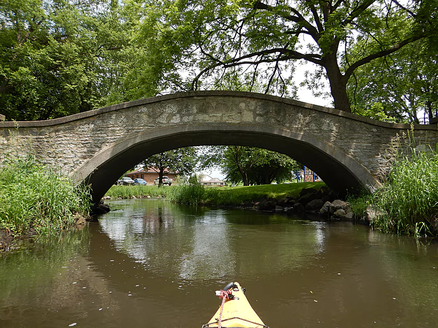
This Lake Mendota tributary was a nice paddle with only a few logjams. Highlights include a marsh, rapids, some scenic parks, 17 total bridges, and even a few boulder gardens.
Read More...Waunakee Village Park to Woodland Drive
Date Paddled: July 17th, 2022
Distance: 4.9 miles
Time: Expect 3 hours if cleared out (way more if not)
This was an incorrectly timed trip...too low and too many logjams. It is however a very pretty creek. With enough rain and after the current cleanup efforts finish, this might be one of the more attractive water trails in Dane County.
Read More...Woodland Drive to Governor Nelson State Park
Date Paddled: August 4th, 2018
Distance: 4.2 miles
Time: 4 hours 48 minutes (2-2.5 hours would be more typical)
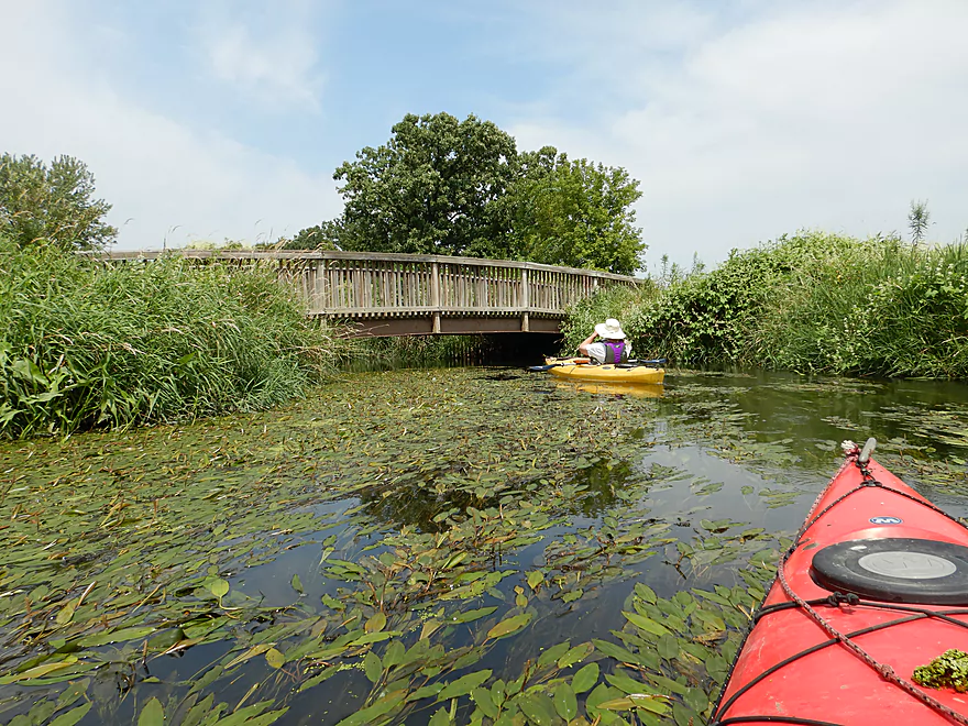
Recently cleared of logjams, lower Six Mile Creek is Dane County's newest water trail. This was a diverse trip that included dense woodlands, marsh, and paddling on Lake Mendota. All in all a pleasant trip with the highlight being the diverse and unique plant life.
Read More...Overview Map
Detailed Overview
- Hwy 19 Culvert to Kingsley Road: 3.4 miles. An interesting prospect through the Waunakee Marsh with clear water. The first half mile is extremely narrow and may need very high water to be viable. Maybe 1-2 logjams.
- Kingsley Road to Ripp Park: 1.2 miles. Likely a nice marsh paddle with maybe 1-2 logjams. There is a mat of dead cattails to circumnavigate at Kingsly Road, otherwise this seems like an ok access.
- Ripp Park to Castle Creek Conservancy: 3.8 miles. A varied paddle with marsh, boulder gardens, rapids, urban parks, and dense woods. Very nice, but a few logjams.
- Ripp Park to Hwy 113: 1.8 miles. An open paddle through a grassy corridor with lazy current. One logjam, but an easy portage. Hwy 113 is a busy road, but access might be possible by parking north of the bridge and launching between the road and the trail bridges.
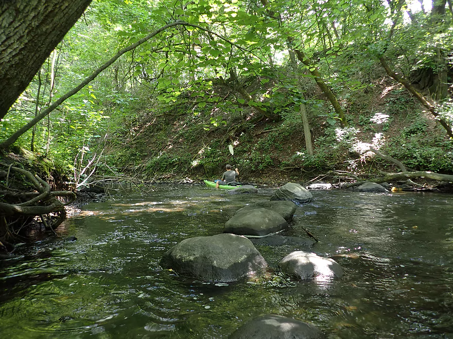
- Hwy 113 to Waunakee Village Park (North): 1.0 mile. A wooded section with some boulder gardens and rapids. Neat part of the creek. Most logjams should be cleared out by now.
- Waunakee Village Park (North) to Waunakee Village Park (South): 0.3 miles. A tidy part of the creek that flows though the park. Highlights are a few rapids and several stone arch bridges. The south end of the park doesn’t have a parking lot…so disembark by Madison Street(2nd bridge) and drag your boat north to 3rd Street to load up your car. Long-term parking is available by the Village Center. Creek here is shallow.
- Waunakee Village Park (South) to Castle Creek Conservancy: 0.7 miles. A densely wooded section that is scenic but shallow and should only be run in high water. There is a nice set of rapids just upstream of Division Street. I suspect Village Center Pond might be a take-out option.
- Castle Creek Conservancy to Woodland Drive: 3.9 miles. Scenic stretch with a lot of potential. But there are significant logjams (which are being cleaned out). This leg is rocky and can only be run in high water.
- Woodland Drive to Governor Nelson State Park Boat Ramp: 4.2 miles. Recently cleared out by Capitol Water Trails this is a nice section with a mixture of marsh and woodlands.
