
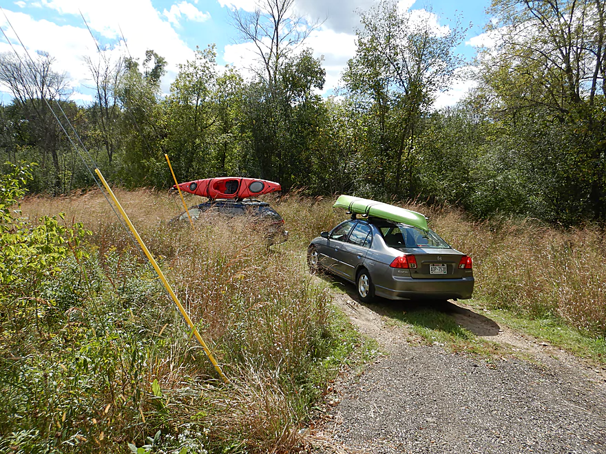
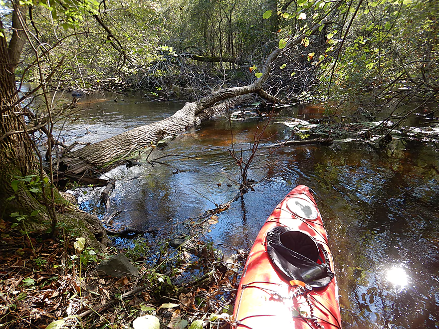
Putting in at Kettle Moraine Scenic Drive
Good put-in
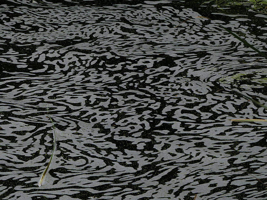
With some nearby abstract art
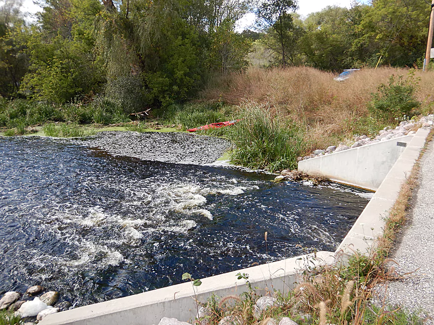
Fun rapids below the bridge
Hiding upstream is the Monches Millpond
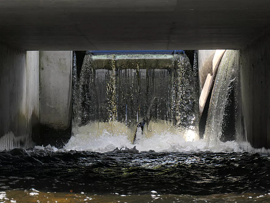
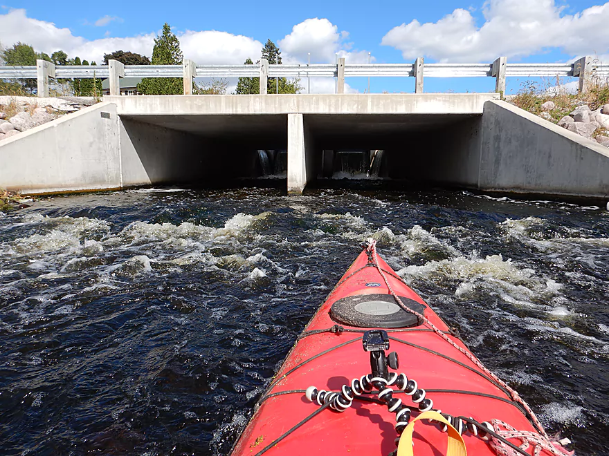
The main dam

Some more abstract artwork
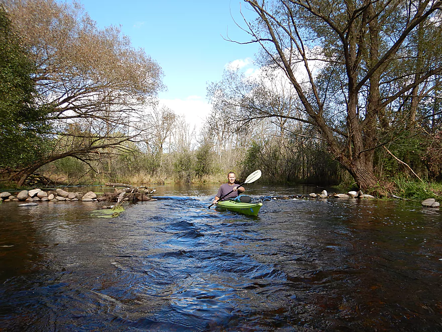
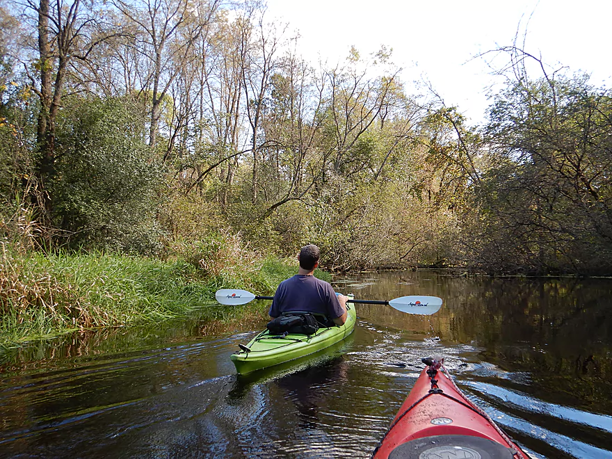
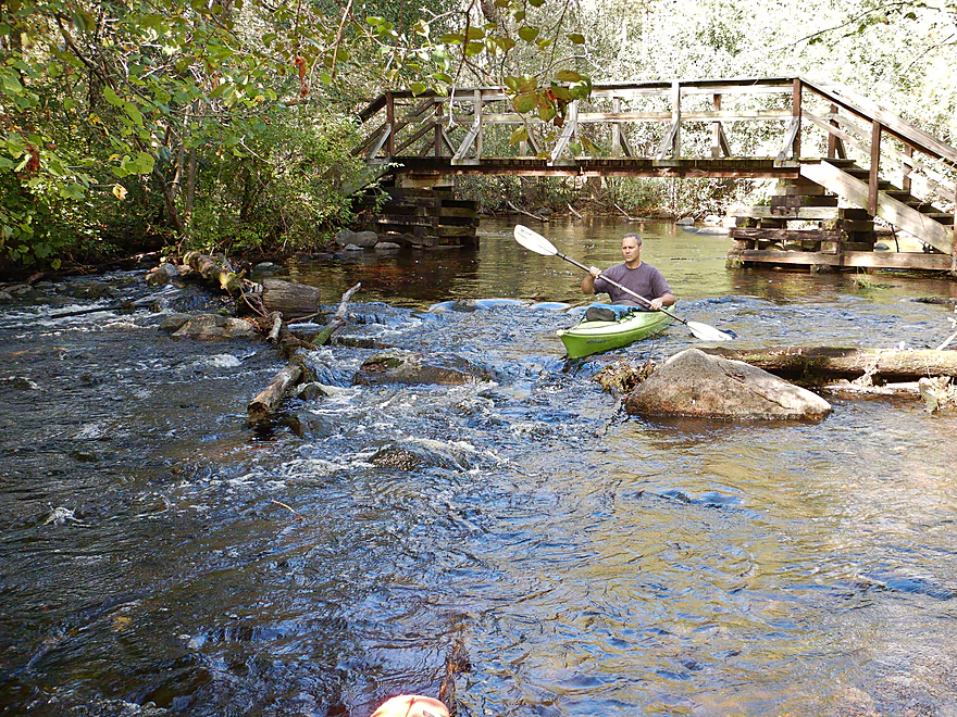
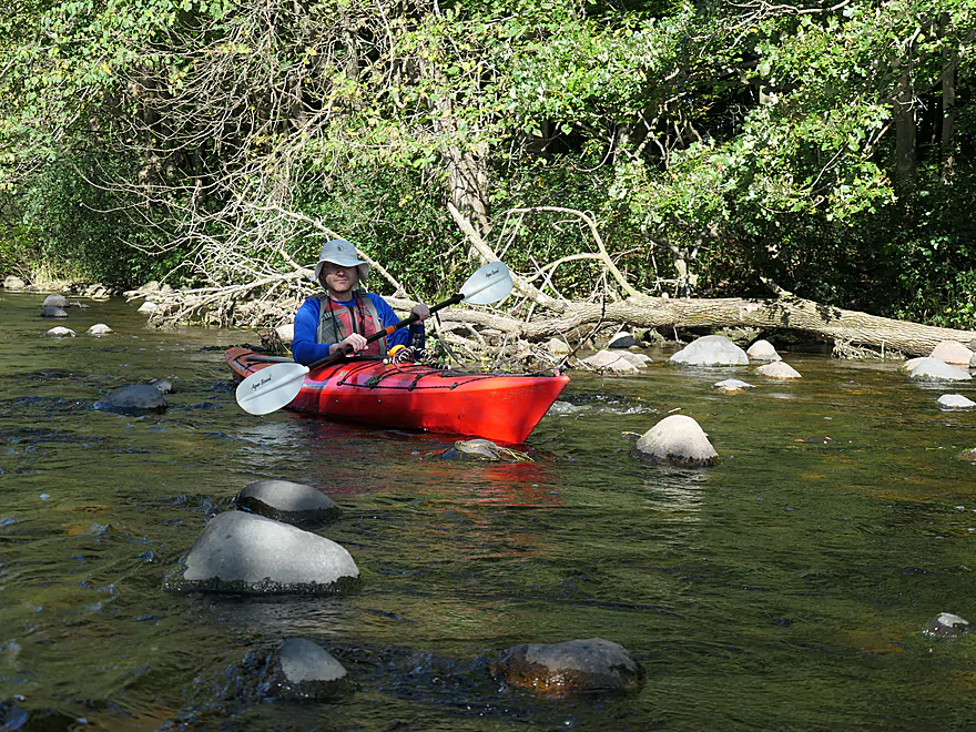
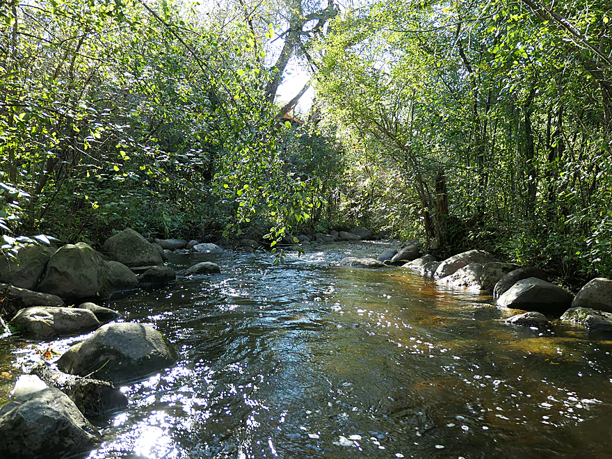
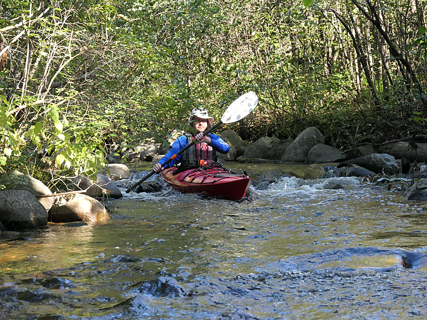
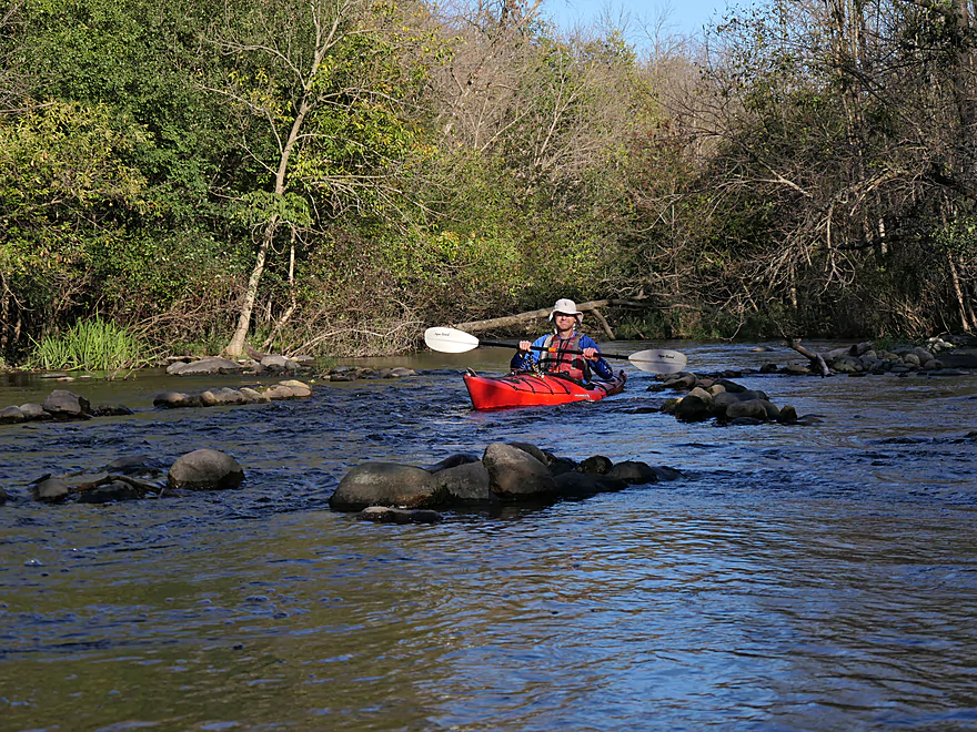
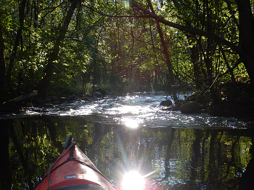
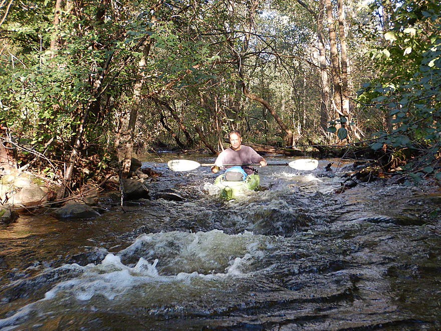
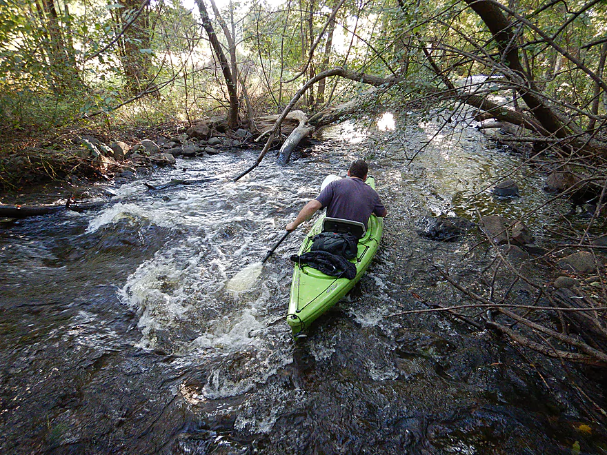
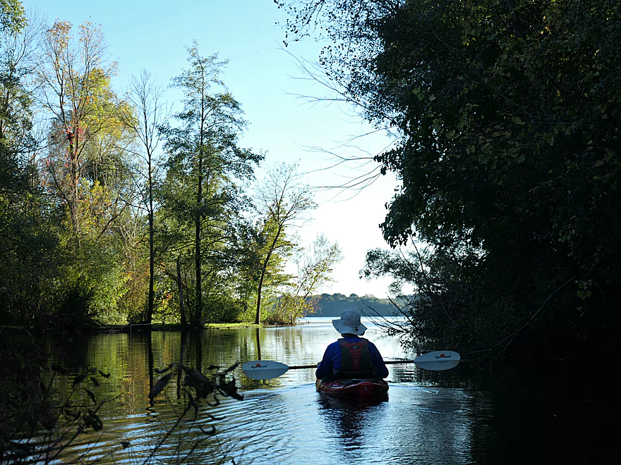
Great little chute to start the trip
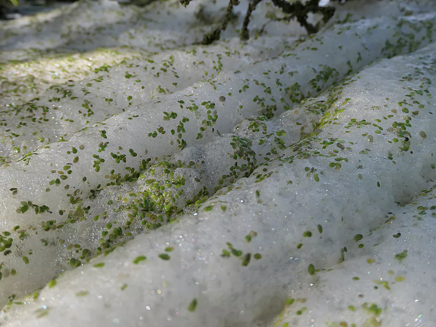
Cool how the foam rolled up in furls
The river really slowed, but there were still minor ledges
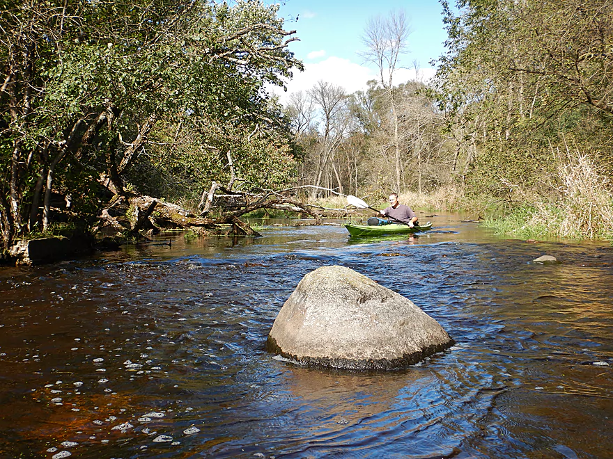
The first of many boulders
Another ledge…lighting was very challenging for photos
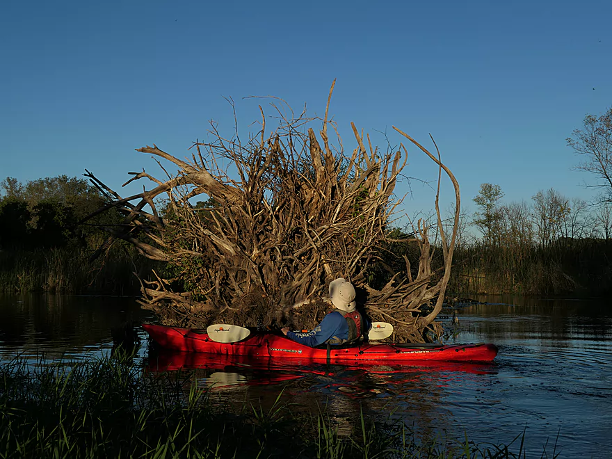
So many dead trees…some type of plague hit this area
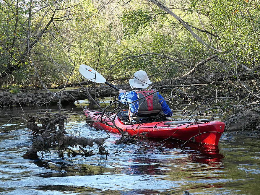
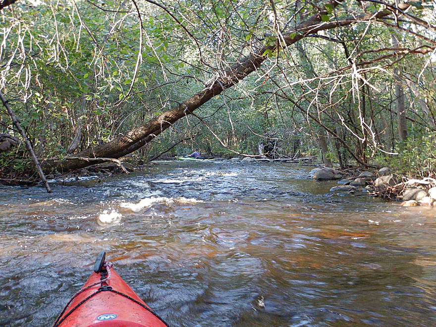
The first logjam…we were able to go over
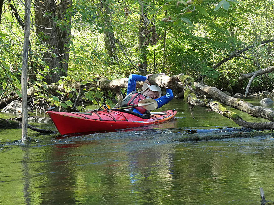
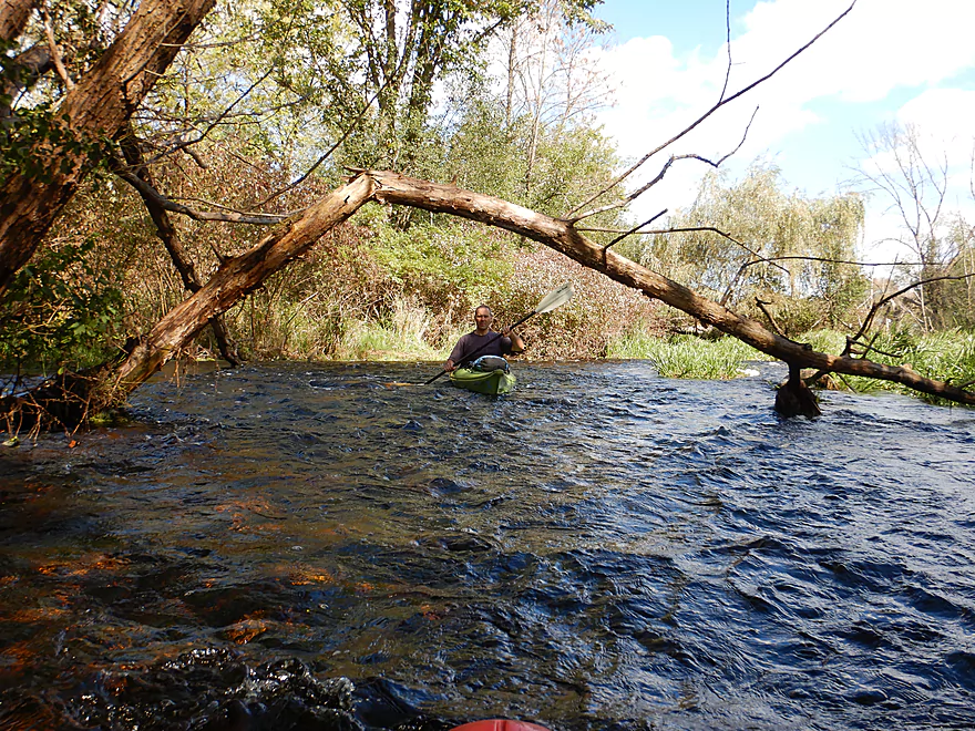
Some logs we had to duck under
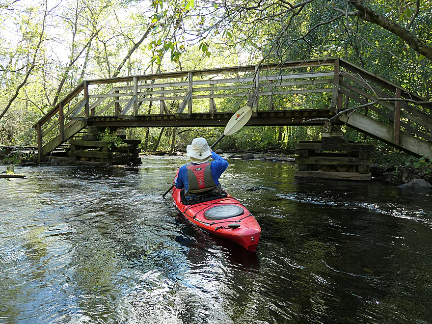
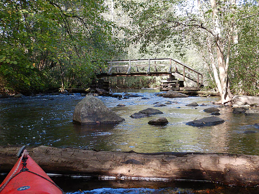
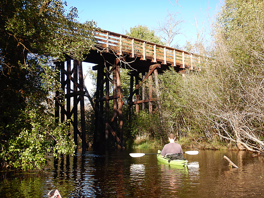
A bridge for the Ice Age Trail (Monches Segment)
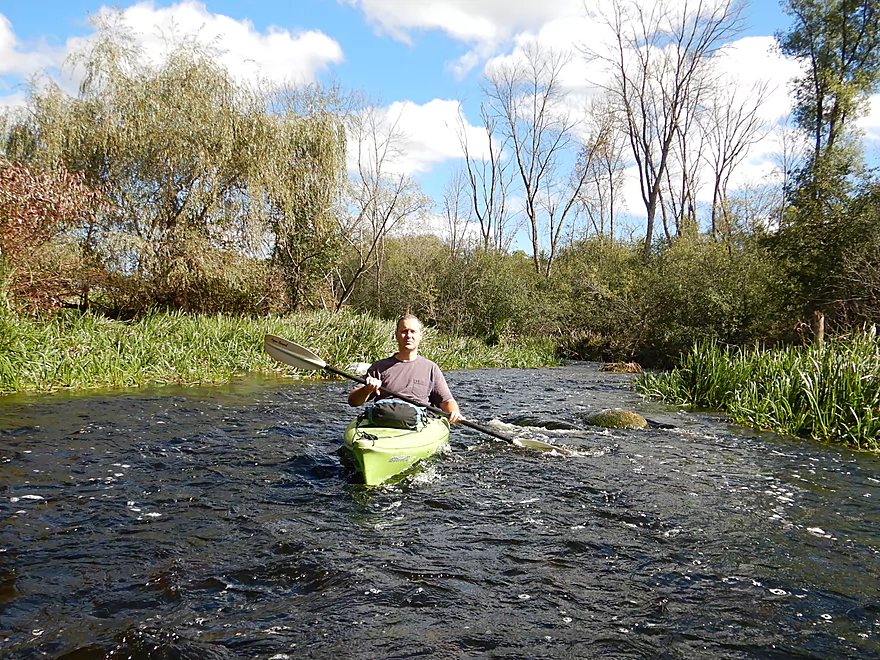
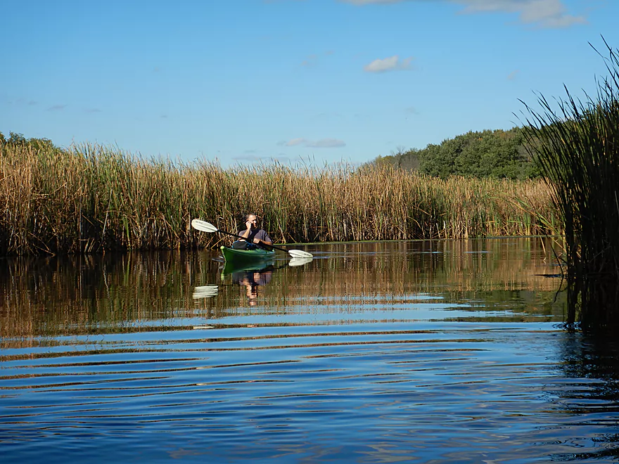
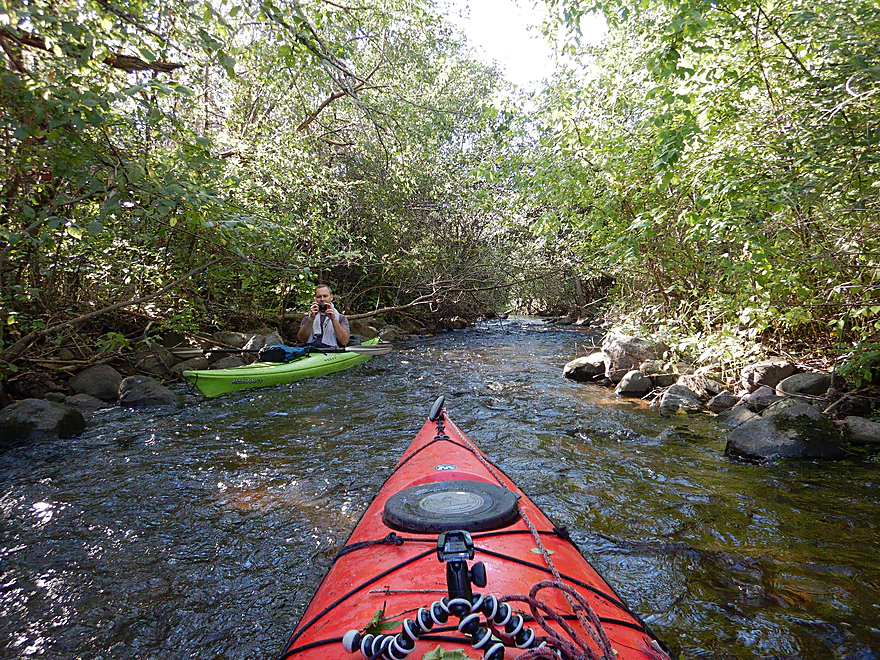
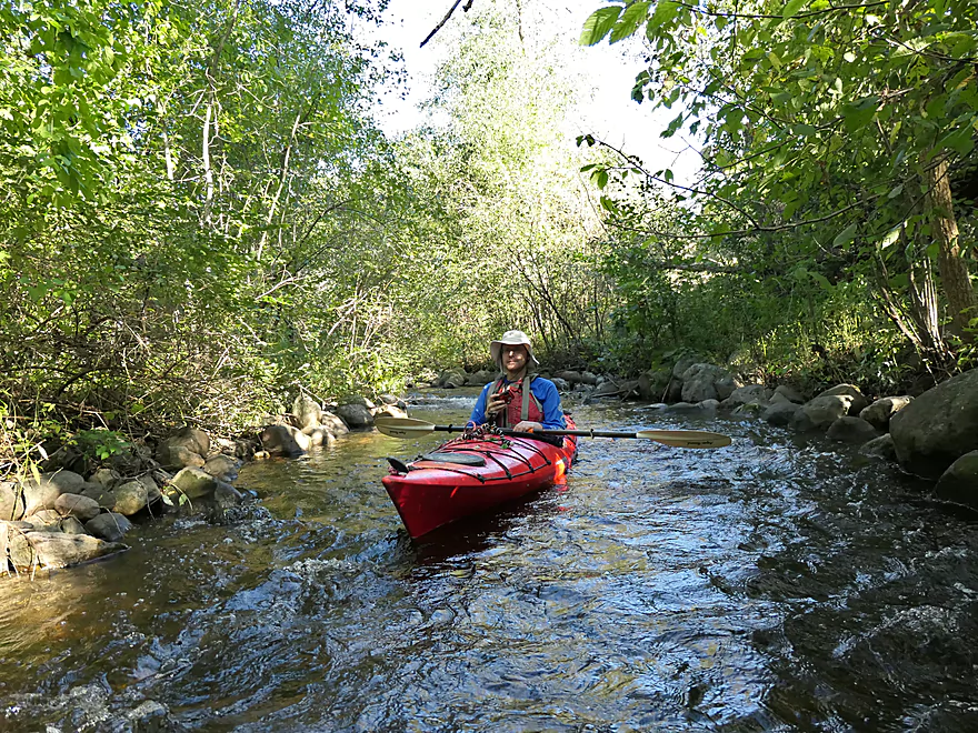
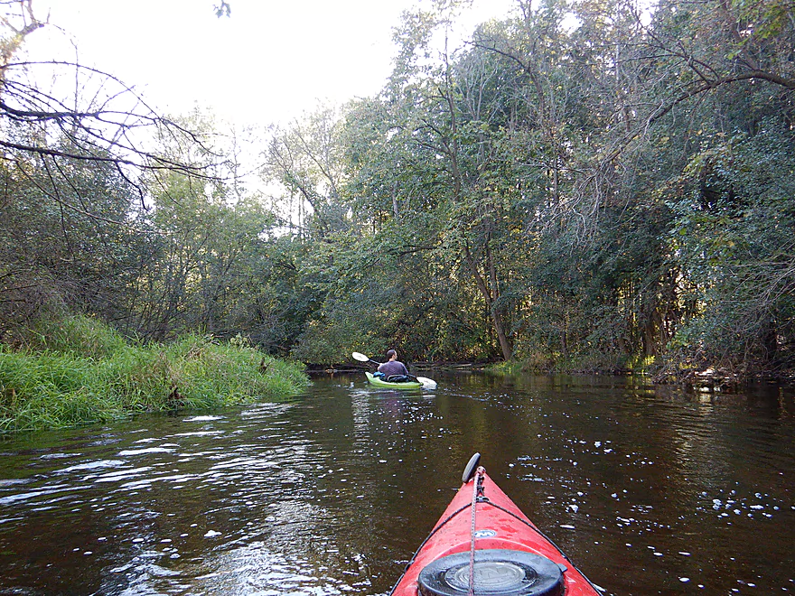
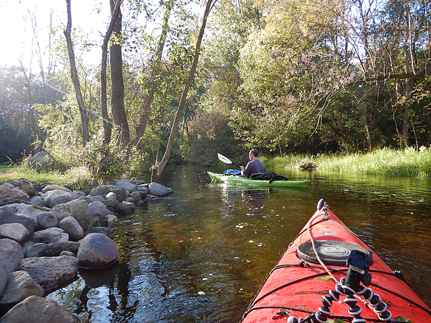
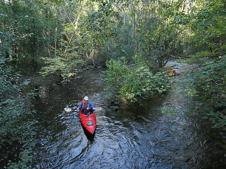
Very scenic
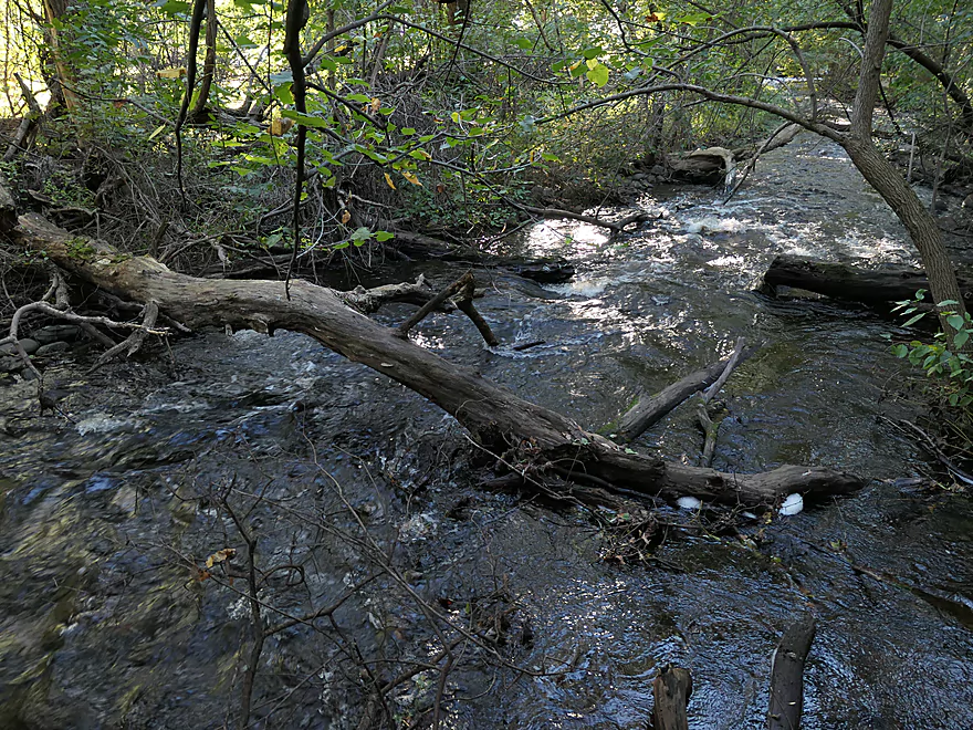
This was our second logjam
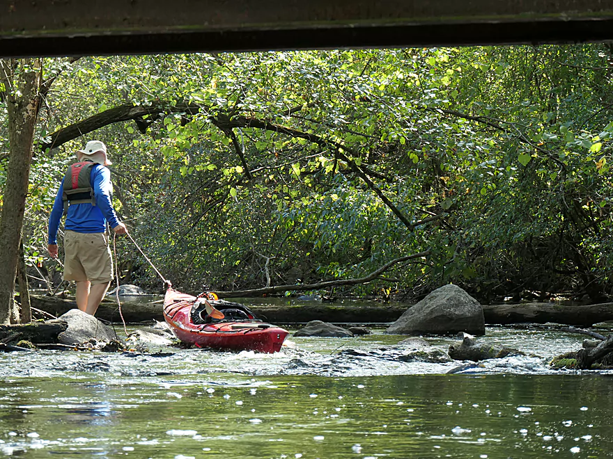
Super easy portage
If you are determined you can squeeze though on the far end
This would be logjam #4…easy portage
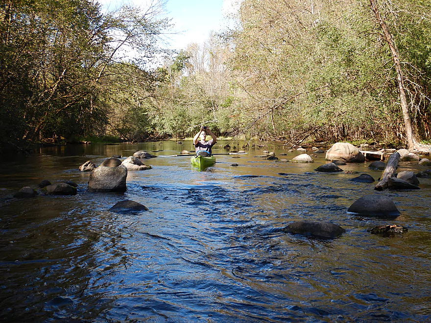
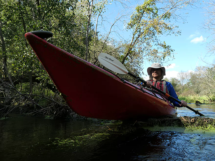
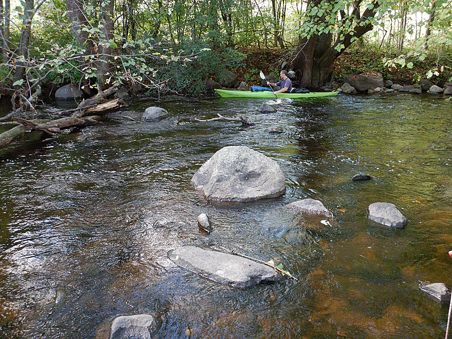
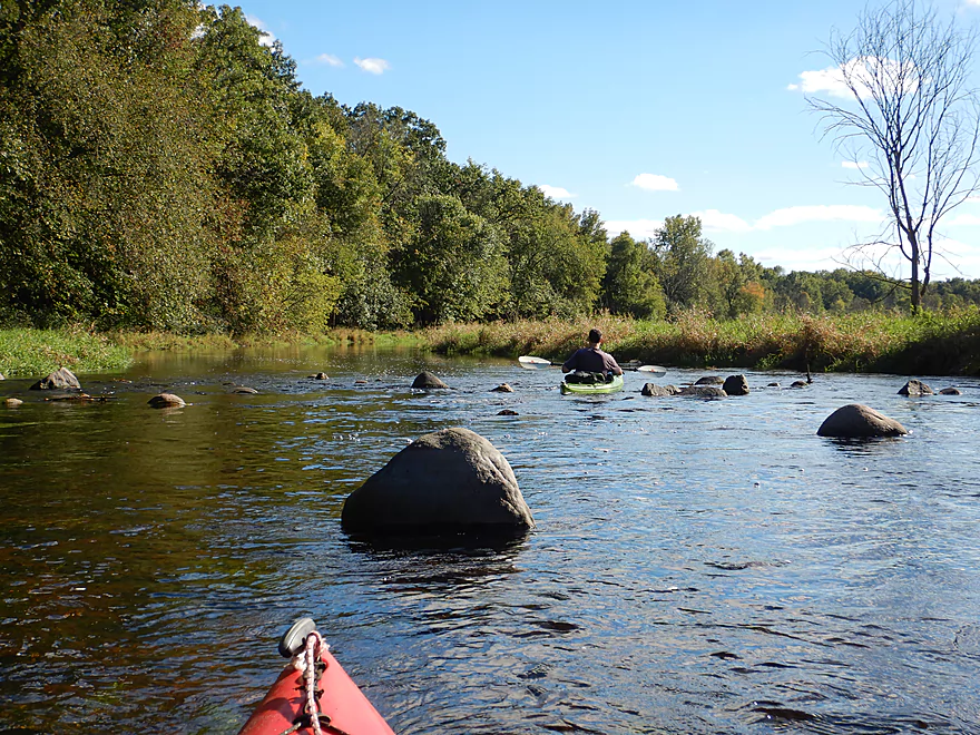
Start of a large boulder garden
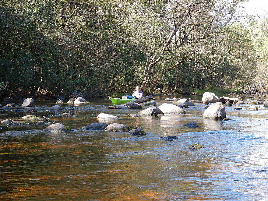
Also very scenic
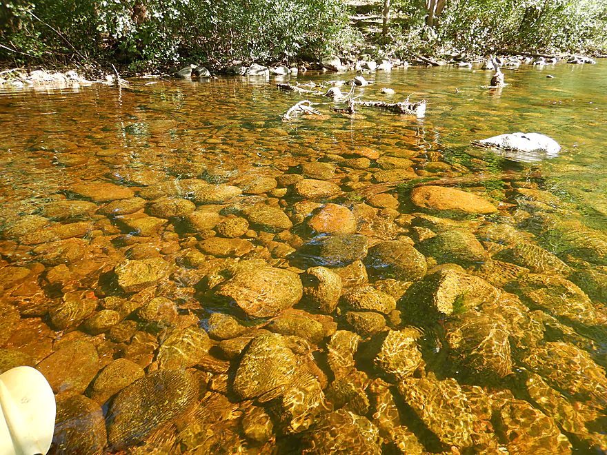
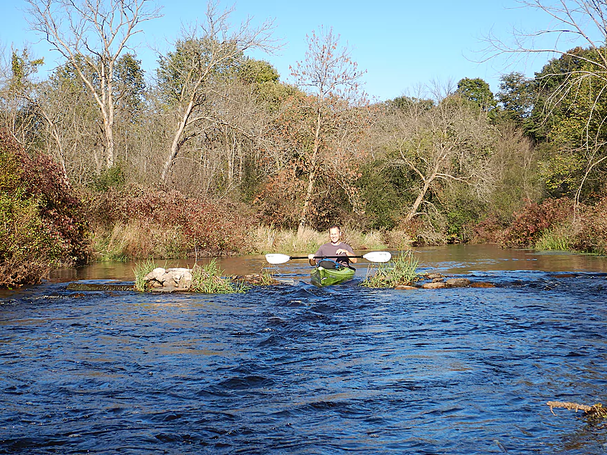
Water clarity was superb
The boulder garden was a bit shallow though
River starting to widen out
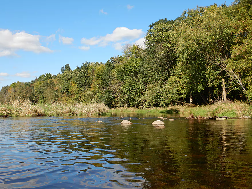
I believe this is where Funks Millpond used to be
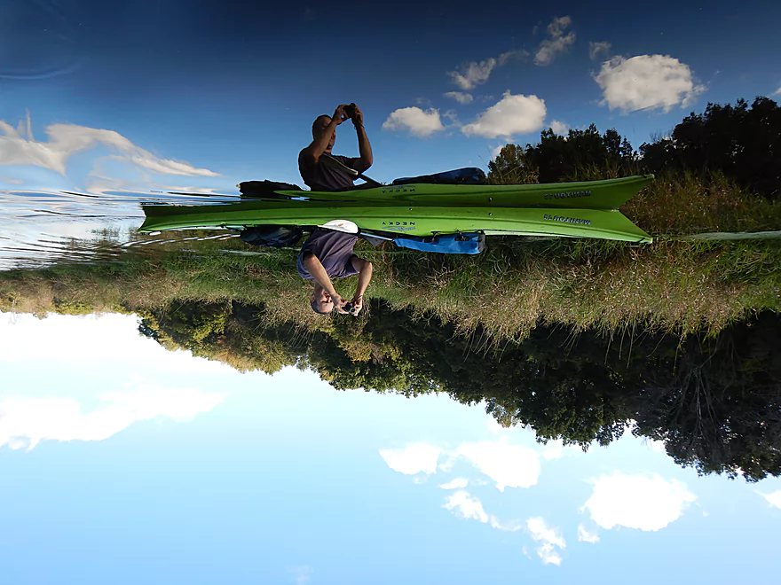
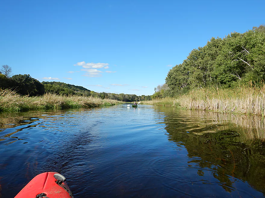
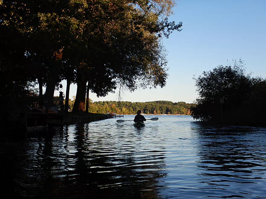
Great spot for kayak reflections
The next mile had a very different character…open and with few trees
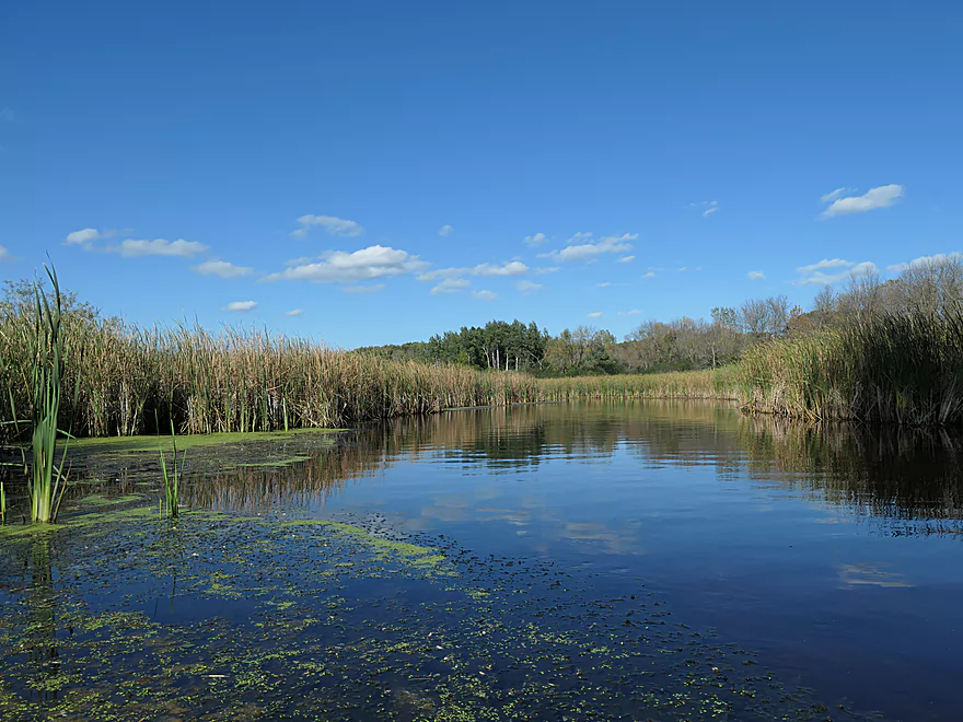
Entering a marsh
Reminded me of the Bark River
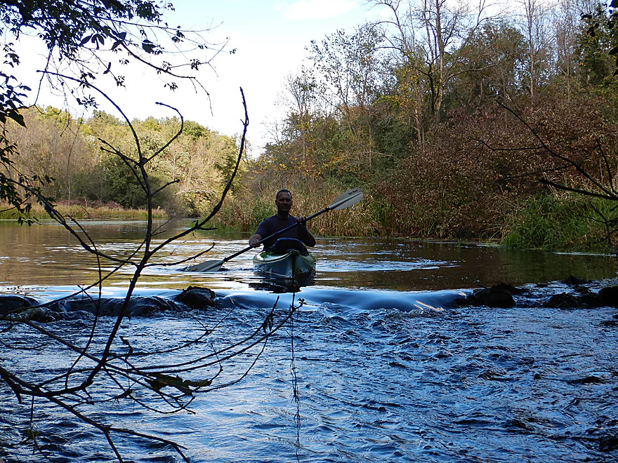
The river narrows where the old dam used to be
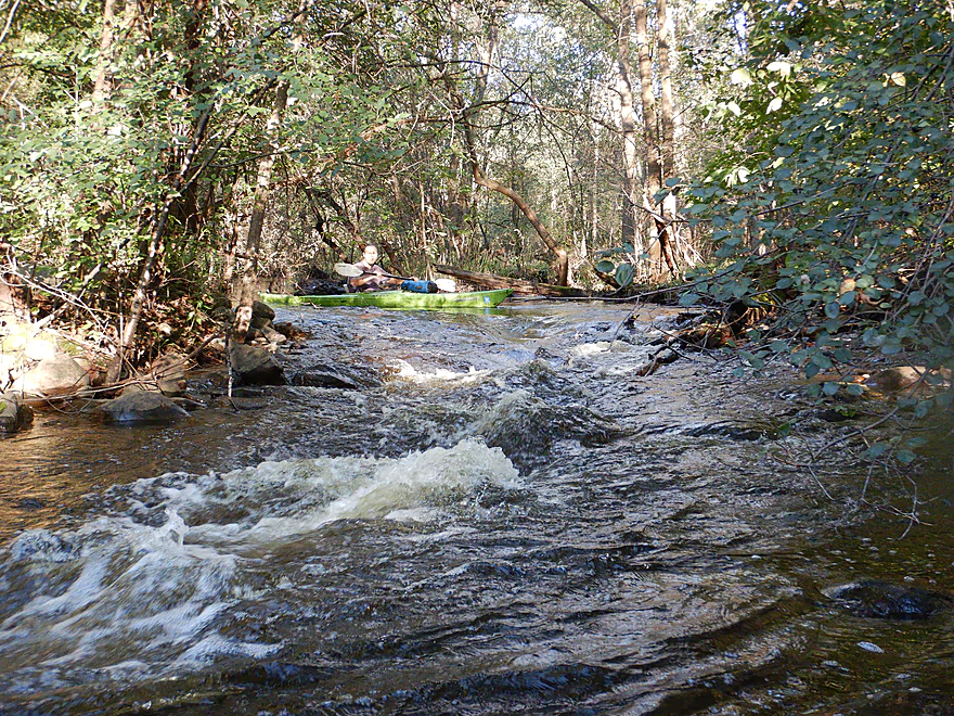
These rapids were great fun
Not easy to turn around
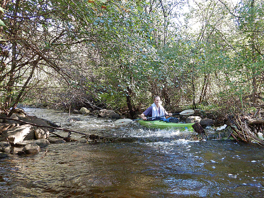
Some tricky rapids but quite doable
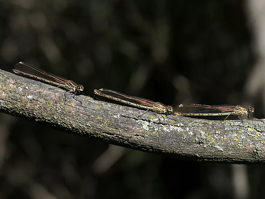
Three blind damselflies
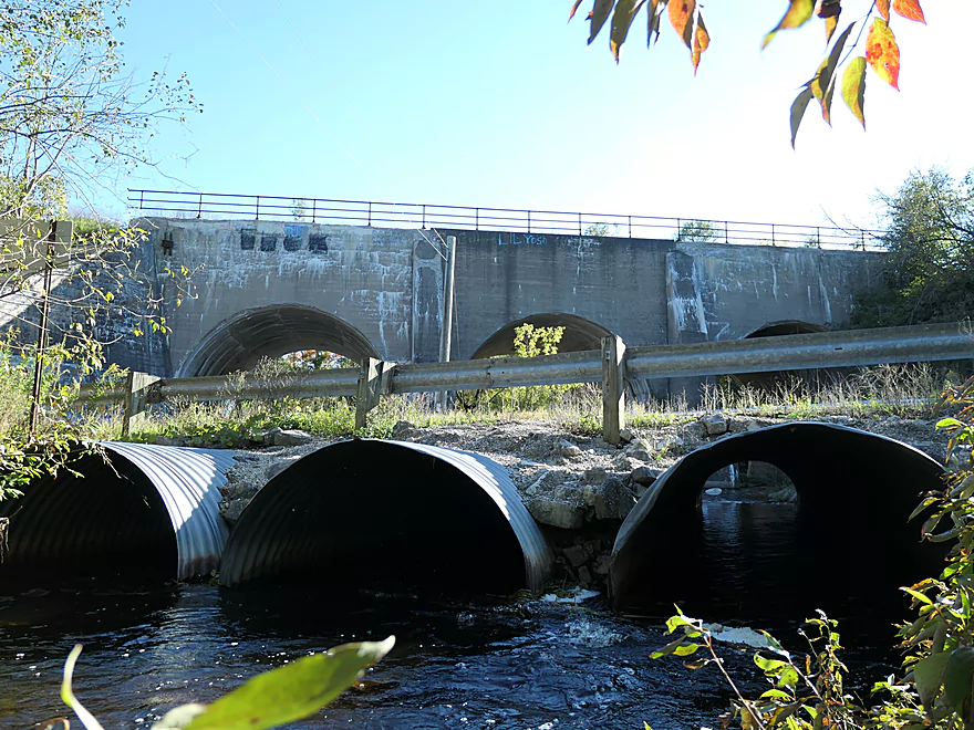
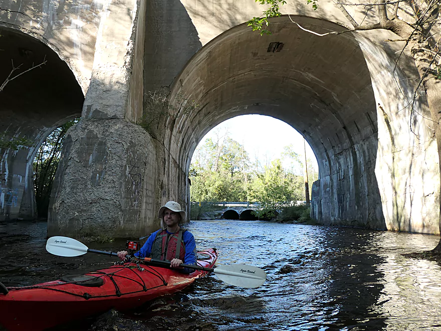
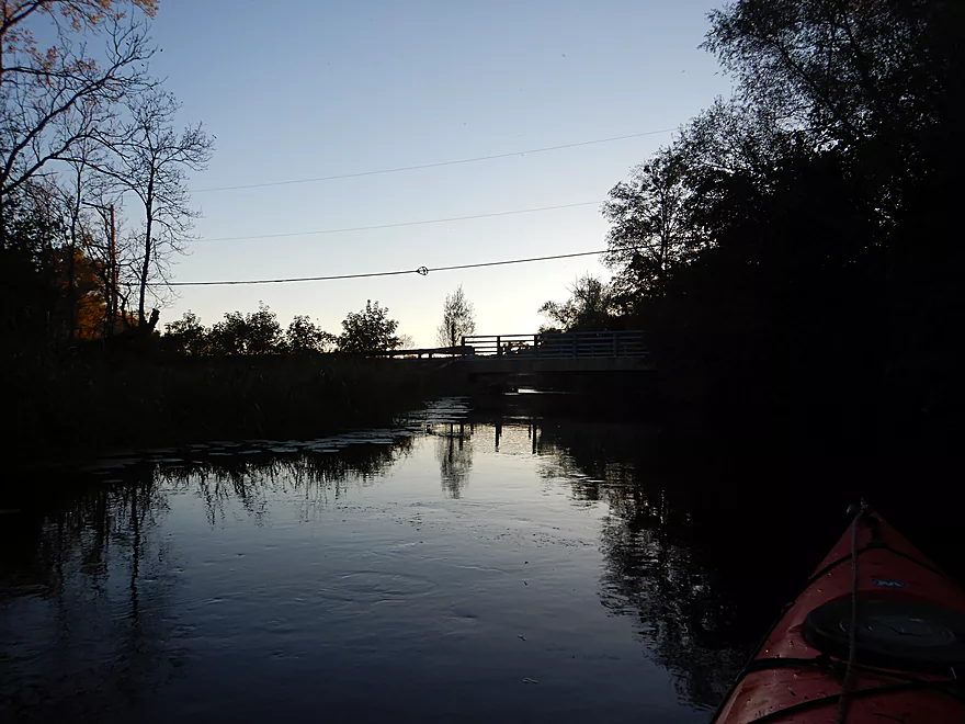
A triple-arched railroad bridge towers over Kilbourn Road
This would be a good alternate access
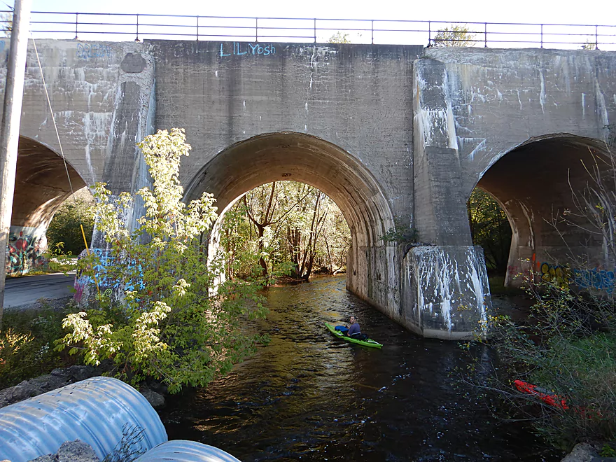
A spectacular bridge
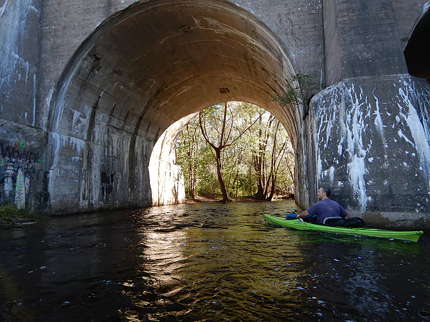
Reverse view
The woods return
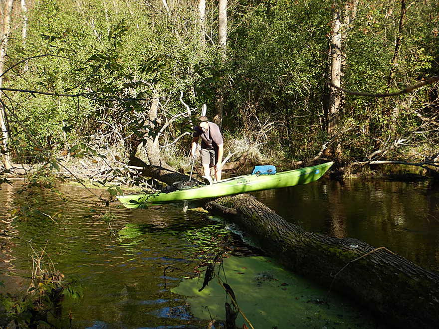
This would be logjam #4…medium difficult portage
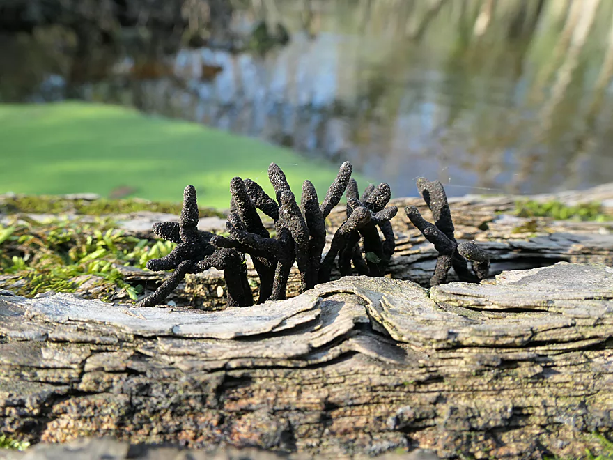
These fungi are known as Dead Mans Fingers
I believe this is another leg of the Ice Age Trail
More dead trees
Log jam #5
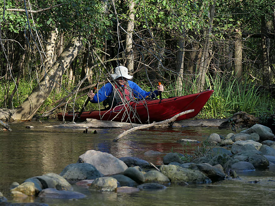
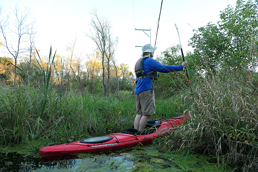
I got stuck when I portaged the wrong spot
Wonder if locals moved these rocks to make the river more navigable
There used to be a snowmobile bridge here but was washed out
Entering another narrow fast section
A Class 2 drop
The best rapids of the trip
They keep going
Choose wisely when navigating around islands
Logjam #6 had to be portaged
More rapids
Hwy 83 marks the end of the rapids and boulder gardens
A great public launch behind the North Lake post office
The boat seems odd at first…
But we are close to North Lake
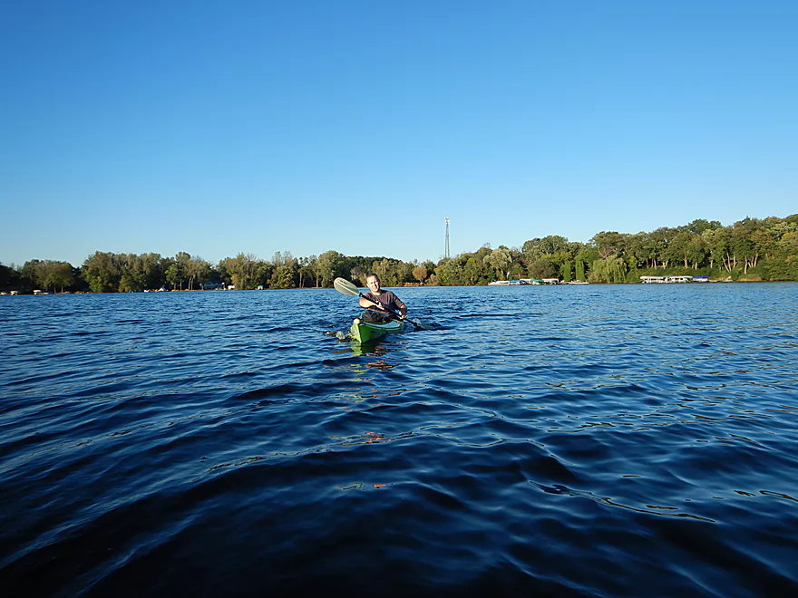
This was a deceptively big lake that took a half hour to cross
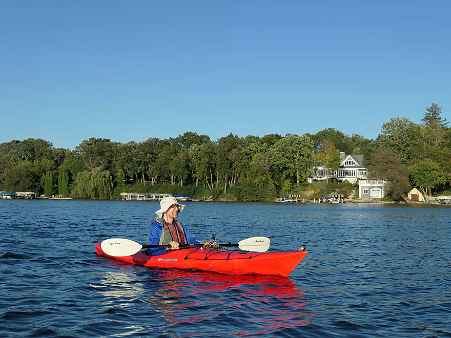
Nice lake though
The outlet was a bit hidden but we found it
Looking back at the lake
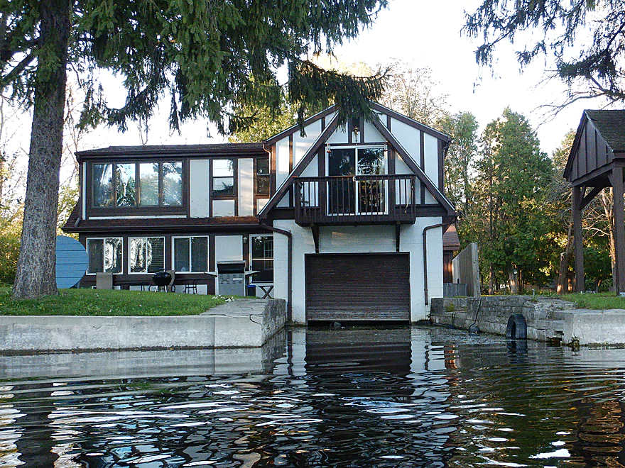
An attached garage…for boats!
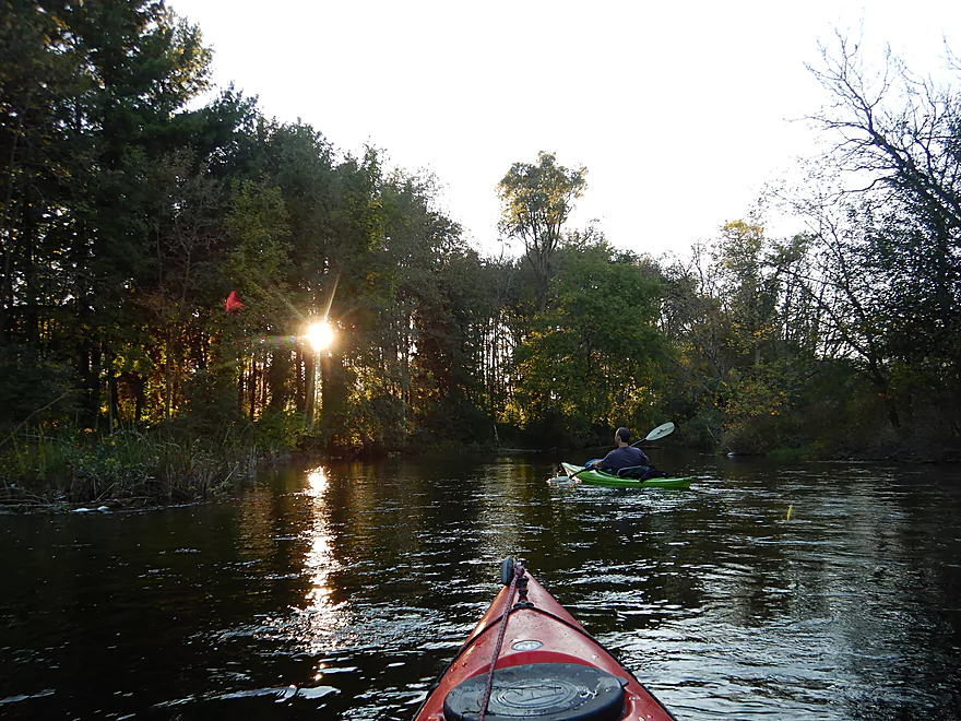
We are losing light fast
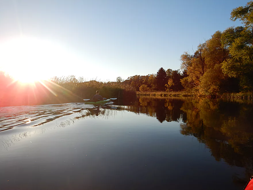
But it did offer some unique photo opportunities
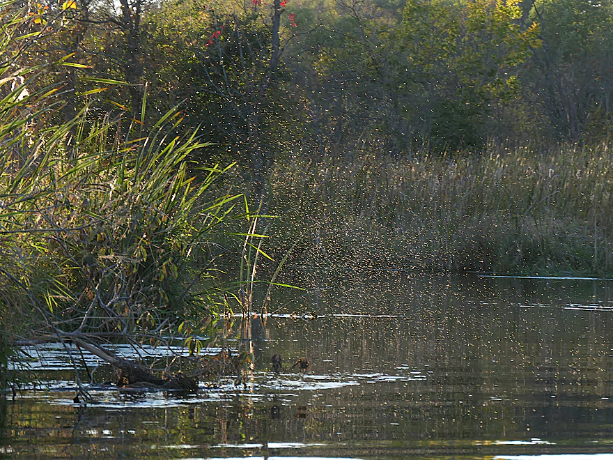
Huge midge swarms came out at dusk
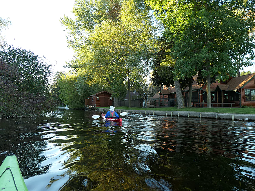
The final mile was part of an attractive wetland
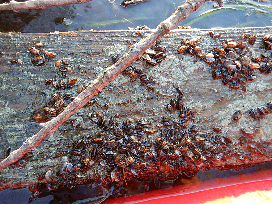
So many zebra mussels
Tree in the middle of the channel
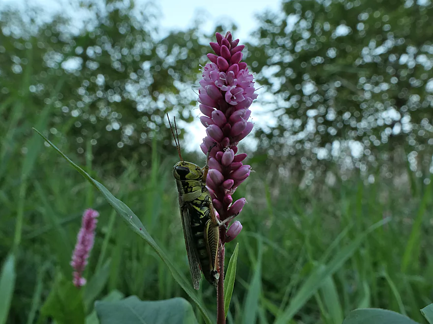
Grasshopper posing for a photo
With little light remaining, we reach our take-out
Scouting take-out options at West Shore Drive
Not great, but the southeast corner had to do
Oconomowoc River – Monches to West Shore Drive


Originating in the western outskirts of Milwaukee, the Oconomowoc is a small river that flows southwest through Kettle Moraine Country before joining the Rock River. This is a neat paddling stream that enjoys excellent clarity not typically associated with a suburban river.
My initial hope was to actually put in off Monches Lake where there is a public boat ramp. But portaging the subsequent dam didn’t appear practical so instead we launched just below it by Kettle Moraine Drive which was a good access option. The river started on a great note with crystal clear water and fun rapids that snaked through a narrow 20′ channel. Soon the river widened and slowed, but stayed scenic with undeveloped and lightly wooded banks. This watershed doesn’t suffer runoff like many other Wisconsin rivers, because of the relatively flat terrain and the glacial soil. The result is surprisingly clean water which makes it easy to see the attractive gravel substrate
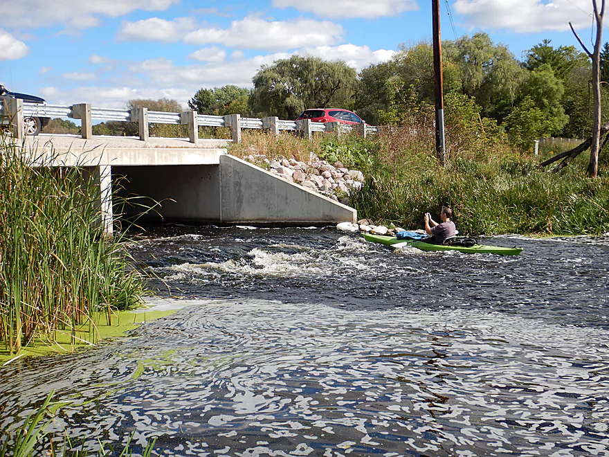
One of the first highlights came a couple miles into the trip when we paddled under a scenic Ice Age Trail bridge which was followed by a large boulder garden. There are actually two bridges here and you want to go under the right one, which is more navigable. But honestly between the boulders and a few downed trees, you’ll need to portage anyway (super easy though). The next half mile featured several more attractive boulder gardens. Unfortunately there were two other logjams upstream of Kilbourne Road, but neither were difficult portages.
Soon we left the dense woods behind and paddled through an attractive marsh section. At the end of the marsh the river shrank to a narrow chute where the old Funk’s Millpond used to be. What remains of the old dam area is a narrow and twisty channel filled with fun rapids. When you approach an island, go left…the right channel is clogged with logjams.
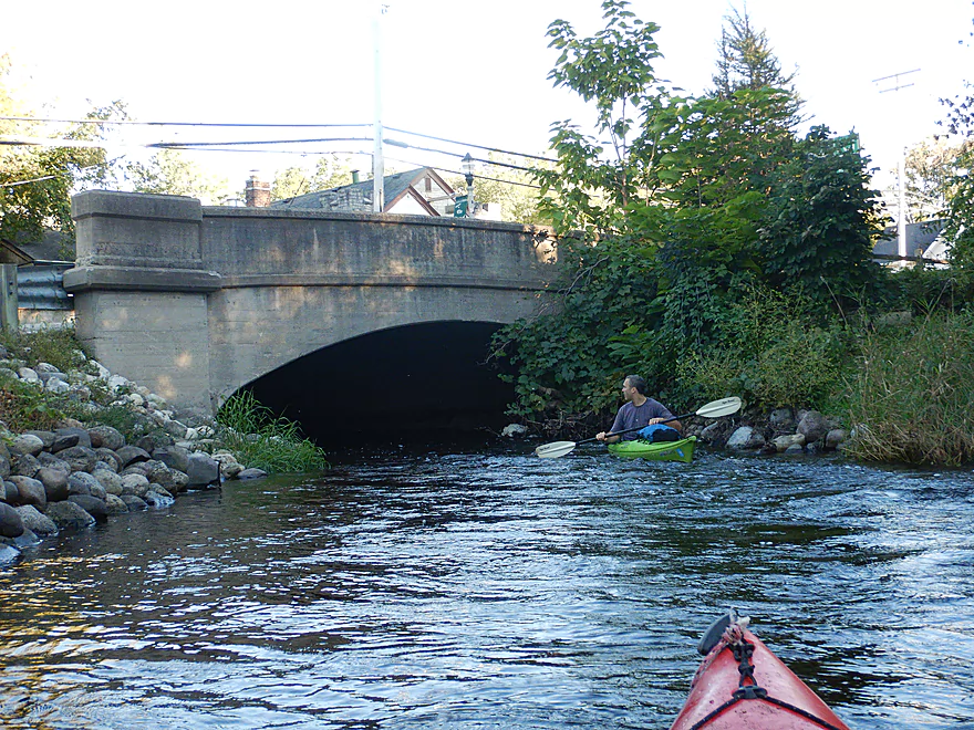
Following the old dam, the river flowed past East Kilbourne Road. Here was a unique scene as the road culverts were backdropped by a much larger arched railroad bridge which was very striking. Shortly after was yet another bridge, but this appeared to be a converted railroad bridge and likely a leg of the Bugline Trail.
As we neared the town of North Lake, the channel became rockier. In one location the locals had arranged the rocks in lines which helped make the river navigable. Following a washed out snowmobile bridge, the river narrowed and sped up for a long stretch of rapids that included some Class 2’s. These were great fun, but there were a few tricky strainers here and there, and in one case we did have to portage a jam that overhung some of the rapids. When you encounter a fork in the channel, you want to go left as that had fewer obstructions.
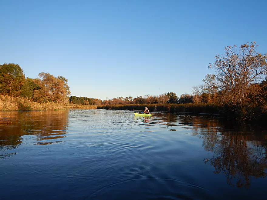
The Hwy 83 bridge and the town of Bear Trap marked the end of the rapids and boulder gardens for the trip. Just behind the town post office was an obscure boat ramp that sees little use but would be a good public access option. Following a short river stretch, the creek widened into North Lake. This was a deceptively big lake that took a half hour to cross. North Lake was an attractive kettle lake that was unique because it was formed from melting glacial ice instead of a dam (99% of the time rivers + lakes = dams). The river outlet wasn’t the easiest to find but we did persevere… If you paddle the lake just keep an eye out for a house with a telescope turret on top…just to the right is the mouth.
The final mile was a slow but pleasant stretch of the river that flowed though an attractive marsh. Unfortunately we lost a lot of light at this point and photography proved very difficult. Twilight paddles can be unique and enjoyable experiences…you just need to make sure you get off the river by dark. We ended the trip at West Shore Drive which was not a great take-out but doable. We initially wanted to do a longer trip, but cancelled after the late start we got. Oh well…future trip.
In summary this was a great trip with surprise boulder gardens, crystal clear water, undeveloped shores, and fun rapids. On the downside, we did get hung up and hit some rocks here and there, but only a small fraction of the river was low and most of it was plenty navigable. The occasional logjams were the reason this didn’t get five stars. None were overly difficult, but you never enjoy a portage. Hopefully locals will clear these out in the future.
A special shout-out to “Mex Mufflers & Brakes”. While driving to the Oconomowoc my brakes frighteningly enough failed near the east side of Madison. With no appointment, they replaced my entire brake line in just two hours and I was able to still do my trip (although I did get a late start). Friendly mechanics, fast, no appointment needed, and cheap…I do recommend.
2024 update…the logjam situation is now significantly worse because of downed ash trees. Paddling the stretch upstream from North Lake is not recommended.
We saw a GBH, a turkey vulture, a kingfisher, geese, some huge clams (sign of a healthy river), turtles, and dragonflies. Near the end of the trip, we also heard sandhill cranes and a horned owl. The Oconomwoc like the nearby Bark does suffer from zebra mussels but they do keep the water clear. The highlight were the large midge clouds that came out at dusk.
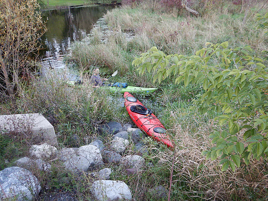
We launched below the Monches dam just northwest of the Hwy E bridge. This is a great access with parking available along a short dead end drive. From here it was easy to pull our boats through the tall grass and launch below the rapids.
An alternate access 0.4 miles upstream would be the Lowes Lake Canoe & Kayak Boat Launch. This is a very good public access, but the additional half mile would include mostly uninteresting flowage paddling and while portaging the dam would be doable it wouldn’t be fun because of the guardrails. Parking may be scarce by this boat launch, but I think it has recently been expanded.
An alternate access 2.6 miles downstream is off the East Kilbourn bridge which appears to be a great put-in option. But if you launch here, you miss out on a nice upstream section with boulder gardens.
We ended the trip at West Shore Drive which wasn’t the greatest of bridge access options, but was doable. The banks were steep, the shoreline marshy, a guardrail must be hurdled, and parking by the bridge is limited (we had to park close to Clearwater Drive). But I’m probably making this sound worse than it was…it wasn’t too bad.
An alternate access 1.3 miles downstream at the mouth of Okauchee Lake would be at a private business such as Hollywood’s Roadhouse Bar & Grill. Seek permission before taking out here. This additional segment should be very nice. Unfortunately there aren’t of a lot of other access options on the lake unless you go to the far west side.
The bike shuttle would be 5.9 miles and be somewhat hilly with 148′ of ascent. There is no gravel or heavy traffic, but the shoulders are very narrow.
Current: This varied greatly. At times quite slow, but in sections very fast with riffles and rapids.
Rapids: There are many Class 1 rapids on this trip and a few Class 2’s. The first Class 2 is just upstream of E. Kilbourn Road which was tricky because of how narrow the channel was. When you approach the island go left (the right channel is clogged). Maybe a half mile later and closer to Hwy 83 there is a long stretch (say 1/4th mile) of continuous rapids. Here there were multiple Class 2’s but these were tricky because of the deadfall with several tough strainers and one logjam in the rapids that required portaging. Go left/south at the main island as that channel is more clear. It’s all doable, but stay on your toes. There were no rapids after Hwy 83.
Logjams: Upstream of E. Kilbourn Road there were three logjams. The first we hopped over and the other two were easy portages because the banks aren’t steep or overgrown. Downstream from E. Kilbourn Road there are three more logjams that had to be portaged. These are a bit more difficult but aren’t bad. One comes up pretty quick because it is in the middle of rapids. There is also a tricky strainer to dodge just upstream of Hwy 83.
2024 update…the logjam situation is now significantly worse because of downed ash trees. Paddling the stretch upstream from North Lake is not recommended.
Wind: North Lake is deceptively big and will take a half hour to cross. Be ware of strong headwinds coming from the west.
Below is a rough depth guide based on a gauge on the nearby Bark River.
- 0-15 CFS: Very low depth. You would likely have to walk many of the rapids.
- 16-35 CFS: An average depth. You might have to walk some of the rapids. Excellent clarity.
- 36-60 CFS: Above average, but good depth. You’ll hit some rocks, but for the most part this shouldn’t be too bad. This trip was done at 51 CFS.
- 61-80 CFS: A high depth. Likely doable, but some of the rapids could be pushy.
- 81+ CFS: A very high depth. The rapids might be too rough to be enjoyable…especially combined with the strainers.
Detailed Overview
- Hwy 164 to Holy Hill Road: (0.9 mile) Mostly unknown. Appears pretty open, but with one wooded section that probably has logjams.
- Holy Hill Road to Hubertus Road: (2.2 miles) Pretty open marsh paddle and should be no downed trees. Some lake paddling to contend with.
- Hubertus Road to Elmwood Road: (0.9 miles) Downed trees are definitely an issue in the first half, but the second half is open and has some nice rocky sections with clear water.
- Elmwood Road to St. Augustine Road: (0.9 miles) A good prospect with nice rocky sections. There will be portages for downed trees, but am not sure how many.
- St. Augustine Road to County Line Road: (4.4 miles)
- St. Augustine Road to Loew Lake: (1.0 miles). A scenic stretch with glacial boulders, rapids and springs. Some parts of the creek here are shallow and will have to be waded.
- Loew Lake to County Line Road: (3.3 miles). A popular wetland paddle with locals. Most do this as a round trip from County Line Road.
- County Line Road to Kettle Moraine Drive/Monches Dam: (0.3 miles) A slow large millpond.
- Kettle Moraine Drive to West Shore Drive: (5.9 miles) A great trip with clear water, boulder gardens, scenic bridges, fun rapids and attractive marshes. Only a few logjams prevent this from being five star.
- Hwy E to E. Kilbourn Road: (2.6 miles) Starts with some light woods and boulder gardens then opens into a marsh before closing with some rapids. There are three logjams, but the portages aren’t difficult. 2024 update...the logjam situation is now significantly worse because of downed ash trees. Paddling this stretch is not recommended.
- E. Kilbourne Road to Hwy 83: (1.2 miles) Fun wooded section with the longest rapids and several scenic bridges. There are three logjams and one tricky strainer. Note Hwy 83 used to be a good landing, but new owners have declared it private property and put up No Trespassing signs. 2024 update...the logjam situation is now significantly worse because of downed ash trees. Paddling this stretch is not recommended.
- Hwy 83 to West Shore Drive: (2.2 miles) Mostly lake paddling (North Lake). The short river section goes through a scenic marsh.
- West Shore Drive to Hollywood’s Roadhouse Bar: (1.3 miles) Section with good potential. Might be a downed tree to portage. The bar is private and you must get permission to disembark here.
- Hollywood’s Roadhouse Bar to Wisconsin Ave Launch: (3.5 miles) Probably an uninteresting paddle through Okauchee Lake, but the one mile river portion looks interesting. The Okauchee Lake Boat Launch is an alternate take-out.
- Wisconsin Ave Boat Ramp to Fowler Lake Park: (3.95 miles) A great lake and river prospect with amazing water clarity.
- Wisconsin Ave Boat Ramp to Wisconsin Ave Fishing Access: (1.7 miles) Mostly a lake paddle on Oconomowoc Lake, but some nice connecting river sections and a scenic railroad bridge.
- Wisconsin Ave Fishing Access to Fowler Lake Park: (2.3 miles) Half of this is through a nice marsh and half runs though a nice attractive suburbs.
- Fowler Lake Park to N. Golden Lake Road: (4.2 miles) Another good lake/river combo trip with good clarity.
- Fowler Lake to Veterans Memorial Park: (0.4 miles) A neat lake paddle with stunning clarity and attractive lakeside buildings.
- Veterans Memorial Park to W. Wisconsin Ave/Dam: (1.3 miles) A short section on Lake Lac La Belle. Heavily developed, this was a mediocre experience. Easy portage or take-out at end by dam, but parking is difficult. Ask permission from Paddleboard Specialists to park in their lot or park one block to the south at Chaffee Road Park.
- W. Wisconsin Ave/Dam to Chaffee Road Park: (0.3 miles) Terrific section with perfect water clarity.
- Chaffee Road Park to South Concord Road: (0.9 miles) Great section with clear water and scenic bridges.
- S. Concord Road to Concord Rd(2nd Bridge): (1.6 miles) Section starts good, but gets mucky after the sanitation plant. Still an ok section. Take-out at North Golden Lake Road is good, and apparently open to the public but can’t be 100% sure of this.
- Concord Rd(2nd Bridge) to N. Morgan Road: (2.6 miles) Some ok clarity, but the river starts to slow down and become less interesting.
- N. Morgan Road to Elm Drive: (2.2 miles) Ok prospect (river is getting slower and wider). For Elm Drive, you should be able to launch NE of the bridge, but must park further to the north to clear the No Parking signs.
- Elm Drive to Hwy F: (1.8 miles) Ok prospect. Hwy F is not great, but one of the more secluded bridge accesses on the lower section.
- Hwy F to W. River Drive: (2.6 miles) Weaker prospect. No Trespassing signs beyond the ditch by W. River Drive and a sign that limits parking doesn’t make this an appealing access. Probably doable for access though.
- W. River Drive to Northside Drive: (1.4 miles) River is getting less interesting and muddy. You must portage by an electric fish barrier under Northside Drive (plenty doable but a bit brushy and super muddy…do scout this before running). Parking is good at Northside Drive.
- Northside Drive to mouth on Rock River: (1.0 miles) Probably an uninteresting section.
- Mouth to Hwy P: (2.6 miles) The lower Rock River is not an interesting prospect IMO (too wide and muddy). Hwy P should be adequate for taking out if you do this section.
Trip Map
Overview Map
Video
Photos Size:
My husband and I did the majority of this trip today (7/26). We put in just below the Monches Dam and took out at the North Lake Post Office and the whole trip took just about 3 hours 30 min. I would say that we’re both at an intermediate skill level and the rapids on this trip were very doable for us. There are a few that get interesting because of logs in the water or sharp turns after a run of rapids, but overall they were fine. The water clarity for the majority of the trip was excellent but the water levels seemed a little low. There were some extremely nice parts of the trip but all the portages dulled the shine a bit. The first was at the Ice Age Trail Bridge, then the next 4 or 5 were over dead trees that had fallen across the water. The last was over Kilbourne Rd. I would highly advise NOT going through the culverts as they are completely covered in spiders. The whole opening of the middle culvert was web, water to ceiling, with spiders as big as your fist. No joke. Overall a wonderful experience.
This section does have its challenges, but it is rewarding. Downstream legs are likely much easier to paddle. Thanks for the review Megan.
I’ve gone from the post office to fowler lake a couple of times.Great trip, stopped foolerys for lunch. On okauchee lake go into Garvin and tearney lake they are hidden jems.See if u can find the hidden pond in one of them.
Appreciate those tips! I didn’t know you could access those two lakes and will put them on my todo list.
Aaron, I’m sad to say I paddled this section today 05/05/2024 at about 53 CFS. It is the worst trip I have ever paddle following your reviews. The entire river is now choked with dead ash fall, literally hundreds of trees in all directions of the water, of which about a dozen required portages and dozens required scooting over.
There is a small reprieve of open marsh after the IAT bridge, but it doesn’t last long. Once the water picks up after Kilbourn road, you are thrust into logs, or smack your face with trees growing across the river. Sadly, I think due to the emerald ash borer, this paddle is no longer viable for most. It took me 2.5 hours to go the 3.7 miles. Unless you want to put in at North Lake, hard pass. I would almost suggest you archive this trip as a fond memory, as such other inexperienced paddlers don’t get their boats stuck doing this trip.
Yikes! I’ll warn paddlers. This isn’t the only water trail the ash border has ruined.