Big Eau Pleine River
This an underrated tributary of the Wisconsin River near Wausau. Water levels are often fickle, but when right this is a terrific paddling with scenic boulder gardens, rapids, and outcrops.
Trip Reports
Elderberry Road to Cherokee Park
Date Paddled: May 27th, 2022
Distance: 3.7 miles
Time: Expect 2 hours
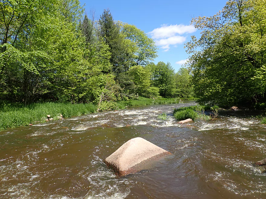
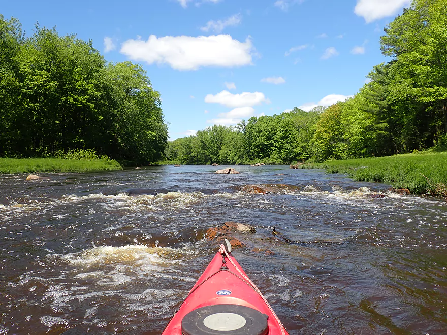
This is one of the more challenging but also rewarding stretches of the Big Eau Pleine. Highlights included scenic boulder gardens and three Class 3 rapids.
Read More...Cherokee Park to Hazelnut Road
Date Paddled: May 25th, 2019
Distance: 3.0 miles
Time: 4 hours 23 minutes (1.5 hours would be more typical)
The Big Eau Pleine is one of the most underrated paddles in central Wisconsin. Clean, fast, and with many granite boulder gardens, this has been my favorite trip to date for 2019.
Read More...Hazelnut Road to March Rapids Park
Date Paddled: May 31st, 2021
Distance: 6.1 miles
Time: Expect 3 hours
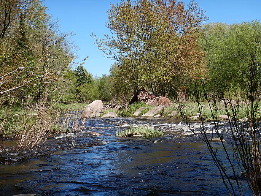
A heavily wooded leg with multiple boulder gardens, a few small outcrops, and two sets of significant Class 2 rapids. While water levels are tricky and timing important, this can be a great paddle.
Read More...March Rapids Park to Big Rapids Park
Date Paddled: May 30th, 2020
Distance: 3.6 miles
Time: 4 hours 14 minutes (1 hour 30 minutes would be more typical)
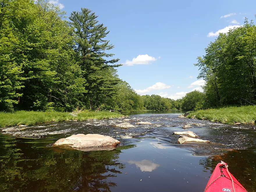
This is a tricky water trail to time, but when done at the right depth it's a lot of fun. Highlights included seven Class 1 rapids and two Class 2's.
Read More...Big Rapids County Park to Hwy M Bridge
Date Paddled: September 27th, 2014
Distance: 8.19 Miles
Time: 4 hours 57 minutes (4 hours would be more typical)
This is a pretty obscure prospect that is rarely reviewed and infrequently paddled…probably because most people associate the river with the massive flowage to the east, but a good length of the river upstream flows freely (mostly) and is actually a good paddling prospect. Put-in: Nice public access is available at Big Rapids County Park, […]
Read More...Overview Map
Detailed Overview
- Upstream of Gierl Ave: Only runnable at very high flow rates. A reader by the name of Jeremy provided a quick summary here.
- Gierl Ave to Elderberry Road: 2.1 miles. This leg doesn’t have quite the concentration of boulders/rapids as downstream legs but is a good prospect with maybe one major stretch of rapids/boulders and three mediocre stretches. This is a shallow leg that can only be run in high water.
- Elderberry Road to Cherokee Park: 3.7 miles.
- Elderberry Road to Huckleberry Road: 1.9 miles. A shallow wooded stretch with a handful of Class 1's and two Class 2's at the end.
- Huckleberry Road to Cherokee Park: 1.5 miles. Very wooded flowing mostly through Cherokee Park. Nice leg with three Class 3's and one large boulder garden.
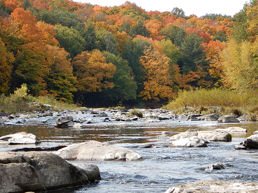
- Cherokee Park to Hazelnut Road: 3.1 miles. Fantastic trip with clear water, many boulder gardens, and fun rapids. The highlight is an 800′ long boulder field below Hwy N.
- Hazelnut Road to March Rapids Park: 6.1 miles. Heavily wooded leg with multiple boulder gardens and a few small outcrops. There are two sets of significant Class 2 rapids.
- March Rapids Park to Big Rapids Park: 3.4 miles. A good trip with 7 Class 1’s and 2 Class 2’s.
- Big Rapids Park to Hwy M: 8.5 miles.
- Big Rapids Park to Hwy 97: 1.9 miles. Shallow but scenic section.
- Hwy 97 to Hwy M: 5.6 miles. Scenic section with several rock outcrops.
- Hwy M to Hwy 153: 0.9 miles. There are some rock walls after Hwy M, but you could just paddle down and back to explore, instead of taking out at Hwy 153. Hwy 153 is not an ideal take-out.
- Hwy 153 to Maryel Drive Boat Ramp: 2.2 miles. Probably uninteresting flowage padding. Put-in at Hwy 153 would be tricky, but the take-out at the ramp would be good.
- Maryel Drive to Reservoir Dam: 13.3 miles. A huge lake that is not paddle friendly. Numerous launch options are marked on my overview map. The dam is located on the mouth near the Wisconsin River.