
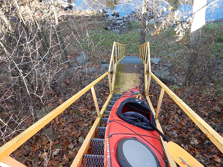
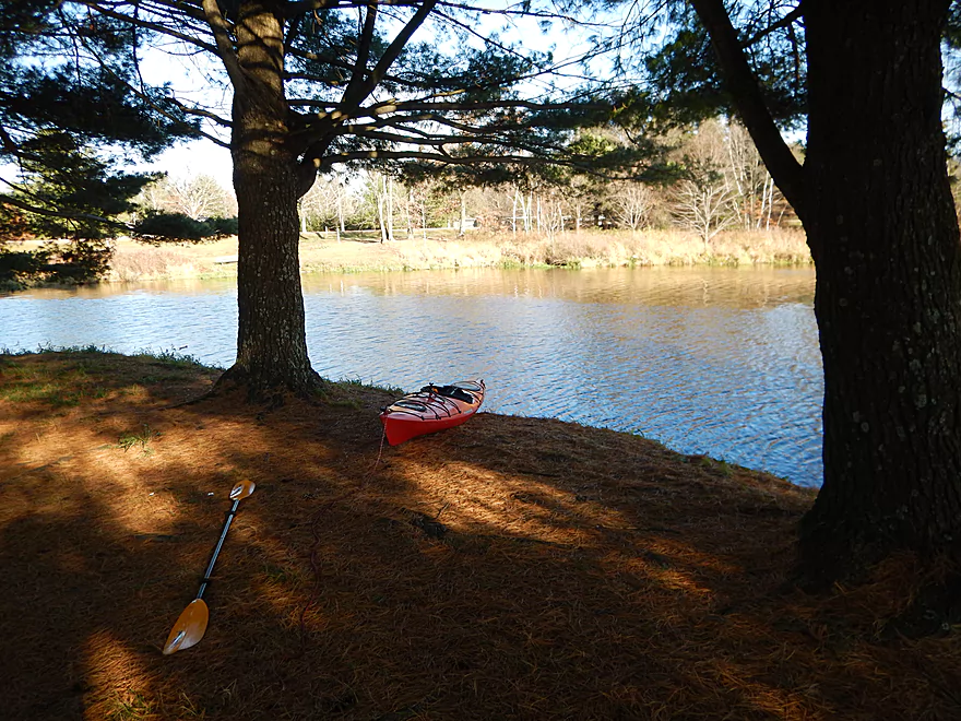
Steep put-in
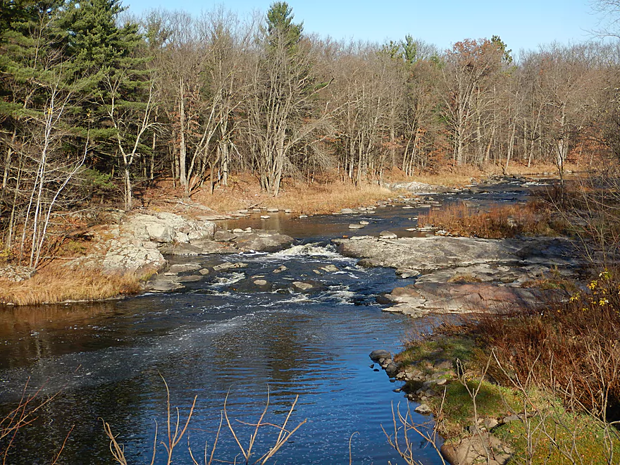
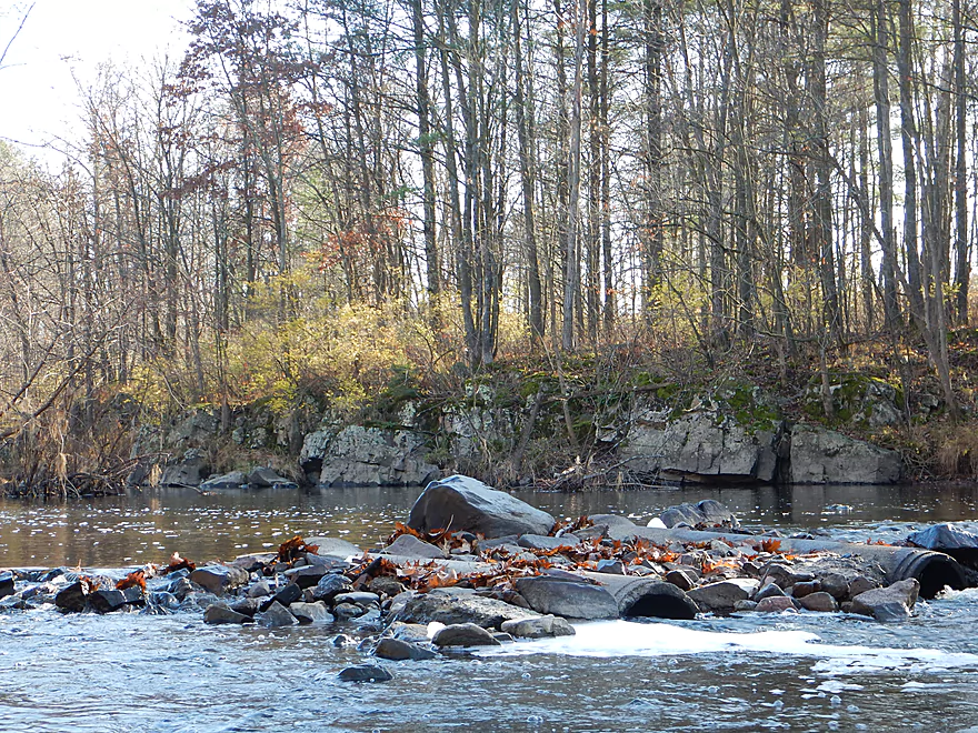
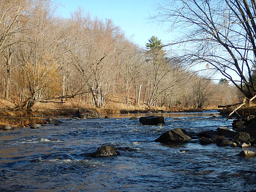
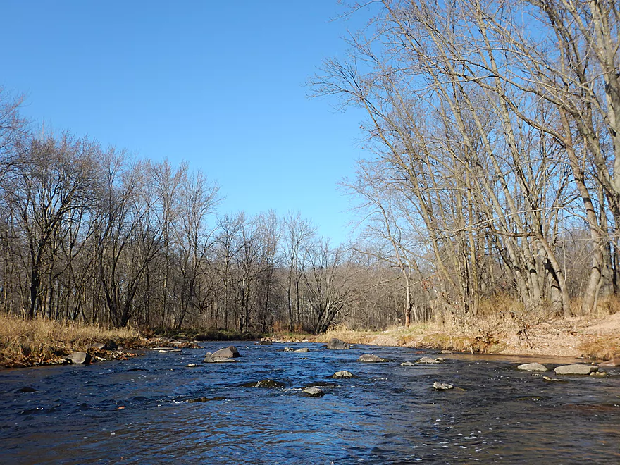
Little Bull Falls (91 CFS)
Usually is higher (300 CFS example)
In low water you can get close
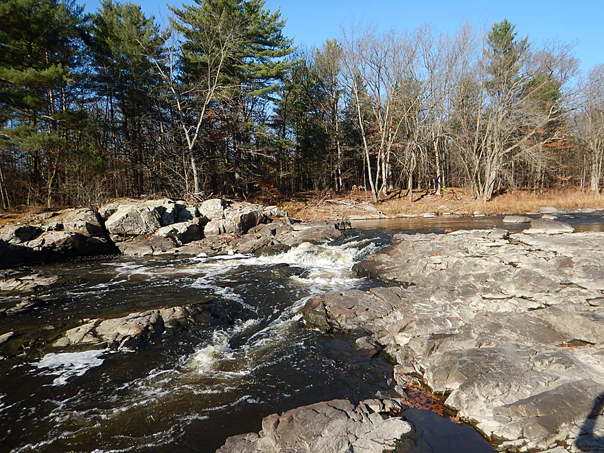
And even out onto the rocks
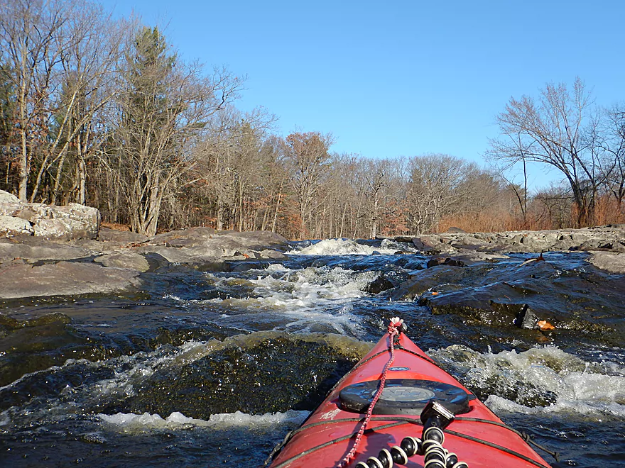
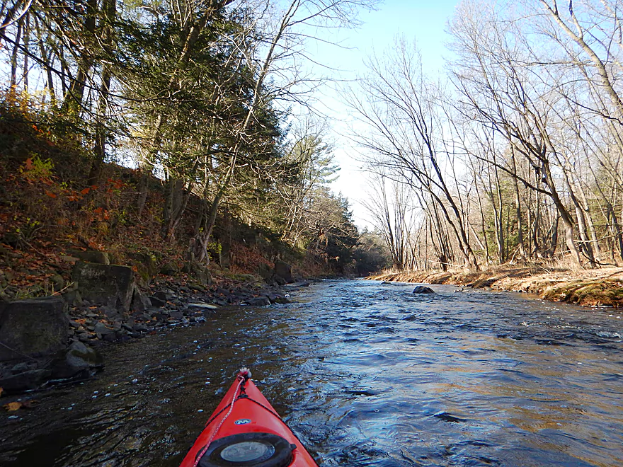
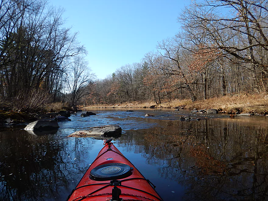
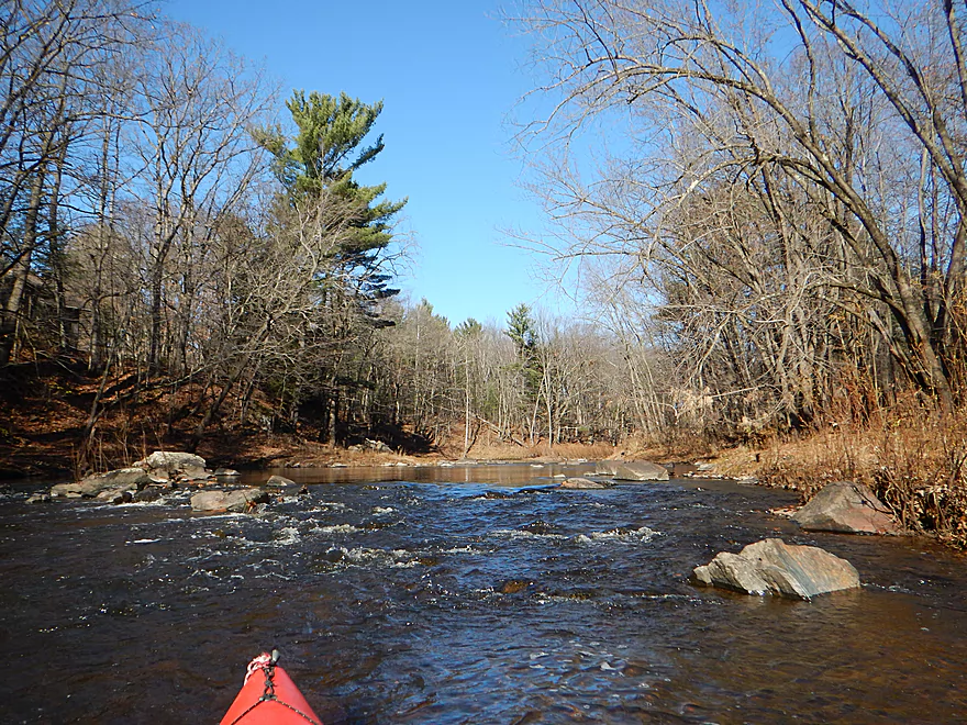
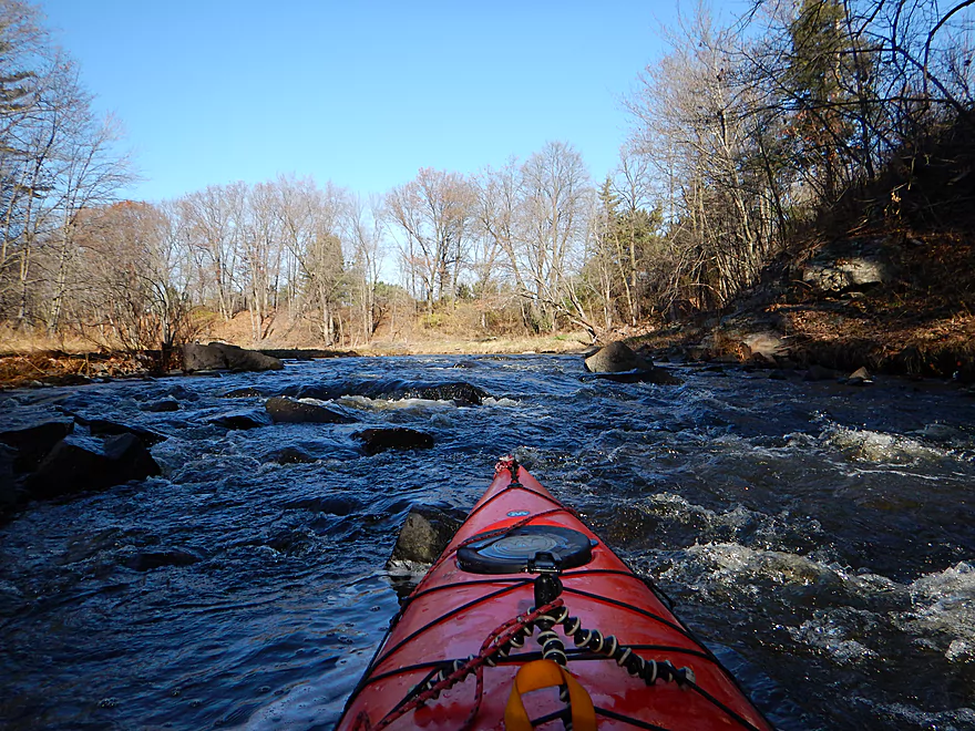
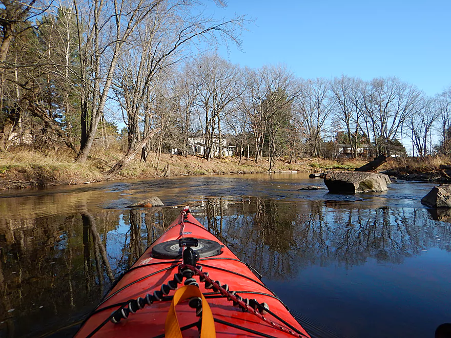
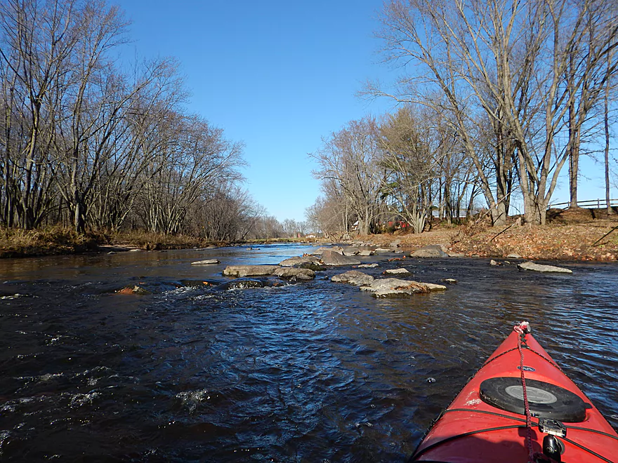
Trip starts fast
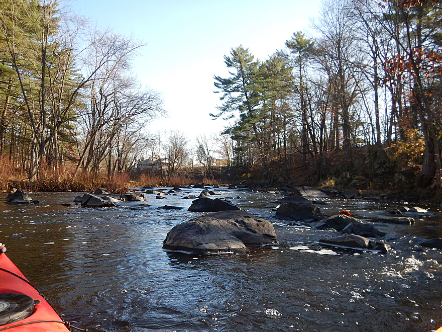
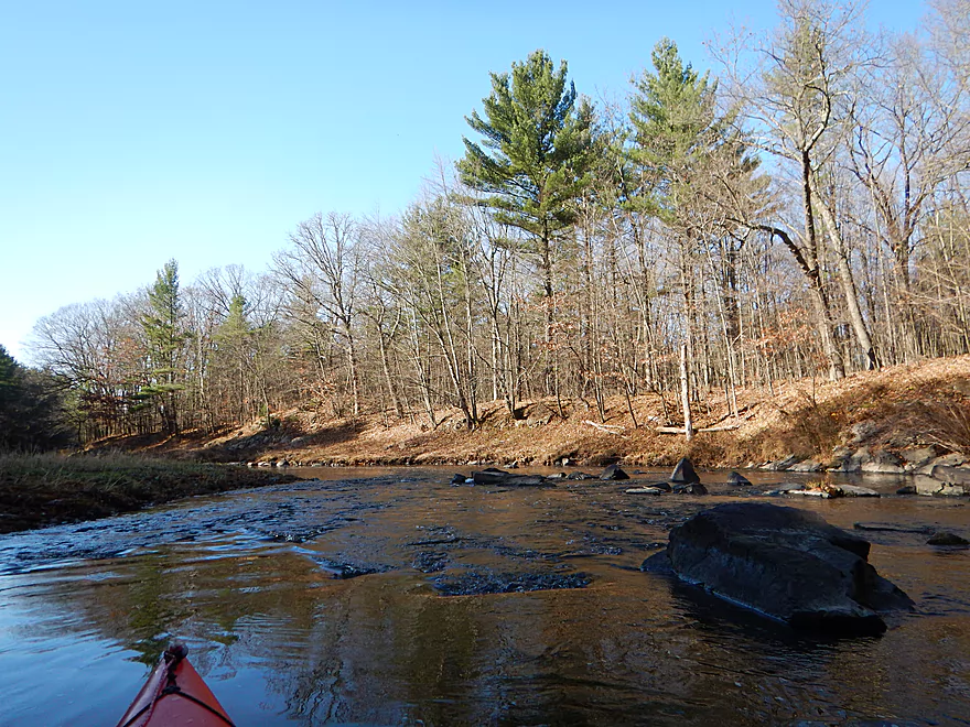
One of a handful of boulder gardens
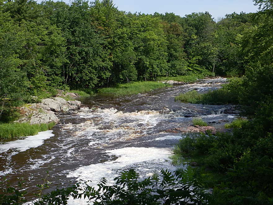
This would look completely different in the summer
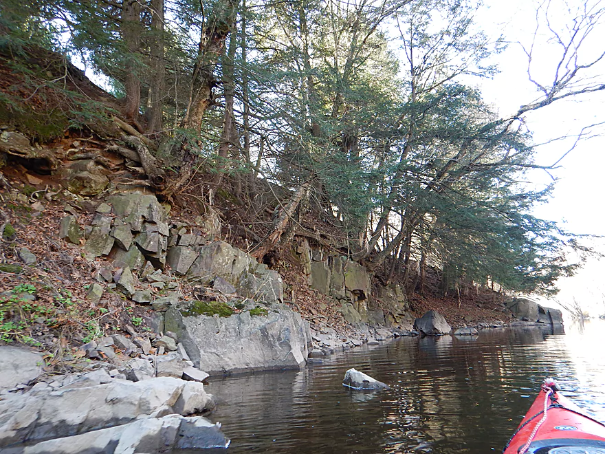
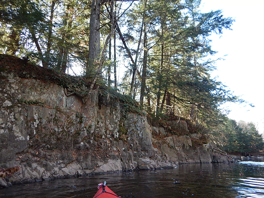
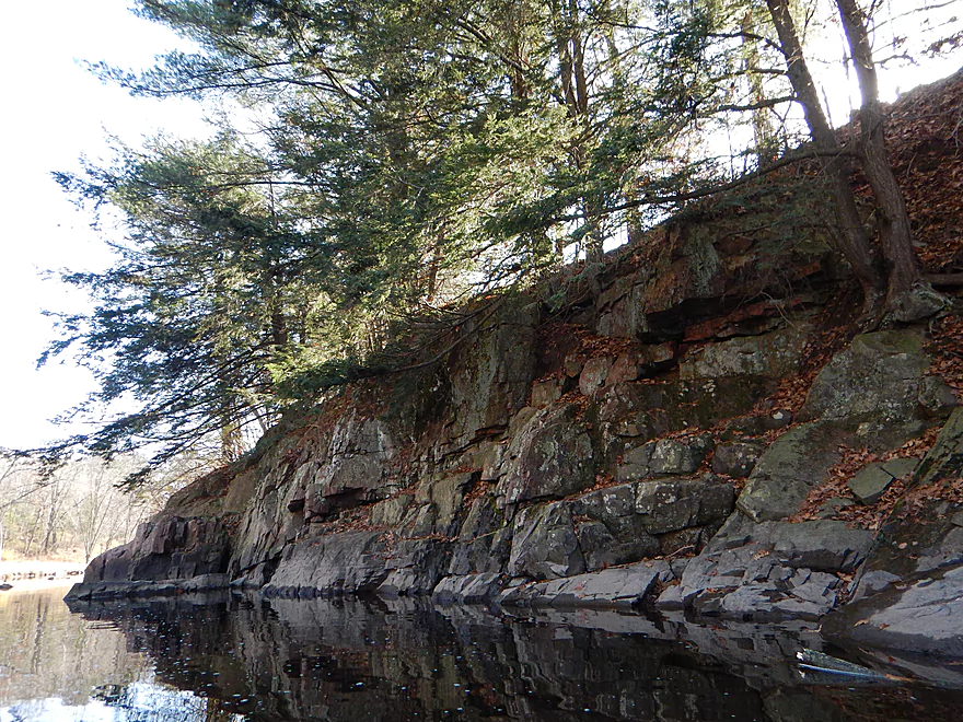
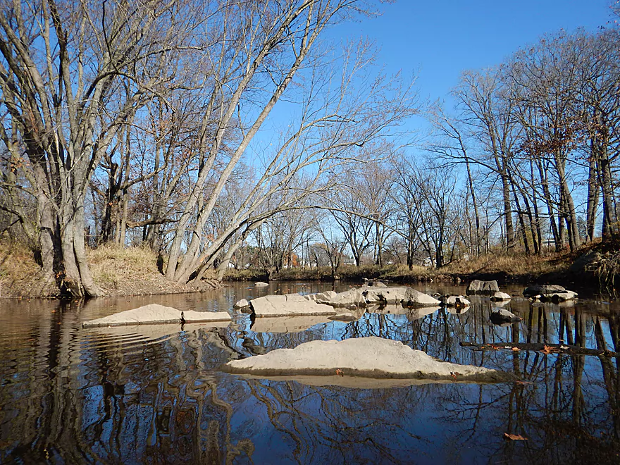
One of many granite outcrops
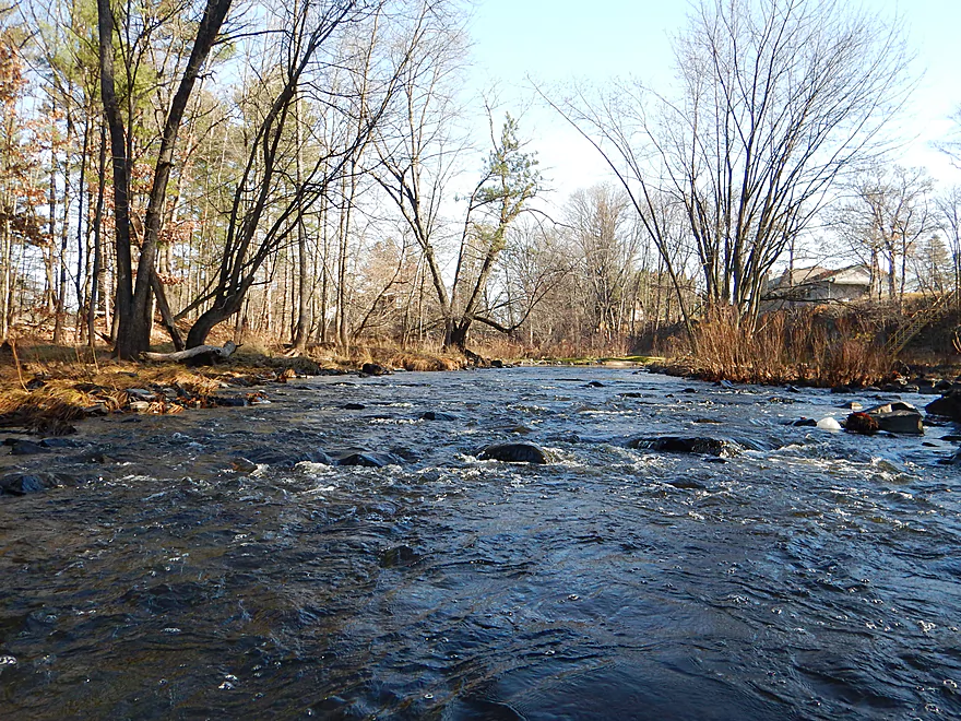
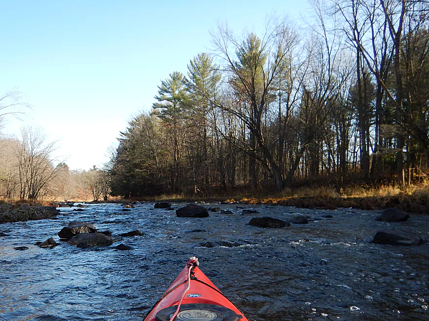
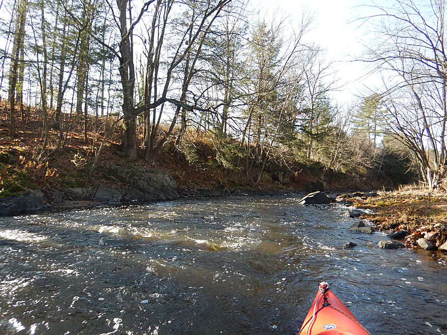
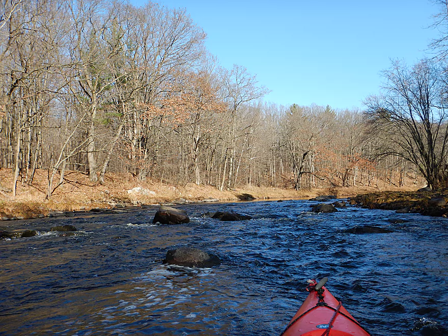
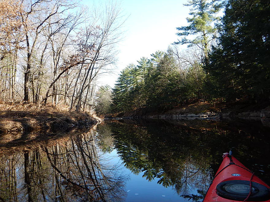
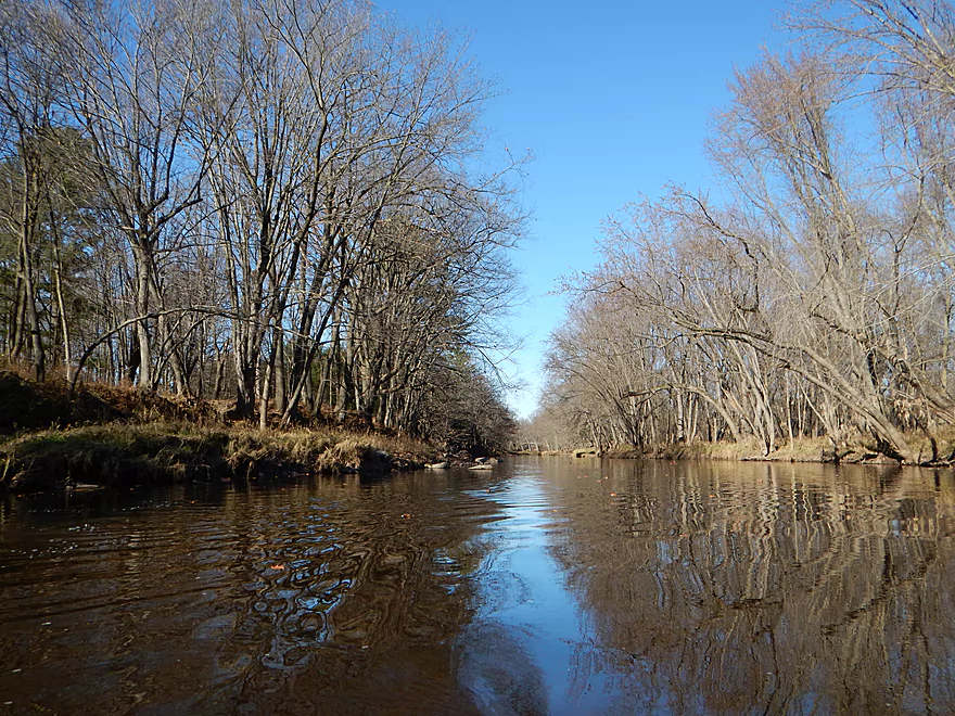
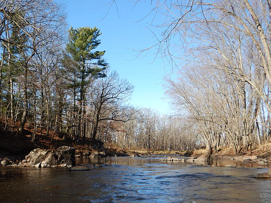
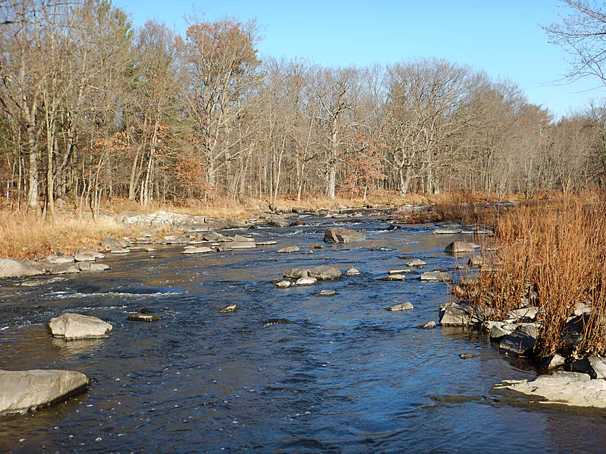
Much of the river is pool and riffle
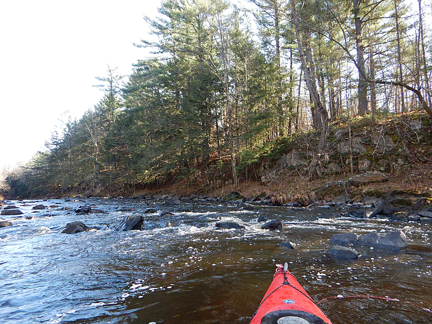
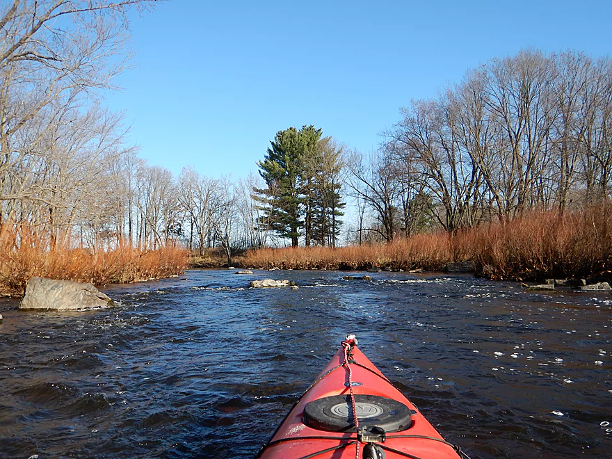
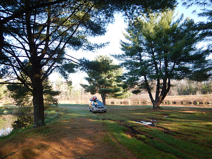
Many pines in the first few miles
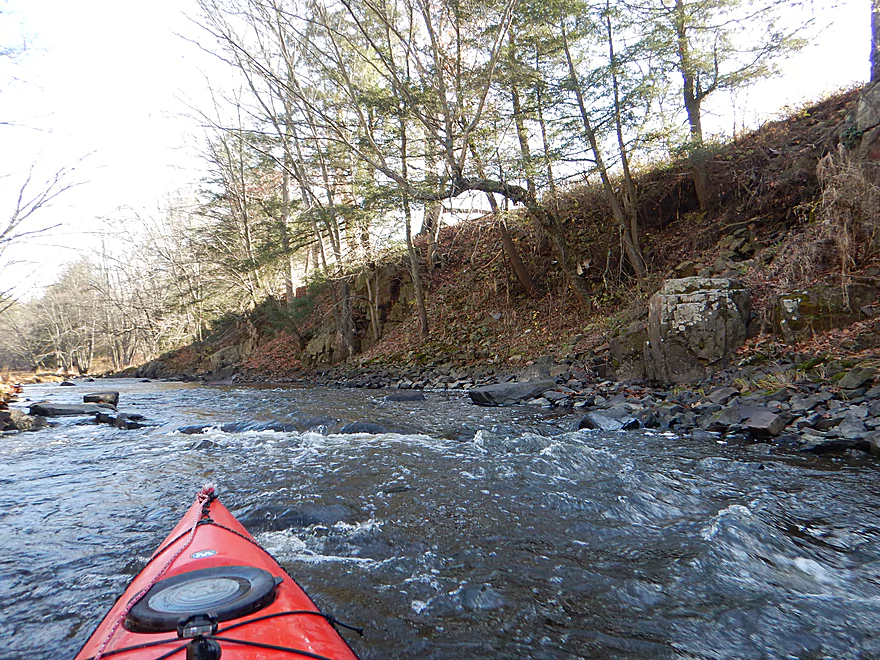
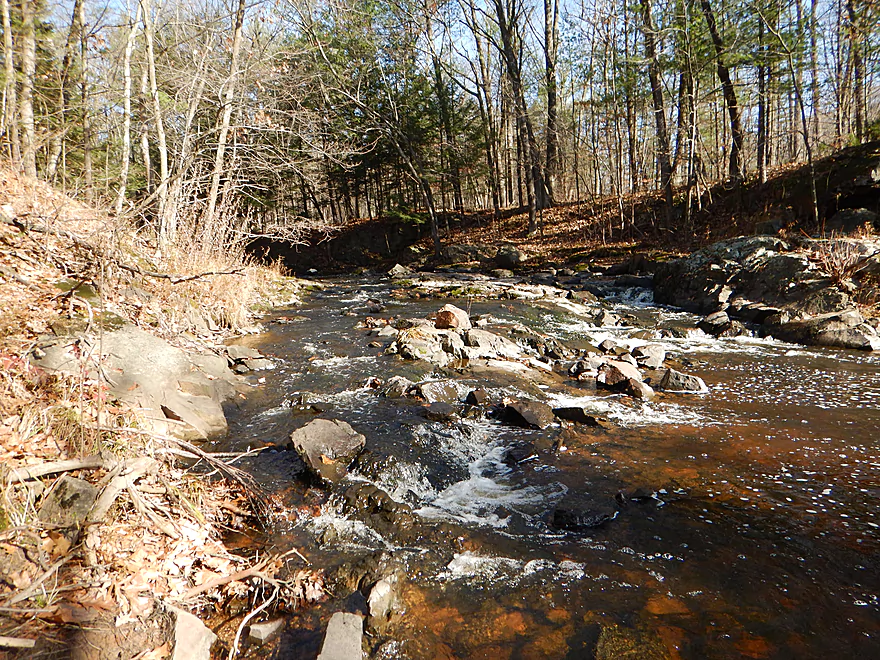
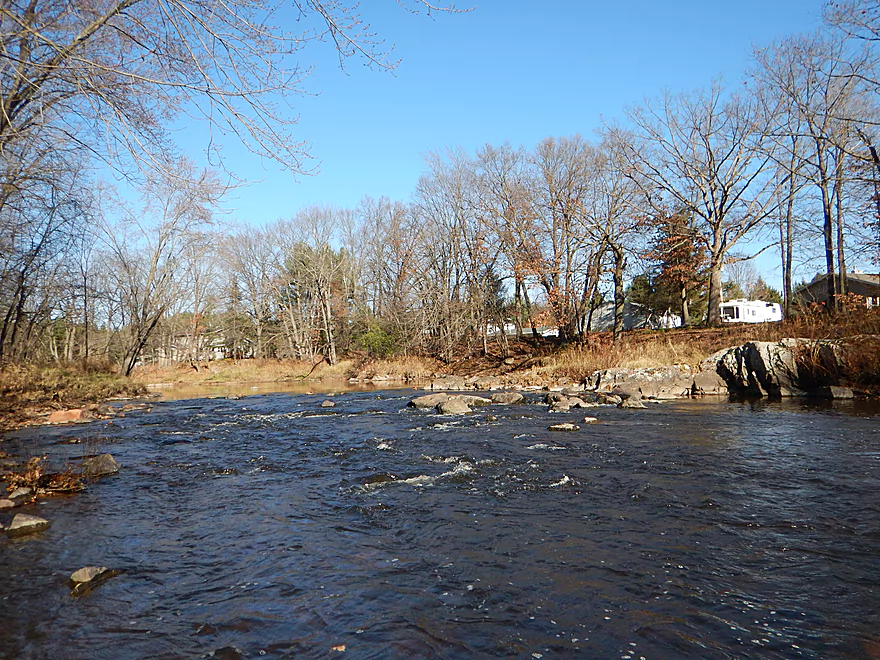
Very shallow rapids
Scenic dells
Reverse view
Rocky Creek is a scenic tributary of the Yellow
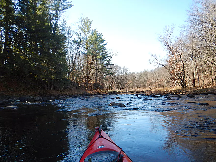
These might be Class 2+ in higher water
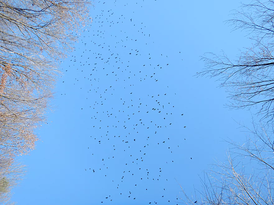
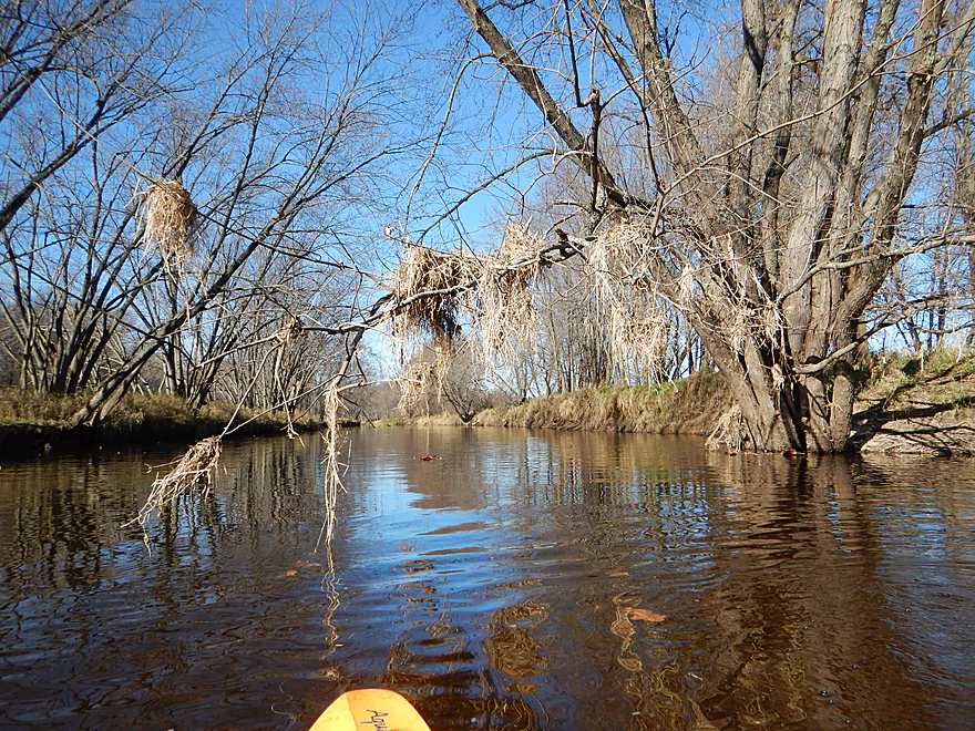
Huge flock of sparrows
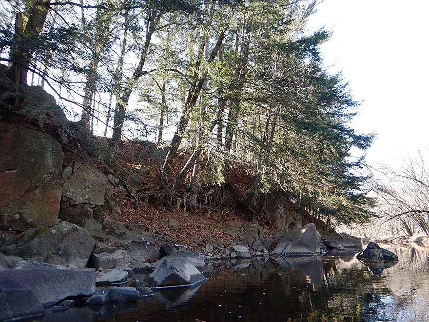
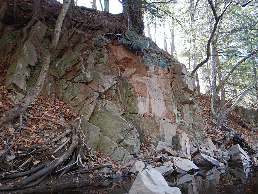
Tree roots destroying the outcrop
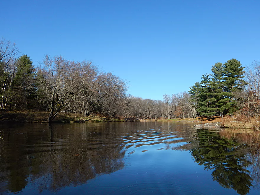
Scenic vista
Side view
Hwy 73 would be a rough but doable access option
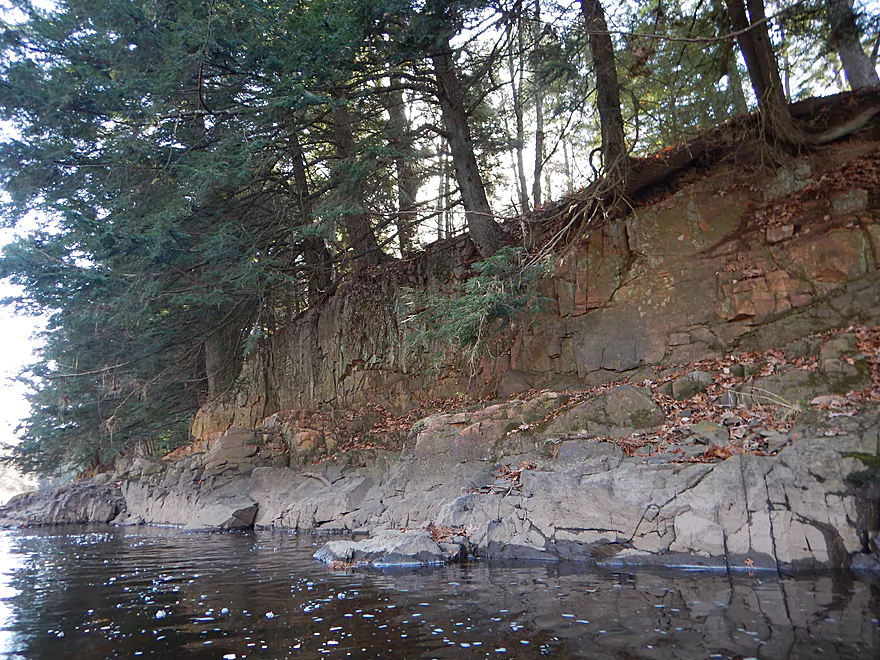
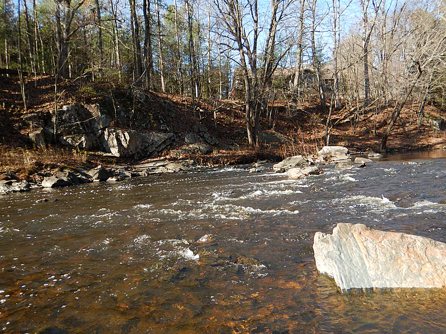
The nicest outcrops after the bridge
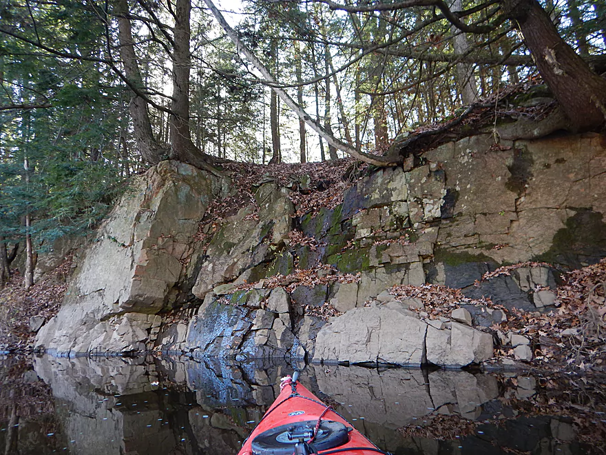
Several of them are seeping water
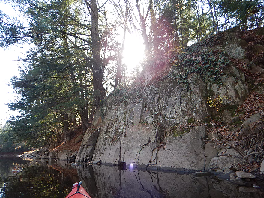
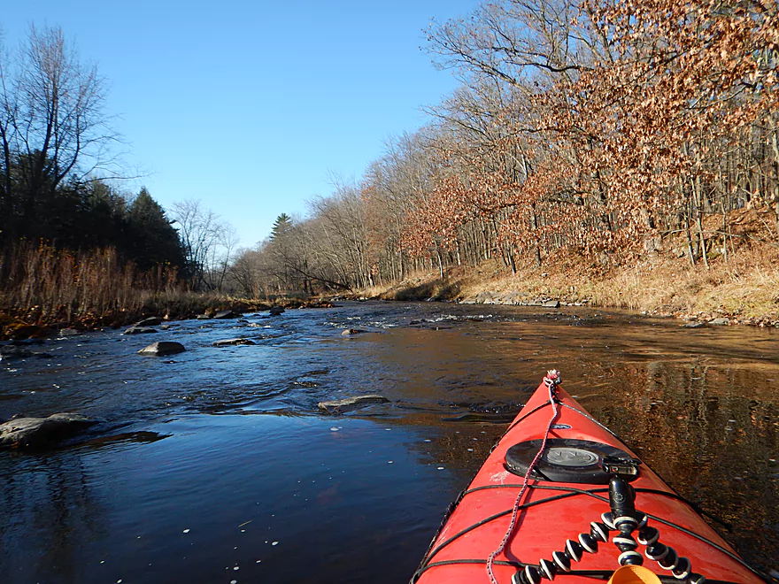
A scenic section
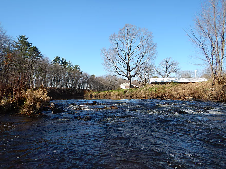
Easy Class 1 rapids
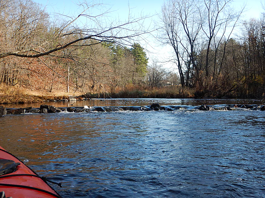
Followed by the strongest rapids on the trip
Riverside Park is an access option
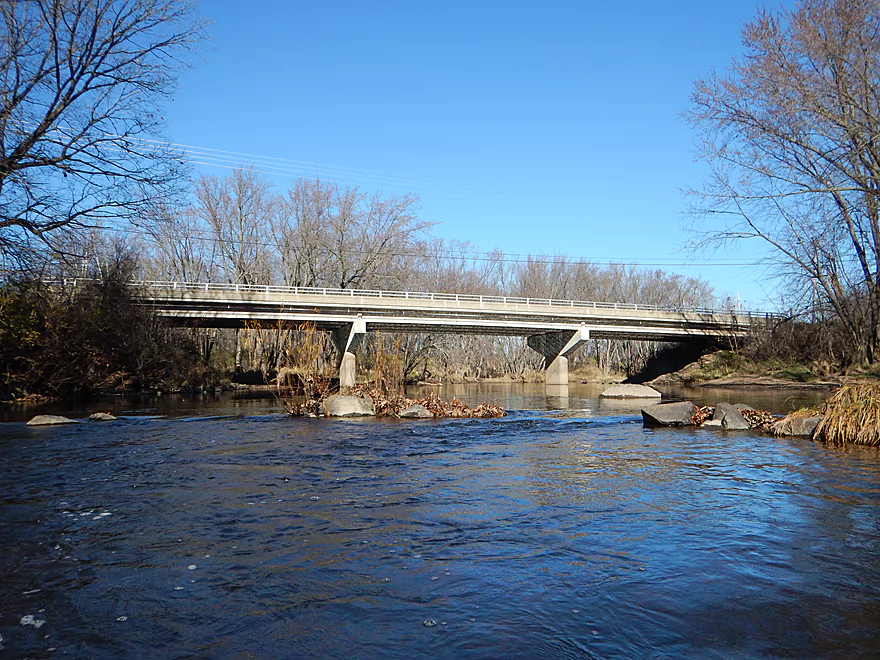
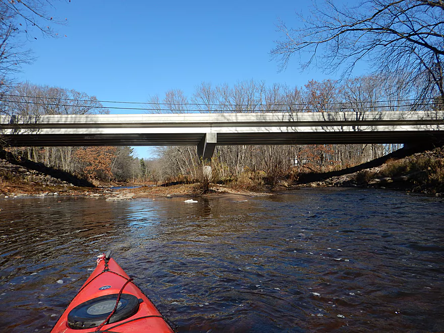
Veedum Street
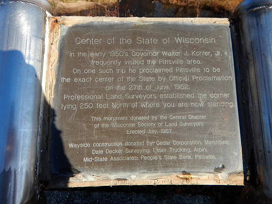
The exact center of the state
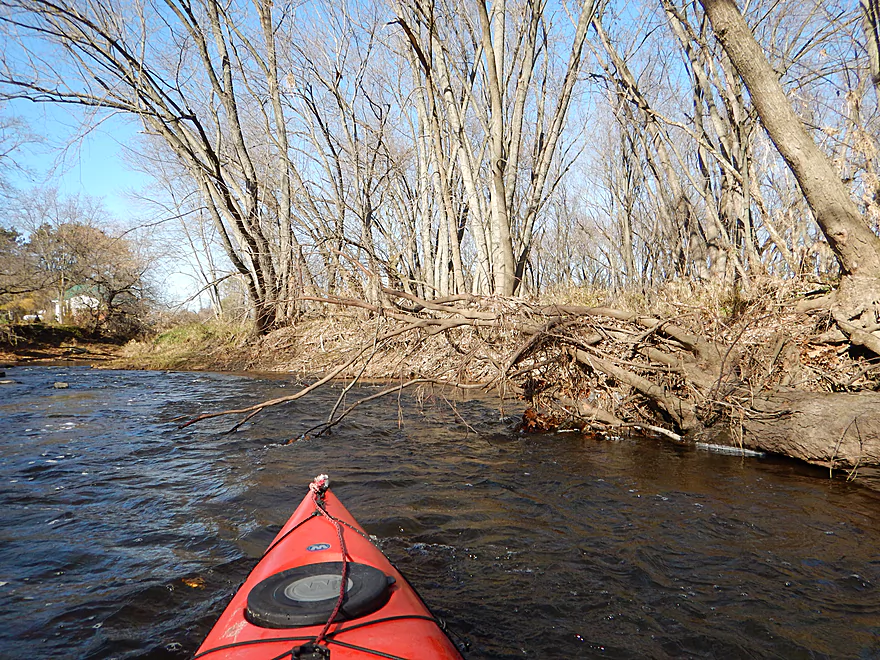
Be mindful of this strainer in fast current after the bridge
After Veedum, the channel widens and slows
Still some nice boulder gardens
And rapids
And pines
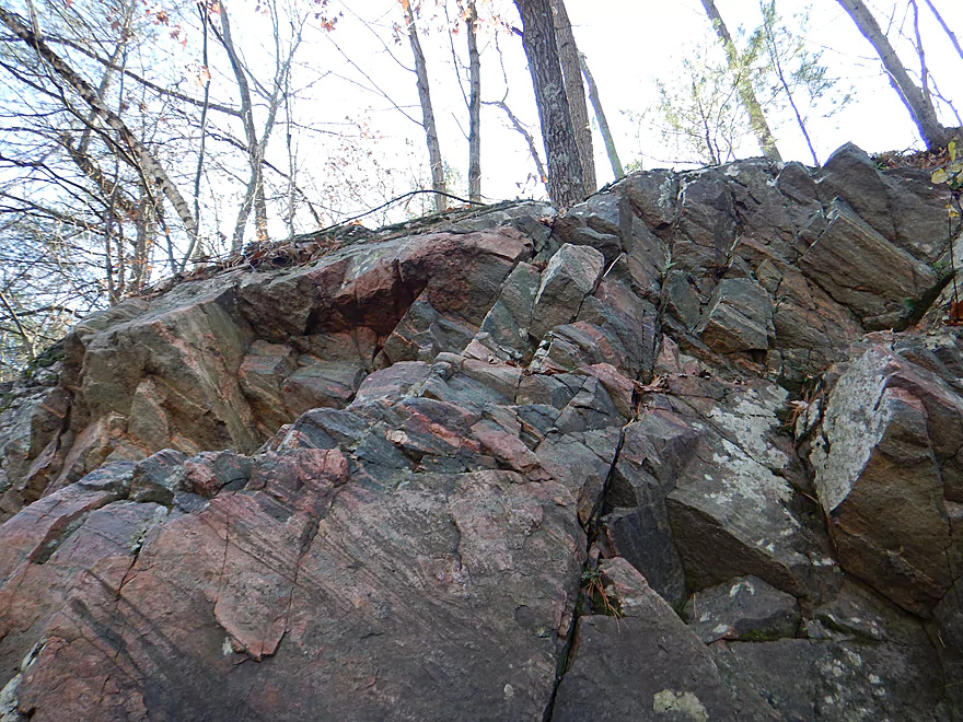
Interesting striations
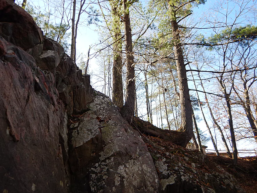
Even the tree is bent out of shape
Last few miles had more houses
Still scenic
You can see how high the river floods
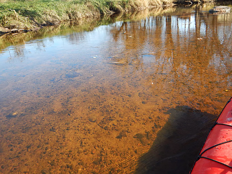
Very clean, clear water (atypical)
Last of the rapids
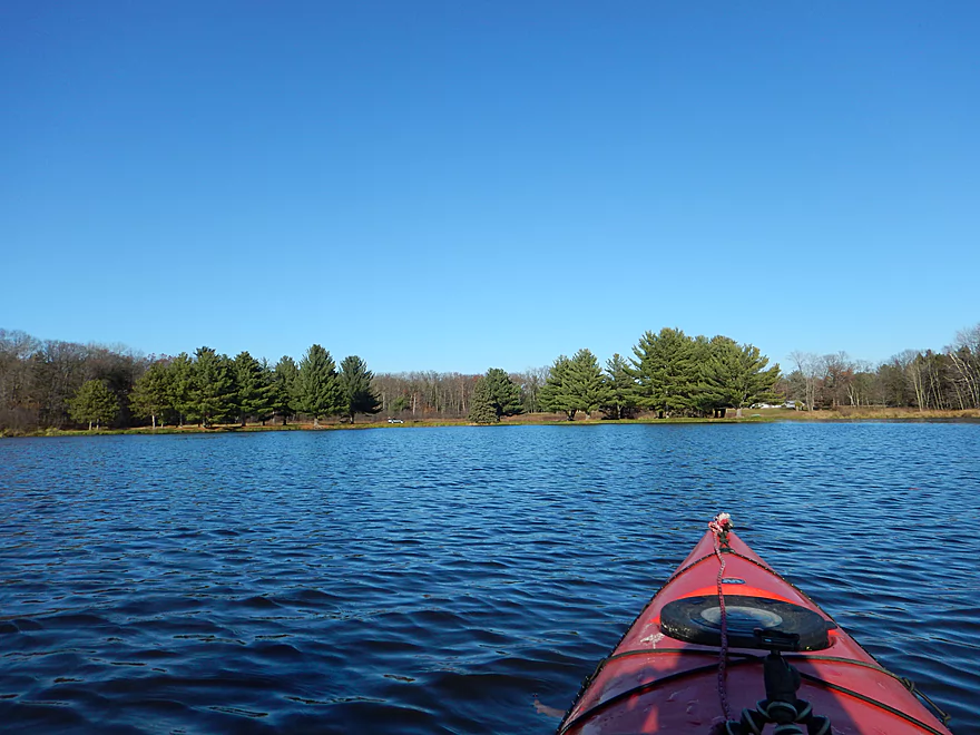
Now paddling on the flowage
After two miles, you will reach Dexter Park
One of several take-out options
This one is on a cool peninsula
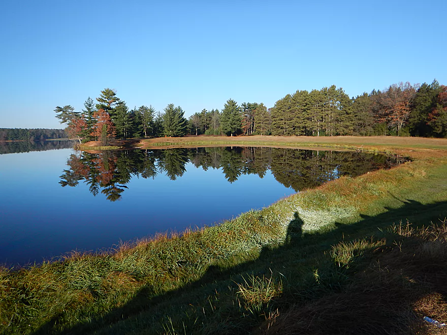
Lake Dexter is very pretty
A future trip will be to paddle upstream of Little Bull Falls
Yellow River – Pittsville

The Yellow River is a long river originating near Marshfield and emptying into the Wisconsin River near Mauston. The lower portion flows through Glacial Lake Wisconsin and, as a result, is very sandy. This is a bad thing for paddling because trees fall over easily in sandy substrate, creating a lot of logjams. Astute readers will notice a “dead spot” or Bermuda triangle on my paddling map that almost perfectly corresponds to where this ancient lake resided (roughly inside Black River Falls – Wisconsin Rapids – Wisconsin Dells). While most of the Yellow flows through this nasty deadfall zone, the Upper Yellow does not, and based on a lot of previous scouting I was very hopeful about this particular branch near Pittsville.
There are a lot of put-in options, but long story short, I settled on a tavern by scenic Little Bull Falls. The local bar overlooks the falls and a staircase leads down to the water from the parking lot. This is completely private and you need to ask permission to launch here (which I did). Little Bull Falls itself is quite the site to behold and in higher water is probably Class 3-4 and not to be taken lightly, with a “keeper” on the right/west that should be scouted. Because of the low flow rate that day, it was probably only Class 2 (and unrunnable) and I was able to get out onto the rocks for better pictures.
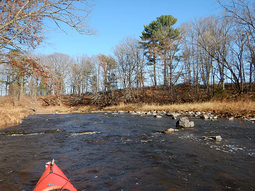
This section of the Yellow has never been reviewed before, so I didn’t know what to expect. The big surprise was how many rapids there were. From Little Bull Falls to Hwy 73, you are almost always within earshot of rapids. These were great…fun and scenic…but I messed up and did this trip at too low of a level (91 CFS) and frequently got stuck on rocks. The other BIG surprise to me…was that there were dells and quartzite outcrops–and a LOT of them. So many, I didn’t keep count, with many averaging 10-15′ high. These were incredibly scenic, especially when flanked by rapids and boulder gardens. Even Yellow River Junior (Rocky Creek) had dells and rapids.
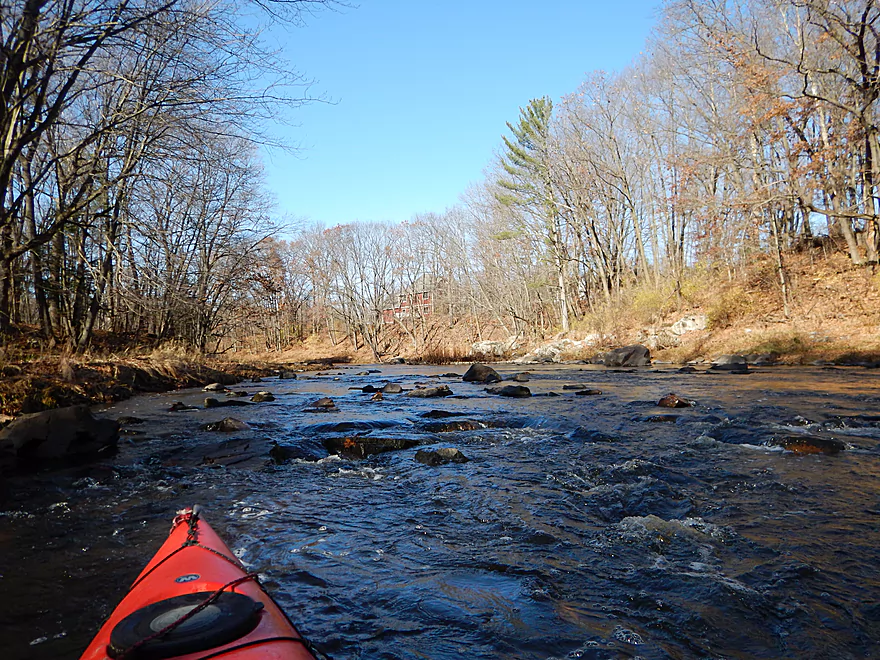
After 1.6 miles you come to Hwy 73, which could be a put-in if you are adventurous (it’s steep and brushy). I thought after Hwy 73 that would do it for outcrops, but nope…the best and largest dells are in the next half mile and were the highlight of the trip. There are still occasional rapids, but most were pretty easy and Class 1. The strongest set is maybe a half-mile past Hwy 73 (past the “camel hump” on the map) and could be tricky in high water.
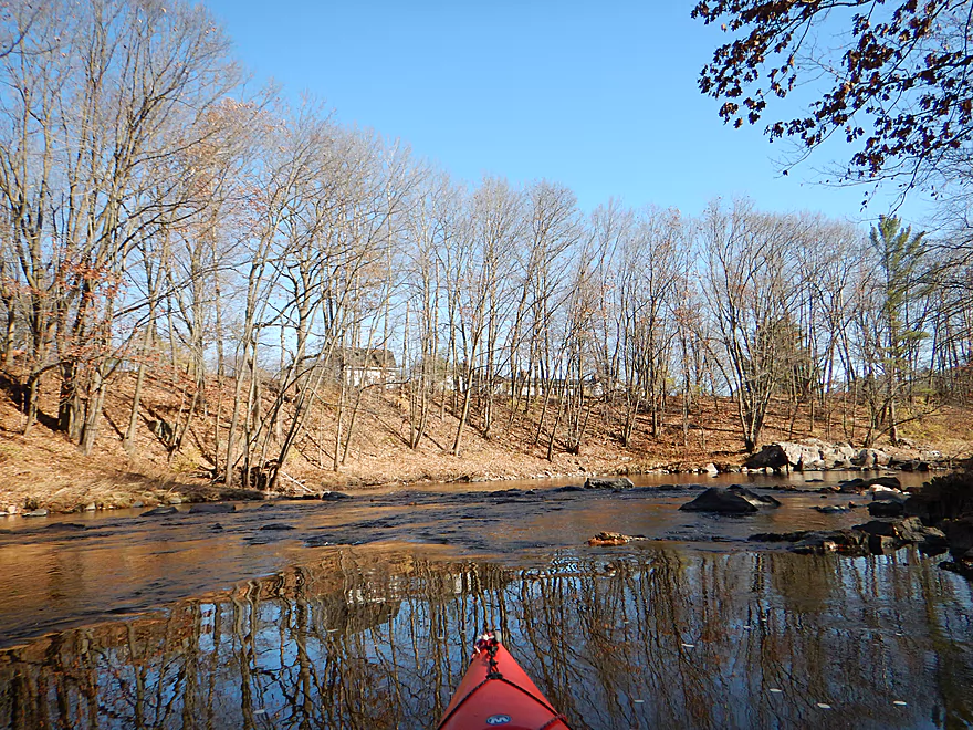
The river corridor itself is very scenic and mostly devoid of homes, with clear water, a rocky substrate, and heavily wooded banks with occasional groves of pine. This changes a little bit once you get to Pittsville where you’ll see more houses along the shoreline. Riverside Park in downtown would be a fine alternate access option. After Riverside Park, the river does change quite a bit. The channel broadens and there are much fewer rock outcrops and rapids, although this section was still very nice.
Two miles prior to the take-out the flowage kicks in and submerges what probably used to be a really cool section of the river. This is largely a slow and uninteresting lake paddle, although the shoreline has some scenic pines.
Take-out was at Dexter County Park, where there are a bevy of take-out options. What is interesting is that the flowage acts as a demarcation of sorts: after the dam at Hwy 54, the river changes dramatically as it enters historic Glacial Lake Wisconsin. You lose most of the pines and clean hardwoods and instead get floodplain forest. Gone are the rapids and boulder gardens and in its place are many sandbars and downed trees. Almost a completely different river after the dam.
I launched by a tavern called “Little Bull Falls.” Very steep stairs lead to the water, so be careful leading your boat down. From the stairs there is a fantastic vista of Little Bull Falls (Class 3-4 rapids). Note, this is completely private. I asked and obtained permission and you will need to do the same (715-884-6066) or use a different launch. When the river is low, you can actually walk out onto the falls for a better view.
For alternate launch options, see my map or overview section at the bottom of the page.
Dexter County Park is large with many options for taking out, all marked on the map. On the northeast side of the lake there is a hidey peninsula that you can drive out onto with a car which made for a convenient (and scenic) take-out option. Ok parking in the grass (although it does occasionally flood!) and no nearby outhouse. This was my preferred landing because it meant the least amount of flowage paddling.
Off Lake Road there are also multiple secluded launch options and a nearby outhouse. South of Owl Creek there is a boat ramp with good parking and outhouses, but it costs five dollars to use the launch. On the west shore there is an access ramp for launching canoes and a swimming beach that are take-out possibilities (although the beach would entail a long walk to the parking lot).
The bike shuttle is 5.3 miles, pretty flat and all paved. Traffic is heavy on Hwy 80, but not a deal breaker.
There are no logjams on the trip (the massive floods just bulldoze these out of the way). There is a strainer over fast current past Veedum Street which might be tricky to dodge in high water (marked on the map).
The river is mostly pool and riffle, with the most riffles/rapids on the upstream half. The flowage kicks in a couple miles after Pittsville, and on the open water a headwind could be an issue.
There are countless rapids on the trip, with most being Class 1 and just a few being maybe Class 2. I went at a low depth (91 CFS), and likely at a higher depths (say 150-300 CFS) many of these rapids would turn into Class 2’s
The Yellow is one of southern Wisconsin’s most volatile rivers. After a big rain it usually is the first river to reach flood stage and after a dry spell it can get extremely low. Catching it at the right depth is a trick and the following is my guestimate as to what levels are best based on the Babcock Gauge.
- 0-70 CFS: Probably too bumpy to run…definitely for the section upstream of Hwy 73. 40 CFS is a common late fall average.
- 71-110 CFS: Upstream of Hwy 73 will be frustratingly shallow. Lower trip will be mostly clear sailing with some bumpy rapids. My trip was done at 91 CFS.
- 111-160 CFS: Low but ok depth with safe rapids but still some bumps. Water will be muddy now.
- 171 – 200 CFS: A good target range. My last trip on the upper Yellow was at 150-200 CFS which was a good depth.
- 201-250 CFS: River starts to get pushier and very muddy.
- 251-300 CFS: At 300 CFS Park Road (North Wood Park) floods. Probably most rec paddlers want to check out at this point, while conversely this is when whitewater paddlers become interested in the river.
- 301-400 CFS: Probably very pushy with strong whitewater.
- 401+ CFS: Only suitable for competent whitewater paddlers.
A few months ago (Sept 2016), the Yellow experienced massive flooding which peaked at 7000 CFS, overflowing many major bridges and homes in the area. That’s a lot…for comparison the far lower Wisconsin by Muscoda (which includes the Yellow) on a typical fall day will flow at 5000 CFS. For the upper Yellow to flow at these rates is impressive.
The highlight was seeing a bobcat cross the road in front of me while driving along the river. Sadly, my camera has horrible zoom and the photos didn’t turn out. On the river, I saw a beaver (and massive beaver hole), several eagles, clams, a decent-sized flock of turkeys flying over my boat, and a massive flock of blackbirds. Pittsville has had recent white deer sightings, but unfortunately I only saw the brown variety.
The bridge at Veedum Street is the very dead center of the state. Seriously. There are flags, a plaque, and a pull-off to celebrate this. Is this bridge pull-off a good launch option? No…too steep, and Riverside Park just upstream is much better. It’s not a bad spot to scout the river depth though as this is a representative shallow area.
Upstream of this trip is Northwood County Park, which is a good camping and picnic prospect and has nice views of the river. Be careful about camping on the west side of the river, as the connecting road floods at 300+ CFS and you can be literally stranded for many days on the wrong side of the river.
Dexter County Park is a large recreation area formed by a flowage on the Yellow River. There is a nice swimming beach and campground on the west bank. There are also numerous launch options on the east bank (official park map).
Detailed Overview
- Eagle Road to Yellow River Road: 4.3 miles. Background provided by WisconsinRiverTrips.com contributor Daniel Akin.
- Eagle Road to Hwy HH: 2.2 miles. This is a dangerous section with Class 3 and 4 rapids. There’s also a wire fence across the river to deal with.
- Hwy HH to Yellow River Road: 2.1 miles. A more wooded stretch that I don’t know much about. Nice street view image.
- Yellow River Road to Hwy 10: 4.3 miles.
- Yellow River Road to Hwy BB: 1.3 miles. A nice wooded stretch with no major rapids.
- Hwy BB to Robin Road: 0.8 miles. A scenic stretch of the river. The South Branch joins up by the BB bridge and adds significant volume.
- Robin Road to Hwy 10: 2.1 miles. A great stretch featuring several fun rapids and small outcrops. Much of this flows by a large golf course which can be scenic in the fall because of all the maple trees.
- Hwy 10 to Hwy 80: 4.0 miles.
- Hwy 10 to Lincoln Ave: 2.2 miles. Very narrow and wooded. At times little light reaches the river, which is really cool. Neat boulder gardens and a great stretch, but there are two logjams.
- Lincoln Ave to Hwy 80: 1.7 miles. Good stretch with a number of scenic boulder gardens and one nice outcrop.
- Hwy 80 to Hwy N: 3.4 miles. Starts slow, but ends with nice boulder gardens and rapids.
- Hwy N to North Wood County Park (2nd Dam): 2.9 miles. A rocky stretch with some rough whitewater, including a Class 3 near the put-in by the “dells”.
- North Wood County Park (2nd Dam) to Little Bull Falls Grill: 4.2 miles.
- North Wood County Park (2nd Dam) to Hwy C: 2.8 miles. Scenic stretch with many boulder gardens and rapids. The most serious rapids are near Hwy C and include Jenny Falls, which is a Class 3.
- Hwy C to Little Bull Falls: 1.2 miles. More rapids and boulder gardens. There is a logjam shortly after Hwy C. Little Bull Falls is a Class 4 and is preceded by a Class 3.
- Little Bull Falls to Dexter Park: 7.5 miles.
- Little Bull Falls to Hwy 73: 1.6 miles. Many rapids on this stretch with some nice rock outcrops. Launch below the falls and at a private access.
- Hwy 73 to Riverside Park: 1.7 miles. More rapids and the biggest and best outcrops. Hwy 73 is a weedy but doable access option.
- Riverside Park to Dexter Park: 4.2 miles. Far fewer outcrops and rapids, but a nice wooded section. Two miles in the flowage kicks in which is less interesting.
- Hwy 54 (Dexter Park) to Hwy 80 (Babcock): 9.7 miles. While you could launch by the park, your best bet will be to launch SW of the dam off Hwy 54. Paddling author Frank Piraino liked this section and said it had no logjams, but I think it has since filled in...could have 10+ logjams. Can be pushy when high and only for adventurers. Not too many sandbars.
- Hwy 80 to Hwy F: 10.6 miles. Good sandbars. Am not sure about jams....maybe 6.
- Hwy F to 9th Street: 8.3 miles. A nice stretch with good sandbars. 2024 update...this stretch now has many logjams (~8?) because of recent storms.
- 9th Street to the dam (Necedah): 16 miles. A lot less sandy and many oxbows. Jams are a question mark. I suspect this is a weak section.
- Necedah to Yellow River Bay: A nice stretch with good sandbars.
- Castle Rock Lake: Blah. A big , open and dangerous flowage (3rd largest in the state).
- Buckhorn State Park: You can explore the back channels and they seem nice, with interpretive signs…but with no current and only 1.5 miles. Here is a map of the official water trail in the park.
Trip Map
Overview Map
Video
Photos Size:
Update from the Webmaster… The owner of the stairs by Little Bull Falls appears to have had issues with trespassers. The stairs are now blocked by a chain and multiple signs warn not to trespass. Get permission if you launch here as initially noted in the above review. For launching you can also use the upstream or downstream bridges (see write-up for more details).