
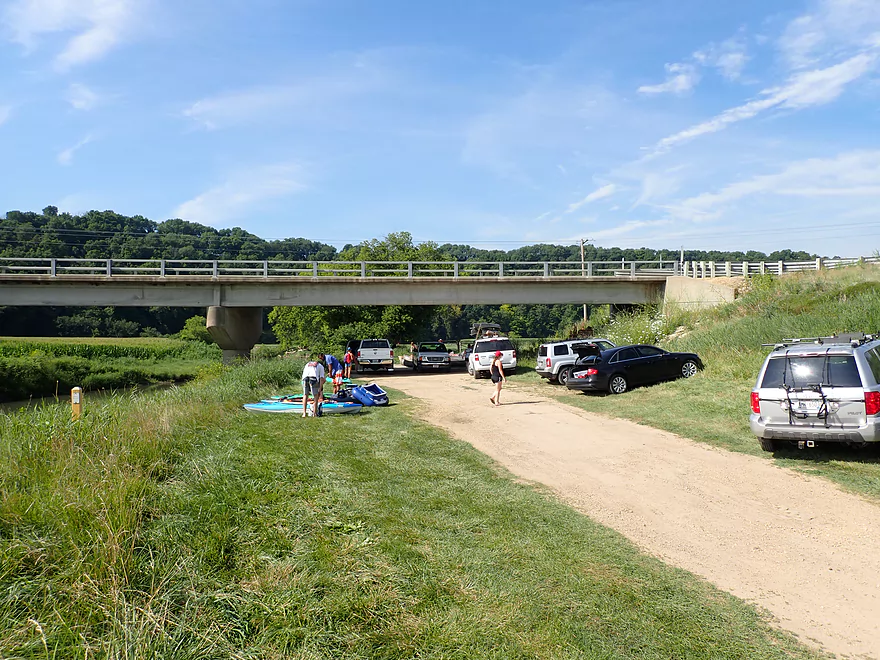
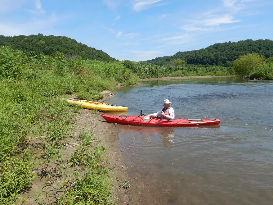
Putting in at Hwy U…a busy access
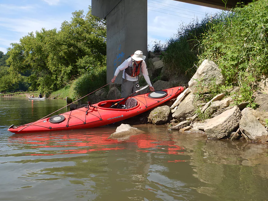
A suitable but rocky shoreline for launching
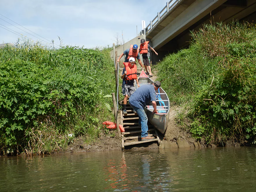
The stairs are reserved for canoers
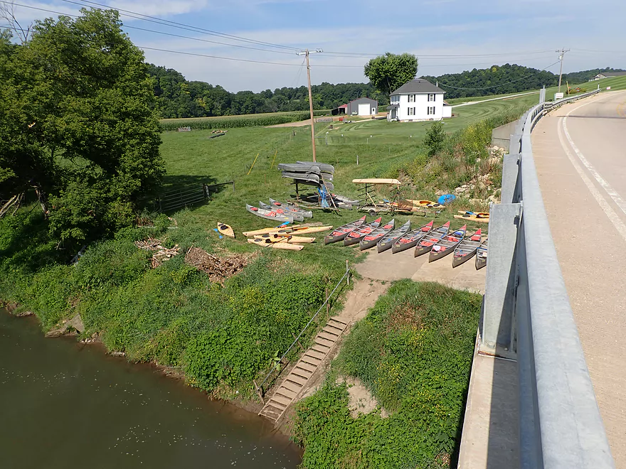
Part of a much larger fleet
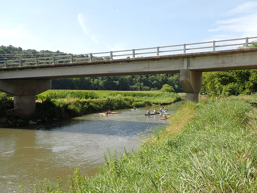
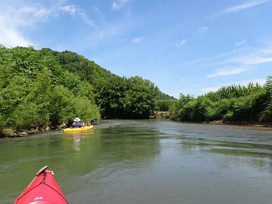
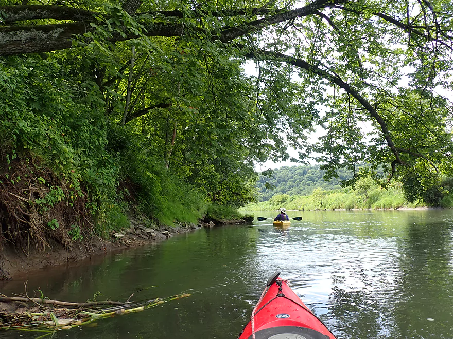
A group heading out ahead of us
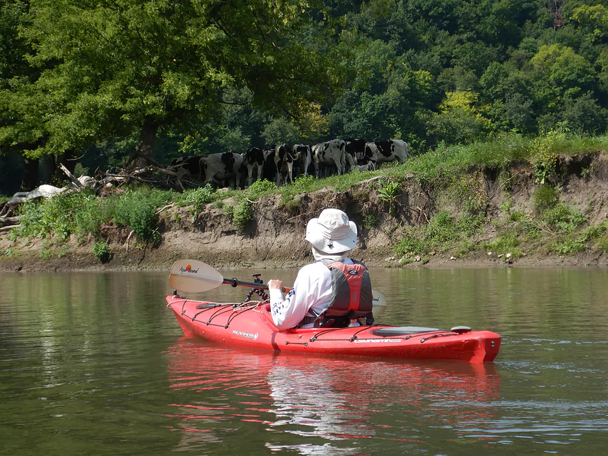
Only cows we saw on the trip
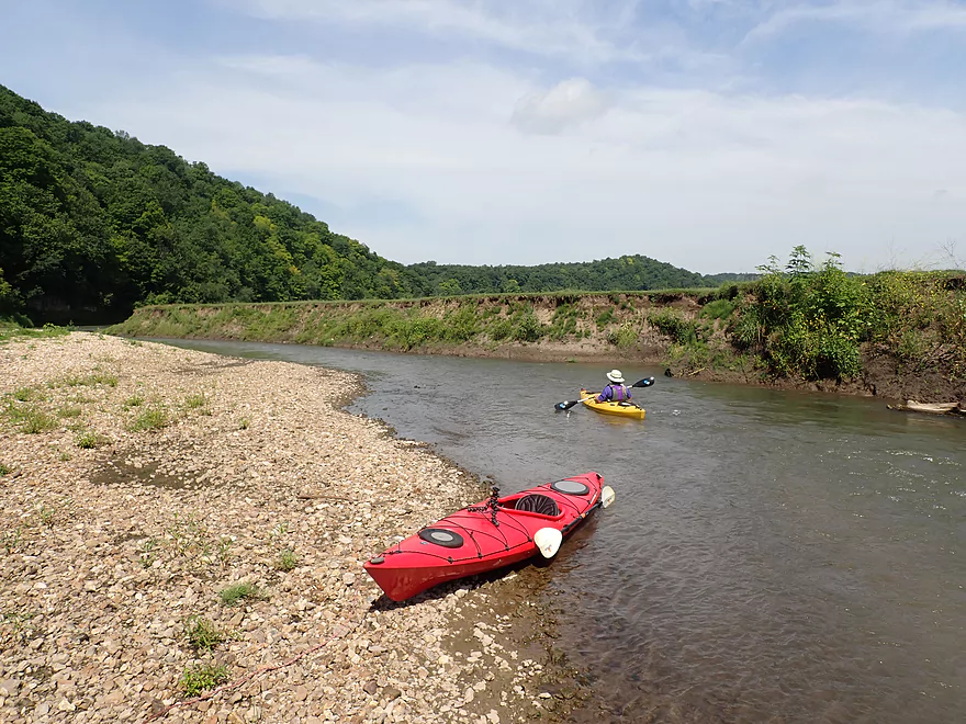
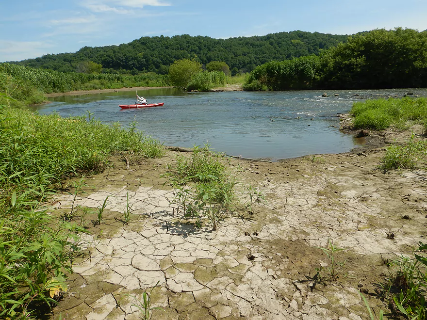
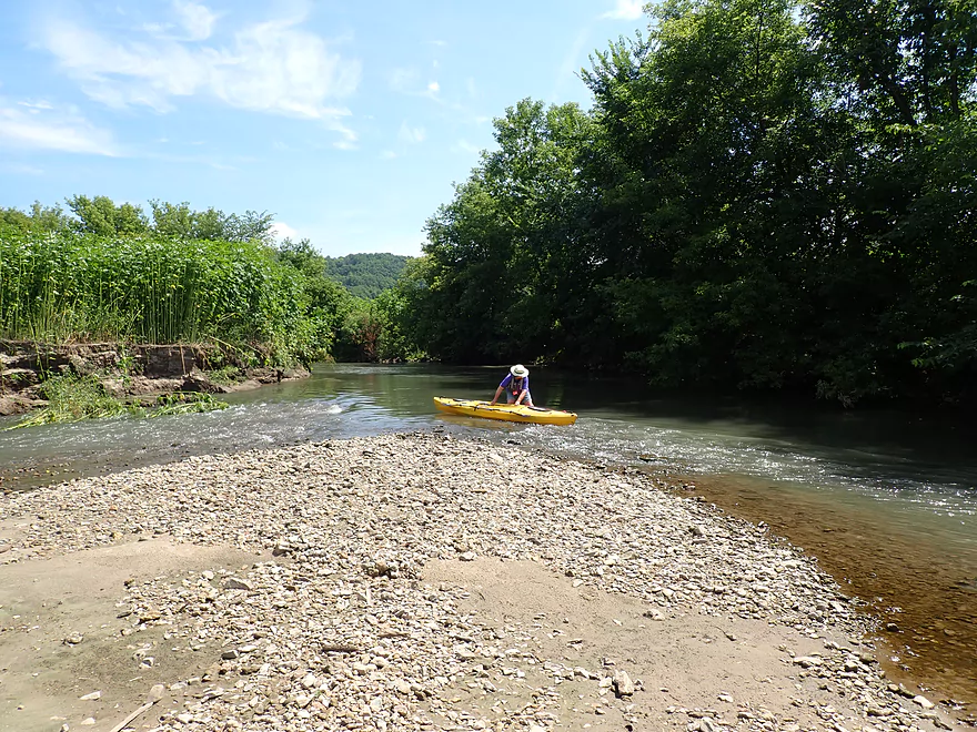
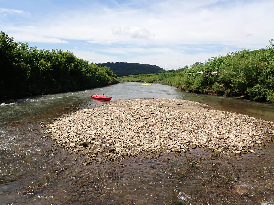
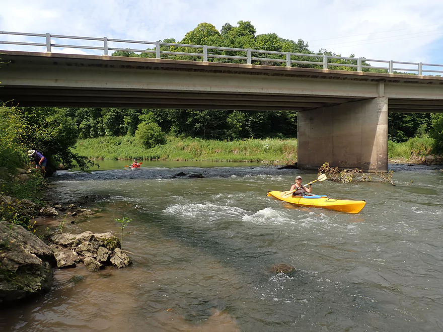
Nice gravel bar and fun rapids
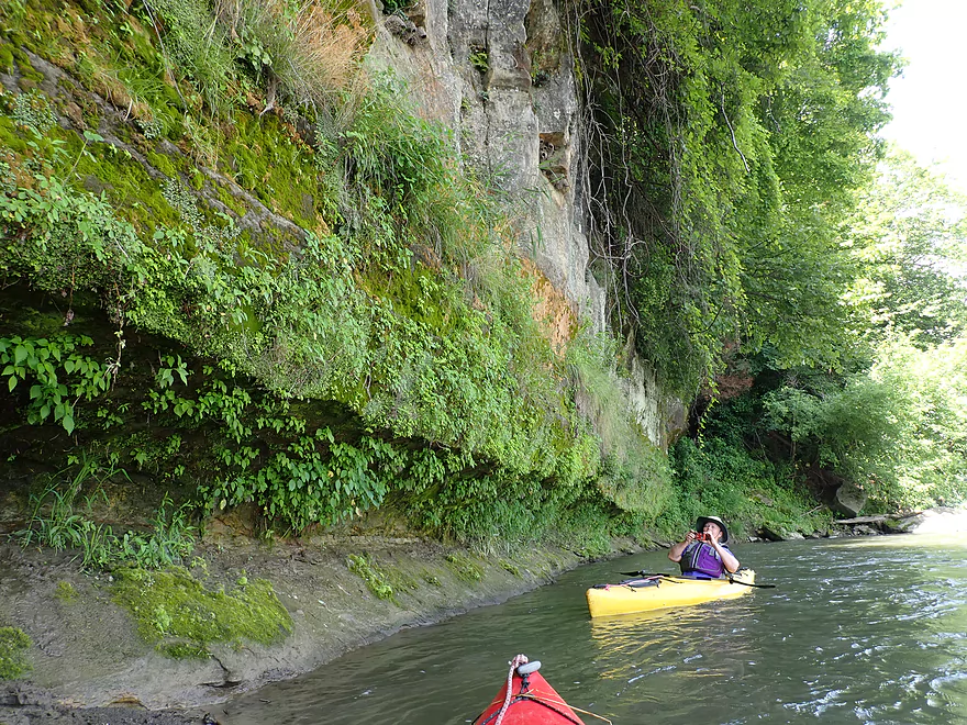
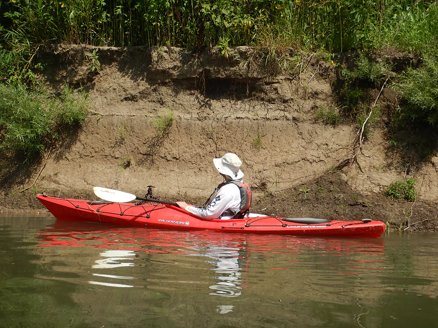
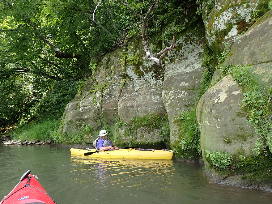
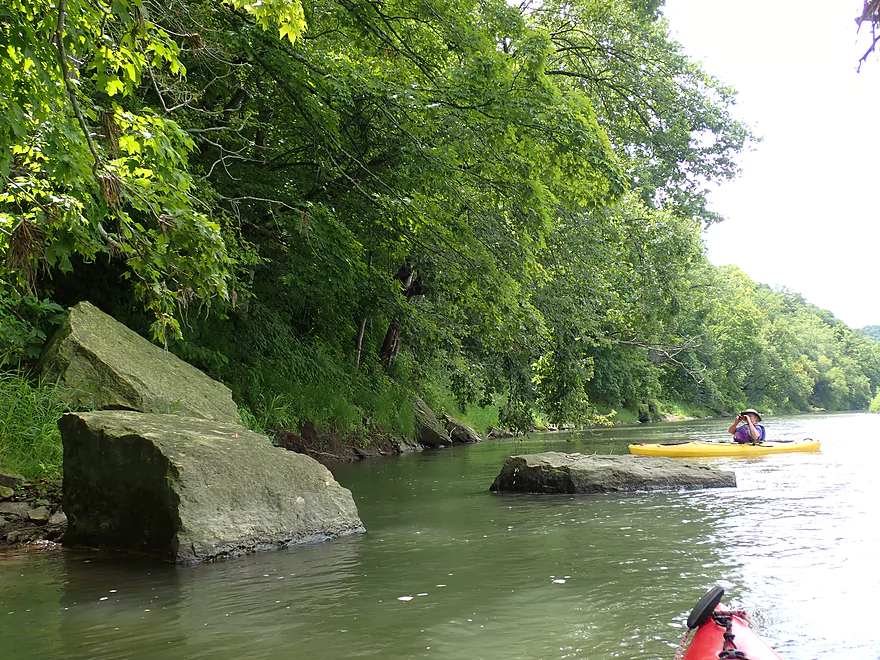
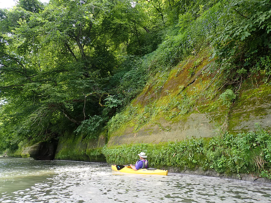
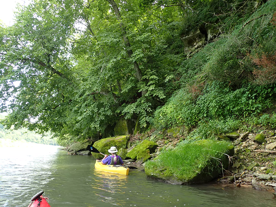
First outcrop of the trip
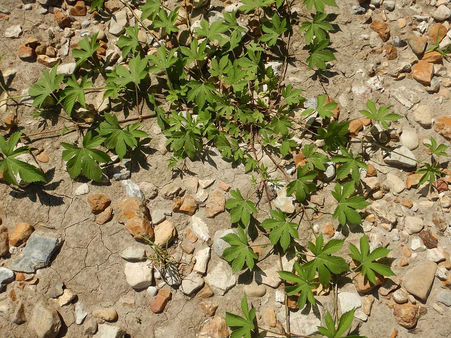
Invasive Japanese hops vine (don’t tangle with this–the stem is covered with reverse barbules)
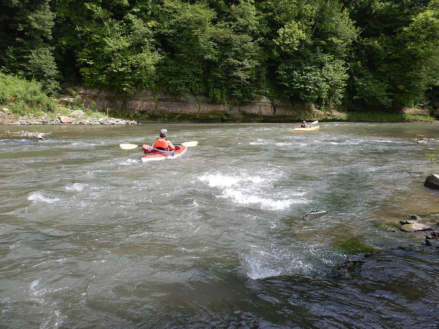
More fun rapids
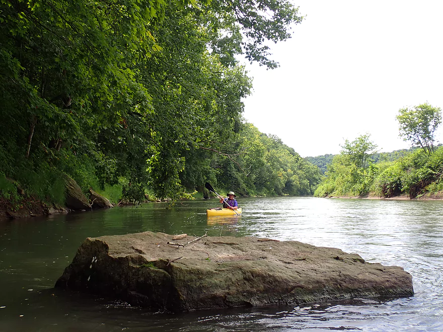
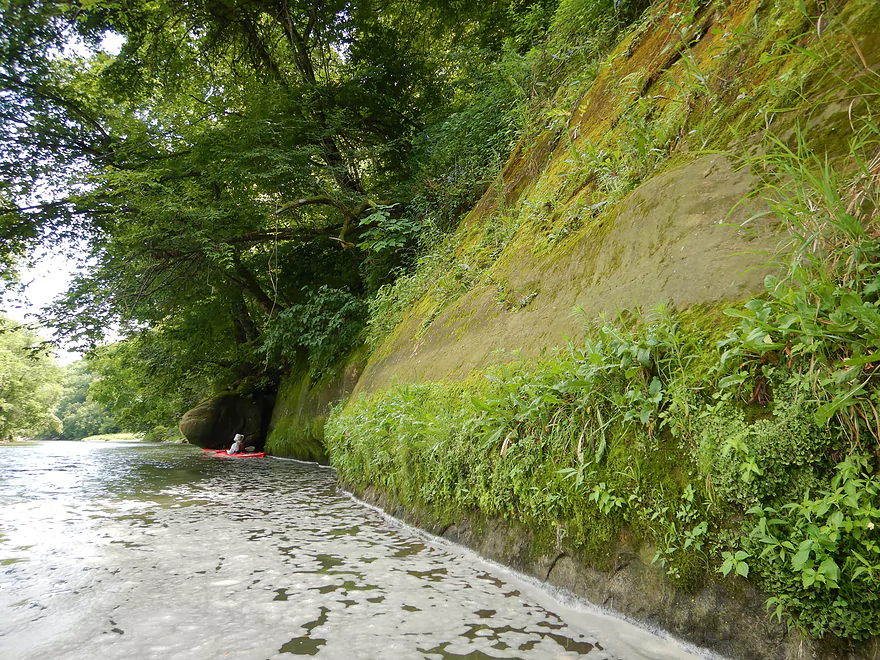
Favorite outcrop
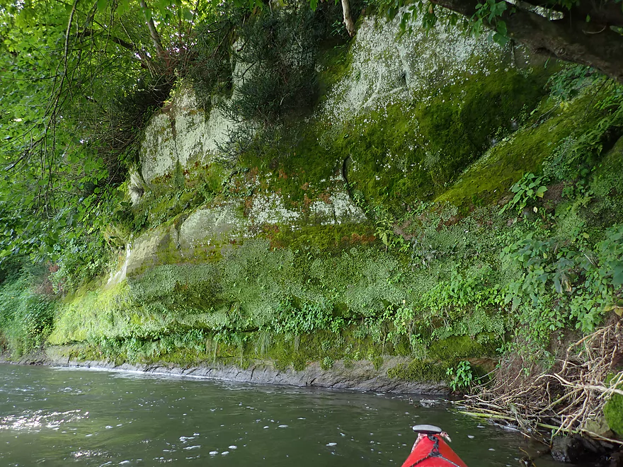
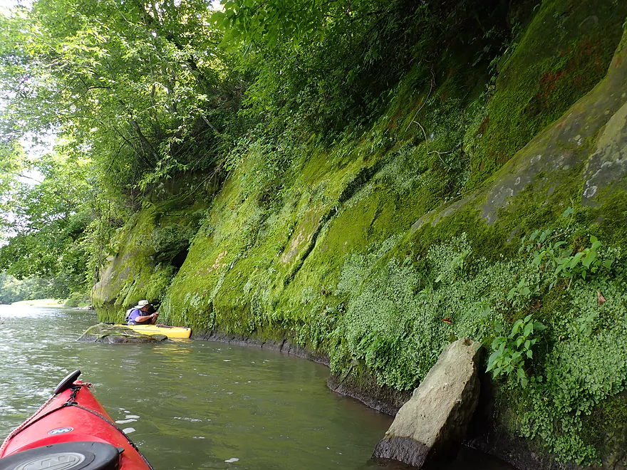
Interesting mossy divide
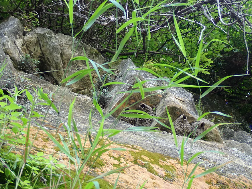
A cliff swallow nest not under a bridge!

Trying to take pictures in the fast current was tough
Part of an open pasture
Canoers taking a swim break
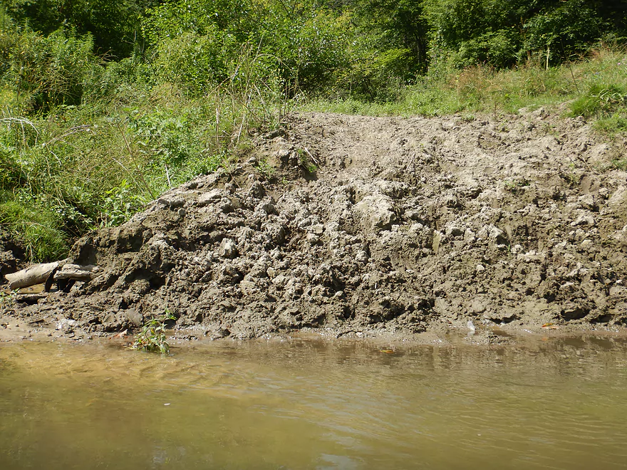
Erosion is a big problem on the Grant
Another nice sandstone bluff
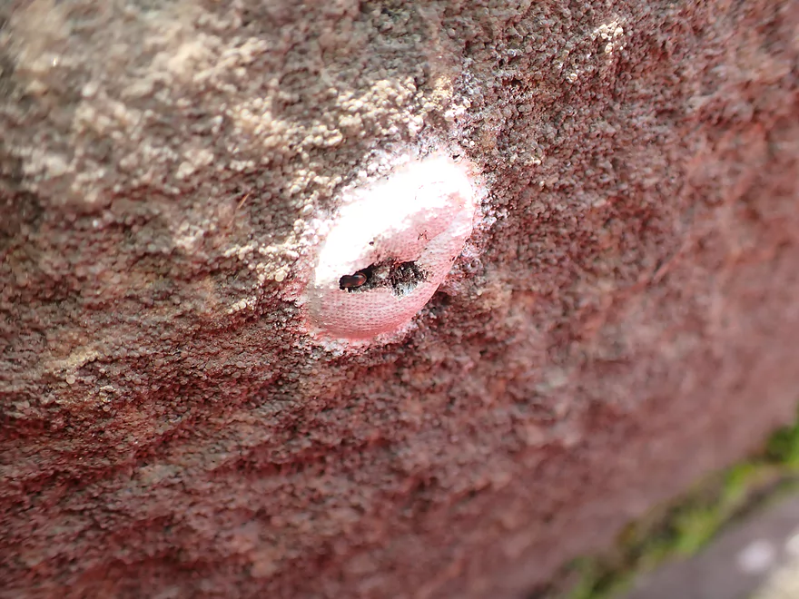
Dobsonfly egg cases.
Looking for more hidden outcrops
Leaving the bluffs behind to enter the lowlands
Driftless bluffs in the distance
Some “mud cliffs”
Topped with giant ragweed
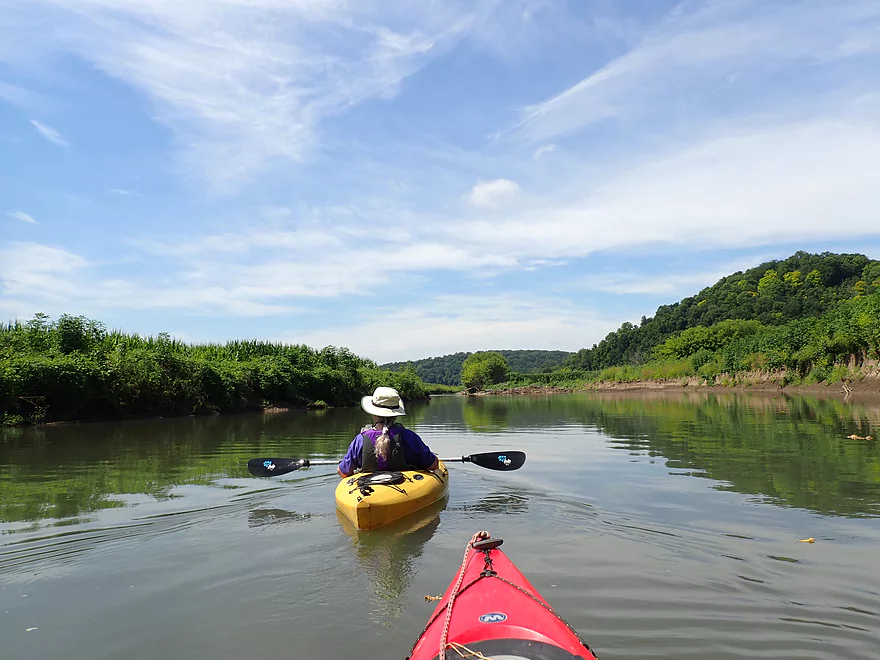
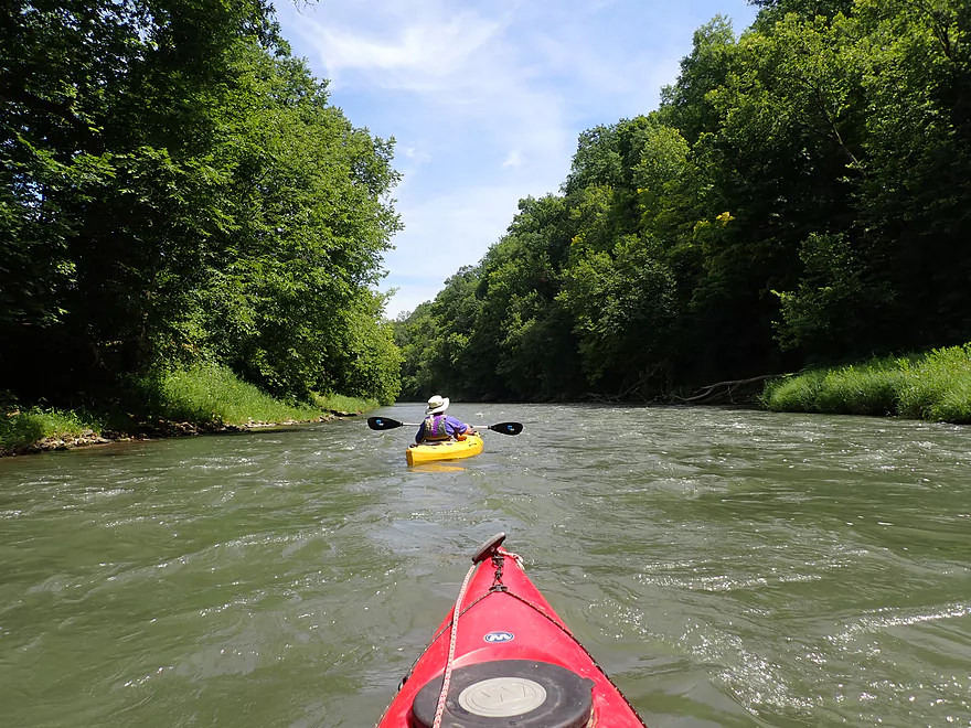
Peaceful stretch
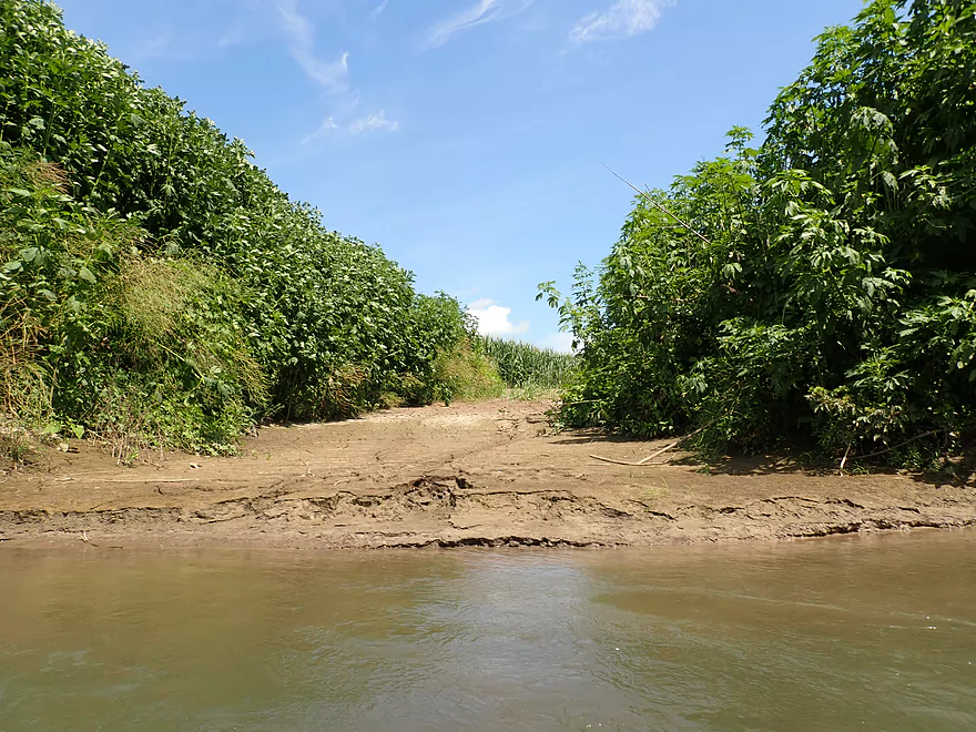
Interesting mud patterns
Taking a break by some of the rapids
Pretty fun
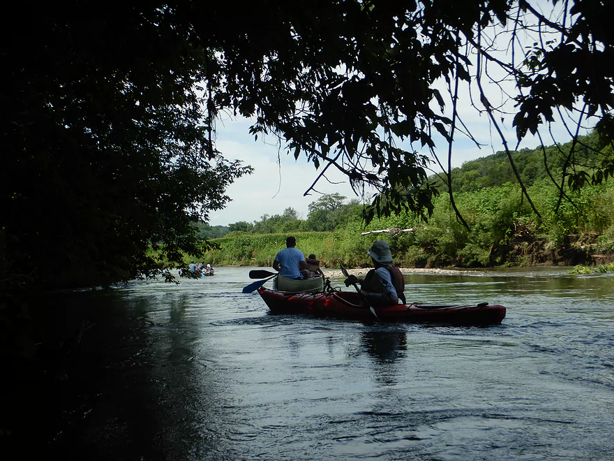
Being passed by canoers
More rapids
One of the nicer gravel bars
A beaver path with partly-eaten cornstalks
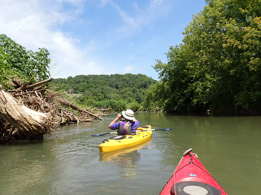
Logjams were never an issue
This beaver home has two entrances
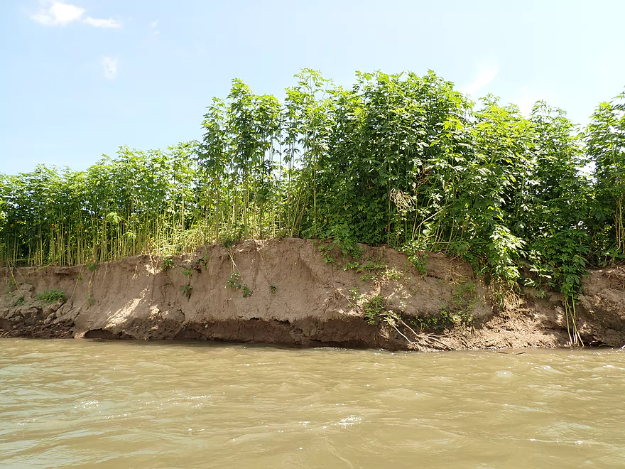
More giant ragweed–they’re like small trees!
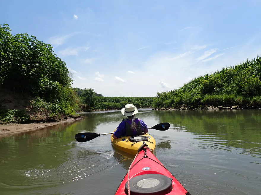
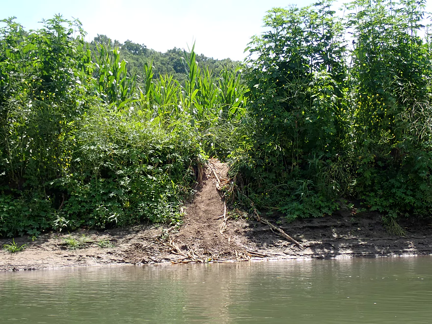
At times it was like paddling through a corn maze
There are few bridges in the area…so in spots the farmer actually drives across the river
Nice blue skies
Finally start seeing outcrops again
Some light riffles
Another set of outcrops
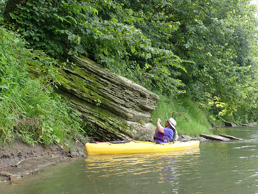
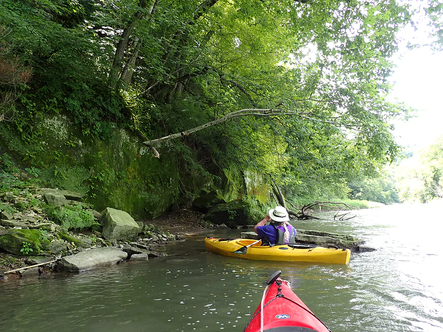
A boulder that had tumbled down the bluff
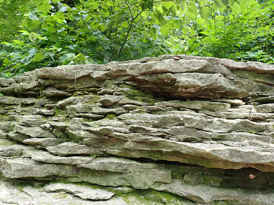
Very ancient…maybe millions of years old
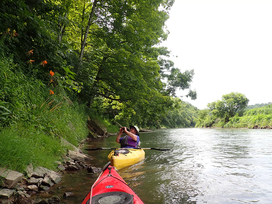
Domestic daylilies in the middle of nowhere
More boulders that fell from the bluff
Another outcrop
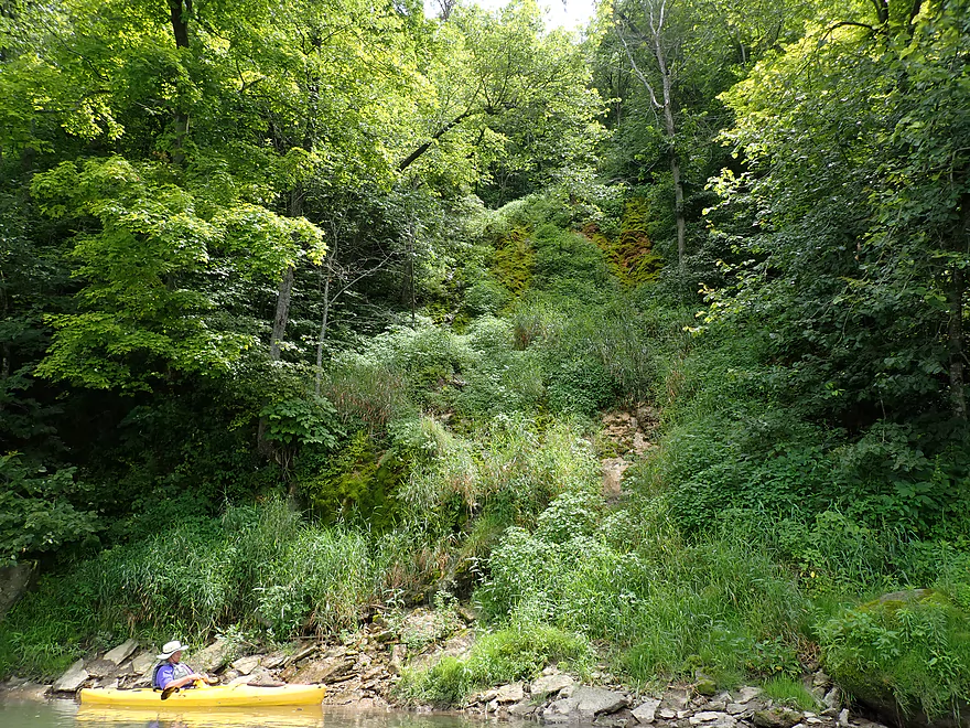
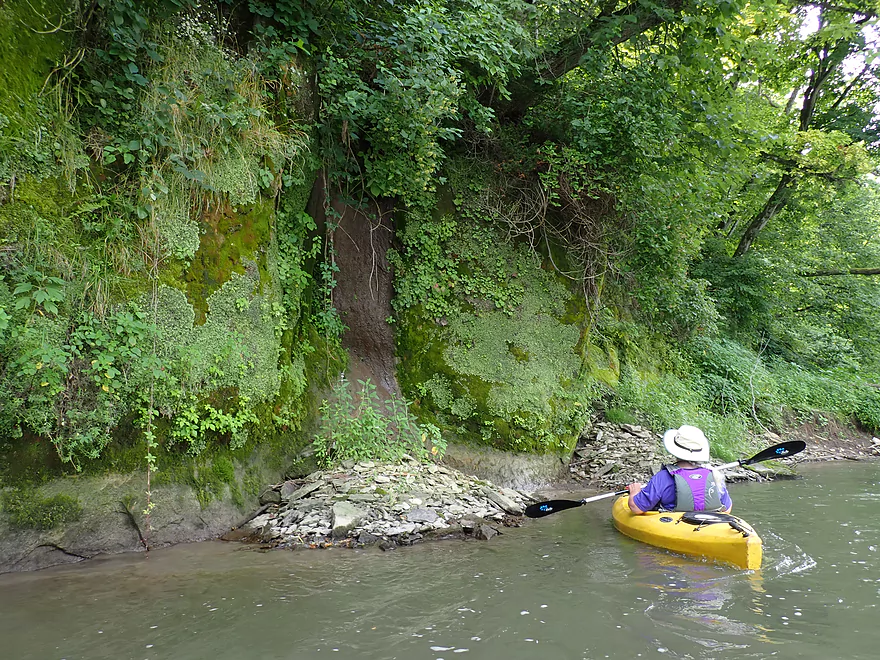
Followed by a very high mossy seep
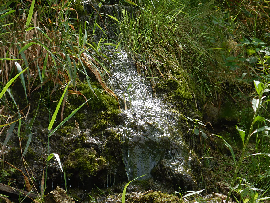
Springwater at the base of the bluff
More Class 1 rapids
One of the bigger outcrops of the trip
Lot of great mosses growing on the face
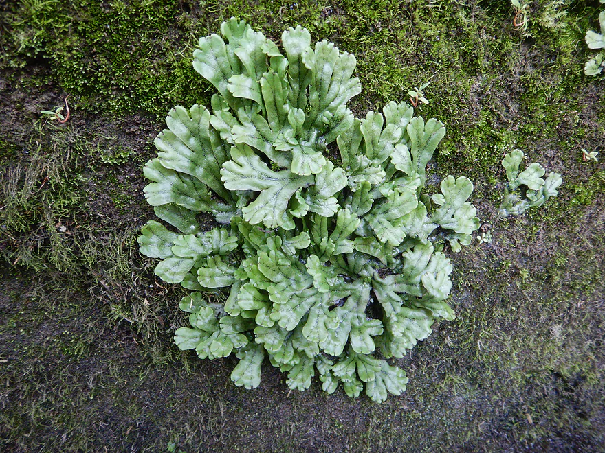
And liverworts
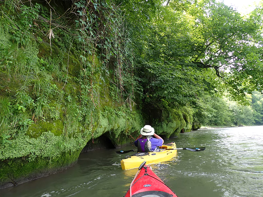
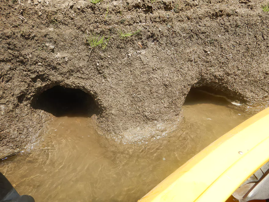
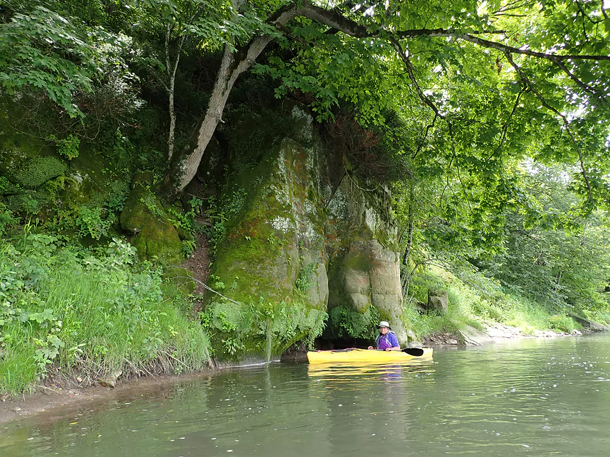
The Grant River “sea caves”
A couple of seeps with rock debris
Very rugged shoreline
The home stretch
Reverse view
Class 2 rapids under Camel Ridge Road
Reverse view
This is followed by a great outcrop

Getting out for pictures
Watching the canoers attempt the rapids
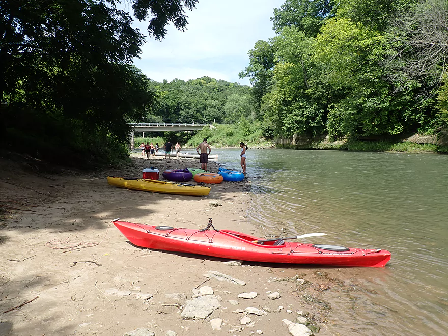
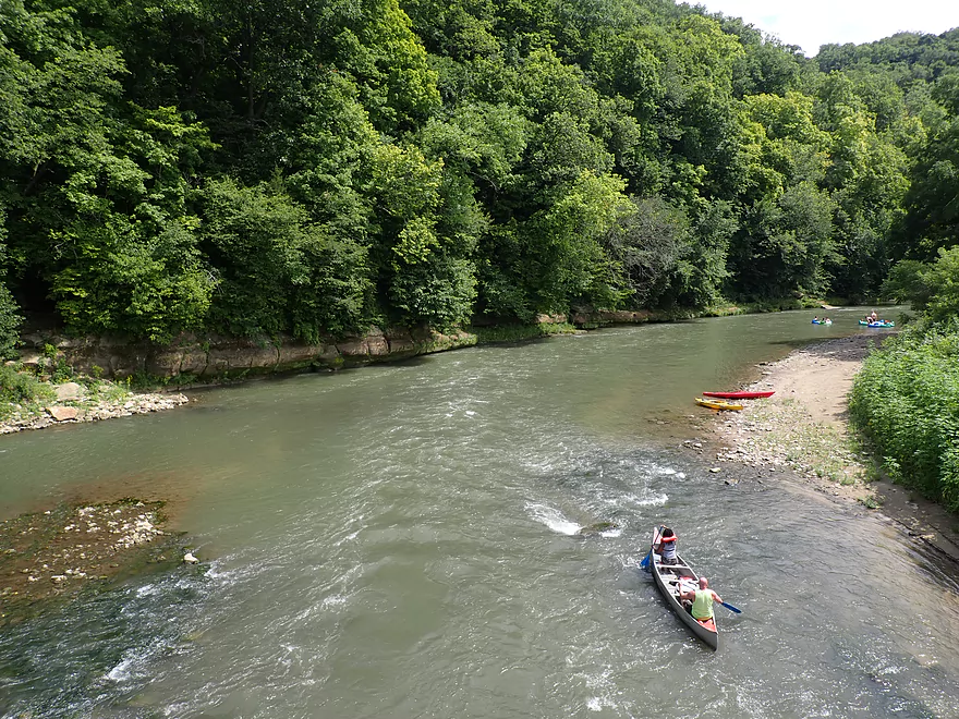
Nice take-out area
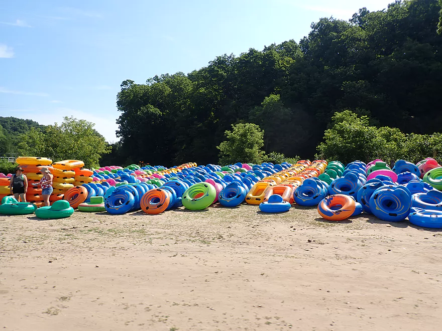
Literally hundreds of tubes
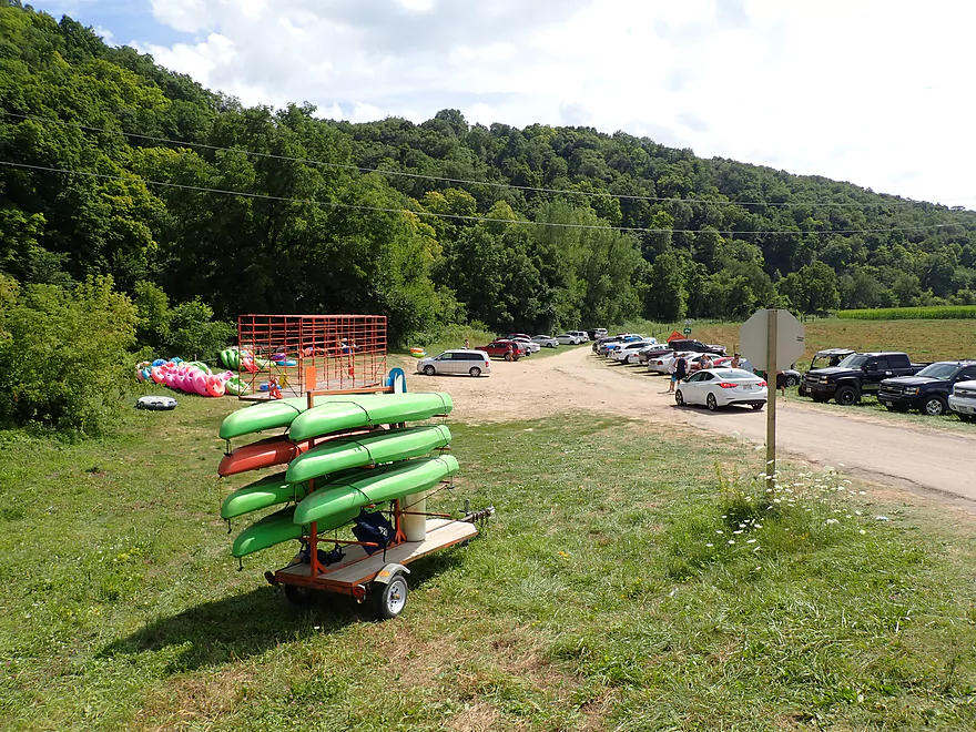
Camel Ridge Road is the busiest access on the Grant River
Grant River – Hwy U

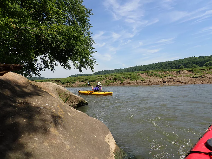
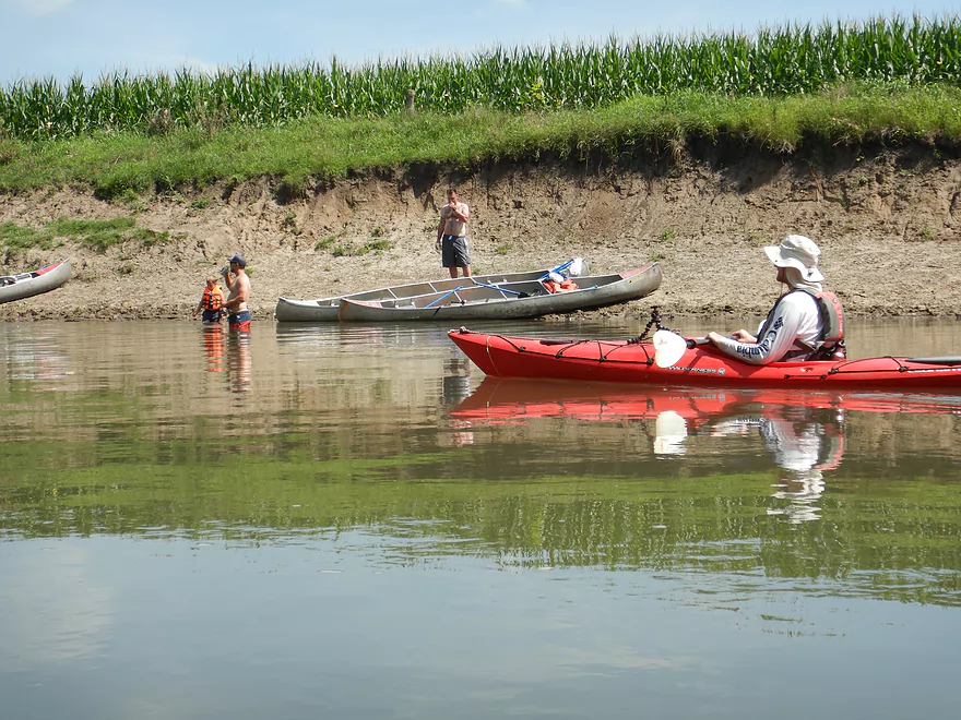
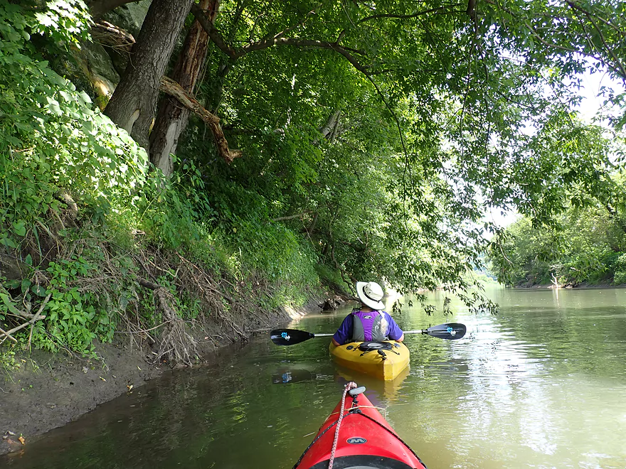
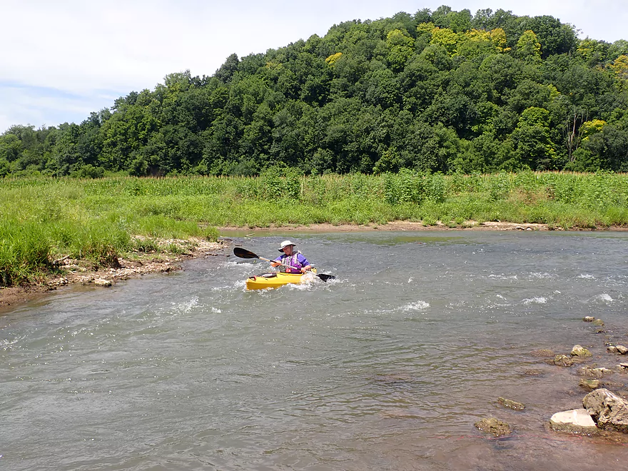
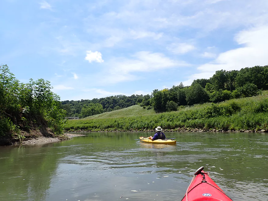
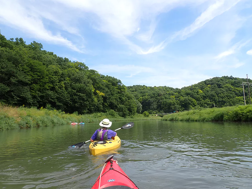
We started the trip at Hwy U which is a popular staging area for canoers on the Grant. The first half mile was quite cool. Just past a herd of cows we encountered multiple rapids, outcrops and a large gravel bar. Unfortunately the current was quite strong which made taking pictures quite difficult. While jockeying for a shot of the rapids I actually lost one of my water bottles (if you find it, let me know!).
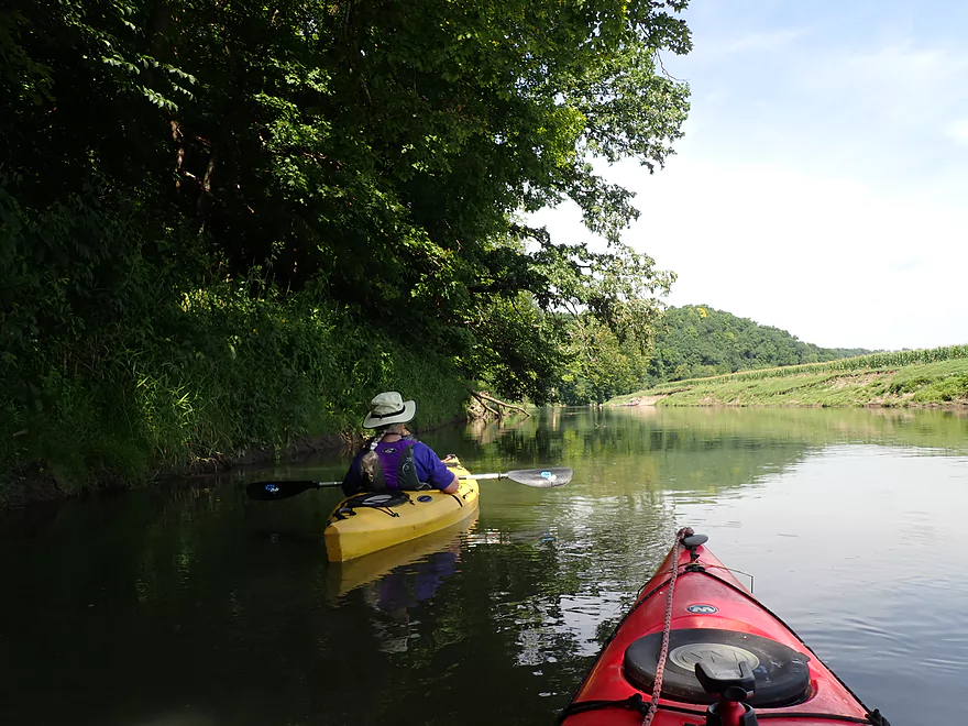
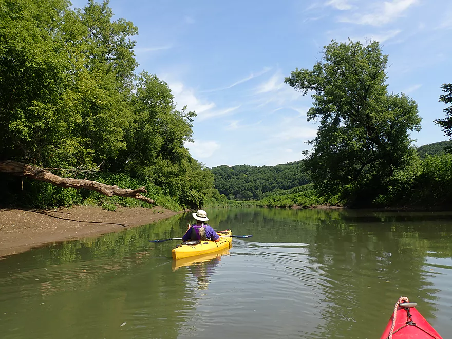
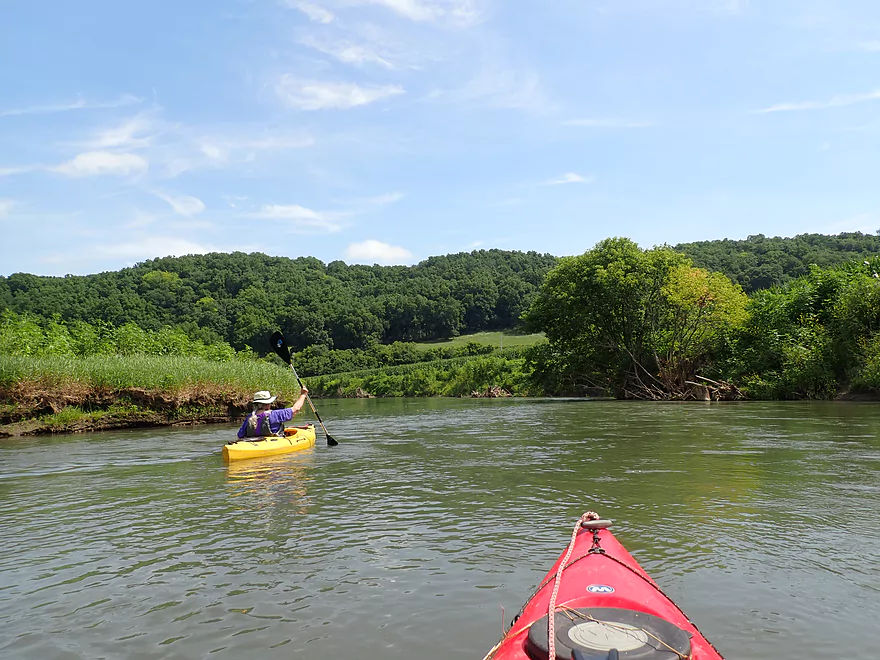
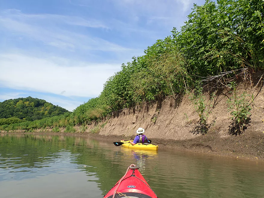
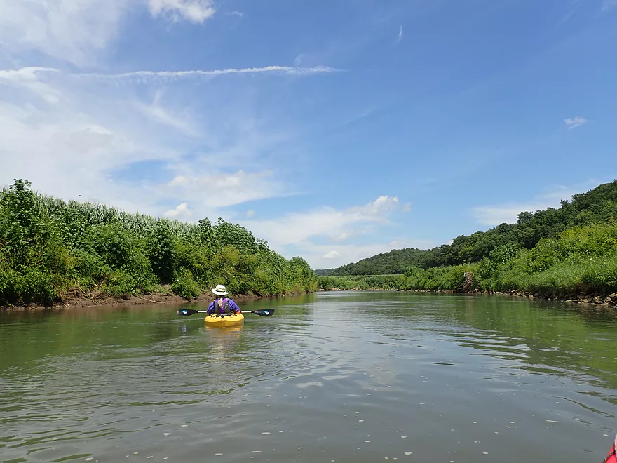
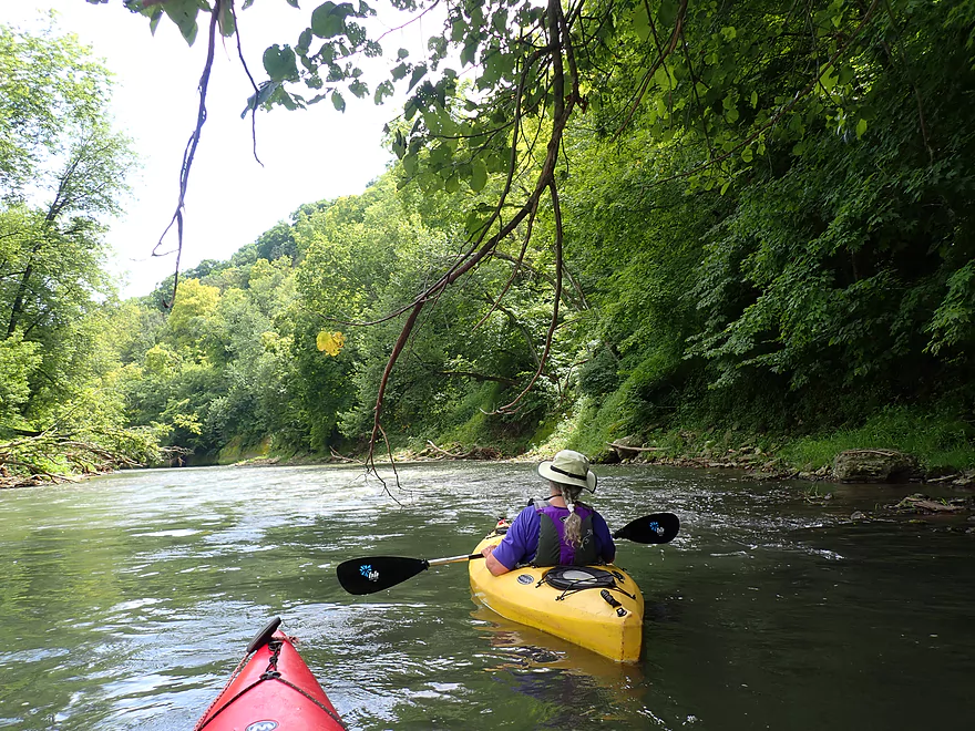
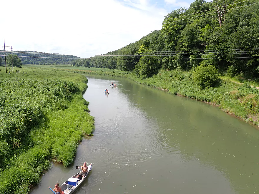
After that, the river opened up and flowed through farm country for the next few miles. In years past these river bottoms would have been open pasture, but recently it’s been replaced with corn. The corn was planted ridiculously close to the river atop near vertical mud banks. In some ways this actually had a cool vibe though…as if we were paddling through a giant “corn maze”.
Unfortunately erosion is a huge problem on the Grant, and big mud banks and turbid water were a common sight. Atop many of the banks were disturbed soil species…mostly giant ragweed and invasive Japanese hops.
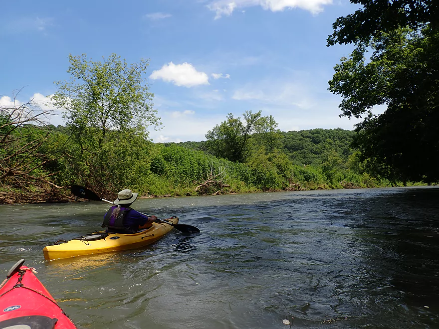
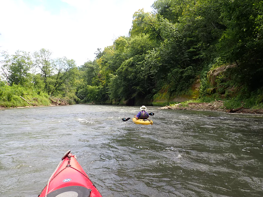
We did this trip at slightly above-normal levels which meant the rapids were well padded and a lot of fun. We even saw a number of canoers run them with (mostly) no issues. The river averaged 2-2.5′, and rarely got more than 4′ deep. At the bottom was a gravel substrate, but you could rarely see it through the turbid water. Something we were glad to not see were tubers which can be a plague below Camel Ridge Road.
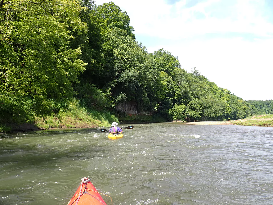
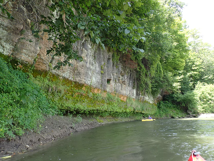
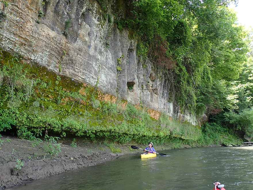
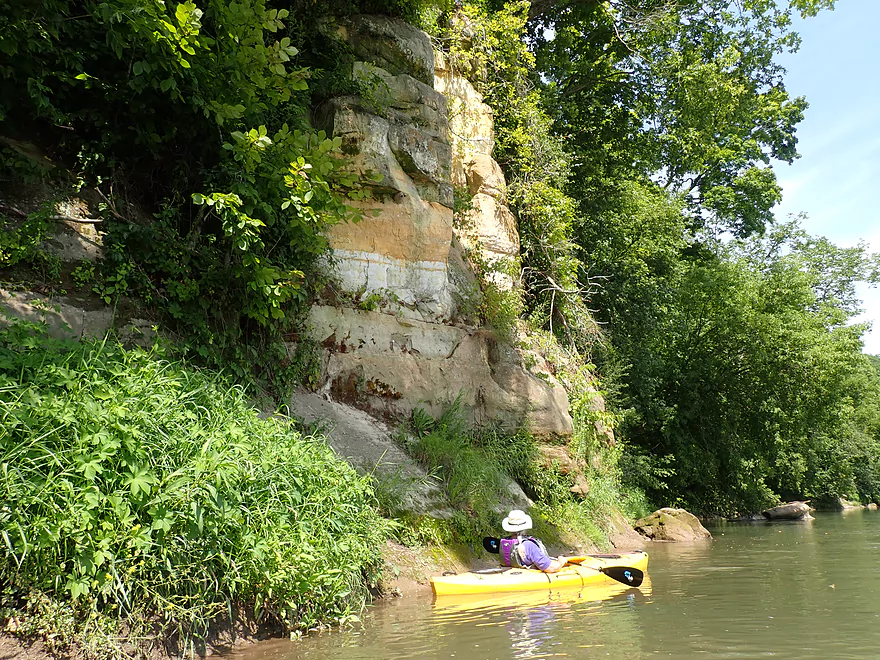
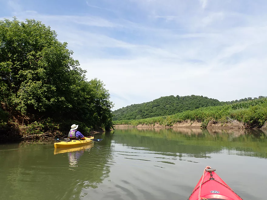
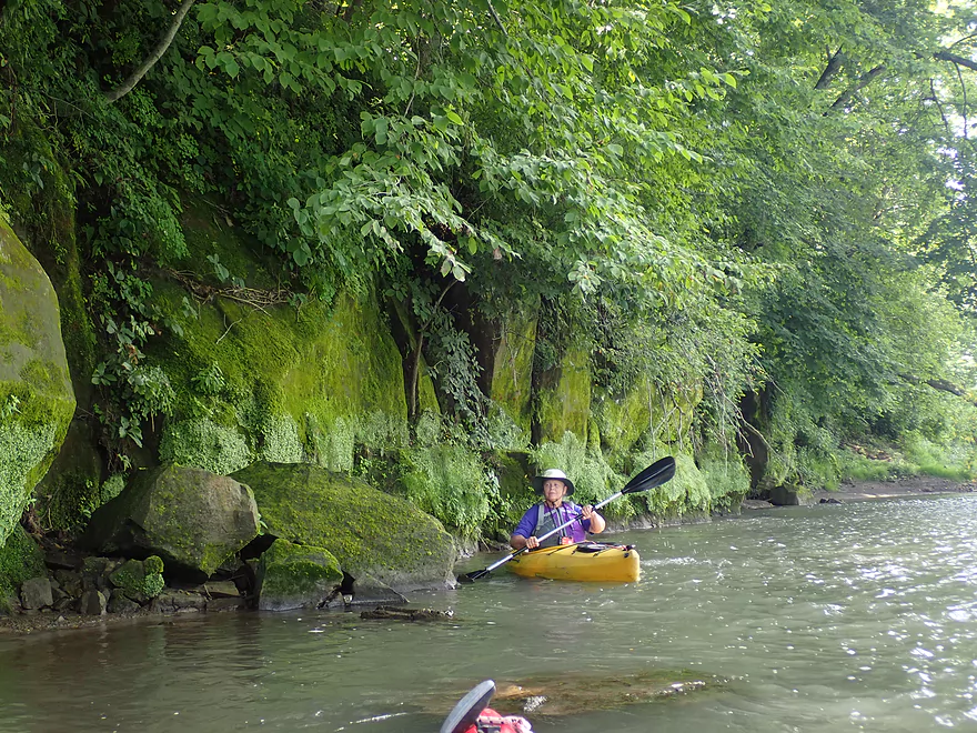
Once Rattlesnake Creek enters the river, the driftless bluffs became more prominent and things start to get interesting. Unlike the lowlands, the bluffs were topped with woods (mostly a mix of oak, ash, basswood, walnut and maple). At the base of these bluffs were scenic outcrops. It was mostly sandstone at the bottom, but in several locations you could see ancient exposed limestone that the river had carved its way through. Along the shore were large boulders that had tumbled down the hillside and settled into the river.
One of the trip highlights was a steep bluff with several springs…but uniquely positioned at the TOP of the rocky hillside. This resulted in water trickling down a mossy slope that was quite cool.
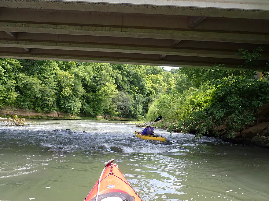
Just before taking out at Camel Ridge Road, we got to run some fun Class 2 rapids directly under the bridge. It was interesting watching the long canoes run these rapids. Some did better than others. Just below the rapids were some fantastic sandstone outcrops…among the best of the trip.
The take-out itself was a bit of a circus with people, cars, and tubes everywhere (this is a major put-in for tubers). While typically we like to loiter at take-outs for pictures, we left ASAP as it wasn’t a relaxing scene with the crazy crowds, cigarette smoke, cow manure smell, and 95°+ heat.
In summary this was a great trip. It started a bit slow with all the open cornfields, but the second half with the bluffs was spectacular. In fact I would rate this as among the better trips to do on the Grant, and a great starter stretch for Grant newbies. This trip is part of a larger super section on the Grant 21 miles long (Short Cut Road to Chaffie Hollow Road) which is all five star paddling and contains some of the highest concentrations of river outcrops in Wisconsin (rivaling even the Kickapoo).
Hwy U/Blackjack Road: There is a nice pull-off by the bridge with a couple of trails that lead down the bank to the water. Officially, this is not a public landing, but there are no “No Trespassing” signs and the public uses it all the time. It’s my understanding that this is a private access, but the owner allows paddlers to use it. Still…it is very important to be considerate if you use this access. The local livery also uses this access and he’s had issues backing his canoe trailer down the wayside because people were careless where they parked. You might want to simply park on the shoulder of Blackjack Road like we did. Also…don’t use the steps directly under the bridge. That is reserved for the livery so he can get his canoes down to the water. Instead use the second path just upstream of the stairs…which is a decent put-in. There are no outhouses at this access (or at any other accesses on the Grant River).
Alternate Put-ins:
- Pigeon Road (1st bridge not the second bridge): Located 4.8 miles upstream of Hwy U, this is a good stretch with many outcrops. This put-in is popular and used by the public, but strictly speaking it is private property. If you use this access, make sure to park on the shoulder so you don’t block the livery truck from turning around with his trailer.
Camel Ridge Road: This is the most popular landing on the entire Grant River. I’ve been told the landing is private, but the owner is nice and lets the public use it. Y’Allbee Tubin is based here and you’ll see a lot of tubers. There is no outhouse at this landing.
Alternate Take-outs:
- Chaffie Hollow Road: Located 3.1 miles downstream, this is a good stretch with several outcrops and a picturesque waterfall. The main landing northeast of the Chaffie Hollow bridge is privately owned and you must pay one of the three liveries to use this and/or sign a liability waver. An alternative might be to take out at the bridge instead of the private wayside, but the banks are steep here and this may be tricky.
Bike Shuttle: Camel Ridge Road to Hwy U – 2.9 miles with 266′ of ascent. This is a relatively short but hilly bike shuttle.
Liveries/Rentals:
- Grant River Canoe and Kayak Rental: 608-794-2342 – 7961 County U West, Beetown, WI 53802
- Main Route #1: Hwy 35 to Hwy U
- Main Route #2: Hwy U to Camel Ridge Road
- Main Route #3: Hwy U to Chaffie Hollow Road
- Custom trips are also an option
- Y’Allbee Tubin: 608-732-0618 – 9000 Camel Ridge Road, Cassville, Wisconsin 53806
- Main Route: Camel Ridge Road to Chaffie Hollow.
- They also rent out kayaks.
- Grant River Tubin’ Co: 608-763-4021
- Main Route #1: Chaffie Hollow Road to Burton.
- Main Route #2: Camel Ridge Road to Burton.
Current: The current was quite strong, but not really hazardous as there weren’t many strainers.
Rapids: There were a handful of fun rapids. I would rate all as Class 1. The exception would be the rapids under Camel Ridge Road which was a Class 2.
Fences: None!
Logjams: None! I believe the local liveries clear them out.
There is a nearby gauge in Burton. We did the trip at 340 CFS.
- 0-100 CFS: A bit low with maybe some rock bouncing, but good clarity.
- 101-200 CFS: Great paddling depth. Five years ago this would have been a very high depth…but nowadays the river rarely gets this low.
- 201-300 CFS: Good paddling depth but water clarity will be turbid.
- 301-500 CFS: A high depth, but should be plenty fine.
- 501-700 CFS: A very high depth, but likely navigable for experienced paddlers. Water quality likely won’t be good.
- 701+ CFS: The Grant likely only gets this high coming from or going to a flash flood. Be careful. For most paddlers these likely are not ideal conditions.
Detailed Overview
- Pine Grove Road to Hwy 61: 2.1 miles. Very small and would need flood-like levels to be navigable. Likely not interesting with several fences, 3-4 logjams, and flowing mostly through cow pasture.
- Hwy 61 to Mt. Ridge: 5.0 miles. A rugged and small paddle that needs high water. Unfortunately there is a lot of mud and pasture to deal with not to mention a few logjams. However, there are many fun rapids and several scenic outcrops.
- Mt. Ridge to Pine Knob Road: 2.6 miles.
- Mt. Ridge to Hwy K: 1.7 miles. Narrow and fast with several rock outcrops. No logjams, but a few tricky strainers.
- Hwy K to Pine Knob Road: 0.9 miles. A neat section with more outcrops, a longer set of Class 2 rapids, and Klondike Springs.
- Pine Knob to Hwy A: 2.7 miles. Likely way too many logjams.
- Hwy A to Grays Mill Road: 0.7 miles. Maybe one downed tree. Mostly a simple farm field paddle.
- Grays Mill Road to University Farm Road: 3.4 miles. Maybe 2-3 downed trees and one set of rock outcrops. River gains significant volume in this stretch from tributaries.
- University Farm Road to Short Cut Road: 3.7 miles.
- University Farm Road to Slab Town Road: 1.5 miles. Very muddy and one noteworthy strainer, but also has a great series of limestone outcrops.
- Slab Town Road to Short Cut Road: 2.0 miles. Less muddy and with several sets of fun rapids, but has only one tiny outcrop and there is a logjam to deal with.
- Short Cut Road to Grant River Road: 5.5 miles. Great section with some attractive outcrops.
- Grant River Road to Hwy U/Blackjack Road: 6.2 miles.
- Grant River Road to Pigeon River Road(1st): 1.4 miles. Great stretch with some of the best outcrops on the river. Grant River Road is a bad access.
- Pigeon River Road(1st) to Hwy U/Blackjack Road: 4.8 miles. A good leg with a mix of sandstone and limestone outcrops. Outcrops aren't as common as other legs, but it's still a nice stretch..
- Hwy U to Camel Ridge Road: 6.0 miles. Good stretch with some nice rock outcrops.
- Camel Ridge Road to Chaffie Hollow Road: 3.2 miles. Very scenic section with good current. Features a waterfall and some nice outcrops. Very popular with tubers.
- Access note – The Chaffie Hollow Road landing is private. Get permission from one of the three liveries like “Y’Allbee Tubin” to use it, or take out under the bridge (the latter is not easy).
- Chaffie Hollow Road to Hwy N/Burton: 3.3 miles. I don’t know much about this section. Likely more open and less interesting…but likely some outcrops and light rapids.
- Access note – The landing at Burton is private. If you take out here, use the bridge instead.
- Hwy N to Great River Road: 8.5 miles. Should be a few nice rock outcrops, but the channel is much larger and muddier. Maybe 3 logjams. Take out at Hwy 133 on SE side…not an ideal launch area.
- Great River Road to Mouth: 1.6 miles.
- Mouth/Mississippi to Potosi Point: 1.2 miles. A short trip on the Mississippi before disembarking at Potosi Point.
Trip Map
Overview Map
Video
Photos Size:
Greetings Aaron, I just wanted to drop you a quick note and let you know that I paddled the Grant River on Friday and can share some intel. We put-in at Shortcut Road which is once again a viable option. There is a clear path the the river, then there is a 3-4′ drop (which is doable to butt slide down), then a flat and solid spot to launch from. Send me your direct e-mail address and I can e-mail you some pictures. We paddled the 6.6 miles to the 1st bridge on Pigeon River Road. It’s doable, not great, not terrible; upstream river left. There are rocks that you can get out on. The bank is steep but climbable with only a little Japanese hops and nettles. There is plenty of roadside parking here as well. There were three of us and we helped each other get our boats up without issue. This 6.6 mile section is nice because you get some great rock formations without the long 11.25 haul to County U. Thanks for your continued posts. I enjoy reading them and adding more paddles to my future list. Take care, Scotty Wertel (aka the Driftless Kayaker)
Thanks Scotty for the updates. That’s good news about Shortcut Road…as that launch was in bad shape last I checked. The upstream bridge isn’t a bad alternate put-in though. It’s good to hear that the 1st bridge on Pigeon River Road is also viable. Keep up the good work on your youtube channel https://www.youtube.com/channel/UCk7VmgN5pQoaxFQaAdCcozA/videos which has a lot of good river videos.