
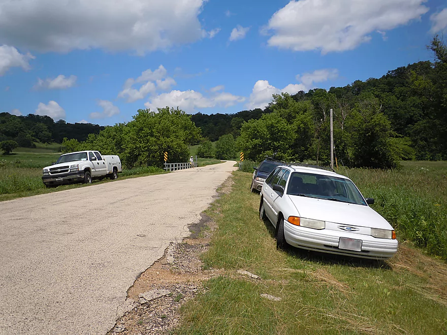
Good bridge access off Platte Road
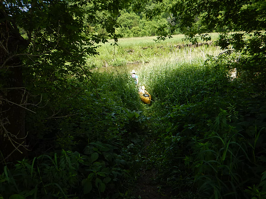
A hidey trail leads to the water
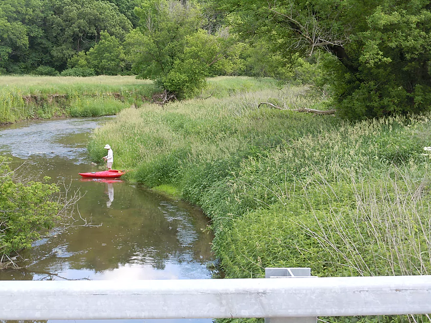
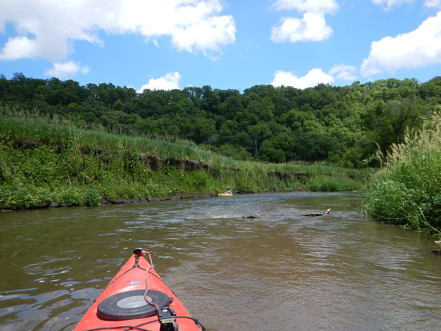
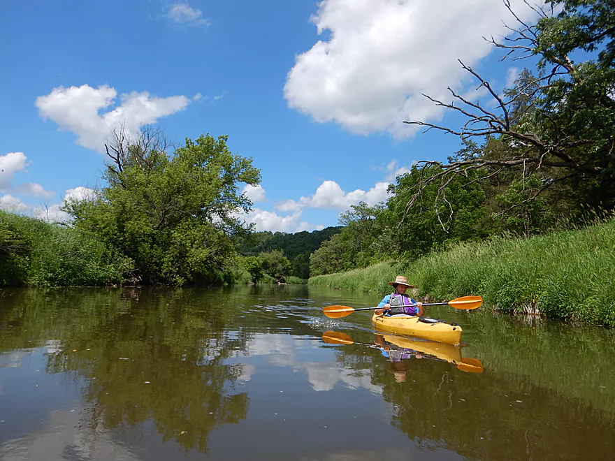
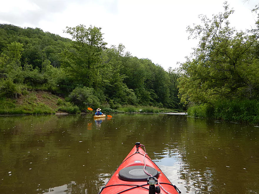
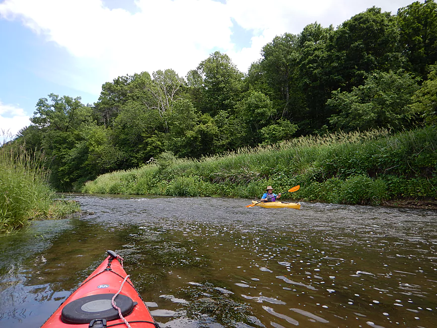
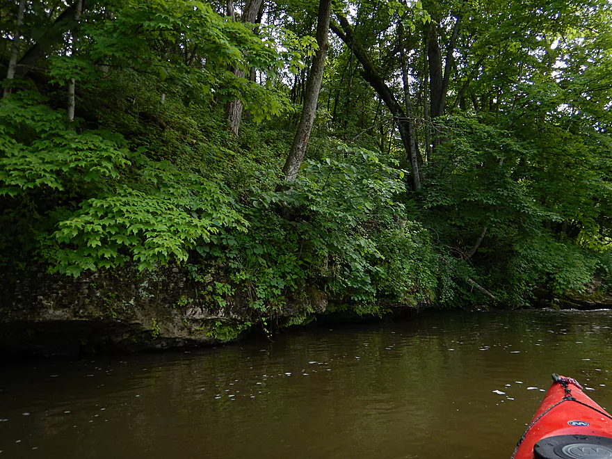
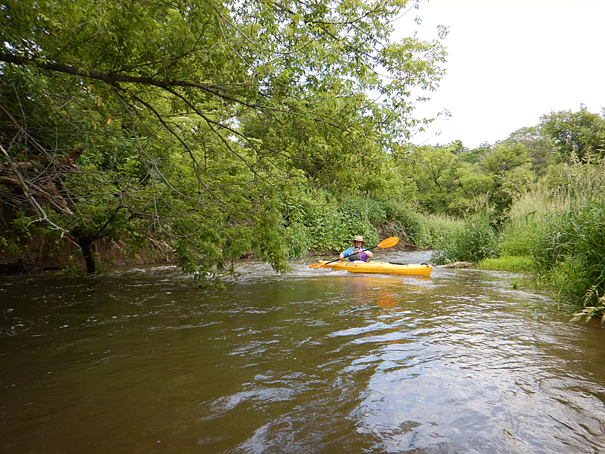
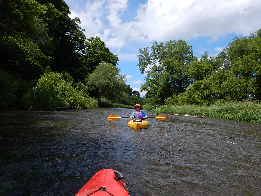
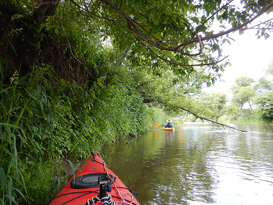
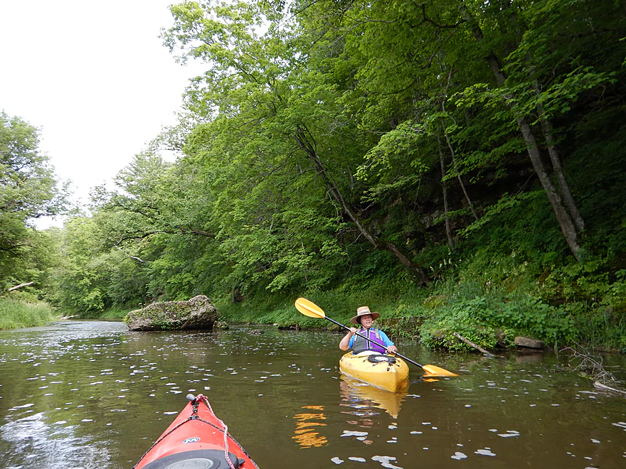
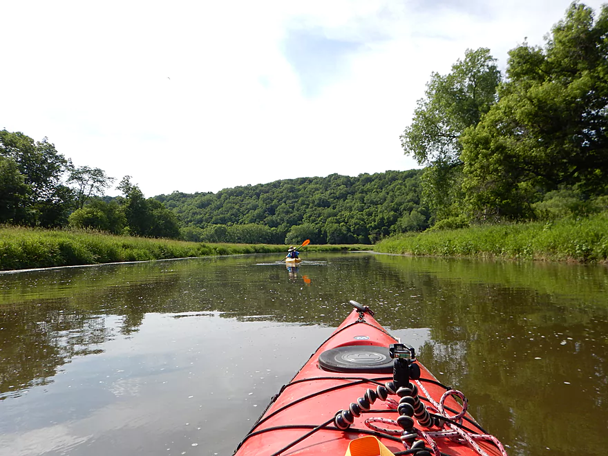
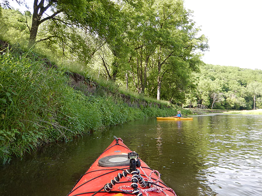
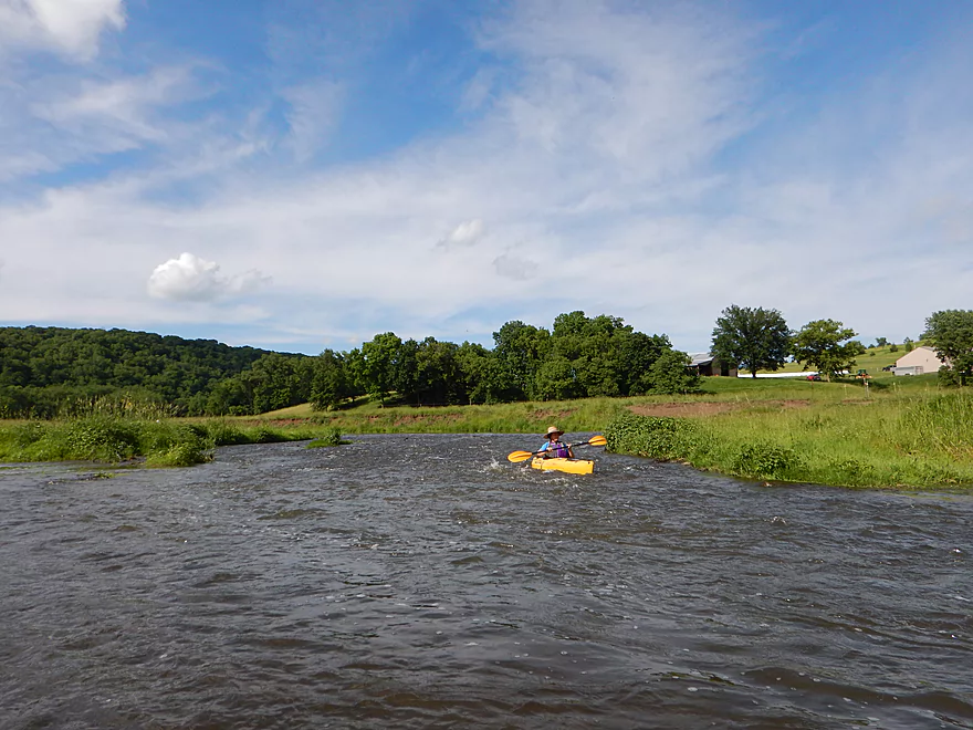
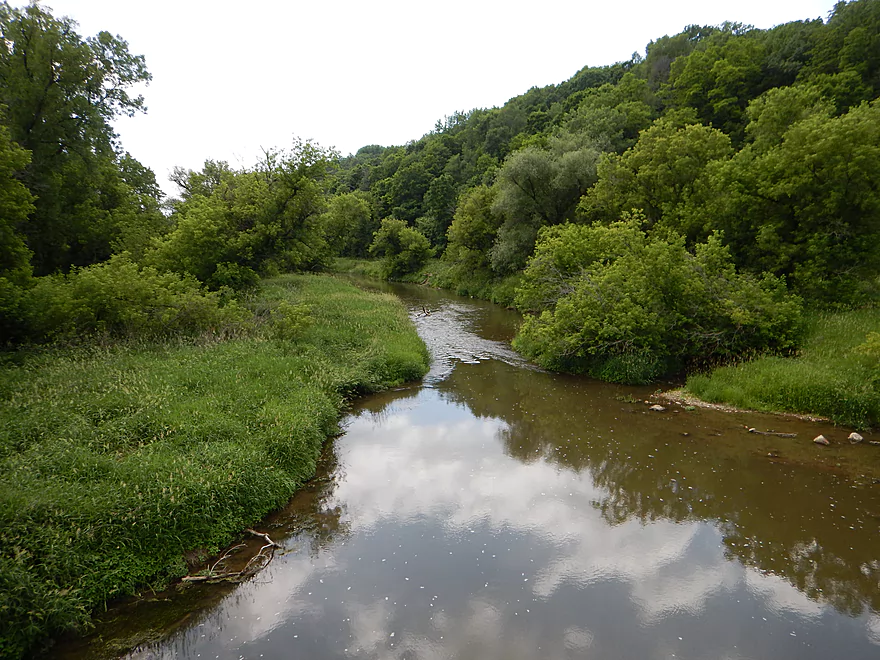
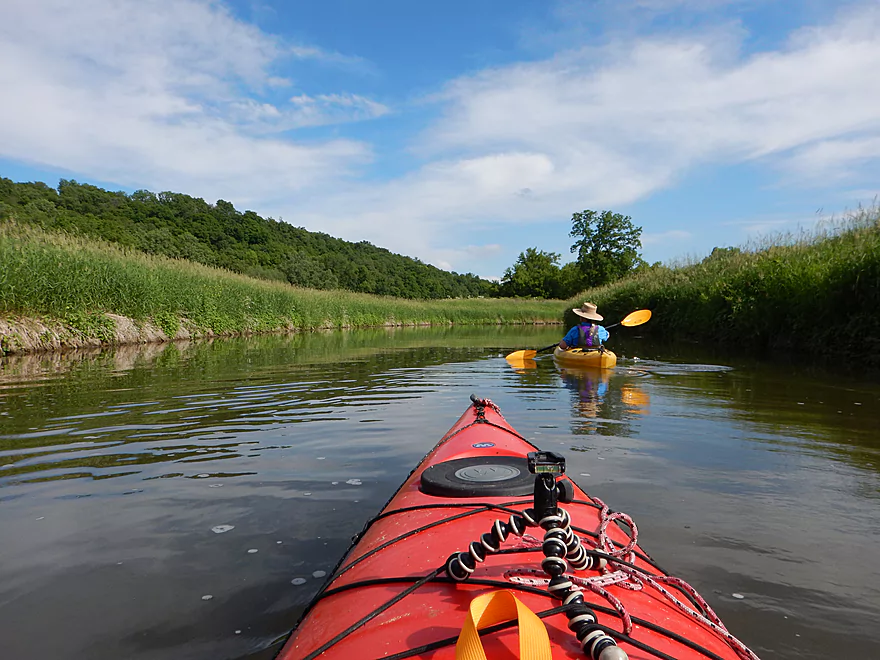
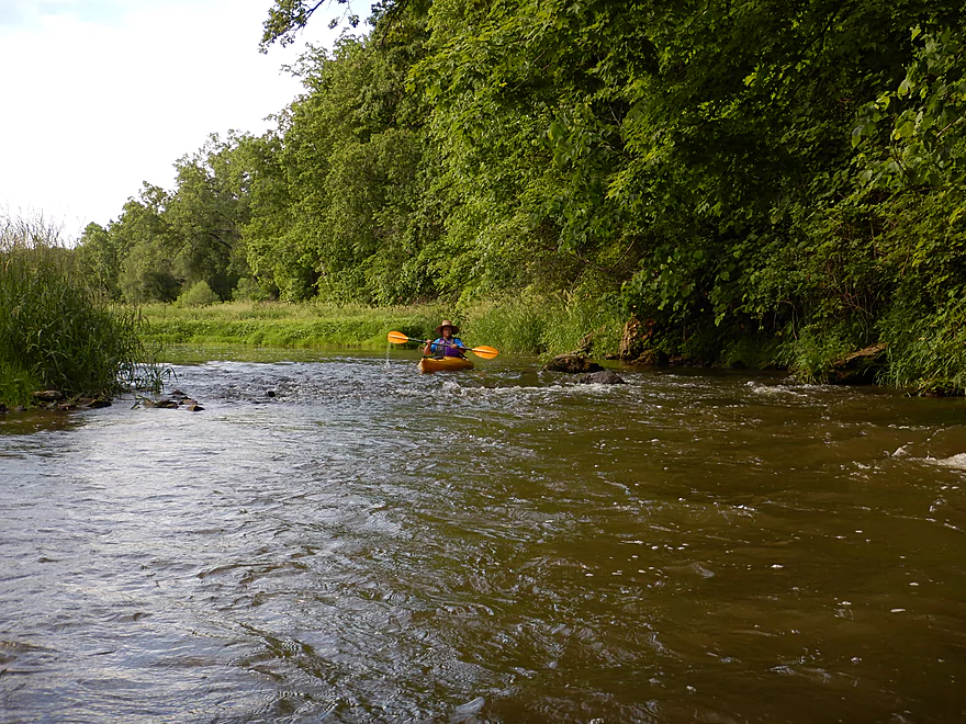
Scenic banks and riffles start the trip
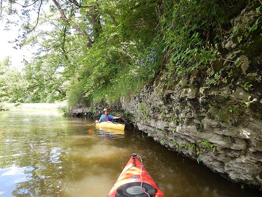
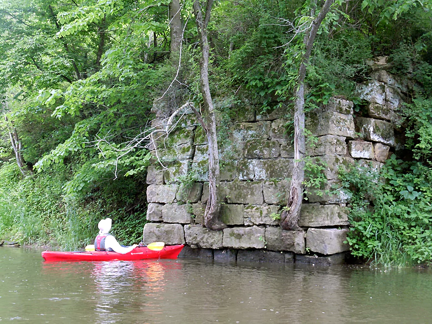
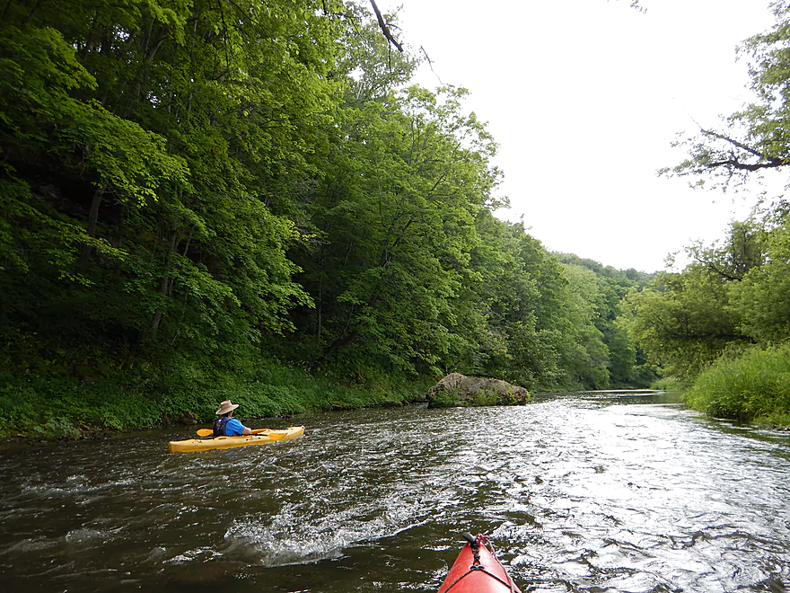
Soon after, some attractive rock outcroppings
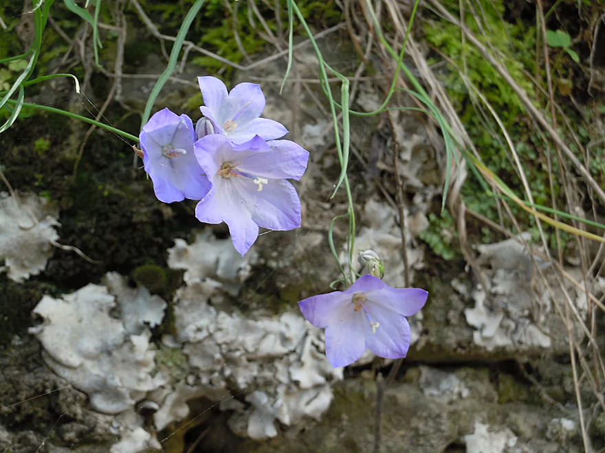
Harebells
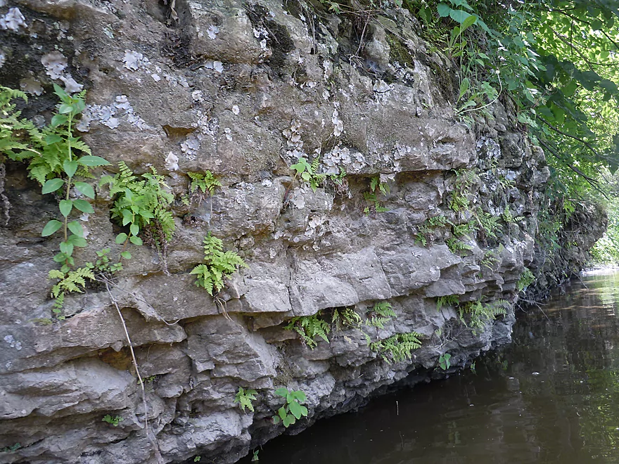
Small ferns growing on the rocks
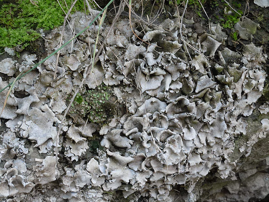
Dermatocarpon or Brook Lichen
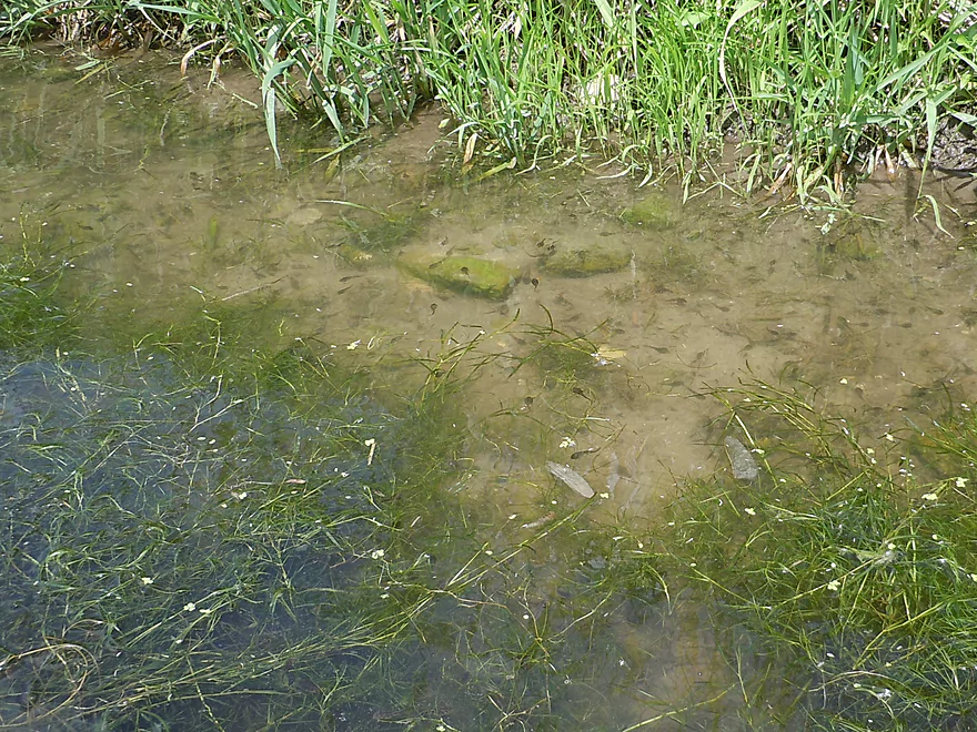
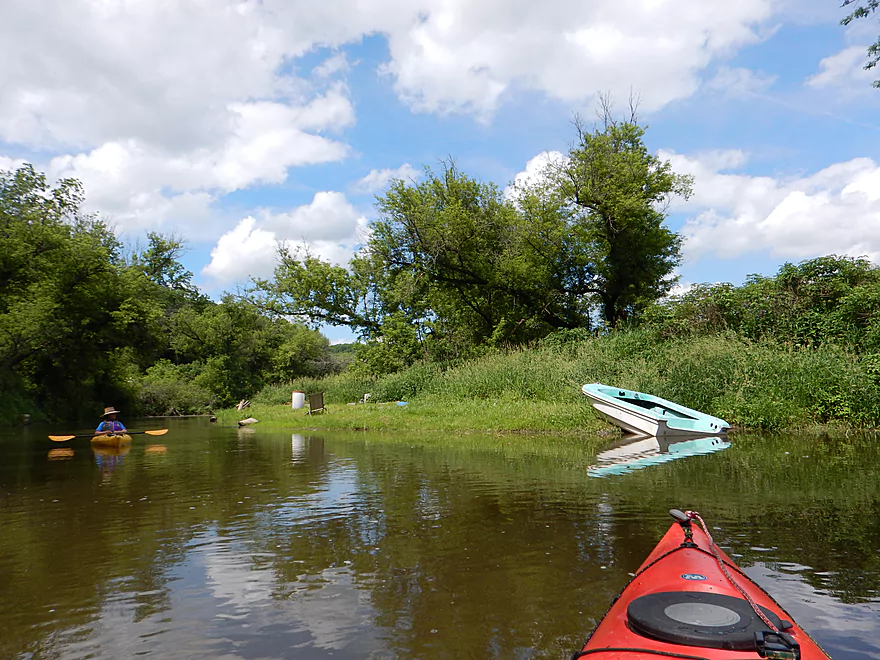
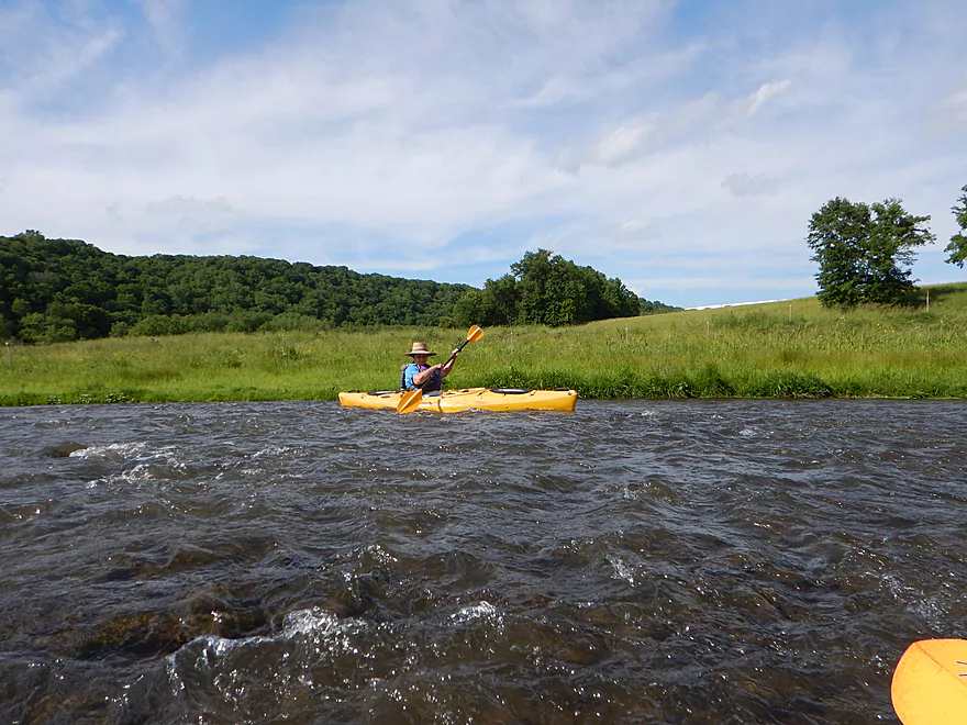
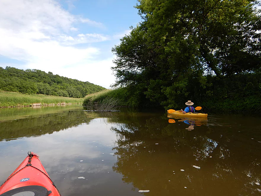
Water was so brown…
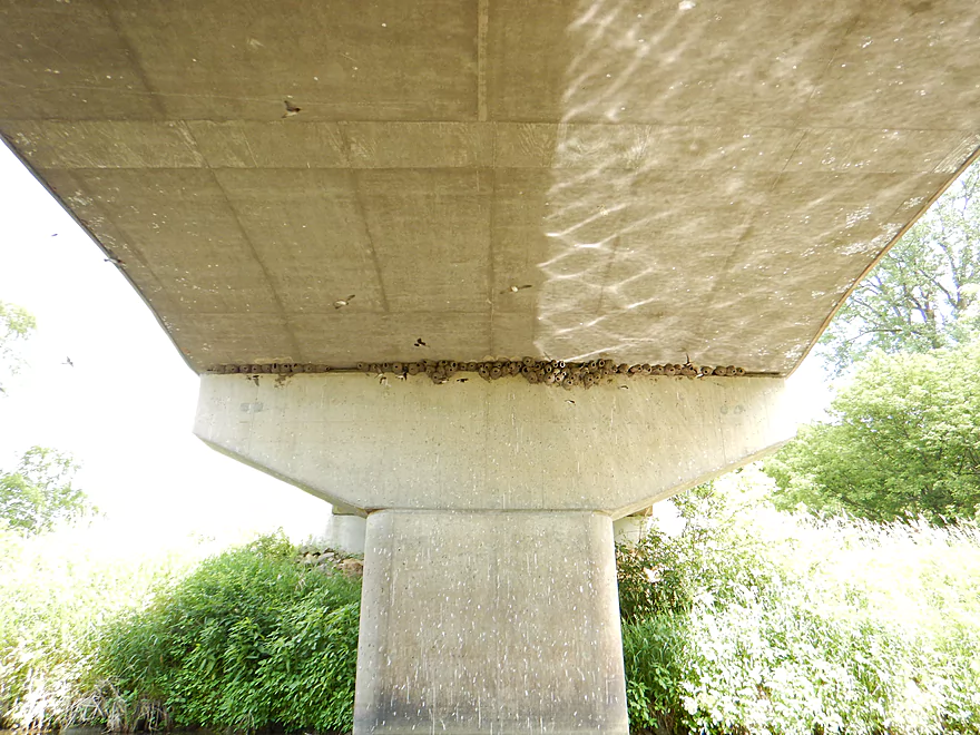
So many nests
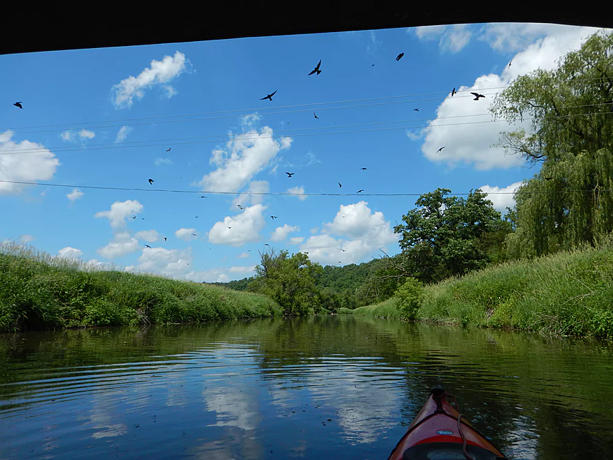
Hopping mad cliff swallows
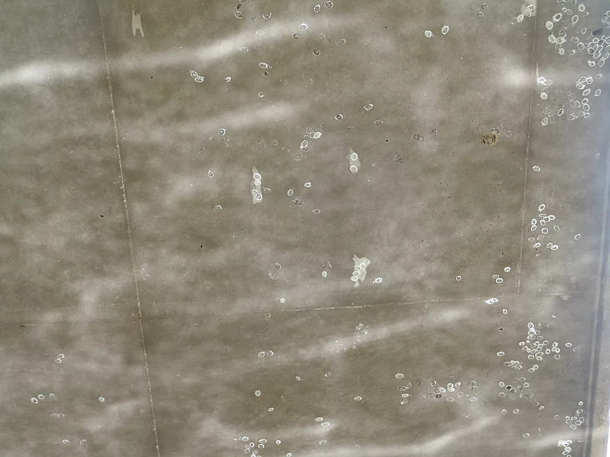
Dobsonfly egg cases and light reflections under the bridge
Ooldles of tadpoles
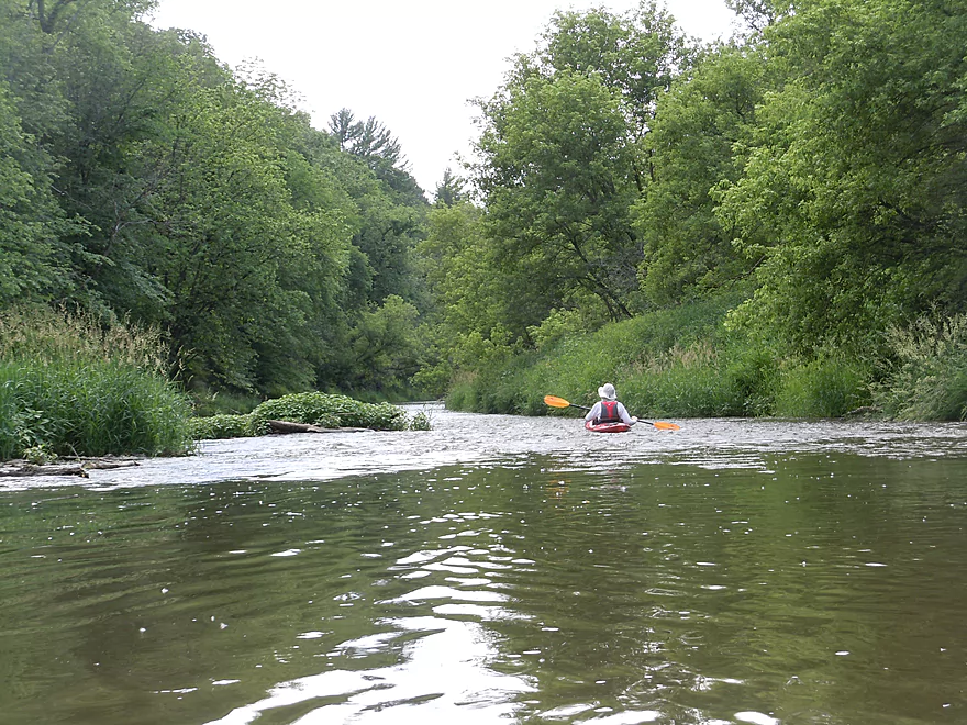
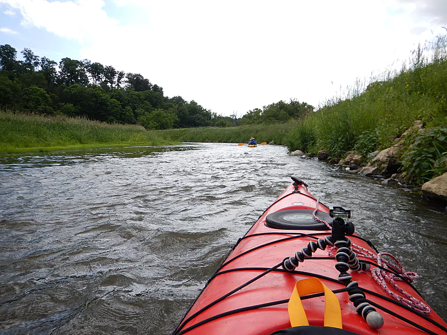
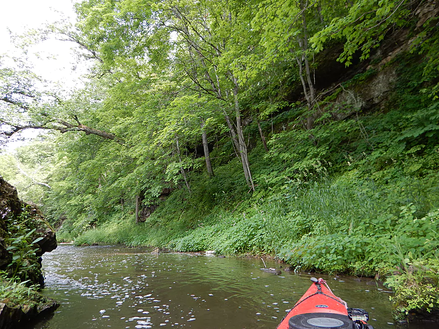
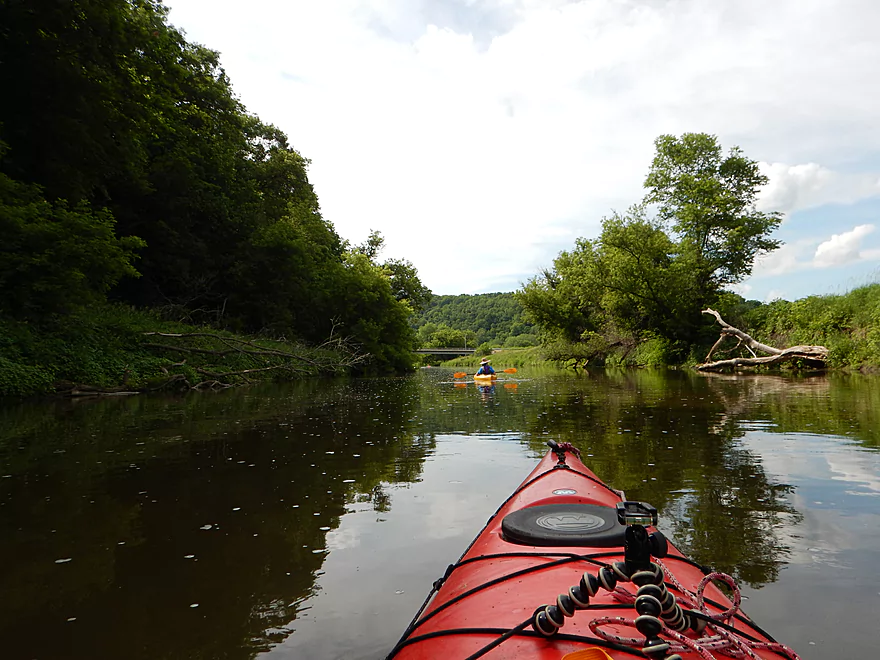
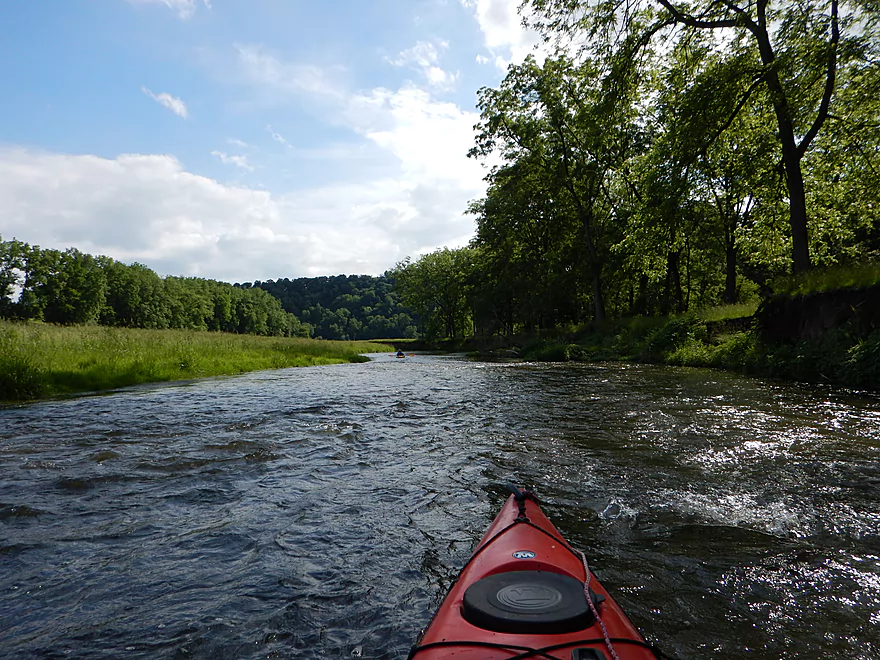
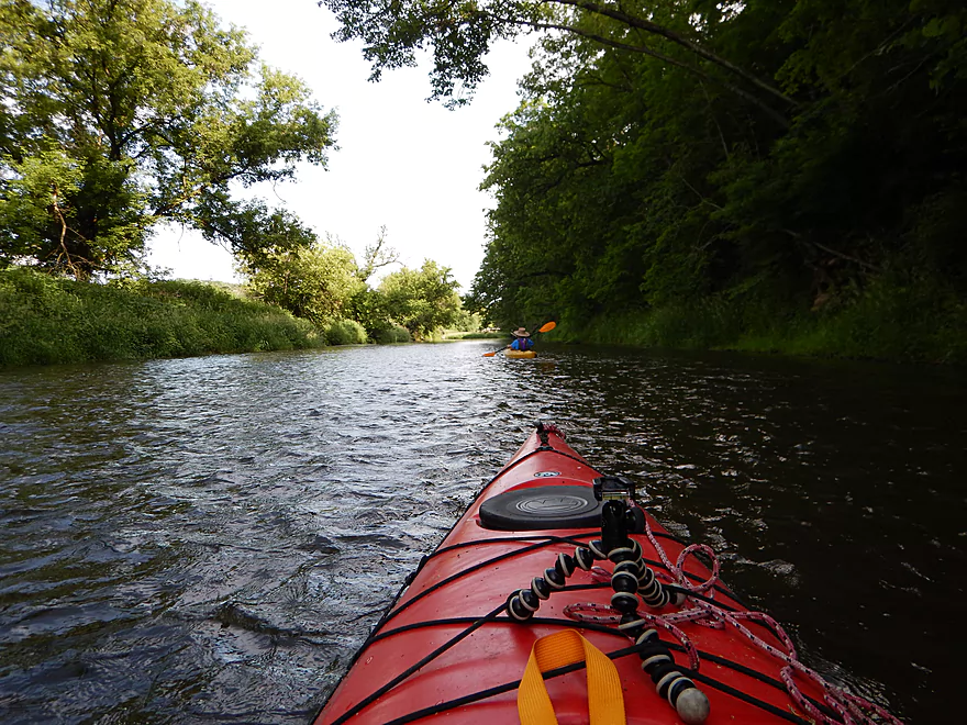
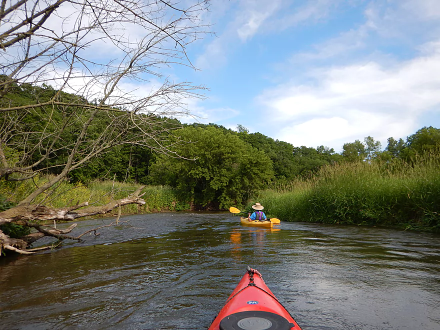
Riffling through the woods
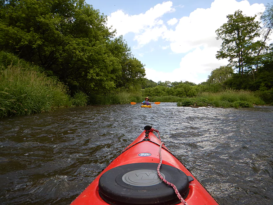
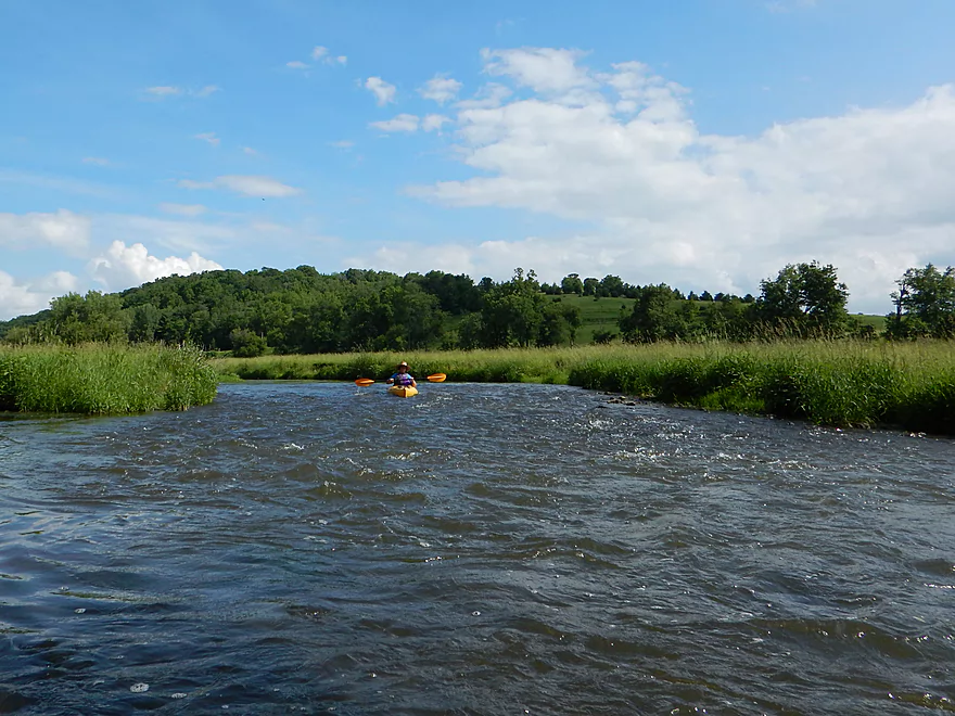
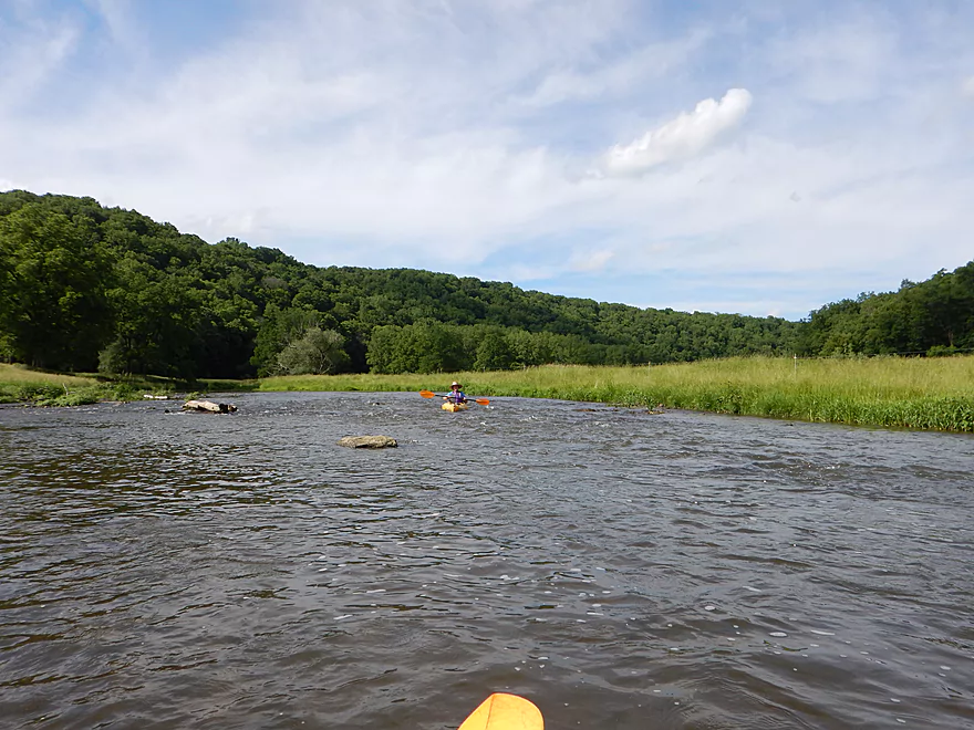
The rapids were the highlight
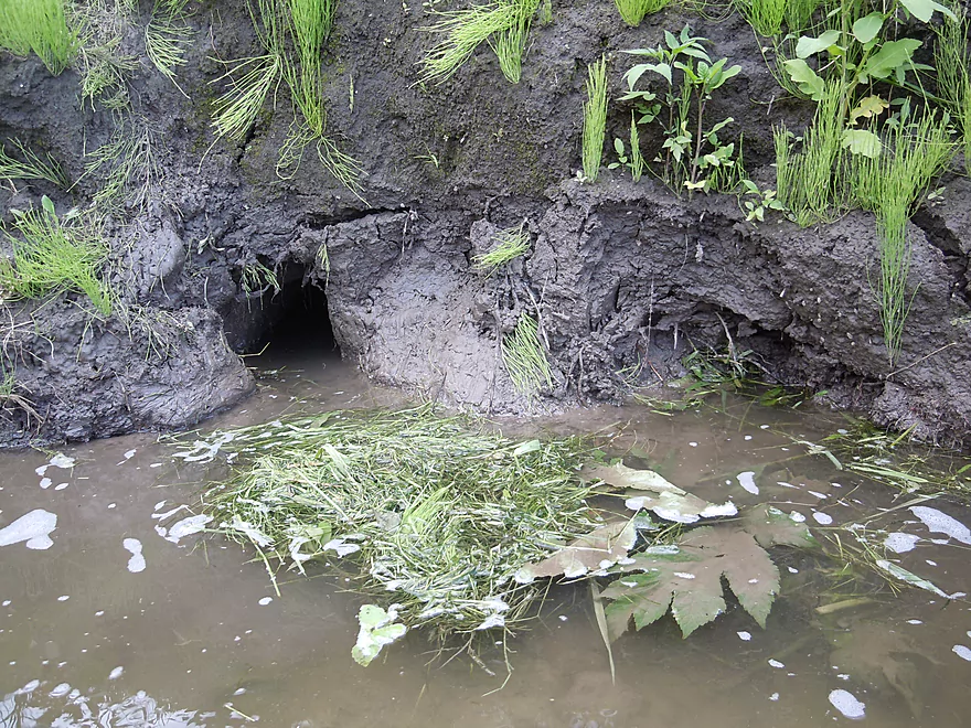
A bank den–probably muskrat, with horsetail growing nearby
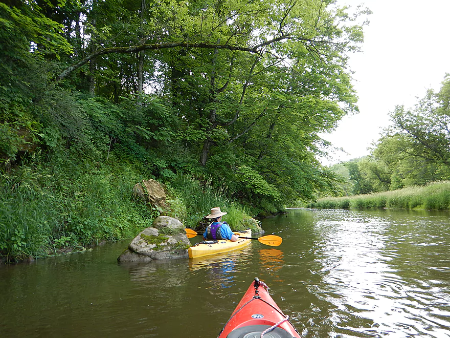
Number of rock outcroppings, but most were overgrown
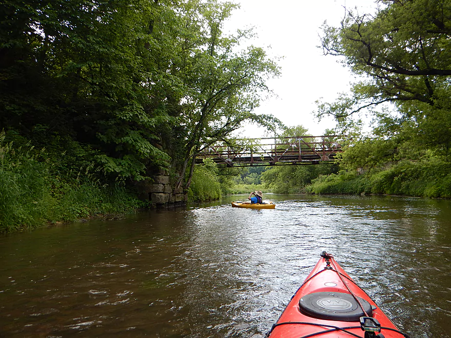
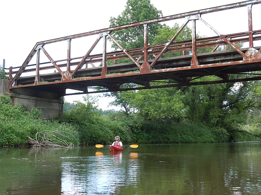
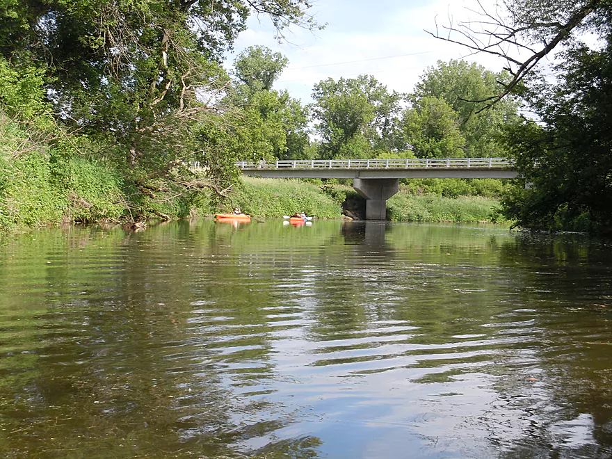
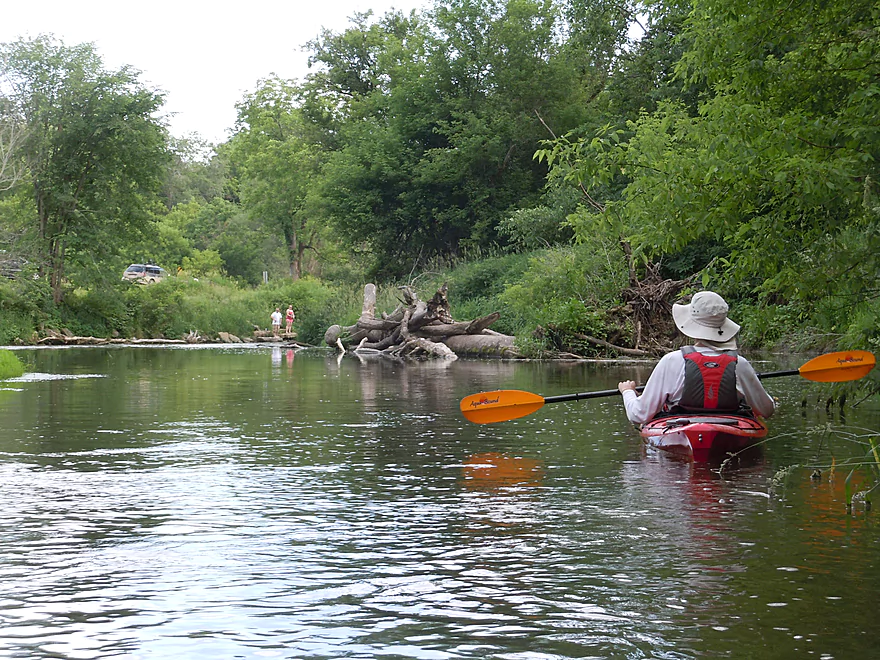
Second Platte Road bridge
An Angkor Wat scene
Cliff swallows much prefer the cement bridges
Try not to get turned around in the fast current
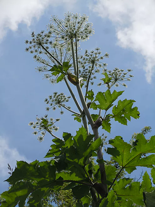
Angelica starting to flower
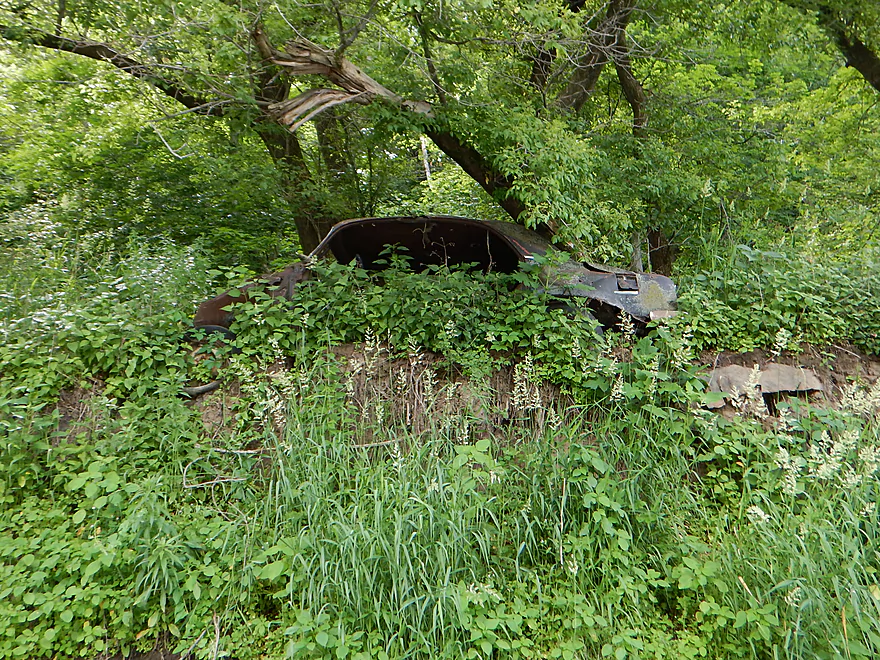
Consumed by the Wisconsin jungle
Do not think a v-bottom boat would do well on the Platte
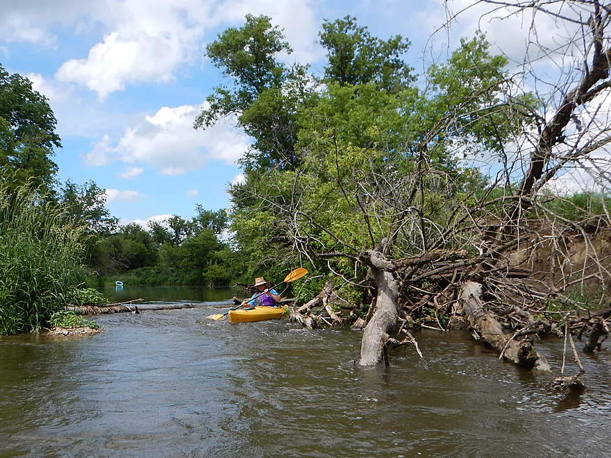
Current really pushes you into this strainer
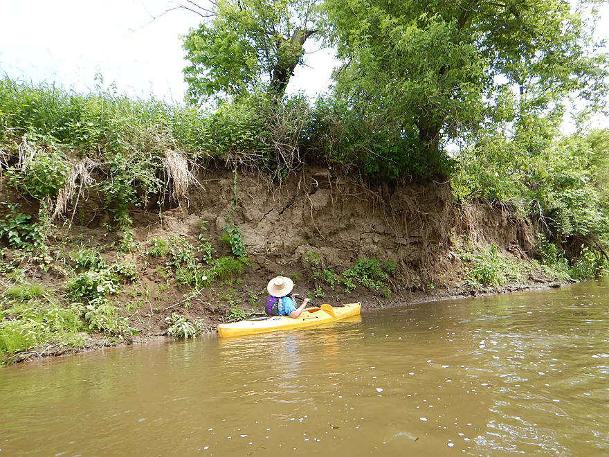
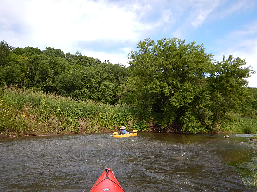
Huge mud banks

Start of my favorite section
More riffles in this scenic stretch
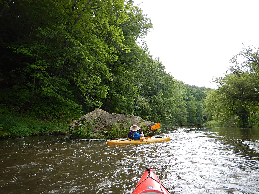
An escapee boulder from the nearby outcroppings
Red Dog Road bridge
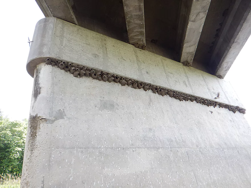
Lot of cliff swallow nests…
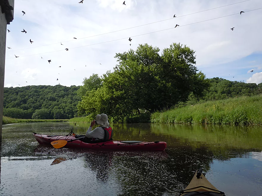
Like a scene from Hitchcock’s ‘The Birds’
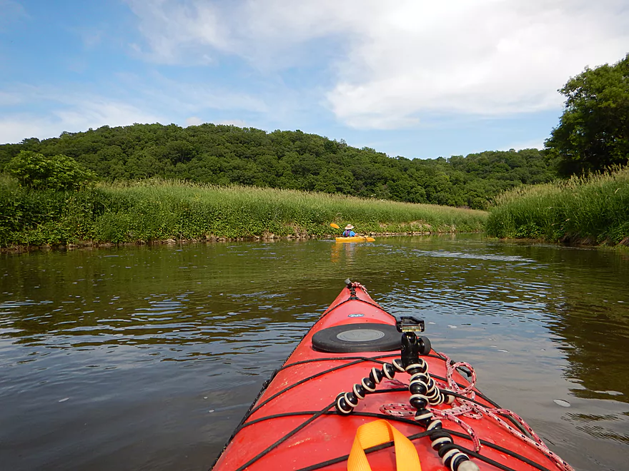
More hilly vistas
More fun rapids
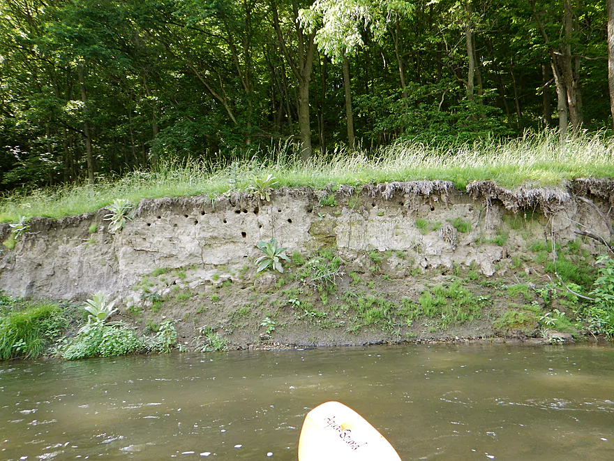
Bank swallow homes
Some mud outcroppings
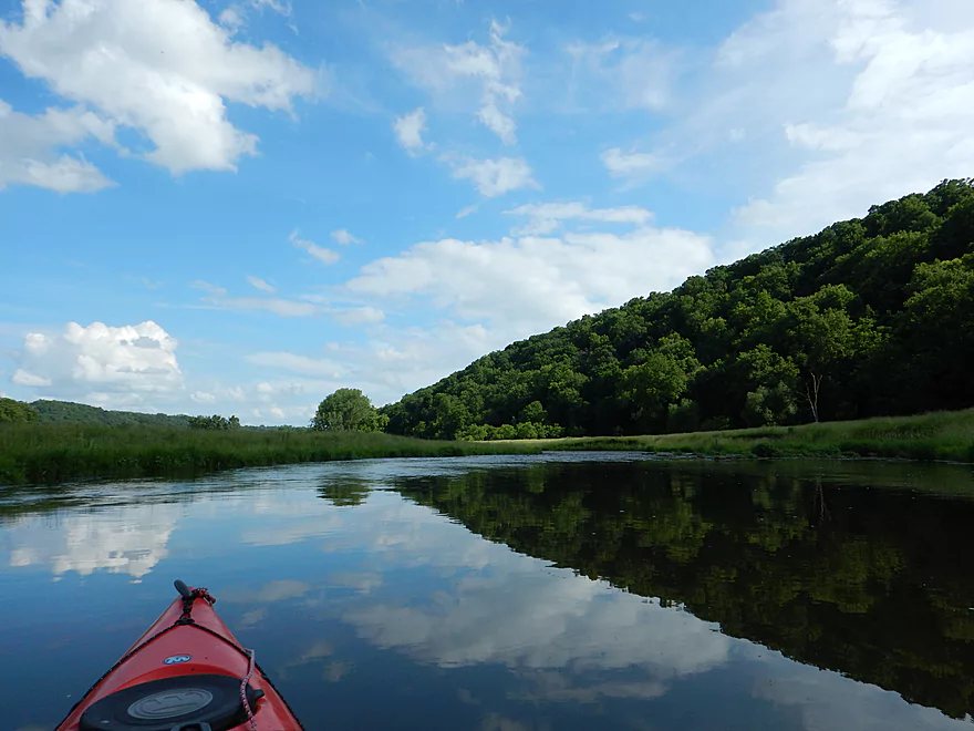
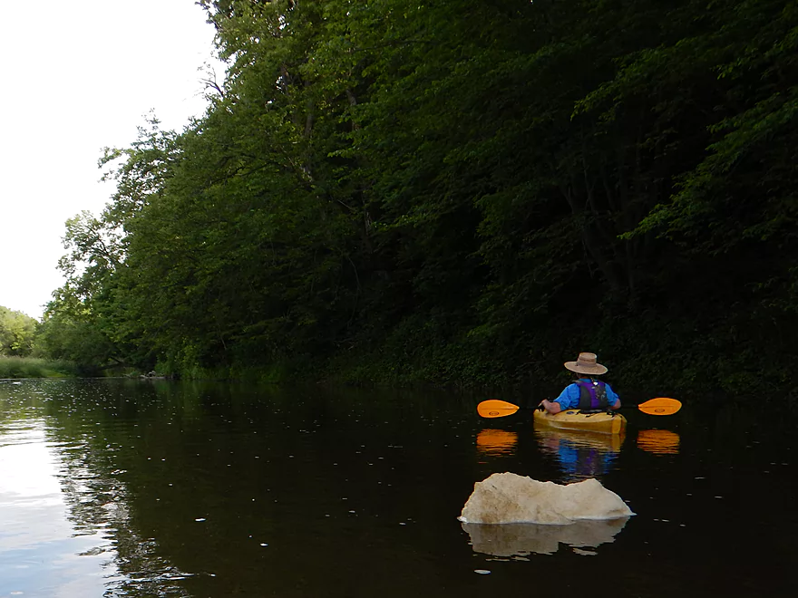
Nice peaceful section
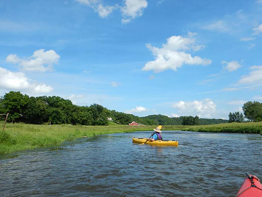
Approaching a goat farm
One of the rare moments we get hung up in the rapids
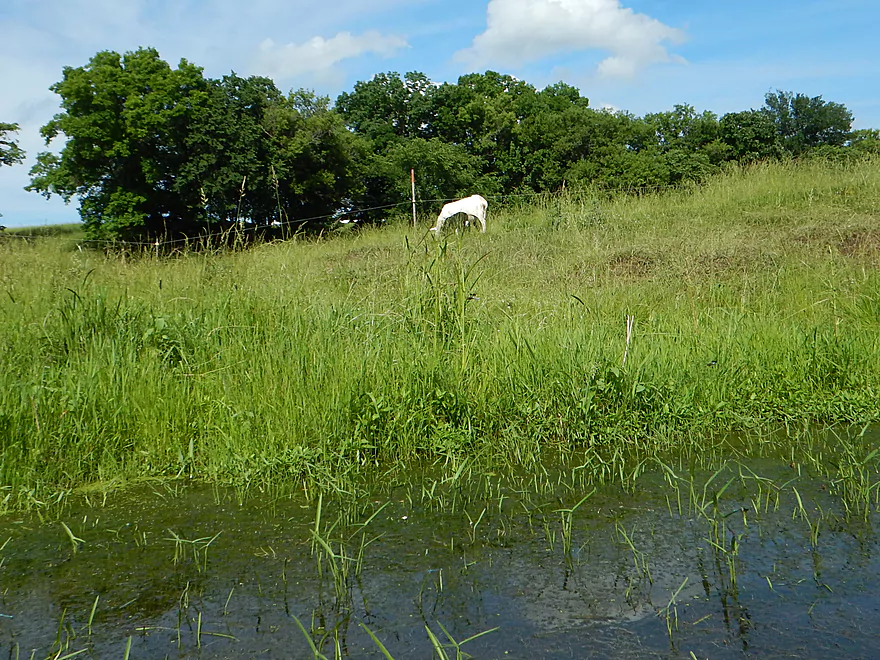
The goat is on the wrong side of the fence…
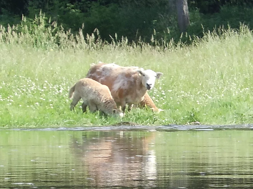
Startled sheep (who are also on the wrong side of the fence)
Too many rapids to count
Need to avoid the foam iceberg
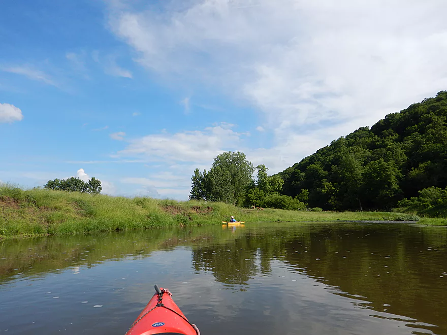
Yet another group of kayakers (Hwy B bridge)
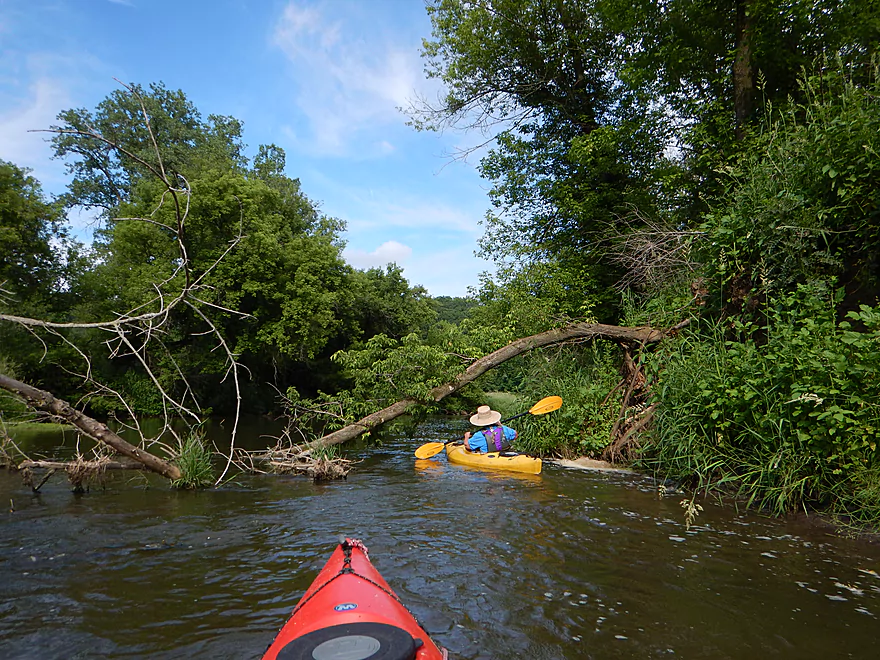
Deadfall really wasn’t an issue on the trip
Last of the rapids
Big Platte Road landing is popular with fishermen
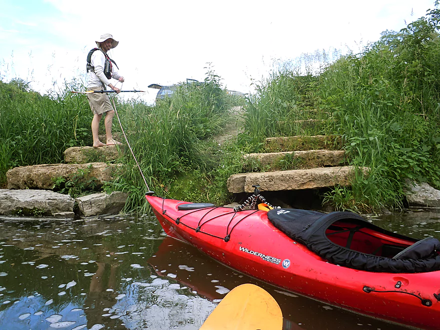
Good take-out with steps and carpeted ramp
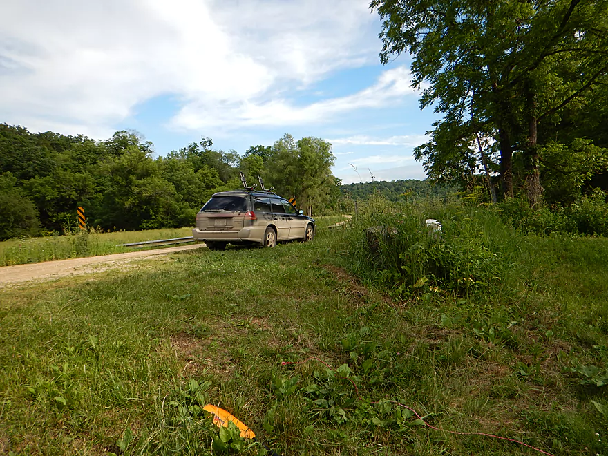
Good parking too
Platte River – Platte Road

Two years ago I paddled the Platte River from Airport Road to the Platte River Road bridge. This was a great trip that was given five stars for its riffles, rock outcroppings, unique plant life and scenic vistas of the driftless hills. With inclement weather (well, water levels) in central Wisconsin, I decided to revisit the Platte and continue where I last left off.
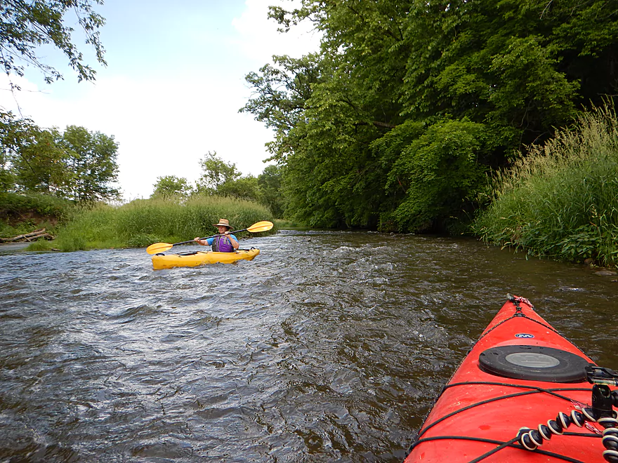
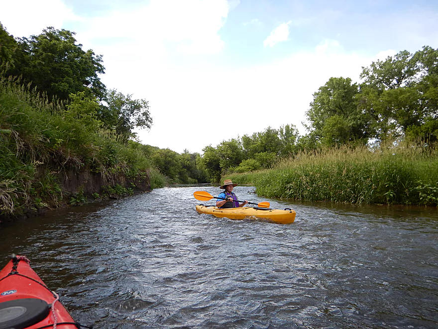
In some ways this was a very similar section and in some very different. The water was very turbid this go-around, which was unfortunate. If you wait to paddle until late summer, I’m sure the river would run much cleaner. Another difference was that we saw a lot of people on the river, which was a surprise (word must be getting out…). There were 3-4 groups of paddlers we came across in just a short five-mile stretch. Not to discourage you though, as this is still a pretty remote river.
The highlight of the trip was the many riffles. All of which are pretty safe even for beginners. There are a couple of instances where the current could push you into strainers, but this should be manageable for alert paddlers.
The second best part of the trip are the occasional limestone rock outcroppings. Is this like the Little Platte? No…not even close. But still pleasant, with the nicest section being just prior to Red Dog Road bridge. The rock outcroppings are not always easy to see as the banks are so overgrown, but this gives the Platte River an exotic feel.
Despite being a rural farm paddle, this is a scenic river with very green, lush hills and plant life sprawled over the rocks. Add to this the occasional angular boulders in the water, many little rapids, and the rocky substrate and it feels like the closest you’ll get to a tropical safari paddle in Wisconsin.
A pleasant trip that I’m giving 4 stars, but it just wasn’t as nice as the previous upstream section. This felt less intimate, more open and more beat up by agriculture.
Platte Road is a decent access with good shoulder parking. Steep, weedy and muddy banks just under the bridge, but most people put in 100′ downstream of the bridge which is much better. You’ll see a faint trail leading from the bridge to this preferred access. Be considerate of the local farmer and do not cut across his soybean field.
Very good bridge access off Big Platte Road (right by Blakely Creek) with plenty of parking. Limestone steps and a simple ramp made of old carpet have been set up for kayakers.
I’m not aware of any local liveries. The bike shuttle is 3.6 miles with moderate hills (climbing 135′ and dropping 187′). While not ideal, this is by far flatter than the bike shuttle on the previous upstream segment.
None, and this is a good introductory paddle for class 1 whitewater. Note, there used to be a low fence on this stretch, but it has been removed. Always be mindful of hoofed animals in the river though.
This was a good depth for the rapids as most were runnable without getting stuck. The Platte River is actually remarkably stable relative to other Wisconsin Rivers, and is not a bad option when other water trails are flooded or too shallow. It still can get too high or low though. My rough guestimate would be that you wouldn’t want to run this over 5′ on the Rockville gauge, nor below 4.2′.
The current was somewhat on and off in character, but generally pretty zippy at 8.4′ per miles
A pretty lively river… 5-6 blue herons, 2-3 muskrats (including one that swam under my kayak), an otter, kingfishers, a number of fish (probably panfish), many dragonflies, and many frogs including the distinct northern cricket frog.
The plant life was attractive but mostly “disturbed soil” species (nettles, wild parsnip, jewelweed, angelica and reed canary grass). The woods were mostly boxelder with some ash, oak and walnut.
Nature highlight #1 of the trip was seeing an eagle fishing (or at least trying to).
Nature highlight #2 of the trip was the cliff swallows. One bridge had about 120 nests in a row. They must have had young in the nests as they were hopping mad when we came close. It was quite the sight to see that many angry cliff swallows swarming around our kayaks.
Detailed Overview
- Upstream of Rock Church Road: The river here is likely too small and degraded by pasture to be enjoyable for paddling. I don't know for sure though.
- Rock Church Road to Hopewell Road: (3.0 miles) Very small...likely needs high water. Maybe 4-6 logjams. Likely mostly a pasture paddle, but a few really nice outcrops and maybe an intriguing gorge.
- Hopewell Road to Annaton Road: (4.2 miles) Small creek. Mostly open with a mixture of wetlands and pasture. Maybe 1-2 outcrops and 4-6 logjams. Maybe some fences.
- Annaton Road to Hwy E: (0.9 miles) Maybe 1 jam. Mostly an open paddle.
- Hwy E to Sleepy Hollow Road Bridge 1: (1.8 miles) River grows from creek to small river with addition of two major tributaries. Might be a few down trees.
- Sleepy Hollow Road Bridge 1 to Sleepy Hollow Road Bridge 2: (1.6 miles) A good prospect that is mostly open. Probably a few limestone outcrops. The second Sleep Hollow Road bridge is not a viable access because of a fence.
- Sleepy Hollow Road Bridge 2 to Coon Hollow Road: (1.8 miles) A good prospect a few nice limestone outcrops.
- Coon Hollow Road to Hwy A: (3.9 miles) A good leg with many scenic outcrops (including one massive one) and multiple fun rapids. Unfortunately this stretch can only be run at high water levels and suffers from serious shoreline degradation. Hwy A is a horrible access.
- Hwy A to Airport Road: (6.4 miles) An excellent leg with great limestone outcrops.
- Hwy A to Kingsford Road: (3.3 miles) A good leg with 6 mediocre outcrops and one really nice one.
- Kingsford Road to Airport Road: (3.2 miles) An excellent leg with multiple outcrops and perhaps the best outcrop on the entire Platte River.
- Airport Road to Platte Road: (5.0 miles) An excellent leg with fun riffly current.
- Platte Road to Big Platte Road Bridge #1: (5.1 miles) An ok leg with fun riffles, limestone outcrops and nice valley vistas.
- Big Platte Road Bridge #1 to Big Platte Road Bridge #2: (3.2 miles) An ok prospect.
- Big Platte Road Bridge #2 to Hwy O: (1.3 miles) An ok prospect.
- Hwy O to Indian Creek Road: (7.6 miles) A mediocre prospect.
- Indian Creek Road to Mouth at Mississippi: (1.6 miles) A mediocre prospect.
- Mississippi Options: Tricky. The Grant River Recreational Area is 3.4 miles upstream of the mouth (that can be tough sledding especially in high water). Downstream you could take out at Eagle Point Lane (very scenic), but that is 5.5 miles on a big Mississippi.
-
Replica air king watches offer an affordable alternative to the iconic luxury timepiece. With meticulous craftsmanship and attention to detail, these replicas mimic the original’s design and functionality, providing a stylish option for watch enthusiasts who appreciate the timeless aesthetic without the hefty price tag.
Trip Map
Overview Map
Video
Photos Size:
Paddled from Platte Rd. to a bend on Big Platte Rd. near Blakely Branch just off Quarry Rd. on July 1, 2018. Next time we’ll likely go all the way to the Big Platte Rd. bridge, despite the muddy takeout. Nice stone steps and a carpeted kayak ramp at this takeout, however. USGS gauge was at about 4.17 ft., and 200 CFS, so very little scraping.
Lots of wild parsnip by the roadside at the put-in, so we had to take care not to brush against it while carrying boats down.
No wire, barbed or otherwise remains. The front end of the old car has now washed into the river. Two heavy rains within the past two weeks caused the river to crest at 800 and 600 CFS, so lots of debris 2 ft. or more above the water.
Cattle in the river were cows and steers (no bulls), and we had plenty of room to drift past. Saw one bald eagle, great blue herons, turkey vultures, kingfishers. Great paddle.
I appreciate the update! The Platte really got beat up by floods earlier this year and it is good to hear that it is still navigable.
I did this section on 9/2/19, levels were great 140 cfs and 4.08 ft, the rapids/riffles were perfect, just a good current, never really pushy. A few shallow spots where we scared or bumped along the bottom, but never had to take the boat for a walk. There was one portage, right at the Quarry road access, due to two trees blocking the creek from shore to shore, There is a wide gravel bar there so it is a very easy portage. Also there are still two places where wire/cable cross the river, they are actually fairly dangerous as they are hard to see and only a foot or so above the water. They are not barbed wire or electric but, and are not hard to get under if you see them in time. Neither was marked, but I was able to put strips of duct tape on the first one. They are both in the last part of the trip, just after a nice rock outcropping on river right and the takeout on Big Platte. Wildlife on the trip was great, we saw a lama in the water (much more fun than a cow) a badger, a swimming chipmunk (ground squirrel?) and an 8 point velvet buck who just froze and let us drift past 15 ft away. along with numerous ducks, geese, herons, and cows
Lot of good information on the logjams, water levels and fences that will help other paddlers. Appreciated as always Eric.