
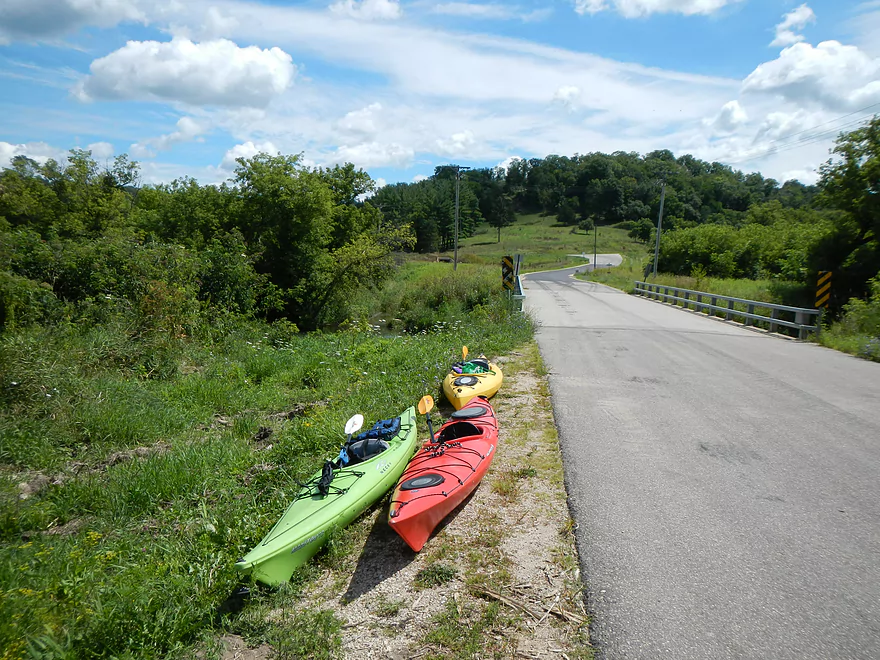
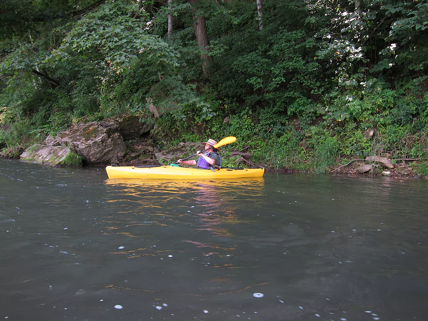
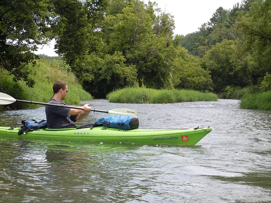
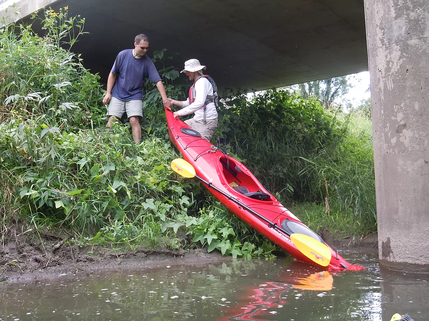
Put-in Area
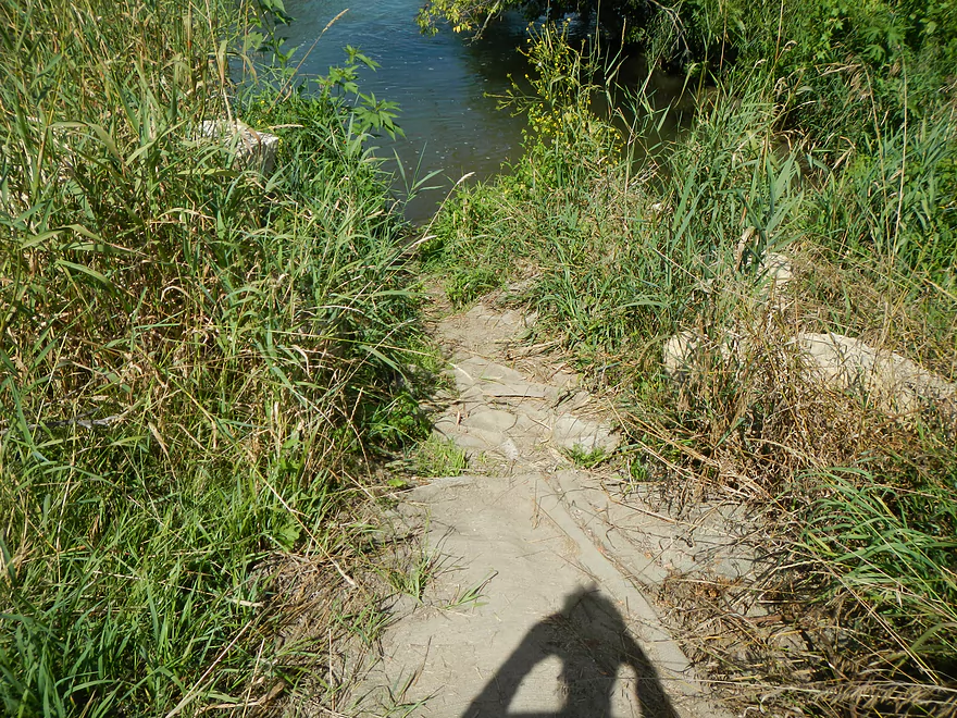
Steeper of the two landings
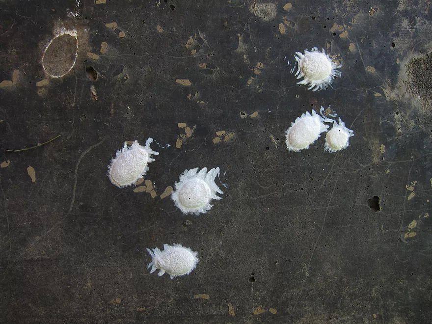
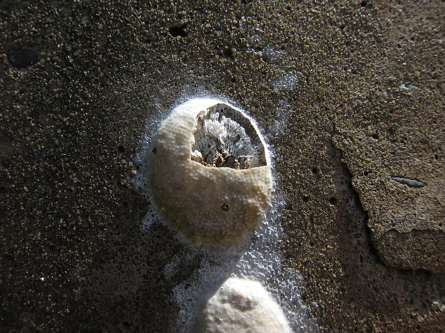
Science Fiction Creatures (dobsonfly eggs)
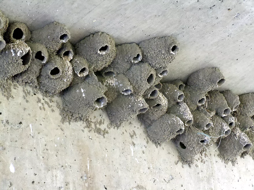
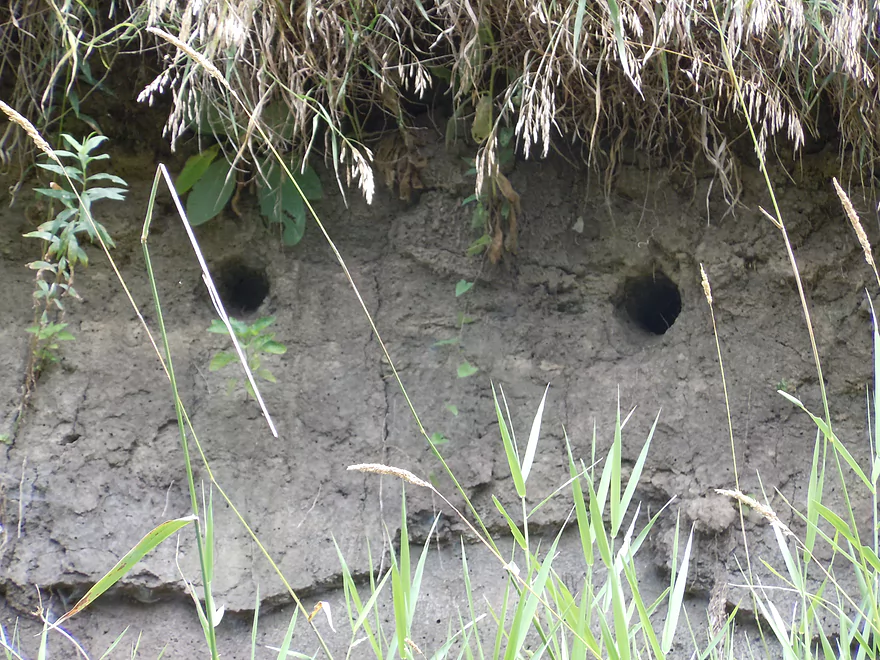
Upside down entryways!
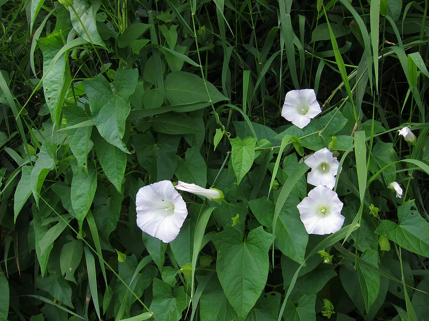
Bindweed
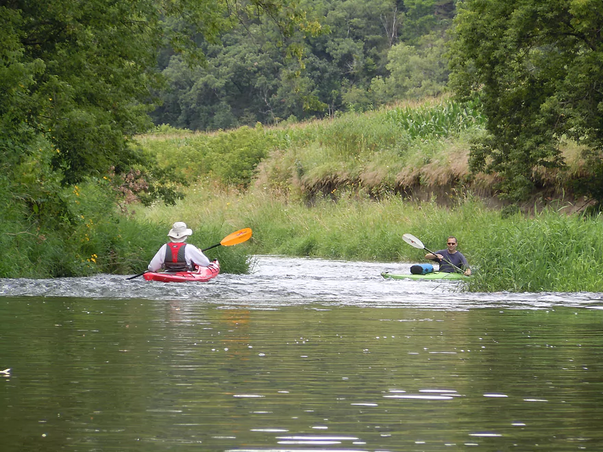
One of many riffles
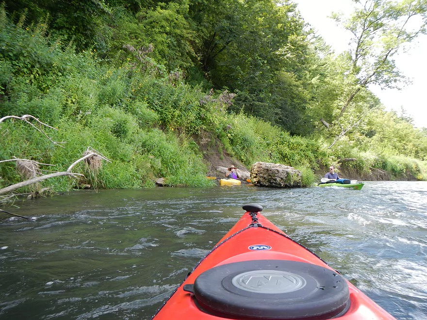
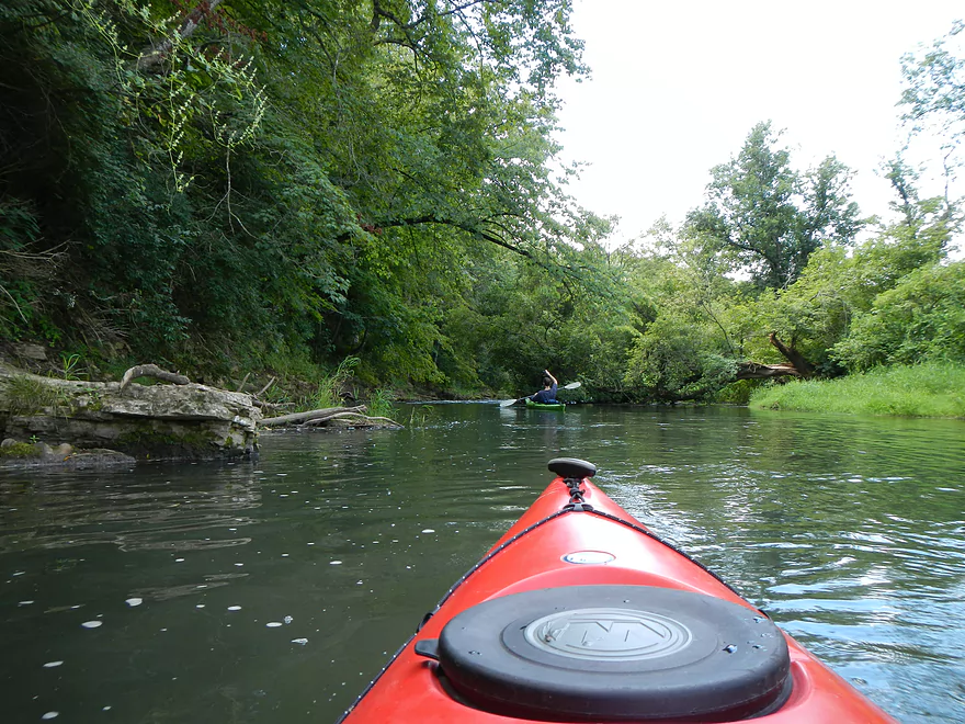
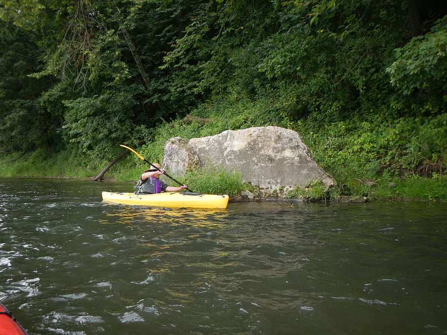
Occasional random boulders in the river
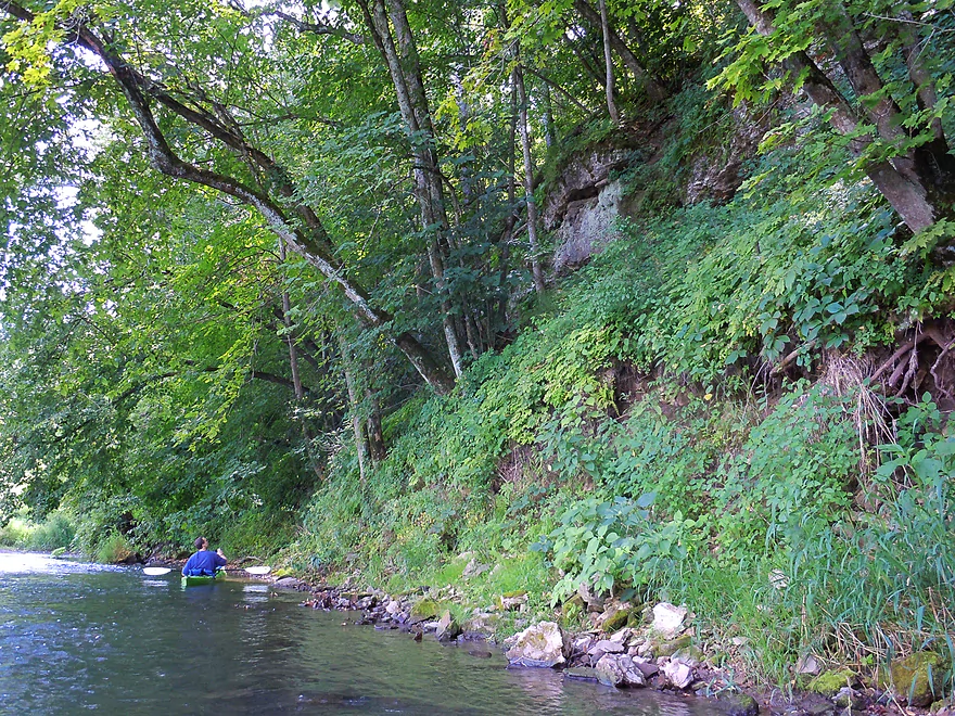
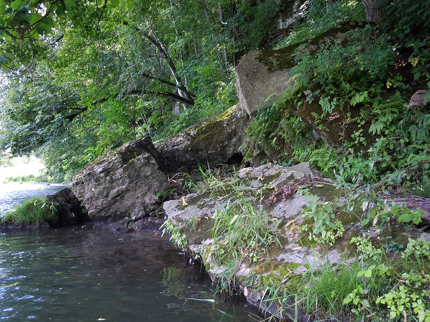
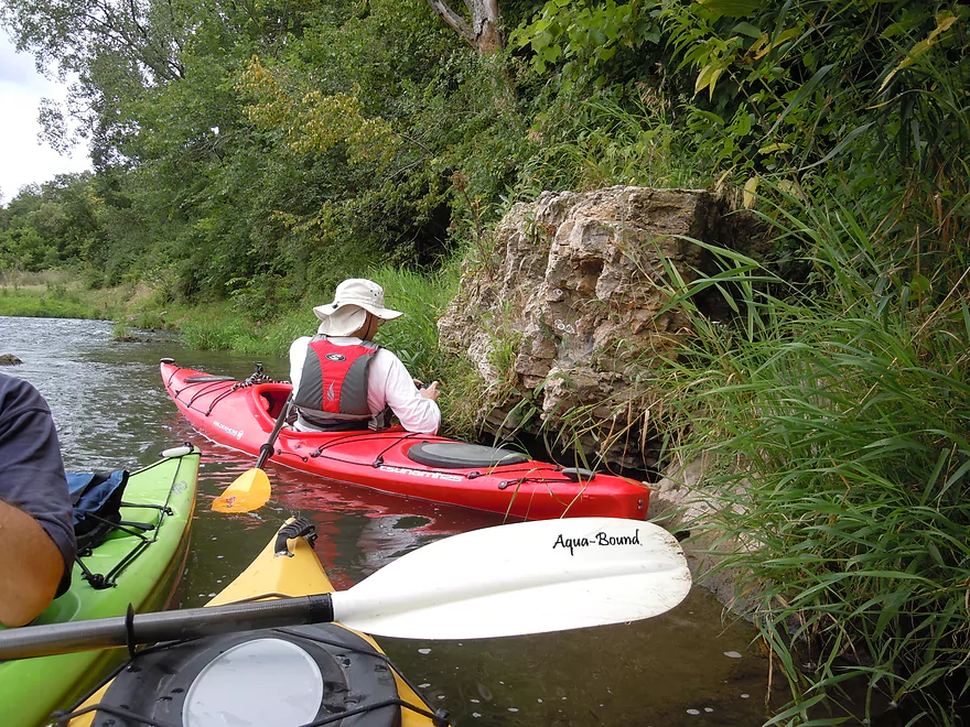
Somebody’s home
Wild Cucumber
Getting stuck
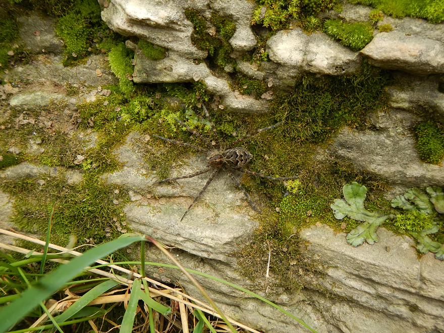
Large fishing spider
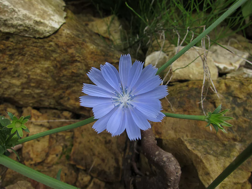
Chicory
Choose…rapids to the left or getting stuck to your right
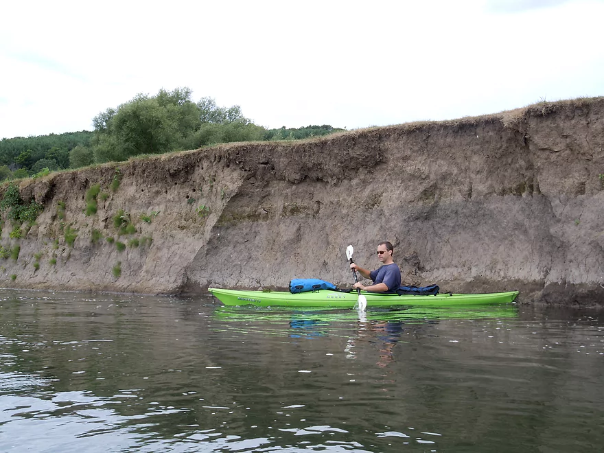
Evidence of bad land use, but still beautiful in its own way
Second barbed wire fence (electric!)
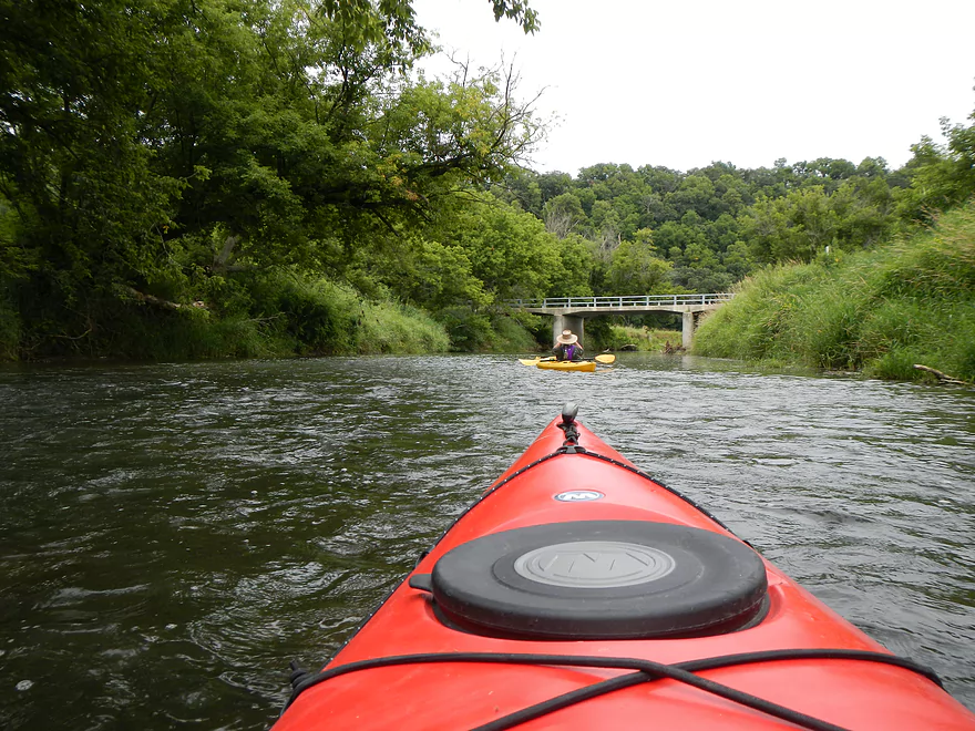
This is the first bridge we met…and our takeout
Not the greatest take out area…but ok
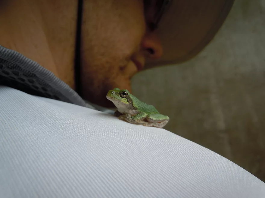
Friendly frog
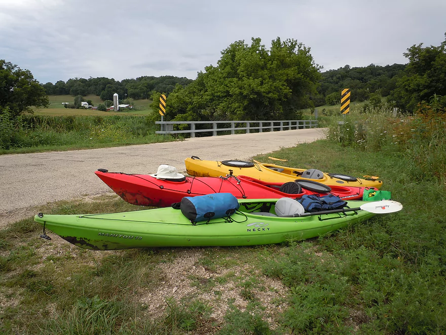
Adequate parking
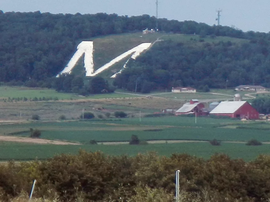
Iconic M Mound you’ll probably see driving home
Platte River – Ellenboro

Located in the SW corner of the state, the Platte is a very nice river often overlooked by paddlers. Unlike its more popular neighbor, the Grant, it has little in the way of rock outcroppings (although it has a few). It also suffers somewhat from poor agricultural use and barbed wires running across the river.
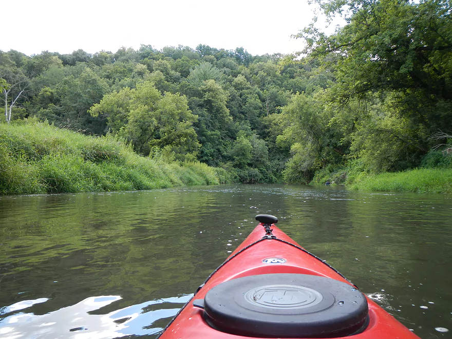
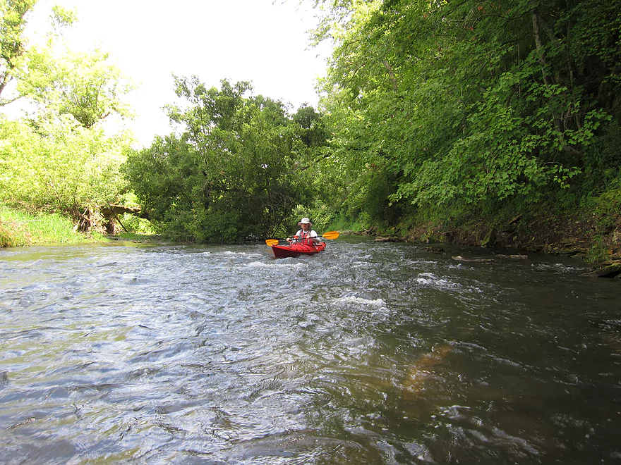
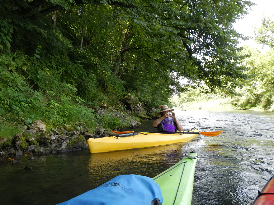
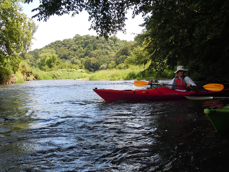
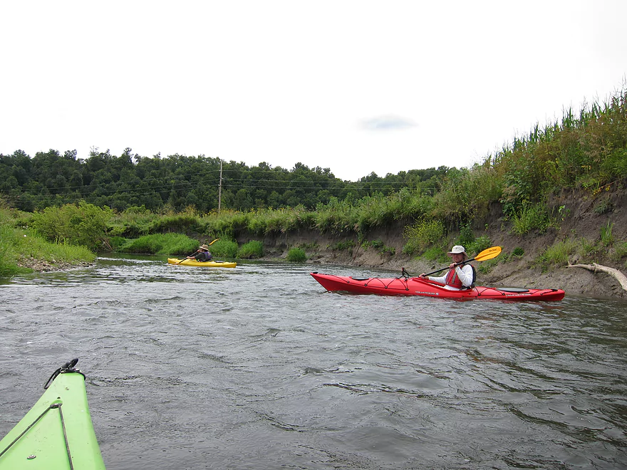
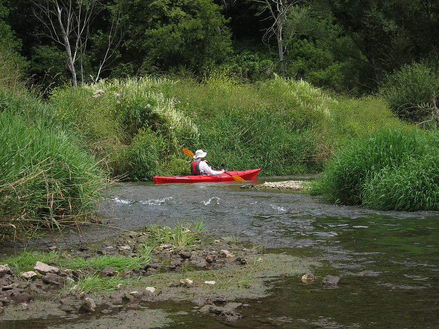
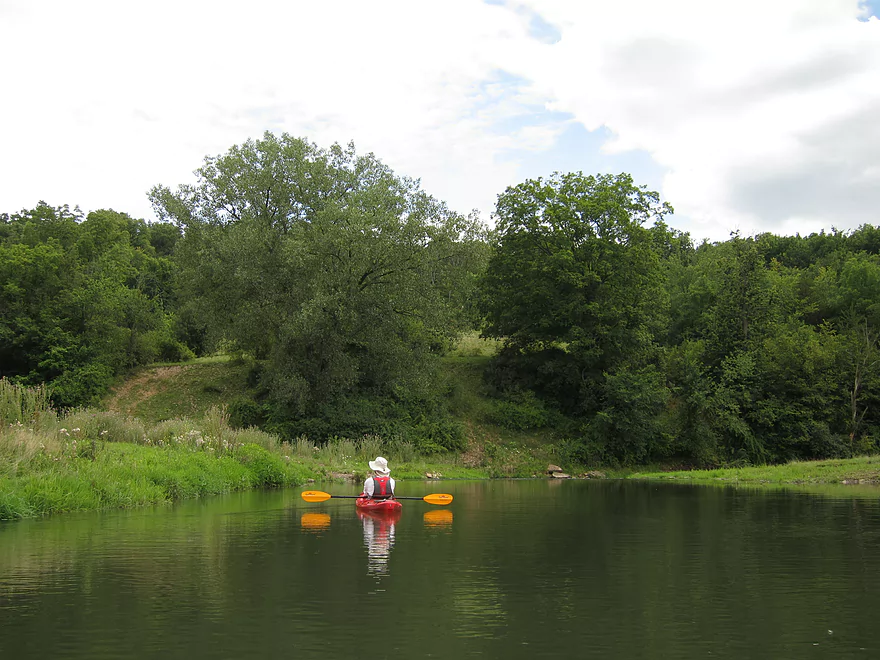
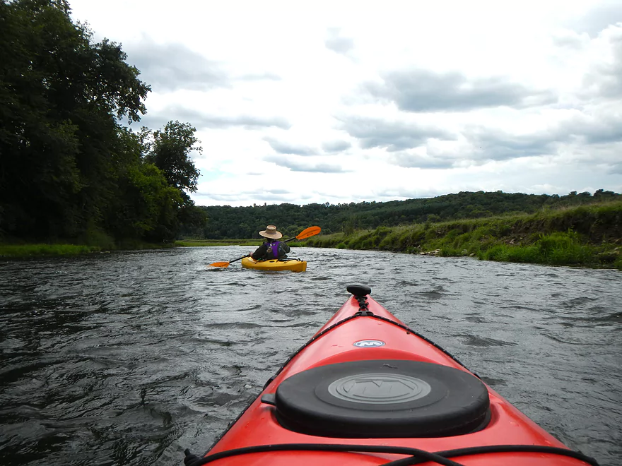
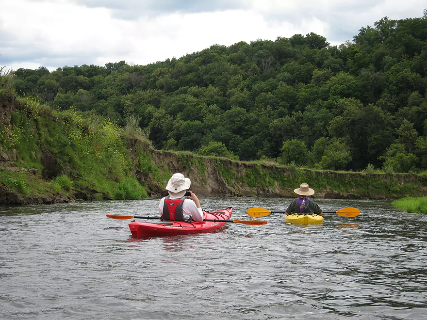
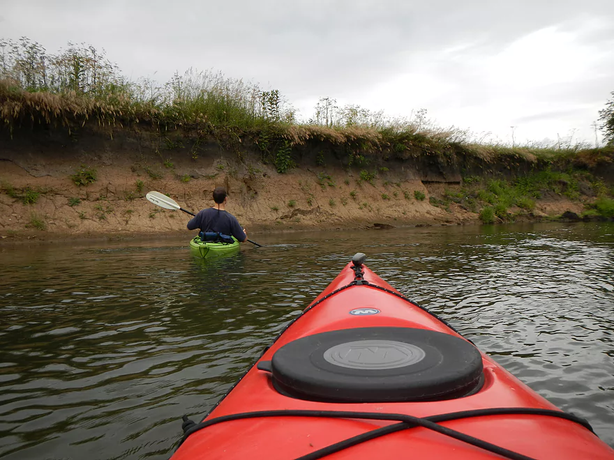
What makes it so appealing despite all this? The primary reason is the current. There are a large number of riffles/class 1 rapids that are fun and safe to navigate–well, at least at our depth of 3.63′ (the river might be more dangerous at higher levels). Never once while running these rapids did I feel they were dangerous and they would be perfect for a beginner looking to graduate from flat-water to minor rapids. Even if you fell out (doubtful) the water is relatively shallow (at our low depth) and not very pushy despite the current, so should be safe.
This trip was done during early August when rivers start to wind down their girth, yet IMO was never too shallow to run (again at 3.63′). While we did have our share of bumps and occasional “wheel-chairing,” it was mostly minor and I think the river would be runnable at lower depths. In fact, I would be more worried about running the river at too high of a depth because of the barbed wire fences.
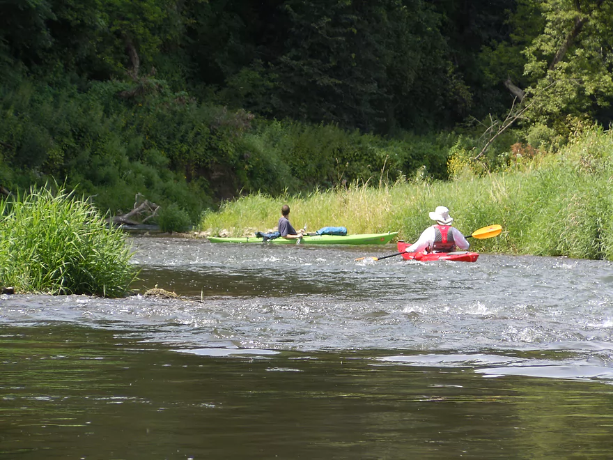
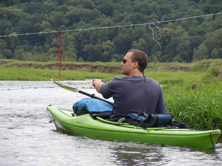
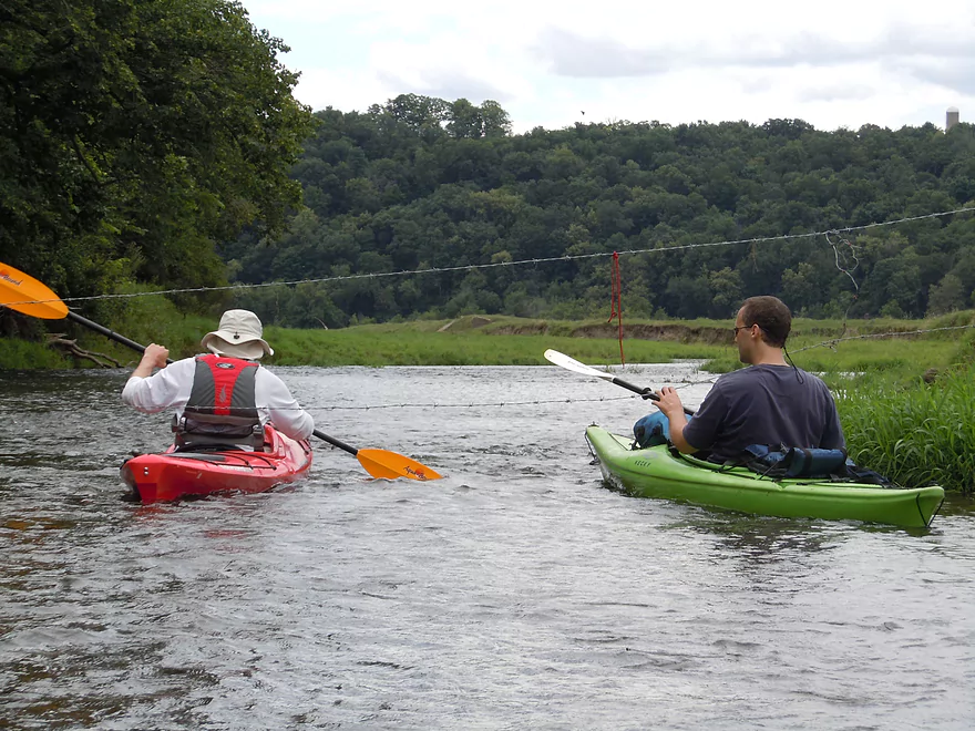
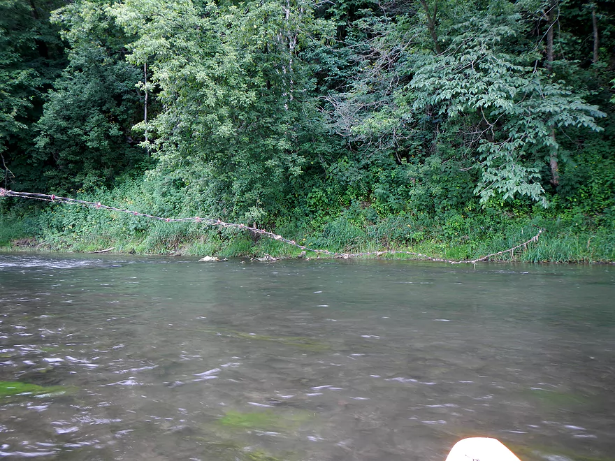
In this segment (there are more of these nasties downstream), there are two instances where you will have to duck under barbed wire fences running across the river. As soon as you can see two distant silos on a hillside, you’ll be close to the first fence. Stay right, as the fence sags in the middle (as detailed by pictures/video), so try to paddle to the edge. What is tricky here is that the water is riffling at a decent speed. Also, the edges are where it is most shallow and you can get hung up. With some “wheel-chairing” and careful maneuvering, the situation is not overly difficult to circumvent, but you do want to be careful.
The second fence is a tad further downstream…but more problematic because it is electric. In the video you’ll see my brother passing underneath it while using one arm to raise the fence above him. He actually received a minor shock from this. Paddle to the edge to avoid the sag and you can sneak under–again through rapids/shallow water (ugh). All this is doable, however, and should not deter you from doing this trip, but it is noteworthy. High water could be an issue with these fences and IMO I would prefer to run the Platte at lower levels just because of the fences. The map accurately shows these fences and displays exact coordinates if you’re curious.
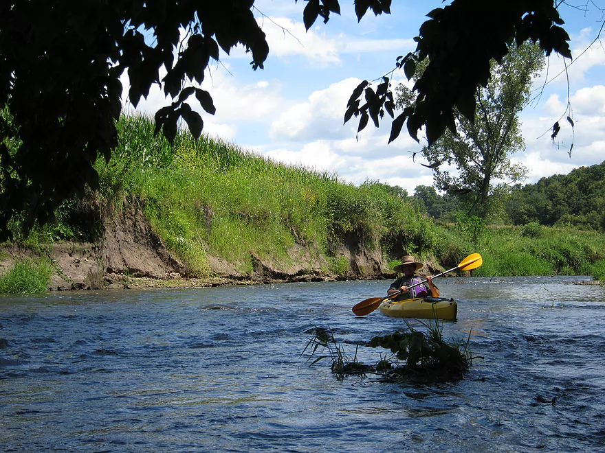
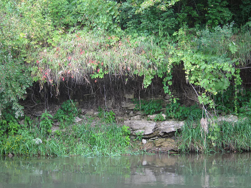
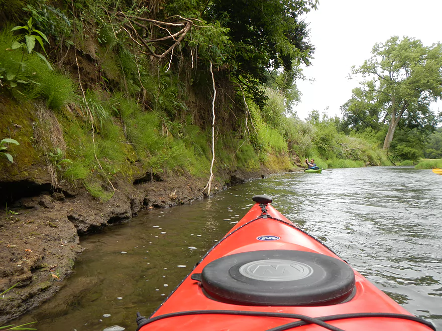
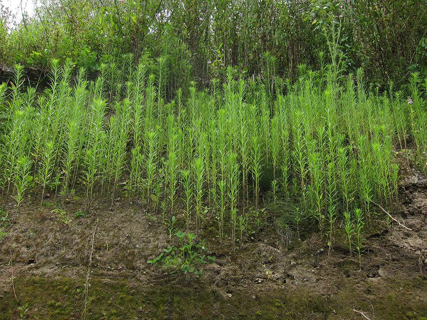
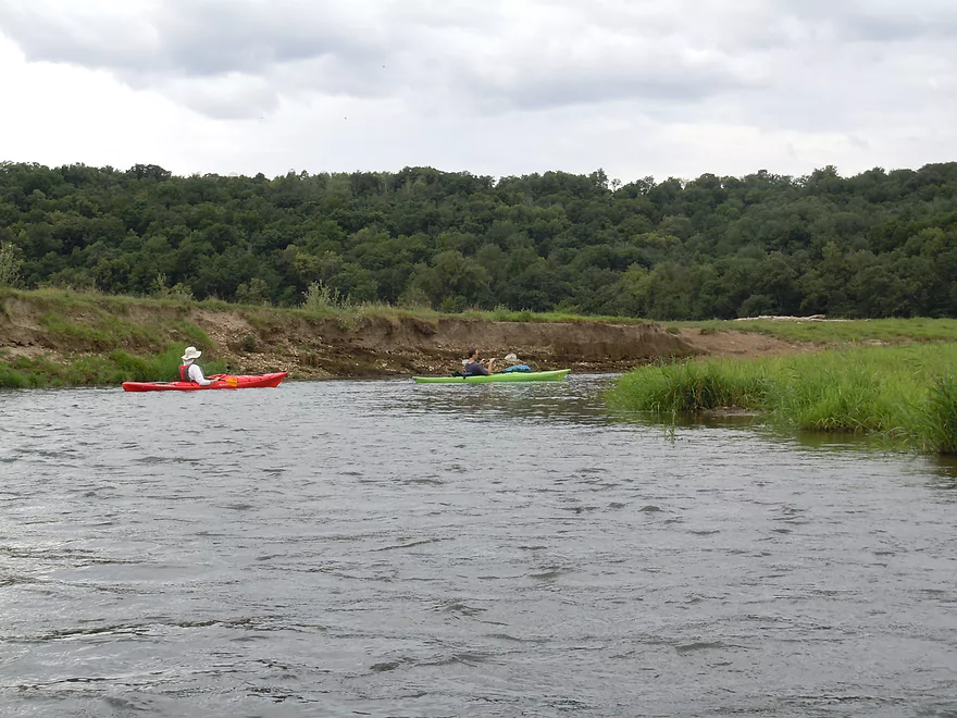
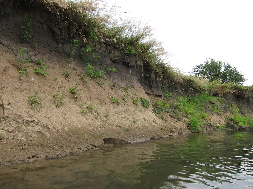
Where there are fences, there are cattle. While we only saw a couple of them, we did hear their incessant mooing (sounded very ornery!). The cows do a number to the river in places unfortunately. The entire area between the electric fences (see map) is beat-up cow country. Despite this, the river retains its charm. While a little “milky” in parts, in other parts it is quite clear, which is impressive for a southern Wisconsin River. Years of farming have deposited massive sediment banks along the river. These are actually impressive in their own right and are somewhat clean for dirt banks and have interesting things growing on them.
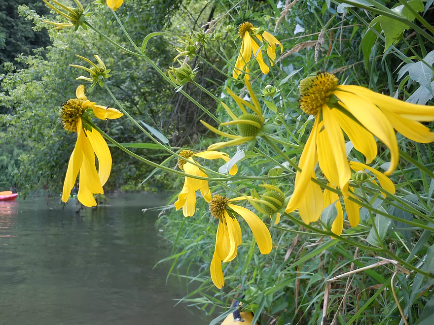
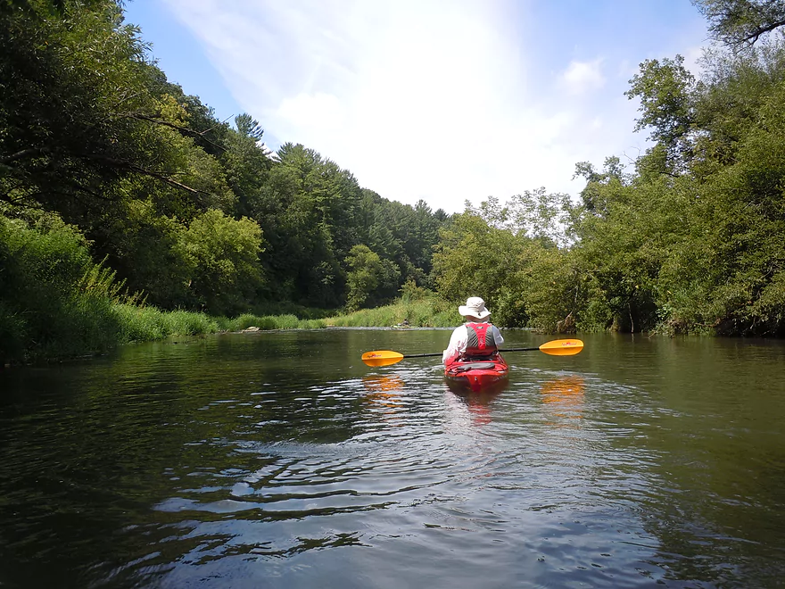
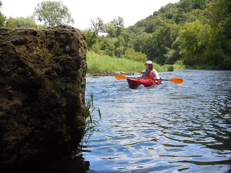
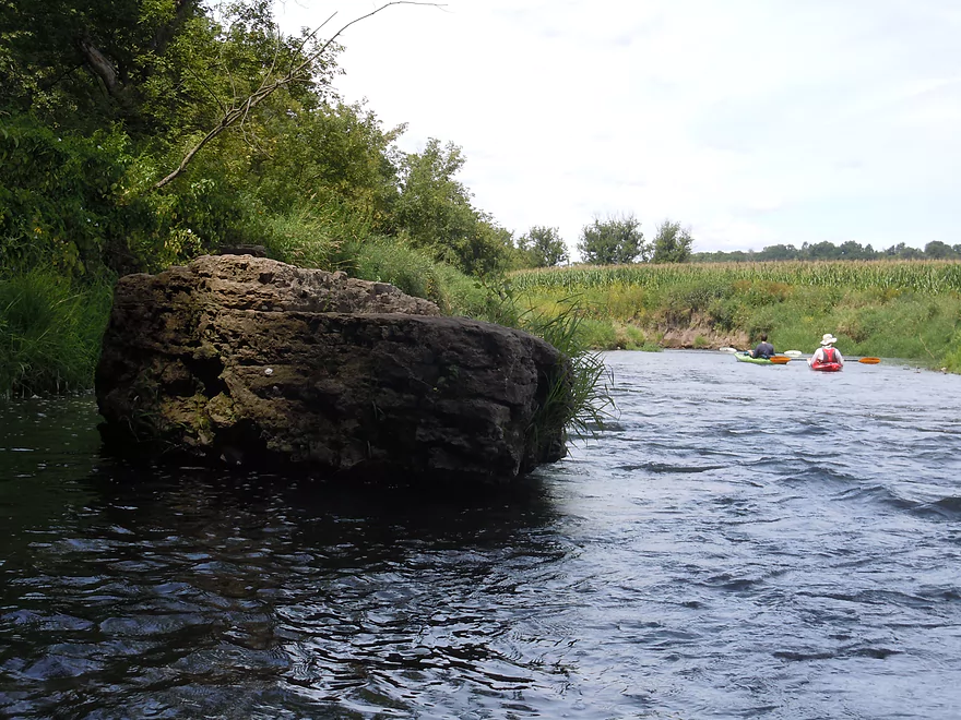
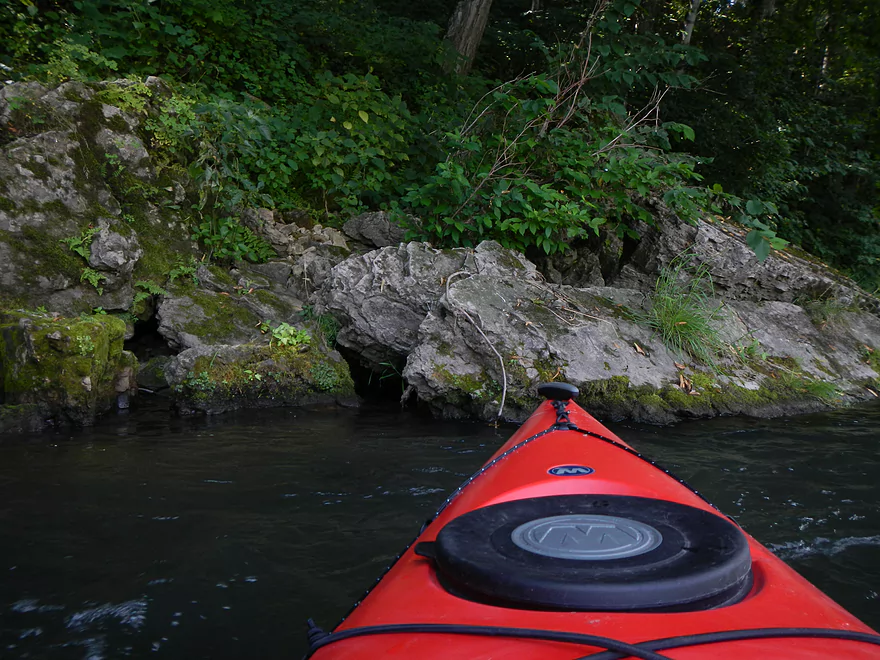
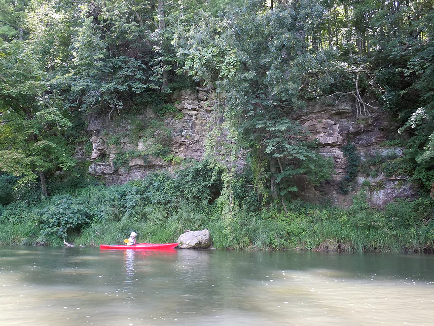
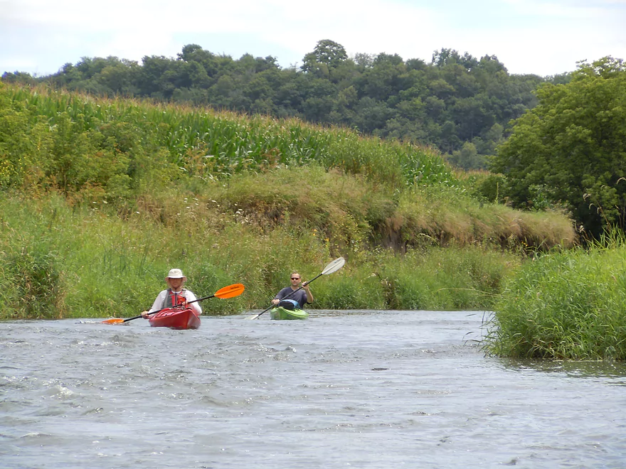
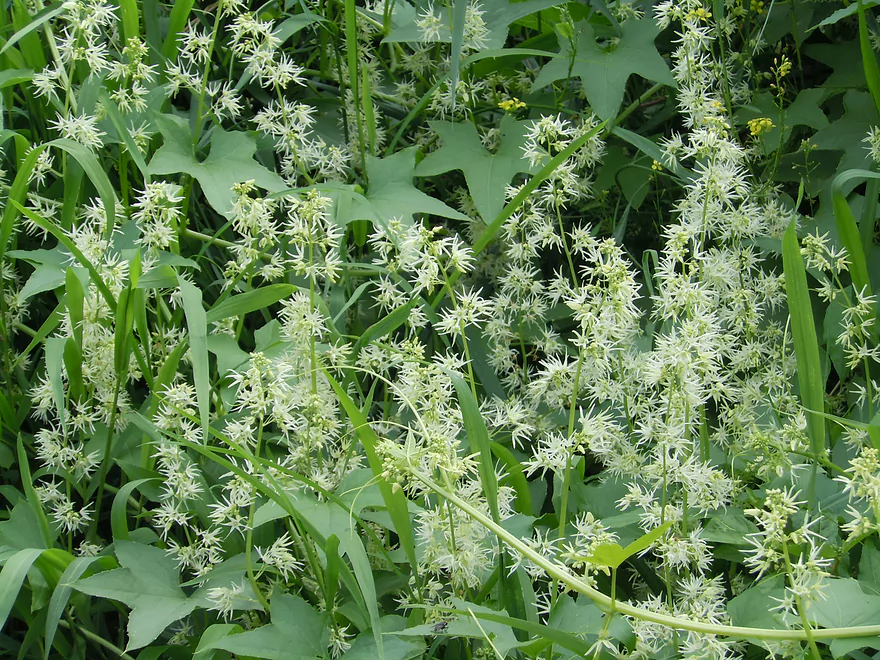
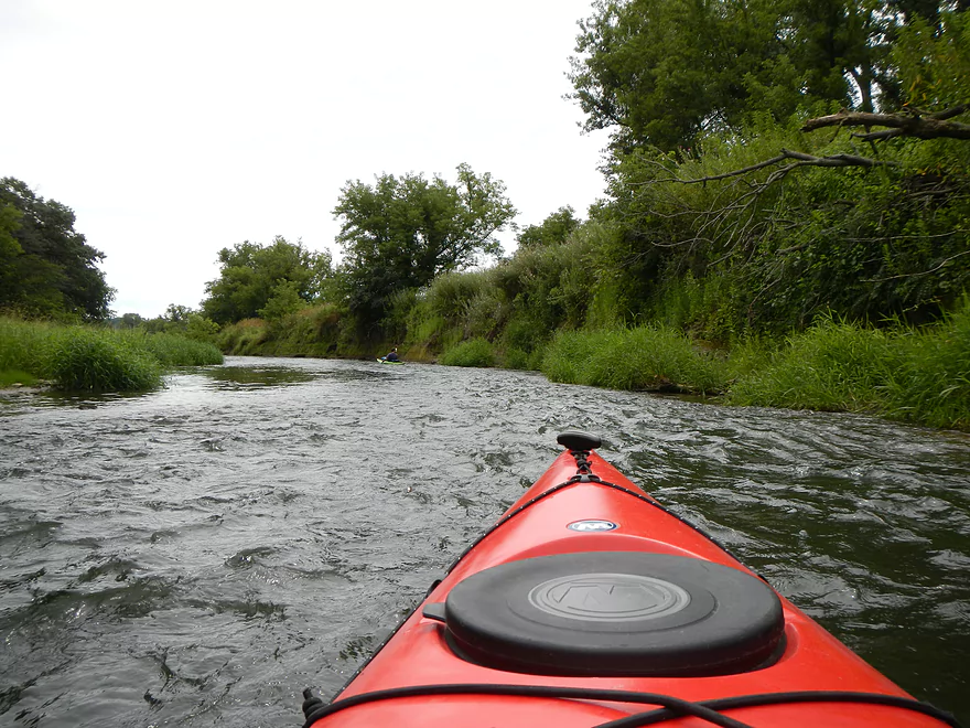
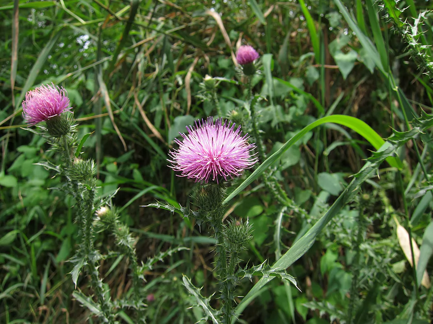
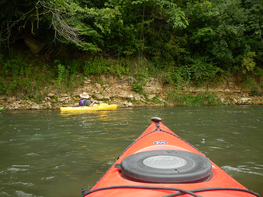
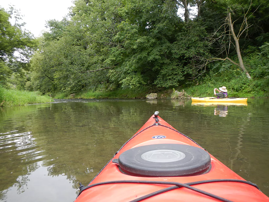
Besides all the riffles, the other benefit of doing this segment of the Platte is the scenery. While not a river known for its rock outcroppings, this section does have a few minor bluffs that are scenic. You’ll see random boulders in the water, gravel bars, distant hills, and wonderful plant life growing on the shore (see pictures). A lot of flowers were in bloom when we went and it was fun to see the different ways the local plants adapted and took advantage of the artificial mud banks. The very best section of the river is the first mile or so–wonderful riffles and rocky shoreline with many twists to the river…while not being too pushy.
Another thing nice about this river is no log jams, or even squeakers. There are two instances I remember where trees fell in, but they were easy to paddle around.
The landings are so-so. The first is at a bridge with okay parking and two options for put-ins. One is steep, direct, and well worn. The other follows a minor trail to the river where there is a flat area that is easy to use. The take-out (at Platte Road) is much tougher. I went downstream of the bridge, double backed, and rammed my kayak onto the mud…then scooted over the kayak and onto shore. Not ideal and has high grass…but there is a beaten area from other paddlers so this isn’t too bad. Parking is very nice here.
While the Grant is serviced by liveries, the Platte (that I know of) is not. It’s not a bad drive from south central Wisconsin if you have to bring two cars though. The river bends in this segment which also makes this trip well suited for a bike shuttle (minus the big hill).
This wasn’t a super rich area for wildlife, but it did have some nice surprises. Saw a green heron, blue heron, woodchuck, fishing spider (large!), bank beaver holes, bird nests in the mud banks, and wonderful cliff swallow nests under both bridges. If you paddle a lot of rivers, you’re probably quite used to seeing cliff swallow nests under most bridges, but these were unique because of their shape. In fact, the entranceway for many of these nests appeared “upside down”! Also, under the first bridge were white dobsonfly egg cases, which had a cool science fiction look to them. They are apparently an indicator of good quality, well-oxygenated water (we did not see these in the “cow” portion of the river).
Detailed Overview
- Upstream of Rock Church Road: The river here is likely too small and degraded by pasture to be enjoyable for paddling. I don't know for sure though.
- Rock Church Road to Hopewell Road: (3.0 miles) Very small...likely needs high water. Maybe 4-6 logjams. Likely mostly a pasture paddle, but a few really nice outcrops and maybe an intriguing gorge.
- Hopewell Road to Annaton Road: (4.2 miles) Small creek. Mostly open with a mixture of wetlands and pasture. Maybe 1-2 outcrops and 4-6 logjams. Maybe some fences.
- Annaton Road to Hwy E: (0.9 miles) Maybe 1 jam. Mostly an open paddle.
- Hwy E to Sleepy Hollow Road Bridge 1: (1.8 miles) River grows from creek to small river with addition of two major tributaries. Might be a few down trees.
- Sleepy Hollow Road Bridge 1 to Sleepy Hollow Road Bridge 2: (1.6 miles) A good prospect that is mostly open. Probably a few limestone outcrops. The second Sleep Hollow Road bridge is not a viable access because of a fence.
- Sleepy Hollow Road Bridge 2 to Coon Hollow Road: (1.8 miles) A good prospect a few nice limestone outcrops.
- Coon Hollow Road to Hwy A: (3.9 miles) A good leg with many scenic outcrops (including one massive one) and multiple fun rapids. Unfortunately this stretch can only be run at high water levels and suffers from serious shoreline degradation. Hwy A is a horrible access.
- Hwy A to Airport Road: (6.4 miles) An excellent leg with great limestone outcrops.
- Hwy A to Kingsford Road: (3.3 miles) A good leg with 6 mediocre outcrops and one really nice one.
- Kingsford Road to Airport Road: (3.2 miles) An excellent leg with multiple outcrops and perhaps the best outcrop on the entire Platte River.
- Airport Road to Platte Road: (5.0 miles) An excellent leg with fun riffly current.
- Platte Road to Big Platte Road Bridge #1: (5.1 miles) An ok leg with fun riffles, limestone outcrops and nice valley vistas.
- Big Platte Road Bridge #1 to Big Platte Road Bridge #2: (3.2 miles) An ok prospect.
- Big Platte Road Bridge #2 to Hwy O: (1.3 miles) An ok prospect.
- Hwy O to Indian Creek Road: (7.6 miles) A mediocre prospect.
- Indian Creek Road to Mouth at Mississippi: (1.6 miles) A mediocre prospect.
- Mississippi Options: Tricky. The Grant River Recreational Area is 3.4 miles upstream of the mouth (that can be tough sledding especially in high water). Downstream you could take out at Eagle Point Lane (very scenic), but that is 5.5 miles on a big Mississippi.
-
Replica air king watches offer an affordable alternative to the iconic luxury timepiece. With meticulous craftsmanship and attention to detail, these replicas mimic the original’s design and functionality, providing a stylish option for watch enthusiasts who appreciate the timeless aesthetic without the hefty price tag.
Trip Map
View Platte River 1 in a larger map
Overview Map
Video
Photos Size: