
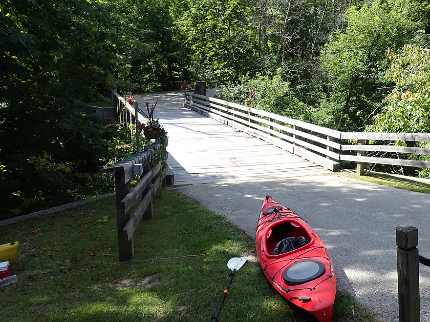
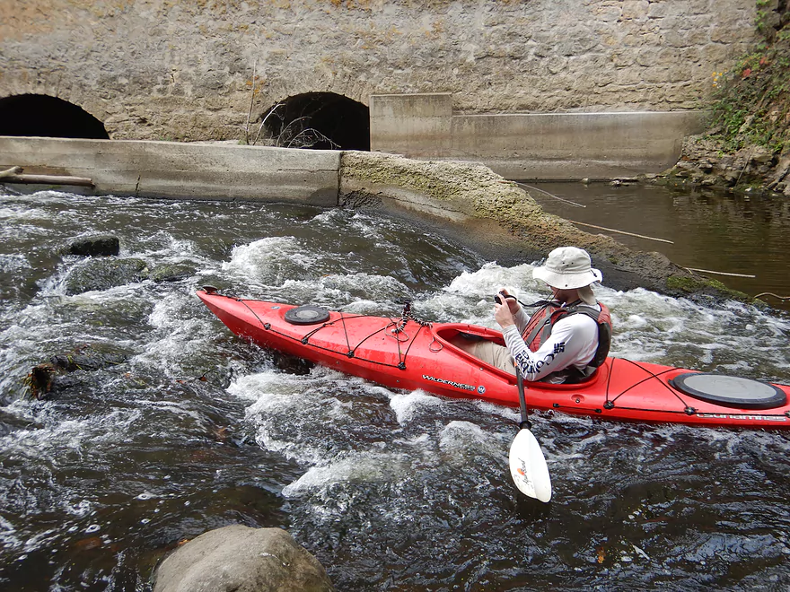
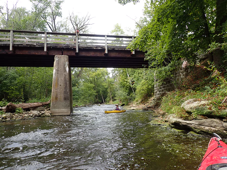
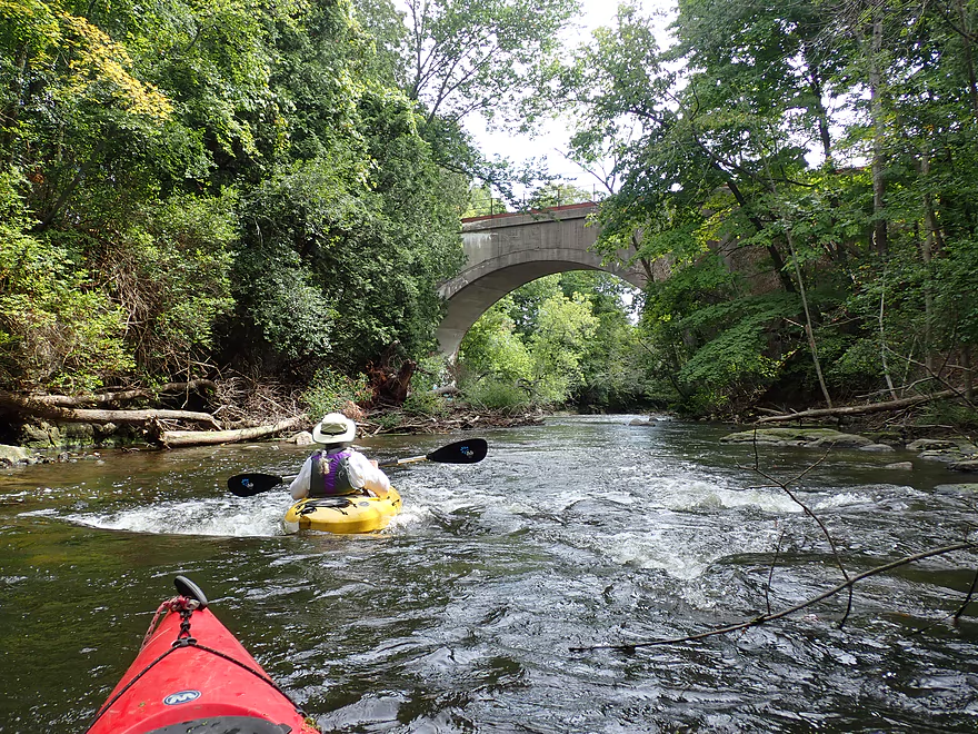
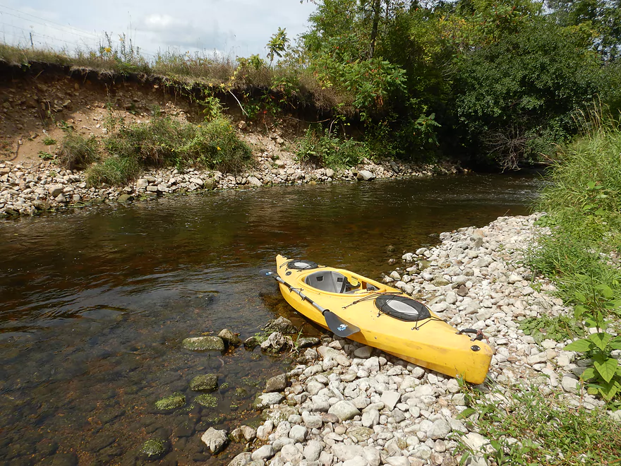
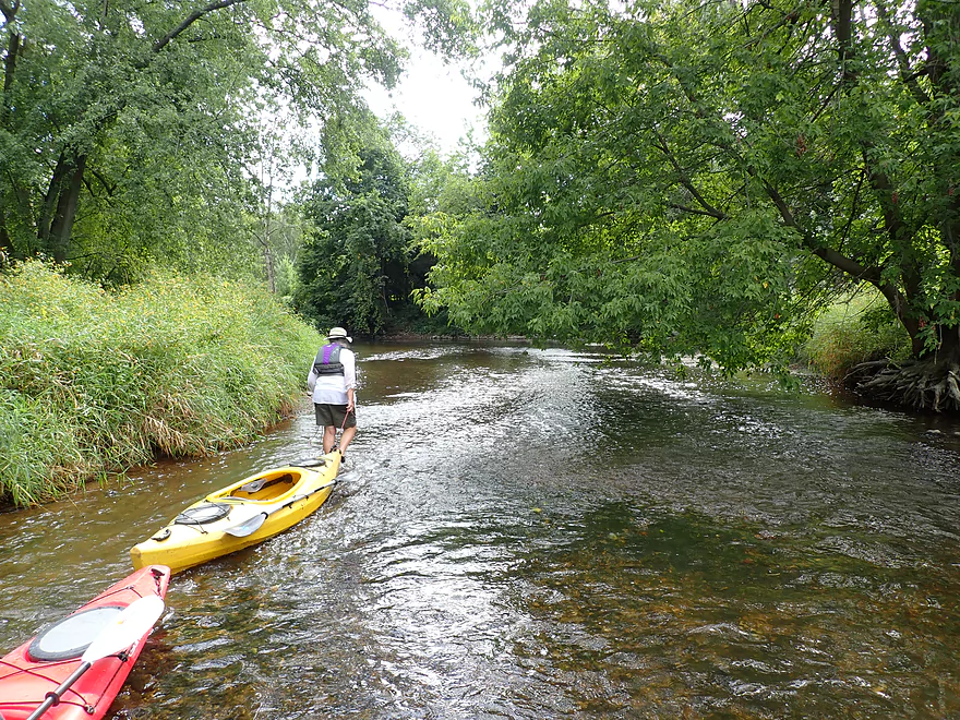
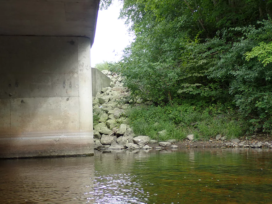
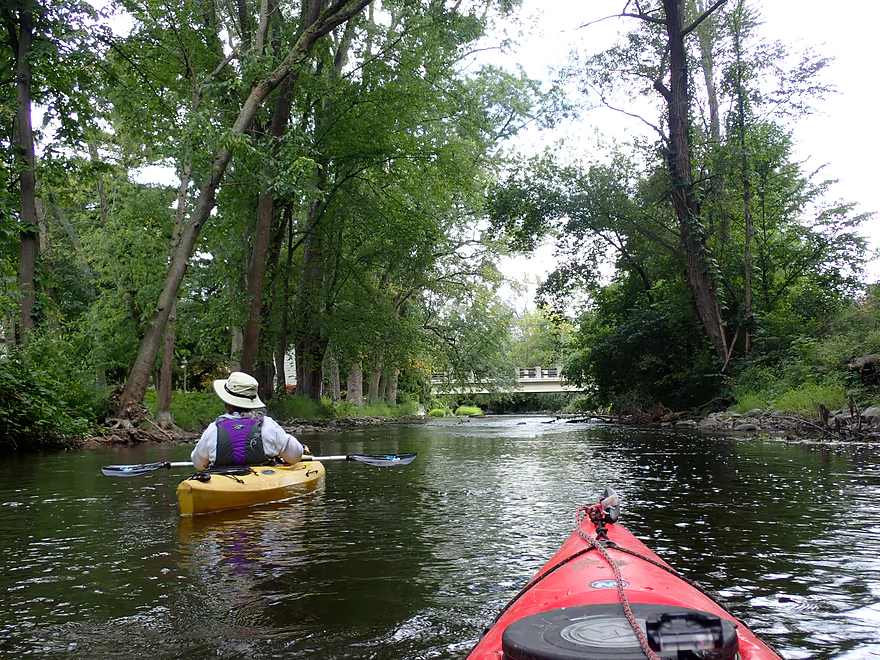
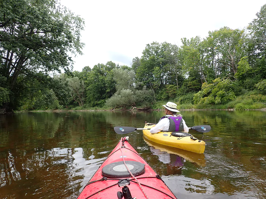
Starting the trip by the Estate Bridge
Really cool
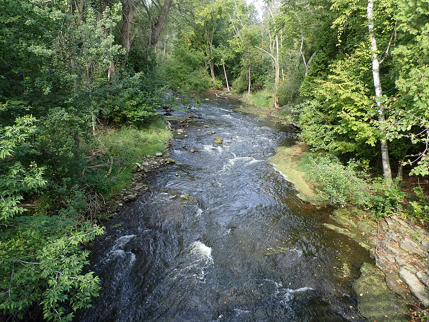
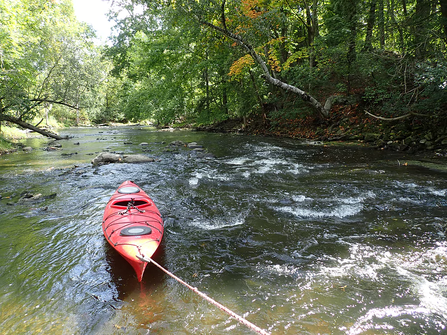
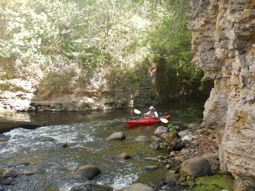
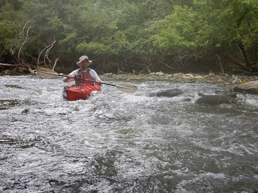
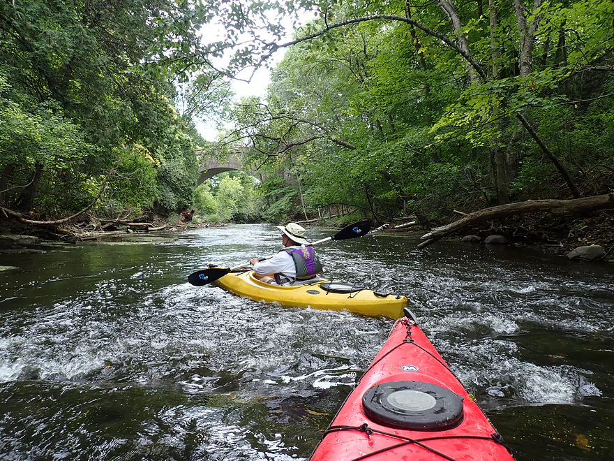
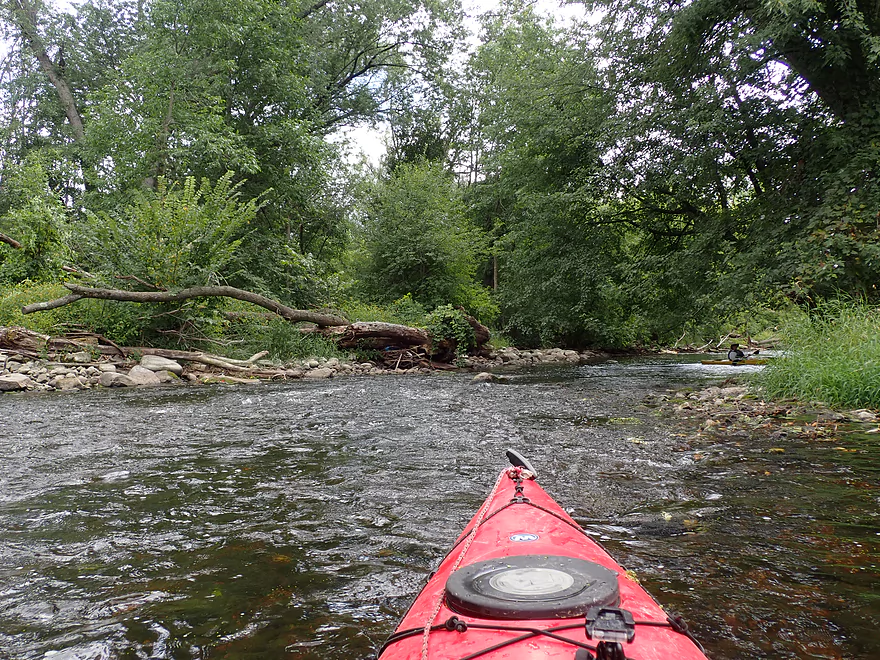
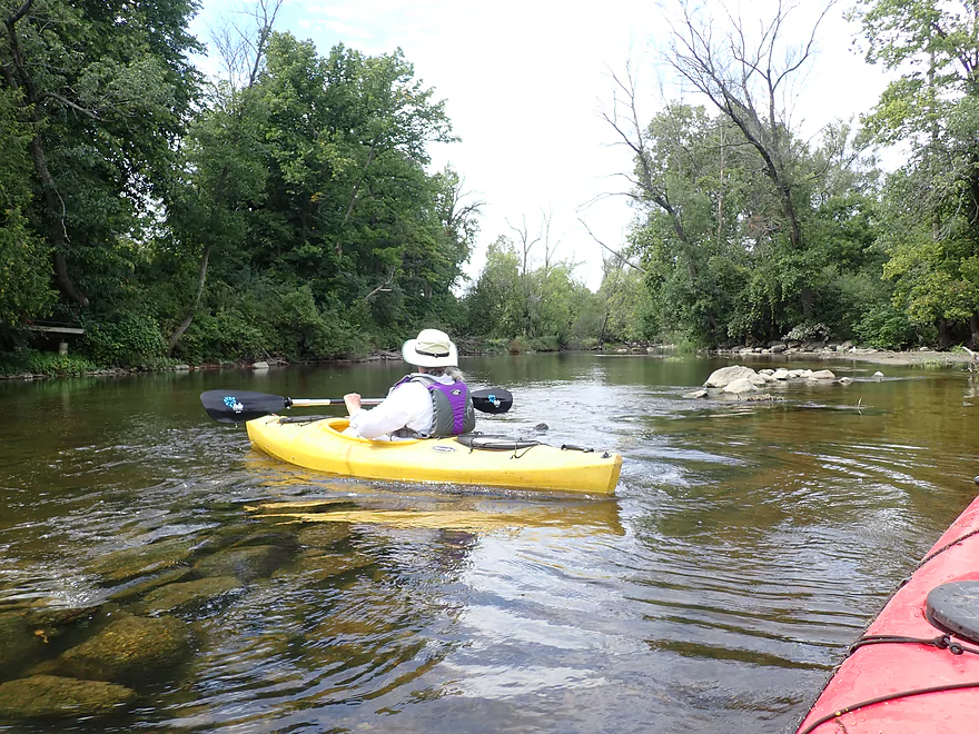
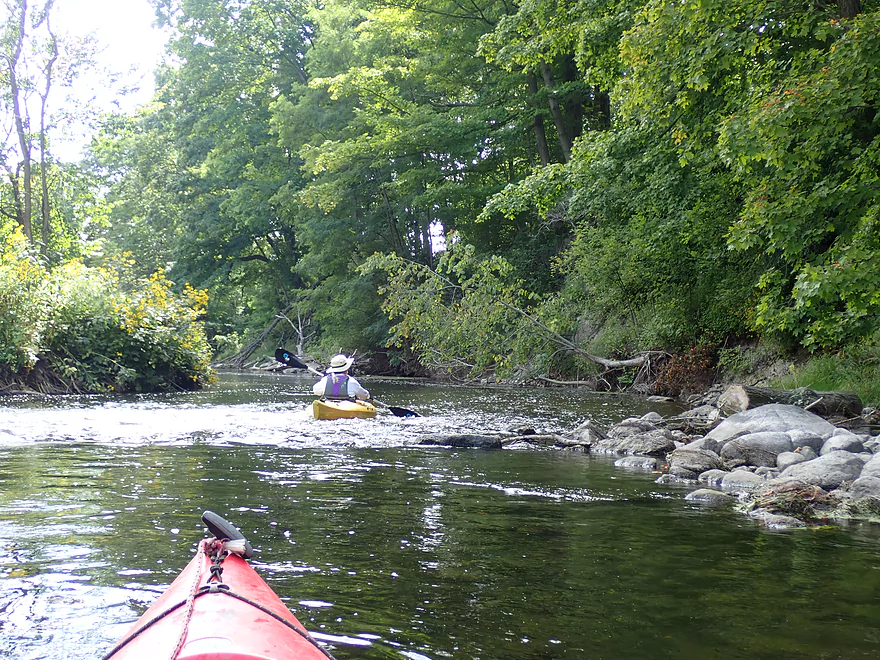
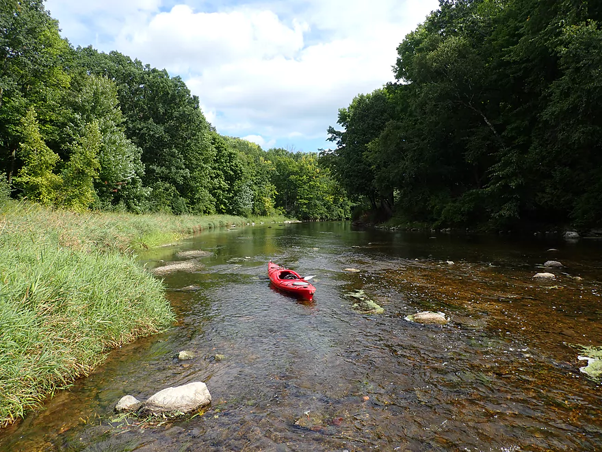
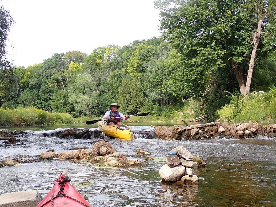
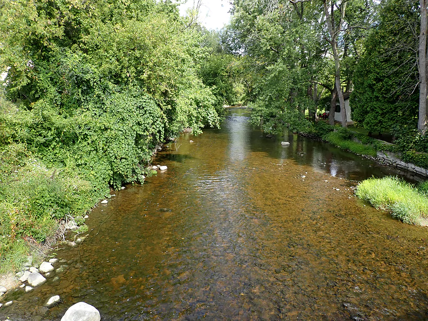
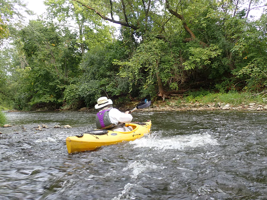
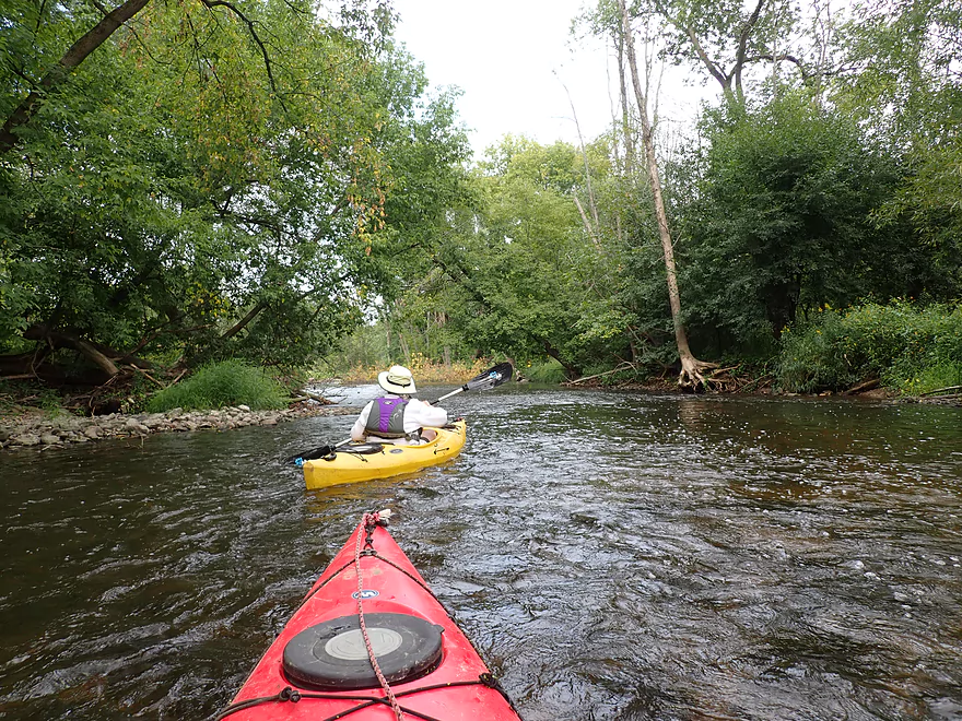
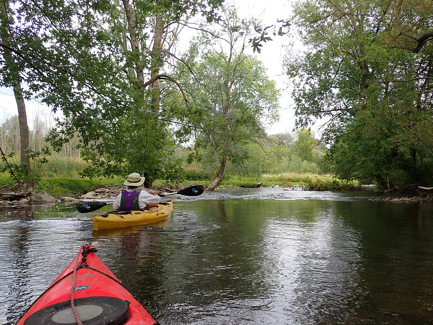
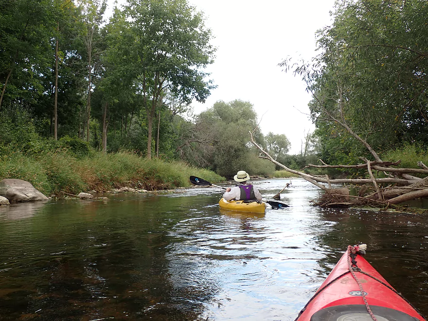
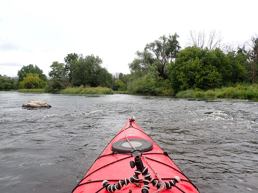
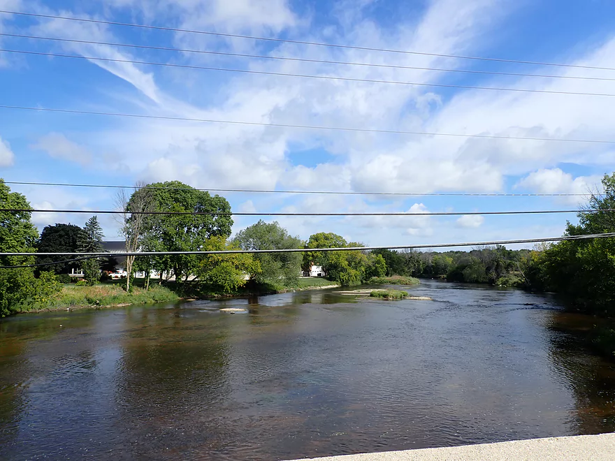
View upstream
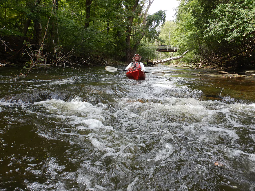
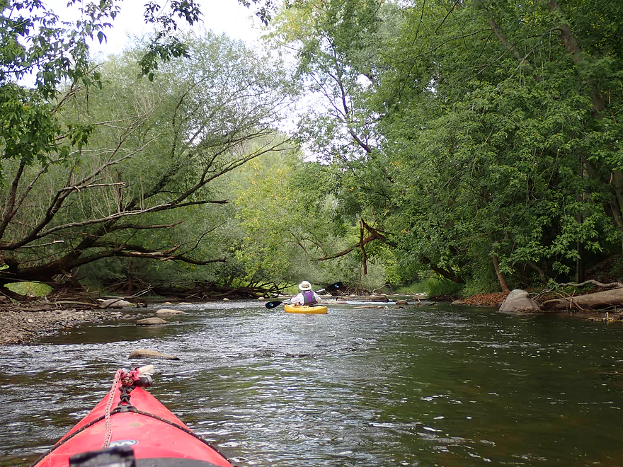
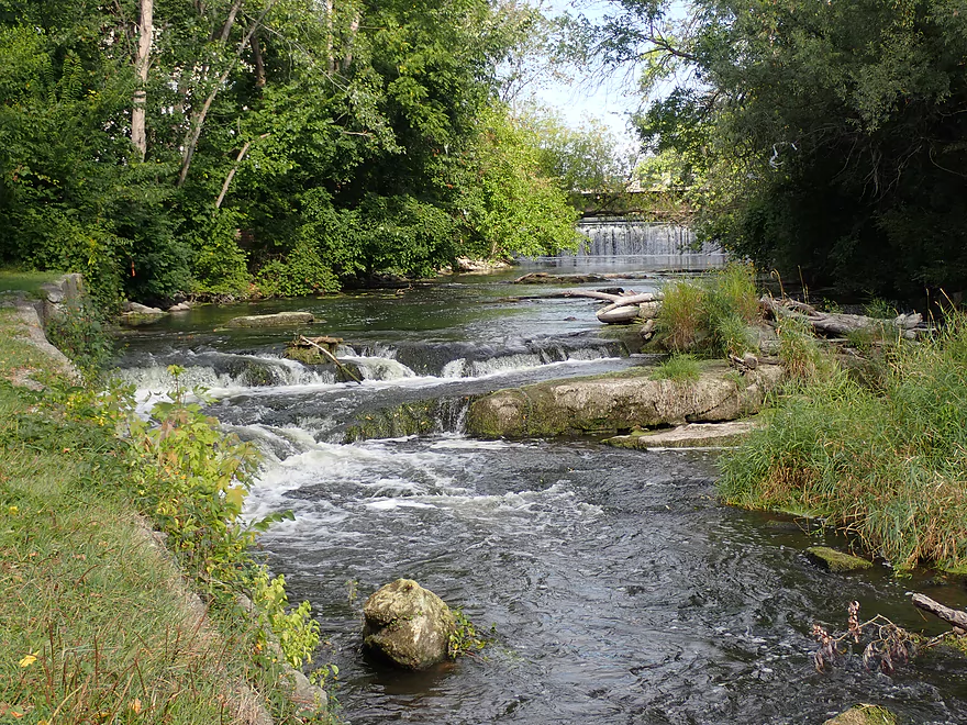
One of countless rapids
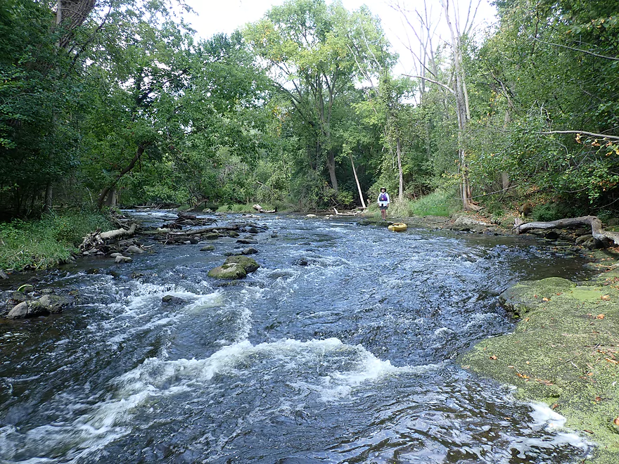
Wading upstream to find the Nail Factory Dam
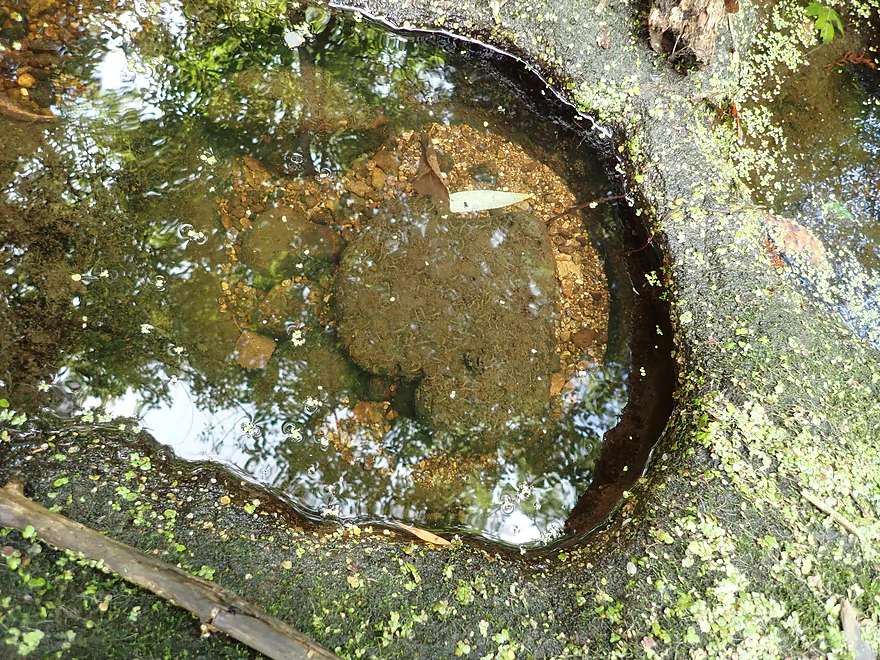
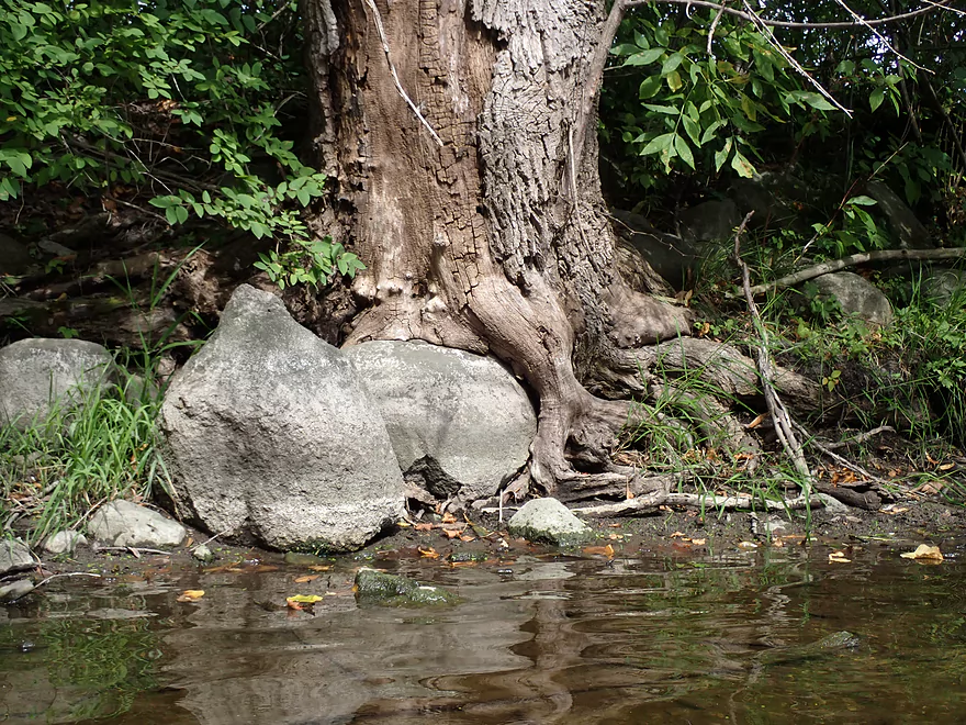
A pothole with fossils in the middle
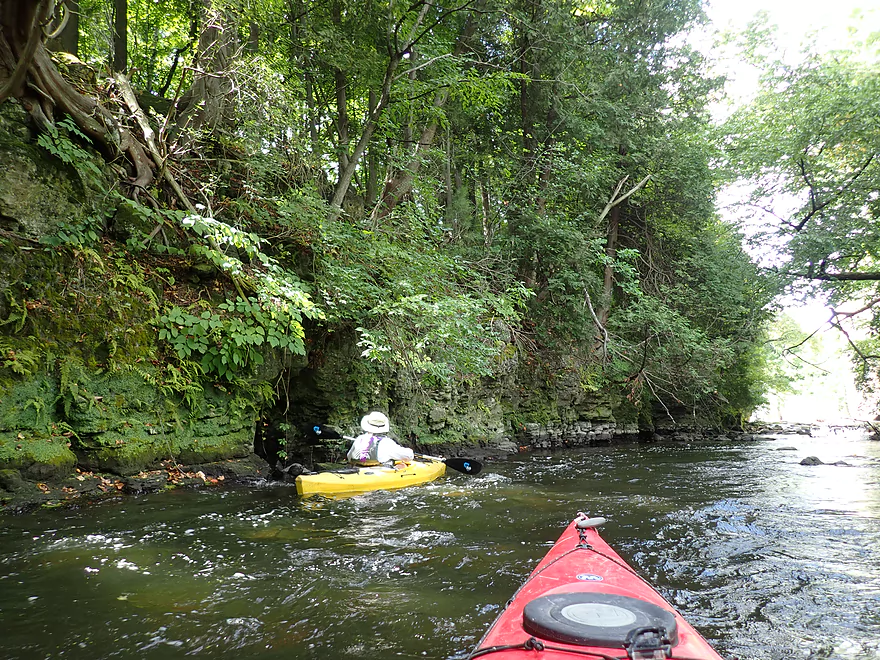
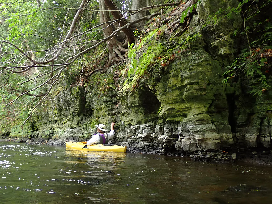
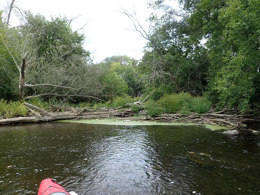
Start of the dells
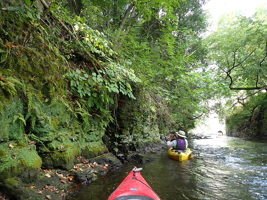
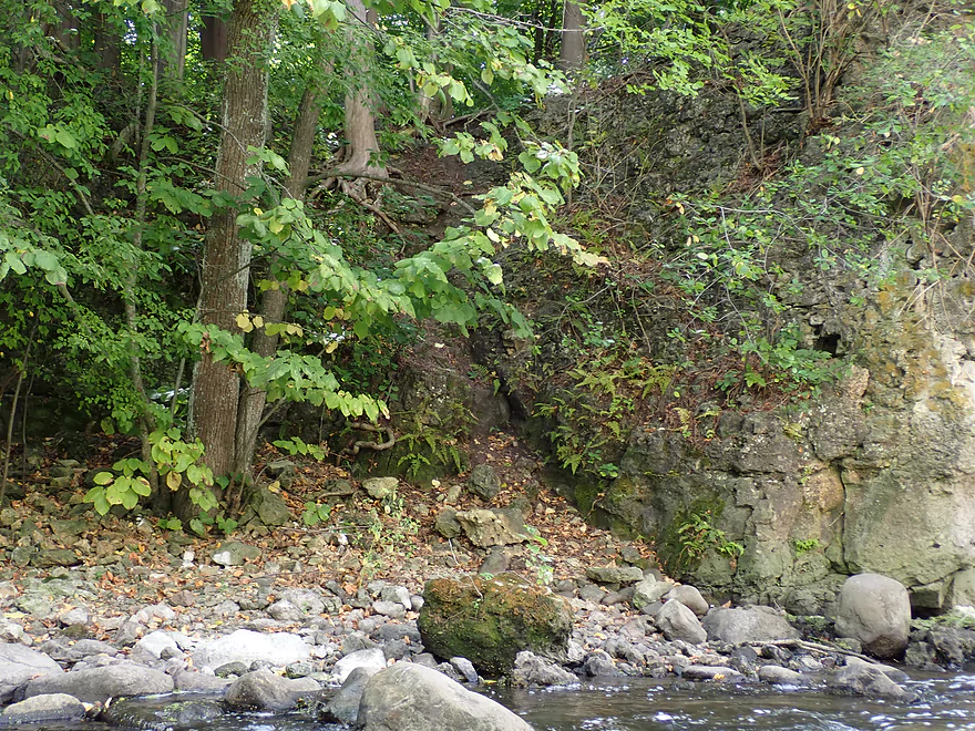
Scenic limestone walls
With attractive mosses and ferns
And even some cedars
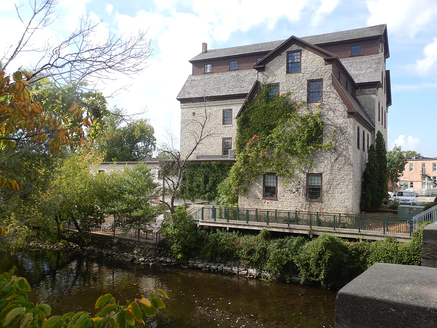
We finally reach the Nail Factory
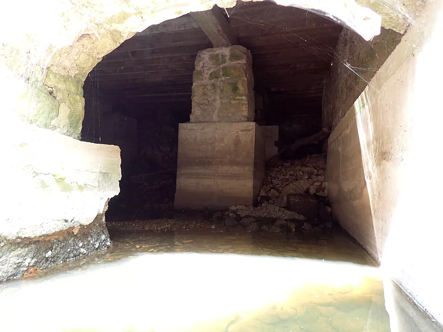
It’s been a while since this has been used
Exiting the dells…
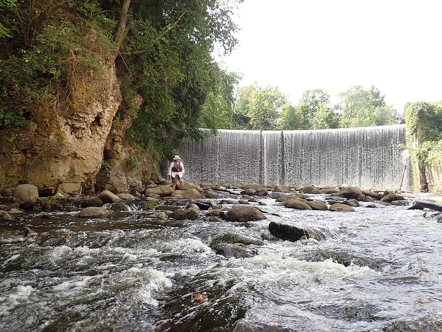
…to be welcomed by a great vista of the dam
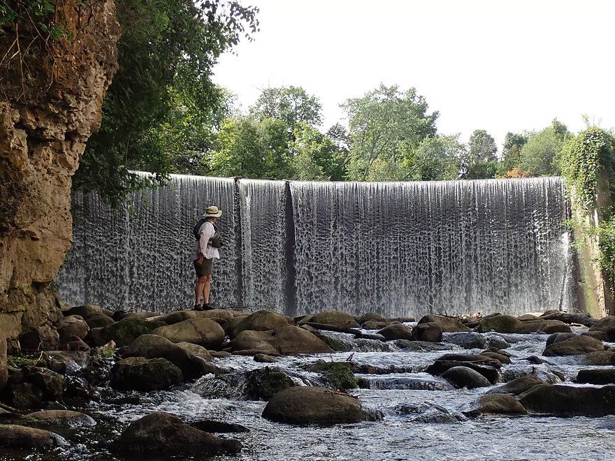
This “waterfall” is 18.5′ high!
Those who portage, must deal with a steep bank
Some rapids at the bottom of the dam

A mayfly frozen in time
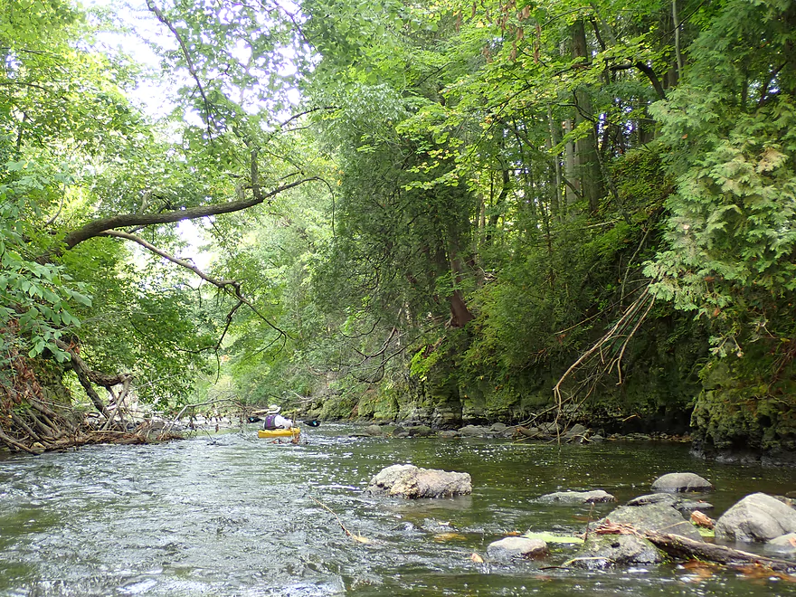
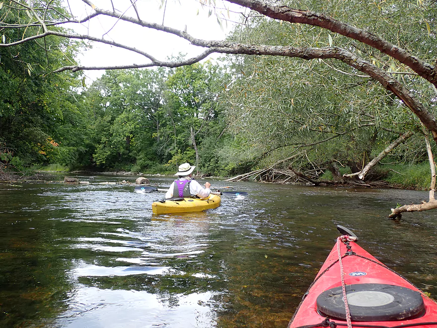
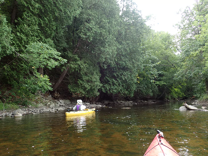
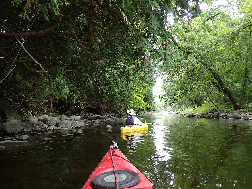
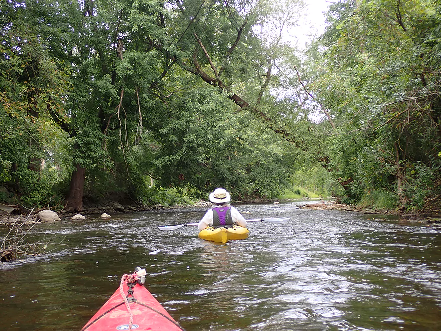
Returning downstream through the dells
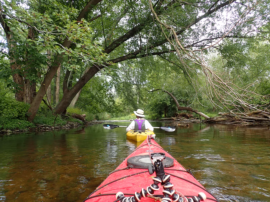
Best part of the creek
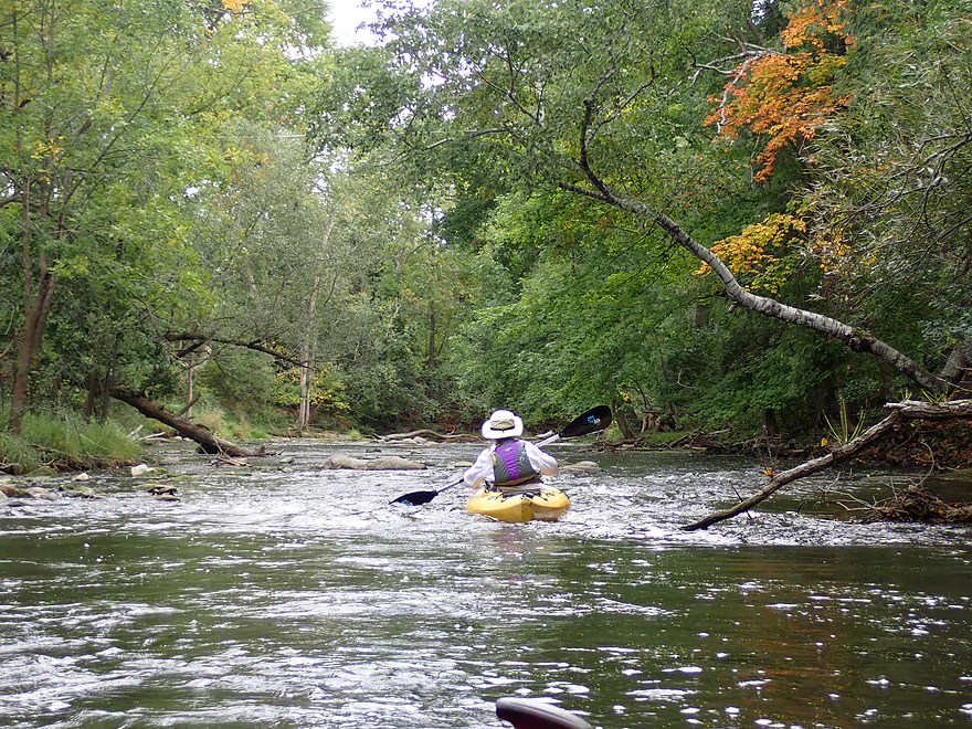
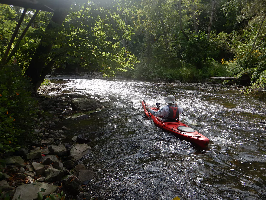
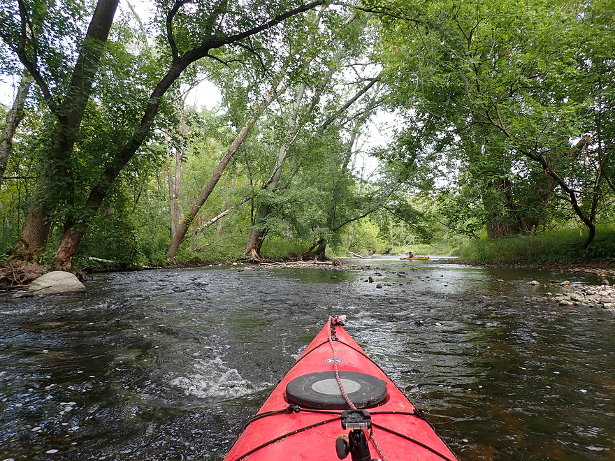
Current is quite fast
Some Class 1 rapids
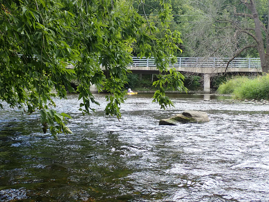
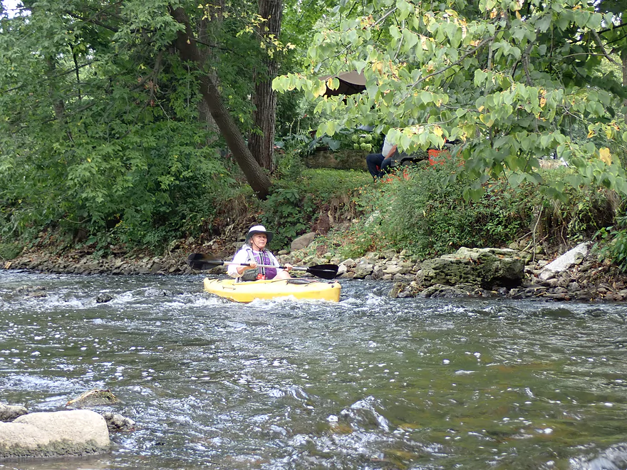
Great scene as we approach the bridge
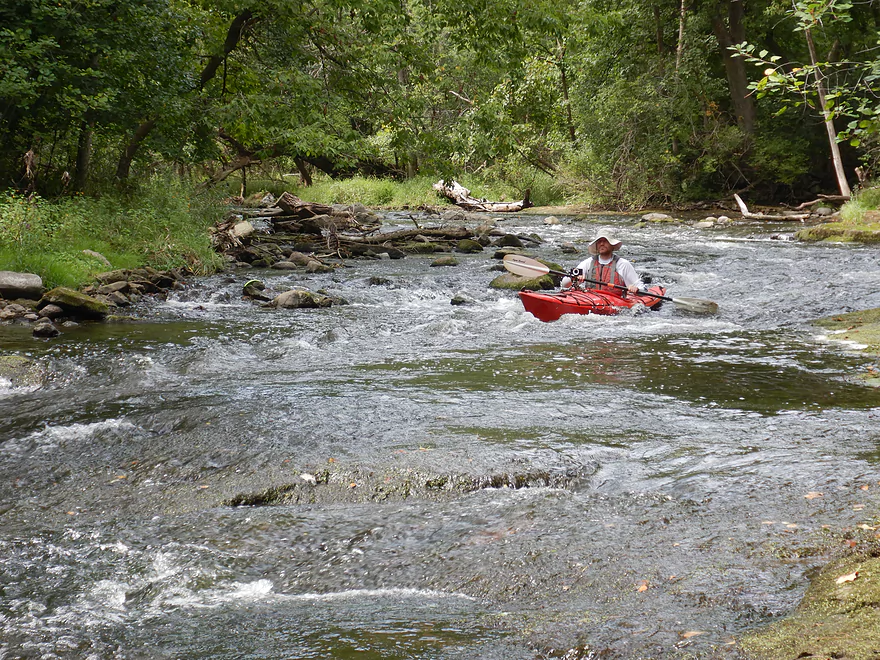
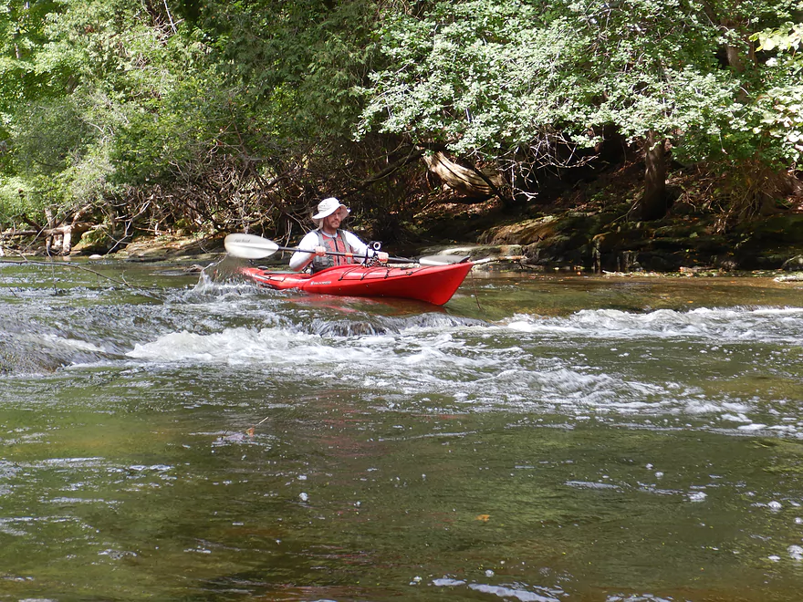
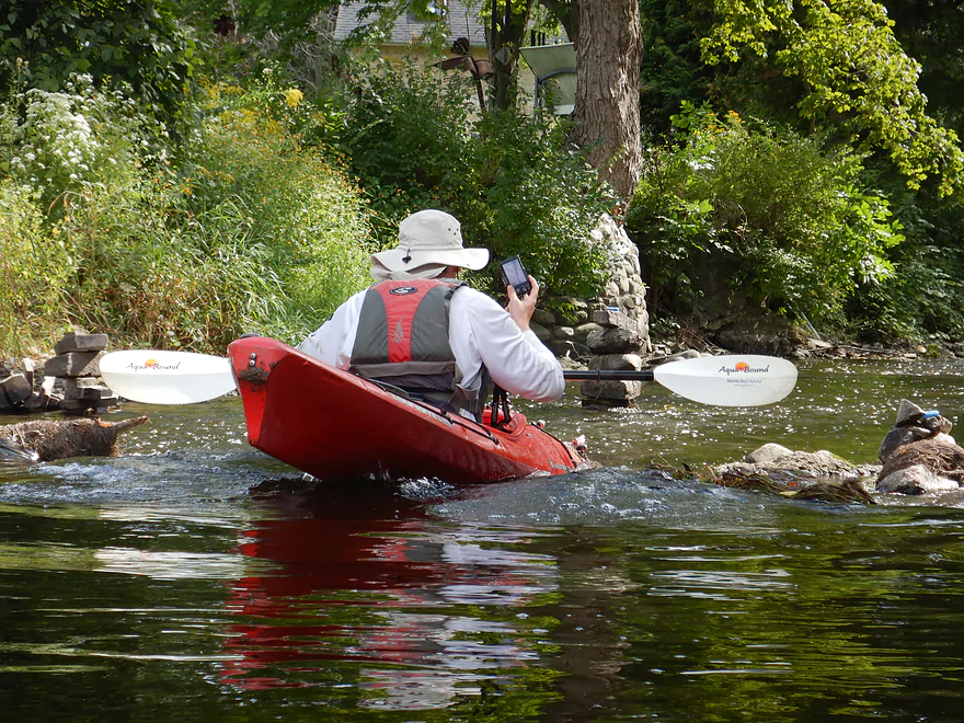
Running the rapids
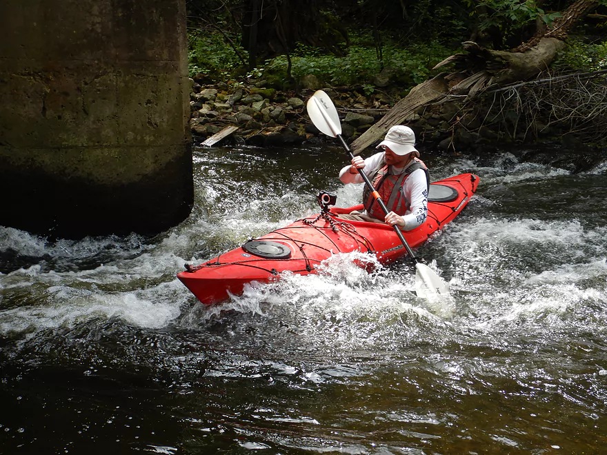
Tricky section by the pillar
Reverse view
Current stays fast
One of several ledges
Reminded me of Halls Creek
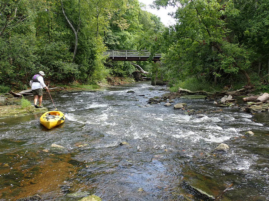
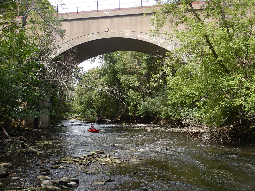
Approaching the railroad bridge
Reverse view
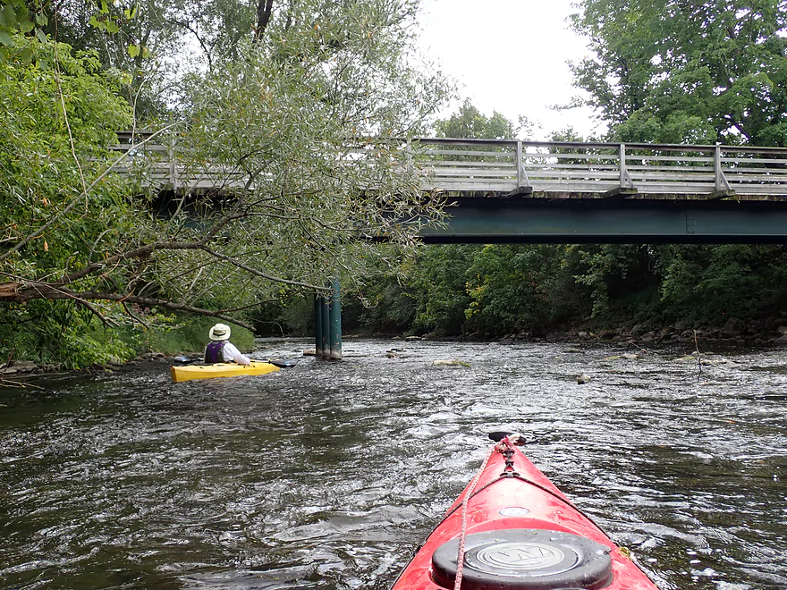
A pedestrian bridge
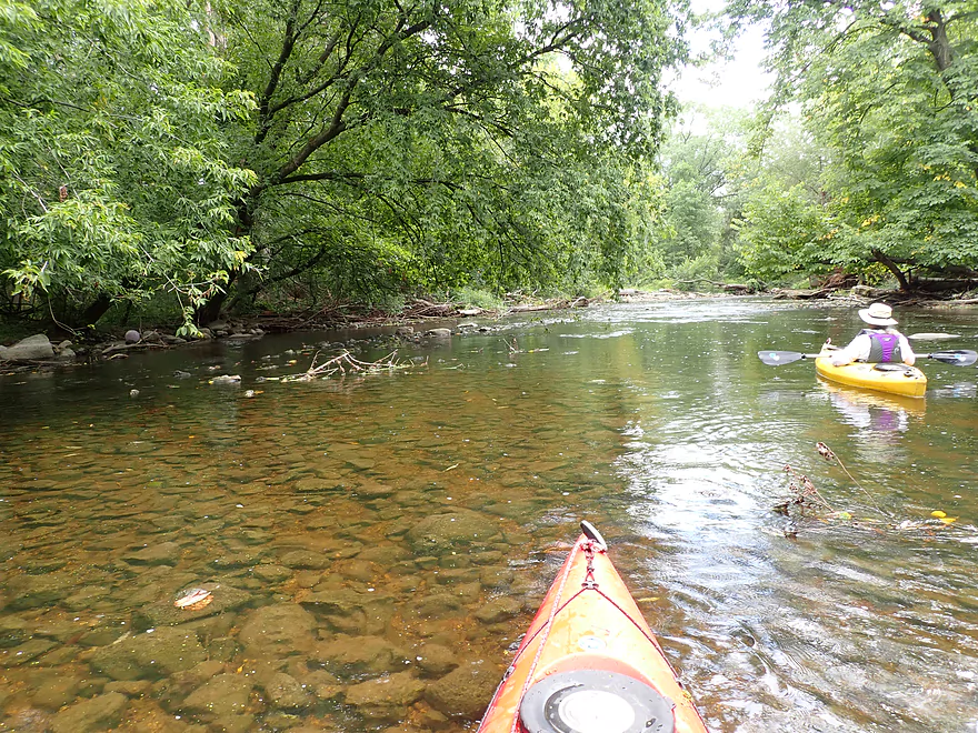
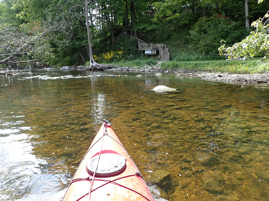
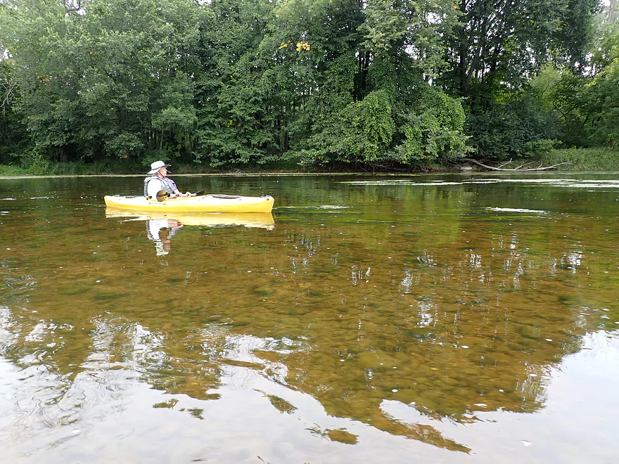
Water clarity was almost perfect at times
Some bumpy rapids
These had to be walked
Start of a large island…the east/left channel is sealed by debris
The west channel has some issues too…this is tree trouble #1
Nice gravel area
Downed tree #2
In high water these rapids and trees could be tricky
Downed tree #3…I broke some branches to help future paddlers
East and west channels combine…no more logjam issues from here on
The creek was a bit deeper here but not by much
Much of the creek was this scenic
A tree laying eggs
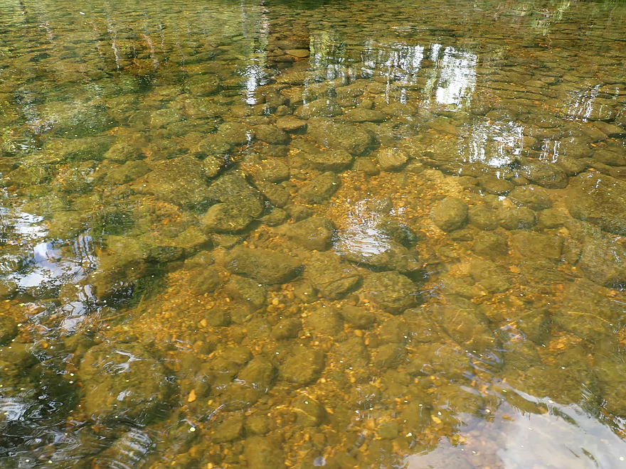
Clarity was top-notch
Shallow water however was an issue
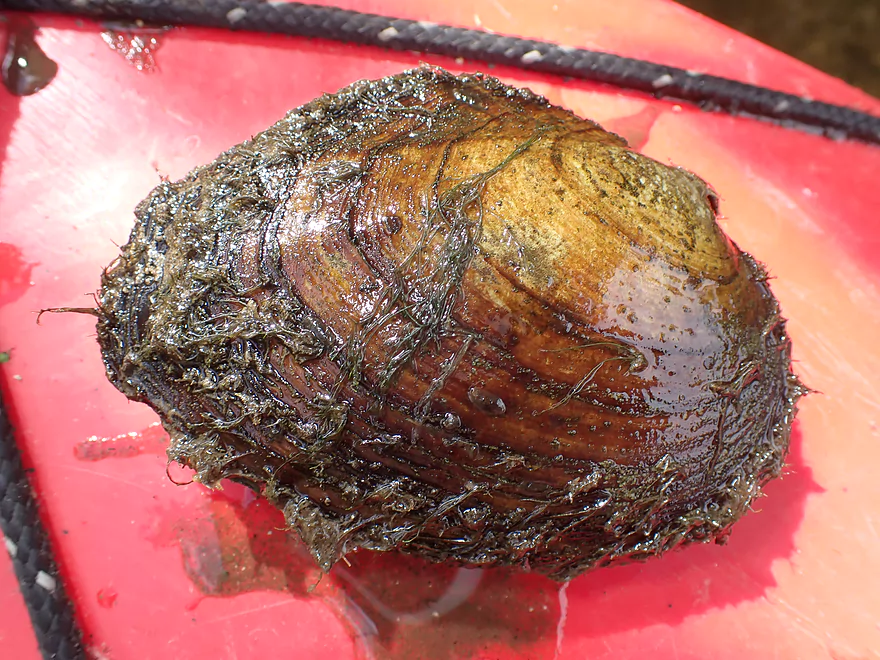
Some clams in the creek
Approaching Lakefield Road
An access option…this is the NW corner
Cedar Creek living up to its namesake
Surprised to see so many cedars
The shoreline for our trip was mostly undeveloped but we saw some homes
More rapids
And I’m stuck…
Approaching a large boulder garden
Very scenic
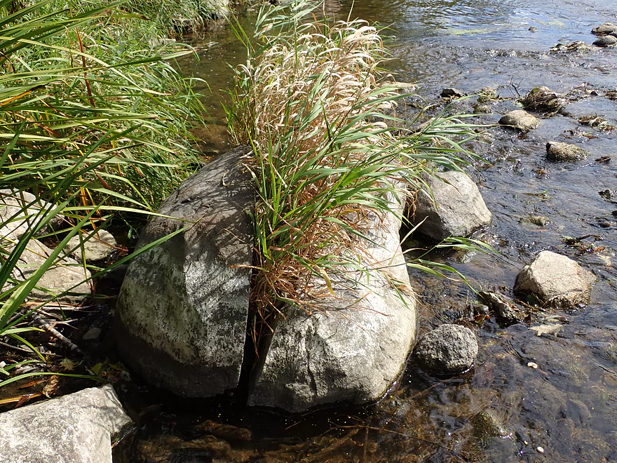
A rock munching on grass
An “up-north” shoreline in southern Wisconsin
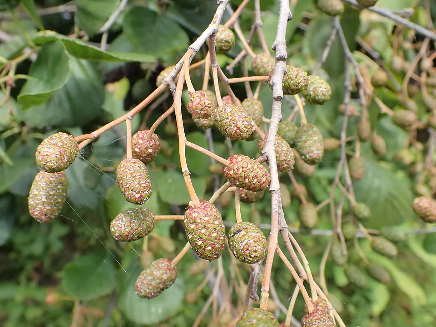
A surprise cluster of alders with lots of cones
Shallow part of the river…
We had to walk a few hundred yards
There used to be an old flowage here
Hopping over the remnants of the Hamilton Dam
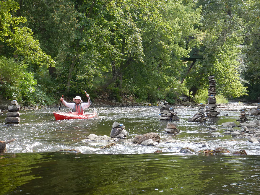
Somebody created cairns in the creek
A lot of dynamite was used to blow up the dam

Candles are lit at night
Rapids starting to pick up speed
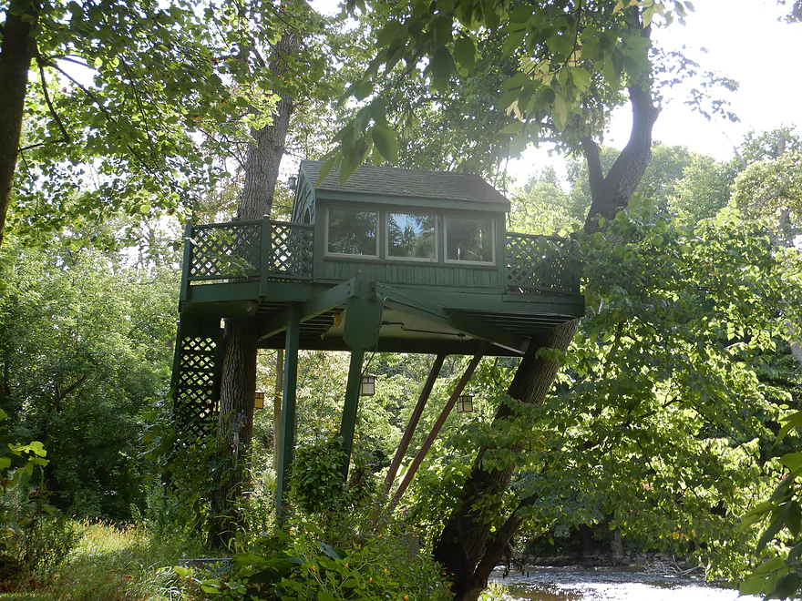
A pretty fancy tree house
Bumpy but fun rapids
Approaching Green Bay Road
Best access is by the bar
View from the bridge
We are actually continuing on to the Milwaukee River though
A fast section
Very scenic
Reminded me of the Upper Yahara
There are several large islands here…the biggest channel is always best
A small boulder garden
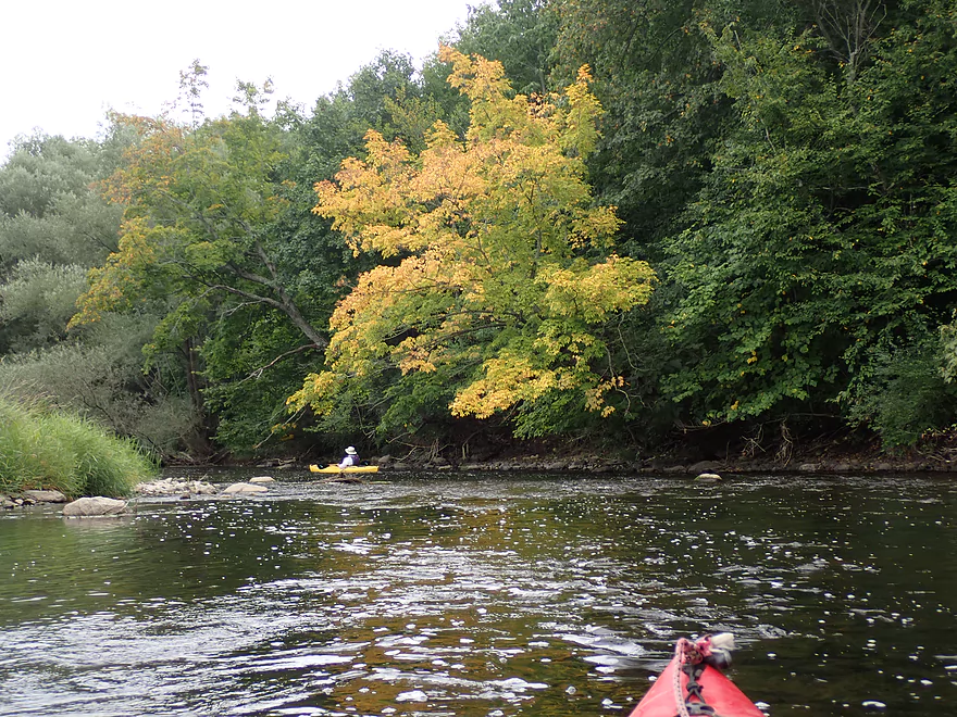
Stressed trees turning color early
Creek starts to open up
Last leg of the creek as we start to lose light
Cedar Creek joins the MIlwaukee River
We paddled 1.3 more miles on the Milwaukee to reach our access
This part of the Milwaukee was surprisingly nice
Good clarity
And even some riffles
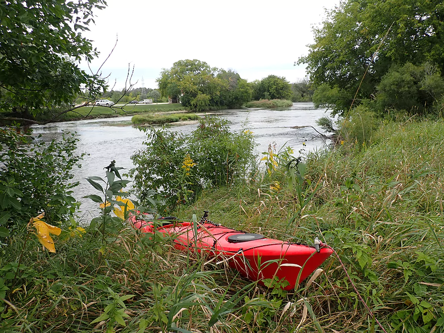
Taking out at Pioneer Road
View from the bridge
It’s worth it to explore downtown Cedarburg after a paddle
Part of Cedar Creek Park…at normal flows these are Class 3

I highly recommend “Amy’s Candy Kitchen”
Cedar Creek – Cedarburg

Cedar Creek is a small tributary of the Milwaukee River known for its clear water and rocky substrate. We previously did an upstream trip by the famous covered bridge which was really nice. I’ve wanted to return for some time, but Cedar Creek logistics are tricky. It has a lot of dams…four in just a 1.3-mile stretch through downtown Cedarburg. These are not little dams either as they account for 80′ of gradient and likely sit atop some pre-settlement waterfalls.
My initial plan was to avoid the flowages and their ensuing portages, by simply putting in below the last dam (the Nail Factory Dam). We arrived at the old mill and knocked on several doors to get permission to launch there, but nobody was home. It likely didn’t matter as the north shore was too steep for launching. We considered our options…one idea was to launch from the BMO Harris Bank just upstream of the dam. This would mean a small millpond paddle that had been recently cleaned of PCB’s (courtesy of Mercury Marine), but we were unsure of how difficult the Nail Factory Dam portage would be, so decided not to.
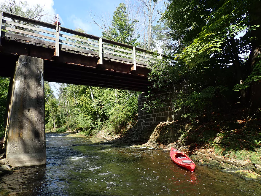
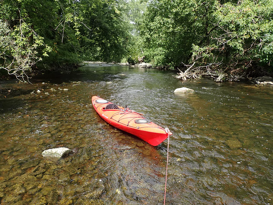
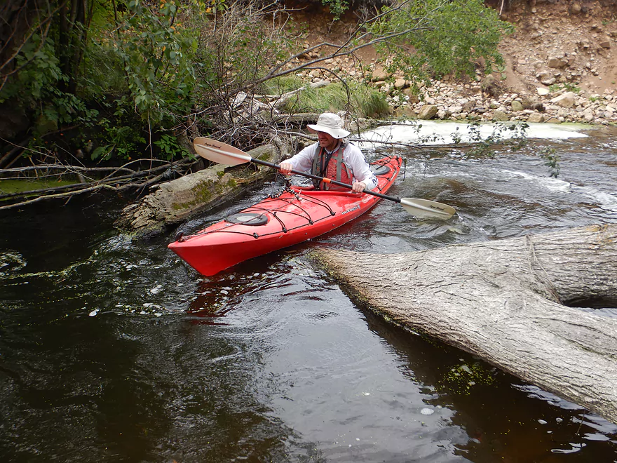
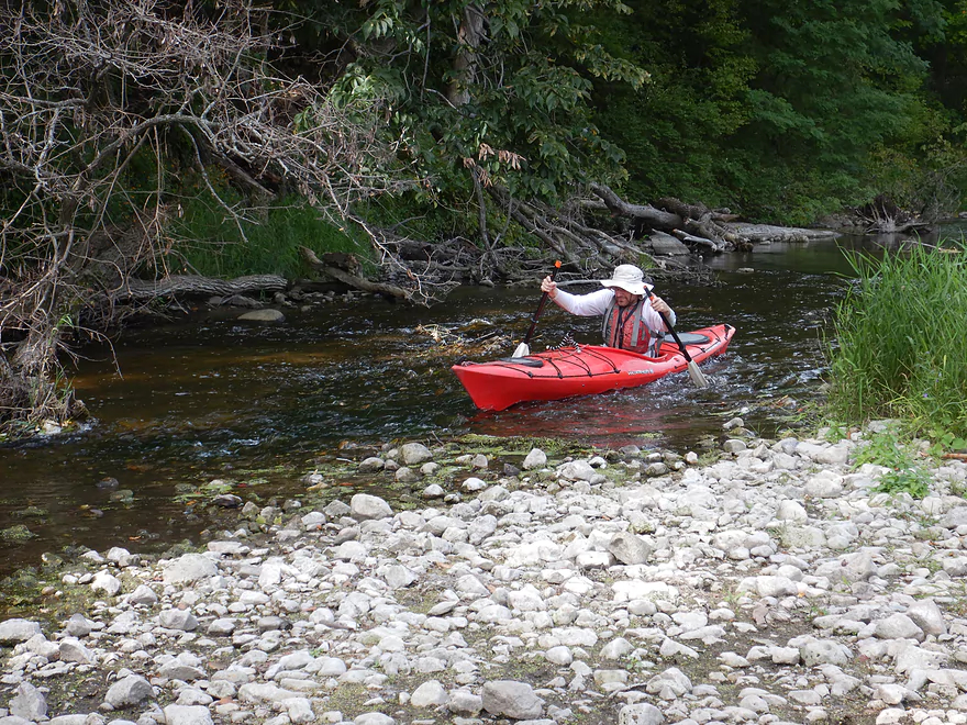
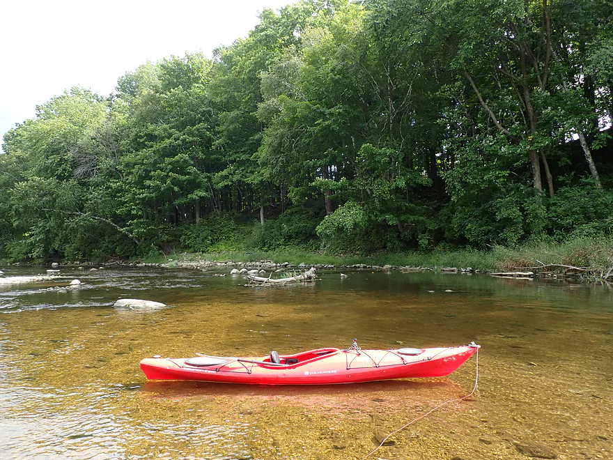
Instead we discovered a bridge just downstream of the Nail Factory which while having steep banks, seemed plenty doable as an access. This bridge (which I believe the locals call the “Estate Bridge”), is SUPER scenic. However, I’m not sure it is the greatest of access options. There were no signs that restricted access and as far as I know it is a public road that services a small community across the creek…but it had a bit of a private vibe to it. The bridge itself spans a narrow, rocky gorge and is topped with wooden planks and railings. Rapids flow over exposed bedrock directly under the bridge which actually can be quite strong in high water, but were just Class 1 that day.
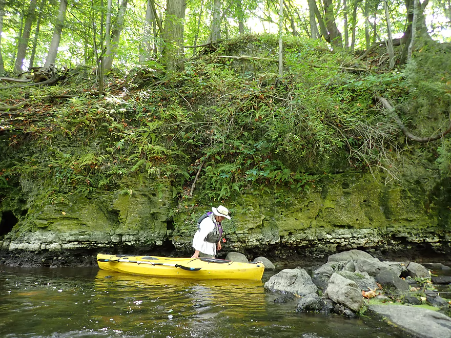
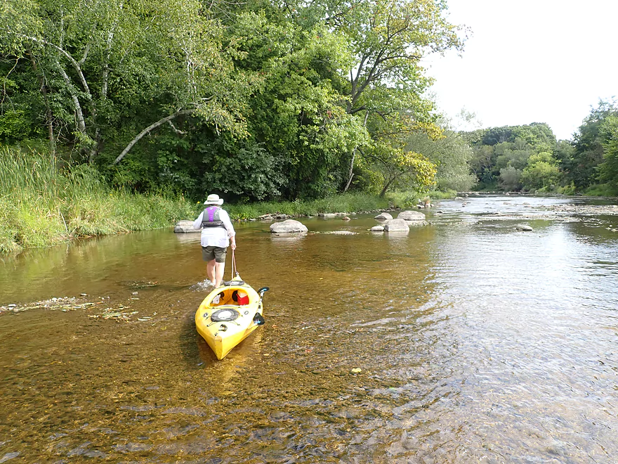
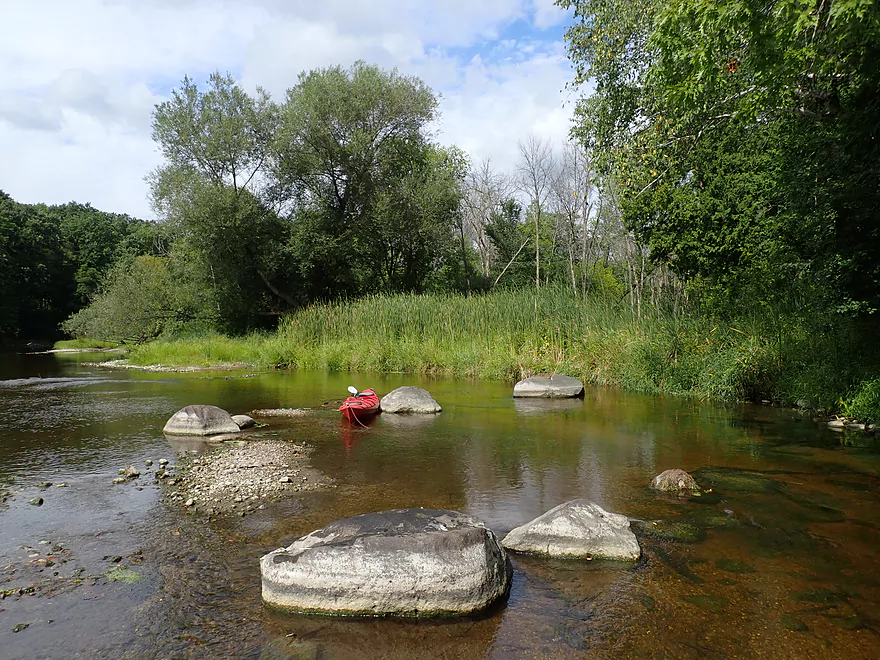
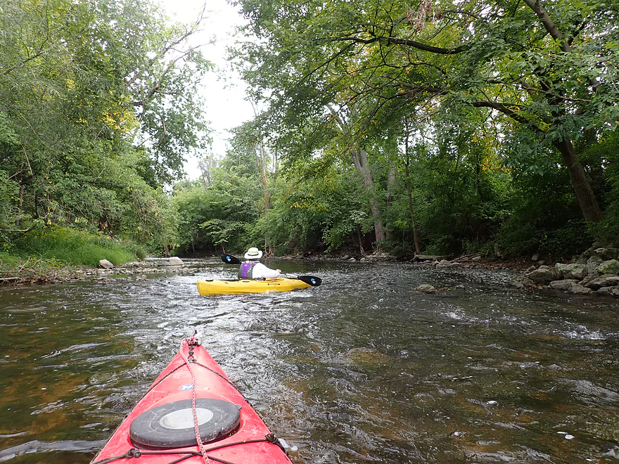
Being bummed we couldn’t launch at the Nail Factory Dam, we decided to do the next best thing and wade upstream to see it. This was actually viable because Cedar Creek was pretty shallow that day (more on that later). This turned out to be a very good decision…the creek below the Nail Factory is gorgeous. Attractive rapids run over raised bedrock very reminiscent of Halls Creek. The banks were lined with attractive woods including the creek’s namesake…cedar! Circular potholes dotted part of the channel bottom and some revealed ancient fossils.
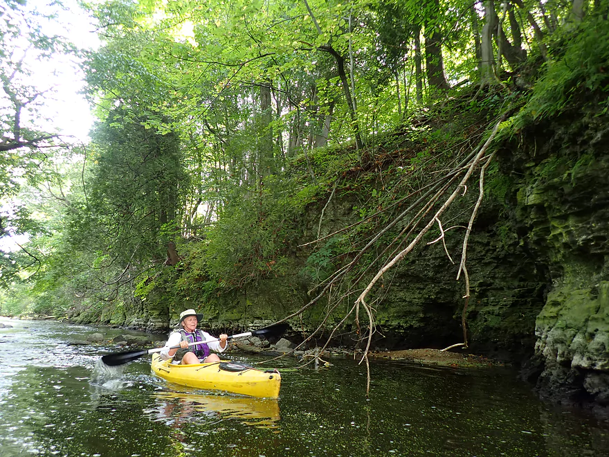
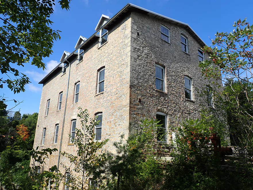
The trip highlight was a series of stunning limestone dells located just below the dam. Past this mini-canyon, the creek descended over an 18.5′ dam which resembled a natural waterfall. In fact I wouldn’t be surprised if a natural waterfall wasn’t submerged just behind the dam. To the right is the old Nail Factory which in theory you could actually paddle partly into…but you wouldn’t get far as the building is in considerable disrepair. Left of the dam, is a narrow portage path that descends steeply down the bank. This would be difficult to use and rope would be recommended. In fact one of the trees used to have a length of rope to help kayakers descend down the bank, but it has since disappeared.
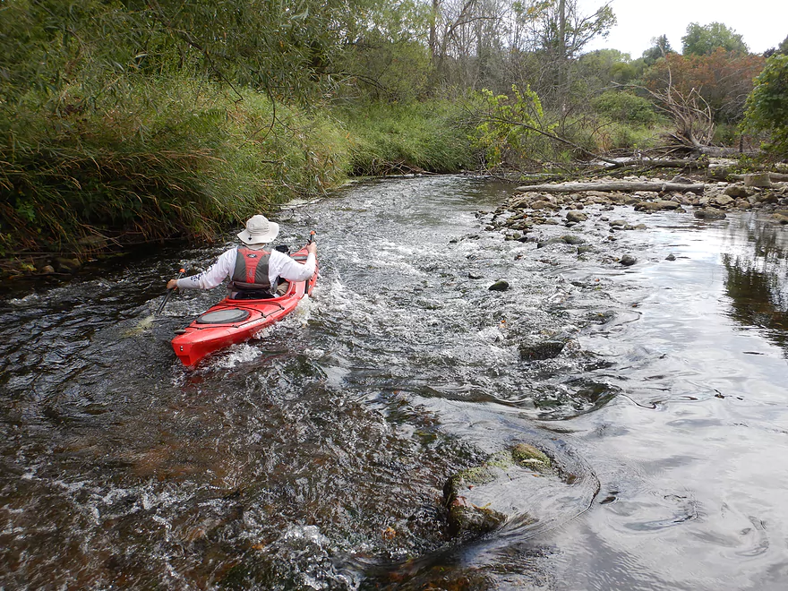
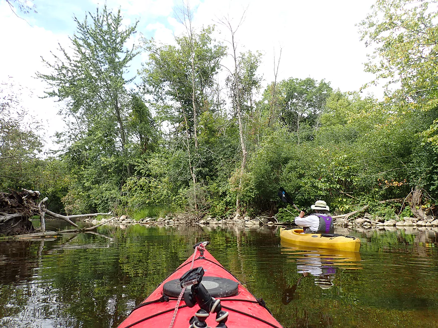
After taking in the dam, we did a u-turn and ran the rapids back to our original put-in. While this stretch can usually have some feisty rapids, they were all easy Class 1s at our low levels. Unfortunately many (almost all), were too shallow and we hit a lot of rocks. Past the Estate Bridge was a majestic stone arch railroad bridge which featured several nice ledges over raised bedrock…but they were so shallow we got hung up. From then on, we dreaded any rapids or riffles…as this usually meant playing bumper cars with rocks. In several cases the shallow rapids were so bad, we had to get out and walk our boats.
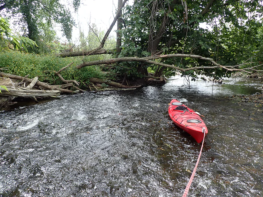
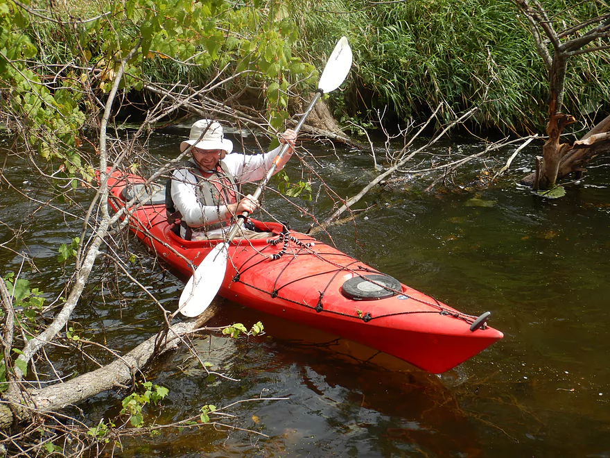
Soon after the railroad bridge the creek forks in two to mark the start of a very large island. American Whitewater advised the right/west channel…but when we did the paddle we didn’t really have a choice as the left/east channel was sealed shut by logjams. It was here on the west channel that we finally encountered some downed trees. I was able to hop/duck past them, but most paddlers would prefer to portage (easily done on a nearby gravel bar and all at once as all three trees are located close together). I did break some branches to help future paddlers, but hopefully locals will clear these out in the future. They could be a bit dicey in high water.
At the bottom of the island the channels rejoin and this spells the end of logjams for the rest of the trip. Shallow water was still an issue that required occasional wading. On the plus side the low depth really showed off the water clarity which at times was nearly perfect. We soon came to Lakefield Road which is an access used by kayakers and one I considered for this trip (northeast bank). Past the bridge the creek cuts sharply right and under a series of scenic cedars which envelop the channel…a great scene!
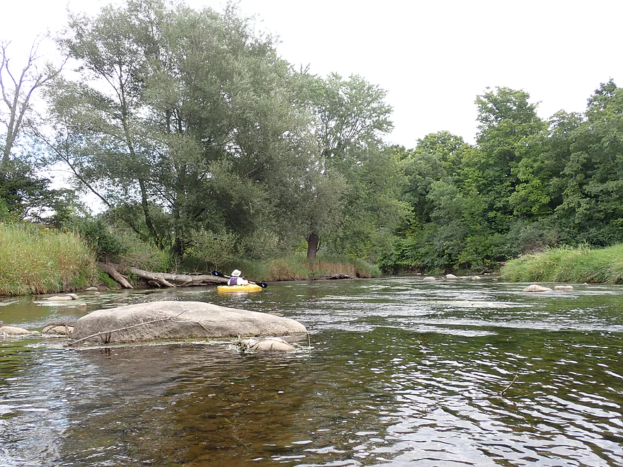
The creek later widens significantly to reveal a large and attractive boulder garden. Unfortunately it was so shallow that we had to wade this entire stretch…but it didn’t seem so bad given the incredible scenery and lack of mud. Despite this paddle being in the heart of Cedarburg and part of the Milwaukee Metro Area, the banks were surprisingly wooded, undeveloped and reminiscent of an up-north river.
Following the boulder garden, we encountered the remnants of the old Hamiton Dam that had mostly (but not completely) been removed. According to a local, the DNR used so much dynamite to remove the dam, that nearby windows were destroyed and two DNR agents were knocked unconscious into the creek and had to be rescued. All that remains is a 1-2′ ledge that can be hopped over in a boat. The area following the old dam is quite artsy and attractive. Locals have stacked large stone cairns in the channel and topped them with candles. Along the shore were Chinese lanterns, a brick encased tree, an attractive metal sculpture and an elaborate tree house.
After the old dam, the river continued over a series of scenic rapids up to Green Bay Road (which is likely an access option). The next half mile flowed through thick woods and rocky rapids…this reminded me somewhat of the Upper Yahara which I really liked. After that the creek opened up by a residential development of upscale homes before it finally emptied into the Milwaukee River.
We then paddled 1.3 miles on the Milwaukee to reach our take out at Pioneer Road. The Milwaukee wasn’t the reason we did this trip, but it turned out to be surprisingly nice. Highlights included attractively wooded banks, good current, a few riffles, and decent clarity. We took out north of Pioneer Road only to realize later there was actually a public park and landing just south of the bridge we totally missed.
In summary, this was a neat trip…perhaps the most scenic in all of southeast Wisconsin. The clarity, occasional cedars, dells, rapids, lack of mud…it was incredible. I did have a few regrets though. The first was that the creek was too low (36 CFS) for our trip. Cedar Creek is a Goldilocks stream…paddling it too low means wading and paddling it too high can result in dangerous whitewater. My second regret was that I didn’t put in further upstream. I suspect there are additional dells located downstream of Highland Drive and there are definitely scenic rapids by Cedar Creek Park. Yes a long trip would mean some tricky portages and perhaps some strong rapids, but I think it would be worth it. Hopefully in the future locals will realize what a treasure they have in this creek. With dam removals, dedicated portage paths, and additional landing options Cedar Creek could be a destination paddle.
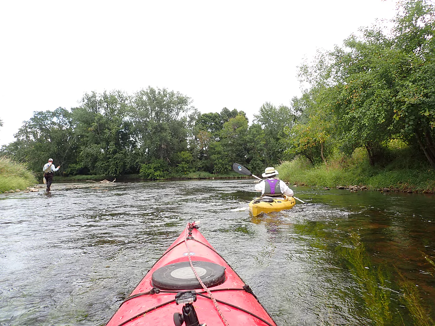
Sights included many great blue herons, some painted turtles, one muskrat, kingfishers, several eagles, many redtails, and a number of minnows. We saw several fly fishermen in the middle of the creek with waders on, so there are likely bigger game fish but we didn’t see any. The great blue herons were often quite agitated (perhaps by nearby birds-of-prey) and would frequently emit loud squawks. On the Milwaukee there were were several flocks of relatively tame geese.
Cedarburg: The town features a European style downtown that caters to upscale tourists. Many of the store fronts are attractive and made of stone. It’s definitely worth it to take a stroll along Washington Ave to take in all the interesting sights.
Covered Bridge Park: Located northwest of the city is a rustic covered bridge that spans Cedar Creek. This is very popular with area photographers.
Amy’s Candy Kitchen: This is a super popular gourmet candy store located in downtown Cedarburg. Its featured item are apples dipped in caramel and covered with a wide assortment of toppings. While a bit pricey, they are really good.
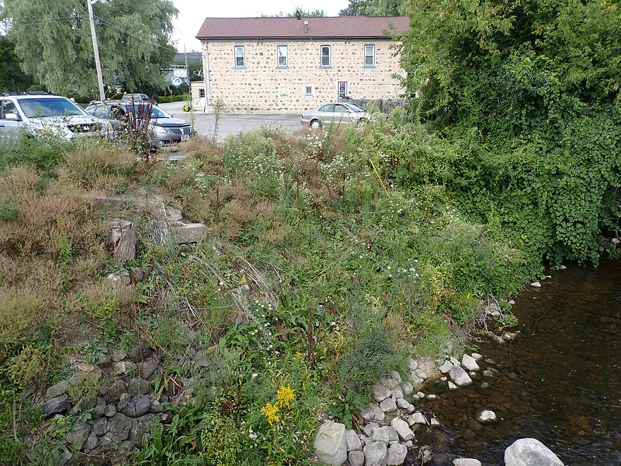
We started the trip at the “Estate Bridge” (an unofficial name) located south of Sendik’s Food Market in Cedarburg. The bank is steep here, but it is not super difficult to launch along the north shore. Note this bridge is part of a dead-end road that services a small group of houses. I believe it is public (there are no signs that prohibit access), but I’m not 100.00% sure of this. If you know more, please leave a comment below. Definitely be courteous and discreet if you use this bridge as an access. You obviously can’t park on the bridge nor on Columbia Road, so you would need to leave your car at Sendik’s Food Market or at North Shore Bank.
The original plan was to put in upstream at the Nail Factory Dam but this is not a viable access (too steep and likely private).
Further upstream, the huge BMO Harris Bank parking lot is likely a viable access option, but I didn’t scout this. If you launch upstream of the Nail Factory Dam, you would have to portage it (which is difficult because of the steep bank).
Putting in even further upstream at Cedar Creek Park is a great option with nice public street parking and easy launch options along the shore. You could even put in above the Class 3 ledges to run those if you wish. But…this would mean you would have to portage the Highland Drive Dam AND the Nail Factory Dam. I wasn’t able to scout Highland Drive, but I think it is is a tricky portage (although not as bad as the Nail Factory). The guys on AmericanWhitewater have portaged both though. The rapids downstream of the Highland Drive Dam may be troublesome at high levels.
An alternate access downstream of the Estate bridge would be Lakefield Road (southwest corner). Kayakers have used that corner and it would work…but if you put in this late, you miss out on the best part of the creek.
We took out on the Milwaukee River at Pioneer Road. There is a small pull-off northeast of the bridge which was a bit weedy, but was suitable as a take-out. In hindsight…I really messed up. Just on the downstream side of the bridge, there was a somewhat hidden but really nice public landing we could have used instead (Garrison’s Glen Park). Oops.
You could take out early at Green Bay Road, but this would be IMO a mistake because the last stretch of the Cedar (as well as the Milwaukee) is really nice. Note the best access at Green Bay Road is northwest of the bridge and at a bar parking lot (The Hamilton of Cedar Creek). Ask permission before using their parking lot.
The bike shuttle would be a relatively short 3.8 miles, flat and mostly pretty easy. But there would be some town traffic to deal with.
The Ozaukee Interurban Trail is nearby. This is a great bike trail that is paved…but it is mostly impractical for a paddle bike shuttle unless you start further upstream.
Current: Very fast with many riffles and rapids.
Logjams: Not as bad as I expected. At the top of the first island (between Hwy T and the railroad) there are a series of three downed trees in a row. They aren’t major though and all three can be portaged together along a gravel bar. Determined paddlers can hop/duck over all three (at least in low water). There were no logjam portages besides those, but in in high water there could be some tight fits. For example there is a large tree that fell down just below the Estate Bridge. There is plenty of room to get under it, but in the future it may slide down and be a big problem.
Rapids: Many…. The most significant are between the Nail Factory and Hwy T. These were all Class 1 because of our exceptionally low water levels, but during normal flow rates the first mile will have 3-4 Class 2s. In high water the pitches under the Railroad Bridge and then under the Estate Bridge may become Class 3. The trickiest rapids are likely at the top of the island because of the earlier mentioned downed trees. After Hwy T, there are countless rapids, but I believe all are Class 1.
Note, this is very important and yet very subjective and difficult to estimate. There is a local gauge in Cedarbug and we went at 36 CFS.
- 0-45 CFS: Likely too shallow for 99% of paddlers. Almost all rapids are too rocky and some wading is required (at times over 200 yards). These are however incredibly scenic levels.
- 46-100 CFS: There still might be some wading and bumpy rapids…but I think this can be a viable trip for those with flat bottom boats. Perhaps a good target range for rec paddlers.
- 101-200 CFS: 100 CFS is considered a minimum by AmericanWhiteWater.org. Rec paddlers should be mindful that some technical whitewater will form at these levels. Clarity may also not be as good.
- 201-400 CFS: Likely an ideal target range for serious whitewater paddlers, but likely too high for most rec paddlers.
- 401-600 CFS: A high flow rate. AmericanWhitewater has a maximum recommended flow of 600 CFS. The logjams by the first island may be very problematic at these levels.
- 600+ CFS: This might be too dangerous to run given the narrow nature of the stream, its speed, and the chance for unexpected deadfall.
If you like second opinions, American Whitewater has their own depth guide here (click Flow).
- Upstream of Hickory Lane: I suspect downed trees make paddling impractical.
- Hickory Land to Hwy 60: 0.7 miles. Short wooded section followed by an open stretch through a corridor created for power lines. Maybe a few jams.
- Note: Hickory may not be a good put-in.
- Hwy 60 to Division Street Landing: 1.5 miles. Creek here is artificially straightened, channelized, and runs through farm fields. Might be a jam or two.
- Division Street to S. Church Road Landing: 1.2 miles. Might be a jam or two…but it is a good sign that the start/end points are public landings.
- S. Church Road to County Aire Drive: 2.1 miles. Mostly an open marsh paddle. Might be a downed tree.
- County Aire Drive to Covered Bridge Park: 6.4 miles. Future trip idea.
- County Aire Drive to Granville Road/Hwy Y: 2.4 miles.
- Granville Road to Hwy NN: 1.4 miles. Good prospect. Might be an alternate landing halfway by Cedar Creek Road.
- Hwy NN to Kaehlers Road: 2.0 miles. Good prospect. At Hwy NN, you might need permission from “The Hub” diner to launch.
- Kaehlers Road to Covered Bridge Park: 0.6 miles.
- Covered Bridge Park to Grafton Lions Park: 3.6 miles.
- Covered Bridge Park to Robin Ct. Landing: 2.3 miles. Shallow but very scenic section.
- Robin Ct. Landing to Grafton Lions Park: 1.3 miles. Launch is SW of W. Cedar Creek bridge. Good section.
- Grafton Lions Park to Boy Scout Park: 1.6 miles. Half of the section is flowage paddling. Take-out NE of the dam or north of Bridge Road.
- Boy Scout Park to Rebellion Brewing Company/Cedar Creek Park: 0.4 miles. Simple flowage paddle.
- Cedar Creek Park to BMO Harris Bank: 0.8 miles. Scenic put-in with the option to run Class 3 rapids. This is followed by a millpond that has had recent PCB remediation. There is a dam by Highland Drive which may be a difficult portage (scout before running). This is followed by some rapids including a Class 2 and then another millpond.
- BMO Harris Bank is a speculative access. There is a large parking lot by the bank which directly faces the creek. The shore is steep here, but it seems viable.
- BMO Harris Bank to Nails Factory Dam: 0.2 miles. Simple millpond paddle.
- Note: The Nail Factory Dam is not a viable access.
- Note: The Nail Factory Dam is a difficult portage. Getting out (south bank) isn’t bad, but the bank is steep by the re-entry. Rope and good shoes are recommended. You could bypass the steep reentry by launching a few hundred yards downstream…but then you miss the scenic dells.
- Nail Factory Dam to Pioneer Road: 5.0 miles.
- Nails Factory Dam to Estate Bridge: 0.2 miles. Stunning scenery…best on the entire creek if not all of SE Wisconsin. Includes limestone dells, steep valley walls, exposed bedrock and many rapids. Rapids are mostly Class 1, but there is a Class 2 just above the Estate Bridge.
- Note: The Estate Bridge is not marked as private, but it is likely near private property so be considerate. This may not be a suitable access.
- Estate Bridge to Lakefield Road: 1.1 miles. There a few more Class 2’s before and after the railroad bridge. No more serious rapids after that, but tons of Class 1s. There is a large island where the east channel is sealed shut by logjams. The west channel has a series of three downed trees in a row that may require a super portage (easily done at shallow depths).
- Note: Lakefield Road is a bit steep but should be doable (northeast corner) and other paddlers have used this as an access.
- Lakefield Road to Green Bay Road: 1.0 miles. Starts with a scenic section of cedars followed by a large boulder garden. Neat artsy section after the removed dam that features fun Class 1 rapids.
- Note: The best access for Green Bay Road is northwest of the bridge by a bar parking lot. Get their permission before using their parking lot or maybe use the Hamilton Park parking lot instead.
- Green Bay Road to Mouth on Milwaukee River: 1.4 miles. Scenic wooded section with plenty of Class 1 rapids. Opens up later by a residential neighborhood. At the island fork, go left/north. The north channel is clear of logjams.
- Mouth to Garrison’s Glen Park: 1.3 miles. A surprisingly nice section of the Milwaukee River…clear, rocky, wooded and even had some light riffles.
- Nails Factory Dam to Estate Bridge: 0.2 miles. Stunning scenery…best on the entire creek if not all of SE Wisconsin. Includes limestone dells, steep valley walls, exposed bedrock and many rapids. Rapids are mostly Class 1, but there is a Class 2 just above the Estate Bridge.
Trip Map
Overview Map
Video
Photos Size:
I’m really glad I stumbled on this post – amazing photos and video.
I’m curious what year this trip was – I’m guessing 2019?
Thanks
Yep…late 2019. Hopefully that darn bridge construction is done by now.
The following is a recent logjam summary of Cedar Creek by Rob (done at high water…510 CFS).
Based on our run of it yesterday:
Bank Waves: There is a tree (or trees) fallen from the left shore (actually a rocky island/peninsula) which blocks the left-half of the flow. The upper wave can be surfed but is a tad ‘dicey’ since you need to come off in-control to skirt the tree. The midwave is covered by the tree. The lower wave was super fine (at ~510 cfs).
Estate Bridge: The BIG tree laying diagonally across just downstream of the bridge is still very much present. At 510 cfs, the low-side (river-right) had enough water flowing over it to be passable, and it was a fairly easy move (for properly skilled whitewater paddlers) to make the river-left eddy to safely get under the high-side (river-left).
Bypass Channel / Island: No wood in the initial/entrance zig-zag. Still a tree branch horizontal across 1/2+ of the stream midway down. LARGE tree in flatwater (just before confluence with flow from other channel) still very problematic. Right (rootball) end has accumulated wood, blocking passage around that side. Left end is awkwardly passable through the various ‘upper’ branches in the water.
After a request was made, Andrea Stern, DNR Water Management Engineer, visited the dams in Cedarburg in May or June of 2019 to assess the portages under NR 330.03 and NR 330.04. https://docs.legis.wisconsin.gov/document/administrativecode/NR%20330.03
“Of the dams we visited that did not already have portage routes, the recreational safety warden did not feel the need for additional ones were warranted since the area is very low use for boaters. I do not know this area or the culture on the river so I am taking the advice of the warden for this determination.” (Andrea Stern, WDNR, 8/5/2019)
The problem is that the warden told me he did not make any such determination, and also that he doesn’t have the authority as a warden to make that kind of determination. The other problem is that “the area is very low use for boaters” because there are not adequate portages.
Over two years later, the report of the findings has still not been written and there doesn’t seem to be much desire to talk about the determination.
Another visit and assessment of all portages at the dams in Cedarburg, city and town, is needed. The assessment done two years ago was botched and has an air of dishonesty.
Please write to Andrea Stern: Andrea.Stern@wisconsin.gov or maybe better, write to her supervisor: Kay.Lutze@wisconsin.gov
These portages are not reasonable and state law demands that they are.
Thanks for the update. What’s the point of having portage access laws for paddlers, if bureaucrats just ignore them when they want? Very frustrating. Hopefully word will get out and this will get fixed.
I ran the class III eastern ledge on 04/08/2023, and posted a link to the YouTube video of me doing it if anyone is interested in watching the quick video! It was a good run except hard not to get broached on the log near the finish of the channel.
I think I found your video here? https://www.youtube.com/watch?v=QUENAj4CeKw&t=1s Looks really cool, although that strainer at the end looks nasty. If you have any other whitewater videos of Cedar Creek, feel free to share.
Ran the section from estate bridge to garrison’s glen on 3/27 at 500cfs in a whitewater packraft. Pretty interesting run with the river being swollen from several days of rainfall. Skipped the class II rapid directly under the estate bridge, but entered the wave train immediately past the bridge to start. Several fun riffles and rapids in the first half (nothing harder than class I), tbh trees were a larger issue. Everything was navigable in my packraft with some precise aiming and paddling. Could easily see there being mandatory portages due to trees at different flows or in a larger boat. Would love to explore upstream next!
I appreciate the update. If you do the upstream leg, definitely let me know it turns out!