
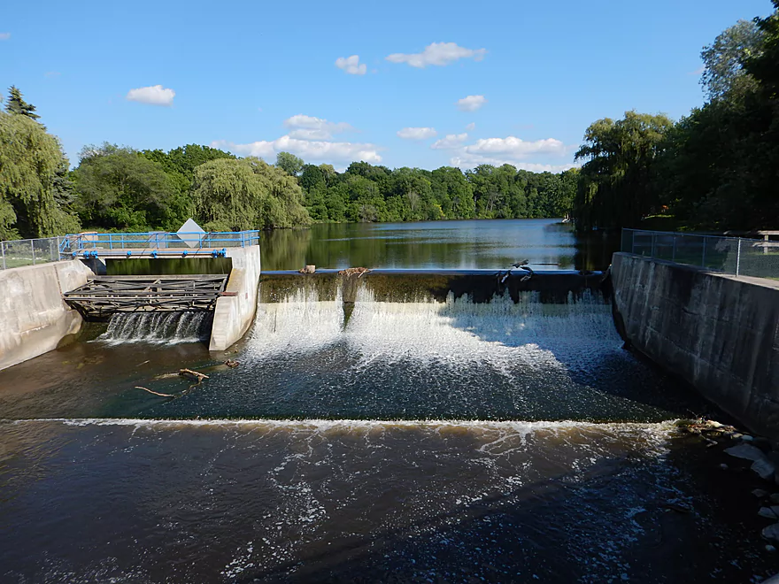
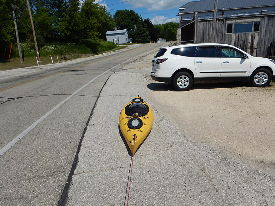
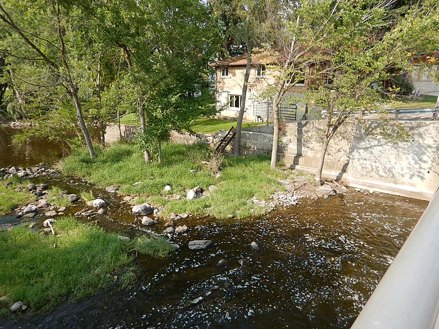
Putting in at the Furnace Mill Dam
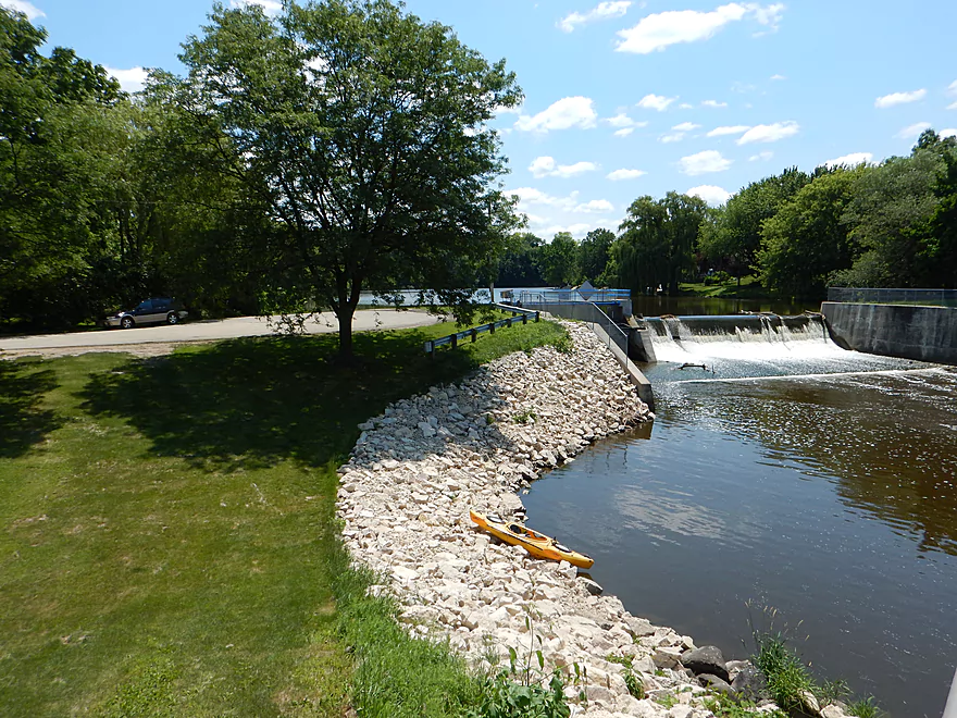
Good access
With good parking
And free snacks
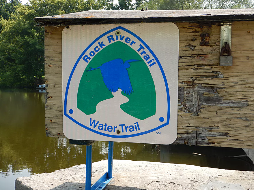
Part of the Rock RIver Water Trail
Did not want to go over that
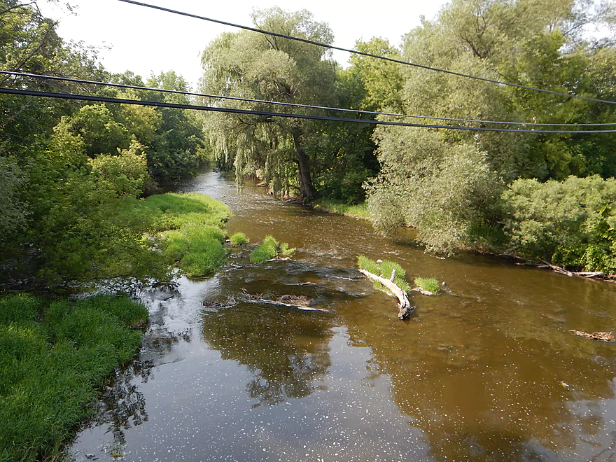
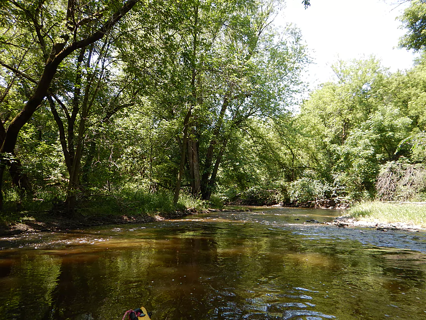
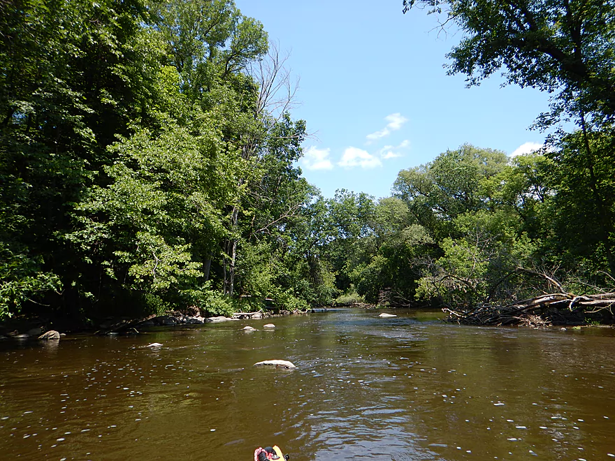
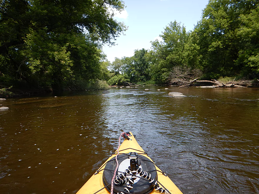
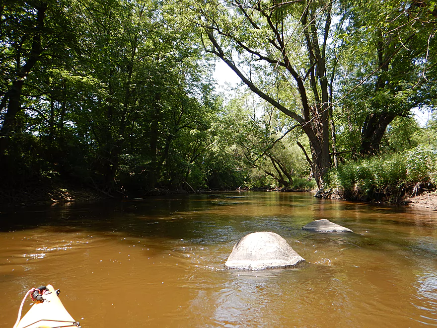
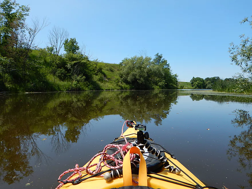
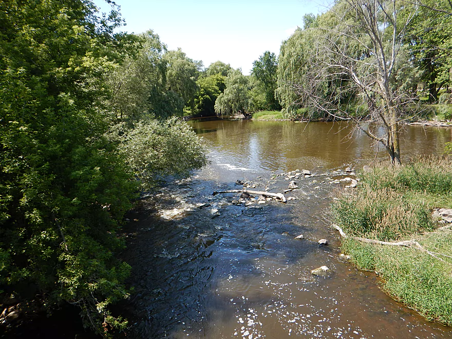
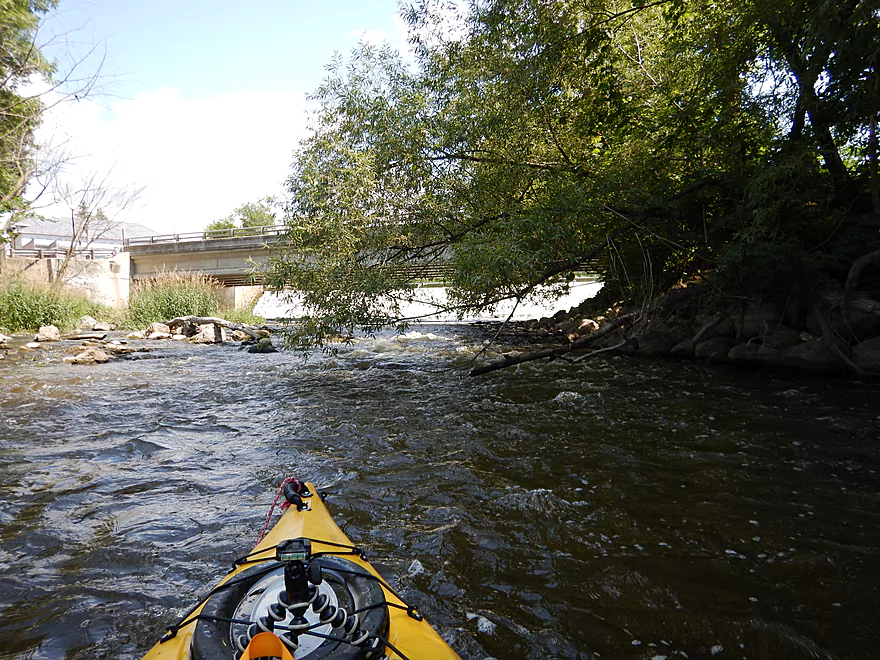
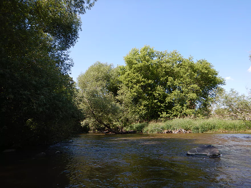
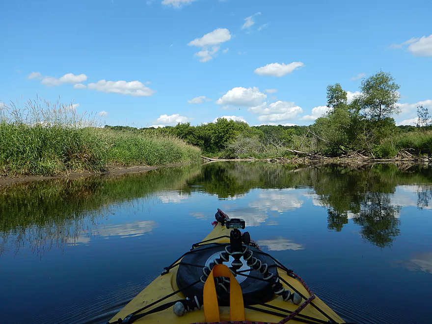
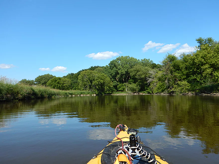
Very scenic start to trip
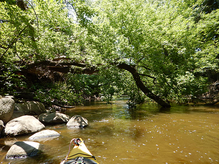
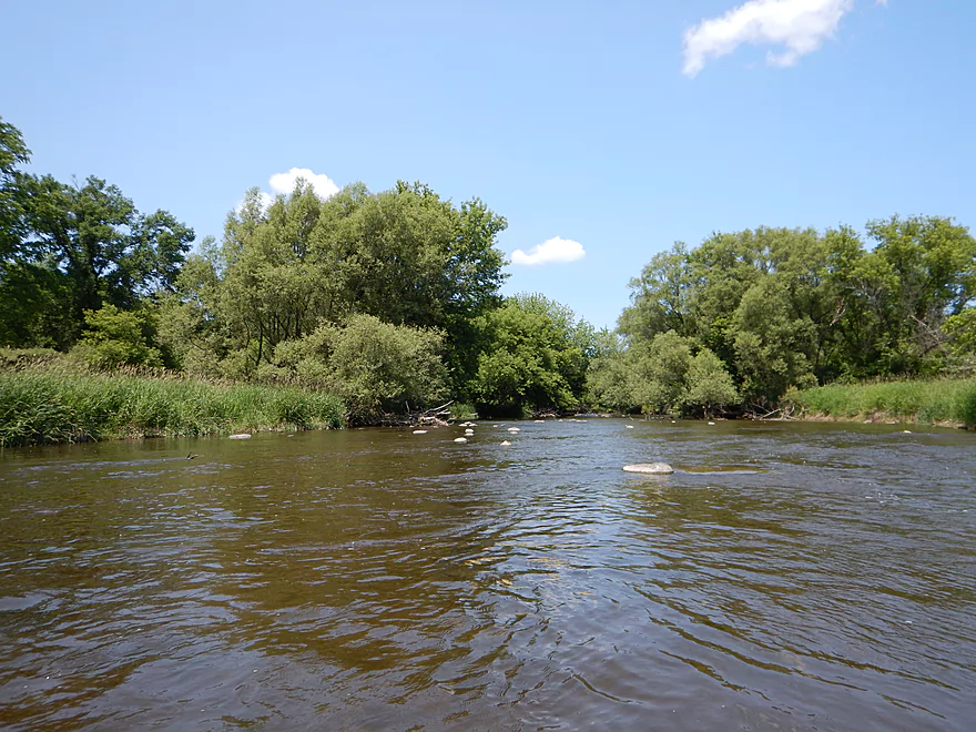
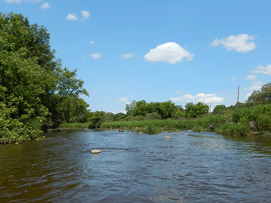
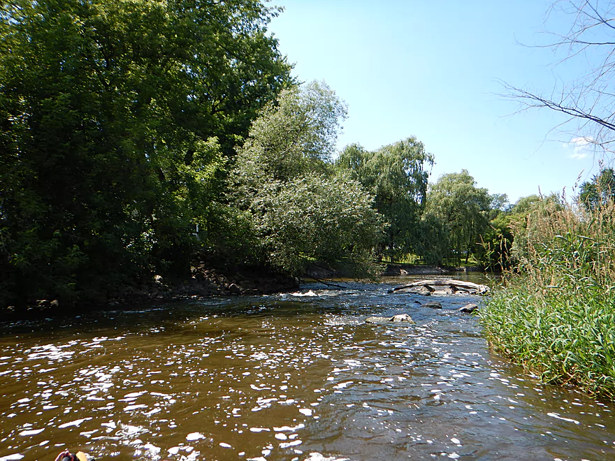
Nice riffles and rocks
Not all are real though
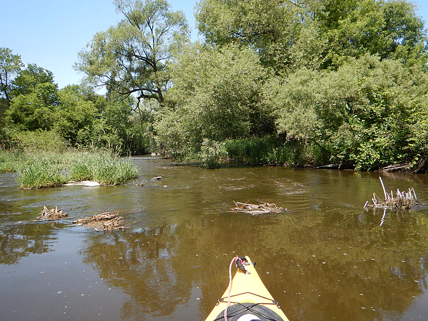
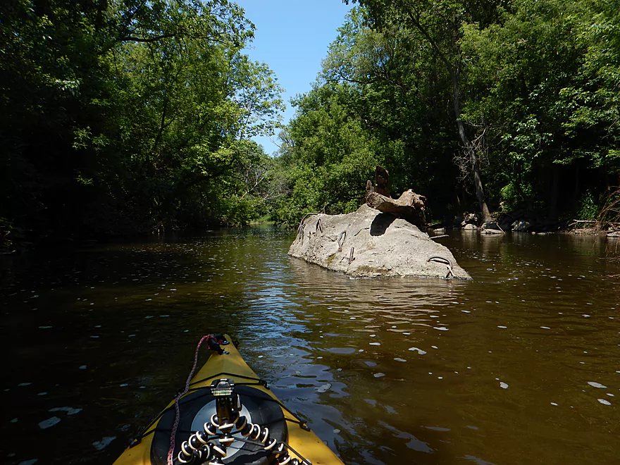
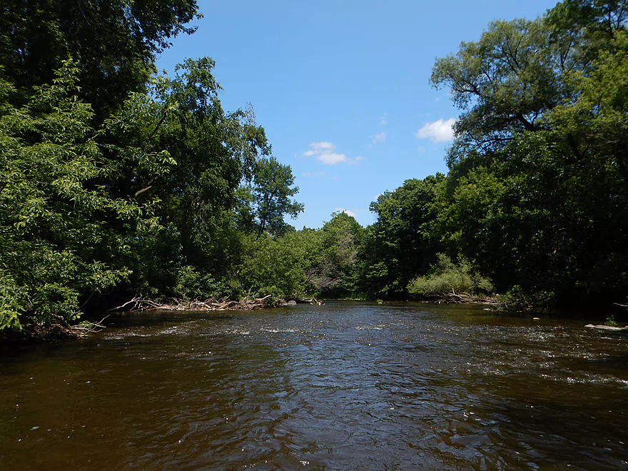
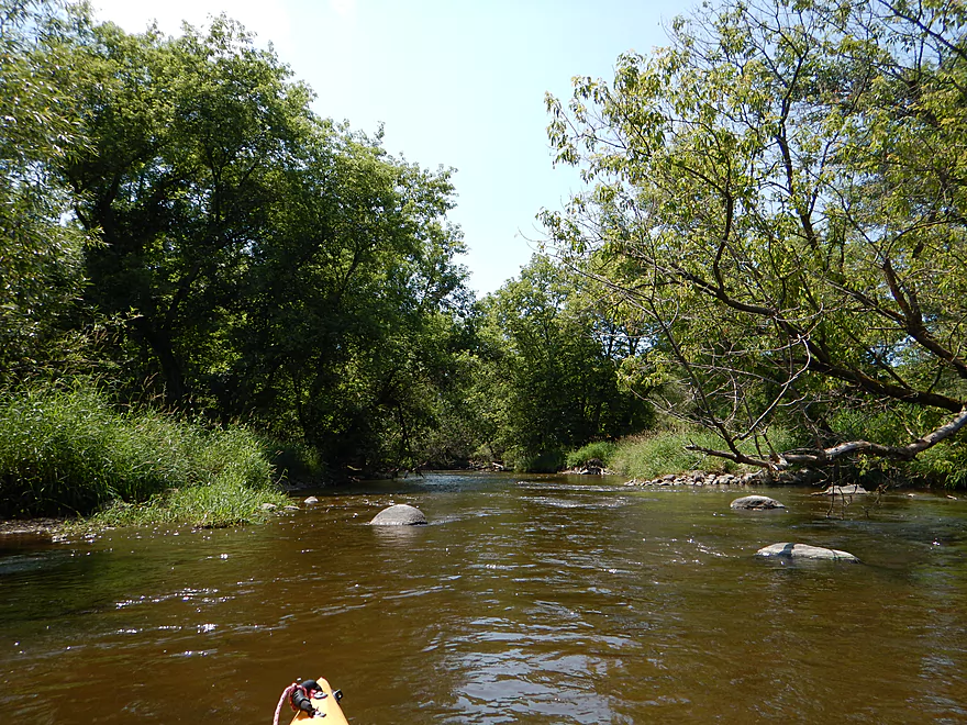
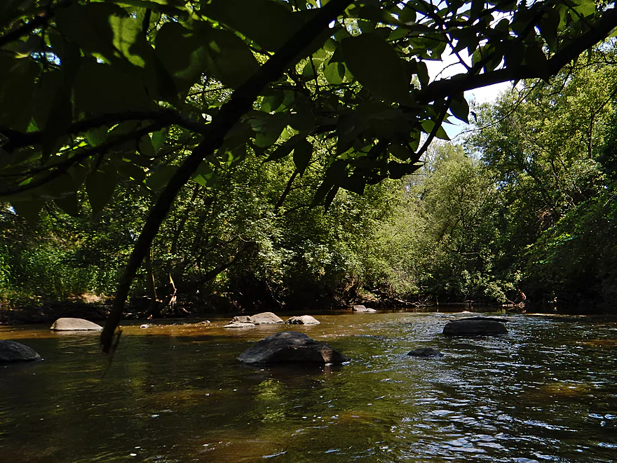
Cool wooded section with the rocks and light rapids
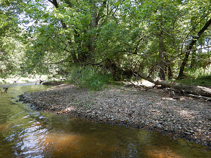
Some gravel bars
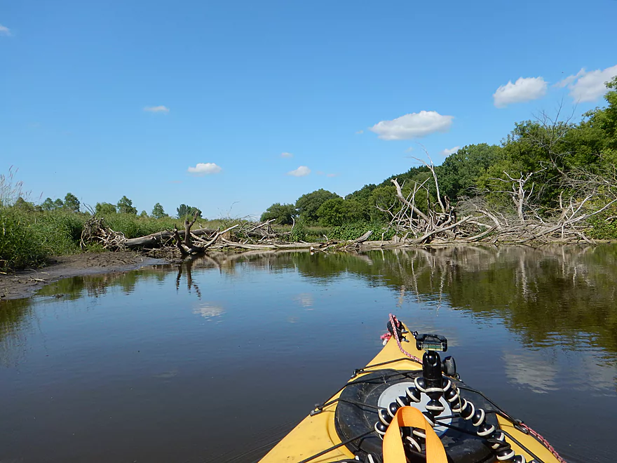
Log jams were not an issue
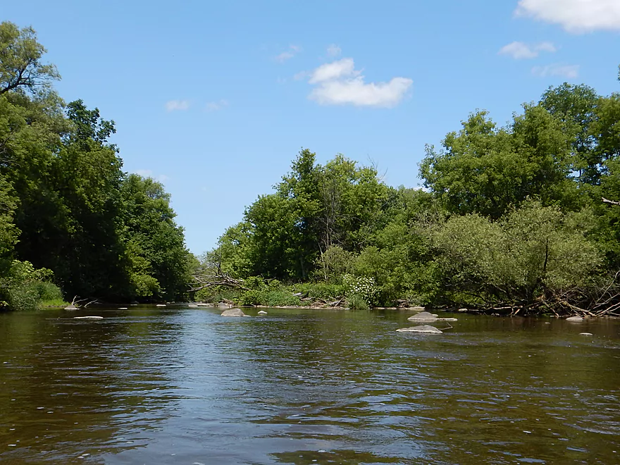
One of many boulder gardens
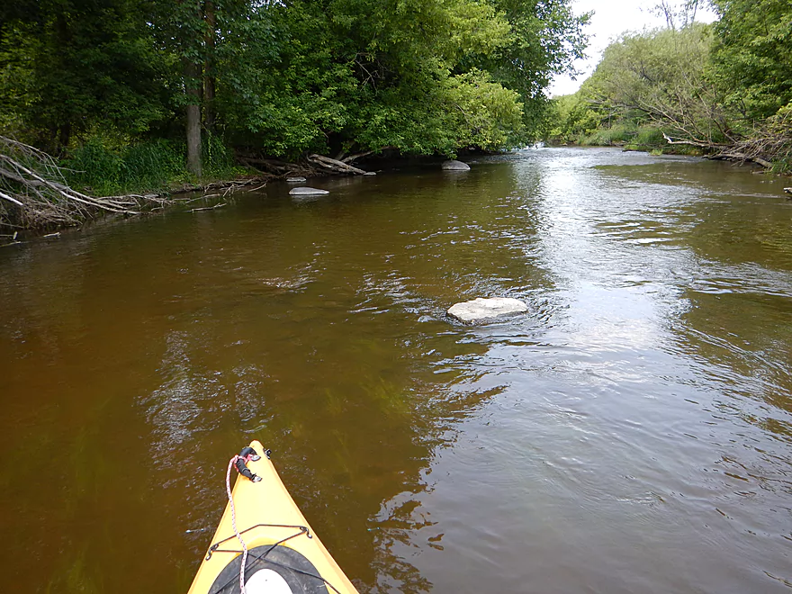
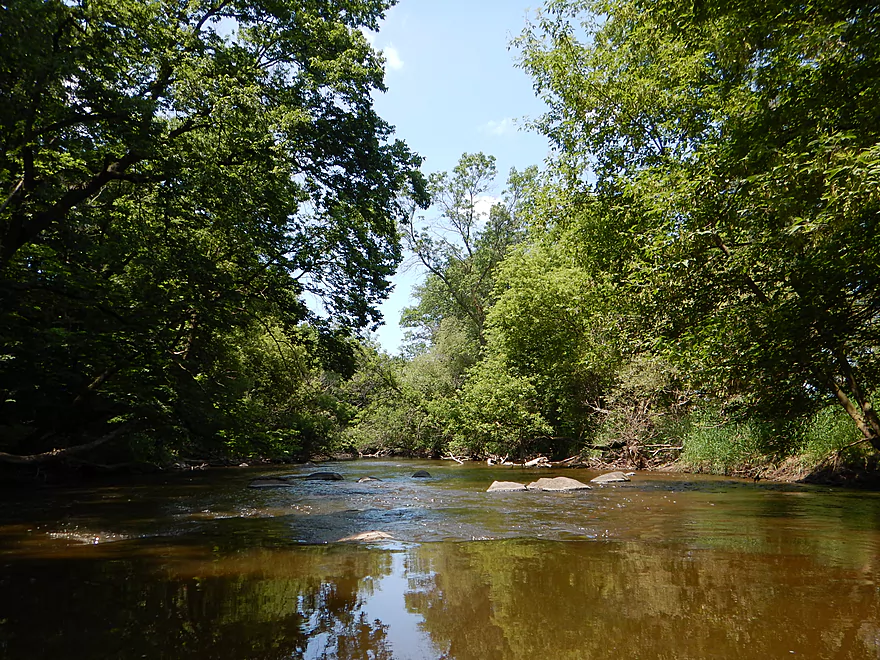
One of countless riffles
My favorite boulder garden
Water was sometimes clear, but not top-notch
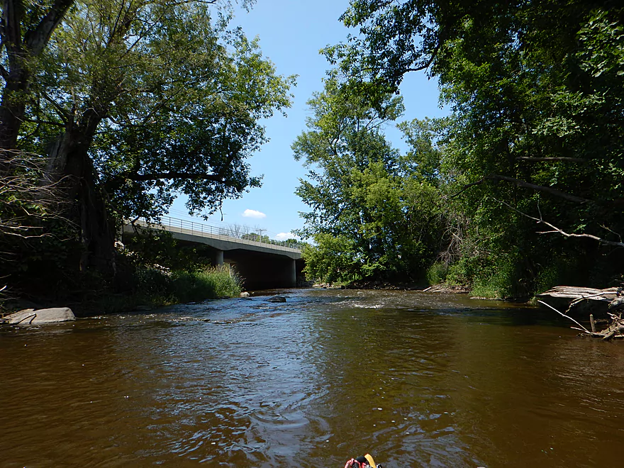
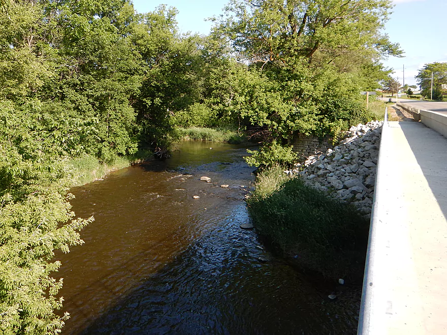
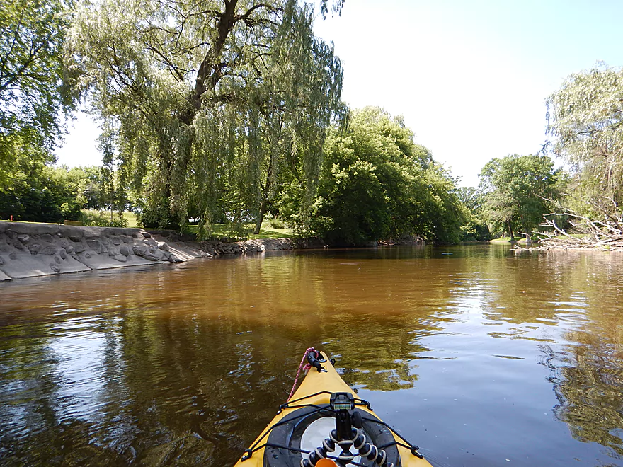
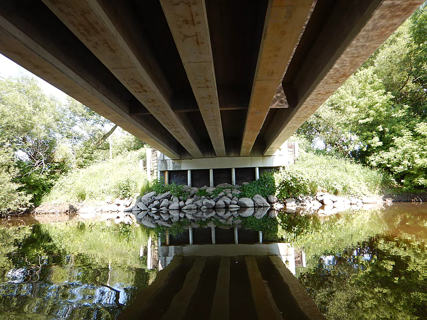
Hwy Y bridge
Cool rocky section
More fun rapids
Long walk if you take out here
Plus you miss more nice sections
Reminded me of a different East Branch…that of the Milwaukee
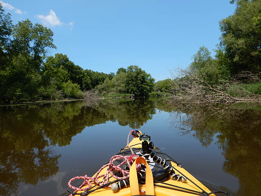
And the flowage starts to kick in
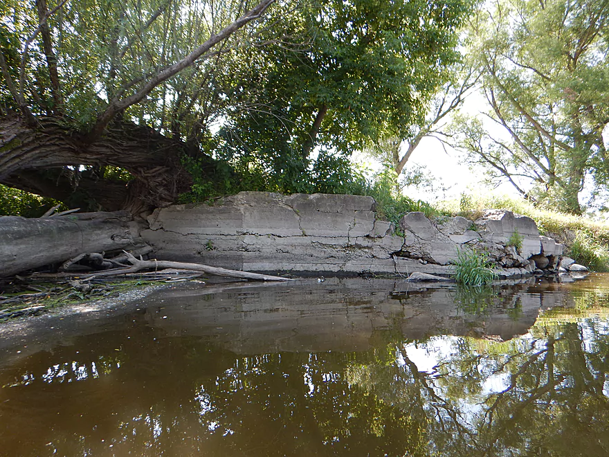
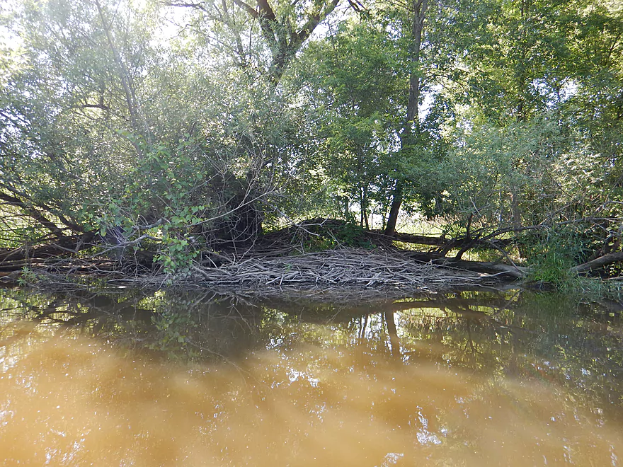
Massive embankment…wonder if it is natural?
Sign of things to come (eventually)
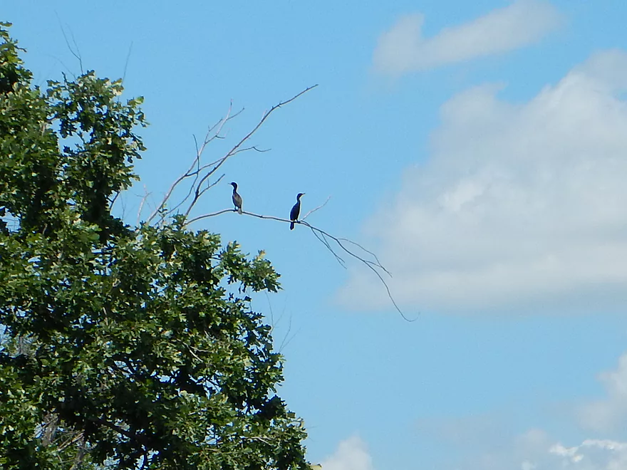
Cormorants
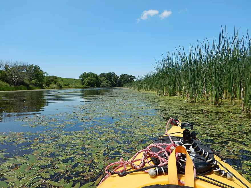
Weedy areas mark where the flowage is silting in
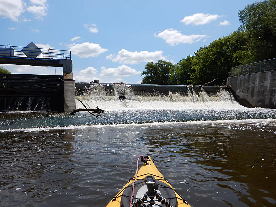
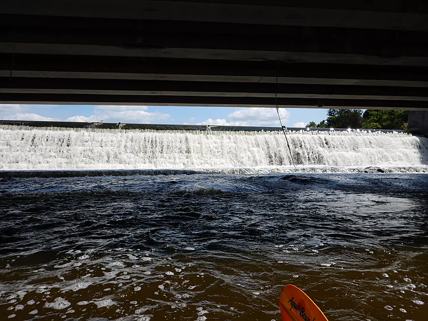
Avoid the dam on the left
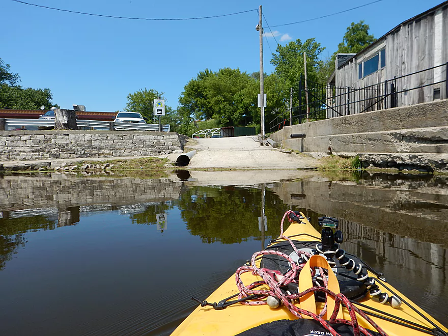
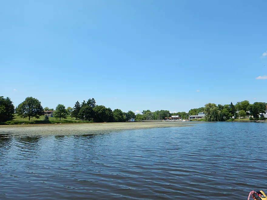
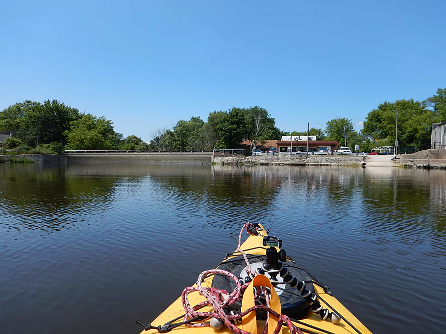
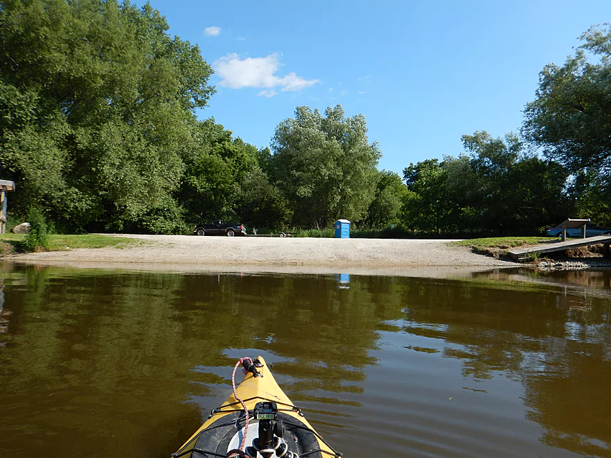
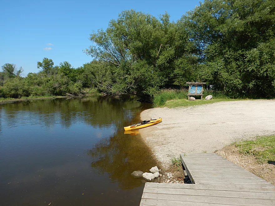
Good take-out at the boat ramp
My kayak magically turns red
Looking back over the flowage
Time for Kayak’s big land adventure
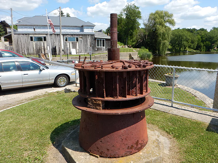
A monument to a dam turbine (seriously!)
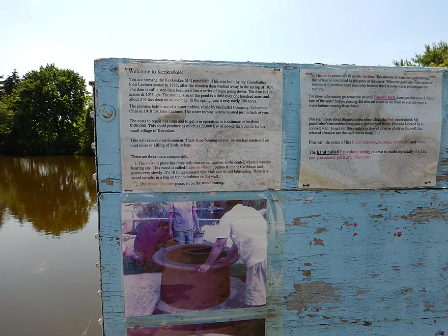
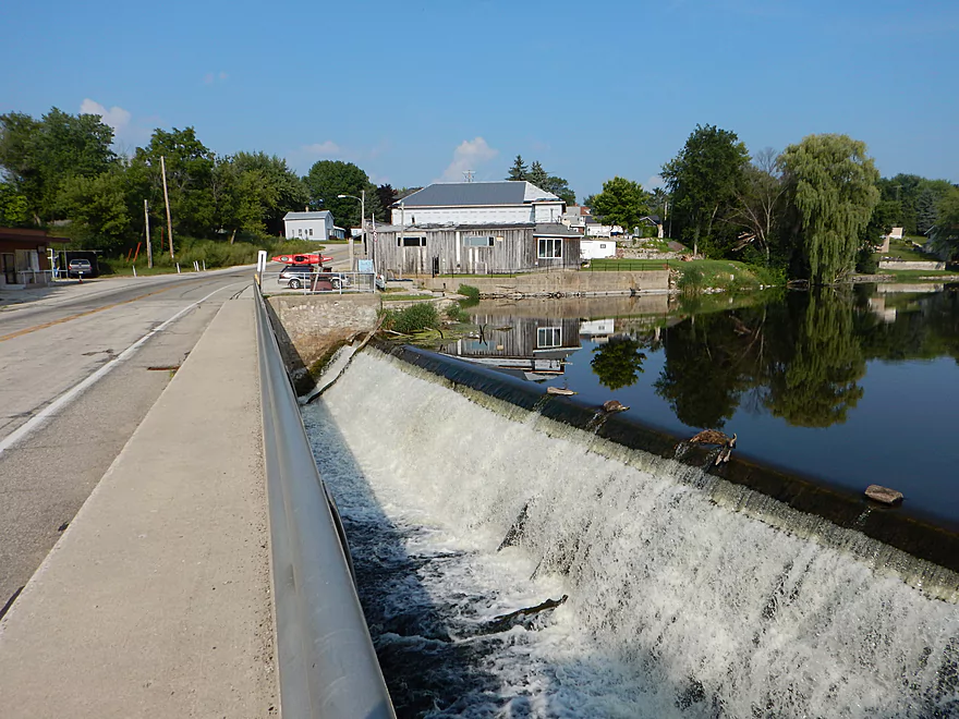
Dam history
Here is where I was stopped by the landowner
You can either rope down the wall/ladder or walk over the lawn
I did the latter but was able to double back to the dam
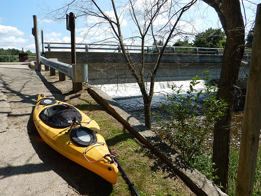
Fun class 2 rapids below the dam
You want to stay left
Reverse view
Not exactly a natural bank
Re-entering the woods after the flowage
This stretch isn’t too special
But still has some rocks and riffles
Dohman Road is an access option
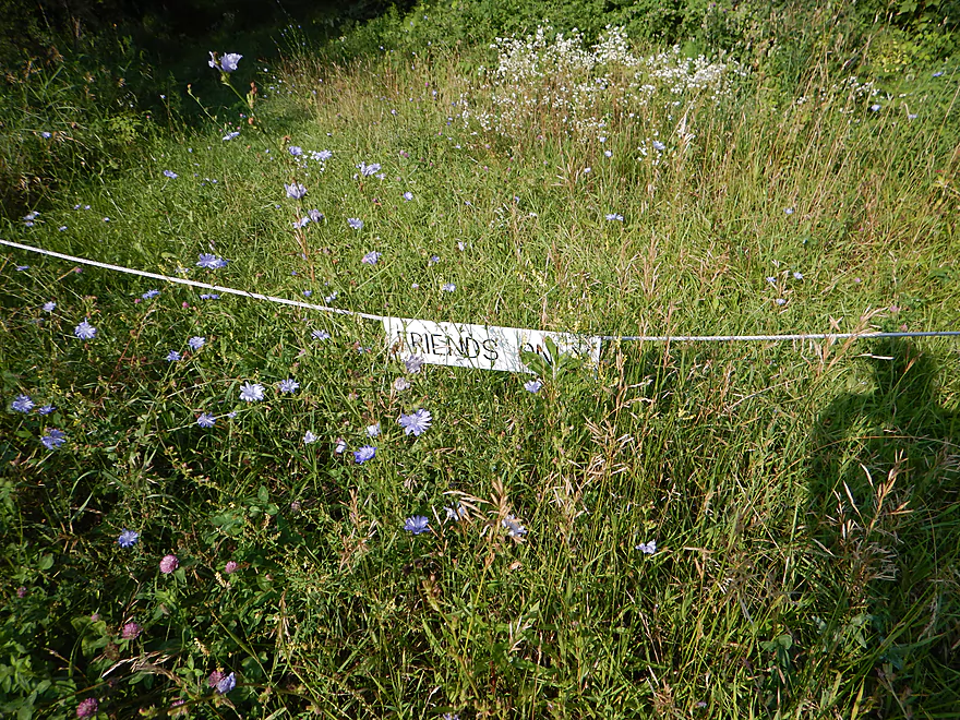
For friends only
Now things are really starting to slow down and widen
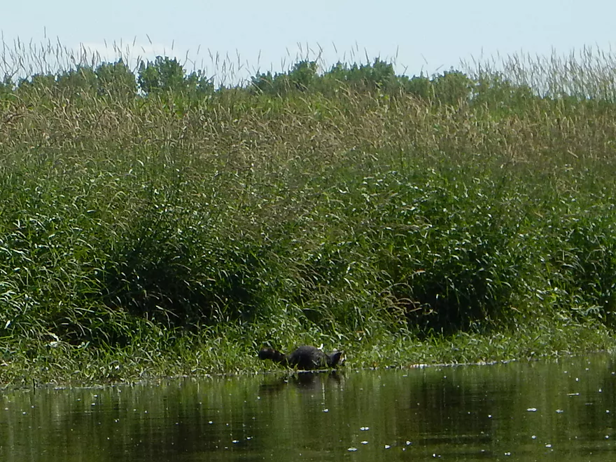
A raccoon digging for clams
You might be able to use Dike Road as access but it seems private
River just gets bigger and wider
Washed out Northern Road bridge (now a DNR access)
FINALLY get good light
Only log jam of the trip
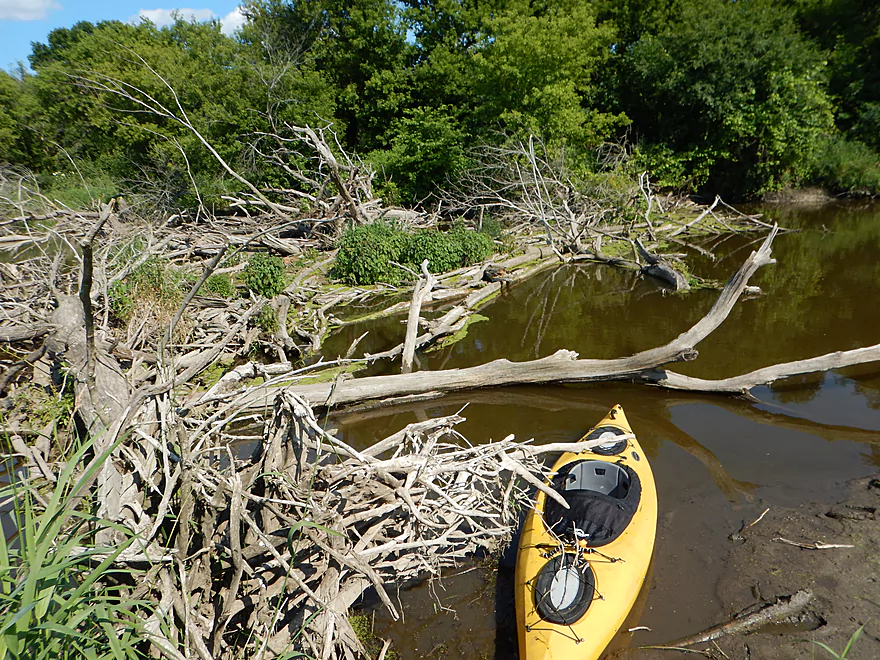
And it is an easy portage
Trees start to return
Beaver lodge
Take-out at Green Head Road
Good access
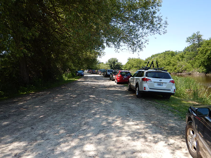
Was maybe 100 cars there that day!
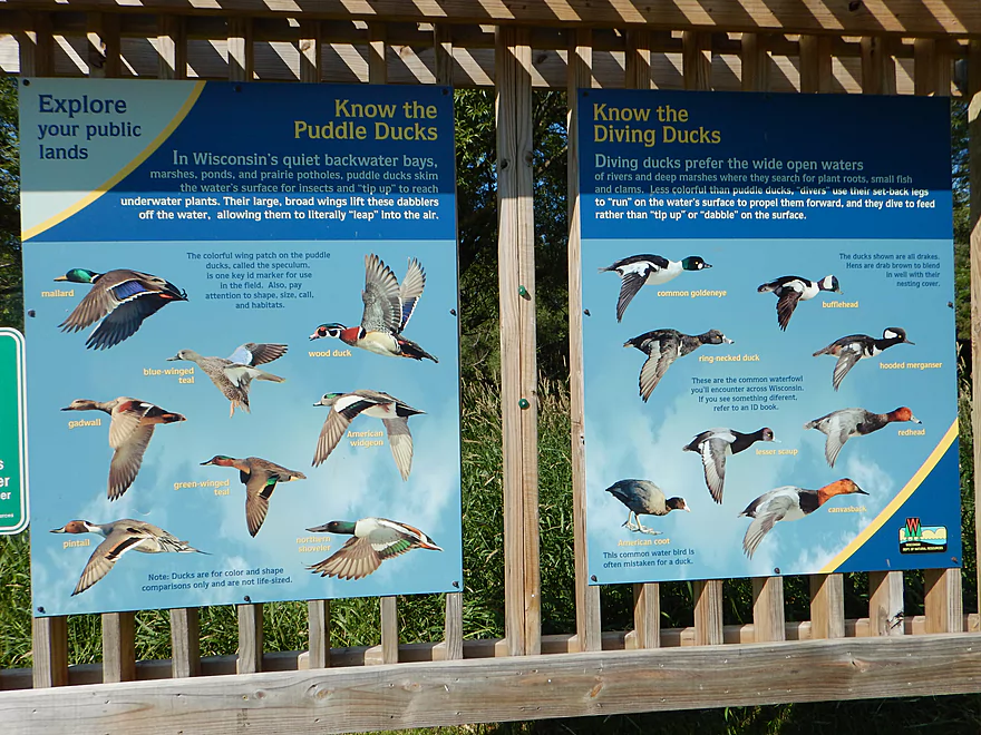
Do you know your ducks?
Rock River – East Branch – Mayville

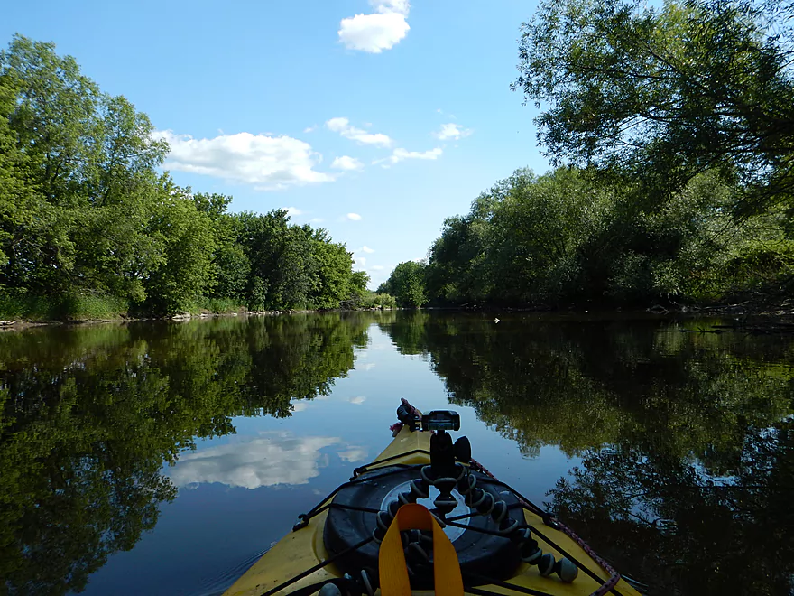
The East Branch is somewhat obscure, so I’ll try to orient you. The Rock River is a major river that has three main forks to the north: the South Branch, West Branch and East Branch. The three branches come together to form Horicon Marsh. Most paddlers are interested in the Rock River below Horicon, but I find the river here mostly too big and boring…and instead highly prefer the three upper branches. I had already paddled the East Branch prior to the city of Mayville and for this trip wanted to pick up where I left off and then continue on until I got to Horicon Marsh.
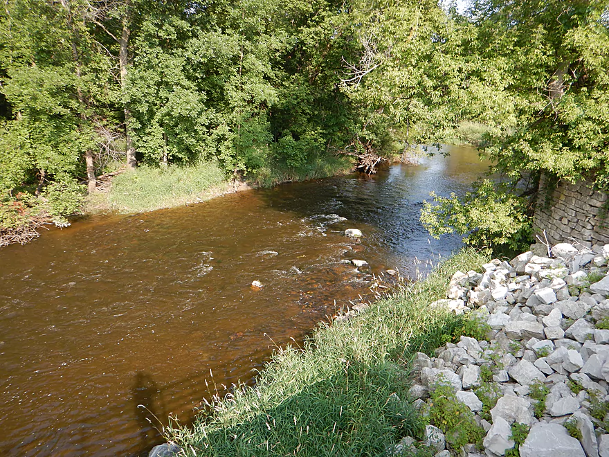
This trip starts out on a great note below the dam, with light rapids and attractive rocks in the stream. This was a wooded section, so I kept expecting a big log jam around each and every corner. This never materialized. The section from the put-in to the Hwy Y bridge (2 miles) was my absolute favorite part and got five stars in my book. Terrific current (14′ per mile is fast), fun safe riffles, attractive wooded corridors and many cool little boulder gardens. This might be the best section on the entire Rock River.
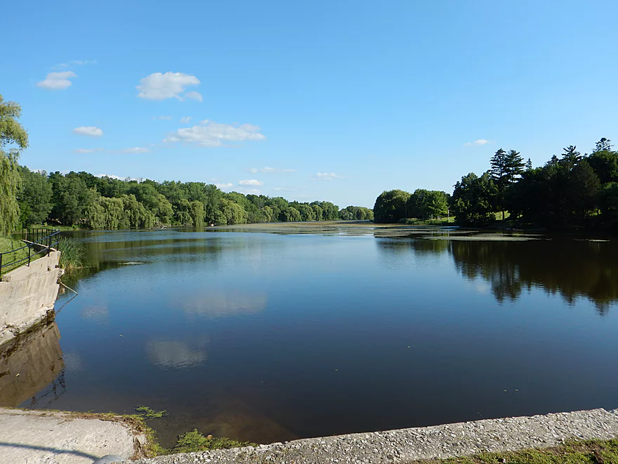
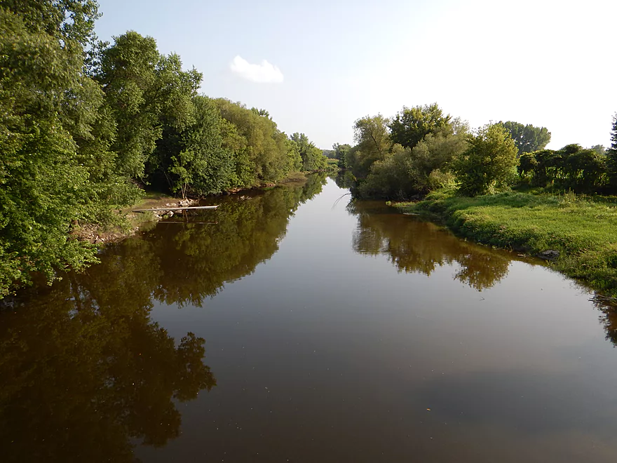
You could take out at Hwy Y, but that would be a short 2 mile trip (and steep bank to drag your boat up). After Hwy Y, the river stays intimate and fast for maybe a half more mile…then the river changes dramatically as the Kekoskee flowage kicks in. I do not think the dam operators in Kekoskee realize the treasure they buried in their lake. No doubt in its native state the Rock would have continued fast, riffly and rocky up to the dam. The flowage isn’t too bad as far as flowages go, with an interesting embankment to your left and a nice marsh to your east (a hint of things to come). It’s still heavily silted in with the northwest section pretty much weed city.
There is a fine boat landing by the flowage dam and ending the trip here would make for a satisfying 4 mile trip.
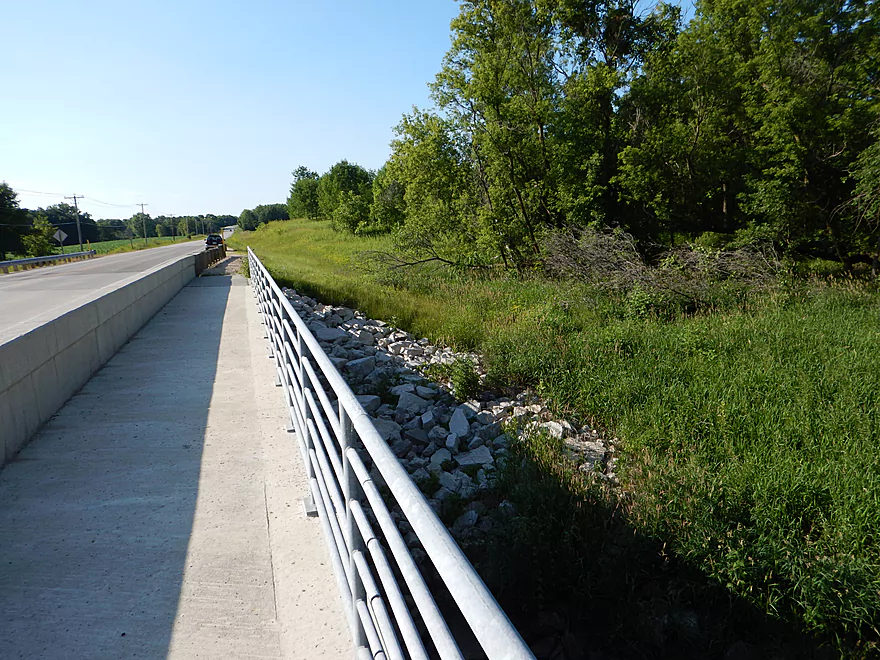
The Kekoskee dam is decently sized (probably the tallest of the East Branch dams) and is not runnable. So you will have to portage it, which is easier said than done. There is no marked portage path, although legally I think it is supposed to have one because of its size. So you’ll have to drag your kayak across the road and either over somebody’s lawn or rope your boat down a ledge (the pictures show this better than I can explain).
I was going to do the latter, when I was approached by the landowner who explained that this was private property and he asked me to wait. He seemed uncomfortable with my being there, but seemed friendly enough and was willing to let me through, so I didn’t get all technical explaining how paddlers absolutely have the legal right to portage dams over private property whether he permitted it or not. He insisted on helping me carry the kayak down over the lawn and into the water.
I was horrified though as I had wanted to run the immediate post-dam rapids, which he was taking me past, but was appreciative of him not making a scene, so bit my tongue. As soon as I was back in the water though, I snuck back upstream behind the retaining walls to get as close to the dam as possible and was then able to run the fun class 2 rapids. Again, I’m appreciative of his cooperation, but it would be nice to see a more permanent and established portage path so this doesn’t have to be an issue. Is the west bank an option? Not really…it has a bigger lawn and steeper bank.
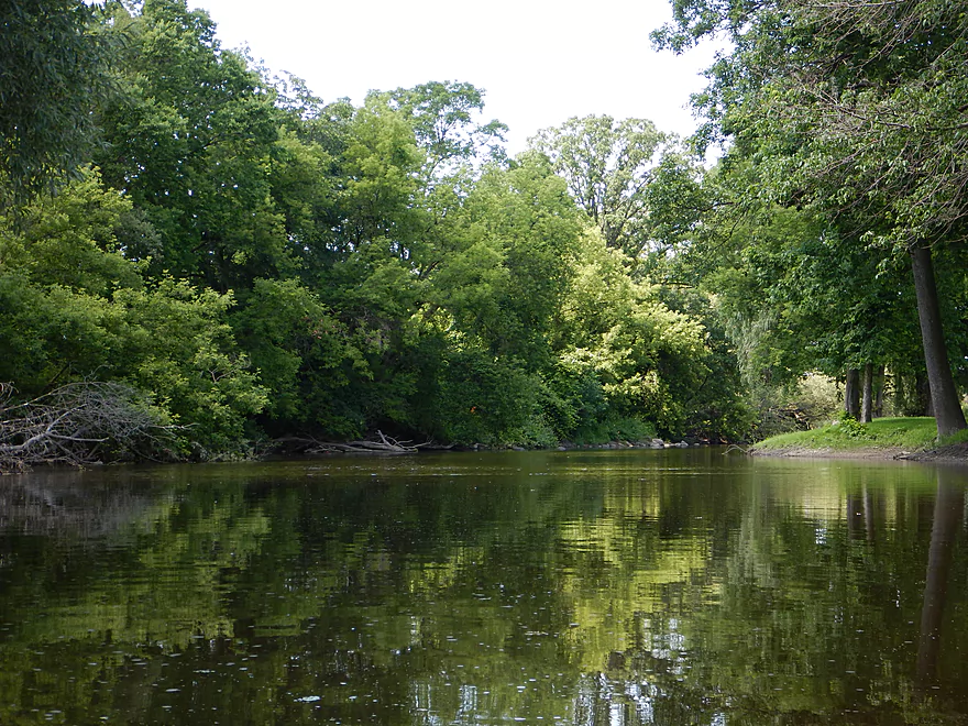
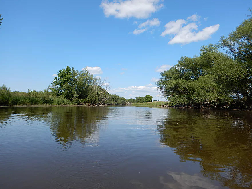
So after the Kekoskee dam, things really change. You get the woods back and some random rocks in the channel, but the current dies and there aren’t many riffles left. The water also gets much milkier and dirtier (a far cry from my trip last year which had terrifically clean water at times). Still a pleasant section but felt more like a ho-hum average river. From Kekoskee to Dohman Road is 1.5 miles.
You can take out at Dohman (I believe). There is a nice pull-off by the bridge to the water with a sign that says “Friends Only”, which I presume means low impact activities like kayaking are ok…but can’t be certain. You could take out at Dike Road a bit later, but that is very exposed, close to houses and the banks are extensively mowed (which gives it a private vibe).
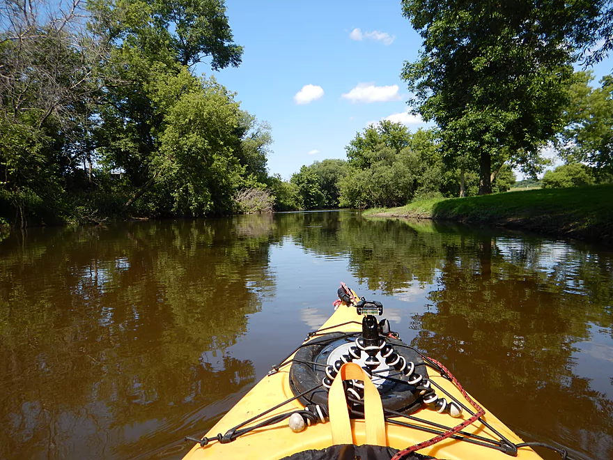
From Dohman to the take-out, the river is nothing special. Not many trees, somewhat dirty water, and slow current.
A bit after the the DNR landing at Northern Road (which I didn’t use because of its gravel roads), I came across my only log jam, which was very easy to portage. The trees come back at last (a bit) which is a nice touch for the final stretch. After one of the few private houses I saw on the trip, the main DNR landing appears on the left, which you can’t miss.
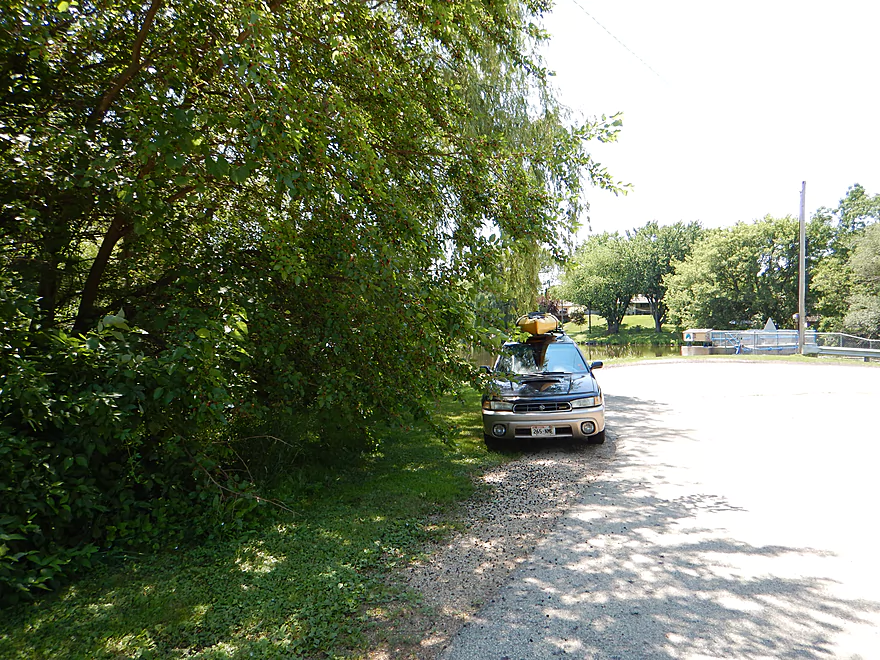
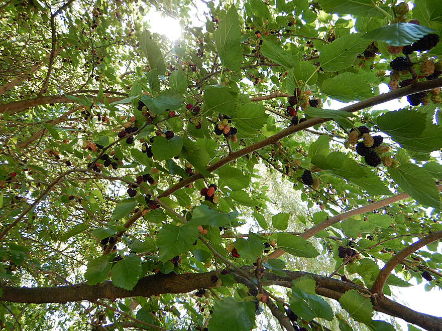
Good access at the Furnace Bridge Dam (N. Main Street bridge in Mayville). No outhouse, but good parking and ok launch area across the jagged rocks. As a bonus, this “fishing access” has a terrific mulberry tree with some of the best tasting mulberries I’ve ever had.
Green Head Road (it’s the main Horicon Marsh boat ramp). Five star landing with great launch, places to lock your gear and an outhouse. Coincidentally, I did this trip during the “Paddle the Marsh” event sponsored by the DNR. There must have been 100 cars at least parked in three different areas, plus buses. Wow…Horicon Marsh was getting invaded by a kayak armada! It was quite the contrast to see so many paddlers putting in where I was getting out. I like Horicon for its waterfowl….but have to say my trip was better than theirs! Despite all the cars…I was the second to last to leave at the end of the day (must mean I’m slow).
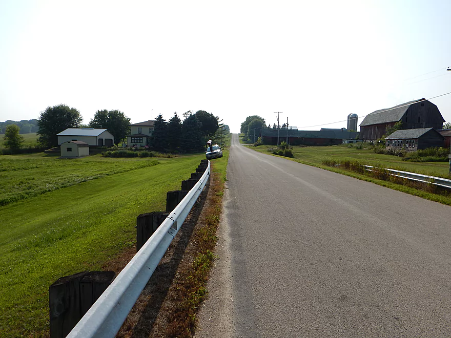
A moderate bike shuttle at 4.3 miles with some decent hills plus a small gravel section on Green Head Road, but this should be manageable for most.
Just one log jam and that is close to the take-out (marked on the map). Otherwise, the rapids are all safe. There are open sections in the last third of the trip, so watch wind direction and speed (avoid headwinds over 10 mph).
This section has rapids which are always very flow-rate sensitive. Too high could be rough and too low could be too bumpy (although with rapids you’re always going to hit rocks regardless so don’t let this deter you too much). I paddled this at 230 CFS which was nice with not too many crashes. I think 200-300 is a good target range for water quality, boulder gardens and padding. If you’re adverse to rock collisions maybe aim for 250 to 350 CFS, but this won’t be as scenic. These are all pseudo-scientific guestimates.
Many familiar faces: two eagles, many blue herons, a green heron, many many carp (friendly too!), I believe an otter, a muskrat, deer/fawns and dragonflies. The highlight would be the two wet raccoons who were in the water digging for I believe clams2:03 in the video.
Detailed Overview
East Branch:
- Upstream of Hillcrest Drive: I believe these portions are too congested to paddle.
- Hillcrest Drive to Hwy DW: 4.1 miles.
- Hillcrest Drive to Riveredge Park: 0.9 miles. Scenic stretch through the outskirts of Allenton with good clarity. However there are two major logjams to portage, and several minor logjams to squeak past.
- Riveredge Park to Hwy DW: 2.7 miles. An open stretch through wetgrass and a state natural area. One logjam needs to be portaged.
- Hwy DW to Hwy D: 5.5 miles. Outside of one nasty logjam cluster this is a pretty open creek paddle through a protected wildlife area that might be decent.
- Hwy D Wayside to N. Pole Rd. Launch: 7.3 miles. A good wetland paddle prospect through Theresa Marsh. Maybe 1-2 downed trees on the upper part.
- Kohlsville River: Note, the Kohlsville River joins the East Branch here, but it seems too congested with downed trees to be feasible.
- N. Pole Rd to Gill Rd(East): 6.0 miles.
- N. Pole Rd Landing to River Edge Park: 1.3 miles. Slow, open, and marshy channel. Nice though.
- River Edge Park to Rock River Street/Dam: 0.5 miles. A nice town paddle through the community of Theresa. One dam to portage.
- Rock River Street/Dam to Hwy AY: 3.5 miles. One of my favorite stretches on the entire Rock River. While shallow in spots, it is scenic with nice woods, small boulder gardens and multiple light rapids.
- Hwy AY to Gill Road(East): 0.7 miles. A brief wooded stretch that is a nice paddle.
- Gill Road(East) to Hwy 67/Dam: 8.3 miles.
- Gill Road(East) to McArthur Road/Fink Creek: 4.7 miles. Starts boring, weedy, and slow, but gets nice with clear water and rocks later on. Gill Road(West) may be a viable halfway access.
- McArthur Road to Hwy 67/Dam: 3.6 miles. A less interesting paddle through a flowage and downtown Mayville with numerous alt take-outs.
- Hwy 67 to Green Head Road Ramp: 6.4 miles.
- Hwy 67 to Hwy Y/Ziegler Park: 1.9 miles. One of the best paddling stretches on the entire Rock River with good current and small boulder gardens.
- Hwy Y to Hwy TW/Kekoskee Pond Ramp: 1.9 miles. A good stretch that includes a little bit of flowage paddling.
- Hwy TW to Green Head Road Ramp: 2.6 miles. An ok stretch as the river really slows and starts to turn into marsh.
- Green Head Road to N. Nebraska St. Ramp: 10.0 miles. The most popular route through Horicon Marsh known for its waterfowl.
South Branch:
- Upstream of E. Rock River Rd.: I suspect downed trees are too much of an issue for this to be navigable.
- E. Rock River Road to Hwy 49: 1.6 miles. Perhaps a cluster of downed trees in the middle and an electric fence upstream of Hwy 49.
- Hwy 49 to Waupun Park: 1.7 miles. Hwy 49 is not ideal for launching, but should be doable. A good prospect mostly through a golf course. Maybe 2 logjams?
- Waupun Park to E. Waupun Road: 7.2 miles. A good section.
- Waupun Park to Tanner Park: 3.1 miles. Great section though downtown Waupun. Alt access at Pine Street Park, Meadow View Park and Harris Mill Park.
- Tanner Park to Roadside Park: 3.2 miles. A pleasant paddle through a mixture of woods and open areas. A couple of logjam squeakers and one major portage.
- Roadside Park to E. Waupun Road: 0.9 miles. River widens, slows, and gets less interesting.
- E. Waupun Road to Dike Road: 10.0 miles. This is the northern unit of Horicon Marsh and is off limits to paddlers per National Wildlife Refuge rules.
- Dike Road to N. Nebraska St. Ramp: 5.6 miles. Am 80% sure you can drive on Dike Road from the east to launch in the ditch. Mostly a long straight canal paddle through Horicon Marsh with perhaps interesting side canals to explore. You can also launch in a west canal by Burnett Ditch Road. The city of Horicon marks the confluence of the South and East Branches of the Rock River.
West Branch:
It’s a neat prospect, but I suspect the logjam situation is too much (I could be wrong).
Main Branch:
- N. Nebraska St. to Legion Park/Dam: 0.9 miles. An ok section through downtown Horicon.
- Legion Park to River Bend Park: 1.1 miles. Simple river segment…probably nothing too special.
- River Bend Park to Lions Park: 8.8 miles. A large and probably uninteresting flowage. If you get permission to take out at Ox-Bo Marine, you can avoid much of the flowage paddling.
- Lions Park to Elmwood Park: 7.2 miles. Trip starts nice with a great boulder garden, but becomes less interesting as the current dies.
- Elmwood Park to Hwy MM: 4.4 miles. An interesting prospect recommended by Frank Piraino.
- Hwy MM to Harnischfeger Park: 6.9 miles.
- Harnischfeger Park to Kaul Park/Hwy CW: 5.1 miles. Nice section with more wooded banks.
- Kaul Park to Kanow Park: 5.7 miles. Nice prospect.
- Kanow Park to Hwy F: 5.0 miles. Mediocre prospect.
- Hwy F to Hwy P: 6.0 miles. This isn't an elite trip with slow current and no exotic scenery. But it is pleasant and one of the nicer legs on the Lower Rock.
- Hwy P to Dam1st/Front St.: 5.6 miles. Probably an uninteresting flowage paddle.
- Dam1st/Front St. to Dam2nd/S. 1st Street: 2.6 miles. Possibly a unique paddle through downtown Watertown.
- 1st Street to Hwy 26 Launch: 3.5 miles. Mediocre prospect.
- Hwy 26 Launch to Hwy B: 10.9 miles. The put-in is SE of Hwy 26 via Jefferson Road. This segment is more undeveloped, but is still probably not interesting with the highlight being I94.
- Hwy B to Lubahn Park/N. Watertown Ave: 4.1 miles. Probably uninteresting.
- Lubahn Park to Tensfeldt Park: 2.3 miles. Paddling through downtown Jefferson might be unique, but there is a dam to portage. Many alt landings in Jefferson.
- Tensfeldt Park to Klement Park: 4.2 miles. Probably an interesting tweener section between Jefferson and Fort Atkinson.
- Klement Park to Lorman Bicentennial Park: 3.1 miles. A weak prospect through downtown Fort Atkinson.
- Lorman Park to Hwy 26 Ramp: 3.3 miles. A weak prospect.
- Hwy 26 to E. Knudsen Road Ramp: 11.8 miles. Mostly boring paddling on Lake Koshkonong. Many other launches on the lake.
- E. Knudsen Road Ramp to Hwy M/Dam: 3.4 miles. Boring flowage.
- Hwy M/Dam to Hwy 14: 8.2 miles. Probably uninteresting.
- Hwy 14 to Century Ave/Dam: 6.4 miles. A trip through downtown Janesville with several dangerous dams to portage (reviewed by AmericanWhitewater.org). There are also many other launch options in Janesville.
- Century Ave/Dam to Happy Hollow Park: 7.8 miles. A very industrial section.
- Happy Hollow Park to Preservation Park Boat launch: 3.2 miles.
- Preservation Park to Wooton Park Boat Ramp: 3.0 miles. Start of urban paddling in Beloit. Numerous other launch options in Beloit proper.
- Further Rock River Trips: From here on, you are in Illinois. For further information see “Paddling Illinois” or Rockrivertrail.com.
Trip Map
Overview Map
Video
Photos Size:
7/5/2020 Just paddled from Mayville millpond dam to Kekoskee dam. 250-300 CFPS. Great trip, 2.5hrs approx. Beautiful paddle no logjams bumped a few rocks, no big deal. Cooper Shop bar was closed at takeout. Have eaten there in the past and it was good. This section of the Rock is definitely under-appreciated. I thank this site for directing us to it.
I agree…I’m not sure why this stretch isn’t more popular than it is.
We took a trip from the lower dam in Mayville in kayaks to horicon through the marsh it was a nine-hour trip but we seen lots of wildlife even a couple of eagles once you enter the marsh there is nowhere to get out of your kayak or at least 6 hours
Yeah…Horicon Marsh is great for wildlife but not so much for bathroom breaks.
Rock river is very under appreciated. The dam in kekoskee is run by my fathers uncles family. The area where u went down the ladder was my grandmas house. My family still owns the land by the old ball diamond in kekoskee. I often put in there and paddle to the green head. Only one small log jam, but I will be clearing it out soon.
I agree the Rock River is underrated. If/when that logjam gets cleared out, definitely let me know!
Just did this run over the weekend. About 6.7ft and 750 cfs on the Horicon rock gauge. It only took a little over an hour to get to the kekoskee dam, so it was a fast fun ride for that part. All the boulder gardens were under water for the most part and were now secret rocks that you have to watch out for. Instead of dealing with the land owner at the kekoskee dam I just carried my kayak about a 2 min walk down the alley behind his house and there is a park there with a nice put it. It does mean you miss the little stretch of rapids below the dam though. And there is a very annoying log jam about a mile before the takeout. Theres no flow to speak of there so it is doable to climb on the logs and drag your kayak over but still annoying. Overall this is a great stretch of river.
Thanks for the update! Yeah the portage path is new and not ideal, but is doable. Too about that logjam though.
A warning to paddlers…On 2025 March 15th, a Tornadoes touched down between Mayville and Juneau. This stretch is between those points and it is possible new logjams have formed on the river. I don’t know much more at this moment.