
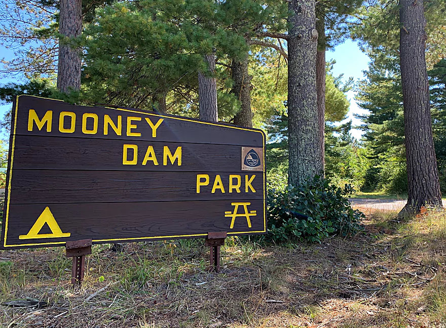
Mooney dam sign
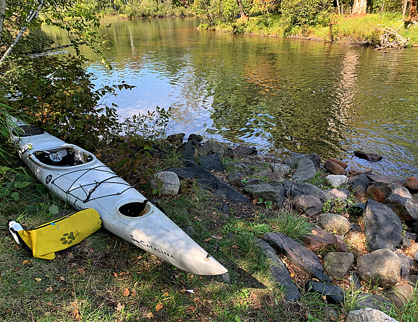
Put-in river left below the dam
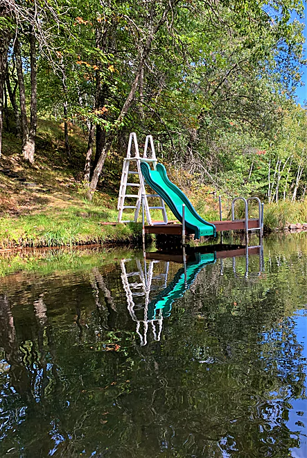
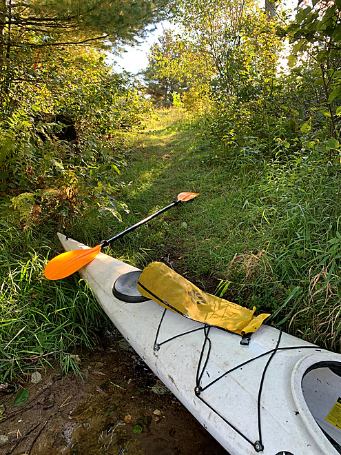
Gotta love the ways people use the river
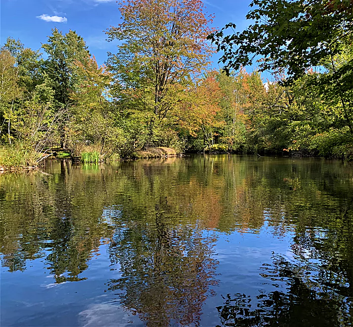
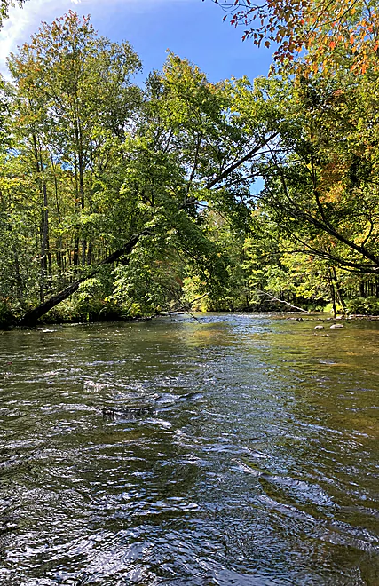
Is there anything sweeter than a river in the fall
Quintessential Eau Claire River Douglas County
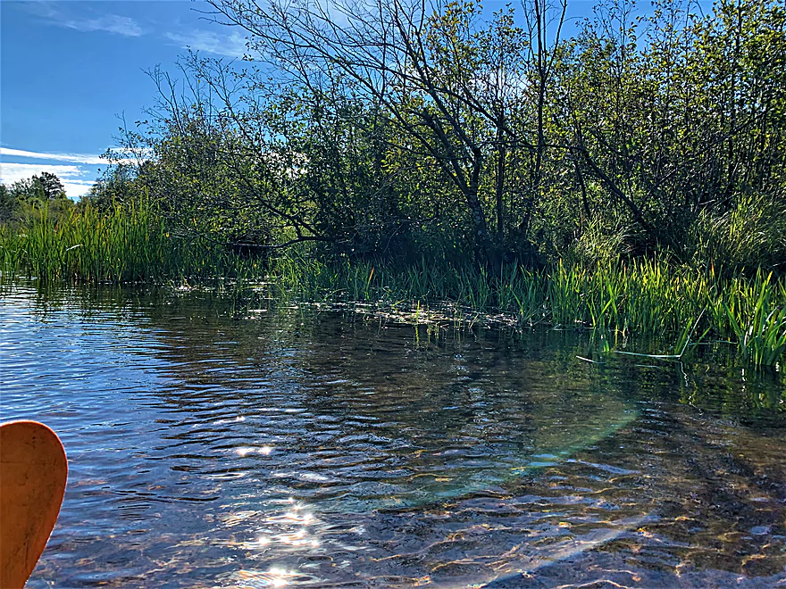
The alder swamp
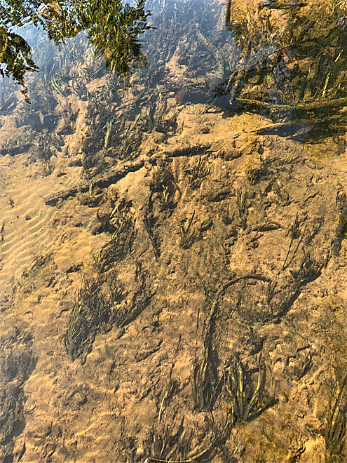
Beauty is underwater too
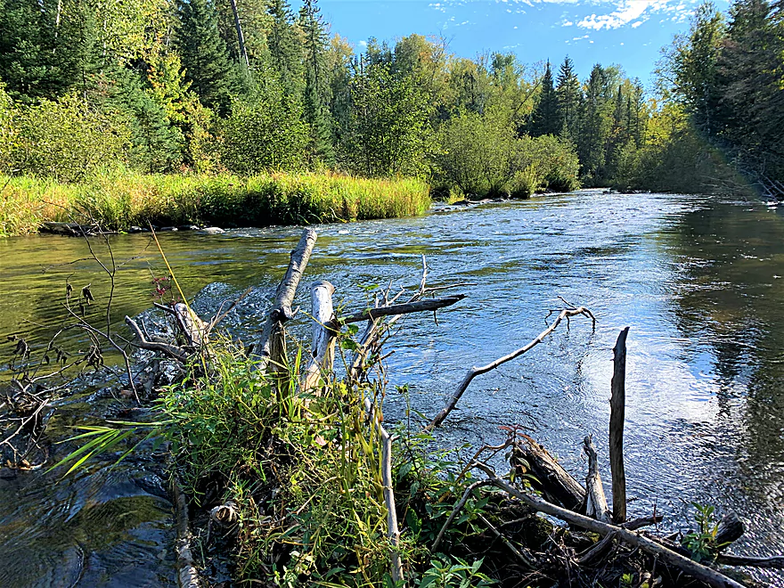
Braided channel, looking upstream
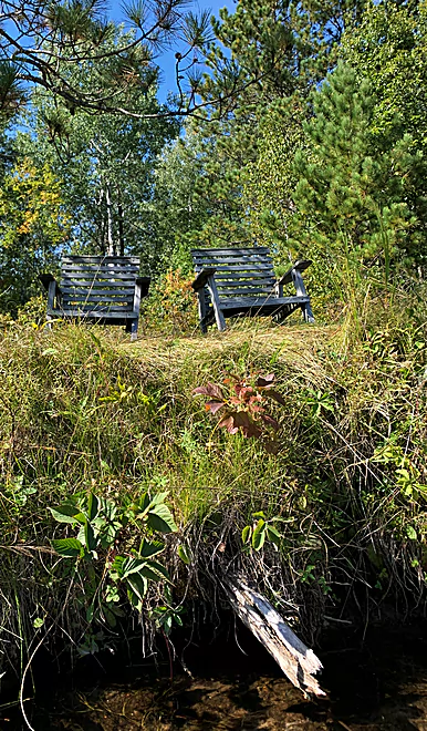
Typical riverbank amenity
Riffles, Eau Claire River style
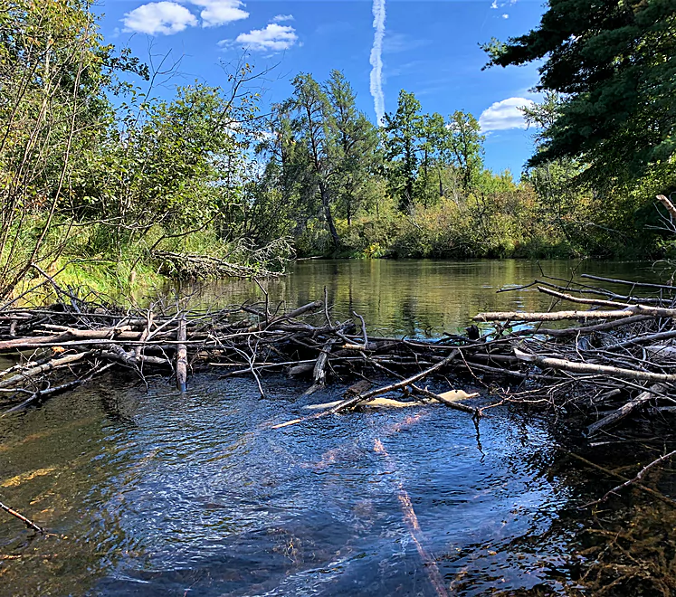
It was easy to scoot over this beaver dam
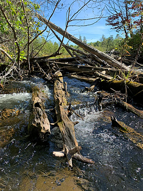
Upstream view of logjam, portage left
An almost ideal takeout at Lawler Bridge Rd
Eau Claire River – Douglas County

I had two motivating nudges to run this stream: One, no other river chroniclers that I could find had explored it. Two, I’m trying to paddle all the navigable Wisconsin rivers with the same name (e.g. Black, Yellow, Eau Claire, Pine). Having knocked out the two other Eau Claires (I’m missing a couple of branches, I’ll admit), I was ready for this one.
I was most pleased I checked it out. Clear water, sandy bottom, almost no obstructions and just enough fun features to keep you engaged, this river would be an ideal training river for those new to paddling in flowing water.
Though the land along the river is cut up into private lots, and away from the river looks to me like industrial forest (no map shows that it is public land), the river feels remote. The riverine property owners seem to want to respect the natural beauty of the river. Most homes are not ostentatious; they are set back from the riverbank and the amenities people have constructed are discrete and modest.
Those structures also indicate that this river’s level is predictably steady; the usual evidence of high or low water levels on the banks or in the trees was absent. Those steady-Eddie levels are probably due to the Eau Claire flowing out of a complex of lakes to the east, with apparently just one impoundment on that lake chain. A river’s water quality is often compromised by dams and the impoundments they create. Not in this case – the water was stunningly clear, and helpfully so: it is shallow, so navigating the sand and gravel bars is facilitated by the transparency of the water.
Though shallow, the usual small river rules of the road apply here – stick to the outside bends. That, and the almost total absence of obstructions like deadfalls and strainers, is why this Eau Claire is ideal for flatwater paddlers wanting to learn how to navigate a river.
I started at Mooney Dam County Park (put in at river left), but a better put-in may be just downstream at Johnson Road (put in downstream left). Subtracting this upper stretch, and adding in the piece between Lidberg Bridge Road and Lawler Bridge Road, would be an ideal outing. (My trip, from the county park to Lawler Bridge Road, took 3.5 hours.)
After Johnson Road, the river widens and slows as it courses through an alder swamp. After narrowing into three small channels, you’ll encounter the only obstacle that requires leaving your boat — a bottleneck jammed with logs. Portaging left, you’ll climb up and over a berm that I suspect is the remnants of a crude dam which may have created the narrows that caused the logjam. Three people, one with a chainsaw, could clean it out in under two hours. I wonder if the homeowners there want the jam to remain; it does amplify that sweet sound of rushing water. (No one would be trespassing or destroying property by undoing the jam.)
Immediately following the logjam is a 200-300-yard run of delightful riffles (Class I in higher water), followed by intermittent ones.
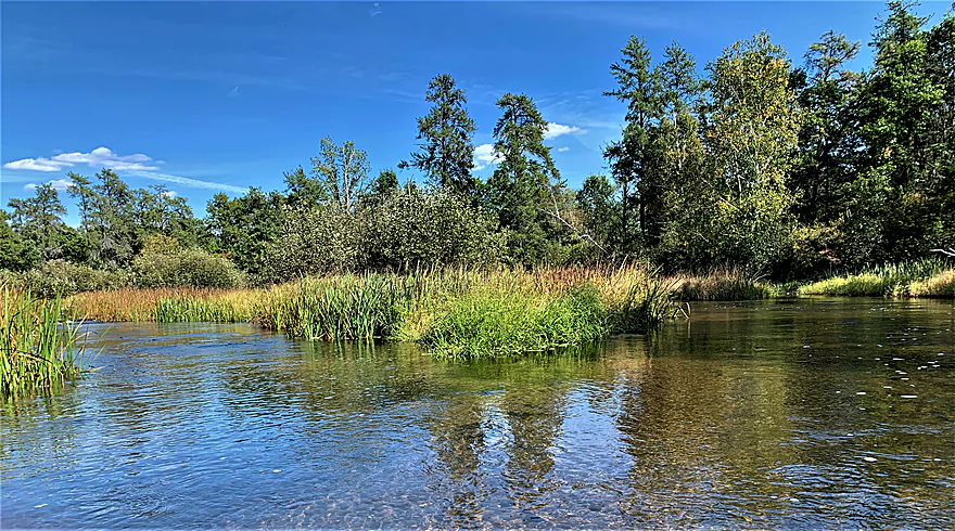
The exception to the rule about modest houses — a suburban style house with a manicured lawn, on the left bank — at the McCumber Road bridge signals your arrival at a series of braided channels. Which channel to take will be obvious. More alder swamp is next, but likely because of that landform, houses also disappear, and so do the fun paddling features.
Upon passing under Lidberg Bridge Road (if you want to take out there, choose either upstream left or downstream right), a refreshing change of pace occurs again – alder swamp is out, more riffles are in, most of the way to Lawler Bridge Road. As mentioned above, putting in at Johnson Road and taking out at Lawler is the optimal choice on this Eau Claire River.
For people biking the shuttle, use County G and East Mail Road to get to Mooney Dam County Park. (This town road is charmingly labeled on some maps and signs as “E Mail Road.”) The bridge at Lawler Bridge Road is actually out; you can’t get from one side of the river to the other with a car. For cyclists, there’s also way less gravel using County G and East Mail Road instead of using town roads and County Road Y to get to the east and the put-ins. For cars it’s six of one, half dozen of the other.
Thanks for the review Denny!
WisconsinRiverTrips.com is always very appreciative of guest reviews, and if you the reader is ever interested in submitting one, you can use this online form.
Trip Map
Photos Size: