
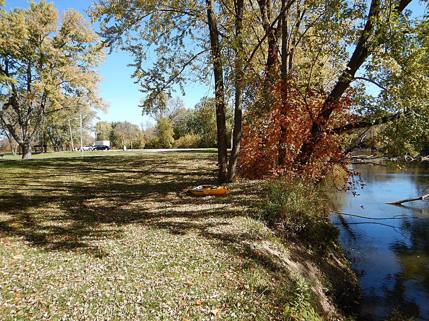
Good parking at Wayside Park
Steep put-in though
Surprise rapids upstream of the put-in
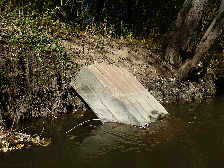
With a strainer, it looks dangerous
A wooden spider web
Another Wayside Park launching option (not much better)
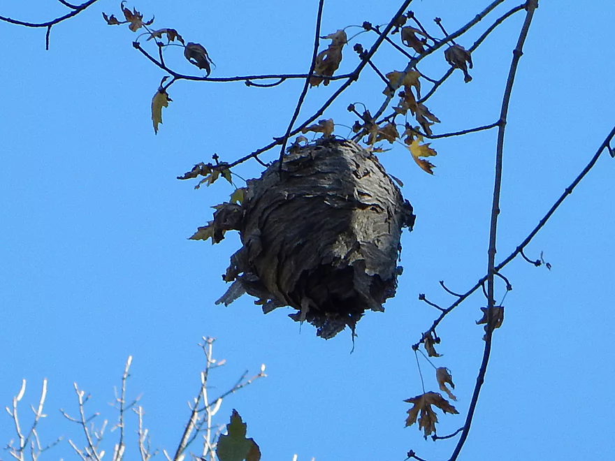
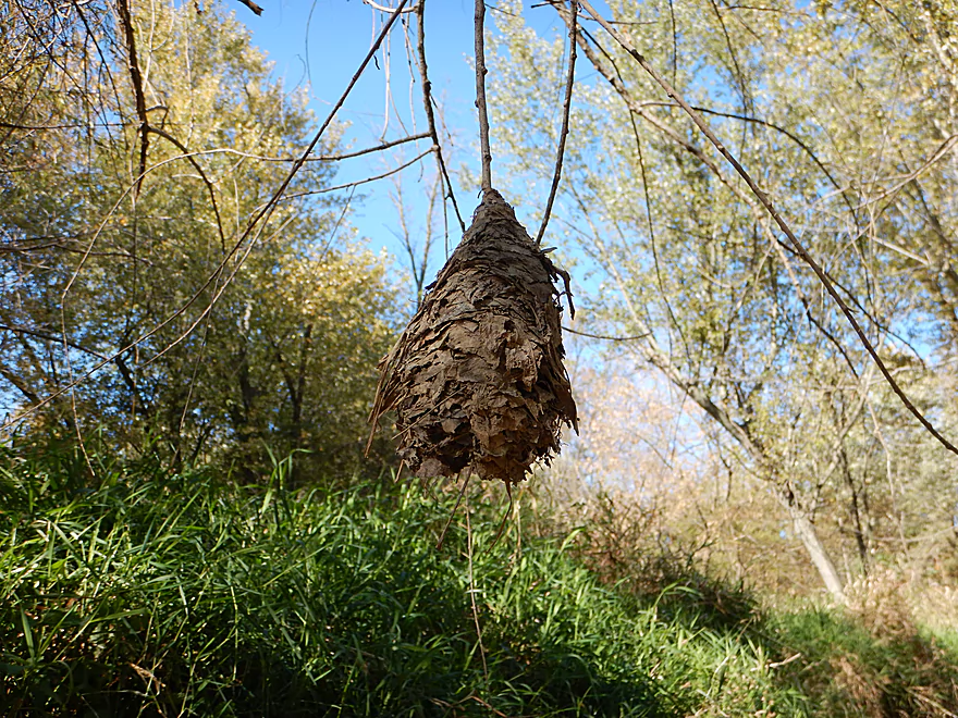
Paper wasp nest
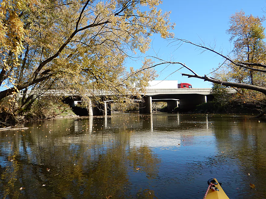
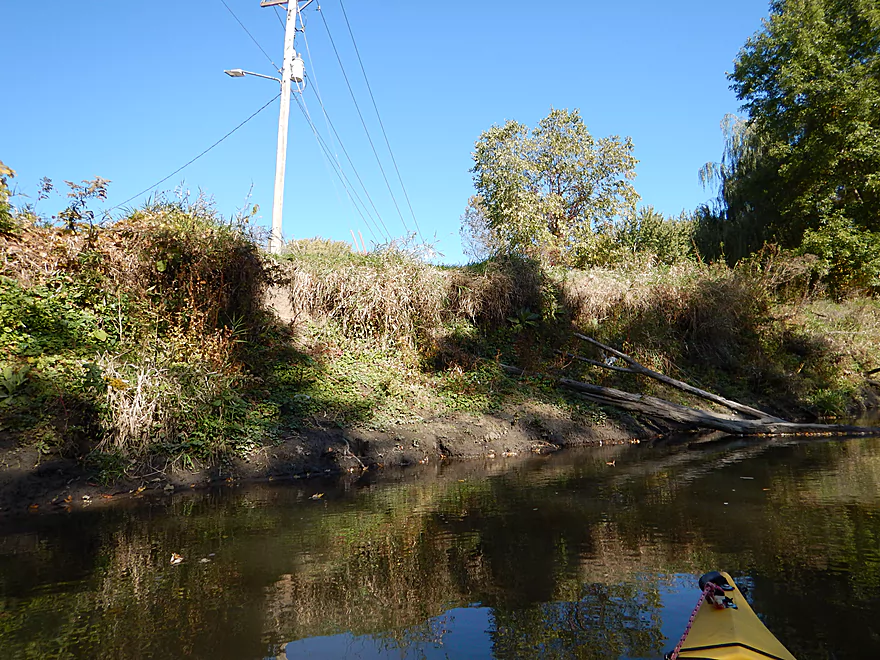
A very noisy I-90
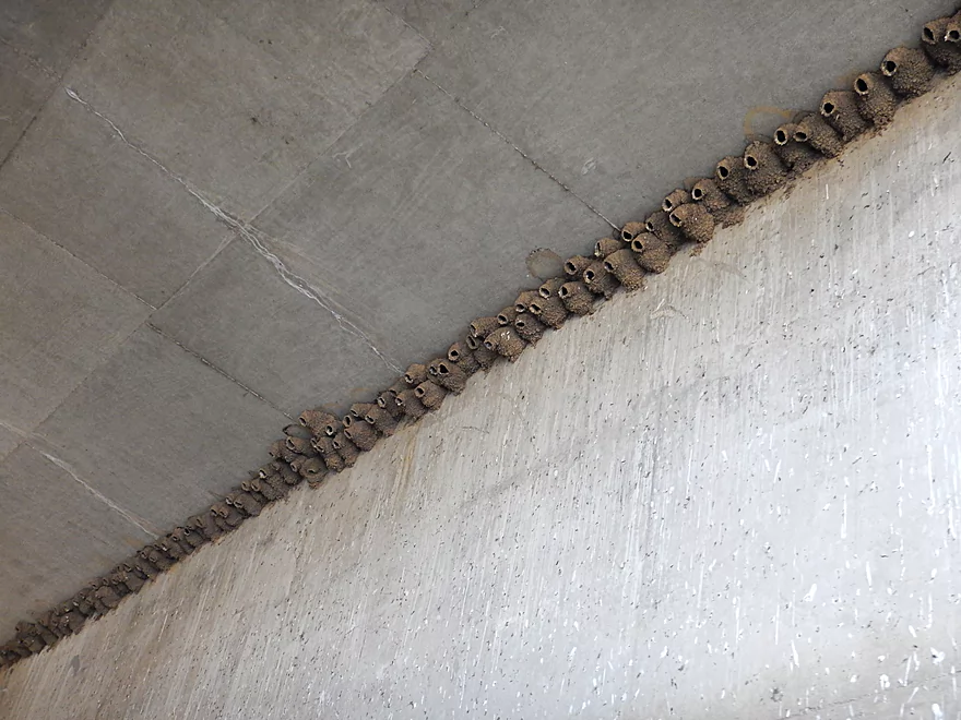
Cliff swallows do not seem to mind
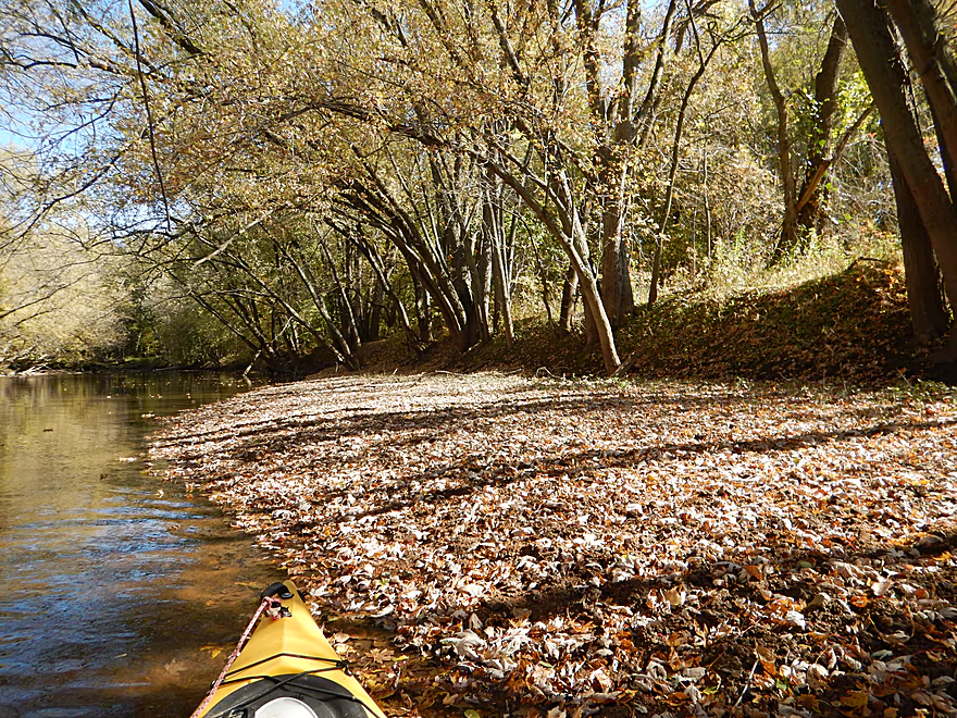
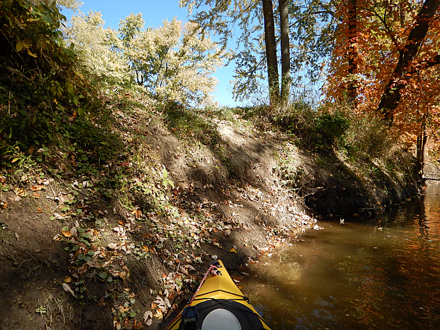
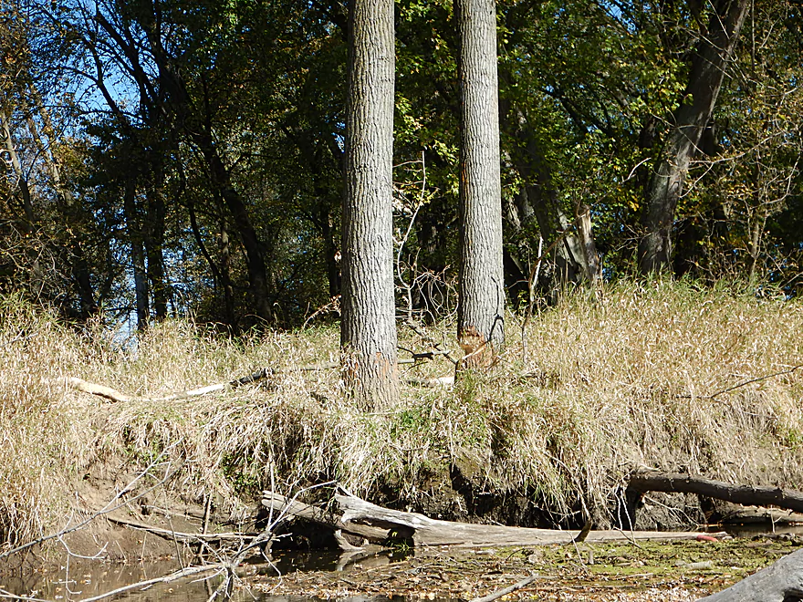
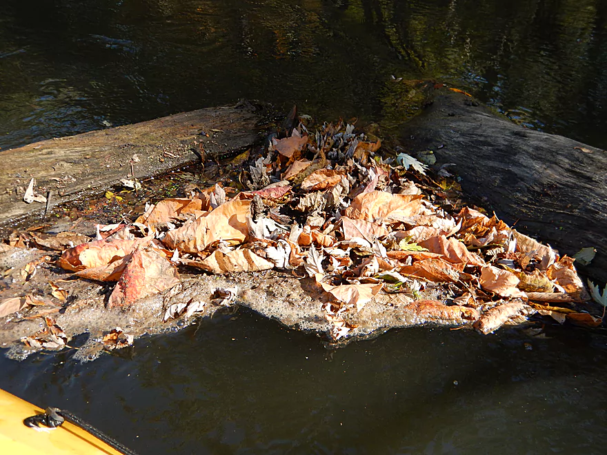
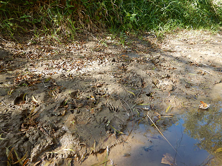
Nice leaf carpet covering up an ugly mud bank
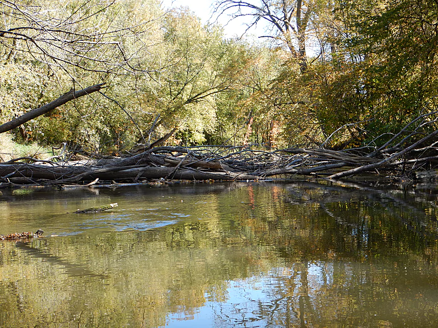
The Baraboo will actually self-cleanse itself of some log jams
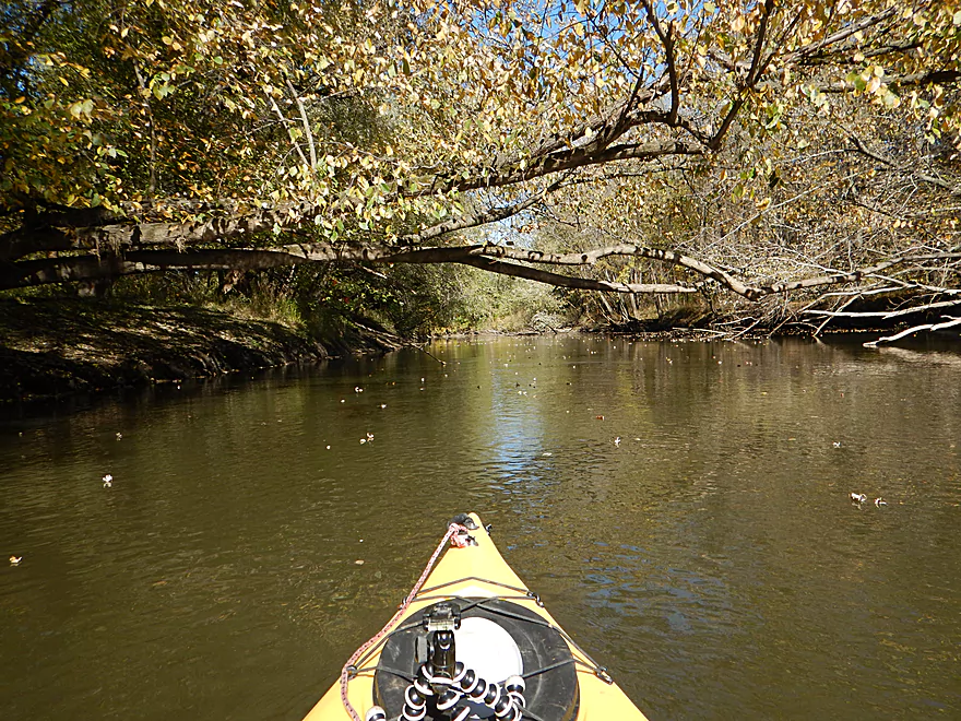
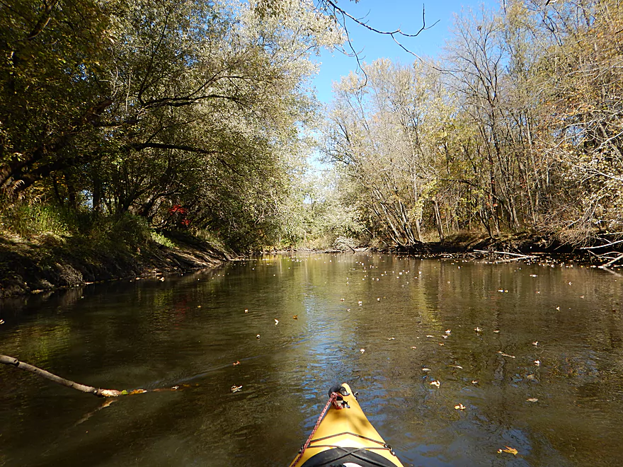
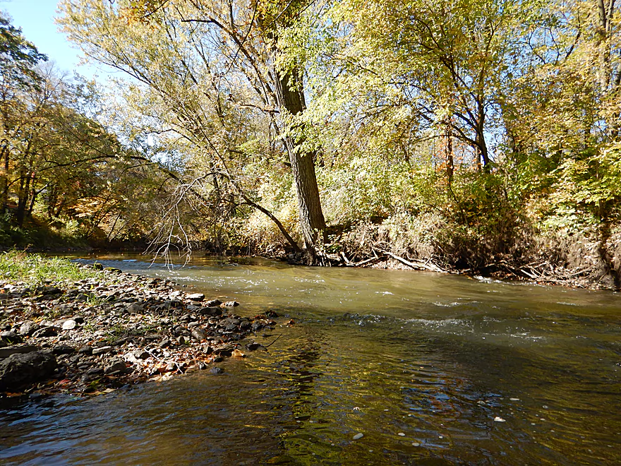
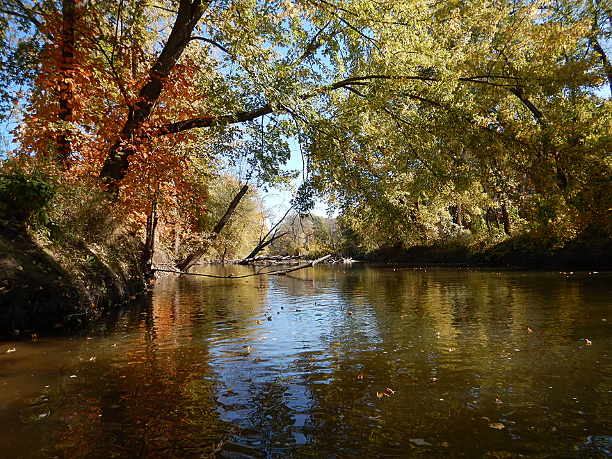
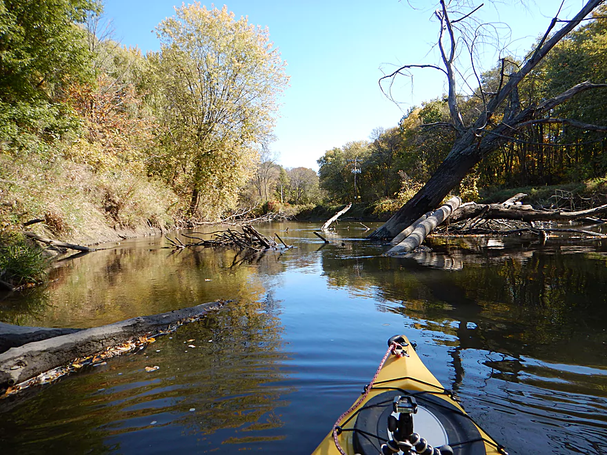
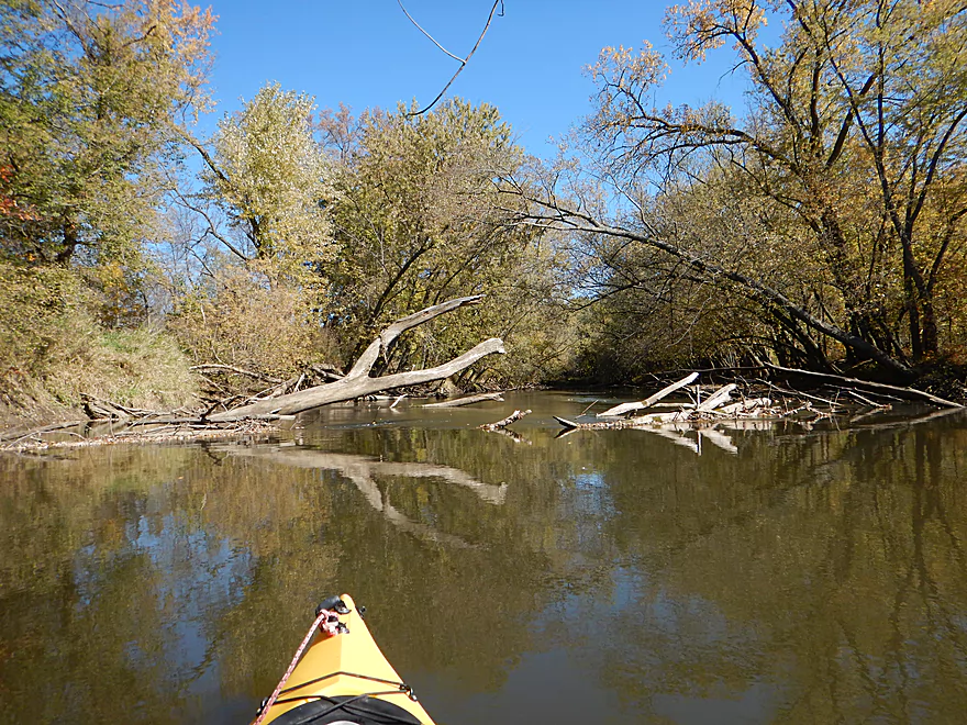
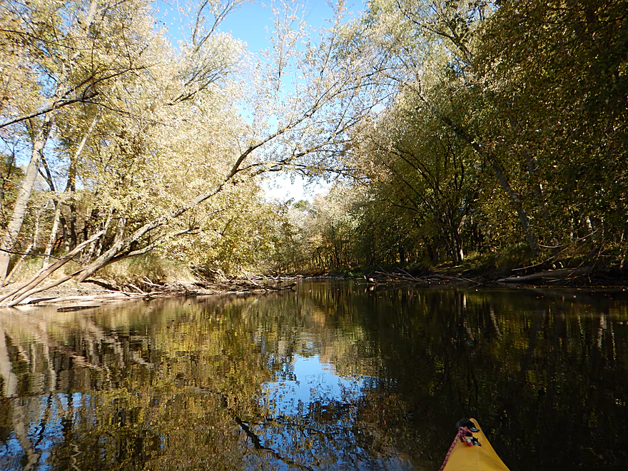
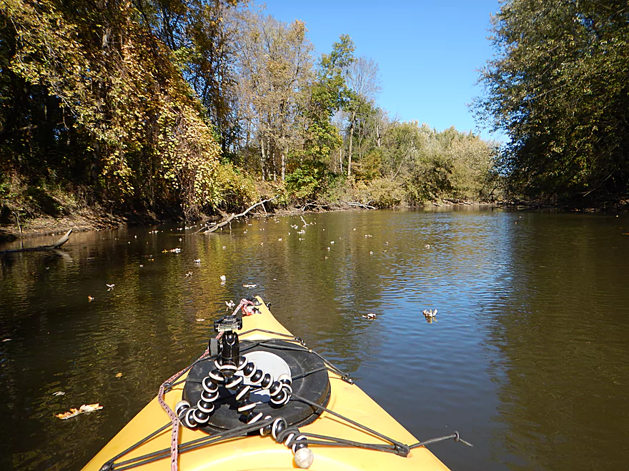
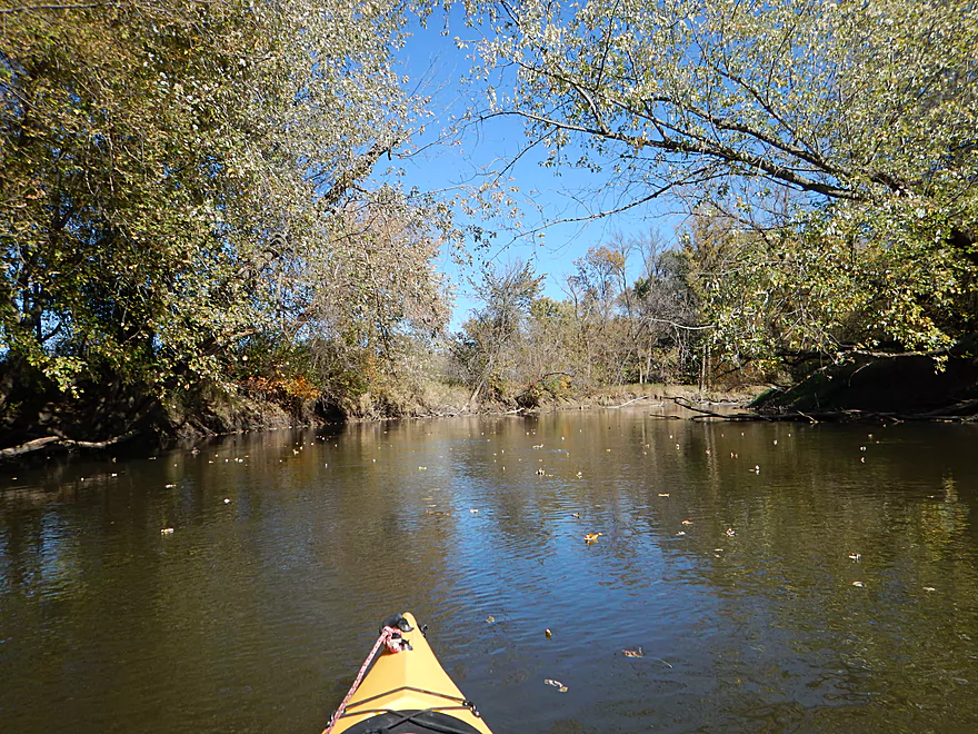
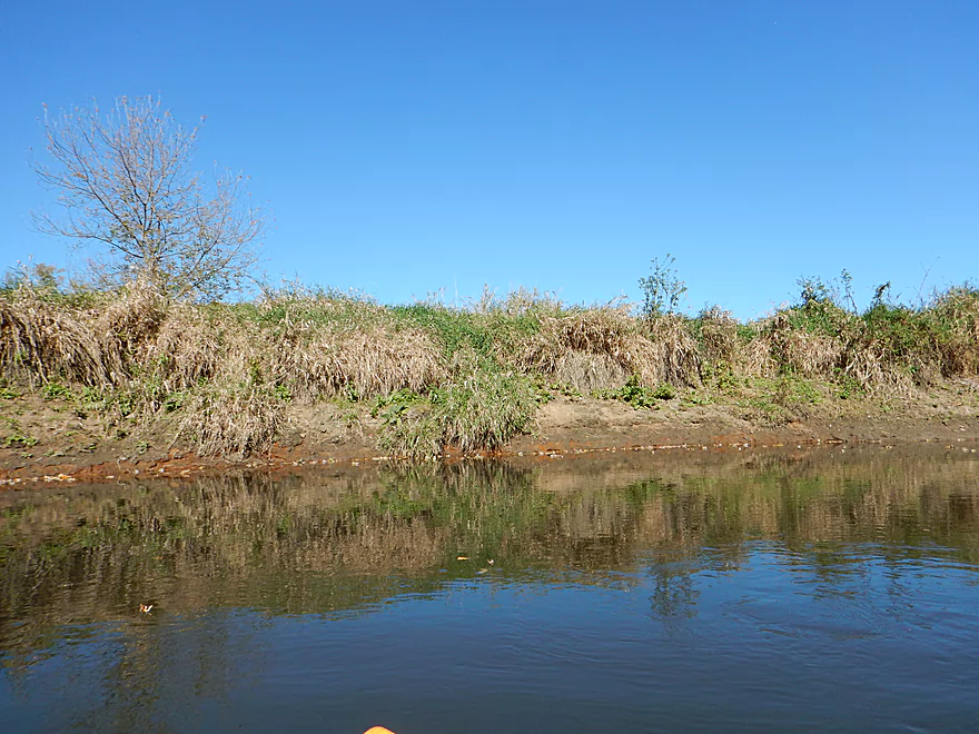
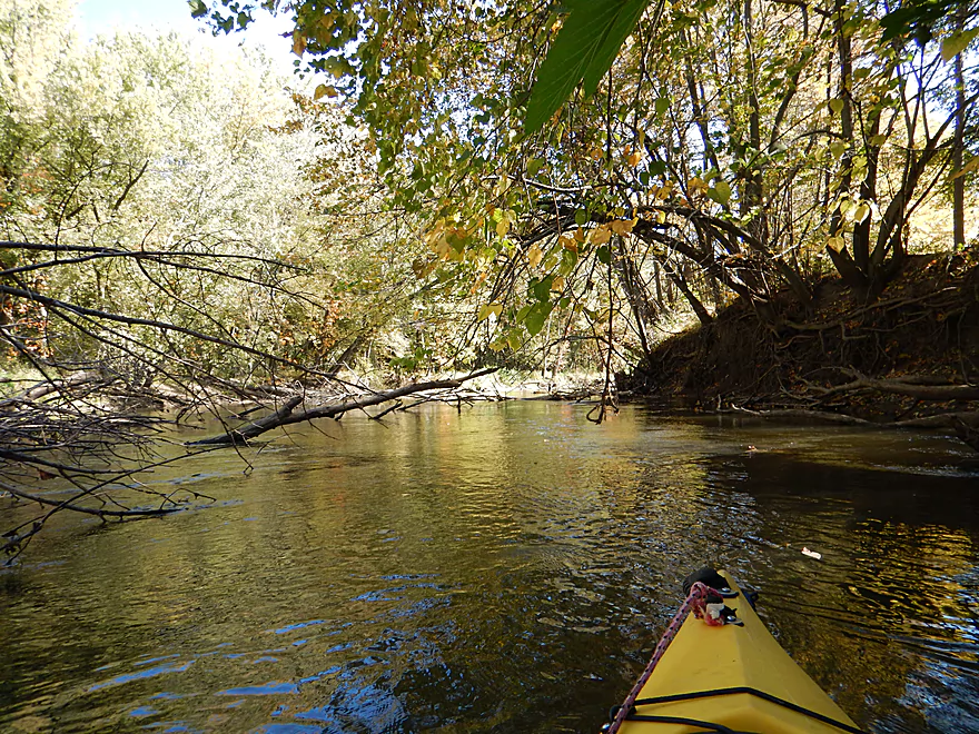
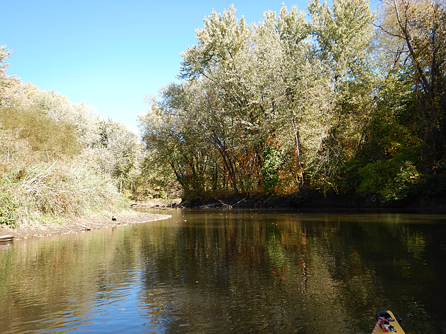
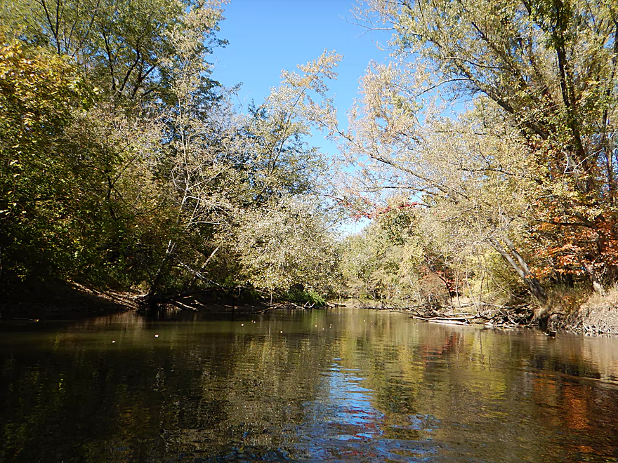
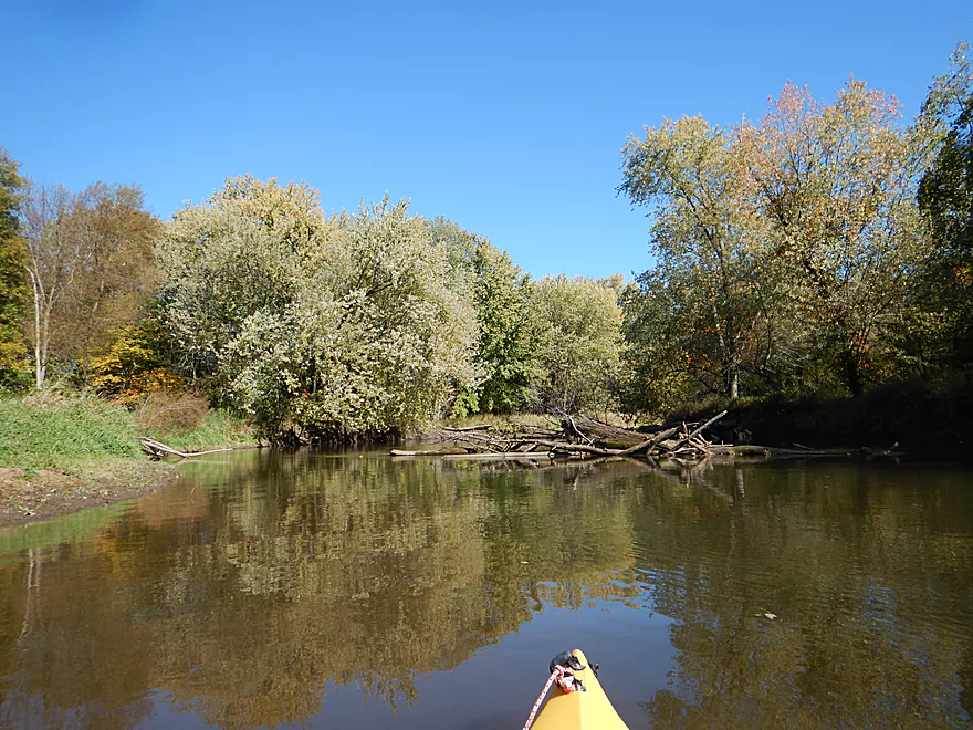
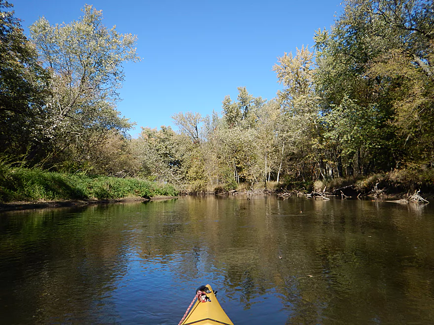
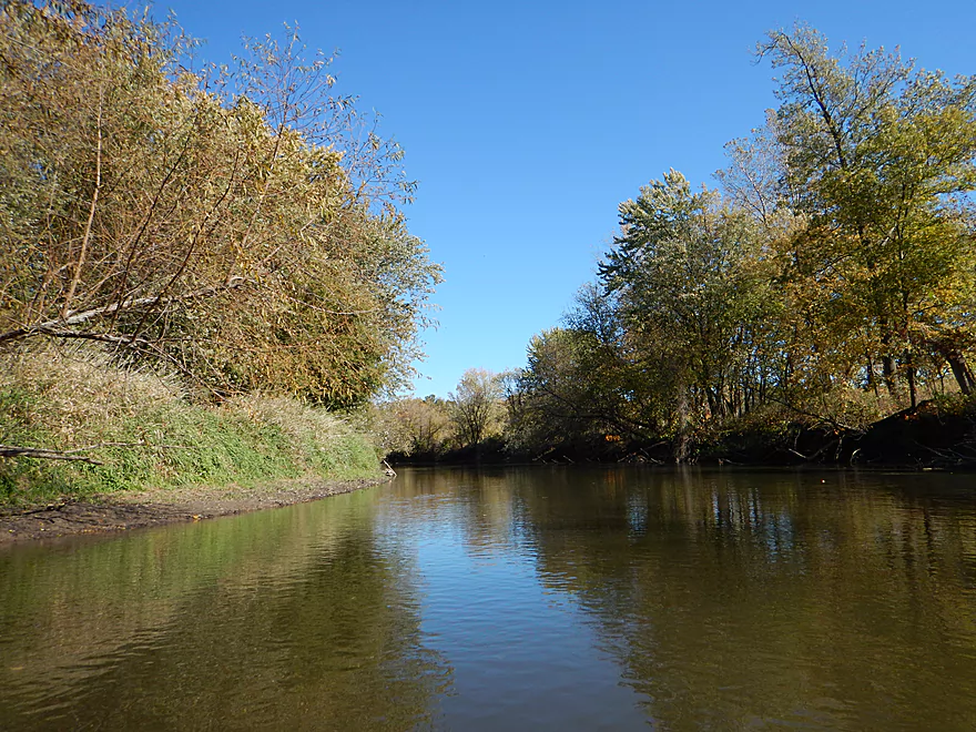
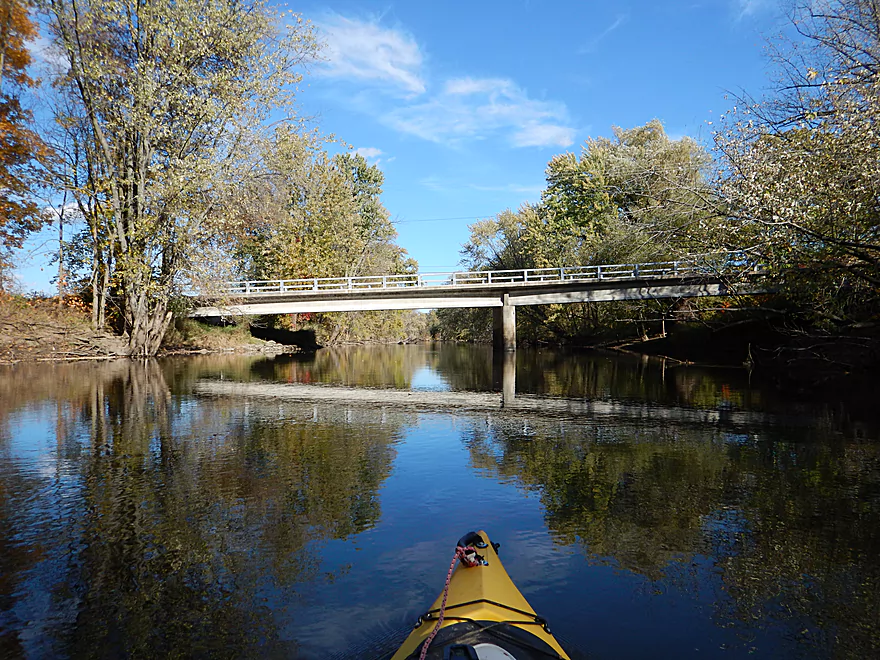
Typical nice scene
Beaver gave up on this one
At times feels like paddling in a ditch because of the banks
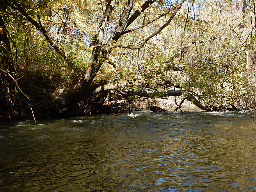
Always a way through
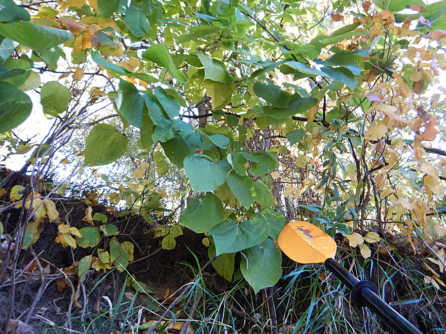
Catalpa leaves are so huge
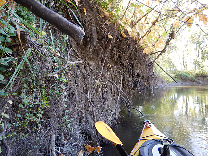
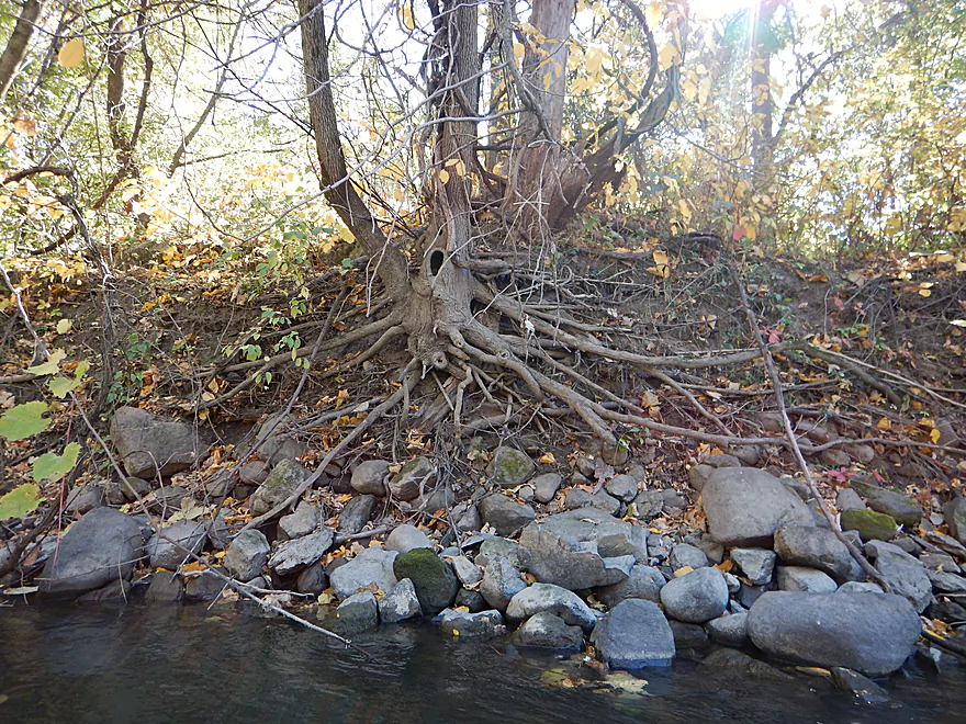
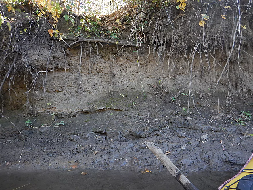
Wall of roots
The Baraboo River had itself a tasty snack
A little beauty inside some ugliness
Kind of unique…a cone of leaves
Evidence of a coon party
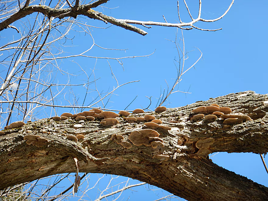
Fall fungus
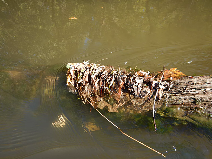
A leaf traffic jam
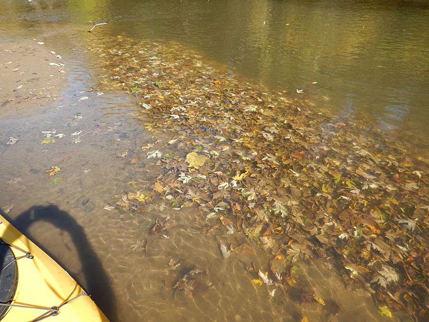
The best fall color was underwater
Sigh…typical Baraboo
A little hopping required
A very noisy I-39
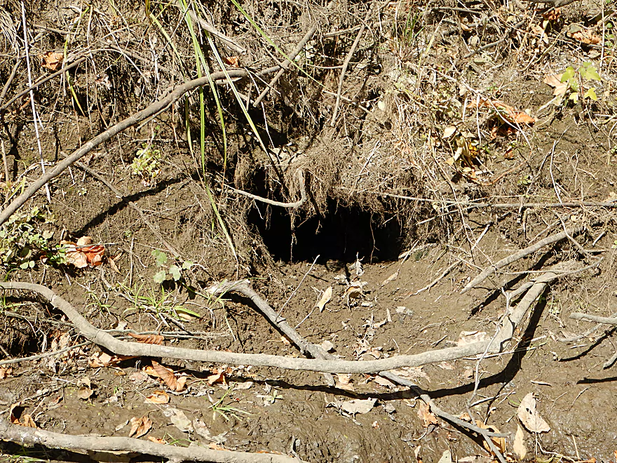
Bank beavers do not need to dam the river
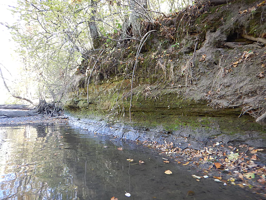
Surprise sandstone outcropping
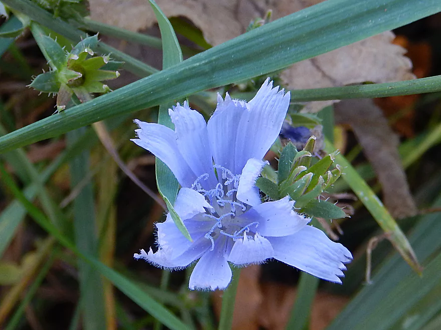
A late chicory flower
Hwy U
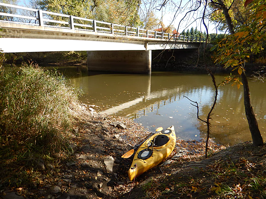
Time to take out
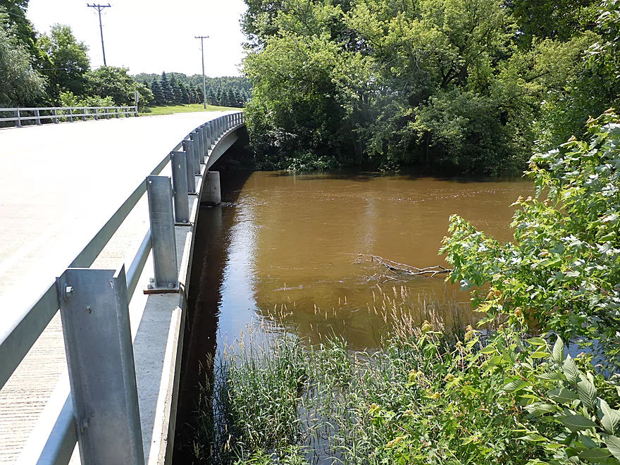
Same picture, but during high water for perspective
The take-out is northwest of the bridge and in a deep ditch
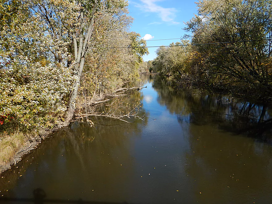
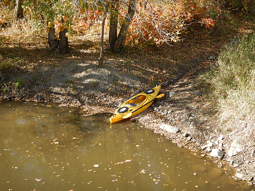
Attractive downstream view at low water
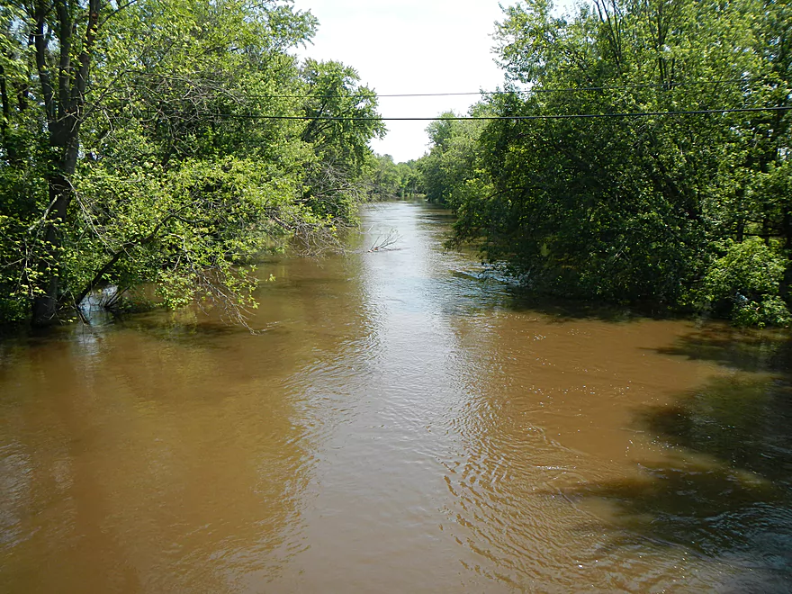
Ugly downstream view at high water
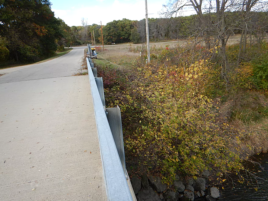
Ok parking by Hwy U
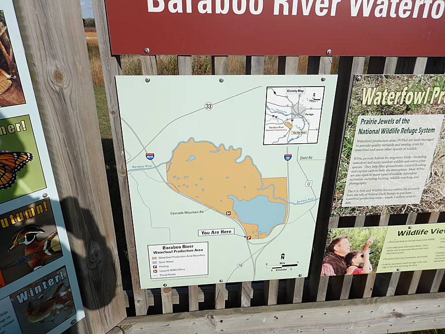
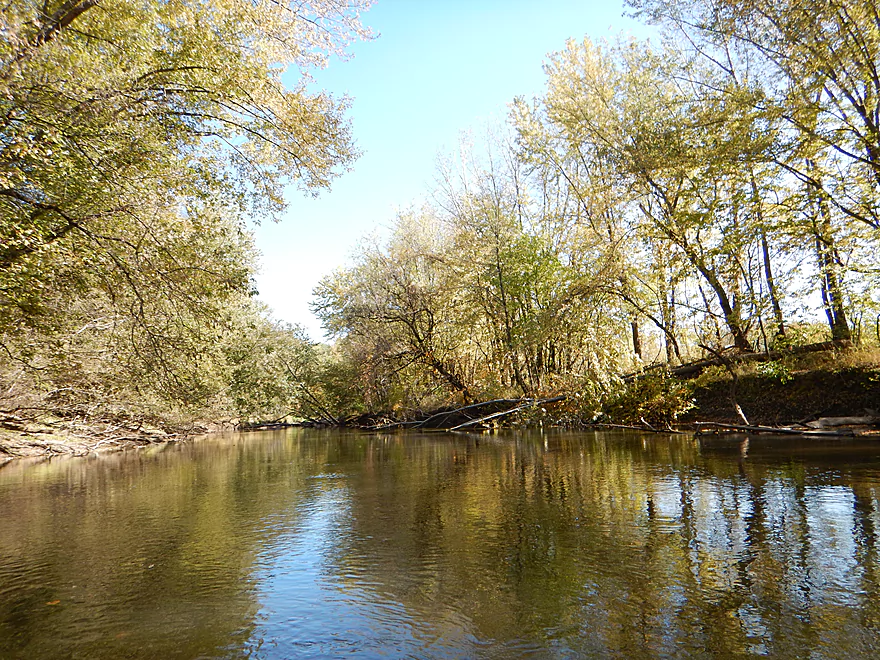
Much of the trip flows through a wildlife area
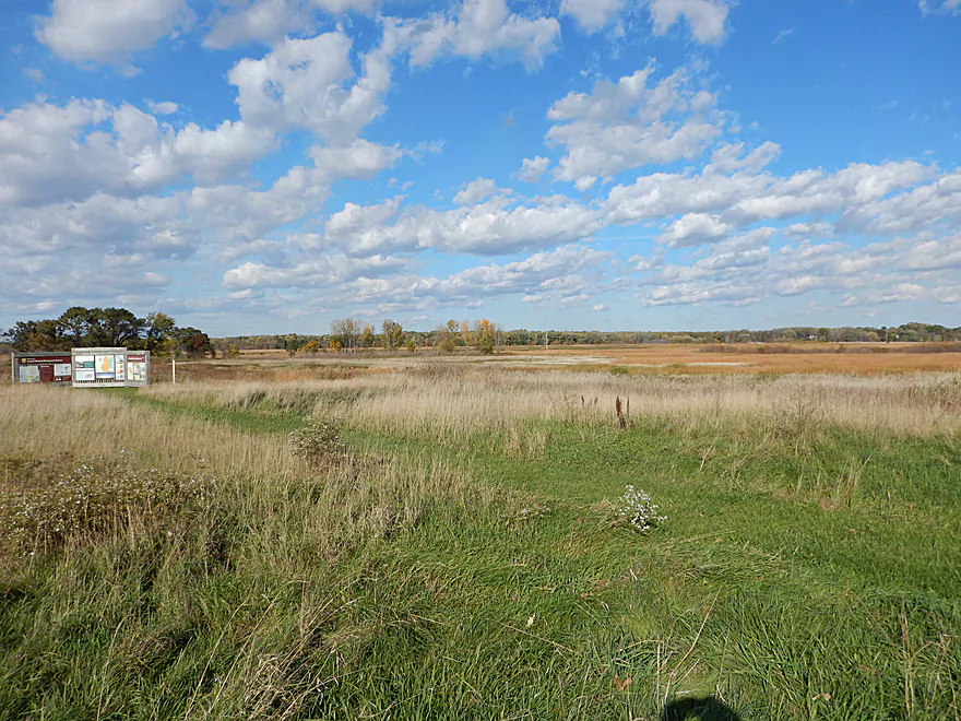
Large flat marsh abuts the river and is popular with waterfowl
Baraboo River – Cascade Mountain

The idea for this trip was to capture the lower Baraboo when the leaves were turning, when the mud banks had dried and the water levels were properly down. This is not an elite prospect, with little that makes it very distinct, but it was pleasant and peaceful (aside from the infernal racket from I-90 and then later I-39).
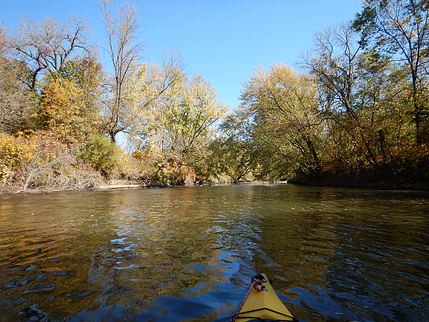
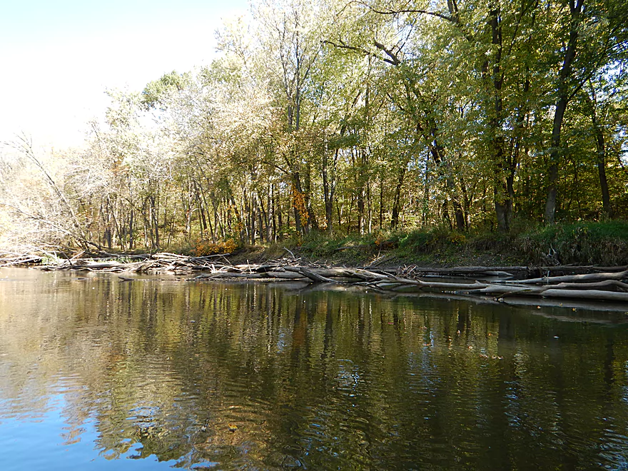
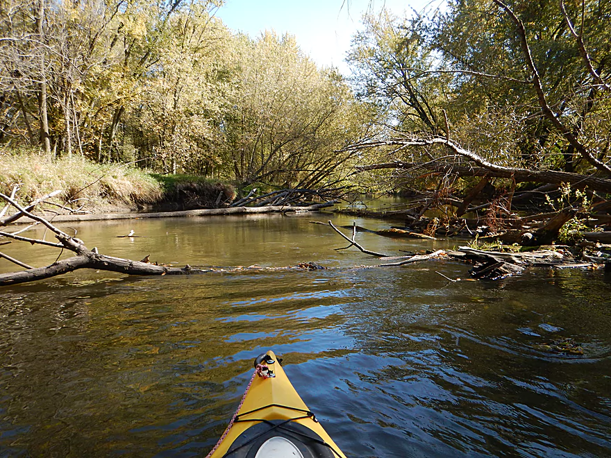
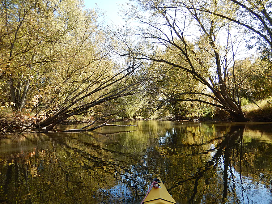
The Baraboo River is known for having a lot of down trees…and this section wasn’t too different. But, by Cascade Mountain the river is big enough you can pretty much go around the jams. It helps that the channel is also strong enough (when flooding) to bulldoze a significant percentage of messes to the side. The frequent floods deter bankside development, which was a nice bonus to the trip. Much of which was along the Leopold Wetland Management District, but you wouldn’t know it because of the high muddy banks (typical Baraboo). The hardwoods on the banks, however, were quite nice and it was very pleasant just letting the current carry me under the tree canopies.
The trip was done for color, but there weren’t as many sugar maples as expected (many silver maple, but they tend not to be as colorful). Often times the best part of any fall paddle is not actually the scenery above the water but in it. In this case, it was a neat experience seeing the leaves floating with the current and getting stacked up in odd crooks and crannies on the river.
Something that makes the Baraboo River special are its many rock outcroppings, but most only appear on the upper stretches. So, I was pleasantly surprised to find one just prior to the take-out on Hwy U.
In summary, this is a three-star trip that I recommend for locals, but for those farther away, you can probably do better. Early into the trip, things were going swell and I almost debated giving it 4 stars, but…the mud got old. Suspended in the water, the substrate and on the banks, it was everywhere. Many rivers have sandbars…not the Boo…it has mudbars! Portaging would have been an adventure, as many of the mud banks were 4-5′ high. But at times this provided a unique experience and enclosed feeling. You can’t help but wonder what the river looked like before logging, channelization and farming permanently damaged the watershed.
Wayside Park is a popular access spot for paddlers and with good parking. However, there is a steep 5′ bank to negotiate just to get into the water. A little awkward to say the least, and I suggest leading your boat down first with rope if possible.
There is a bridge at Hwy U, with the best access being a drainage ditch just northwest of the bridge. Note, the banks are steep here for parking, but the shoulders do flatten somewhat the further west you get away from the bridge. There is no outhouse at either the put-in or the take-out.
I’m not aware of any local liveries (kind of odd if you think about how popular the Baraboo River is).
Bike shuttle is pretty easy at 4 miles, with low traffic and just a few minor hills on Cascade Mountain Road.
Not a single major log jam (big surprise for the Baraboo!). Somebody has cleaned out many of the snags, which is appreciated. There are a few hoppers and squeakers, but I thought these were easy to negotiate in my smaller boat. Bigger boats and/or inexperienced paddlers may want to be careful as occasionally fast current and protruding deadfall can cause issues if you’re not attentive.
The main hazard is actually just upstream of the put-in, so you’ll probably miss it anyway (but will see it). It consists of the river constricting sharply into class 2 rapids…that go straight through a strainer. Pictured and videoed at 0:09.
Per the local gauge in Baraboo, the river was at 252 CFS which is relatively low but typical for fall. That’s actually what you want. This stretch NEVER gets too low to paddle. Despite the low flow rate, I never ran aground and frequently was able to stick my paddle deep into the water before touching. The problem with the Baraboo is it floods easy and often. Even when not flooding, it doesn’t take much rain to really push up water levels and make the current pushy and sloppy with mud. Low water also gives this stretch nice character and gives you the ability to get around many downed trees.
Typical low turnout for fall, but I did see a couple of eagles, a few great blue herons, a bank beaver den and a few deer with nice antlers.
Detailed Overview
- Nutmeg Road to Hwy PP: 6.2 miles. Flows by the historic Elroy-Sparta Trail and is mostly open, but there are a few logjams. This is a narrow small stretch that will need very high water to be runnable. There are scenic outcrops on this stretch….maybe 3.
- Hwy PP to 2nd Main Street: 1.6 miles. Maybe 3 logjams.
- 2nd Main Street to Franklin Street: 0.9 miles. Maybe 1-2 logjams. Trip starts at a scenic covered bridge and on Class 1 rapids.
- Franklin Street to Hwy 82(South of Lincoln Street): 0.5 miles. A good stretch that is mostly open and has maybe one outcrop.
- Hwy 82(South of Lincoln Street) to Schultz Park: 0.6 miles. Maybe 2 logjams.
- Schultz Park to Hwy 82(South of Snyder Road): 4.0 miles.
- Schultz Park to Hwy 82(North of Lumsden Road): 0.6 miles. One outcrop, one logjam portage and a few tight fits.
- Hwy 82(North of Lumsden Road) to Hwy 82(South of Snyder Road): 3.4 miles. Three outcrops, three significant logjams and several tight fits. A section with good potential but needs cleanup work.
- Hwy 82(South of Snyder Road) to Hwy W: 1.9 miles. Maybe 2-3 jams…think this is doable though.
- Hwy W to Hwy 82/Union Center: 1.3 miles. Good prospect by the golf course with maybe 2 outcrops. Maybe 1-2 logjams.
- Hwy 82 to Hwy FF Landing/Wonewoc: 7.1 miles. A great section with one of the largest rock outcrops on the river.
- Hwy FF Landing to Wayside Park: 2.9 miles. There used to be a lot of logjams here. I think it might be doable…maybe 2-3 major portages.
- Wayside Park to Kalepp Road: 4.5 miles. An uninteresting part of the river with weedy, muddy banks. But…there are three fantastic sandstone outcrops.
- Kalepp Road to N. Dutch Hollow Road: 5.3 miles. One logjam portage with several “hoppers” and “duckers”. There are some outcrops but most are recessed and away from the river. Mud and downed trees are a bit unsightly, otherwise a pleasant paddle.
- N. Dutch Hollow Road to La Valle: 3.8 miles. Second best section on the entire river with great rock outcrops.
- From La Valle to Lake Redstone: 3.6 miles. One of the more underrated sections of the Boo, which I really liked.
- Lake Redstone to Monument Park/Reedsburg: 9.0 miles. Supposedly kind of boring, but the logjams should be cleared out.
- Monument Park to South Park: 1.4 miles. Spanning the length of Reedsburg, this should be a nice section mostly free of jams.
- South Park to Golf Course Road: 4.7 miles. Maybe 4-5 logjams. Probably one too many. Should be 1-2 small sandstone outcrops. Golf Course Road might not be a good access.
- Golf Course Road to Hwy 136(by Beth Road): 3.6 miles. Maybe a few jams. Likely mostly floodplain paddling and probably uninteresting.
- Hwy 136(by Beth Road) to Hwy 136(by Ableman’s Gorge): 6.0 miles. Maybe some outcrops at the end, but mostly uninteresting paddling I suspect. Likely several serious logjams with difficult portages because of the high muddy banks.
- Hwy 136(by Ableman’s Gorge) to North Freedom Boat Launch: 8.2 miles.
- Hwy 136(by Ableman’s Gorge) to Rock Springs Boat Launch/Firemen’s Park: 1.3 miles. One of the most scenic parts of the entire Baraboo River. Highlights include a steep gorge, riverside boulders and scenic outcrops.
- Rock Springs Boat Launch to North Freedom Boat Launch: 7.1 miles. This is a nice paddle, but with some downed trees to dodge and one to portage. Highlights include historic railroad bridges, scenic outcrops, and seeing the railroad museum from the river.
- North Freedom Boat Launch to Giese Park: 7.4 miles.
- North Freedom Boat Launch to Kohlmeyer Road: 4.3 miles. Stretch starts nice as the river naturally curves and has many shade trees. There is a scenic long outcrop after Seeley Creek. River becomes boring after that except for a scenic railroad bridge and a few rocky banks. Kohlmeyer Road isn't a great bridge access.
- Kohlmeyer Road to Giese Park: 3.1 miles. Some longer and less interesting stretches. There is however a unique large volume artesian well, and a historic railroad tunnel you can wade under.
- Giese Park to Gander Outdoors: 2.9 miles. A pleasant but simple farm country paddle. Highlights include the Skillet Creek bridge, the towering Hwy 12 bridge, and a rock outcrop upstream of Hwy 12.
- Gander Outdoors to Glenville Landing: 4.9 miles. A fantastic stretch through the heart of Baraboo with many light rapids.
- Gander Outdoors to Haskins Park: 0.6 miles. A good stretch with some fantastic rapids upstream of Hwy 136.
- Haskins Park to Maxwell-Potter Conservancy: 3.3 miles. The best section on the entire river with many rapids.
- Maxwell-Potter Conservancy to Glenville Landing/Hwy 113: 1.1 miles. A pleasant stretch, but lacking in rapids.
- Glenville Landing to Luebke Landing: 5.1 miles. A pleasant trip, but a little boring at times. I would rate this as one of the more uninteresting sections of the Baraboo. On the plus side it had no logjams (as of 2023) and remains plenty navigable even during big droughts.
- Luebke Landing to Hwy 33: 3.5 miles. This might be one of the better legs on the Lower Baraboo.
- Hwy 33 to Wayside Park: 8.0 miles. A stretch I’m curious about.
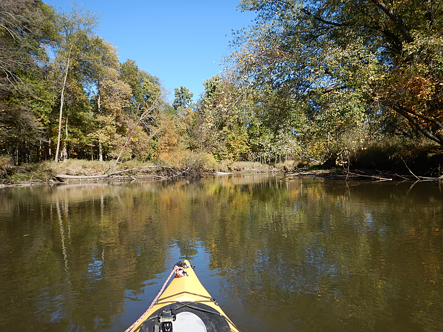
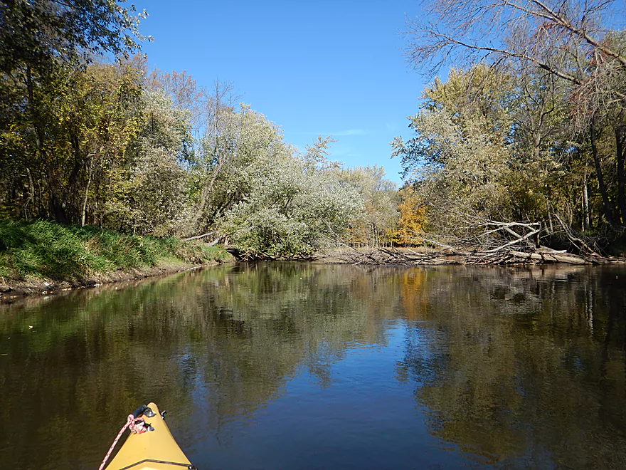
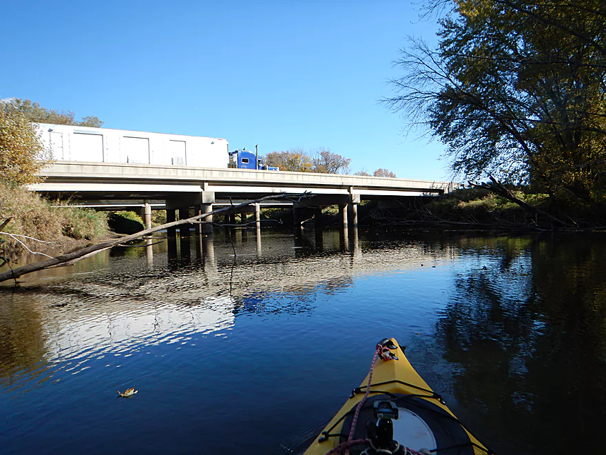
- Wayside Park to Hwy U: 3.9 miles. Simple but pleasant short section flanked by busy interstates.
- From Hwy U to the mouth: 5.3 miles. The final leg running through floodplain forest.
Notable Baraboo River Tributaries:
- West Branch of the Baraboo River: For the most part, too many logjams, but the flowage by Hillsboro is navigable with scenic outcrops by the dam.
- Dutch Hollow Lake: A heavily developed lake and popular with locals. Not as great as Lake Redstone but still nice. Dutch Hollow Creek is likely too shallow to run, but it (and the bike trail) goes past a fantastic and huge exposed rock face.
- Hemlock Slough: A nice little lake paddle with many rock outcrops and attractive hemlocks.
- Little Baraboo River: For the most part too many logjams. However the small flowage by Cazenovia Memorial Park is navigable and there are small outcrops both below the dam and on the northwest corner of Lee Lake.
- Lake Redstone: Definitely a fun paddle with fantastic red rock formations, a swimming beach, and a spillway waterfall.
- Big Creek: You can’t get too far upstream because of logjams, but there is a nice outcrop by Hwy F and this can be combined with a trip on the north side of Lake Redstone.
- Narrows Creek: There is a neat section by Weidman Memorial Park with boulders and light rapids with I believe nearby outcrops downstream. Unfortunately there are likely too many logjams. I did partly paddle a nice downstream portion from the mouth on the Baraboo before I hit a logjam and turned back.
- Seeley Creek:
- Hwy PF to Seeley Lane Boat Landing: 3.6 miles. A mix of creek and flowage paddling. Ok…maybe 2 logjams.
- Seeley Lane Boat Landing to Freedom Road: 1.7 miles. Probably too many logjams on this section.
- Freedom Road to Mouth: Neat stretch of the creek, but some logjams.
- Skillet Creek:
- From Gasser Road to Pewit’s Nest: Gorgeous, but filled with logjams.
- Pewit’s Nest: Stunning scenery, but the ledges are likely too steep and narrow for kayaking. Best experienced as a hike.
- Pewit’s Nest to Hatchery Road: A bit of nice geology, but likely small with several logjams. Neither endpoint is a great access.
- Rowley Creek: A scenic creek, but shallow and with hostile locals.
- Leech Creek: From Hwy U to Tritz Road would be 2.5 miles. Likely open and an easy paddle, but uninteresting because of the artificial channelization.
- Long Lake: A very slow creek that empties into the Boo close to the Wisconsin. There could be serious logjams by the mouth, but the upper sections are plenty navigable and are paddled by locals.
Trip Map
Overview Map
Video
Photos Size: