
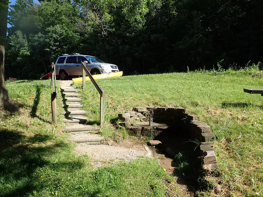
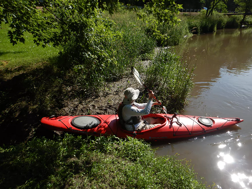
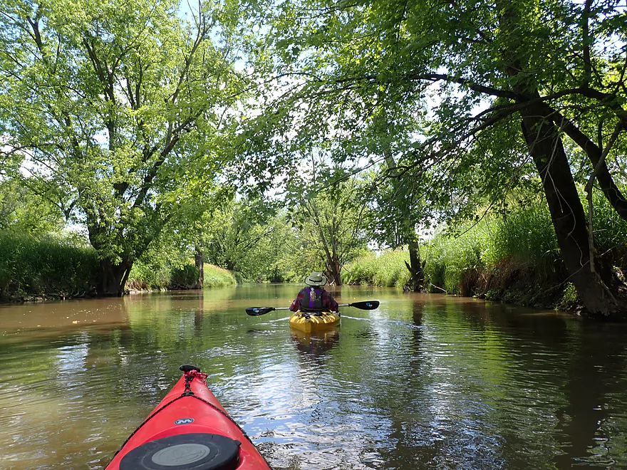
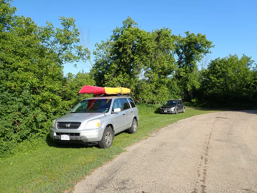
Putting in at Wayside Park
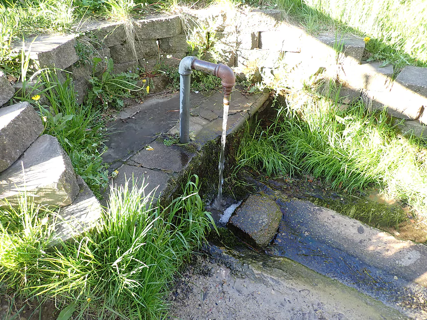
Famous for its artesian well
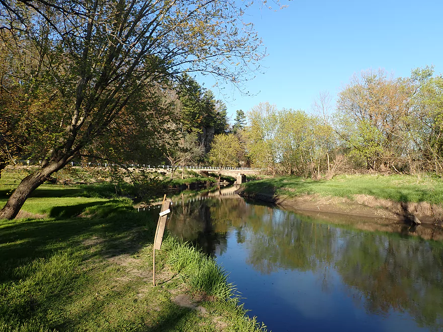
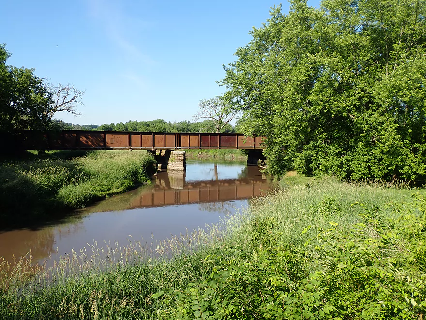
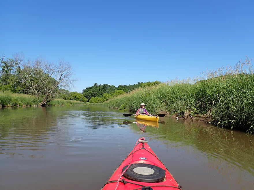
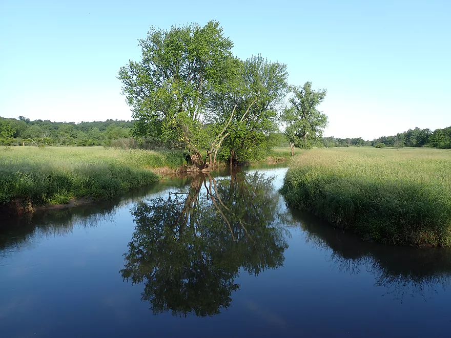
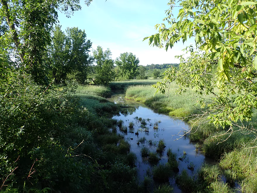
View of river from park
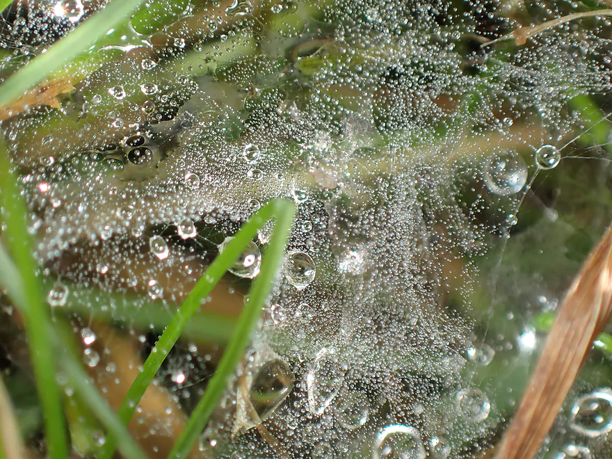
A very wet spider web
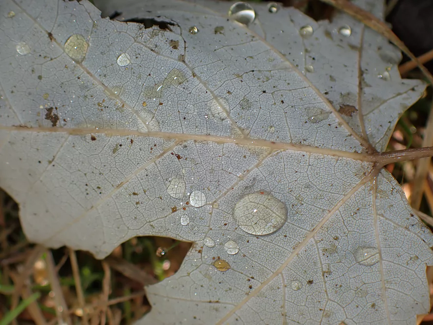
The local area had just gotten a lot of rain
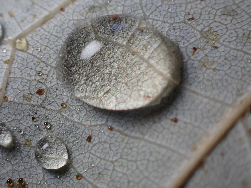
Droplet acting like a magnifying glass
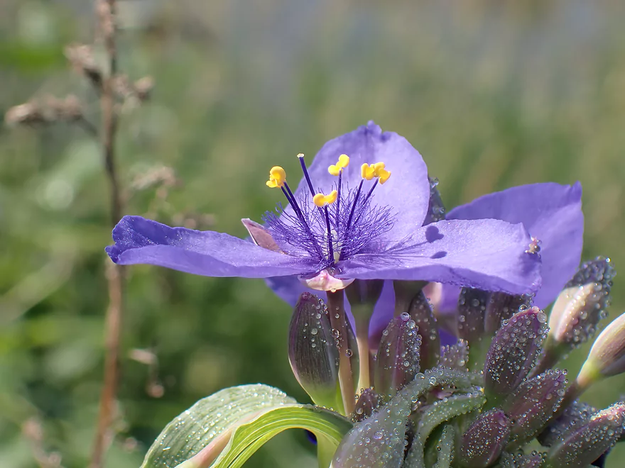
Spiderwort
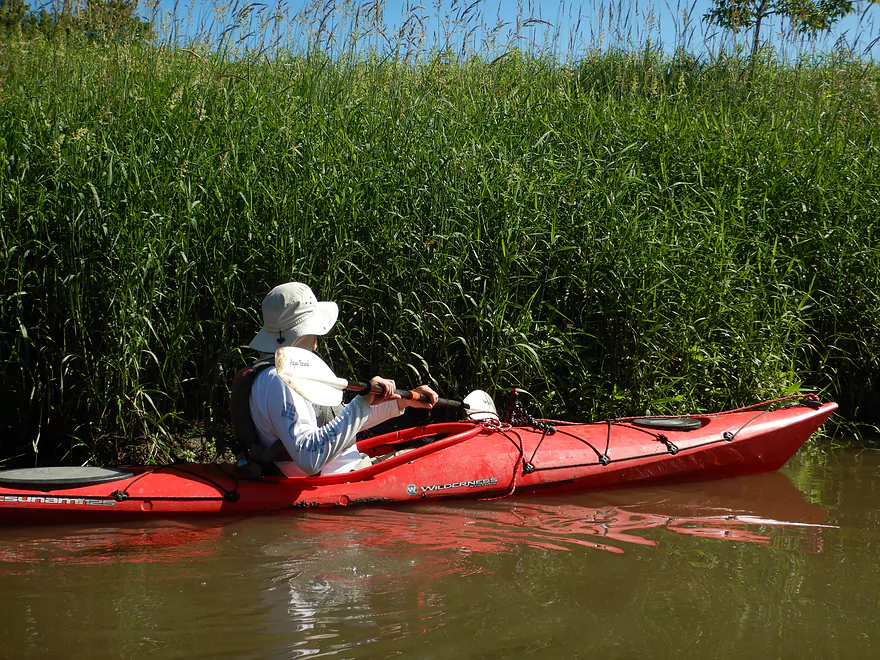
Launching below the spring
Very muddy banks
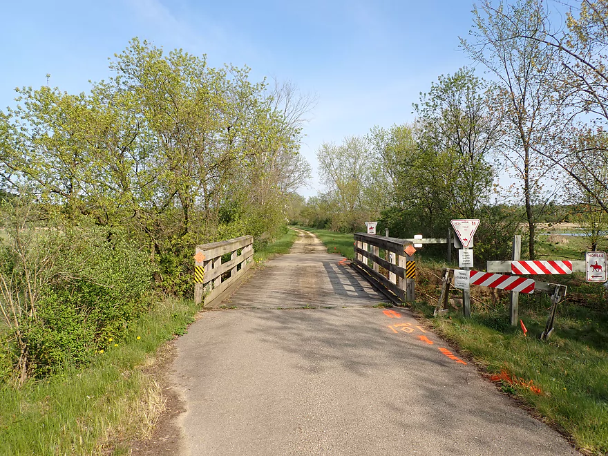
Wayside Park connects with the Old 400 Bike Trail
The Boo can flood with a fury…note the location of those weeds
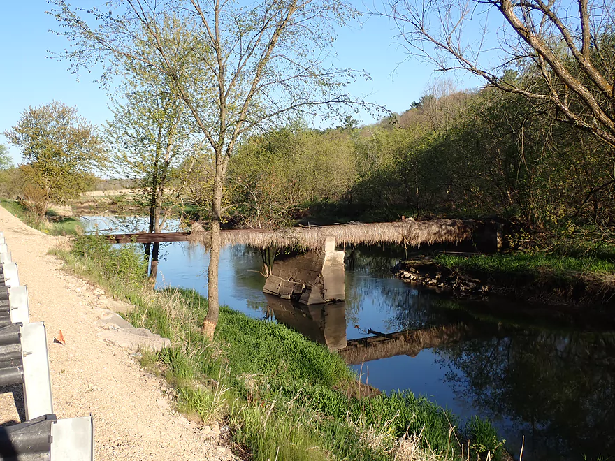
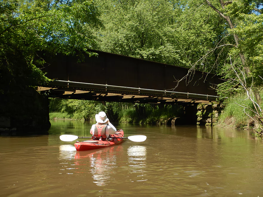
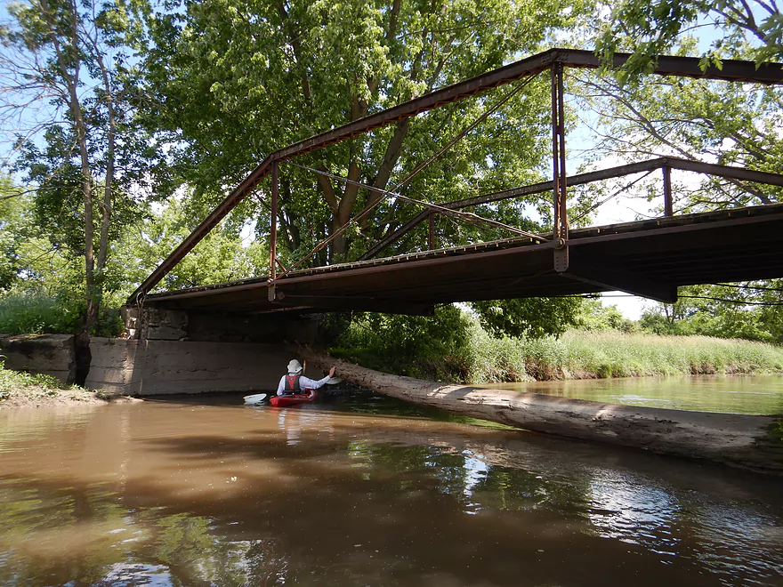
This bridge is in poor shape
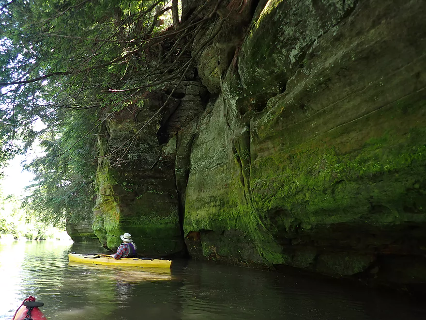
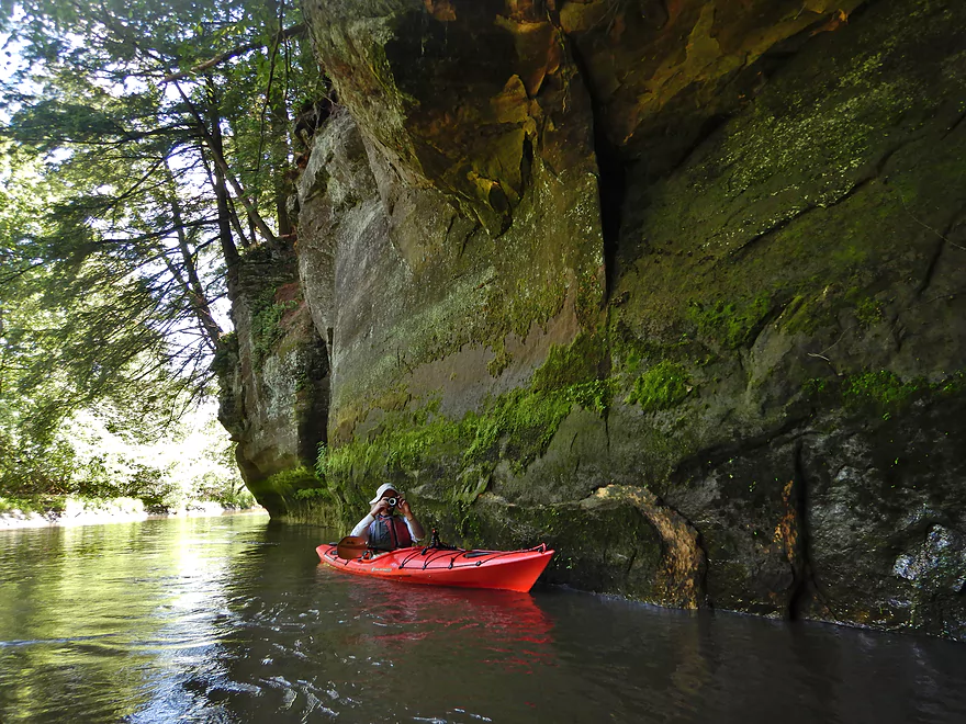
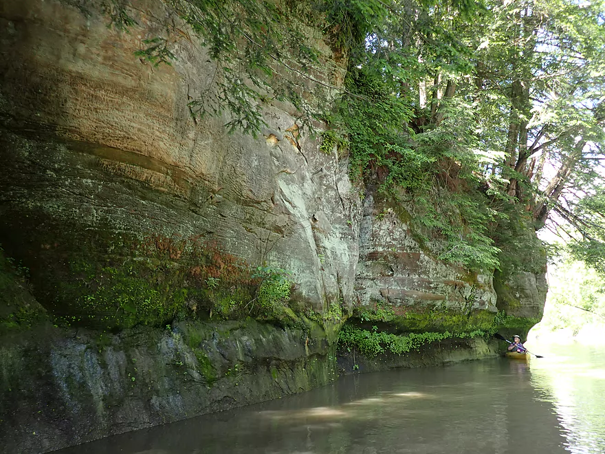
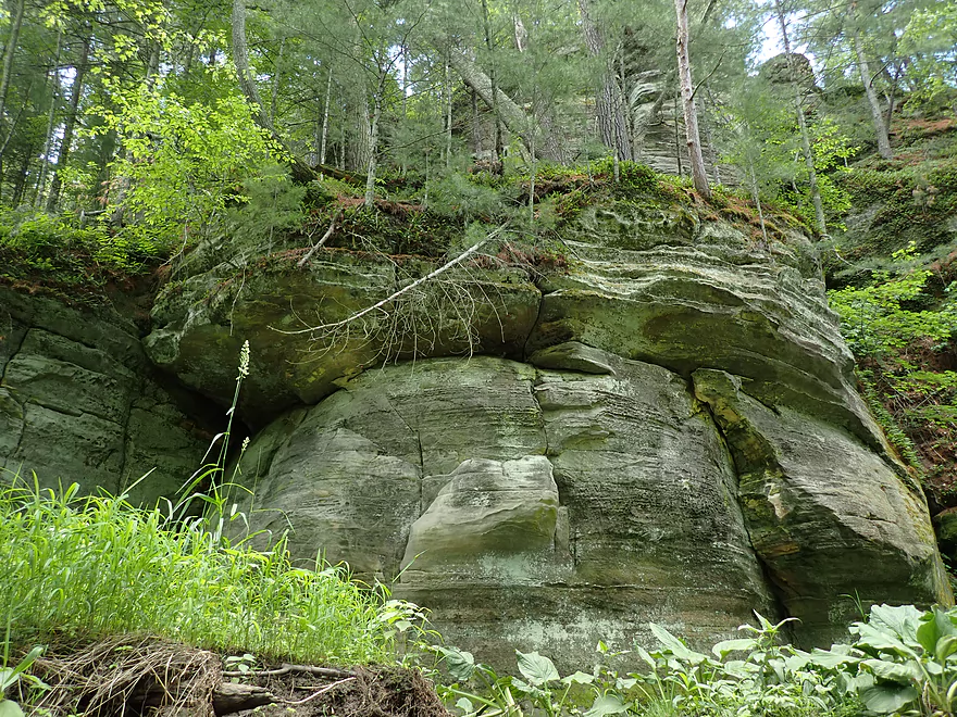
The first major outcrop of the trip
Very scenic
One last shot
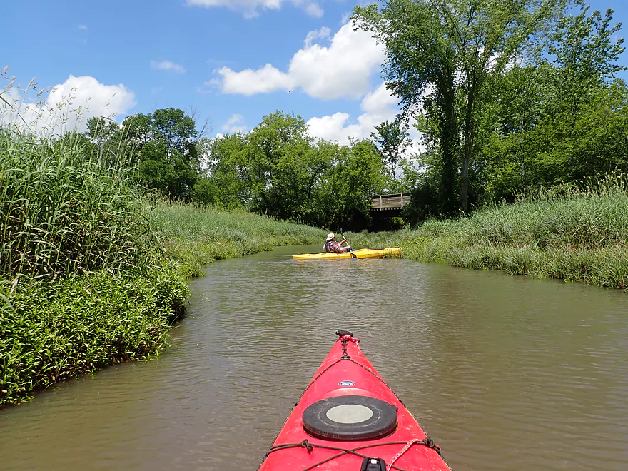
The first mile was very straight and unvaried
Invasive reed canary grass was everywhere
This section was likely artificially straightened by farmers
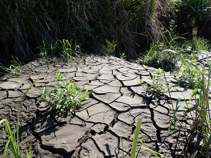
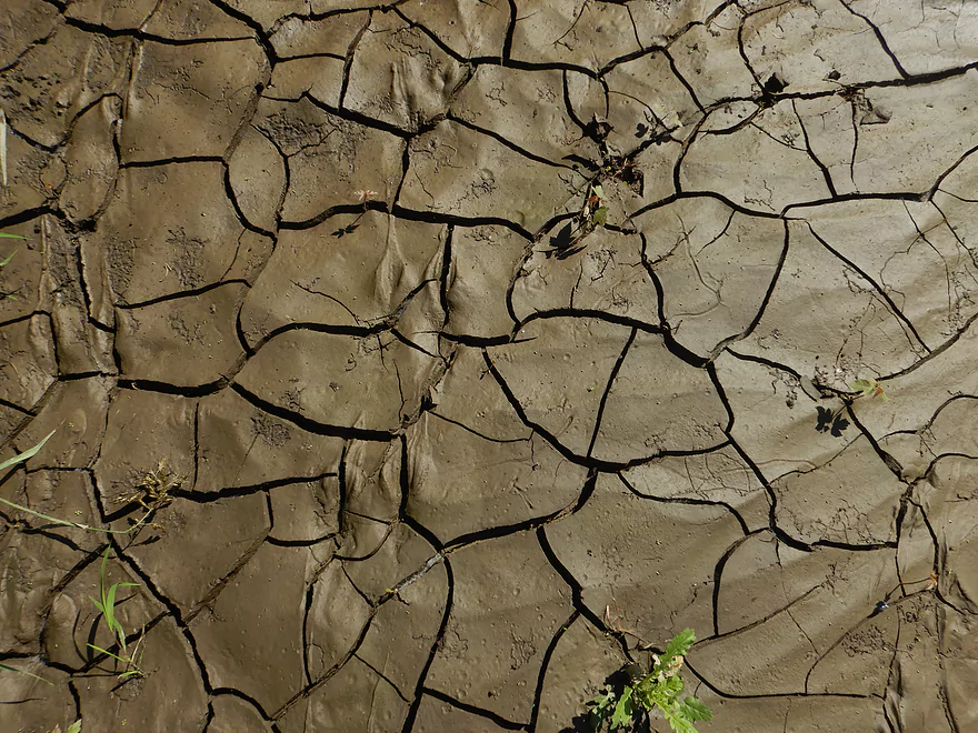
More cool mudcracks
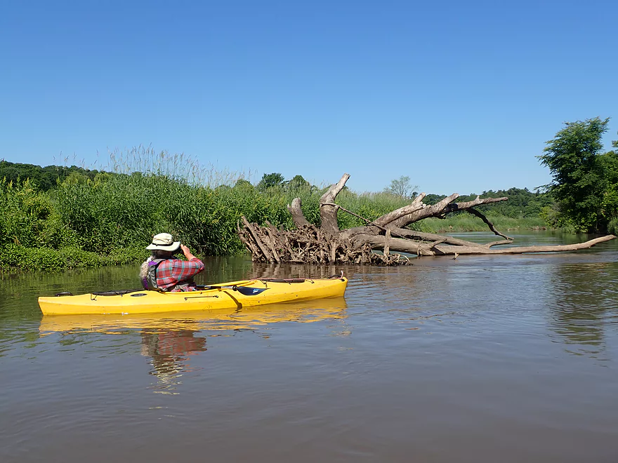
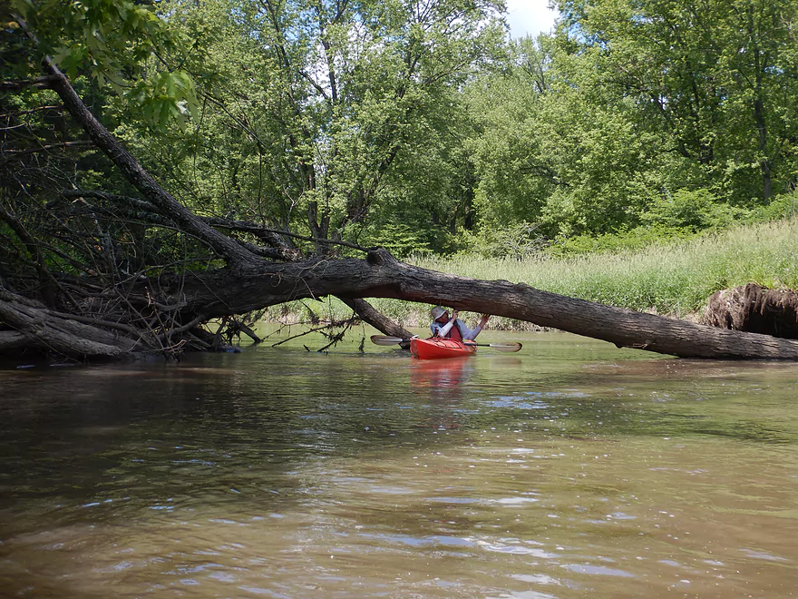
Thankfully the river is big enough to get around most obstacles
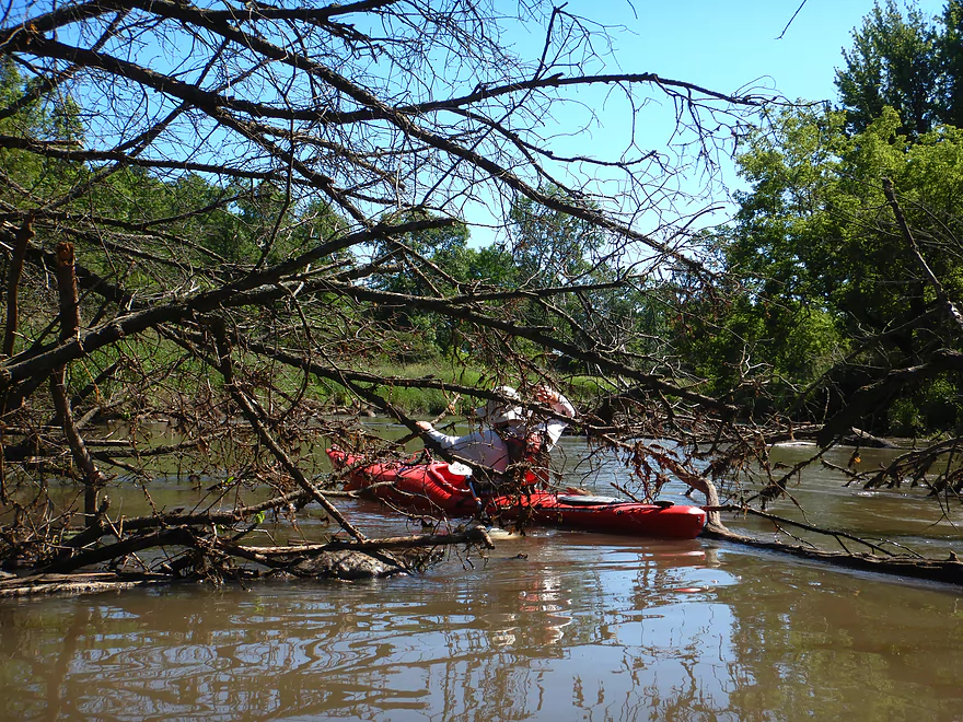
First snag…not bad
Second snag…my red boat barely got through
One of several local bridges
More high muddy banks and tall grass
One of the nicer trail bridges
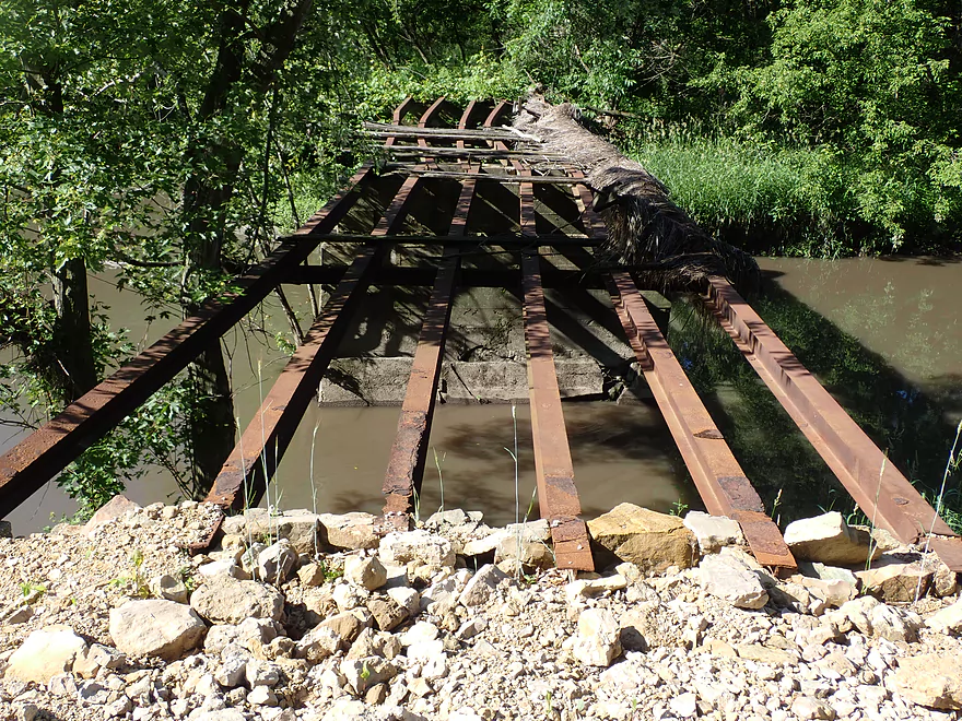
This could be an issue in higher water
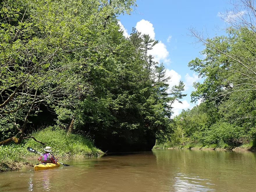
Entering a more wooded stretch
The “Old 400 Trail”
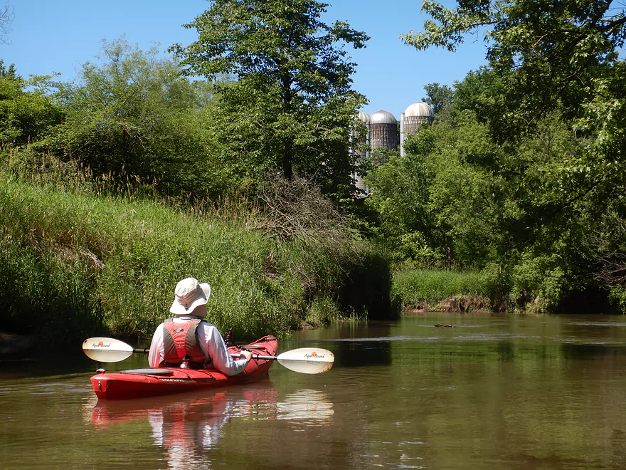
Silos perched atop the hillside
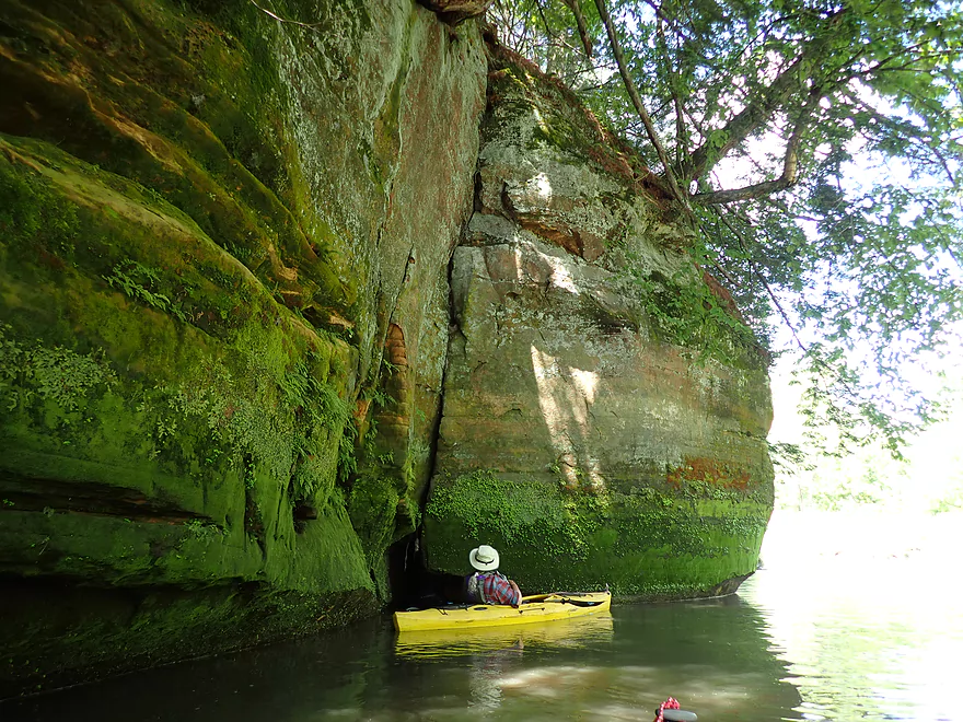
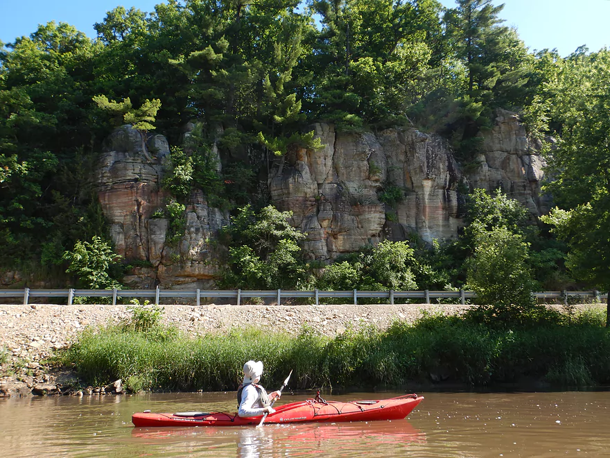
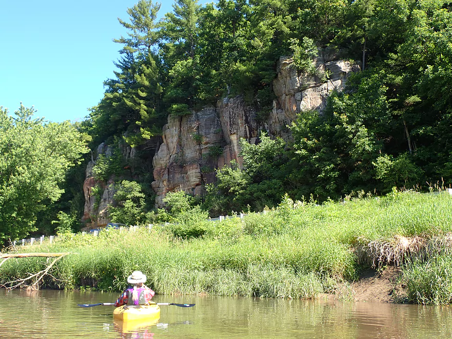
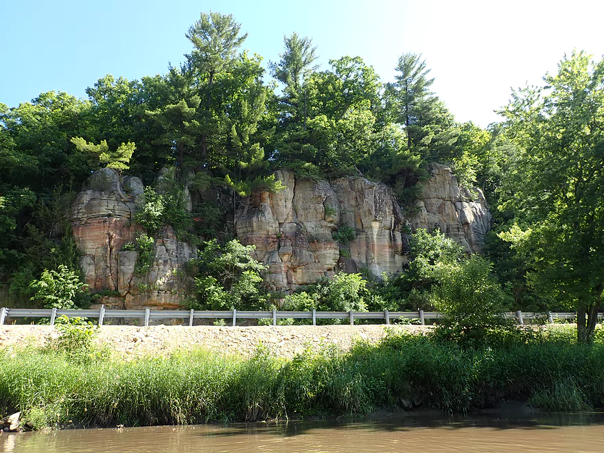
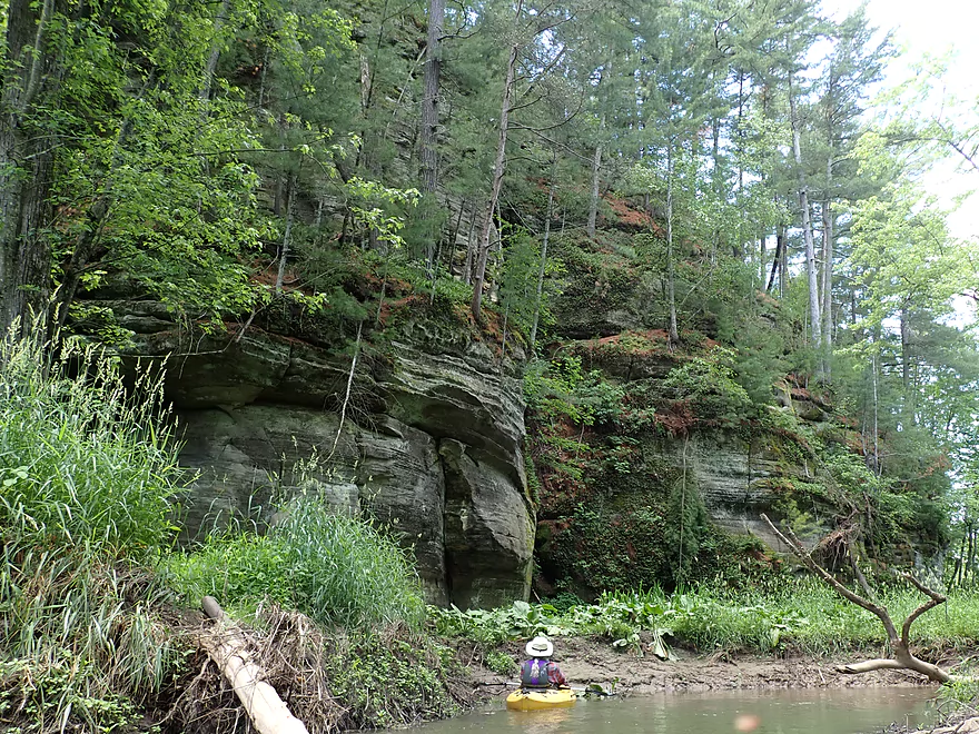
The second major outcrop
This is the best one of the trip
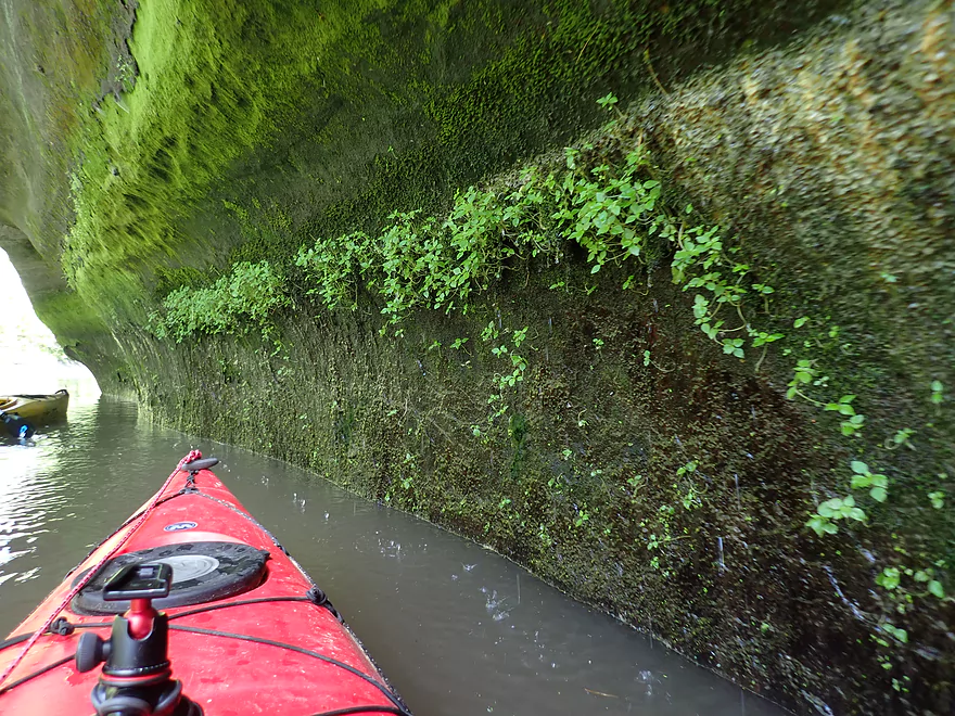
Emerald mosses color the rock face
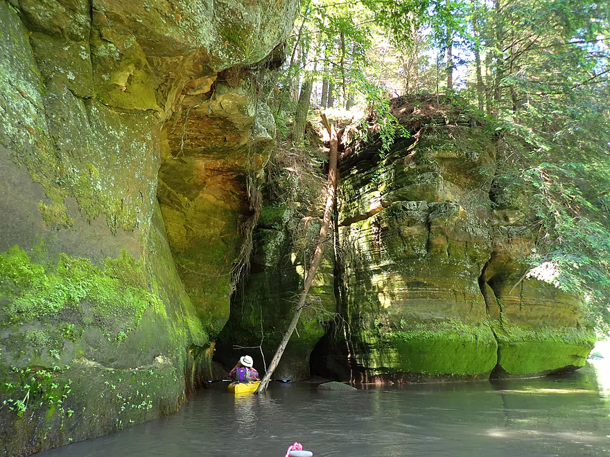
A cool alcove
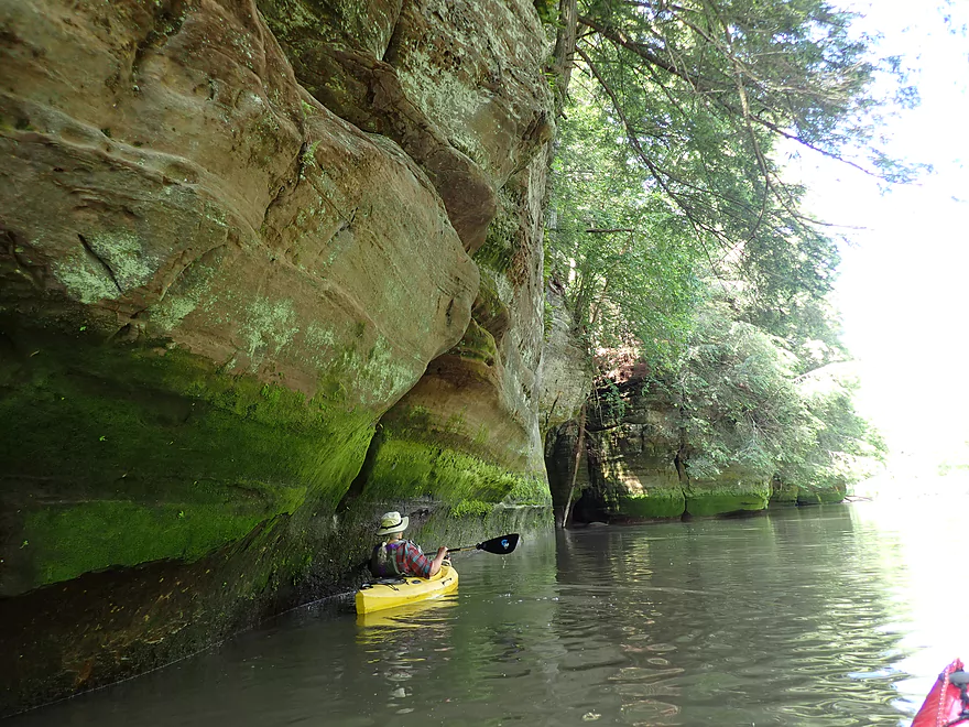
This is a very long outcrop
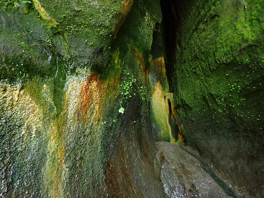
Interesting colors
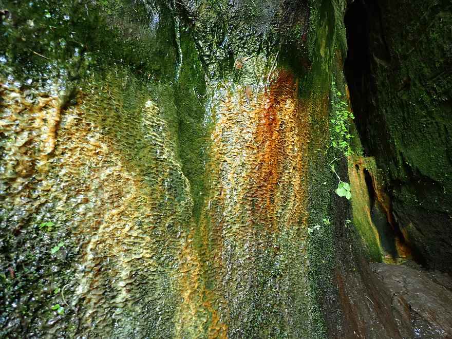
Looks like some type of bacterial growth
White pines and hemlocks grew on the blufftop
Rain pouring out of the rock face
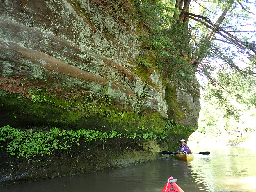
Final part of the 600′ long outcrop
Hemlocks lean over the water
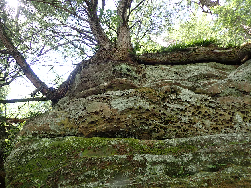
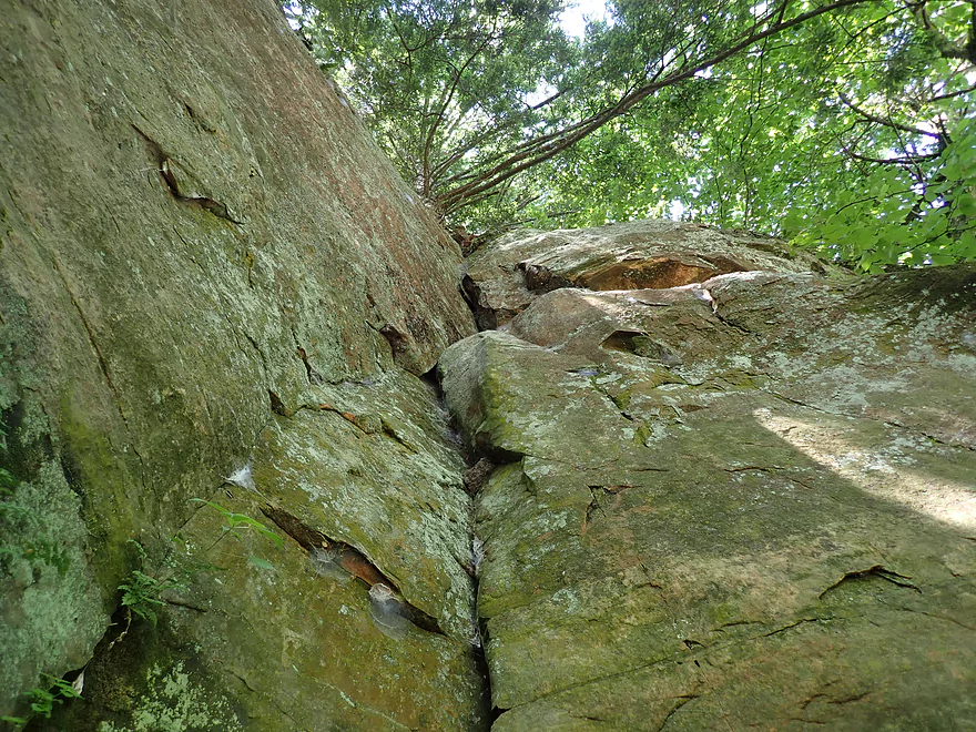
Interesting erosion patterns
Looking back at the bluff
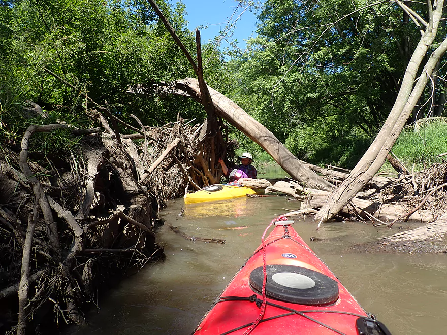
Exploring a small channel
Only to discover another major outcrop
Very scenic
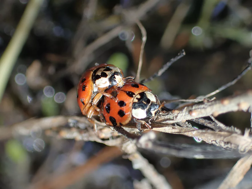
A pair of ladybugs
Back on the main channel…still some obstacles to duck under
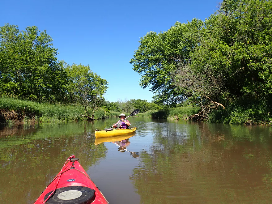
River starting to open up
The last mile was very nice
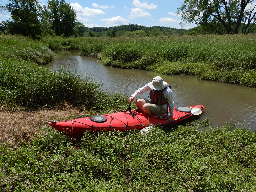
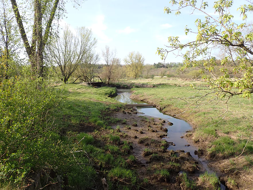
Taking out at Kalepp Road
A side creek leads to the Old 400 State Trail bridge
Where it’s not difficult to get out
A view of the side creek from the “400” bridge
Same view six weeks ago with lower water
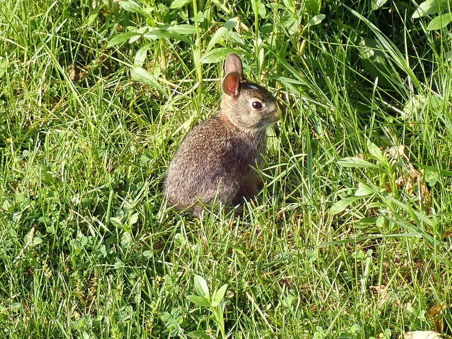
A friendly local
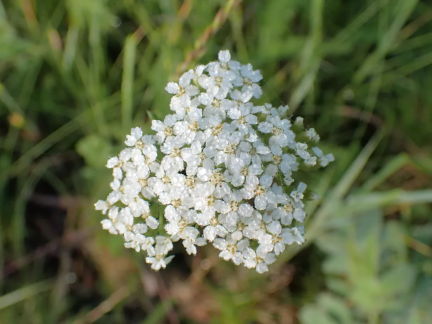
Yarrow
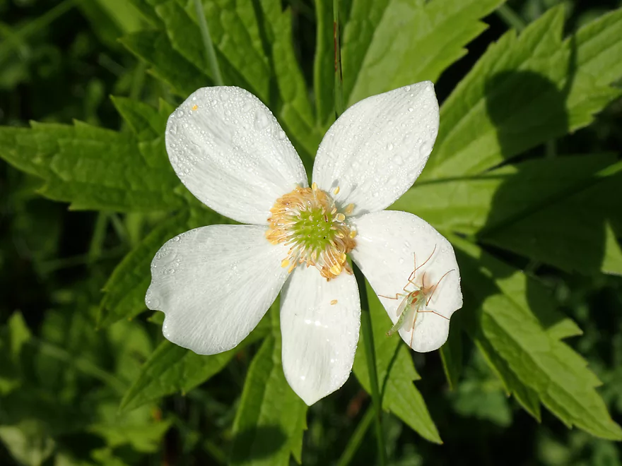
Canada anemone and a young crane fly
Nice public parking lot
Bike shuttlers can use the bike trail to head back
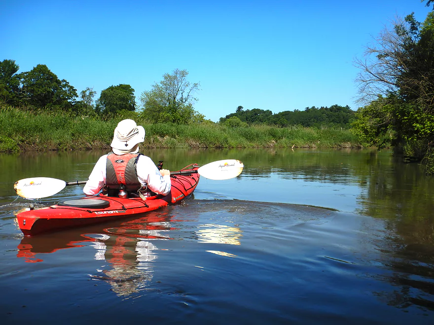
Baraboo River – Wayside Park

This section of the “Boo” is a mixed bag: It’s very muddy and weed-lined, but occasionally along its course are sandstone bluffs that stand like jewels above the river plain and make your trip all worthwhile.
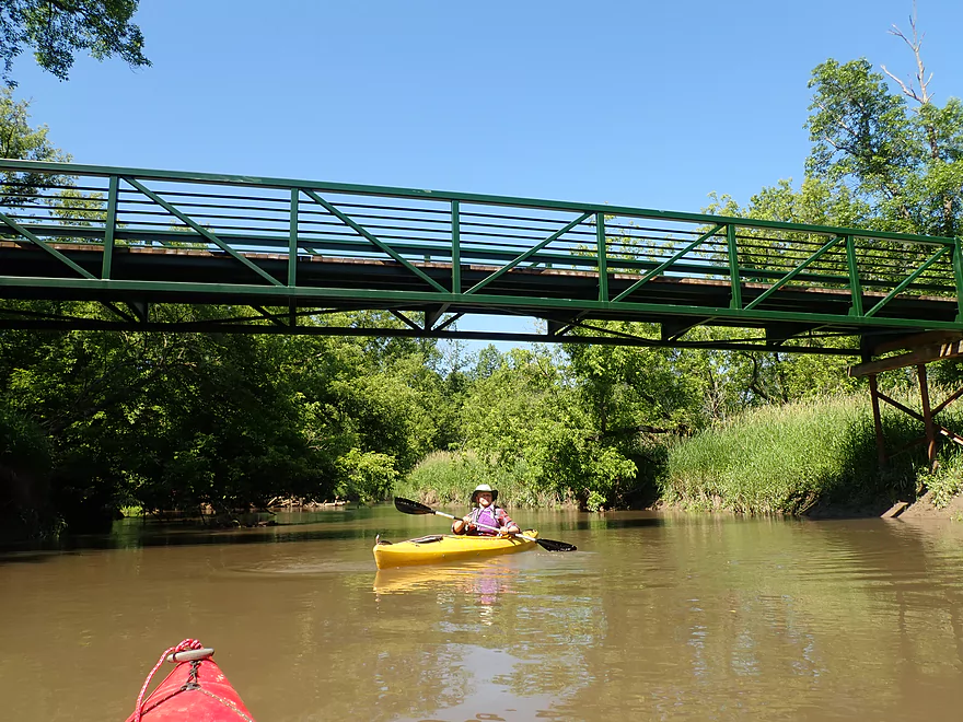
Our put-in was at a wonderful roadside stop called Wayside Park, located about three miles downriver from Wonewoc. The park has paved parking, restrooms, a gazebo, and a marvelous artesian well that can draw a line of people waiting to fill their jugs. Wayside Park is also a rest area for the 400 State Bike Trail, which follows the Baraboo River from Elroy to Reedburg—a distance of 22 miles. Bike trail bridges are a common occurrence on the Upper Baraboo.
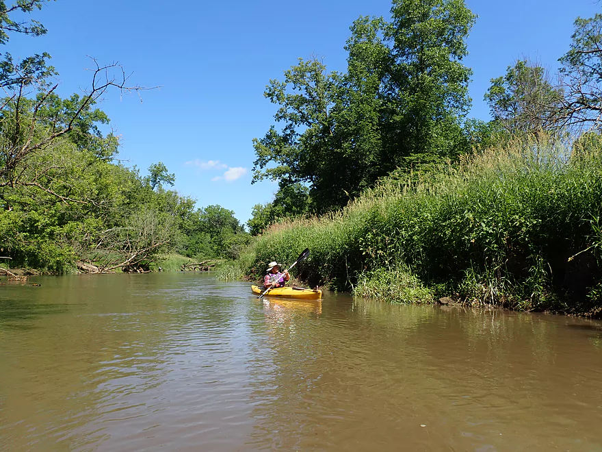
We slid into the water (literally) along a muddy ditch connecting the artesian stream to the river. Some rain from the previous day had caused the water level to spike, so the river and banks were a little muddier than usual which was unfortunate. The Baraboo River Friends are working on improving access to the river, so hopefully the situation with the muddy launch will be improved in the future.
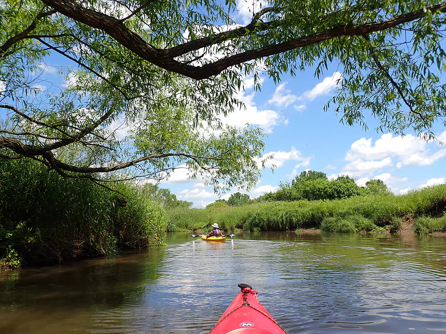
The first mile of the river was abnormally straight—a suspicious indicator of past attempts at channel diversion and farming efforts on the Baraboo lowlands (there is no sign of any farming on the current bottoms, so it looks like the river won).
A massive sandstone bluff dominates the scenery north of the put-in and is one of the reasons a drive in this area is so beautiful. Many of these sandstone outcrops were once islands in ancient Glacial Lake Wisconsin—geological reminders that the earth was not always as we see it today.
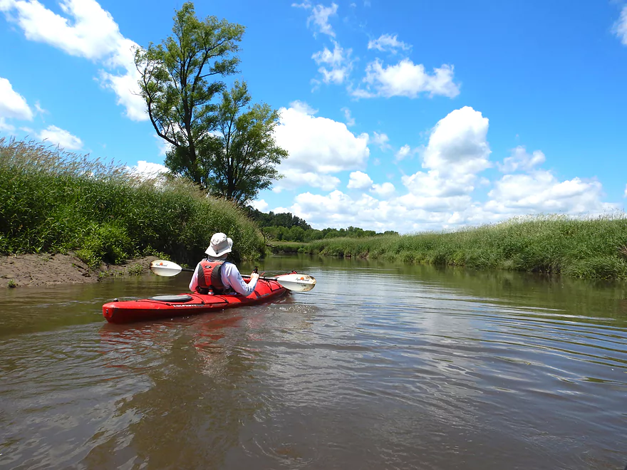
Most of the remainder of the trip was very winding, very muddy, and very deep. Frequent paddle drops didn’t hit bottom, and the few that did, pushed into soft mud. This is one river where it would be wise to wear your life jacket. Don’t expect to fall out of your boat or jump out and hit bottom. You will disappear.
Most of the banks on both sides of the river were lined with reed canary grass—that ubiquitous invasive that creates monotony along too many of our Wisconsin Rivers. There were few flowers and few signs of wildlife outside of occasional wood ducks scurrying off with their young.
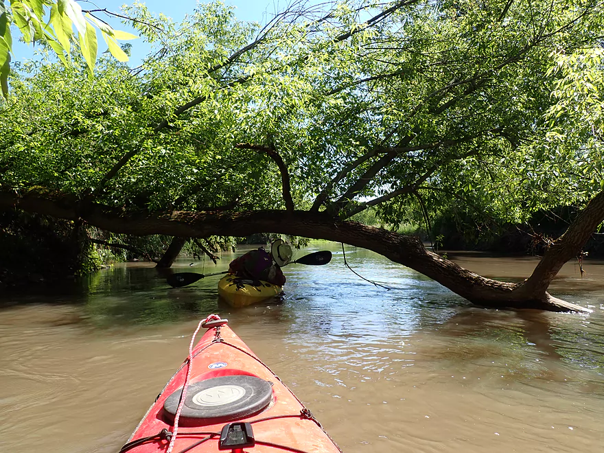
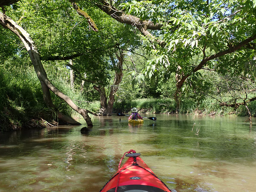
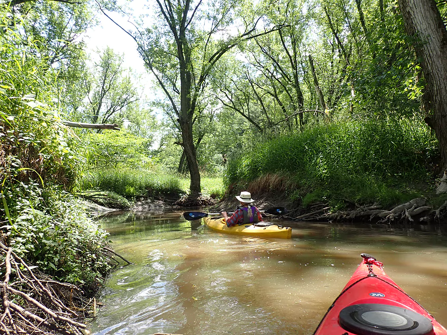
In typical Boo style, logs poked up out of the water here and there in the wooded portions, but only a couple created jams. We were able to squeeze through—thankfully, since tall mud banks along both shores would make any portage extremely difficult. Much of the woods were silver maple, which gave the trip a lowland/floodplain feel.
Then finally (at about mile three)…we saw a clump of white pines in the distance. Pines grow atop the sandstone bluffs in the shallow, poor soils that other trees shun and are a giveaway to bluff locations. And then it appeared: a wondrous bluff with graceful curves of rock covered with emerald mosses and oozing spring water–all draped with a brow of overhanging hemlock boughs. At over 600 ft. long, this is one of the biggest and best outcrops on the entire Baraboo River. In winter it must be an even more glorious sight when the springs freeze and create ice flows.
Unfortunately, the area farmer grazes cows on the bluff. We could make out a chainlink fence along much of the bluff about halfway up, but it didn’t appear to extend the entire distance. So…if a cow slips on the bluff and drops in the water beside your boat, you’ll know why.
Further along we saw more telltale pines, but were discouraged that the river was going away from them instead of toward them. Then a small channel diverged toward the bluff and we risked logjams and getting stuck to see if it would indeed take us to our next treasure. And it did. Although this was a smaller bluff, it was still quite tall and very scenic. The creek then rejoined the main channel.
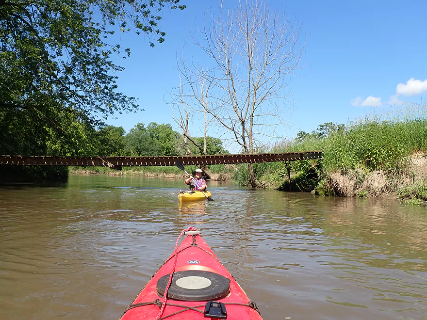
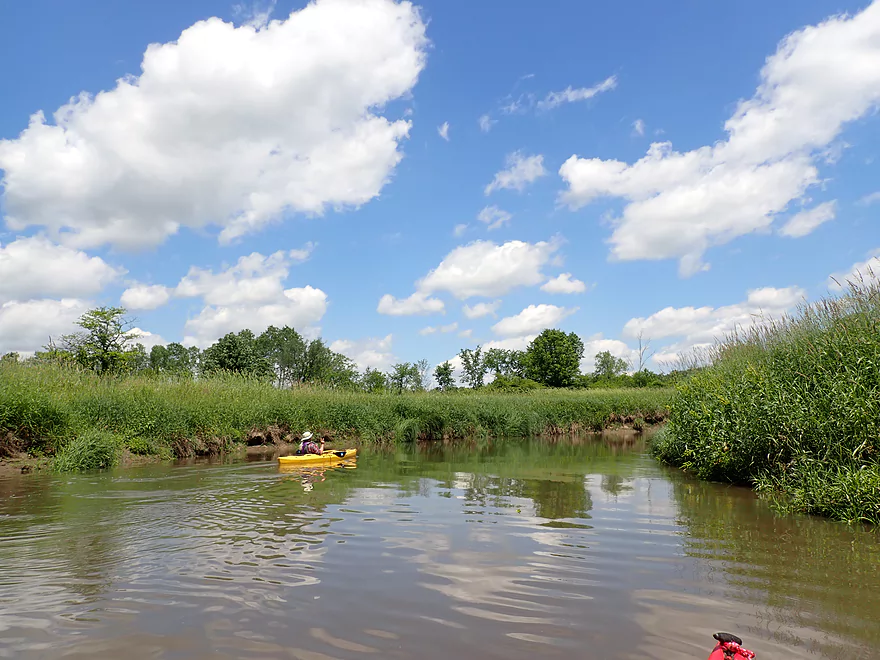
Soon after this, the Boo became more open as it entered a marshy area with few trees. The channel was straighter again, but had a less enclosed feel to it. This led us to an old iron bridge across the river that marked our take-out, which was actually a side creek just before the bridge.
In conclusion, this isn’t a premier section of the Boo. The muddy water, high banks and monoculture of reed canary grass are problems that may never get solved. But you’re never going to have to worry about scraping (even if we have the drought of the century), and for the most part, there weren’t any logjams. What makes this trip worthwhile are the outcrops. There are only a few, but they are fantastic. A great time to do a trip like this would be in spring before the river becomes overgrown, which would allow for really nice vistas of the surrounding countryside.
Wayside Park: This is a really nice park with a gazebo, artesian well, and adjacent access to the “400 Bike Trail”. Outhouses are available but are currently locked because of Covid-19. The only downside to this put-in is the launch area itself, as the banks were quite muddy. So expect to get a bit dirty if you launch here.
Alternate Put-ins:
- Washington Street (2.9 miles upstream of Wayside Park): The main canoe launch for Wonewoc is located here and an outhouse is available. This upstream stretch is a bit more obscure and I don’t know much about it. I would estimate there are 2-3 logjam portages and one nice outcrop…likely not a special stretch.
Kalepp Road: At the end of this road is a DNR public parking lot. Just on the other side of the “400 State Trail” is the Baraboo River which is joined by a small creek. We were able to paddle up this creek and take out close to the bike trail bridge, which worked out well. Note, much of the land west of the Old 400 State Trail here is part of a large “Voluntary Public Access Easement” intended mostly for turkey hunters. These public easements, while administered by the DNR, are technically private so be respectful when you’re on them. Note the Baraboo River Corridor Plan – Phase 2 has future plans to convert this area into a proper kayak launch.
Alternate Take-outs:
- N. Dutch Hollow Road (5.3 miles downstream from Kalepp): This is a muddy but doable take-out with a steep bank. Most paddlers “cheat” and take out on the upstream side which is much nicer but is also likely private. The river on this stretch is pleasant with several outcrops, but it is muddy and there is one major logjam.
Bike Shuttle – Wayside Park to Kalepp Road: 2.2 miles. This would be a terrific bike shuttle entirely on the “400 State Trail”. While the path isn’t paved and has some horse/snowmobile damage, it’s still a good surface for biking. Note you will need a state trail pass to use this bike path.
Livery Shuttle/Rental – Beyond Boundaries: This is a neat little livery/rental business located in nearby Wonewoc. Typically they service the Union Center to Wonewoc leg, but they will likely agree to shuttle paddlers below Wonewoc if asked. Call ahead to ensure availability – (608) 464-7433.
- Mud Banks: This is one of the muddiest rivers in Wisconsin. If you need to get out, be advised you may get dirty. Also note many of the banks are steep which can make portaging (if required) difficult.
- Logjams: There were two logjams, but we were able to squeeze through both and never had to portage the entire trip. The second jam is much more difficult and big boats may need to portage (not easy given how steep the banks are here). For location information see the trip map.
- Strainers: There are downed trees in fast, deep, and muddy waters that need to be carefully avoided. This is definitely a trip to keep that life jacket on.
- Current: The current was relatively strong, but some of this was a product of the high water levels (6.7′). The river will slow significantly during lower flow rates.
Nearest Gauge: Baraboo River @ La Valle – 6.7′
- 0 – 5.6′: A low depth but plenty navigable (it’s a deep stretch).
- 5.6′ – 6.2′: An average depth and a good target.
- 6.2′ – 6.4′: Above normal depth. At times pushy, but manageable for experienced paddlers.
- 6.4′ – 6.9′: A high depth. The river is pretty pushy and dirty at this point.
- 6.9′ – 7.3′: A very high depth. River will be quite filthy and tough to maneuver in.
- 7.3’+: This might approach flood stage.
Detailed Overview
- Nutmeg Road to Hwy PP: 6.2 miles. Flows by the historic Elroy-Sparta Trail and is mostly open, but there are a few logjams. This is a narrow small stretch that will need very high water to be runnable. There are scenic outcrops on this stretch….maybe 3.
- Hwy PP to 2nd Main Street: 1.6 miles. Maybe 3 logjams.
- 2nd Main Street to Franklin Street: 0.9 miles. Maybe 1-2 logjams. Trip starts at a scenic covered bridge and on Class 1 rapids.
- Franklin Street to Hwy 82(South of Lincoln Street): 0.5 miles. A good stretch that is mostly open and has maybe one outcrop.
- Hwy 82(South of Lincoln Street) to Schultz Park: 0.6 miles. Maybe 2 logjams.
- Schultz Park to Hwy 82(South of Snyder Road): 4.0 miles.
- Schultz Park to Hwy 82(North of Lumsden Road): 0.6 miles. One outcrop, one logjam portage and a few tight fits.
- Hwy 82(North of Lumsden Road) to Hwy 82(South of Snyder Road): 3.4 miles. Three outcrops, three significant logjams and several tight fits. A section with good potential but needs cleanup work.
- Hwy 82(South of Snyder Road) to Hwy W: 1.9 miles. Maybe 2-3 jams…think this is doable though.
- Hwy W to Hwy 82/Union Center: 1.3 miles. Good prospect by the golf course with maybe 2 outcrops. Maybe 1-2 logjams.
- Hwy 82 to Hwy FF Landing/Wonewoc: 7.1 miles. A great section with one of the largest rock outcrops on the river.
- Hwy FF Landing to Wayside Park: 2.9 miles. There used to be a lot of logjams here. I think it might be doable…maybe 2-3 major portages.
- Wayside Park to Kalepp Road: 4.5 miles. An uninteresting part of the river with weedy, muddy banks. But…there are three fantastic sandstone outcrops.
- Kalepp Road to N. Dutch Hollow Road: 5.3 miles. One logjam portage with several “hoppers” and “duckers”. There are some outcrops but most are recessed and away from the river. Mud and downed trees are a bit unsightly, otherwise a pleasant paddle.
- N. Dutch Hollow Road to La Valle: 3.8 miles. Second best section on the entire river with great rock outcrops.
- From La Valle to Lake Redstone: 3.6 miles. One of the more underrated sections of the Boo, which I really liked.
- Lake Redstone to Monument Park/Reedsburg: 9.0 miles. Supposedly kind of boring, but the logjams should be cleared out.
- Monument Park to South Park: 1.4 miles. Spanning the length of Reedsburg, this should be a nice section mostly free of jams.
- South Park to Golf Course Road: 4.7 miles. Maybe 4-5 logjams. Probably one too many. Should be 1-2 small sandstone outcrops. Golf Course Road might not be a good access.
- Golf Course Road to Hwy 136(by Beth Road): 3.6 miles. Maybe a few jams. Likely mostly floodplain paddling and probably uninteresting.
- Hwy 136(by Beth Road) to Hwy 136(by Ableman’s Gorge): 6.0 miles. Maybe some outcrops at the end, but mostly uninteresting paddling I suspect. Likely several serious logjams with difficult portages because of the high muddy banks.
- Hwy 136(by Ableman’s Gorge) to North Freedom Boat Launch: 8.2 miles.
- Hwy 136(by Ableman’s Gorge) to Rock Springs Boat Launch/Firemen’s Park: 1.3 miles. One of the most scenic parts of the entire Baraboo River. Highlights include a steep gorge, riverside boulders and scenic outcrops.
- Rock Springs Boat Launch to North Freedom Boat Launch: 7.1 miles. This is a nice paddle, but with some downed trees to dodge and one to portage. Highlights include historic railroad bridges, scenic outcrops, and seeing the railroad museum from the river.
- North Freedom Boat Launch to Giese Park: 7.4 miles.
- North Freedom Boat Launch to Kohlmeyer Road: 4.3 miles. Stretch starts nice as the river naturally curves and has many shade trees. There is a scenic long outcrop after Seeley Creek. River becomes boring after that except for a scenic railroad bridge and a few rocky banks. Kohlmeyer Road isn't a great bridge access.
- Kohlmeyer Road to Giese Park: 3.1 miles. Some longer and less interesting stretches. There is however a unique large volume artesian well, and a historic railroad tunnel you can wade under.
- Giese Park to Gander Outdoors: 2.9 miles. A pleasant but simple farm country paddle. Highlights include the Skillet Creek bridge, the towering Hwy 12 bridge, and a rock outcrop upstream of Hwy 12.
- Gander Outdoors to Glenville Landing: 4.9 miles. A fantastic stretch through the heart of Baraboo with many light rapids.
- Gander Outdoors to Haskins Park: 0.6 miles. A good stretch with some fantastic rapids upstream of Hwy 136.
- Haskins Park to Maxwell-Potter Conservancy: 3.3 miles. The best section on the entire river with many rapids.
- Maxwell-Potter Conservancy to Glenville Landing/Hwy 113: 1.1 miles. A pleasant stretch, but lacking in rapids.
- Glenville Landing to Luebke Landing: 5.1 miles. A pleasant trip, but a little boring at times. I would rate this as one of the more uninteresting sections of the Baraboo. On the plus side it had no logjams (as of 2023) and remains plenty navigable even during big droughts.
- Luebke Landing to Hwy 33: 3.5 miles. This might be one of the better legs on the Lower Baraboo.
- Hwy 33 to Wayside Park: 8.0 miles. A stretch I’m curious about.
- Wayside Park to Hwy U: 3.9 miles. Simple but pleasant short section flanked by busy interstates.
- From Hwy U to the mouth: 5.3 miles. The final leg running through floodplain forest.
Notable Baraboo River Tributaries:
- West Branch of the Baraboo River: For the most part, too many logjams, but the flowage by Hillsboro is navigable with scenic outcrops by the dam.
- Dutch Hollow Lake: A heavily developed lake and popular with locals. Not as great as Lake Redstone but still nice. Dutch Hollow Creek is likely too shallow to run, but it (and the bike trail) goes past a fantastic and huge exposed rock face.
- Hemlock Slough: A nice little lake paddle with many rock outcrops and attractive hemlocks.
- Little Baraboo River: For the most part too many logjams. However the small flowage by Cazenovia Memorial Park is navigable and there are small outcrops both below the dam and on the northwest corner of Lee Lake.
- Lake Redstone: Definitely a fun paddle with fantastic red rock formations, a swimming beach, and a spillway waterfall.
- Big Creek: You can’t get too far upstream because of logjams, but there is a nice outcrop by Hwy F and this can be combined with a trip on the north side of Lake Redstone.
- Narrows Creek: There is a neat section by Weidman Memorial Park with boulders and light rapids with I believe nearby outcrops downstream. Unfortunately there are likely too many logjams. I did partly paddle a nice downstream portion from the mouth on the Baraboo before I hit a logjam and turned back.
- Seeley Creek:
- Hwy PF to Seeley Lane Boat Landing: 3.6 miles. A mix of creek and flowage paddling. Ok…maybe 2 logjams.
- Seeley Lane Boat Landing to Freedom Road: 1.7 miles. Probably too many logjams on this section.
- Freedom Road to Mouth: Neat stretch of the creek, but some logjams.
- Skillet Creek:
- From Gasser Road to Pewit’s Nest: Gorgeous, but filled with logjams.
- Pewit’s Nest: Stunning scenery, but the ledges are likely too steep and narrow for kayaking. Best experienced as a hike.
- Pewit’s Nest to Hatchery Road: A bit of nice geology, but likely small with several logjams. Neither endpoint is a great access.
- Rowley Creek: A scenic creek, but shallow and with hostile locals.
- Leech Creek: From Hwy U to Tritz Road would be 2.5 miles. Likely open and an easy paddle, but uninteresting because of the artificial channelization.
- Long Lake: A very slow creek that empties into the Boo close to the Wisconsin. There could be serious logjams by the mouth, but the upper sections are plenty navigable and are paddled by locals.
Trip Map
Overview Map
Video
Photos Size: